- Advertisement -
San Fernando, which means “St. Ferdinand” in Spanish, is a general-purpose city located in the San Fernando Valley region of Los Angeles County, California. Surrounded by the city of Los Angeles, it is an independent enclave within the larger metropolitan area. According to the 2020 census, San Fernando has a population of 23,946.
Santa Rosa Catholic Church in San Fernando CA
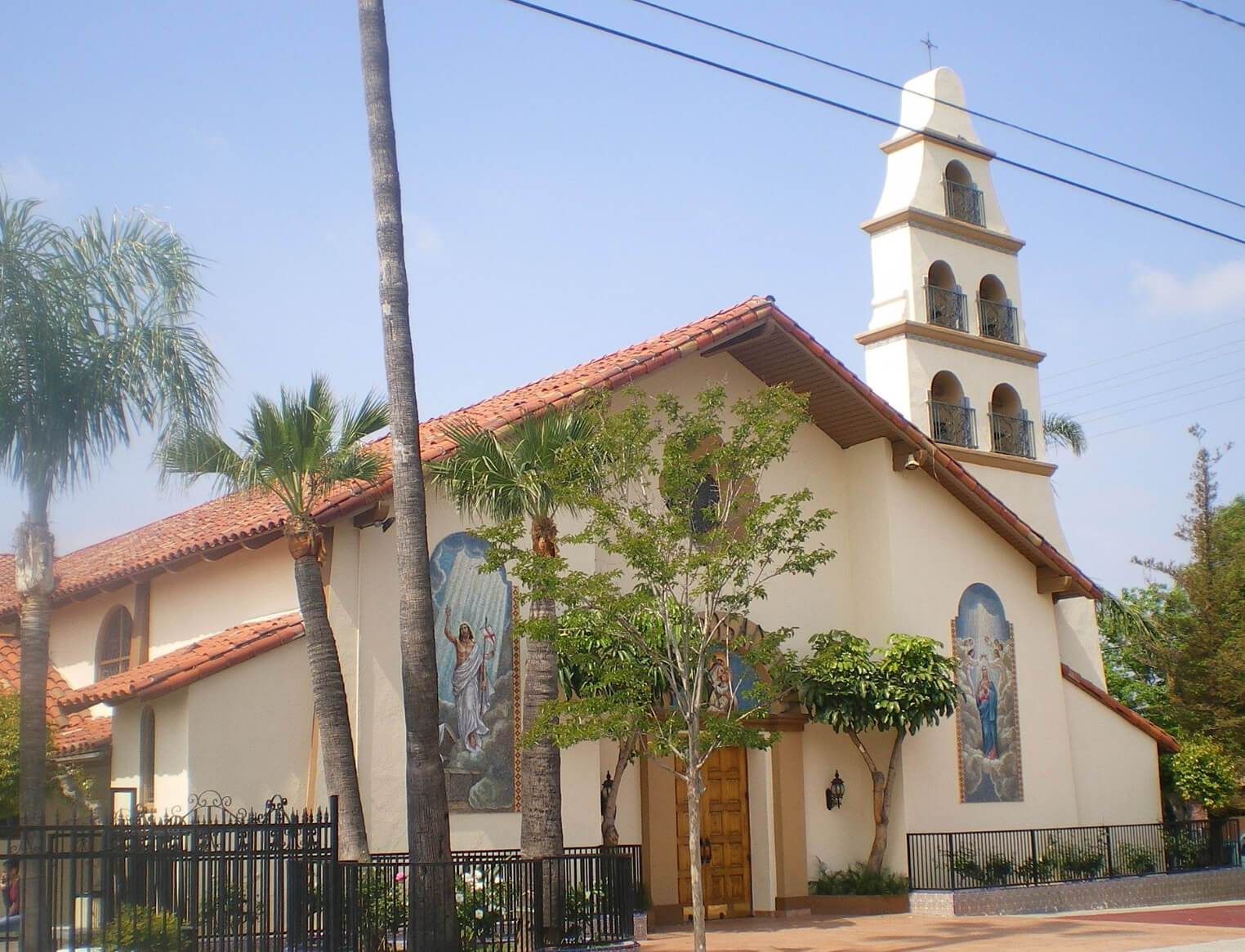 Santa Rosa Catholic Church in San Fernando California, USA
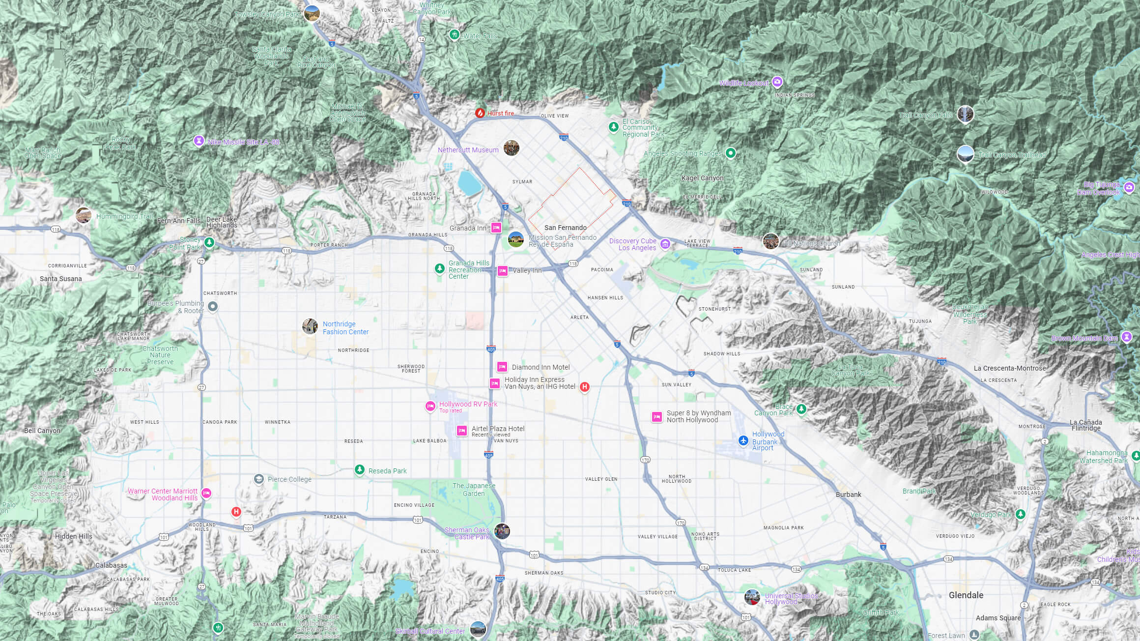
San Fernando city map Los Angeles
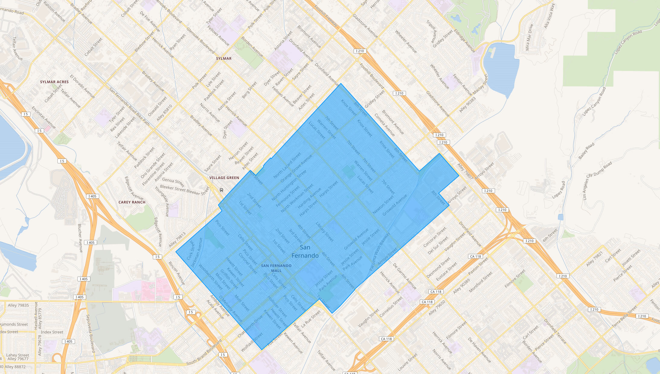
San Fernando map Los Angeles
San Fernando satellite map Los Angeles
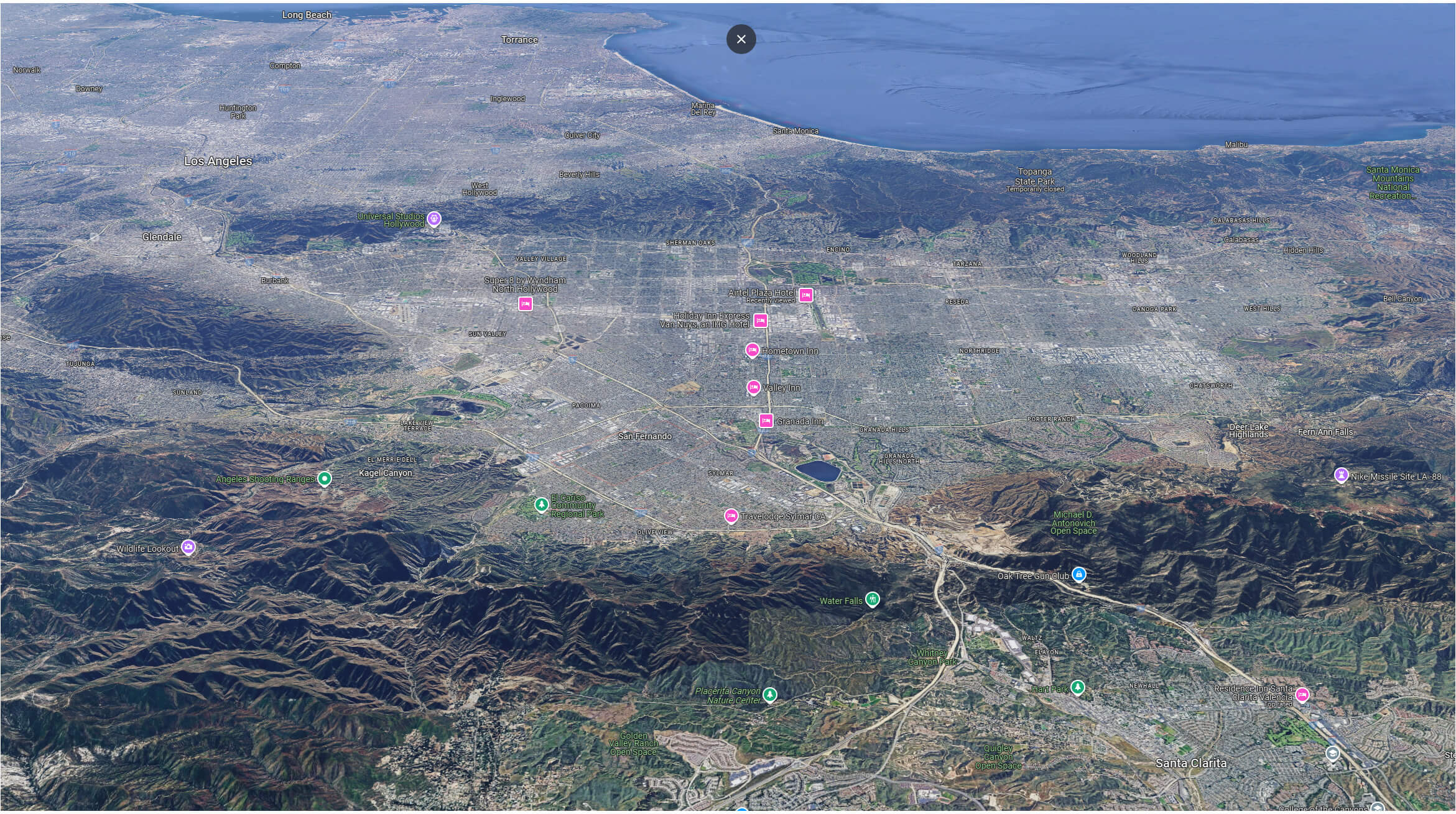
San Fernando terrain map Los Angeles
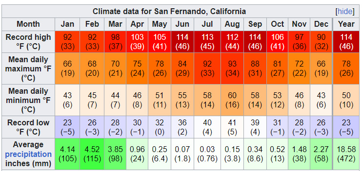
San Fernando Climate Data Map
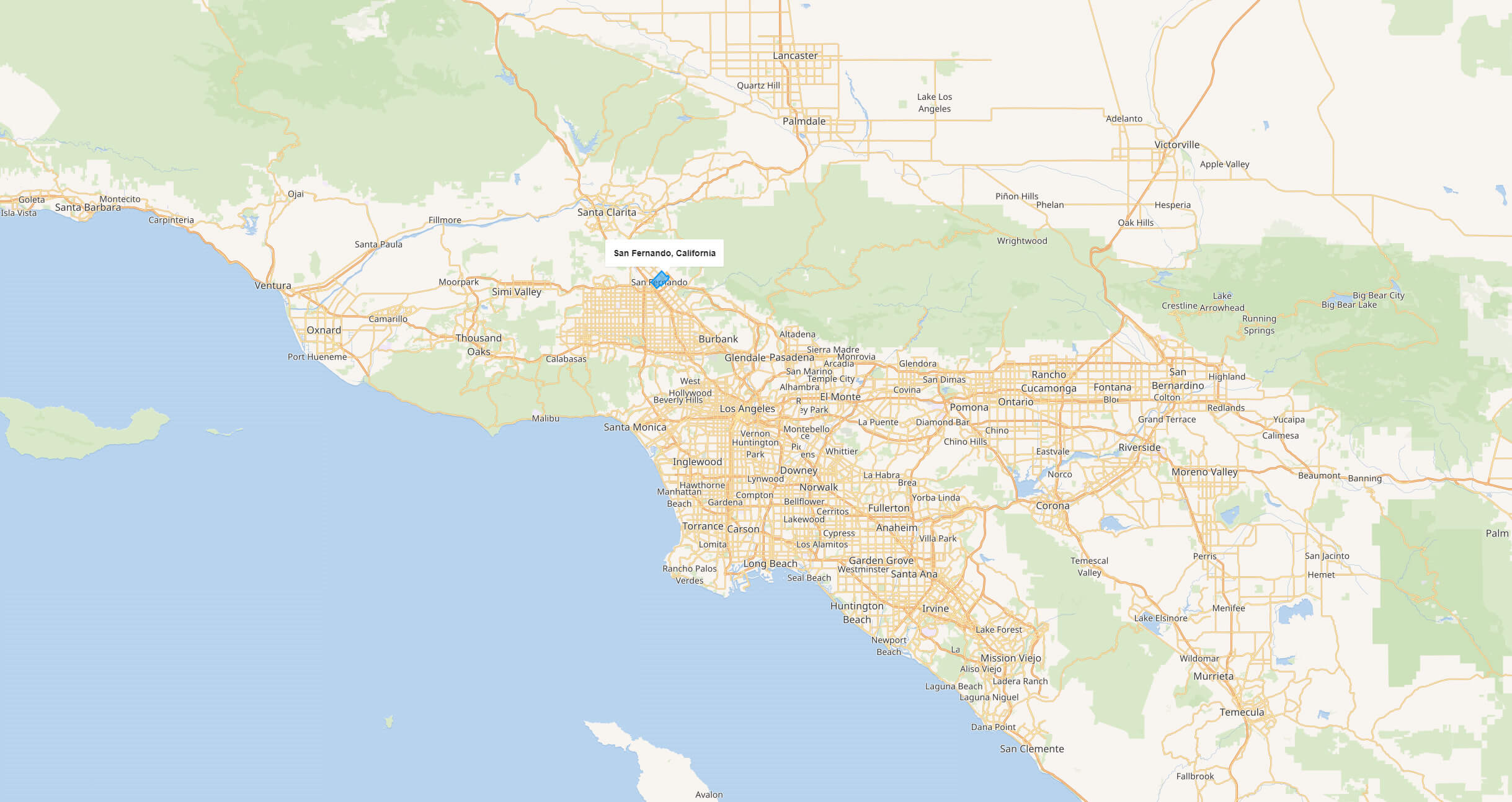
Where is San Fernando on Los Angeles Map?
Show Google map, satellite map, where is the country located.
Get directions by driving, walking, bicycling, public transportation and travel with street view.
Where is California in the US and and Cities Map of California – @WorldGuide Youtube
Feel free to explore these pages as well:
- Los Angeles Map ↗️
- LA Fires January 2025 ↗️
- Los Angeles Wildfires in Map ↗️
- Palisades Map in Los Angeles ↗️
- Eaton Map in Los Angeles ↗️
- Pasadena Map in Los Angeles ↗️
- Malibu Map in Los Angeles ↗️
- Discovering Los Angeles ↗️
- Discovering Bakersfield: The Heart of California’s Central Valley ↗️
- Anaheim: California’s Hidden Gem ↗️
- Guide to Los Angeles’ Top 10 Attractions ↗️
- Discover Chula Vista: A Hidden California Gem with Rich Culture and Stunning Views ↗️
- California Map ↗️
- Map of California↗️
- A Collection of California Maps ↗️
- Discover the California: A Vibrant Journey through Golden State ↗️
- California County Map ↗️
- California Physical Map ↗️
- California Political Map ↗️
- California Cities Map ↗️
- California Road Map ↗️
- California Population Map ↗️
- Advertisement -