- Advertisement -
Pacific Palisades, located in the Westside region of Los Angeles, California, is approximately 20 miles (32 km) west of downtown Los Angeles. On January 7, 2025, the Palisades Fire, part of the ongoing Southern California wildfires, devastated much of the community, leaving significant destruction in its wake.
Pacific Palisades, LA
 Pacific Palisades, Los Angeles, California – US
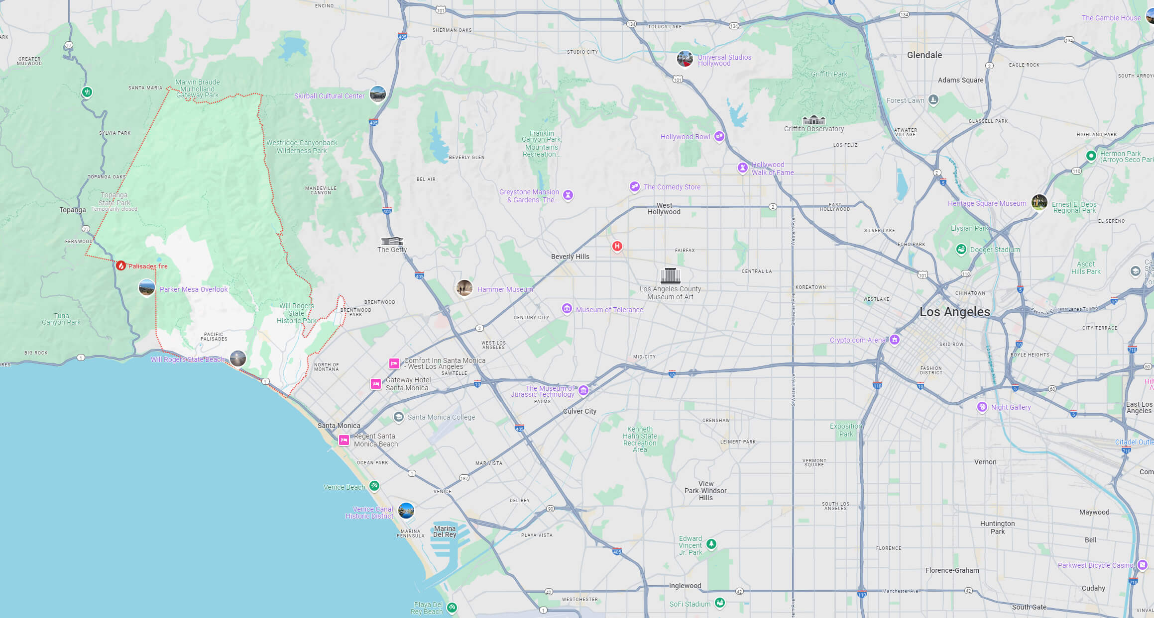
Where is located Palisades in LA, California
 Pacific Palisades is located approximately 7 miles (11 kilometers) west of the UCLA campus.
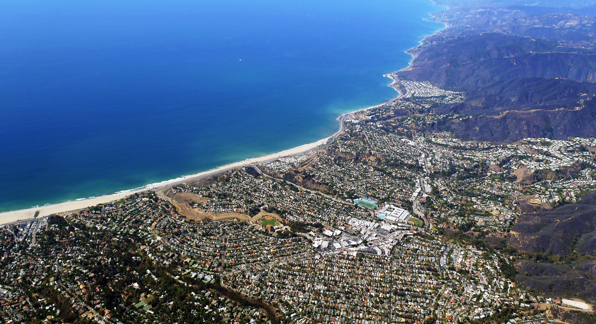
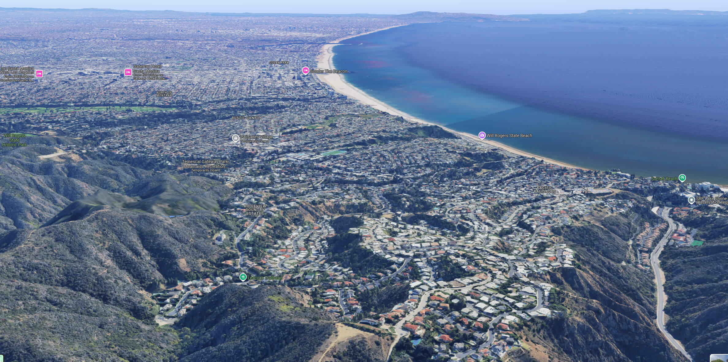
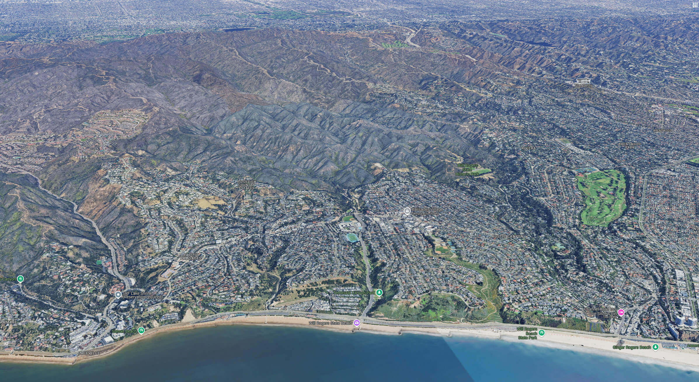
Aerial view of Pacific Palisades before fire
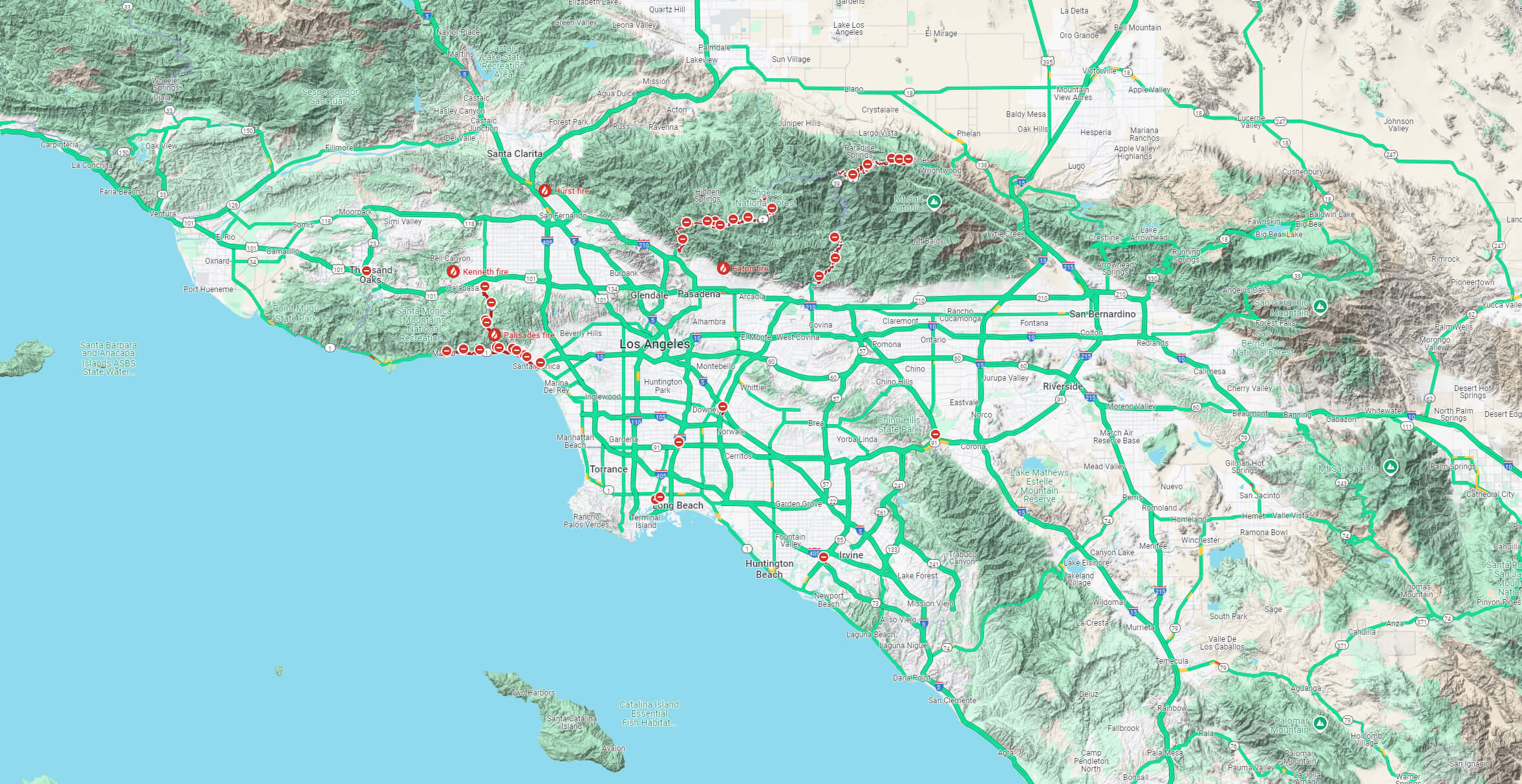
Affected area fire map of Pacific Palisades
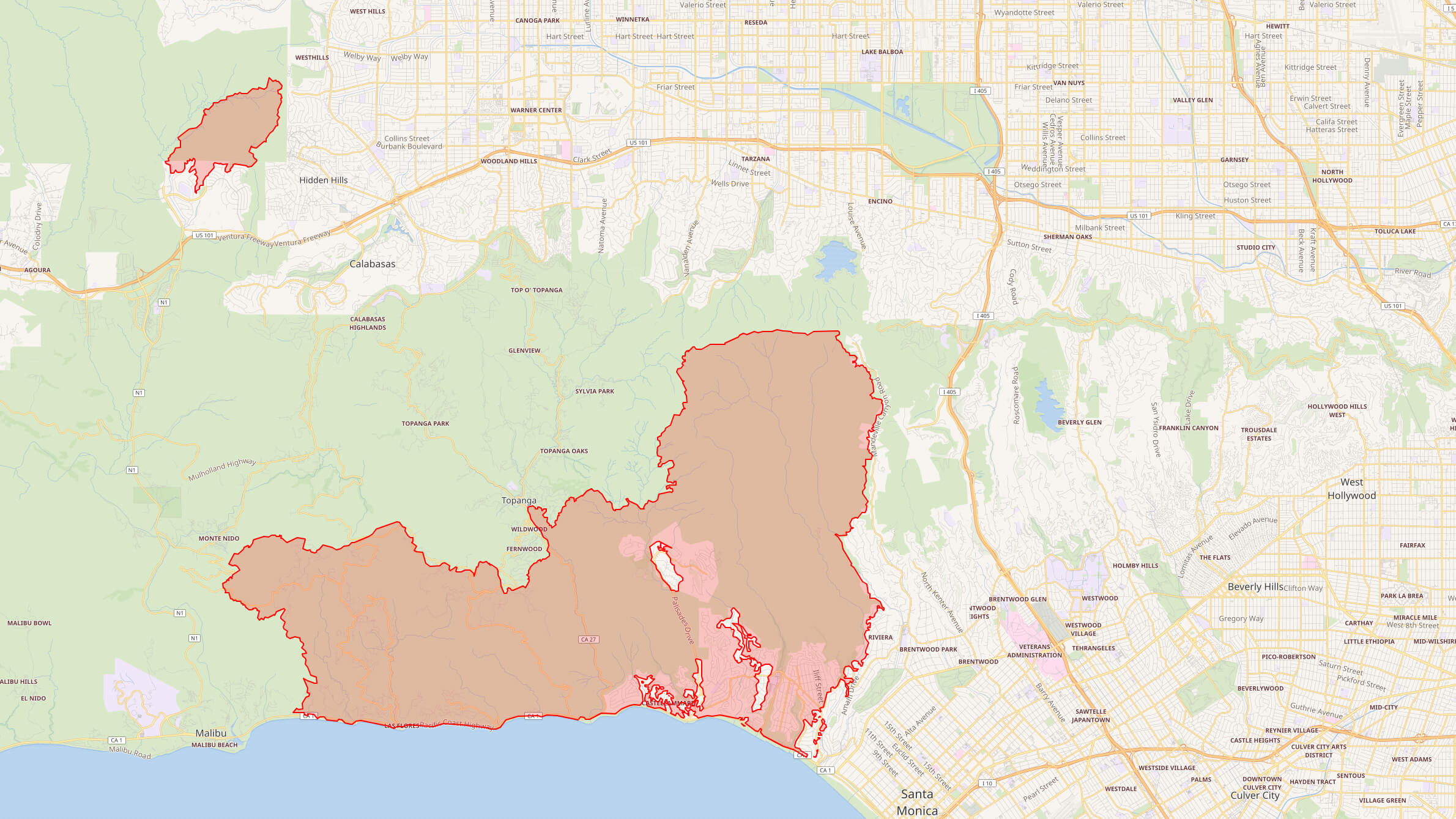 Affected area fire map of Pacific Palisades, LA – California.
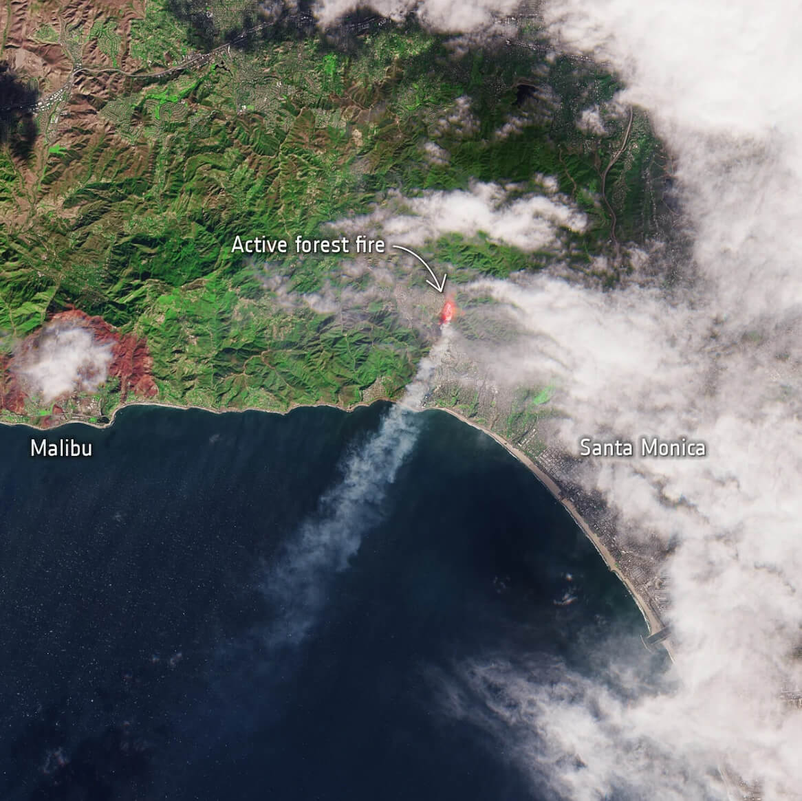
Palisades fire in Los Angeles wild fire satellite image
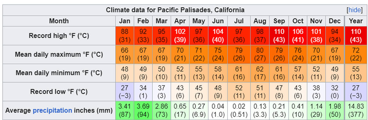
Pacific Palisades county climate
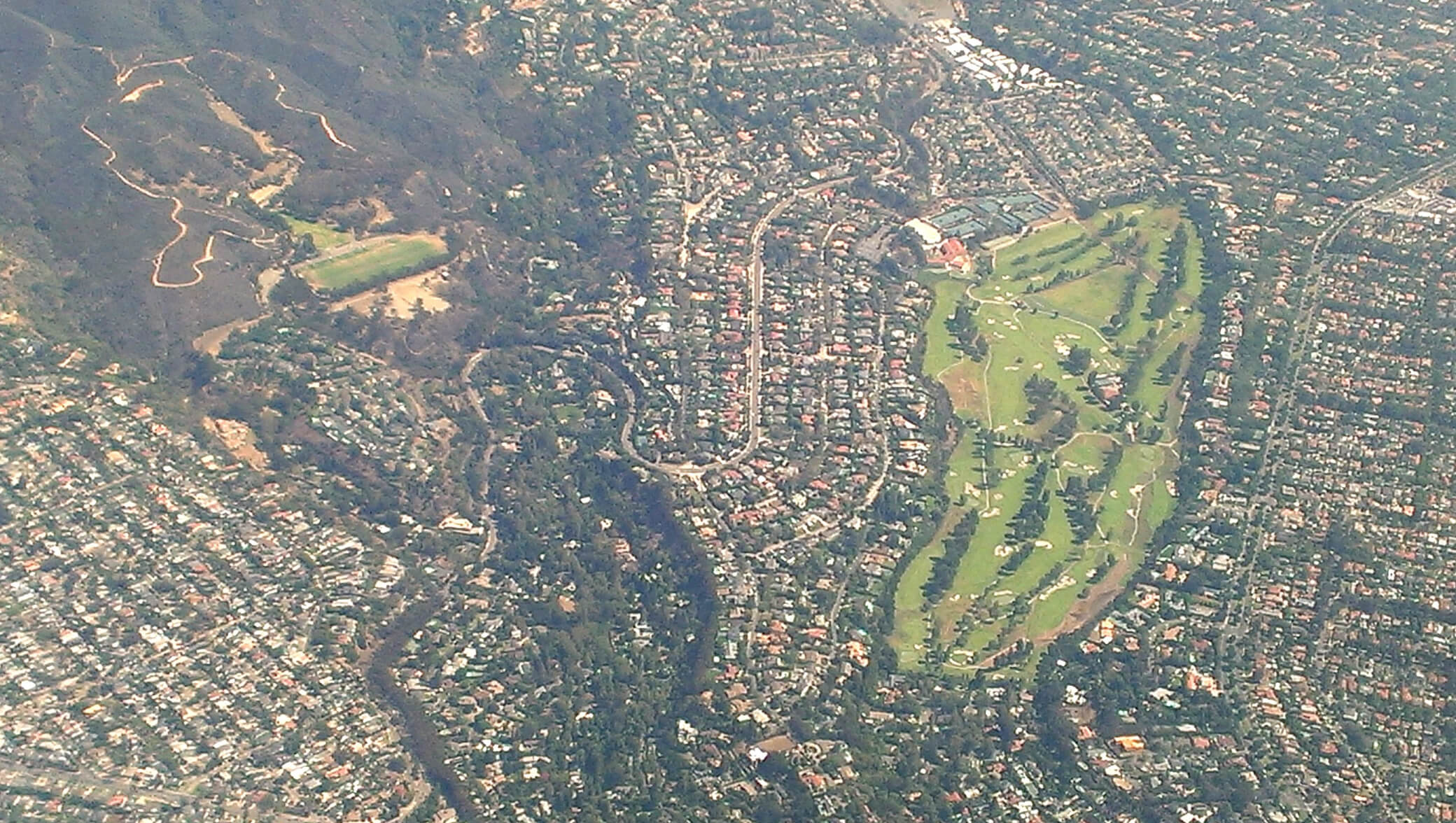
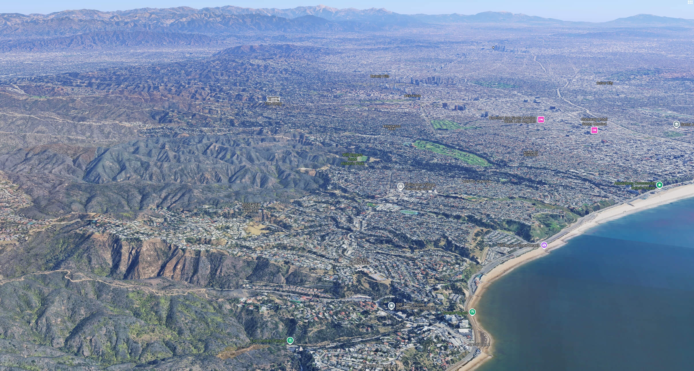
Palisades aerial view and Los Angeles
Los Angeles downtown view from palisades
Pacific Palisades aerial view map Los Angeles
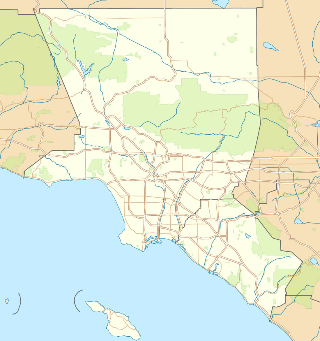
Pacific Palisades county map California
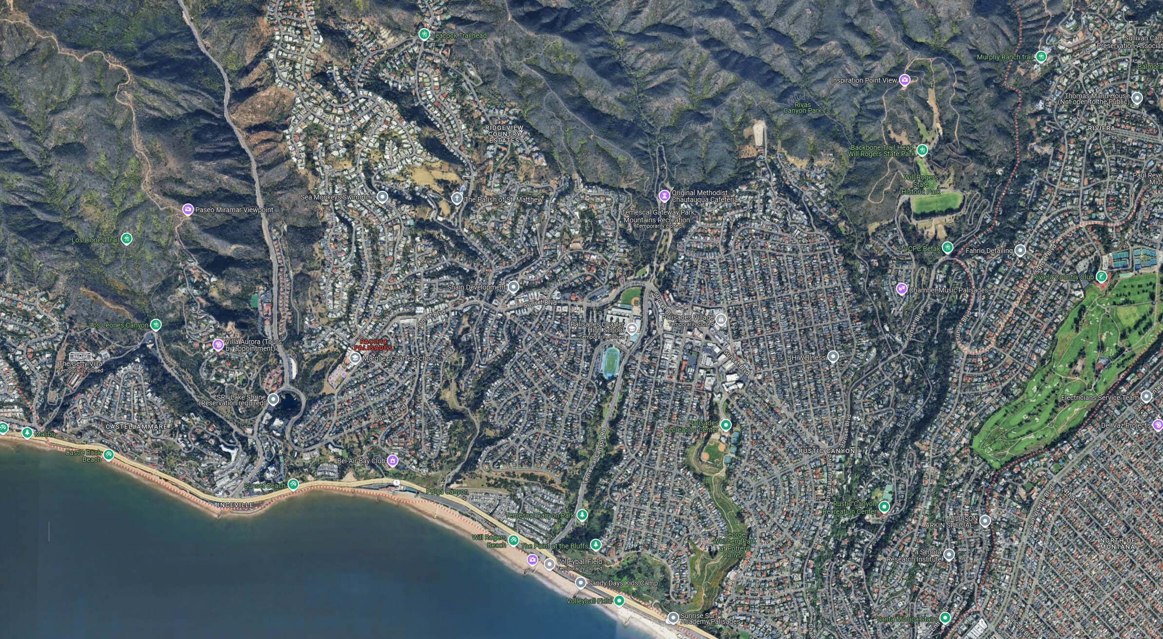
Pacific Palisades satellite map
Palisades Terrain Map, California
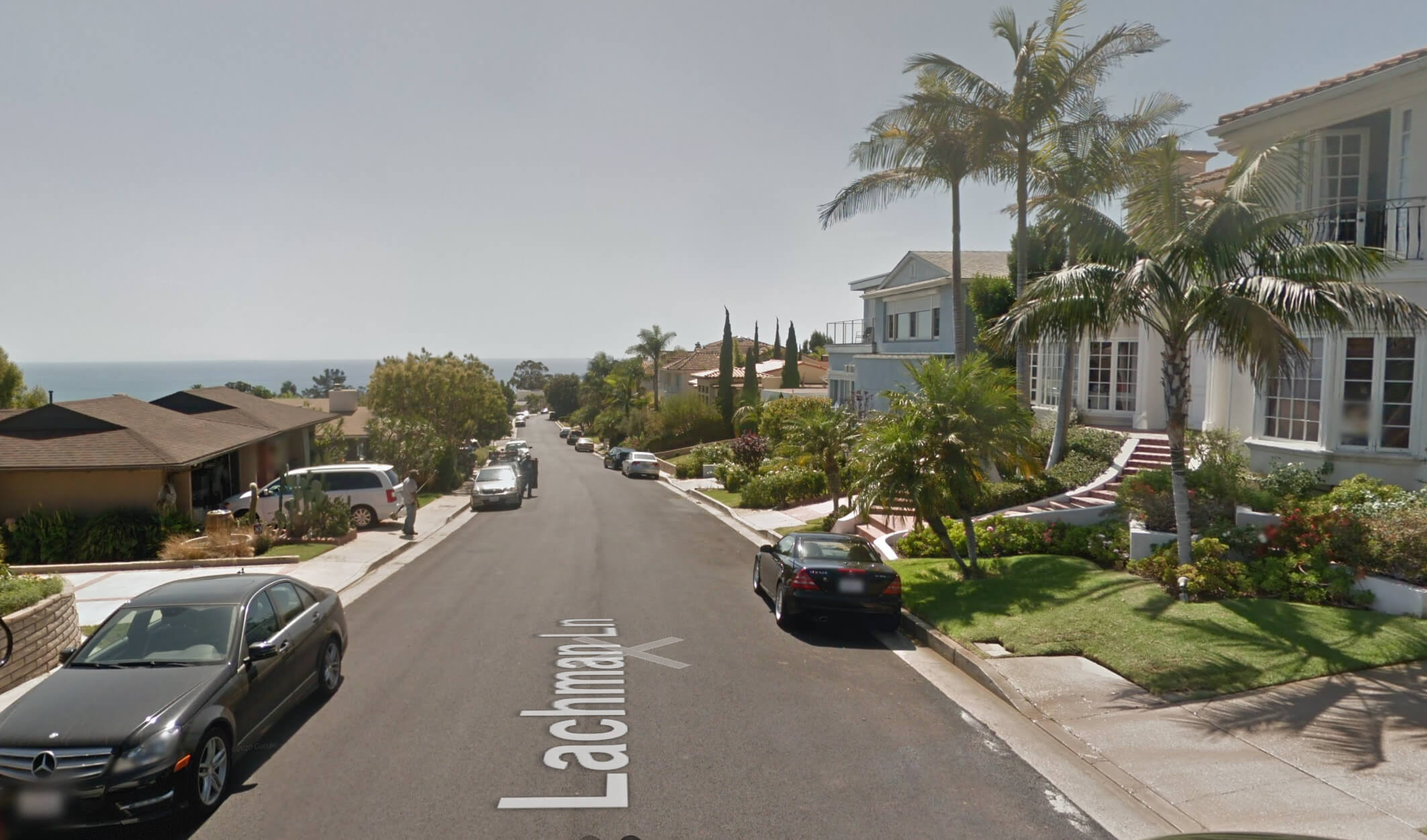
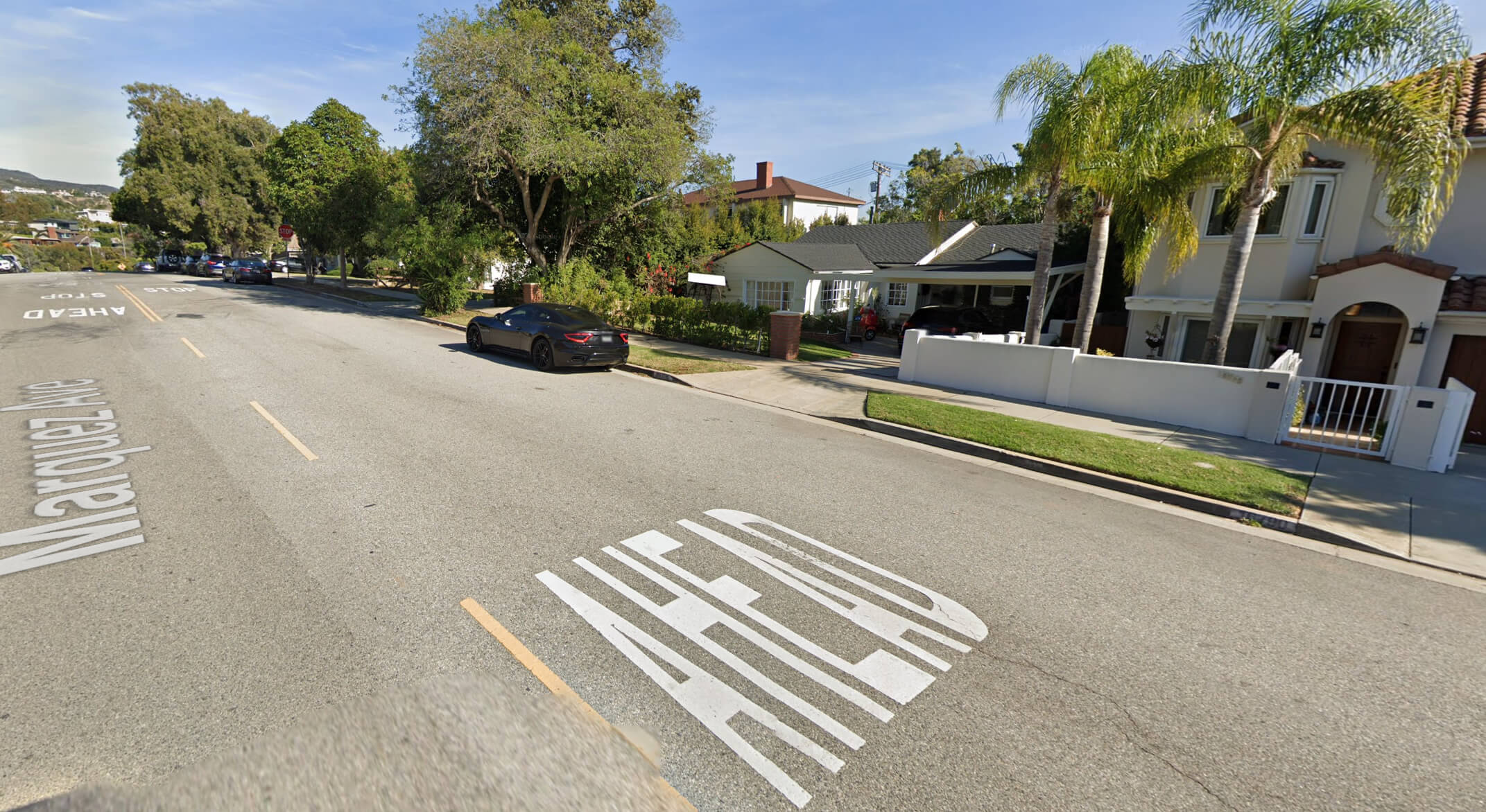
Pacific Palisades street view in la
Pacific Palisades wedding Los Angeles

Palisades street view before 2025 fire
Where is Palisades on Los Angeles?
Show Google interactive map, satellite map, where is the country located.
Get directions by driving, walking, bicycling, public transportation and travel with street view.
Where is California in the US and and Cities Map of California – @WorldGuide Youtube
Feel free to explore these pages as well:
- Los Angeles Map ↗️
- LA Fires January 2025 ↗️
- Los Angeles Wildfires in Map ↗️
- California Map ↗️
- Map of California↗️
- A Collection of California Maps ↗️
- California County Map ↗️
- California Physical Map ↗️
- California Political Map ↗️
- California Cities Map ↗️
- California Road Map ↗️
- California Population Map ↗️
- North America Earth Map ↗️
- Discovering Los Angeles ↗️
- Discover the California: A Vibrant Journey through Golden State ↗️
- Eaton Map in Los Angeles ↗️
- Malibu Map in Los Angeles ↗️
- San Fernando Map in Los Angeles ↗️
- Discovering Bakersfield: The Heart of California’s Central Valley ↗️
- Anaheim: California’s Hidden Gem ↗️
- Guide to Los Angeles’ Top 10 Attractions ↗️
- Discover Chula Vista: A Hidden California Gem with Rich Culture and Stunning Views ↗️
- United States Map ↗️
- Map of United States ↗️
- North America Map ↗️
- Map of North America ↗️
- Advertisement -