A collection of United States Maps; View a variety of United States physical, political, administrative, relief map, United States satellite image, higly detalied maps, blank map, United States world and earth map, United States’s regions, topography, cities, road, direction maps and atlas.
A Collection of United States of America Maps
Map of United States
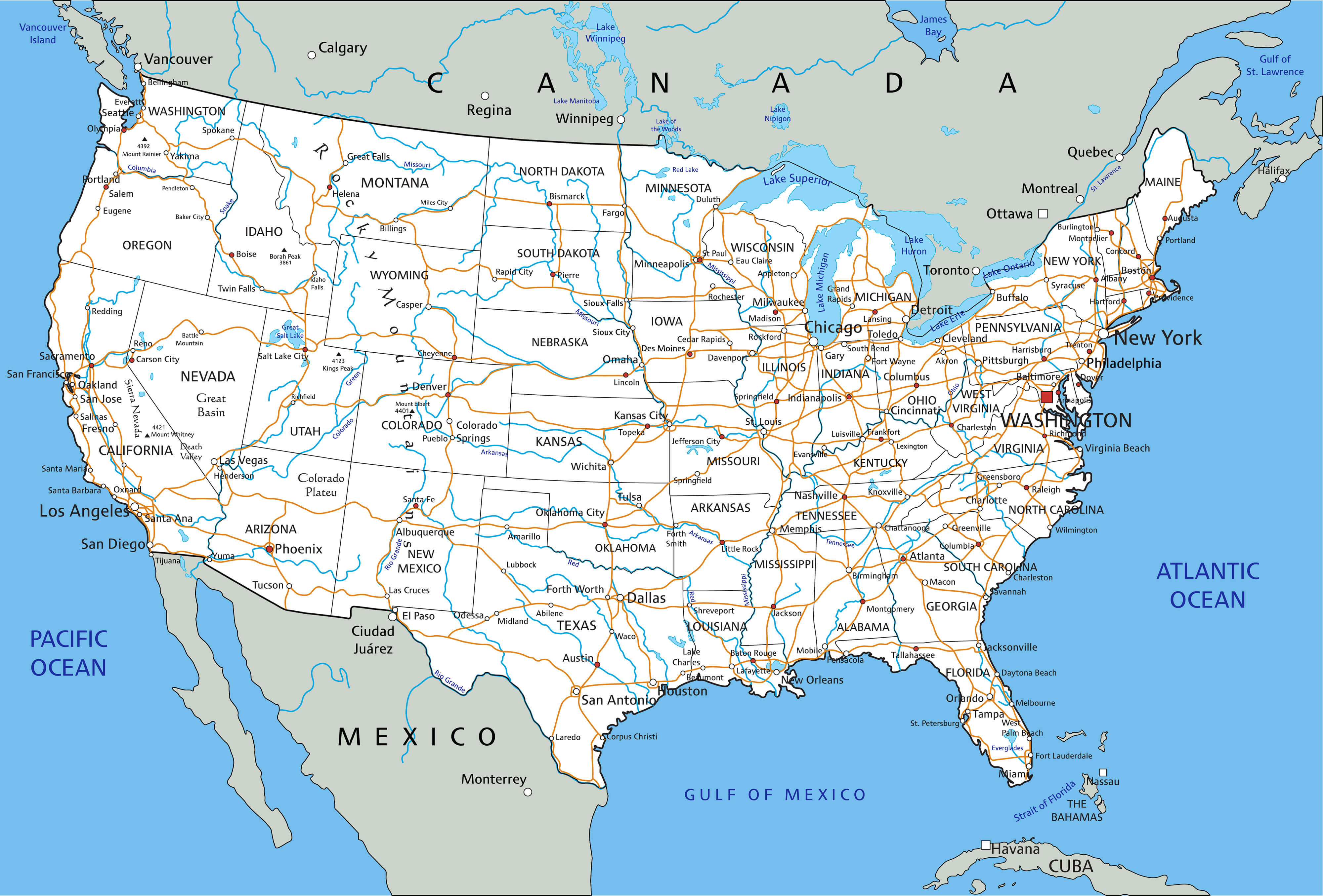
Map of United States
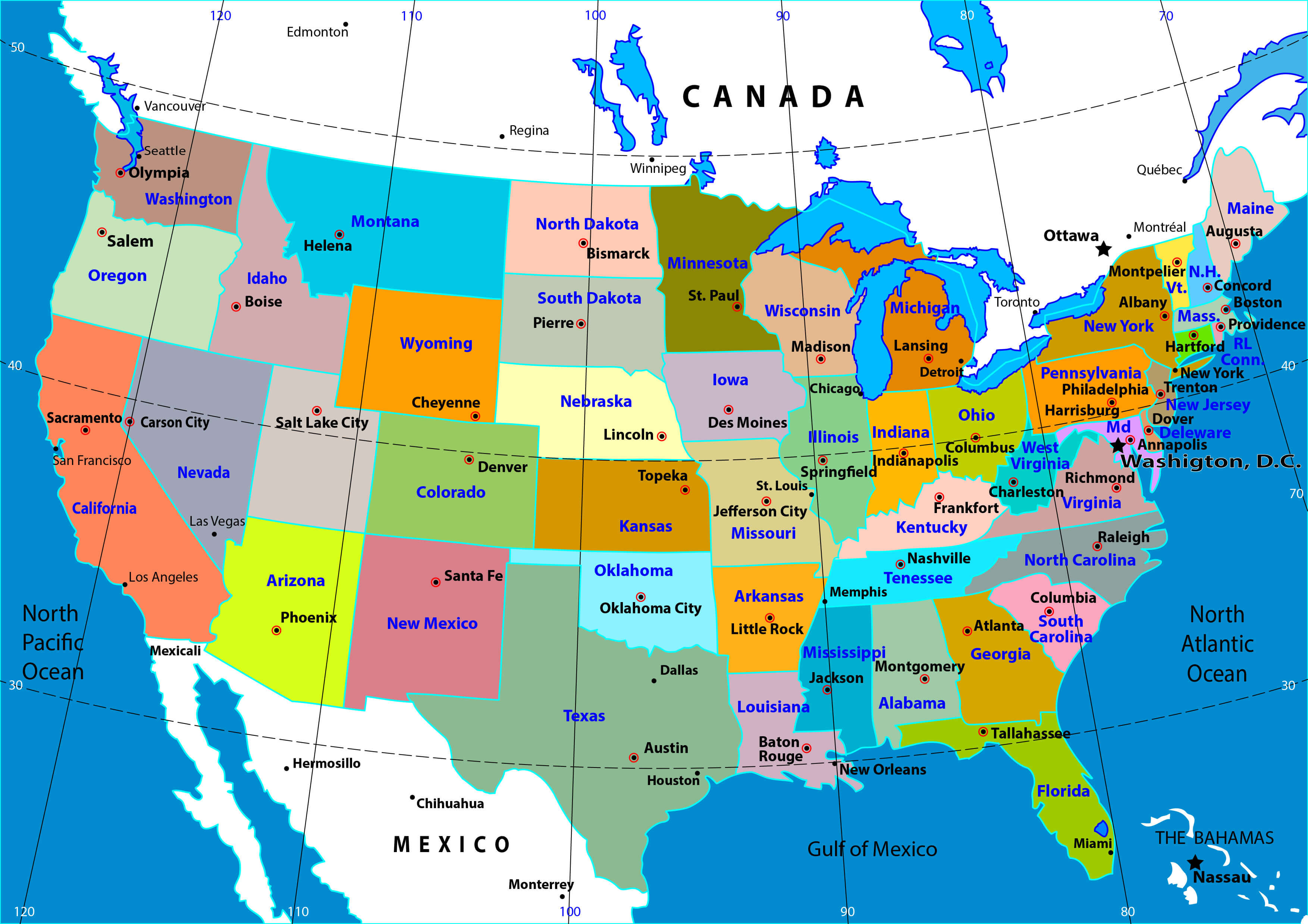
Map of United States with states and major cities.
United States Physical Map
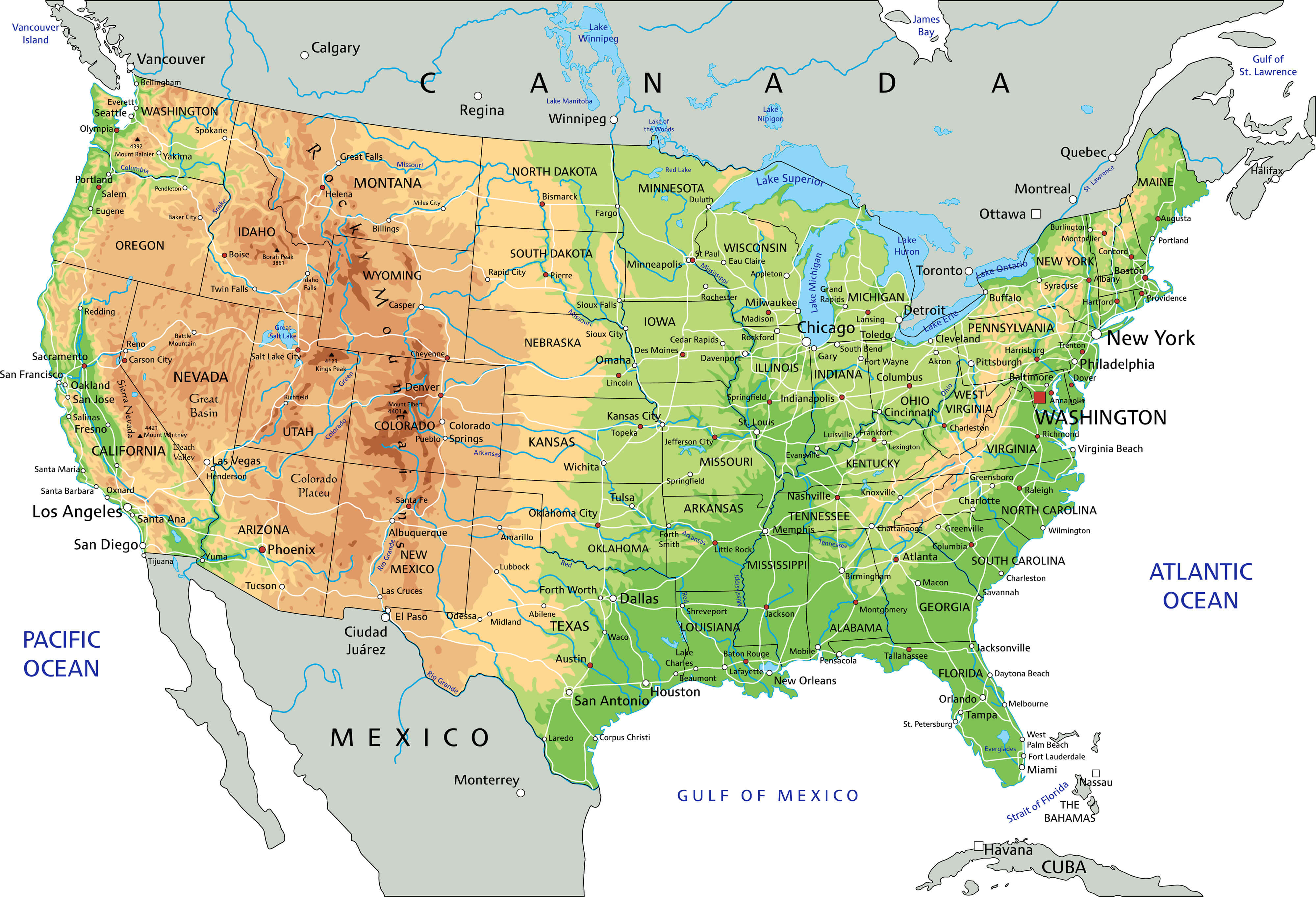
The United States Physical Map with state borders.
This United States Physical Map highlights the topographical features of the country, including the Rocky Mountains, Sierra Nevada, and Appalachian ranges, as well as the Great Plains, deserts in the southwest, and coastal regions. Major rivers such as the Mississippi and Colorado are also shown, along with key cities and interstate routes that connect them across the varied landscape.
Map of the United States
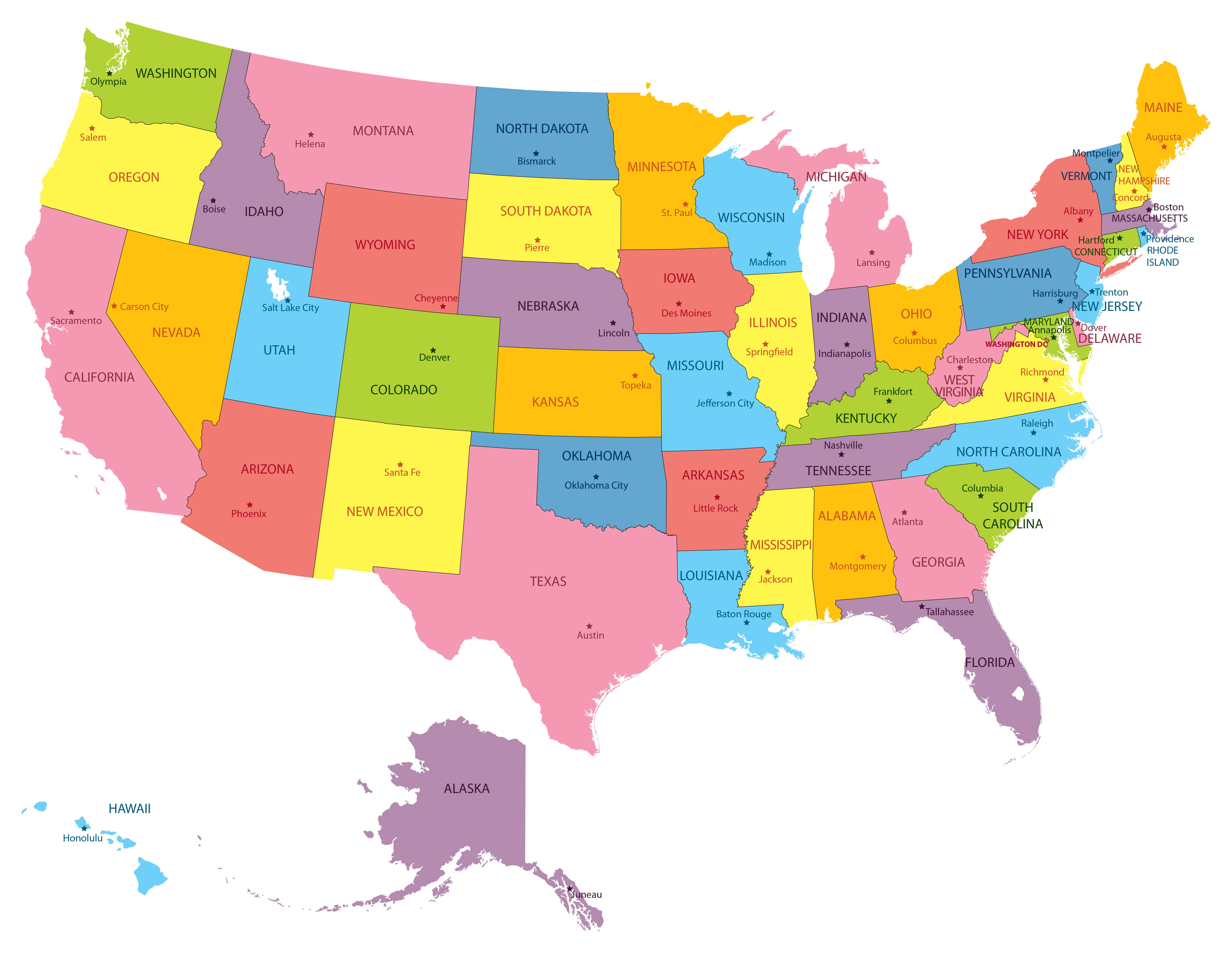
Map of the United States with state borders and state capital cities.
Map United States
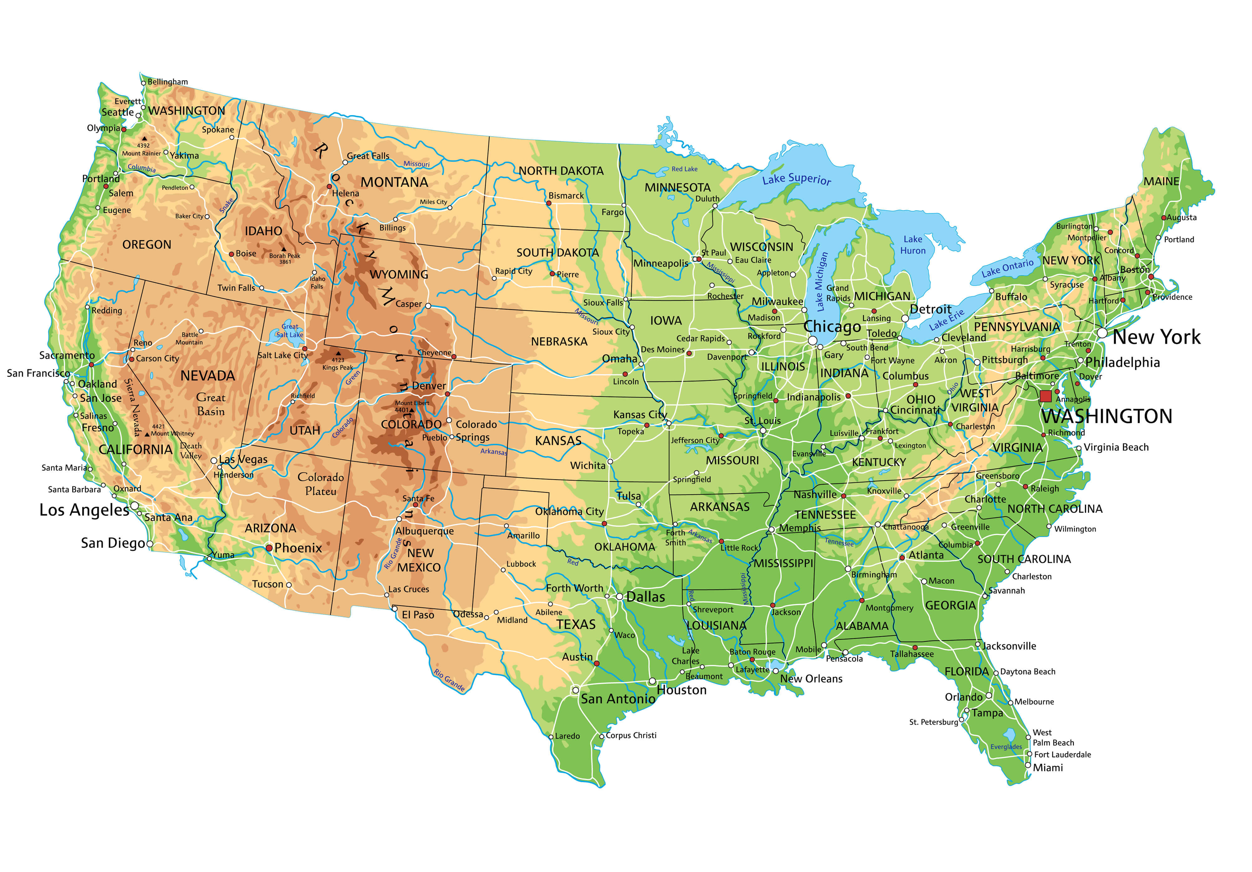
Physical Map of United States.
US Map with States
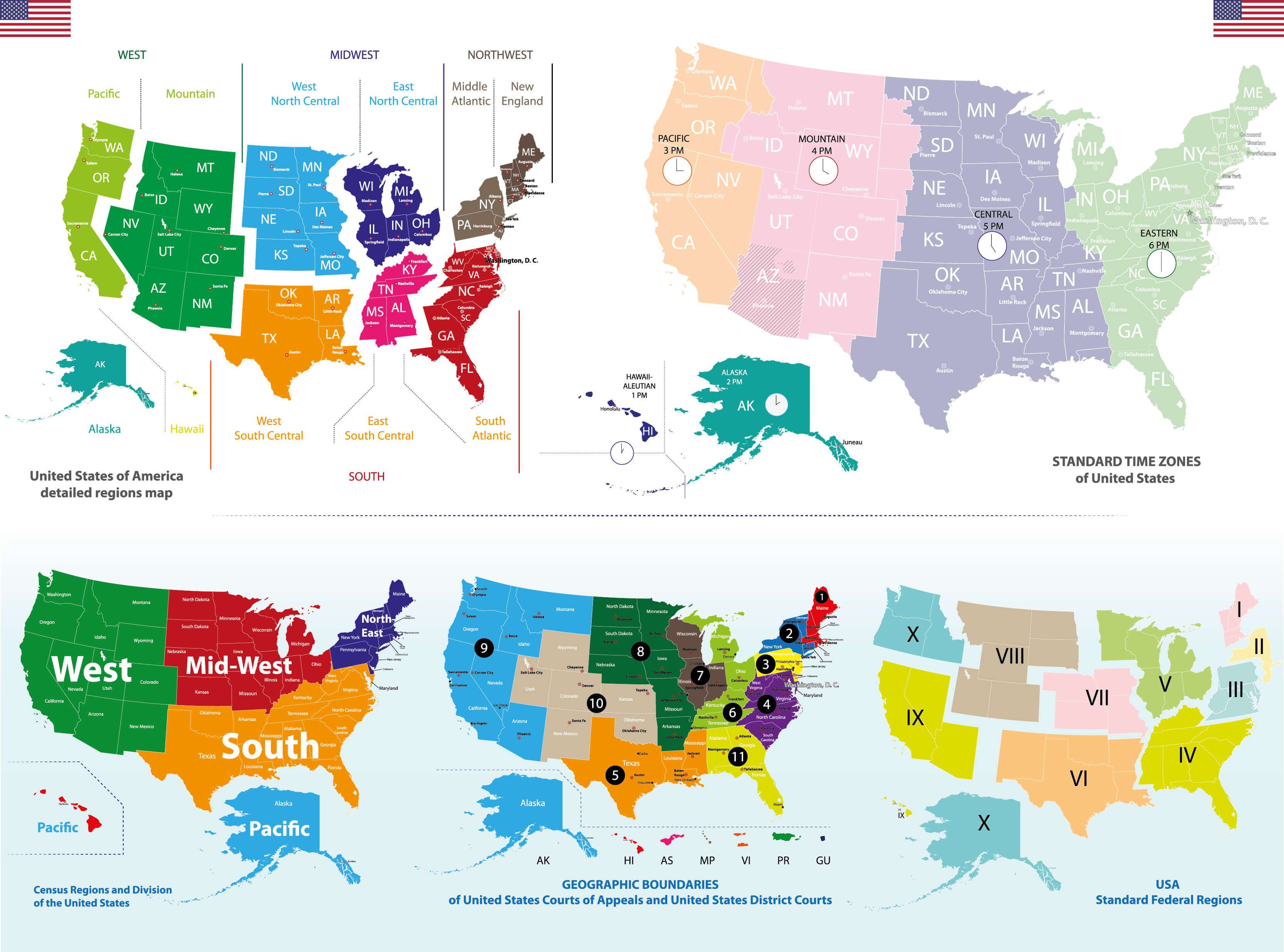
US Map with States and regions.
United States Map States
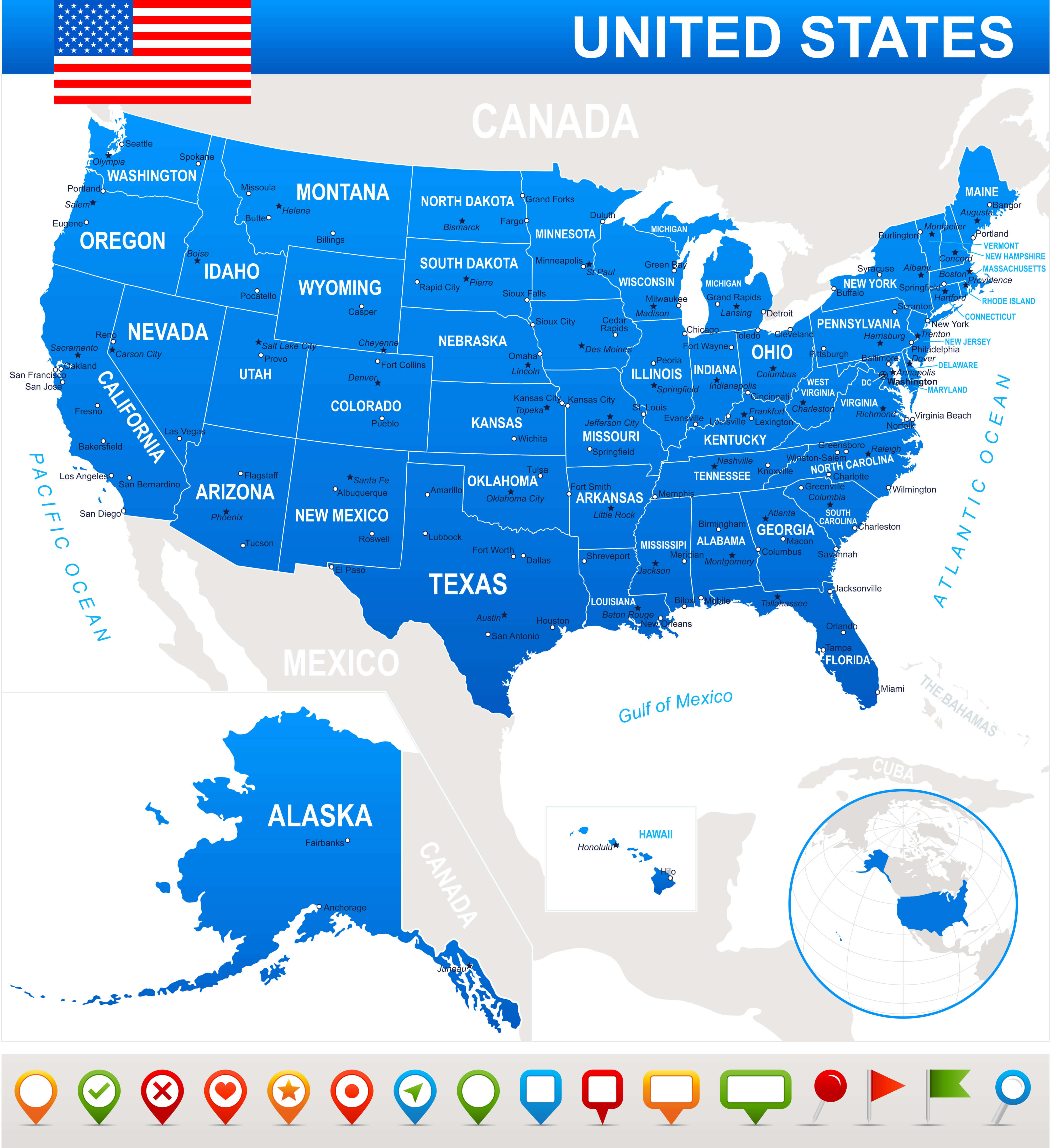
United States Map with major cities.
Map of United States States
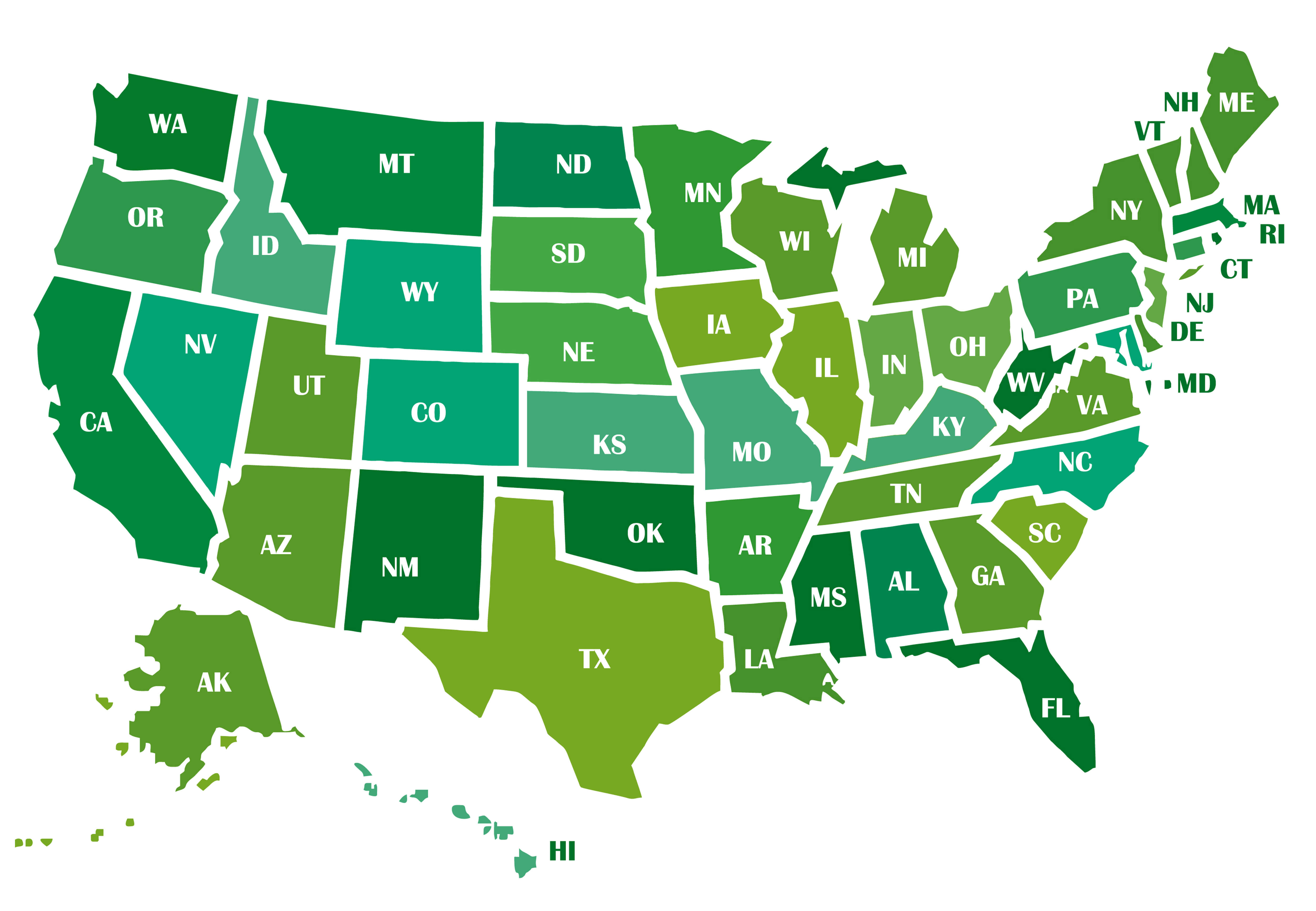
Map of United States States with state abbreviation.
United States Electoral Votes Map
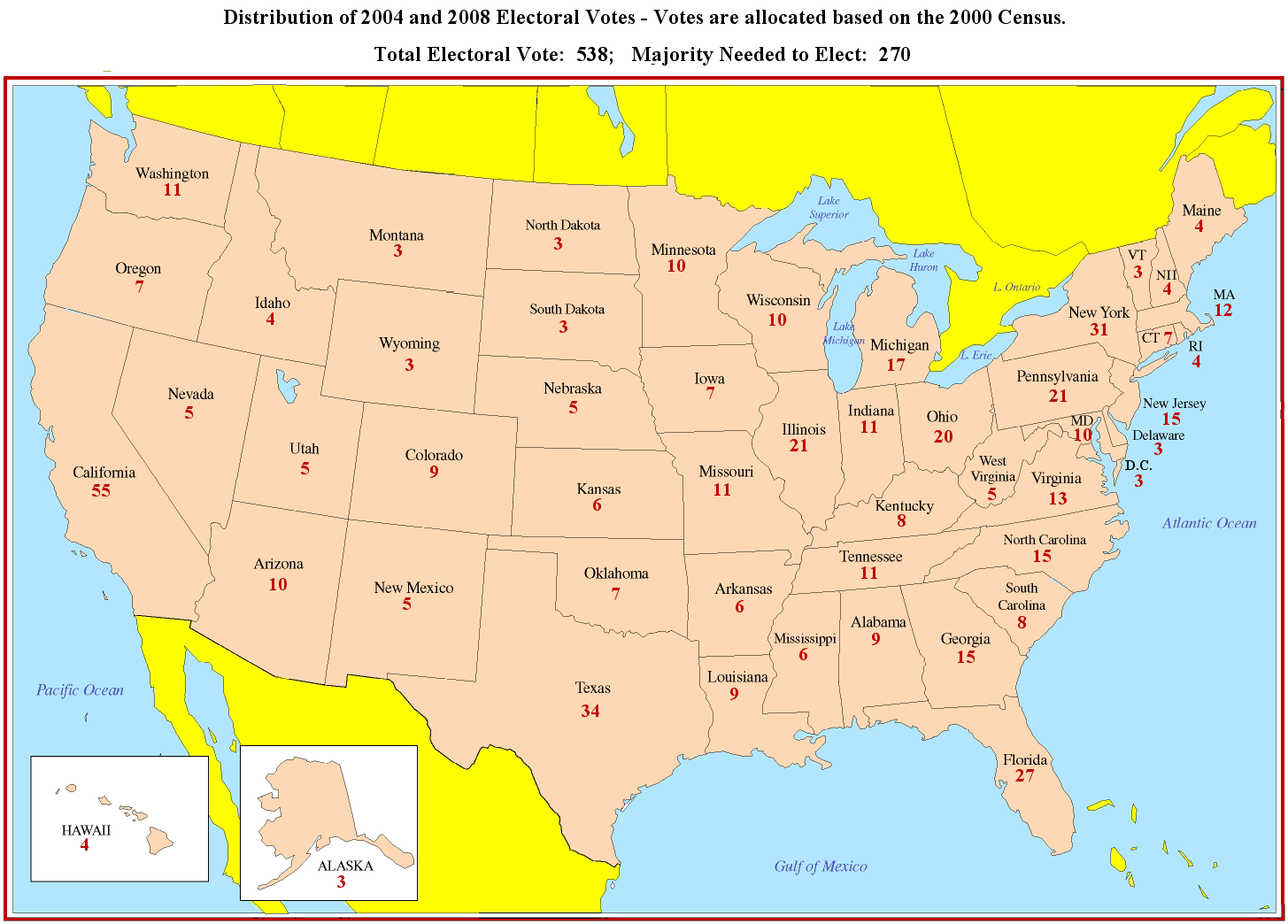
This map of the United States shows the distribution of electoral votes based on the 2000 census, with a total of 538 votes allocated to each state. The majority required to elect a president is 270. California has the largest number of electoral votes (55), followed by Texas (34) and New York (31). Smaller states such as Wyoming, North Dakota and Vermont are allocated 3 electoral votes each. This distribution of electoral votes reflects the population size of the states, which influences the outcome of US presidential elections.
United States Interstate Road Map
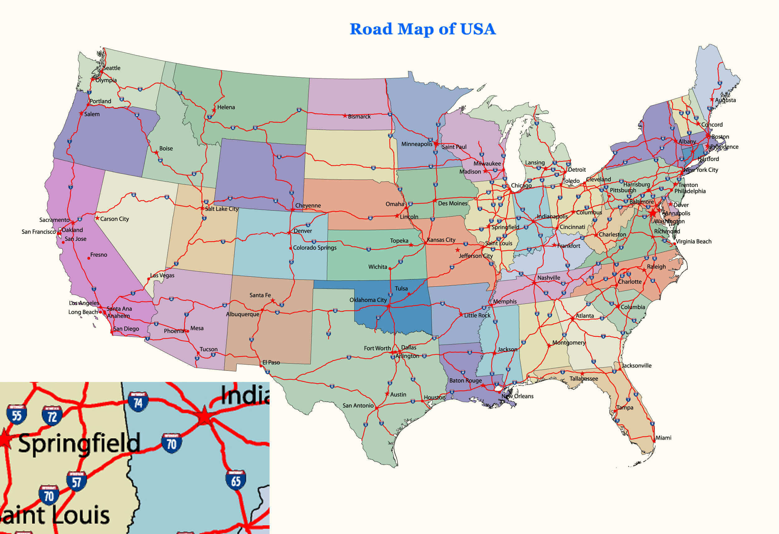
This is a detailed United States interstate road map showing the major highways and interstates connecting major cities and regions across the country. The map highlights key routes such as I-95 along the east coast, I-10 through the southern states and I-70 connecting the central regions from the midwest to the west. These interstates play a vital role in the US transportation network, facilitating long-distance travel and the movement of goods.
United States Map with US States National Capitals
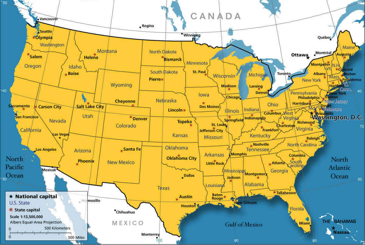
This map shows all the US states and their respective capitals, with Washington, D.C. marked as the national capital. It provides a clear overview of the location of each state’s administrative centre and shows how the capitals are distributed across the country, from Sacramento in California to Augusta in Maine. The map also highlights important regions such as the Gulf of Mexico and the North Pacific and North Atlantic Oceans, which border the country.
United States Physical Map
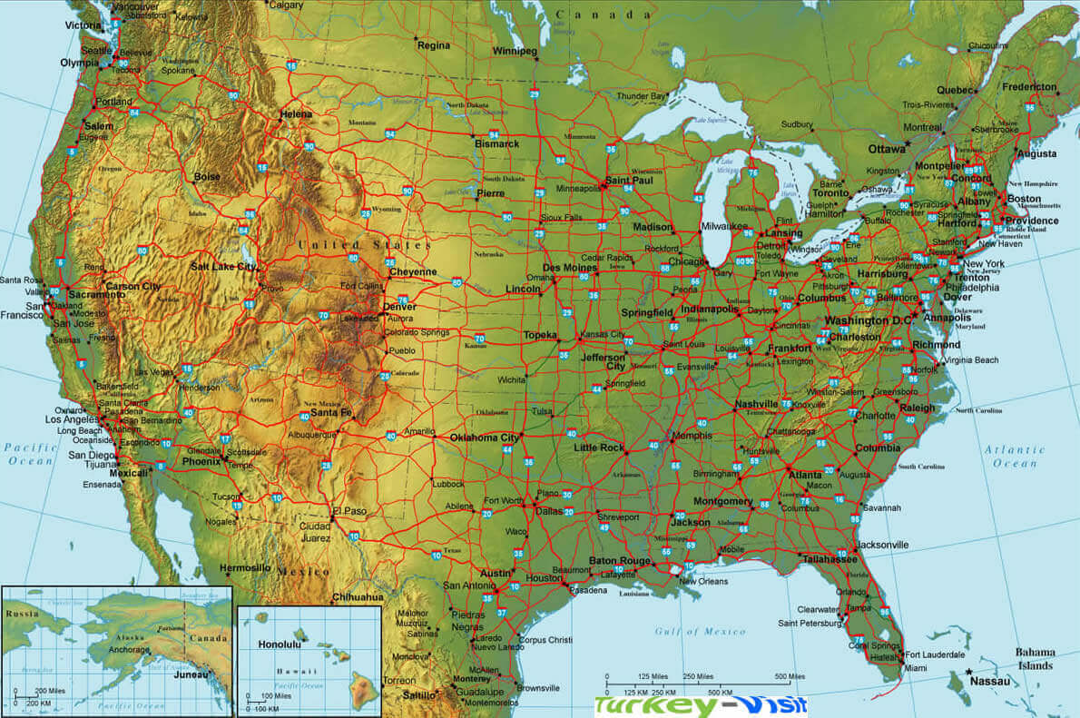
United States Interstate Highways Map
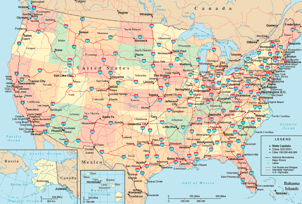
This map of the United States highlights the vast network of interstate highways that crisscross the country, connecting major cities, regions and states. The system is a vital part of the US infrastructure, facilitating transport, commerce and long-distance travel. Major highways such as I-95, I-10 and I-80 connect the East Coast to the West and the North to the South. This road network also provides access to various state capitals, as shown on the map, as well as major urban centres and natural landmarks.
The United States Map with State Abbreviations
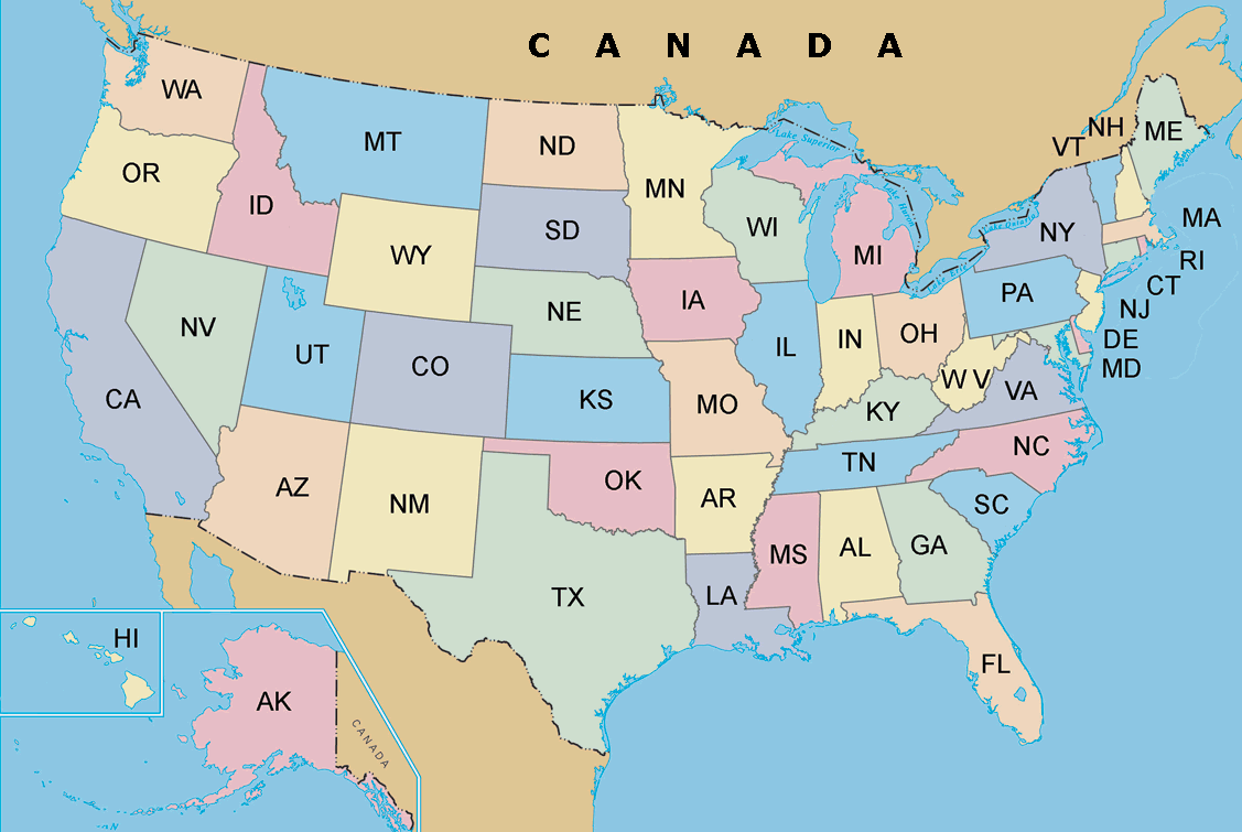
This map of the United States shows the 50 states and their abbreviations. Each state is colour-coded for easy identification, and major geographical features such as lakes and international borders are clearly defined. States such as CA for California, TX for Texas and FL for Florida are shown by their two-letter abbreviations. In addition, Alaska (AK) and Hawaii (HI) are shown in separate insets due to their geographical distance from the continental United States.
US States Map
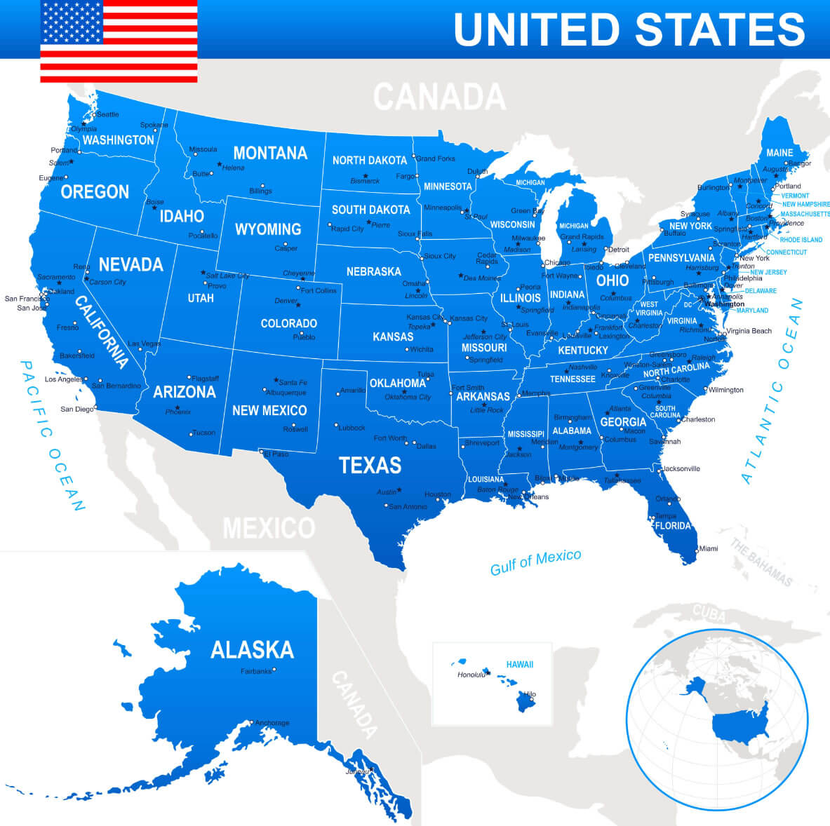
This map shows all 50 states of the United States, clearly labelled with their names. Alaska and Hawaii are included as separate insets, and the map is fully shaded in blue. The layout also shows the major oceans that border the United States, such as the Pacific and Atlantic Oceans, as well as the neighbouring countries of Canada and Mexico.
US Cities Rivers Roads Map
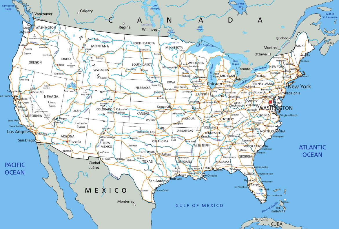
This map of the United States shows major cities, roads and rivers. It highlights major metropolitan areas, the extensive network of interstate highways that connect them, and major waterways across the country, providing a comprehensive view of the country’s geography and infrastructure. The map also shows the proximity of major US cities to Canada, Mexico and other surrounding regions, providing insight into transport and trade routes.
Physical Map of The United States Map
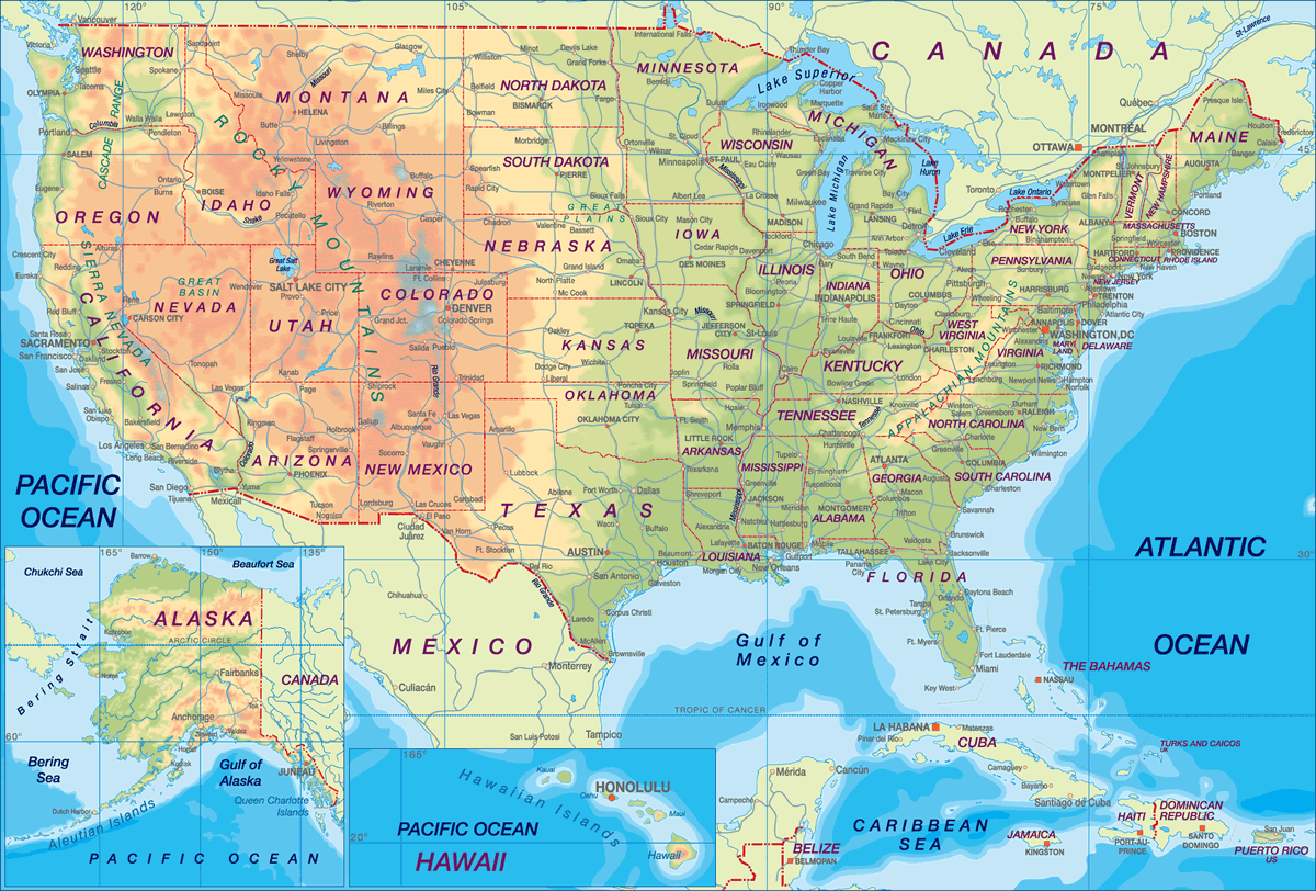
This physical map of the United States displays the diverse geographical features across the country, including mountain ranges like the Rockies in the west, the Appalachian Mountains in the east, and the Great Plains in the central region. The map also highlights major rivers such as the Mississippi and Colorado, as well as notable bodies of water like the Great Lakes and the Gulf of Mexico. The map’s detailed topography provides insight into the varying elevations and landscapes, from the deserts of the southwest to the fertile plains and coastal areas.
United States Time Zone Map
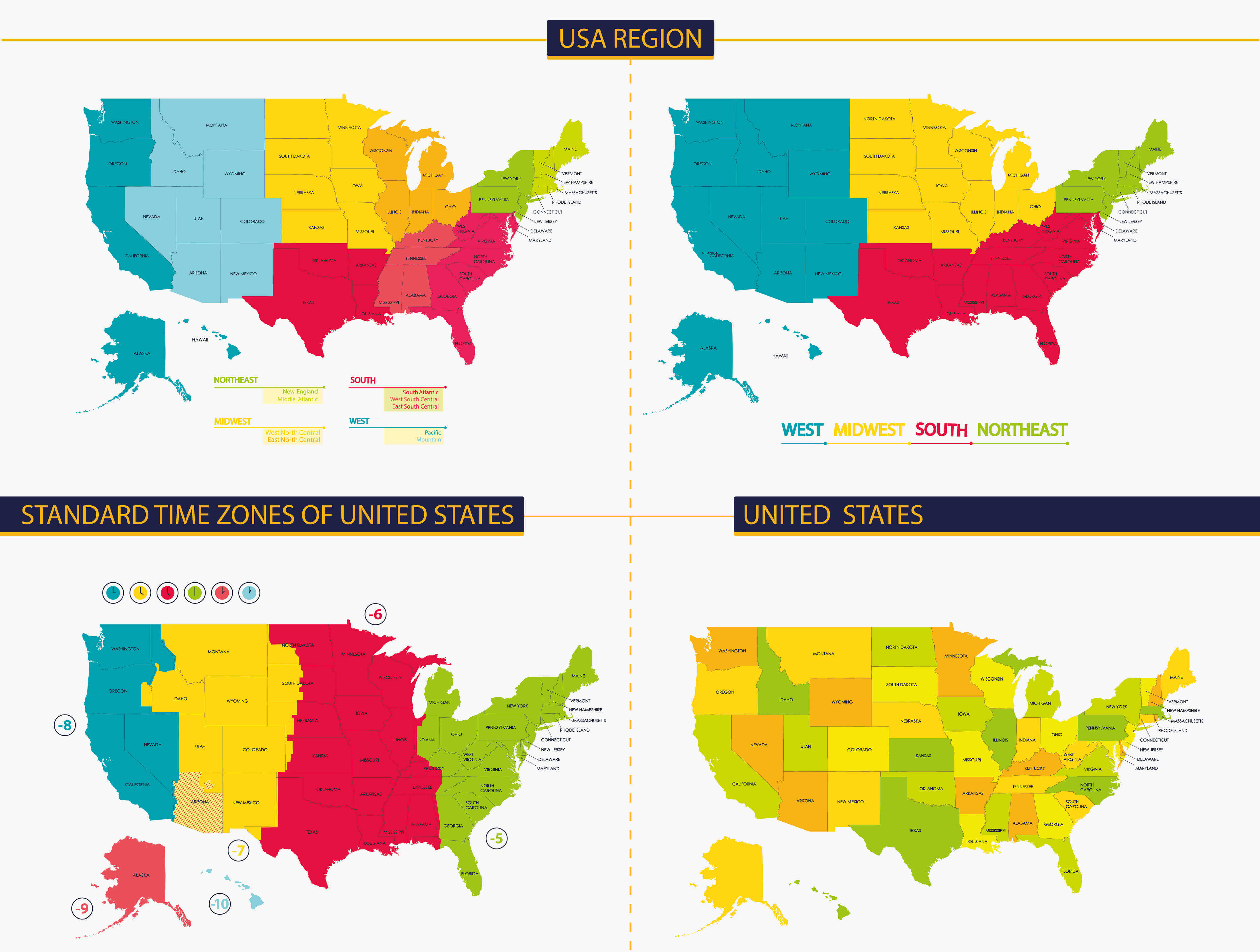
The United States time zone map shows the different time zones in the country, including Pacific, Mountain, Central and Eastern time zones. The map also shows the regions – West, Midwest, South and Northeast – providing a clear visual distinction of how the country is divided both geographically and by time. This information is critical to understanding how time shifts between states affect planning and coordination, especially for business, travel and national events.
United States, Canada, Gronland Satellite Map
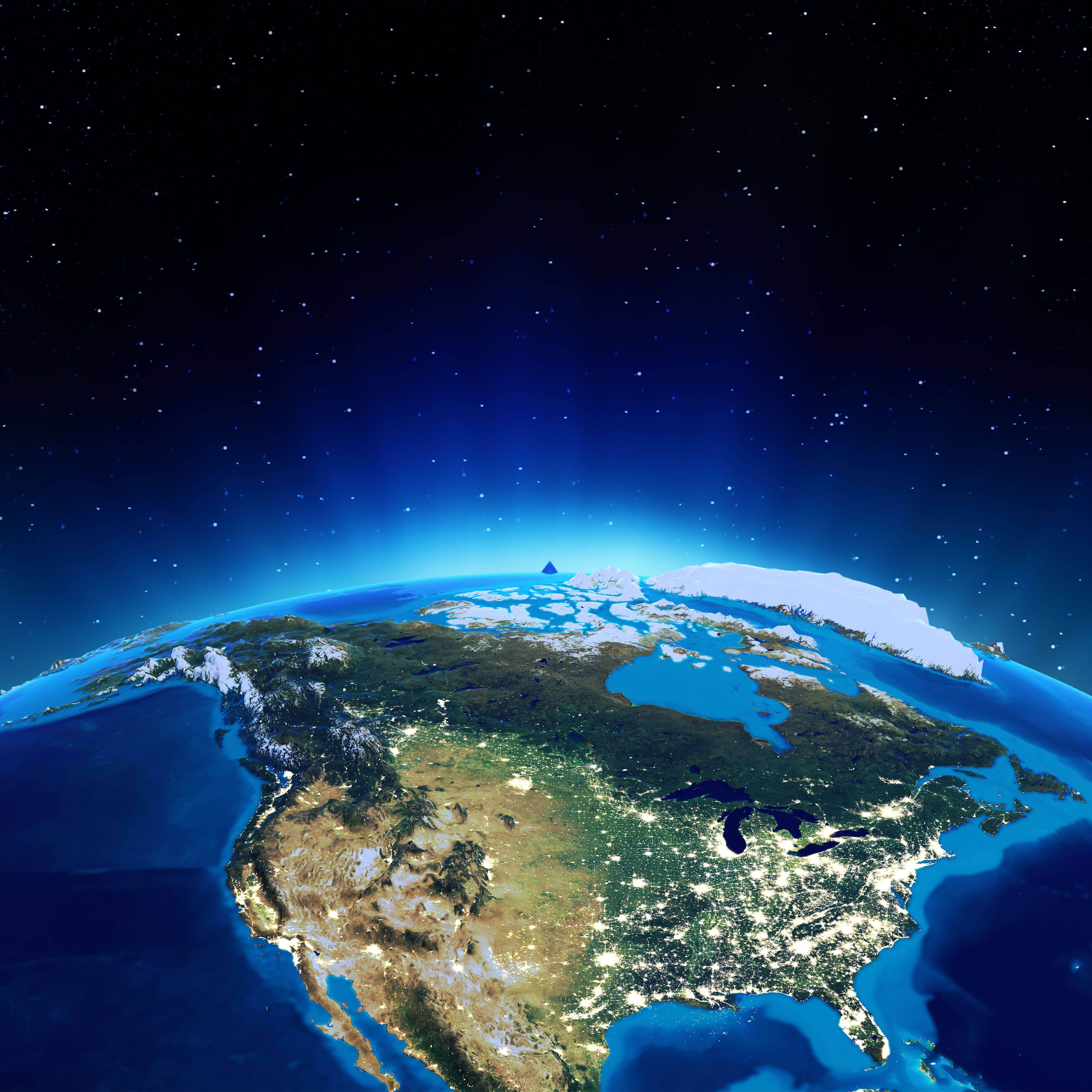
This satellite view highlights North America, including the United States, Canada and Greenland, showing major urban centres lit up at night in the United States, the vast snow-covered regions of Canada and the icy terrain of Greenland, giving a captivating sense of the region’s geographical and environmental diversity from space.
United States and US States Capital Map
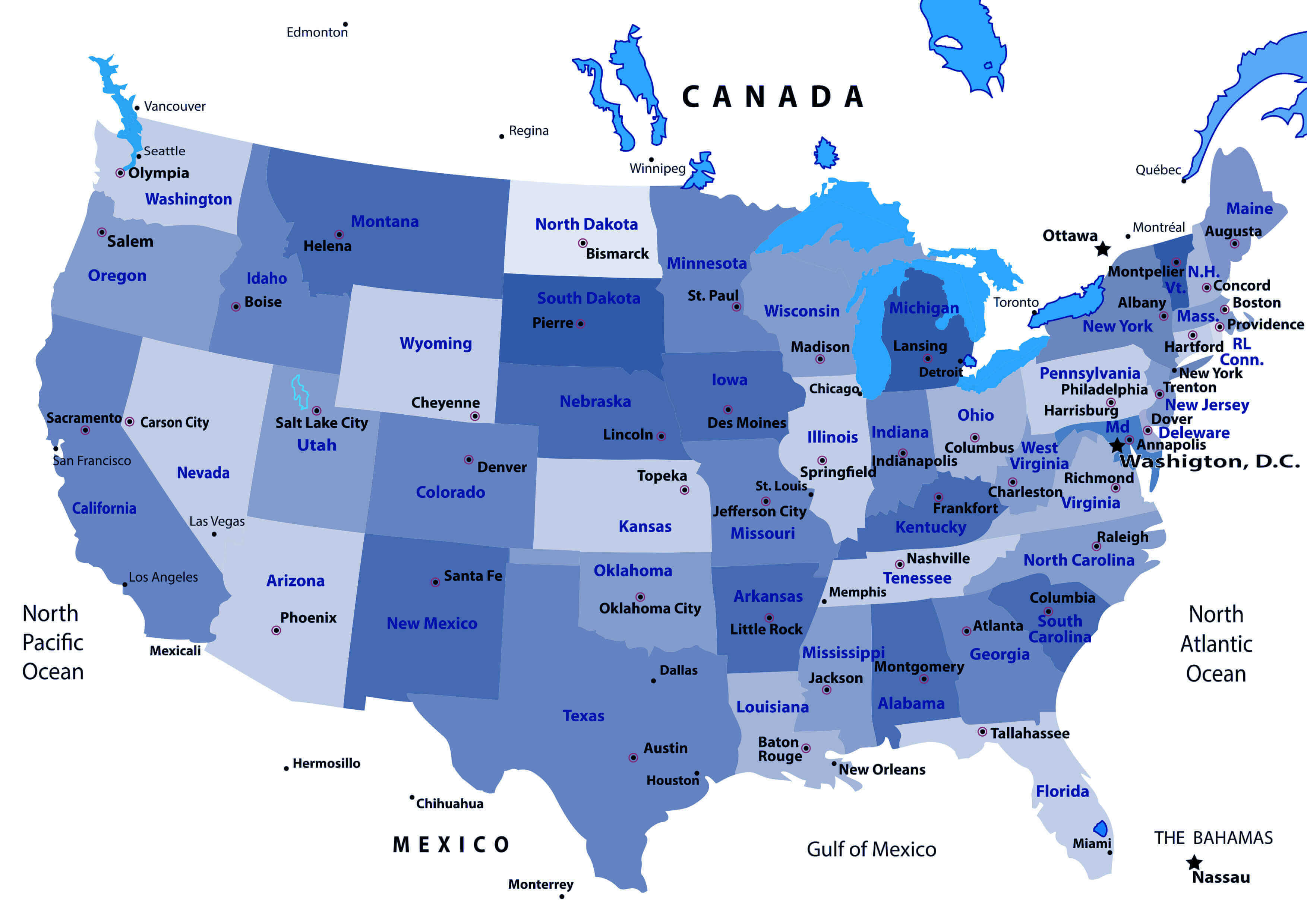
This map of the United States highlights all 50 states along with their respective capitals. It visually separates the states with clear borders and indicates key capitals such as Washington, D.C. for the United States, and capitals like Austin for Texas, Sacramento for California, and Albany for New York. It serves as a quick reference for understanding the geographic locations of U.S. capitals relative to their states and major regions.
Time Zone Map of the United States
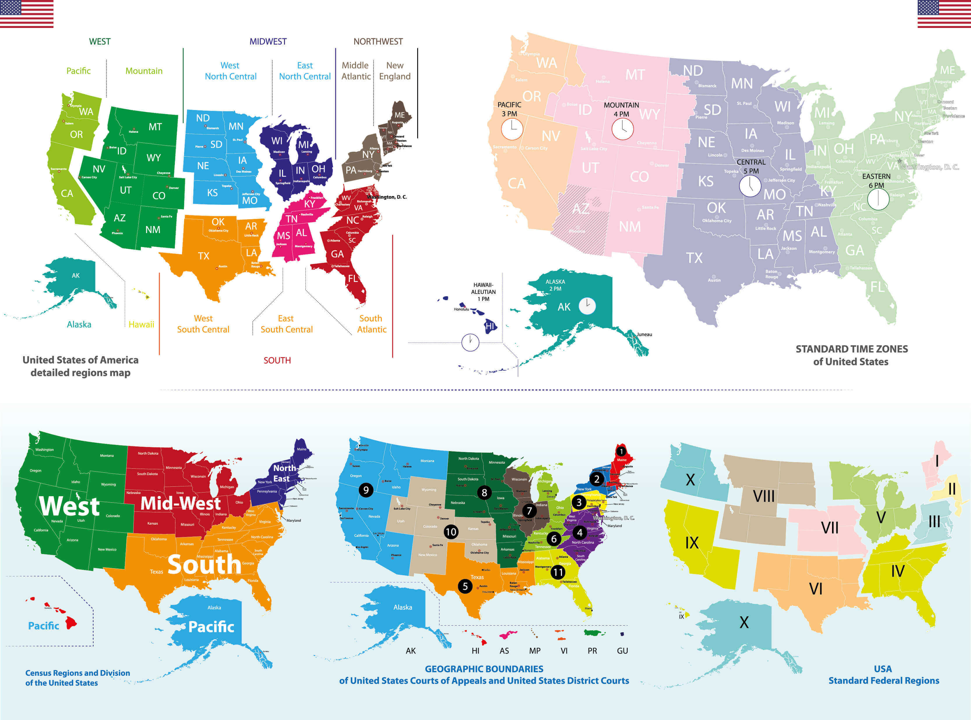
The Time Zone Map of the United States illustrates the division of the country into four primary time zones: Pacific, Mountain, Central, and Eastern. Each zone is adjusted according to the local solar time, with Alaska and Hawaii-Aleutian time zones also included. The map helps to track the varying time differences across the states, demonstrating how regions like California follow Pacific Time, while New York follows Eastern Time. This division is crucial for national coordination, especially for transportation, broadcasting, and other time-sensitive activities.
United States, Mexico, Cuba Satellite Map
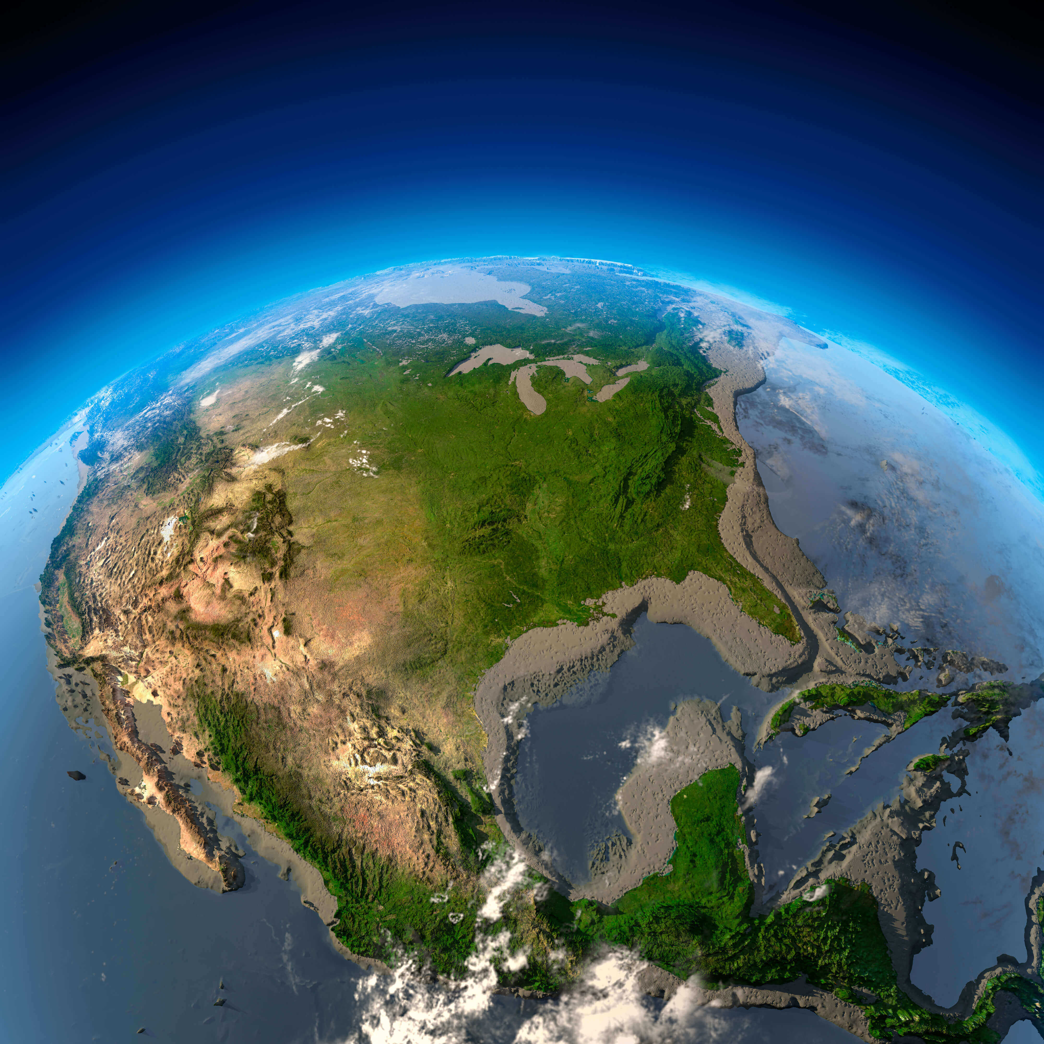
This satellite map provides a clear view of the United States, Mexico and Cuba, highlighting the diverse landscapes from the Rocky Mountains in the western United States to the tropical regions of Mexico and Cuba. The map shows the geographic proximity and interconnectivity of these countries, emphasising the vast terrain of North America, bordered by the Gulf of Mexico and the Caribbean Sea.
United States Blank Map
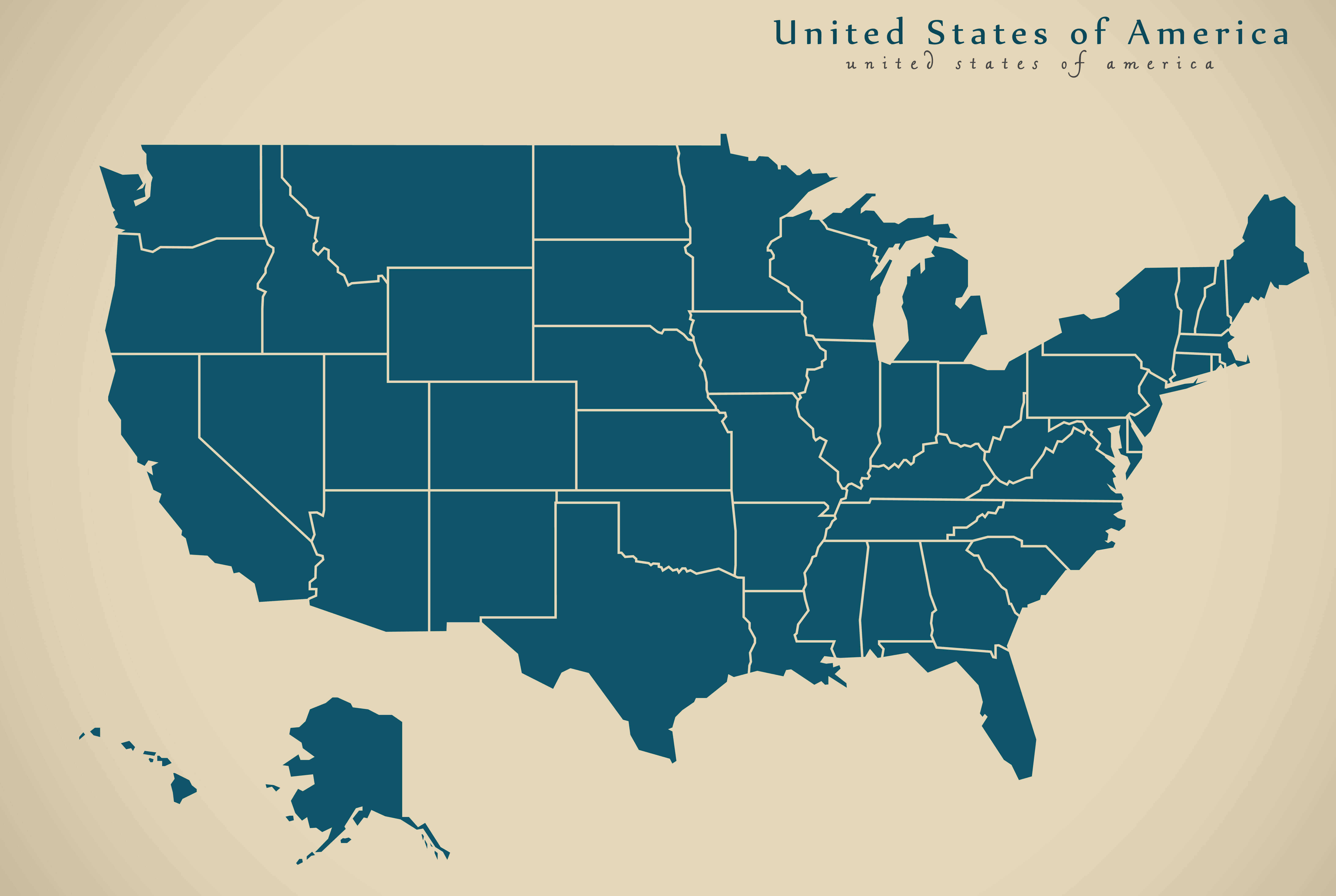
USA Physical Map

US Religion Map
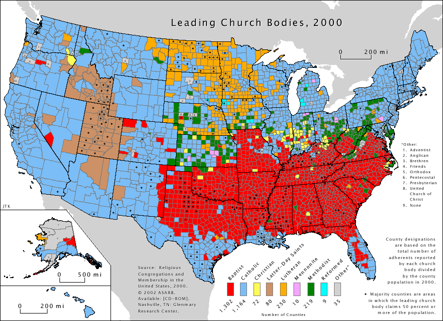
This map of religious affiliation in the United States (from the year 2000) shows the predominant church bodies in each county. The map highlights the geographic dominance of different Christian denominations across the country, with the Southern Baptist Convention being the most widespread in the southern states (indicated by red), the Catholic Church prevalent in parts of the Northeast, Midwest, and Southwest (represented by blue), and the Lutheran Church concentrated in the upper Midwest (yellow). Other denominations and church bodies are scattered throughout the country, illustrating the diversity of religious practice across the U.S. at the county level.
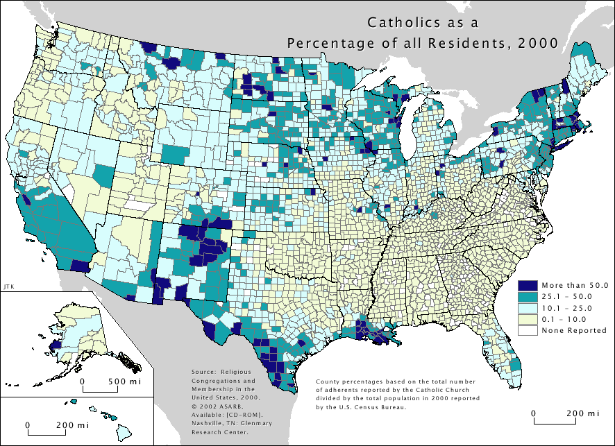
United States Catholic Religon Map
United States Renewable Resources Map
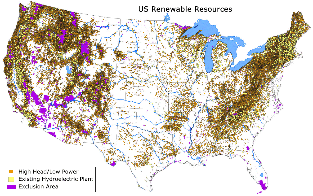
The United States Renewable Resources Map highlights areas with high potential for hydropower generation. The brown squares indicate high head/low power hydro potential, the yellow represents existing hydro facilities, and the purple zones show areas excluded from development. This distribution shows significant opportunities for renewable energy development, particularly in mountainous regions such as the Rockies and Appalachians.
United States Precipitation Map
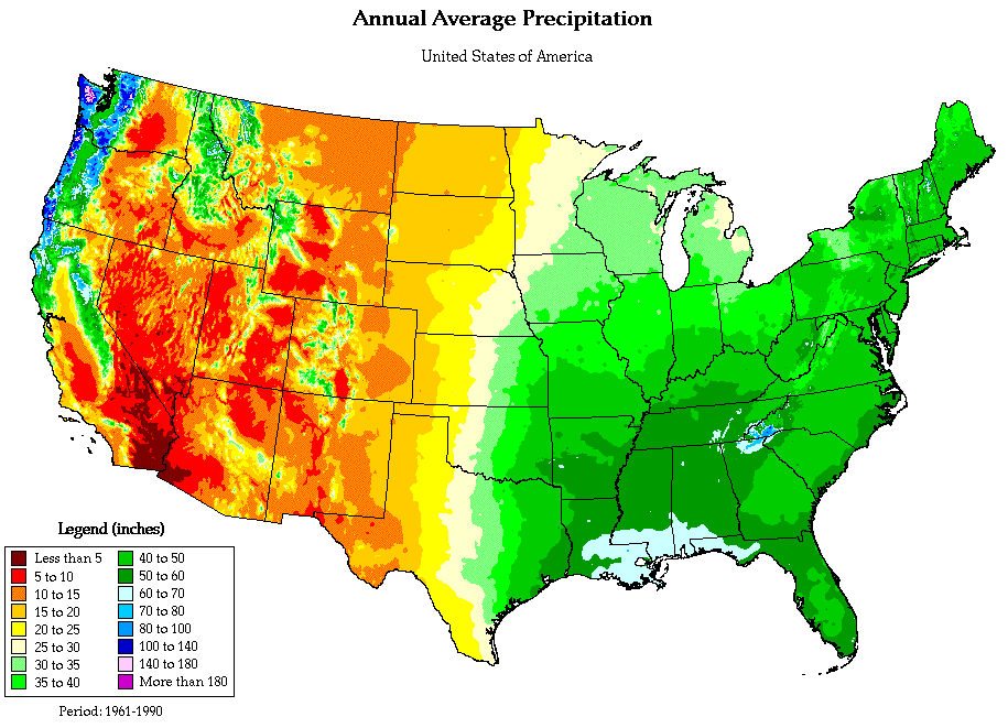
This map of the United States shows the average annual precipitation across the country. The map highlights that the Pacific Northwest and parts of the southeastern United States, particularly the Gulf Coast, receive the most precipitation, exceeding 50 inches annually. In contrast, the western interior regions and parts of the Southwest, including Arizona and Nevada, receive significantly less, often under 15 inches per year. The map provides a clear visual of the country’s varying rainfall patterns, with a notable gradient from the wet eastern regions to the drier western states.
United States Income Map
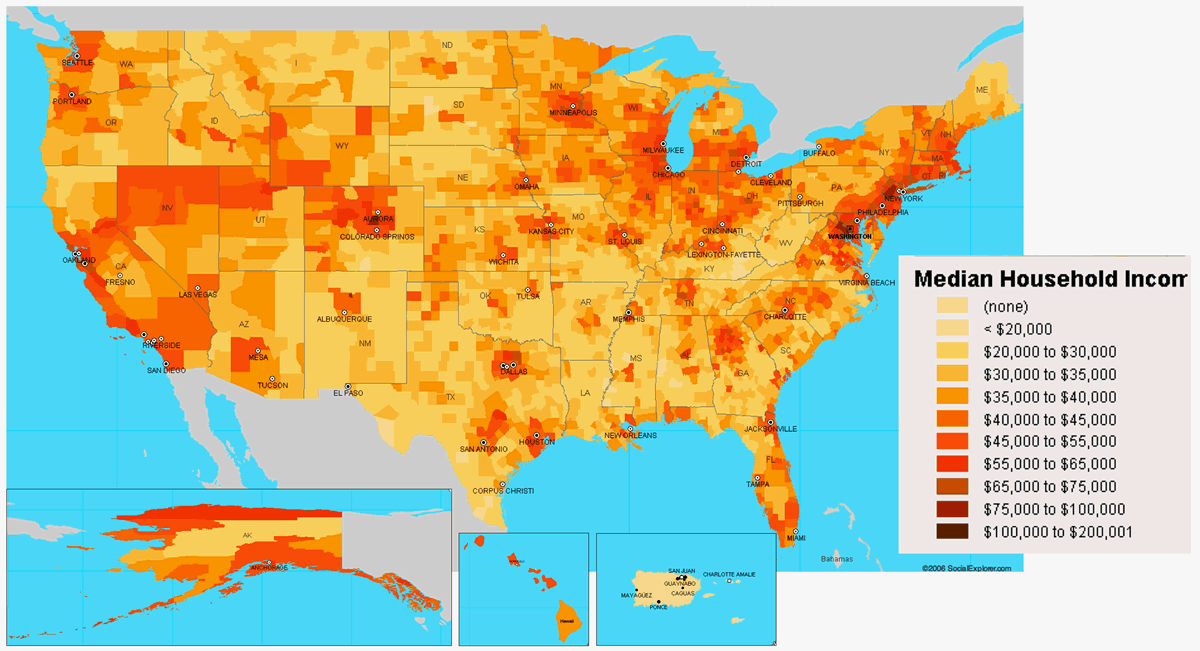
This map of the United States shows the median household income across various regions, with darker shades indicating higher income levels and lighter shades representing lower incomes. The wealthier regions are concentrated in urban areas, particularly along the East and West Coasts, while rural areas in the Midwest and South tend to have lower median incomes.
United States Indian Tribes Map
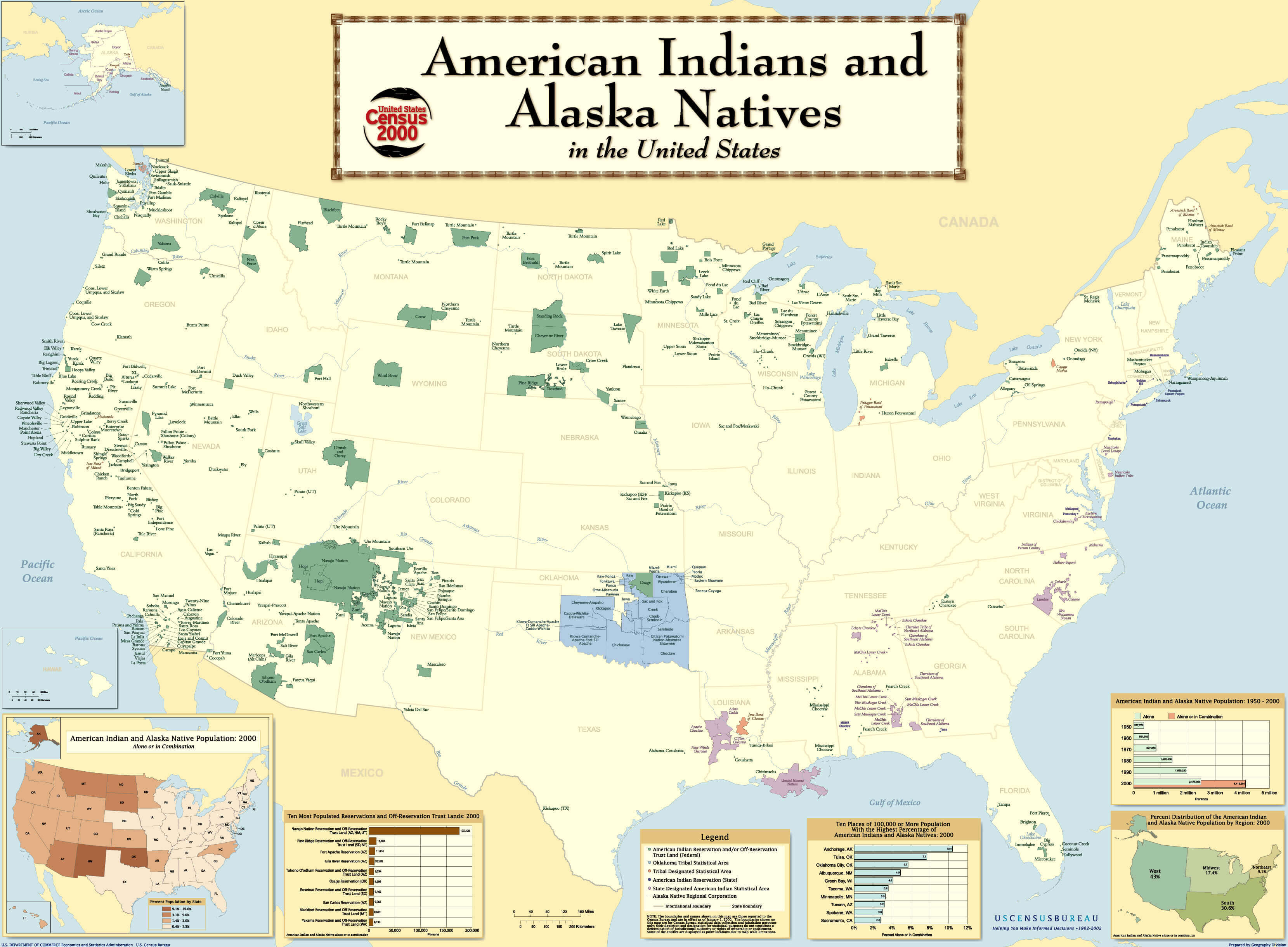
The map you provided shows the distribution of American Indian and Alaska Native populations in the United States based on the 2000 US Census. It highlights the geographic areas with significant Native American populations, including reservations and off-reservation trust lands. Major areas include parts of the Southwest, Northern Plains, and Northwest, where Native American populations are particularly concentrated. It also includes the most populous reservations, such as the Navajo Nation, and areas in Oklahoma with large Native American populations. This map is a valuable resource for understanding the geographic distribution of indigenous groups in the US.
Map of USA Wall
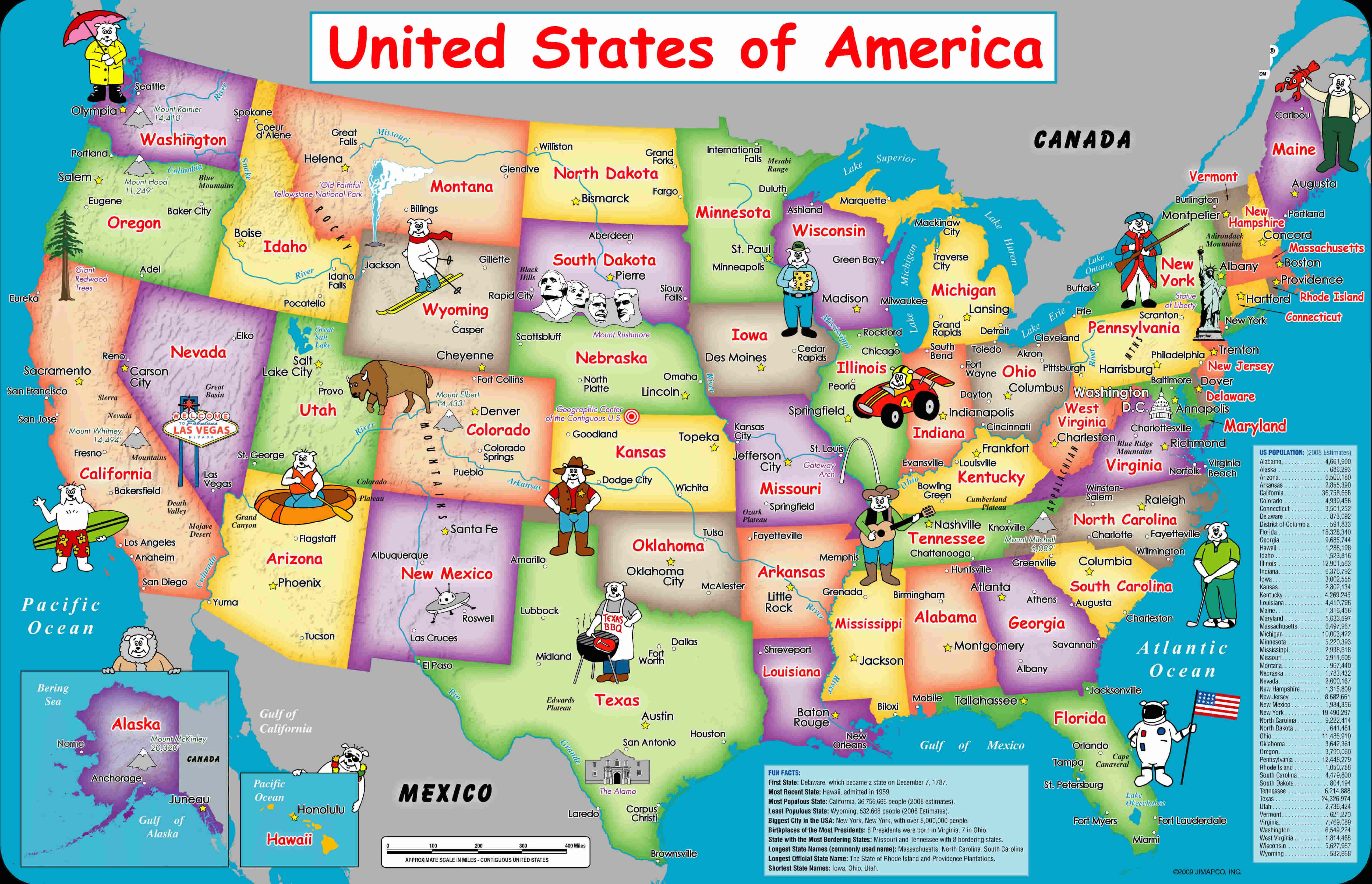
This map of the USA displays a colorful, cartoon-style illustration of each state, highlighting notable symbols, landmarks, and fun representations of activities or characters specific to each state. It’s designed as a whimsical, educational wall map ideal for children or as decorative art, helping familiarize viewers with key features and geography of the United States in an engaging way.
Where is United States on the World Map?
Show Google map, satellite map, where is the country located.
Get directions by driving, walking, bicycling, public transportation and travel with street view.
Feel free to explore US states maps:
- United States Map ↗️
- Map of United States ↗️
- Gulf of America (The Gulf of Mexico) Map ↗️
- US Population Map ↗️
- California Map ↗️
- Texas Map ↗️
- New York Map ↗️
- Florida Map ↗️
- Illinois Map ↗️
- Pennsylvania Map ↗️
- Ohio Map ↗️
- Michigan Map ↗️
- Georgia Map ↗️
- New Jersey Map ↗️
- North Carolina Map ↗️
- Virginia Map ↗️
- Massachusetts Map ↗️
- Indiana Map ↗️
- Tennessee Map ↗️
- Arizona Map ↗️
- Missouri Map ↗️
- Maryland Map ↗️
- Washington Map ↗️
- Minnesota Map ↗️
- Colorado Map ↗️
- Alabama Map ↗️
- Louisiana Map ↗️
- South Carolina Map ↗️
- Kentucky Map ↗️
- Oregon Map ↗️
- Oklahoma Map ↗️
- Connecticut Map ↗️
- Iowa Map ↗️
- Mississippi Map ↗️
- Arkansas Map ↗️
- Kansas Map ↗️
- Utah Map ↗️
- Nevada Map ↗️
- Illinois Map ↗️
- North America Map ↗️
- Map of North America ↗️
