A collection of Michigan Maps; View a variety of Michigan physical, united states political map, administrative, relief map, Michigan satellite image, higly detalied maps, blank map, Michigan USA and earth map, Michigan’s regions, topography, cities, road, United States of America direction maps and US atlas.
Color Map of Michigan
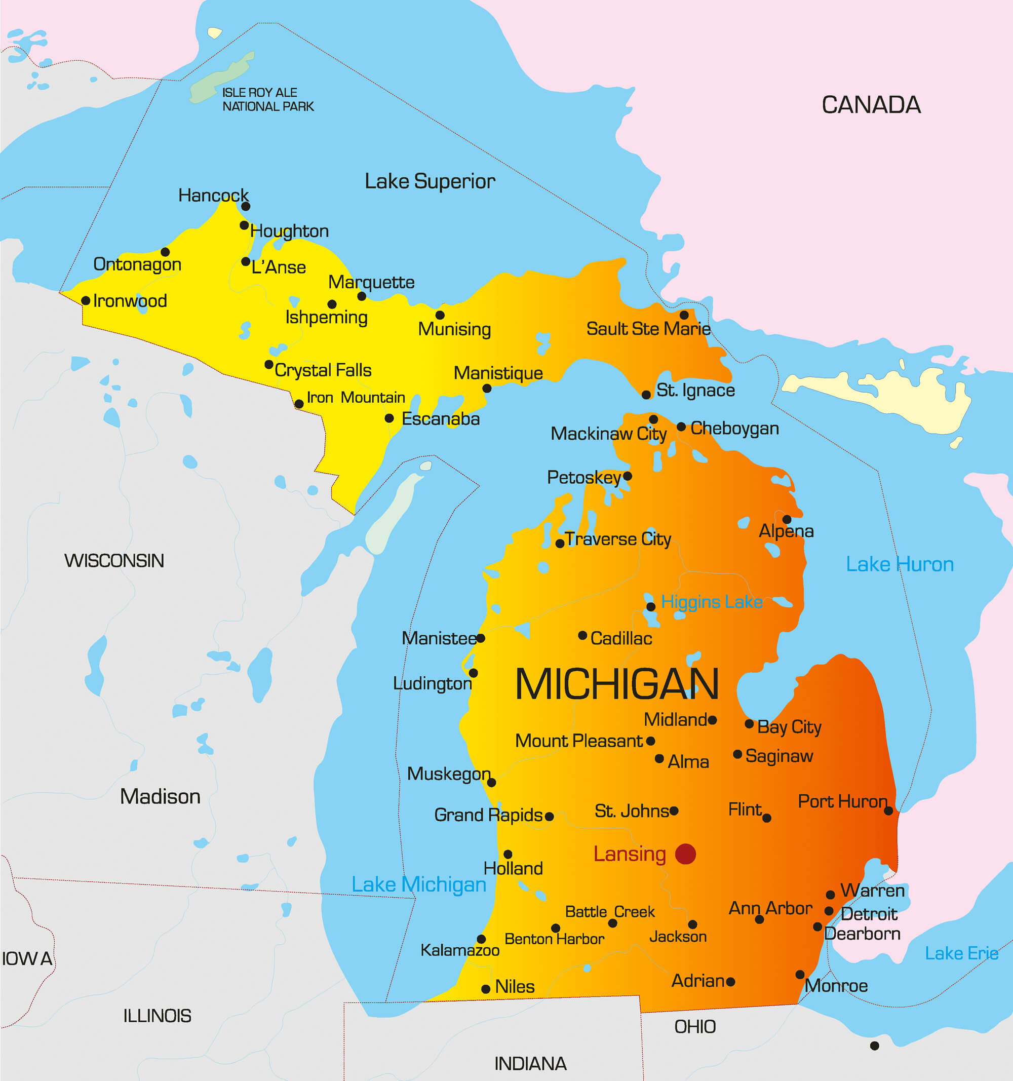
Vector color map of Michigan state, USA.
Geographic Map of Michigan
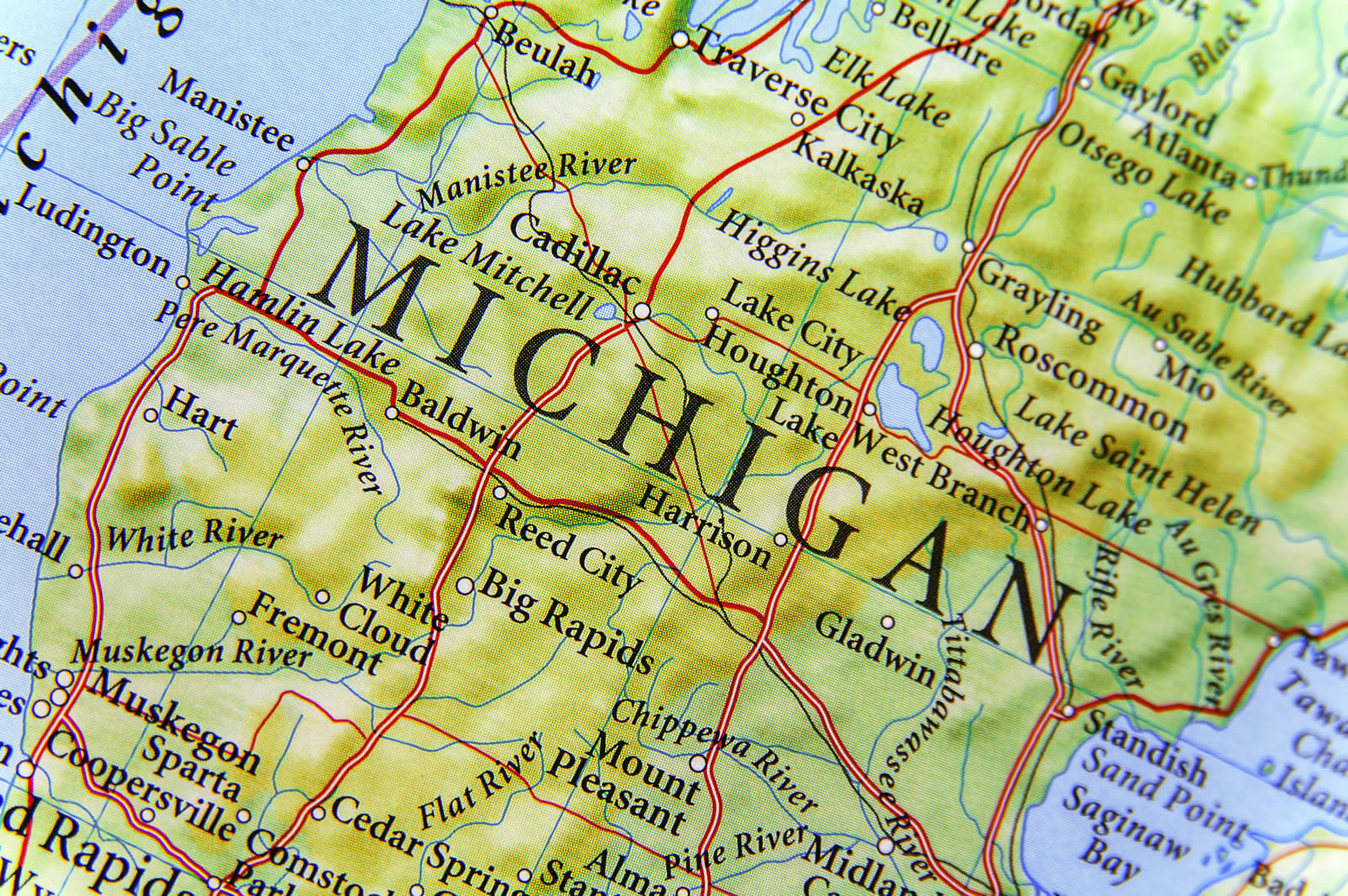
Geographic map of Michigan close Big Rapids and Mount Pleasent.
Geographic Map of Detroit
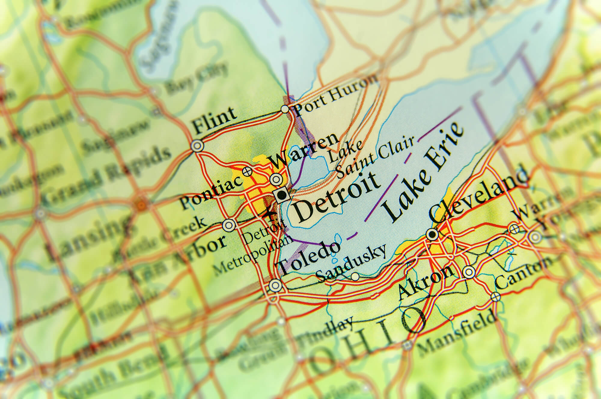
Geographic map of US state Michigan and Detroit city.
Lansing Map, Michigan
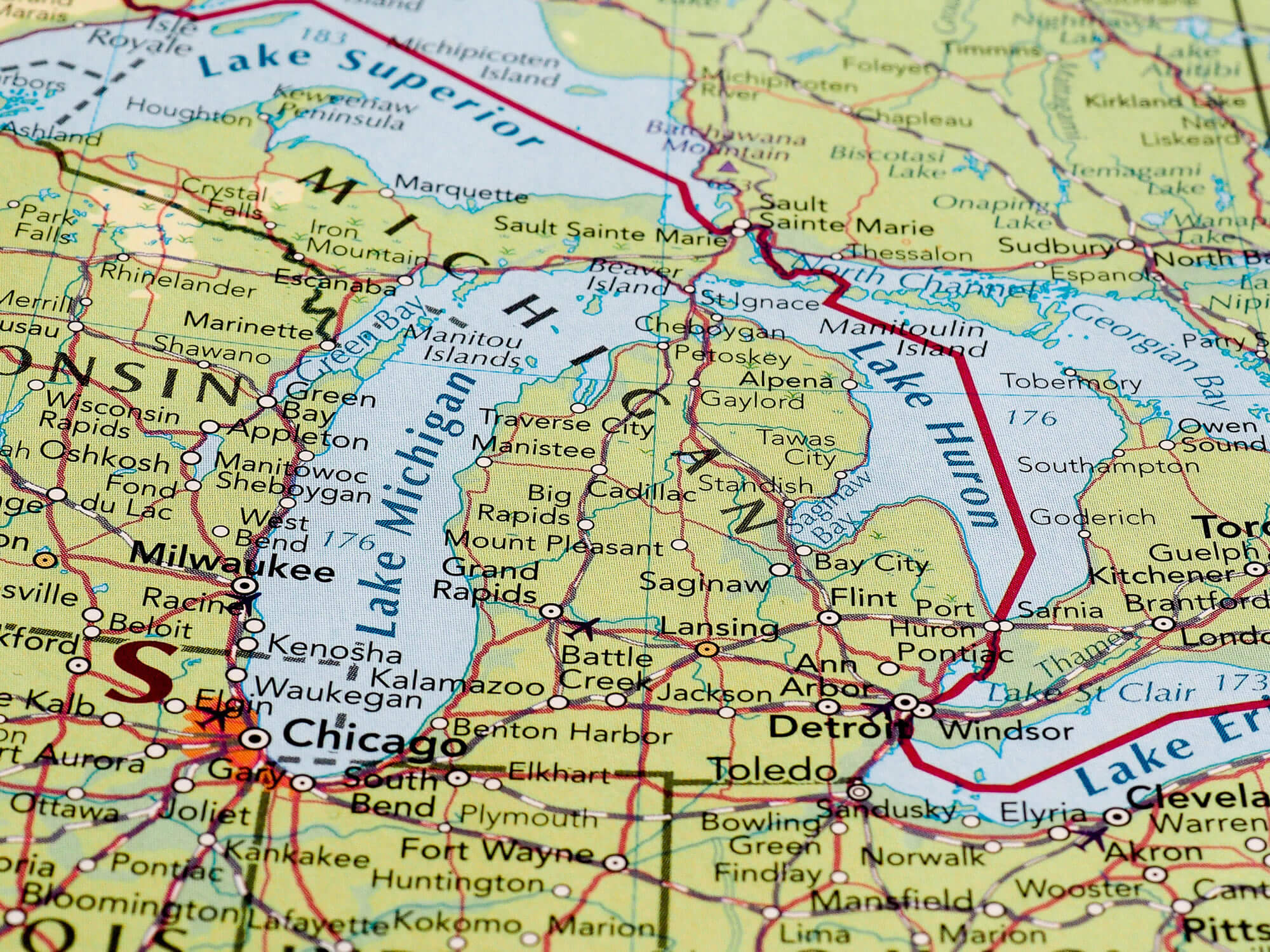
Lansing, USA – CIRCA MAY 2016: Map of the state of Michigan with selective focus on state name.
Map of Detroit, Michigan
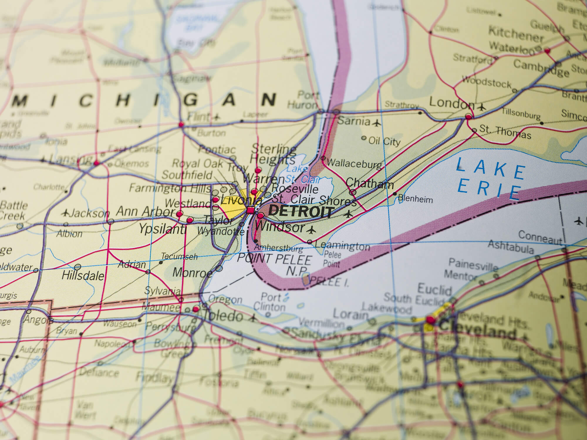
Map of Detroit, Michigan United States.
Michigan Planet Earth in the Night
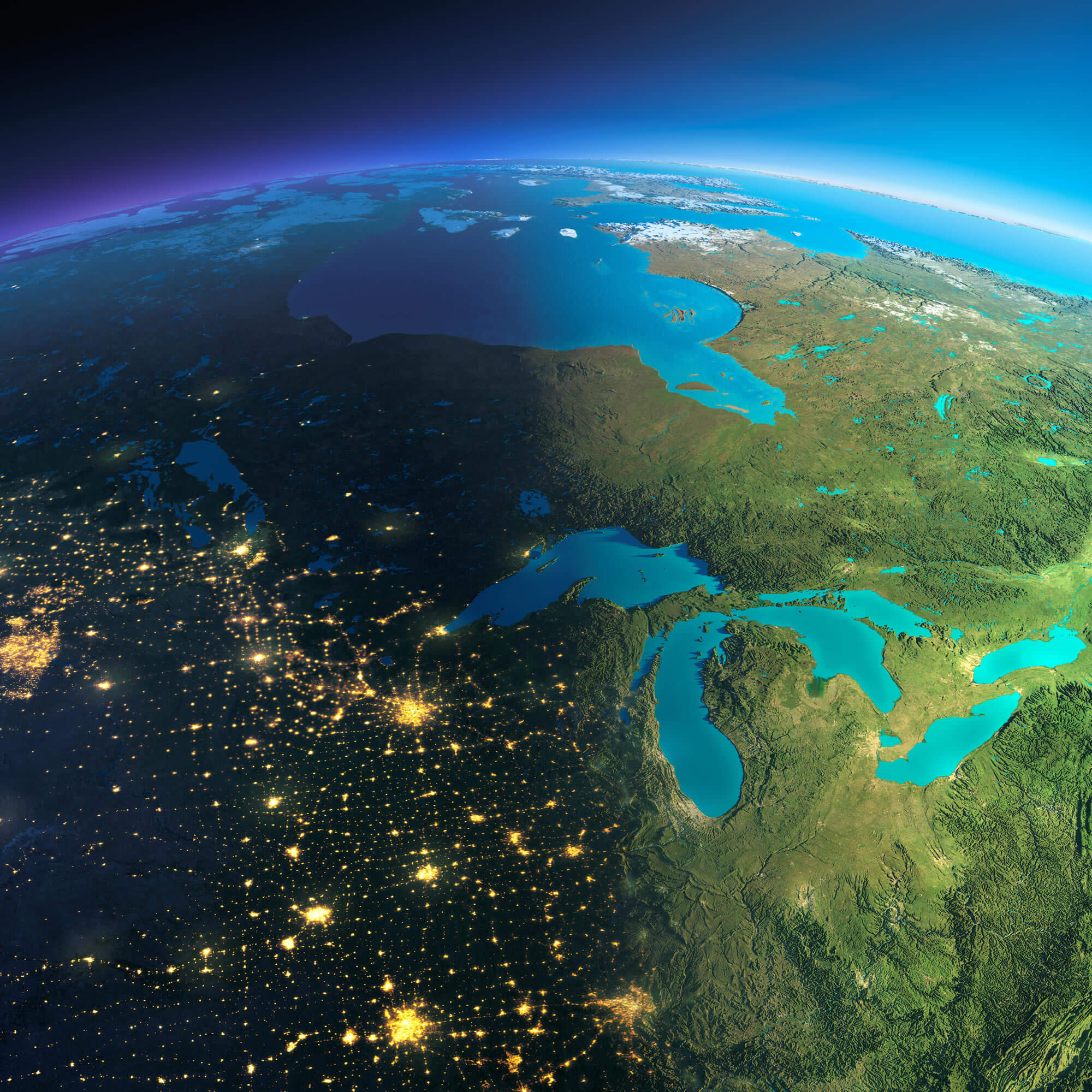
Highly detailed planet Earth. Night with glowing city lights gives way to day. The boundary of the night & day. The northern U.S. states and Canada.
Michigan Atlas 1900
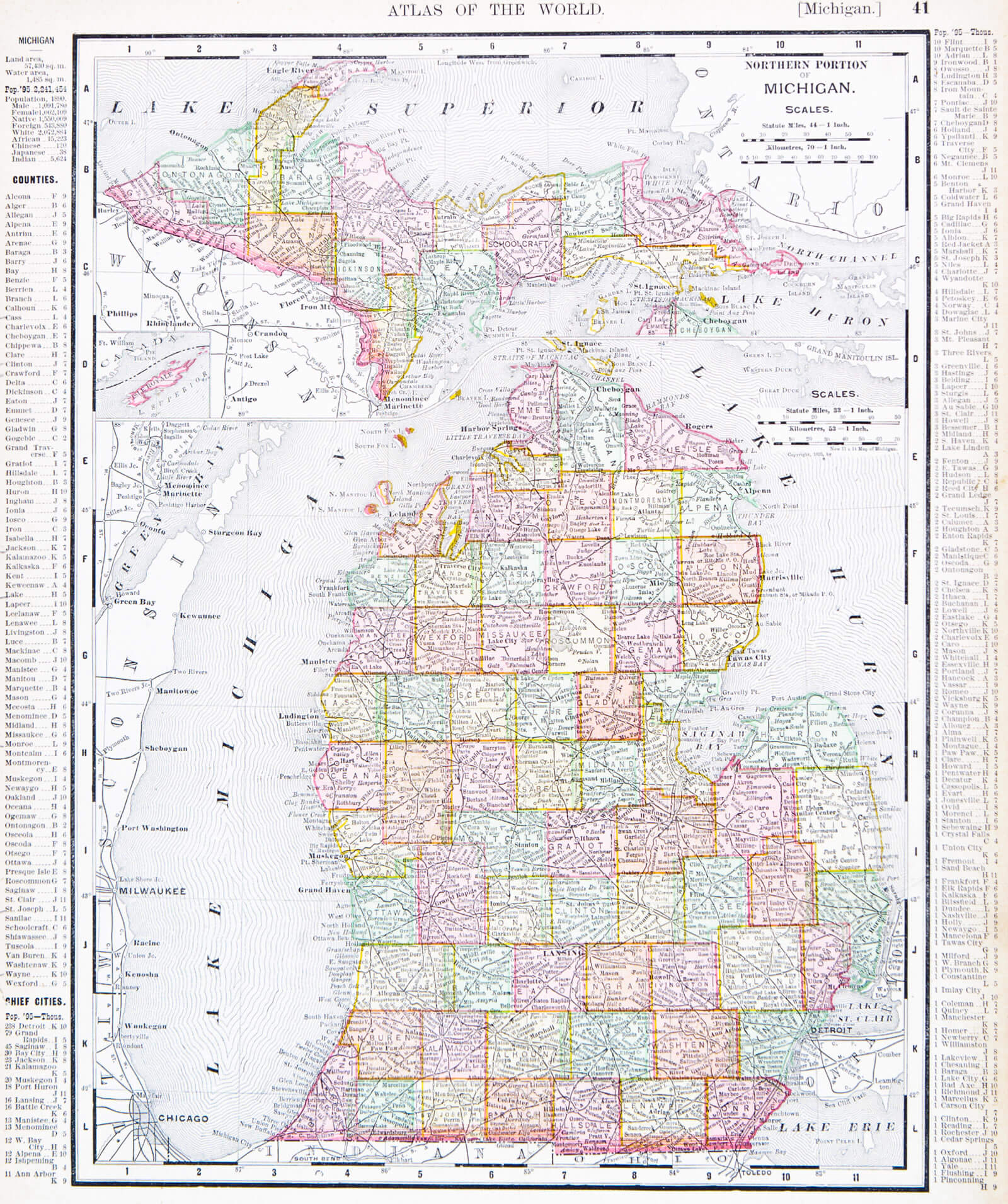
A map of Michigan, USA from Spofford’s Atlas of the World, printed in the United States in 1900.
Lansing Map, Chicago USA
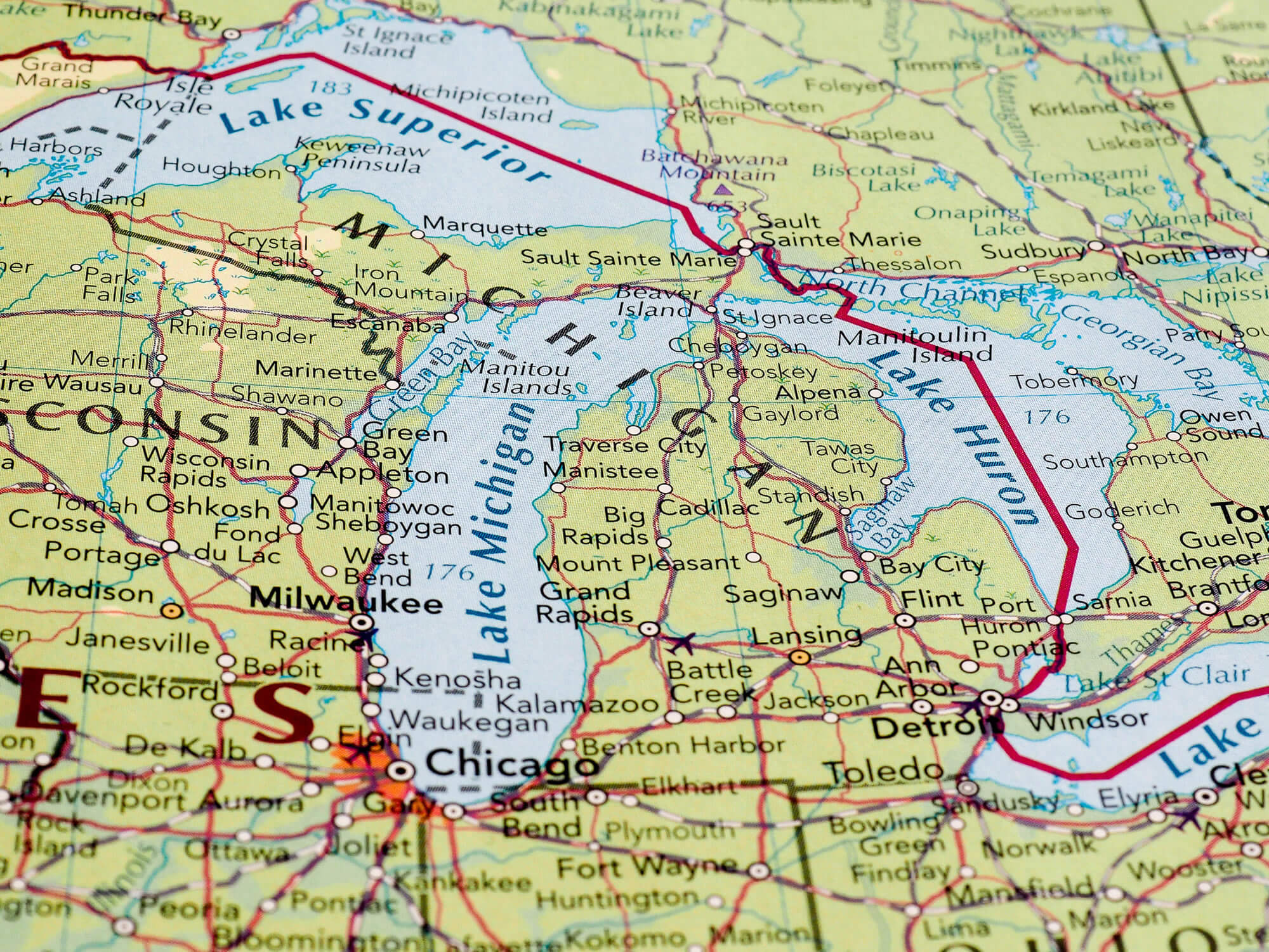
Lansing, Chicago USA – CIRCA MAY 2016: Map of the state of Michigan with selective focus on state name.
Michigan Political Map
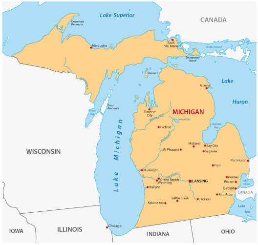
Michigan Political Map with Major Cities.
Located in the Great Lakes region of the United States, Michigan is known for its abundant natural beauty, including its coastline along four of the five Great Lakes – Huron, Ontario, Michigan, and Erie. With more than 3,000 miles of coastline, Michigan has more freshwater coastline than any other U.S. state, making it a popular destination for boating, fishing, and outdoor recreation. The state consists of two peninsulas, the Upper and Lower, connected by the Mackinac Bridge, one of the longest suspension bridges in the world. Michigan’s landscape is diverse, ranging from dense forests and sandy dunes to bustling urban areas, with Detroit being the state’s largest city and an iconic hub for the automotive industry.
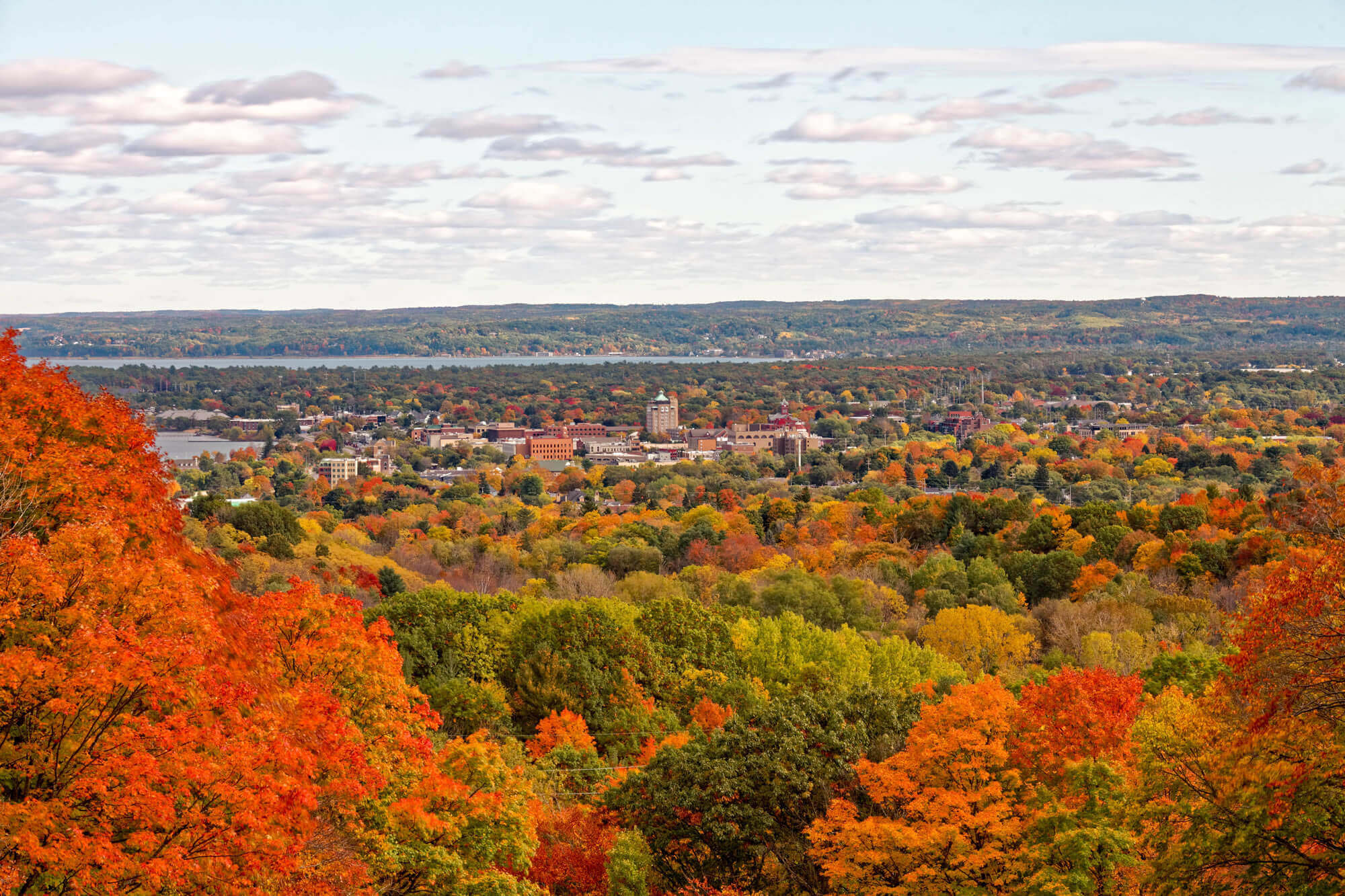
Economically, Michigan has a rich industrial history, particularly as the birthplace of the American automobile industry. Major automakers such as Ford, General Motors, and Chrysler were founded and continue to operate here, earning Detroit the nickname “Motor City”. While the automotive sector remains a significant part of Michigan’s economy, the state has diversified over the years with growing sectors in technology, healthcare, and tourism. Michigan is also home to several prestigious universities, including the University of Michigan and Michigan State University, which contribute to the state’s educational reputation and drive innovation and research.
Where is located Michigan on the US Map
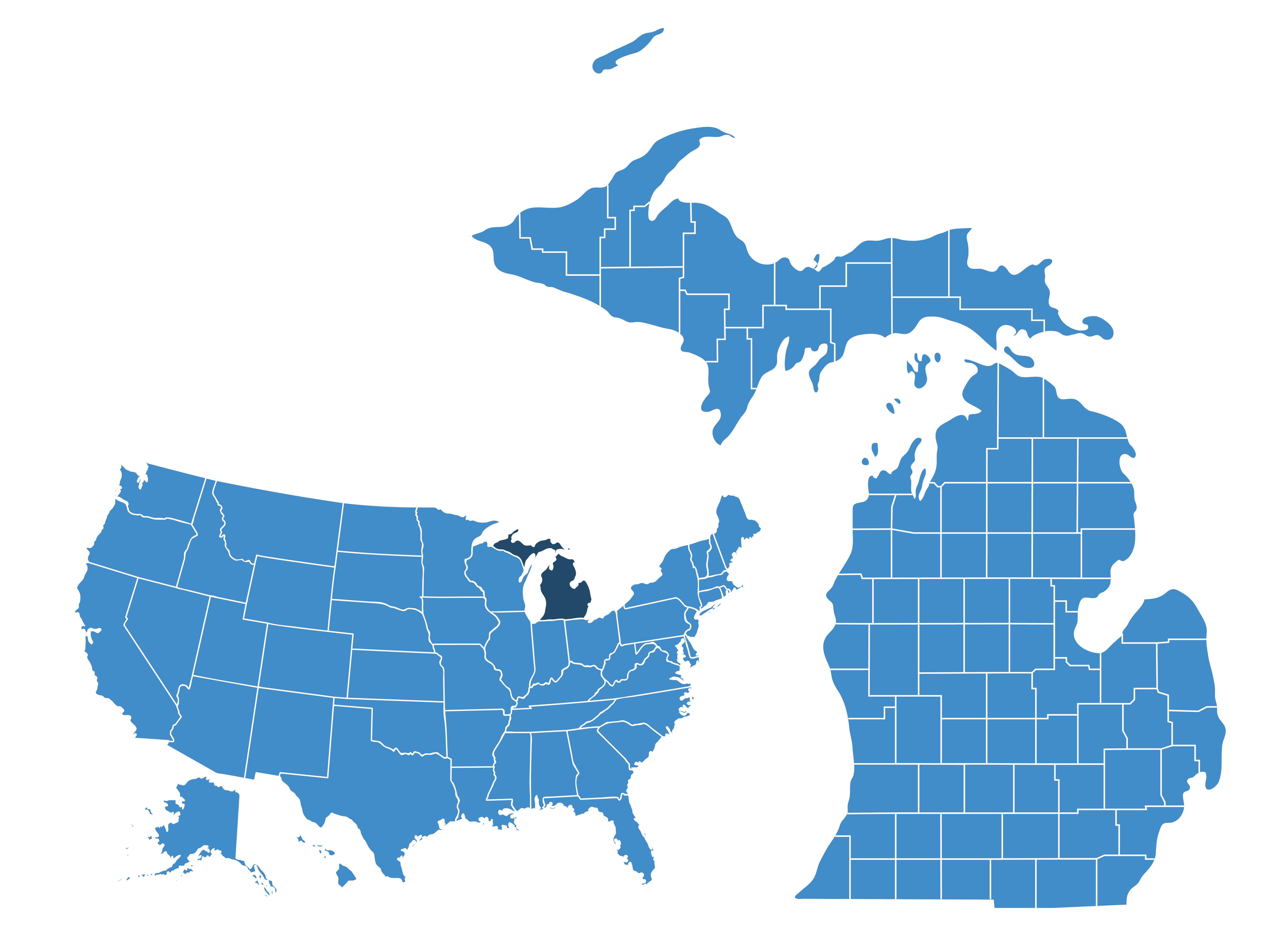
Located in the Great Lakes region of the northern United States, Michigan is bordered by four of the five Great Lakes – Lake Michigan, Lake Huron, Lake Superior and Lake Erie – making it one of the most water-rich states in the country. It borders Ohio and Indiana to the south and Wisconsin to the west. Michigan is unique in that it consists of two distinct peninsulas: the Lower Peninsula, which resembles a mitten, and the Upper Peninsula (often called the “U.P.”), separated by the Straits of Mackinac. The state is also close to Canada, with easy access via the Detroit-Windsor Tunnel and the Ambassador Bridge, which connects Detroit to Windsor, Ontario.
On the map of the United States, Michigan stands out for its divided geography and extensive water borders. The state is known for its diverse landscapes, from the urban centres of Detroit and Grand Rapids in the Lower Peninsula to the remote forests and natural beauty of the Upper Peninsula. Michigan’s location in the Midwest makes it an important hub for trade and transportation, particularly due to its proximity to Canada and its extensive waterways, which have historically been vital for shipping and trade.
Here are some statistical information about Michigan:
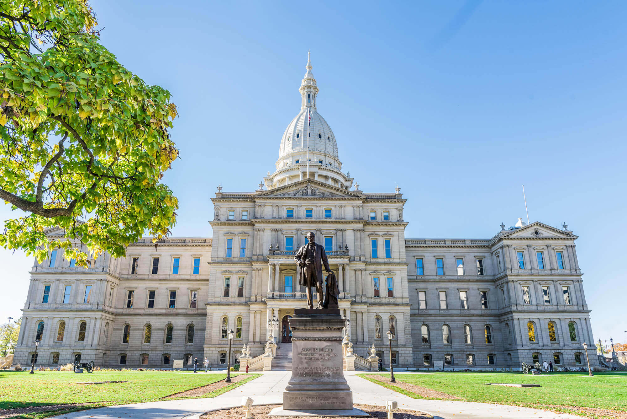 Michigan State Capitol – USA
Michigan Population Growth (1800-2020)
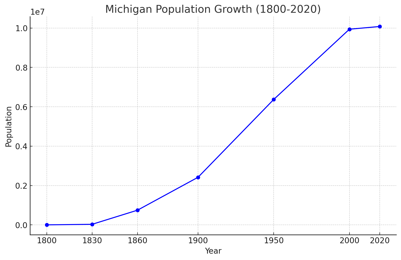 Michigan Population Growth (1800-2020).
Religious Composition Of Michigan In 2021
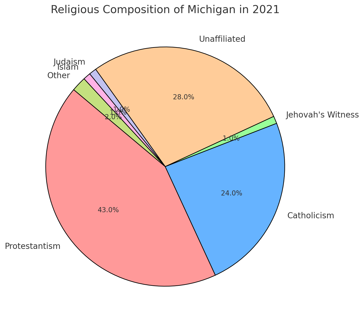 Religious Composition Of Michigan In 2021
- Protestantism (43%)
- Unaffiliated (28%)
- Catholicism (24%)
- Jehovah’s Witness (1%)
- Judaism (1%)
- Islam (1%)
- Other (2%)
Mapping Michigan’s Rivers and Cities: A Geographic Overview
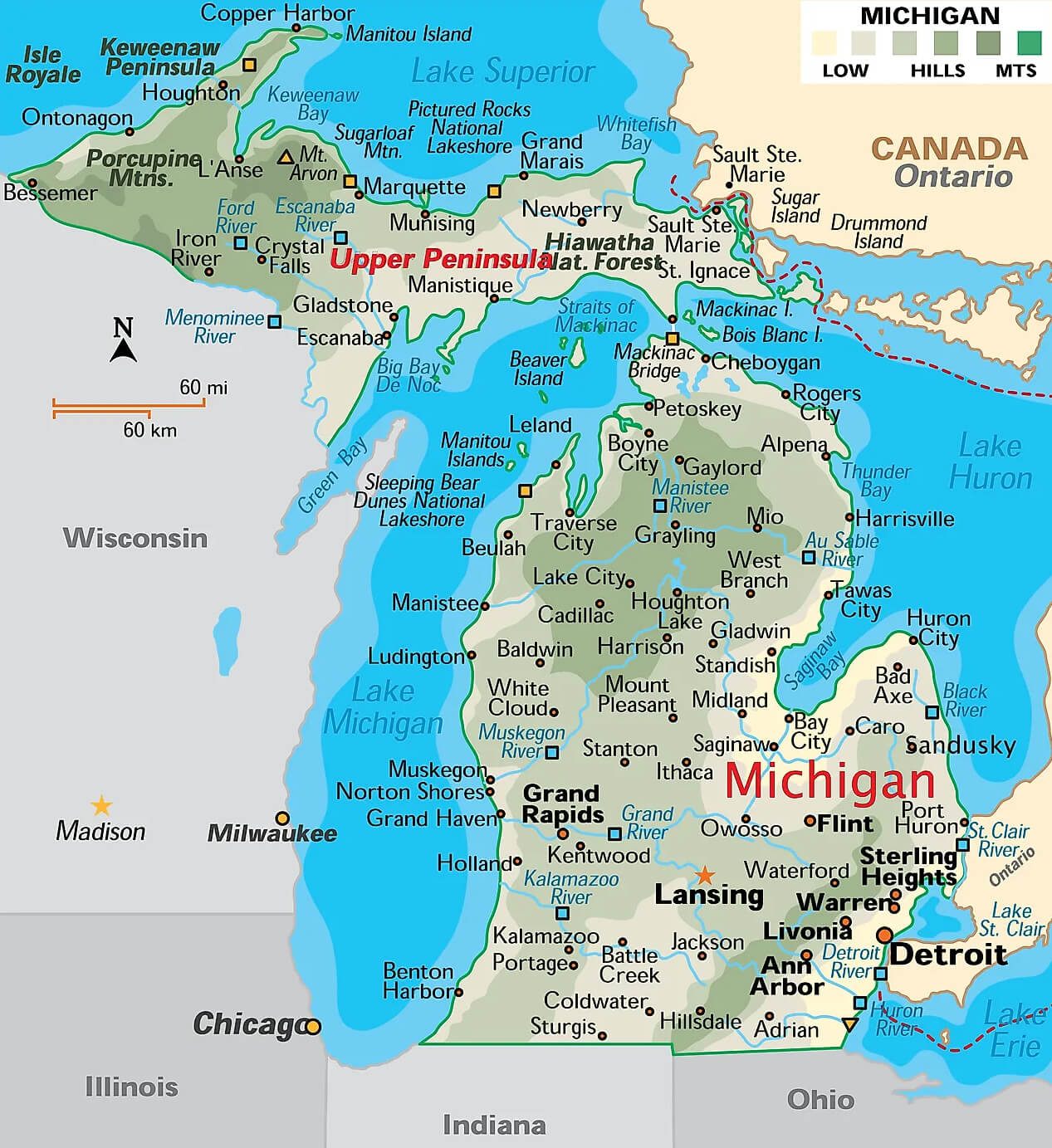 Map of Michigan showing rivers, cities, and natural features
Navigating Michigan: A Comprehensive Road Map
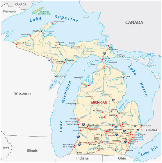 Michigan road map with major highways and cities
Michigan Political Map: Counties and Key Divisions
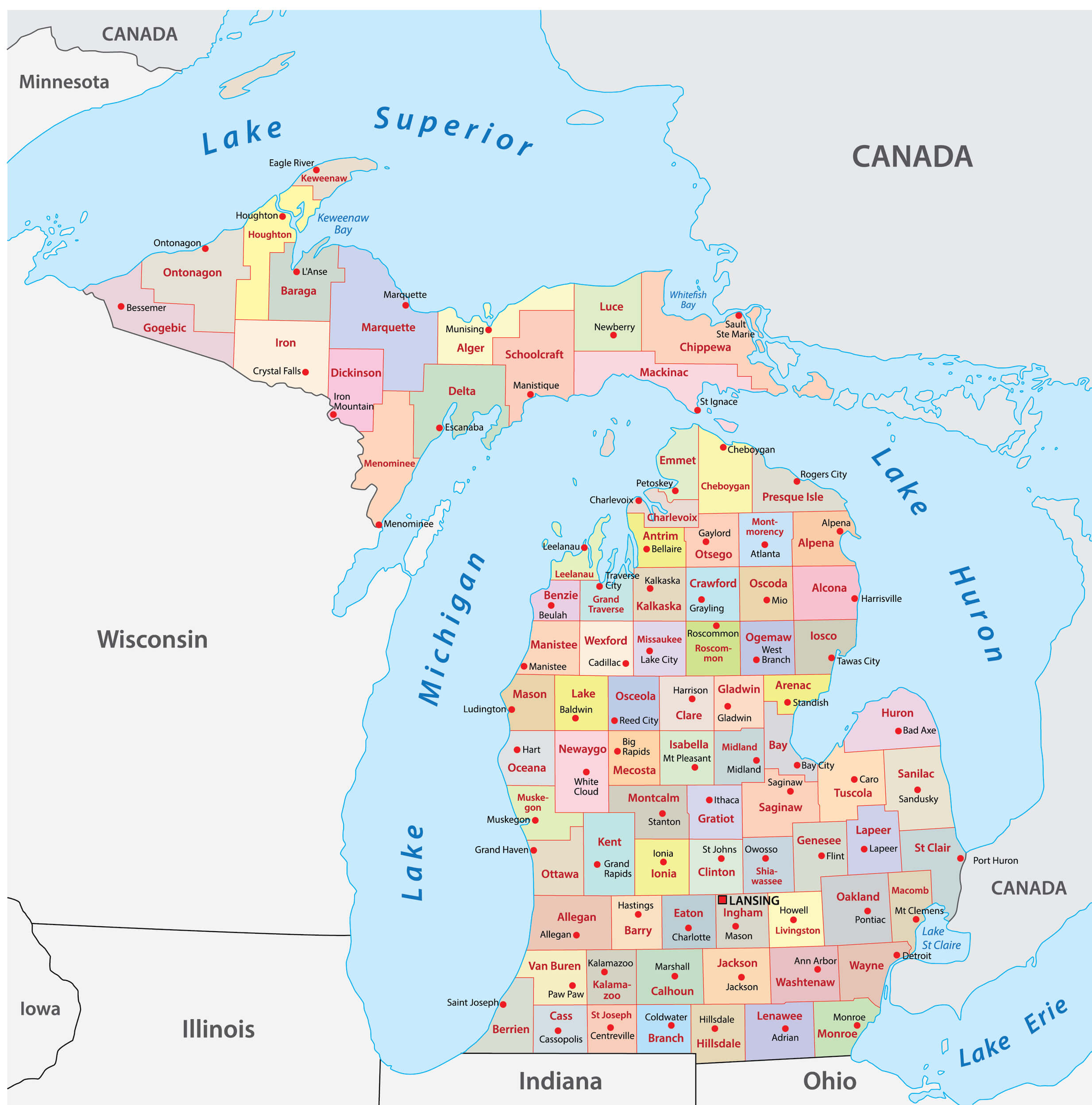 Michigan political map with counties and major boundaries.
Michigan Relief Map: Elevation and Terrain Features
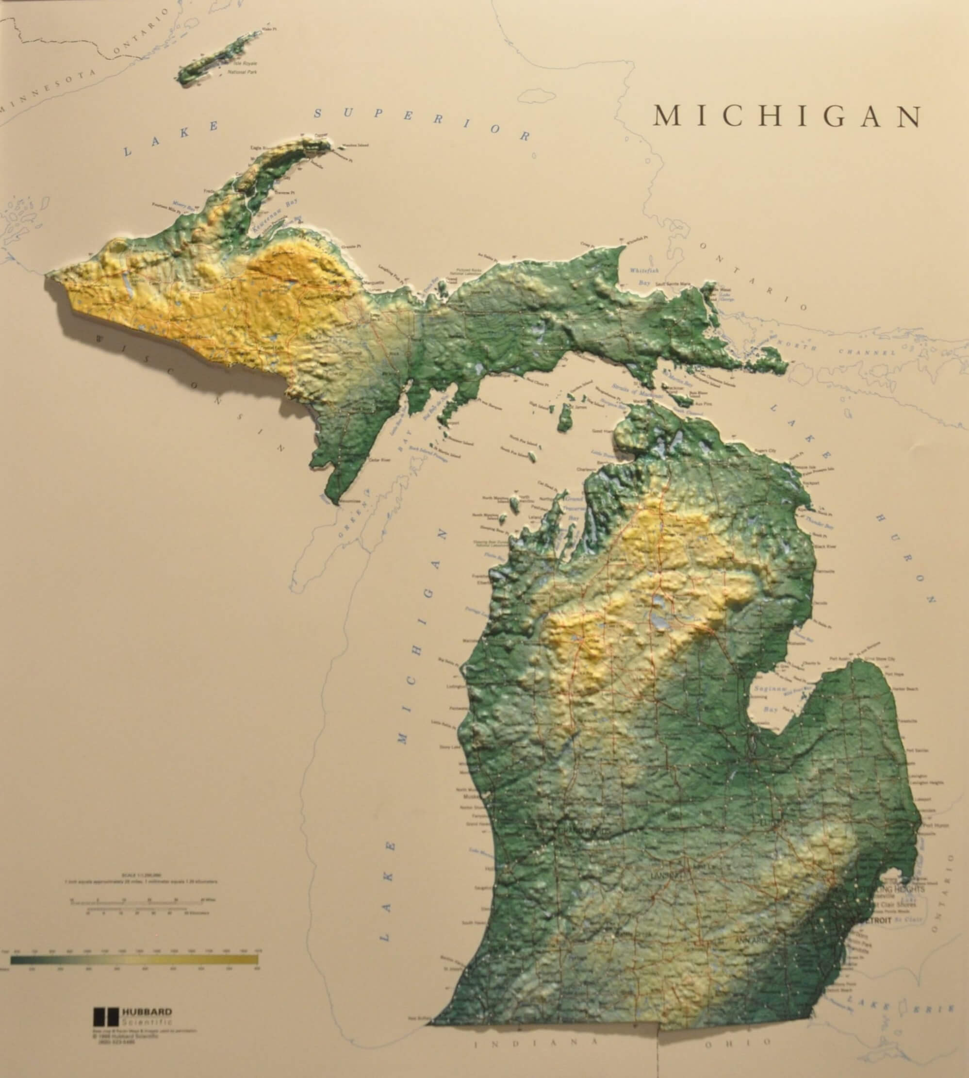 Michigan relief map showing elevation and terrain details.
Michigan Population Density: A 2020 Census Overview
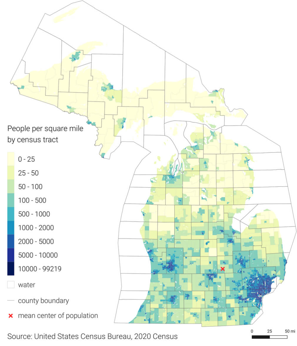 Michigan population density map by census tract, 2020.
Major cities and population in Michigan, US
Here are some of the major cities in Michigan along with their estimated populations based on recent data:- Detroit – 632,464
- Grand Rapids – 202,767
- Warren – 138,130
- Sterling Heights – 134,346
- Ann Arbor – 123,851
- Lansing – 112,644 (state capital)
- Flint – 94,762
- Dearborn – 93,932
- Livonia – 93,665
- Westland – 82,318
- Troy – 85,694
- Farmington Hills – 81,093
- Kalamazoo – 77,150
- Wyoming – 76,501
- Southfield – 73,325
Michigan Interstate Map: Routes to Chicago and Detroit
 Michigan interstate map showing routes to Chicago and Detroit
Michigan Physical Map: Elevation and Natural Features
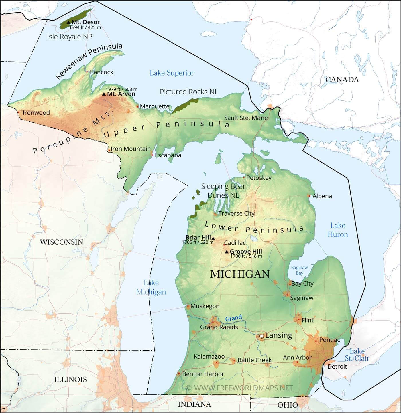 Michigan physical map showing Upper and Lower Peninsulas.
Map of Michigan’s Major Cities and Surrounding Lakes
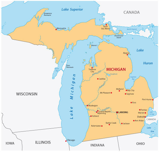 Michigan major cities map with nearby lakes and states.
Locating Michigan on the U.S. Map: State and County Boundaries
 Michigan highlighted on U.S. map with state and county borders.
Historic Map of British Colonies and the Province of Quebec (1763–1775)
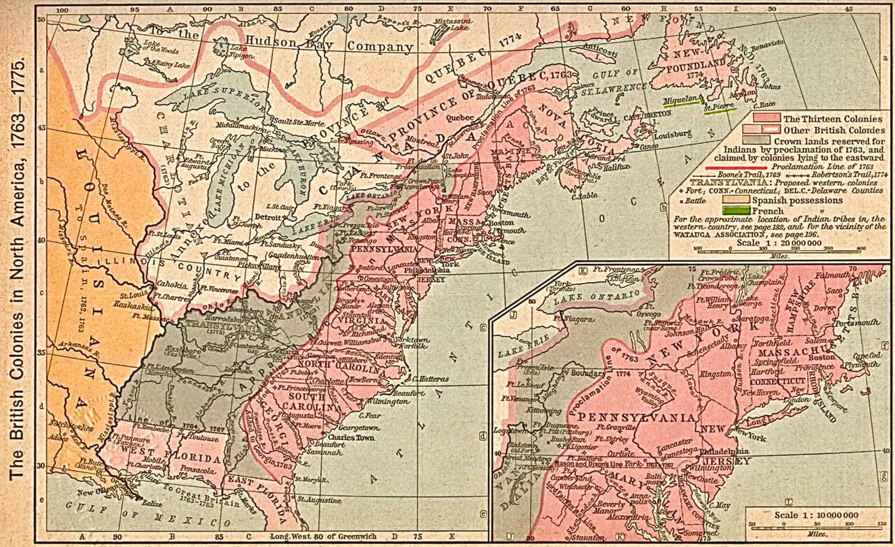 Map showing Michigan and Province of Quebec in 1763-1775
Michigan and the Great Lakes: Satellite View at Night
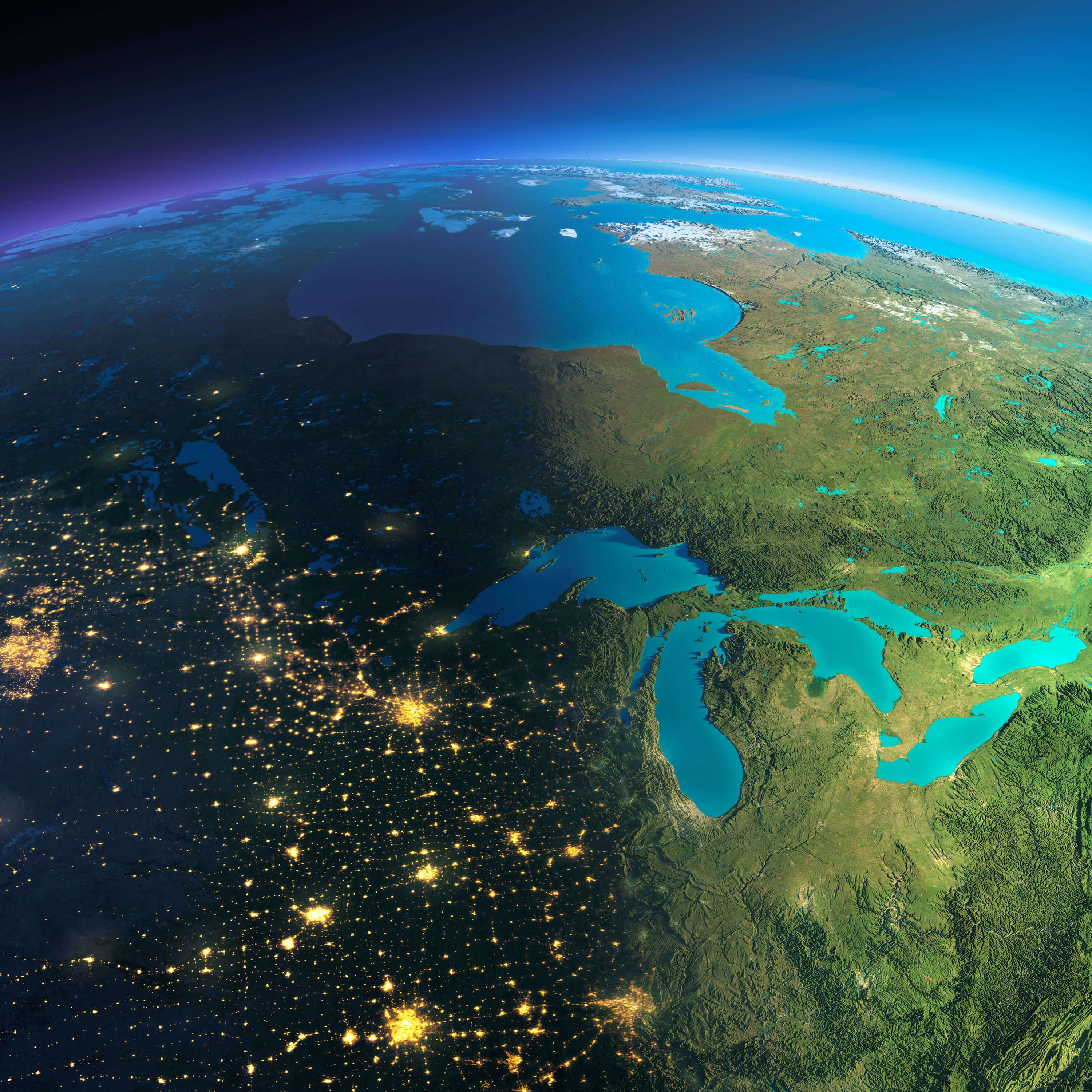 Michigan satellite map at night showing city lights and Great Lakes
Blank Outline Map of Michigan: Upper and Lower Peninsulas
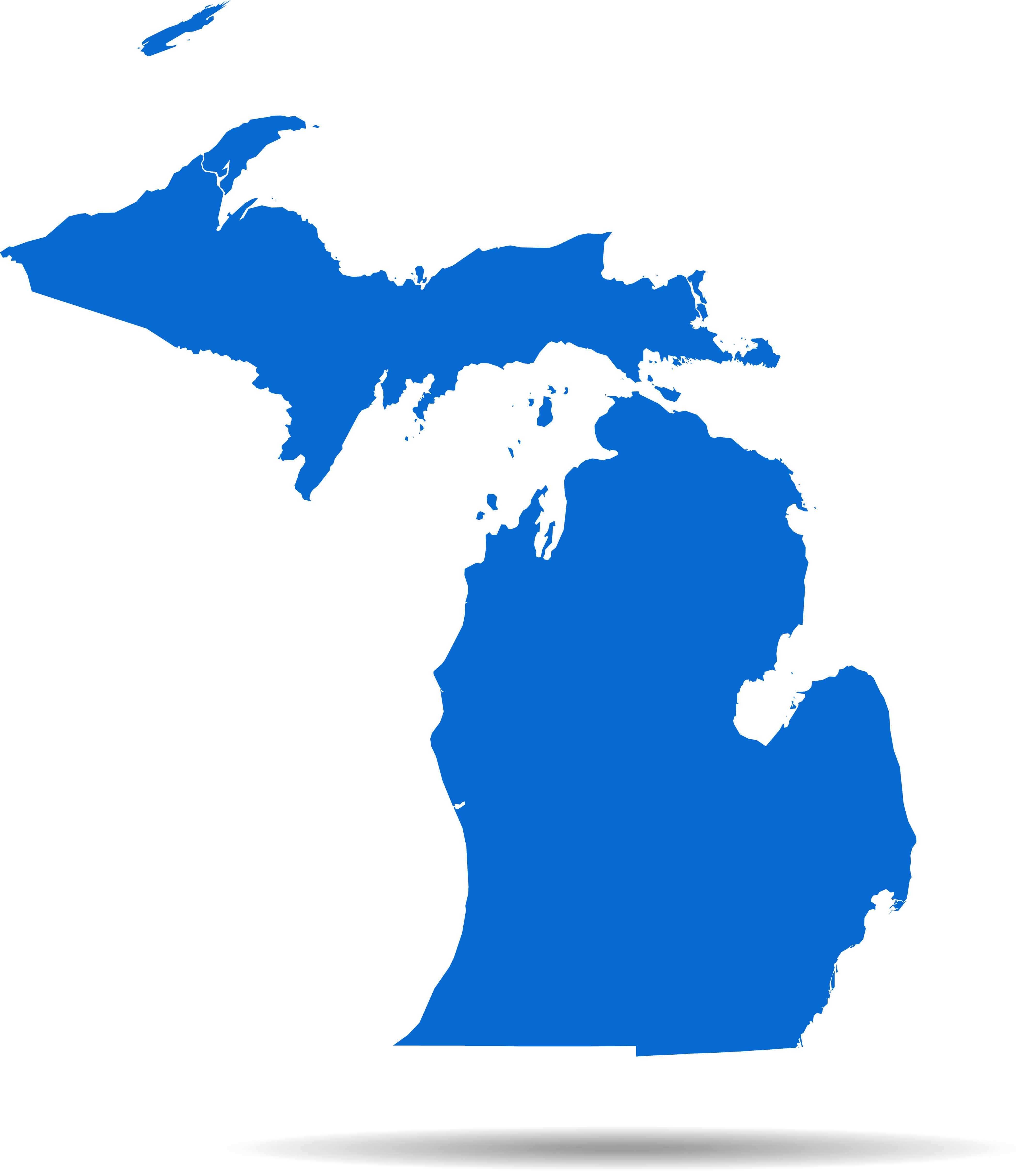 Blank map of Michigan with Upper and Lower Peninsulas
Michigan’s Location in the U.S.: State Outline and Position Map
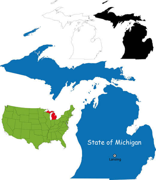 Michigan location map in the U.S. with outline and Lansing marked.
Comprehensive Michigan State Map: Cities, Highways, and Features
 Detailed Michigan state map with cities, highways, and landmarks
Where is Located Michigan on the US Map?
Show Google interactive map, satellite map, where is the country located.
Get directions by driving, walking, bicycling, public transportation, and traveling with street view.
Feel free to explore these pages as well:
- Michigan Map ↗️
- Map of Michigan ↗️
- 2024 US Presidential Election Swing States by Maps ↗️
- Michigan on the Edge: 2024 US Election Predictions and the 2020 Turnaround ↗️
- About Michigan ↗️
- Michigan Photos ↗️
- The US presidential election in Georgia: Predictions for 2024 and a look back at the swing in 2020 ↗️
- Arizona’s US Presidential Election: 2024 Predictions and a Look Back at the 2020 Swing ↗️
- Illinois Map ↗️
- Map of Illinois ↗️
- Illinois Photos ↗️
- Top 10 Best Experiences to Maximize Your Chicago Journey ↗️
- Chicago’s Hidden Gems: Exploring the Lesser-Known Sights of the Windy City ↗️
- Kenosha Travel Guide, Kenosha Protests and 4K Aerial View ↗️
- United States Map ↗️
- Map of United States ↗️
- North America Map ↗️
- Map of North America ↗️
