The results of the 2020 US presidential election in Arizona were closely contested, making it one of the most important battleground states that year. The Democratic Party, represented by Joe Biden, won Arizona with 1,672,143 votes, narrowly edging out the Republican Party, represented by then-President Donald Trump, who received 1,661,686 votes. This marked a shift in Arizona’s political landscape, as the state had historically leaned Republican in previous elections. The margin of victory was narrow, emphasizing the competitive nature of the election and the importance of every vote in the state.
2020 U.S. Presidential Election Results In Arizona
Arizona’s outcome in 2020 reflects broader demographic and political trends that have influenced American elections in recent years. The state has experienced significant population growth, particularly in urban areas such as Phoenix and Tucson, which tend to be more liberal than the state’s rural areas. This urban growth, combined with shifting political affiliations among certain demographic groups, has contributed to Arizona’s swing towards the Democratic Party. Arizona had last voted for a Democratic presidential candidate in 1996, so Biden’s victory was a notable shift and an indication that the state could become a key battleground in future elections.
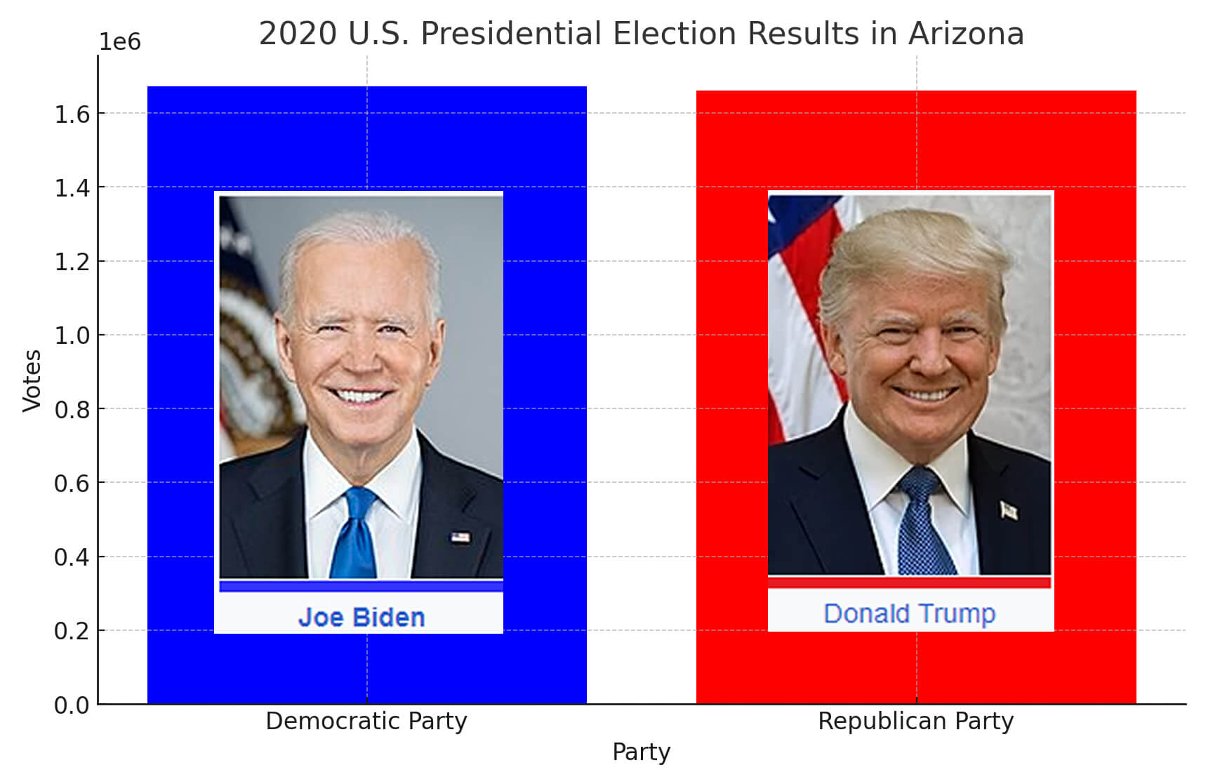 2020 U.S. Presidential Election Results In Arizona
- Democratic Party: 1,672,143 votes
- Republican Party: 1,661,686 votes
2020 U.S. Presidential Election in Arizona by Counties Map
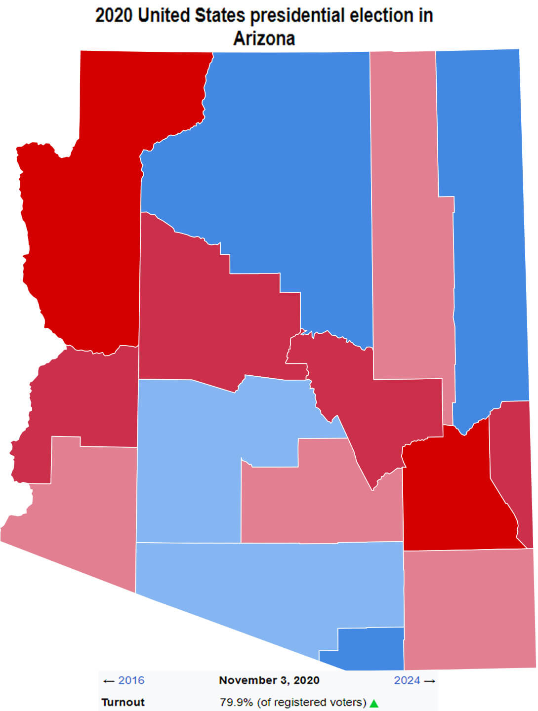 2020 U.S. Presidential Election in Arizona by Counties Map
The closeness of the results in Arizona underscored the importance of voter outreach and engagement in swing states. Both parties campaigned heavily in the state, recognising its potential to influence the national outcome. Biden’s victory in Arizona contributed to his overall electoral success, helping him secure the necessary electoral votes to win the presidency. This result also highlighted the changing dynamics in the southwestern United States, where traditionally conservative states are becoming increasingly competitive, reflecting changing voter priorities and demographics across the region.
How much of Arizona’s population turned out to vote in 2020
Based on Arizona’s 2020 population of approximately 7.3 million, this chart, showing around 3.3 million total votes, indicates that roughly 45% of the population participated in the election. Of the voters, approximately 51% were women and 49% were men, reflecting a relatively balanced gender turnout.
Arizona’s demographic composition in 2020 was diverse, with approximately 55% White, 32% Hispanic or Latino, 5% Native American, 4% Black, and 4% Asian residents.
Arizona’s Demographic Composition In 2020
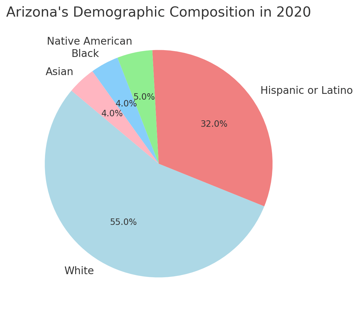
Arizona’s Demographic Composition In 2024
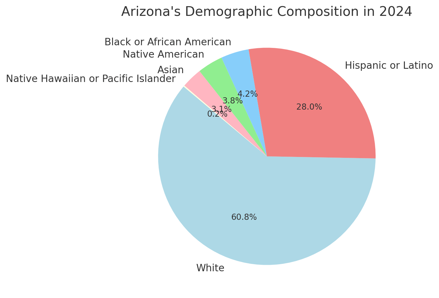 Arizona’s Demographic Composition In 2020
Arizona’s Population Trend Since 1860
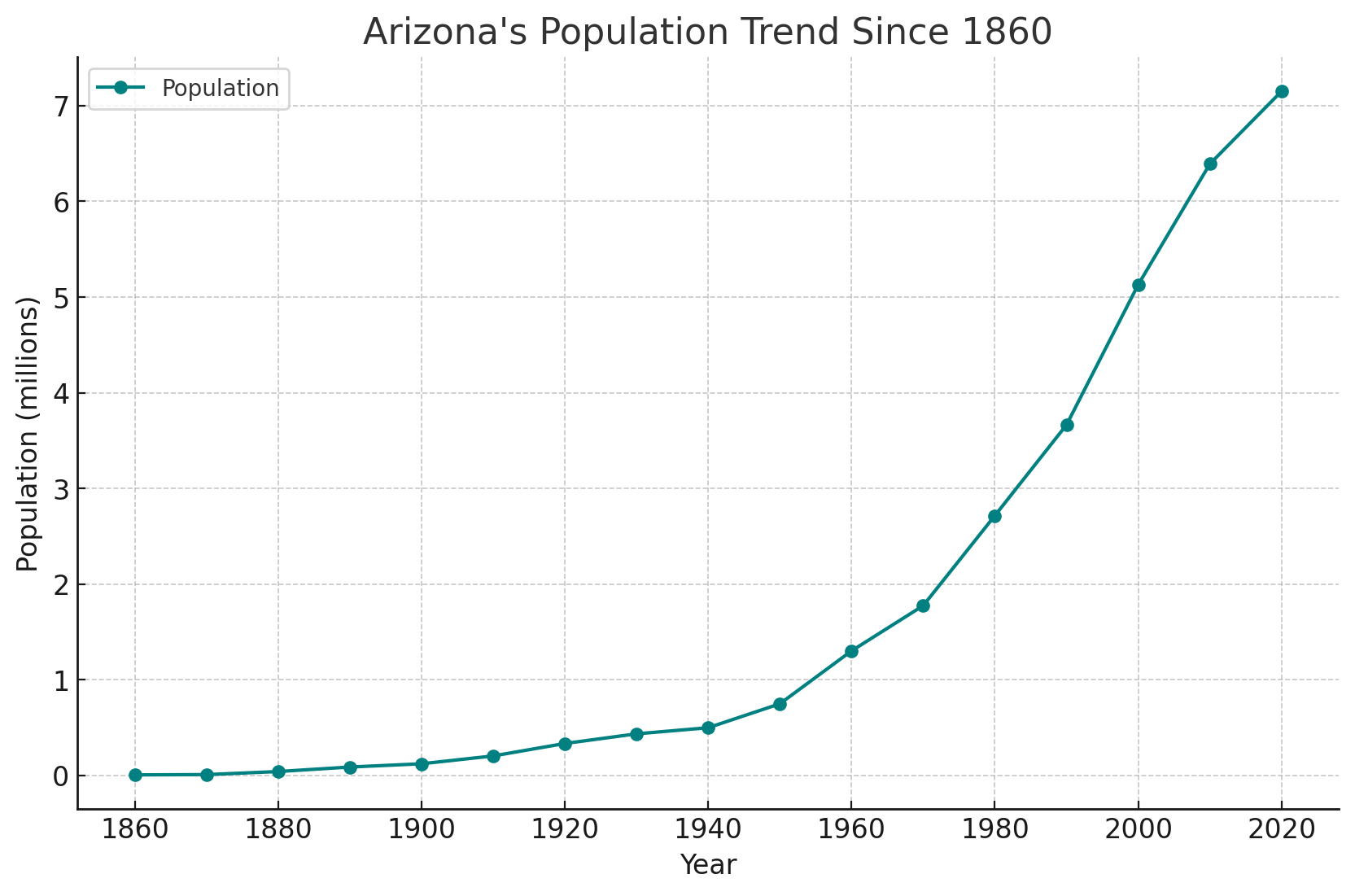 Arizona’s Population Trend Since 1860.
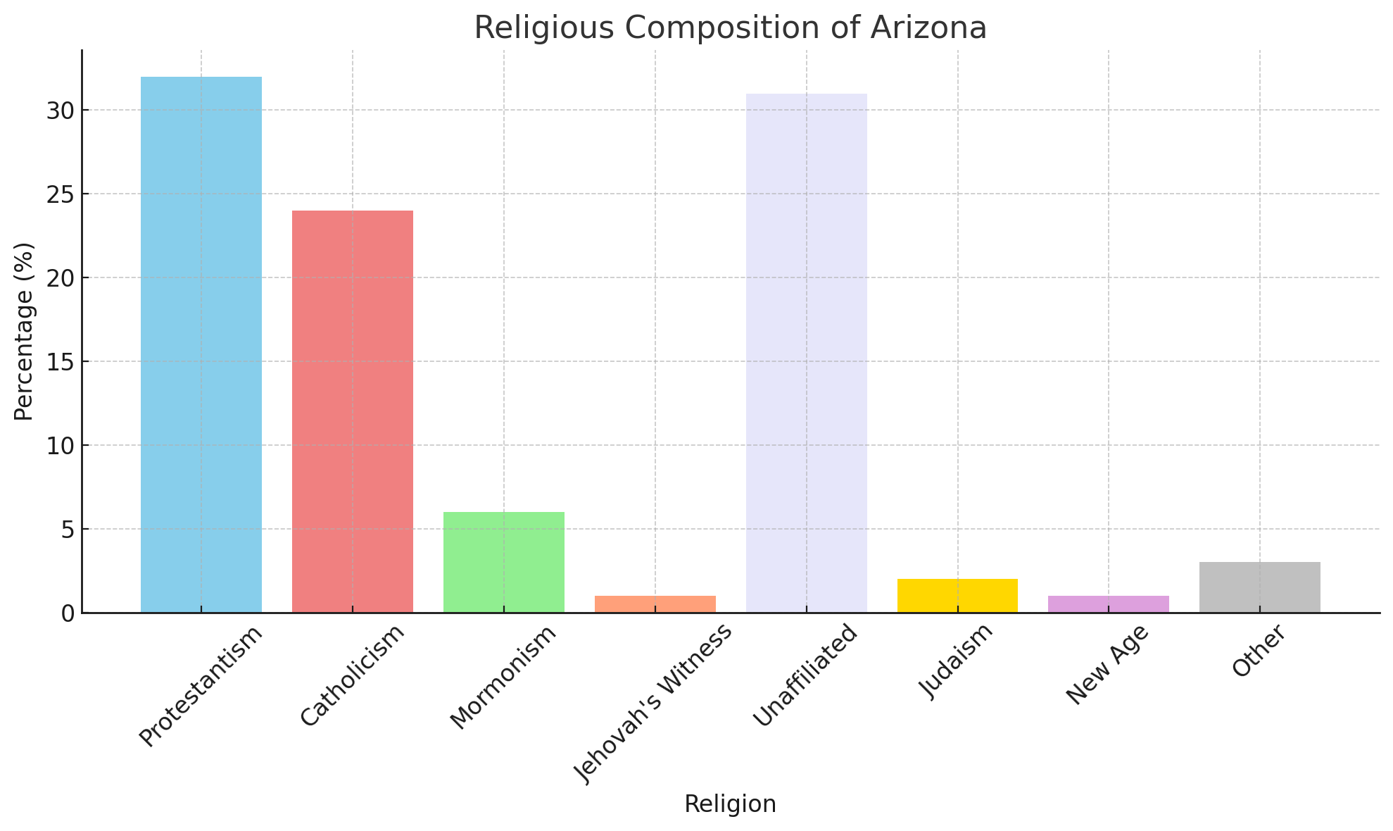
Religious Composition Of Arizona
Where is located Arizona on the US Map
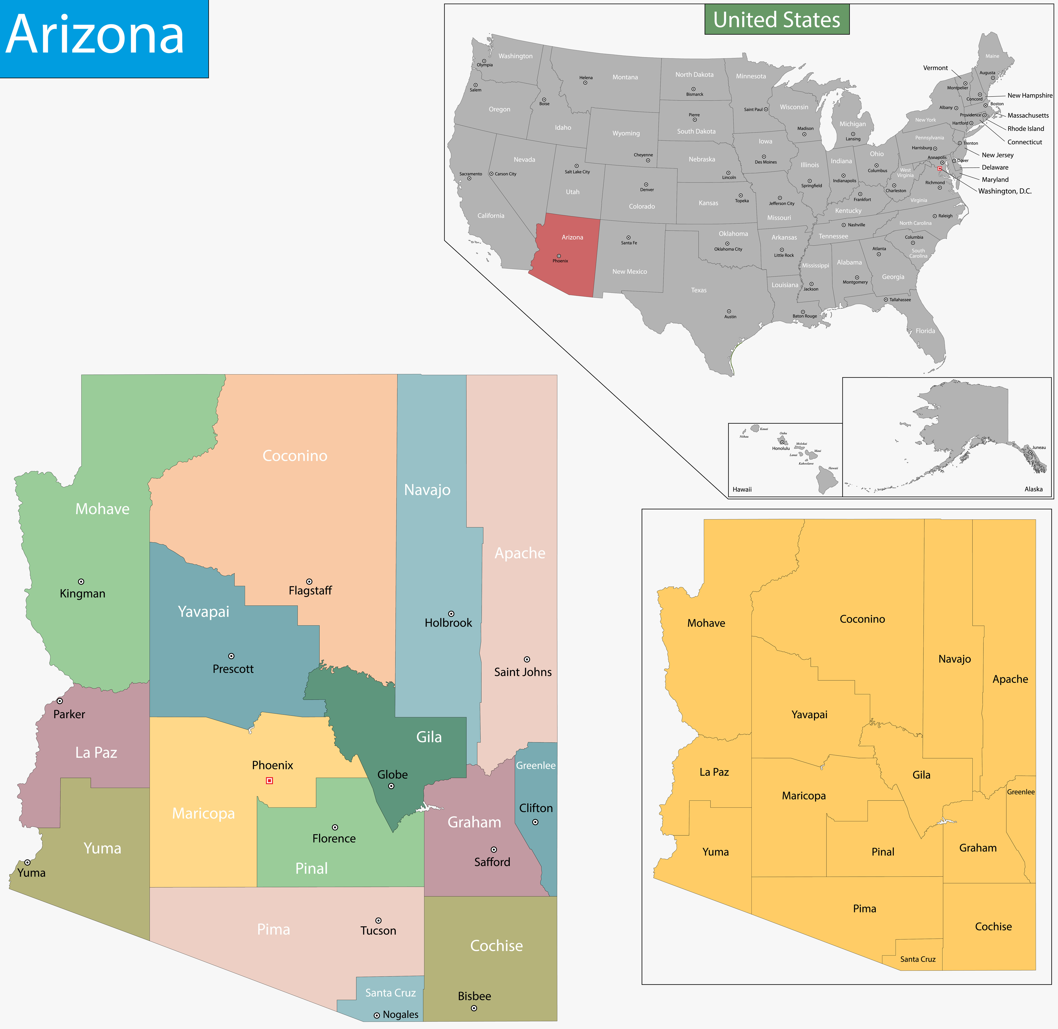
Arizona is located in the southwestern part of the United States, sandwiched between California to the west and New Mexico to the east. It also borders Nevada to the northwest, Utah to the north and the Mexican state of Sonora to the south, making it a key link between the US and Mexico. This strategic location places Arizona at the heart of the American Southwest, a region known for its vast deserts, red rock formations and unique landscapes. Arizona is part of the Four Corners region, where it meets Colorado, Utah and New Mexico at a single point, the only place in the US where four states meet.
Arizona Political Map with Counties and State Symbols
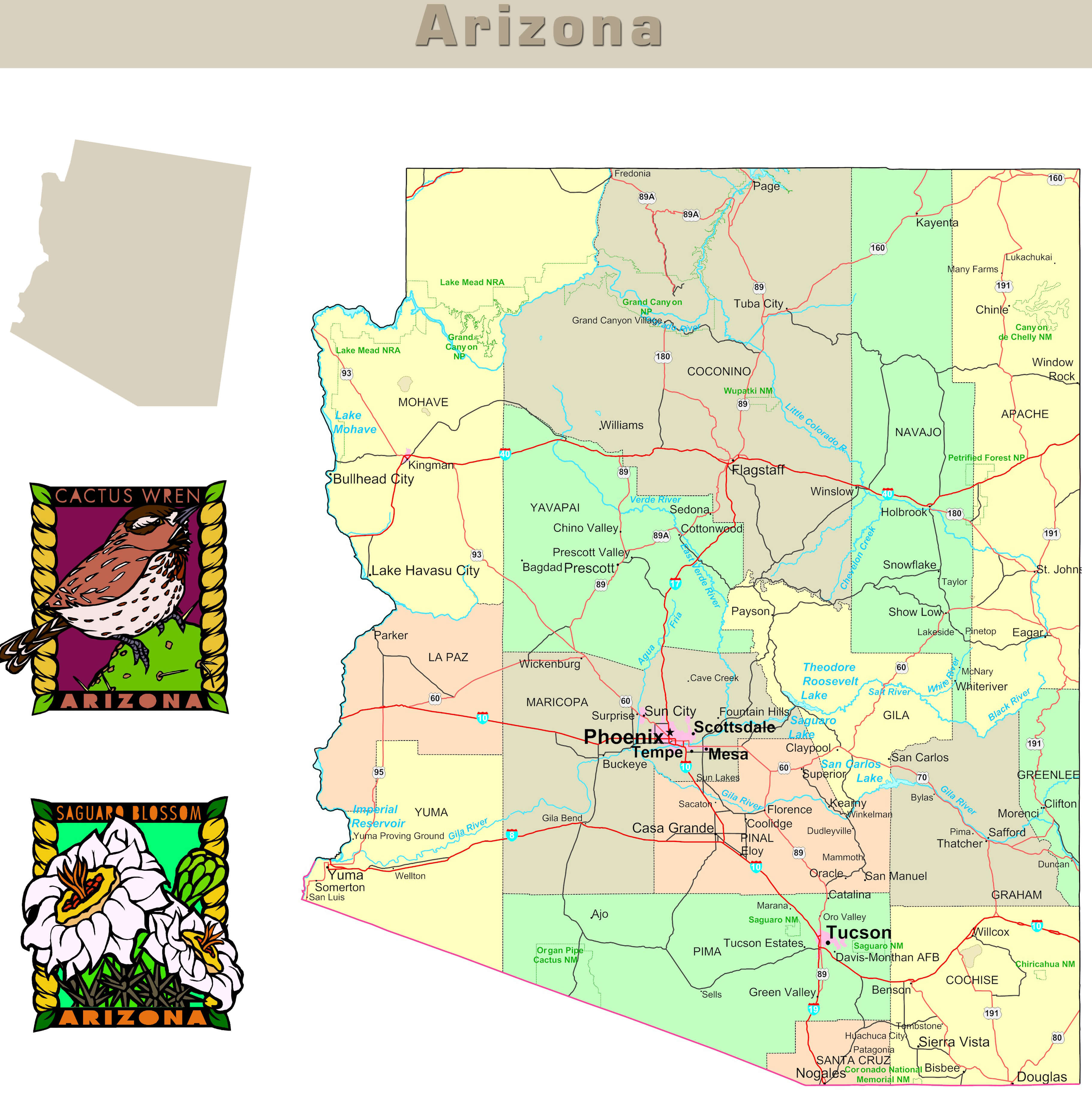 Detailed political map of Arizona with county divisions and state symbols
Colorful Vector Map of Arizona with Major Cities
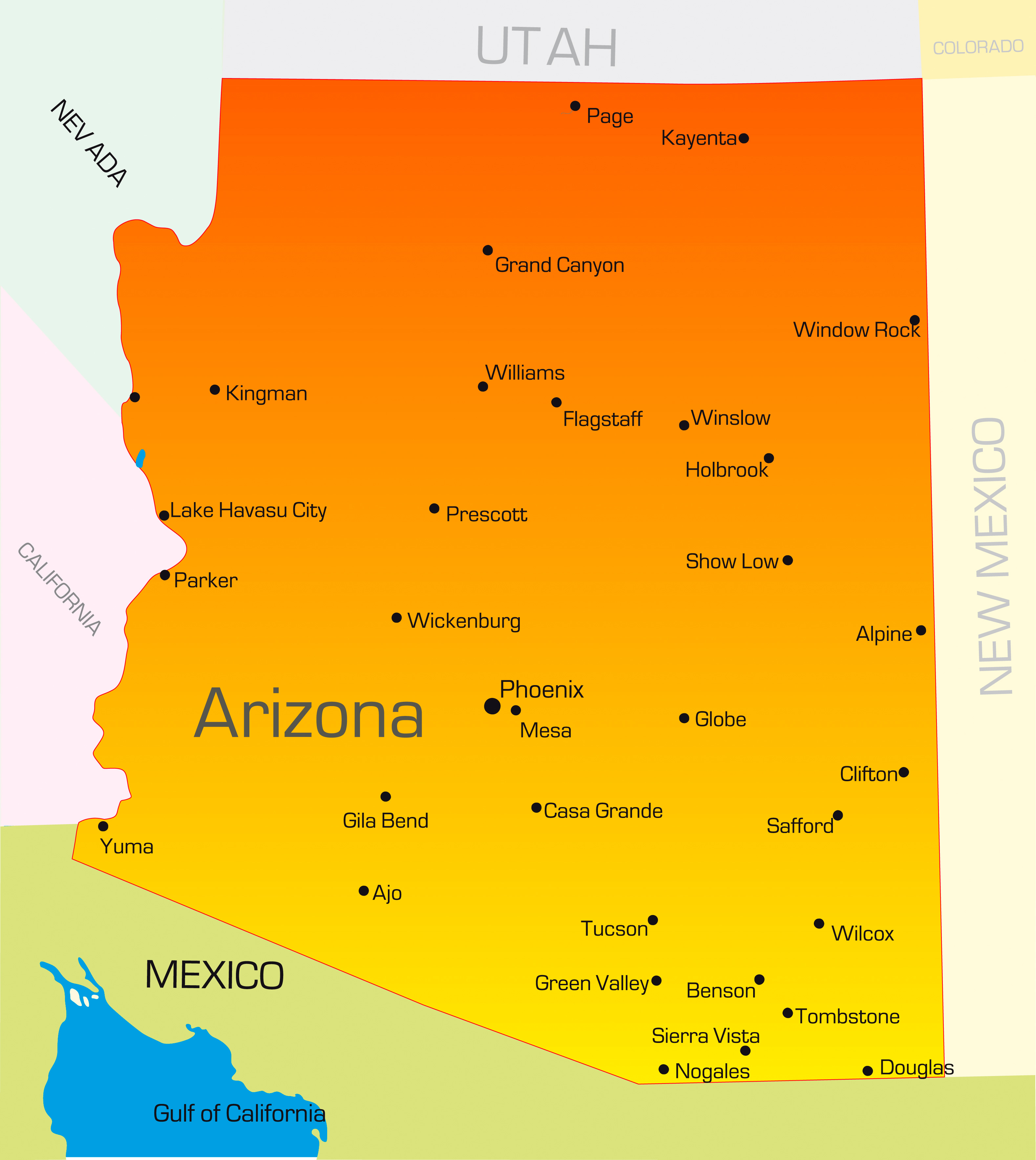 Bright vector map of Arizona highlighting major cities and borders.
Arizona’s Mystical Journey: From Canyons to Cities
Where is Arizona on the United States Map?
Show Google interactive map, satellite map, where is the country located.
Get directions by driving, walking, bicycling, public transportation and travel with street view.
Feel free to explore these pages as well:
- 2024 US Presidential Election Swing States by Maps ↗️
- Arizona Map ↗️
- Map of Arizona ↗️
- Arizona’s US Presidential Election: 2024 Predictions and a Look Back at the 2020 Swing ↗️
- The US presidential election in Georgia: Predictions for 2024 and a look back at the swing in 2020 ↗️
- Chandler Chronicles: Unveiling the Desert Jewel of Arizona ↗️
- Arizona’s Hidden Wonders: A Journey Through the Grand Canyon State ↗️
- New Mexico Map ↗️
- California Map ↗️
- Texas Map ↗️
- New York Map ↗️
