Brief information about New Mexico
New Mexico, in the southwestern United States, is known for its rich cultural heritage, unique landscapes, and vibrant arts scene. It was originally inhabited by indigenous peoples, including the Navajo, Apache, and Pueblo tribes, long before European settlers arrived. Spanish explorers established it as part of New Spain in the 16th century, making it one of the oldest continuously inhabited regions in North America. Today, New Mexico’s cultural tapestry is a blend of Native American, Hispanic and Anglo influences, reflected in its architecture, festivals, and cuisine. The state capital, Santa Fe, is particularly famous for its adobe buildings and thriving art community, which hosts one of the largest art markets in the US.
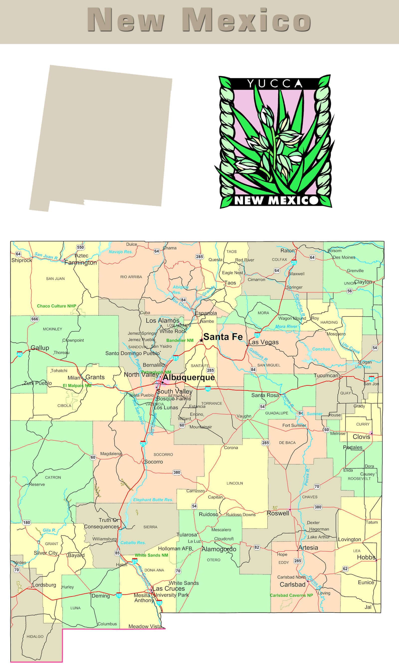
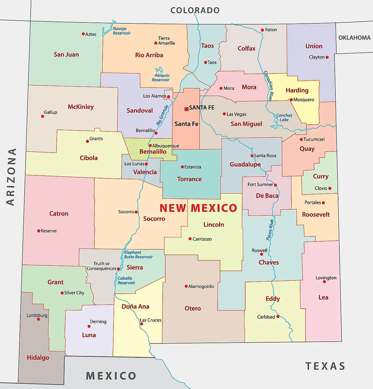 New Mexico Counties Map
Geographically, New Mexico is known for its diverse landscapes, ranging from the Chihuahuan Desert to high mountain ranges and vast plains. It’s home to notable natural landmarks such as White Sands National Monument, which features stunning white gypsum sand dunes, and Carlsbad Caverns, a vast network of underground limestone caves. The state’s climate varies with elevation, allowing for activities such as hiking, skiing, and exploring hot springs. New Mexico is also renowned for its scientific contributions and is home to the Los Alamos National Laboratory, where the atomic bomb was developed during the Second World War. The state’s dark skies also make it a prime destination for stargazing and astronomy.
Where is located New Mexico on the US Map
New Mexico is located in the southwestern region of the United States, bordered by Arizona to the west, Texas to the east and southeast, and Oklahoma to the northeast. To the south lies the country of Mexico, with which it shares an international border, while Colorado forms its northern boundary. New Mexico is one of the four “Four Corners” states, a unique point where it meets Arizona, Utah and Colorado, marking the only place in the US where four states meet. Its location places it within the mountainous and arid regions of the American Southwest, contributing to its distinctive landscape and climate.
On a US map, New Mexico is often recognised by its almost rectangular shape, with a slight dip on the western side along the Gila River area. The state’s geographic coordinates centre around 34.5° north latitude and 106° west longitude. Because of its location, New Mexico encompasses a wide range of ecosystems, from deserts and canyons in the south to forested mountains in the north. The state’s largest city, Albuquerque, is located near the centre, while the capital, Santa Fe, is in the north-central part of the state, nestled in the Sangre de Cristo Mountains. This location has made New Mexico a hub for both historic trade routes and modern transportation corridors.
Here are some statistical information about New Mexico:
New Mexico Map
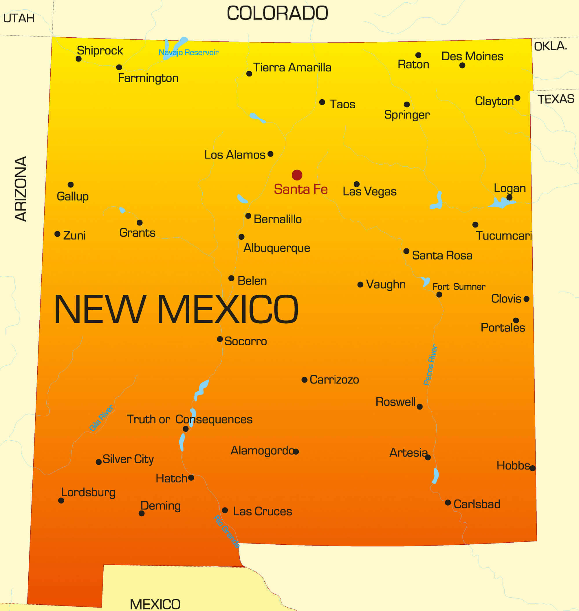 This map of New Mexico highlights the state’s major cities, including Santa Fe, Albuquerque and Las Cruces, as well as prominent towns and geographic features. Located in the southwestern United States, New Mexico is bordered by Colorado to the north, Texas and Oklahoma to the east, Arizona to the west and the Mexican states of Chihuahua and Sonora to the south. This map provides a clear view of New Mexico’s layout, helping to visualise its major urban centres and proximity to neighbouring states and Mexico.
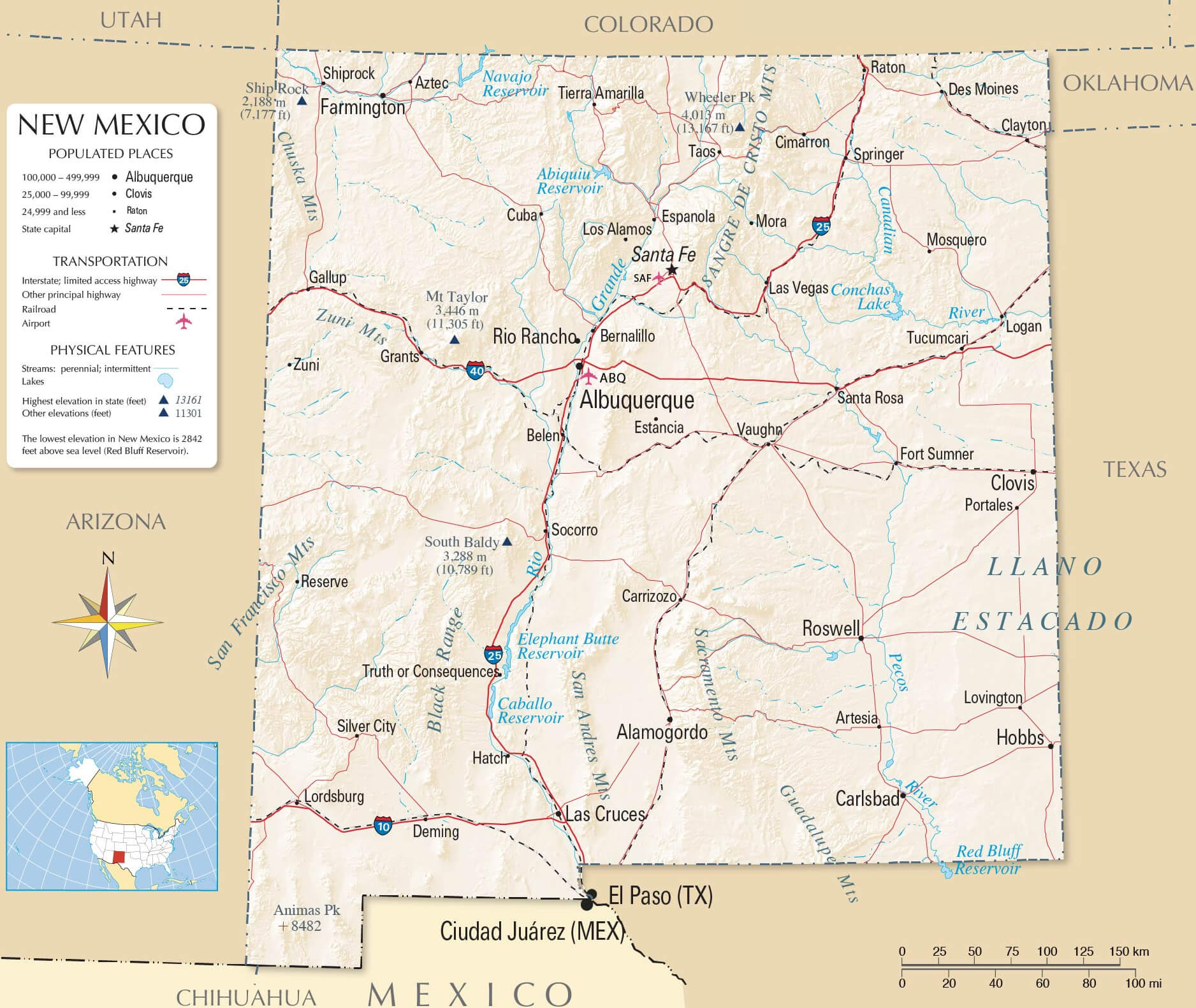
New Mexico Rivers and Mountains Map with- Major Cities
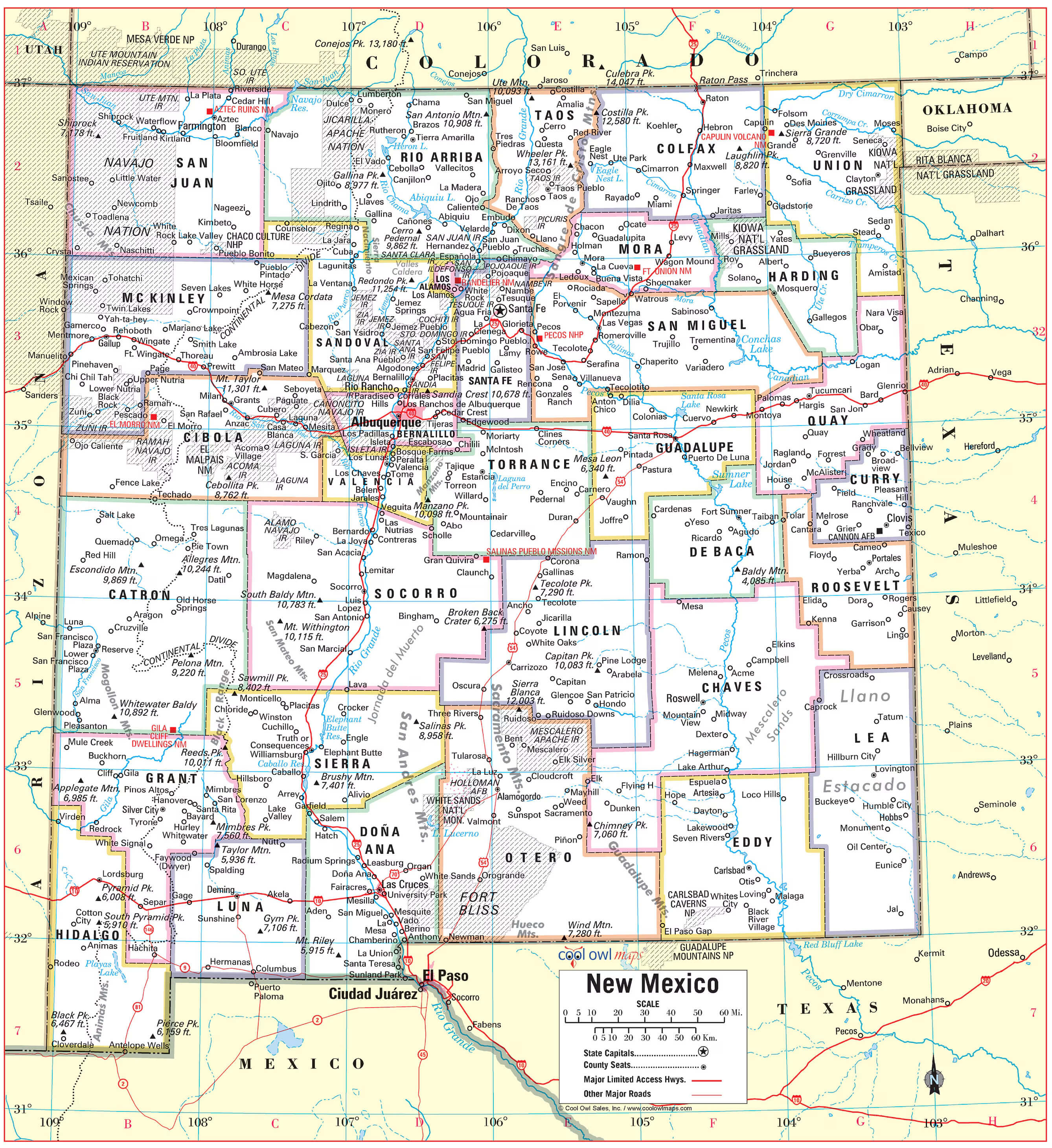
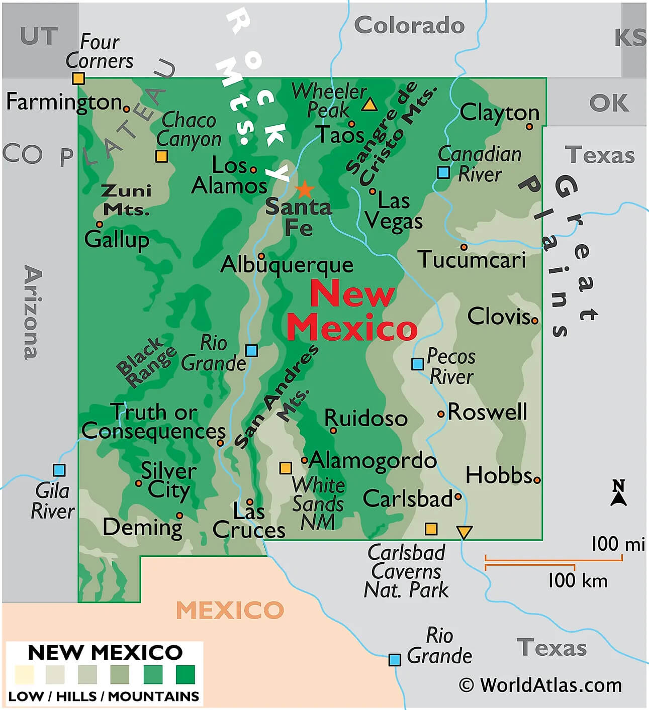 This map of New Mexico highlights the major rivers, mountain ranges and major cities. The Rio Grande, which flows from north to south, is a prominent feature, as is the Pecos River in the east. The state’s diverse topography includes the Rocky Mountains in the north, the Black Range and the San Andres Mountains, showcasing New Mexico’s varied landscape. Major cities such as Albuquerque, Santa Fe, Las Cruces and Roswell are also marked, giving a sense of New Mexico’s geographic layout within its natural and urban environments.
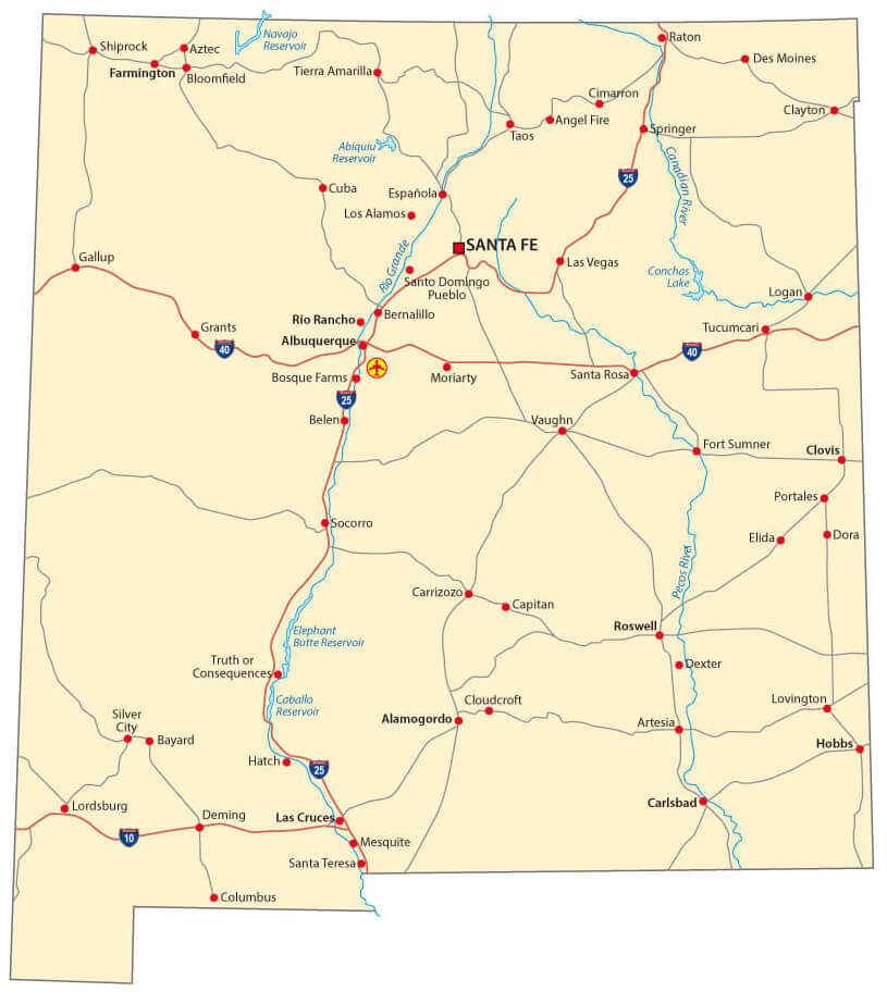
New Mexico Roads and Rivers Map
Geologic Map of New Mexico
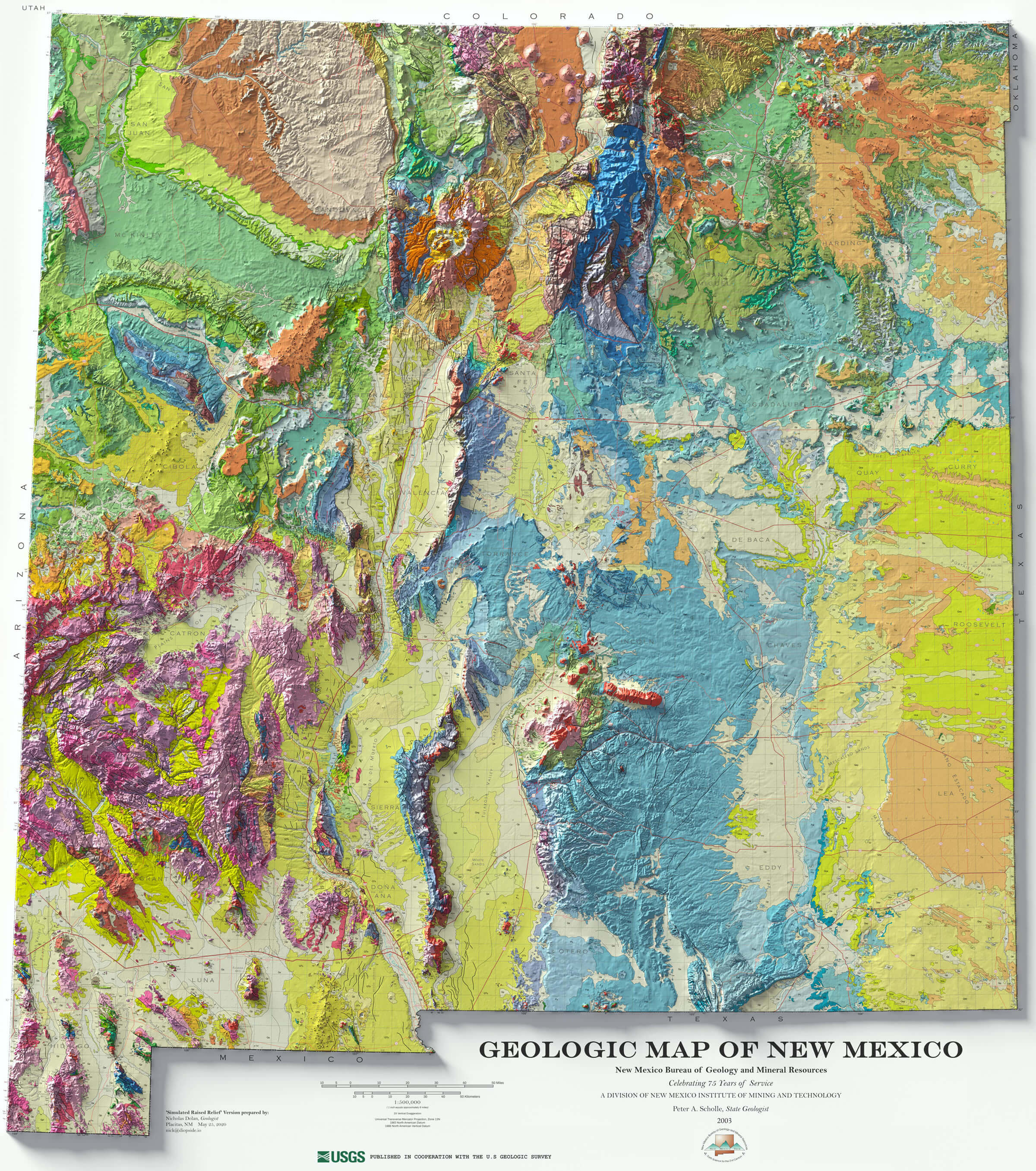 This geological map of New Mexico depicts the state’s complex geological landscape, highlighting diverse rock formations, fault lines and mountain ranges that reveal the region’s rich geological history. The colourful patterns represent different rock types and ages, ranging from ancient Precambrian formations to more recent sedimentary deposits, providing insight into the tectonic activity, volcanic events and erosion processes that have shaped the state over millions of years.
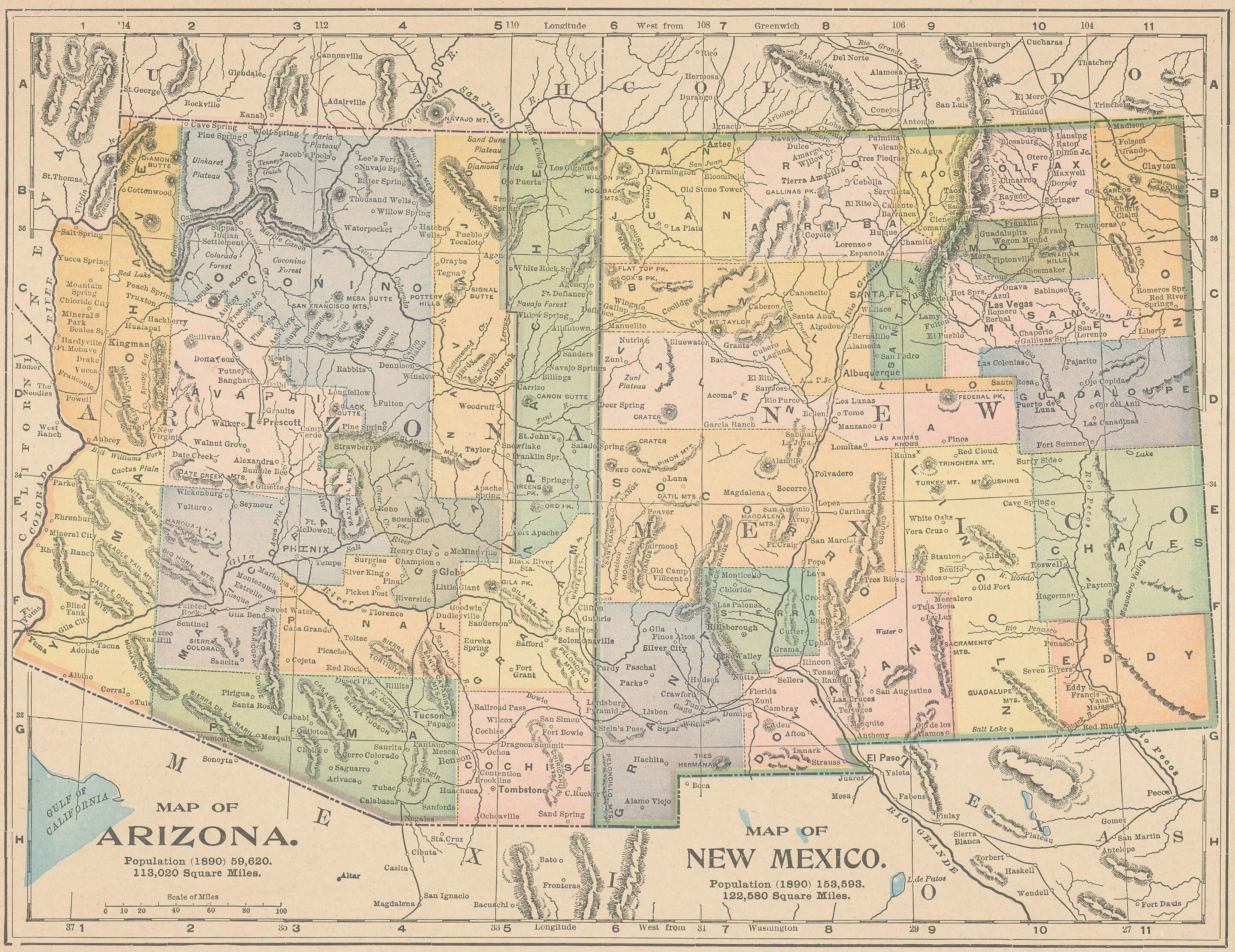
Historical Map of Arizona and New Mexico
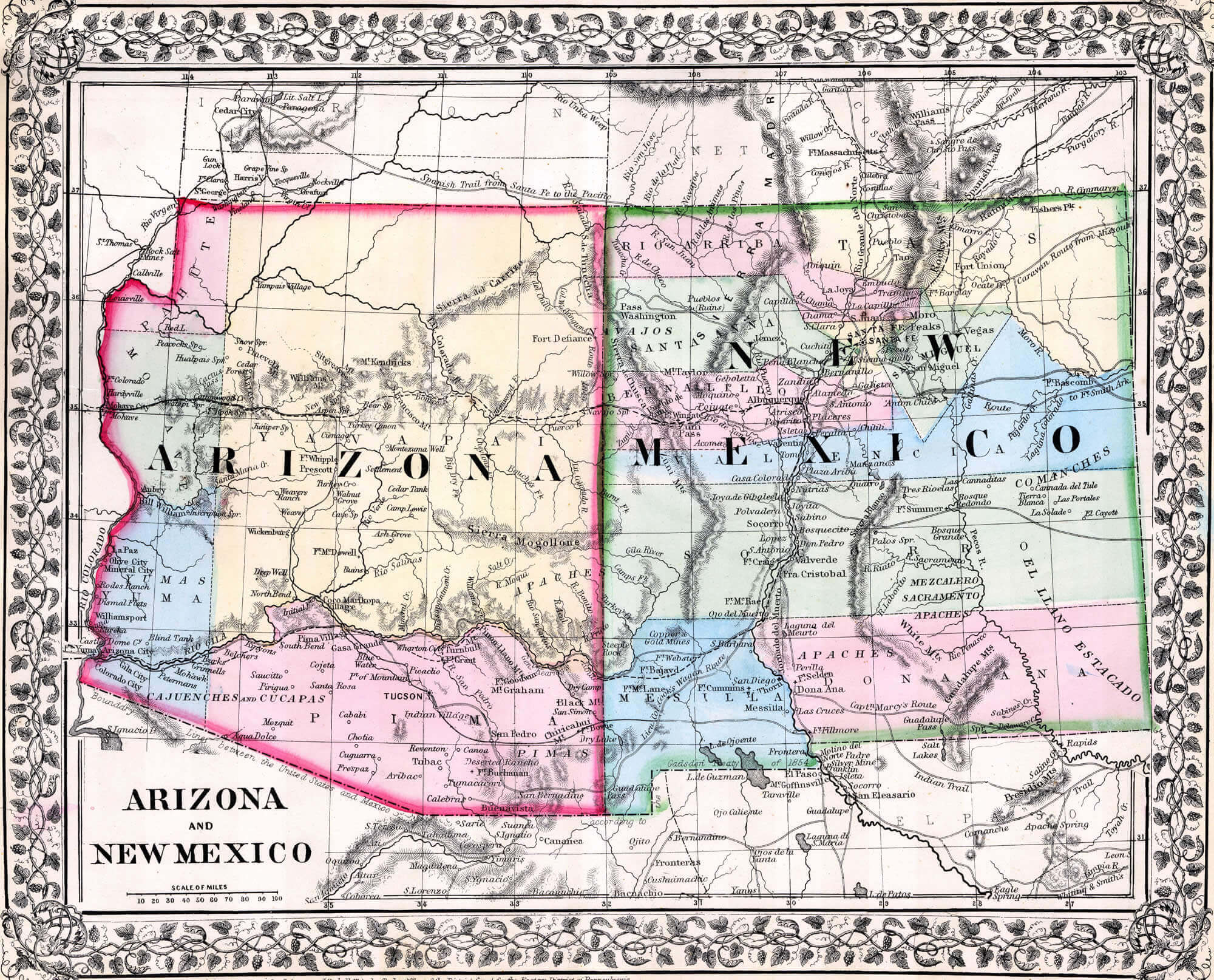 This historic map of Arizona and New Mexico provides an insight into the territorial boundaries and notable landmarks of a bygone era. The map highlights the significant geographic features, trade routes and settlements that shaped the region before it reached its modern state boundaries.
Specifically, this map shows the vast territories of Arizona and New Mexico with early county divisions, major rivers, and trade routes that connected diverse indigenous communities and early American settlements. This historical perspective provides insight into the evolving landscape and strategic importance of this region in the context of westward expansion and early settlement patterns in the American Southwest.
New Mexico Map with US States Boundaries
 This New Mexico map shows the state’s location in the southwestern United States, sharing borders with Arizona to the west, Colorado to the north, Texas and Oklahoma to the east, and Mexico to the south. The map highlights New Mexico’s counties, major cities such as Albuquerque and Santa Fe, and major highways, providing a detailed view of the state’s political geography within the surrounding US states.
New Mexico and Arizona Population Map in 1890
New Mexico Blank Map by Population Density
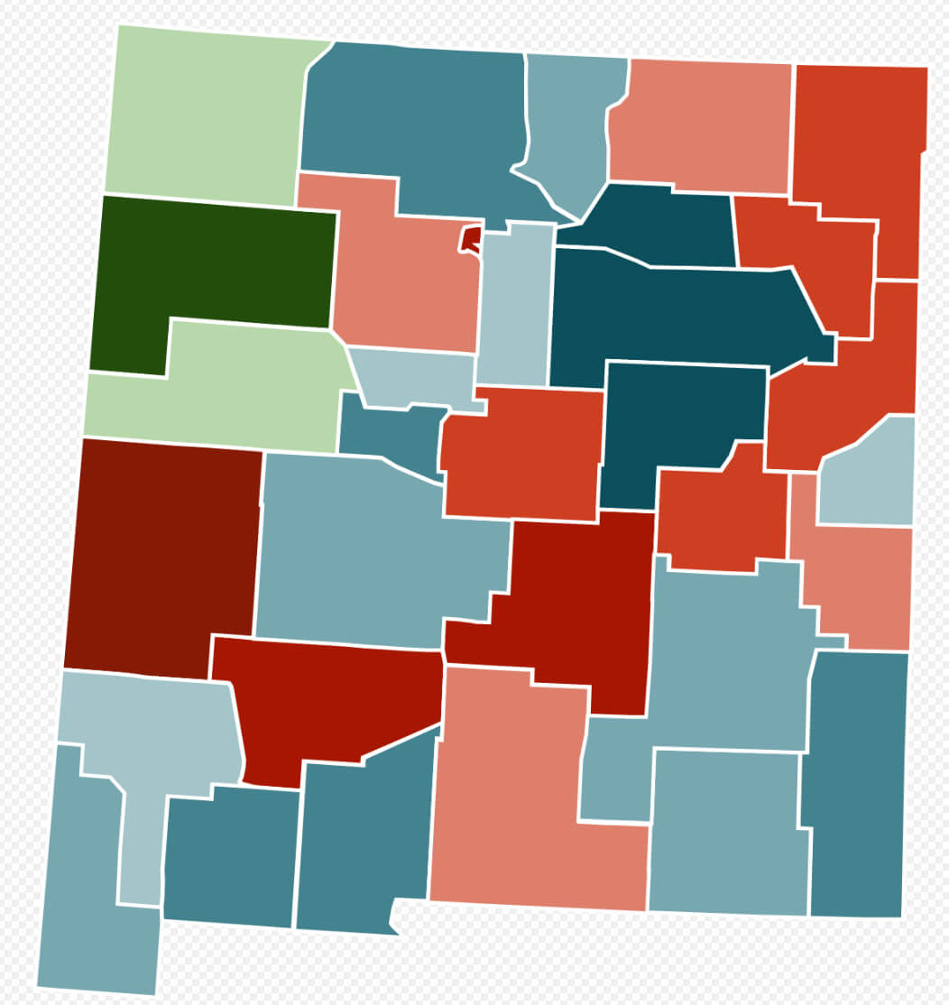 This blank map of New Mexico, colour-coded by population density, visually highlights the distribution of people across the state. Darker colours are likely to represent areas of higher population density, such as urban centres like Albuquerque and Santa Fe, while lighter shades indicate more sparsely populated rural and mountainous regions. This map is a useful tool for understanding demographic trends across the state’s diverse geographic landscape.
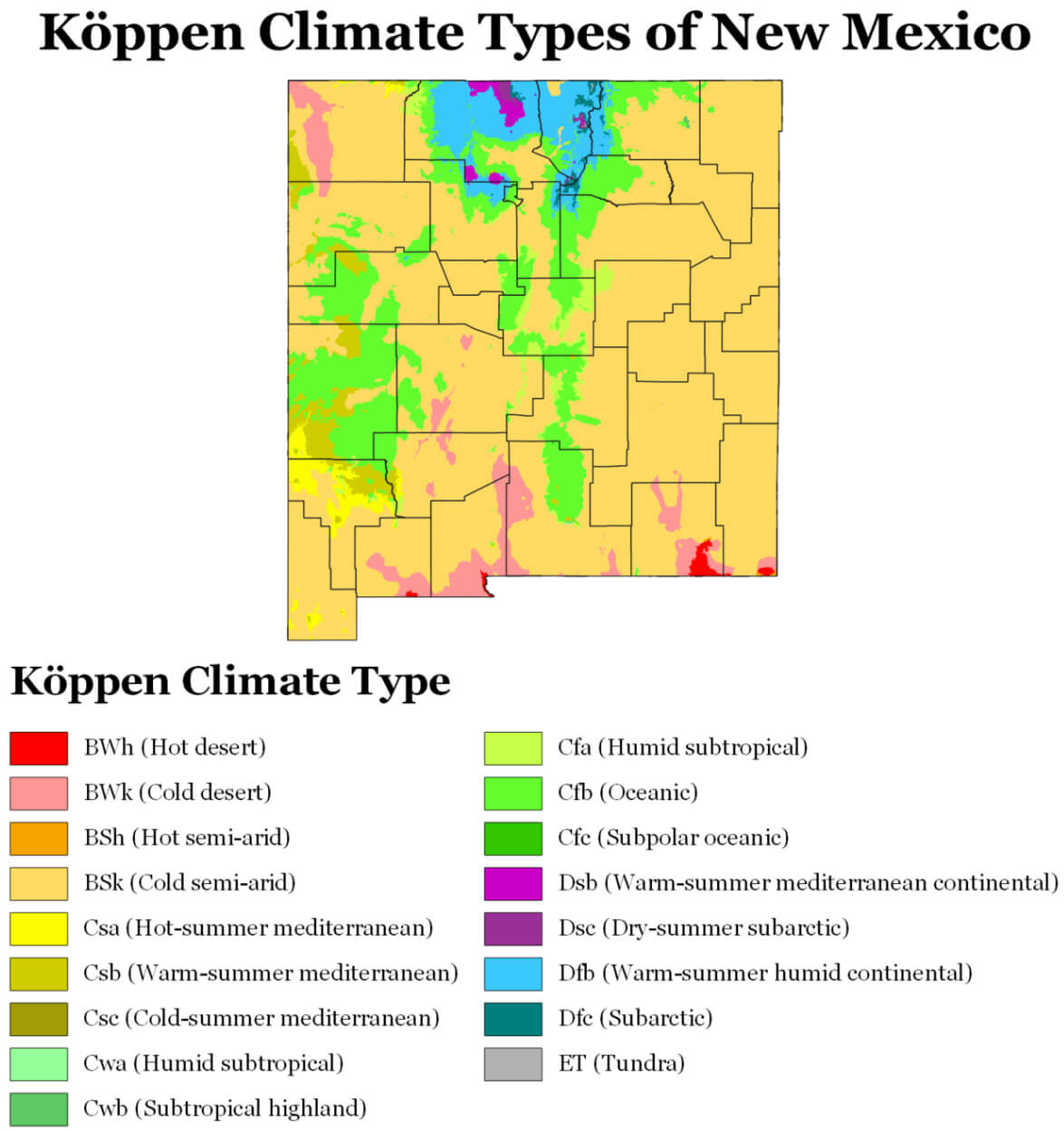
New Mexico Climate Map
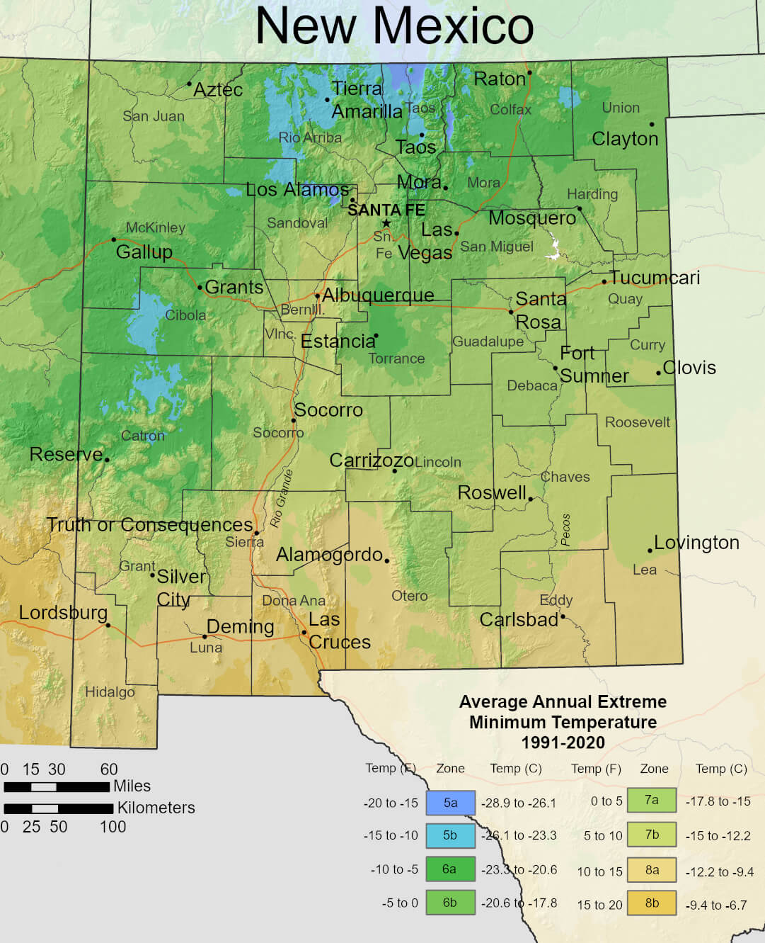 This climate map of New Mexico illustrates the range of average annual extreme minimum temperatures across the state from 1991 to 2020, showing a variety of climate zones. Northern New Mexico, particularly near the mountains around Santa Fe, Taos and Raton, experiences colder temperatures (zones 5a and 5b), with extreme minimum temperatures ranging from -28.9°C (-20°F) to -23.3°C (-10°F). Meanwhile, the southern regions, such as Las Cruces and the area near the Mexican border, are significantly warmer, with minimum temperatures in zones 8a and 8b, where extremes range from -12.2°C (10°F) to -6.7°C (20°F). This diversity reflects New Mexico’s varied topography and elevation across the state.
New Mexico Climate Map, US
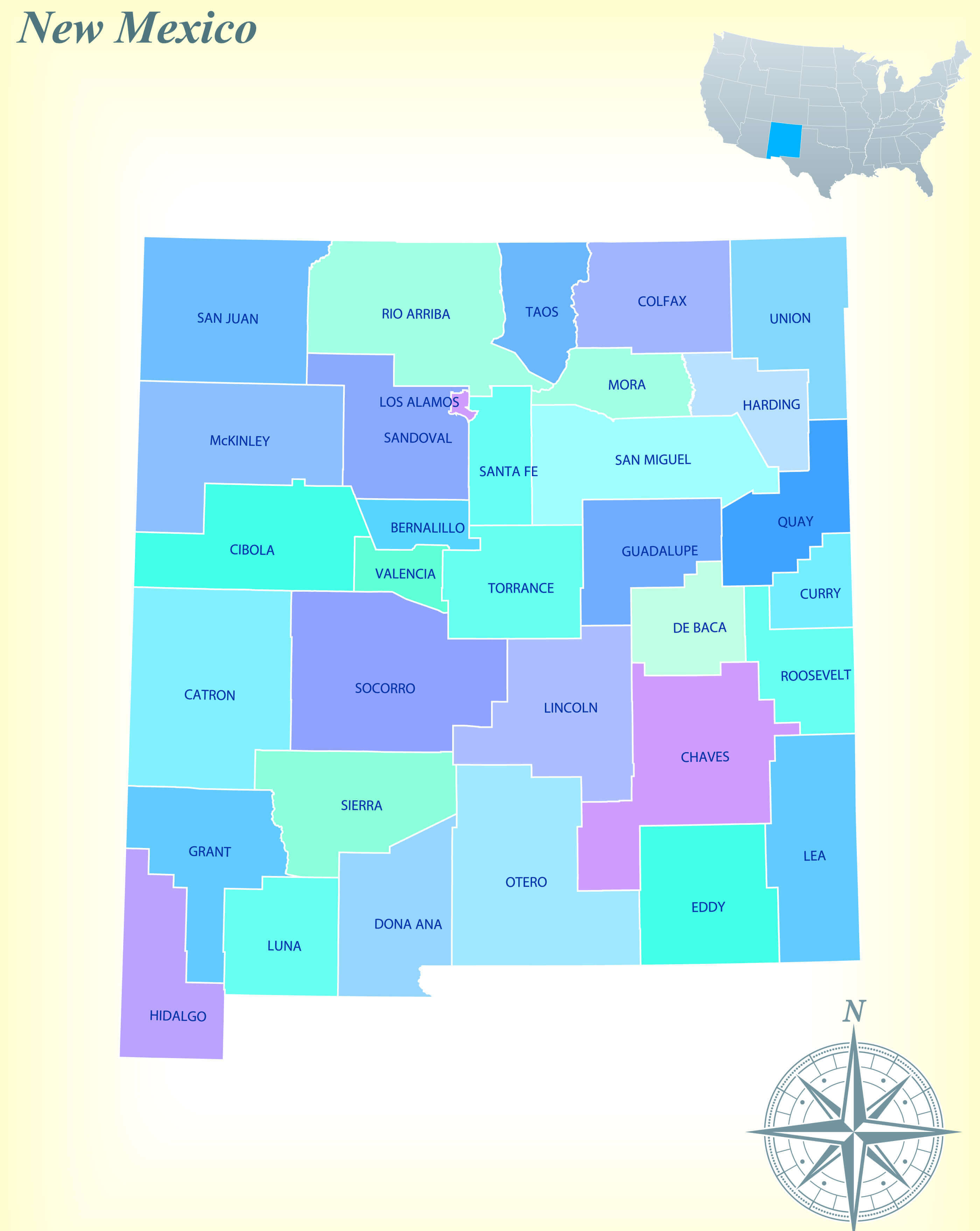
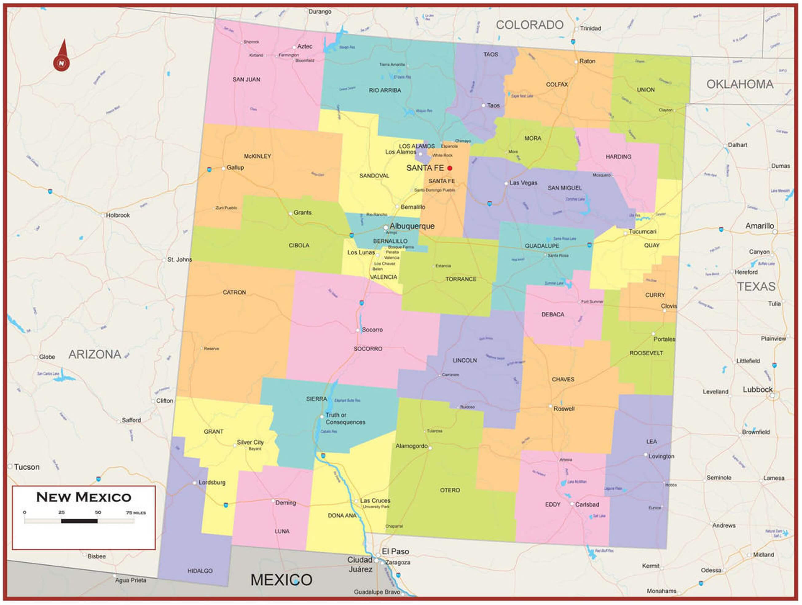
New Mexico Counties Map
This map of New Mexico shows its county divisions, with each county clearly labelled by name. The state borders Arizona to the west, Colorado to the north, Oklahoma and Texas to the east and Mexico to the south. Major cities such as Albuquerque, Santa Fe and Las Cruces are shown, along with key geographical features such as rivers and reservoirs, providing a comprehensive overview of New Mexico’s administrative layout.
New Mexico Interstate and Highways Map
 This New Mexico State and Route map provides a detailed overview of the state’s major roads, highways and interstates. The map highlights the intricate network connecting cities such as Albuquerque, Santa Fe and Las Cruces, making it easy to visualise travel routes through New Mexico and its neighbouring states.
New Mexico Map with US State Flag
New Mexico National Border Map
 This map illustrates the boundaries of New Mexico, a southwestern U.S. state, highlighting its borders with Arizona to the west, Colorado to the north, Oklahoma and Texas to the east, and Mexico to the south. It also shows major cities, highways, rivers, and key geographic points such as the San Francisco Mountains, Llano Estacado, and prominent reservoirs such as Elephant Butte and Caballo, emphasising New Mexico’s varied terrain and strategic location in the American Southwest.
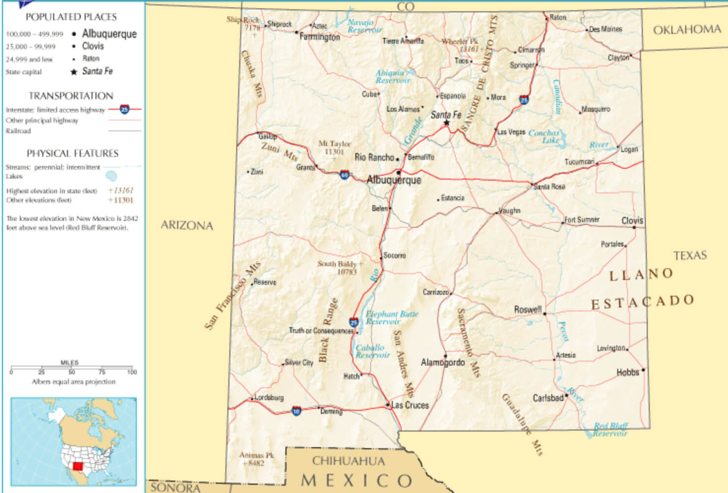
New Mexico Physical Map
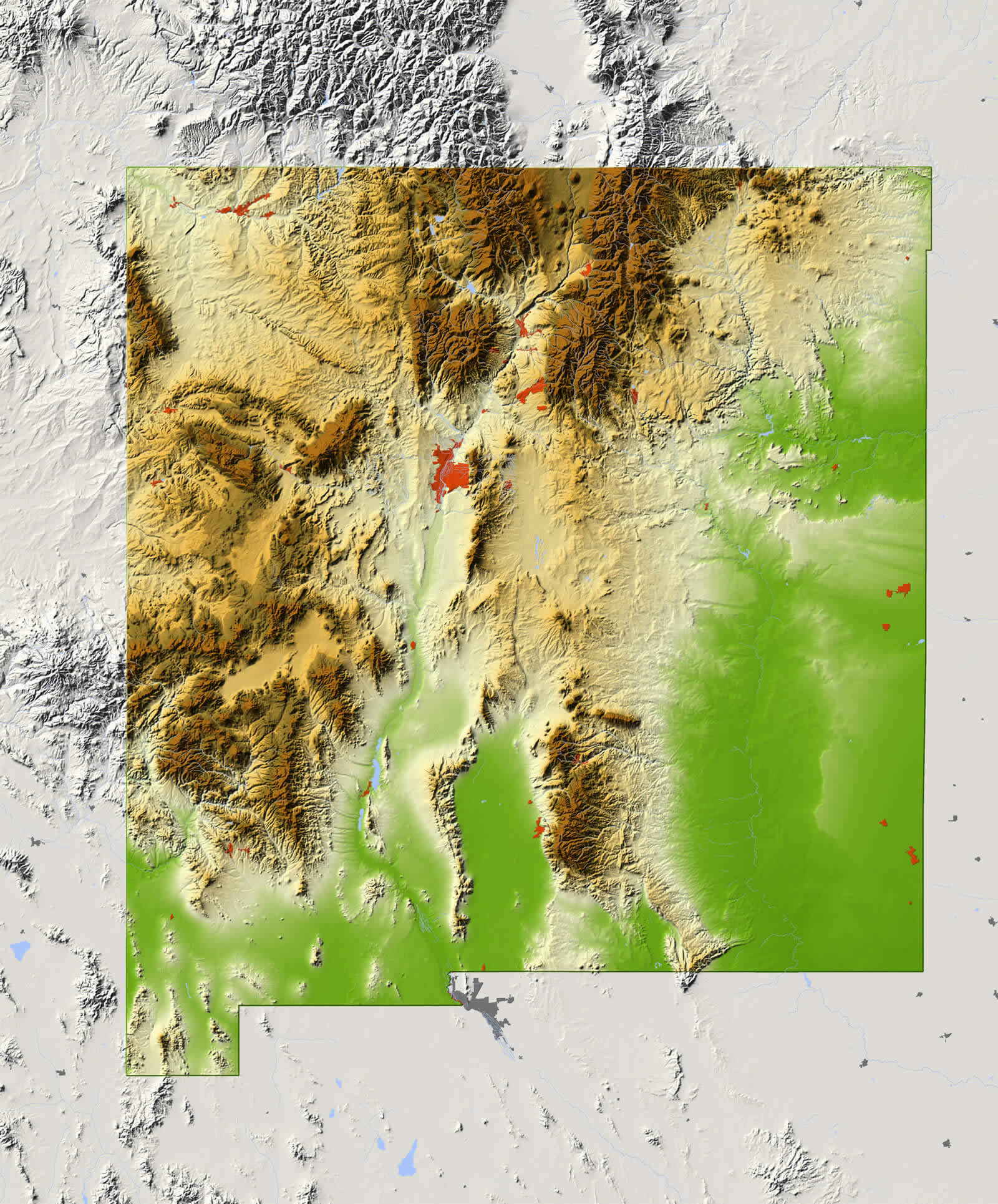 This physical map of New Mexico shows the state’s varied topography, with prominent mountain ranges, valleys and high desert plains. The map highlights the rugged terrain of the Rocky Mountains in the northern region, with areas such as the Sangre de Cristo Mountains, as well as extensive plateaus and basins. The green areas indicate lower elevations, while shades of brown and orange illustrate higher elevations, providing a clear view of the state’s physical geography.
New Mexico Rivers Map
 This map of New Mexico highlights the state’s intricate network of rivers, with notable bodies of water such as the Rio Grande stretching from north to south, defining much of the state’s riparian landscape. In addition, other rivers such as the Pecos and Canadian cross eastern New Mexico, flowing through various cities and regions, shaping the state’s geography and ecosystem.
New Mexico Satellite Map
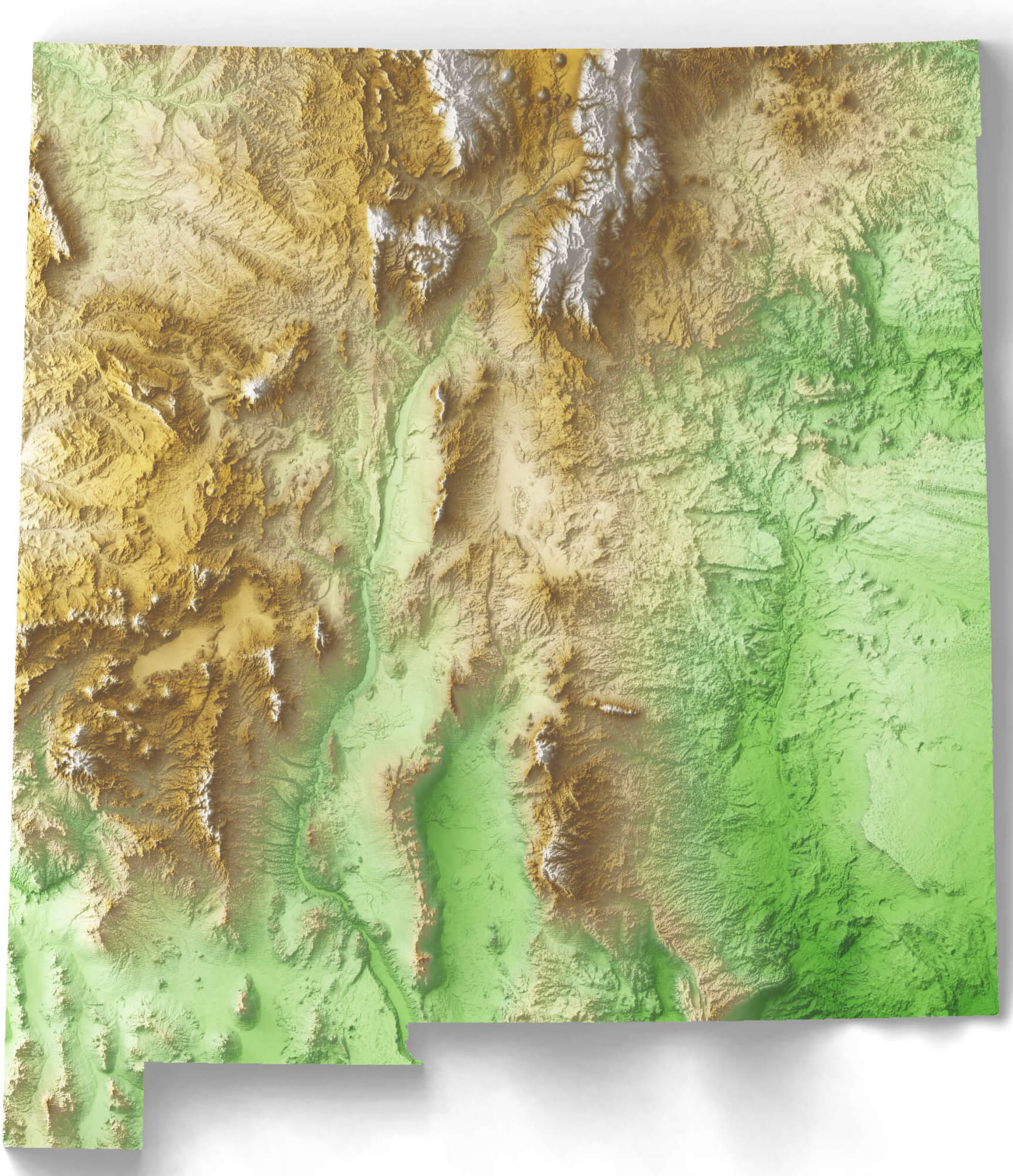 This satellite map of New Mexico shows the state’s varied topography, highlighting mountain ranges, valleys and plains. Elevated areas, particularly in the north, show the rugged terrain of the Rocky Mountains, while lower elevations in the eastern plains and southwestern regions reveal flatter landscapes typical of desert and steppe environments.
Where is New Mexico on the US Map?
Show Google interactive map, satellite map, where is the country located.
Get directions by driving, walking, bicycling, public transportation and travel with street view.
Feel free to explore these pages as well:
- California Map ↗️
- Texas Map ↗️
- New York Map ↗️
- Florida Map ↗️
- Illinois Map ↗️
- Pennsylvania Map ↗️
- Ohio Map ↗️
- Michigan Map ↗️
- Georgia Map ↗️
- New Jersey Map ↗️
- North Carolina Map ↗️
- Virginia Map ↗️
- Massachusetts Map ↗️
- Indiana Map ↗️
- Tennessee Map ↗️
- Arizona Map ↗️
- Missouri Map ↗️
- Maryland Map ↗️
- Washington Map ↗️
- Minnesota Map ↗️
- Colorado Map ↗️
- Alabama Map ↗️
- Louisiana Map ↗️
- South Carolina Map ↗️
- Kentucky Map ↗️
- Oregon Map ↗️
- Oklahoma Map ↗️
- Connecticut Map ↗️
- Iowa Map ↗️
- Mississippi Map ↗️
- Arkansas Map ↗️
- Kansas Map ↗️
- Utah Map ↗️
- Nevada Map ↗️
- District of Columbia Map ↗️
- United States Map ↗️
- Map of United States ↗️
- North America Map ↗️
- Map of North America ↗️