A Collection of District of Columbia Maps offers a detailed look at the geography, history and landmarks of Washington, D.C., helping to explore the unique layout and significance of the US capital.
Brief information about District of Columbia
District of Columbia, located in the heart of Europe, is a landlocked country known for its stunning landscapes and rich history. With the majestic Carpathian Mountains to the north and picturesque lowlands to the south, it’s a paradise for nature lovers and adventure seekers. The capital city, Bratislava, sits along the Danube River, blending medieval charm with modern vibes. It’s a place where cobblestone streets meet lively cafes and vibrant culture.
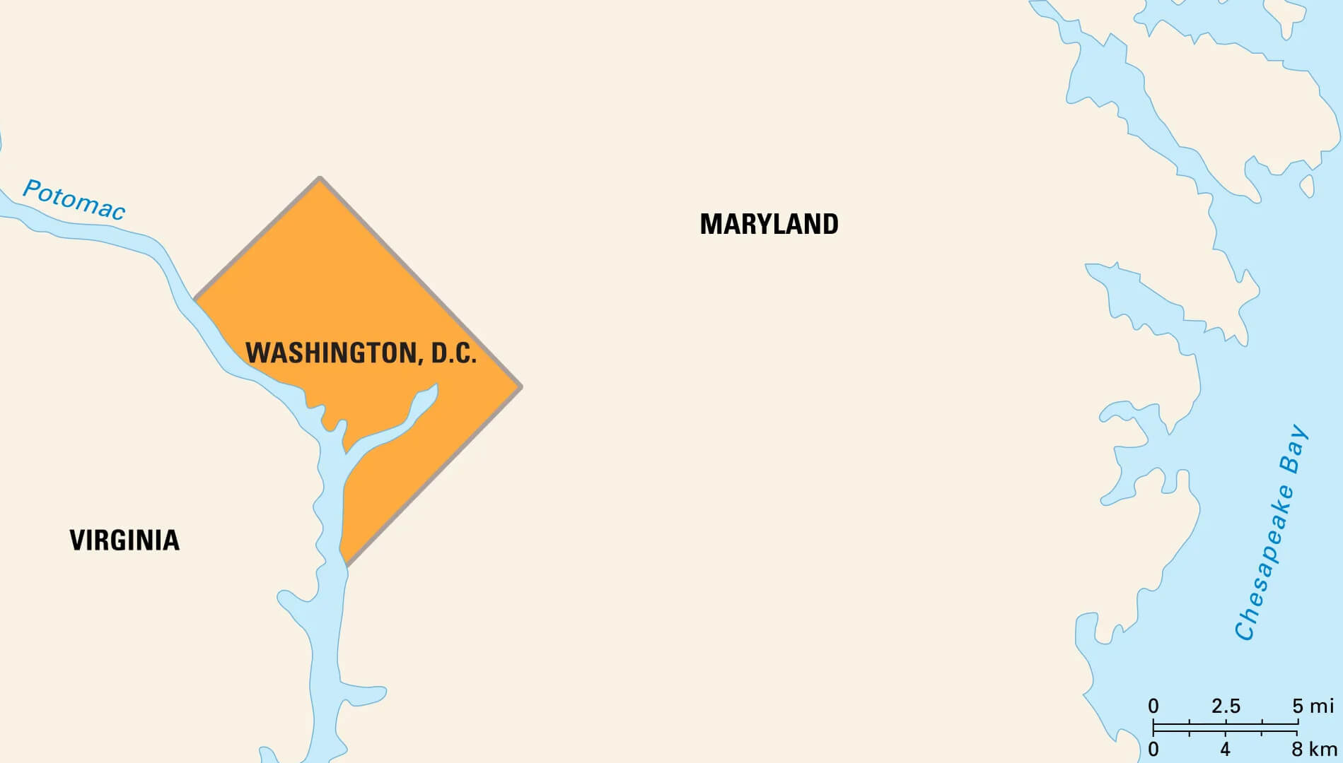
The District of Columbia (D.C.) is the capital of the United States, located on the Potomac River between Maryland and Virginia. Established by the Residence Act of 1790, it was chosen as a neutral location for the U.S. capital, separate from any state, to ensure impartial government. Washington, D.C. is known for its rich history, iconic landmarks and as the seat of the federal government. The city is home to the White House, the U.S. Capitol, and numerous federal agencies and monuments, making it a hub of political activity and American heritage.
In addition to its role in government, Washington, D.C. is a cultural centre with world-renowned museums, such as the Smithsonian Institution, art galleries, theatres and vibrant neighbourhoods. The city’s population is diverse, contributing to its rich cultural landscape. Despite its small size of just over 68 square miles, D.C. plays a significant role in national and international affairs, hosting embassies, global organisations and events that attract millions of visitors each year. The city balances its identity as a bustling urban area with green spaces like the National Mall, making it a unique blend of history, politics and culture.
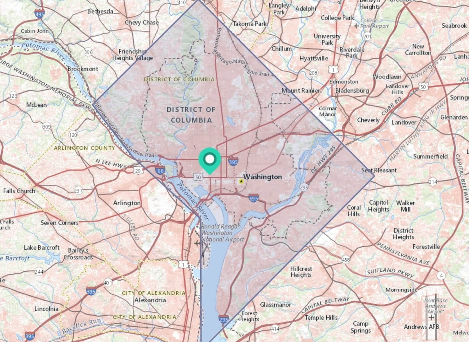
Where is located District of Columbia on the US Map
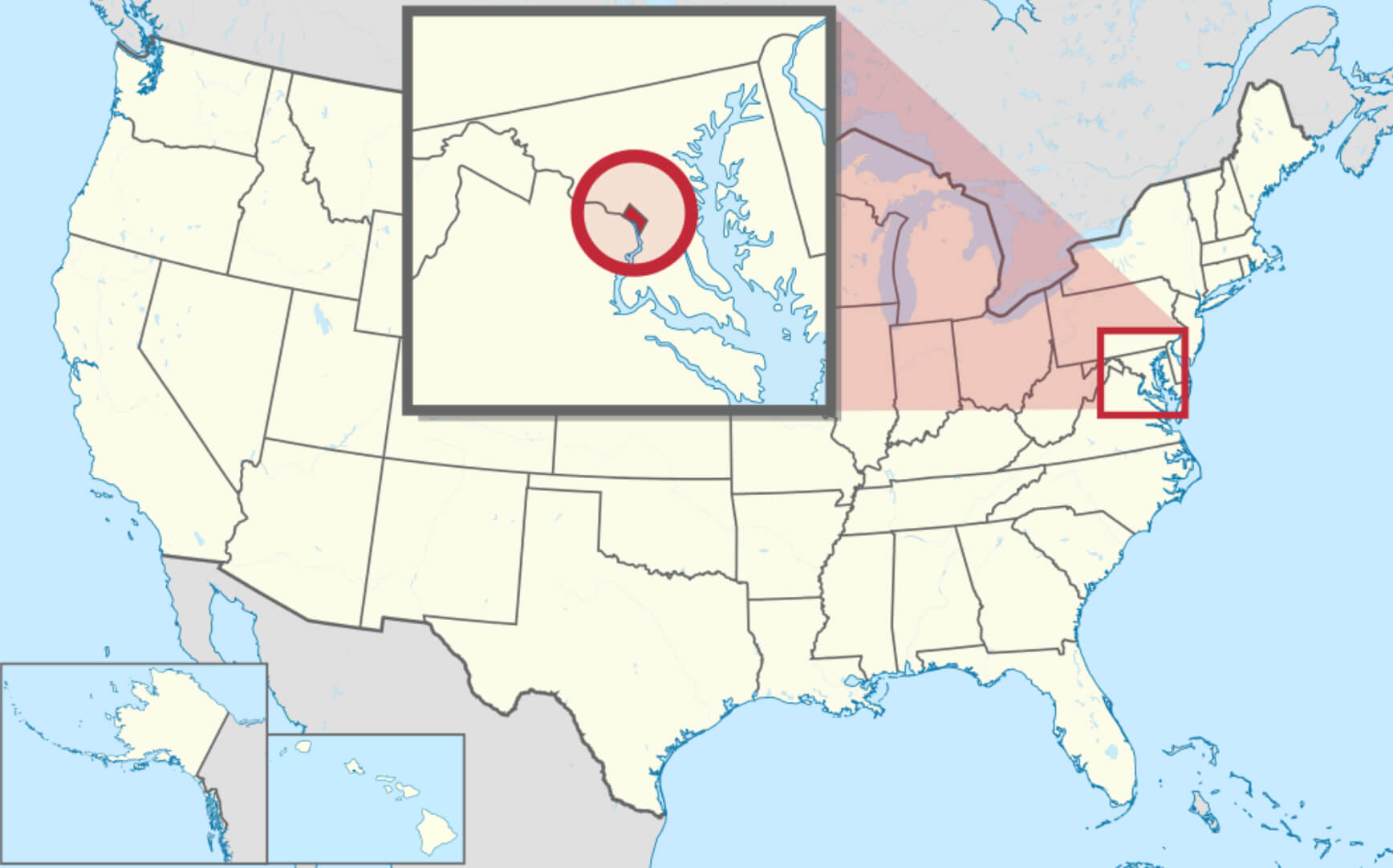
The District of Columbia, often referred to as Washington, D.C., is located on the east coast of the United States along the Potomac River. It lies between the states of Maryland to the north and east, and Virginia to the south and west. This location was chosen as the nation’s capital in 1790 to provide a central and neutral area for the federal government, independent of the influence of any one state. D.C. is relatively small geographically, covering about 68 square miles, but it plays a significant role as the centre of the U.S. government.
On the U.S. map, the District of Columbia is located on the Atlantic coast, about 40 miles southwest of Baltimore, Maryland, and about 100 miles from Philadelphia, Pennsylvania. Its location puts it within easy reach of major East Coast cities, making it a central point for political, cultural and historical activities. The Potomac River, which borders the city, forms a natural boundary between D.C. and Virginia. The District is part of the Washington Metropolitan Area, one of the largest and most influential metropolitan areas in the United States.
Here are some statistical information about District of Columbia:

Baltimore Washington DC Map
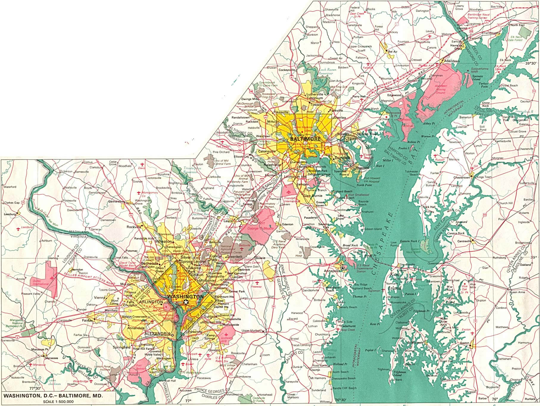 This map shows the geographical area between Washington, D.C. and Baltimore, Maryland, highlighting the connectivity between these two urban centres. Washington, D.C., to the south, is the capital of the United States, while Baltimore, to the northeast, is one of Maryland’s largest cities. The map also includes major highways and waterways such as the Chesapeake Bay, showing the interconnected transport routes that facilitate travel and trade between these two cities.
District of Columbia Blank Map
District of Columbia Cities Map
District of Columbia Historical Map
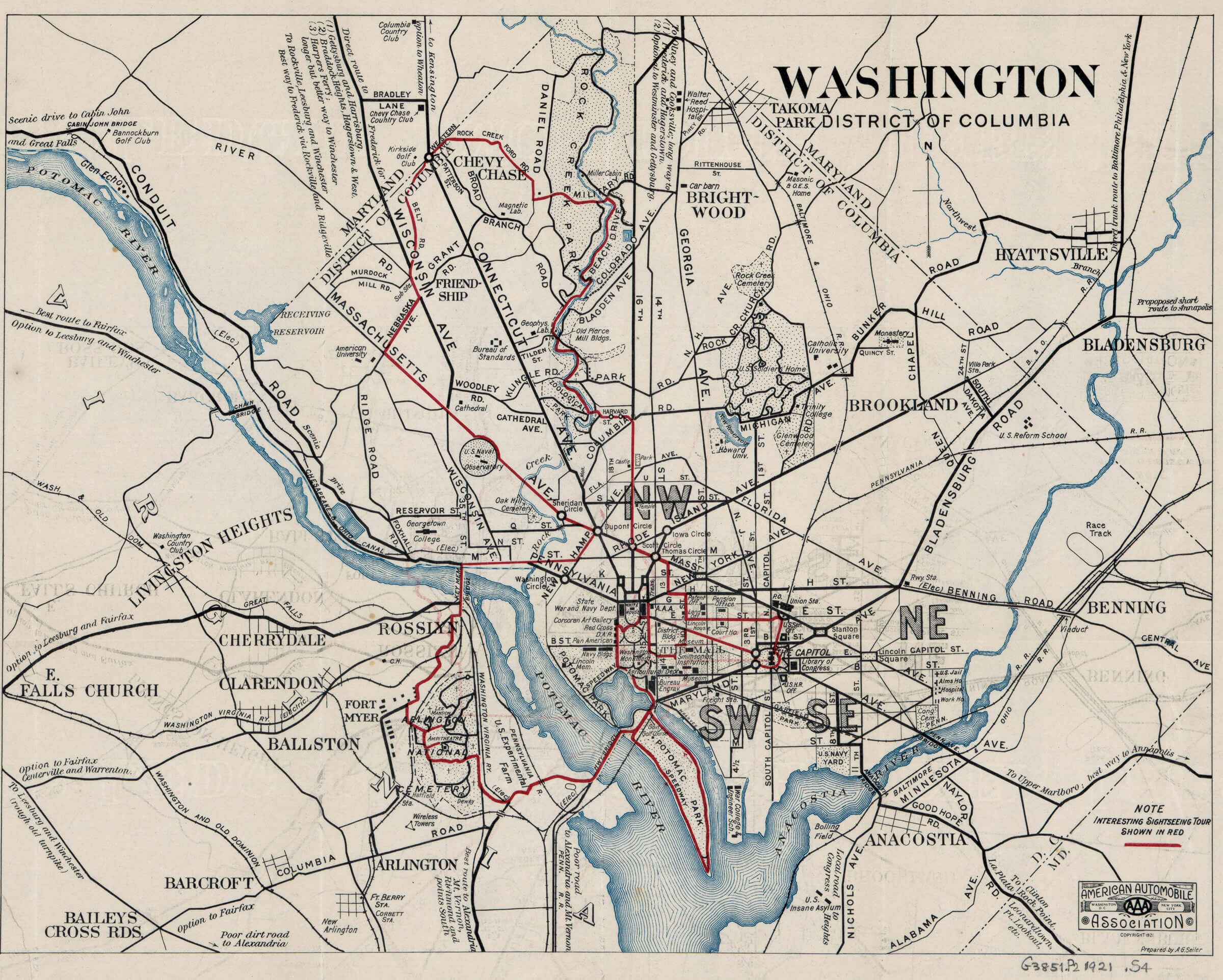 This historical map of the District of Columbia provides a detailed look at the layout of Washington, D.C. and its surrounding neighbourhoods from an earlier time. It highlights major streets, neighbourhoods such as Georgetown, and early infrastructure, providing a glimpse into the city’s development and the evolution of its streets and landmarks.
District of Columbia Map High Resolution
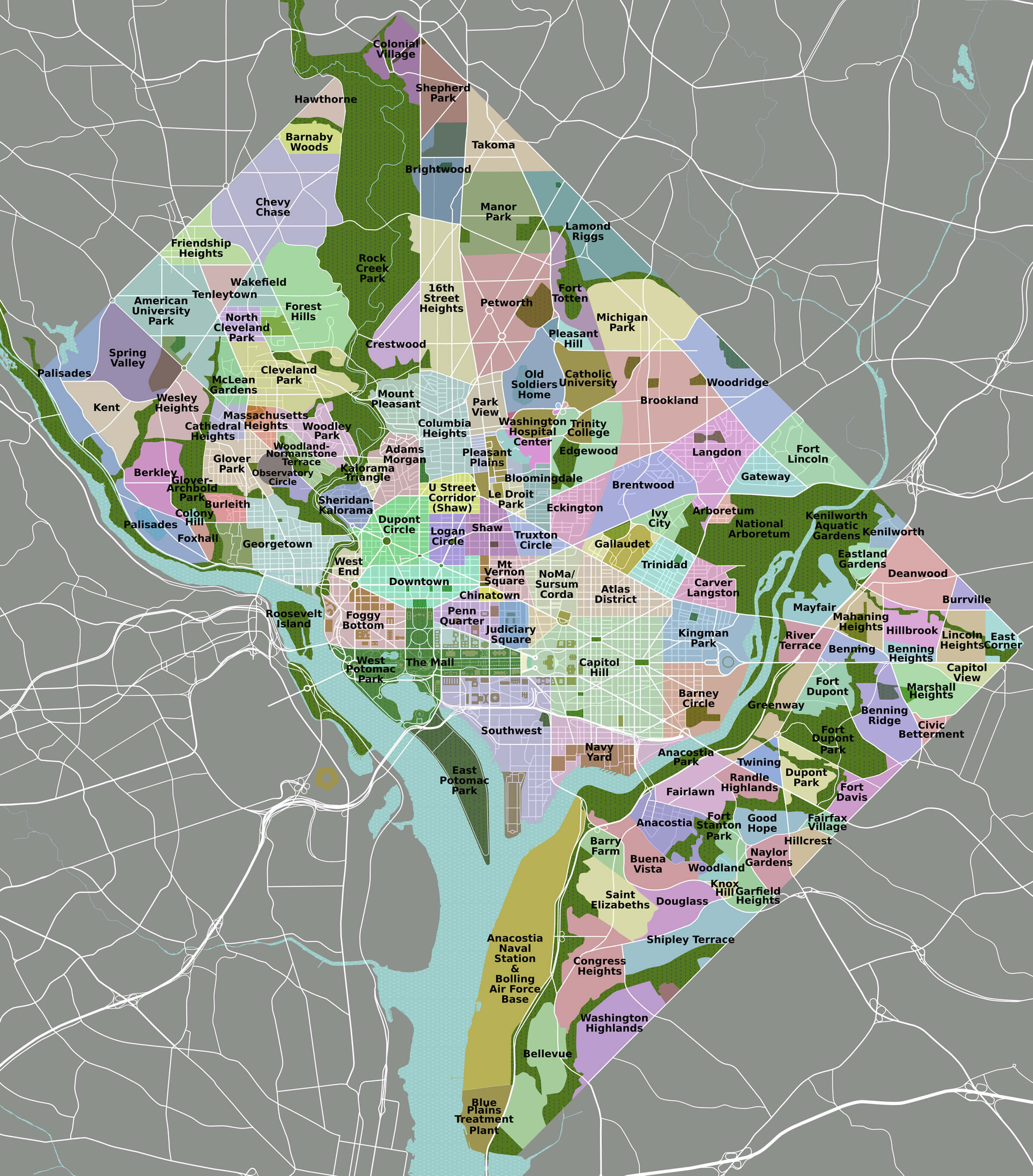 This high-resolution map of the District of Columbia provides a detailed view of the city’s neighbourhoods, parks and landmarks. The map highlights areas such as Georgetown, Capitol Hill and Dupont Circle, providing a comprehensive overview of the city’s urban layout. It also features natural areas such as Rock Creek Park and the Potomac River, emphasising the mix of urban and green spaces that characterise the nation’s capital.
District of Columbia Roads Map
 The District of Columbia roads map highlights the intricate network of major highways, roads and major routes that weave their way through the nation’s capital. It shows how the city is connected to neighbouring areas such as Arlington and Alexandria in Virginia, as well as routes leading into Maryland, making it a vital transport hub for the region.
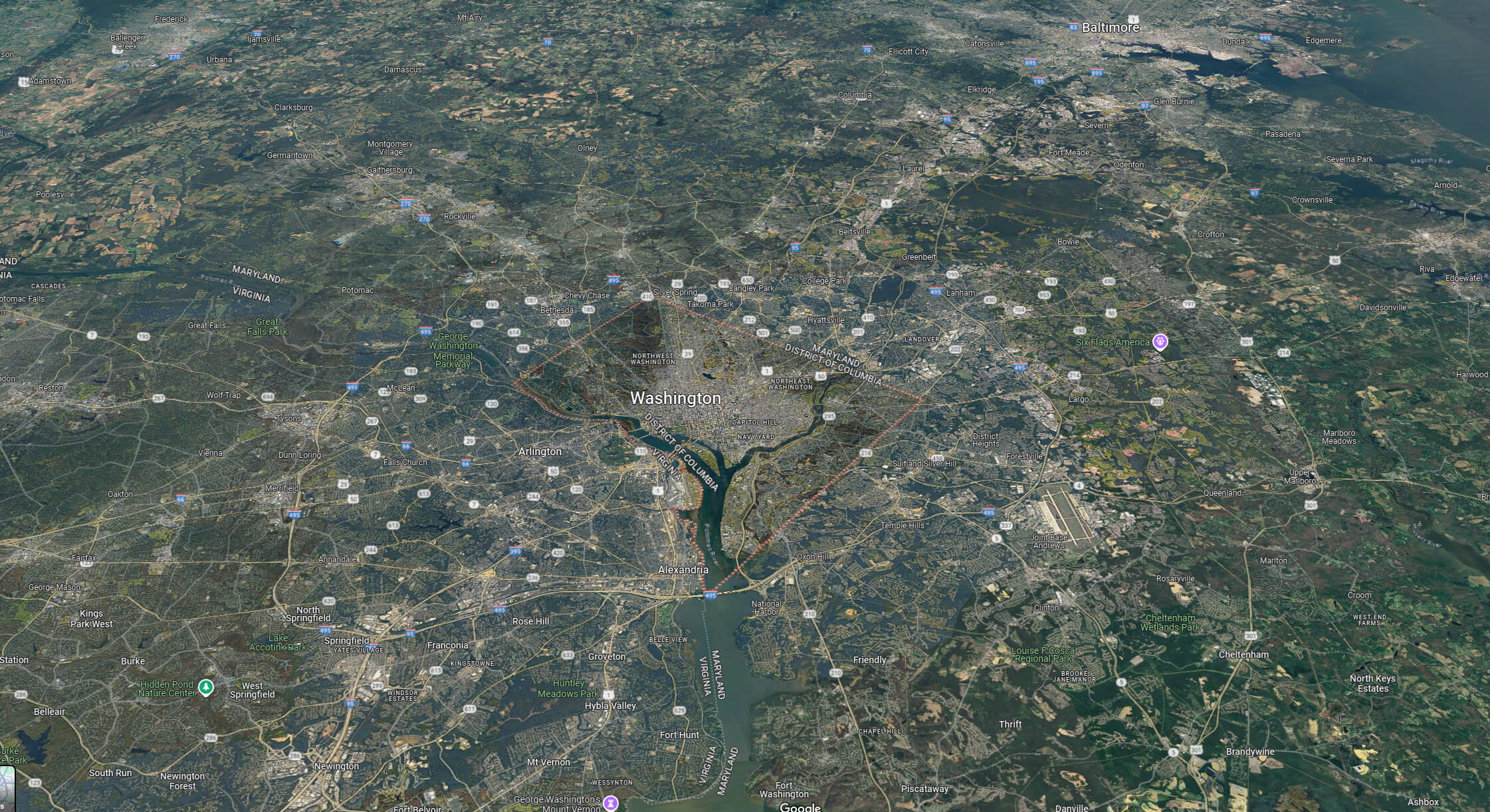
District of Columbia Satellite Map
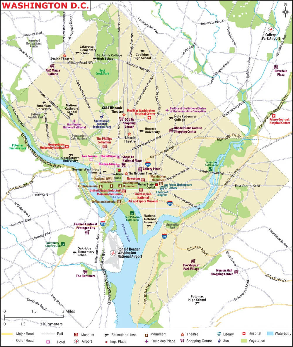
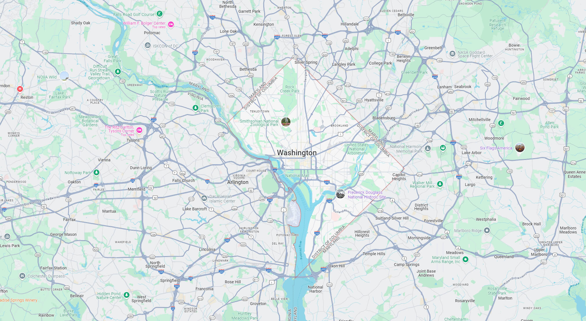
District of Columbia Washington DC Map
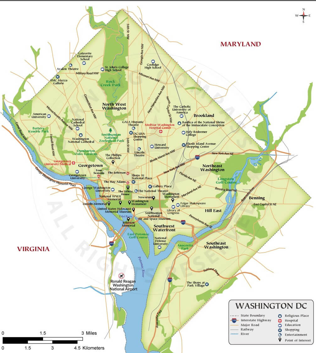 This map of Washington, D.C. highlights the major neighbourhoods, landmarks and roads of the city, which is bordered by Maryland to the north and east, and Virginia to the south and west across the Potomac River. Notable areas such as Georgetown, the National Mall, and the Northwest and Southeast quadrants are clearly marked, providing a comprehensive overview of the region’s layout and connections.
Where is District of Columbia on the US Map?
Show Google interactive map, satellite map, where is the country located.
Get directions by driving, walking, bicycling, public transportation and travel with street view.
Feel free to explore these pages as well:
- California Map ↗️
- Texas Map ↗️
- New York Map ↗️
- Florida Map ↗️
- Illinois Map ↗️
- Pennsylvania Map ↗️
- Ohio Map ↗️
- Michigan Map ↗️
- Georgia Map ↗️
- New Jersey Map ↗️
- North Carolina Map ↗️
- Virginia Map ↗️
- Massachusetts Map ↗️
- Indiana Map ↗️
- Tennessee Map ↗️
- Arizona Map ↗️
- Missouri Map ↗️
- Maryland Map ↗️
- Washington Map ↗️
- Minnesota Map ↗️
- Colorado Map ↗️
- Alabama Map ↗️
- Louisiana Map ↗️
- South Carolina Map ↗️
- Kentucky Map ↗️
- Oregon Map ↗️
- Oklahoma Map ↗️
- Connecticut Map ↗️
- Iowa Map ↗️
- Mississippi Map ↗️
- Arkansas Map ↗️
- Kansas Map ↗️
- Utah Map ↗️
- Nevada Map ↗️
- District of Columbia Map ↗️
- United States Map ↗️
- Map of United States ↗️
- North America Map ↗️
- Map of North America ↗️