A collection of Colorado Maps; View a variety of Colorado physical, political, administrative, relief map, Colorado satellite image, higly detalied maps, blank map, Colorado USA and earth map, Colorado’s regions, topography, cities, road, direction maps and atlas.
A Collection of Colorado Maps
Colorado Administrative Map
 Colorado administrative map with cities, USA.
Colorado Shaded relief map
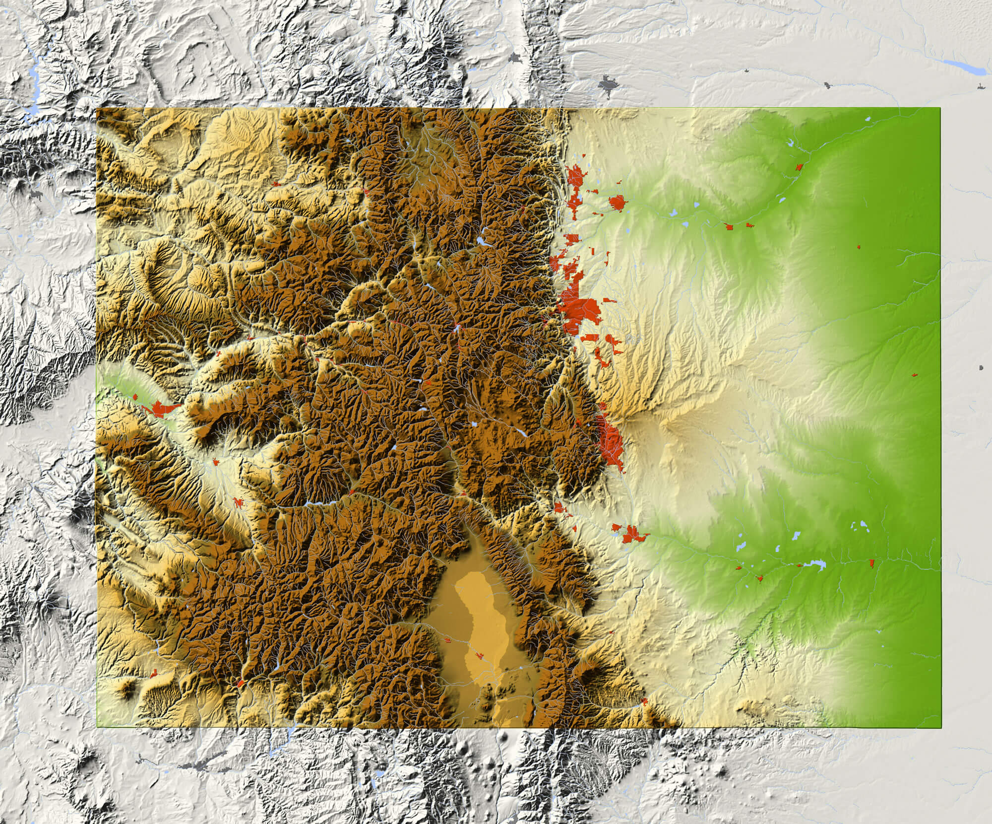
Colorado. Shaded relief map, with major urban areas and rivers, surrounding territory greyed out. Colored according to elevation. Clipping path for the state area included.
Map of America, Colorado
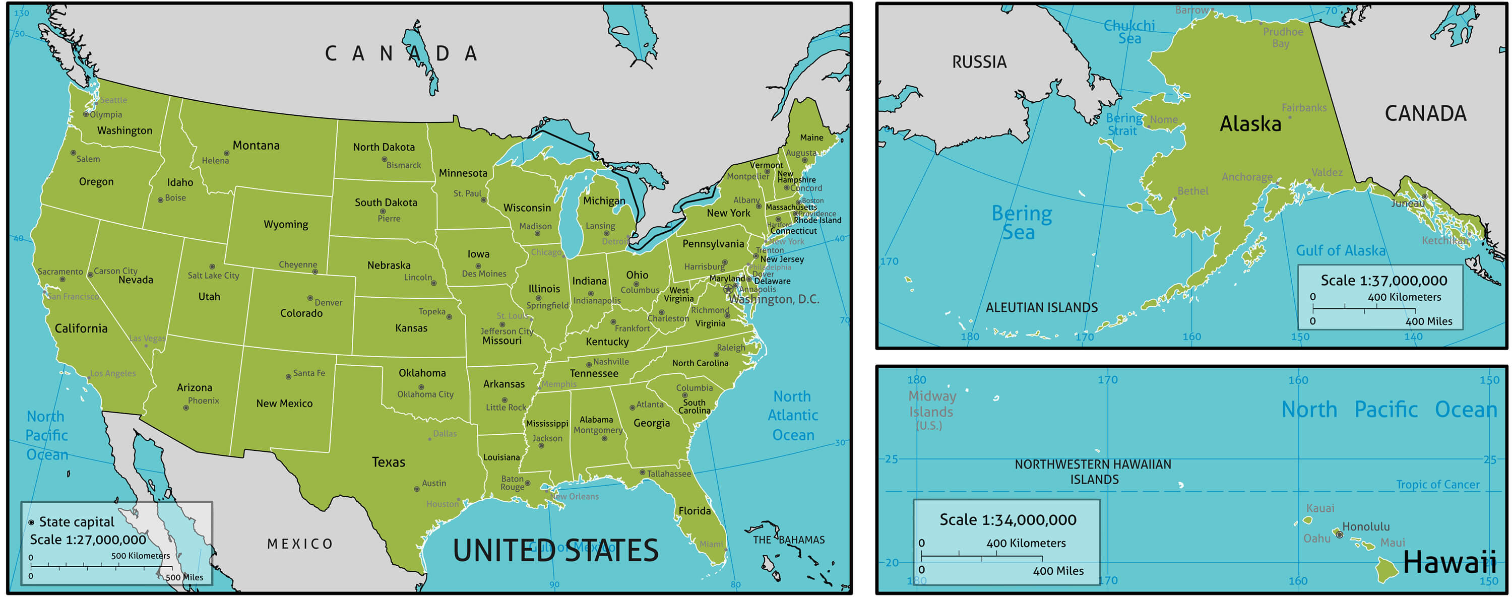
Map of America with state names, capitals and other major citieS. Colors and strokes easily changed. Vector Layers: Keys, state names, capital markers, capital names, longitude latitude lines and more.
Colorado State Map
Colorado State Map with Community Assistance and Activates Icons Original Illustration.
Colorado state road map
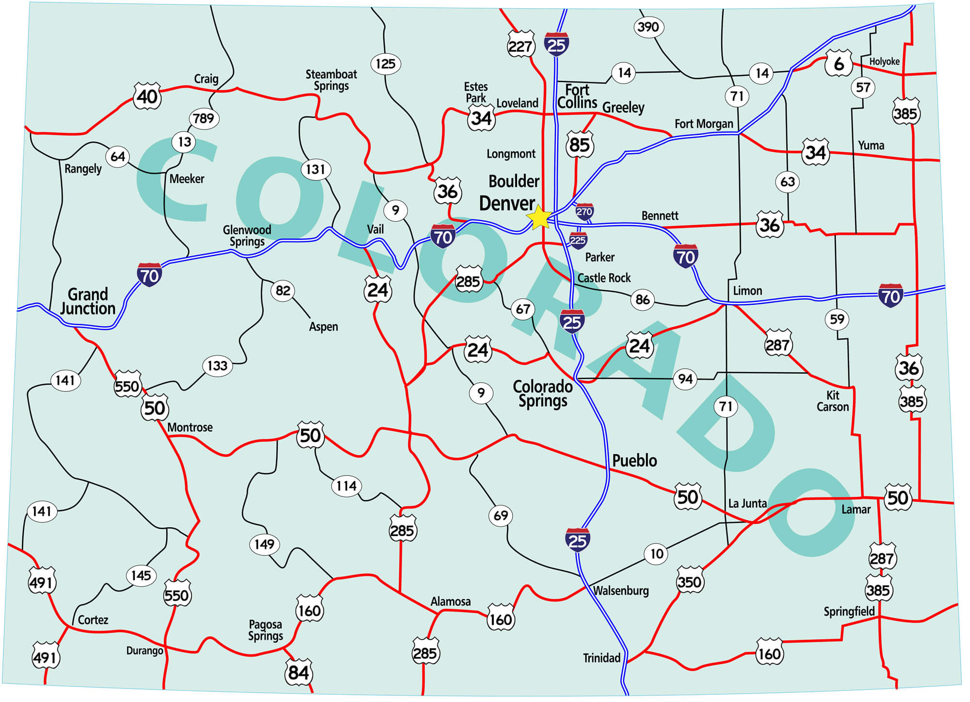
Colorado state road map with Interstates, U.S. Highways and state roads. Raster illustration.
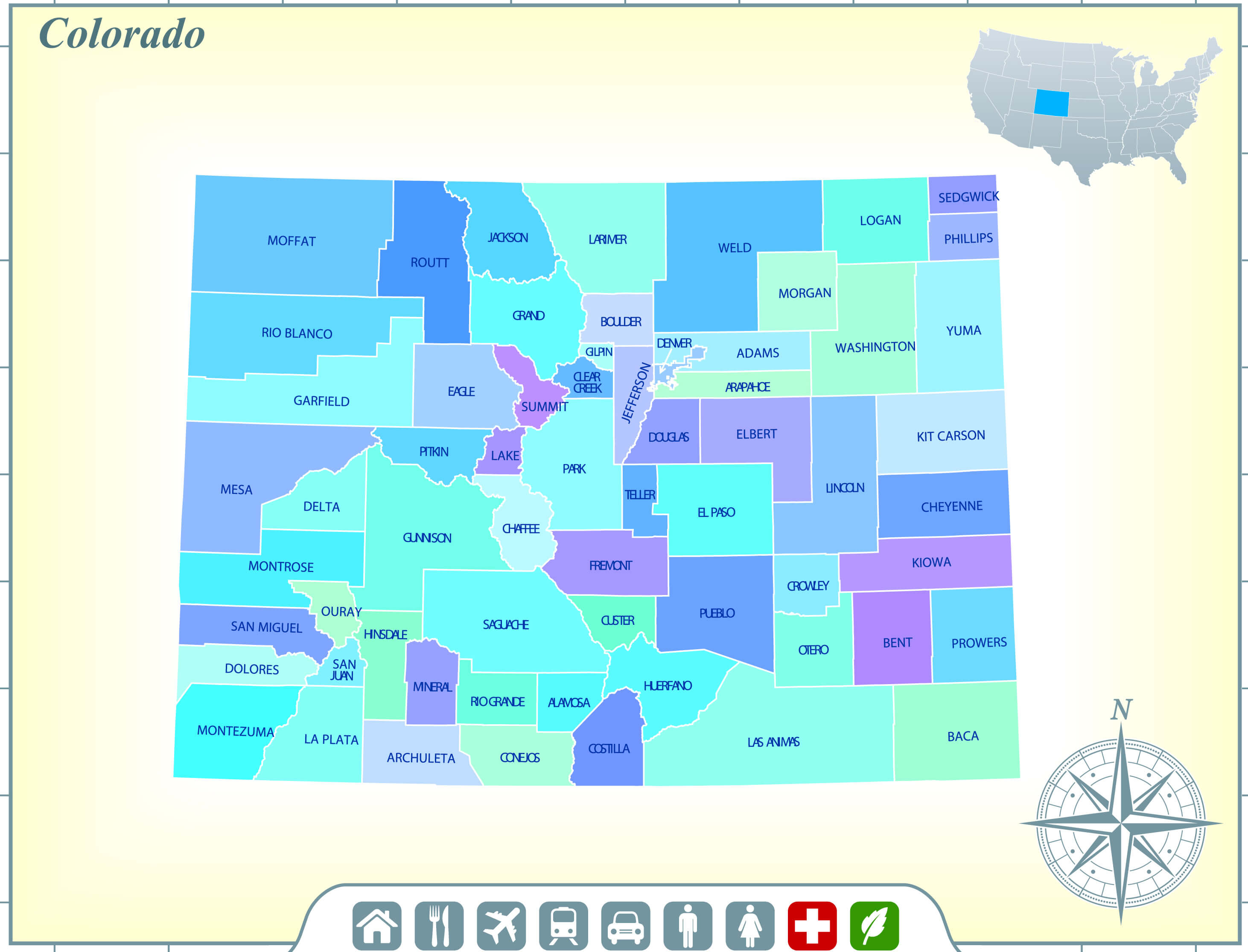
Map of Colorado state
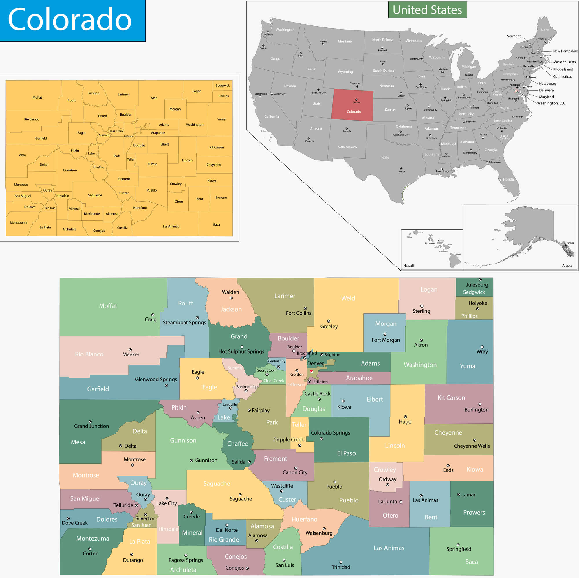
Map of Colorado state designed in illustration with the counties and the county seats.
Map of Colorado
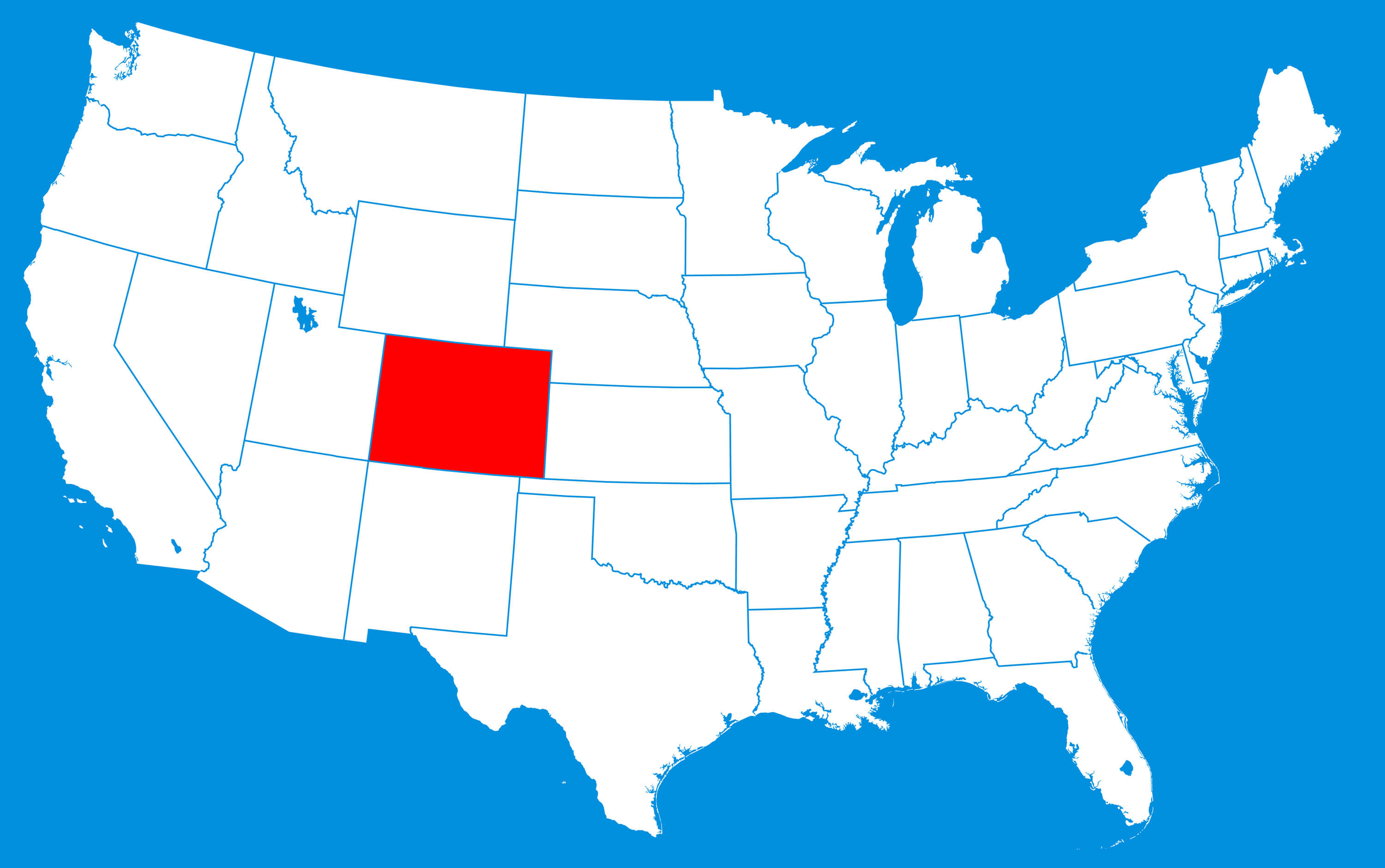
Map of Colorado where is state located in the USA.
Colorado Road Map
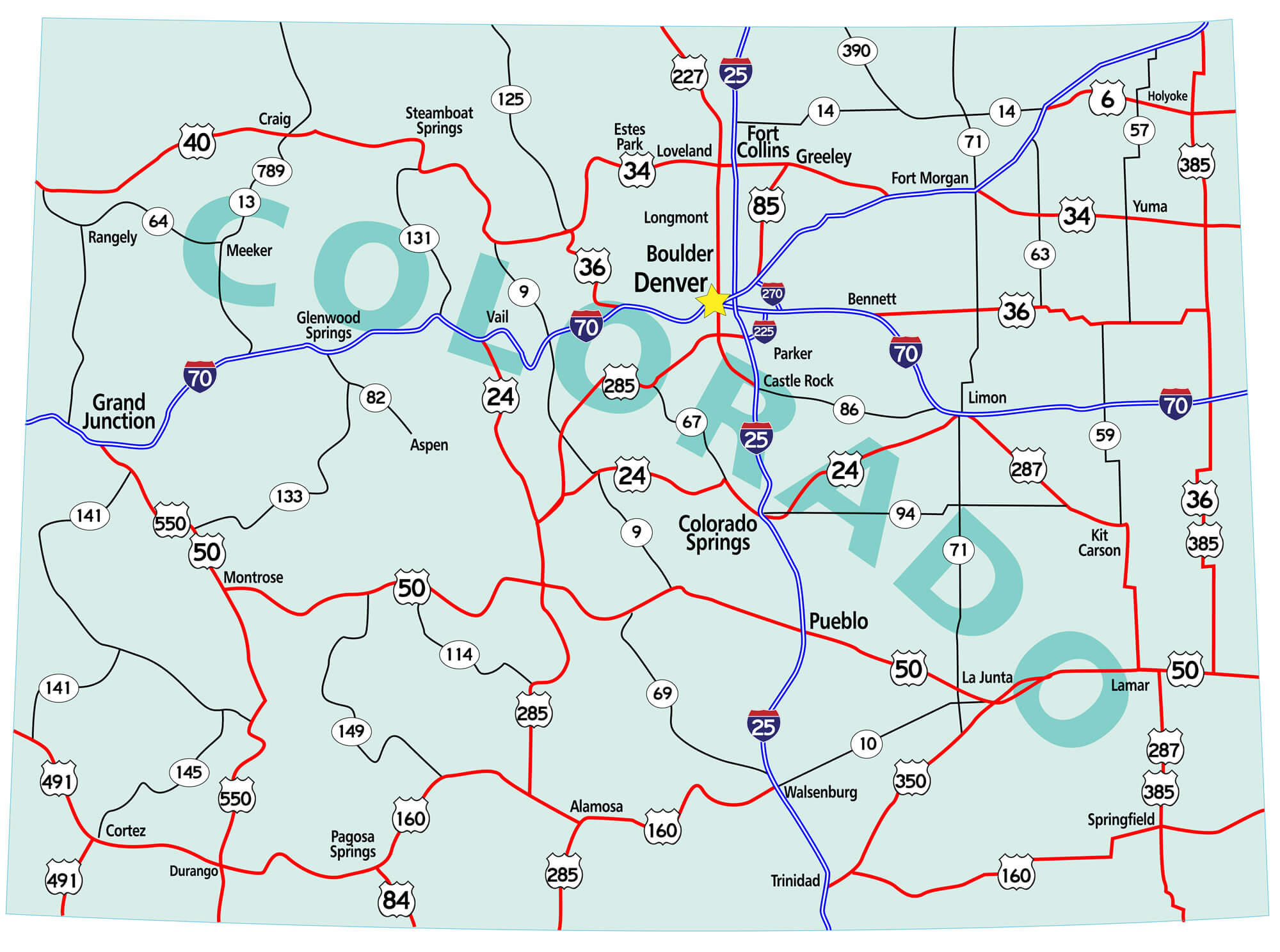
Colorado state road map with Interstates, U.S. Highways and state roads. Vector illustration.
Colorado Maps and Photos
- Please Click for more Colorado Map
- Please Click for more Info About Map of Colorado
Where is Colorado on the United States Map?
Show Google map, satellite map, where is the country located.
Get directions by driving, walking, bicycling, public transportation and travel with street view.