A collection of Arizona Maps; View a variety of Arizona physical, political, administrative, relief map, Arizona satellite image, higly detalied maps, blank map, Arizona Arizona and earth map, Arizona’s regions, topography, cities, road, direction maps and atlas.
A Collection of Arizona Maps
Map of Arizona
 Map of Arizona state designed in illustration with the counties and the county seats.
Arizona Road Map
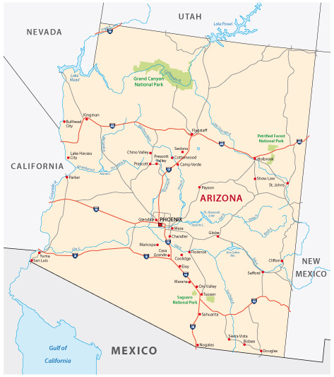
Arizona Road Map, United State of America, USA.
Phoenix, Arizona area map
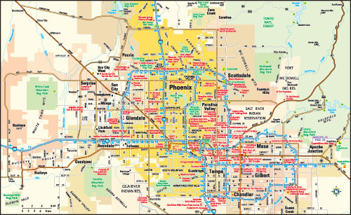
Phoenix, Arizona area map, United States.
Arizona state road map with Interstates
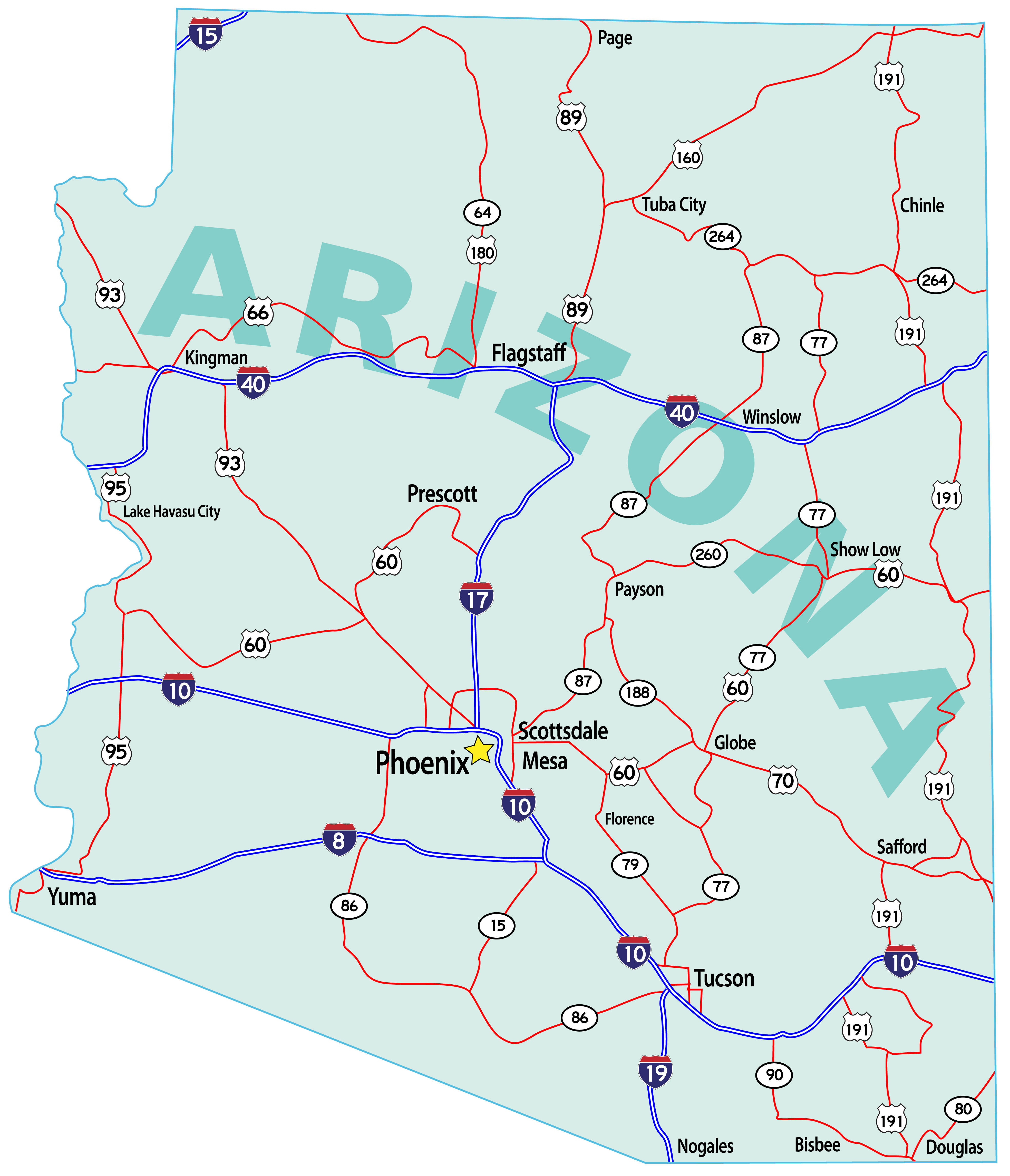
Arizona state road map with Interstates, U.S. Highways and state roads.
Arizona Map 1900, USA
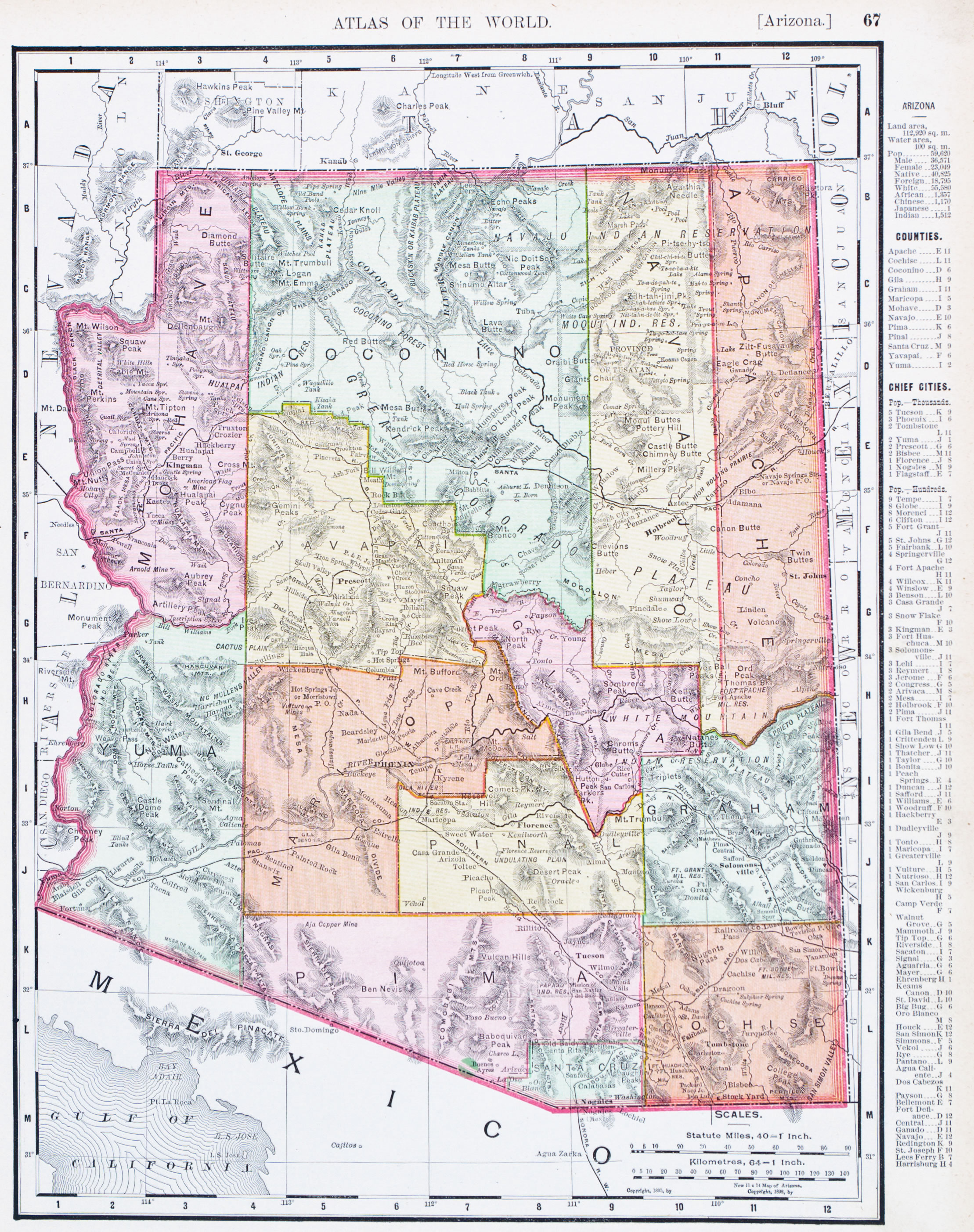
A map of Arizona, USA, from Spofford’s Atlas of the World, printed in the United States in 1900.
Brief information about Arizona
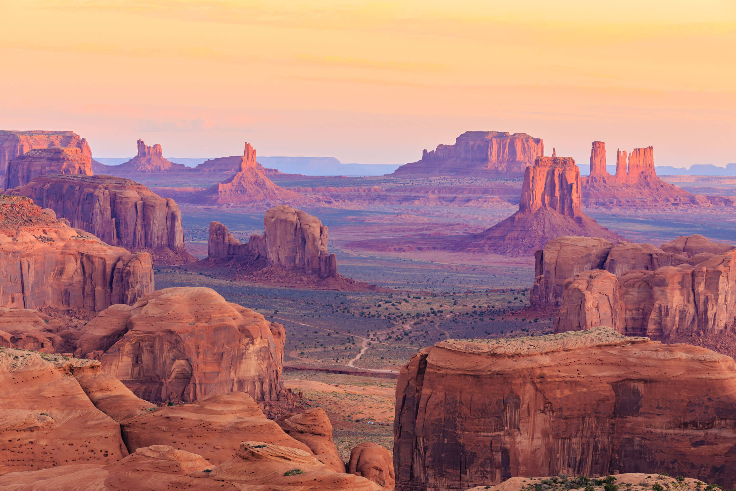
Arizona, known as the Grand Canyon State, is located in the southwestern region of the United States. Bordered by California, Nevada, Utah, Colorado, New Mexico and Mexico, it is a crossroads of diverse cultures and landscapes. The state is famous for its arid deserts, scenic mountains and unique natural formations, with the Grand Canyon being one of the world’s most iconic attractions. Arizona became the 48th state of the United States in 1912 and is rich in Native American history, with many tribes, including the Navajo, Apache and Hopi, having deep-rooted ties to the land. The state capital, Phoenix, is one of the fastest growing cities in the US, known for its year-round warm weather and vibrant metropolitan lifestyle.
Arizona’s economy is driven by a combination of tourism, technology and natural resources. The state has a significant mining industry, particularly for copper, and a growing aerospace and defence sector. Agriculture is also important, with cotton, cattle and citrus being the main products. The population is diverse and has grown rapidly in recent decades, attracting people from across the US and abroad for its sunny climate and job opportunities. Culturally, Arizona is a blend of Western and Native American traditions, reflected in its festivals, art and cuisine. This blend makes Arizona a unique state with a rich heritage and an attractive destination for residents and visitors alike..
Where is located Arizona on the US Map
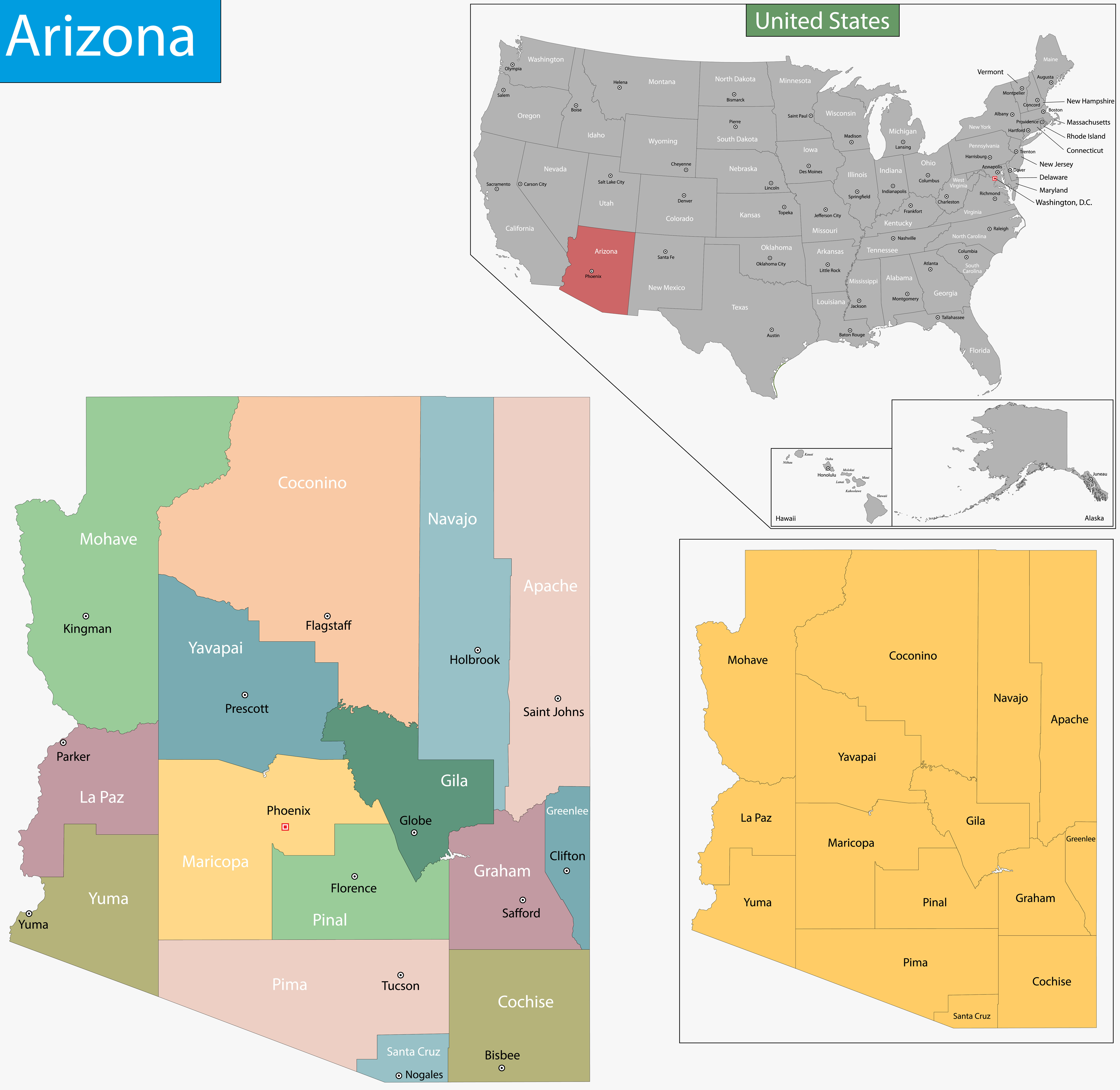
Arizona is located in the southwestern part of the United States, sandwiched between California to the west and New Mexico to the east. It also borders Nevada to the northwest, Utah to the north and the Mexican state of Sonora to the south, making it a key link between the US and Mexico. This strategic location places Arizona at the heart of the American Southwest, a region known for its vast deserts, red rock formations and unique landscapes. Arizona is part of the Four Corners region, where it meets Colorado, Utah and New Mexico at a single point, the only place in the US where four states meet.
Arizona is easy to spot on a US map because of its rectangular shape and distinctive geography. The state is known for its arid deserts and dramatic canyons, most famously the Grand Canyon in the northern part of the state. The southern part of Arizona is dominated by the Sonoran Desert, while the northern part has a mix of high plateaus, pine forests and mountainous terrain. The capital, Phoenix, is located in the central part of the state, providing access to both the desert areas in the south and the cooler, mountainous regions in the north. Arizona’s geographical diversity and location make it an important part of the American West, attracting visitors for its natural wonders and cultural richness.
Here are some statistical information about Arizona:
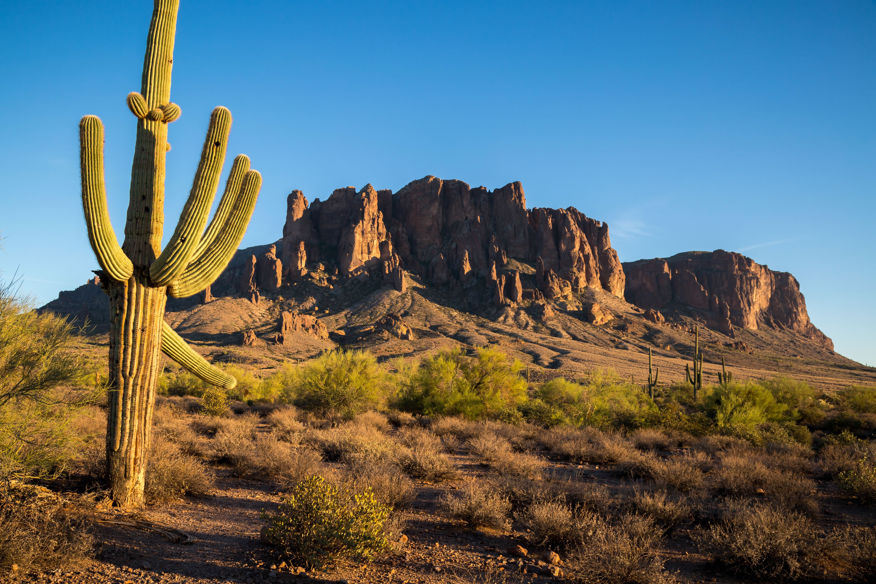 Superstition Mountains in Arizona, US
Arizona’s Population Trend Since 1860
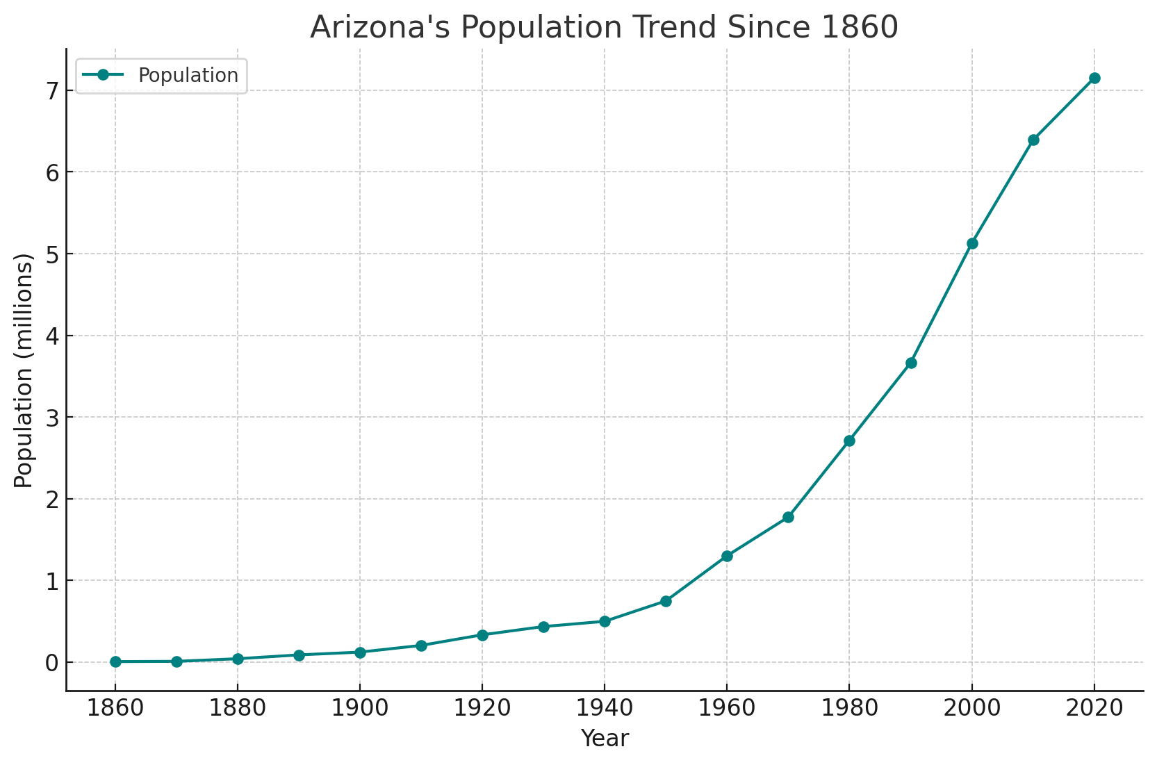 Arizona’s Population Trend Since 1860.
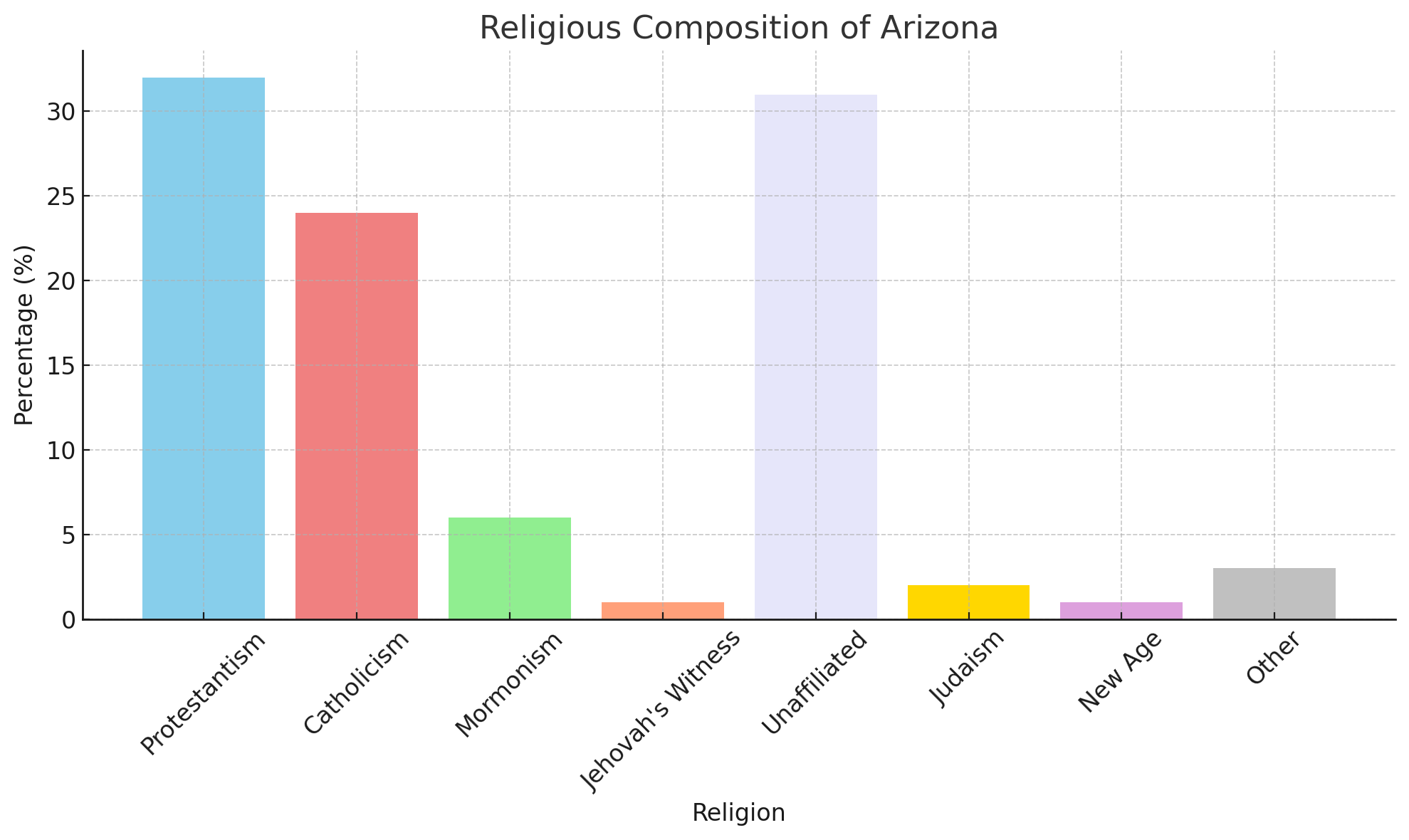
Religious Composition Of Arizona
Arizona Counties and Major Cities
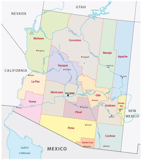 Arizona administrative map showing counties and major cities.
Major Cities and Landmarks in Arizona
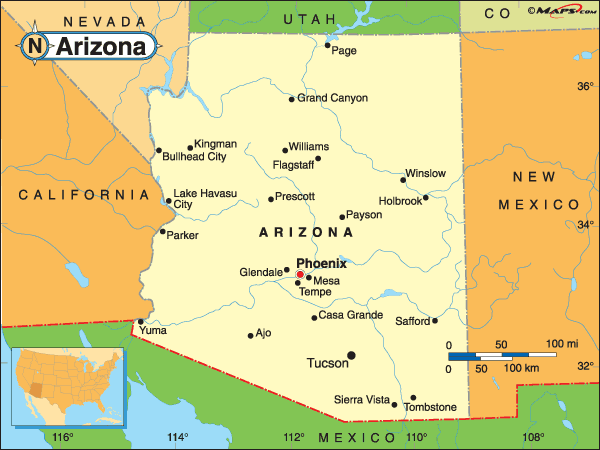 Map of Arizona showing major cities and landmarks
Köppen Climate Types in Arizona
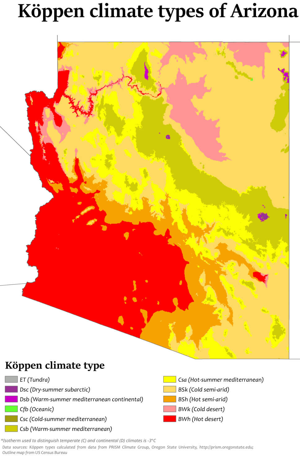 Map of Arizona showing Köppen climate classifications
Arizona Counties Map
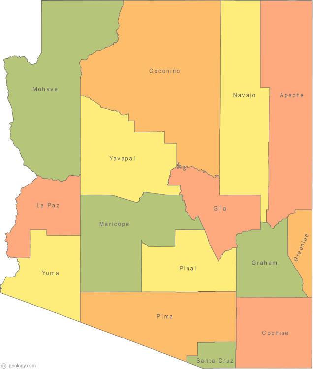 Map of Arizona counties with labeled regions
Arizona Highways and Major Roads Map
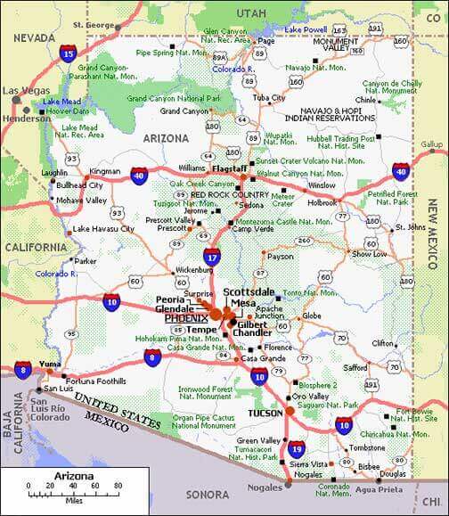 Map of Arizona showing major highways and roads
Arizona Interstate Highways and Cities Map
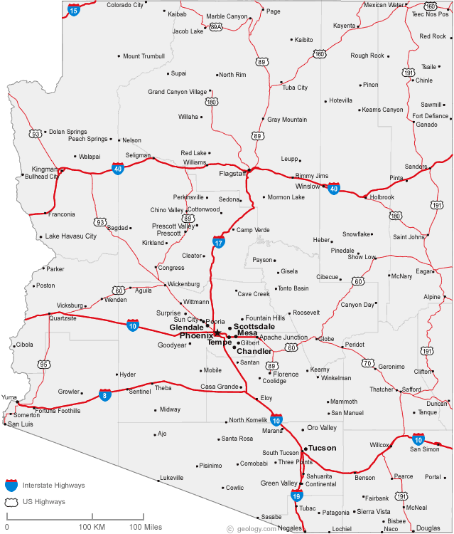 Map of Arizona with interstate highways and major cities.
Population density map of Arizona
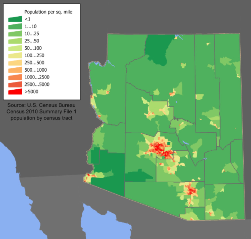 Arizona Population Density by Census Tract.
Major cities and population in Arizona, US
Here is a list of major cities in Arizona, along with their estimated populations:- Phoenix – 1,644,409
- Tucson – 542,629
- Mesa – 528,159
- Chandler – 275,987
- Scottsdale – 268,839
- Glendale – 248,325
- Gilbert – 273,136
- Tempe – 186,498
- Peoria – 194,917
- Surprise – 150,204
Arizona Interstate Map with Major National Parks
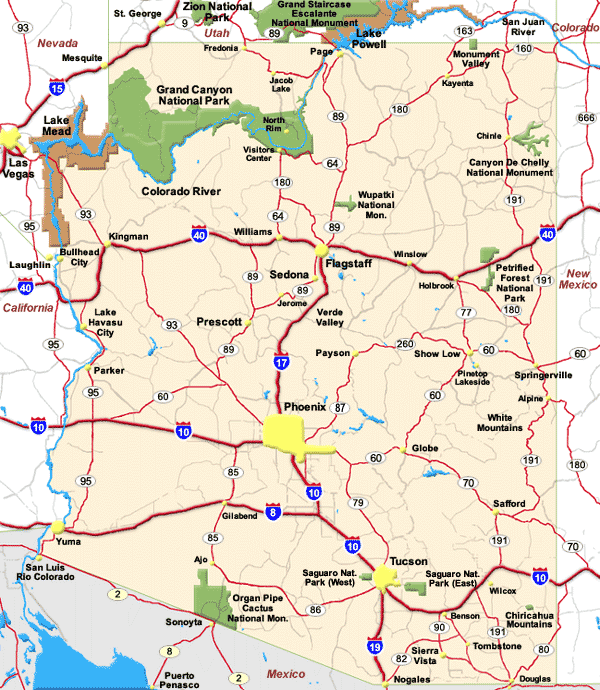 Map of Arizona showing interstates and national parks
Arizona Map from 1900 Showing Early Counties and Landmarks
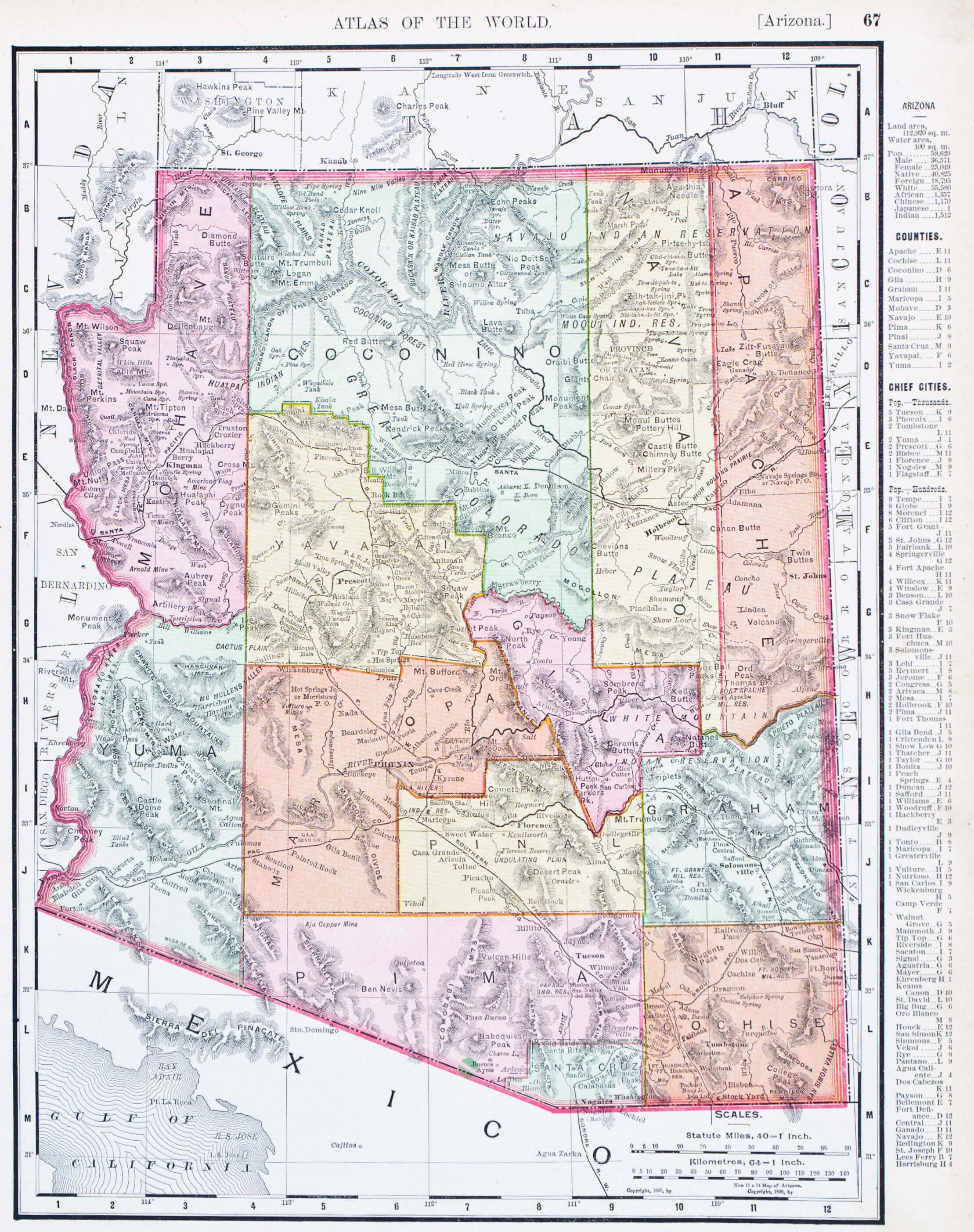 Historical 1900 map of Arizona with counties and landmarks
Detailed Map of Arizona with Cities and National Parks
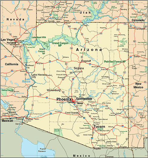 Arizona map showing cities, highways, and national parks in the U.S.
Map of Mexican Territory Including Arizona and Alta California in 1824
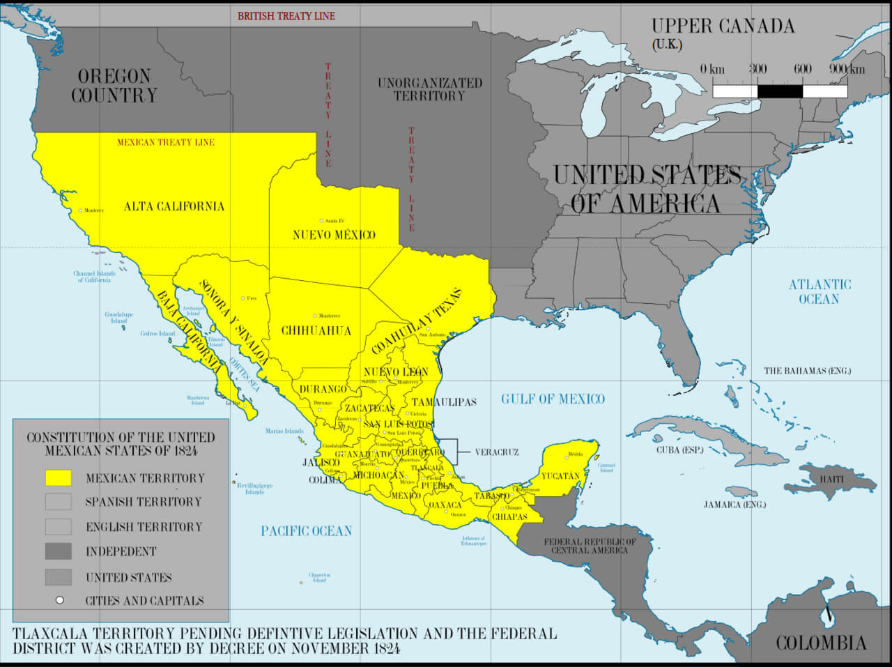 Map showing Mexican territory of Arizona and Alta California in 1824
Arizona Political Map with Major Cities and Highways
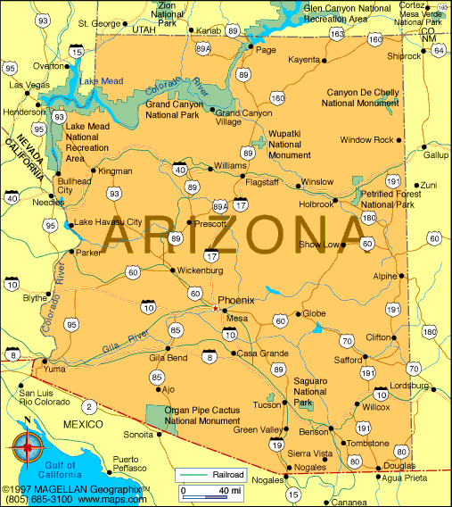 Detailed political map of Arizona showing cities, highways, and landmarks.
Arizona’s Mystical Journey: From Canyons to Cities
Where is Arizona on the United States Map?
Show Google interactive map, satellite map, where is the country located.
Get directions by driving, walking, bicycling, public transportation and travel with street view.
Feel free to explore these pages as well:
- Arizona Map ↗️
- Map of Arizona ↗️
- 2024 US Presidential Election Swing States by Maps ↗️
- Arizona’s US Presidential Election: 2024 Predictions and a Look Back at the 2020 Swing ↗️
- The US presidential election in Georgia: Predictions for 2024 and a look back at the swing in 2020 ↗️
- Chandler Chronicles: Unveiling the Desert Jewel of Arizona ↗️
- Arizona’s Hidden Wonders: A Journey Through the Grand Canyon State ↗️
- New Mexico Map ↗️
- California Map ↗️
- Texas Map ↗️
- New York Map ↗️
- Florida Map ↗️
- Illinois Map ↗️
- Pennsylvania Map ↗️
- Ohio Map ↗️
- Michigan Map ↗️
- Georgia Map ↗️
- New Jersey Map ↗️
- North Carolina Map ↗️
- Virginia Map ↗️
- Massachusetts Map ↗️
- Indiana Map ↗️
- Tennessee Map ↗️
- Arizona Map ↗️
- Missouri Map ↗️
- Maryland Map ↗️
- Washington Map ↗️
- Minnesota Map ↗️
- Colorado Map ↗️
- Alabama Map ↗️
- Louisiana Map ↗️
- South Carolina Map ↗️
- Kentucky Map ↗️
- Oregon Map ↗️
- Oklahoma Map ↗️
- Connecticut Map ↗️
- Iowa Map ↗️
- Mississippi Map ↗️
- Arkansas Map ↗️
- Kansas Map ↗️
- Utah Map ↗️
- Nevada Map ↗️
- District of Columbia Map ↗️
- United States Map ↗️
- Map of United States ↗️
- North America Map ↗️
- Map of North America ↗️
