- Advertisement -
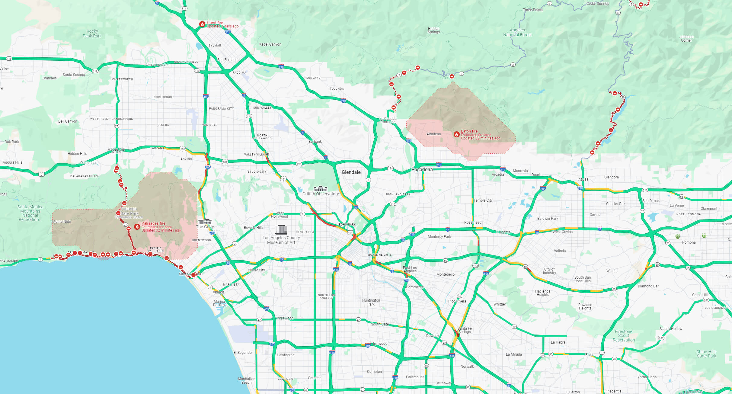
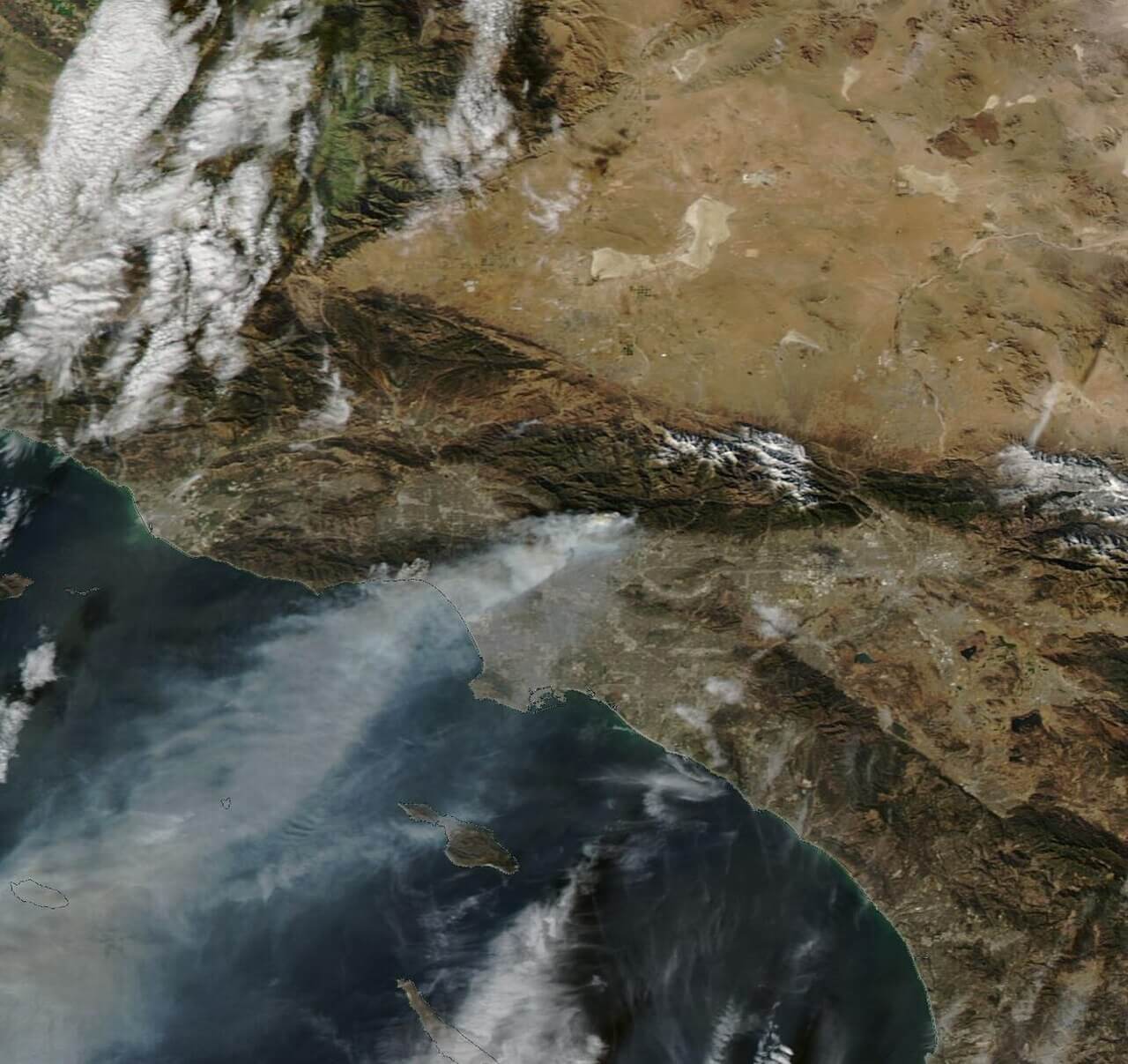
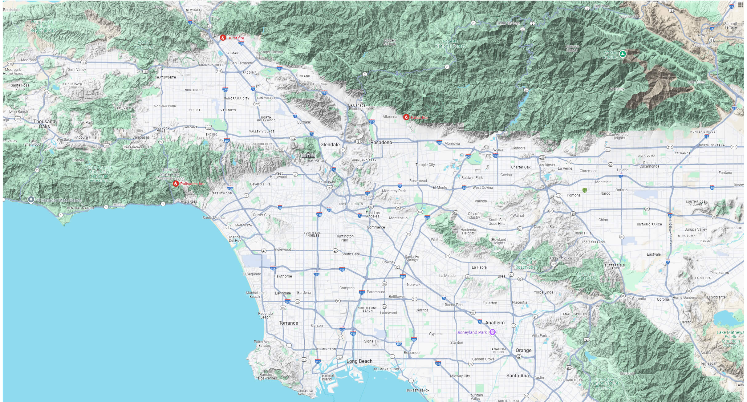
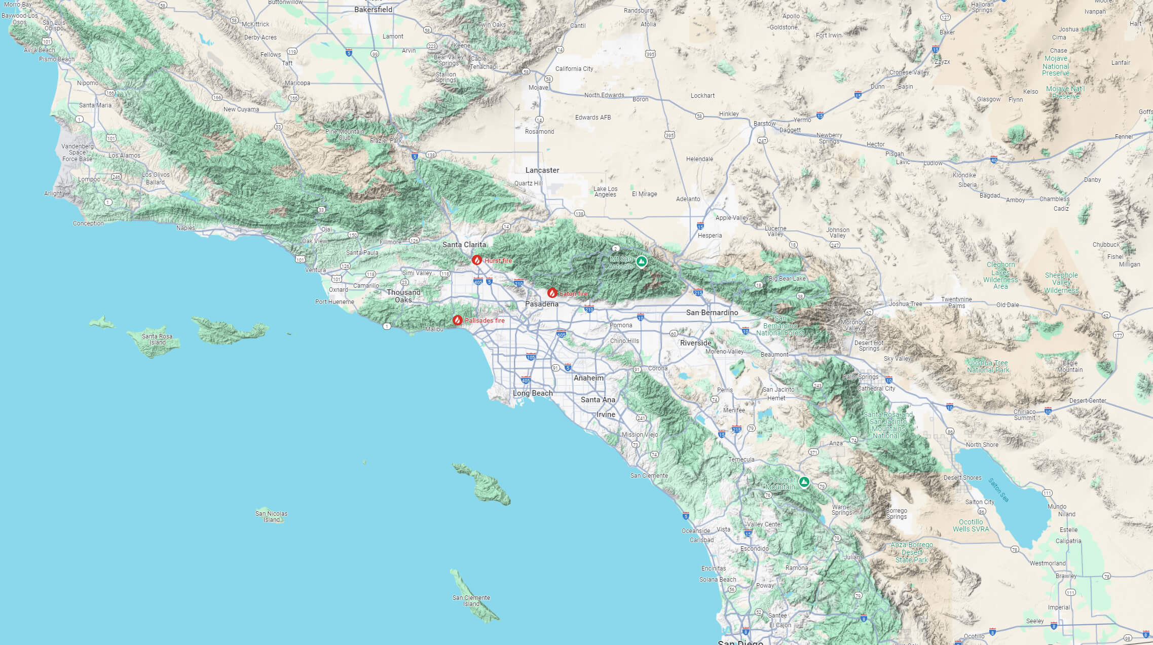
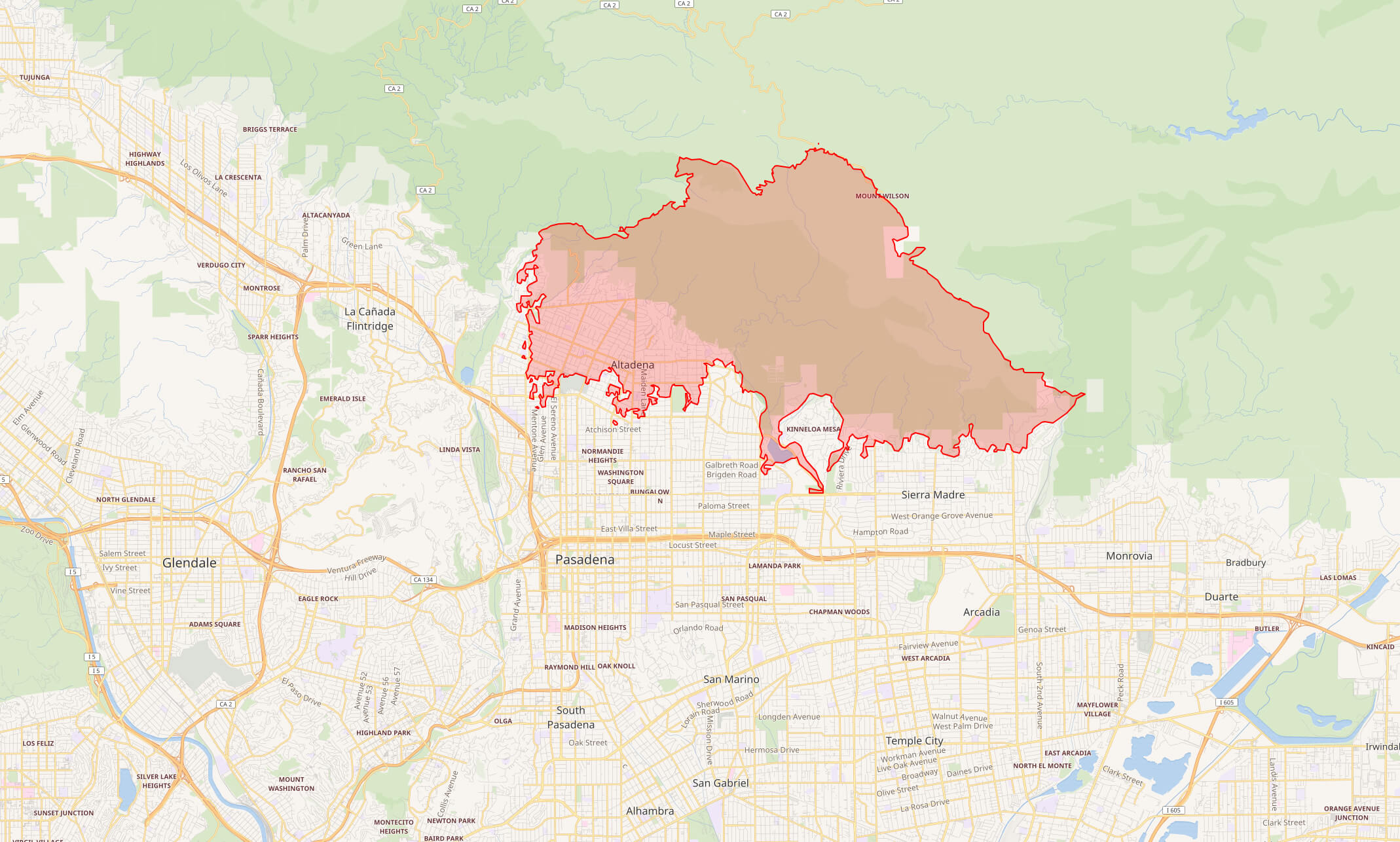
The Eaton Fire is an ongoing wildfire currently burning in the Altadena area of Los Angeles County, Southern California. It ignited on the evening of January 7, 2025, in Eaton Canyon within the San Gabriel Mountains. By January 8, 2025, at 10:36 a.m. PST, the fire had grown to approximately 14,117 acres (5,713 ha). Fueled by the powerful Santa Ana winds, it is one of several active fires, alongside the larger Palisades Fire. As of January 12, 2025, the Eaton Fire has tragically become the fifth deadliest fire in California history, claiming 16 lives.
Eaton fire 2025 damage
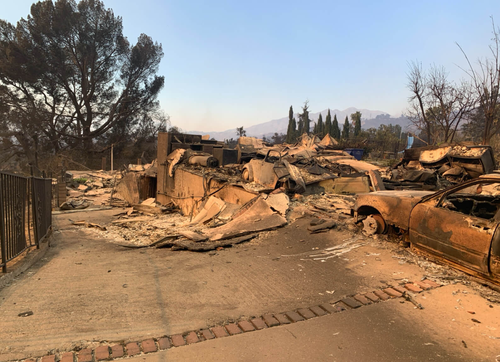 The Eaton Fire, which ignited on January 7, 2025, in Eaton Canyon near Altadena, has caused significant devastation in Los Angeles County. As of January 13, the fire has consumed over 14,000 acres and is approximately 27% contained.
Eaton fire 2025 map
 The blaze has destroyed numerous structures, including the historic Pasadena Jewish Temple and Center, and led to mandatory evacuations in Altadena, Pasadena, and surrounding areas.
Eaton fire 2025 starting point LA
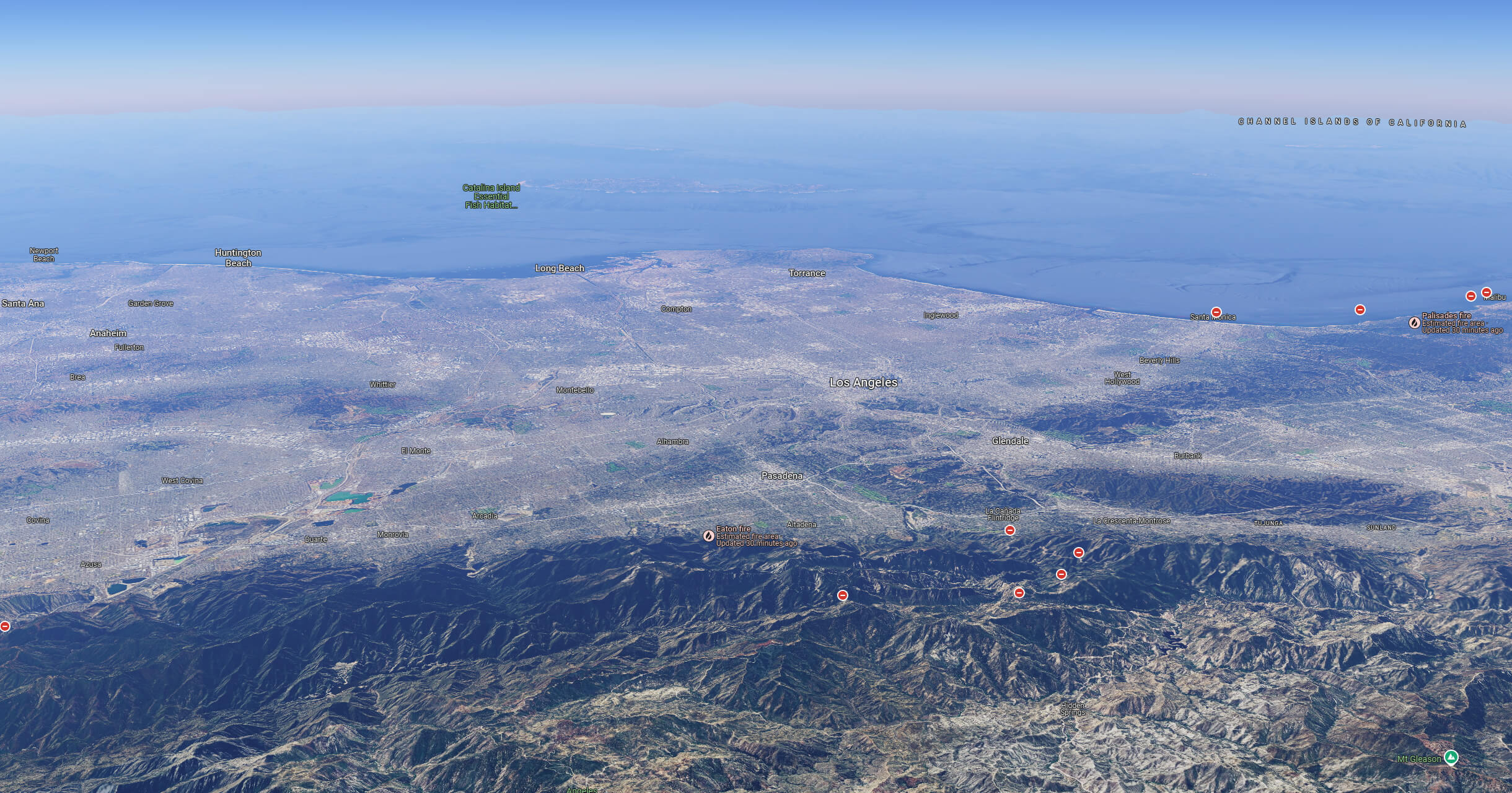
Eaton Fire satellite view january 8th 2025
Eaton wildfire terrain map
La wildfire 2025 Eaton map
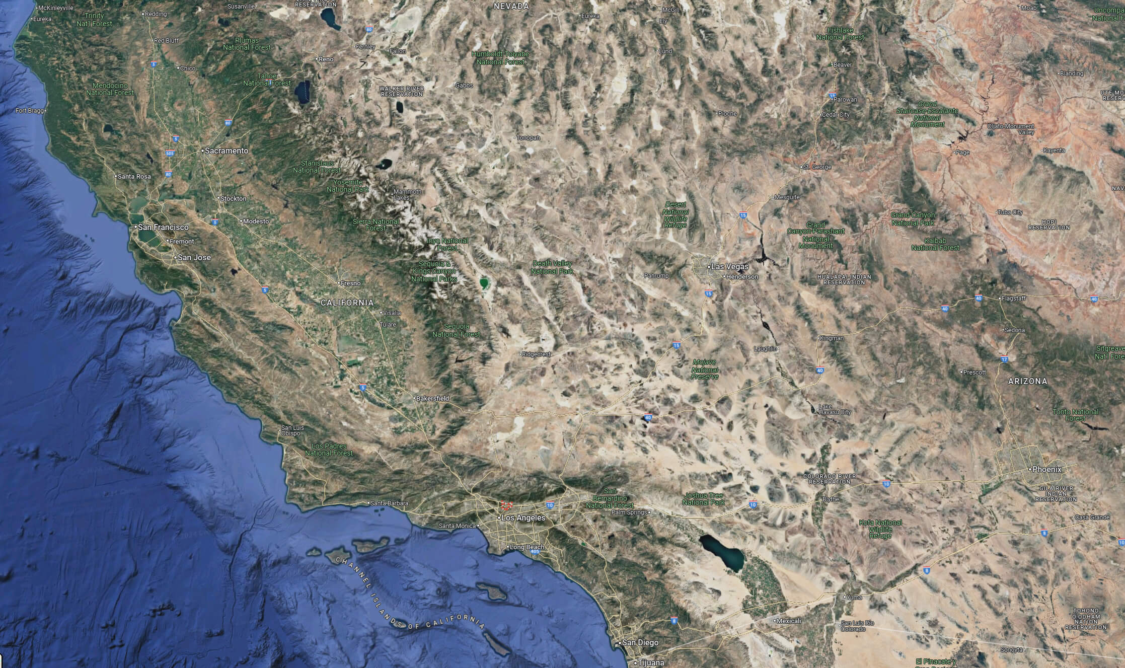
Map of Eaton fire 2025 california
Where is located Eaton on California map
Eaton location on California satellite map
Before Eaton fire aerial view map
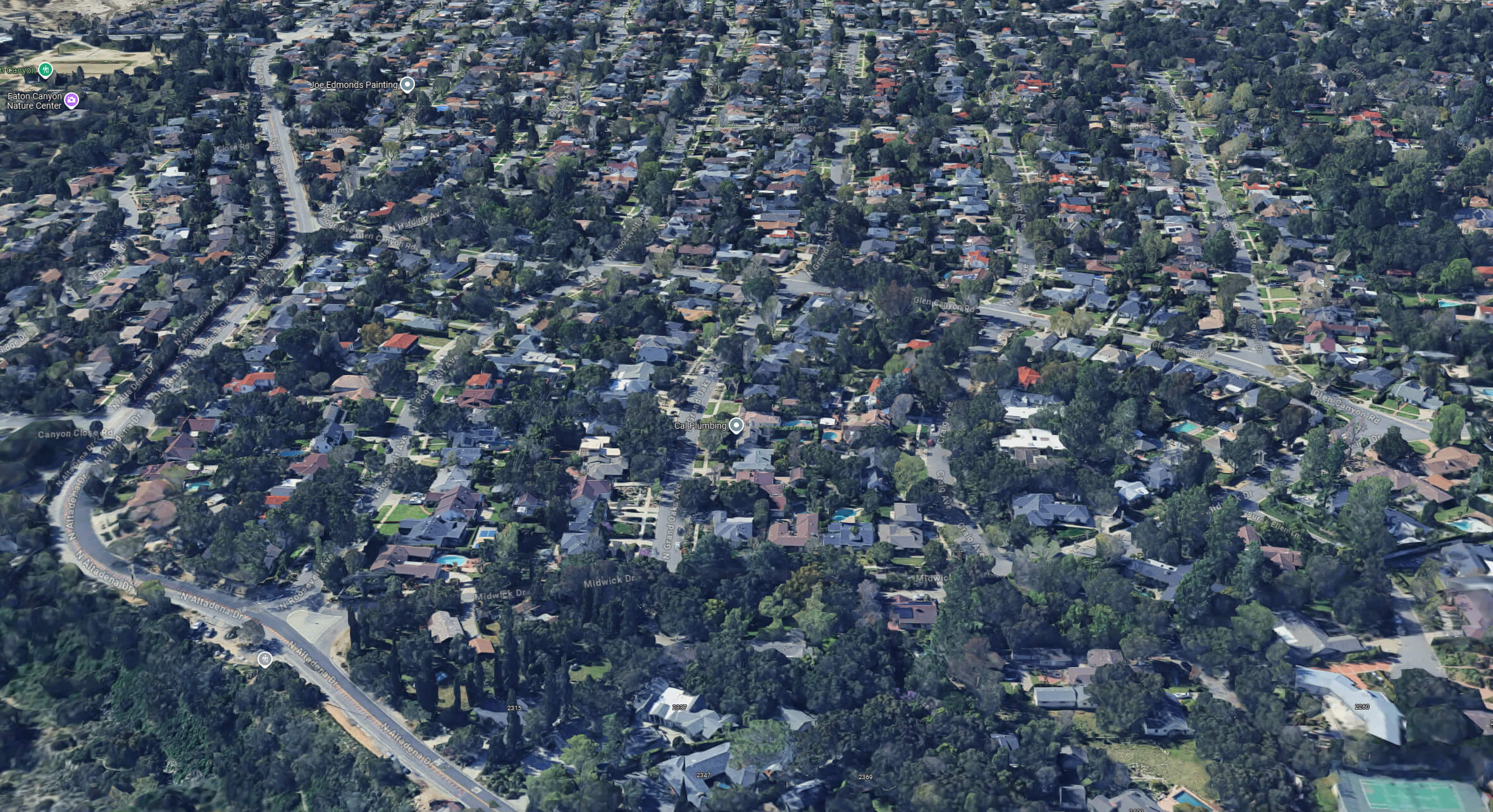
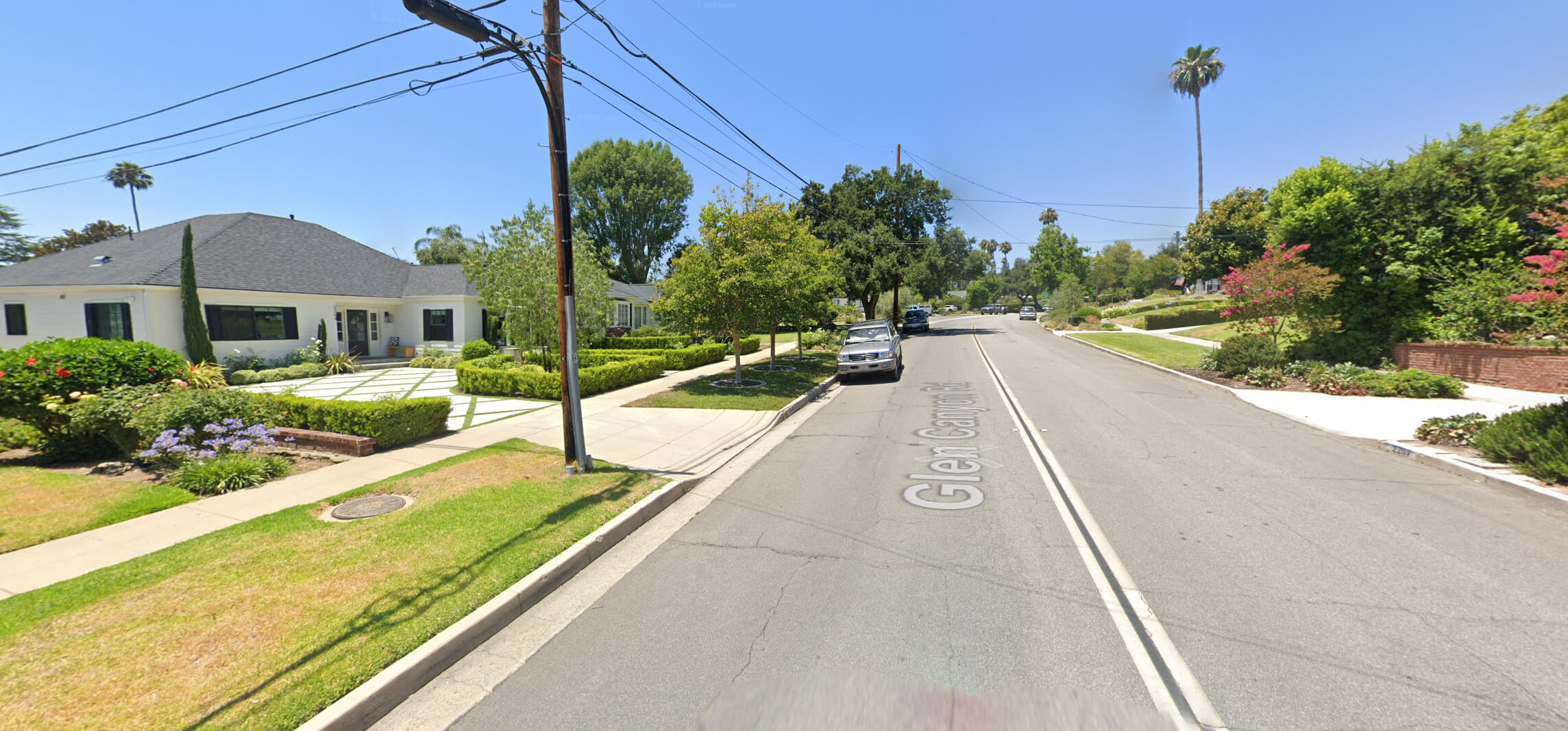
Eaton street view Map lon angeles
Where is Eaton on Los Angeles Map?
Show Google map, satellite map, where is the country located.
Get directions by driving, walking, bicycling, public transportation and travel with street view.
Where is California in the US and and Cities Map of California – @WorldGuide Youtube
Feel free to explore these pages as well:
- California Map ↗️
- California County Map ↗️
- California Physical Map ↗️
- California Political Map ↗️
- Map of California↗️
- California Cities Map ↗️
- California Road Map ↗️
- California Population Map ↗️
- A Collection of California Maps ↗️
- Los Angeles Map ↗️
- LA Fires January 2025 ↗️
- Los Angeles Wildfires in Map ↗️
- Palisades Map in Los Angeles ↗️
- Malibu Map in Los Angeles ↗️
- San Fernando Map in Los Angeles ↗️
- Discovering Los Angeles ↗️
- Discover the California: A Vibrant Journey through Golden State ↗️
- Discovering Bakersfield: The Heart of California’s Central Valley ↗️
- Anaheim: California’s Hidden Gem ↗️
- Guide to Los Angeles’ Top 10 Attractions ↗️
- Discover Chula Vista: A Hidden California Gem with Rich Culture and Stunning Views ↗️
- Advertisement -