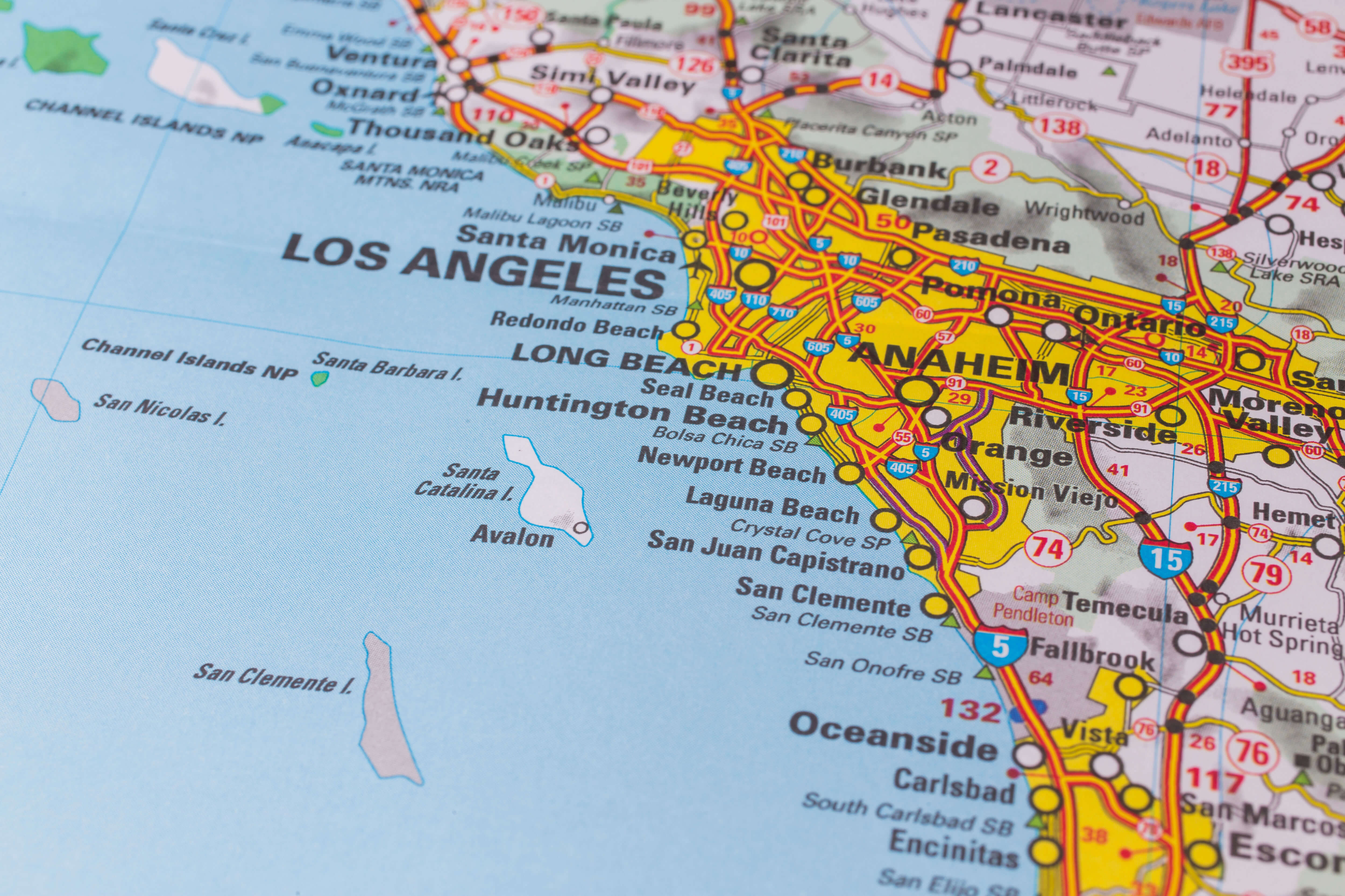
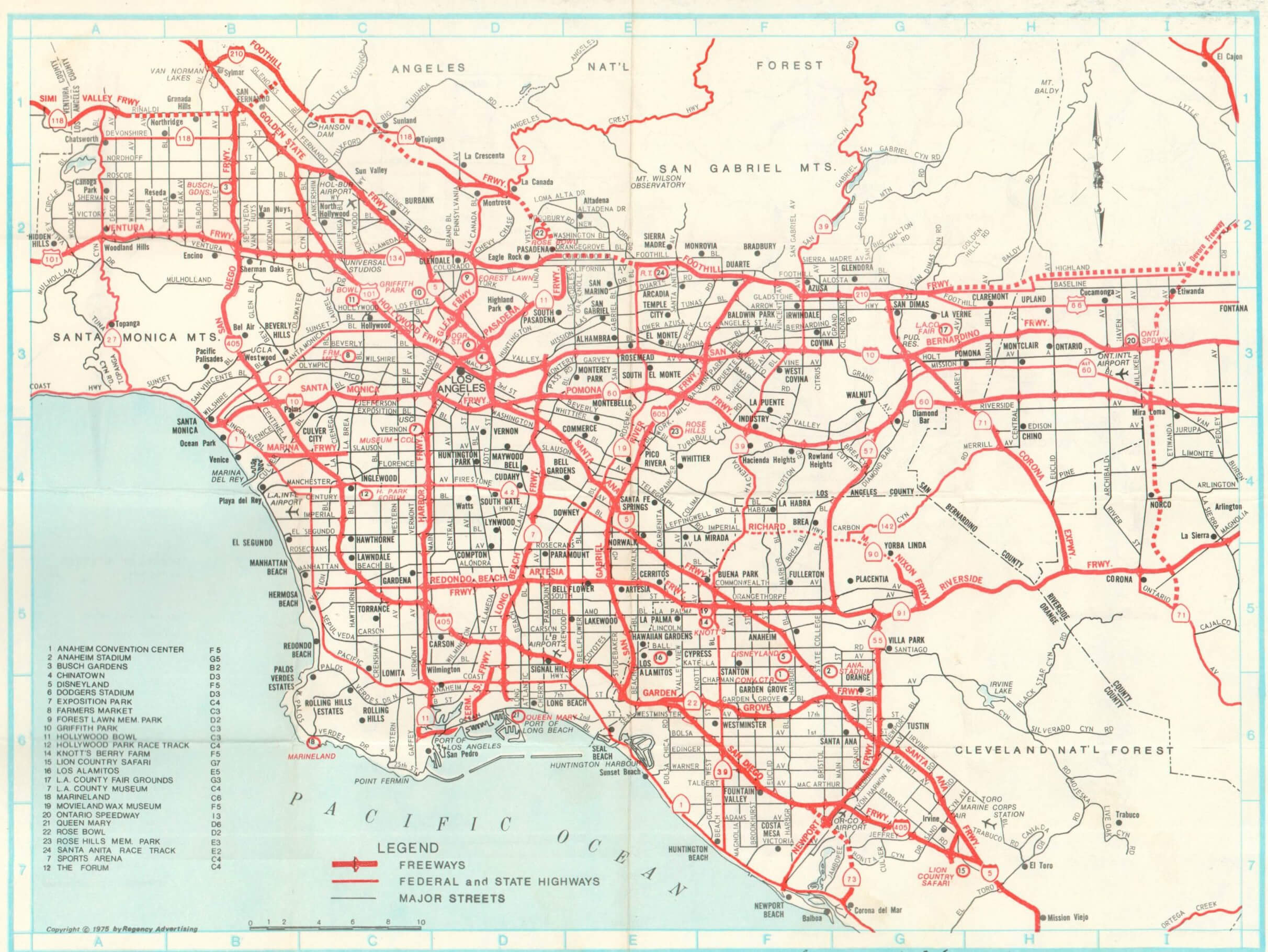
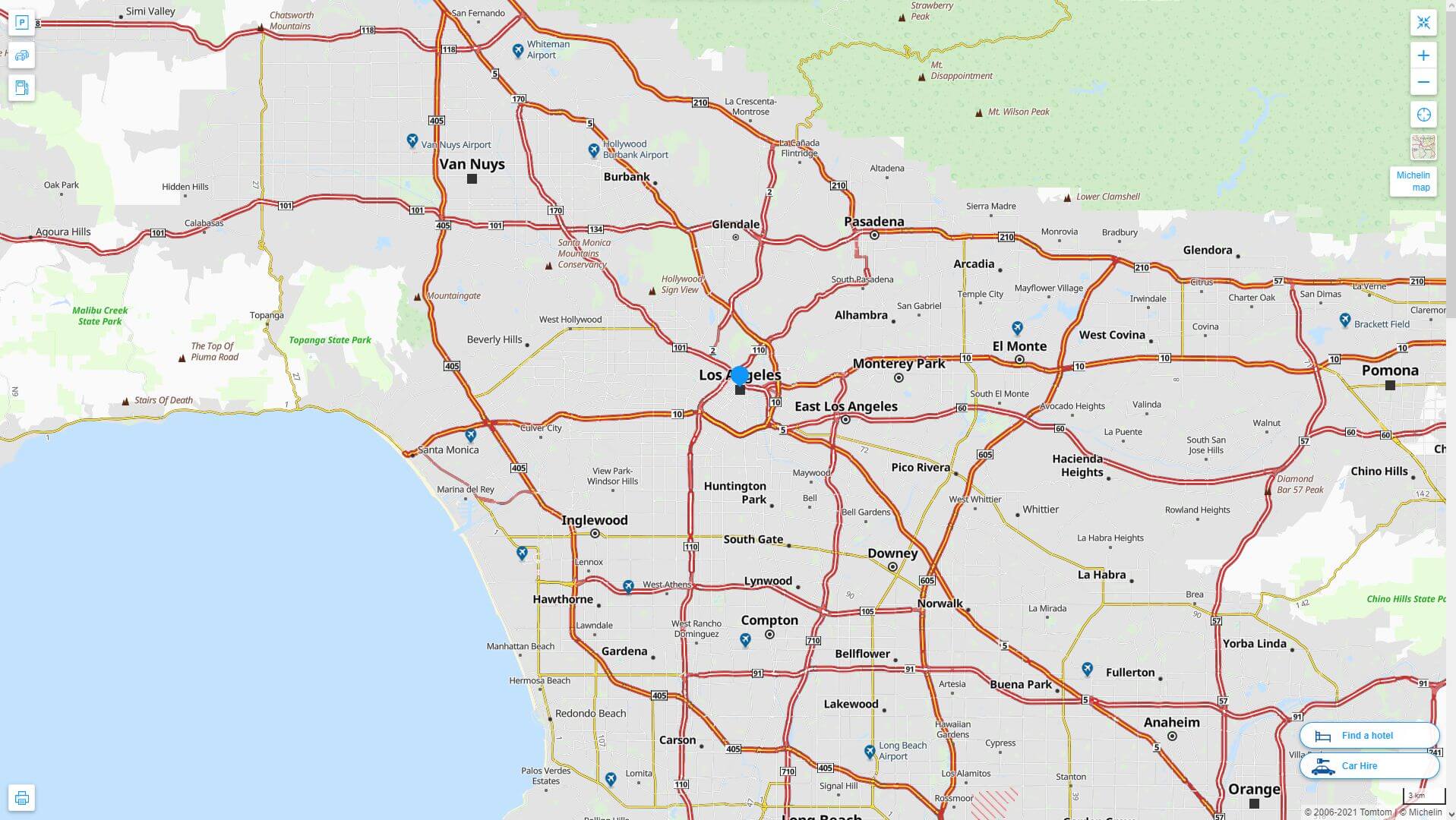
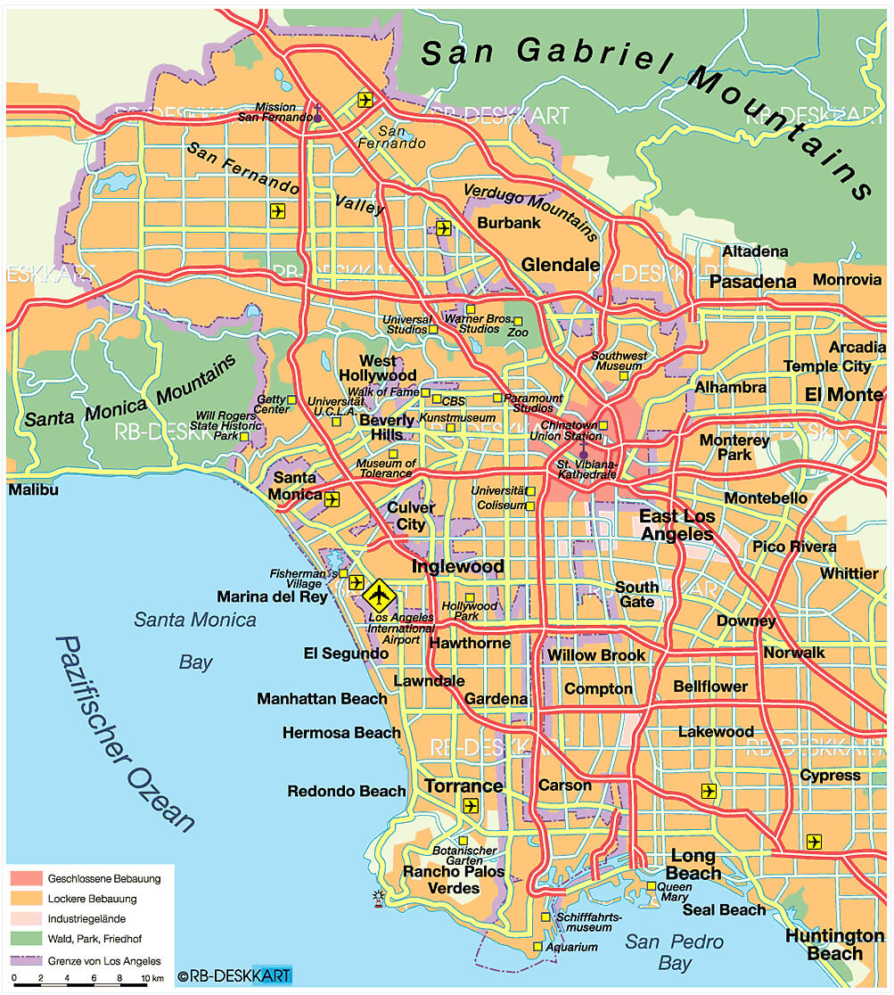
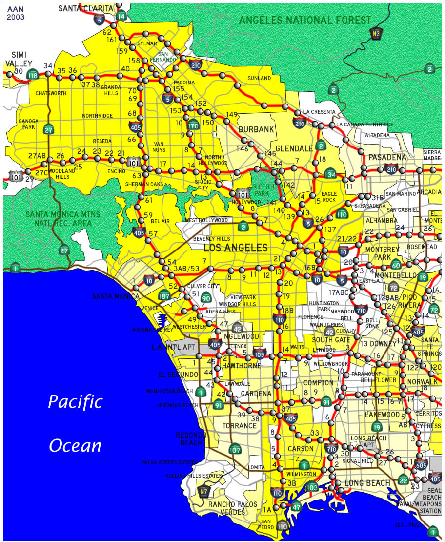
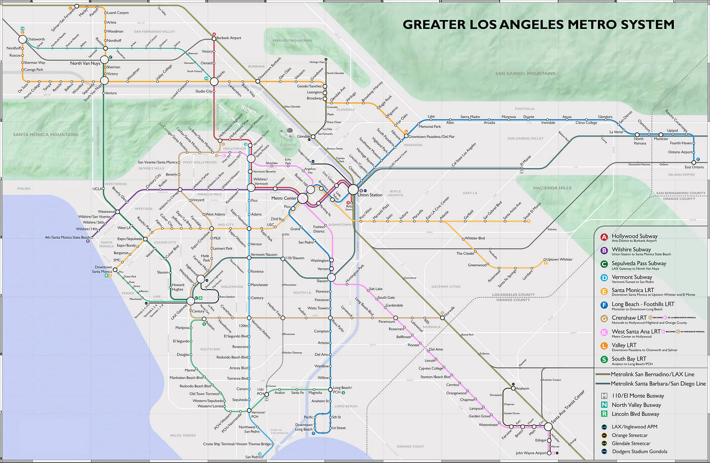
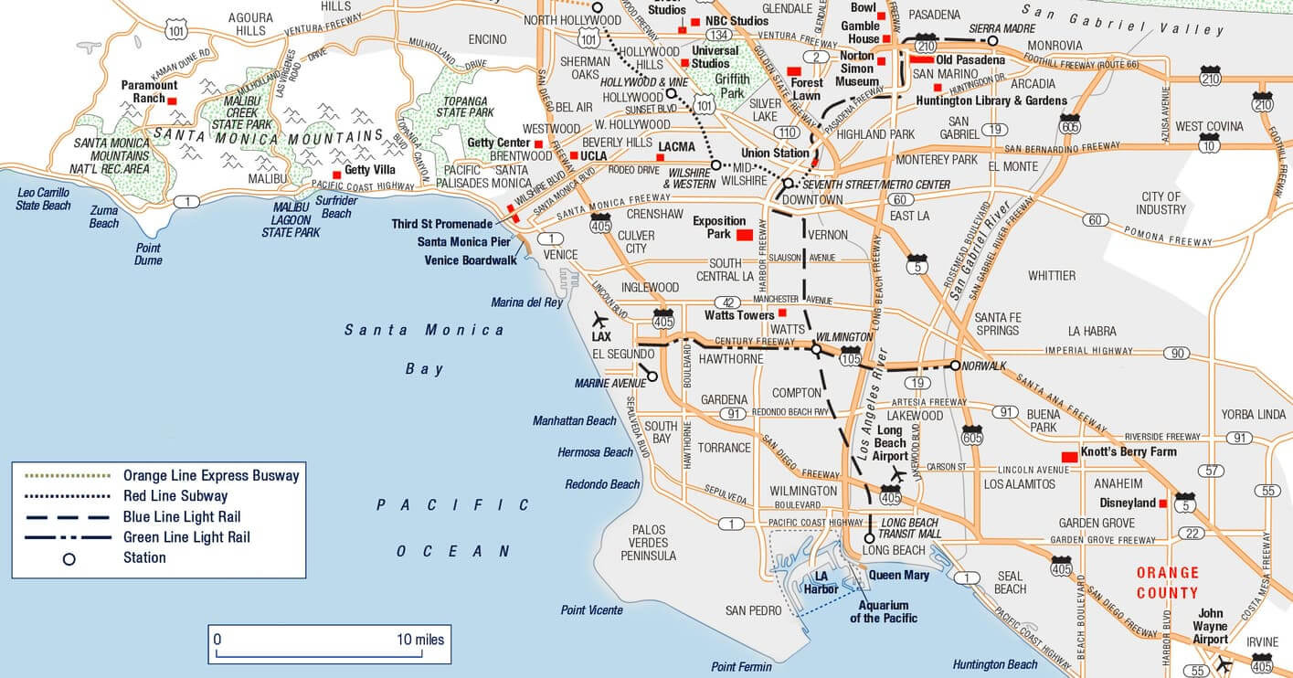
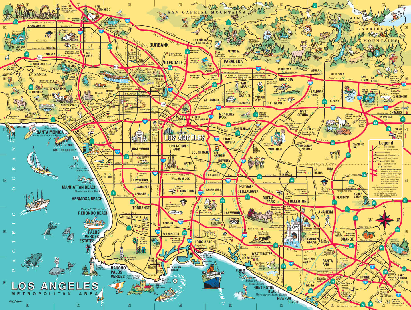
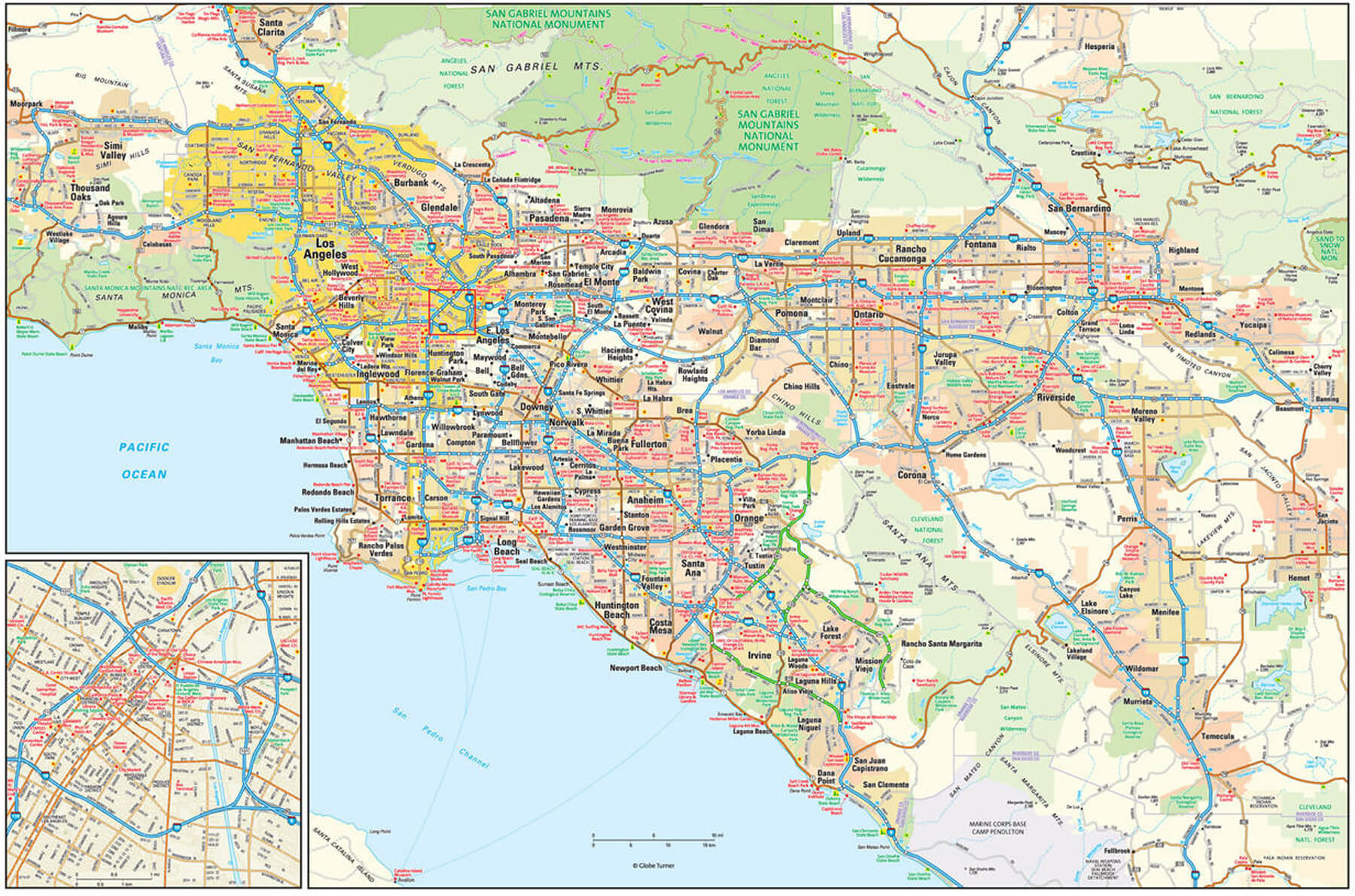
Los Angeles is a sprawling metropolis with a diverse geography and intricate infrastructure that is best explored through a variety of specialised maps. The Metro map shows the extensive transit system that connects key neighbourhoods such as Hollywood, Downtown and Santa Monica. The county map highlights the boundaries of Los Angeles County within California, providing context for its massive scale. A street map reveals the city’s iconic grid layout, while the highway map focuses on the extensive freeway network, including the famous I-405 and Route 101.
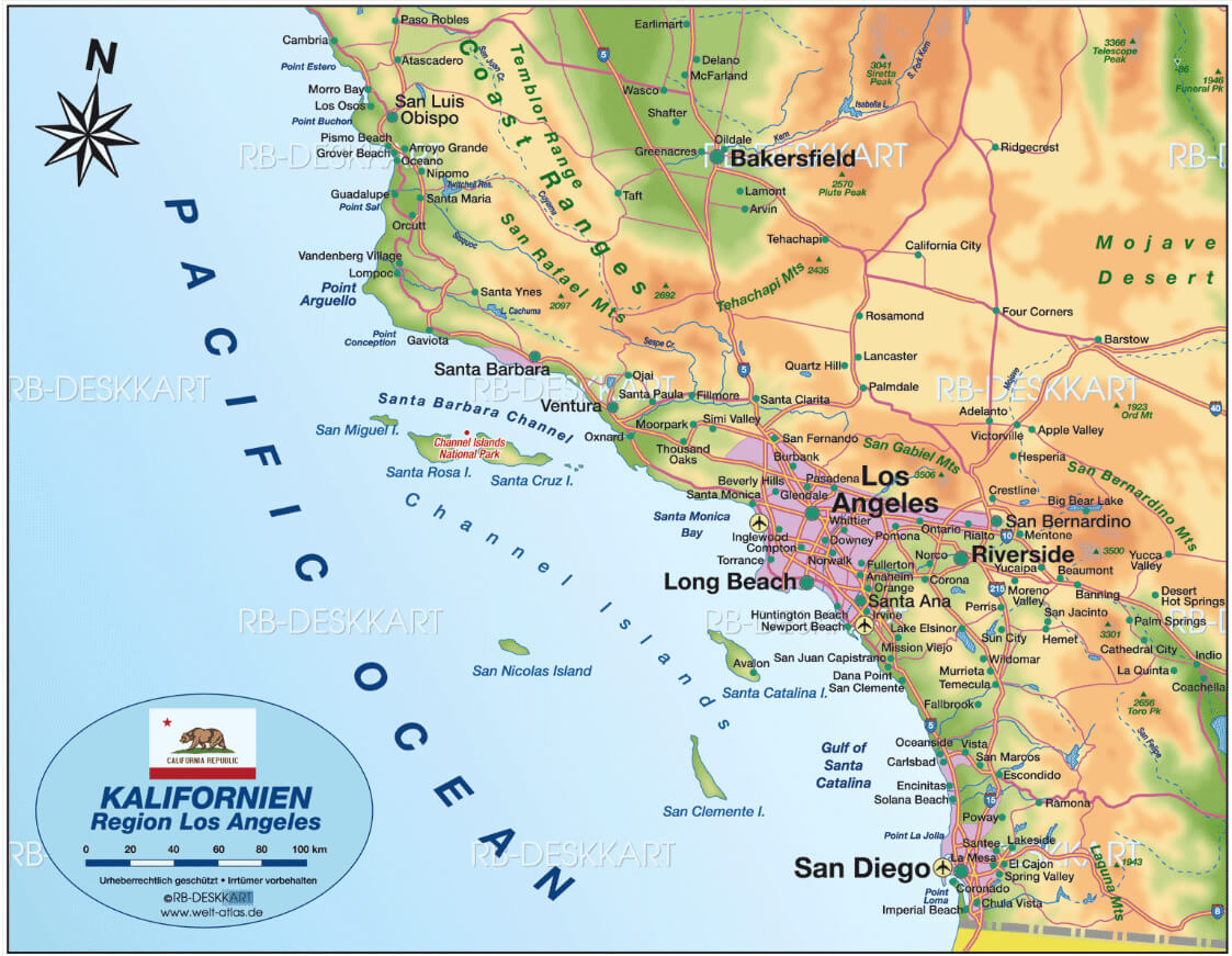
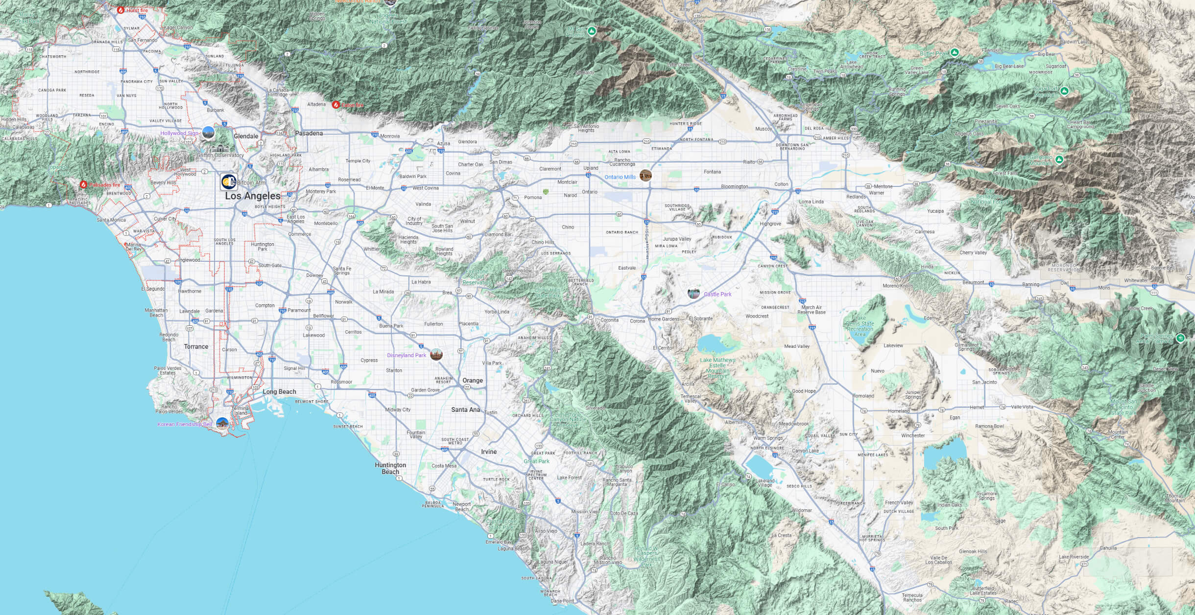
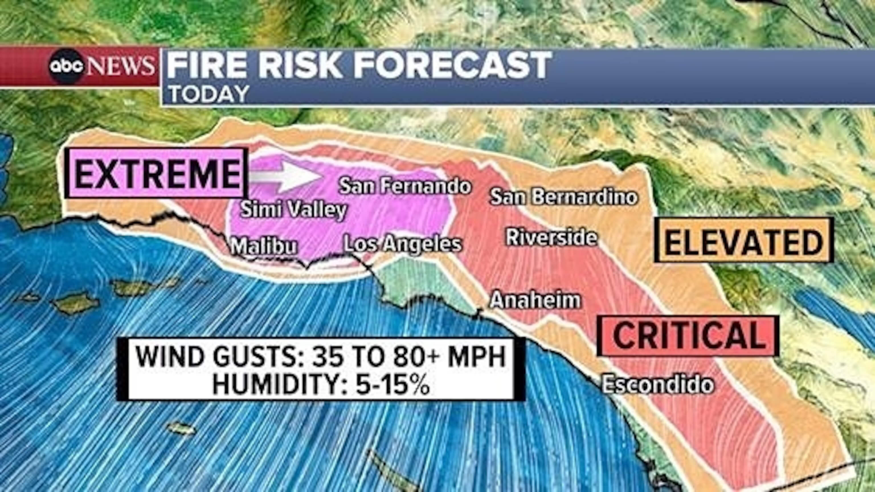
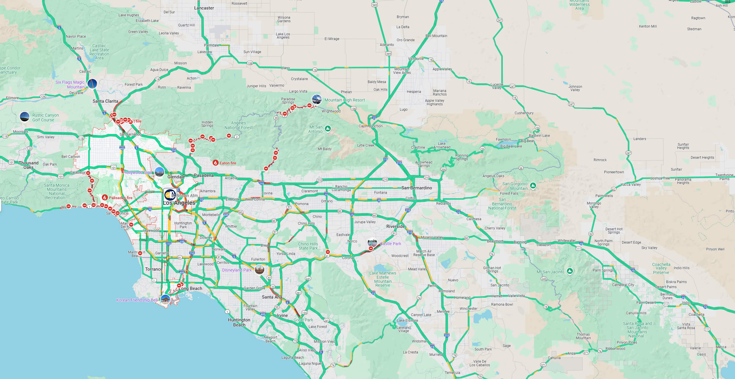
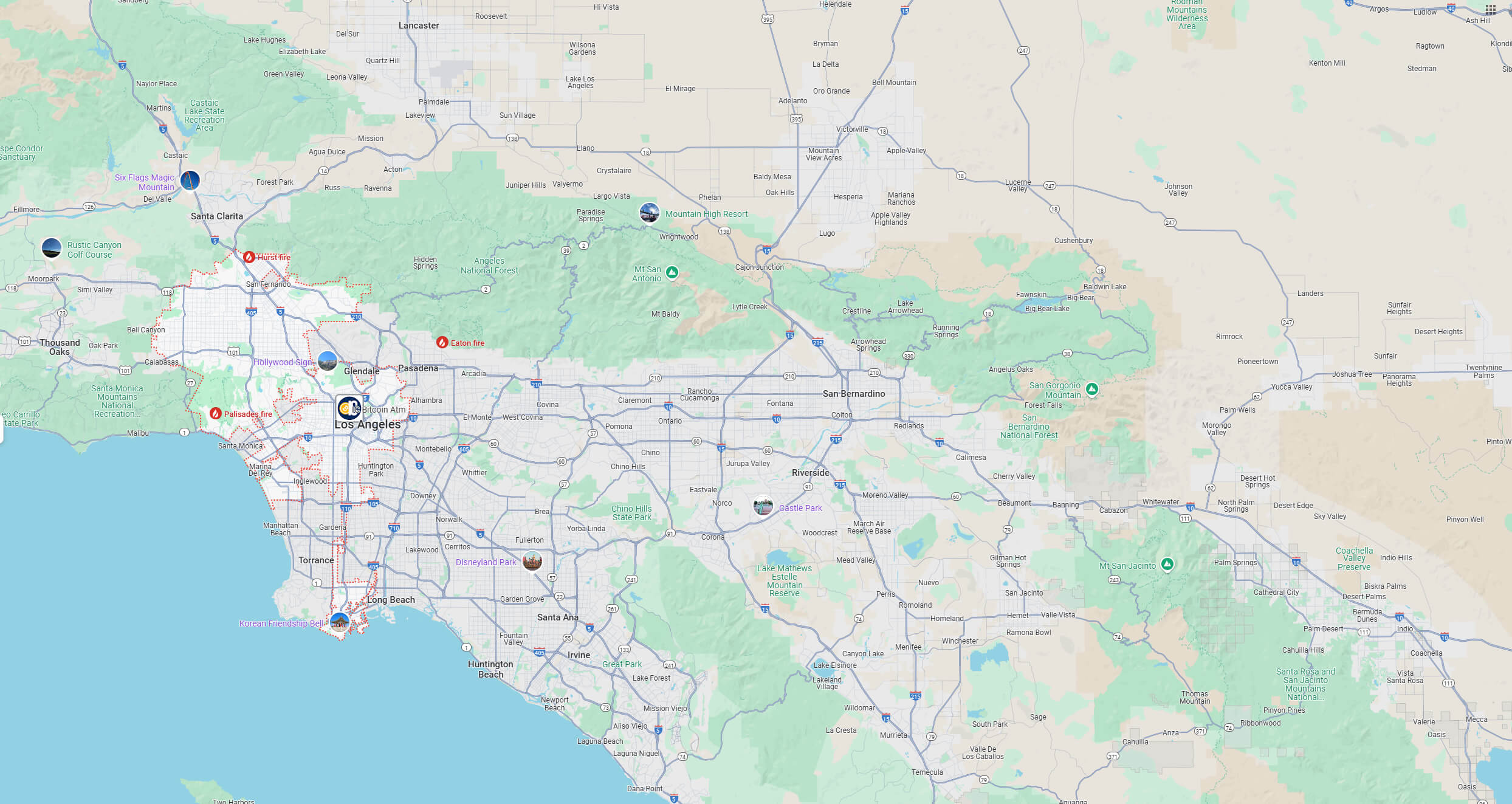
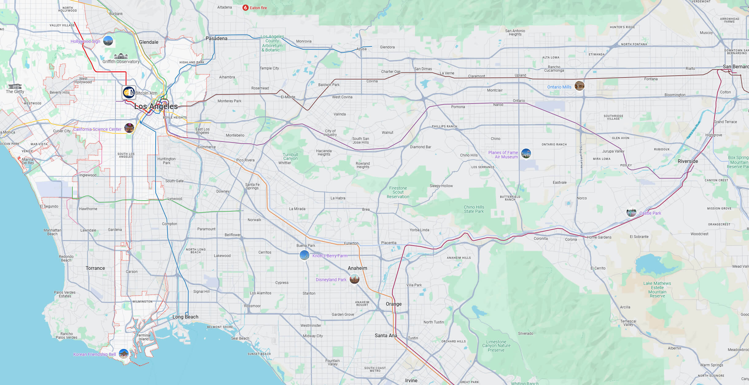
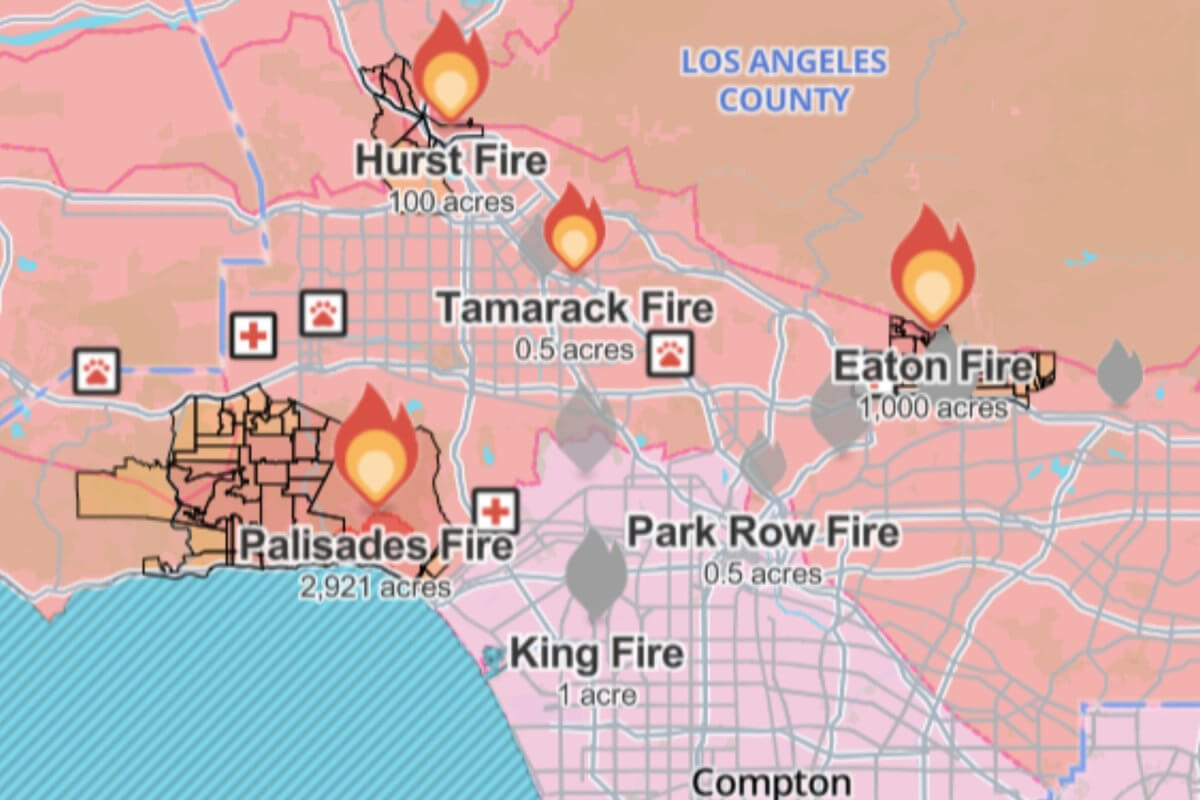
For outdoor enthusiasts, the terrain map of Los Angeles and California details the area’s mountains, valleys and coastline. The wildfire map is essential for tracking fire-prone areas and provides real-time updates for safety. Together, these maps paint a complete picture of the vibrant and complex region that is Los Angeles.
Los Angeles Map

Los Angeles and California map
Los Angeles road Map
Los Angeles terrain map California
Los Angeles fire risk map in 2025
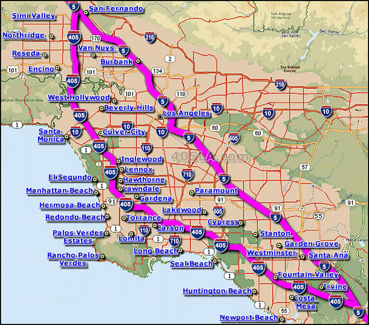
Los Angeles highways map
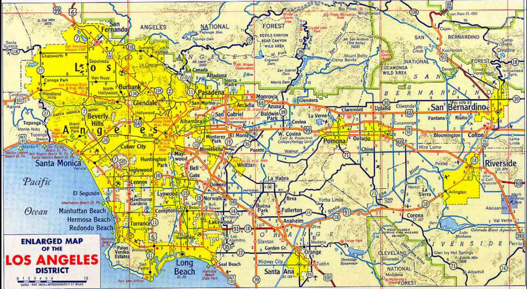
Enlarged Map of Los Angeles
Interstates Map of Los Angeles
LA wildfires map january 2025

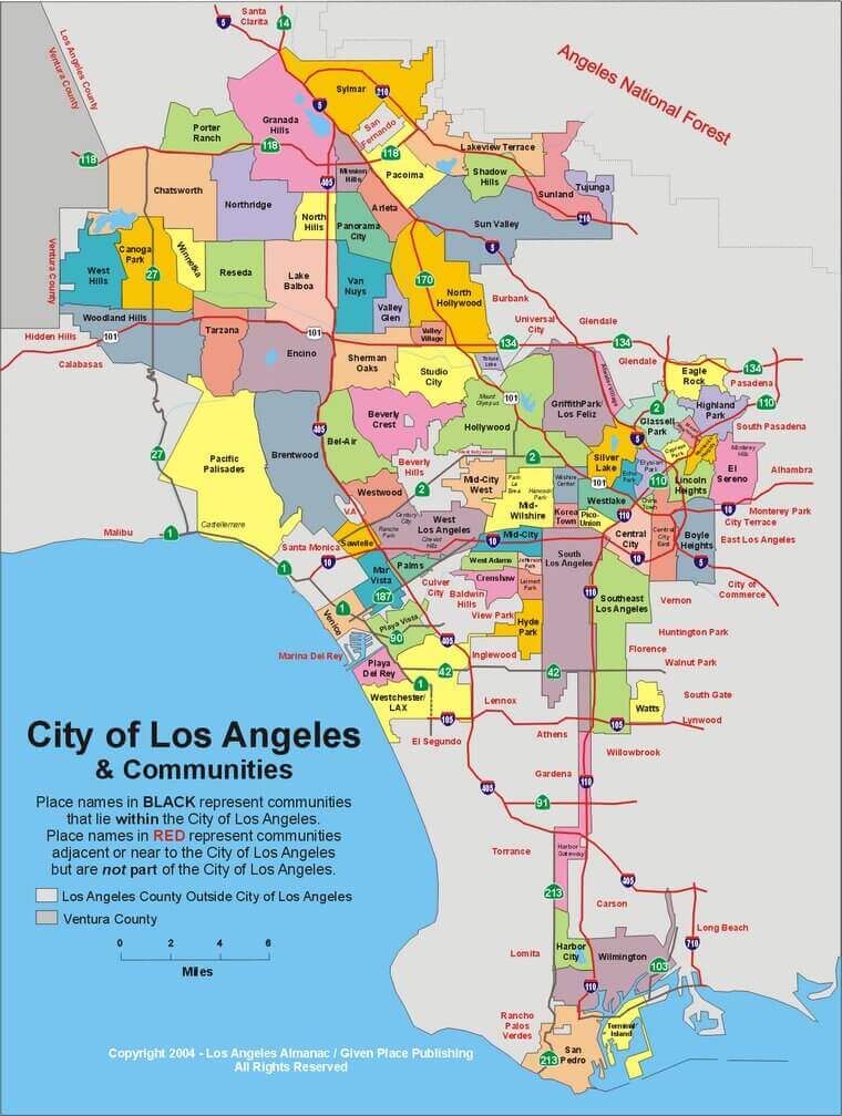
Los Angeles counties map
Los Angeles California highway and road map
Los Angeles downtown map
Los Angeles downtown street map
Los Angeles highways traffic map
Los Angeles metro map
Los Angeles metropol area road map
Los Angeles public transportation map
Los Angeles subway map
Los Angeles travel map
Los Angeles fire map in 2025
Los Angeles metro area map
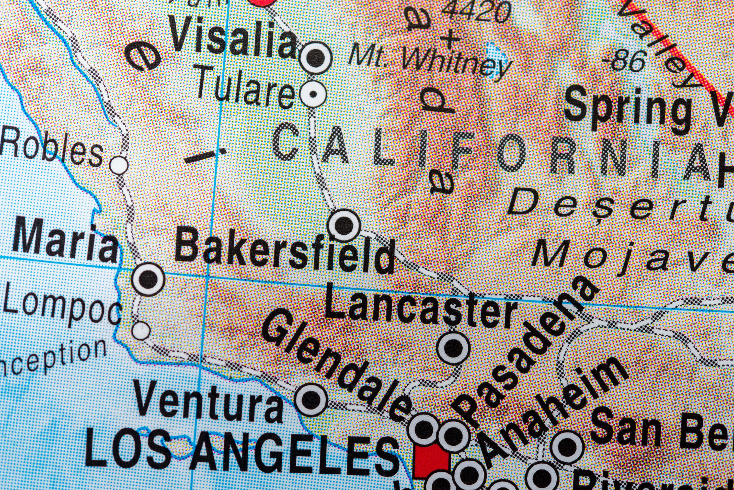
Map of Los Angeles in California
Map of Los Angeles in California
Where is Los Angeles on California Map?
Show Google interaactive map, satellite map, where is the country located.
Get directions by driving, walking, bicycling, public transportation and travel with street view.
Where is California in the US and and Cities Map of California – @WorldGuide Youtube
Feel free to explore these pages as well:
- Los Angeles Wildfires in Map ↗️
- Los Angeles Map ↗️
- Palisades Map in Los Angeles ↗️
- Eaton Map in Los Angeles ↗️
- Malibu Map in Los Angeles ↗️
- San Fernando Map in Los Angeles ↗️
- California Map ↗️
- Map of California↗️
- California County Map ↗️
- A Collection of California Maps ↗️
- North America Earth Map ↗️
- Discovering Los Angeles ↗️
- Discover the California: A Vibrant Journey through Golden State ↗️
- Discovering Bakersfield: The Heart of California’s Central Valley ↗️
- Anaheim: California’s Hidden Gem ↗️
- Guide to Los Angeles’ Top 10 Attractions ↗️
- Discover Chula Vista: A Hidden California Gem with Rich Culture and Stunning Views ↗️
- United States Map ↗️
- Map of United States ↗️
- North America Map ↗️
- Map of North America ↗️