- Advertisement -
Pasadena, located 11 miles (18 km) northeast of downtown Los Angeles, is a city in Los Angeles County, California. As the largest city in the San Gabriel Valley, it serves as the region’s cultural hub. Old Pasadena, the city’s historic commercial district, is a key landmark.
Pasadena Tournament House in Los Angeles
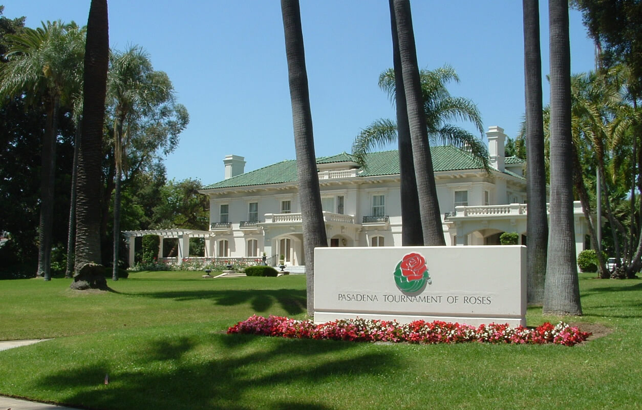 Pasadena Tournament House surrounded by palm trees and a manicured lawn.
Santa Fe Depot in Los Angeles, 1900
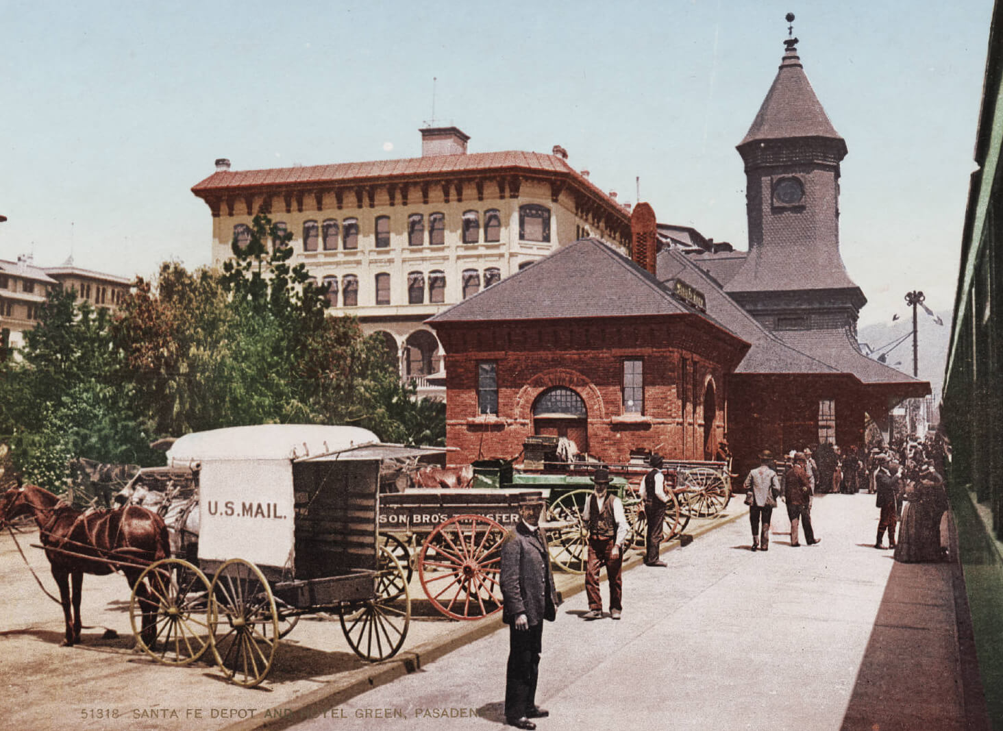 Santa Fe Depot in Los Angeles, 1900, with horse-drawn carriages and bustling crowds.
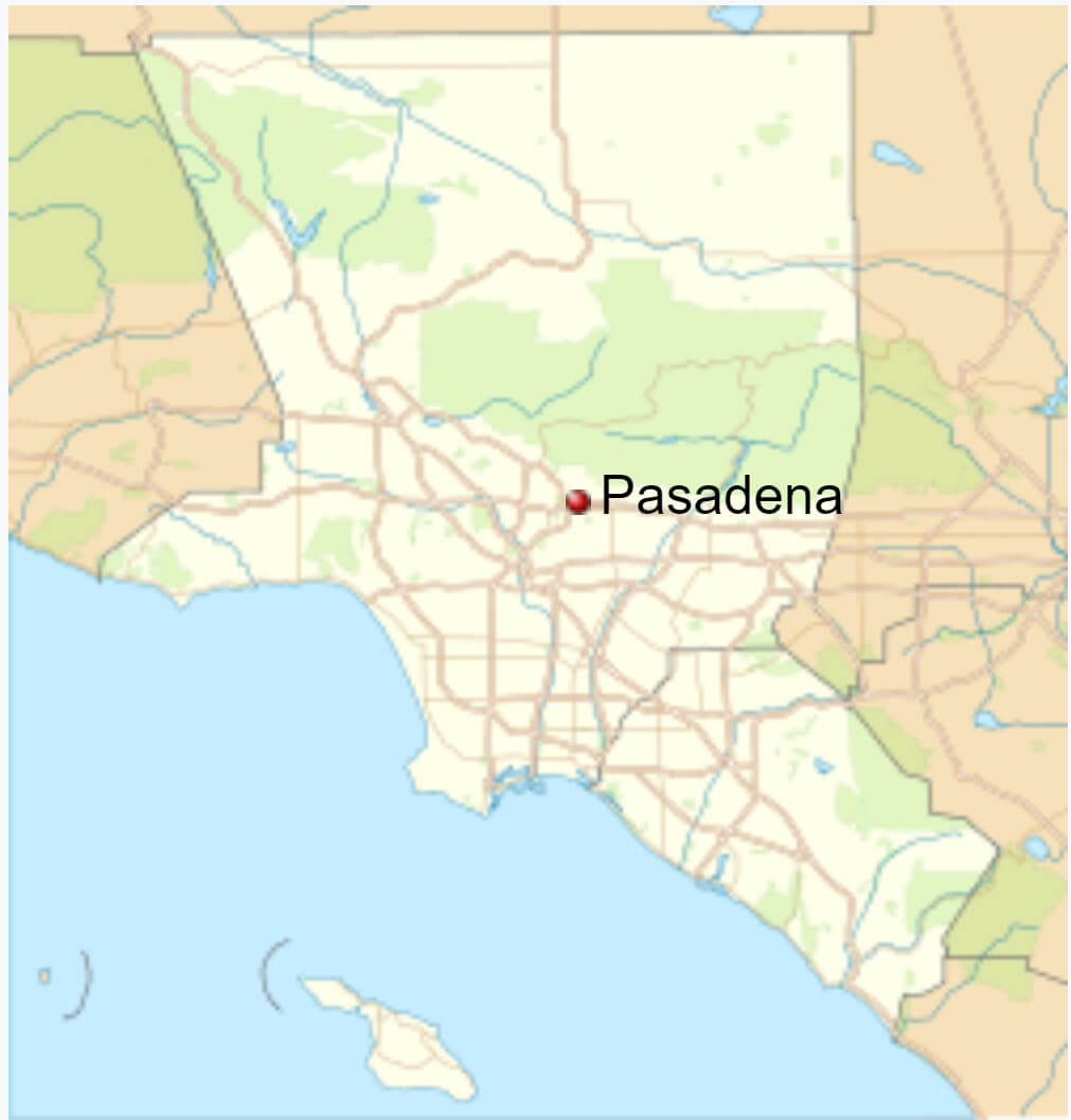
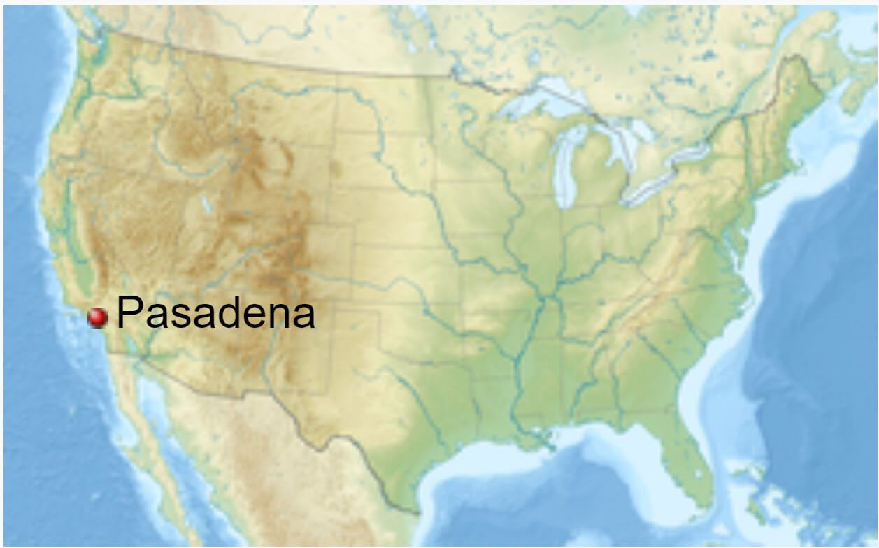
Pasadena map in Los Angeles metropolitan area
Pasadena on the California Map
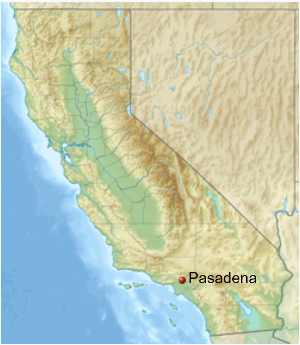 Map showing Pasadena’s location in California, highlighted on a relief map.
Pasadena location map in the US
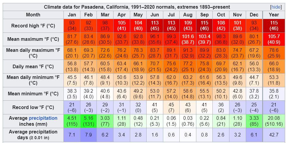
Pasadena Climate Data Overview
Pasadena Map, Los Angeles
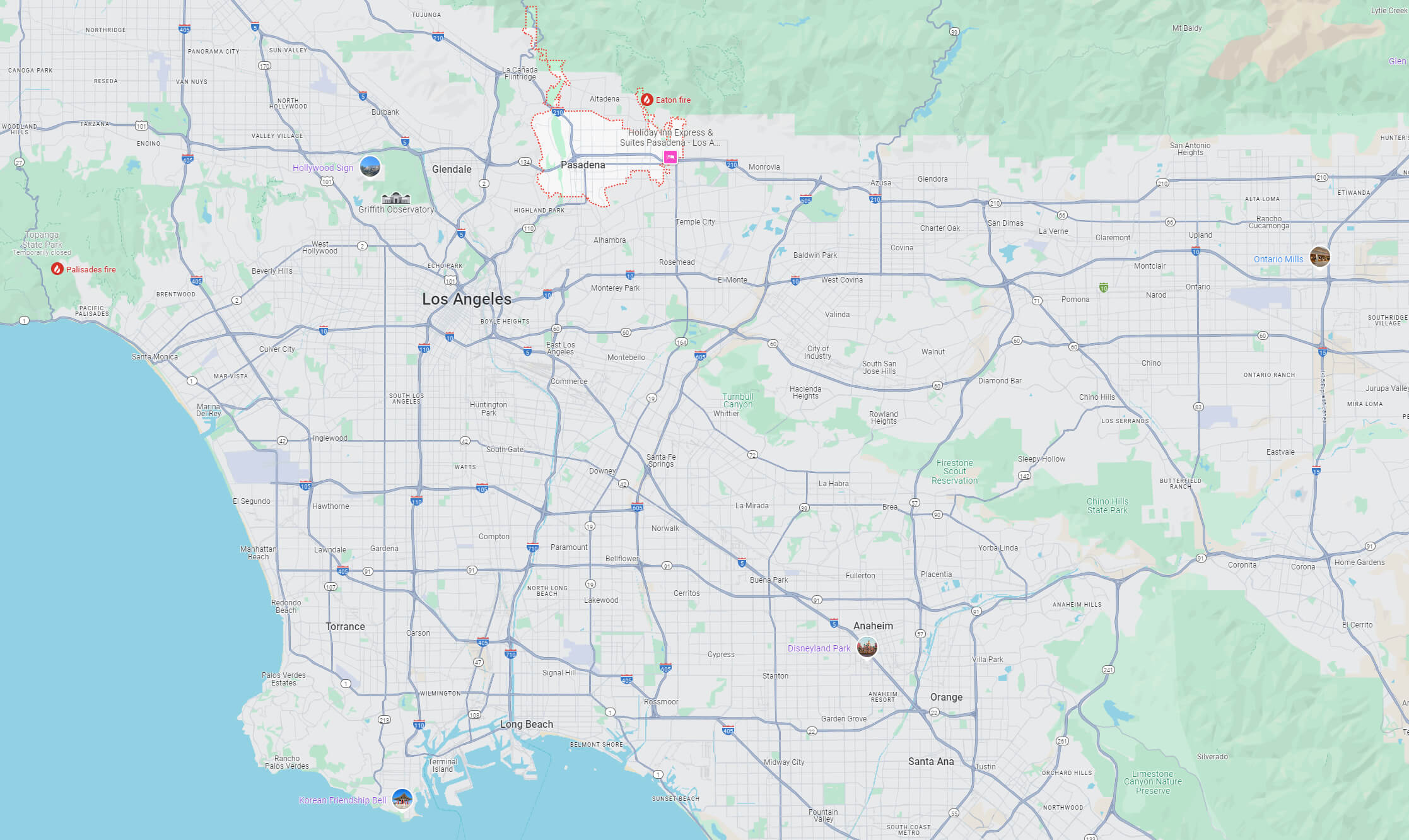
Pasadena Satellite Map, Los Angeles
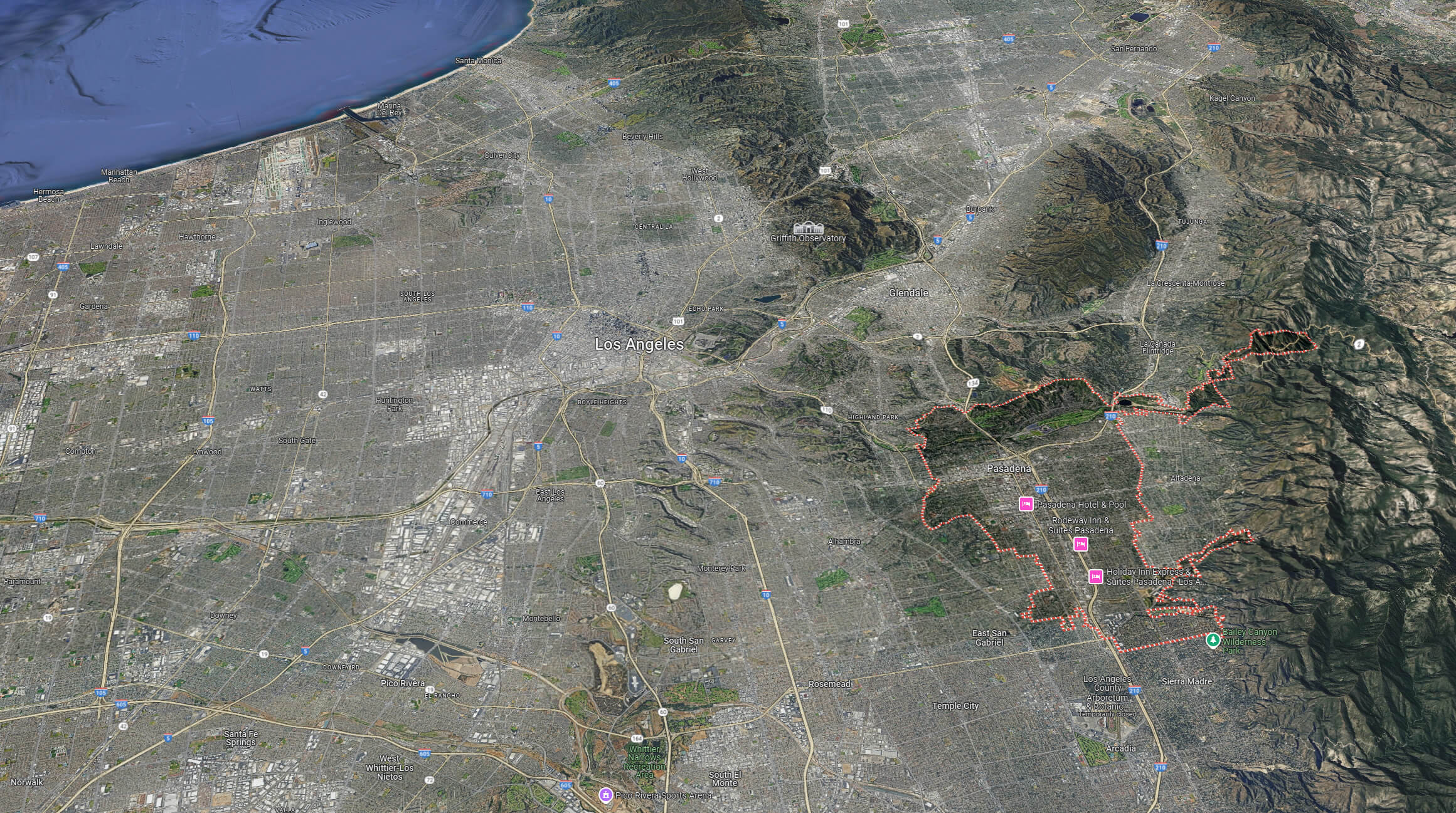
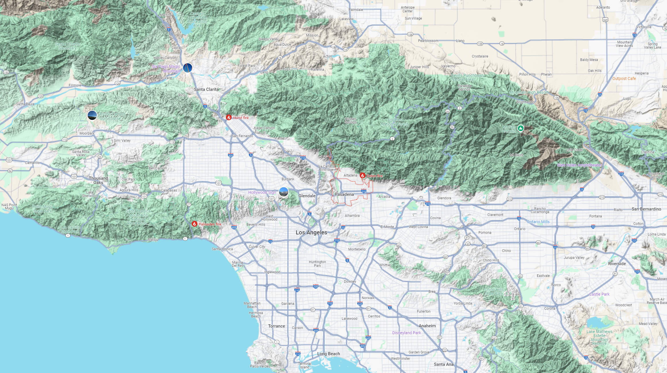
Pasadena Terrain Map, Los Angeles
Where is Pasadena on Los Angeles Map?
Show Google map, satellite map, where is the country located.
Get directions by driving, walking, bicycling, public transportation and travel with street view.
Where is California in the US and and Cities Map of California – @WorldGuide Youtube
Feel free to explore these pages as well:
- Los Angeles Map ↗️
- LA Fires January 2025 ↗️
- Los Angeles Wildfires in Map ↗️
- Palisades Map in Los Angeles ↗️
- Malibu Map in Los Angeles ↗️
- San Fernando Map in Los Angeles ↗️
- Eaton Map in Los Angeles ↗️
- Discovering Los Angeles ↗️
- Discovering Bakersfield: The Heart of California’s Central Valley ↗️
- Anaheim: California’s Hidden Gem ↗️
- Guide to Los Angeles’ Top 10 Attractions ↗️
- Discover Chula Vista: A Hidden California Gem with Rich Culture and Stunning Views ↗️
- California Map ↗️
- California County Map ↗️
- California Physical Map ↗️
- California Political Map ↗️
- California Cities Map ↗️
- California Road Map ↗️
- California Population Map ↗️
- Map of California↗️
- A Collection of California Maps ↗️
- Discover the California: A Vibrant Journey through Golden State ↗️
- Advertisement -