San Francisco, in northern California, is a major coastal city on the Pacific Ocean and San Francisco Bay. Situated on a hilly peninsula, it is known for landmarks such as the Golden Gate Bridge, its rich history and vibrant cultural scene. As a major hub in the United States, San Francisco plays an important role in technology, finance and tourism.
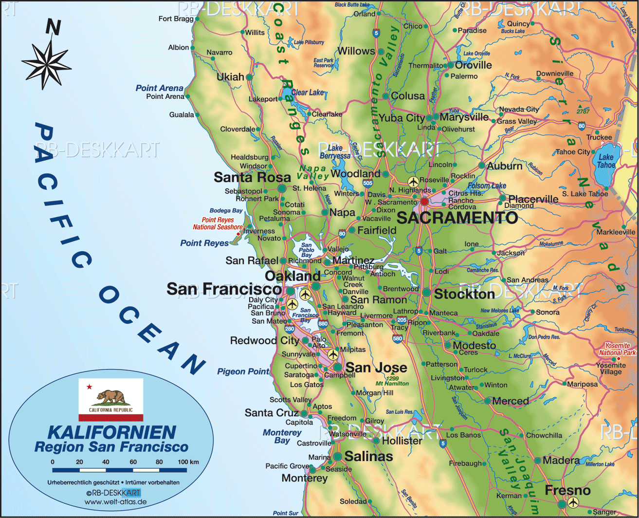
Where is San Francisco on California map
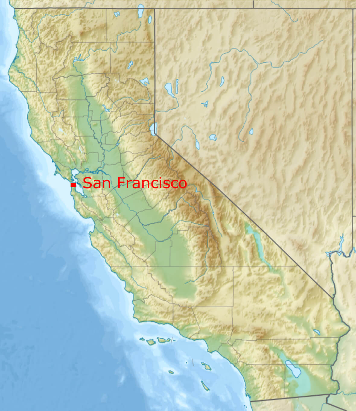 Where is located San Francisco on California map.
Located on the northern tip of the California peninsula, San Francisco is one of the most iconic cities in the United States. With a population of approximately 815,000, it is the fourth largest city in California, but its influence extends far beyond its size. Located on the Pacific Ocean and bordering the San Francisco Bay, the city is a major cultural and economic hub on the west coast of the U.S. Known for its rolling hills, breathtaking bay views and famous landmarks such as the Golden Gate Bridge, San Francisco is a geographically stunning city that captivates visitors and residents alike. Despite its compact size – approximately 121 square kilometres (47 square miles) – the city’s unique neighbourhoods, from historic Chinatown to bohemian Haight-Ashbury, offer a diverse and vibrant urban experience.
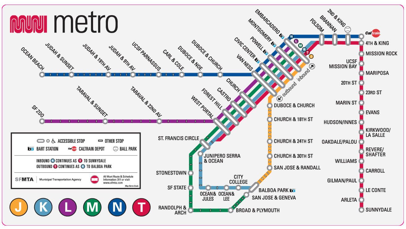
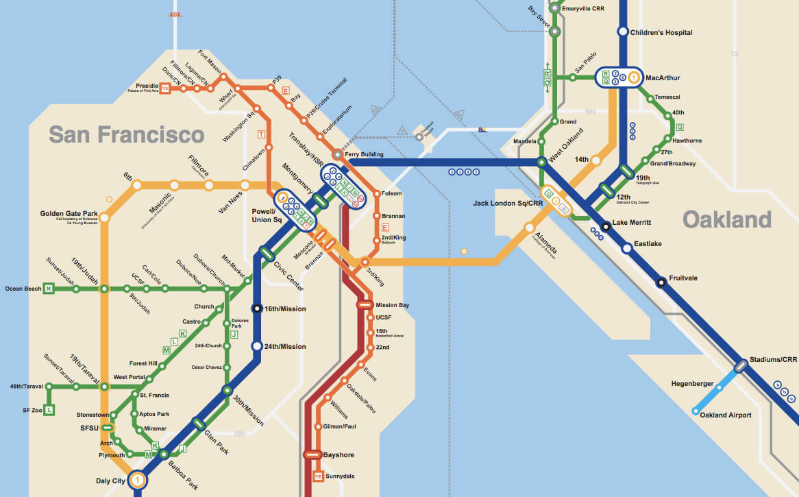
San Francisco subway map
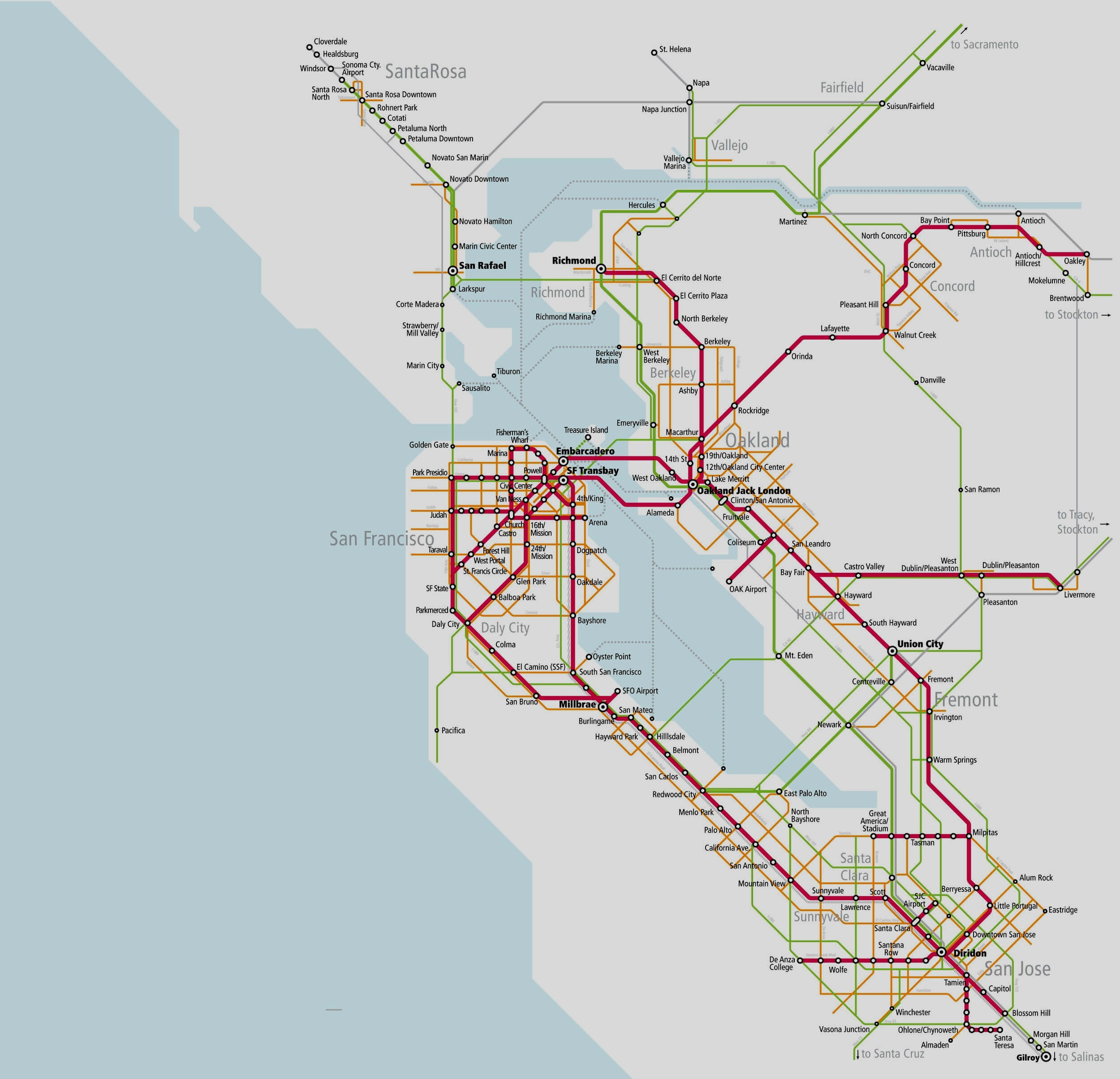
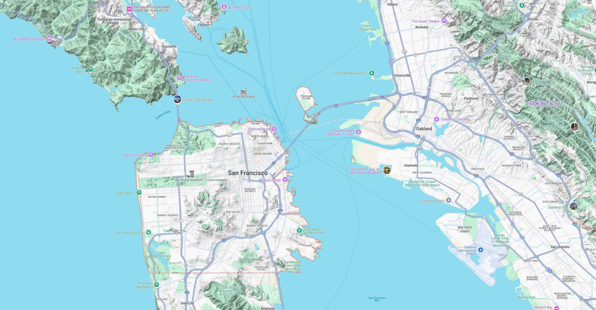
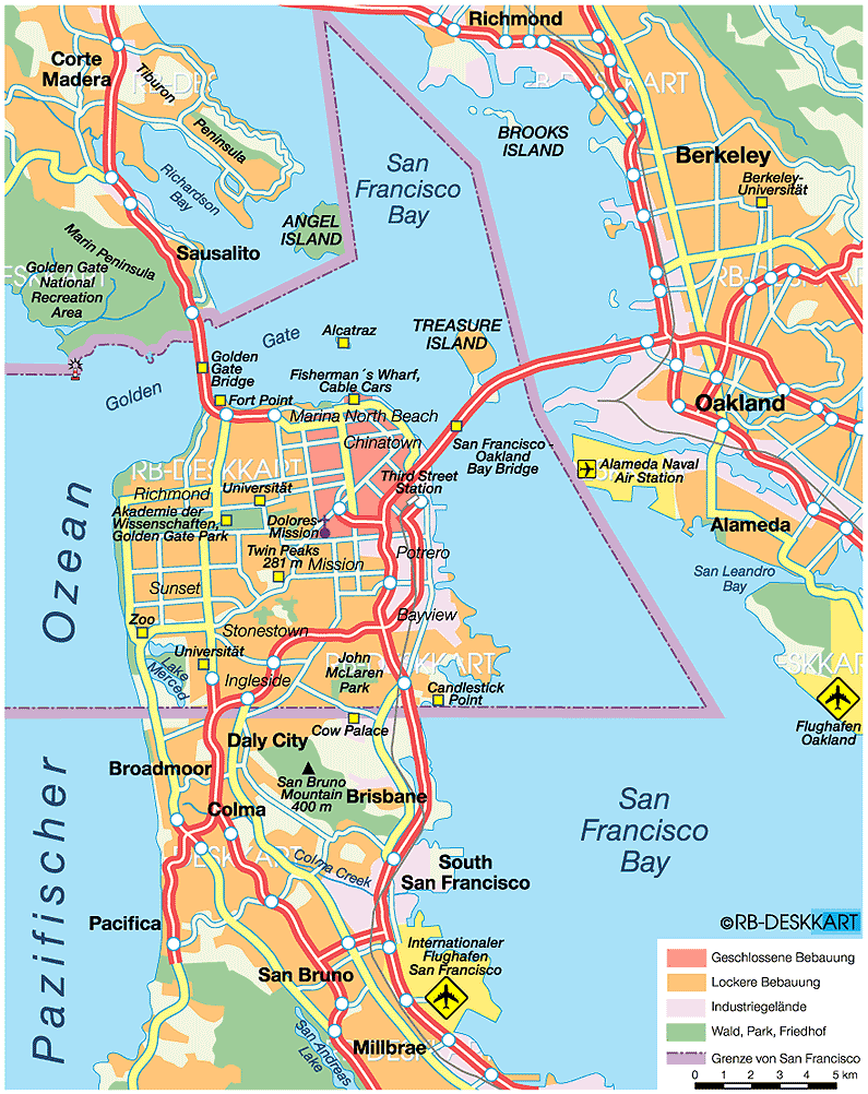
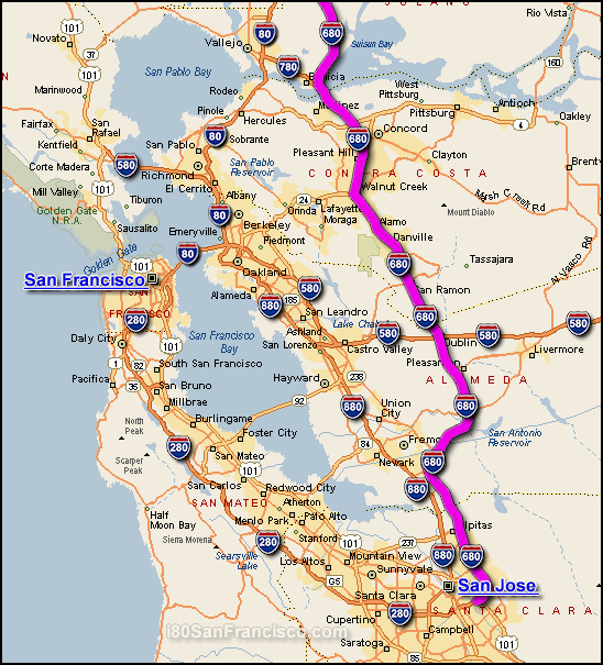
San Francisco bay area metro map
Golden Gate bridge in San Francisco
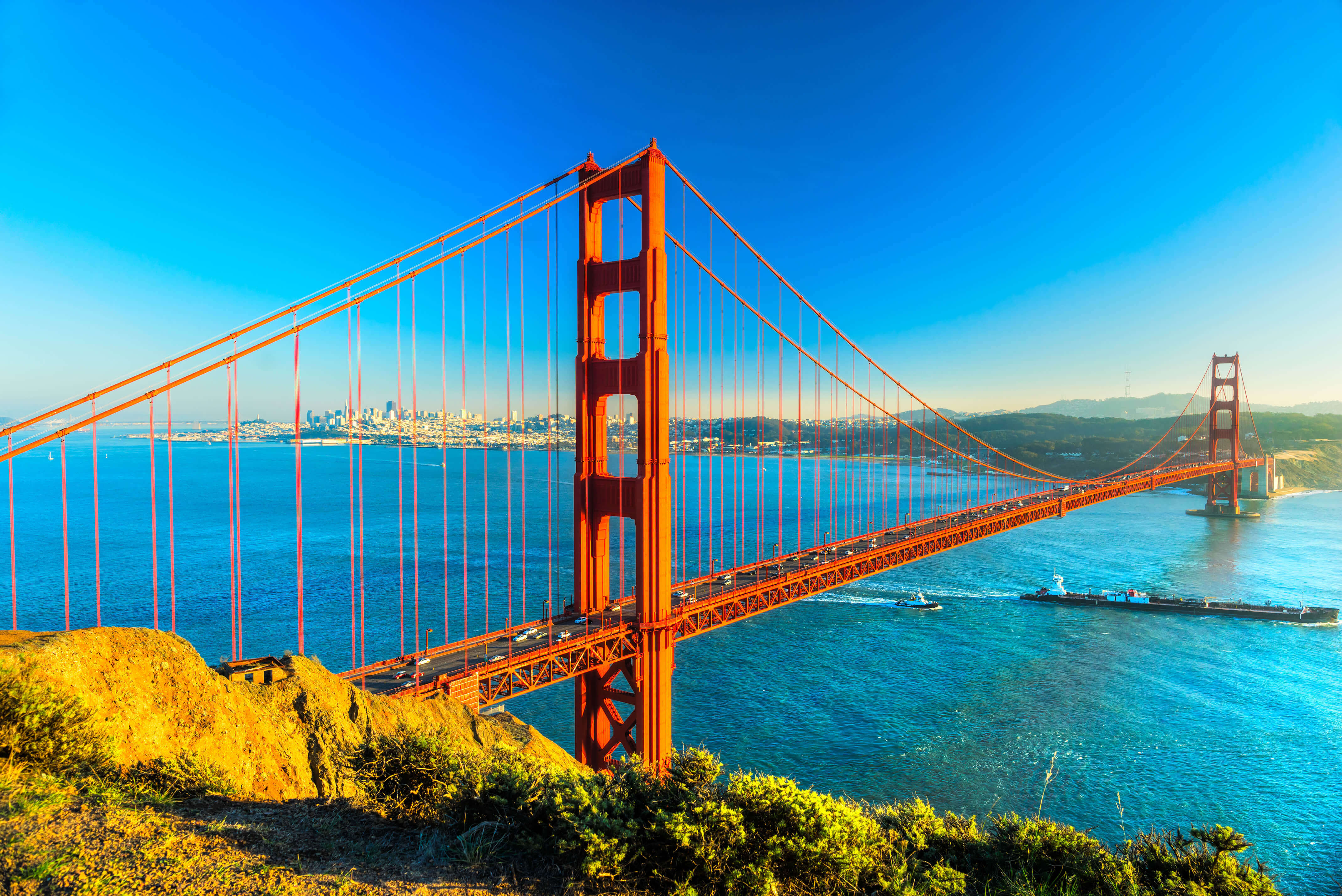 View from Golden Gate Bridge and San Francisco Downtown
San Francisco has a rich history that has shaped both California and the United States. It boomed during the 1849 Gold Rush, attracting thousands of fortune seekers and earning it the nickname “The Golden City”. It later played a key role in the LGBTQ+ rights movement, the counterculture revolution of the 1960s and tech innovation, with Silicon Valley to the south. The city’s resilience is legendary – after being devastated by the 1906 earthquake and fire, it quickly rebuilt and emerged stronger than ever. Today, it remains a centre for technology, finance and progressive social movements, making it one of the most forward-thinking cities in the world.
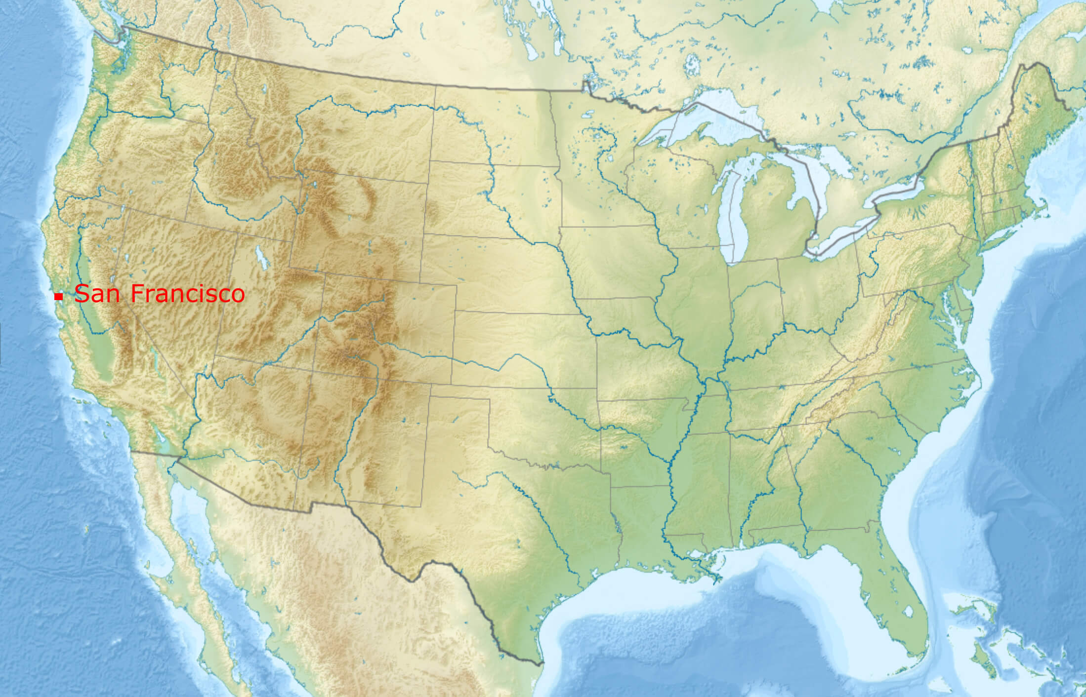
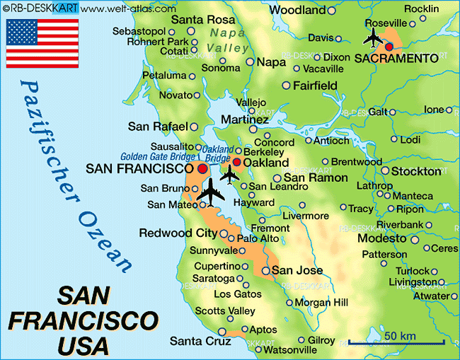
Where is San Francisco on the US map
San Francisco bay area terrain map
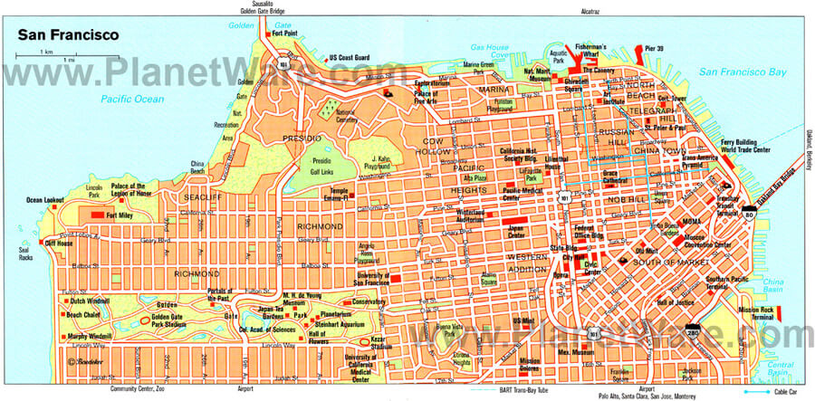
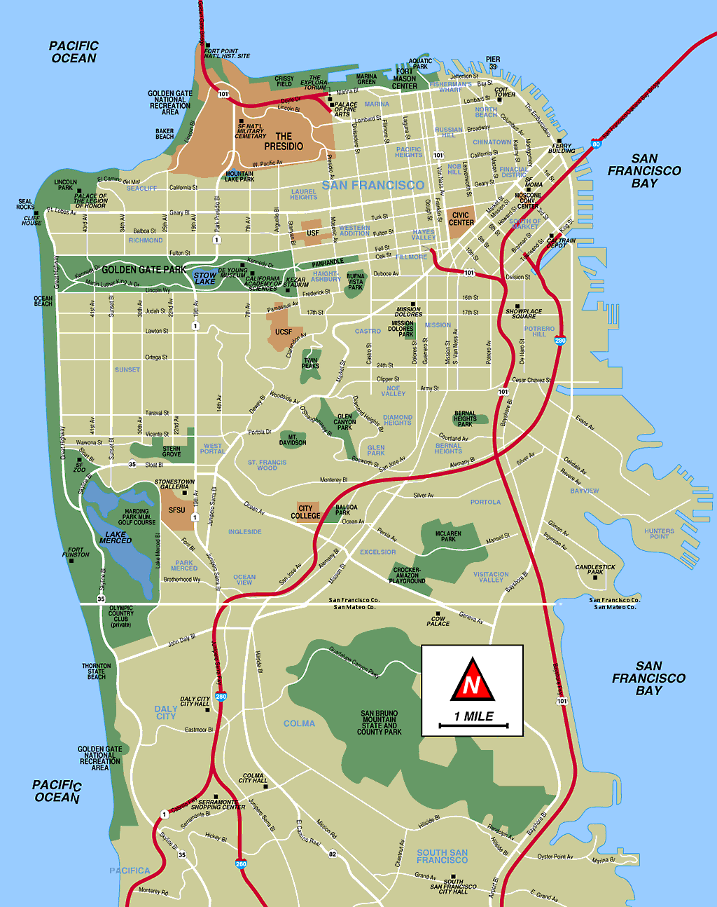
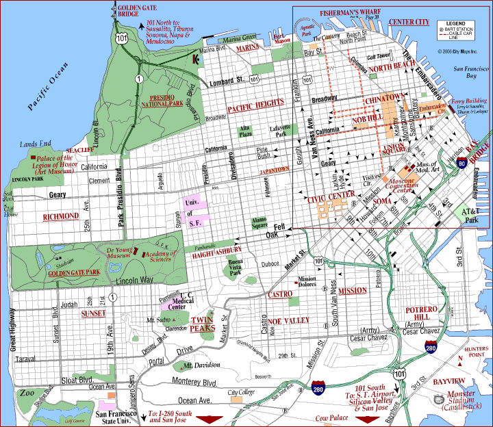
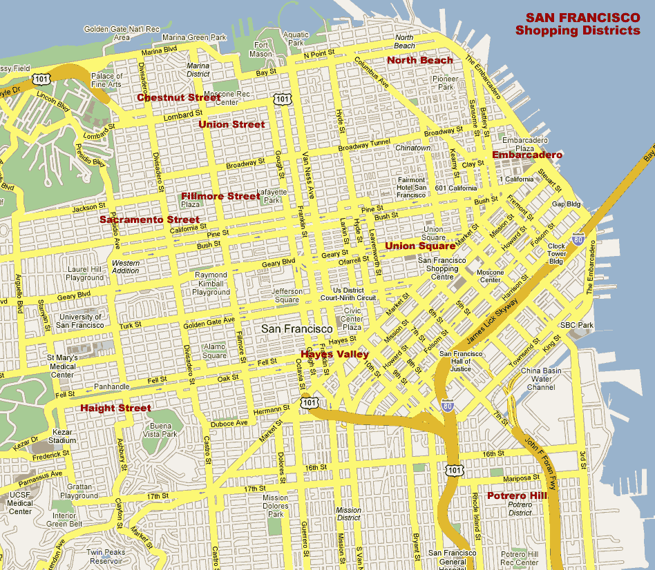
San Francisco Map with districts
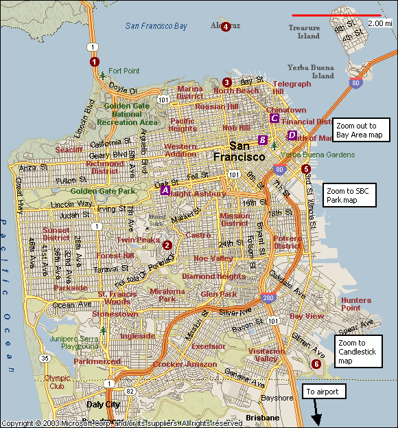
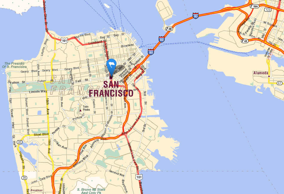
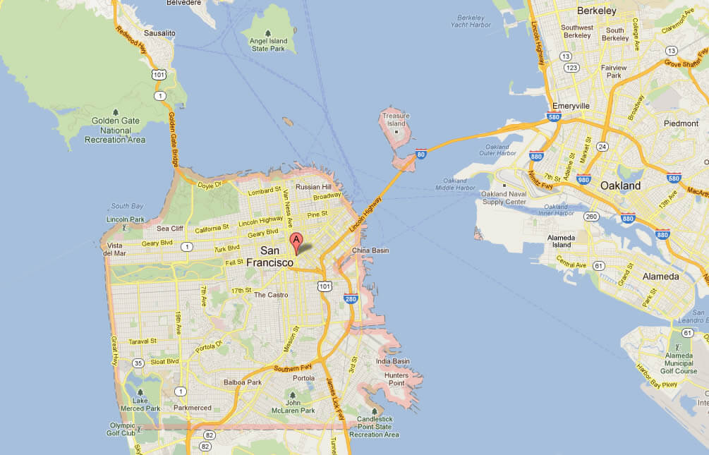
San Francisco map
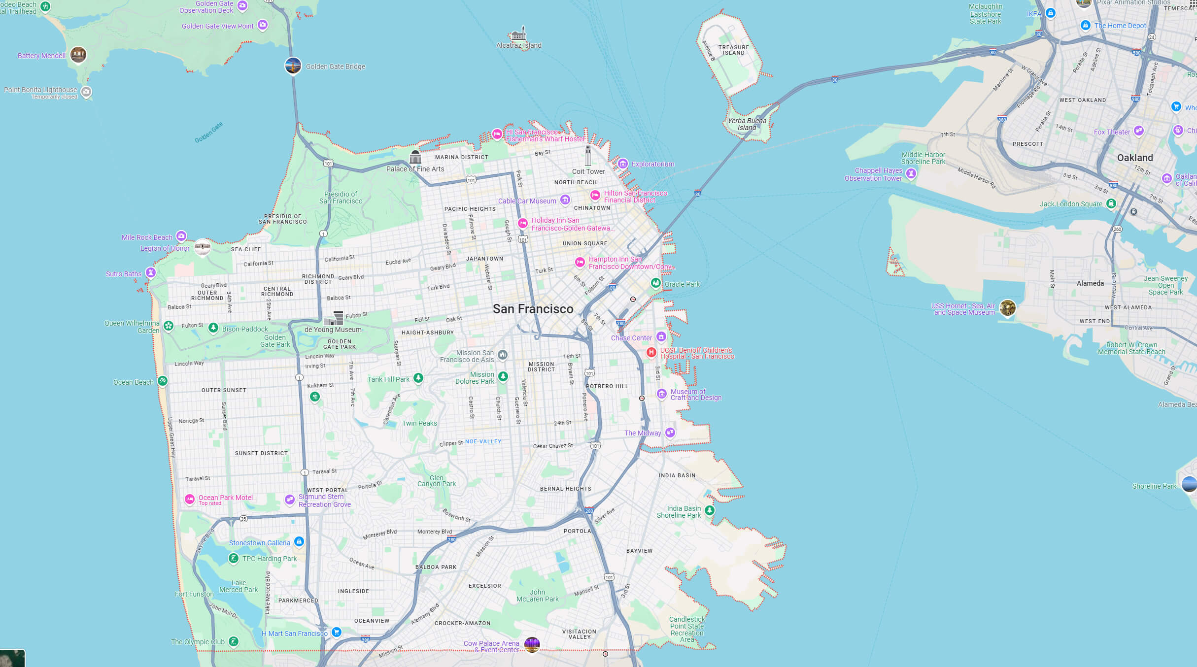
San Francisco downtown map
Atlas Map of San Francisco
City Map of San Francisco
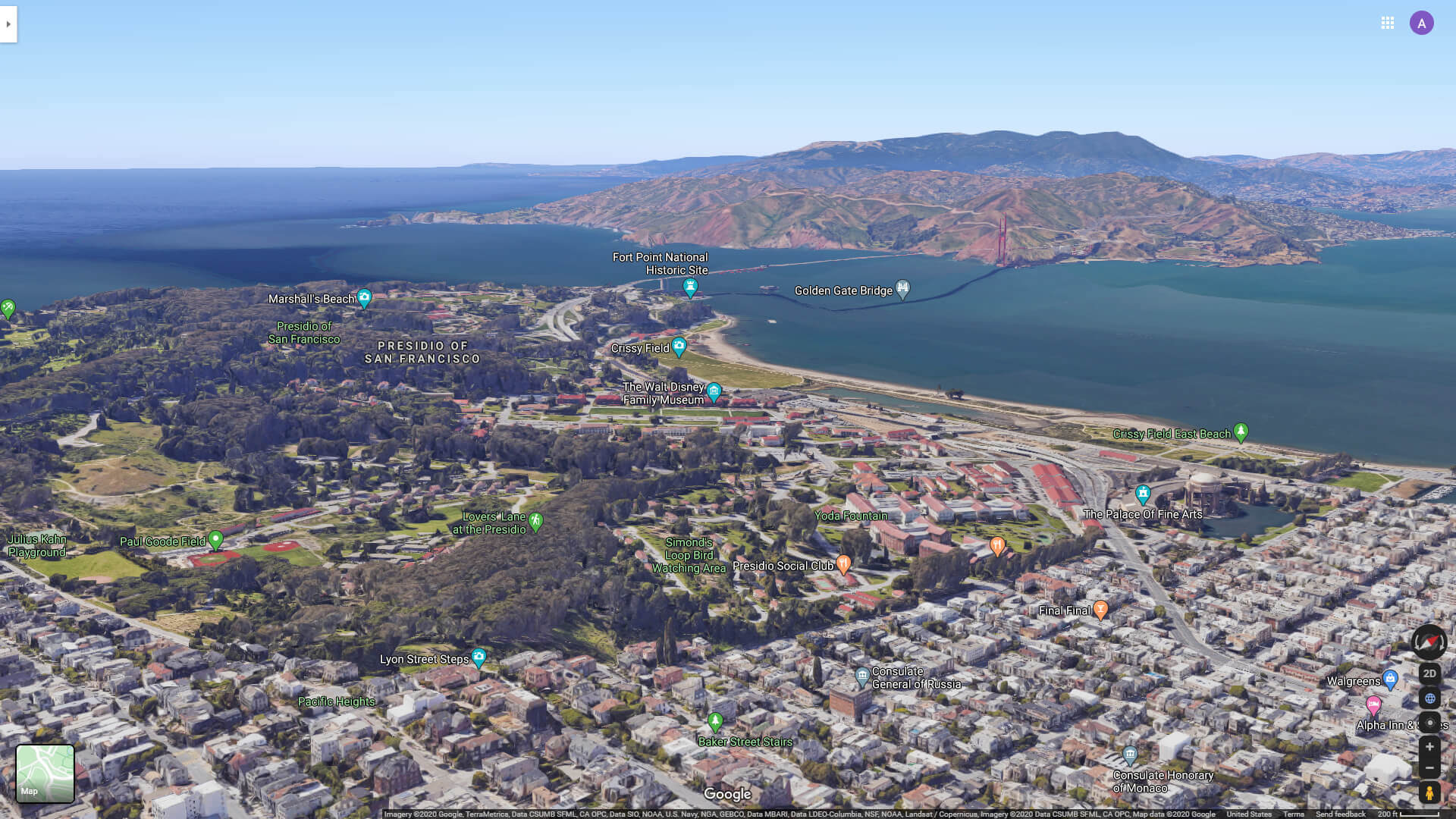
Golden Gate Bridge and The Palace of Fine Art
Lombard Street and Russian Street San Francisco
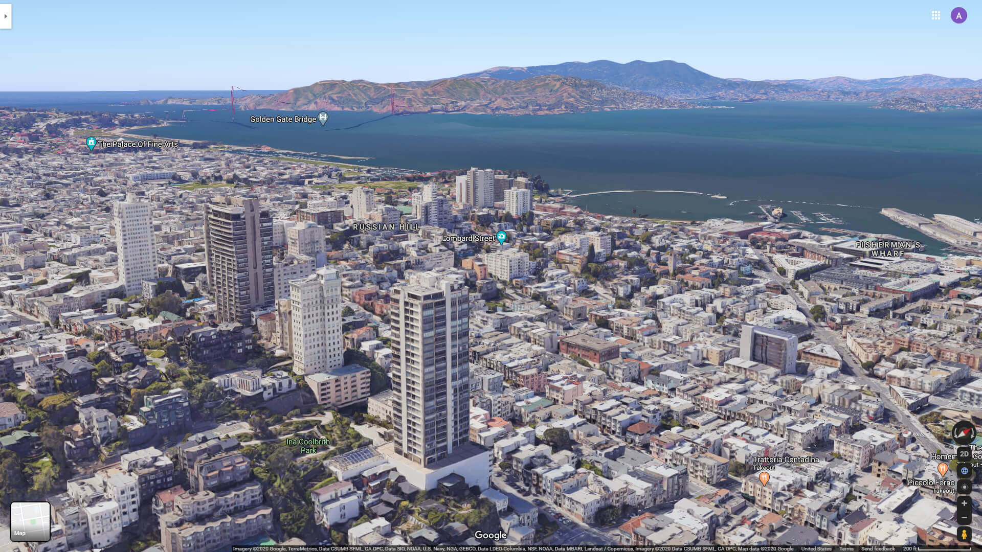 Lombard Street and Russian Street in San Francisco.
San Francisco’s climate is mild year-round, with cool summers often shrouded in its famous fog (known locally as “Karl”) and wet but mild winters. This cool, oceanic influence sets it apart from much of sunny California. Its cultural life is equally dynamic, with a deep appreciation for art, music and food. The city is home to world-class institutions such as the San Francisco Museum of Modern Art (SFMOMA) and a thriving theatre scene. The Mission District offers incredible Latin American cuisine, while Fisherman’s Wharf remains a tourist favourite for seafood and bay views. Whether it’s tech innovators, artists or activists, San Francisco thrives on a spirit of creativity and reinvention, making it one of the most unique places to experience in the United States.
Map of San Francisco environment
Map of San Francisco
Map of San Francisco
Road Map of San Francisco
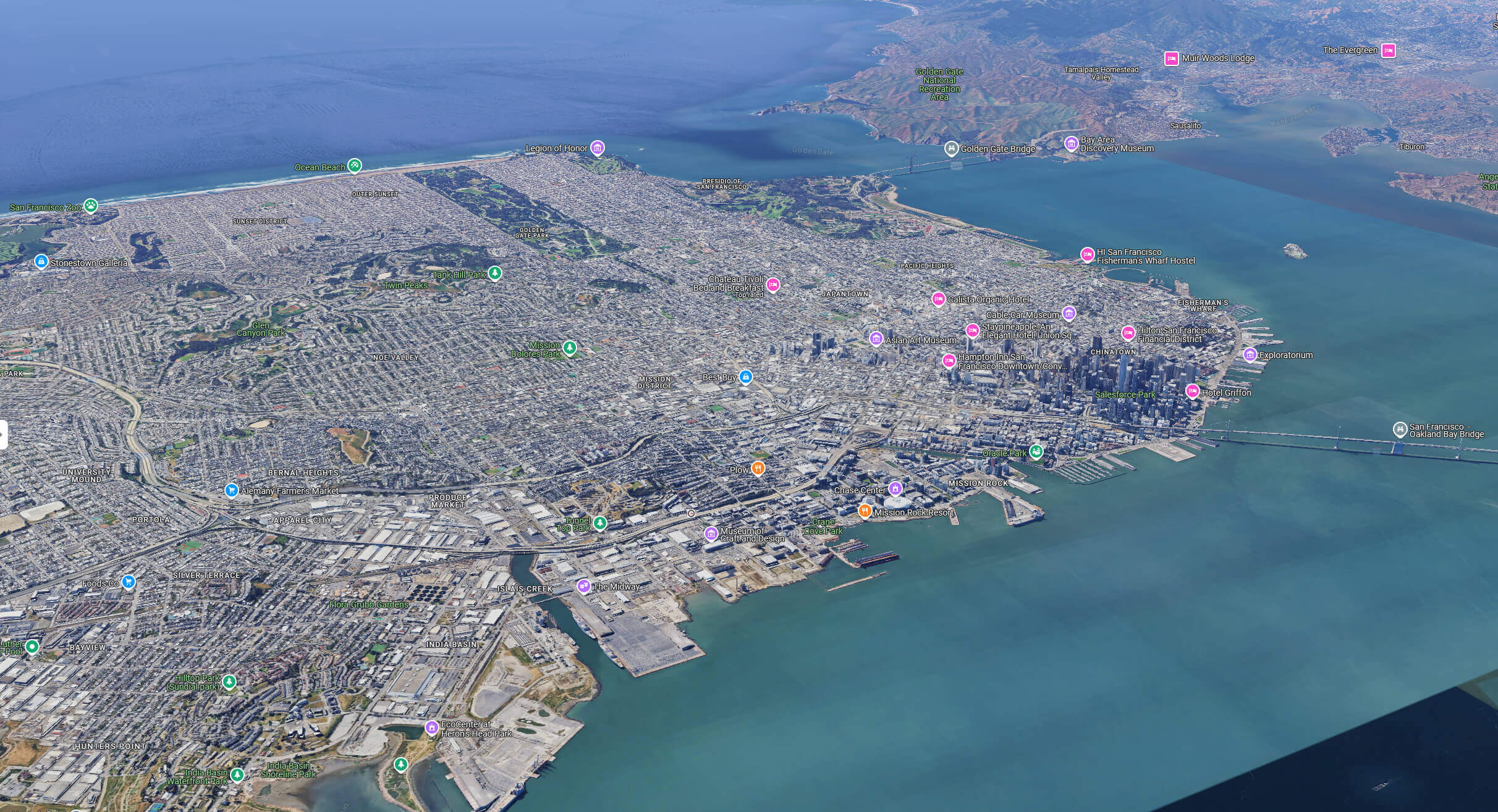
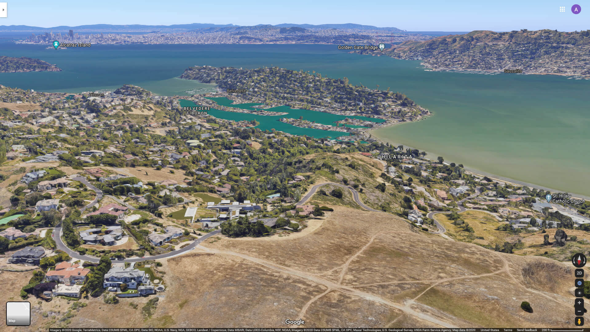
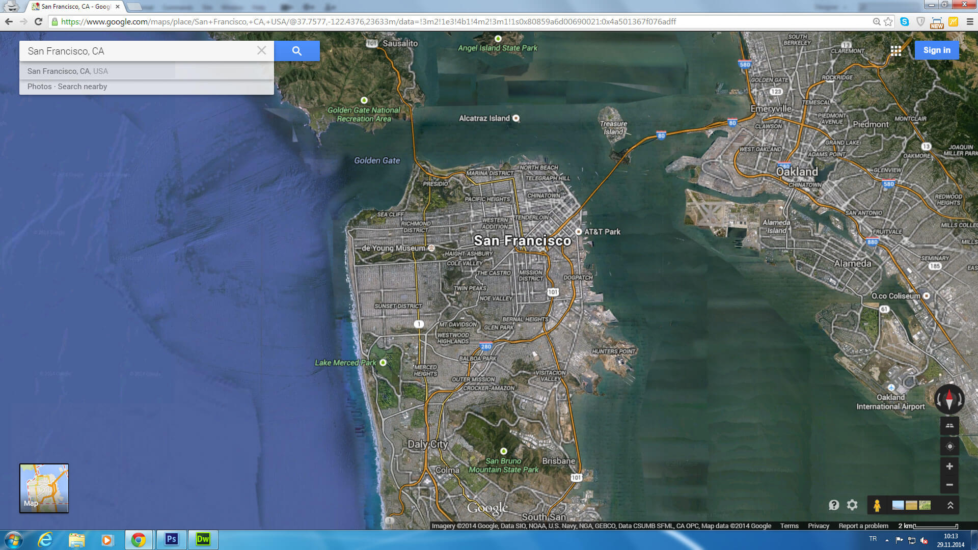
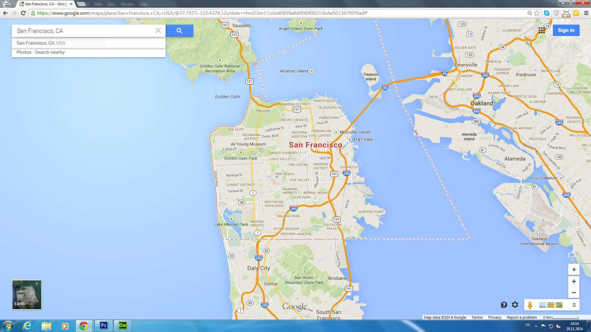
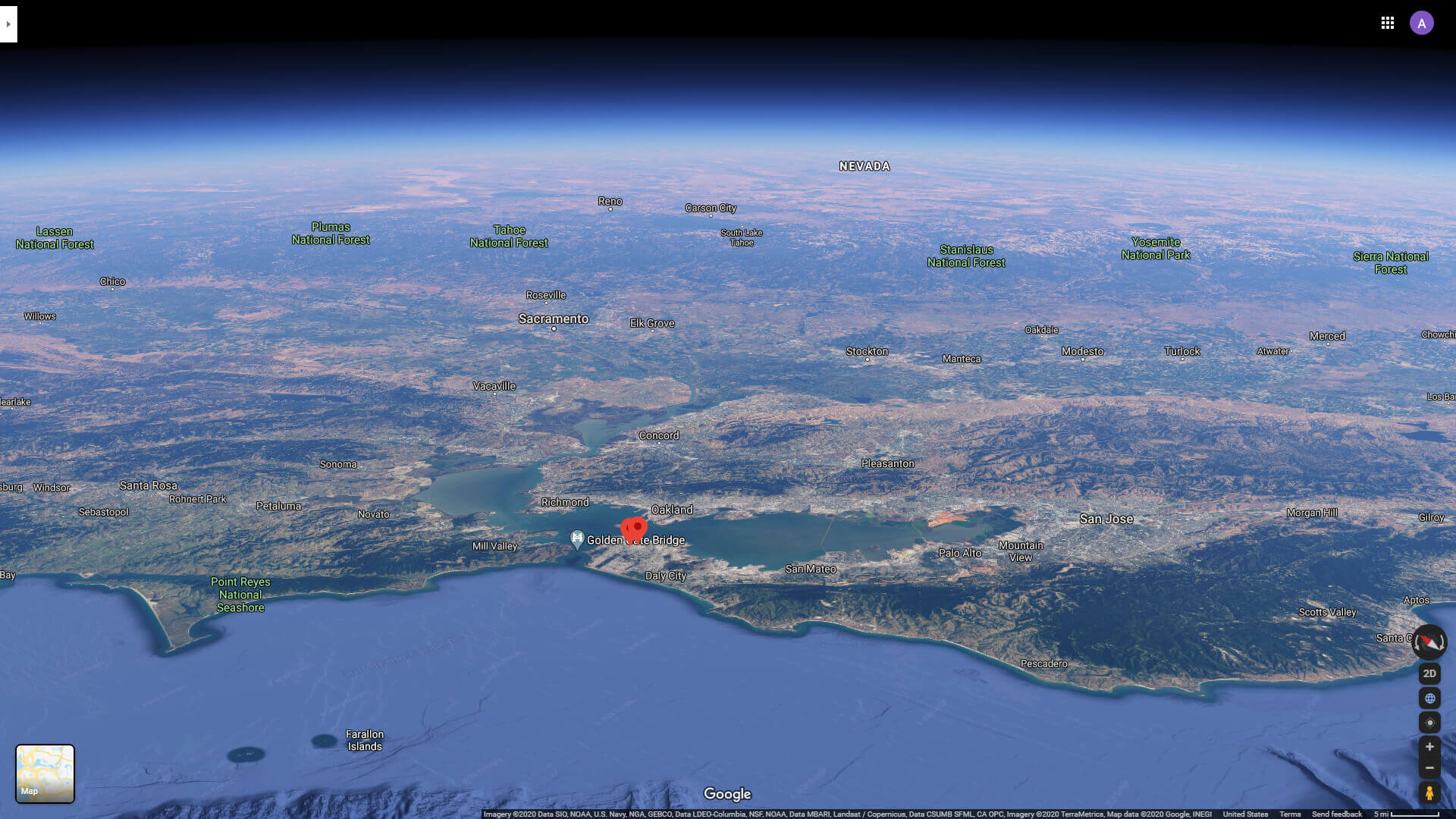
San Francisco aerial view map
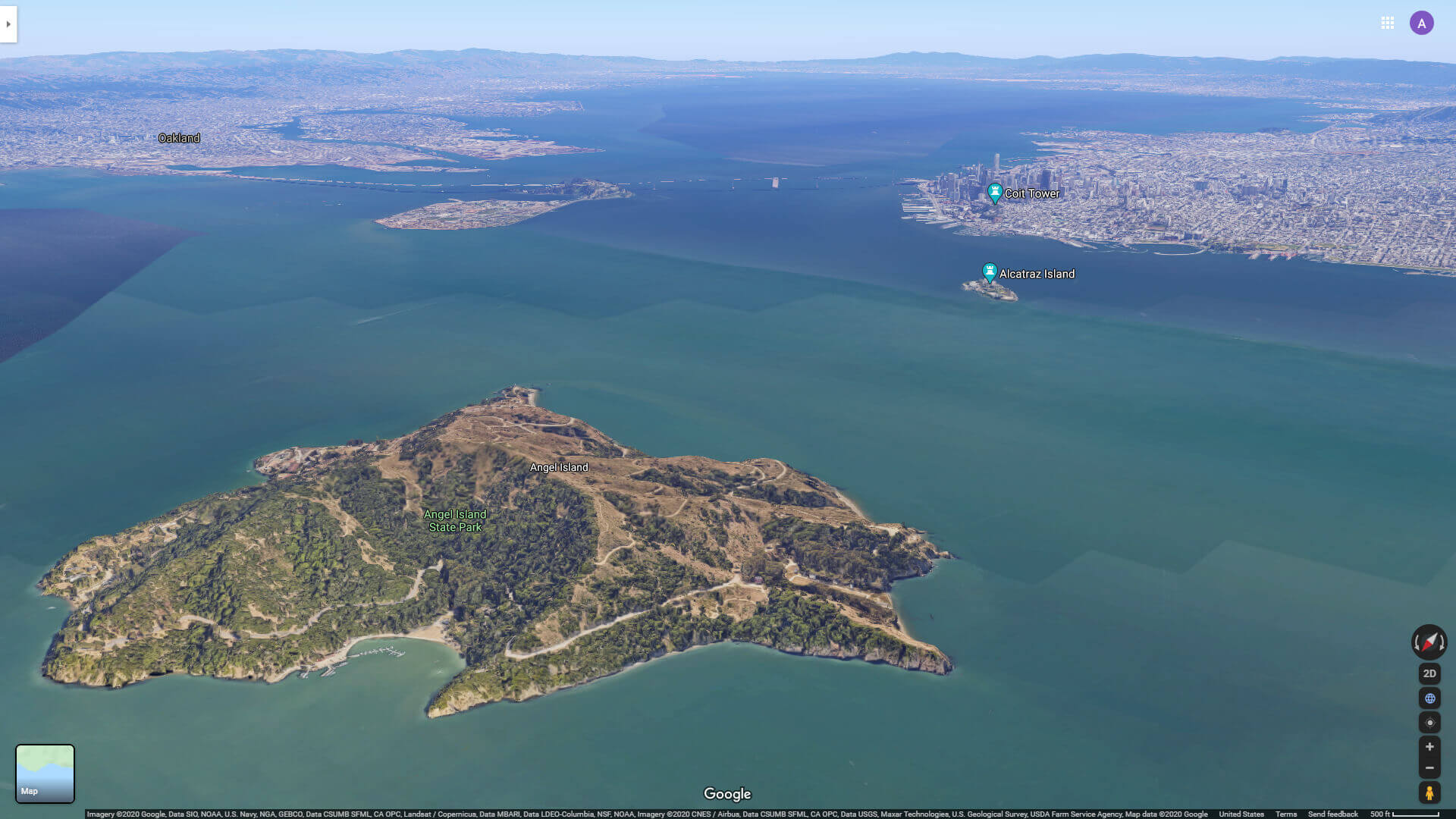
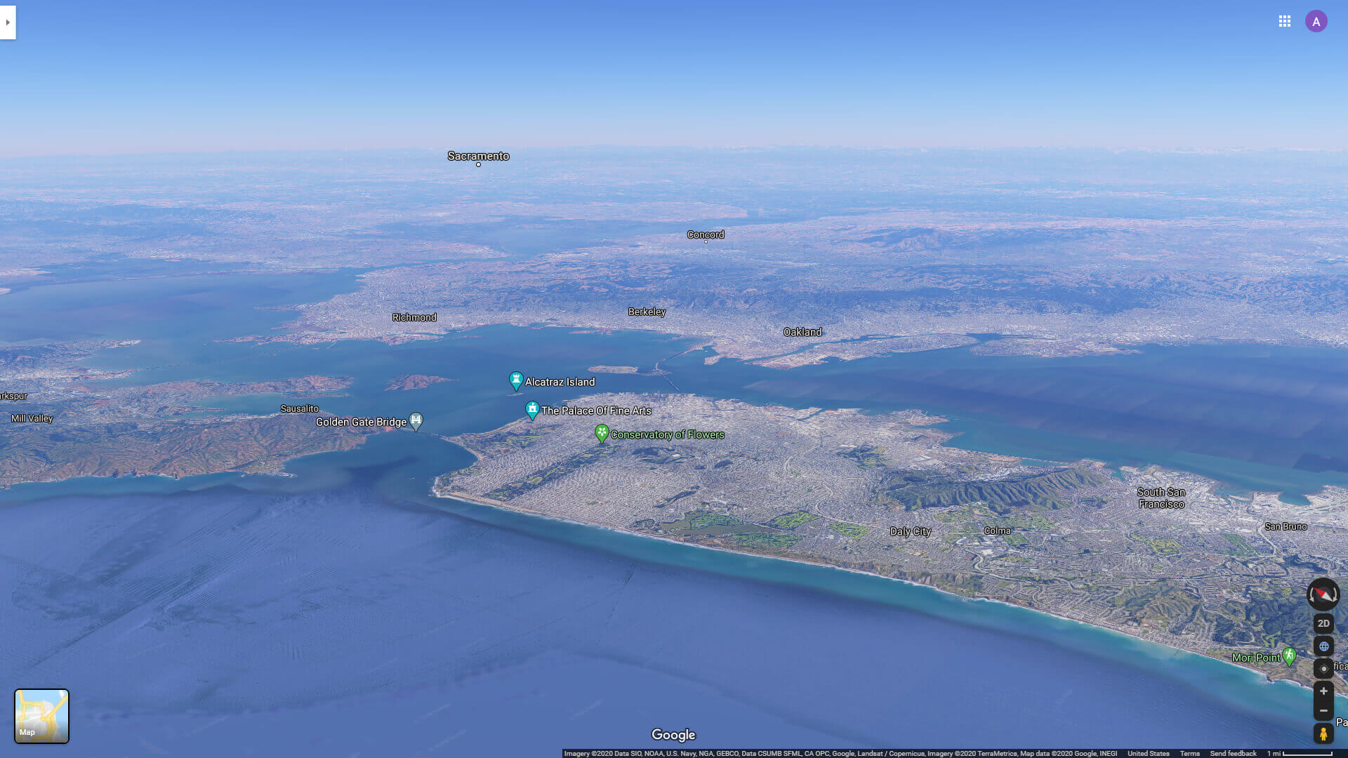
San Francisco and Alcatraz Island from Angel Island
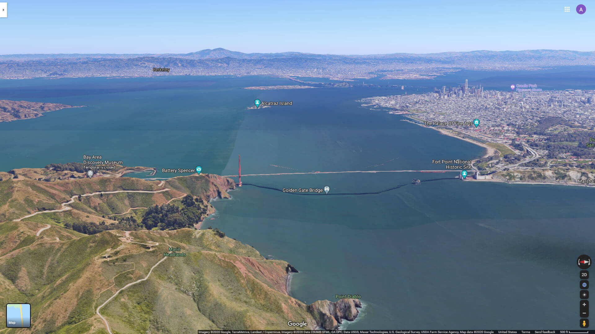
San Francisco and Golden Gate from Marin Headlands
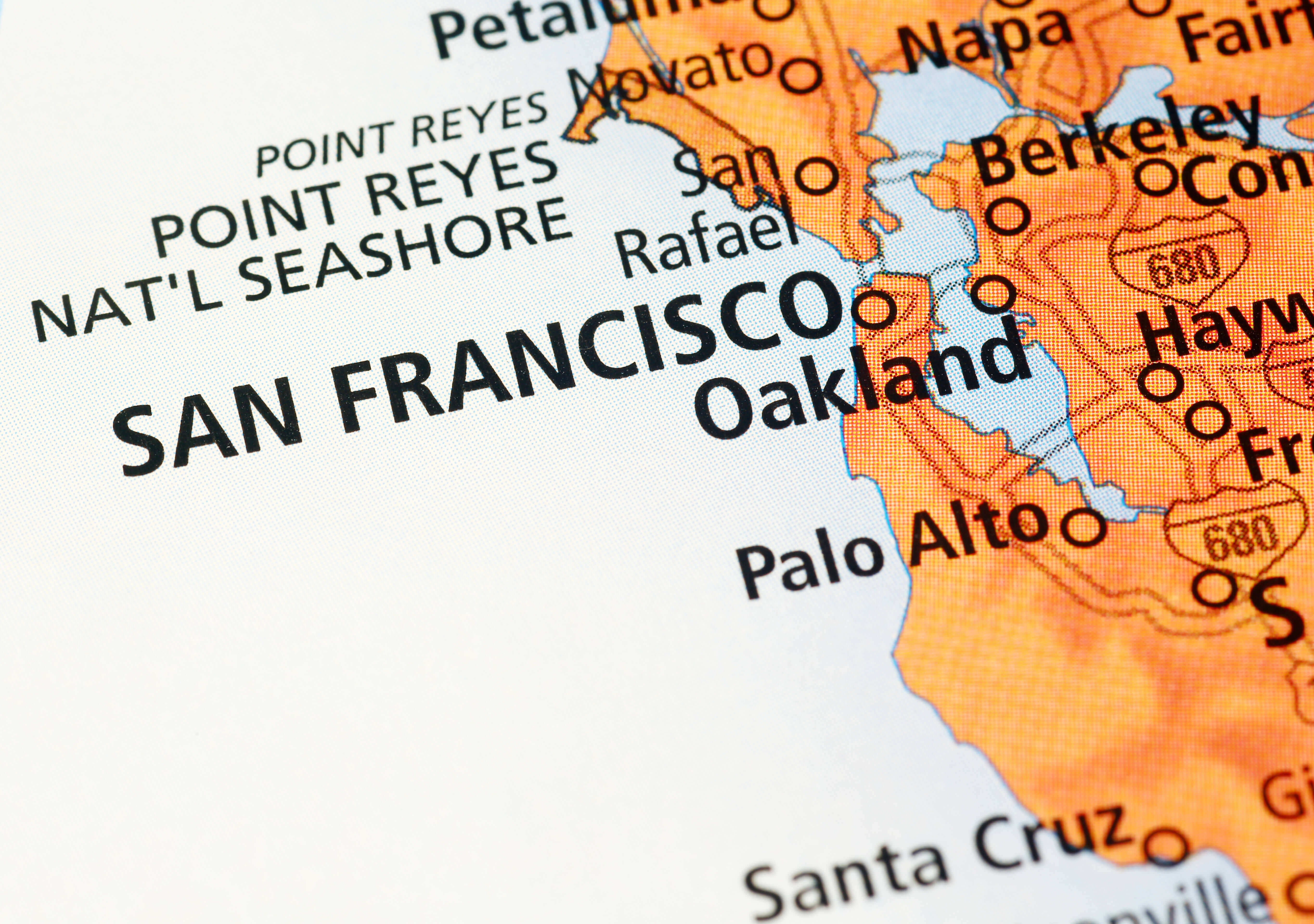
San Francisco and Marin County
San Francisco bay area bart metro map
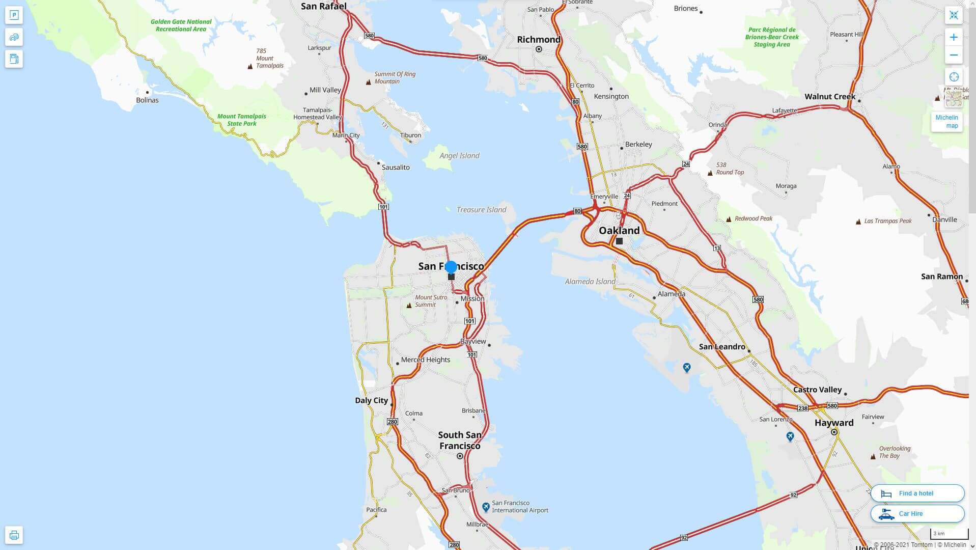
San Francisco bay area map
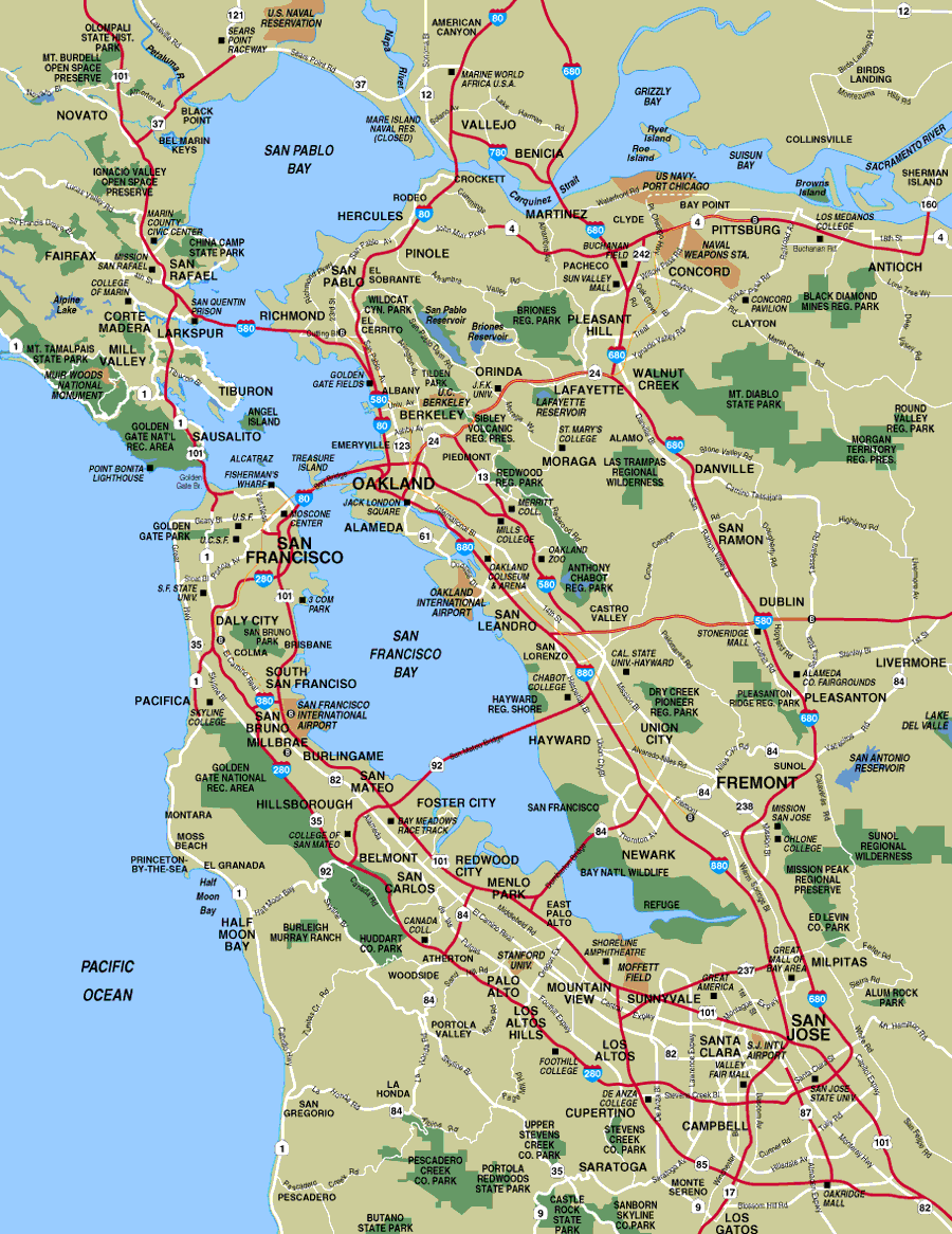
San Francisco bay area maps
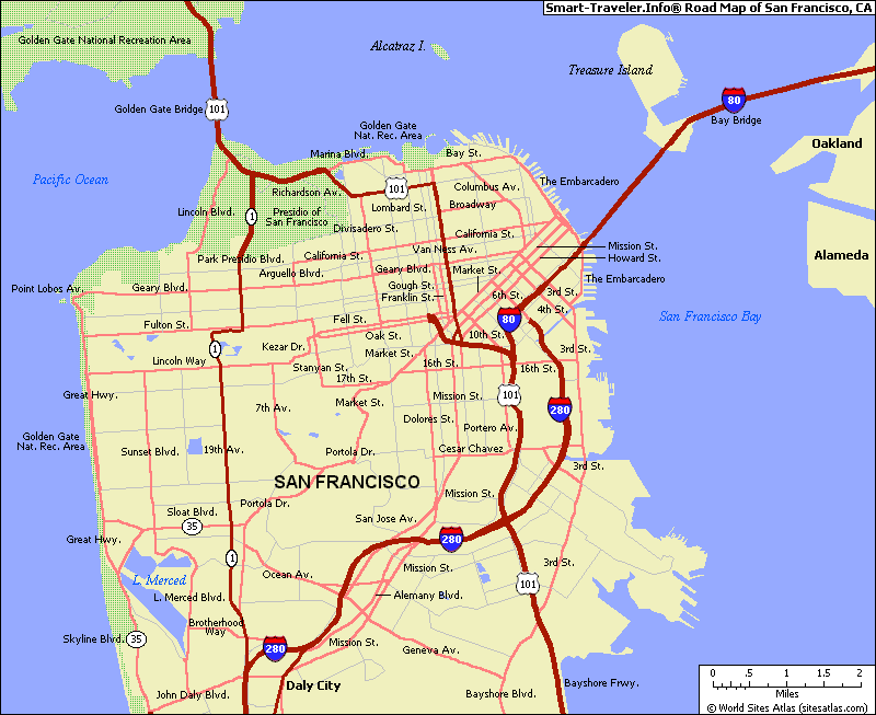
San Francisco California Highway and Road Map with Satellite View
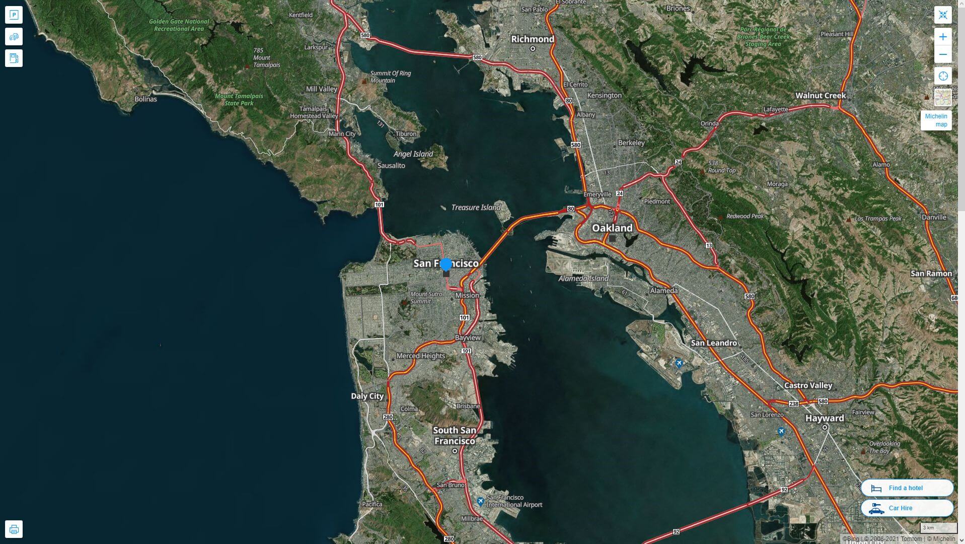
San Francisco California Highway and Road Map
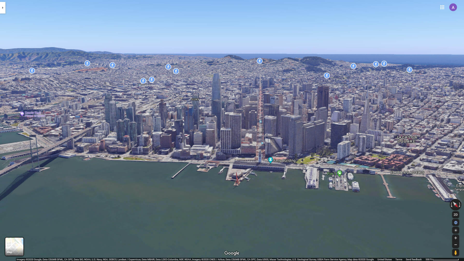
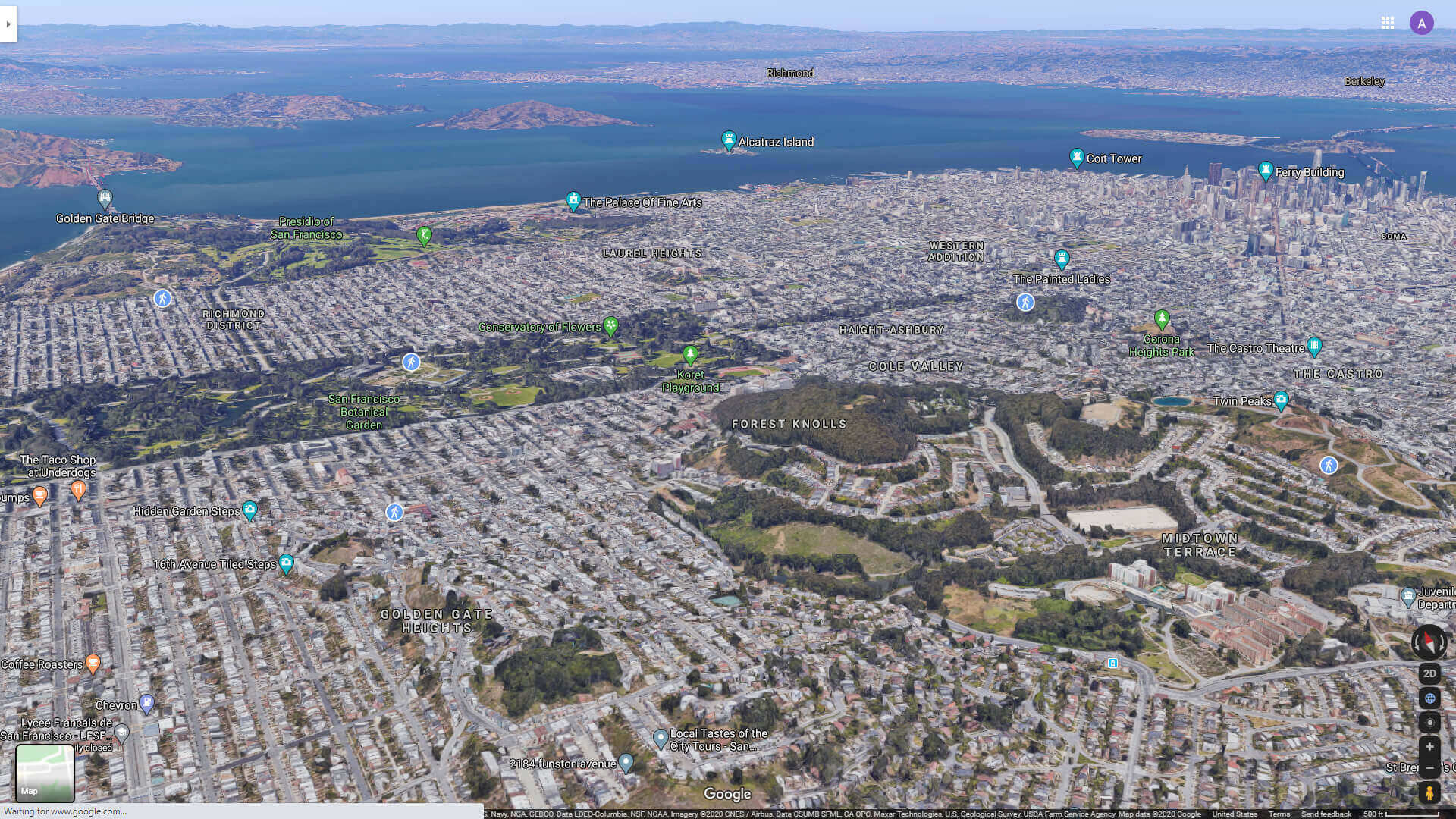
San Francisco City Center Aerial View
San Francisco city map
San Francisco Golden Gate Aerial View
San Francisco historical population growth 1850 – 2023
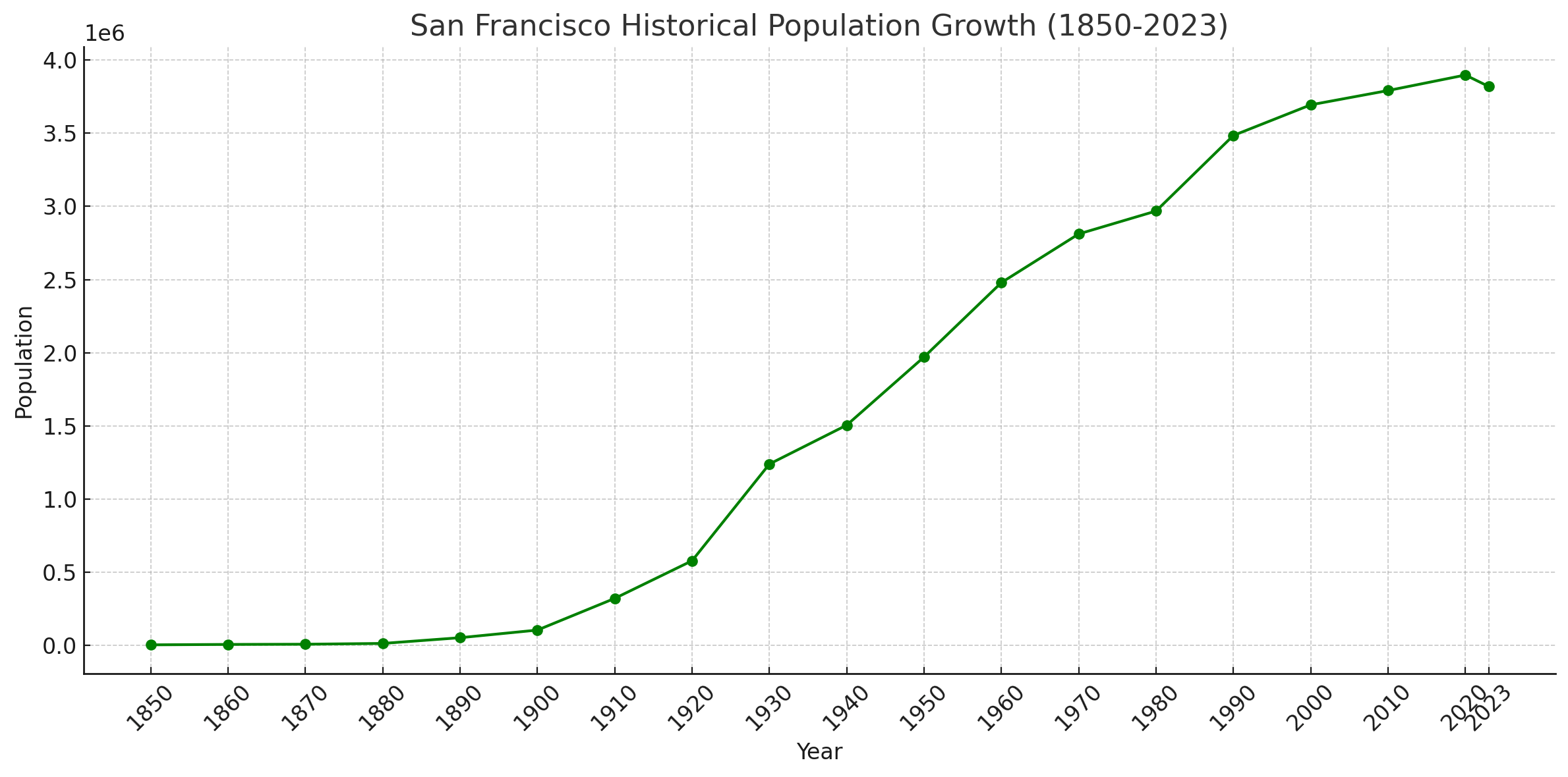 Population History of San Francisco, 1850 – 2023
San Francisco Map California us satellite
San Francisco Map California us
San Francisco Map city boundary
San Francisco map
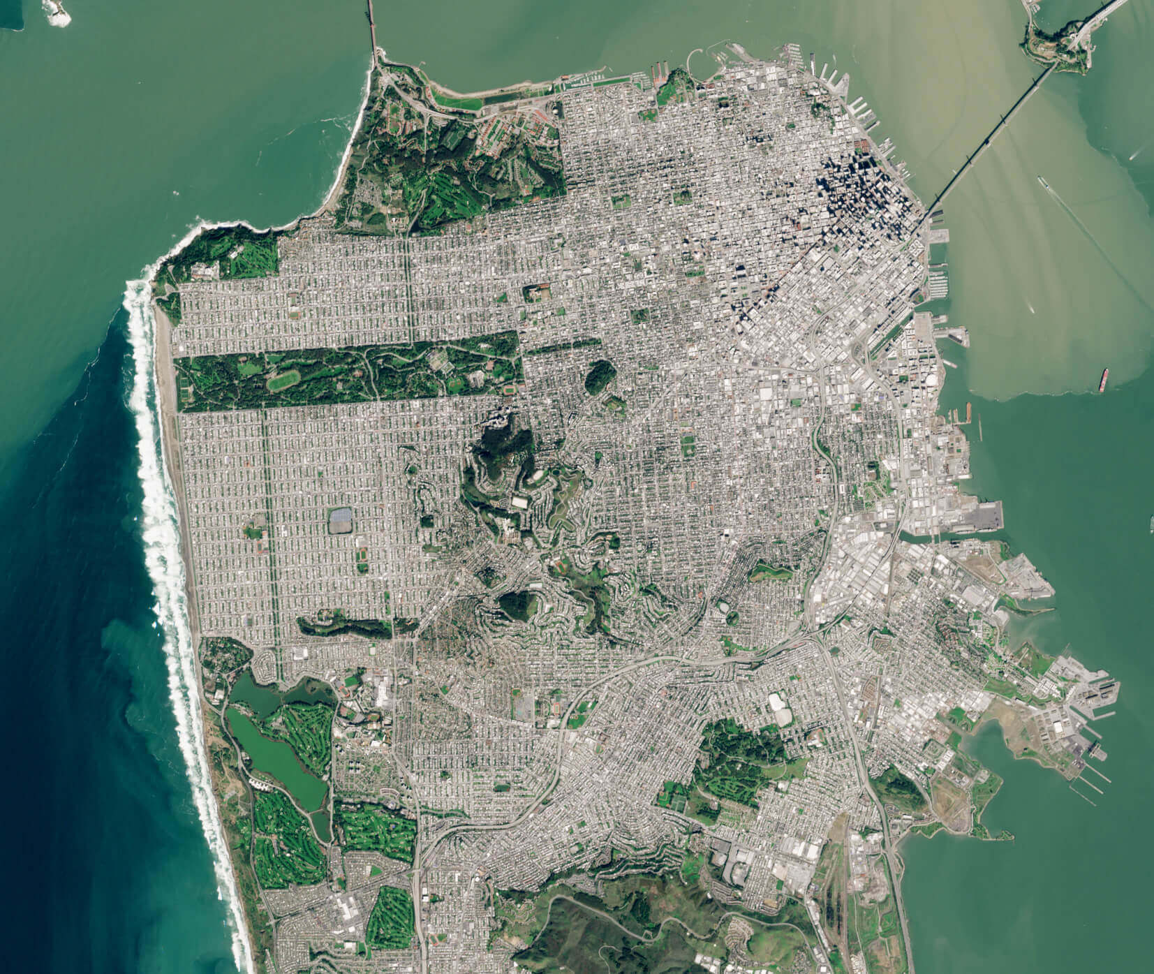
San Francisco satellite map
San Francisco Satellite View and National Forests
San Francisco Satellite View from Pacific Ocean
San Francisco street map
Where is San Francisco on California Map?
Show Google interaactive map, satellite map, where is the country located.
Get directions by driving, walking, bicycling, public transportation and travel with street view.
Feel free to explore these pages as well:
- Los Angeles Wildfires in Map ↗️
- Los Angeles Map ↗️
- San Diego Map ↗️
- Alameda Map ↗️
- Alhambra Map ↗️
- Anaheim Map ↗️
- Antelope Map ↗️
- Antioch Map in California ↗️
- Bakersfield Map in California ↗️
- Orange County Map in California ↗️
- Riverside Map in California ↗️
- California Map ↗️
- California County Map ↗️
- California Physical Map ↗️
- California Road Map ↗️
- California Population Map ↗️
- A Collection of California Maps ↗️
- United States Map ↗️
- North America Map ↗️