Find San Diego’s location on California and USA maps. Situated in Southern California by the Pacific Coast, it’s known for beaches, mild weather, and culture.
San Diego: A Coastal Gem of California and the United States
Where is San Diego in California
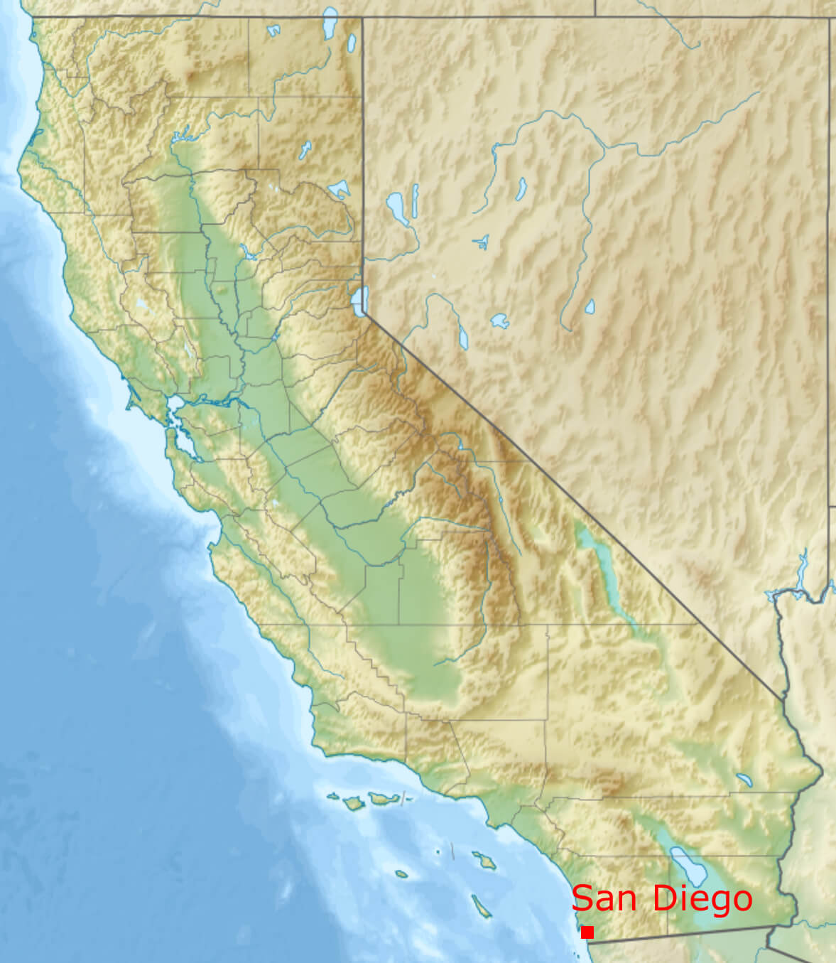 Where is located San Diego on California map.
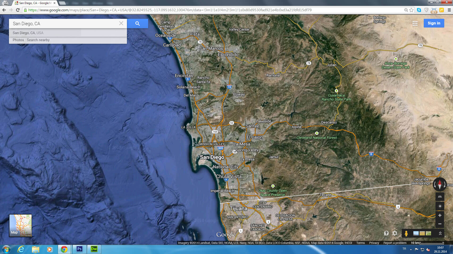
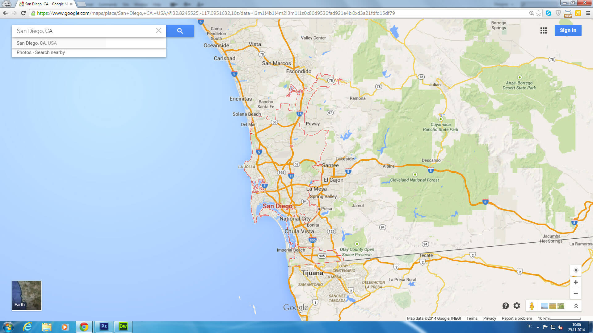
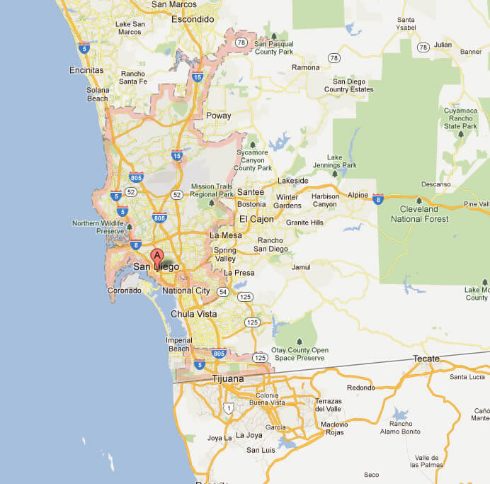
Situated on the Pacific coast of Southern California, San Diego enjoys a prime geographical location just north of the Mexican border. It is the second largest city in California and the eighth largest in the United States, with a population of over 1.4 million. Known for its stunning coastline, San Diego is strategically located between Los Angeles to the north and Tijuana, Mexico to the south, offering a unique blend of American and Mexican cultures. Covering an area of approximately 372 square miles (963 km²), the city boasts a diverse landscape – from golden beaches and coastal cliffs to rolling hills and canyons – all set against the backdrop of the vast Pacific Ocean.
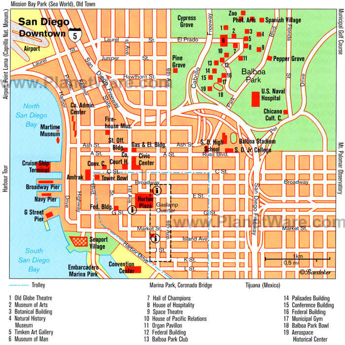
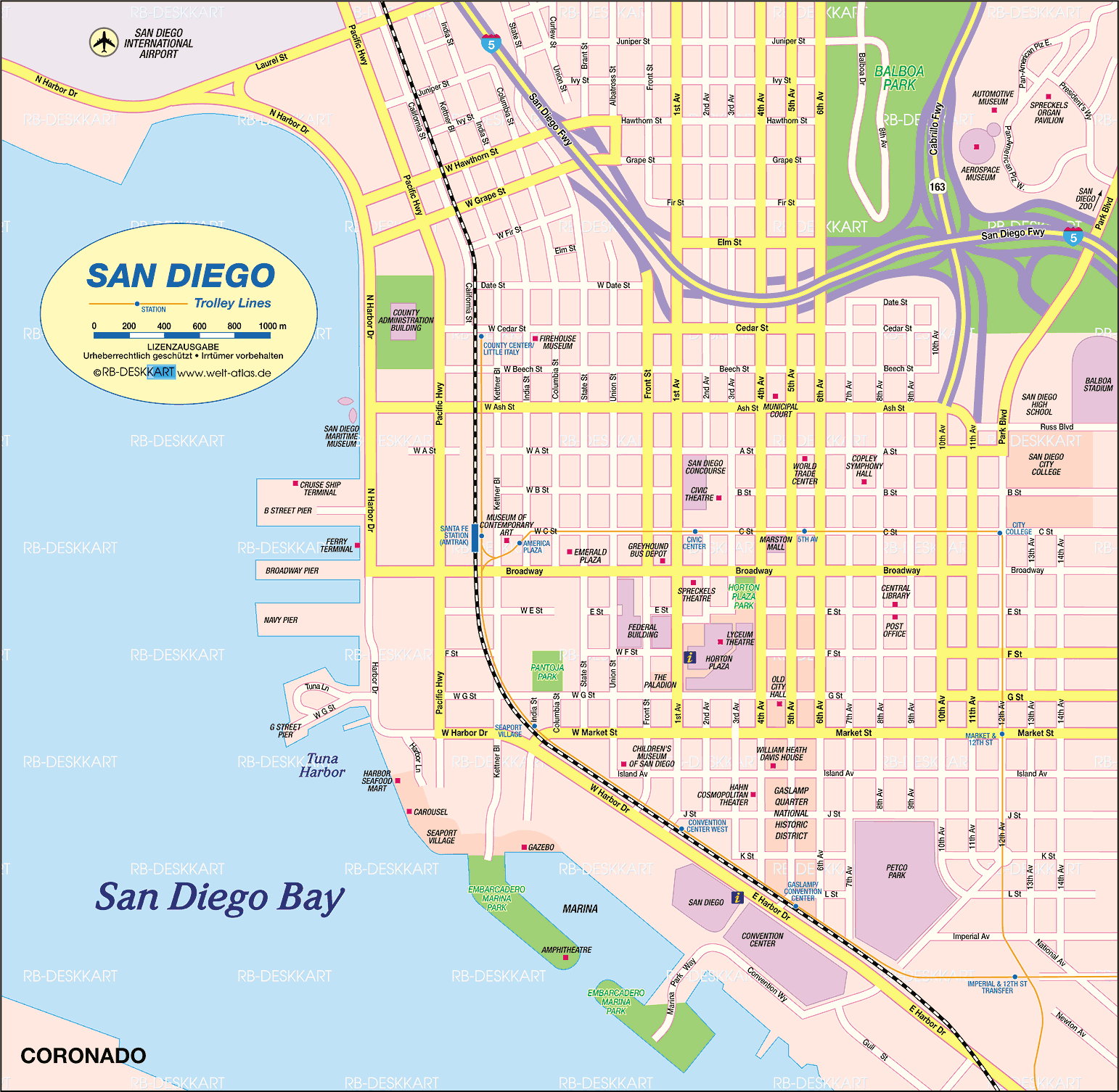
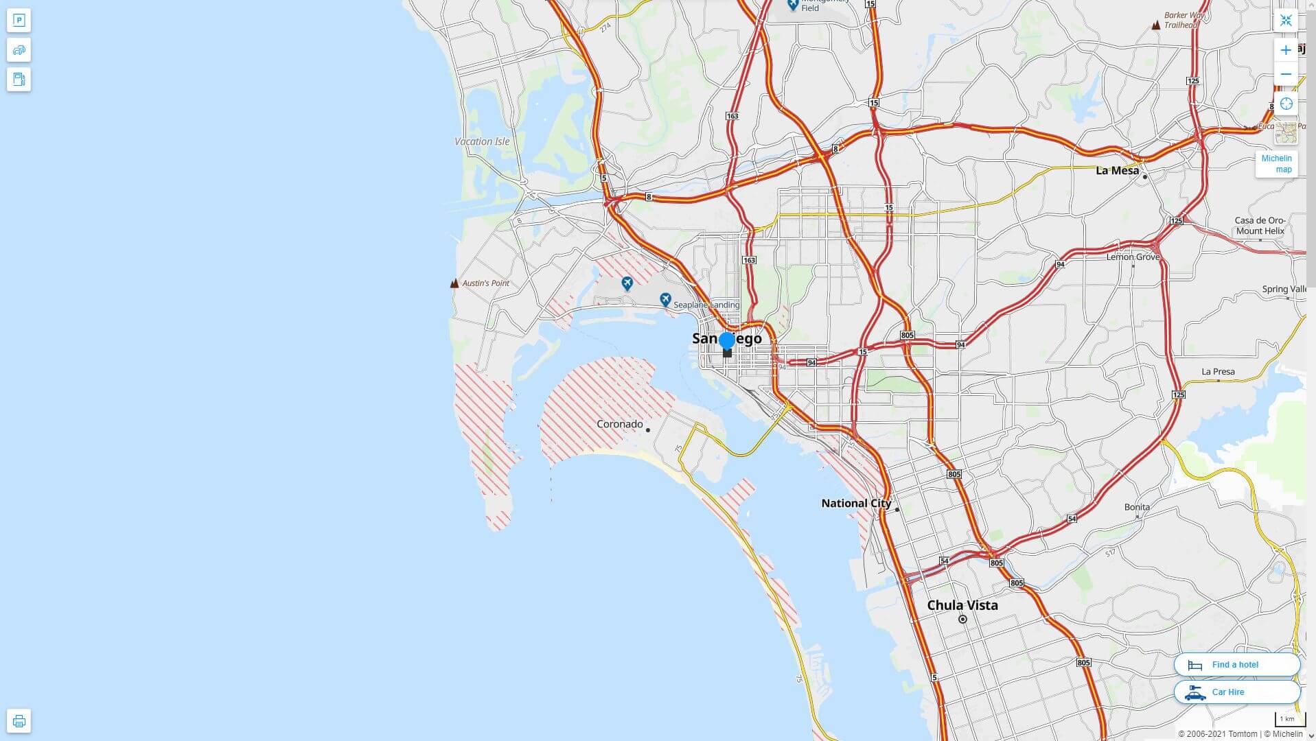
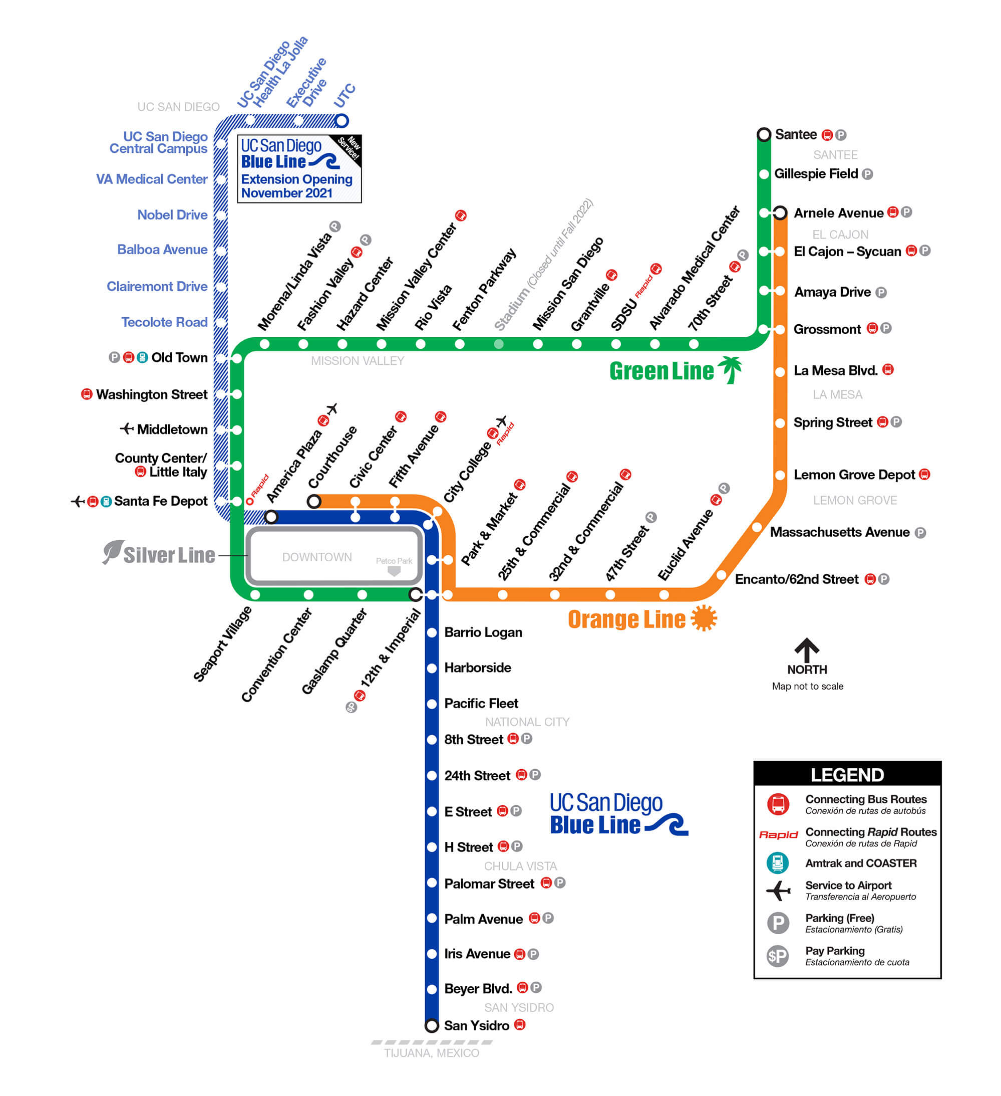
San Diego downtown map
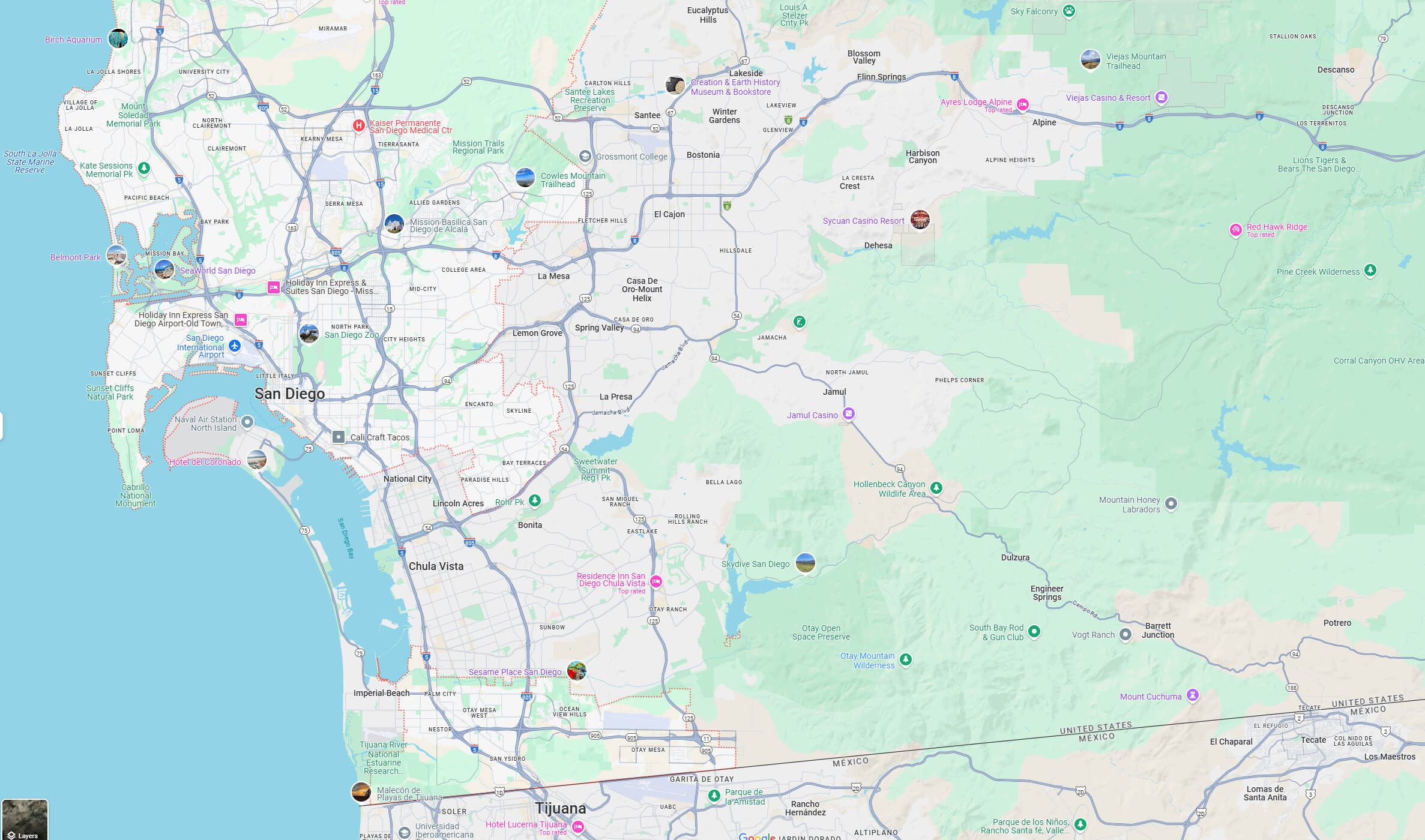
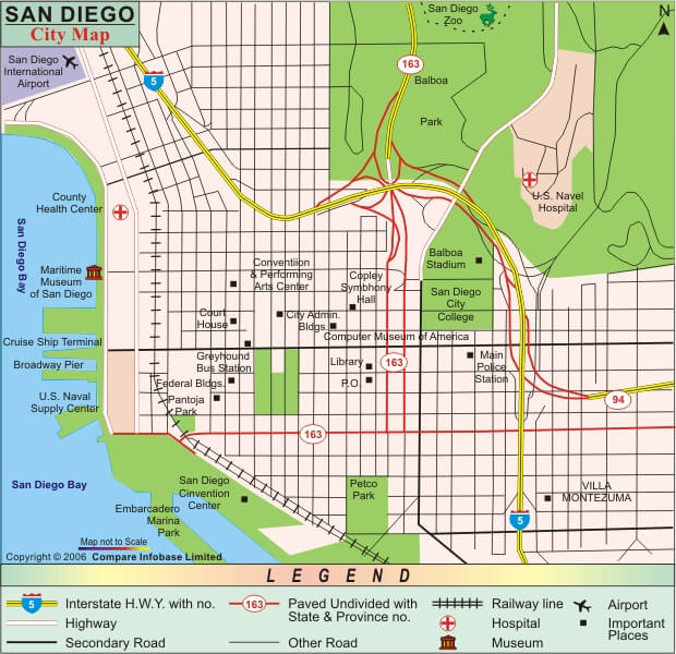
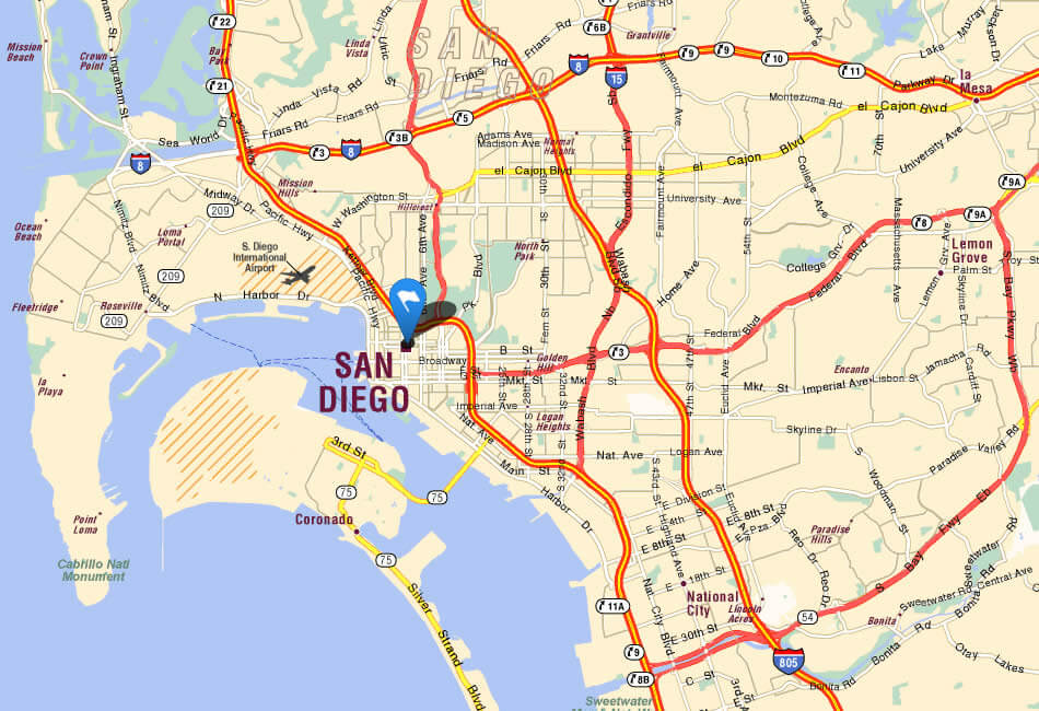
San Diego city map
Atlas Map of San Diego
City maof of San Diego
San Diego California
San Diego’s rich history dates back thousands of years, with the Kumeyaay people originally inhabiting the region long before European exploration. In 1542, Portuguese explorer Juan Rodríguez Cabrillo became the first European to set foot on the west coast, naming the area “San Miguel”. It wasn’t until 1769 that the Spanish established the San Diego Mission and Presidio, making it the first European settlement in California. Over time, San Diego grew from a small military outpost to a bustling port city, eventually becoming part of the United States in 1850. Today, its historic landmarks – such as Old Town San Diego and the Gaslamp Quarter – are vibrant reminders of its storied past.
Map of San Diego
Map of San Diego
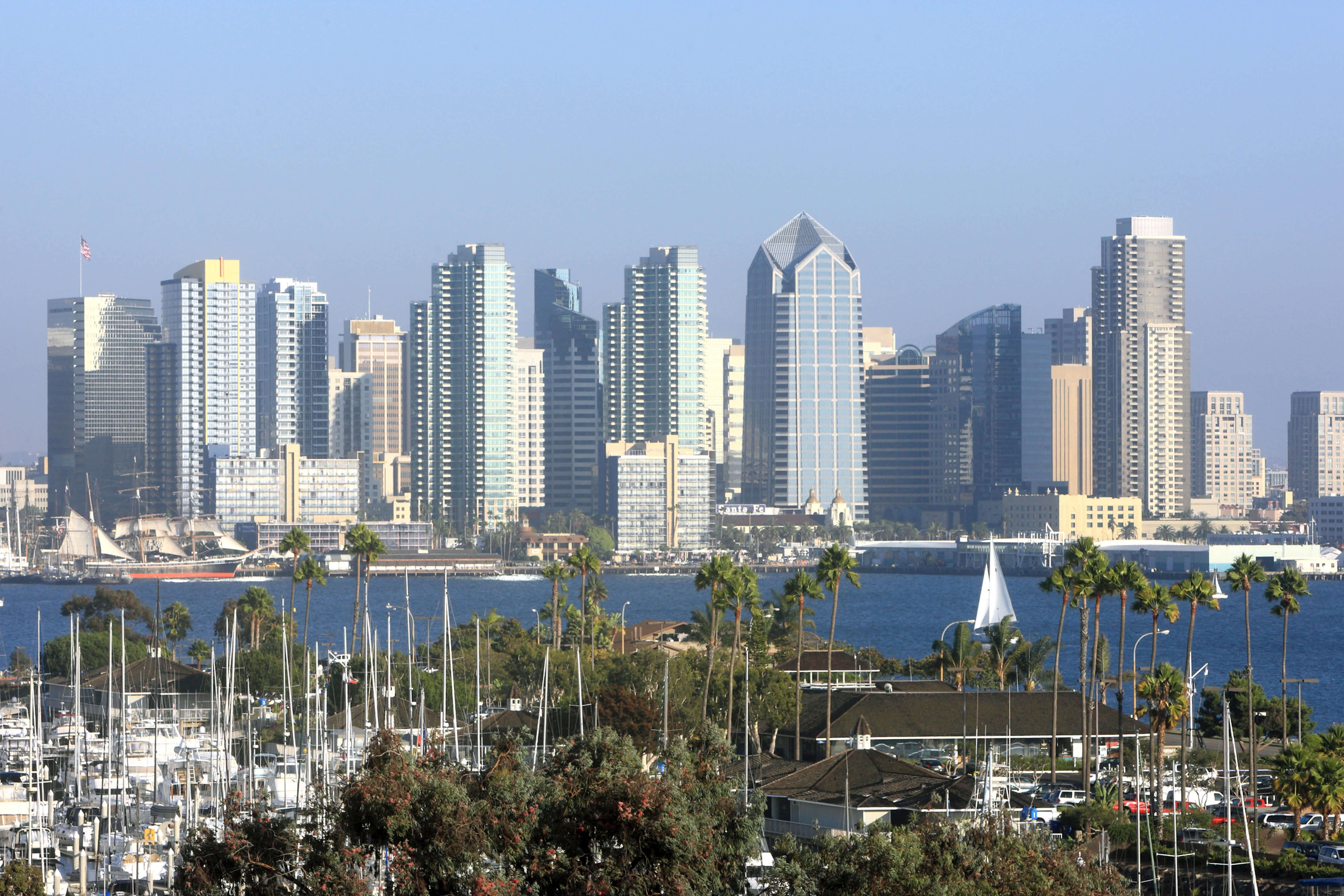
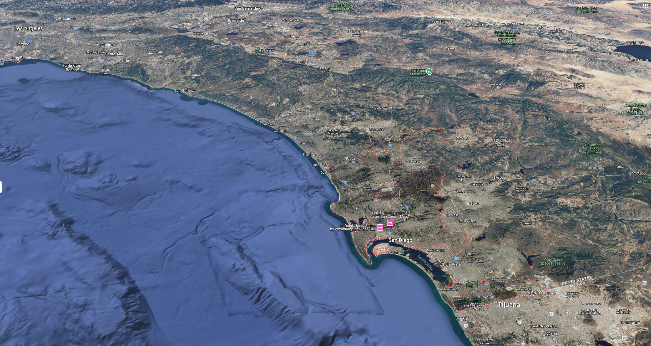
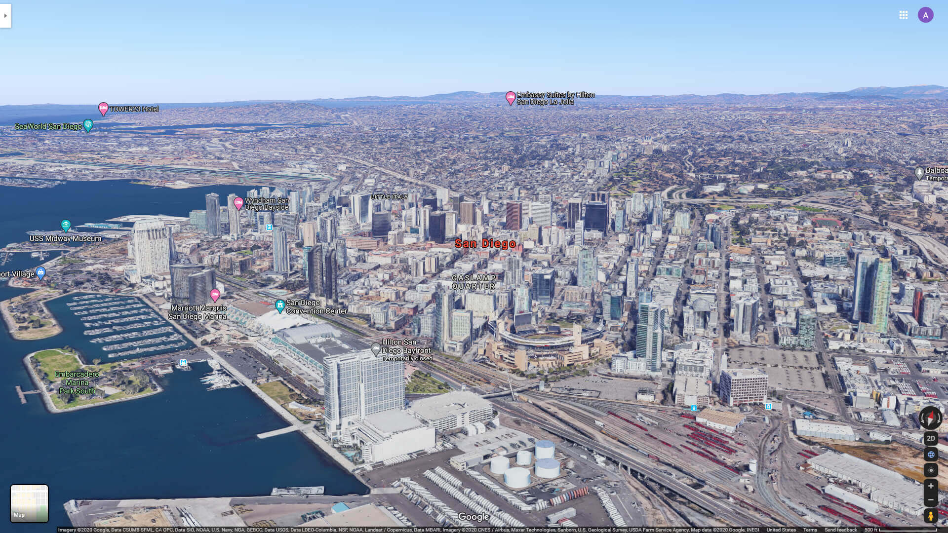
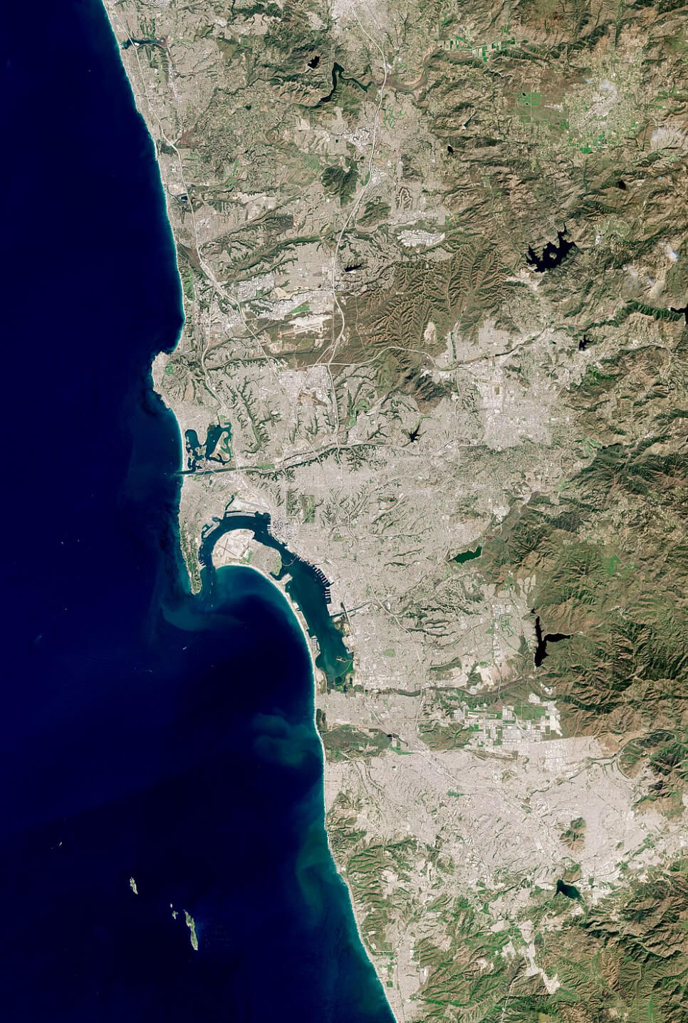
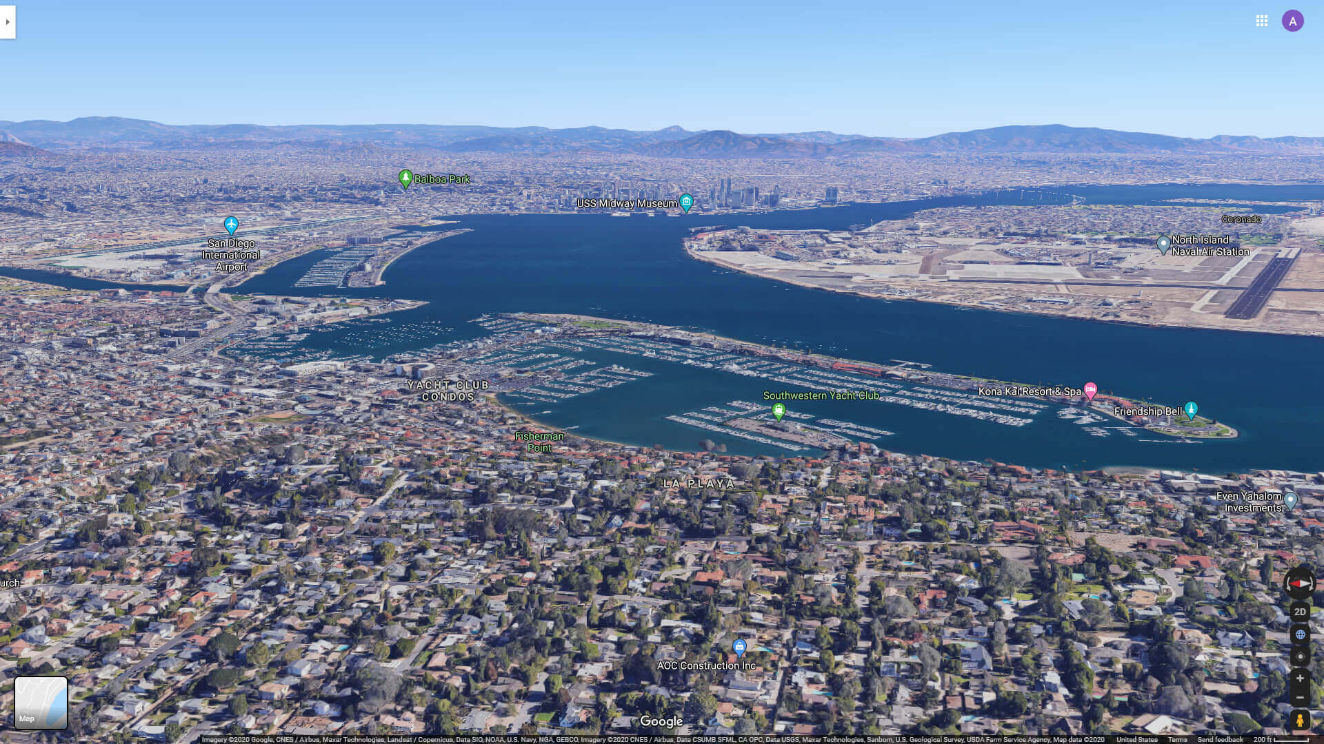
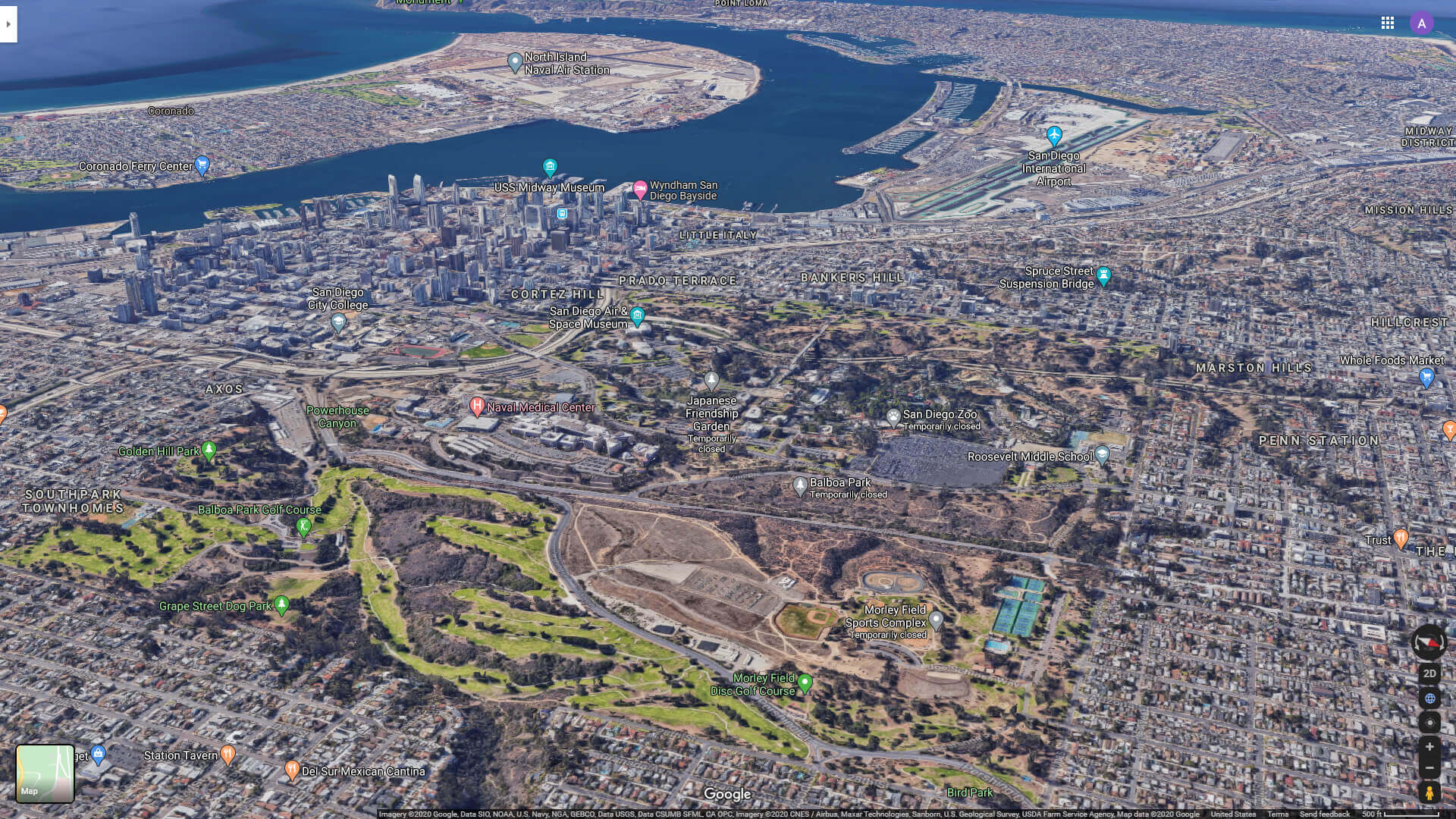
San Diego aerial view from pacific ocean
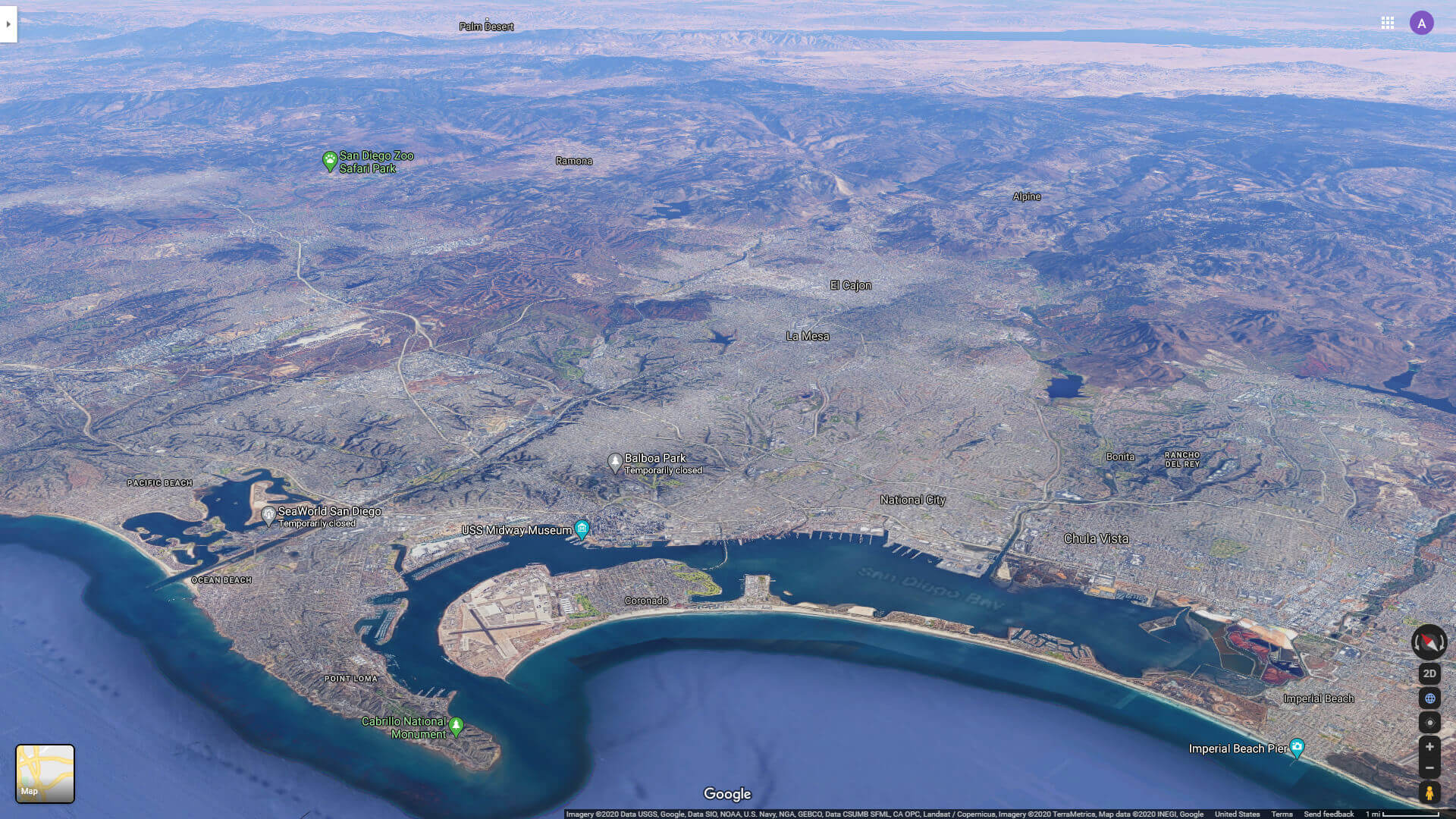
San Diego aerial view map
San Diego bay area map
Linda Vista San Diego California
 Linda Vista in San Diego, California – United States.
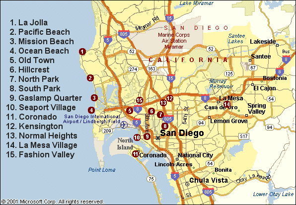
San Diego’s Mediterranean climate is one of its most alluring features, offering mild, sunny weather year-round, with average temperatures ranging from 57°F (14°C) in winter to 72°F (22°C) in summer. This idyllic weather fosters an active outdoor culture where surfing, hiking and sailing are part of everyday life. But San Diego isn’t just about beaches and sunshine – it’s also a cultural powerhouse. The city is home to Balboa Park, a sprawling urban oasis filled with museums, theatres and the renowned San Diego Zoo. Its vibrant neighbourhoods – such as Little Italy, North Park and La Jolla – each offer their own flavour of art, cuisine and community spirit. From world-class craft breweries to annual events like Comic-Con, San Diego combines laid-back coastal living with a dynamic cultural scene, making it a truly unique destination in California and the United States.
San Diego California highway and road Map with satellite view
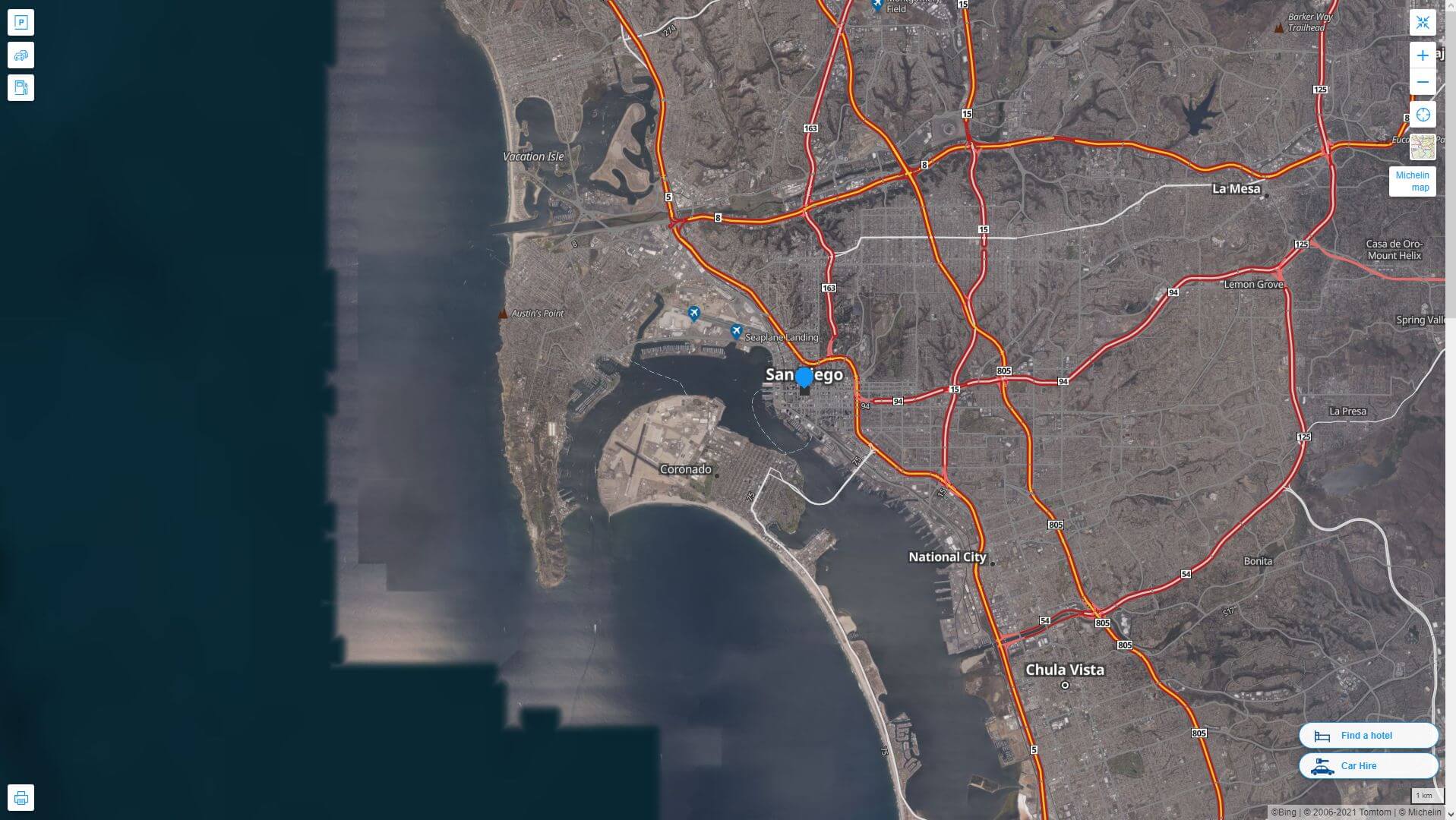
San Diego California highway and road map
San Diego city center aerial view
San Diego city Map CA
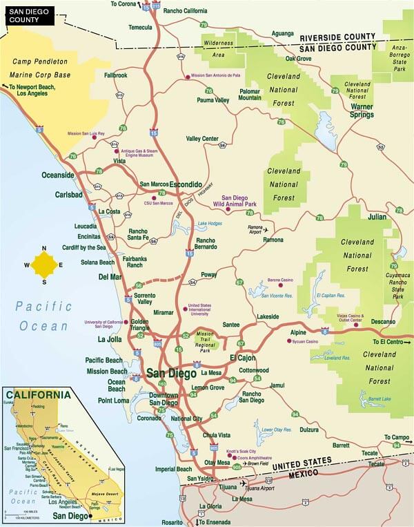
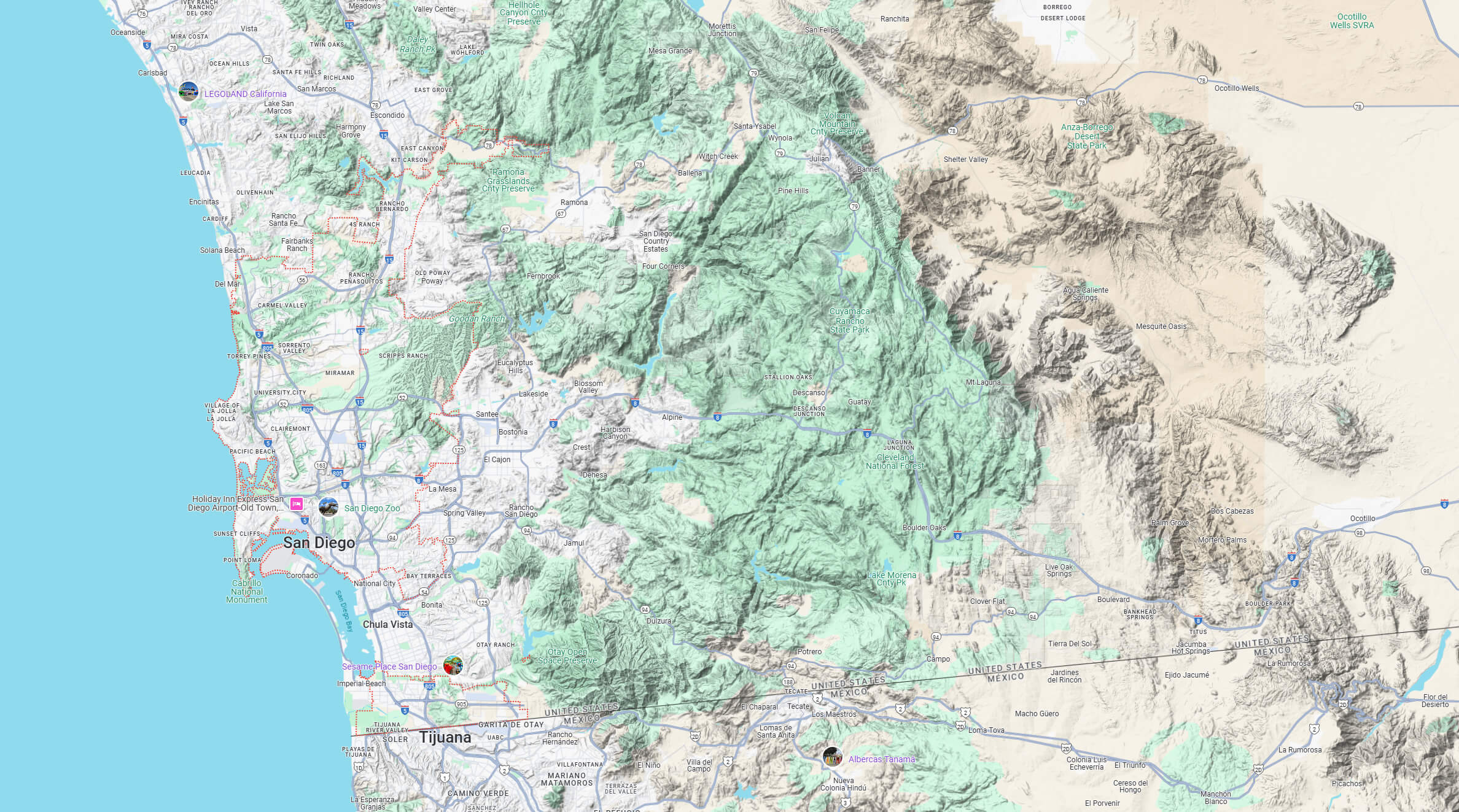
San Diego county map
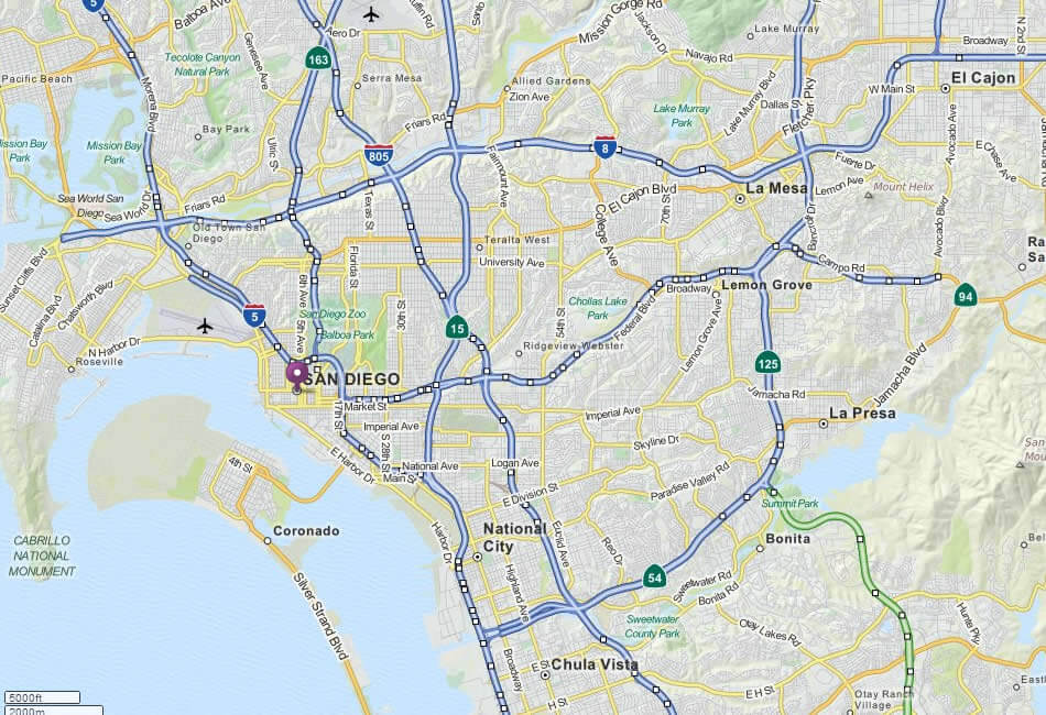
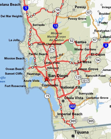
San Diego highways map
San Diego historical population growth 1850 – 2023
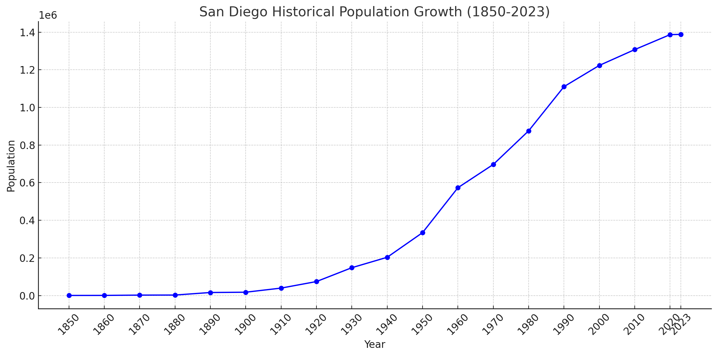 Population History of San Diego, 1850 – 2023
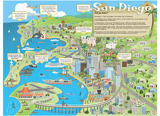
San Diego tourism map
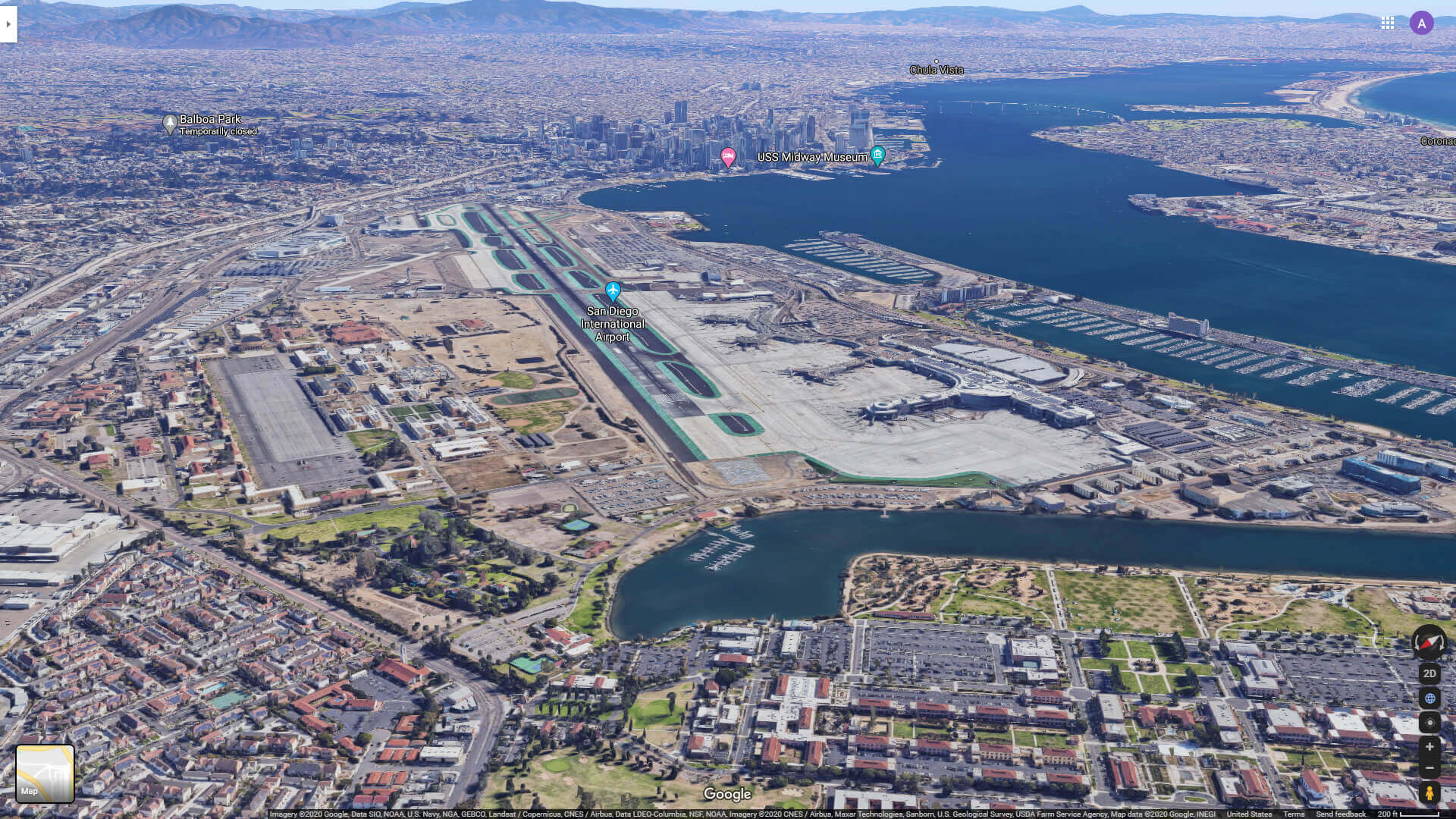
San Diego international airport
San Diego Map California US satellite
San Diego Map California US
San Diego Map city boundary
San Diego map
San Diego metro map
San Diego satellite map
San Diego terrian map
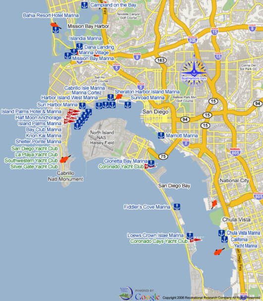
San Diego yacht club
San Diego zoo California
Where is San Diego on the US map
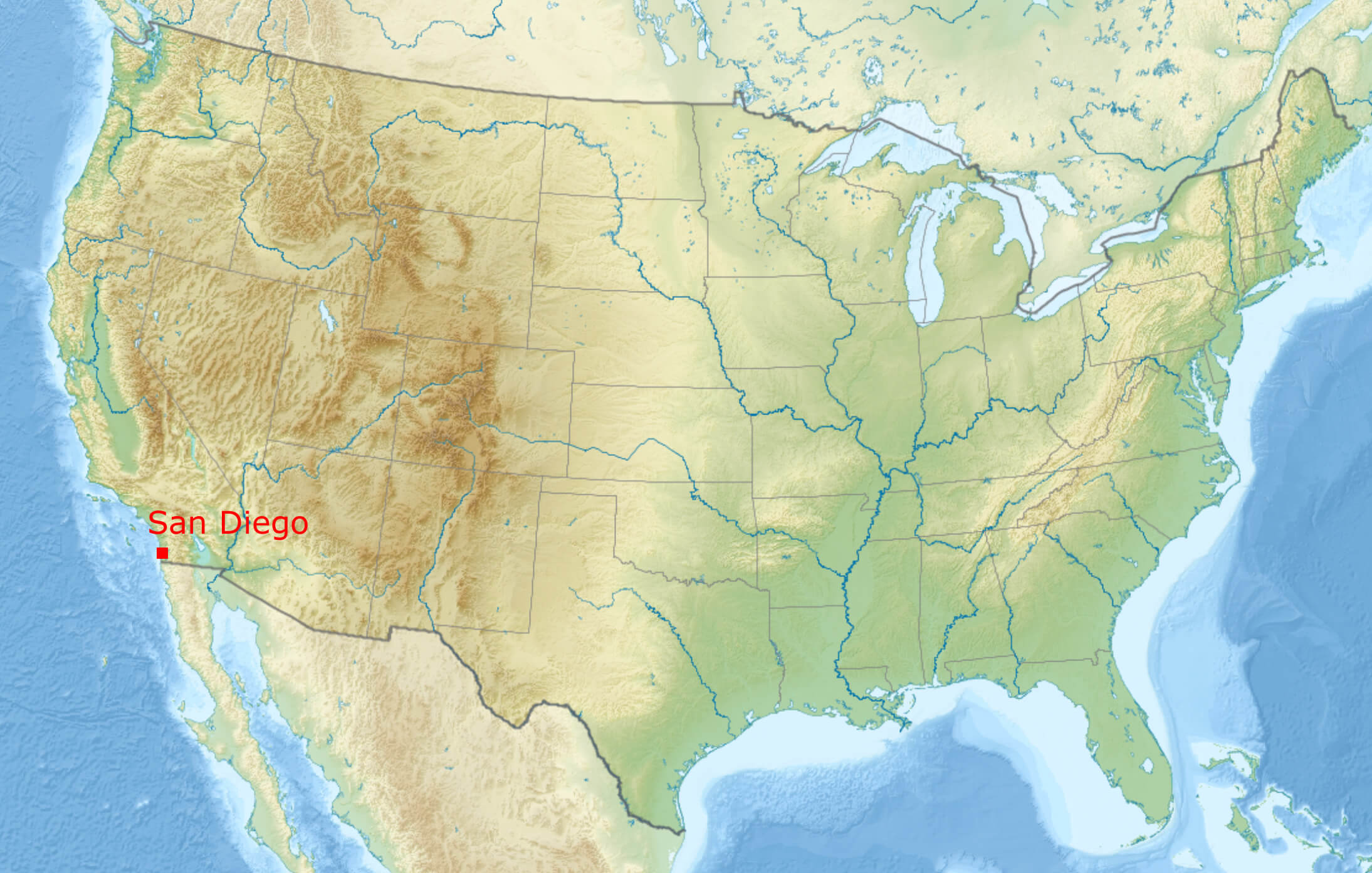
Where is San Diego on California Map?
Show Google interaactive map, satellite map, where is the country located.
Get directions by driving, walking, bicycling, public transportation and travel with street view.
Feel free to explore these pages as well:
- Los Angeles Wildfires in Map ↗️
- Los Angeles Map ↗️
- San Francisco Map ↗️
- Alameda Map ↗️
- Alhambra Map ↗️
- Anaheim Map ↗️
- Antioch Map in California ↗️
- Antelope Map ↗️
- Bakersfield Map in California ↗️
- Orange County Map in California ↗️
- Riverside Map in California ↗️
- California Map ↗️
- California County Map ↗️
- California Physical Map ↗️
- California Road Map ↗️
- California Population Map ↗️
- A Collection of California Maps ↗️
- United States Map ↗️
- North America Map ↗️