A collection maps of Georgia; View a variety maps of Georgia physical, political, relief map. Satellite image of Georgia, higly detalied maps, blank map of Georgia, USA and Earth. And find more Georgia’s country, regions, topography, cities, road, rivers, national, directions maps and atlas.
Georgia US State Map
 Georgia US State map with major cities and towns.
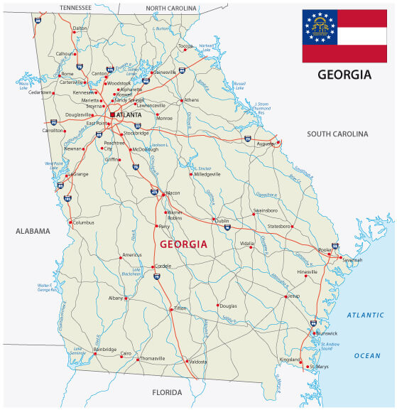
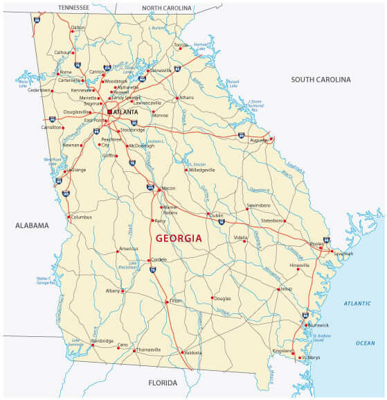
Georgia Road Map

Georgia Road map with main cities and interstate routes.
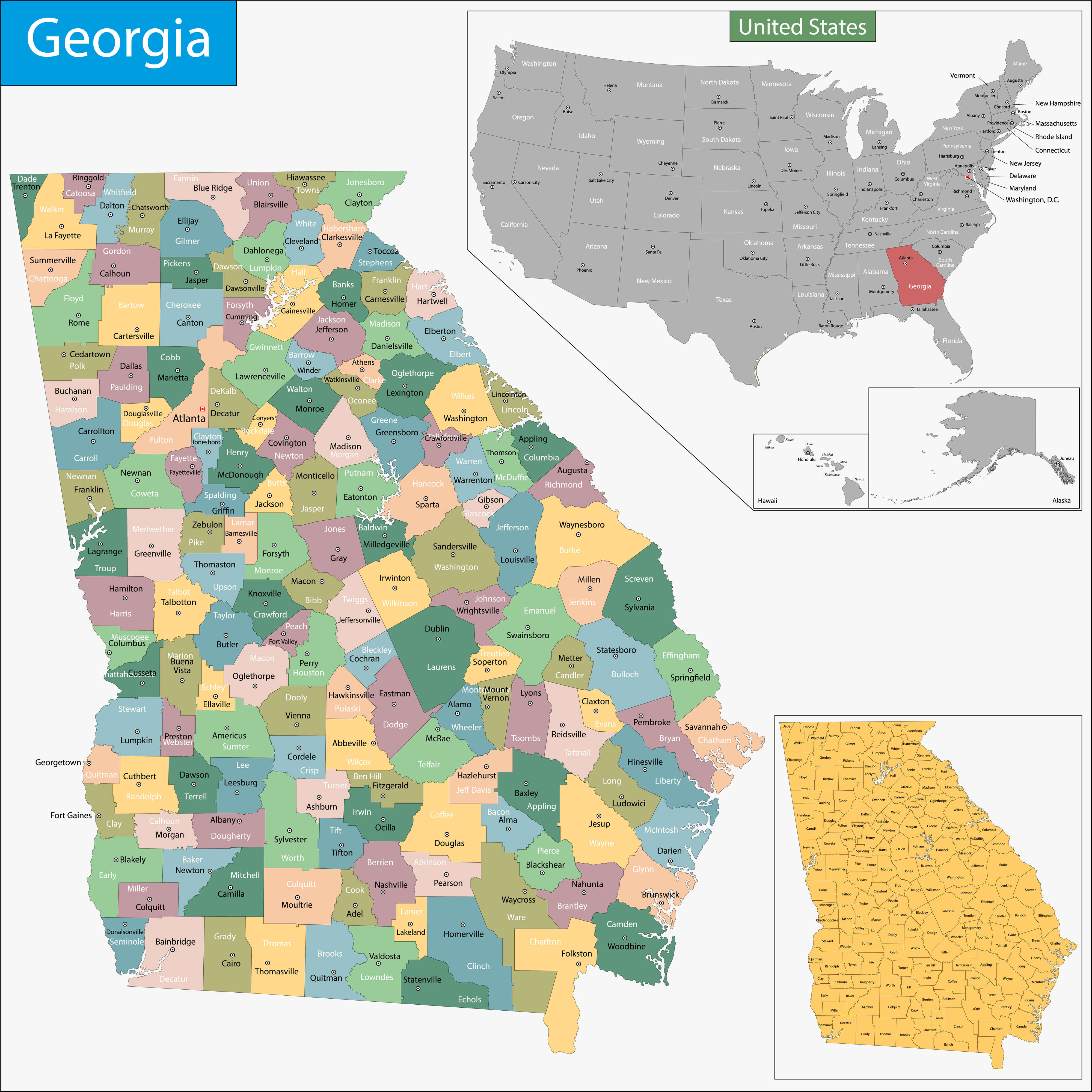
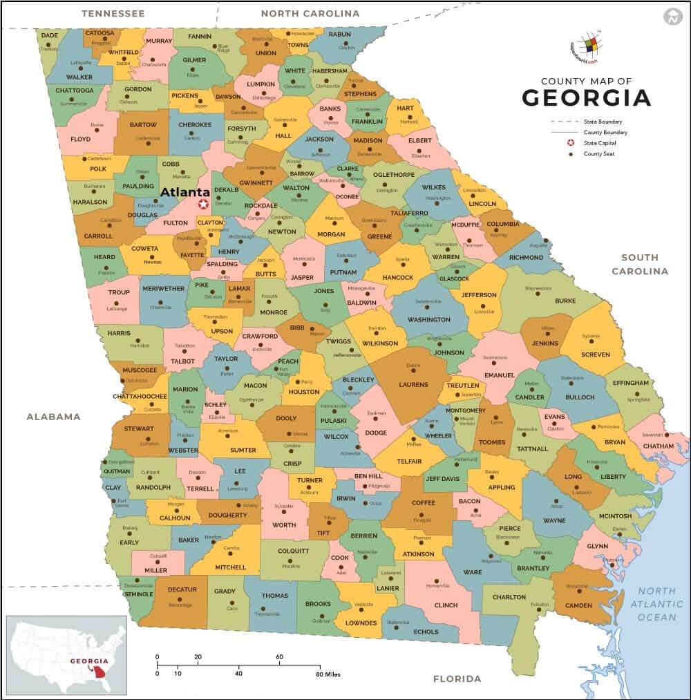
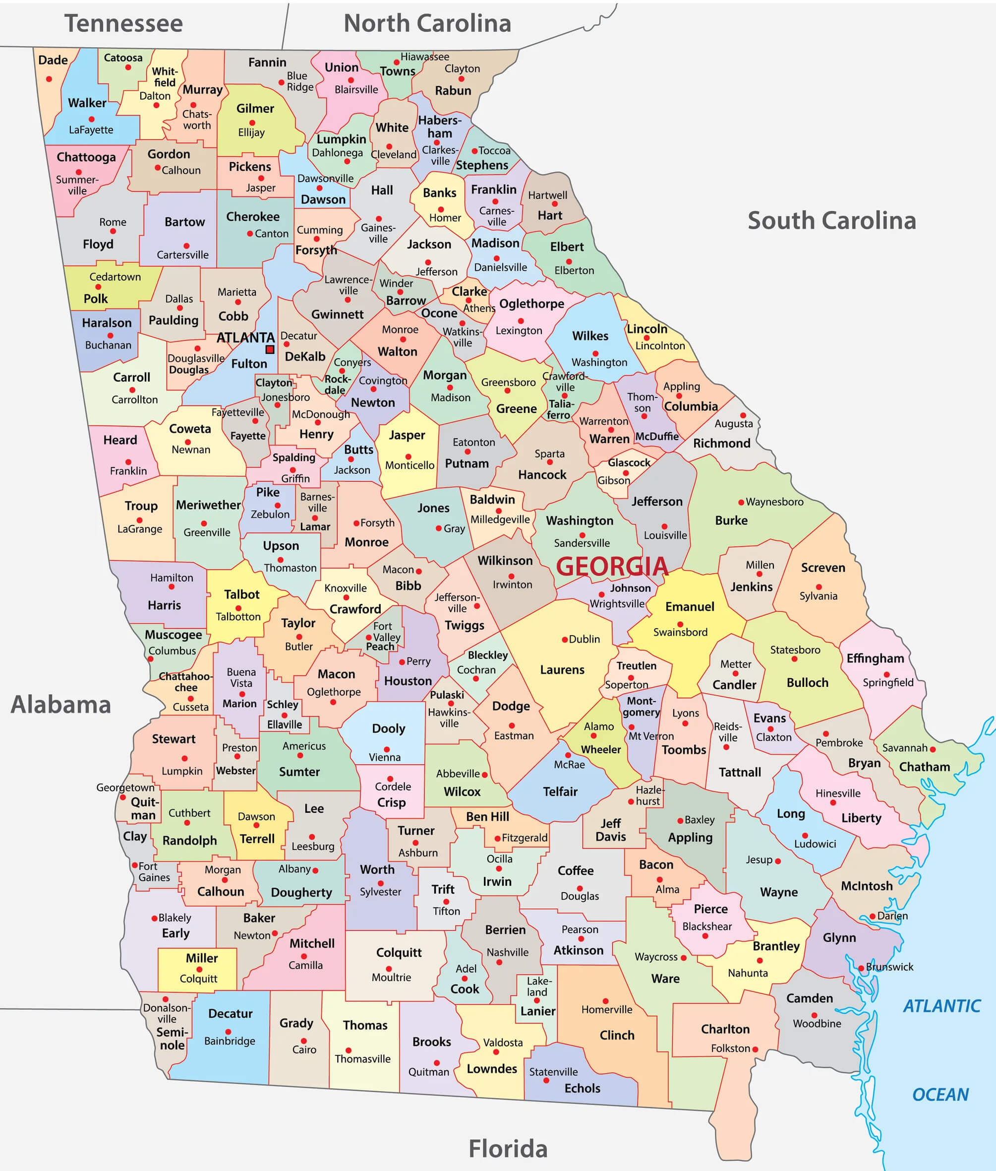
Georgia Counties Map
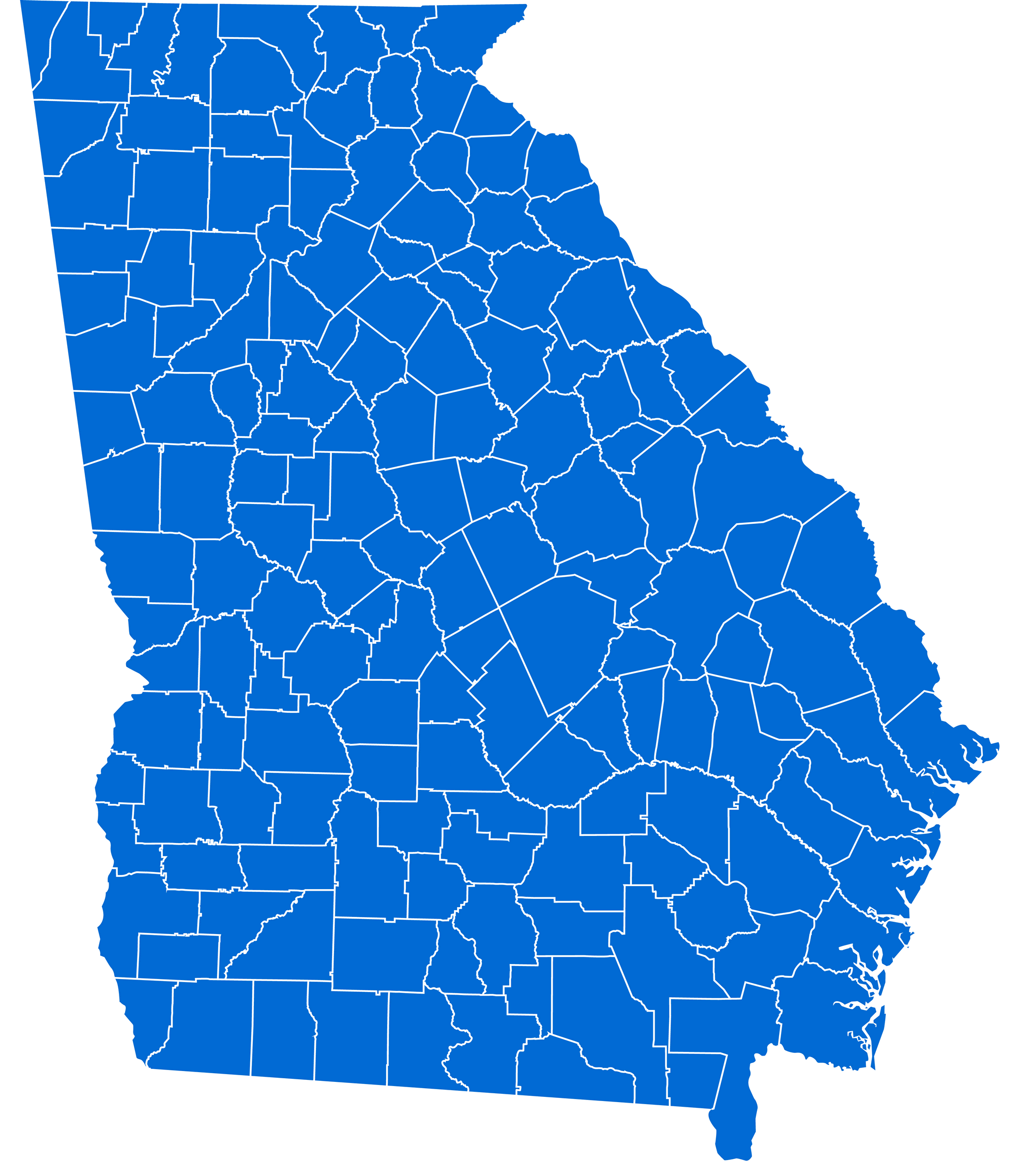
Georgia Counties map with blank state map.
Georgia Road Map with Flags
Georgia Road map with main cities and flags.
Atlanta, Georgia Area Map
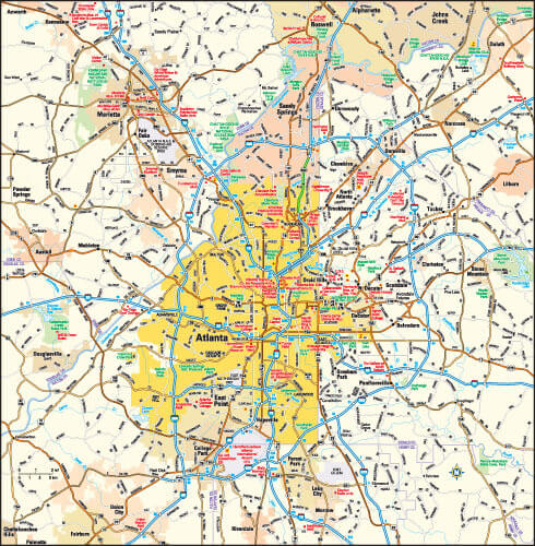
Atlanta, Georgia Area Map, United States.
Georgia State Map, US
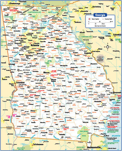
Georgia State maps the US with main cities and towns.
Where is located Georgia on the US Map
Georgia is located in the southeastern region of the United States, bordered by several states and the Atlantic Ocean. It borders Tennessee and North Carolina to the north, and South Carolina to the northeast, separated in part by the Savannah River. Alabama borders Georgia to the west and Florida to the south. Its eastern coast runs along the Atlantic Ocean, providing access to major ports such as Savannah, which has historically been crucial to trade and transportation in the region.
The state’s geography varies from the mountainous terrain of the Appalachian Mountains in the north to the coastal plains in the south. Georgia’s capital, Atlanta, is located in the north-central part of the state and is a major transportation, business and cultural hub, not only for Georgia but for the entire southeastern U.S. Known as the Peach State, Georgia is also an important agricultural state with diverse landscapes that support agriculture, forestry and outdoor tourism. Its central location in the Southeast makes it both a cultural crossroads and an economic powerhouse in the region.
Here are some statistical information about Georgia:
 Superstition Mountains in Georgia, US
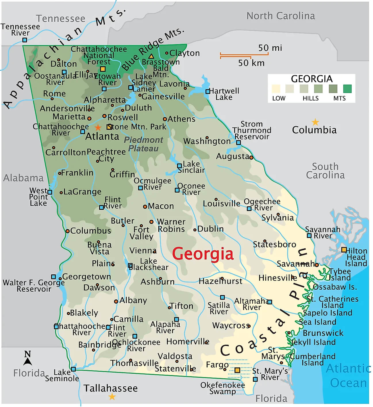
Physical Map of Georgia, USA – Landforms and Natural Features
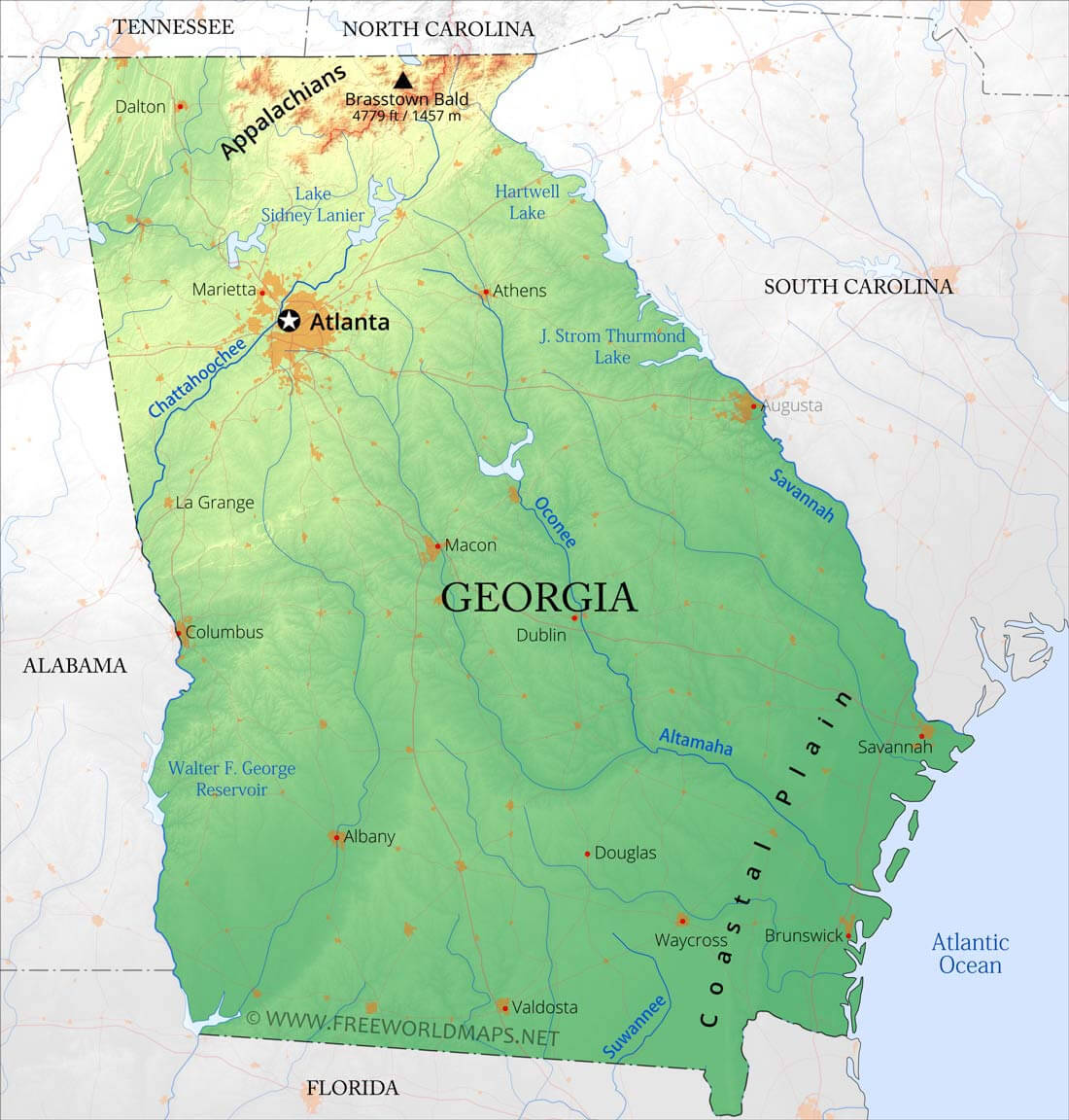 Map highlighting Georgia’s physical features – Appalachians, rivers, plains.
Political Map of Georgia with Counties and County Seats
Georgia Population Density Map by County
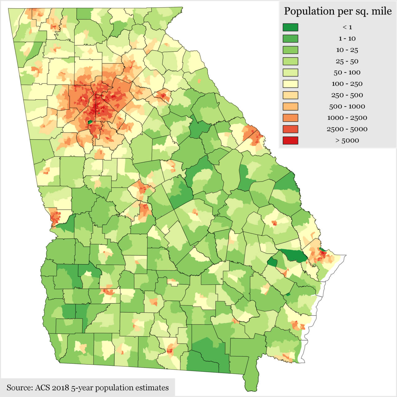 Map of Georgia showing population density per square mile by county.
Major cities and population in Georgia, US
Here are some of the major cities in Georgia, United States, along with their approximate populations based on recent data:- Atlanta – 498,715 (state capital and largest city)
- Augusta – 202,081
- Columbus – 206,922
- Macon – 157,346
- Savannah – 147,780
- Athens – 127,315
- Sandy Springs – 109,452
- Roswell – 94,884
- Johns Creek – 84,579
- Warner Robins – 81,446
- Alpharetta – 67,213
- Marietta – 61,497
- Valdosta – 56,457
- Smyrna – 56,666
- Brookhaven – 55,366
Georgia Rivers Map with Major Cities and Geographic Features
 Map of Georgia showing rivers, major cities, and geographic features.
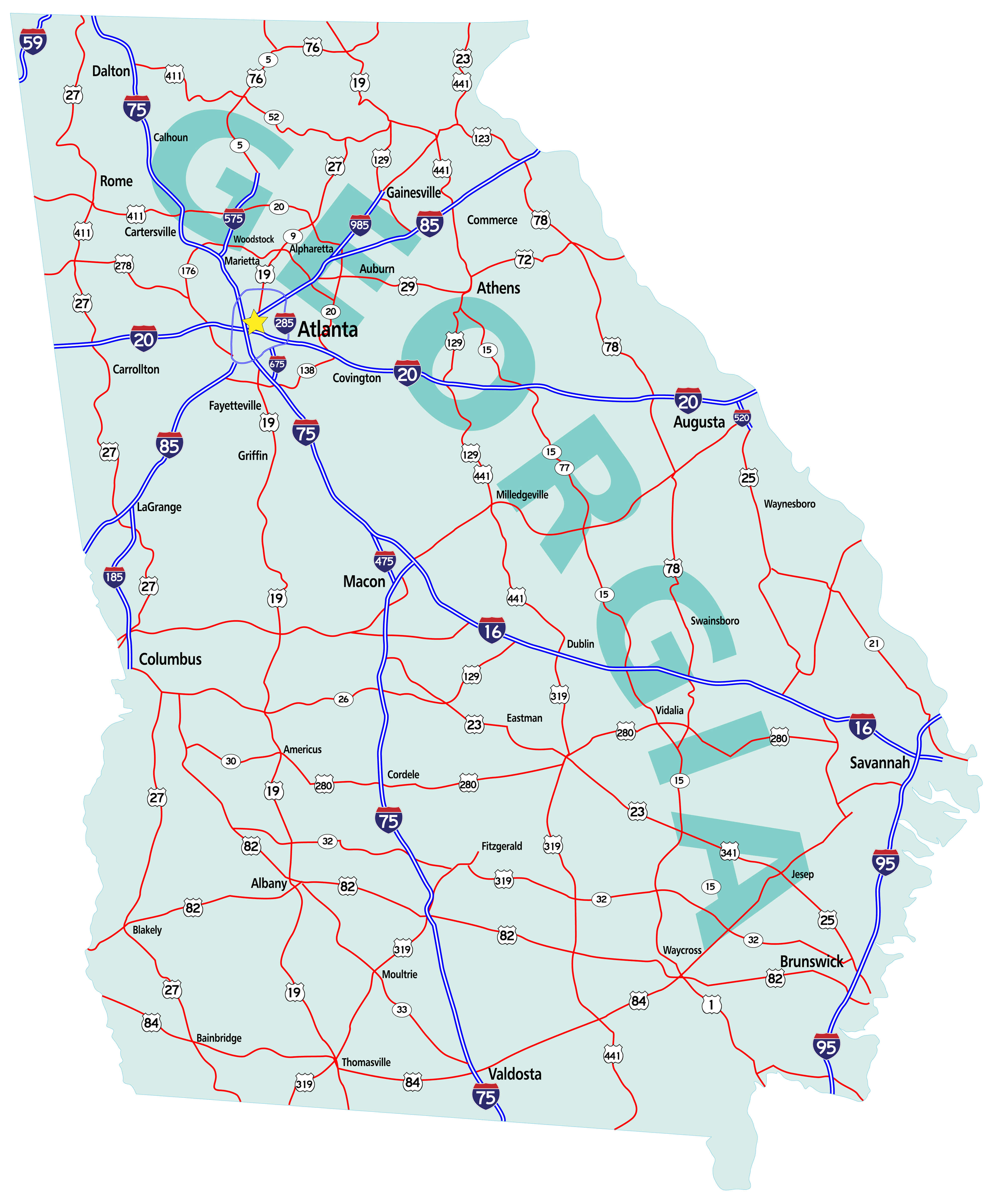
Comprehensive Georgia Road Map with Major Highways and Cities
 Georgia road map highlighting major highways, cities, and interstates.
Detailed Georgia State Borders and Counties Map
 Map of Georgia state with borders, highlighting counties and major cities
Comprehensive Georgia State Road Map with Major Highways
 Map of Georgia state showing major highways, interstates, and cities.
Detailed National Map of Georgia, USA with Key Features
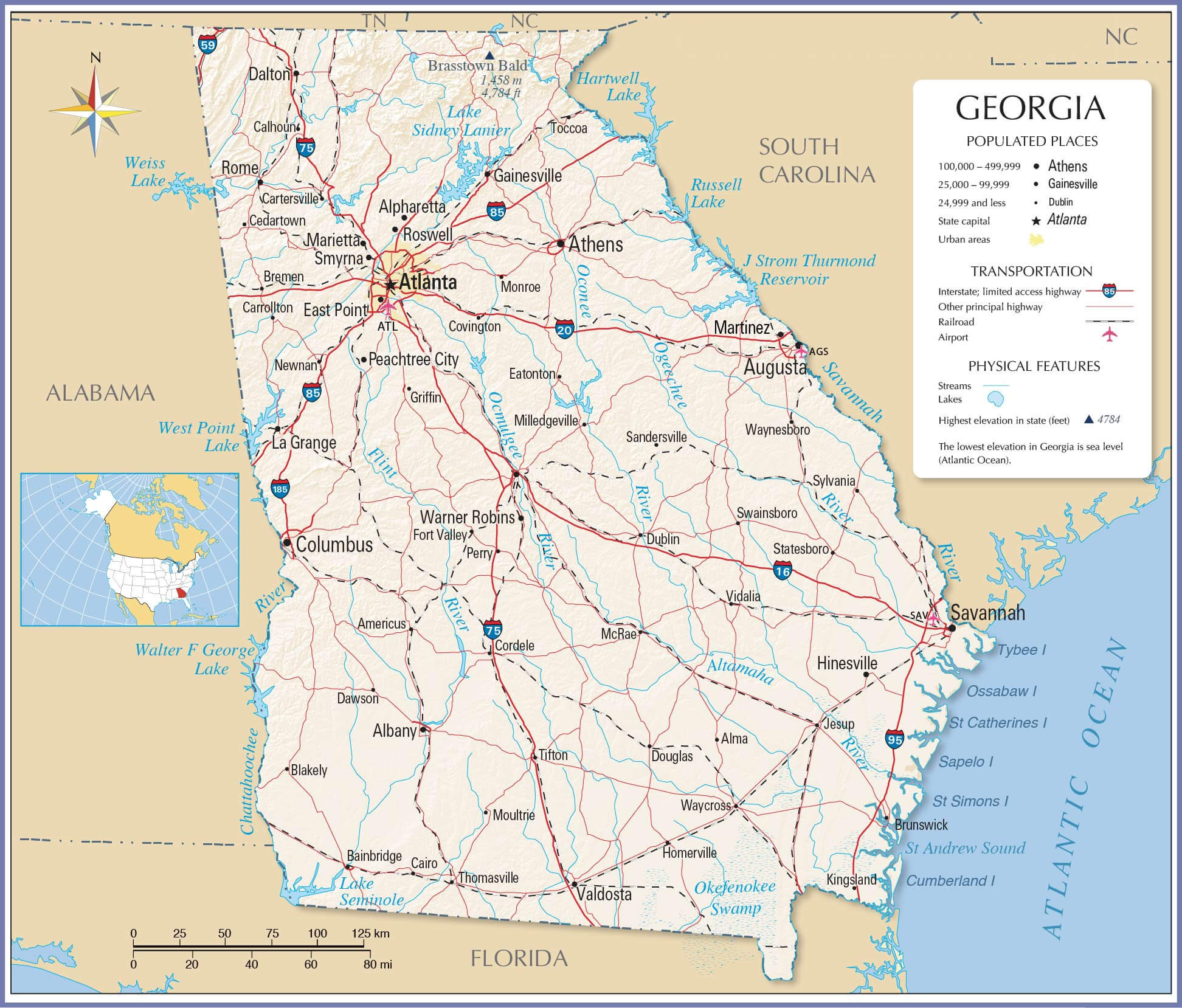 Georgia map showing populated places, highways, airports, lakes, and rivers.
1896 Historical Map of Georgia’s Indian Lands
 Historical map showing Indian lands in Georgia, dated 1896.
Location of Georgia on the U.S. Map with Detailed County View
Map showing Georgia’s location in the U.S. with county detailsWhispers of Arlington (Virginia): A Visual Journey Through Time and Culture
Where is Georgia on the United States Map?
Show Google interactive map, satellite map, where is the country located.
Get directions by driving, walking, bicycling, and public transportation, and travel with street view.
Feel free to explore these pages as well:
- Georgia Map ↗️
- Map of Georgia ↗️
- Georgia Photos ↗️
- Atlanta’s Allure: The Vibrant Heart of the South ↗️
- 2024 US Presidential Election Swing States by Maps ↗️
- The US presidential election in Georgia: Predictions for 2024 and a look back at the swing in 2020 ↗️
- Arizona Map ↗️
- Arizona’s US Presidential Election: 2024 Predictions and a Look Back at the 2020 Swing ↗️
- California Map ↗️
- Texas Map ↗️
- New York Map ↗️
- Florida Map ↗️
- Illinois Map ↗️
- Pennsylvania Map ↗️
- Ohio Map ↗️
- Michigan Map ↗️
- New Jersey Map ↗️
- North Carolina Map ↗️
- Virginia Map ↗️
- Massachusetts Map ↗️
- Indiana Map ↗️
- Tennessee Map ↗️
- Missouri Map ↗️
- Maryland Map ↗️
- Washington Map ↗️
- Minnesota Map ↗️
- Colorado Map ↗️
- Alabama Map ↗️
- Louisiana Map ↗️
- South Carolina Map ↗️
- Kentucky Map ↗️
- Oregon Map ↗️
- Oklahoma Map ↗️
- Connecticut Map ↗️
- Iowa Map ↗️
- Mississippi Map ↗️
- Arkansas Map ↗️
- Kansas Map ↗️
- Utah Map ↗️
- Nevada Map ↗️
- District of Columbia Map ↗️
- United States Map ↗️
- Map of United States ↗️
- North America Map ↗️
- Map of North America ↗️