A collection of Georgia Maps; View a variety of Georgia physical, political, administrative, relief map, Georgia satellite image, higly detalied maps, blank map, Georgia US and earth map, Georgia’s regions, topography, cities, road, direction maps and atlas.
A Collection of Georgia USA Maps
Map of Georgia State
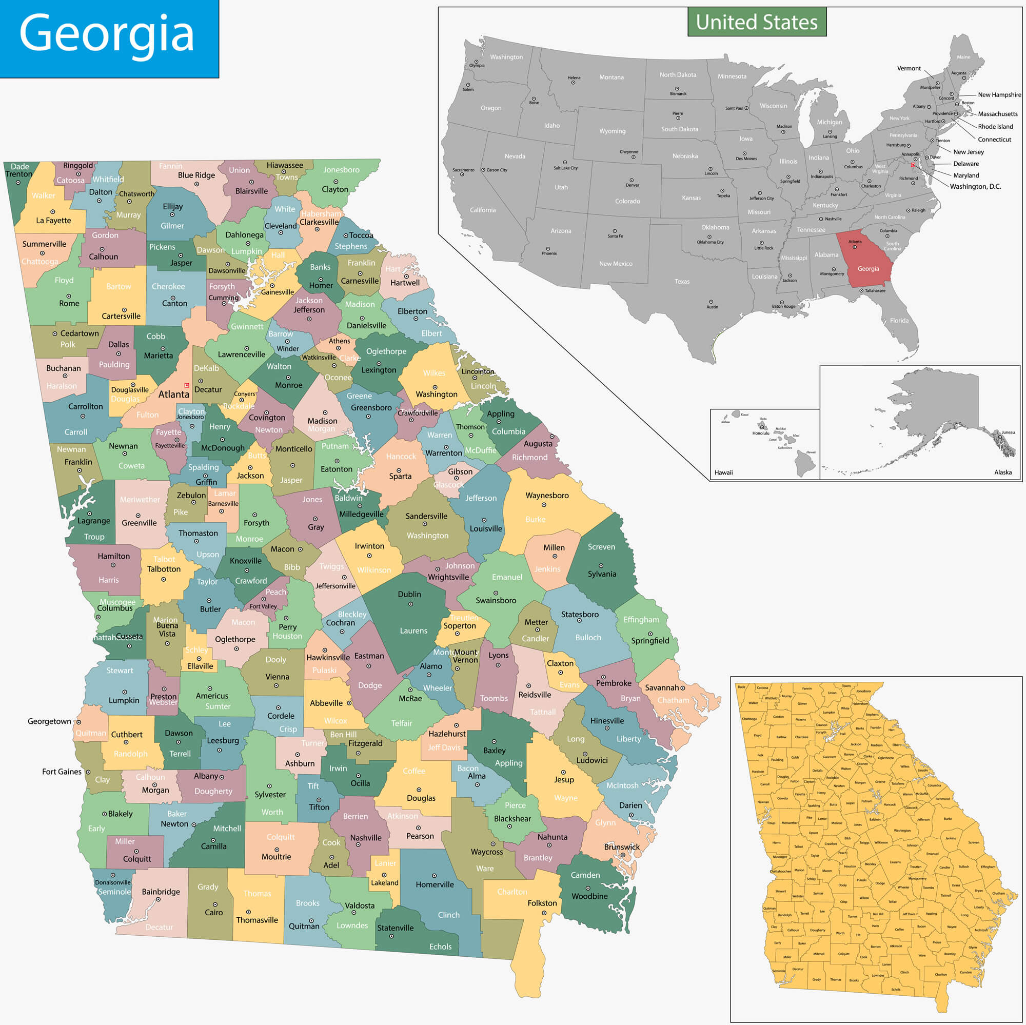 Map of Georgia state designed in illustration with the counties and the county seats
Map of Georgia, USA
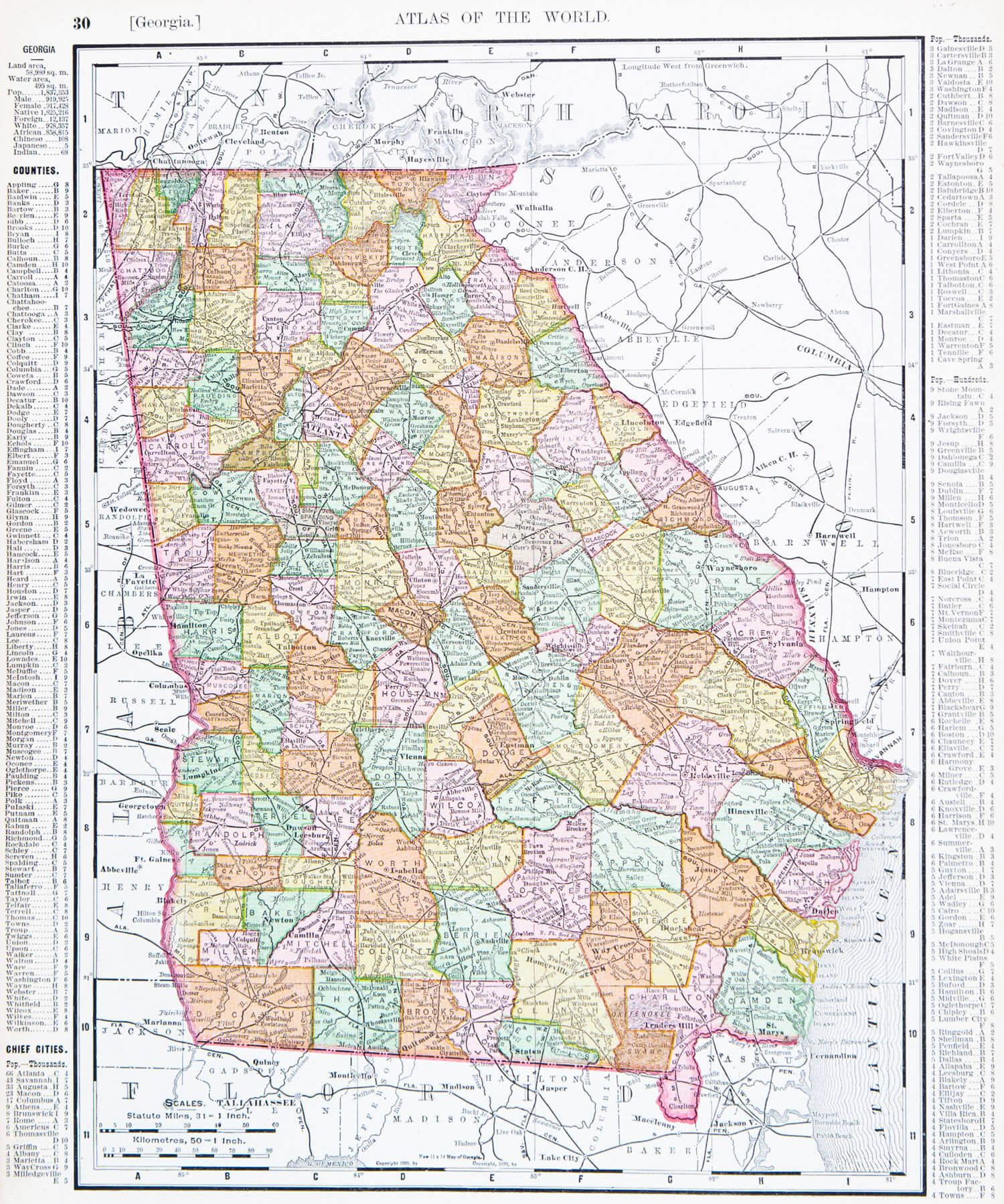
A map of Georgia, USA from Spofford’s Atlas of the World, printed in the United States in 1900.
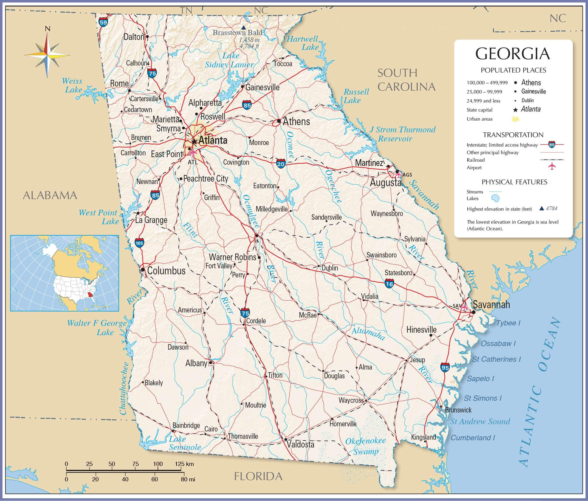
Georgia State Road Map
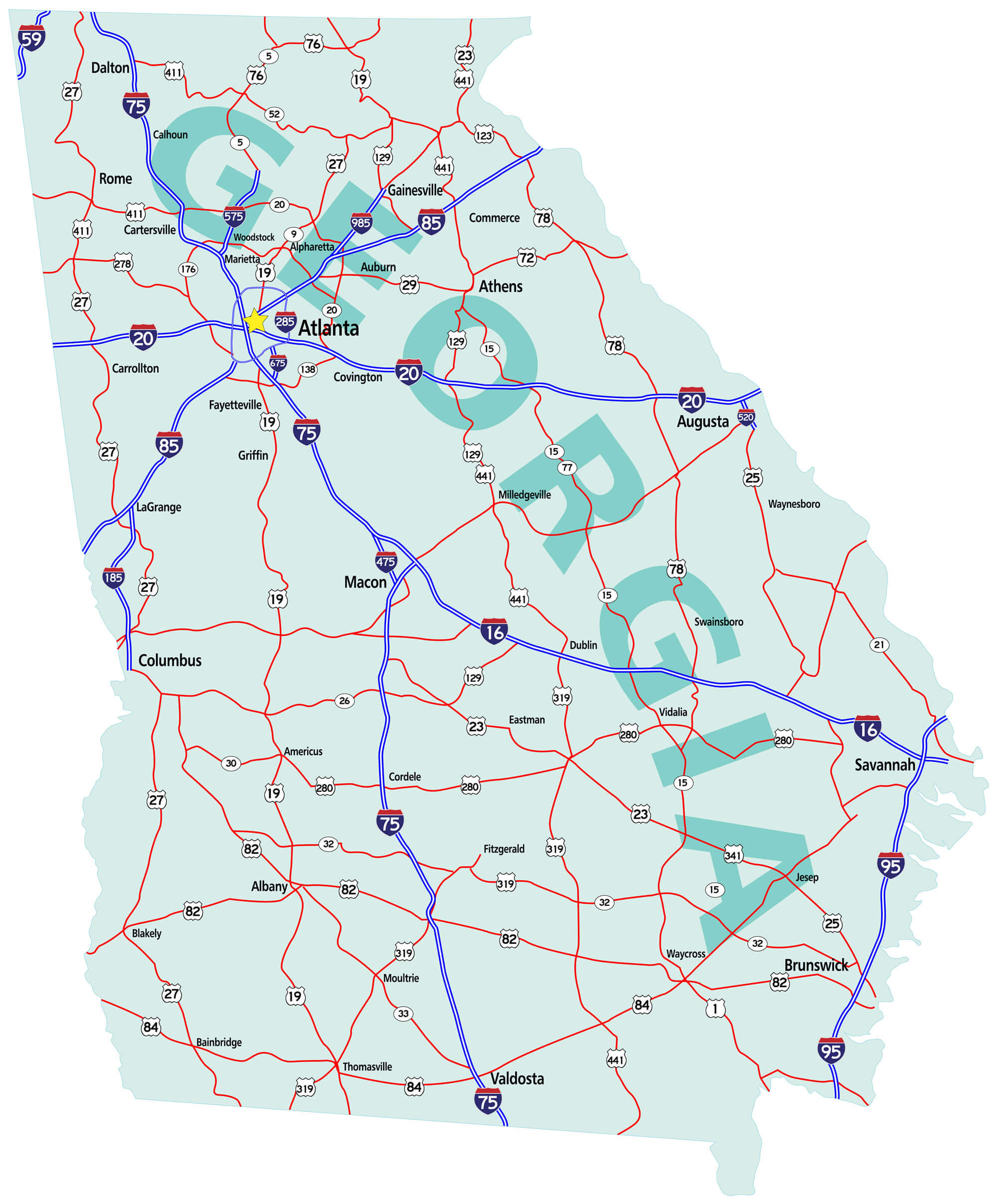
Georgia state road map with Interstates, U.S. Highways and state roads.
Color Map of Georgia
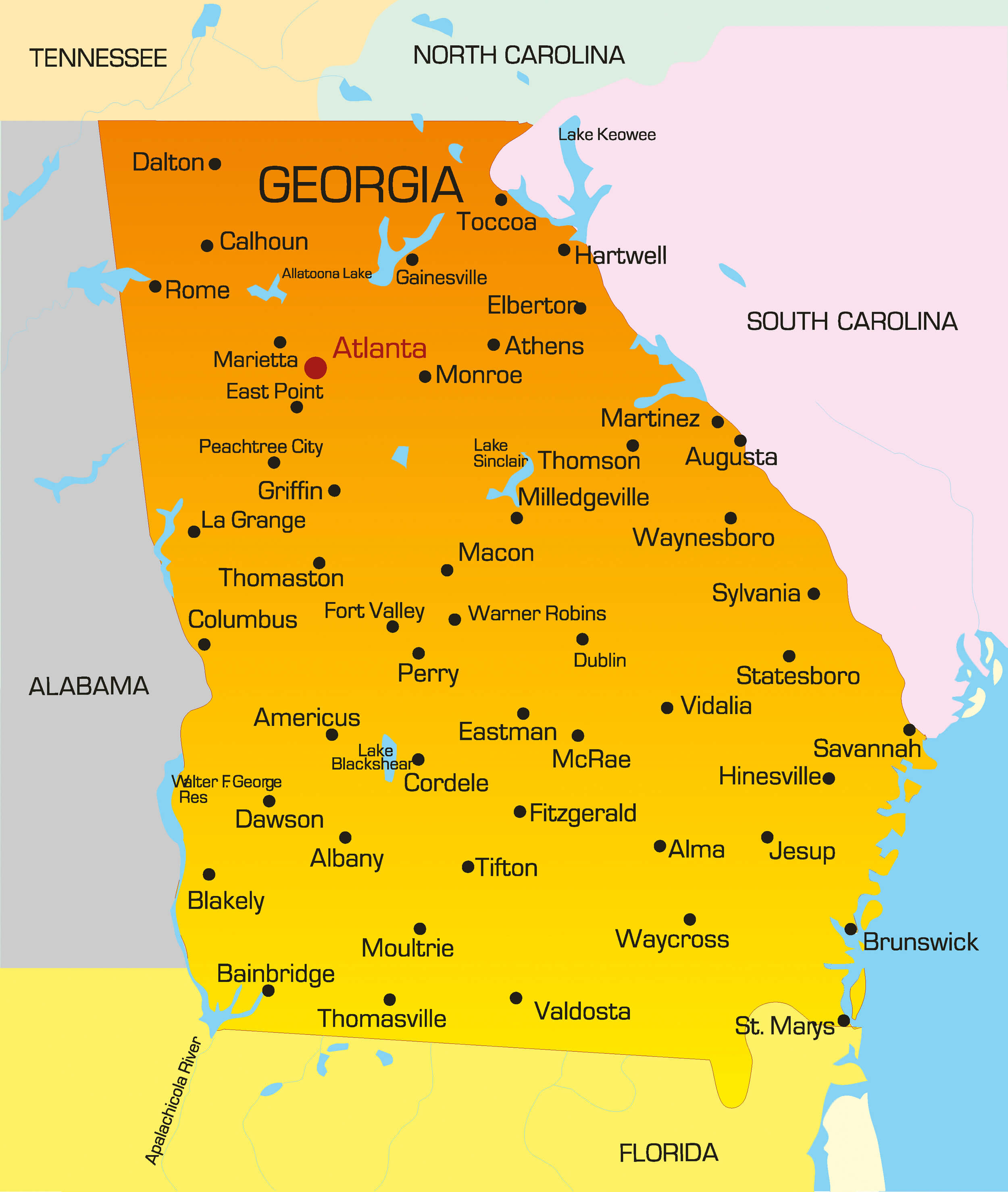
Vector color map of Georgia state. USA.
Georgia State Map
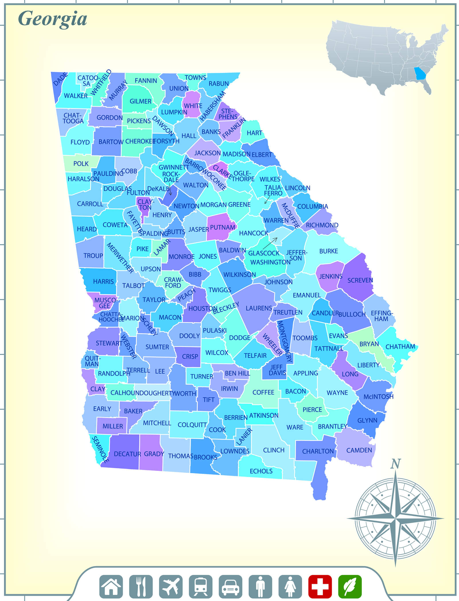
Georgia State Map with Community Assistance and Activates Icons Original Illustration.
State of Georgia Map
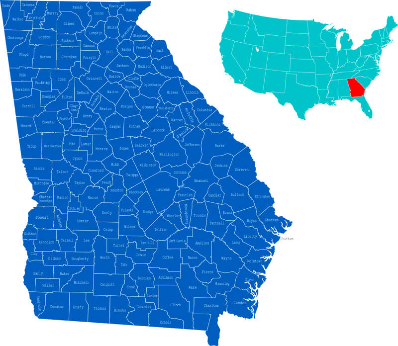
State of Georgia on the map of the USA.
Georgia Map with USA
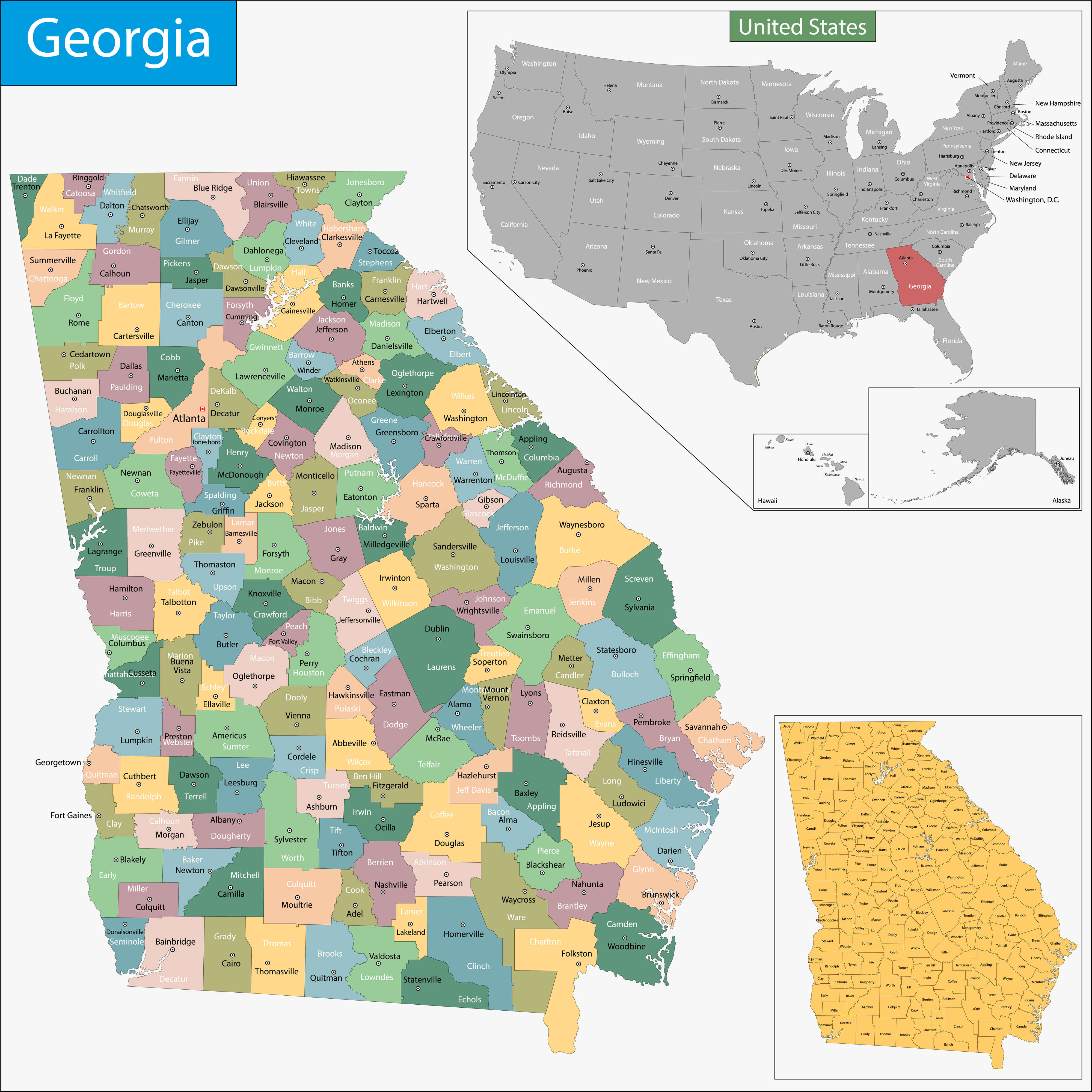
Georgia map with USA and states.
Brief information about Georgia
Located in the southeast United States, Georgia is known for its diverse landscapes, historical significance, and vibrant cities. The state borders Tennessee and North Carolina to the north, South Carolina and the Atlantic Ocean to the east, Florida to the south, and Alabama to the west. Georgia’s capital, Atlanta, is a major cultural and economic centre, recognised for its influence in various industries, including film, media, and transportation. Home to the world’s busiest airport, Hartsfield-Jackson Atlanta International Airport, Georgia is a gateway to the Southeast, attracting business, tourism, and cultural exchange.
 Sunrise in Hunts Mesa, Monument Valley, Georgia, US
Historically, Georgia played a pivotal role in both the Civil War and the Civil Rights Movement. Today, its economy is a mix of agriculture, manufacturing, and a growing technology sector, with peaches, peanuts, and poultry among its most famous exports. The state is home to renowned universities such as Emory and Georgia Tech, as well as scenic natural attractions such as the Blue Ridge Mountains and Savannah’s coastal landscape. Known as the Peach State, Georgia offers a blend of Southern charm, natural beauty, and a thriving metropolitan area, making it a dynamic and diverse place to live and visit.
Where is located Georgia on the US Map
Georgia is located in the southeastern region of the United States, bordered by several states and the Atlantic Ocean. It borders Tennessee and North Carolina to the north, and South Carolina to the northeast, separated in part by the Savannah River. Alabama borders Georgia to the west and Florida to the south. Its eastern coast runs along the Atlantic Ocean, providing access to major ports such as Savannah, which has historically been crucial to trade and transportation in the region.
The state’s geography varies from the mountainous terrain of the Appalachian Mountains in the north to the coastal plains in the south. Georgia’s capital, Atlanta, is located in the north-central part of the state and is a major transportation, business and cultural hub, not only for Georgia but for the entire southeastern U.S. Known as the Peach State, Georgia is also an important agricultural state with diverse landscapes that support agriculture, forestry and outdoor tourism. Its central location in the Southeast makes it both a cultural crossroads and an economic powerhouse in the region.
Here are some statistical information about Georgia:

Population Trend In Georgia (1790-2020)
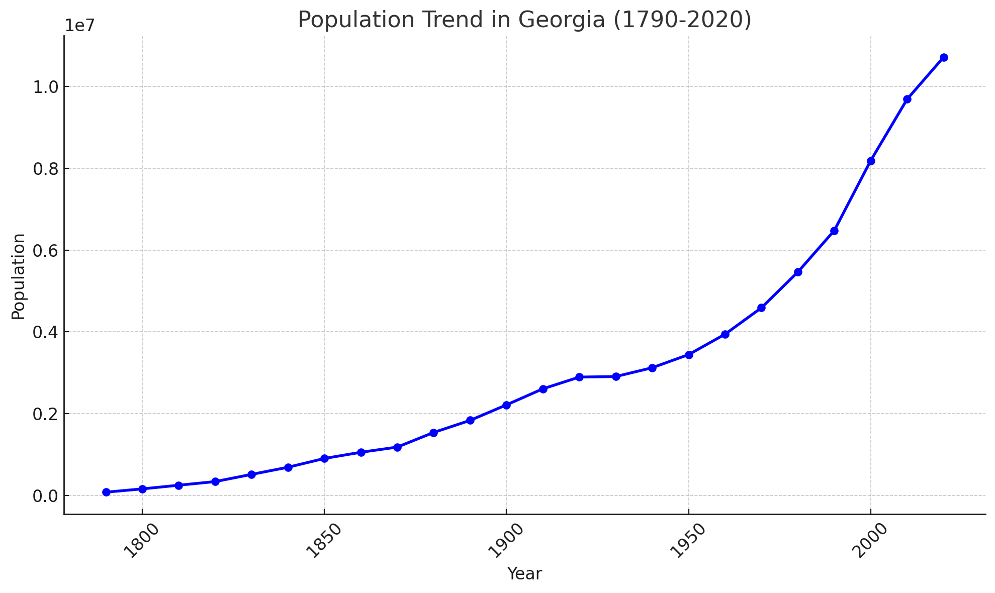 Population Trend In Georgia (1790-2020).
Religion In Georgia, USA (2014)
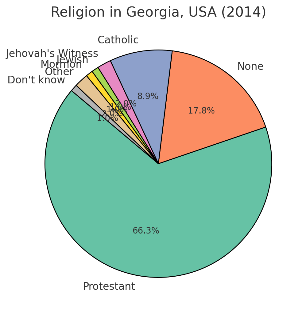 Religious Composition Of Georgia.
Major Cities in Georgia, USA
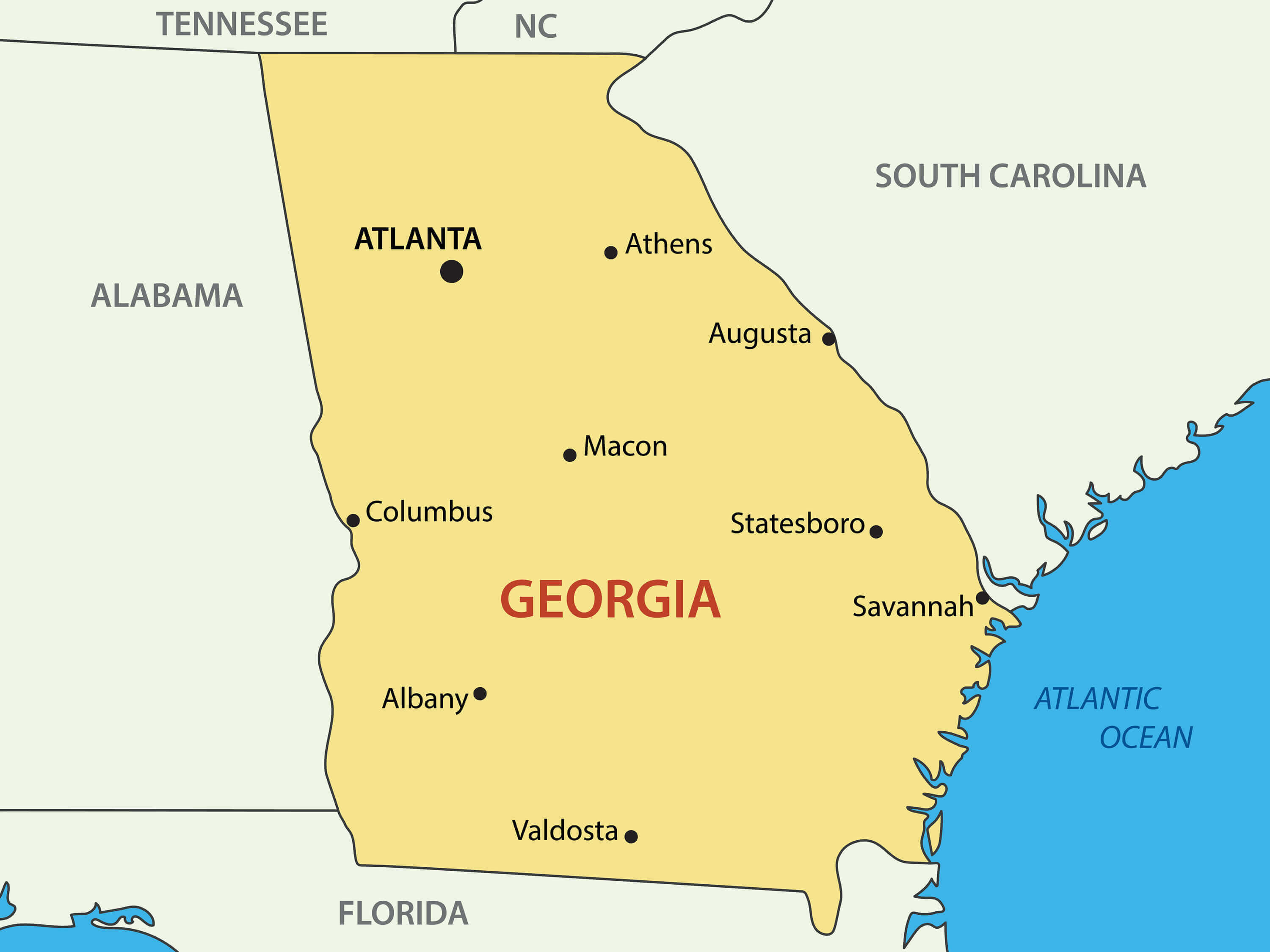 Map showing major cities in Georgia, USA, including Atlanta, Augusta, Columbus, Savannah, Macon, and others.
Key Cities in Georgia with Atlanta Highlighted
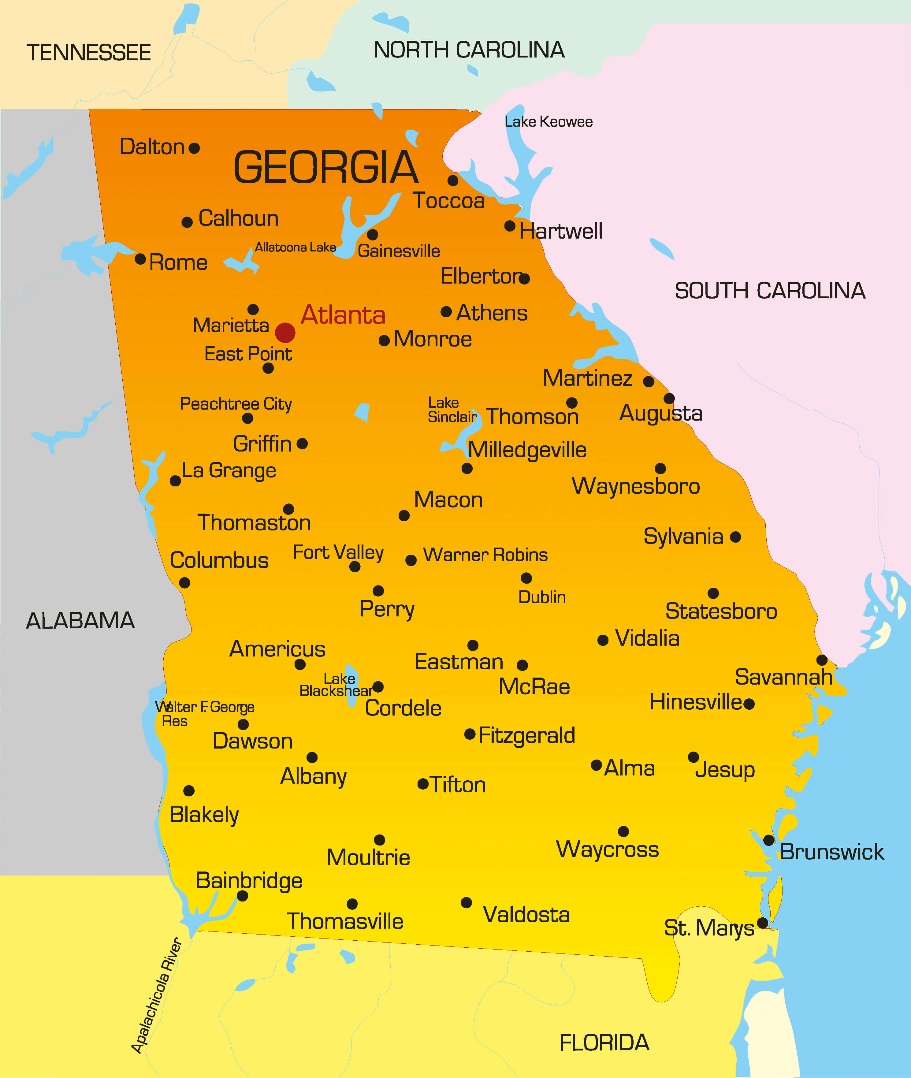 Map of Georgia highlighting major cities, including Atlanta
Köppen Climate Types in Georgia
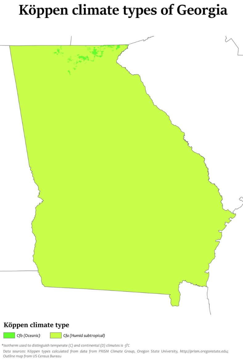 Georgia climate map showing humid subtropical and oceanic zones.
Blank Map of Georgia Counties
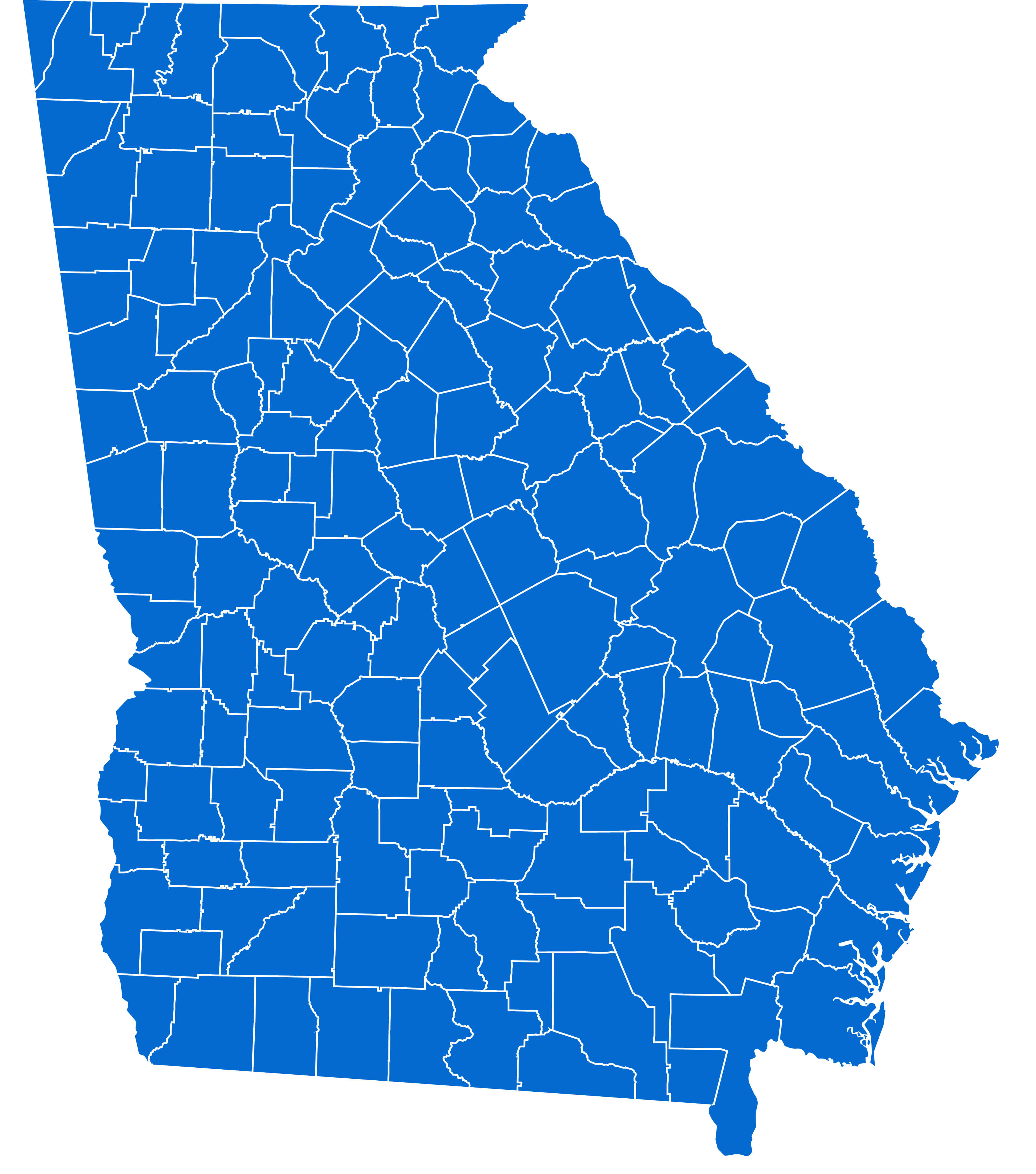 Blank map of Georgia counties outlined in blue.
Map of Georgia Counties in the U.S.
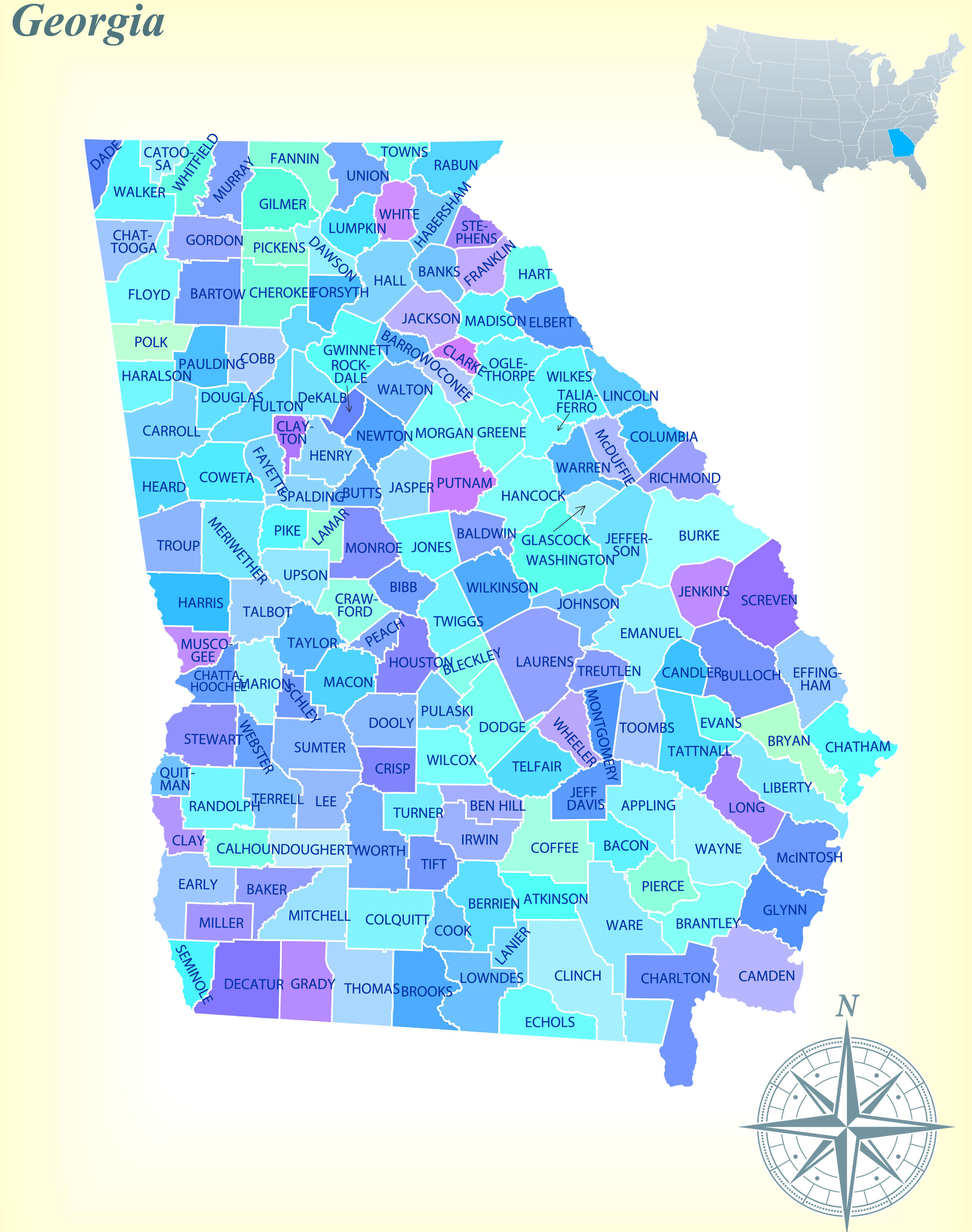 Map of Georgia with labeled counties in various colors.
Elevation Map of Georgia (1987)
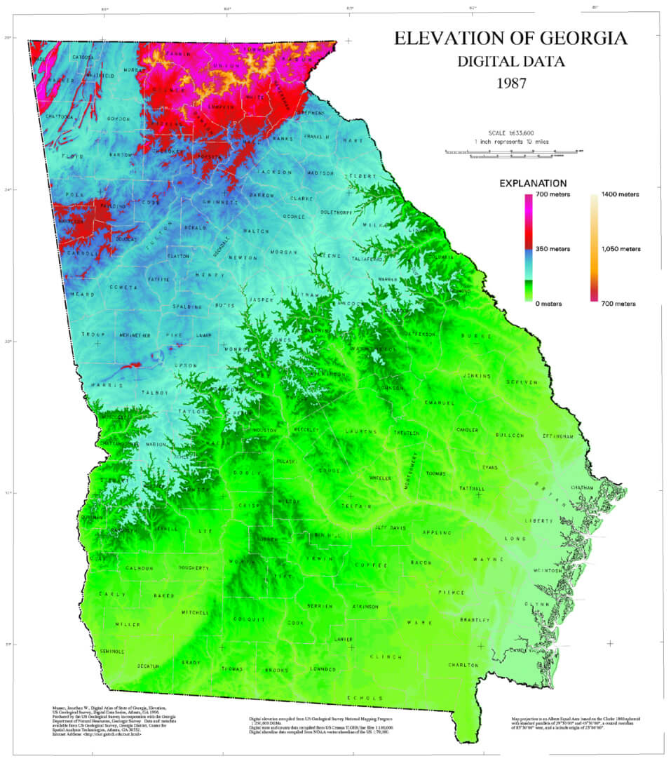 Georgia elevation map with varying colors representing altitude.
Georgia Highway Map with Major Roads and Cities
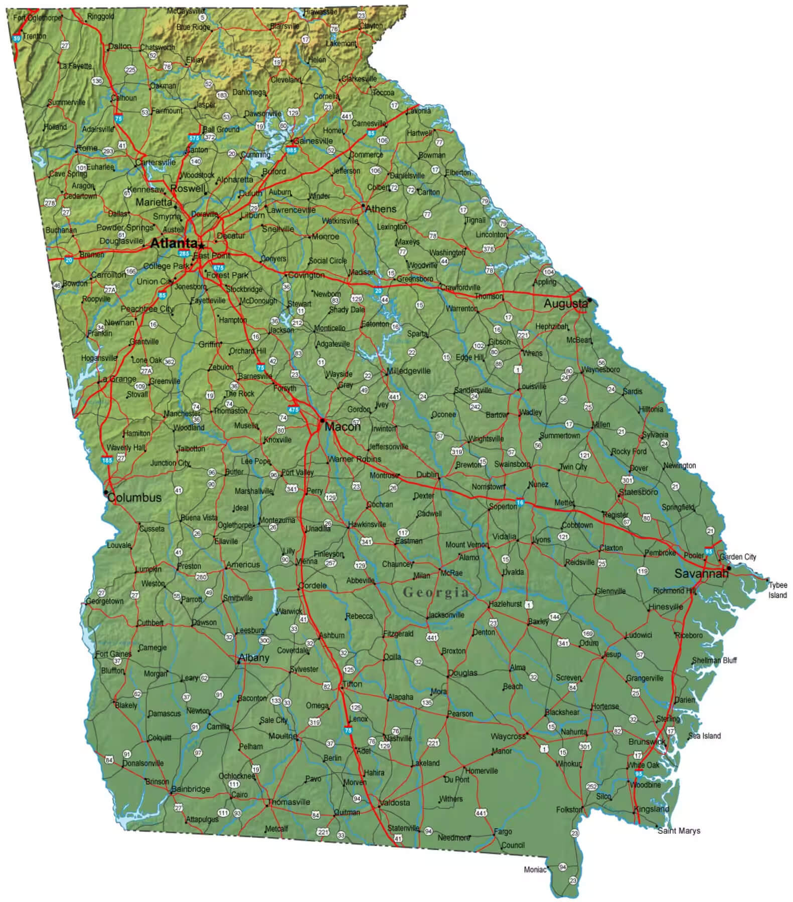 Georgia highway map with major roads and cities.
Georgia Historical Map from 1900 with Counties and Cities
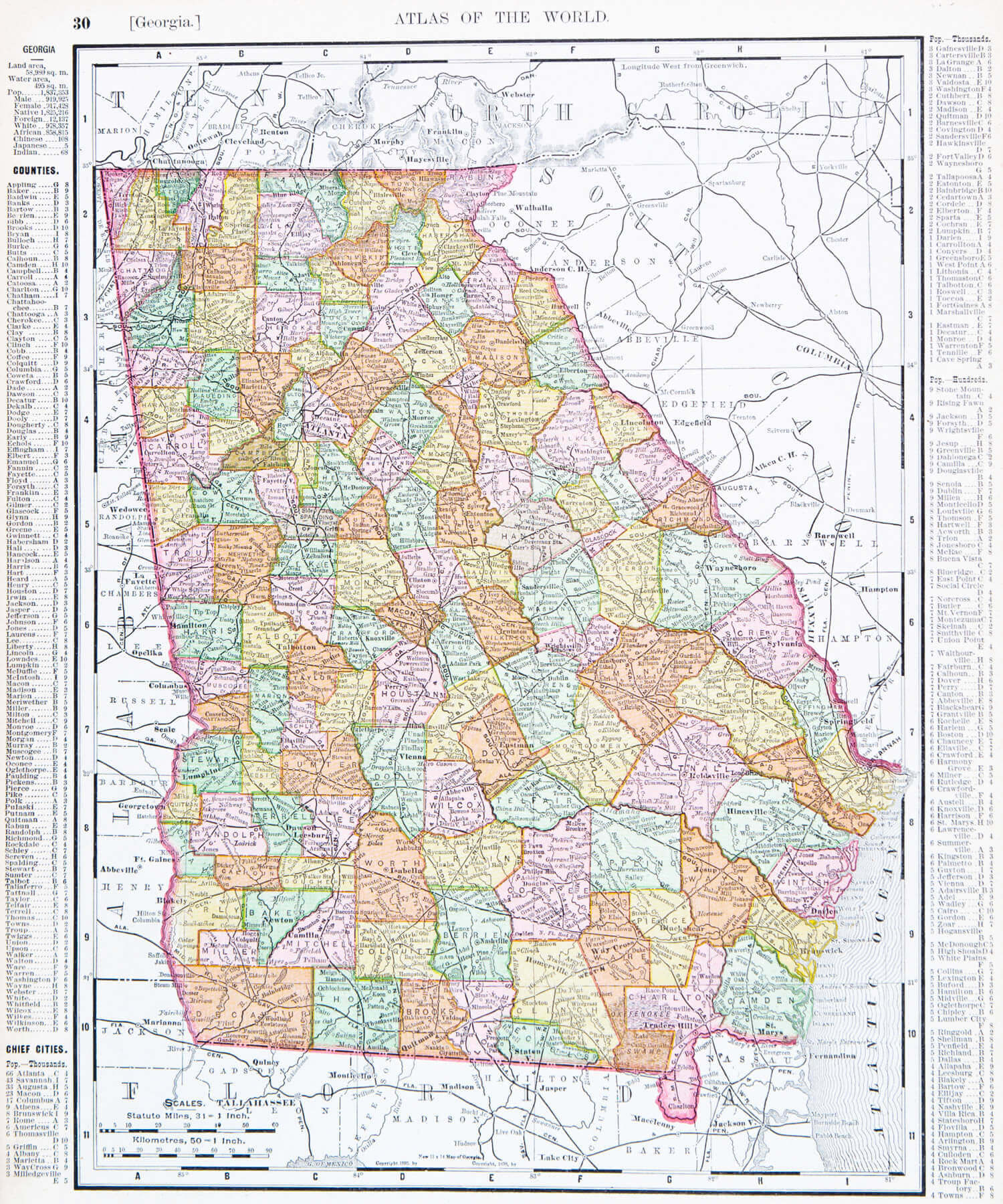 Georgia historical map of counties and cities in 1900.
Income Distribution by Location in Georgia
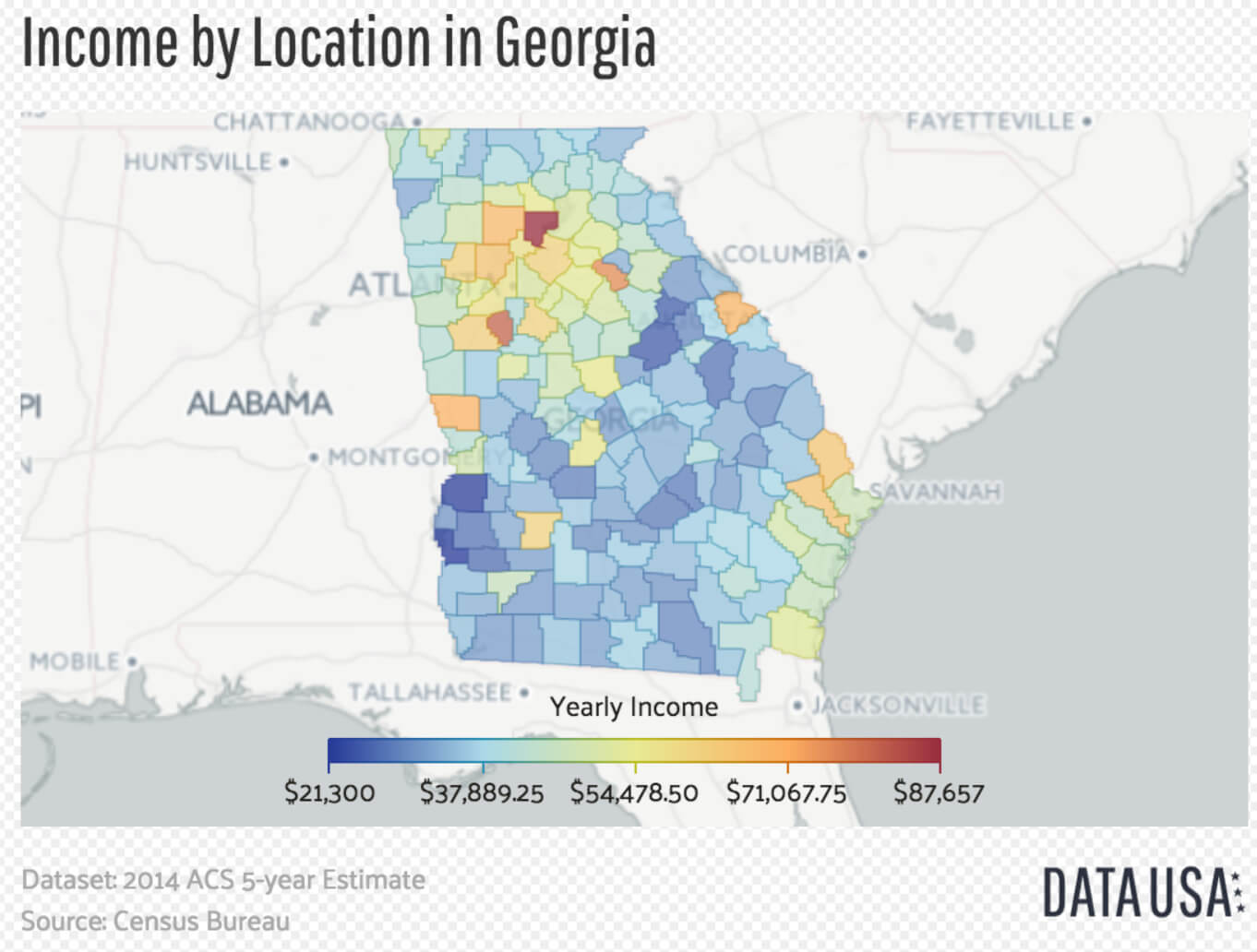 Georgia income map by location with yearly income levels.
Georgia’s Location Within the United States
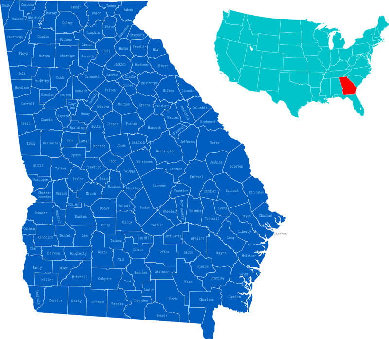 Map highlighting Georgia within the USA, with all Georgia counties.
Georgia’s National Parks and Natural Reserves Map
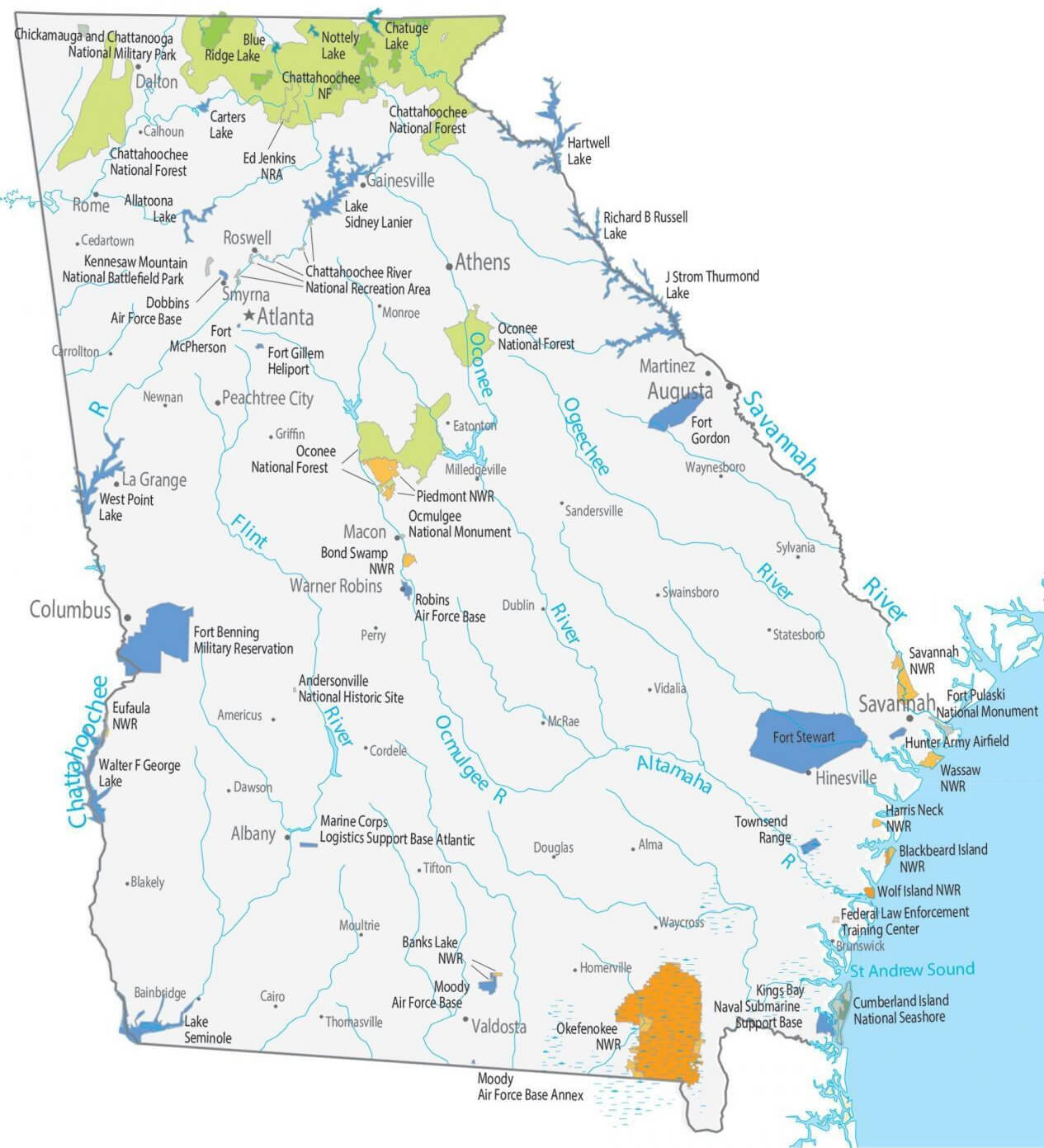 Map of Georgia showing national parks and natural reserves.
Whispers of Arlington (Virginia): A Visual Journey Through Time and Culture
Where is Georgia on the United States Map?
Show Google interactive map, satellite map, where is the country located.
Get directions by driving, walking, bicycling, and public transportation, and travel with street view.
Feel free to explore these pages as well:
- Georgia Map ↗️
- Map of Georgia ↗️
- Georgia Photos ↗️
- Atlanta’s Allure: The Vibrant Heart of the South ↗️
- 2024 US Presidential Election Swing States by Maps ↗️
- The US presidential election in Georgia: Predictions for 2024 and a look back at the swing in 2020 ↗️
- Arizona Map ↗️
- Arizona’s US Presidential Election: 2024 Predictions and a Look Back at the 2020 Swing ↗️
- California Map ↗️
- Texas Map ↗️
- New York Map ↗️
- Florida Map ↗️
- Illinois Map ↗️
- Pennsylvania Map ↗️
- Ohio Map ↗️
- Michigan Map ↗️
- New Jersey Map ↗️
- North Carolina Map ↗️
- Virginia Map ↗️
- Massachusetts Map ↗️
- Indiana Map ↗️
- Tennessee Map ↗️
- Missouri Map ↗️
- Maryland Map ↗️
- Washington Map ↗️
- Minnesota Map ↗️
- Colorado Map ↗️
- Alabama Map ↗️
- Louisiana Map ↗️
- South Carolina Map ↗️
- Kentucky Map ↗️
- Oregon Map ↗️
- Oklahoma Map ↗️
- Connecticut Map ↗️
- Iowa Map ↗️
- Mississippi Map ↗️
- Arkansas Map ↗️
- Kansas Map ↗️
- Utah Map ↗️
- Nevada Map ↗️
- District of Columbia Map ↗️
- United States Map ↗️
- Map of United States ↗️
- North America Map ↗️
- Map of North America ↗️
