- Advertisement -
France population maps provide a comprehensive view of the country’s demographics, including population density, urban populations and religious groups such as the Muslim population. These maps and data also include historical population trends for 2017, 2018 and 2023, as well as projected figures for 2030, providing insight into the diverse and evolving make-up of France.
France Population Density Map
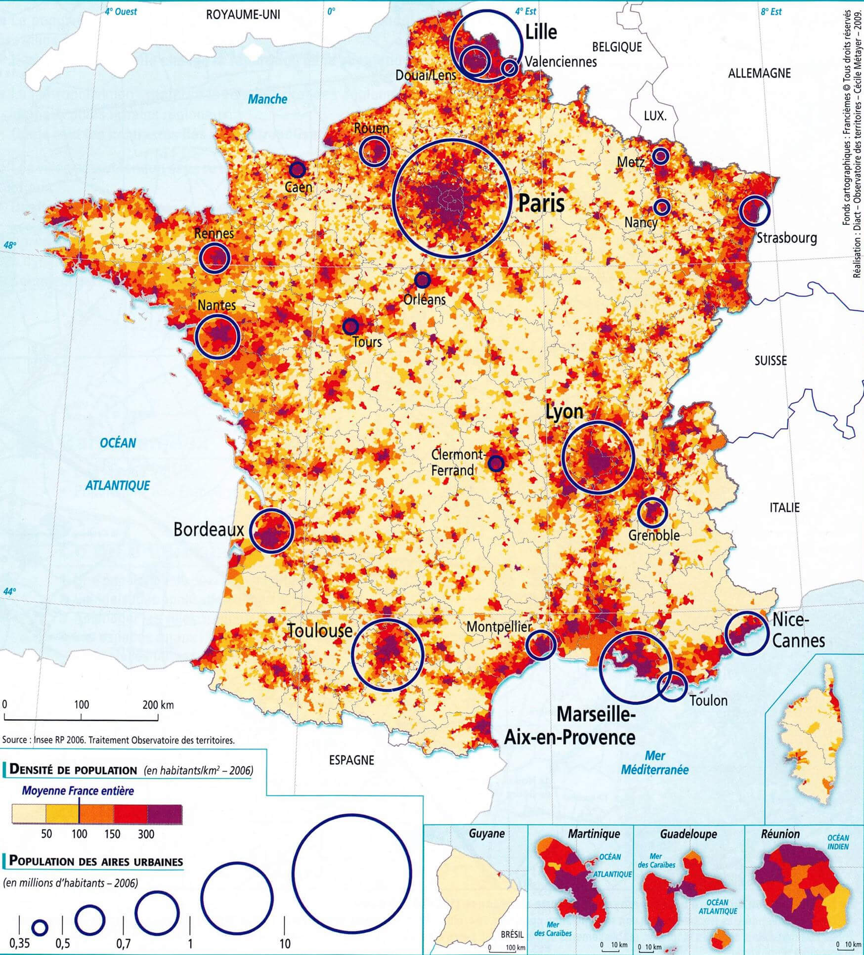 Map of France showing population density and urban areas.
Population Density Across France by Region
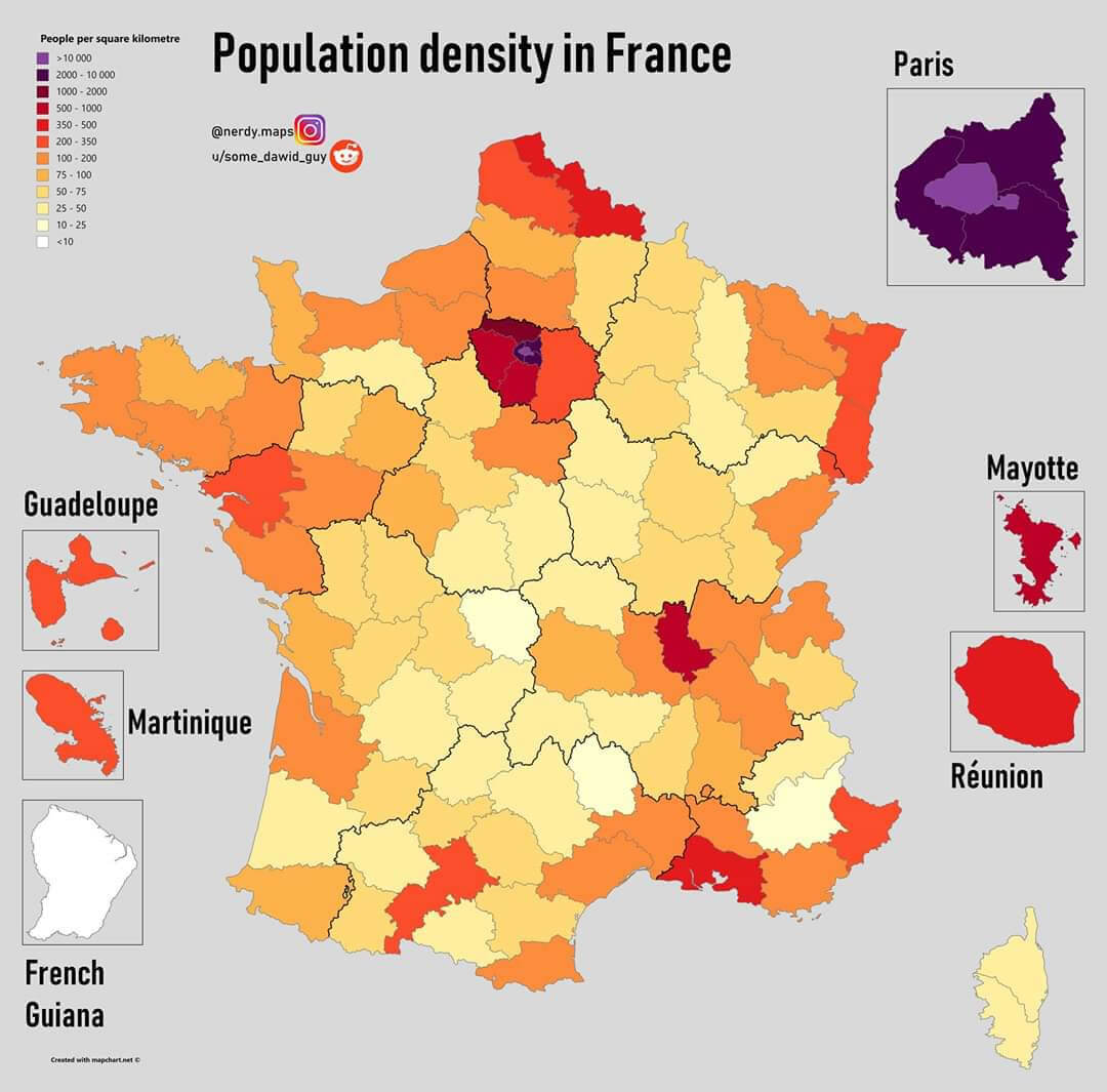 Map of France showing population density per square kilometer across regions.
Population density map of France
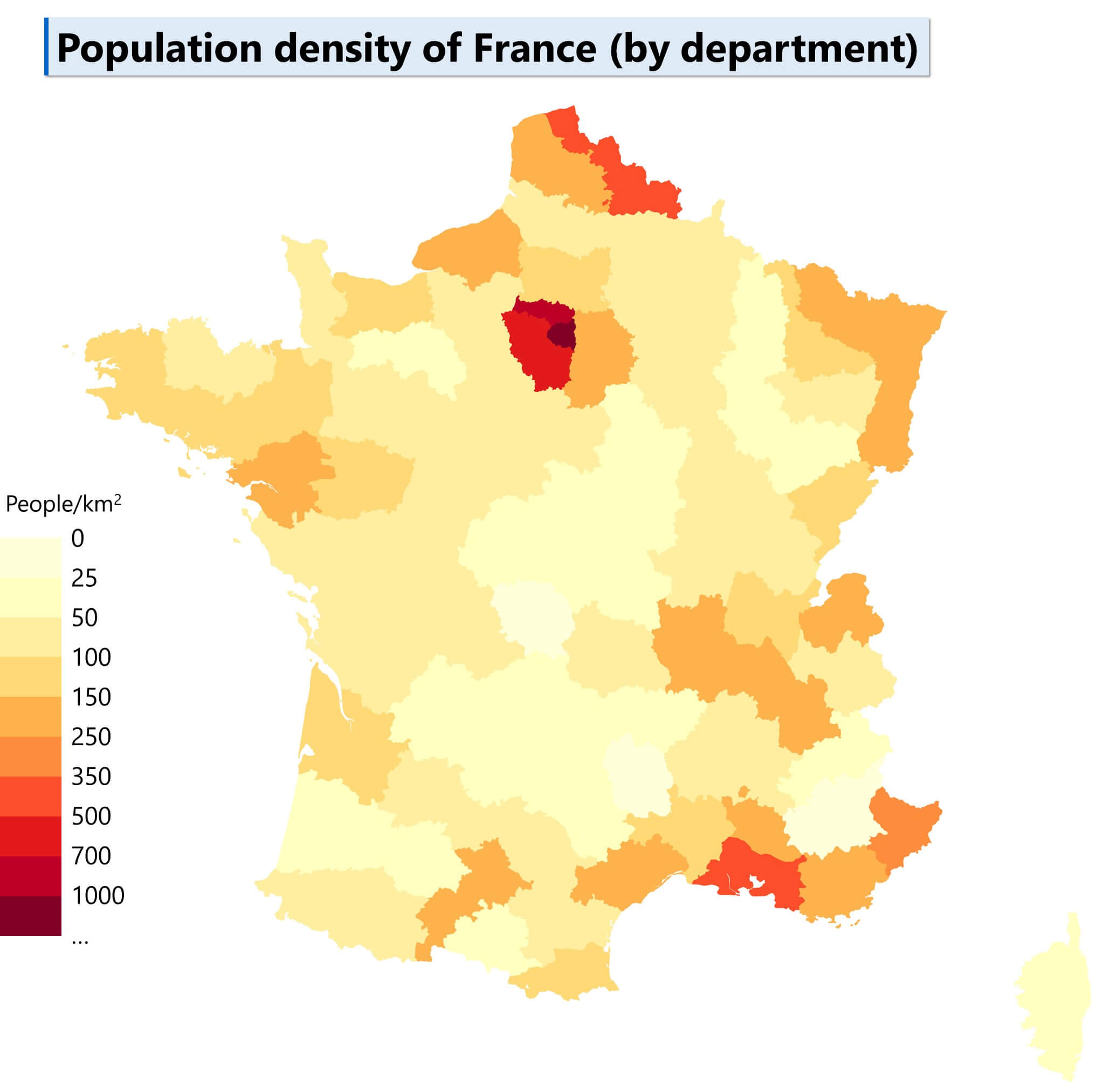
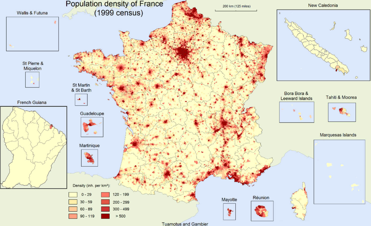
Population density map of France in 1999
France Physical Map with City Populations
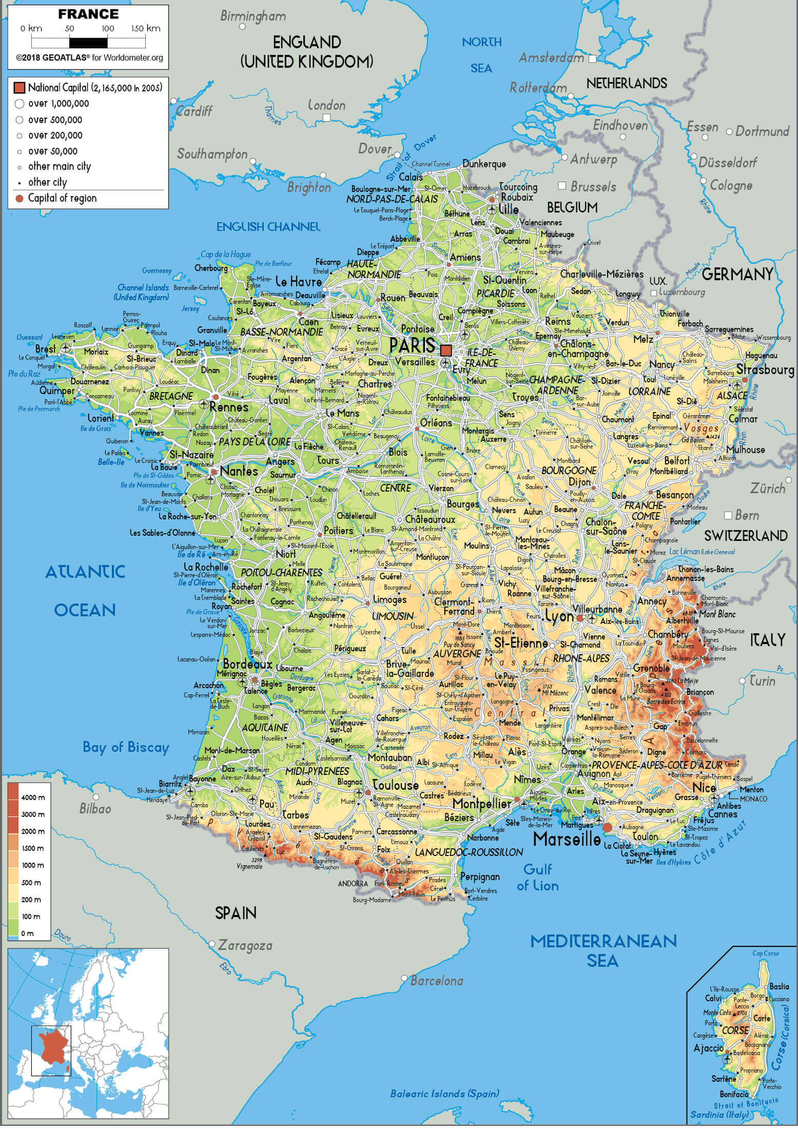 Detailed physical map of France showing cities and population data.
Muslim Population in Europe: 2010 Overview
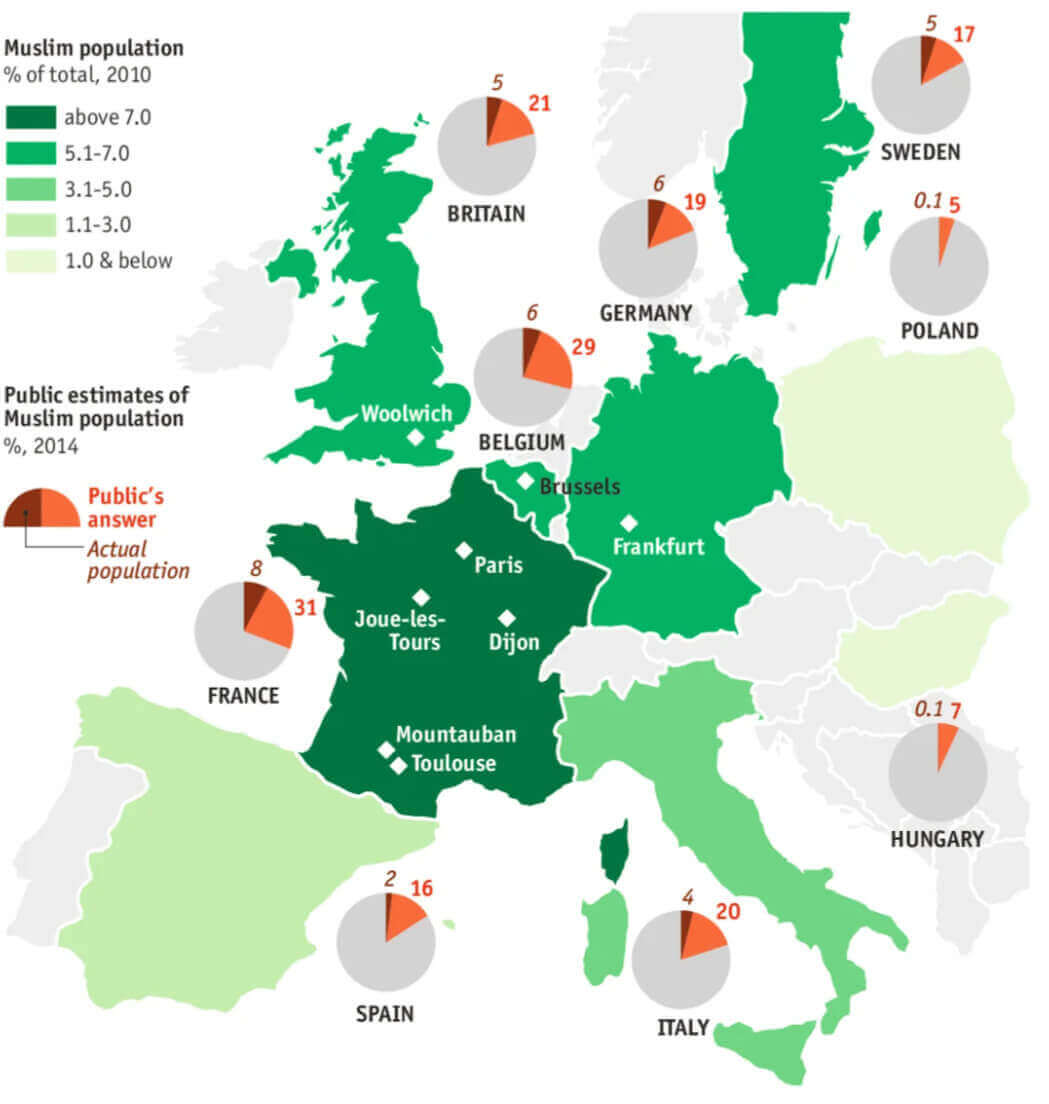 Map showing Muslim population distribution in Europe as of 2010 with public estimates.
France Ethnic Demographic Composition 2004
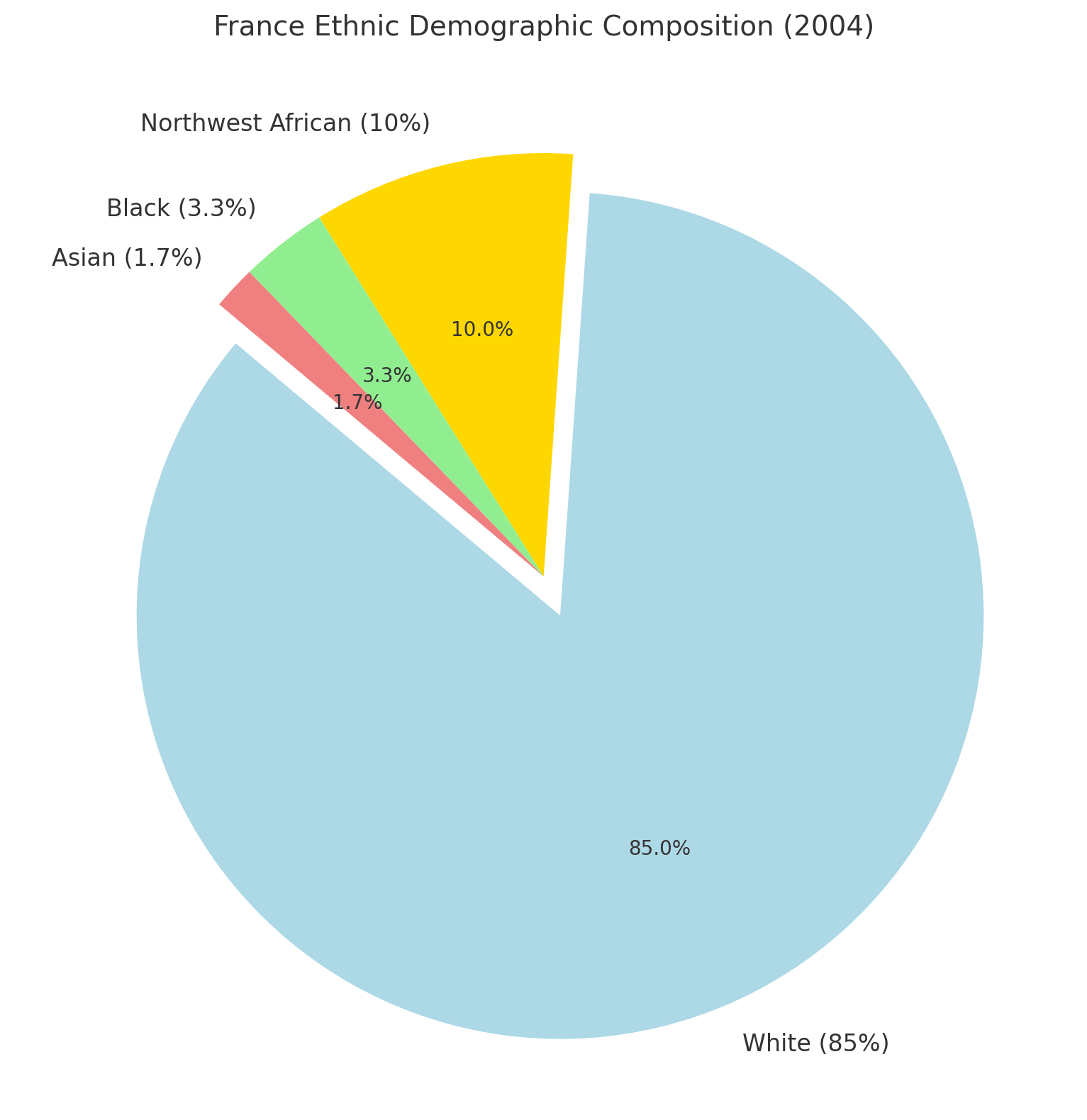 France Ethnic Demographic Composition 2004
Religion In France (2021 Census)
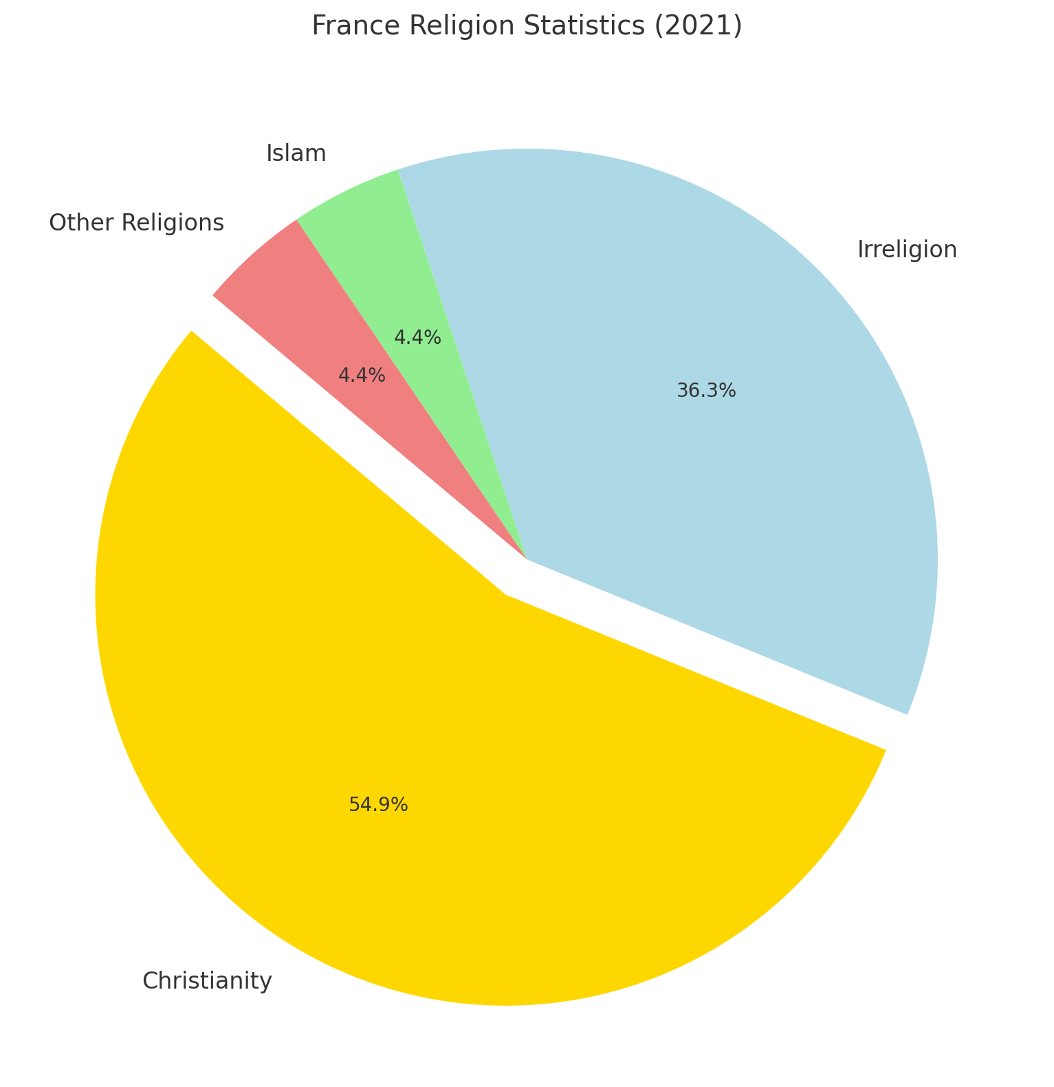 France Religion Statistics (2021)
France Historical Population (1806-2022)
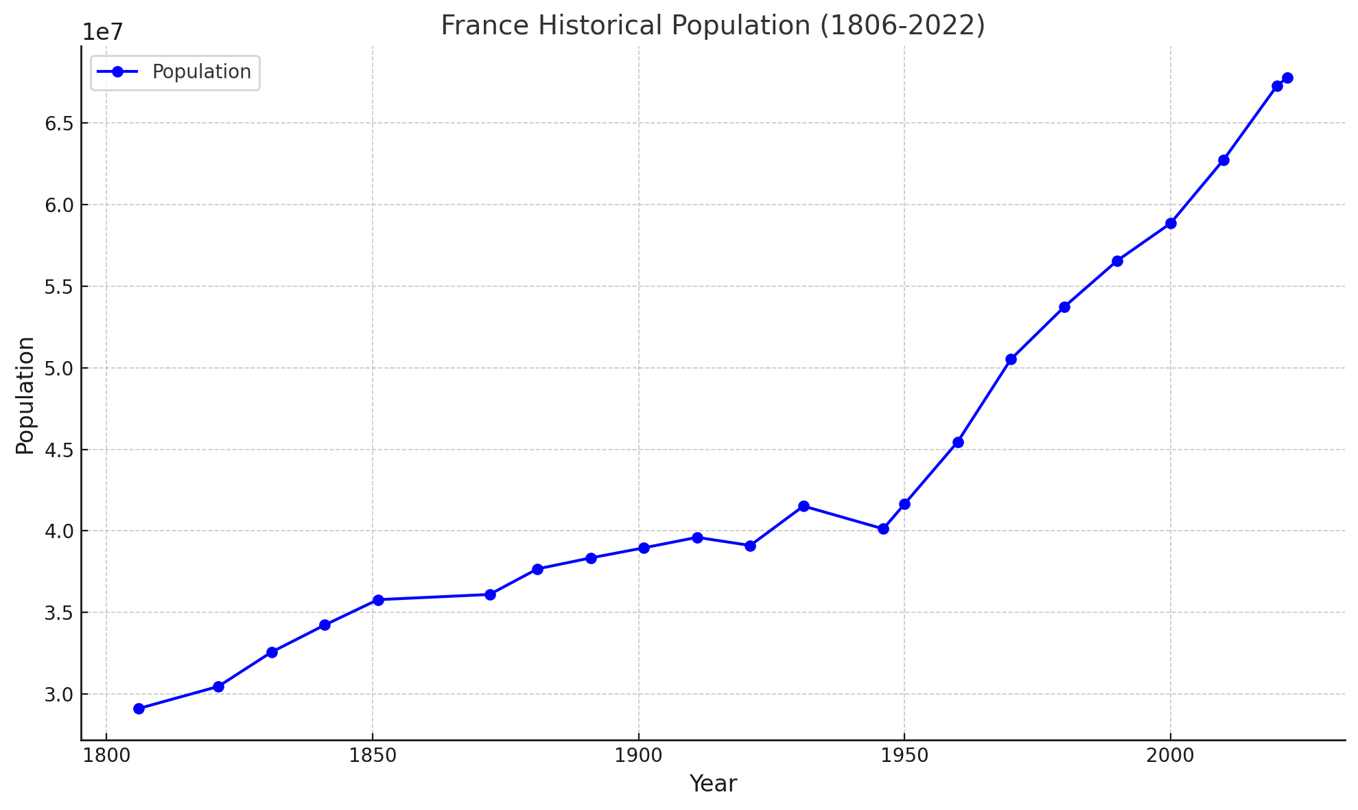 This chart shows France historical population between 1806 and 2022.
Muslim Population Map: France in a Global Context
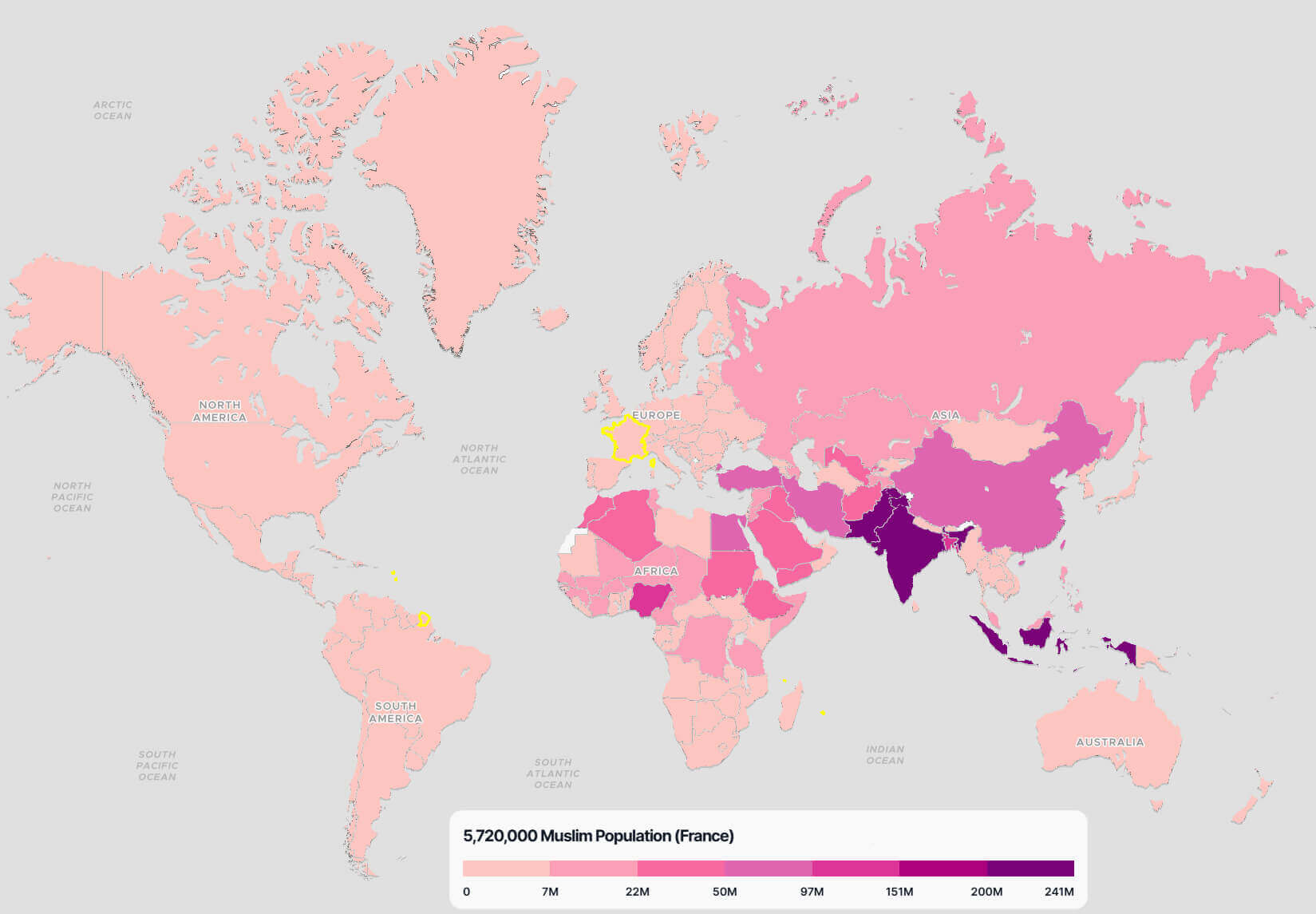 World map highlighting France’s Muslim population of 5,720,000 with a global comparison.
France population density map in 2017
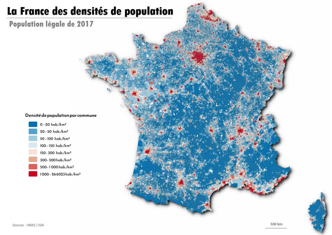
France population density map in 2018
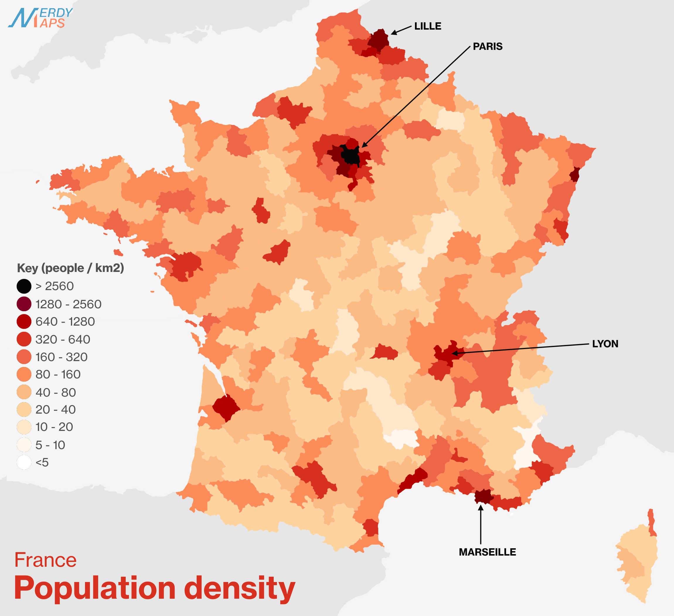
France population density map in French
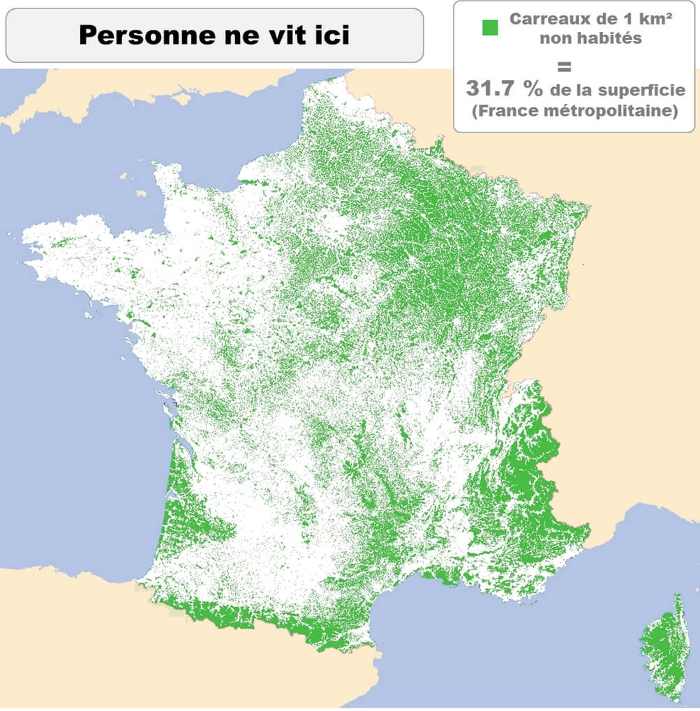
France population map by regions
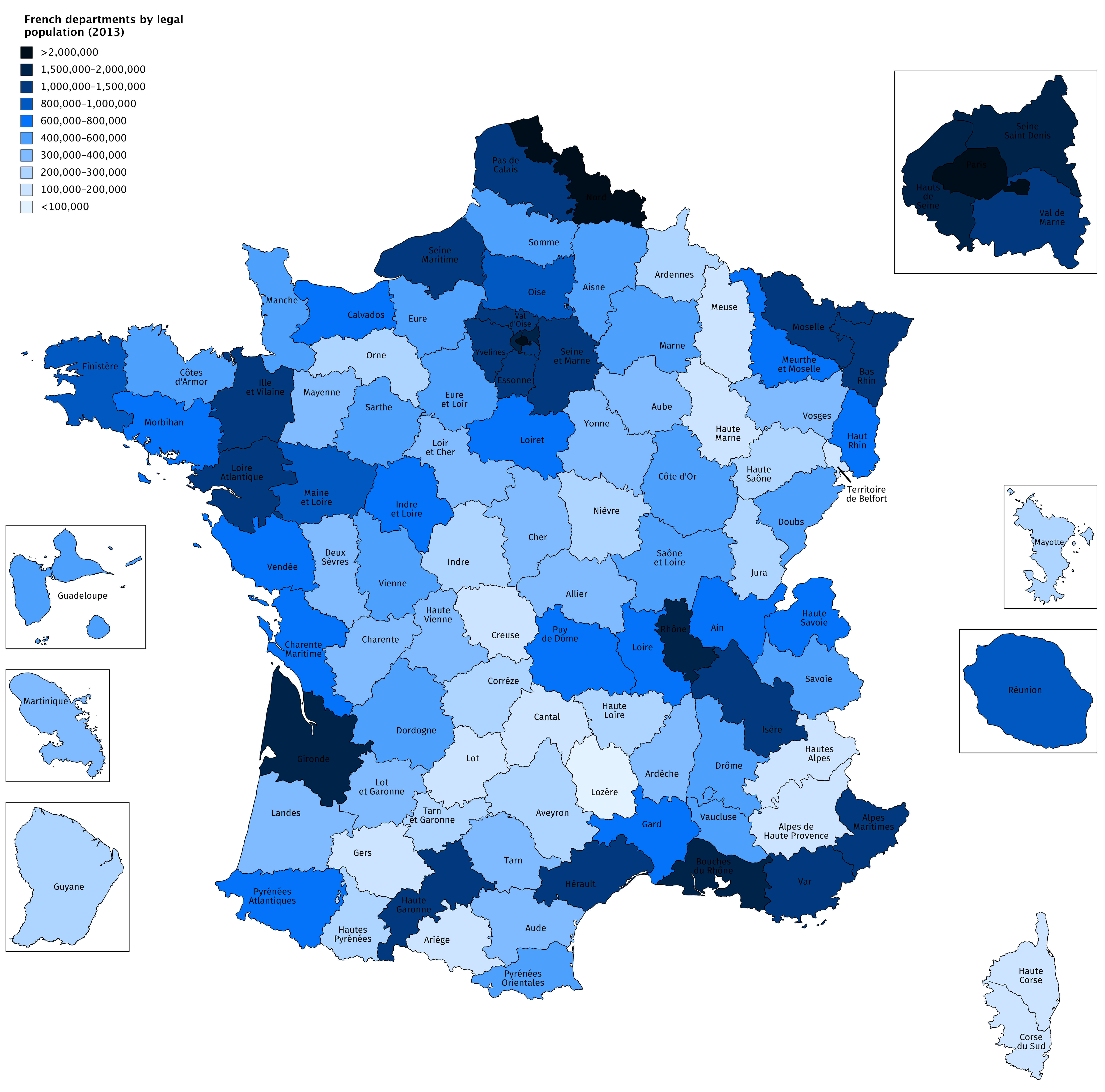
France population map with major cities
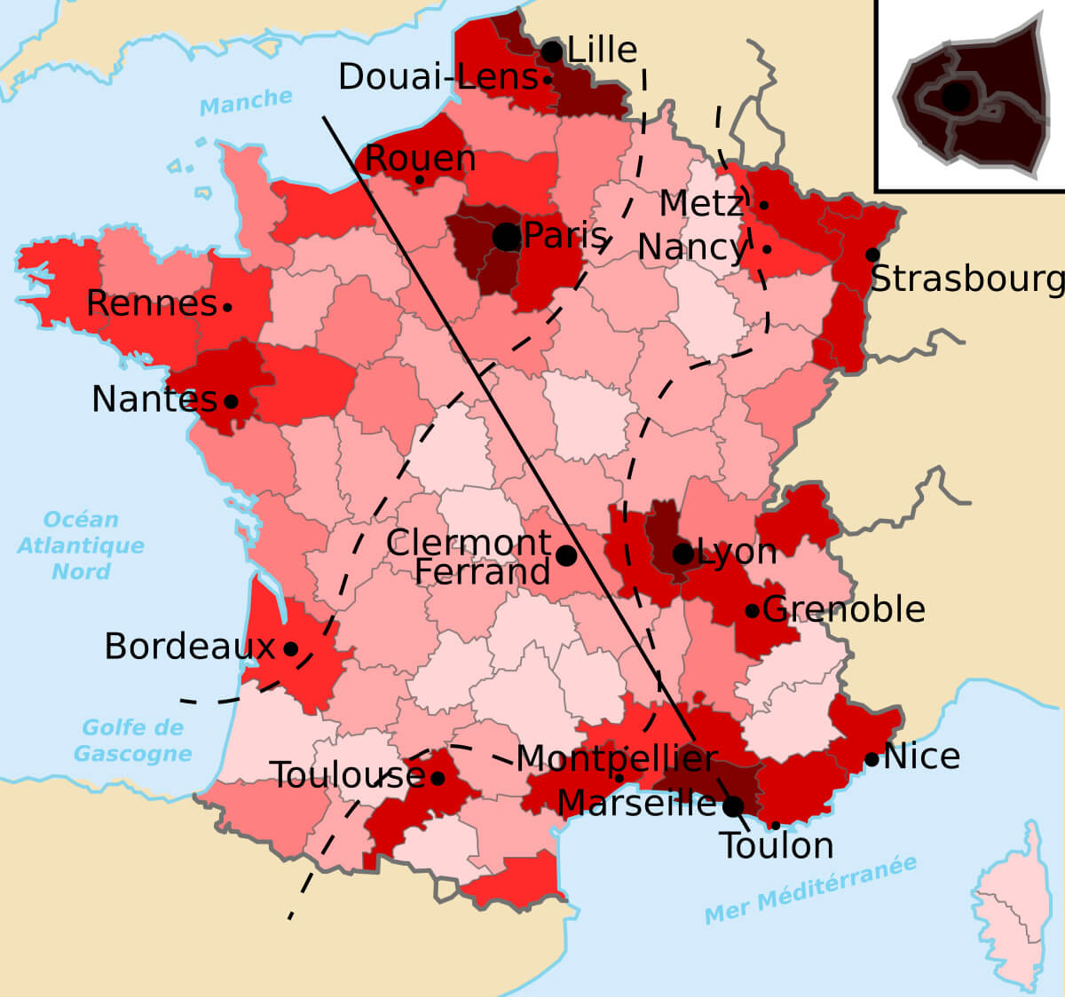
French populated cities regions map
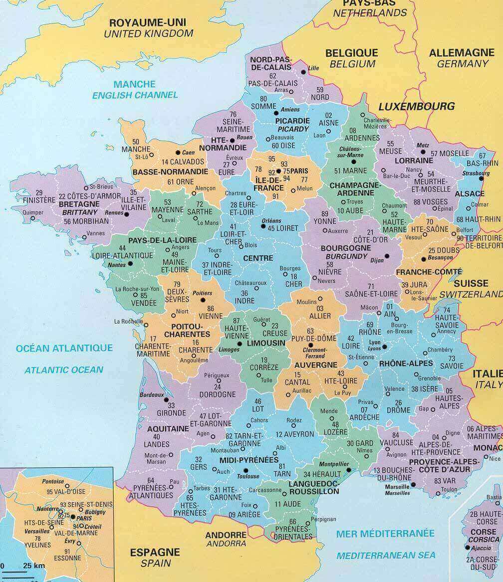
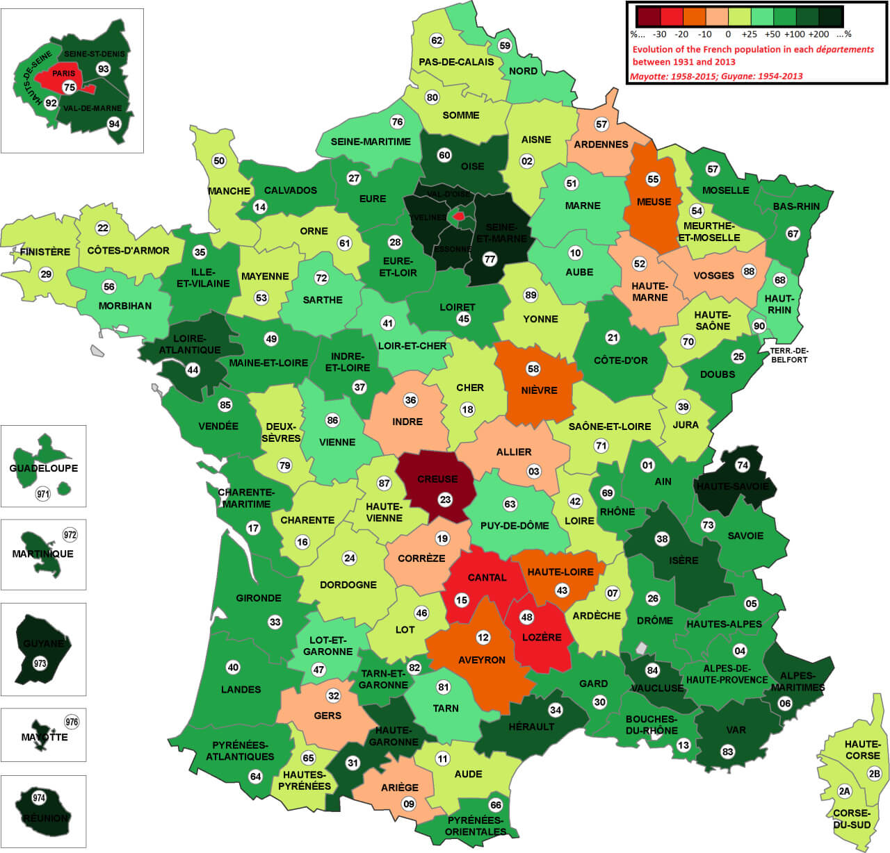
French population map between1931 and 2013
Male Life Expectancy in France by Region (2023)
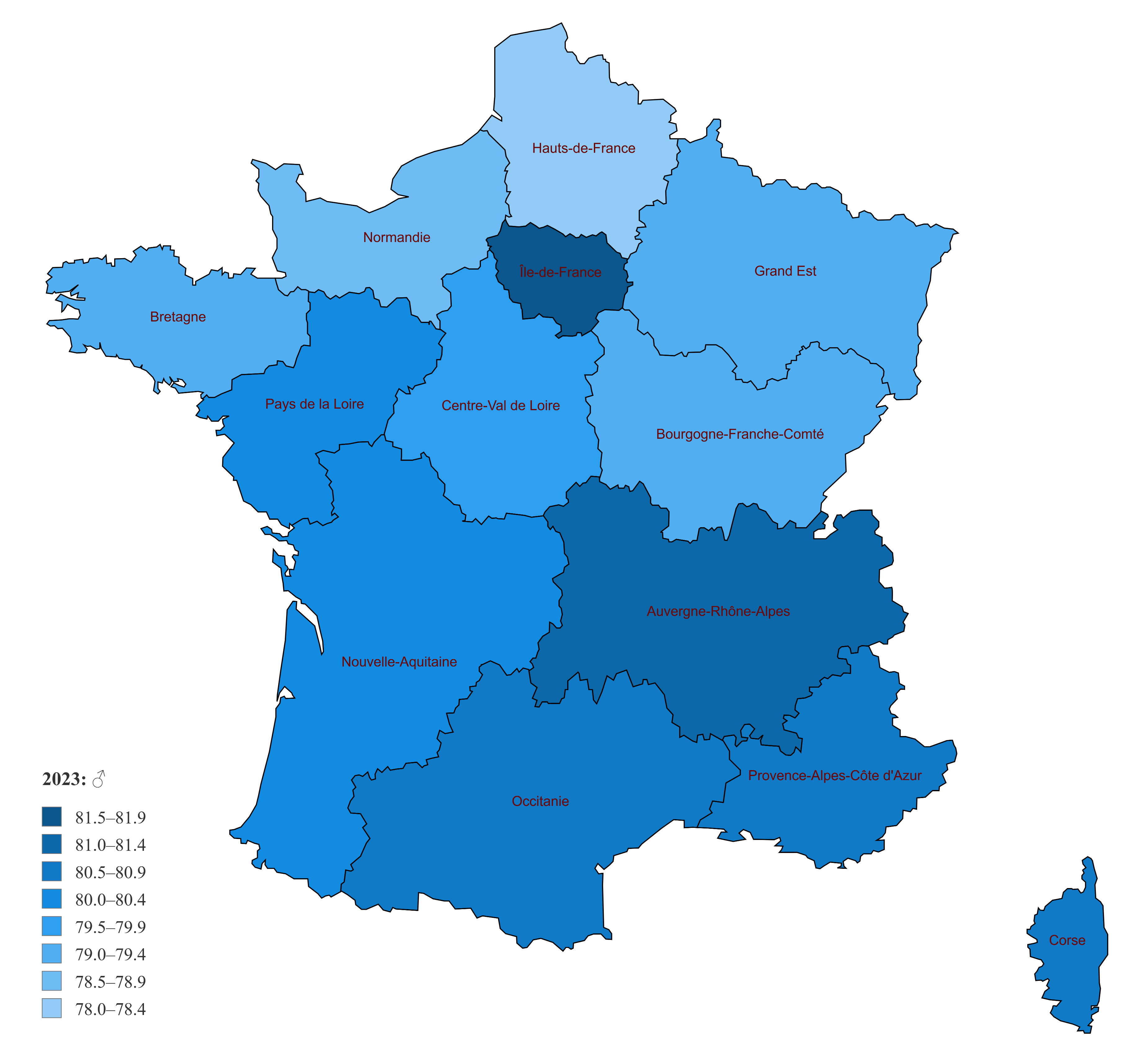 Map of France showing male life expectancy in 2023 across regions.
Female life expectancy map of France 2023 with regions
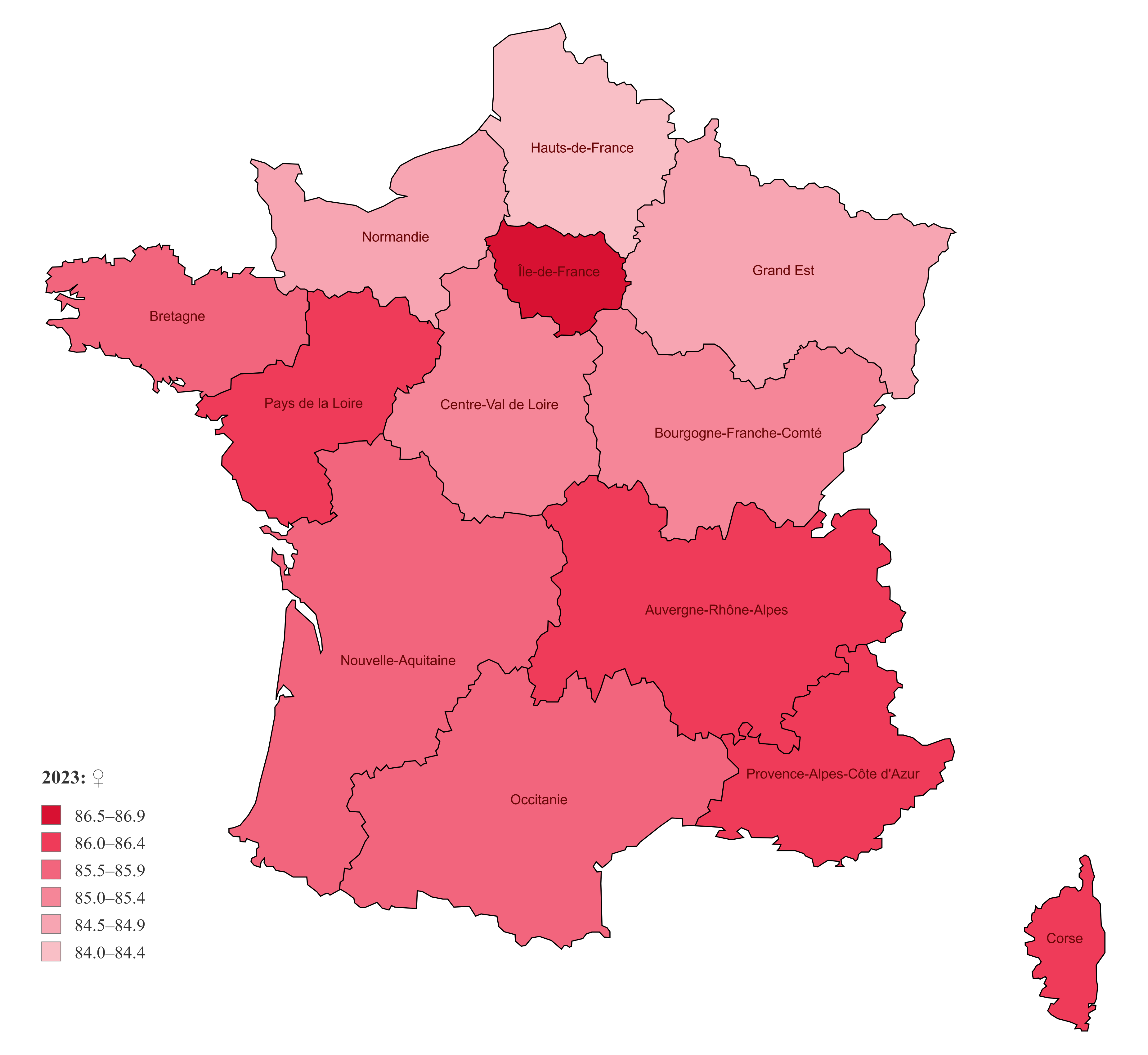 Map of France showing female life expectancy in 2023 across regions.
Where is France on Europe Map?
Show Google interactive map, satellite map, where is the country located.
Get direction by driving, walking, bicycling, public transportation and travel with street view.
Feel free to explore these pages as well:
- France Map ↗️
- France High-resolution Map ↗️
- France Physical Maps ↗️
- France Political Map ↗️
- France Cities Map ↗️
- France Road Map ↗️
- Map of France ↗️
- France Map Collection ↗️
- Top 10 Destinations in France ↗️
- Discovering Angers: The Gem of France’s Loire Valley ↗️ ↗️
- Nice’s Top 10 Attractions for Every Traveler ↗️
- Muslim Population Map in Europe by Country ↗️
- Europe Map ↗️
- Map of Europe ↗️
- A Collection of Europe Maps ↗️
- France Map ↗️
- Map of Spain ↗️
- Italy Map ↗️
- Ireland Map ↗️
- Political Map of the World ↗️
- United Kingdom Map ↗️
- Israel Map ↗️
- Germany Map ↗️
- Turkey Map ↗️
- Map of Sweden ↗️
- Map of Portugal ↗️
- Poland Map ↗️
- Switzerland Map ↗️
- Belgium Map ↗️
- Norway Map ↗️
- Finland Map ↗️
- Advertisement -
