Large World Map, World Satellite Images, world colored blank map, English World Map, World Atlas, Vectorel World Map, World War I Map and more maps…
The
world political map is more than just a tool for geography—it’s a visual story of our planet’s nations, boundaries, and political regions. From the
political map of the world to the world geopolitical map, these maps highlight the diversity of countries, their borders, and their unique roles in global politics.
Whether you’re exploring a political atlas of the world or a
world map with political boundaries, these resources are essential for understanding the complex relationships between nations. Available in formats like world political map printable or world political map high resolution, they provide a clear view of international boundaries and political regions of the world map, making them perfect for education, research, or even travel planning.
A collection of World Political Maps
Large Free HD World Map for free Download
 World Map Free: World political map with countries, oceans, and continents highlighted.
World Political Map: Countries and Boundaries at a Glance. Explore a detailed world political map showing countries, their boundaries and major oceans. Perfect for understanding world geography and international relations at a glance.
Large Free HD World Map for free Download
 Download a High-Quality World Map for Free
This colourful world map shows all continents with country names clearly labelled. Major nations are highlighted in bold colours, providing a quick and engaging overview of global geography. Ideal for general geographical reference.
World Map with Political Boundaries

World map with political boundaries and country names on a blue globe background
A detailed world map that shows political boundaries and country names in a spherical layout. This map highlights major continents, oceans and nations, making it ideal for educational purposes, travel planning or global studies.
World Colored Blank Map
 World Colored Blank Map with Continents and Countries International Borders.
<
The World Countries Colored Map
 World map with countries in different colors and labeled with names.
A vibrant world map displaying countries in different colours, clearly labelled for easy identification. Perfect for education, travel planning or global awareness, this map highlights international borders and country names in a visually appealing format.
World Map with International Boundaries and Oceans in English

Detailed world map showing international boundaries and major oceans.
A comprehensive world map highlighting international boundaries, countries, and major oceans. Ideal for educational, travel, or geographical reference, this map provides a clear view of the global landscape, including political divisions and water bodies.
Political Map of the World: Countries and Borders
 Political world map showing countries, borders and major geographical divisions.
A detailed political map of the world showing country boundaries, place names and geographical divisions. Perfect for understanding the global political landscape, planning travel or for educational use, highlighting key territories and international boundaries.
Political Countries and Regions of the World Map
 World map showing political countries, regions, and oceans on a detailed layout.
A comprehensive map highlighting the political boundaries of countries and regions worldwide. This map also labels major geographical areas and oceans, making it a useful resource for educational, planning, or reference purposes.
World Map with Countries and Cities Labeled
 Detailed world map showing countries, major cities, and geographical features.
A comprehensive world map features countries and major cities, as well as international boundaries and geographic details. Perfect for education, travel planning or global reference, this map provides a detailed view of political divisions and urban centres.
Comprehensive Political Atlas of the World

World political atlas showcasing countries, boundaries, and major water bodies.
A detailed political atlas of the world showing countries, their boundaries and major oceans. This map is an excellent resource for educational and reference purposes, providing a clear view of the world’s political divisions and geographical features.
World Atlas: Countries and Continents Overview
 World atlas map showing countries, continents, and major geographic features.
A simplified world atlas highlighting countries, continents, and key geographic features. Ideal for general reference, educational purposes, or travel planning, this map provides a clear and colorful representation of the globe.
High-Resolution World Political Map with Countries
 High-resolution world political map displaying countries and boundaries.
A detailed, high-resolution world political map depicting countries, their boundaries, and significant geographic features. This map is ideal for educational use, research or presentations, providing a clear and comprehensive view of the world’s political divisions.
World Map of Continents and Regions
 World map highlighting continents and regions with vibrant colors and labels.
A colourful world map showing continents and regions such as Asia, Europe, Africa and Oceania. Perfect for educational purposes, this map clearly distinguishes the world’s regions and provides an easy visual reference for understanding the earth’s geography.
World War I Map: Europe and Key Alliances in 1914
 Map of Europe in 1914 showing alliances and regions during World War I.
A historical map of Europe in 1914, highlighting the alliances and territorial divisions at the onset of World War I. The map provides a clear depiction of the Central Powers, Allied Powers, and neutral states, along with key events and regions of conflict.
High-Resolution Political World Map
 High-resolution political world map with countries in vibrant colors and labels.
A detailed, high-resolution political world map showing countries, boundaries and continents. The map features vibrant colours and clear labels, making it an excellent resource for educational use, travel planning or global reference.
Political Map of the World: Countries and Borders
 Political world map showing countries, boundaries and geographical features.
A detailed political map of the world depicting countries, international borders, and key geographic elements. Ideal for education, research or general reference, this map provides a clear view of the world’s political divisions and regions.
Political World Map with Geographic Details
 Political world map highlighting countries, borders, and geographic features.
A detailed political world map featuring country boundaries, major cities, and geographic elements. This map offers a clear and comprehensive view, making it ideal for education, global studies, or reference purposes.
World Political Map with Countries and Cities
 World political map showing countries, cities, and major geographic features.
A comprehensive world political map highlighting countries, capitals, and international borders. Ideal for educational purposes, travel planning or global reference, this detailed map provides a clear view of political divisions and urban centres.
World Political Map in French: Countries and Oceans
 World political map in French showing countries, borders, and oceans.
A political world map with French inscriptions, highlighting countries, boundaries and major oceans. Perfect for the French-speaking learner, teacher or traveller, this map provides a clear overview of the world’s political divisions and geographical features in French.
World Political Map in German: Länder und Ozeane
 World political map in German showing countries, oceans, and borders.
A detailed world political map labeled in German, showcasing countries, international borders, and major oceans. Perfect for German-speaking learners and educators, this map provides a clear view of global political divisions and geographic features.
World Political Map in Russian: Страны и Океаны
 World political map in Russian displaying countries, borders, and oceans.
A detailed Russian-labelled world political map showing countries, international boundaries and major oceans. Ideal for Russian-speaking students and teachers, this map provides a clear and comprehensive view of world political divisions and geographical features.
Political Map of the World in Spanish
 Political map of the world in English showing countries, oceans and borders..
A political map of the world labelled in Spanish, highlighting countries, international borders and major oceans. Ideal for students, educators and speakers of Spanish, this map provides a clear and detailed view of global political divisions and geographic features.
World Political Map: Countries and Continents
 Detailed geographical display including political map of the world, countries and oceans.
This world political map shows in detail the borders of countries, their capitals and major cities. It also includes geographical elements such as continents, oceans and seas. Ideal for education, geography studies or general knowledge.
World Political Map: Countries in Local Languages
 World political map displaying countries with names in their local languages.
This world political map showcases countries with their names written in local languages. It’s a great visual tool for exploring linguistic diversity, understanding geopolitical divisions, and enhancing cultural awareness. Ideal for educational and cultural reference purposes.
Feel free to explore these pages as well:
Where are countries located in the World?
Show Google Maps and satellite maps of where the country is located.
Get directions by driving, walking, bicycling, public transportation, and travel with street view.
- Advertisement -
 World Map Free: World political map with countries, oceans, and continents highlighted.
 Download a High-Quality World Map for Free
 World Colored Blank Map with Continents and Countries International Borders.<
 World map with countries in different colors and labeled with names.
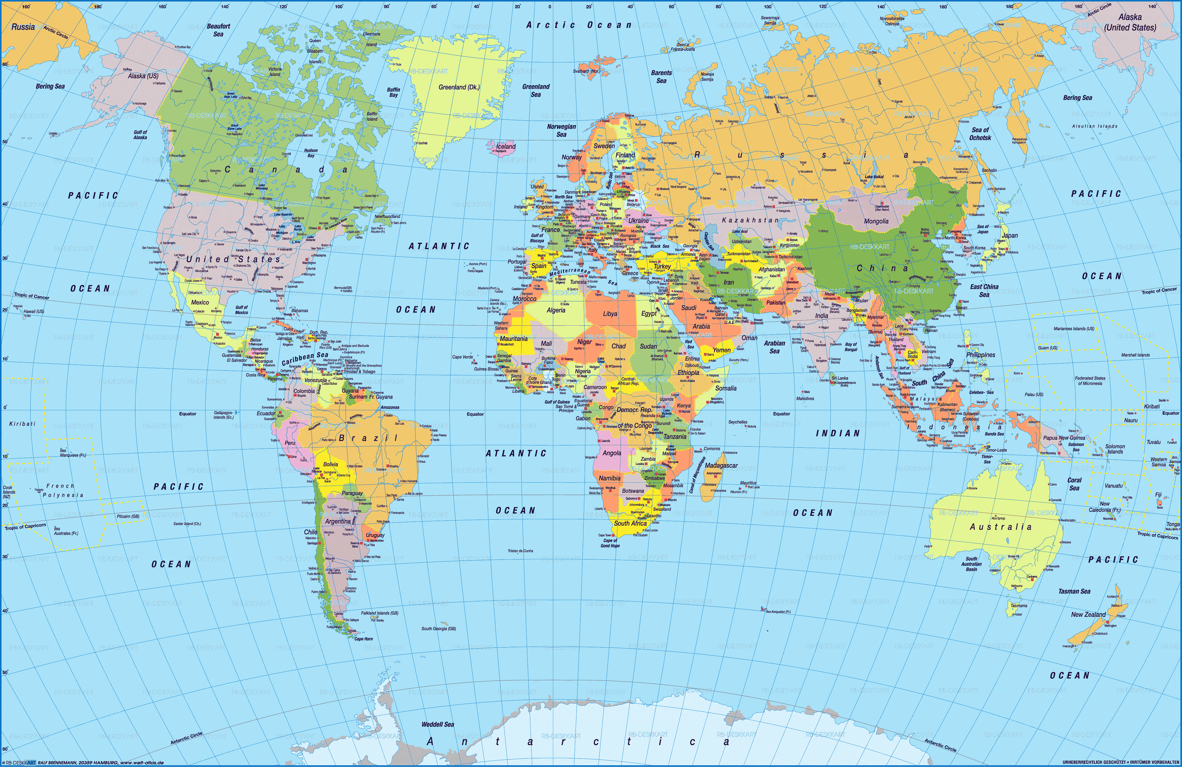
 Political world map showing countries, borders and major geographical divisions.
 World map showing political countries, regions, and oceans on a detailed layout.
 Detailed world map showing countries, major cities, and geographical features.
 World atlas map showing countries, continents, and major geographic features.
 High-resolution world political map displaying countries and boundaries.
 World map highlighting continents and regions with vibrant colors and labels.
 Map of Europe in 1914 showing alliances and regions during World War I.
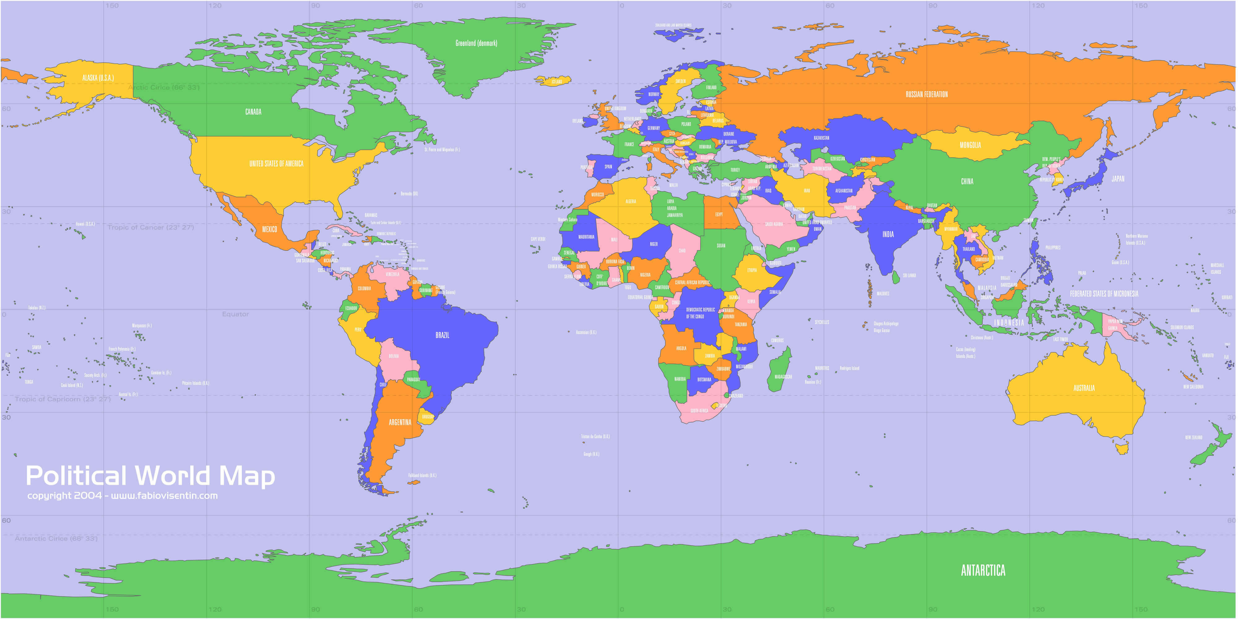 High-resolution political world map with countries in vibrant colors and labels.
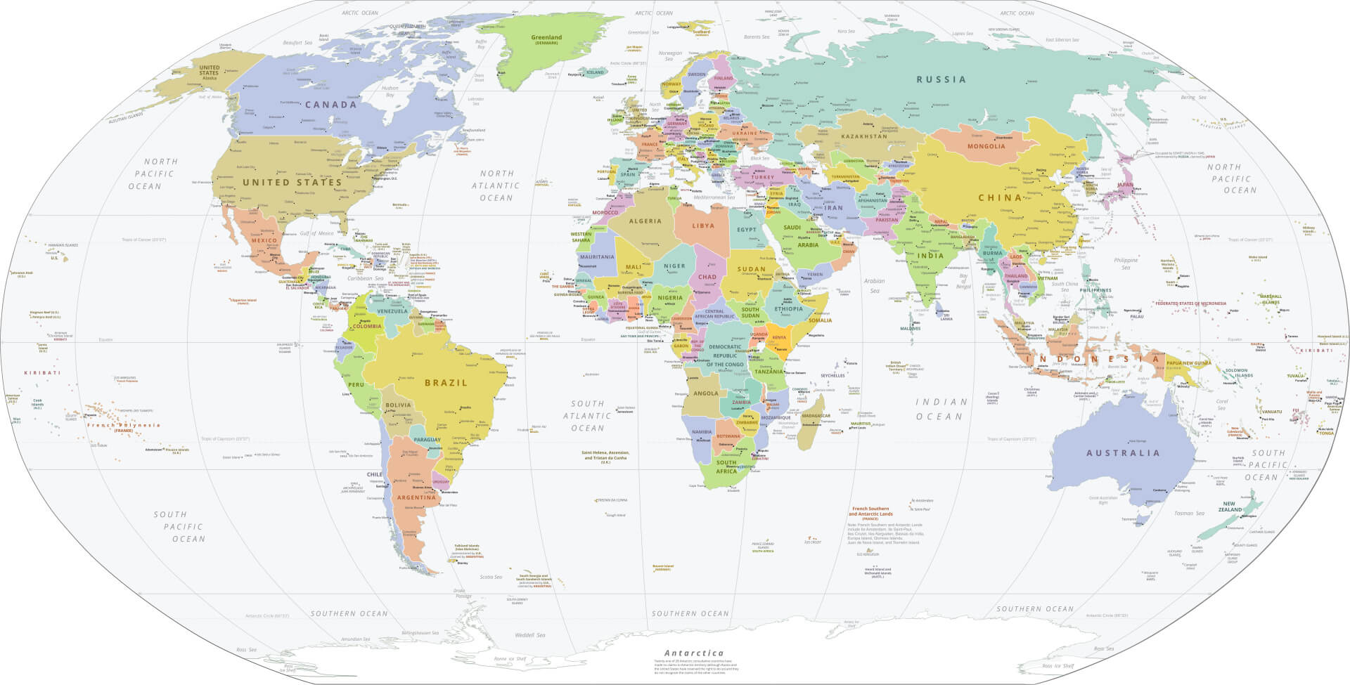 Political world map showing countries, boundaries and geographical features.
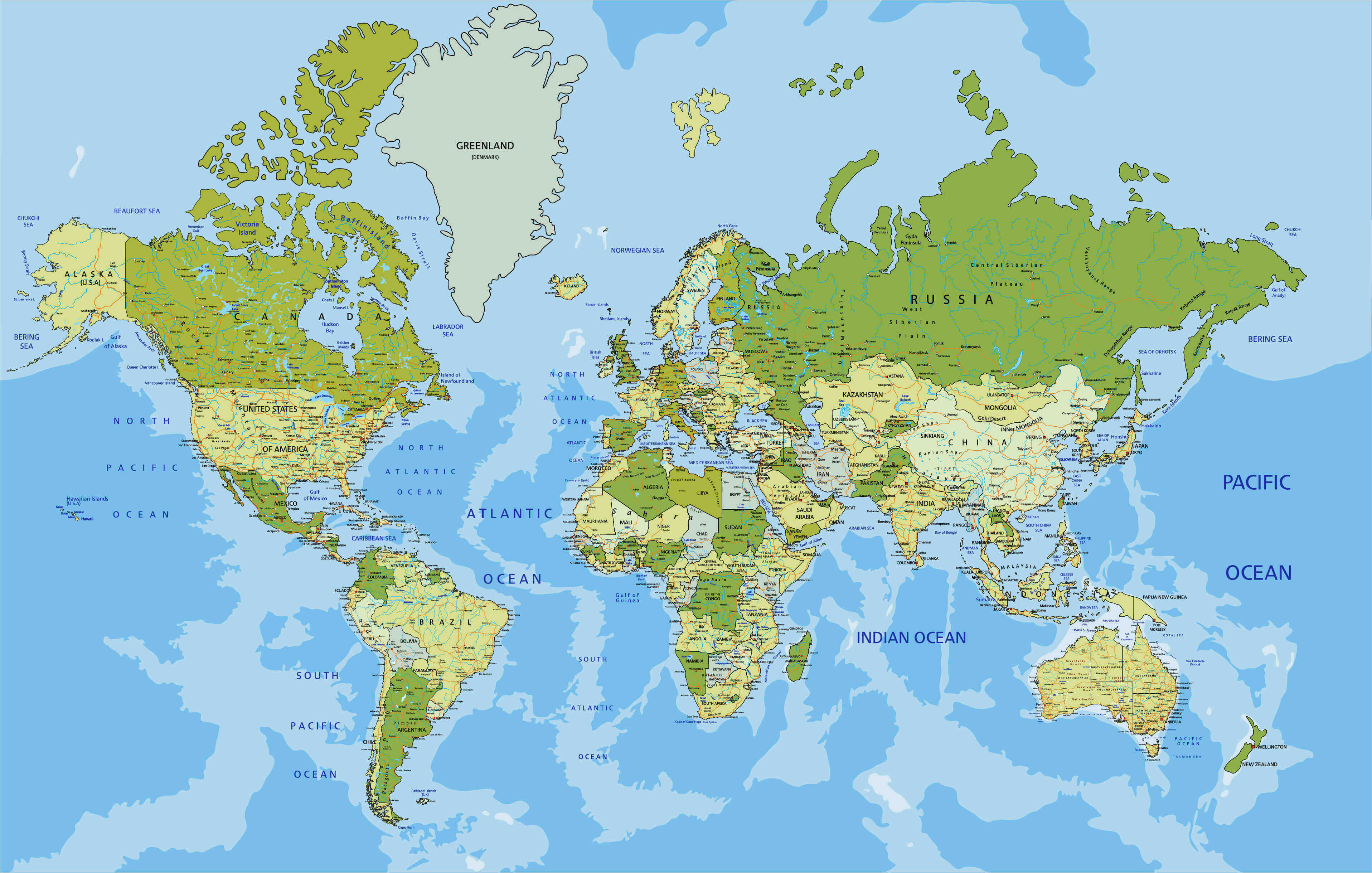 Political world map highlighting countries, borders, and geographic features.
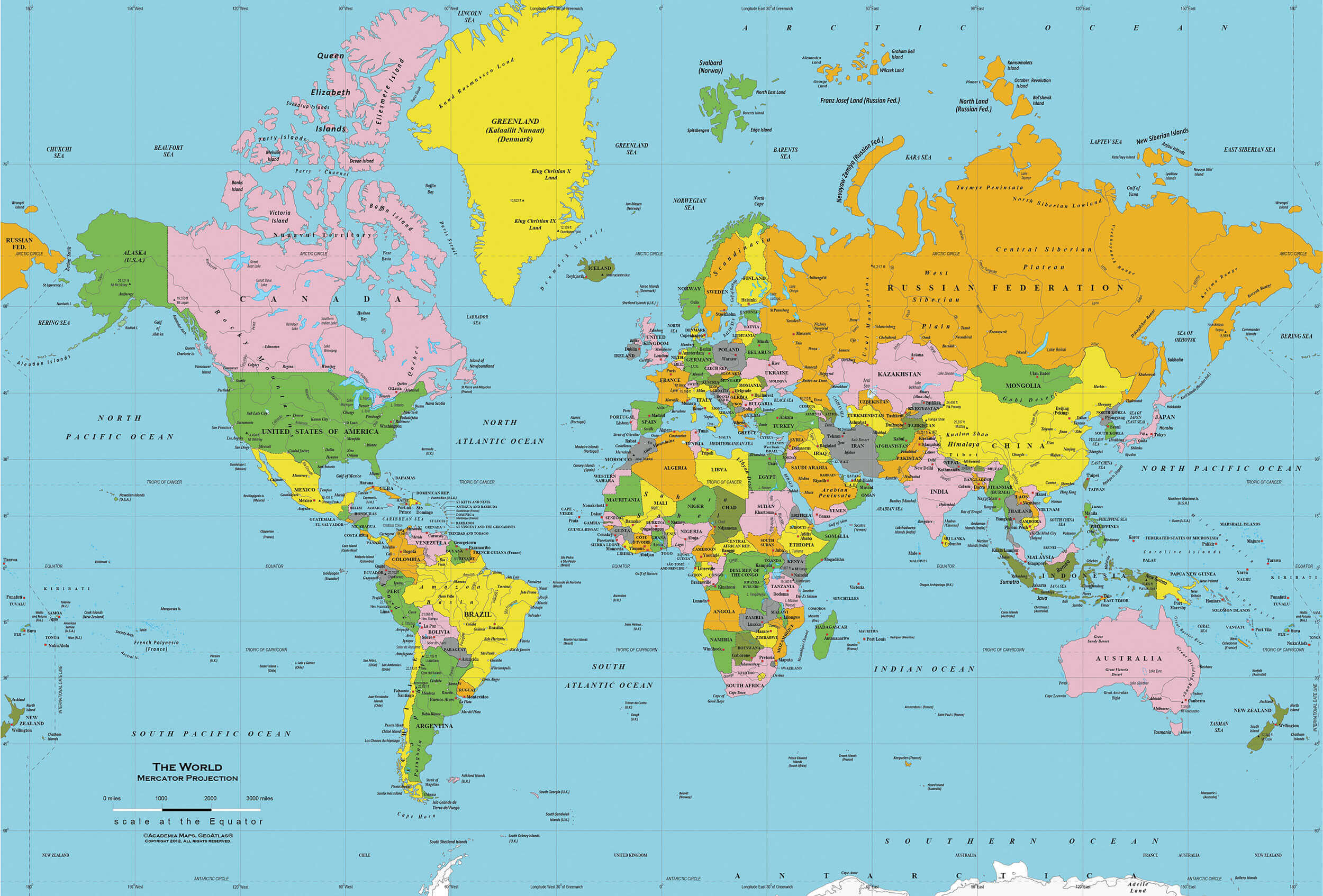 World political map showing countries, cities, and major geographic features.
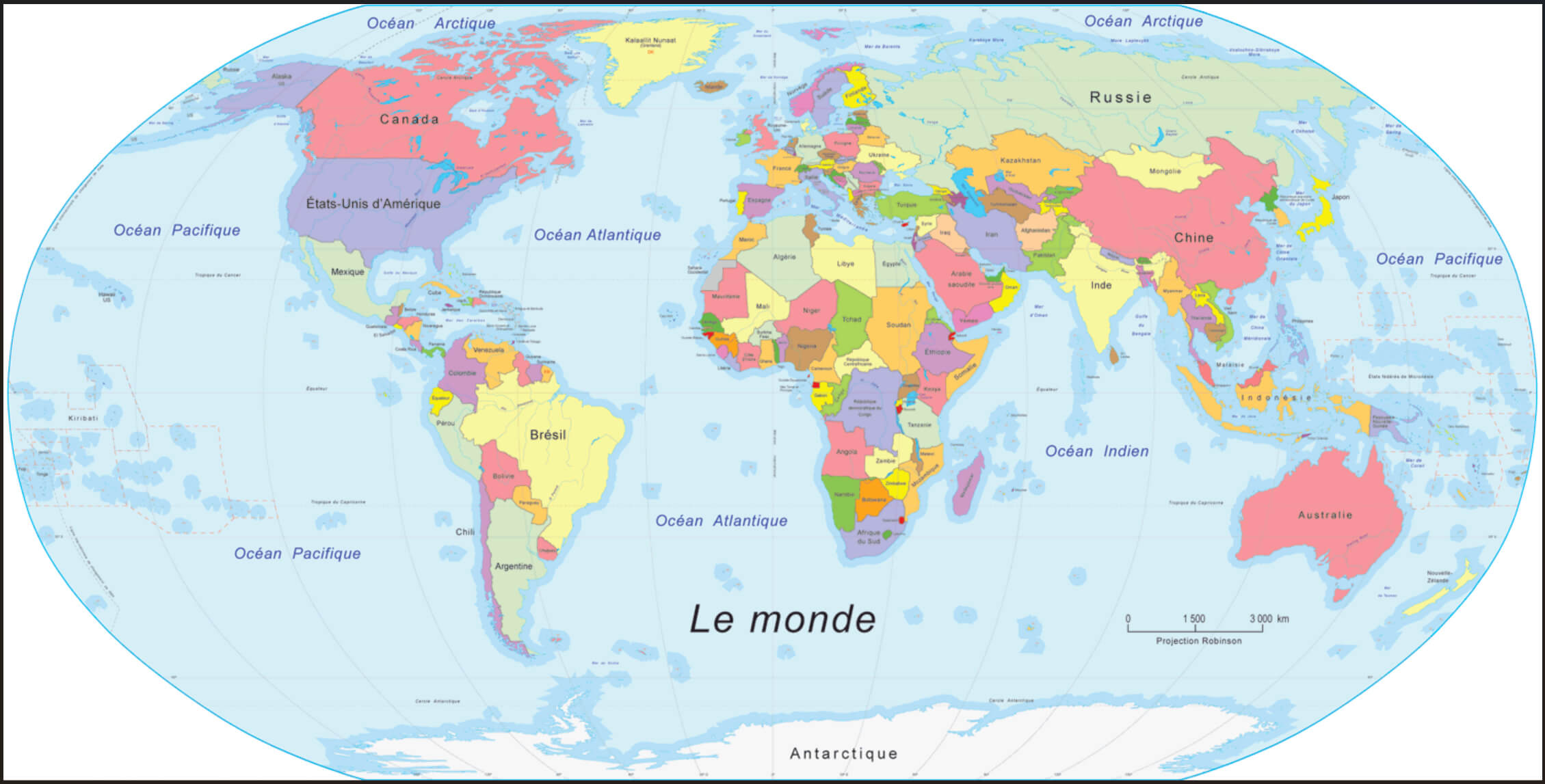 World political map in French showing countries, borders, and oceans.
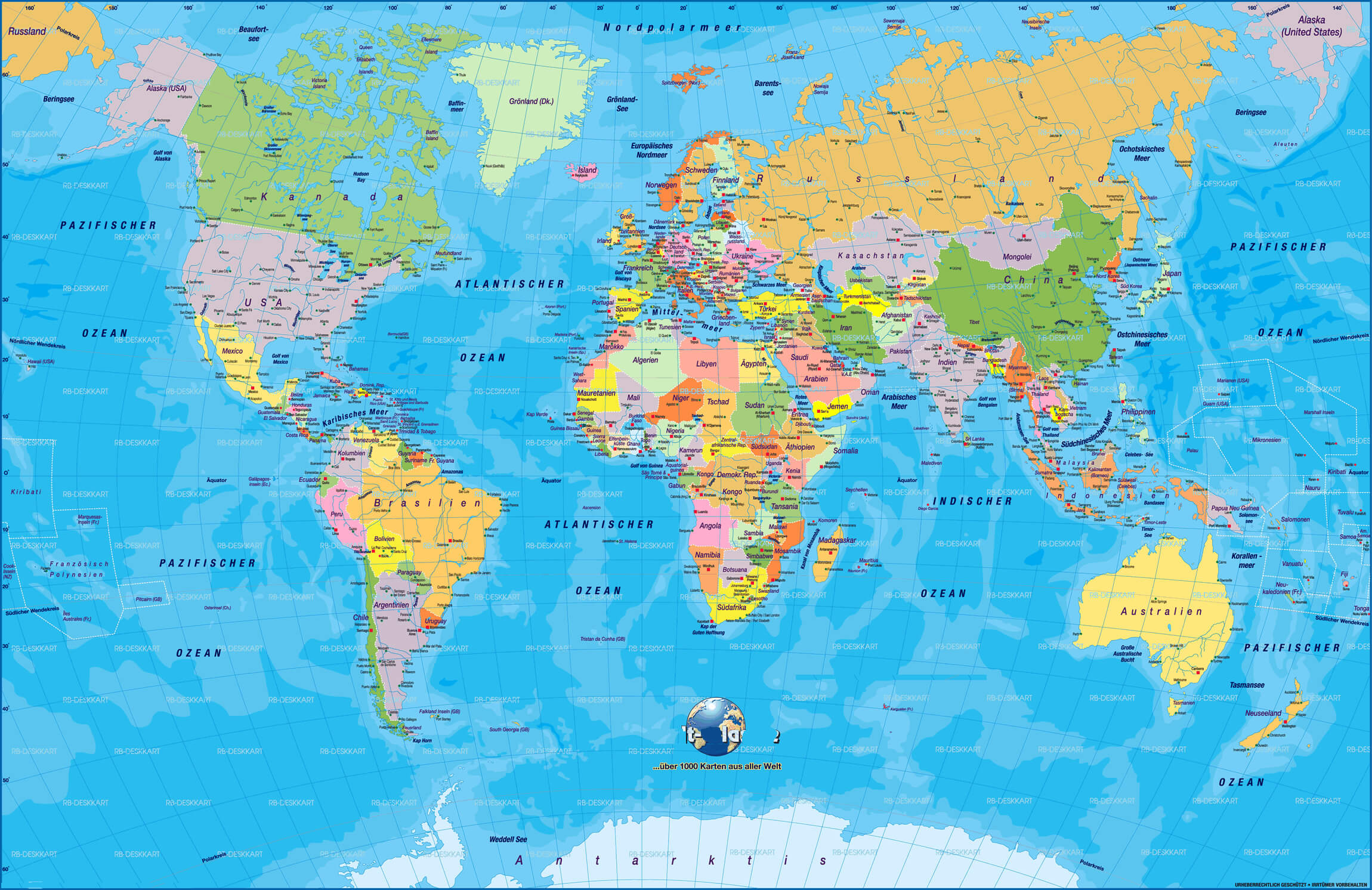 World political map in German showing countries, oceans, and borders.
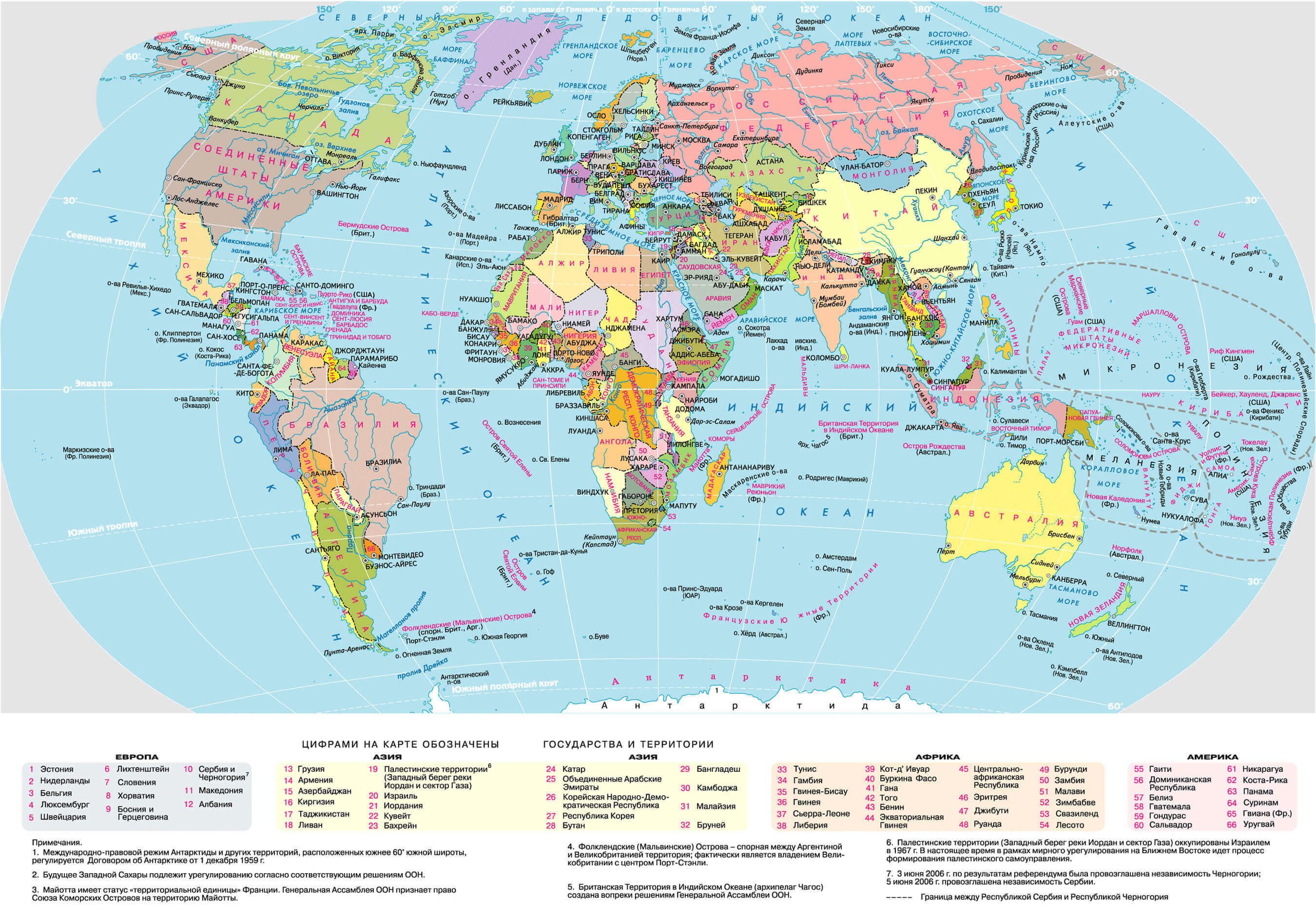 World political map in Russian displaying countries, borders, and oceans.
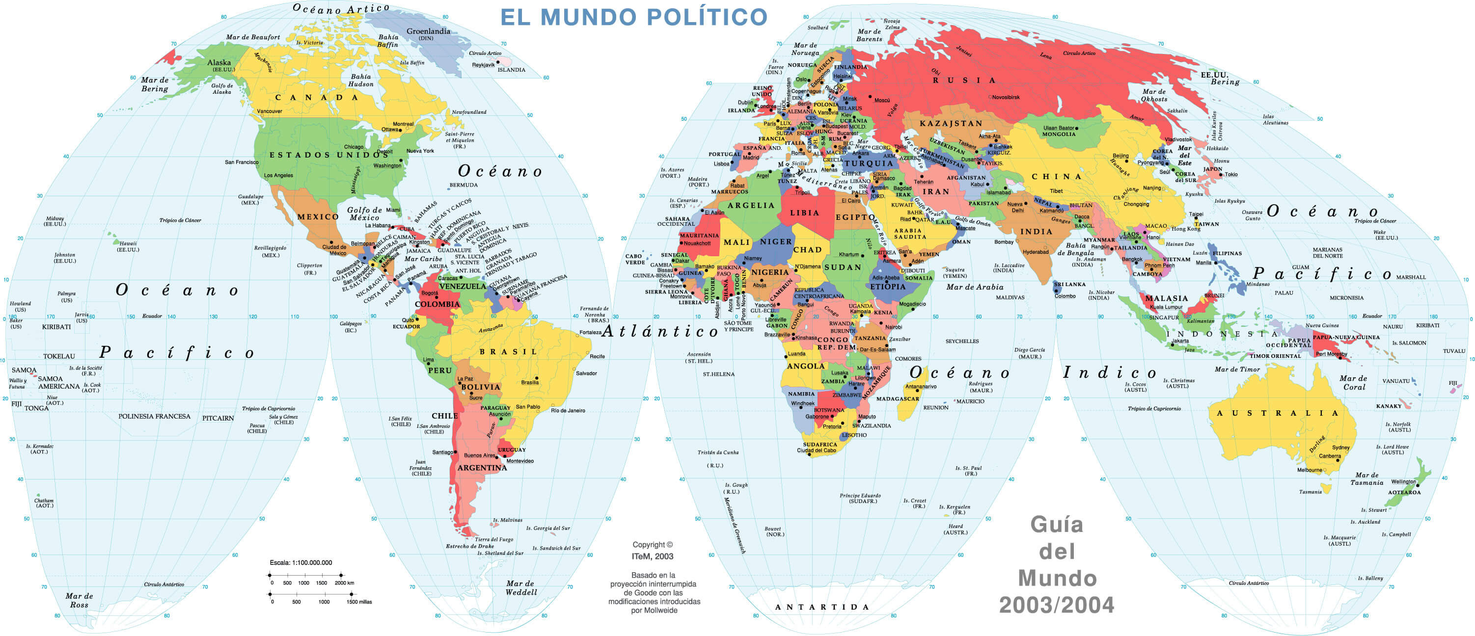 Political map of the world in English showing countries, oceans and borders..
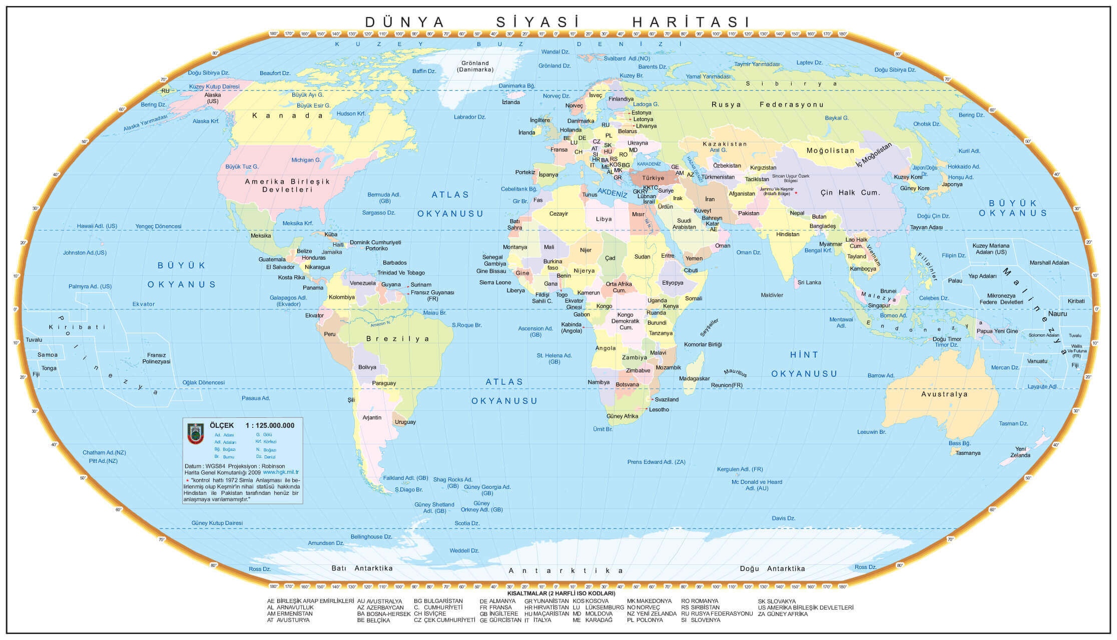 Detailed geographical display including political map of the world, countries and oceans.
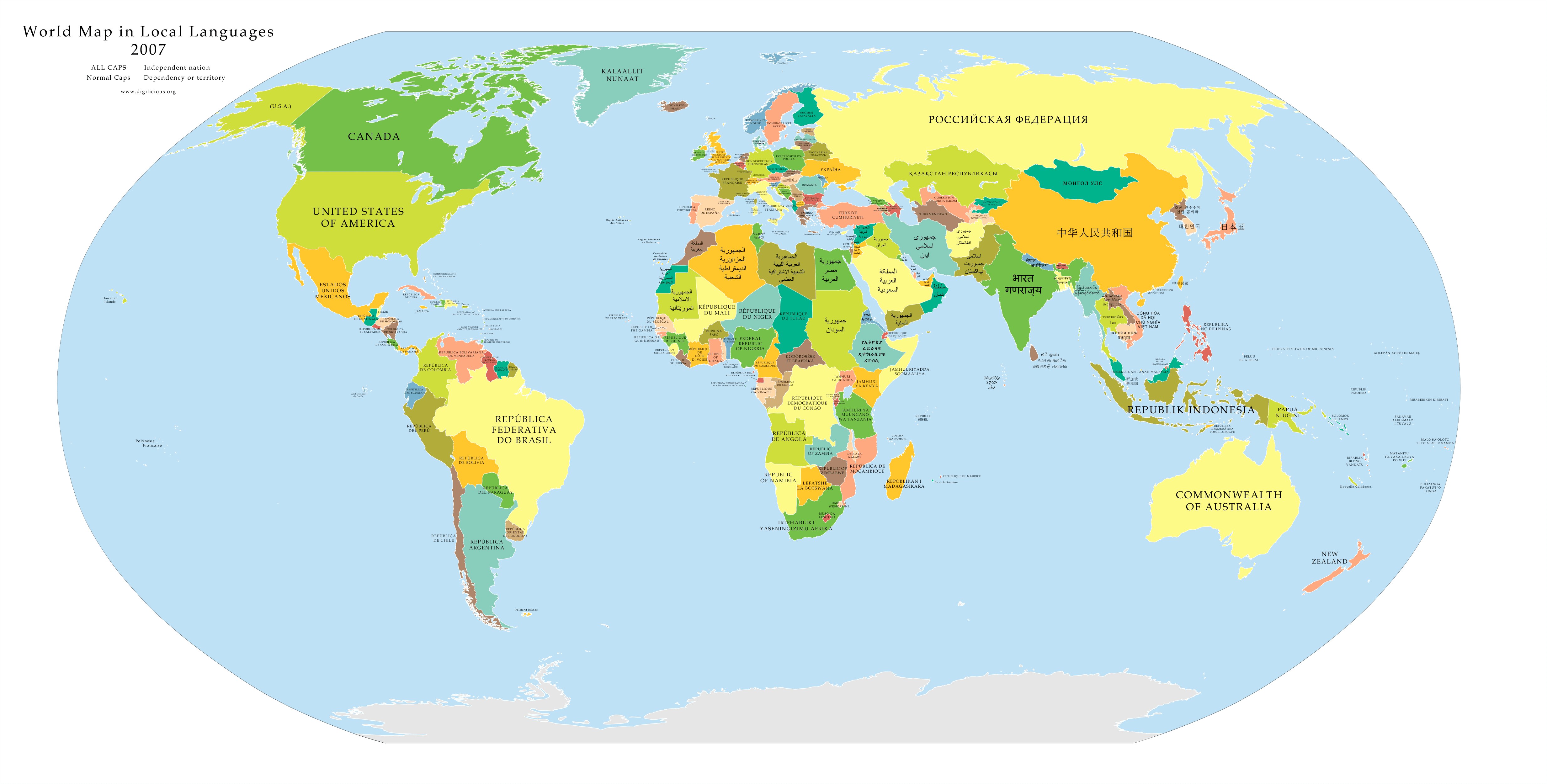 World political map displaying countries with names in their local languages.