Explore a collection of Norway maps featuring a range of types, including physical, political, administrative, and relief maps. You can also view satellite images, detailed maps, blank maps, and maps of Norway’s regions, cities, and topography. Whether you’re looking for road maps, directions, or an atlas, this collection provides a comprehensive look at Norway’s geography and landscape, offering valuable resources for travelers, students, or anyone interested in the country’s detailed features..
A Collection of Norway Maps
Norway Political Map
 Norway Political Map with capital Oslo, national borders, important cities, rivers and lakes. English labeling and scaling.
Map of Norway with Sweden and Denmark (1886 – 1891)
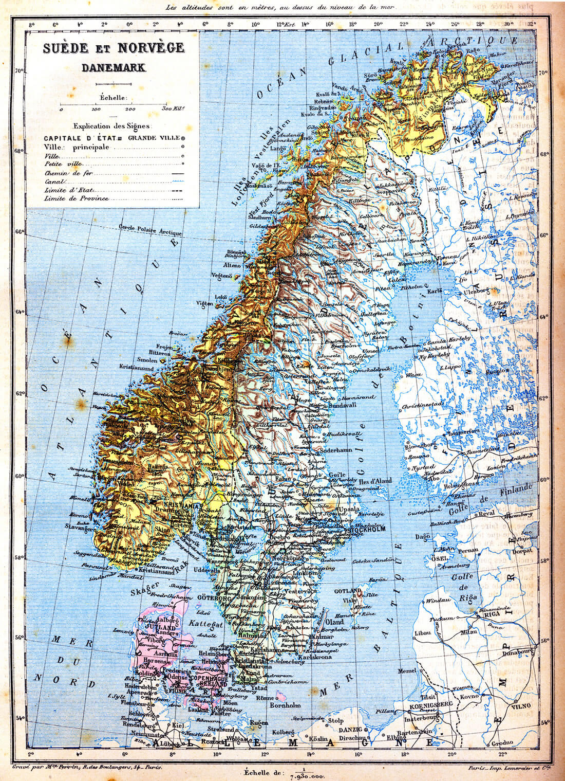
The map of Sweden, Norway and Denmark with explanation of signs on it. Old vintage map from the late 19th century, Trousset encyclopedia (1886 – 1891).
Norway Map with Earth, Europe, Scandinavia
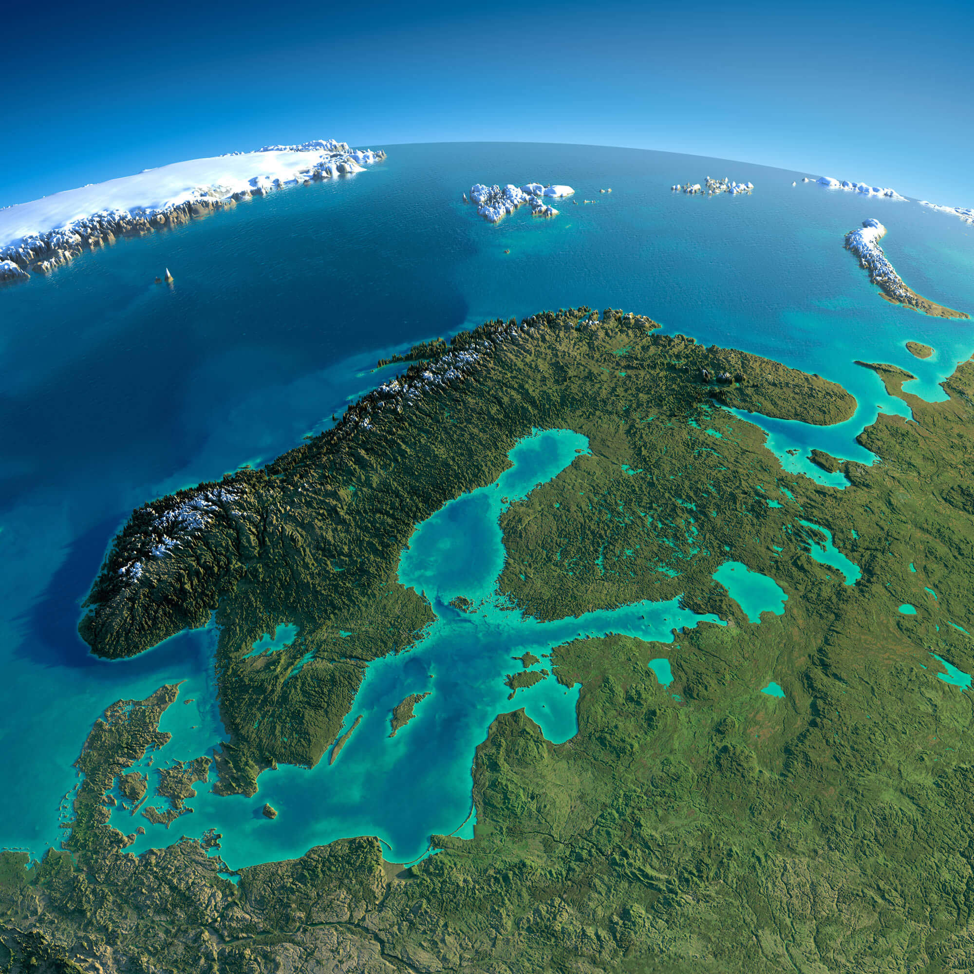
Highly detailed planet Earth in the morning. Exaggerated precise relief lit morning sun. Detailed Norway Map with Earth, Europe, Scandinavia.
Norway Shaded Relief Map
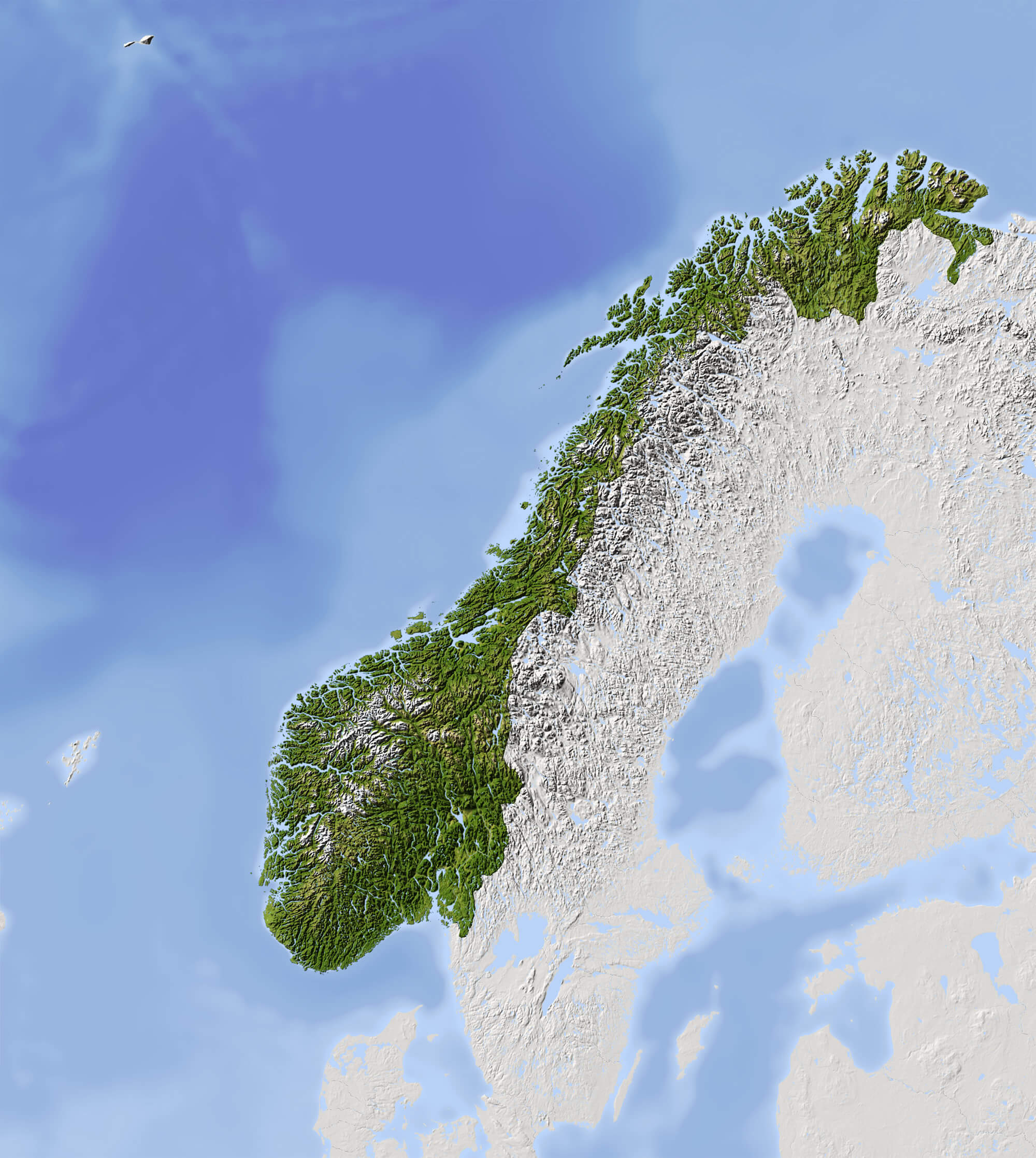
Norway Shaded relief map. Surrounding territory greyed out. Colored according to vegetation. Includes clip path for the state area.
Norway Satellite Map
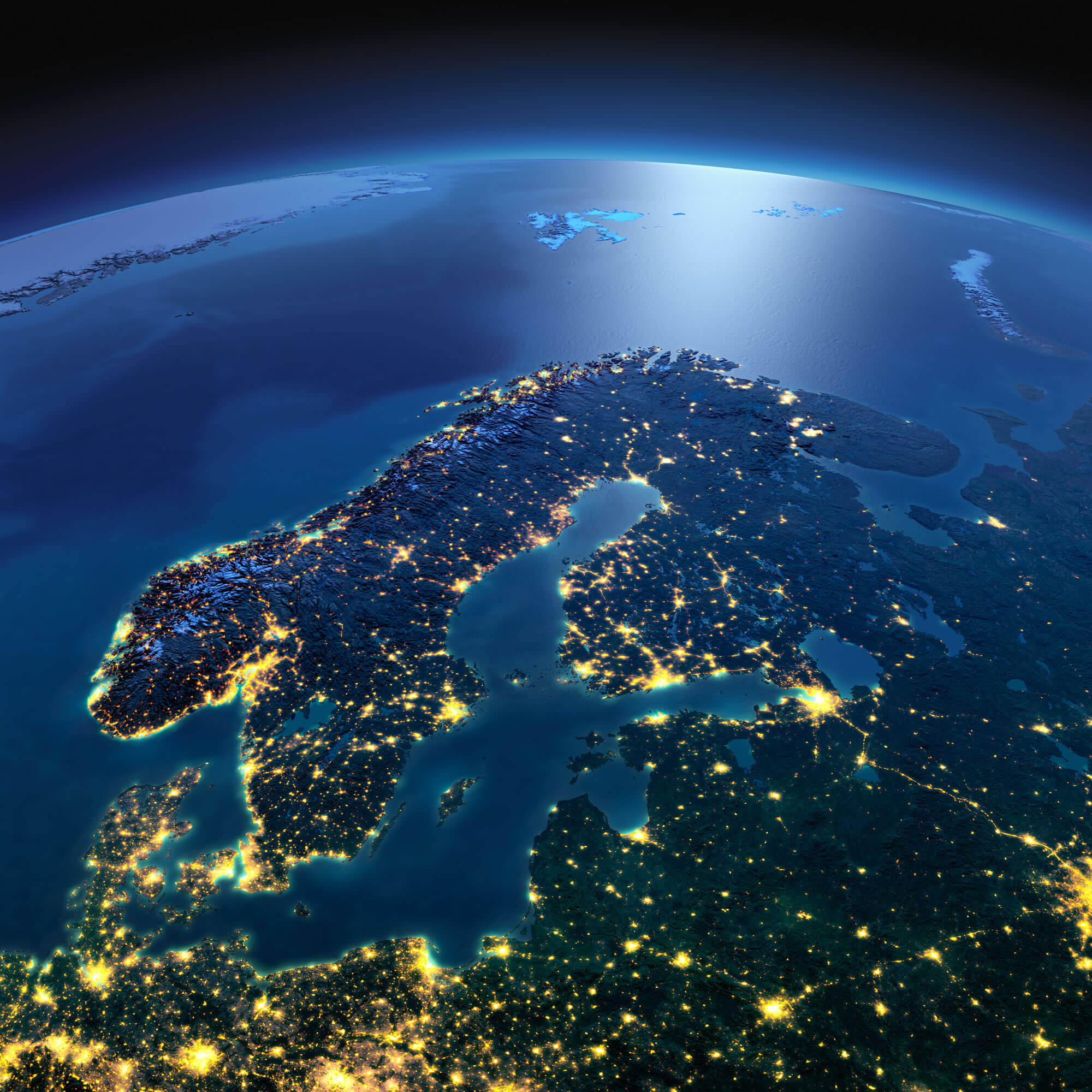
Norway Satellite Map, Night planet Earth with precise detailed relief and city lights illuminated by moonlight Europe, Scandinavia.
Political Map of Norway

Highly detailed editable political map of Norway with separated layers.
Vector Map of Norway, Europe
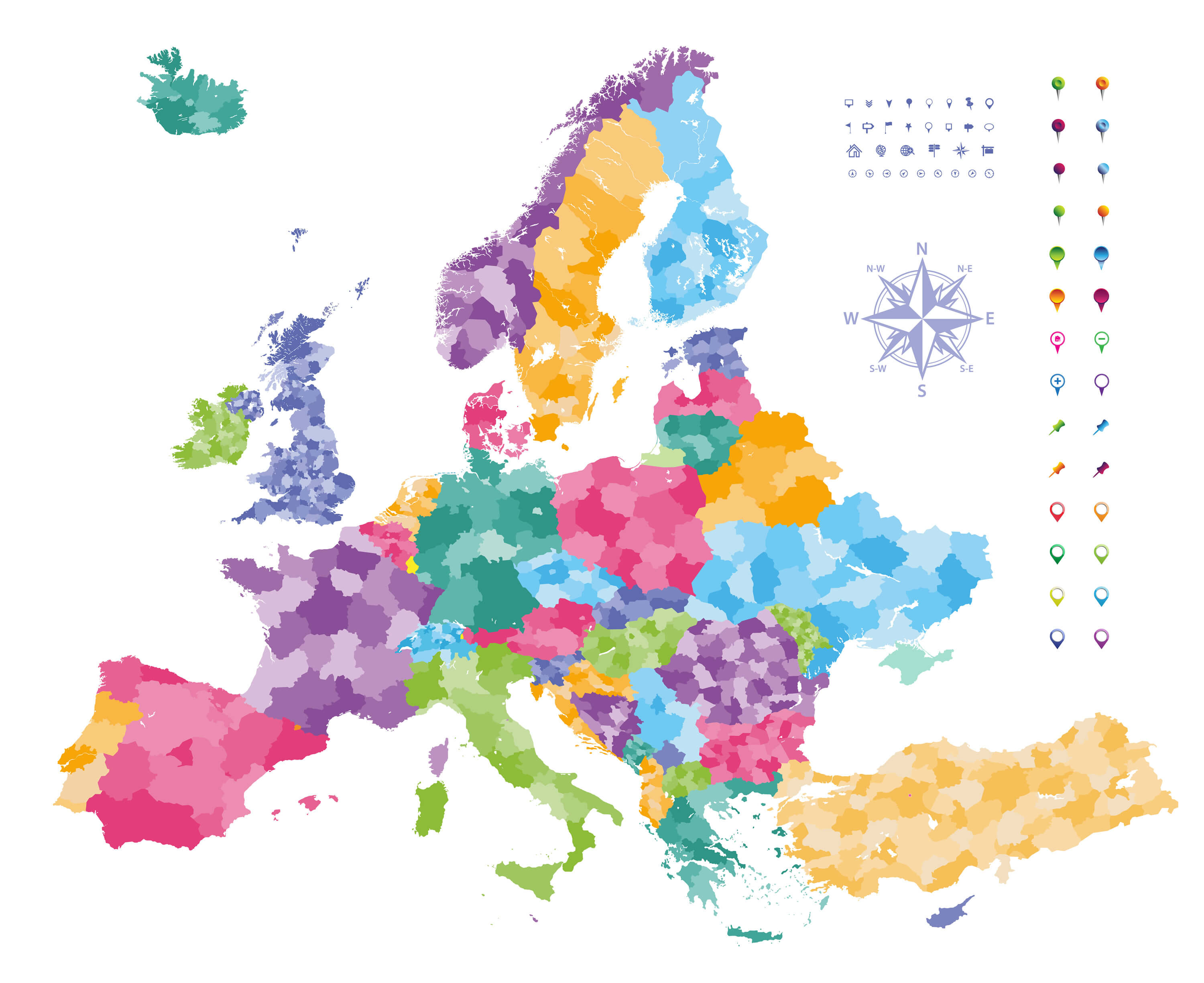
Vector Map of Norway, Europe map colored by countries with regions borders. Navigation, location, and travel icons collection.
Where is Norway on the Europe Map?
Show Google map, satellite map, where is the country located.
Get directions by driving, walking, bicycling, public transportation and travel with street view.
Feel free to explore these pages as well:
- Norway ↗️
- Norway Map ↗️
- Map of Norway↗️
- Map of Sweden ↗️
- Sweden Map ↗️
- Ultimate Guide to Stockholm’s 10 Must-Visit Attractions ↗️
- Aland Islands Map ↗️
- Faroe Islands Map ↗️
- Finland ↗️
- Map of Finland ↗️
- Finland Map ↗️