Discover the stunning Faroe Islands with detailed map, pyhsical, political, satellite, road maps. Explore the unique landscapes, towns and natural wonders to plan your trip to this stunning North Atlantic archipelago.
Brief information about Faroe Islands
The Faroe Islands, an autonomous territory within the Kingdom of Denmark, are located in the North Atlantic, halfway between Iceland and Norway. The archipelago consists of 18 rugged volcanic islands known for their dramatic cliffs, deep fjords and lush green landscapes. With a small population of around 50,000, the Faroese culture is deeply rooted in Nordic traditions, with its own language, Faroese, and a distinctive way of life shaped by the sea and the islands’ remote location.
Tourism is growing as more visitors are drawn to the Faroe Islands’ unspoilt natural beauty, abundant birdlife and outdoor activities such as hiking, birdwatching and fishing. The islands’ capital, Tórshavn, is one of the smallest capitals in the world and offers a charming blend of historic wooden buildings and modern Nordic culture. Despite their isolation, the Faroe Islands are well connected by ferry, air and a network of roads and tunnels that make it easy to explore the breathtaking scenery all year round.
Where is located Faroe Islands on the World Map
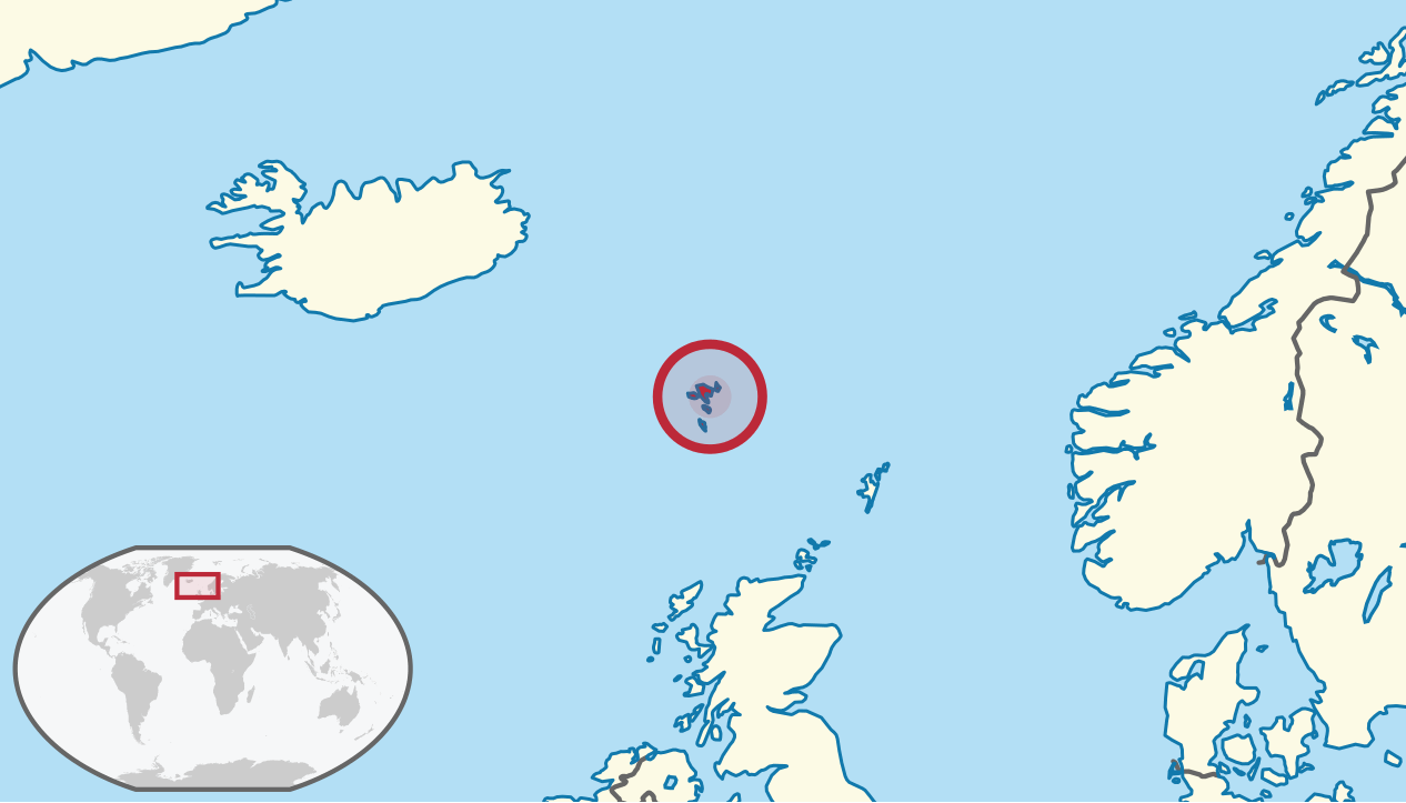
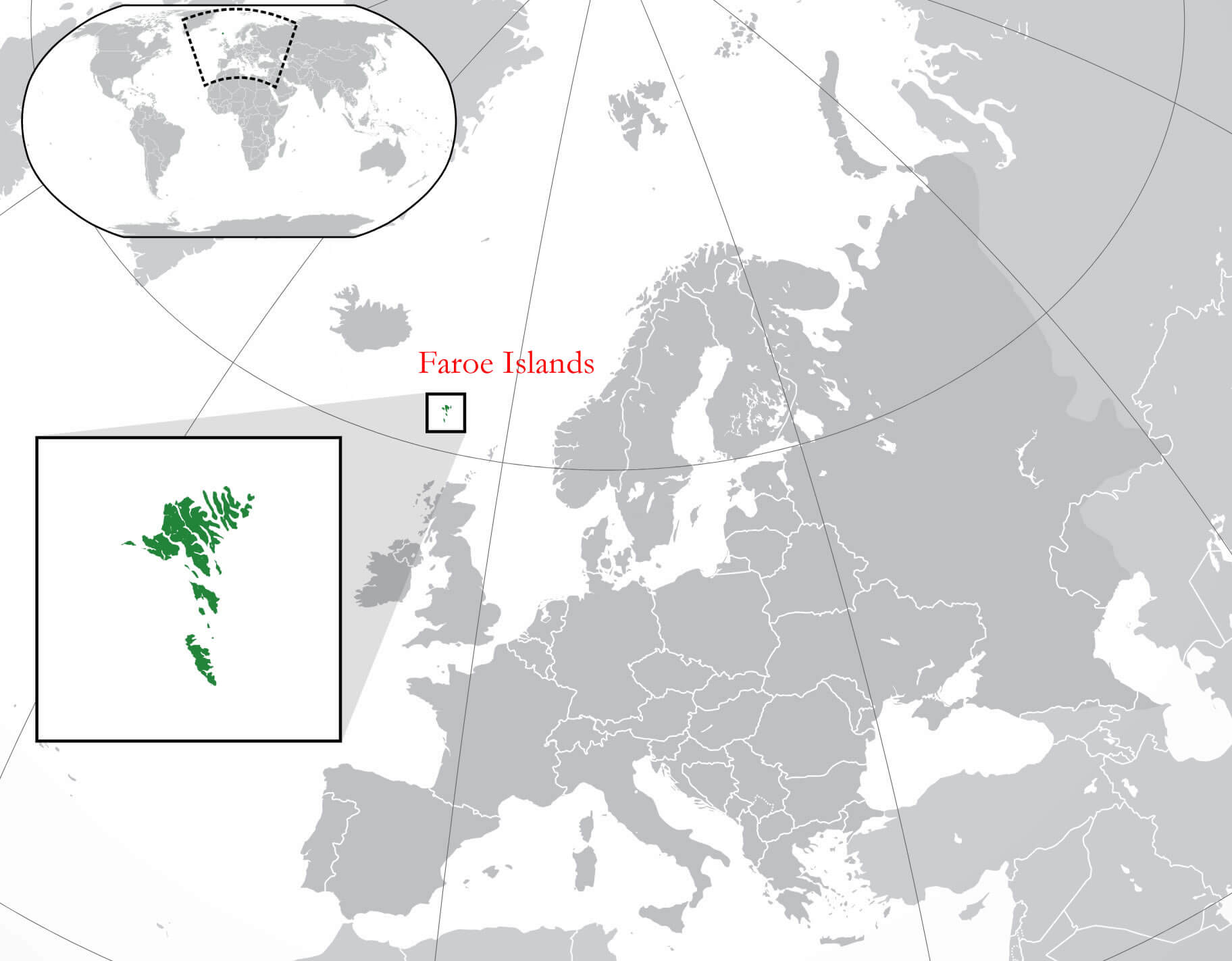
The Faroe Islands are located in the North Atlantic Ocean, between Iceland to the northwest and Norway to the east. This small, remote archipelago lies approximately 200 miles (320 kilometres) north of Scotland, making it one of the most isolated territories in Europe. The islands’ position in the North Atlantic gives them a unique, rugged environment, shaped by strong ocean currents and frequent weather changes.
Although part of the Kingdom of Denmark, the Faroe Islands maintain their own identity with their own language, Faroese, and autonomous government. The archipelago’s location has allowed it to develop a culture and way of life distinct from mainland Denmark, strongly influenced by Nordic traditions and the surrounding sea. The sea provides both sustenance and a natural barrier that helps preserve the islands’ cultural heritage.
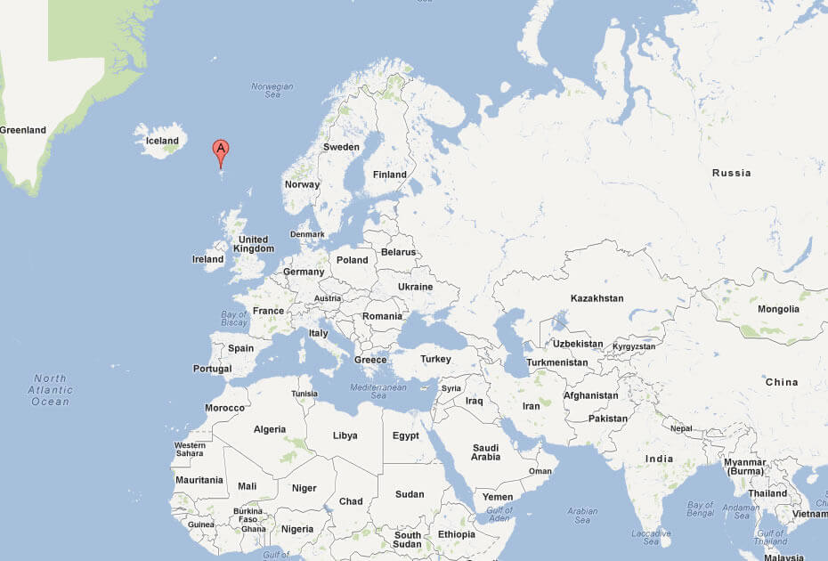
On the world map, the Faroe Islands appear as a tiny speck in the North Atlantic, but they are strategically important due to their location along major North Atlantic shipping routes. This location, combined with its natural beauty and rich fishing grounds, makes the Faroe Islands a fascinating destination for travellers looking to explore remote and unspoilt landscapes.
Here are some statistical information about Faroe Islands:
 Area: 1,393 km2 (538 sq mi)
Faroe Islands map with cities
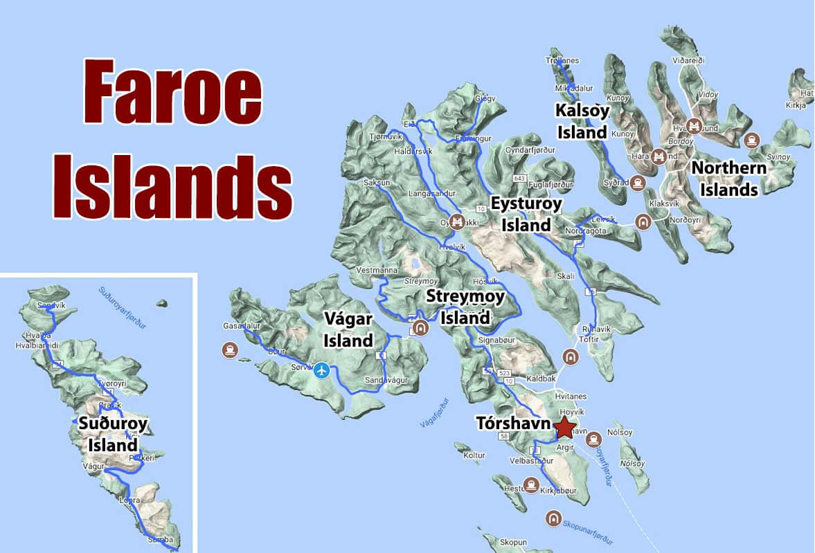
Map of Faroe Islands
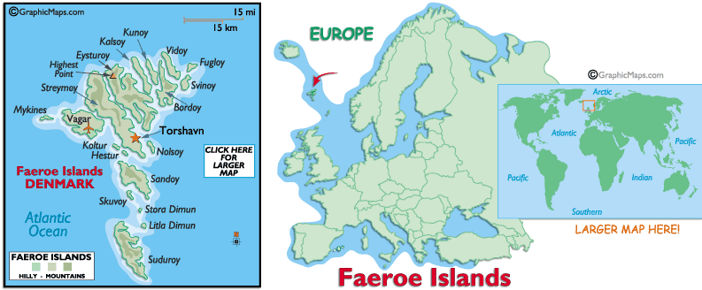 Faroe Islands map in North Atlantic, showing main islands.
This map shows the Faroe Islands, an archipelago in the North Atlantic Ocean between Iceland and Norway. The islands are part of the Kingdom of Denmark, as the label indicates, although they have a high degree of autonomy. The main islands, such as Streymoy, Eysturoy, Vágar, and Suðuroy, are marked with their major towns, including Tórshavn, the capital, which is located on Streymoy. An inset map places the Faroe Islands in a European context, showing their relative position northwest of Scotland. In addition, a world map highlights the Faroe Islands’ global location, emphasizing their isolated, oceanic position in the northern hemisphere.
Map of The Faroe Islands Torshavn
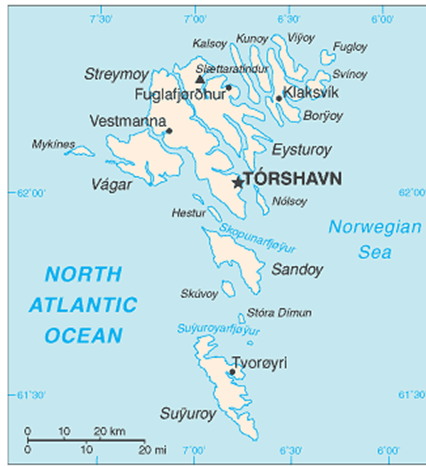
Faroe Islands Satellite Map
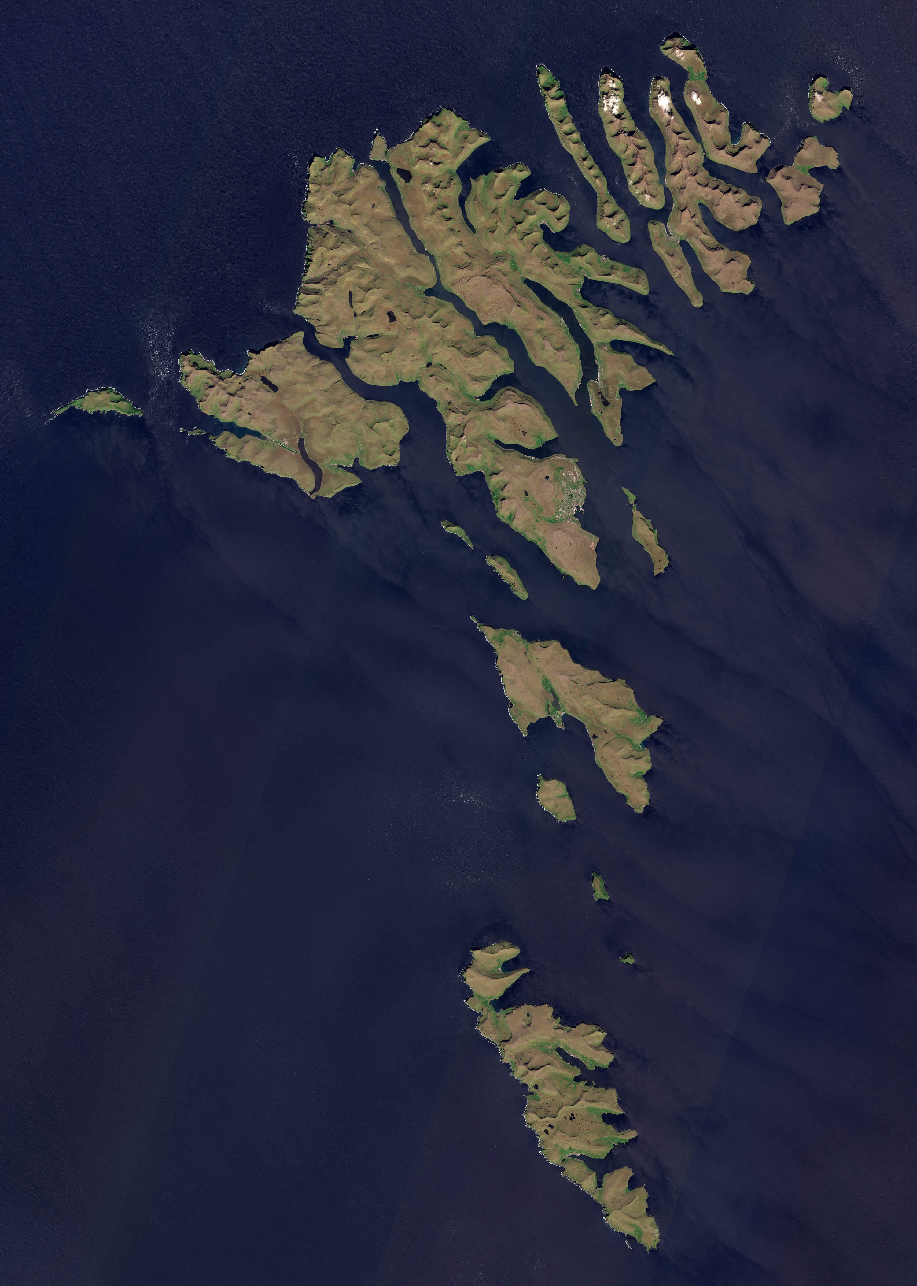
Faroe Islands Road Map
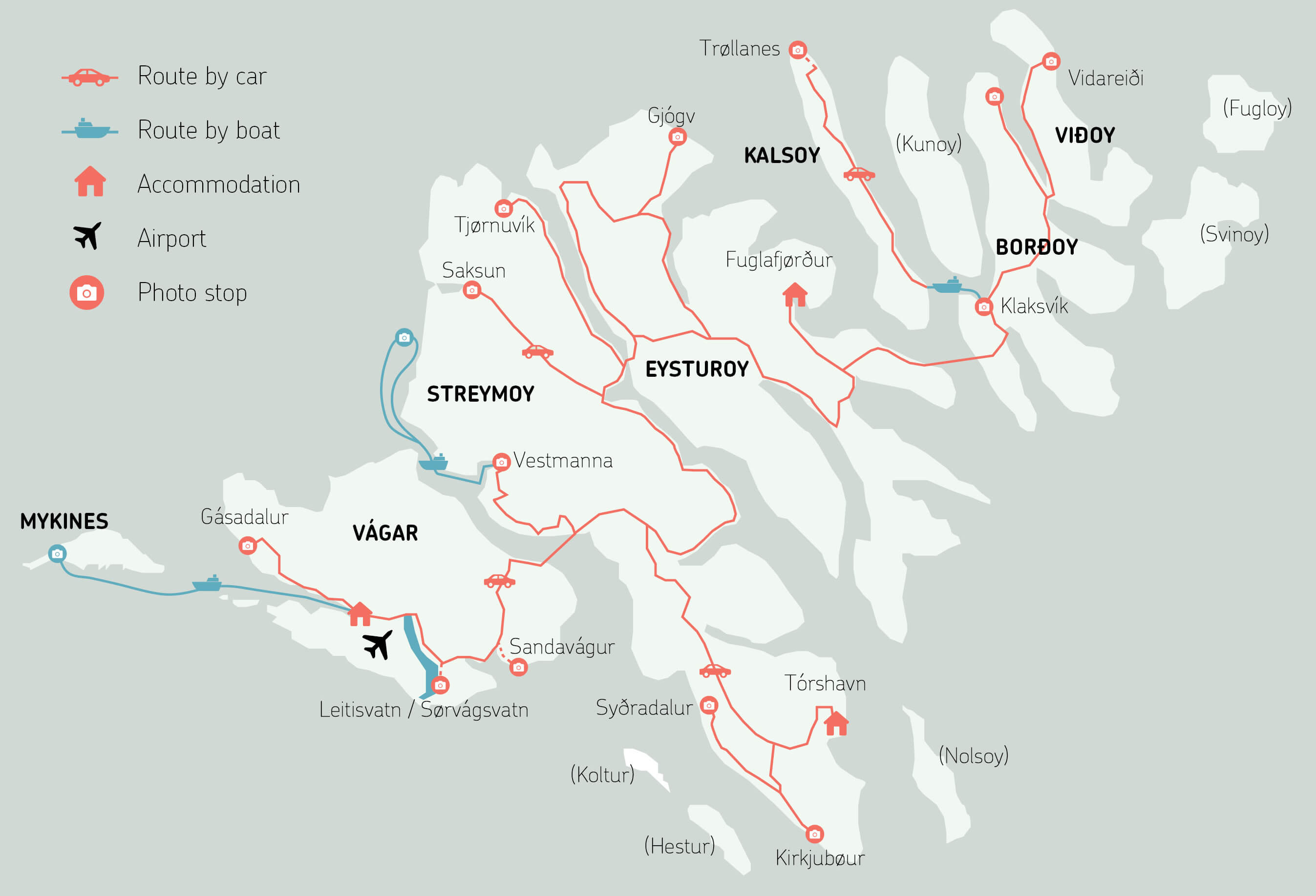 Faroe Islands road map showing routes by car and boat, photo stops, airports, and accommodations.
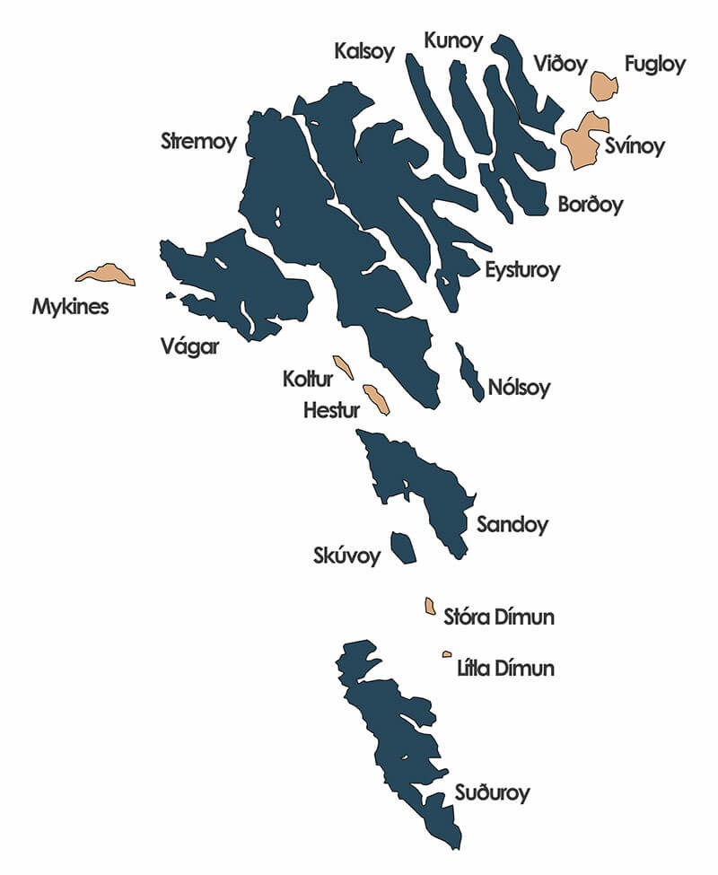
Faroe Islands Political Map
Faroe Islands historical population
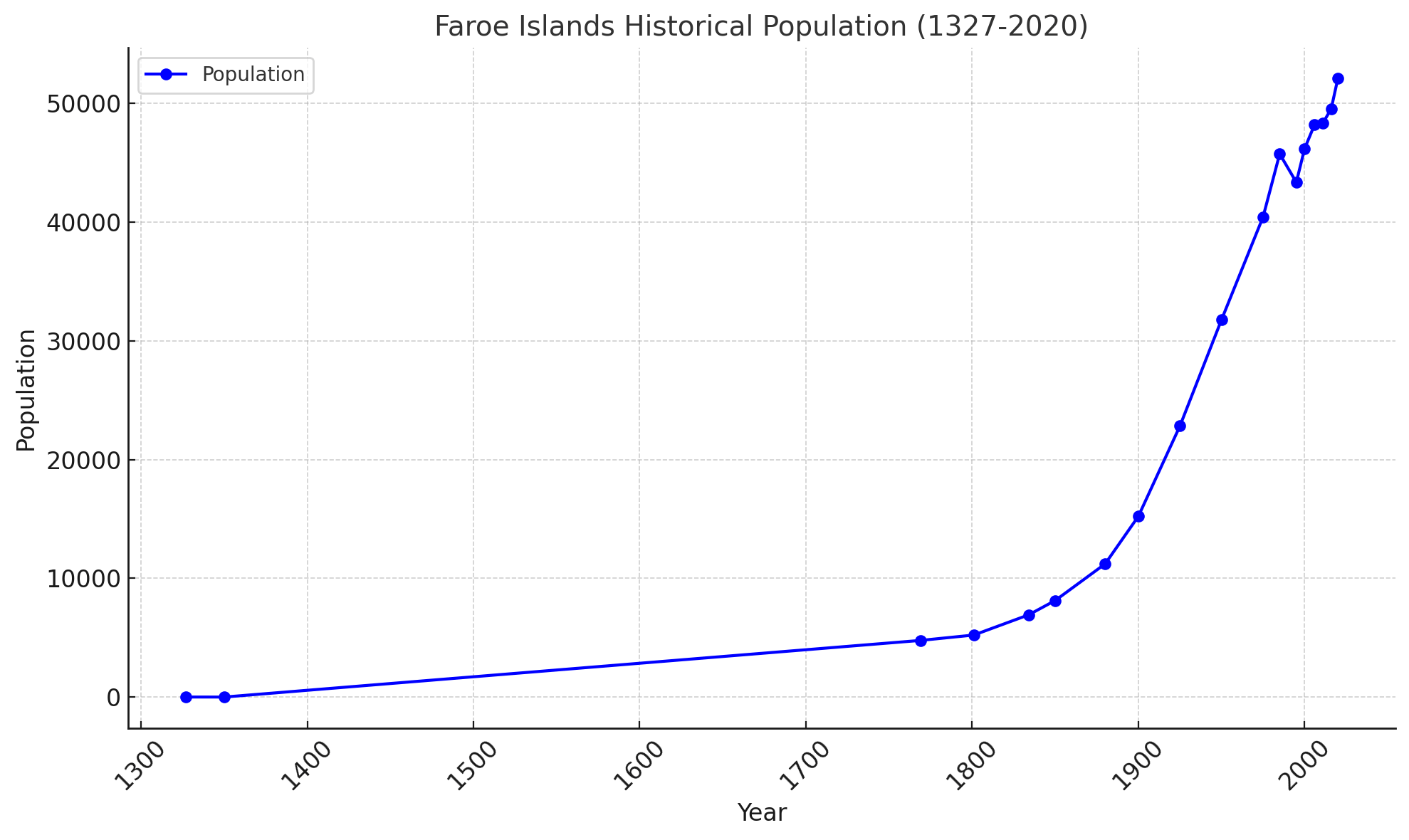
Here is the line chart illustrating the historical population of the Faroe Islands from 1327 to 2020. It visually represents the population growth trends over the centuries. Let me know if you need any adjustments or further analysis.
Where is located Faroe Islands in the World
Faroe Islands Map
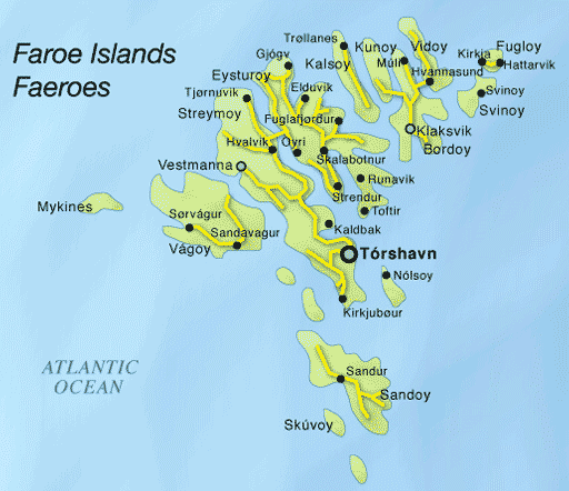 Faroe Islands map with Tórshavn, main towns, and villages.
This map of the Faroe Islands shows the major islands and the many towns and villages scattered throughout the archipelago. The capital, Tórshavn, is prominently marked on Streymoy, the largest island. Other important settlements such as Klaksvík on Borðoy and Vestmanna on Streymoy are marked to give an idea of the populated areas of the islands. Smaller islands such as Mykines and Sandoy are also shown, illustrating the dispersed and isolated nature of the Faroe Islands. This map emphasizes the unique layout and geography of the archipelago, surrounded by the Atlantic Ocean, with each island connected by sea routes and tunnels.
Map of Faroe Islands Europe
Map of Faroe Islands World
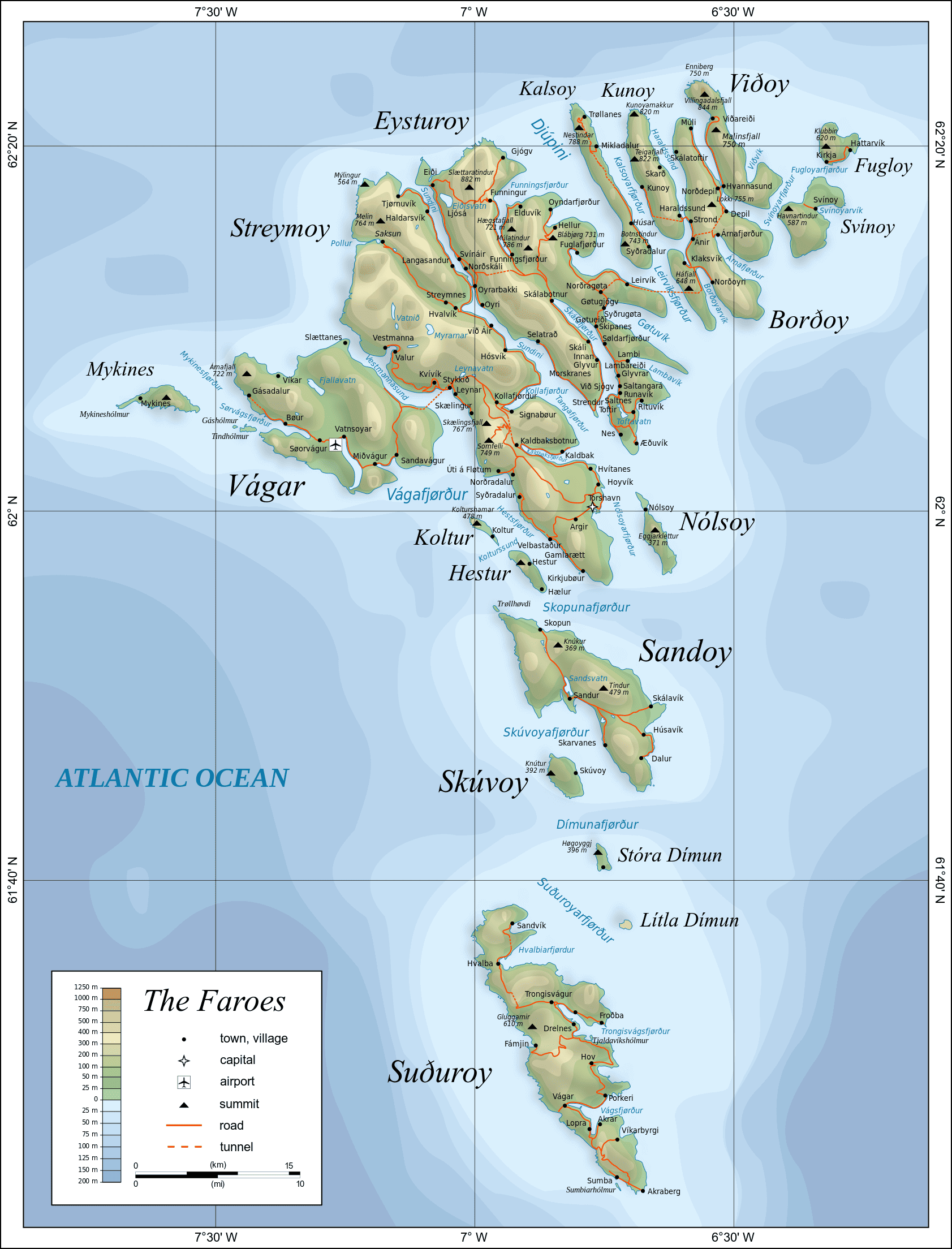
Physical Map of Faroe Islands
Map of Faroe Islands North Europe
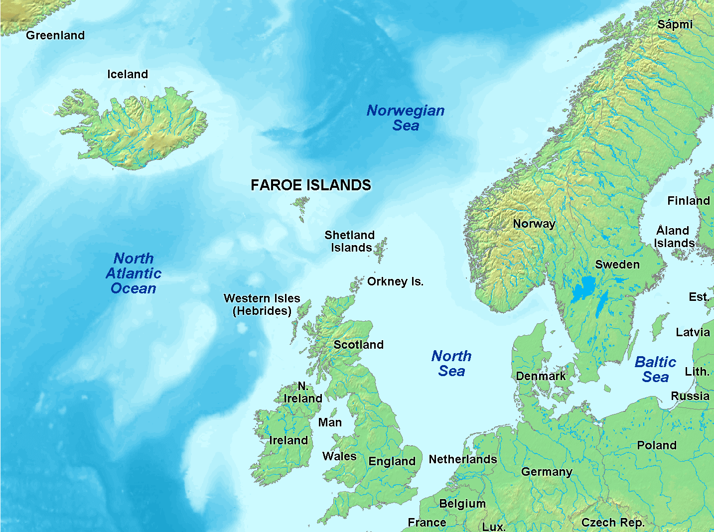 Faroe Islands map in North Atlantic near Iceland and Norway.
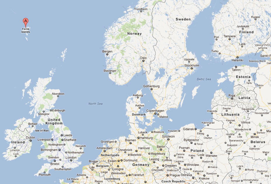
This map shows the Faroe Islands’ position in the North Atlantic Ocean, nestled between Iceland to the west, Norway to the east, and Scotland to the south. Surrounded by the Norwegian Sea and the North Atlantic Ocean, the Faroe Islands are strategically located, making them a unique part of Northern Europe. The map also highlights nearby regions, including the Shetland and Orkney Islands, as well as other areas like the Western Isles of Scotland and mainland Scandinavia. This geographic placement emphasizes the islands’ connection to both the Nordic and British Isles, showcasing their isolated yet central position in the North Atlantic.
Political Map of Faroe Islands
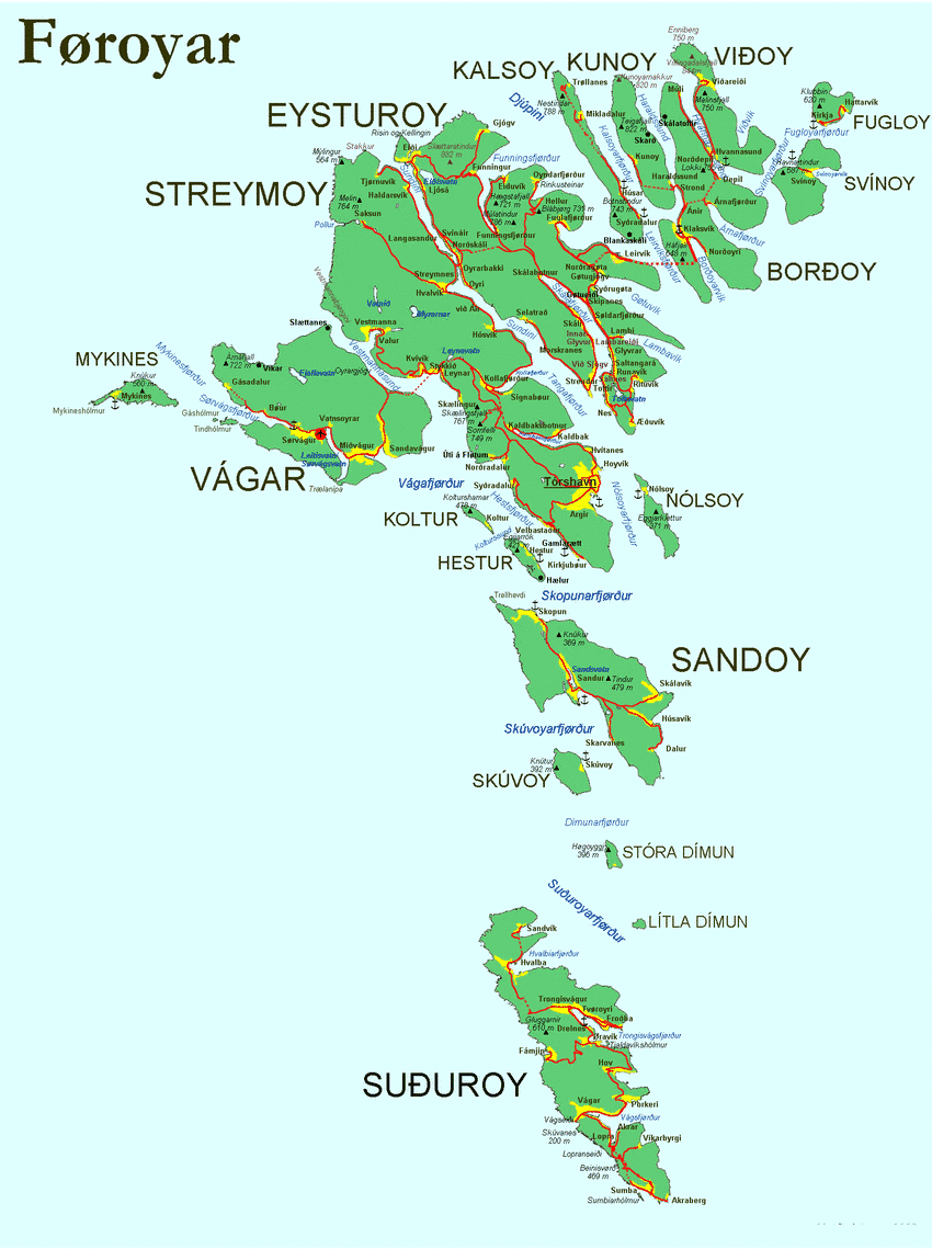
Map of The Faroe Islands
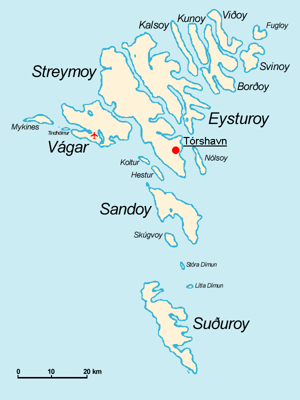 Faroe Islands map with main islands, Tórshavn, and airport.
This map shows the Faroe Islands, an archipelago of 18 islands in the North Atlantic Ocean. The map highlights several of the main islands, including Streymoy, Eysturoy, Vágar, Sandoy, and Suðuroy, with Tórshavn, the capital, marked by a red dot on Streymoy. The island of Vágar, which has the Faroe Islands’ only airport in the village of Sørvágur, is marked with an airplane symbol. Smaller surrounding islands such as Mykines and Koltur are also shown, illustrating the rugged and dispersed nature of this Nordic archipelago. The map includes a scale for distance reference, giving viewers a sense of the geographical layout of the islands and their proximity to each other.
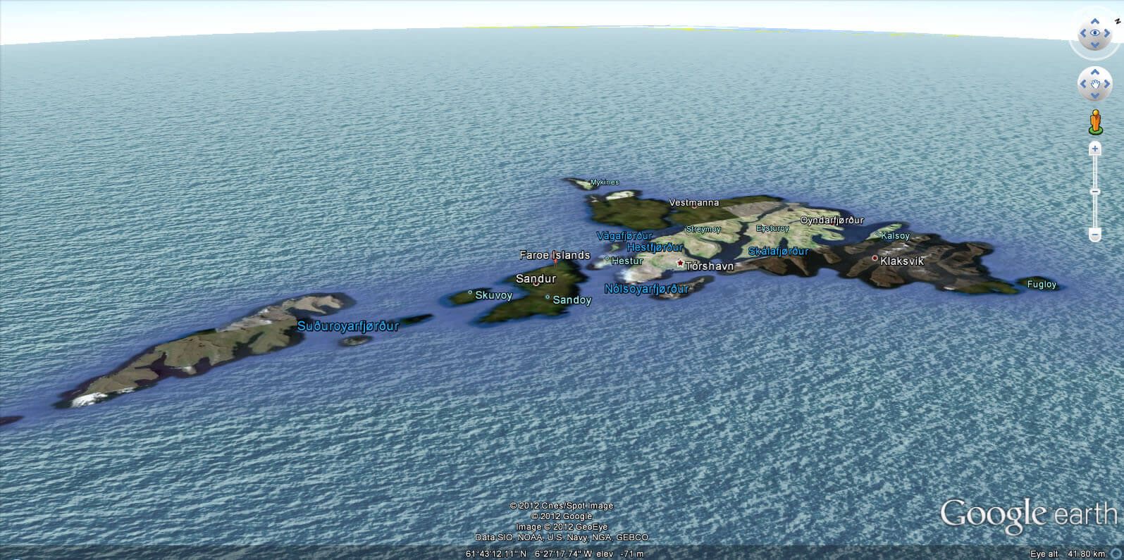
Faroe Islands Earth Map
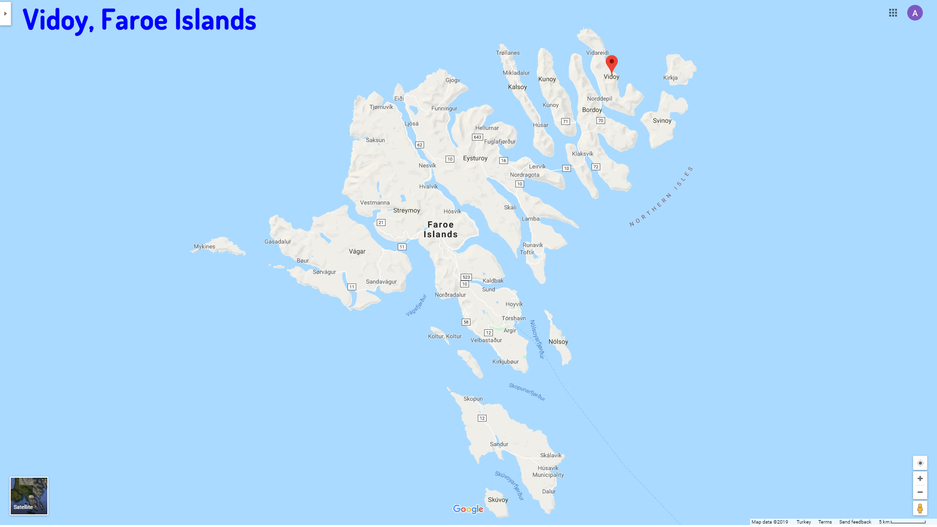
Vidoy Map Faroe Islands
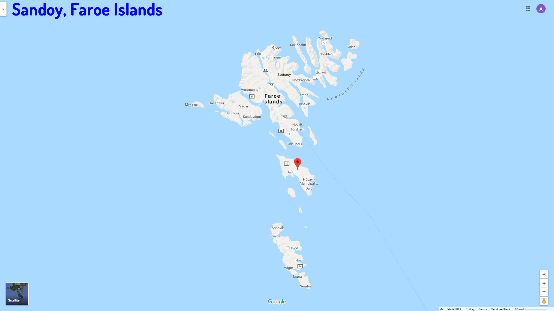
Sandoy Map Faroe Islands
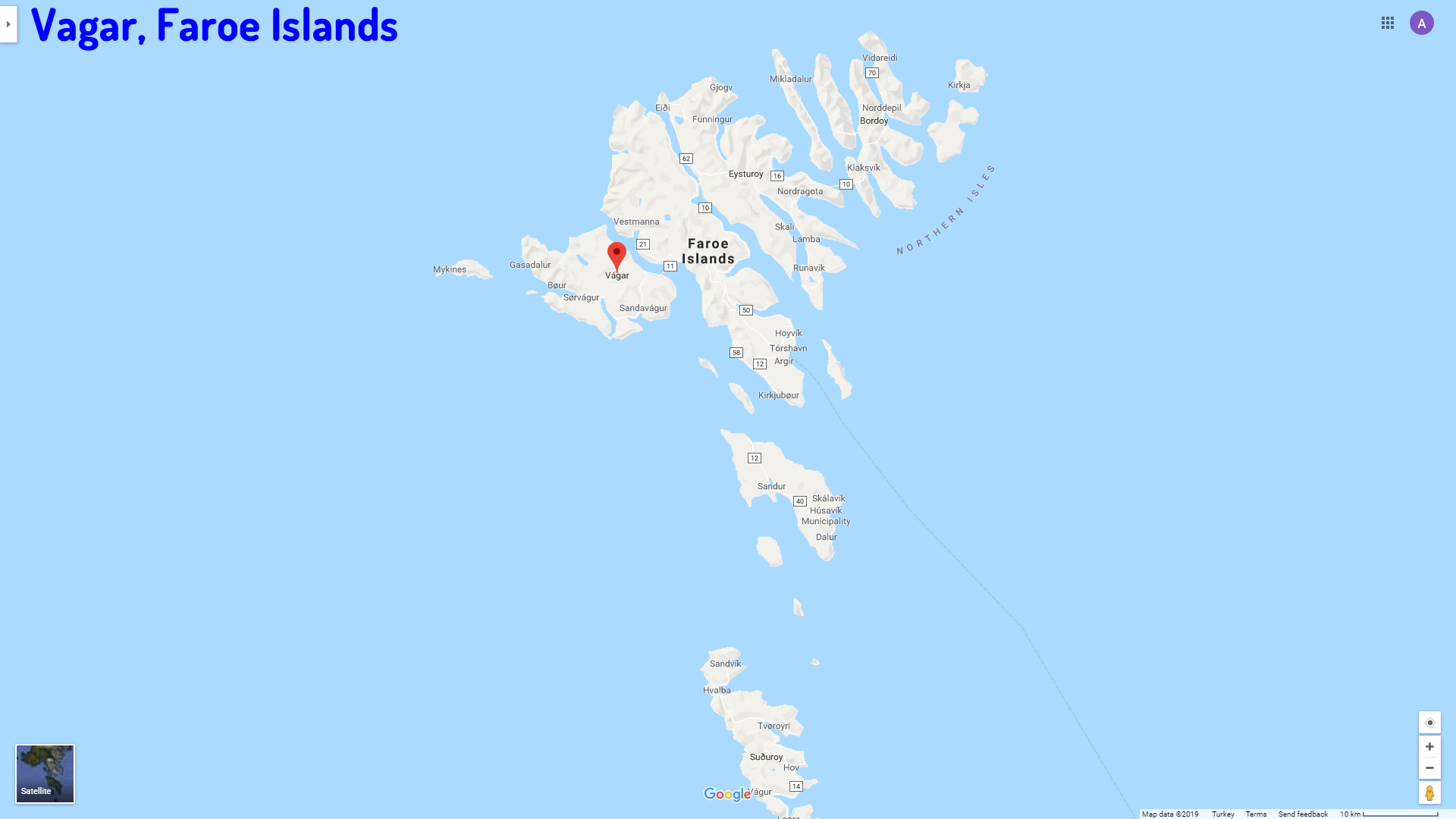
Vagar Map Faroe Islands
Where is Faroe Islands on the Europe Map?
Show Google map, satellite map, where is the country located.
Get directions by driving, walking, bicycling, public transportation and travel with street view.
Feel free to explore these pages as well:
- Norway Map ↗️
- Sweden Map ↗️
- Ireland Map ↗️
- Aland Islands Map ↗️
- Finland Map ↗️
- Denmark Map ↗️
- United Kingdom Map ↗️
