- Advertisement -
A collection of Germany Maps; View a variety of Germany physical, political, administrative, relief map, Germany satellite image, higly detalied maps, blank map, Germany world and earth map, Germany’s regions, topography, cities, road, direction maps and atlas.
Germany Road Map
 High detailed Germany road map with labeling, major cities and towns.
Germany Cities Map
 Germany Main Cities Map with country national boundaries.
Germany Blank States Map
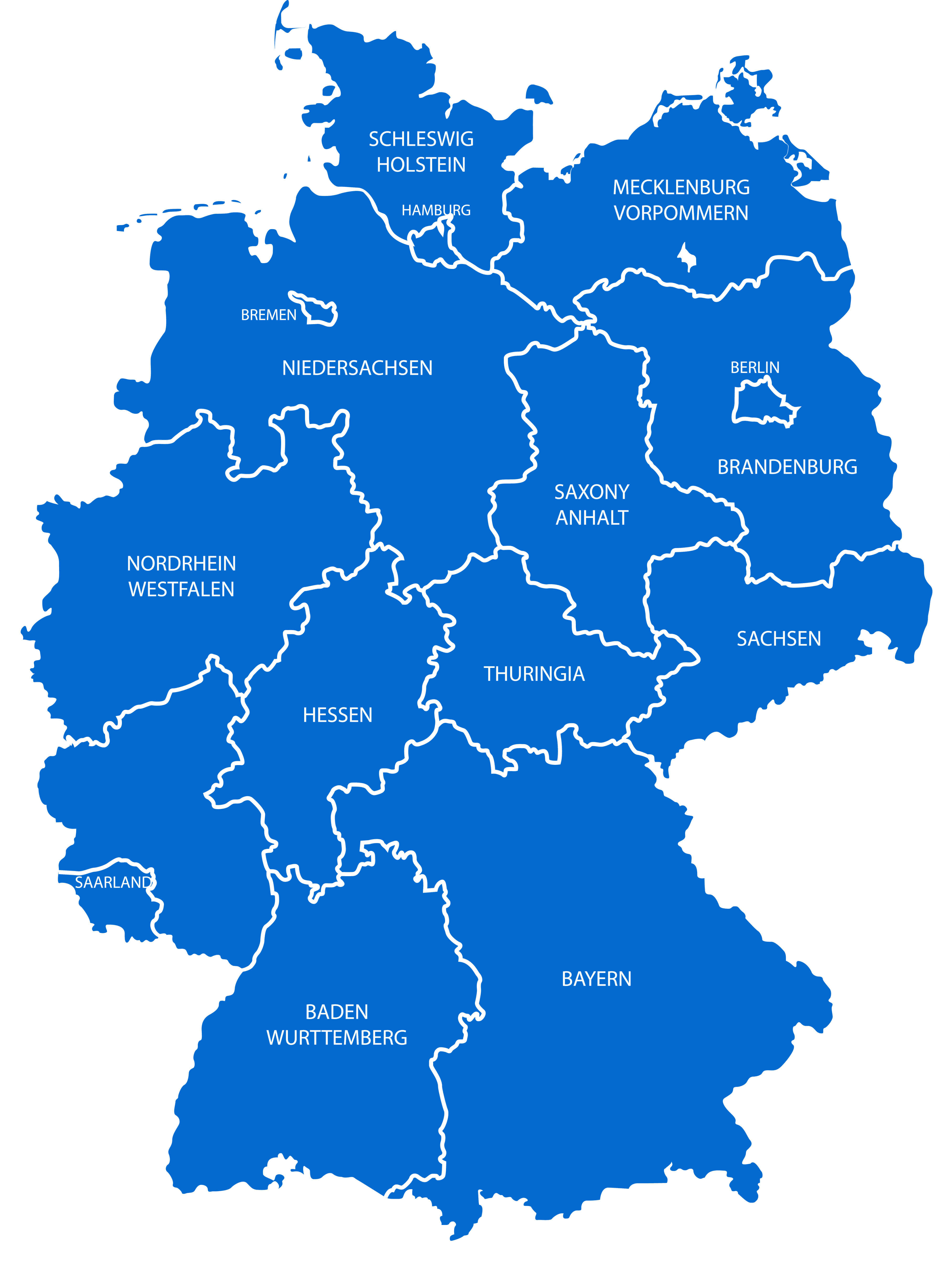
Germany Provinces Map with state borders.
Germany Main Cities Map
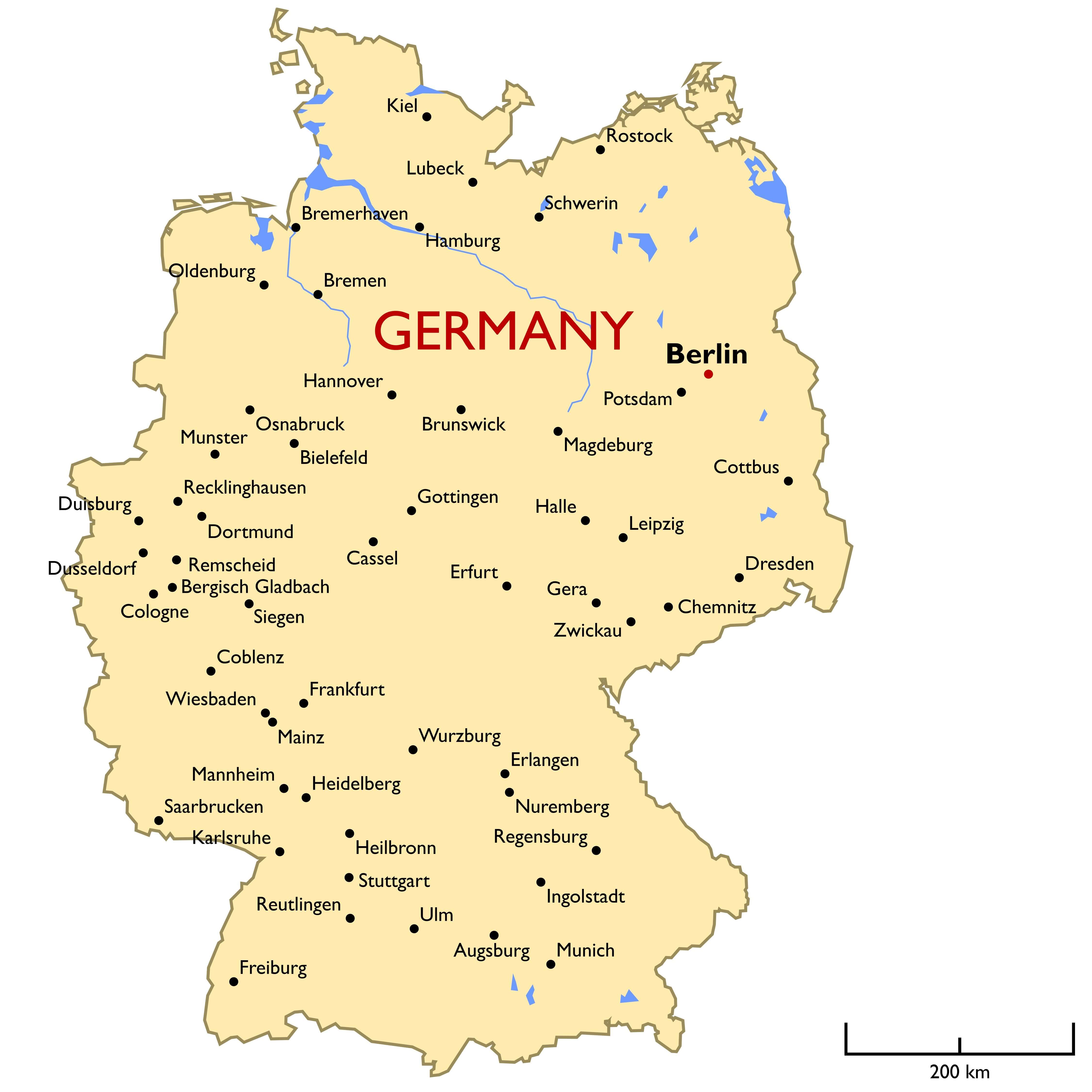
Major Cities Map of Germany.
Germany Detailed Regions Map
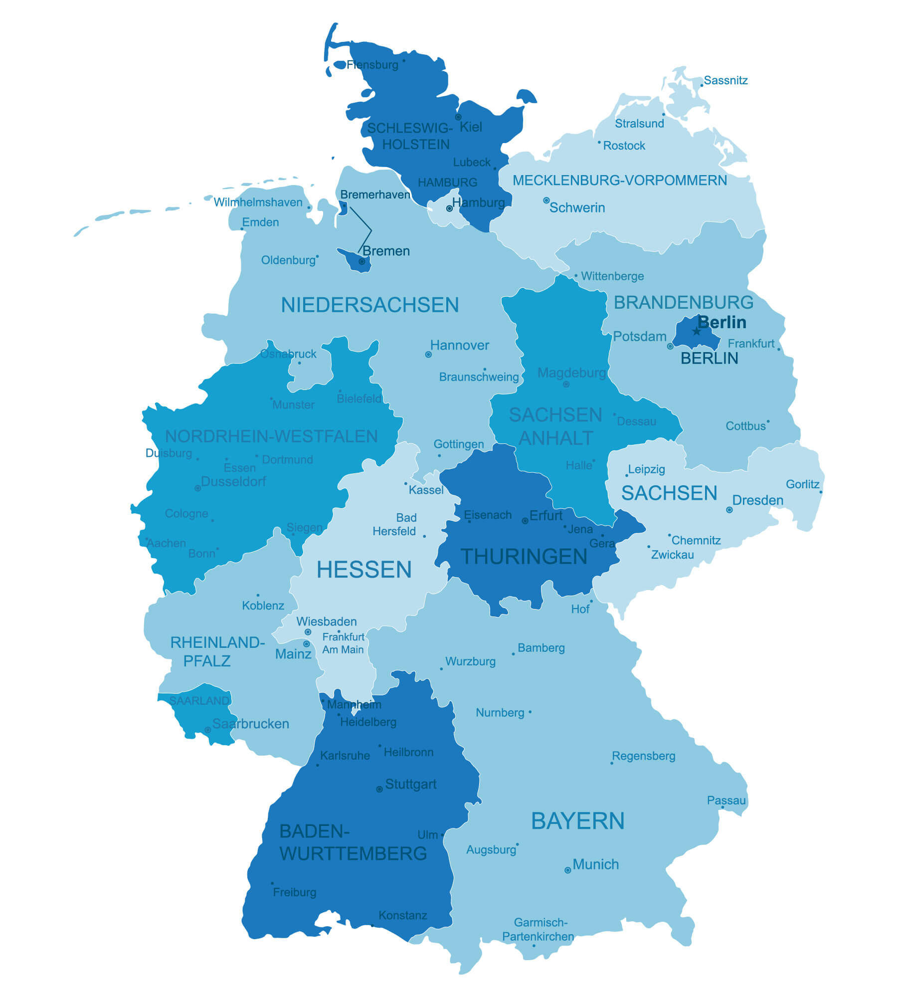 Germany highly detailed regions map.
Germany Major Cities Rivers Map

Germany Blank Map
 Blank map of Germany with state boundaries.
Where is Located Germany on Europe Map?
Show Google interactive map, satellite map, where is the country located.
Get directions by driving, walking, bicycling, public transportation, and traveling with street view.
Feel free to explore these pages as well:
- Map of Germany ↗️
- Where is Magdeburg on the Germany Map ↗️
- Discovering the Charms of Cologne ↗️
- Exploring the Charm of Bremen ↗️
- Discover Bochum ↗️
- Discovering Bielefeld ↗️
- A Collection of Czechia Maps ↗️
- Belgium Map ↗️
- Netherlands Map ↗️
- Europe Map ↗️
- Map of Europe ↗️
- A Collection of Poland Maps ↗️
- Advertisement -