Political maps of France provide a comprehensive overview of the country’s regions, cantons, cities, roads, administrative divisions and population density. These maps also highlight key aspects of tourism, history and the country’s boundaries, providing a valuable insight into France’s diverse cultural and geographical landscape. Ideal for travellers, students and history buffs alike, these maps reveal the intricate structure of one of Europe’s most fascinating countries.
France Political Map
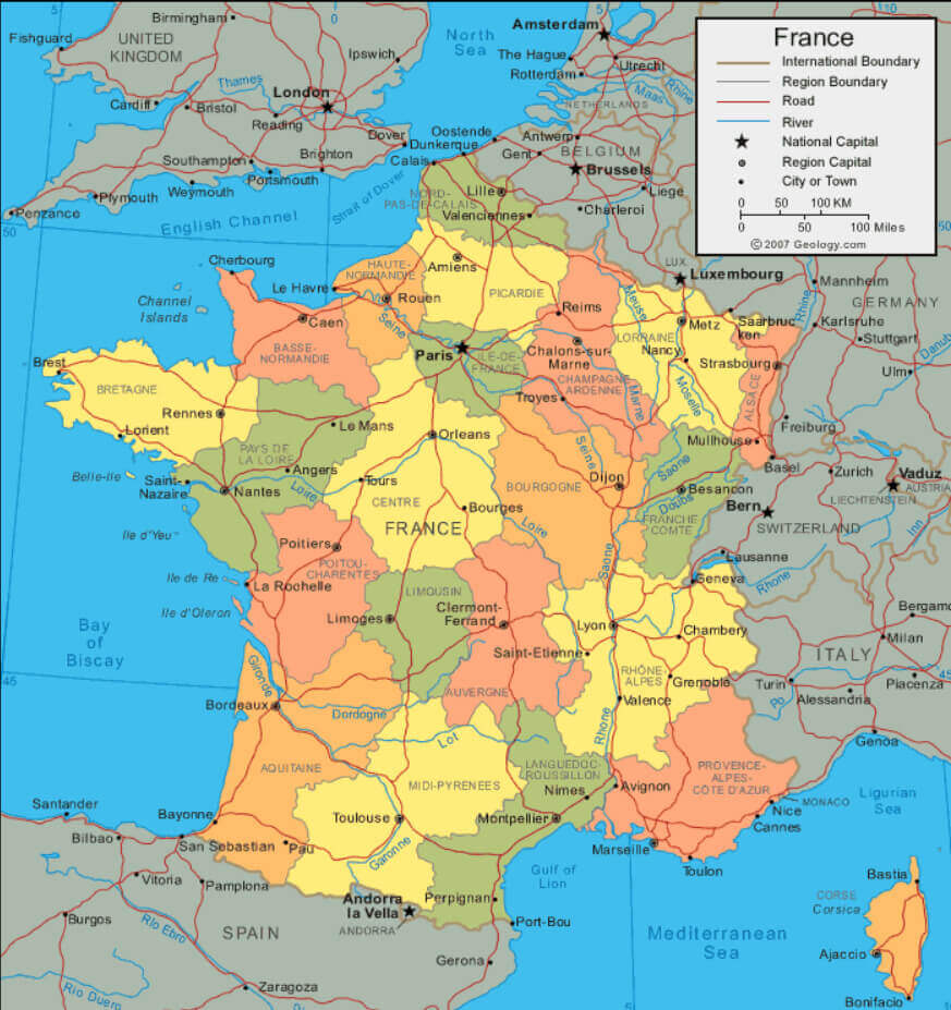
 France political map showing regions, boundaries, and neighboring countries.
France Political Map with National Borders
 France political map showing regions, cities, and national borders.
France Provinces Map
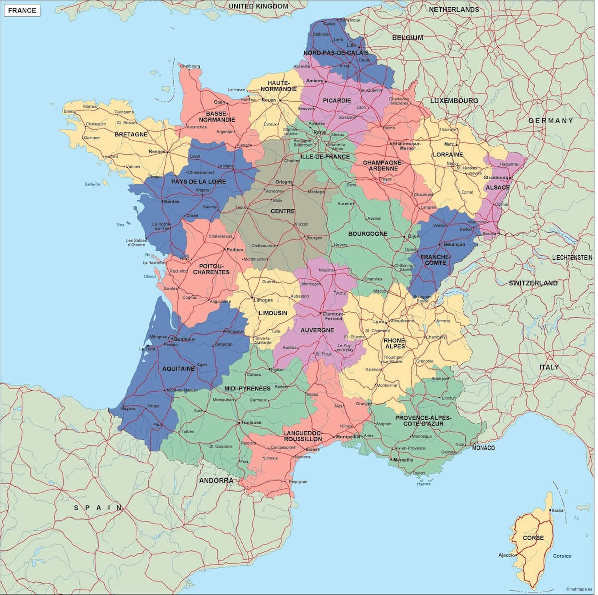
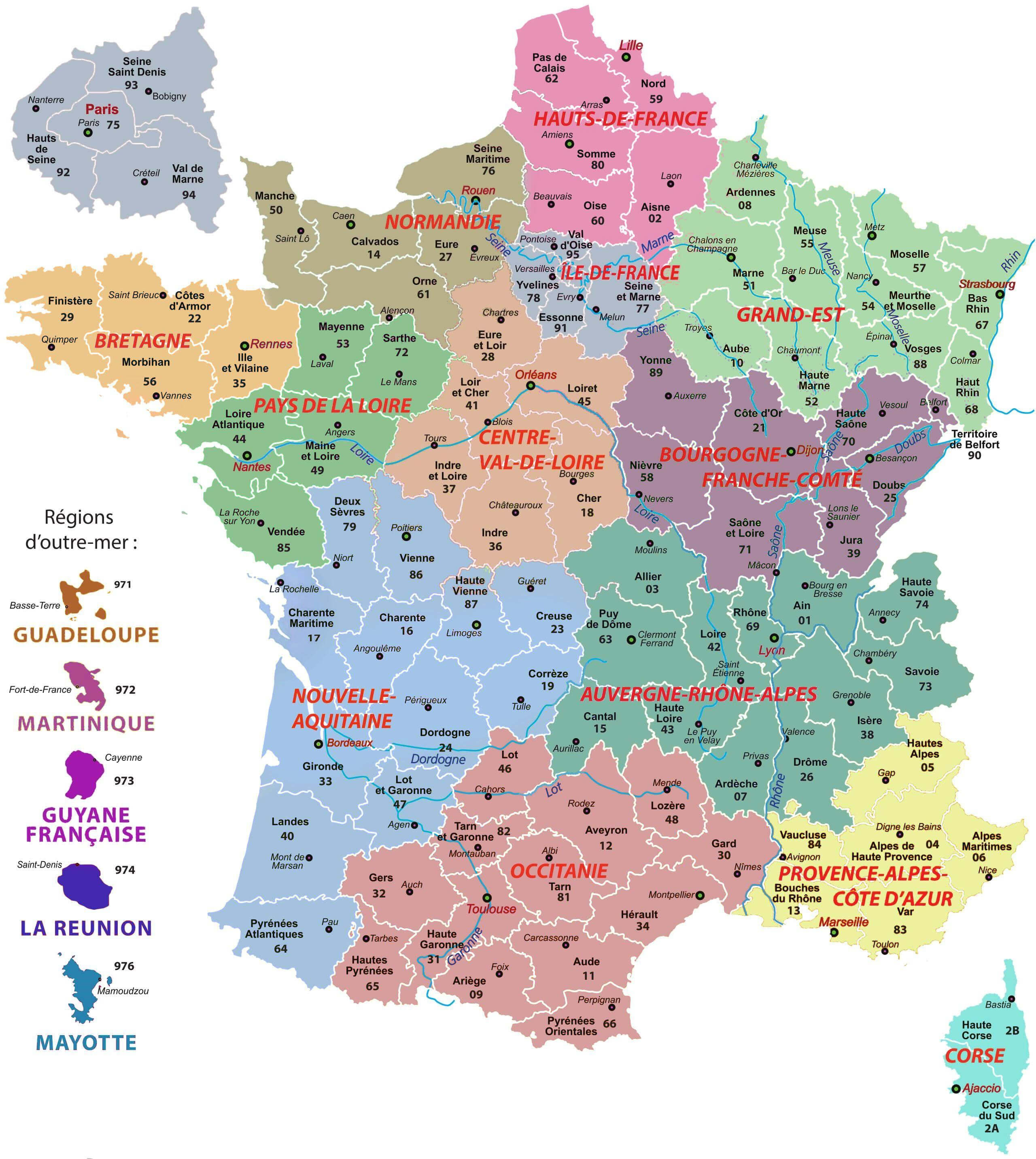
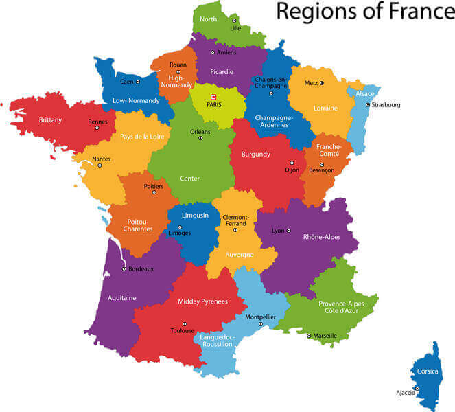
France Regions Map
 France regions map with boundaries, cities, roads, and neighboring countries
Political Map of France
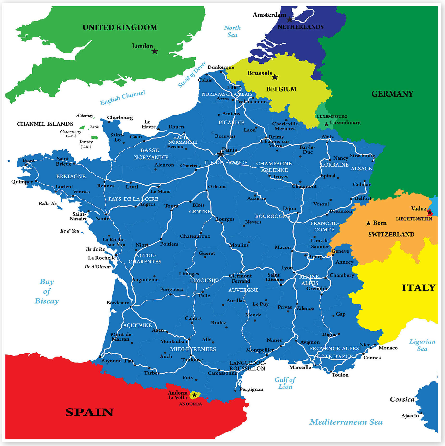
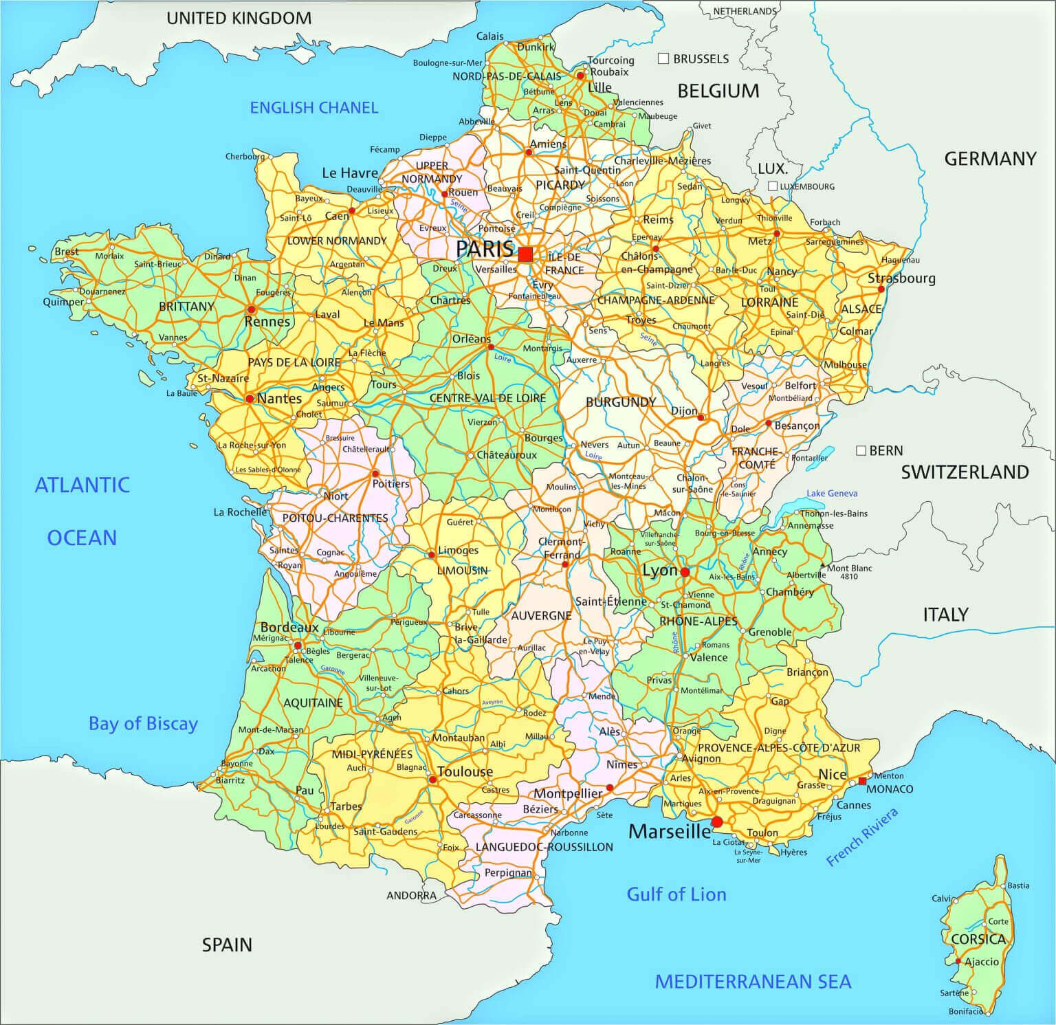
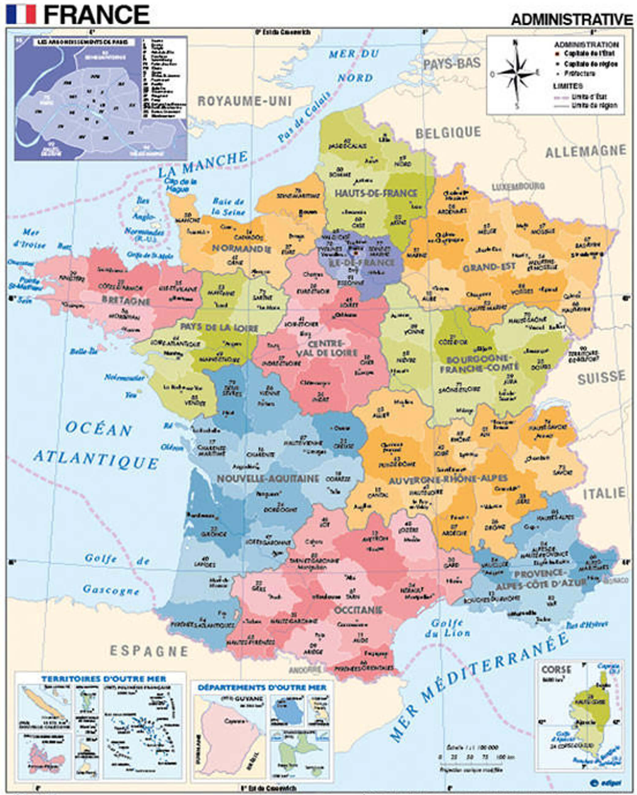
 Political map of France with regions, departments, and overseas territories
France Administrative Map with Regions and Roads
Where is located France on Europe Map
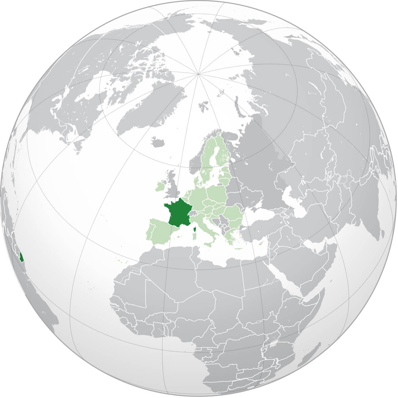
France is located in Western Europe, bordered by Belgium and Luxembourg to the north-east, Germany, Switzerland and Italy to the east and Spain to the south. It is also flanked by the Atlantic Ocean to the west and the Mediterranean Sea to the south-east. Its geographical diversity includes coastal plains in the north and west, the towering Alps and Pyrenees in the south and east, and central plateaus that define the interior. France’s strategic location connects it to major European trade routes, making it a cultural and economic hub in the region. Its capital, Paris, lies in the northern part, at the heart of this dynamic geography.
Here are some statistical information about France:
 Area: 201.03 km2 (77.62 sq mi)
France Historical Political Map in 1453
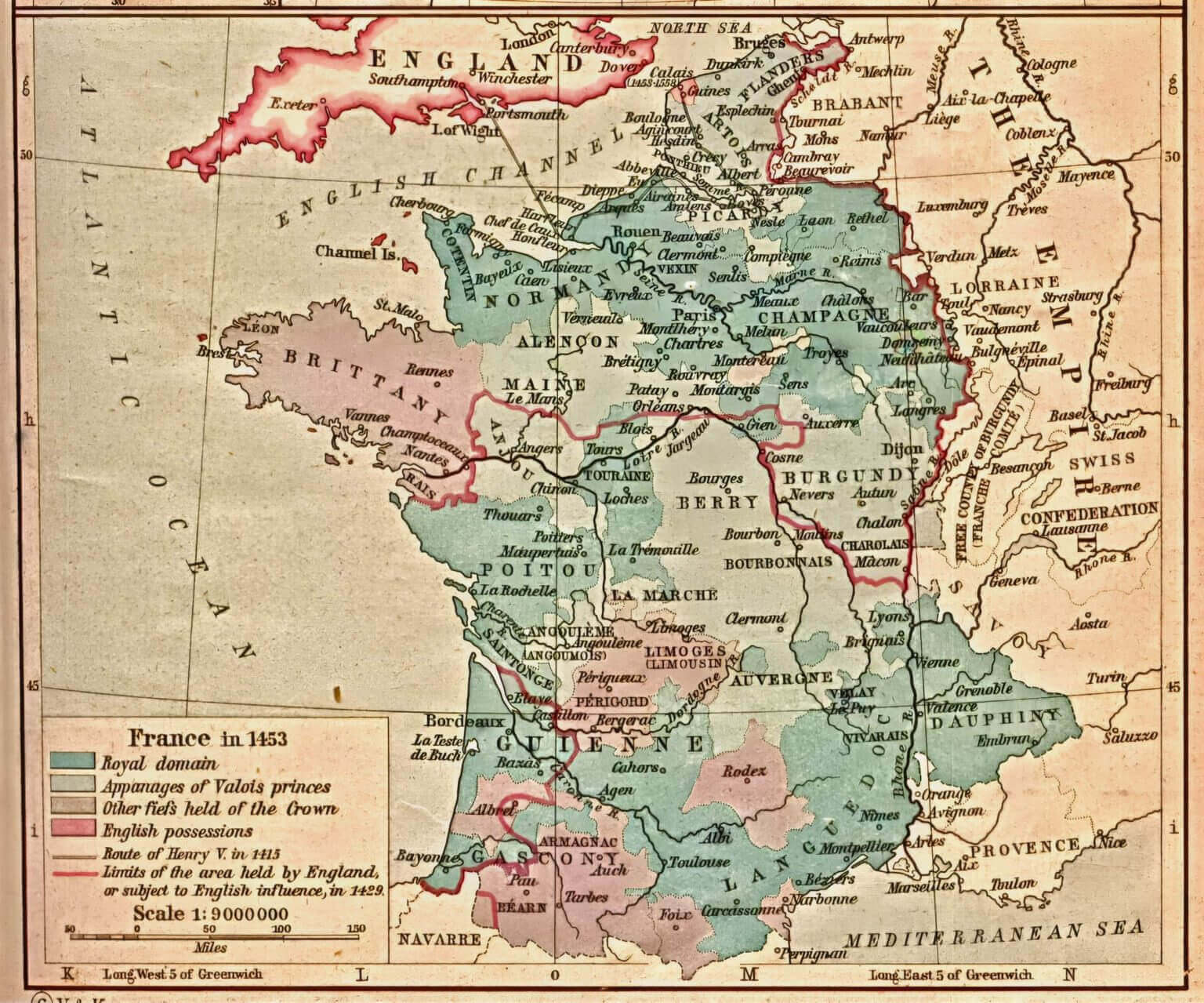 France historical political map of 1453 showing royal domains and English possessions.
France political map in 1920
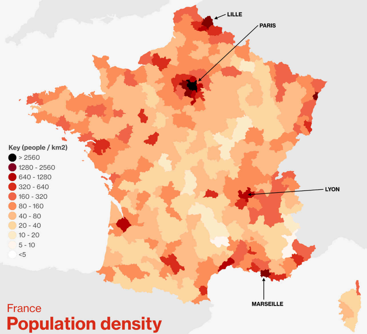
France political map with population density
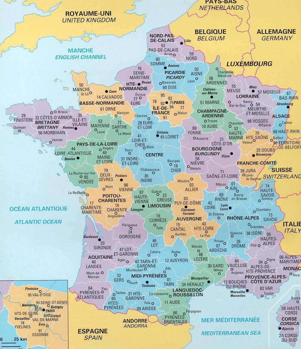
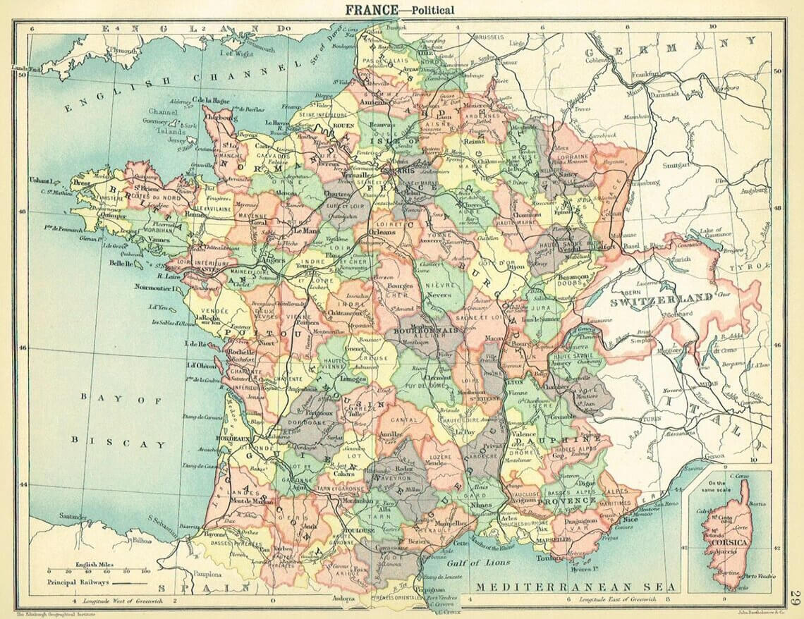
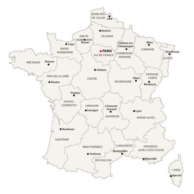
France political map with provinces
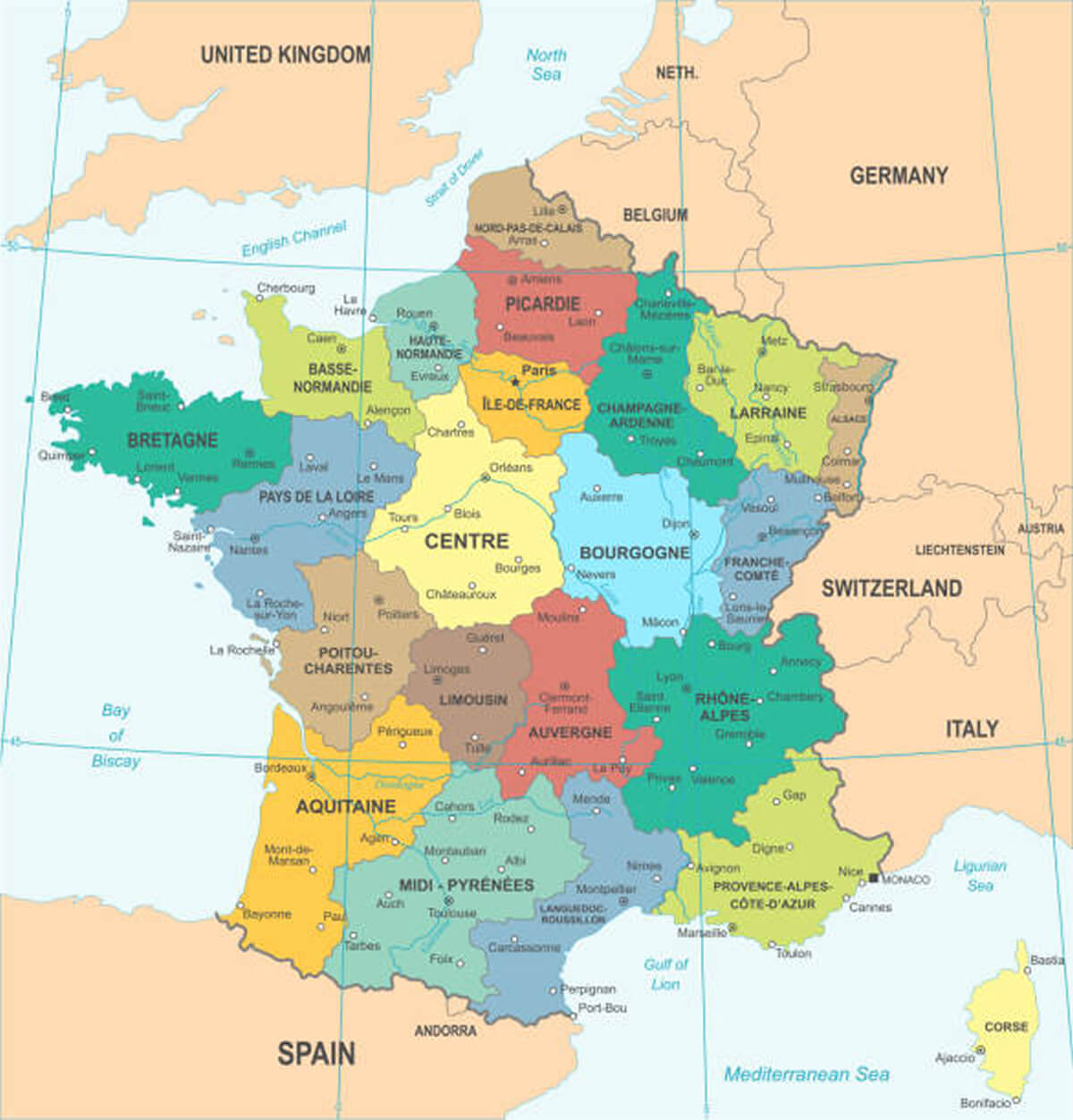
France political map with regions
Political map of France map with regions
France administrative map
France blank political map
Where is France on Europe Map?
Show Google interactive map, satellite map, where is the country located.
Get direction by driving, walking, bicycling, public transportation and travel with street view.
Feel free to explore these pages as well:
- France Map ↗️
- France Physical Maps ↗️
- France Cities Map ↗️
- France Population Map ↗️
- France Road Map ↗️
- Map of France ↗️
- France Map Collection ↗️
- Top 10 Destinations in France ↗️
- Discovering Angers: The Gem of France’s Loire Valley ↗️ ↗️
- Nice’s Top 10 Attractions for Every Traveler ↗️
- Muslim Population Map in Europe by Country ↗️
- Europe Map ↗️
- Map of Europe ↗️
- A Collection of Europe Maps ↗️
- France Map ↗️
- Map of Spain ↗️
- Italy Map ↗️
- Ireland Map ↗️
- Political Map of the World ↗️
- United Kingdom Map ↗️
- Israel Map ↗️
- Germany Map ↗️
- Turkey Map ↗️
- Map of Sweden ↗️
- Map of Portugal ↗️
- Poland Map ↗️
- Switzerland Map ↗️
- Belgium Map ↗️
- Norway Map ↗️
- Finland Map ↗️