France Population Map

HomeMapsFrance Population Map
- Advertisement -

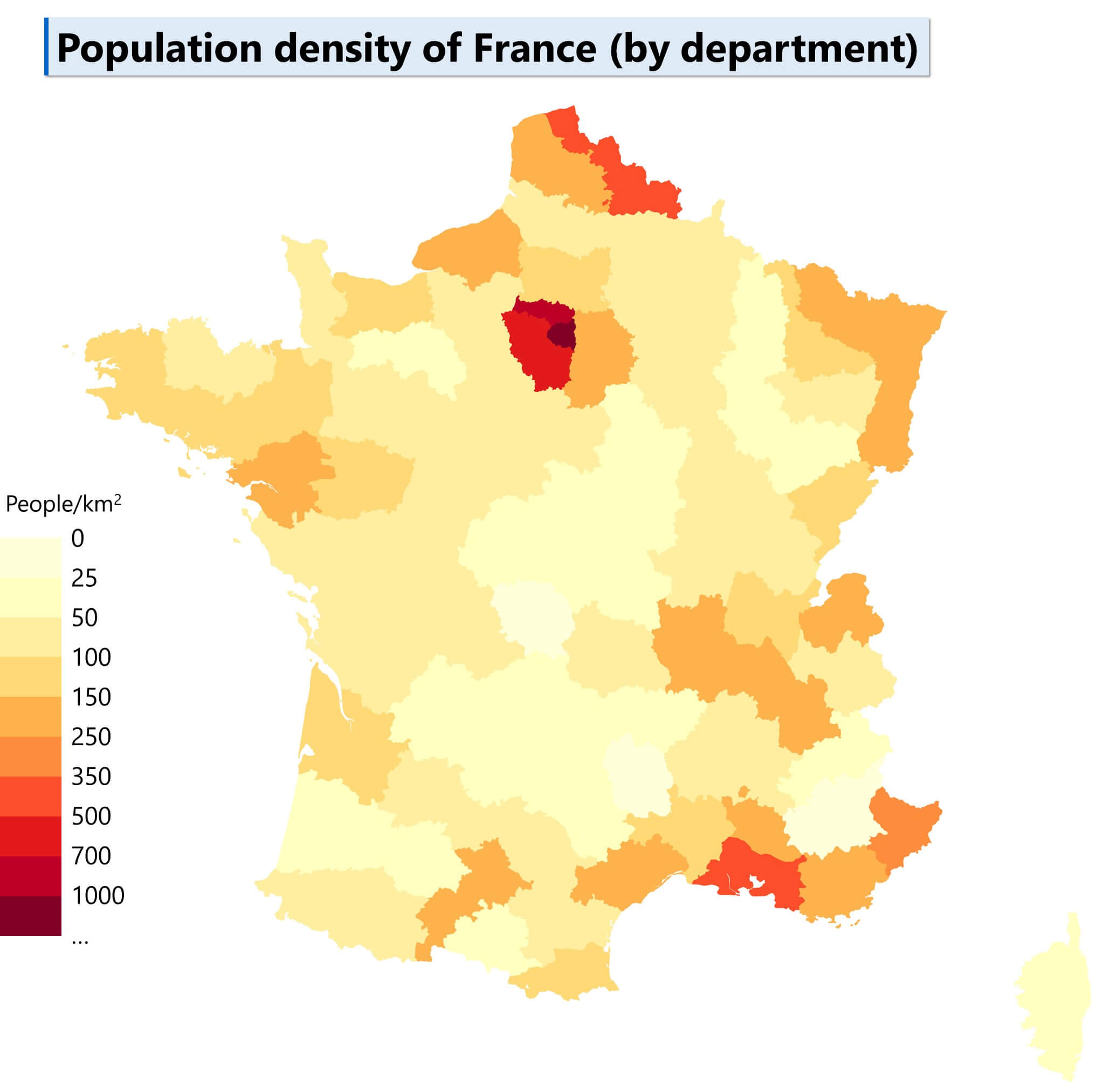
France population maps provide a comprehensive view of the country’s demographics, including population density, urban populations and religious groups such as the Muslim population. These maps and data also include historical population trends for 2017, 2018 and 2023, as well as projected figures for 2030, providing insight into the diverse and evolving make-up of France.

France Population Density Map
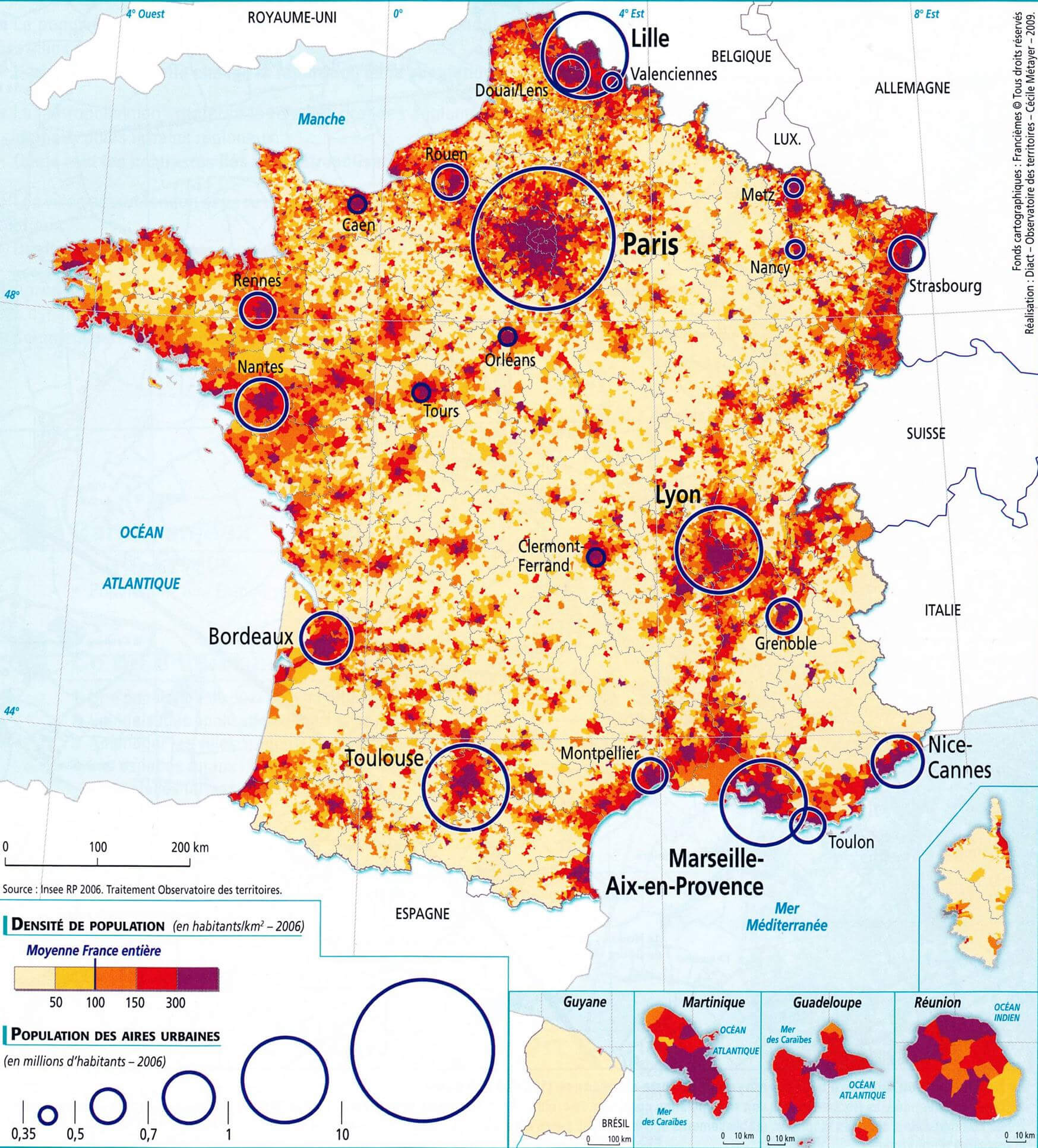
France Population Density Map
Map of France showing population density and urban areas.

This map illustrates France’s population density, highlighting densely populated urban areas such as Paris, Lyon, and Marseille. The color gradient indicates population density per square kilometer, while circles represent major urban population clusters. Insets include French overseas territories

Population Density Across France by Region
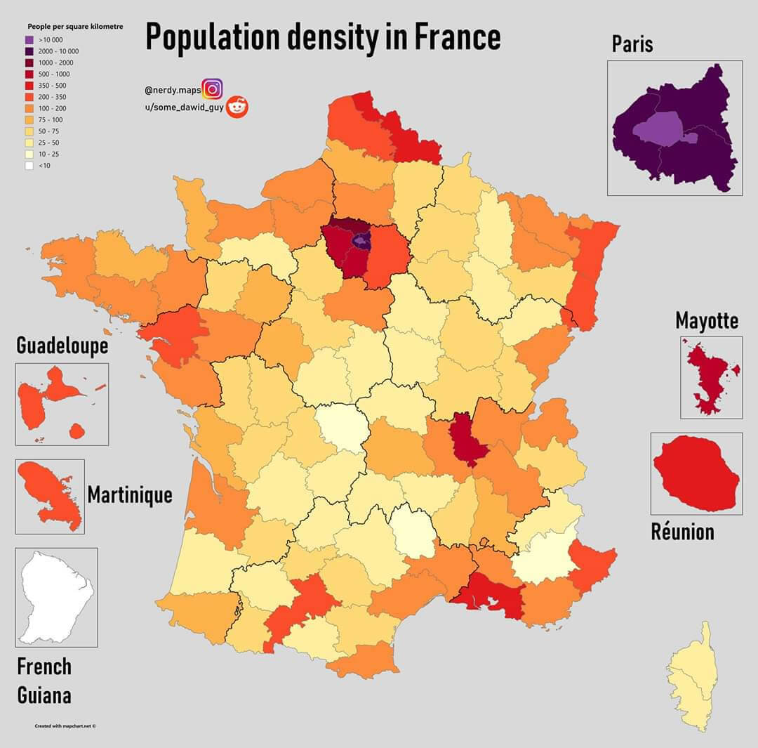
Population Density Across France by Region
Map of France showing population density per square kilometer across regions.

This map visualises population density in France, highlighting densely populated areas such as Paris and its environs. The map also includes overseas territories such as Guadeloupe, Martinique and Réunion, highlighting regional differences in population distribution

Population density map of France

Population density map of France

Population density map of France in 1999
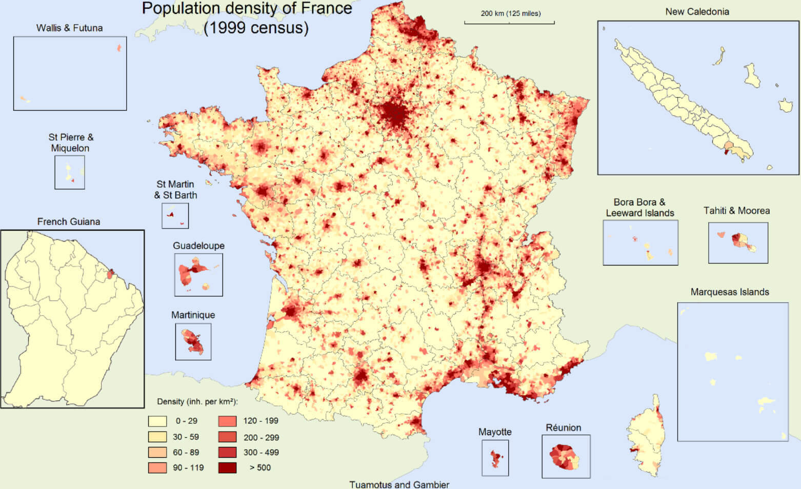
Population density map of France in 1999

France Physical Map with City Populations
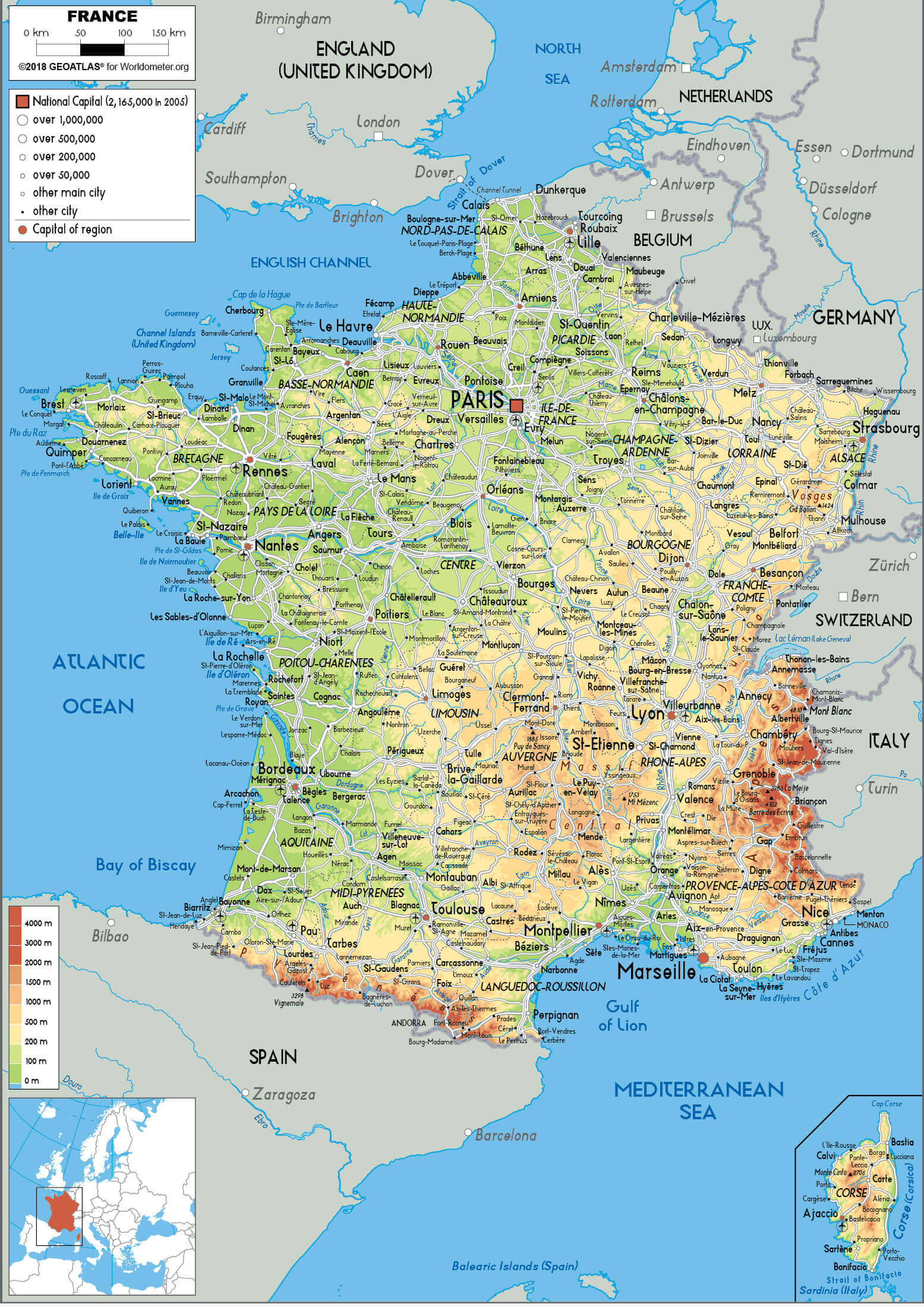
France Physical Map with City Populations
Detailed physical map of France showing cities and population data.

Explore the diverse geography of France with this physical map highlighting major cities and their populations. The map provides a clear view of the country’s topography, including mountain ranges, rivers and regional population densities. Perfect for geographical and demographic insights

Muslim Population in Europe: 2010 Overview
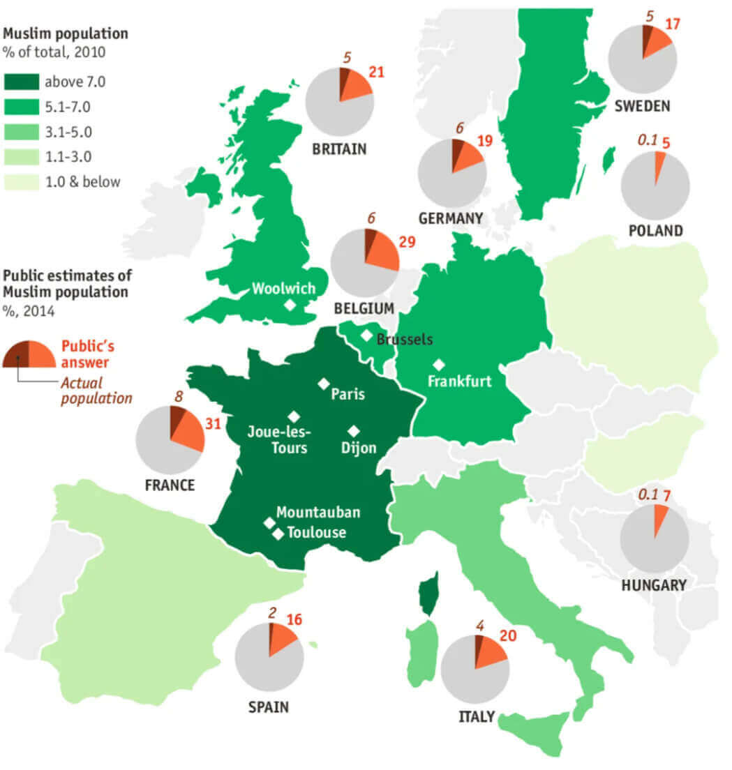
Muslim Population in Europe: 2010 Overview
Map showing Muslim population distribution in Europe as of 2010 with public estimates.

This map shows the percentage of Muslim populations in European countries in 2010, compared with public estimates from 2014. Pie charts illustrate the gap between perception and reality, highlighting notable cities such as Paris, Frankfurt and Brussels

France Ethnic Demographic Composition 2004
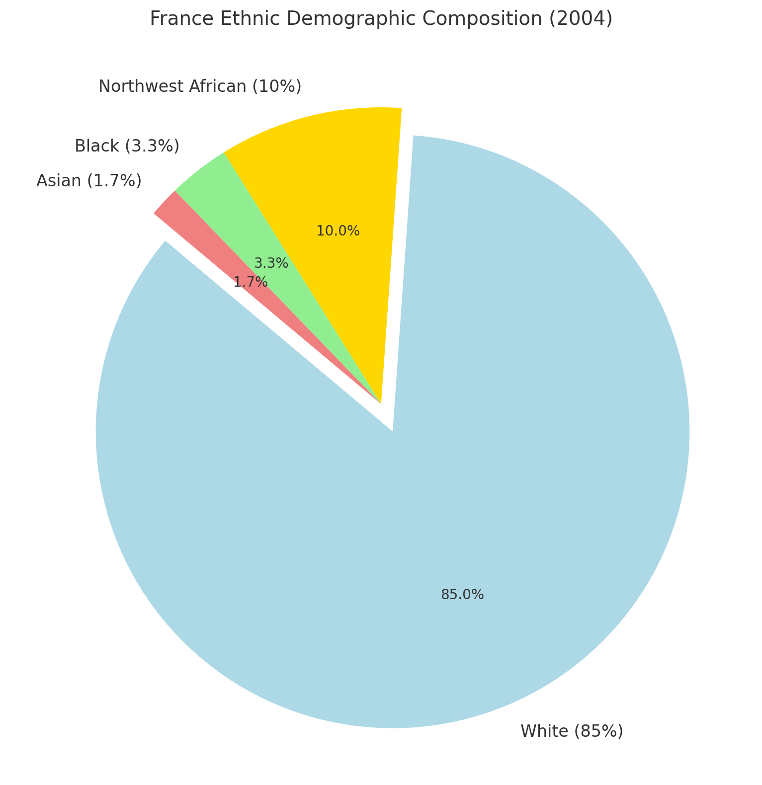
France Ethnic Demographic Composition 2004

This pie chart illustrating France’s ethnic demographic composition in 2004. It shows that 85% of the population was White, 10% Northwest African, 3.3% Black, and 1.7% Asian. Let me know if you need further details or adjustments.

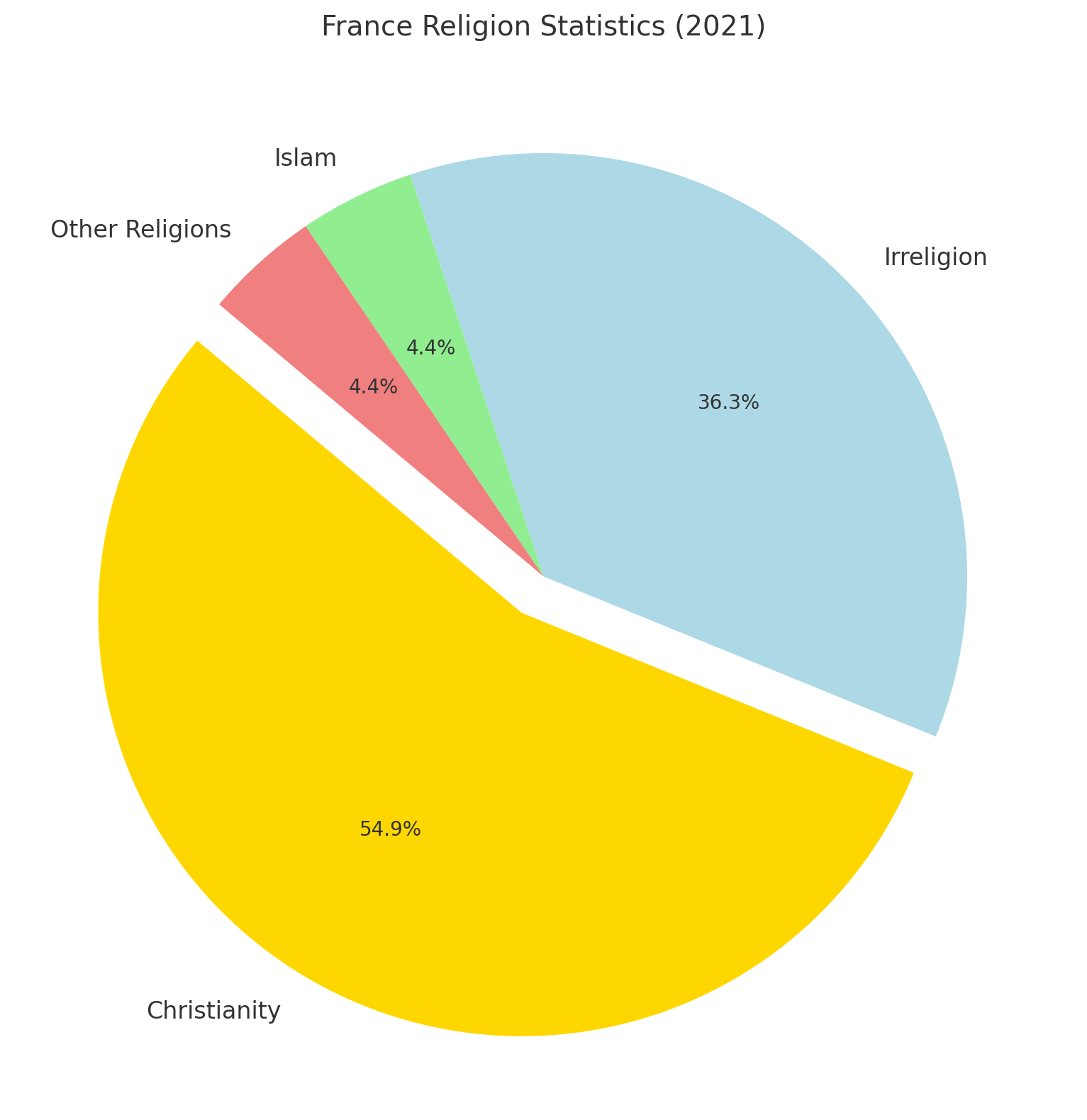
Religion In France (2021 Census)

Religion In France (2021 Census)
France Religion Statistics (2021)

This pie chart displaying the distribution of religious affiliations in France for 2021. It shows 50% Christianity, 33% Irreligion, 4% Islam, and 4% other religions. Let me know if you’d like to add further details or adjustments.
GDP (nominal): 4.359 trillion (2024 estimate)
Per capita: $48,011 (2024 estimate)
Currency: Euro (€) (EUR)
Calling code: +33
Time zone: UTC+1 (CET)

France Historical Population (1806-2022)
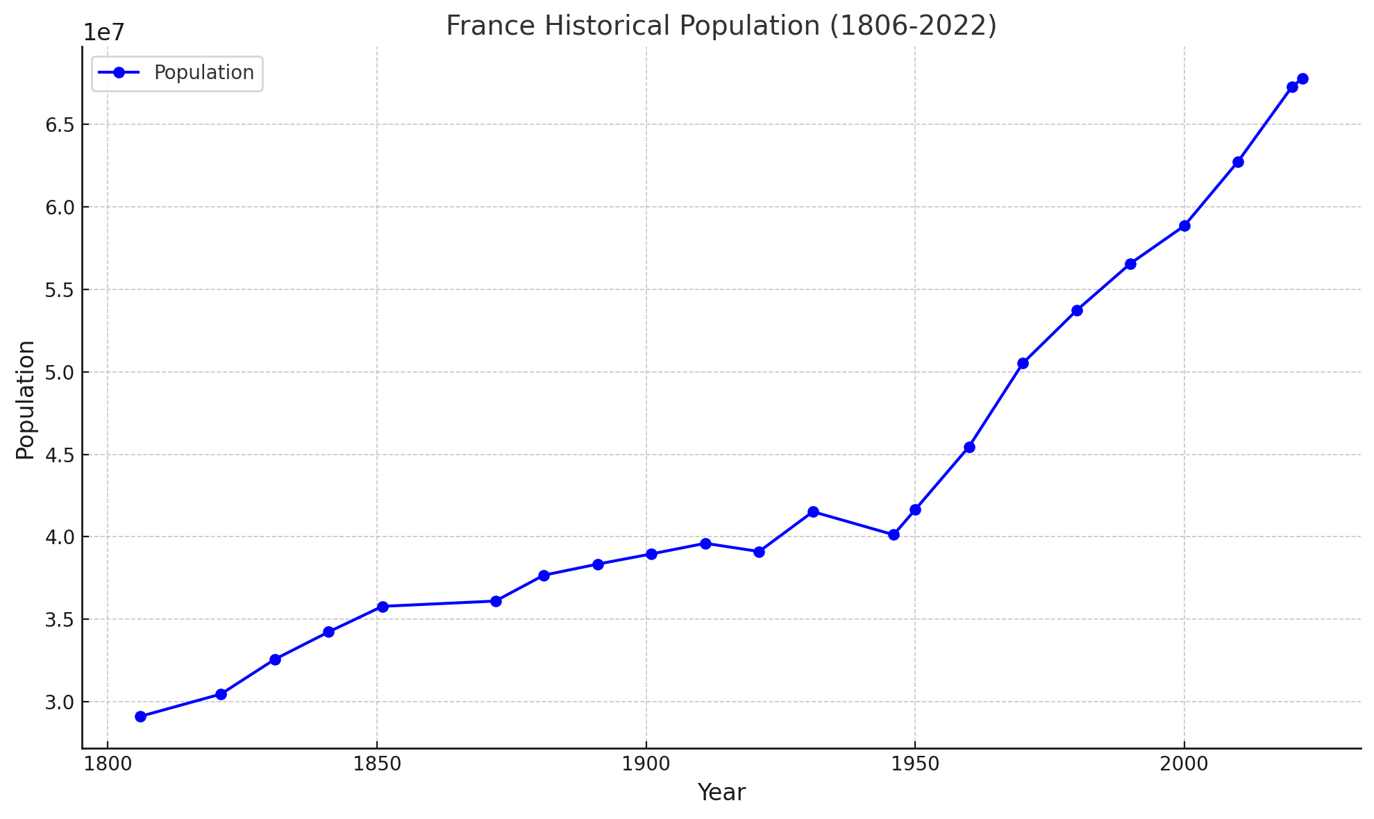
France historical population from 1806 to 2022
This chart shows France historical population between 1806 and 2022.

This line graph shows the historical population of France from 1806 to 2022. It illustrates population growth over time, showing periods of steady growth, slight declines and rapid increases, reflecting historical events and demographic changes. Let me know if you’d like further customisation or insights.
Capital and Largest city: Paris
Official languages: Italian

Muslim Population Map: France in a Global Context
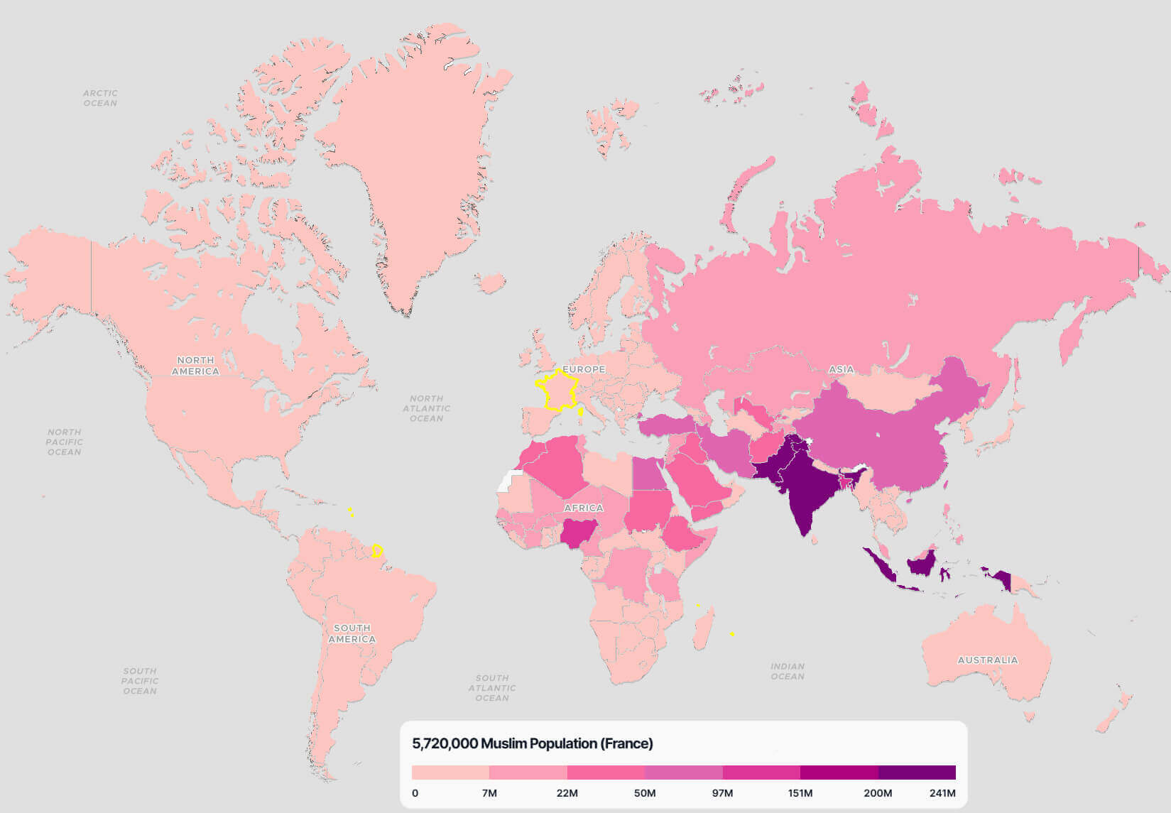
Muslim Population Map: France in a Global Context
World map highlighting France’s Muslim population of 5,720,000 with a global comparison.

This map illustrates the distribution of the world’s Muslim population, with France highlighted for its 5,720,000 Muslims. The colour scale represents population density, providing a comparative perspective on the presence of Muslims in different regions of the world

France population density map in 2017
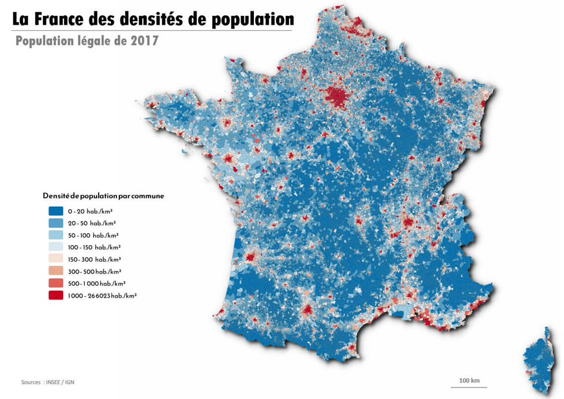
France population density map in 2017

France population density map in 2018
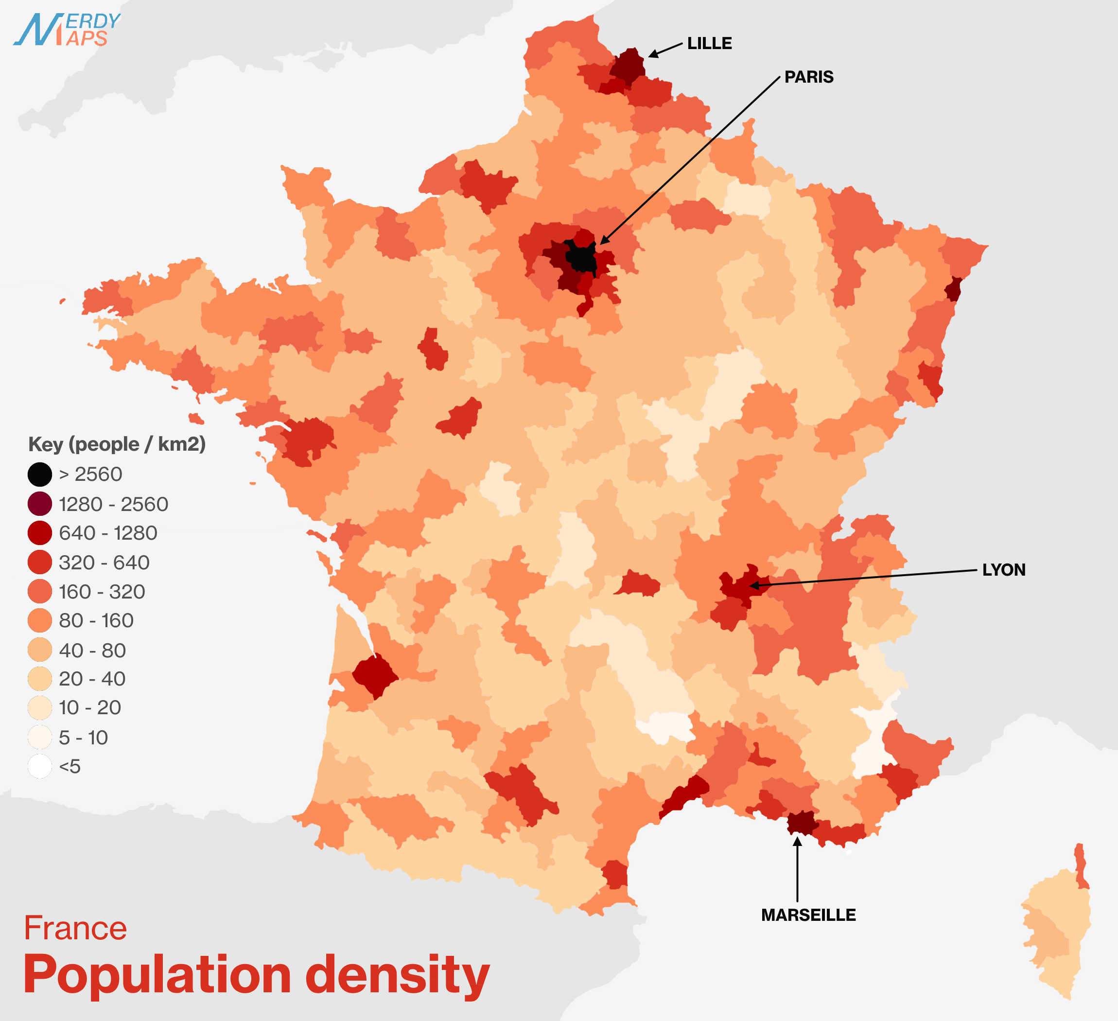
France population density map in 2018

France population density map in French
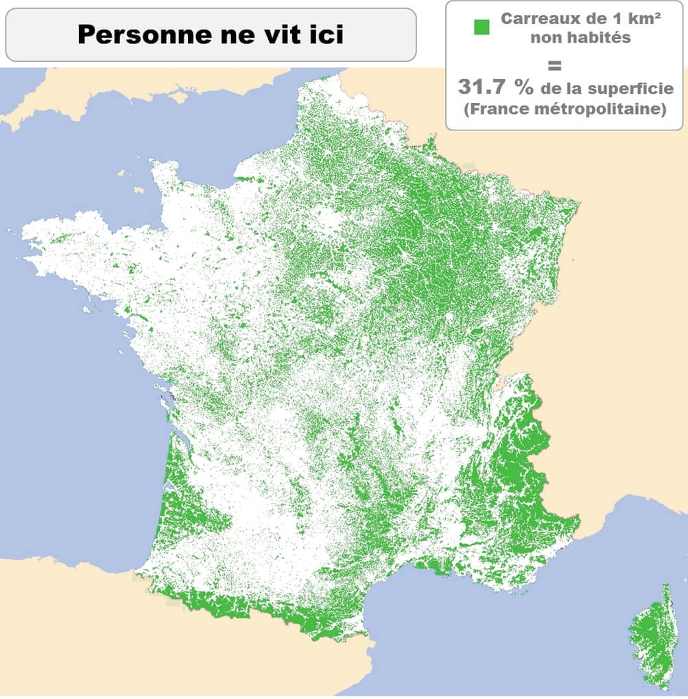
France population density map in French

France population map by regions
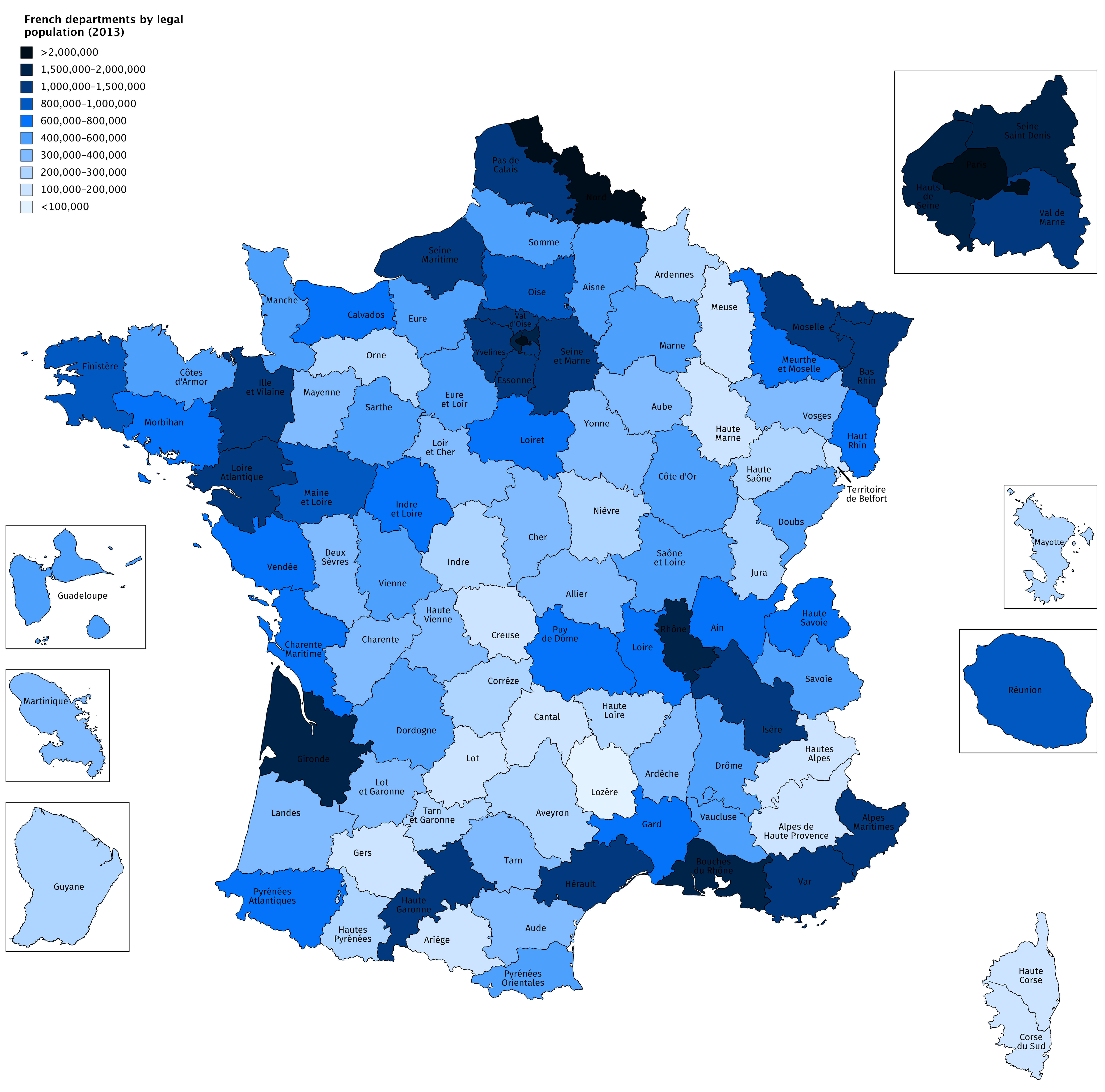
France population map by regions

France population map with major cities
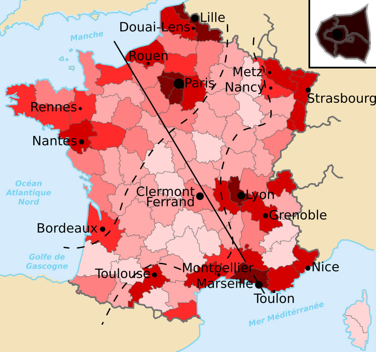
France population map with major cities

French populated cities regions map
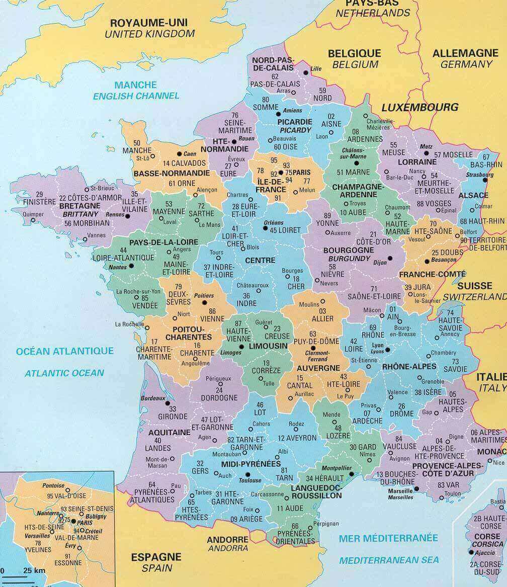
French populated cities regions map

French population map between1931 and 2013
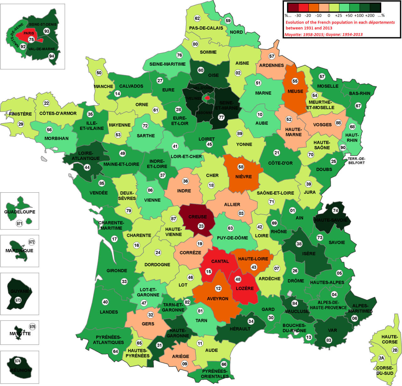
French population map between1931 and 2013

Male Life Expectancy in France by Region (2023)
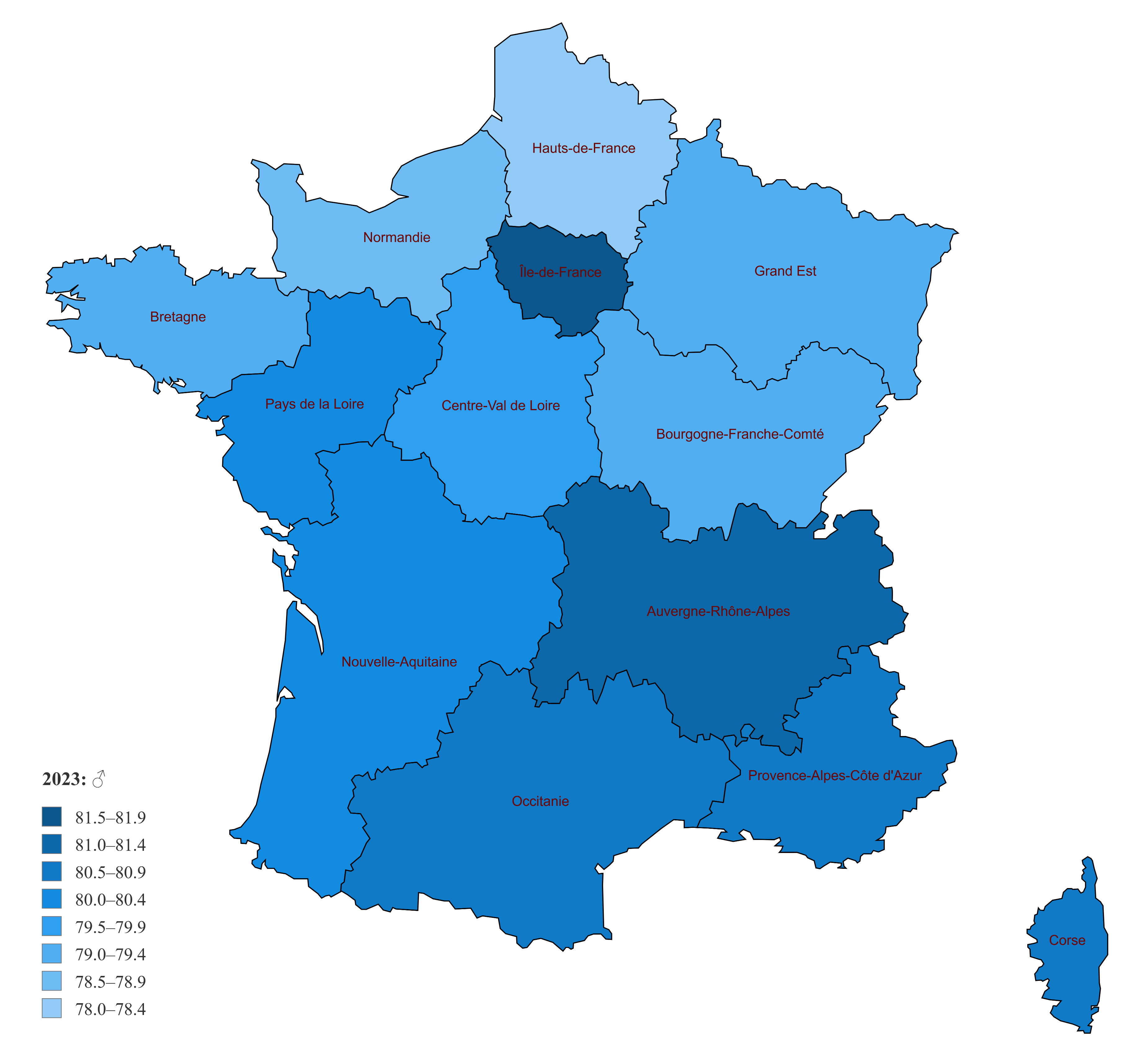
Male Life Expectancy in France by Region (2023)
Map of France showing male life expectancy in 2023 across regions.

This map shows the life expectancy of men in the French regions in 2023, with darker shades indicating higher life expectancy and lighter shades indicating lower values. Regions such as Île-de-France and Auvergne-Rhône-Alpes have higher life expectancies, highlighting regional disparities

Female life expectancy map of France 2023 with regions
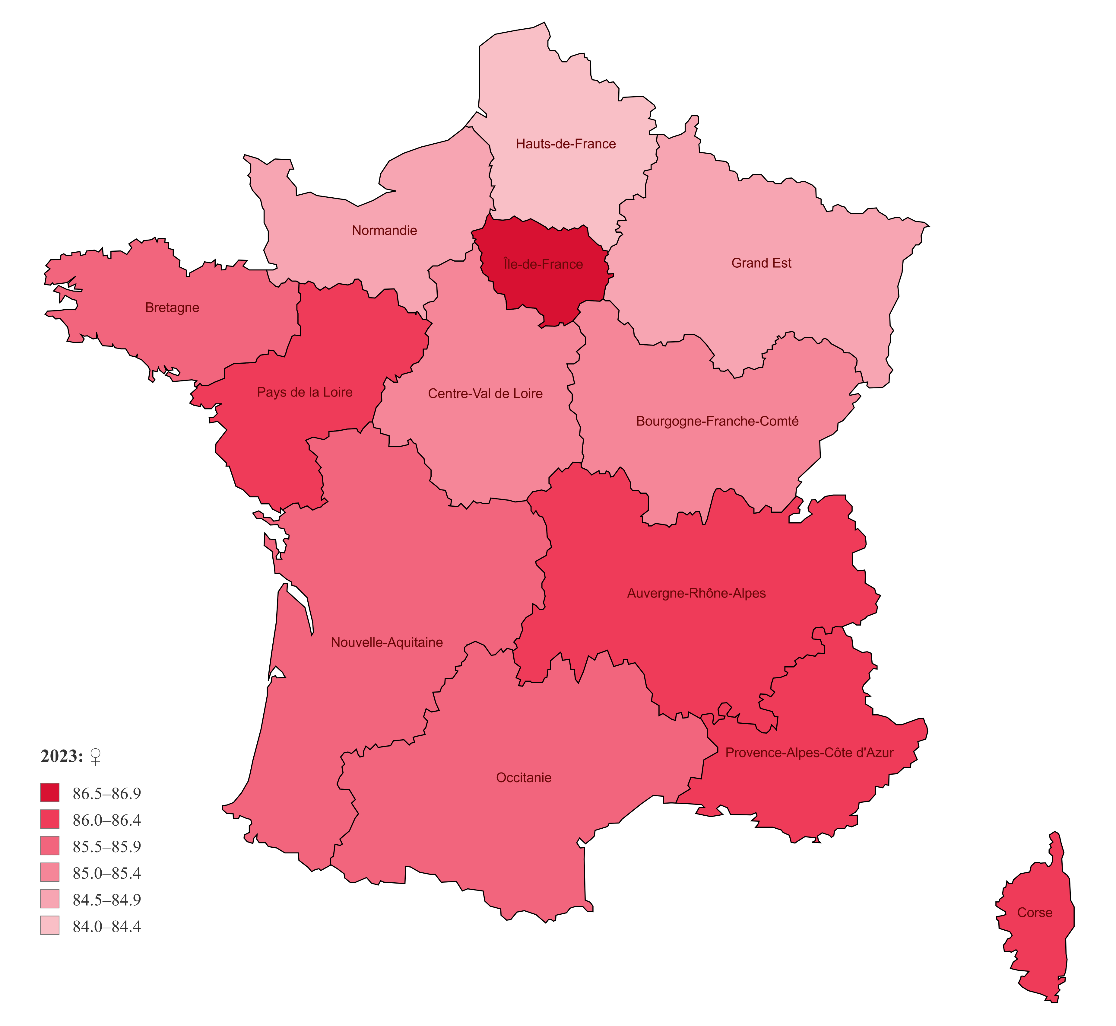
Female Life Expectancy in France by Region (2023)
Map of France showing female life expectancy in 2023 across regions.

This map illustrates female life expectancy in France by region for 2023. Darker shades represent regions with higher life expectancy, such as Île-de-France and Provence-Alpes-Côte d’Azur, highlighting disparities in health outcomes across the country

Where is France on Europe Map?

Show Google interactive map, satellite map, where is the country located.

Get direction by driving, walking, bicycling, public transportation and travel with street view.

Feel free to explore these pages as well:

- Advertisement -
Previous article
Next article

Discover

Sponsor

Latest Posts

Cairo Unveiled: A Tapestry of Time and Tradition

Welcome to the enchanting city of Cairo, where history and modernity dance along the Nile's banks. This bustling metropolis, the heart of Egypt, is...

Where is Located Qatar in the World?

Qatar is located in the Middle East on the northeastern coast of the Arabian Peninsula. It is bordered by Saudi Arabia to the south...

Switzerland Photos 3

Lauterbrunnen, Bernese Oberland, Switzerland Green fields and famous stunning touristic town with high cliffs in background, Lauterbrunnen, Bernese Oberland, Switzerland, Europe. Lavaux Vineyard Terraces Lausanne The Lavaux...

Map of World Countries

World Digital Map, empty map, line map, pacific ocean, World Metropolis Map, and World Political Map with Countries. World Map, World Countries Map and Earth...

A Collection of Algeria Maps: Exploring a North African Gem via Maps

Welcome to the ultimate collection of Algeria maps! Whether you're a geography buff, a travel enthusiast, or someone with an interest in the various...