A Collection of Ukraine Maps offers a detailed look at the country’s regions, cities, political, conflict, physical, landscapes and key geographical features, providing a valuable insight into its diverse terrain and cultural landmarks.
Brief information about Ukraine
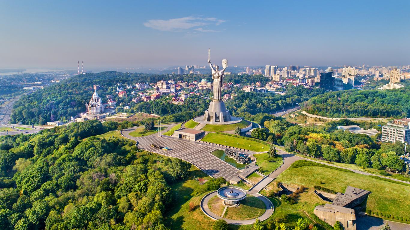
Ukraine is a large country in Eastern Europe, known for its rich cultural heritage, historical significance, and vibrant landscapes. It’s a land of vast plains, the Carpathian Mountains, and the Black Sea coastline. The capital city, Kyiv, is one of the oldest cities in Europe and is renowned for its stunning architecture, including golden-domed churches and Soviet-era monuments.
Physical Map of Ukraine
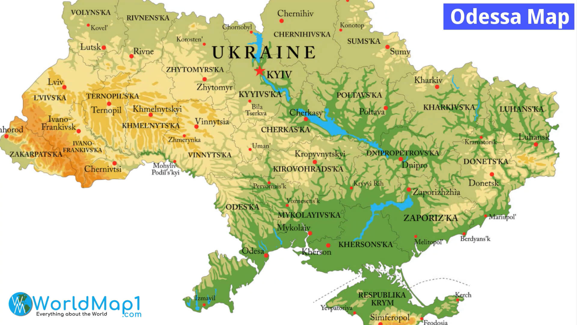
The country has a long and complex history, shaped by its interactions with neighboring powers such as Russia, Poland, and Austria. Ukraine is also known for its resilient spirit, especially in recent years, as it has faced significant challenges while striving to maintain its sovereignty and democratic values. Its culture, music, and traditional food—like borscht and varenyky—remain central to its national identity.
Where is located Ukraine on the World Map
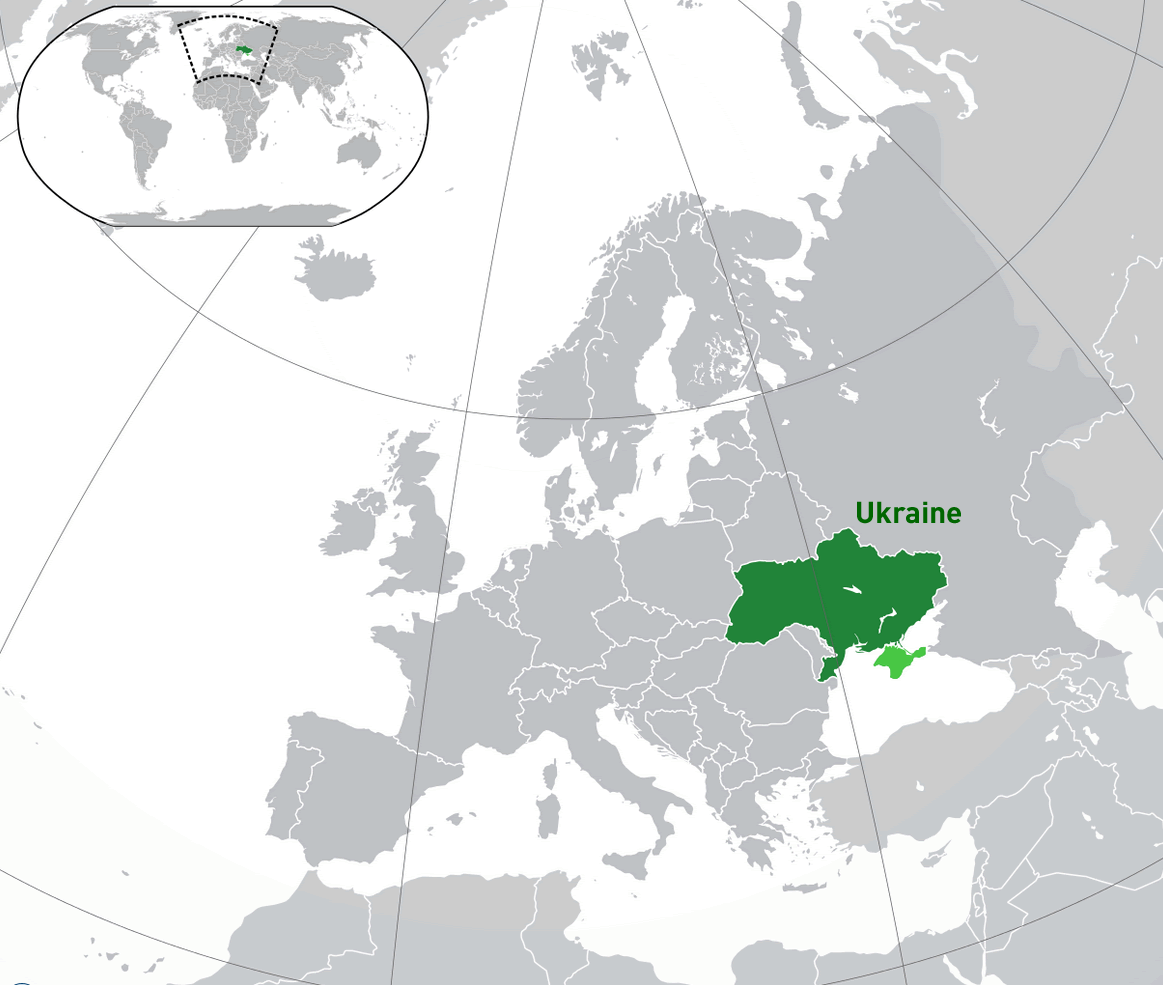
Ukraine is situated in Eastern Europe, bordered by several countries that give it a central role in the region. To the north, it shares a border with Belarus, while to the east, it is bordered by Russia, which has historically had a strong influence on the country. To the west, Ukraine touches Poland, Slovakia, and Hungary, and to the southwest, it borders Romania and Moldova. This strategic location has made Ukraine a cultural and economic crossroads throughout its history.
To the south, Ukraine has a coastline along the Black Sea and the Sea of Azov, giving it access to important maritime routes. This access plays a crucial role in its trade and economic activities, especially through key ports like Odesa. The Black Sea also connects Ukraine to other countries in the region, such as Turkey.
On the world map, Ukraine lies between latitudes 44° and 53° N, making it part of the Northern Hemisphere. Its time zone is primarily Eastern European Time (EET). This positioning means that it experiences a variety of climates, from the cooler conditions in the Carpathian Mountains in the west to the milder, more temperate climate along the southern coastlines.
Here are some statistical information about Ukraine:
Ukraine Location Map
Donbass Conflict Map in Ukraine
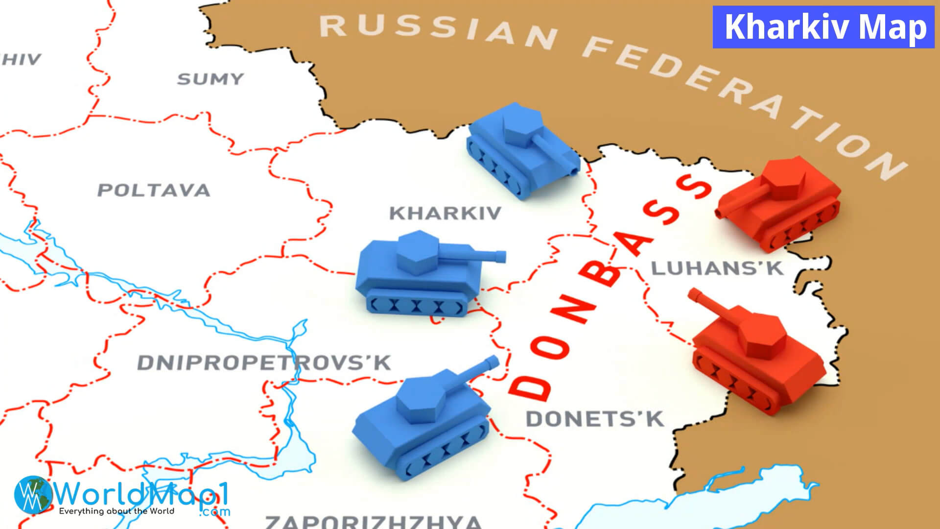
This map illustrates the geographical position of the Donbass region in Eastern Ukraine, highlighting key areas like Kharkiv, Luhansk, and Donetsk, and shows a representation of military activity along the border with Russia.
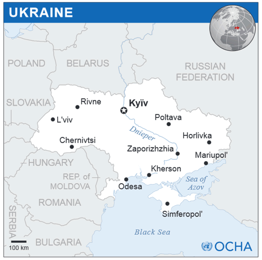
Kiev Map Ukraine
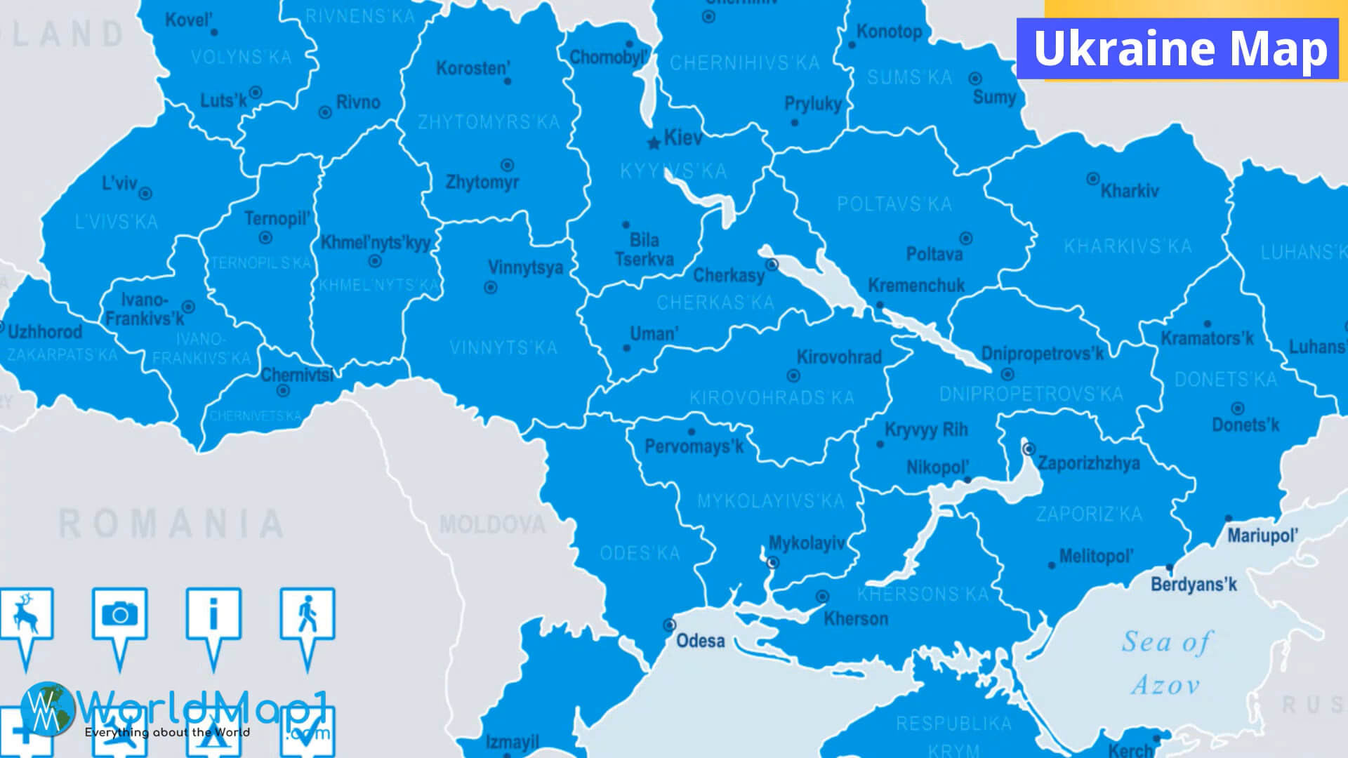
This map of Ukraine highlights its major regions and cities, including the capital, Kyiv, as well as important locations like Odesa, Kharkiv, and Lviv. It also outlines Ukraine’s borders with neighboring countries such as Romania, Moldova, and Russia, and indicates the proximity of the Black Sea and the Sea of Azov to the south. This geographical positioning plays a crucial role in Ukraine’s strategic importance in Eastern Europe.
Ukraine Major Cities Map
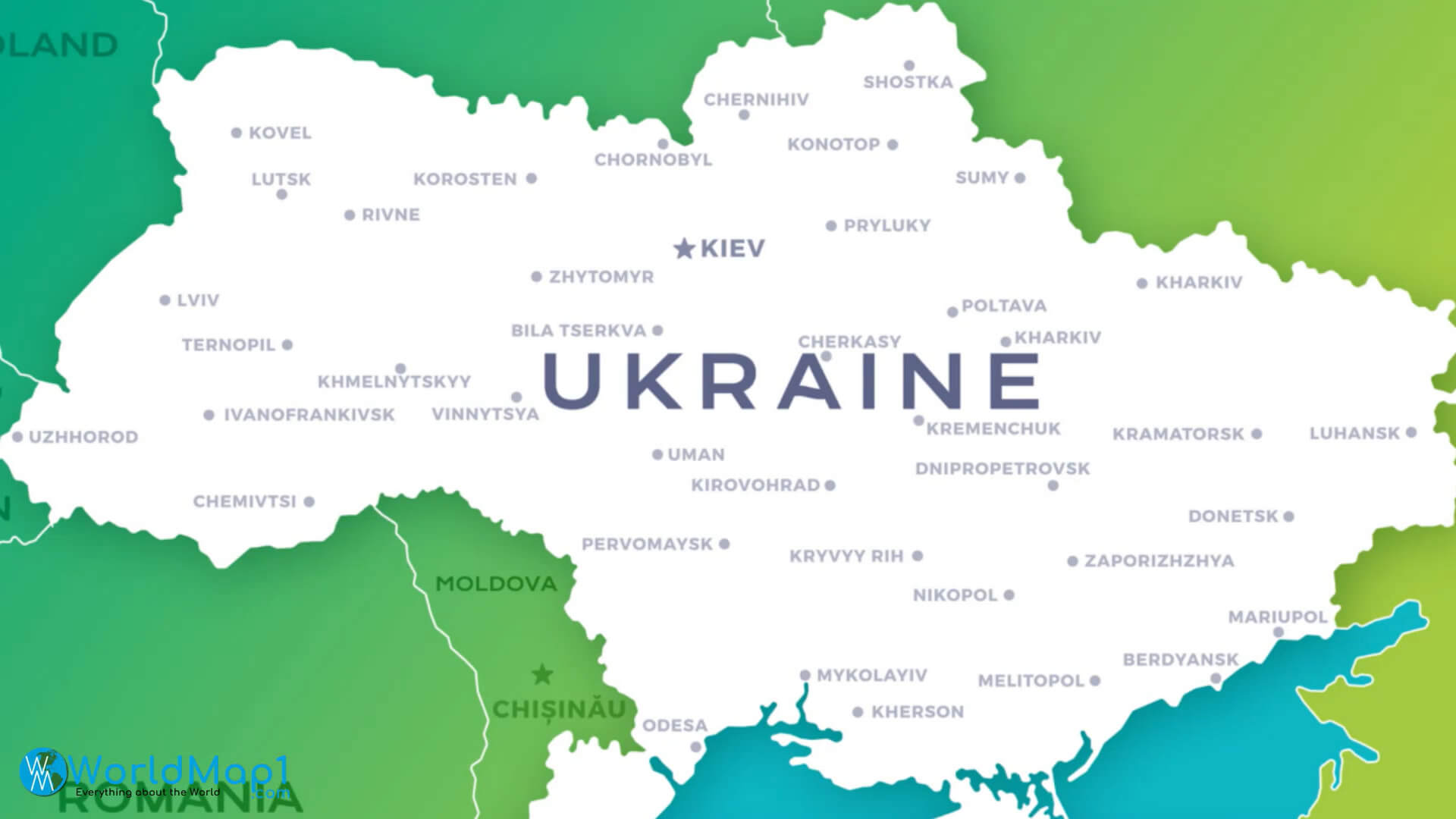
This map highlights the major cities across Ukraine, including Kyiv, Kharkiv, Lviv, and Odesa, showcasing the country’s geographic diversity from its western border with Poland to its eastern regions near Russia. It also indicates Ukraine’s neighboring countries, such as Moldova and Romania, giving a clear sense of its position within Eastern Europe.
Regions Map of Ukraine
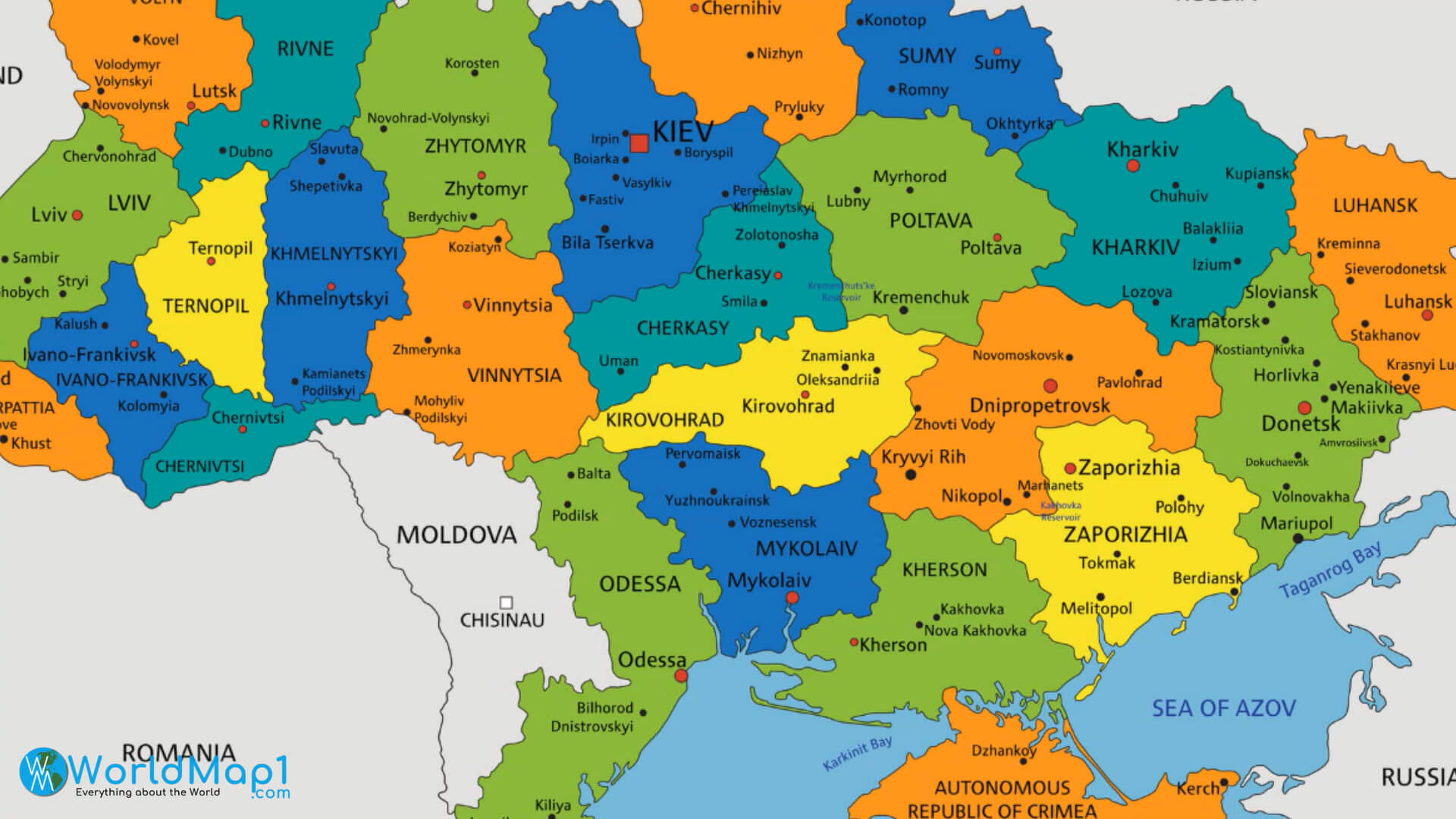
Ukraine Infographic Map
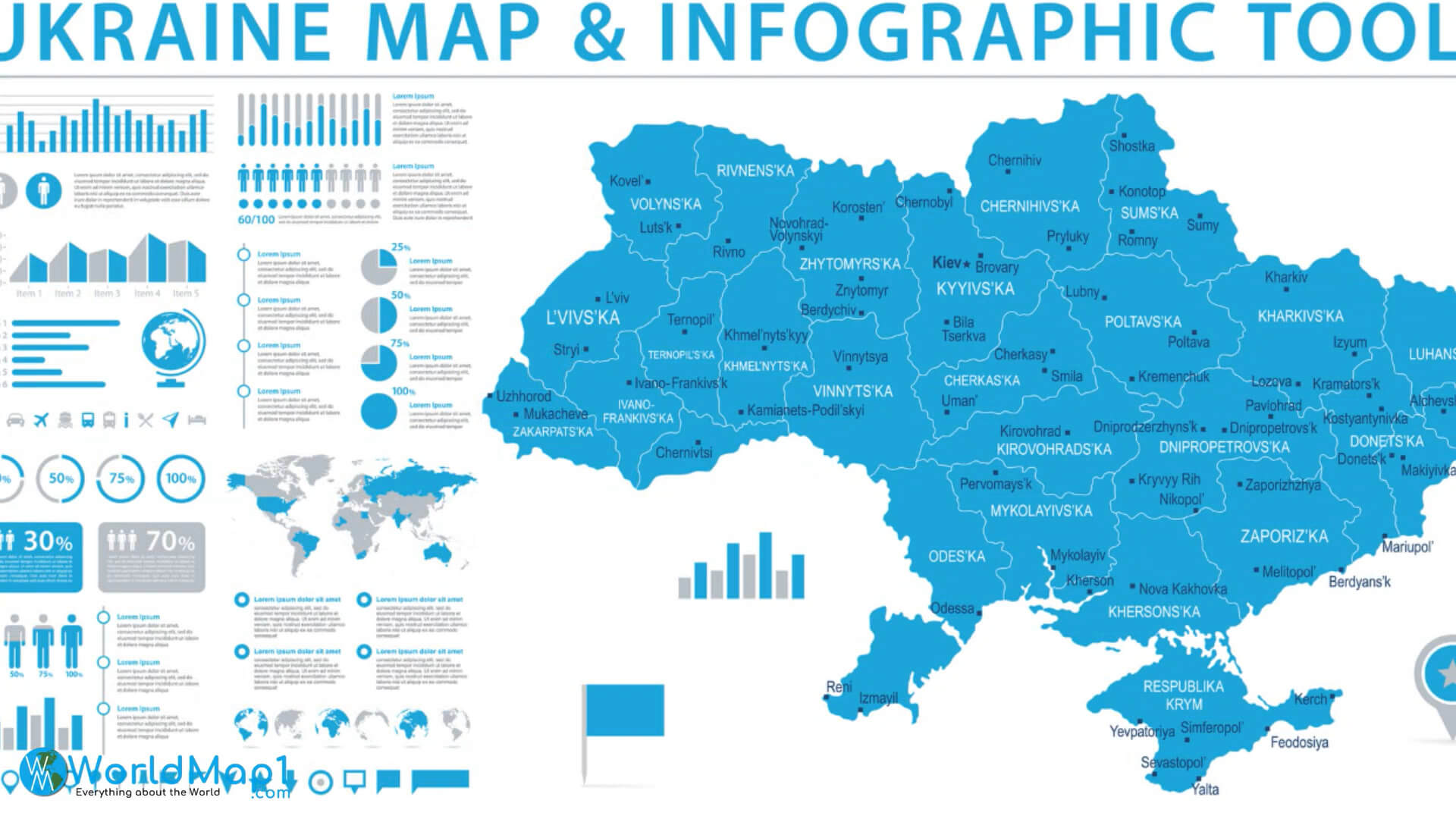
This infographic map of Ukraine provides a detailed overview of the country’s administrative divisions, highlighting each region and key cities such as Kyiv, Lviv, and Odesa. It also features various statistical graphics, such as demographic data, transport options, and economic indicators, offering insights into the country’s population distribution and economic activity. The map positions Ukraine within a global context, with smaller maps indicating its place in relation to the rest of the world.
Ukraine Political Map with National Flag
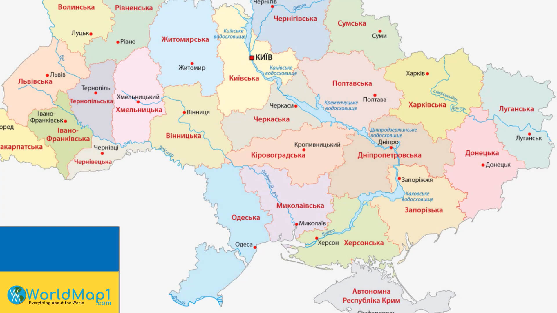
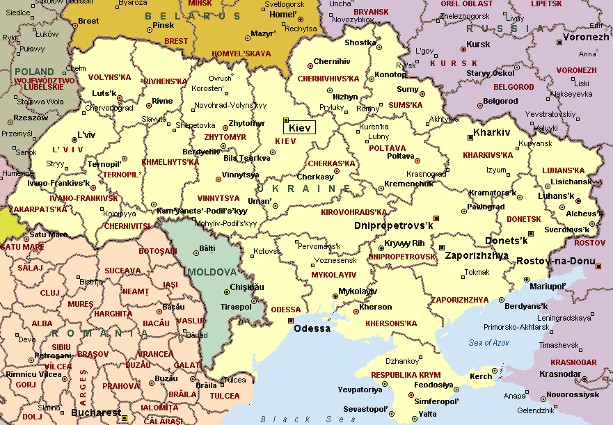
Ukraine Provinces Map
Russian Invasion of Ukraine Map in 2024
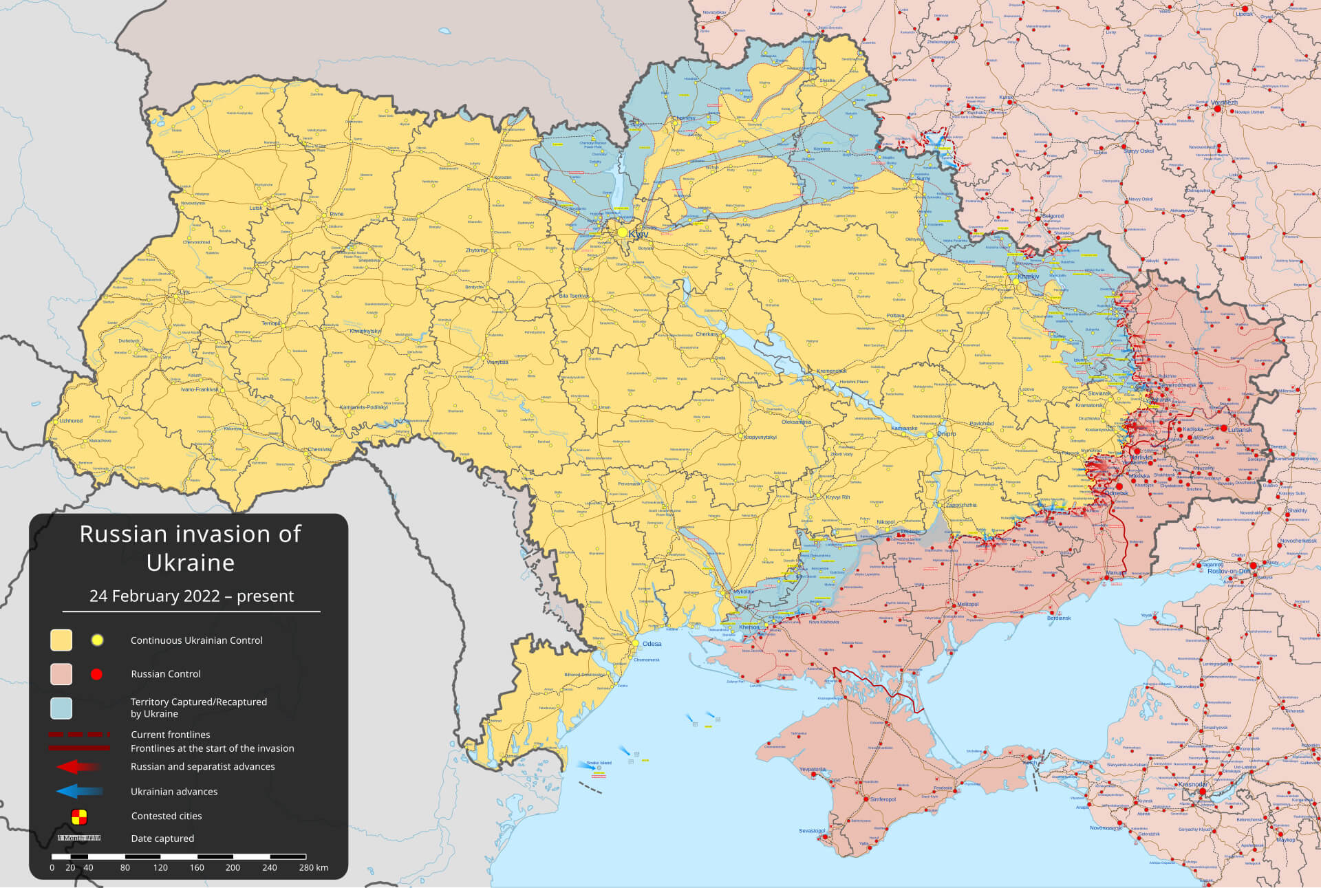 This map of the Russian invasion of Ukraine in 2024 illustrates the areas of control and conflict between Ukrainian and Russian forces. The colour-coded regions show areas under continuous Ukrainian control, areas under Russian control, and areas contested or captured during the ongoing conflict, highlighting the dynamic frontlines in 2024.
Topographic Map of Ukraine with Borders Cities
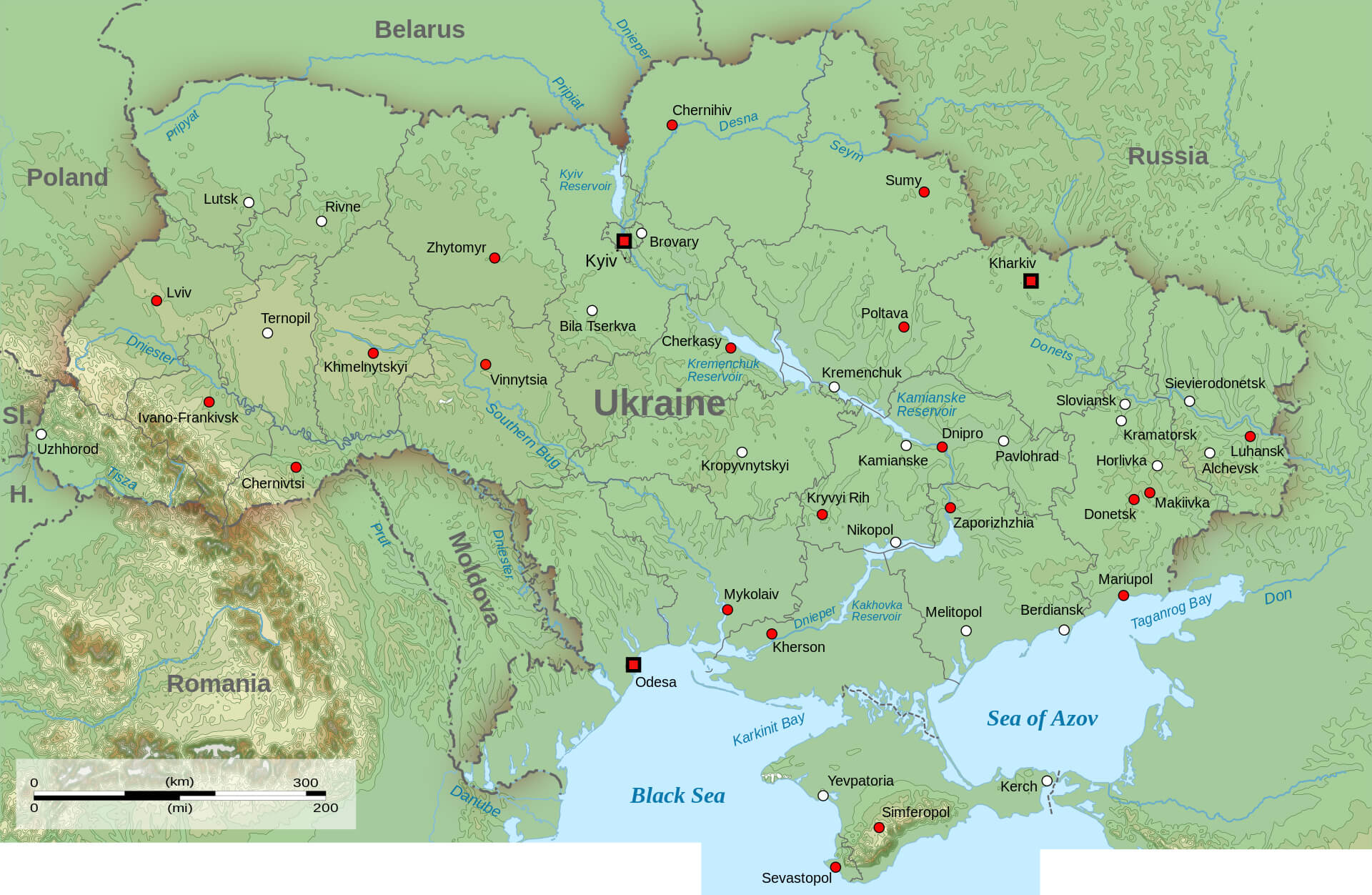 This topographical map of Ukraine depicts the country’s diverse landscapes, highlighting key geographical features such as rivers, mountains and plains. The map also marks borders with neighboring countries, including Poland, Romania, Moldova and Russia, along with major cities like Kyiv, Lviv, Kharkiv and Odesa, providing a detailed view of Ukraine’s terrain and urban centers.
Ukraine Climate Map
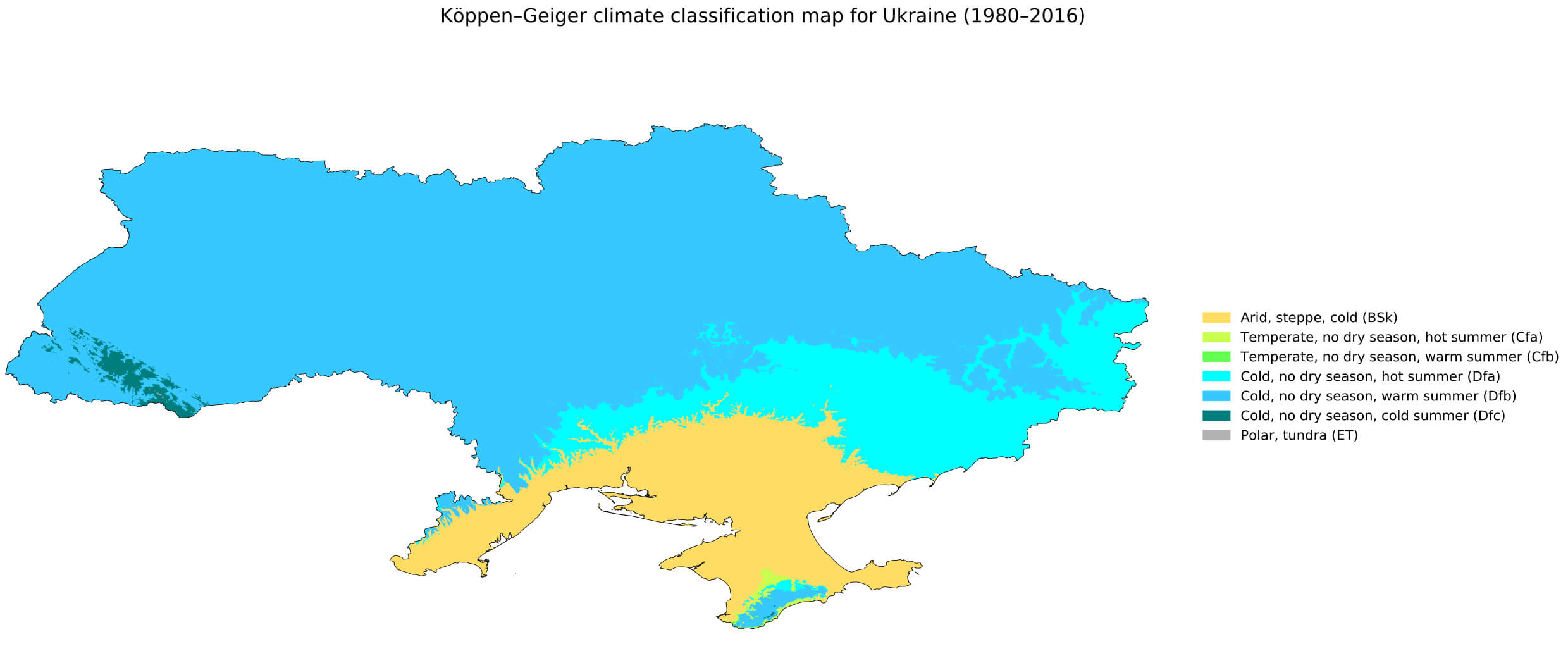 This climate map of Ukraine illustrates the diverse Köppen-Geiger climate classifications across the country, ranging from cold, no dry season zones in the north and central regions (Dfa and Dfb) to arid, steppe areas in parts of the south, including Crimea (BSk). The map highlights the transition between different climate types, providing a clear visual representation of Ukraine’s varying weather patterns from the colder, snow-prone north to the relatively milder and drier southern regions.
Free Trade Area Map with EU and Ukraine
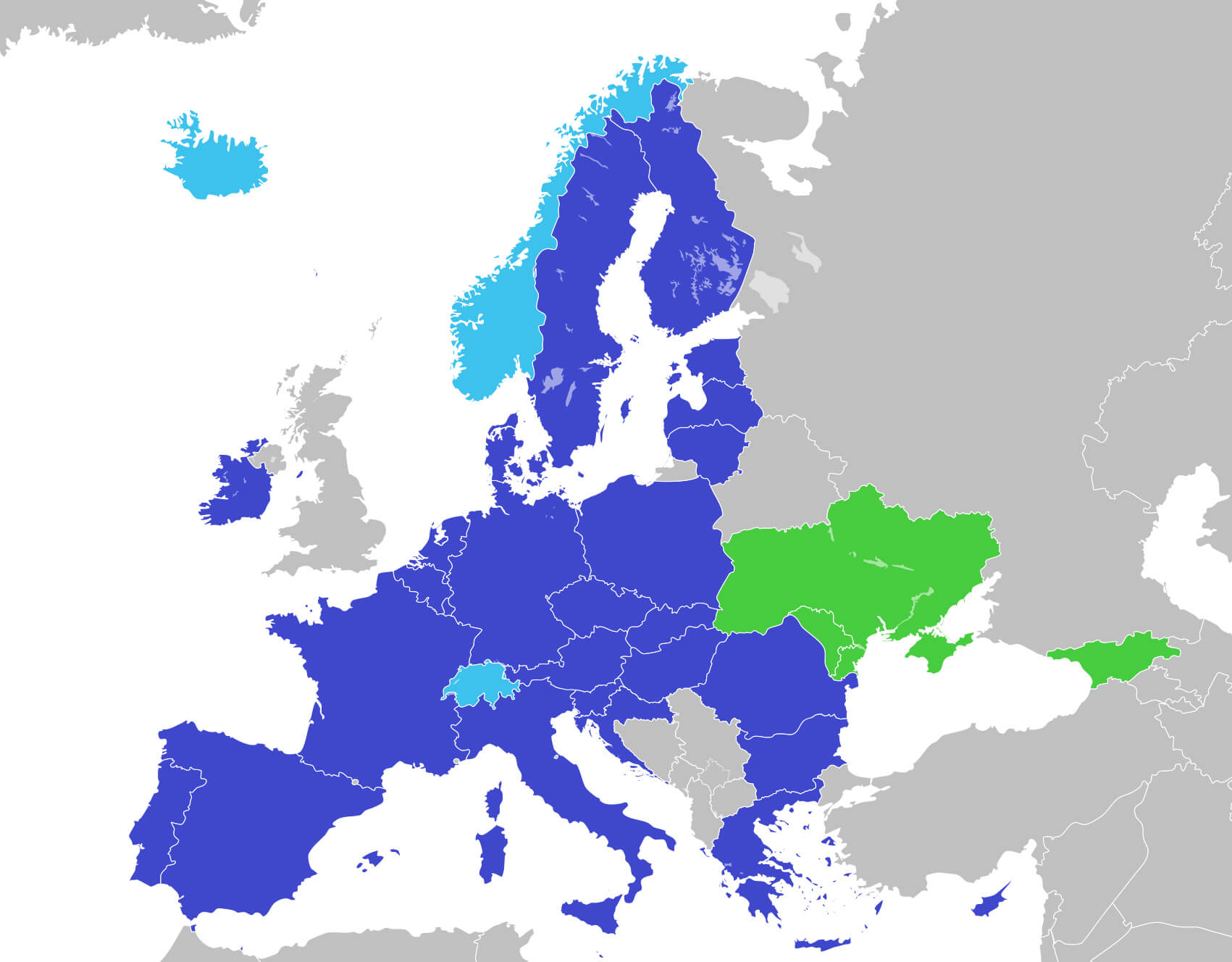 This map shows the Free Trade Agreement between the European Union (EU) and Ukraine, illustrating the countries involved in the partnership. The EU Member States, shown in dark blue, have a comprehensive trade relationship with Ukraine, shown in green. This agreement aims to promote economic integration, reduce trade barriers and strengthen political ties between Ukraine and the EU.
Ukraine Languages Map
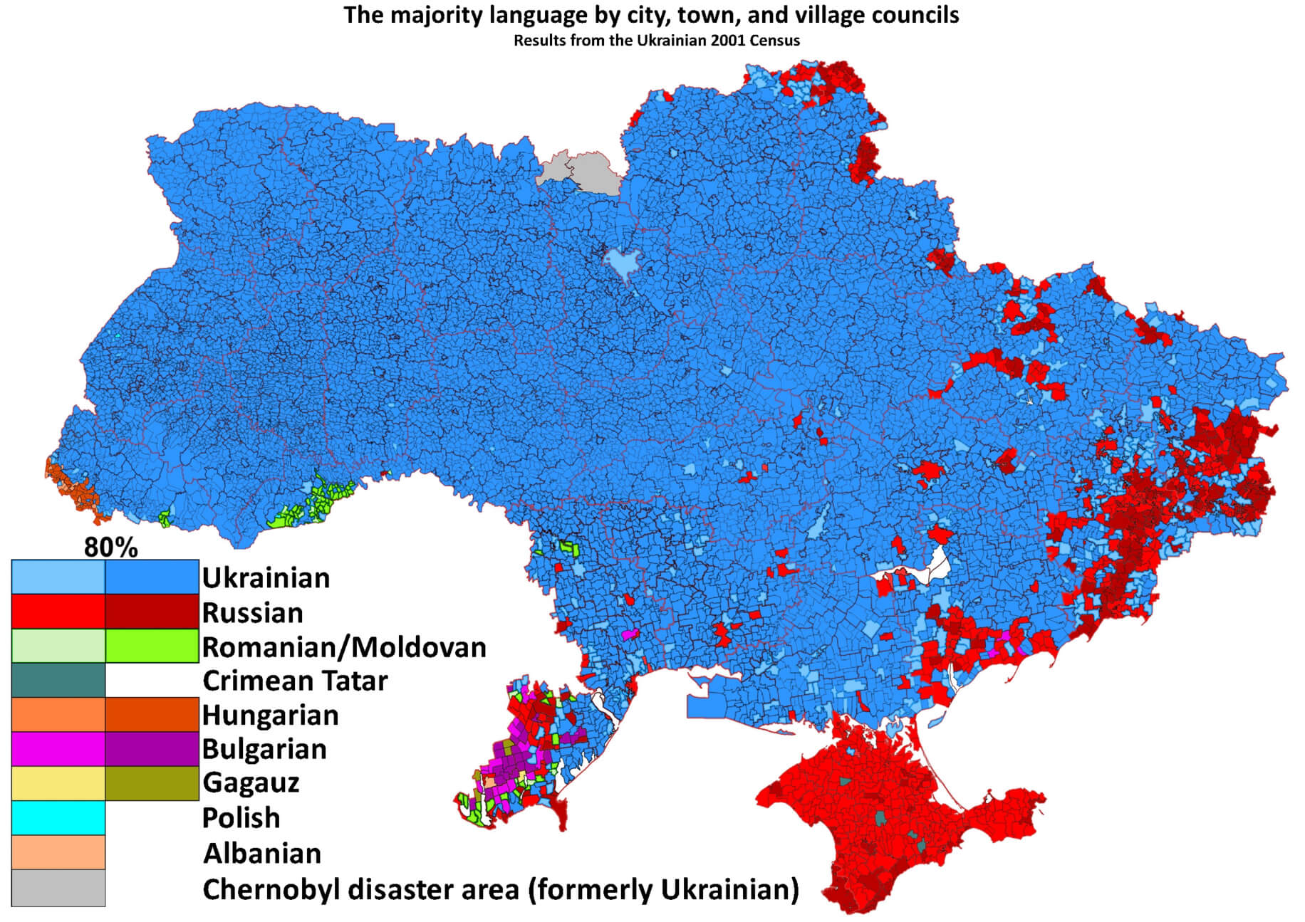 This map of Ukraine shows the distribution of majority languages by city, town and village council, based on data from the 2001 Ukrainian census. Predominantly, the western and central regions of Ukraine are highlighted in blue, indicating a majority Ukrainian-speaking population. In contrast, the red areas in the east and south reflect Russian-speaking majorities, particularly in regions such as Donetsk, Luhansk and Crimea. Other languages such as Romanian/Moldovan, Hungarian and Crimean Tatar are represented in specific localised areas, highlighting Ukraine’s linguistic diversity.
Ukraine Cities Map by Population
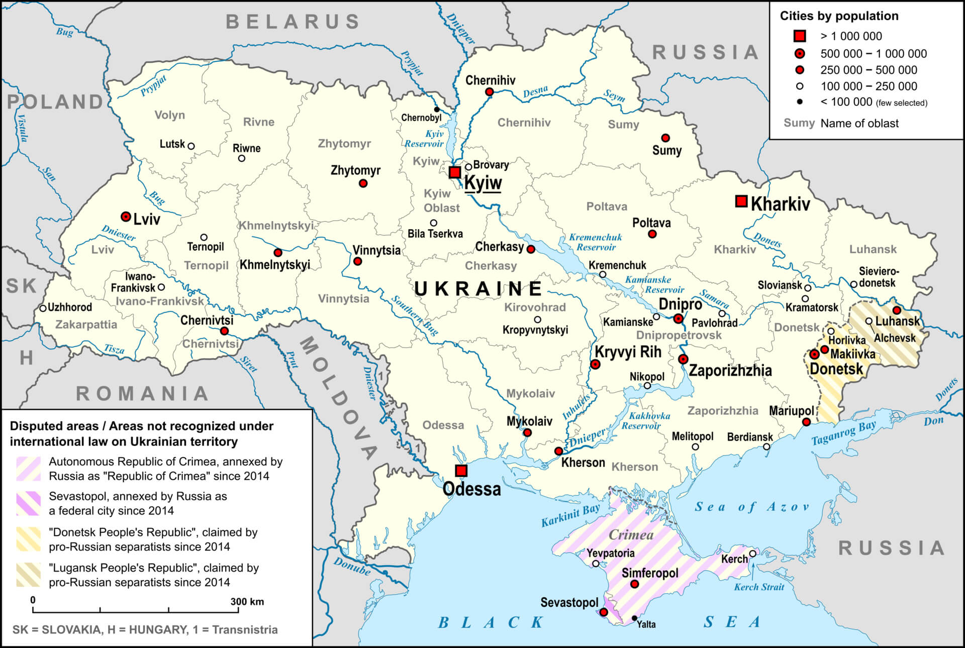 This map of Ukraine shows the distribution of major cities by population, highlighting key urban centers like Kyiv, Kharkiv, Odessa, Lviv, and Donetsk along with the disputed areas such as Crimea and parts of Donetsk and Luhansk.
Ukraine Administrative Map with Regions
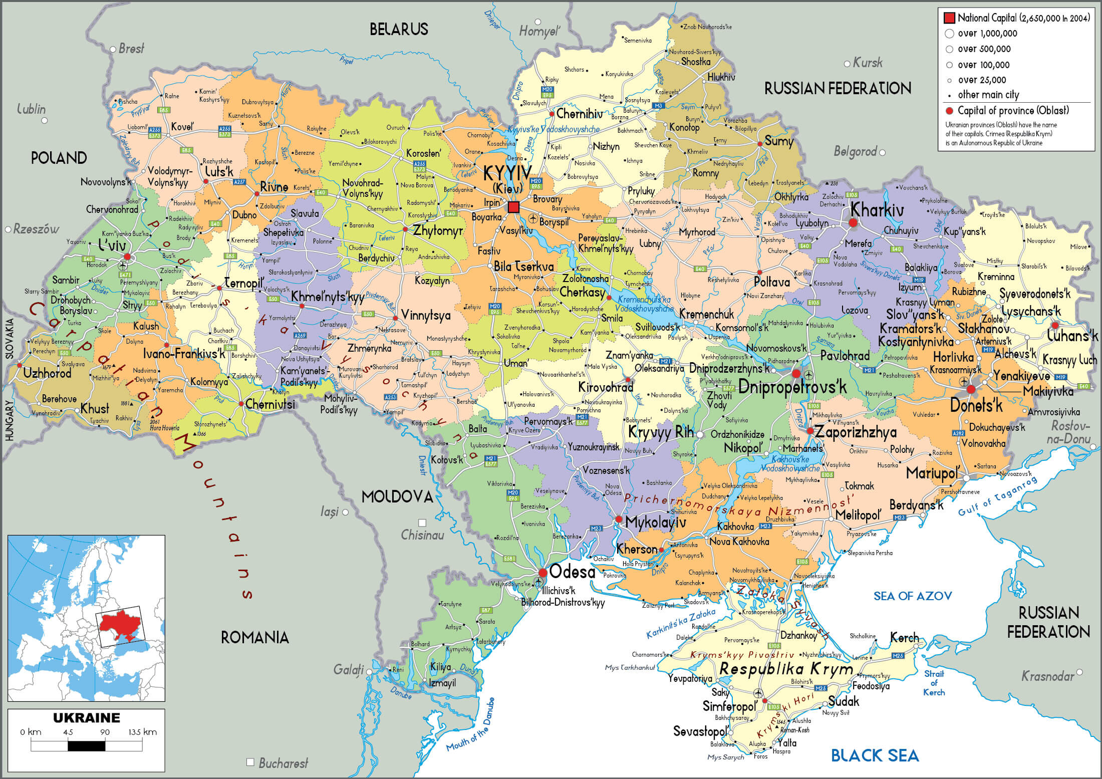 This map of Ukraine highlights the country’s administrative divisions and regions, showing major cities and oblasts (provinces). It provides a detailed view of the political landscape, including regional capitals and important urban centers such as Kyiv, Lviv, Kharkiv and Odesa, as well as the geographical layout of Crimea and areas under dispute since 2014.
Ukraine Donbas Region Russia Map
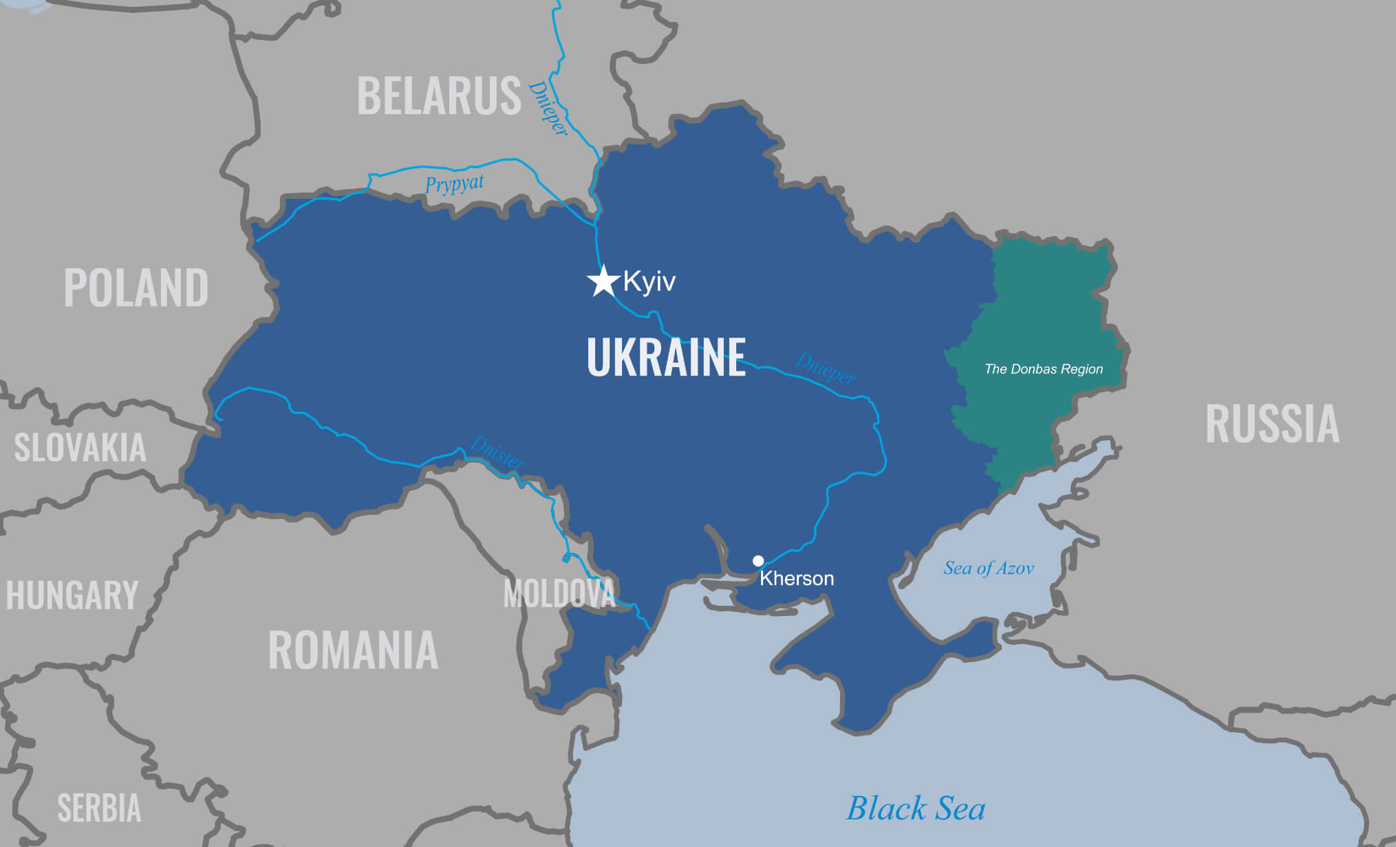 This map highlights the Donbass region of Ukraine, which lies close to the eastern border with Russia. It outlines Ukraine’s key cities, such as Kyiv and Kherson, while emphasizing the geographical location of the Donbass area in relation to neighboring countries like Poland, Belarus and Russia. The map clearly depicts regional divisions and key waterways such as the Dnieper River, illustrating the strategic position of the Donbass in the ongoing geopolitical dynamic.
Ukraine Cities Map
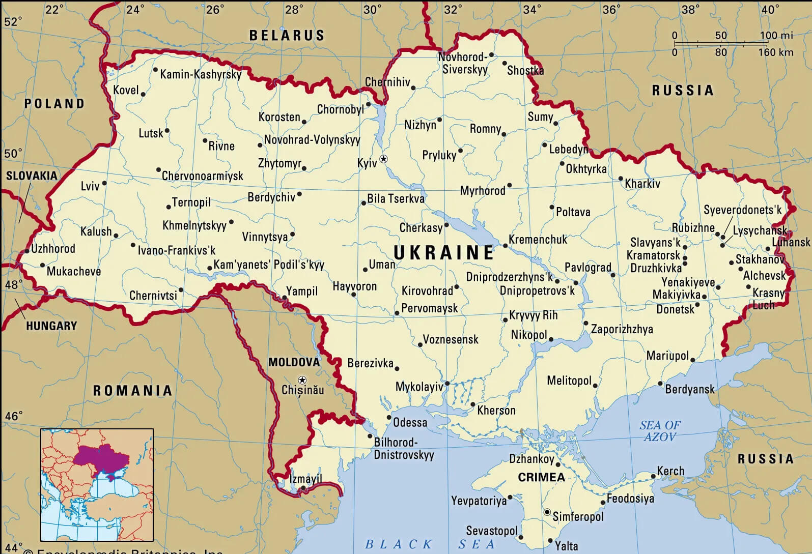 This map of Ukraine highlights the country’s major cities, including Kyiv, Lviv, Kharkiv, Odessa and Dnipro, alongside key neighboring countries like Poland, Romania and Russia. Ukraine’s borders are clearly marked, showing its position in Eastern Europe and highlighting the locations of urban centres and regional hubs within the country’s geographical layout.
Ukraine Satellite Map
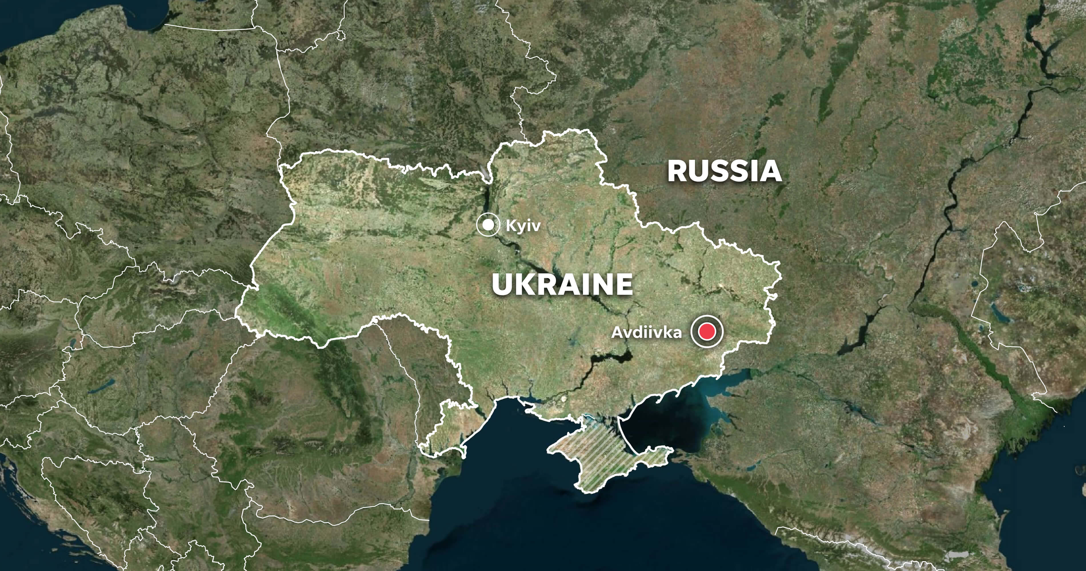 This satellite map of Ukraine provides a detailed view of the country’s geography, showing the natural landscape and key locations like Kyiv, the capital, and Avdiivka, a city of strategic significance in eastern Ukraine. The map also highlights Ukraine’s terrain and proximity to neighbouring countries such as Poland, Russia and Romania, as well as its southern coastline along the Black Sea.
Ukraine Russia War Map 2023
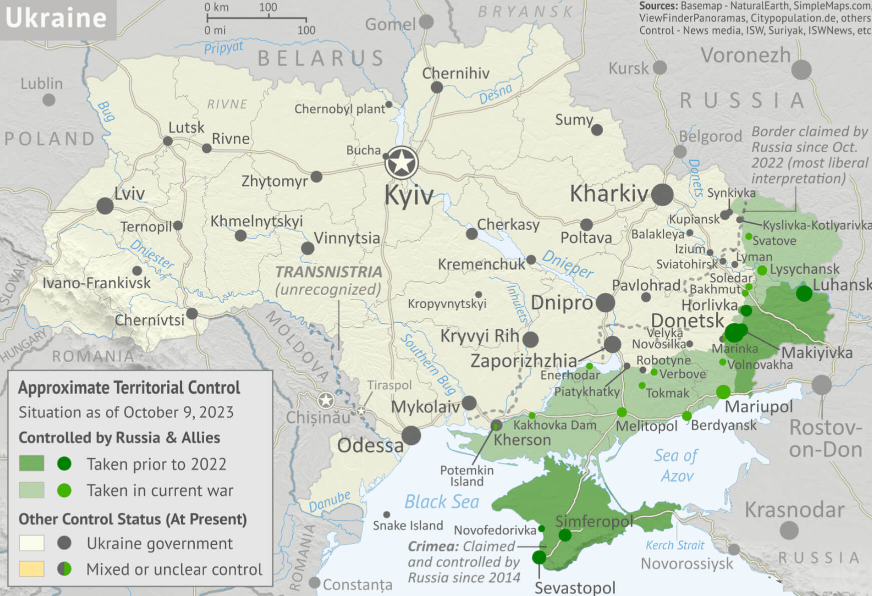 This map of the Ukraine-Russia conflict as of 2023 shows the regions under varying degrees of control. Areas in green represent regions held by Russian forces and allies, including areas captured before 2022 and during the ongoing conflict. Meanwhile, regions in beige represent Ukrainian government control, with some zones marked as contested or with unclear control. Key cities such as Kyiv, Kharkiv and Lviv are highlighted, illustrating the geographical scope of the conflict across the eastern and southern parts of Ukraine, especially near Donetsk, Luhansk and Crimea.
Ukraine Provinces Map with Major Cities
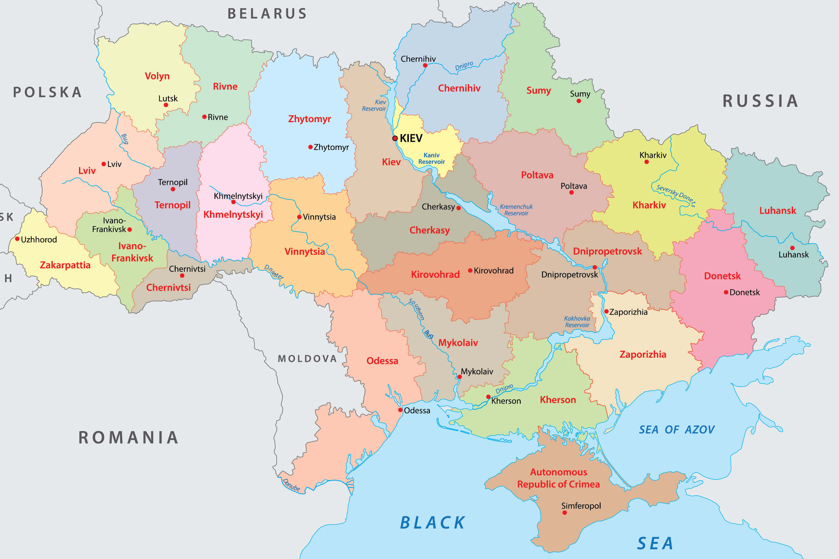 This map of Ukraine illustrates its various provinces, each with distinctive colours, alongside the locations of major cities such as Kyiv, Kharkiv, Lviv and Odessa. The map also shows the Autonomous Republic of Crimea in the south, highlighting key geographical and political regions.
Ukraine Physical Map
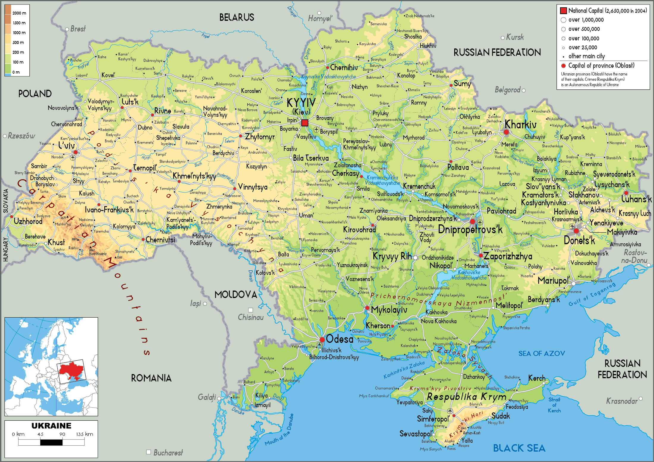 This map of Ukraine provides a detailed physical overview, highlighting the country’s varied landscapes, including mountain ranges such as the Carpathians in the west, extensive river systems such as the Dnieper and Dniester, and key geographical features such as the Black Sea coast. It illustrates the locations of major cities, rivers and elevation changes across Ukraine, providing a comprehensive view of the country’s topography and natural divisions.
Ukraine Early Indo European Migrations Map from Pontic Steppes
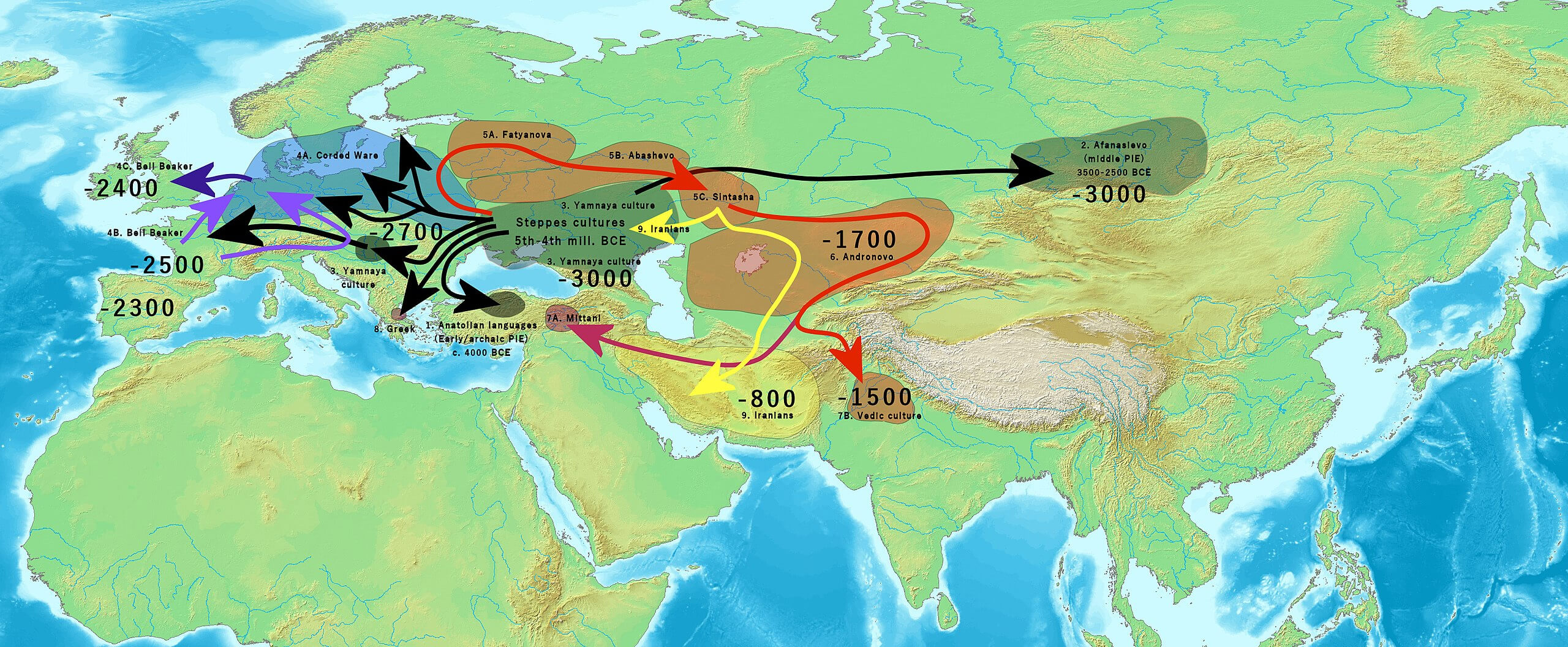 This map illustrates the early Indo-European migrations from the Pontic Steppes, showing the movement of different cultures and languages across Europe and Asia. It highlights key migration routes and timeframes, such as the spread of the Yamnaya culture around 3000 BC, and subsequent influences on the development of various Indo-European language groups and cultures, including the Corded Ware culture in Europe and the Iranian expansion to the east.
Ukraine Extent of Kievan Rus Map between 1054 and 1132
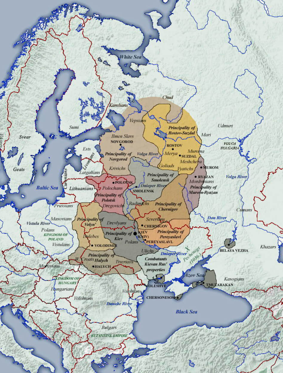 This map illustrates the territorial extent of Kievan Rus’ between 1054 and 1132, showing the various principalities that made up the early medieval state. Highlighting regions such as Kiev, Rostov and Chernigov, the map illustrates the cultural and political landscape of Eastern Europe during this period. Kievan Rus’ served as the foundation for the cultural and historical heritage of modern Ukraine, Belarus and Russia, and played a crucial role in the development of Eastern Slavic culture and Orthodox Christianity.
Ukraine Polish Lithuanian Commonwealth Map in 1619
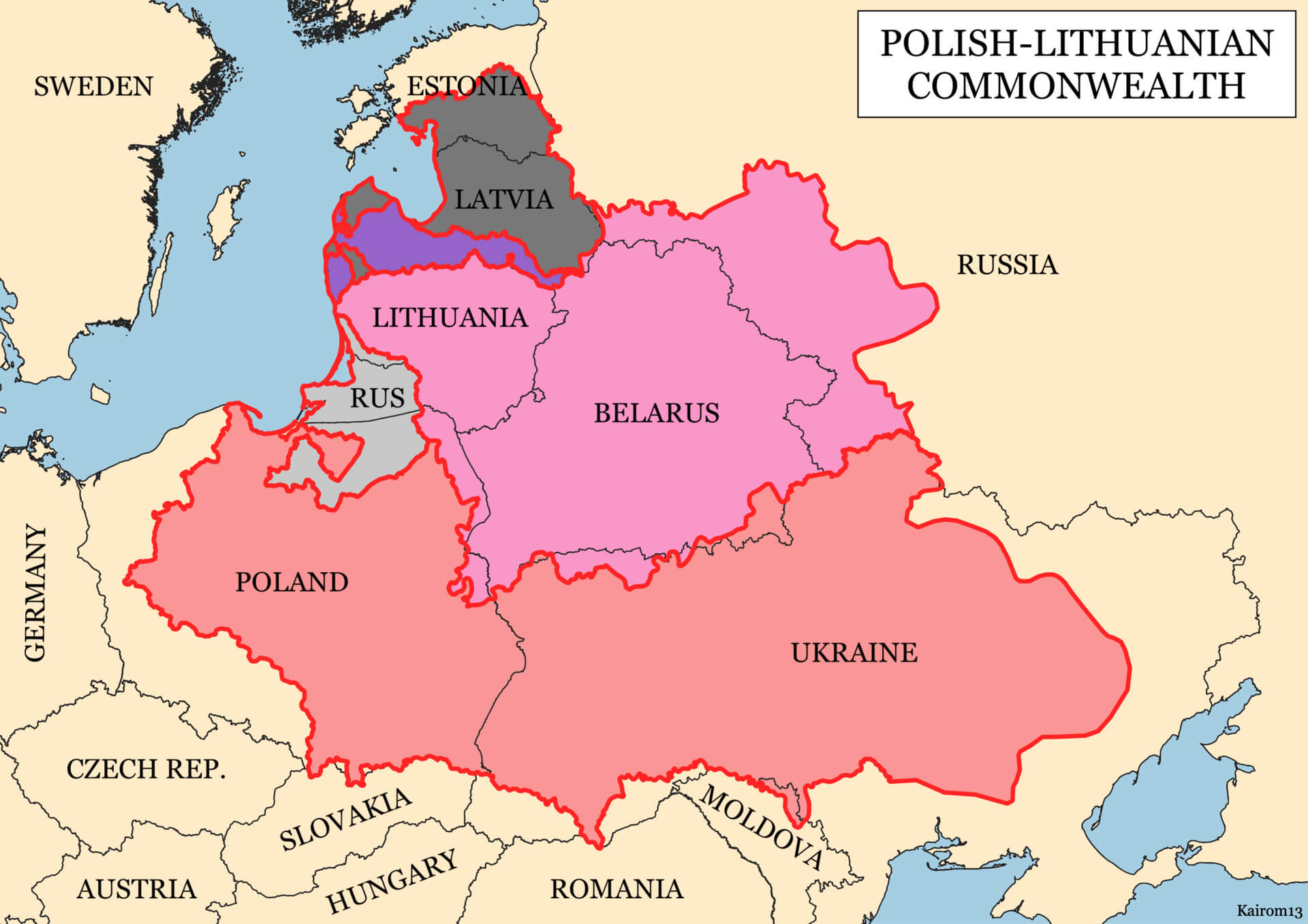 This map shows the extent of the Polish-Lithuanian Commonwealth in 1619, highlighting its territorial reach over modern-day regions including Poland, Lithuania, Belarus, Latvia, and parts of Ukraine. During this period, the Commonwealth was one of the largest and most influential political entities in Europe, with a diverse population and significant cultural and political influence over Eastern Europe.
Territorial Evolution Map of Ukrainian SSR between 1922 and 1954
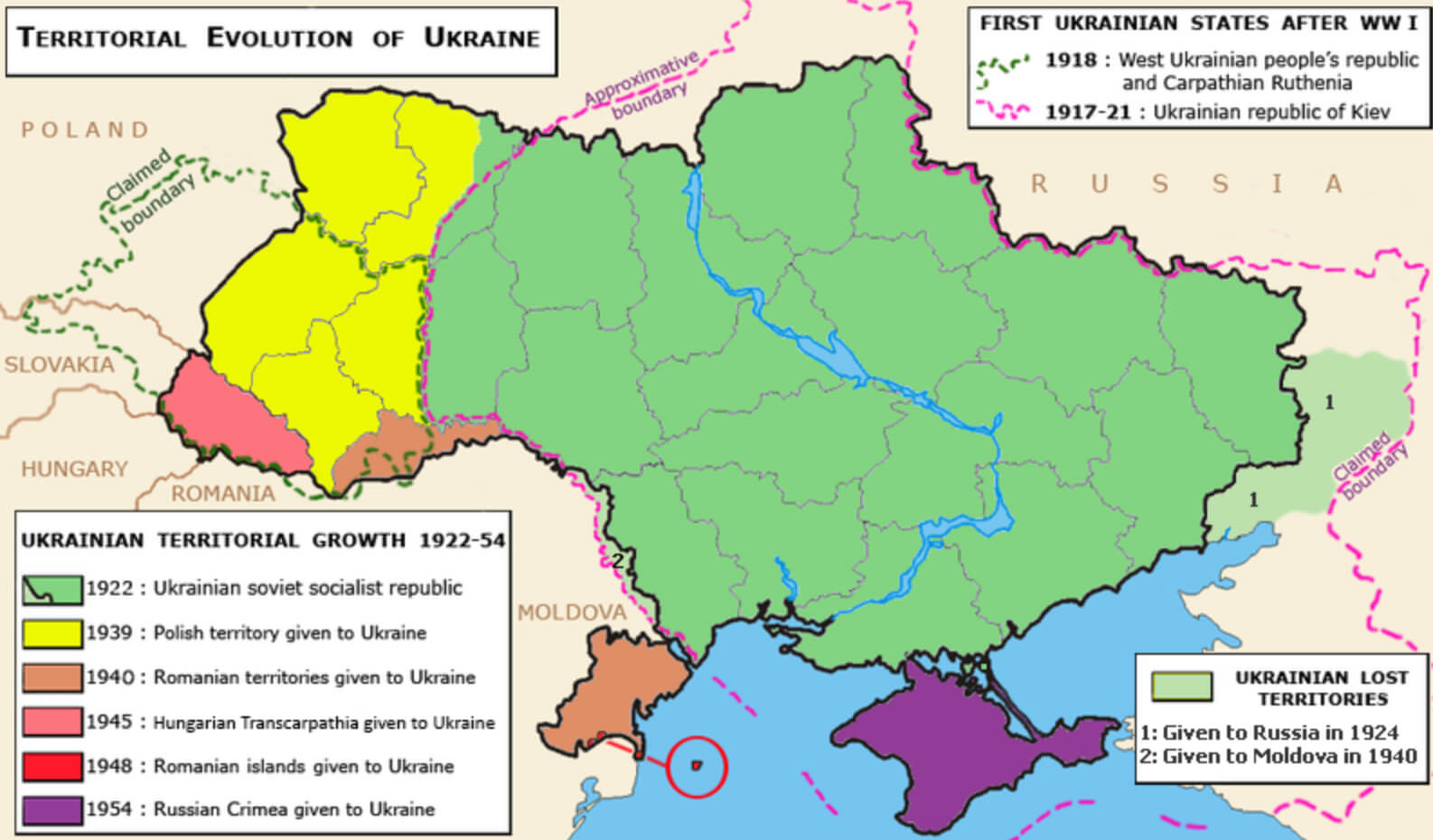 This map illustrates the territorial development of the Ukrainian SSR between 1922 and 1954, showing the main changes in its borders during this period. It highlights the incorporation of territories from Poland in 1939, Romania in 1940, Hungarian Transcarpathia in 1945 and the transfer of Crimea from Russia to Ukraine in 1954, as well as the loss of some territories to Russia and Moldova. The map provides a visual representation of how Ukraine’s borders were shaped during the Soviet era, reflecting the geopolitical shifts in Eastern Europe.
Map of Ukraine Europe
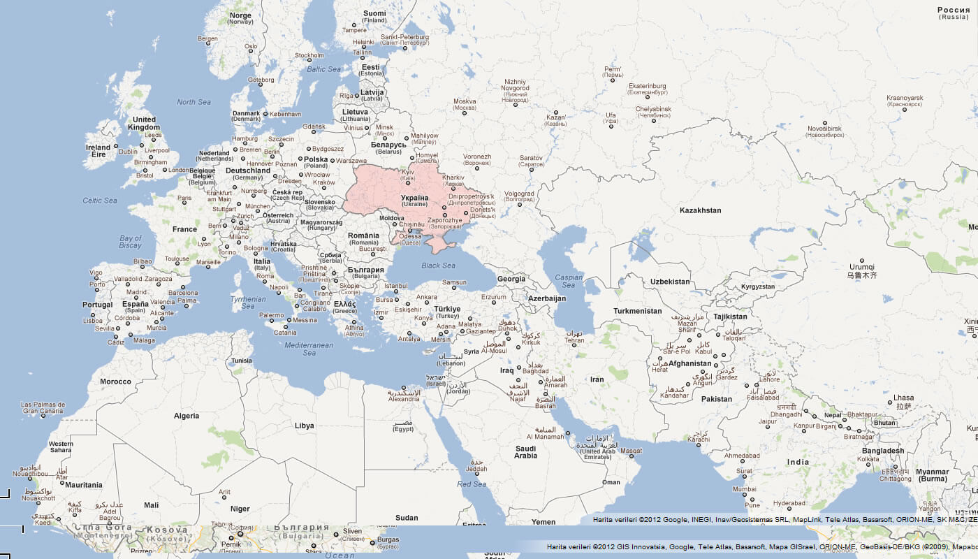
Where is Ukraine on the Europe Map?
Show Google interactive map, satellite map, where is the country located.
Get directions by driving, walking, bicycling, public transportation and travel with street view.
Feel free to explore these pages as well:
- Russia Map ↗️
- Transnistria Map ↗️
- Georgia Map ↗️
- South Ossetia Map ↗️
- United States Map ↗️
- United Kingdom Map ↗️
- Germany Map ↗️
- Poland Map ↗️
- France Map ↗️
- Map of Russia ↗️
- About Russia ↗️
- Largest Cities of Russia: From Moscow to Rostov ↗️
- Top 10 Must-Visit Places in Moscow ↗️
- Abkhazia Map ↗️
- Nagorno Karabakh ↗️
