Explore Georgia with our detailed map of regions, physical, satellite, political, cities maps and natural landmarks. Discover top attractions, political boundaries and travel tips to help you plan your perfect adventure in this beautiful country that straddles Europe and Asia.
Brief information about Georgia
Located at the crossroads of Eastern Europe and Western Asia, Georgia is a country rich in culture, history and natural beauty. Its diverse landscapes stretch from the scenic Black Sea coast to the towering Caucasus Mountains, offering visitors everything from ancient monasteries to charming wine regions. Known as the birthplace of wine, Georgia’s winemaking traditions date back over 8,000 years and are deeply intertwined with its vibrant culture and cuisine.
Political Map of Georgia, Abkhazia, and South Ossetia
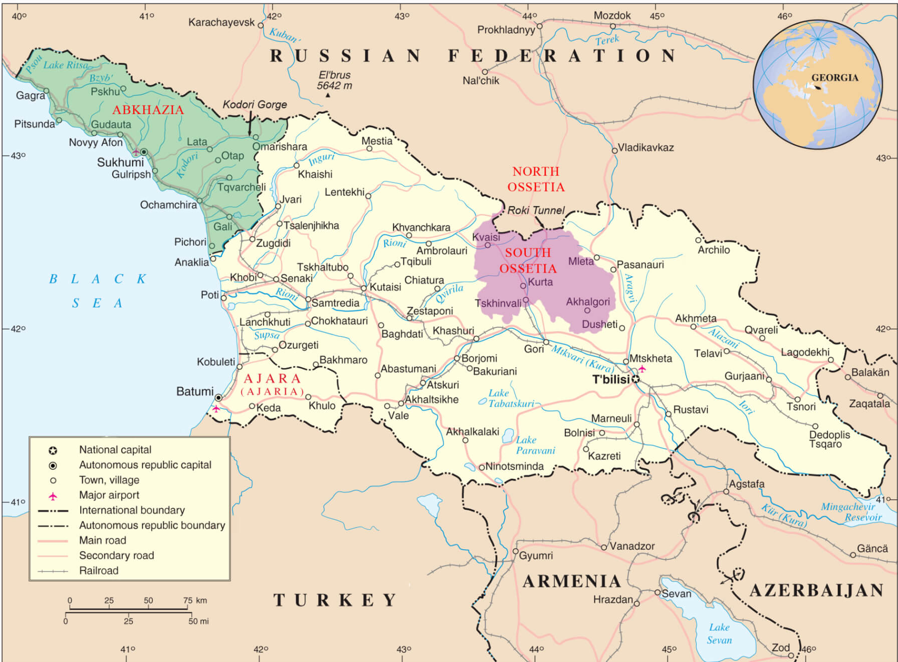 Political map of Georgia with regions Abkhazia and South Ossetia highlighted
This political map highlights Georgia and its regions, including Abkhazia and South Ossetia, which are areas with complex political and territorial dynamics. Key features like international borders, autonomous republics, and major cities such as Tbilisi are labeled.
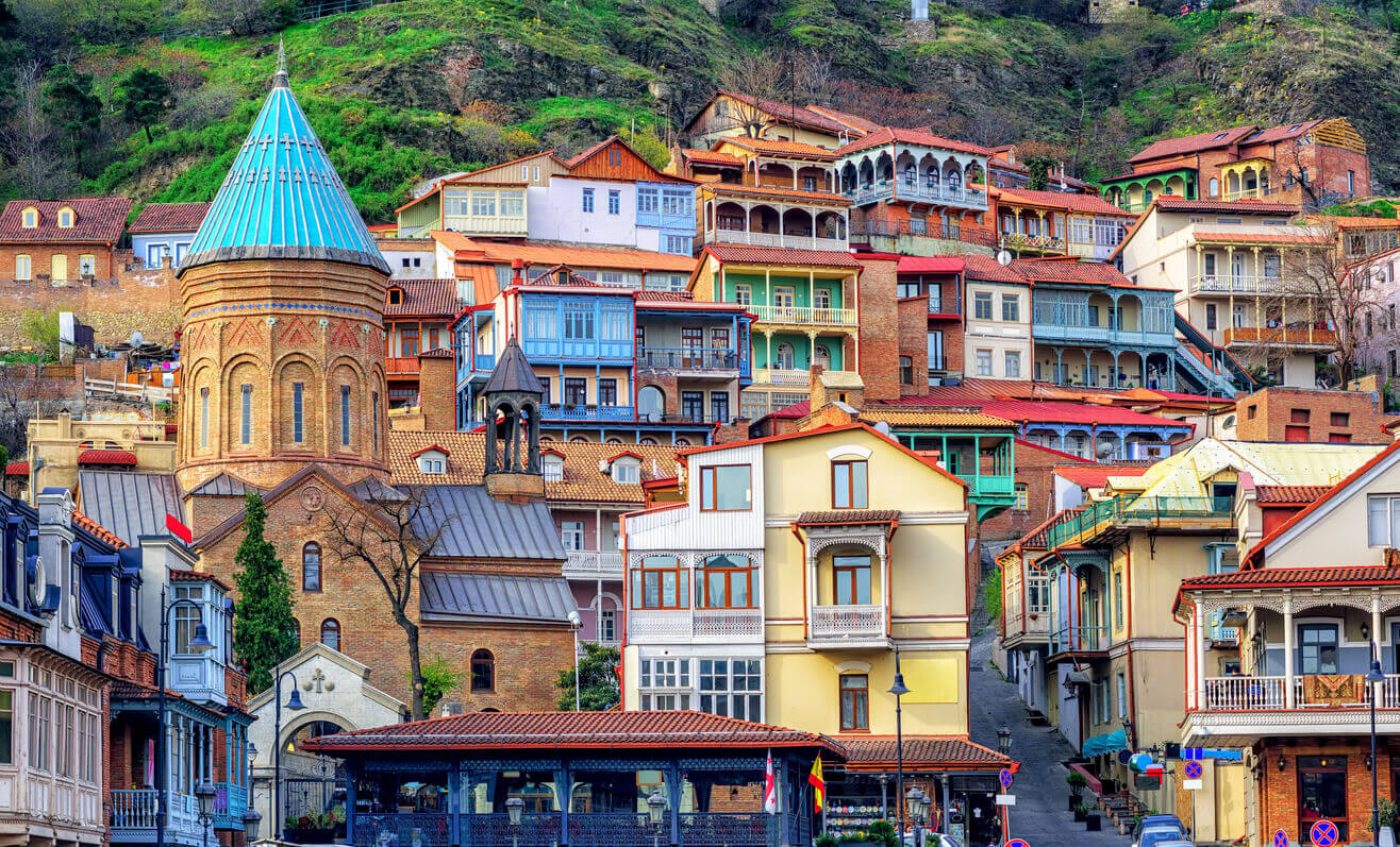
The capital, Tbilisi, is a blend of old and new, where narrow cobbled streets meet modern cafes and art galleries. This dynamic city, with its unique architecture and welcoming atmosphere, reflects Georgia’s historical influences, including Persian, Russian and Ottoman. Georgian hospitality is world-renowned, with locals eager to share their traditions, food and warm smiles, making it an unforgettable destination for travellers.
Where is located Georgia on the World Map?
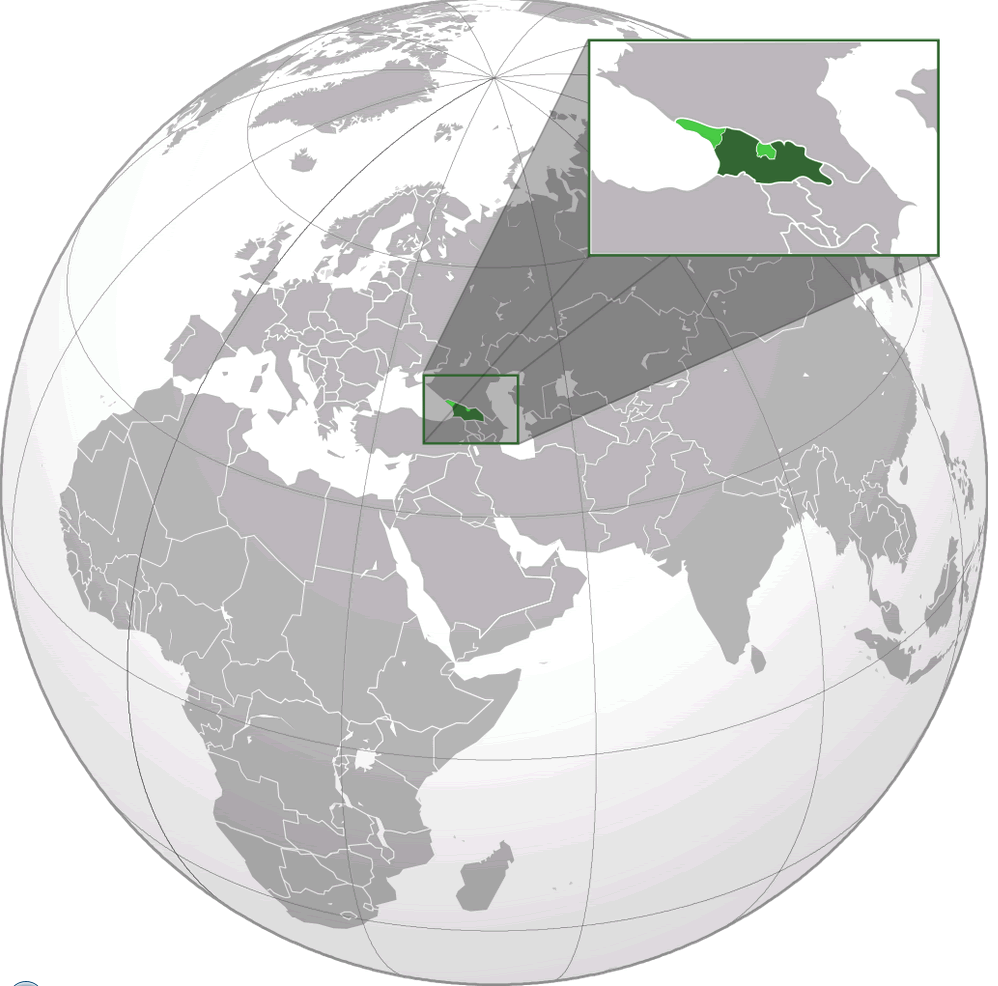
Georgia is a small country strategically located at the crossroads of Eastern Europe and Western Asia. Nestled between the Black Sea to the west and the towering Caucasus Mountains to the north, it serves as a natural bridge between Europe and Asia. This unique location has shaped Georgia’s cultural and historical identity, blending influences from both continents.
Georgia borders Russia to the north and Armenia and Turkey to the south. Its eastern neighbour is Azerbaijan, which together with Georgia connects the Caspian Sea to the Black Sea, an important link for trade routes. Despite its relatively small size, Georgia’s location gives it an outsized role in the region’s economic and political landscape.
Georgia’s location makes it accessible to travellers from different parts of the world, with the capital, Tbilisi, just a few hours’ flight from major European, Middle Eastern and Central Asian cities. This convenient location has made Georgia a growing tourism hub, offering visitors the chance to experience its scenic landscapes, ancient heritage and renowned hospitality.Comprehensive Georgia Road Map: Highways and Cities
Map of the Georgian Civil War in Abkhazia (1993)
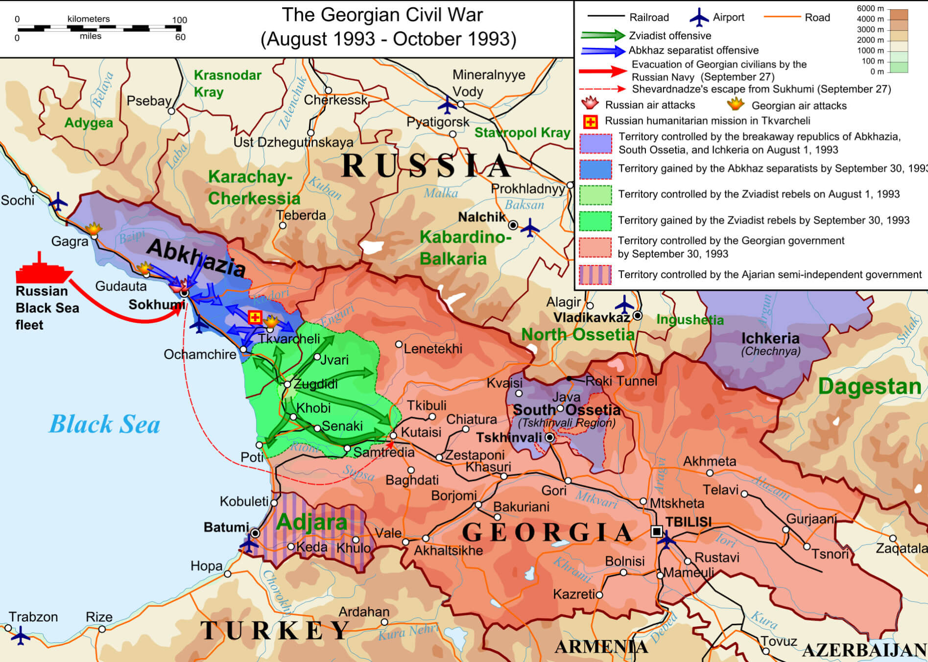 Map showing Georgian Civil War in Abkhazia with troop movements and controlled areas.
This map illustrates the Georgian civil war in Abkhazia (1993), highlighting troop movements, territorial changes and areas controlled by Abkhaz separatists, Georgian forces and Zviadist rebels during the conflict. Key events such as Shevardnadze’s escape and evacuations are highlighted.
Here are some statistical information about Georgia:
 Area: 69,700 km2 (26,900 sq mi)
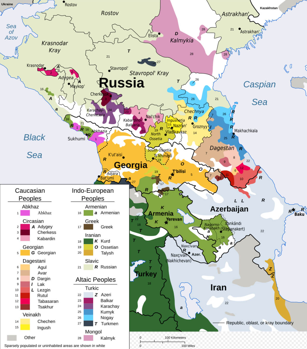
Ethno linguistic map in the Caucasus region
Map of Georgia
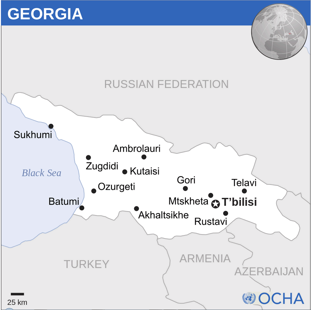
Georgia Location Map
Georgia Map
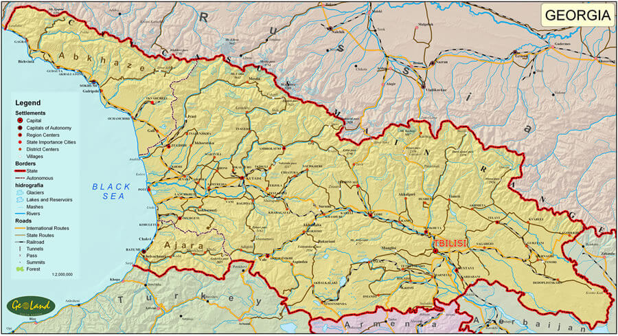
Georgia Political Map
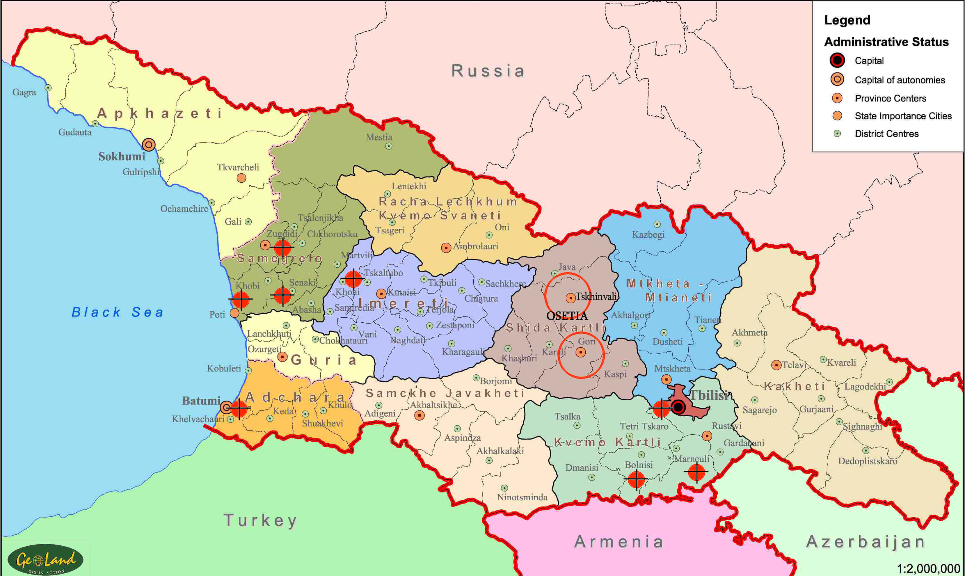
Georgia Detailed Map
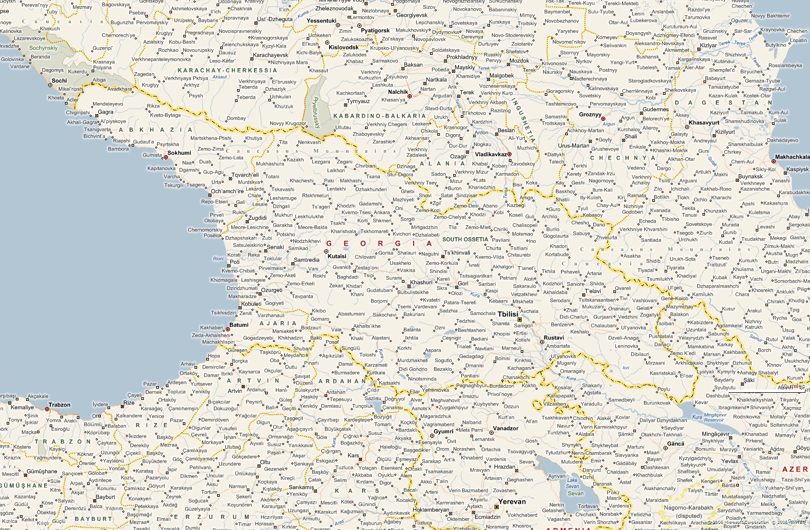 Detailed map of Georgia showing cities, regions, and borders.
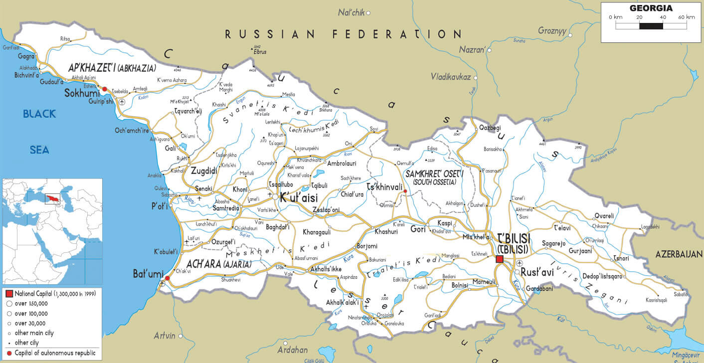
This map provides a detailed view of Georgia, highlighting its cities, towns and administrative regions, as well as neighbouring countries. Georgia borders Russia to the north, including areas such as Chechnya and Dagestan, Armenia and Turkey to the south and Azerbaijan to the southeast. Major Georgian cities such as Tbilisi (the capital), Batumi on the Black Sea coast and Kutaisi in the west of the country are marked. Regions such as Adjara and South Ossetia, which have different administrative statuses, are also visible. The map reflects Georgia’s position as a crossroads between Eastern Europe and Western Asia, with detailed connections to nearby regions and cities.
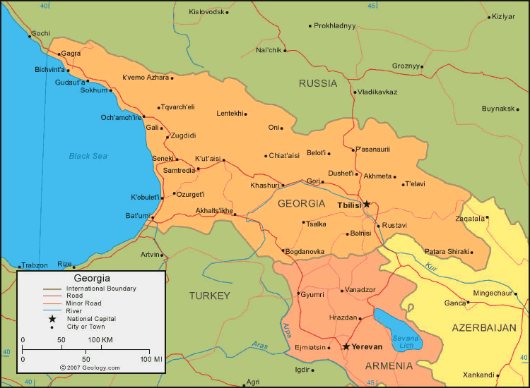
Map Georgia
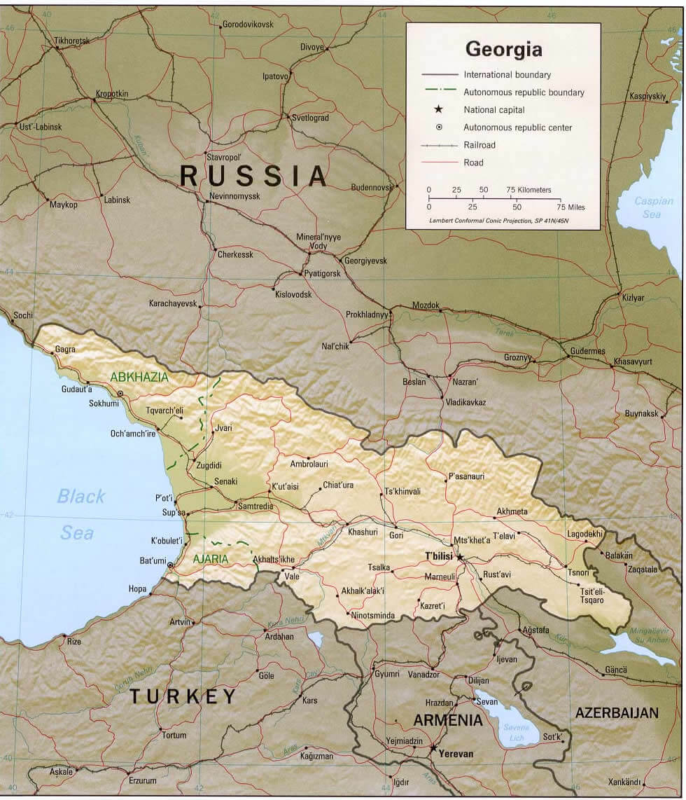 Map of Georgia with major cities, borders, and geographic features.
This map shows the geographical layout of Georgia, which is bordered by Russia to the north, Turkey to the south, Armenia to the south and Azerbaijan to the south-east. Key regions such as Abkhazia and Adjara, both of which have autonomous status, are marked, as is the country’s capital, Tbilisi, located in the eastern part of Georgia. The map shows major road networks and railways linking Georgia’s central cities, including Batumi on the Black Sea coast and Kutaisi further inland. The varied terrain is evident, with mountain ranges in the north and fertile plains stretching across the central and eastern areas. The map also highlights Georgia’s strategic location near the Caspian Sea, with accessible routes linking it to neighbouring countries.
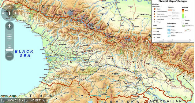
Georgia Physical Map
Georgia Regions Map
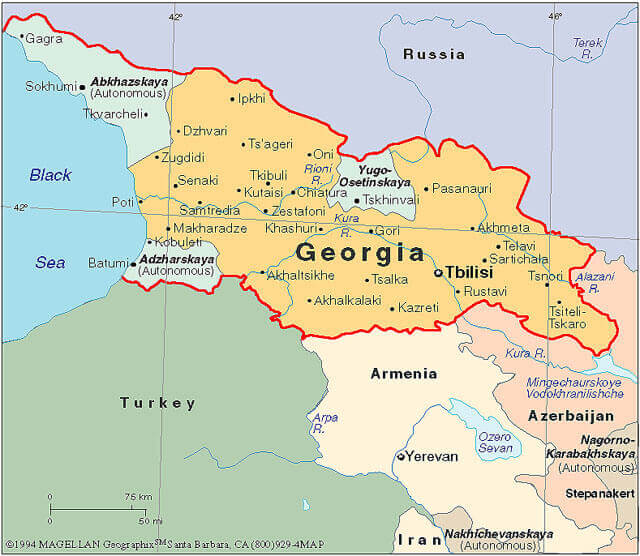 Map of Georgia’s regions, cities, and bordering countries.
This map shows the regions of Georgia, a country located at the crossroads of Eastern Europe and Western Asia. It borders Russia to the north, Turkey to the south-west, Armenia to the south and Azerbaijan to the south-east. Key regions, including Abkhazia and Adjara (both autonomous) and South Ossetia, are marked to indicate areas of special administrative status or historical significance. Major cities such as Tbilisi, the capital, and Batumi, Kutaisi and Rustavi are shown. The Black Sea coast to the west provides Georgia with strategic access to maritime trade. This regional layout shows Georgia’s cultural and geographical diversity, shaped by the influences of its neighbours and its unique position in the Caucasus.
Maps Georgia
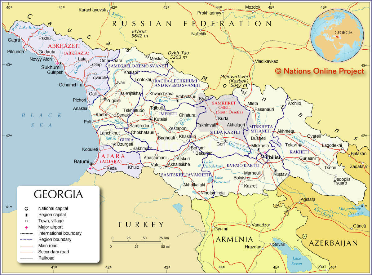 Map of Georgia showing regions, cities, borders, and major roads.
This map illustrates the geographical and administrative divisions within Georgia, highlighting key regions such as Abkhazia, Adjara and Samtskhe-Javakheti. Georgia’s international borders are shown, with Russia to the north, Turkey to the south-west, Armenia to the south and Azerbaijan to the south-east. Major cities, including the capital Tbilisi, Kutaisi and Batumi on the Black Sea coast, are shown alongside regional capitals and other towns. The map also shows key natural features, such as the Caucasus Mountains with notable peaks such as Elbrus and Kazbek, and bodies of water, including Lake Paravani. Transportation routes, including major roads and railways, are visible, illustrating Georgia’s connectivity both internally and with neighbouring countries.
Georgia Earth Map
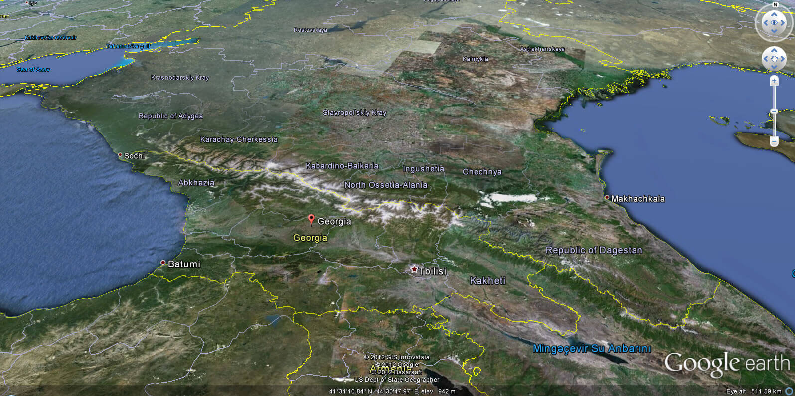
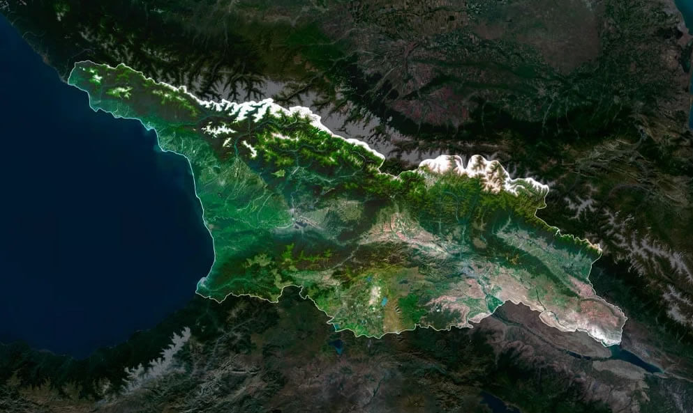
Georgia satellite map
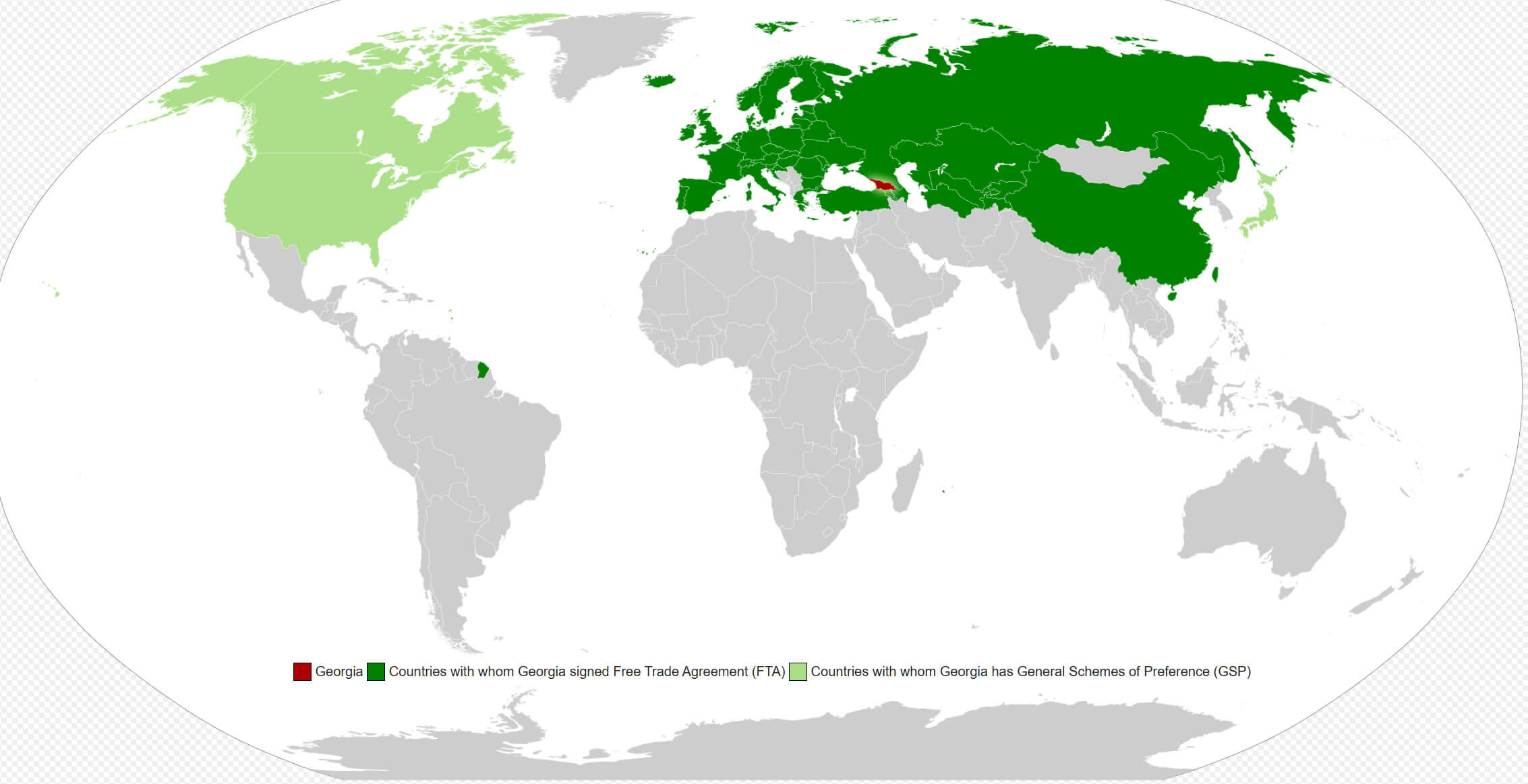
Georgia free trade agreement map
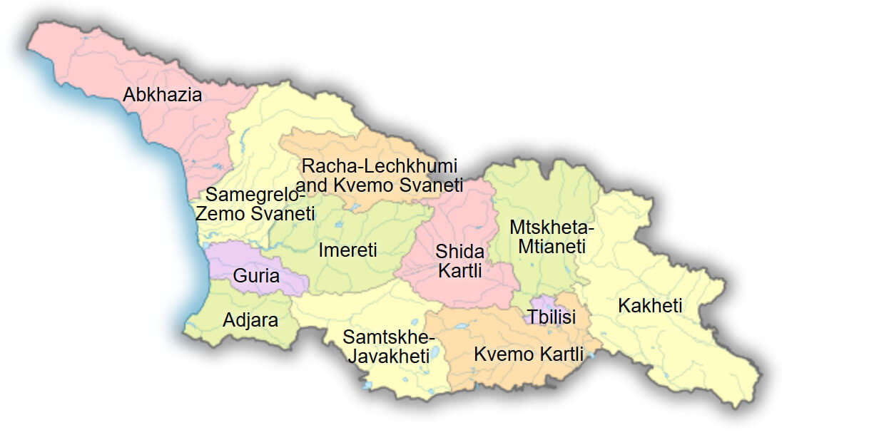
Georgia administrative map
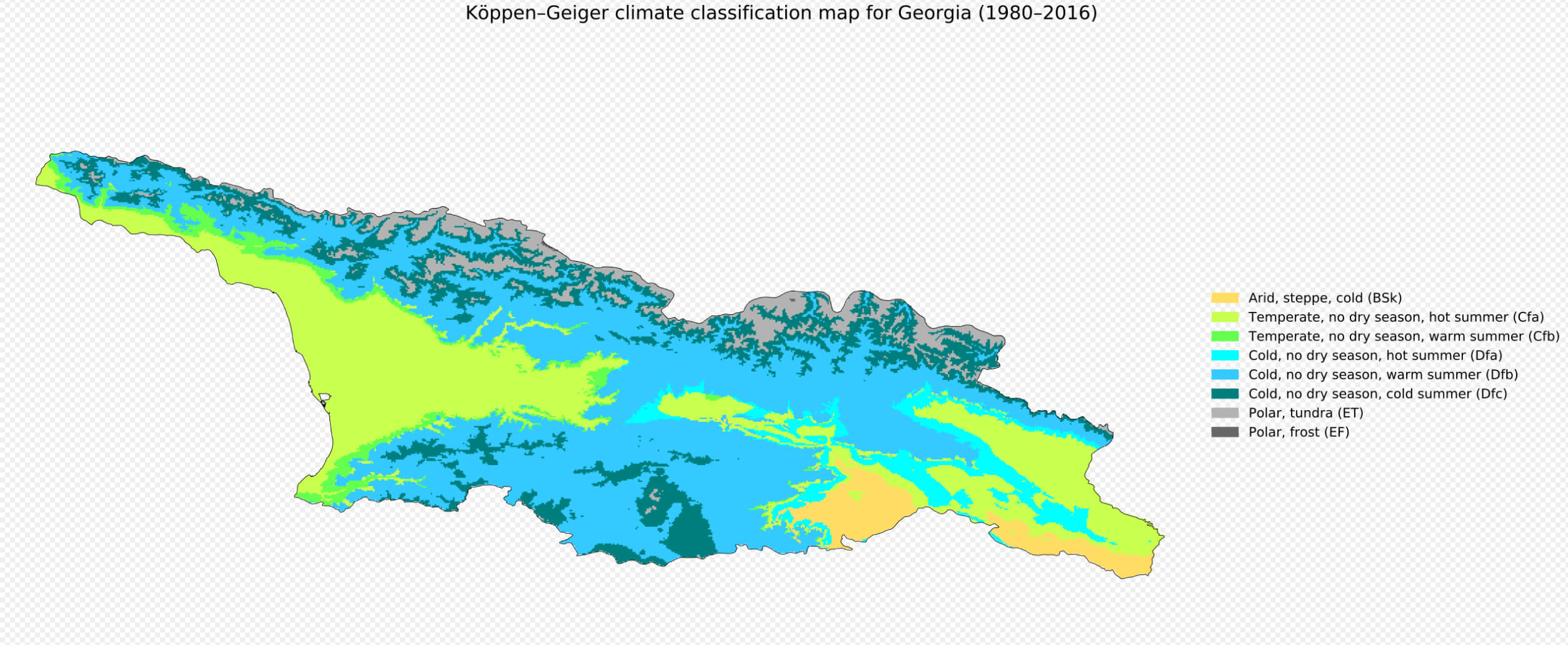
Georgia climate map
Where is Georgia on the Europe Map?
Show Google map, satellite map, where is the country located.
Get directions by driving, walking, bicycling, public transportation and travel with street view.
Feel free to explore these pages as well:
- Russia Map ↗️
- Turkey Map ↗️
- Ukraine Map ↗️
- Iran Map ↗️
- Largest Cities of Russia: From Moscow to Rostov ↗️
- Top 10 Must-Visit Places in Moscow ↗️
- Abkhazia Map ↗️
- Nagorno Karabakh ↗️
- Azerbaijan Map ↗️
- South Ossetia Map ↗️
