Explore the geography, history, and resources of Azerbaijan with this diverse collection of detailed maps, providing a comprehensive overview of the country’s unique landscape and strategic importance.
Brief information about Azerbaijan
Azerbaijan, often called the “Land of Fire,” is a country where East meets West, blending rich history with modern vibrancy. Nestled between the Caspian Sea and the Caucasus Mountains, it shares borders with Russia, Georgia, Armenia, and Iran, making it a fascinating crossroads of cultures. Known for its natural resources, Azerbaijan is one of the world’s oldest oil-producing nations, and Baku, its capital, is a vibrant city filled with stunning architecture that mixes Islamic, Soviet, and contemporary styles.
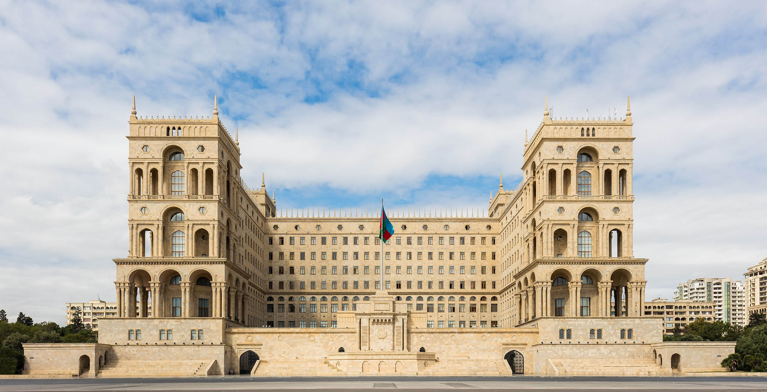
Beyond the capital, Azerbaijan offers diverse landscapes and ancient wonders, from the medieval rock carvings of Gobustan to the lush forests and alpine beauty of Sheki. With a history that includes Silk Road trade routes and Persian Empire influences, Azerbaijan’s cultural heritage is as complex as it is captivating. The people are known for their hospitality, and visitors are often charmed by the warm Azeri culture, delicious cuisine, and dynamic folk music.
Where is located Azerbaijan on the World Map
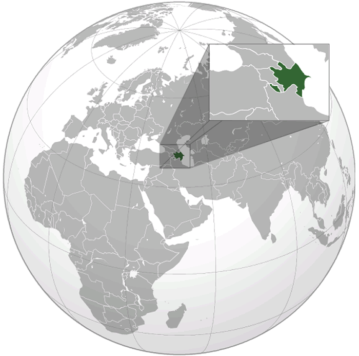
Azerbaijan is located in the South Caucasus region of Eurasia, where Eastern Europe meets Western Asia. Sitting on the western shores of the Caspian Sea, it shares borders with Russia to the north, Georgia to the northwest, Armenia to the west, and Iran to the south. This strategic location has historically made it a vital crossroads of various cultures, empires, and trade routes.
The country’s capital, Baku, lies along the Caspian coast and is the largest city in the Caucasus region. Positioned just south of the Greater Caucasus Mountains, Azerbaijan’s landscape shifts dramatically from lush forests and rolling hills to dry plains and stunning mountain ranges. This geographical diversity has contributed to the country’s unique blend of natural beauty and rich resources, particularly in oil and gas.
On a world map, Azerbaijan appears as a compact area bridging Europe and Asia. Its strategic position between the Black Sea and the Caspian Sea has made it a cultural and economic link between East and West for centuries. For travelers, this means Azerbaijan is just a few hours away by plane from major European, Middle Eastern, and Central Asian cities, making it both accessible and intriguing for international visitors.
Here are some statistical information about Azerbaijan:
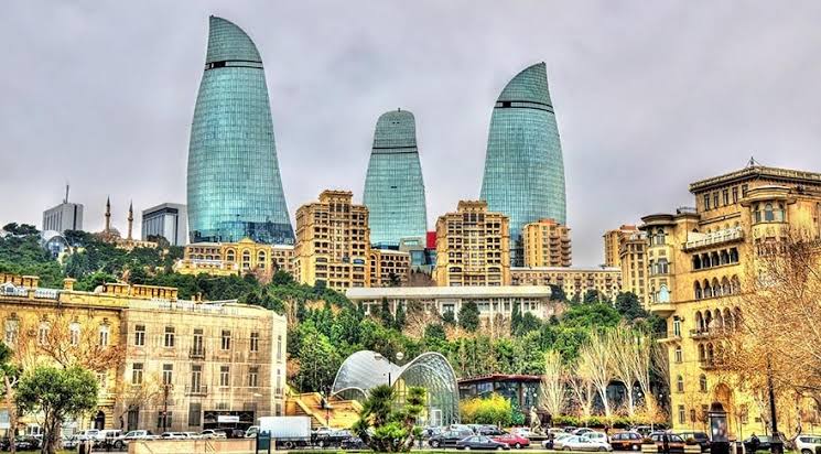
Map of Azerbaijan
Road Map of Azerbaijan
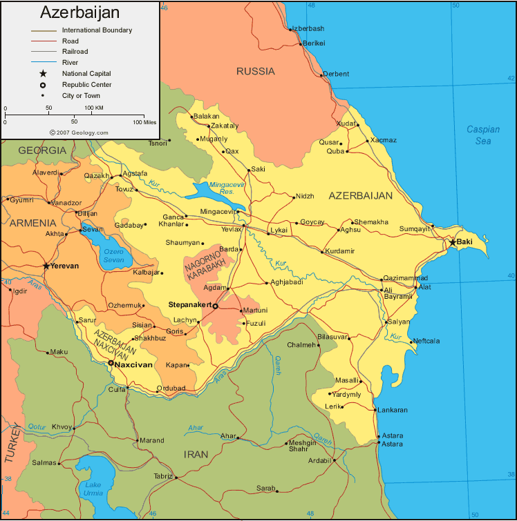
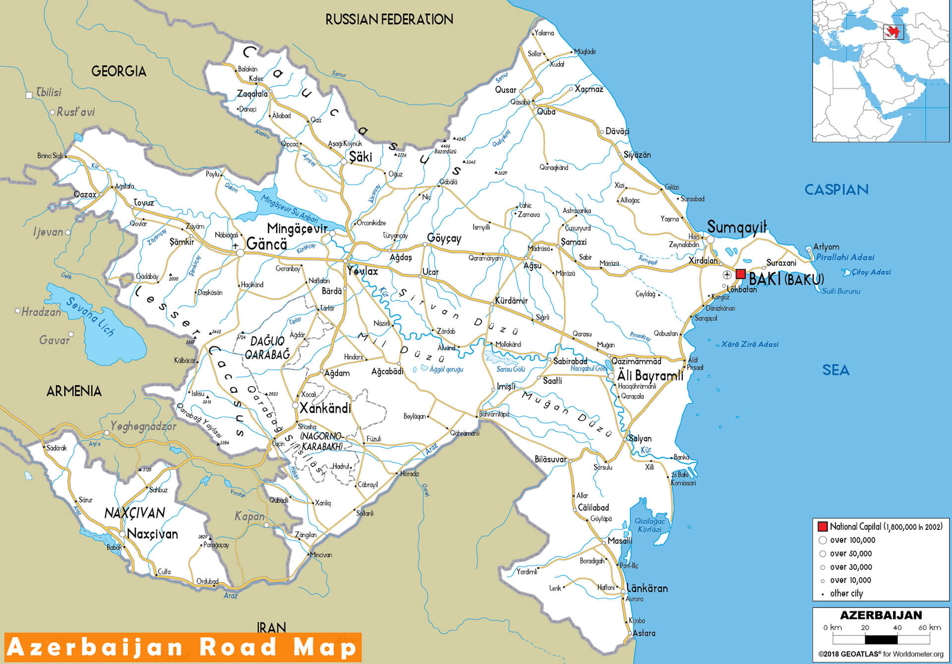 Azerbaijan road map with major cities and national borders.
Tourist Map of Azerbaijan
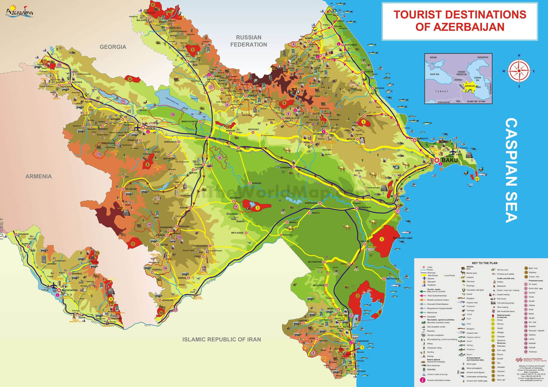
This map highlights key tourist destinations in Azerbaijan, showing popular attractions, historical sites, nature reserves, and recreational areas throughout the country. Major cities, including the capital Baku, are marked alongside main highways and roads, making it easy for travelers to plan their routes. The map offers a comprehensive view of Azerbaijan’s diverse landscapes, from the Caspian Sea coast to mountainous regions and lush forests.
Azerbaijan Caspian Sea Oil Gas
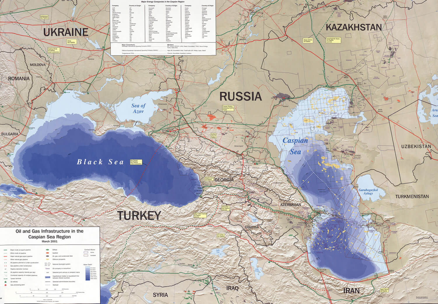
This map illustrates the oil and gas infrastructure and key energy companies operating in the Caspian Sea region, highlighting the strategic significance of surrounding countries like Azerbaijan, Kazakhstan, and Russia.
Azerbaijan Cia Map 1995
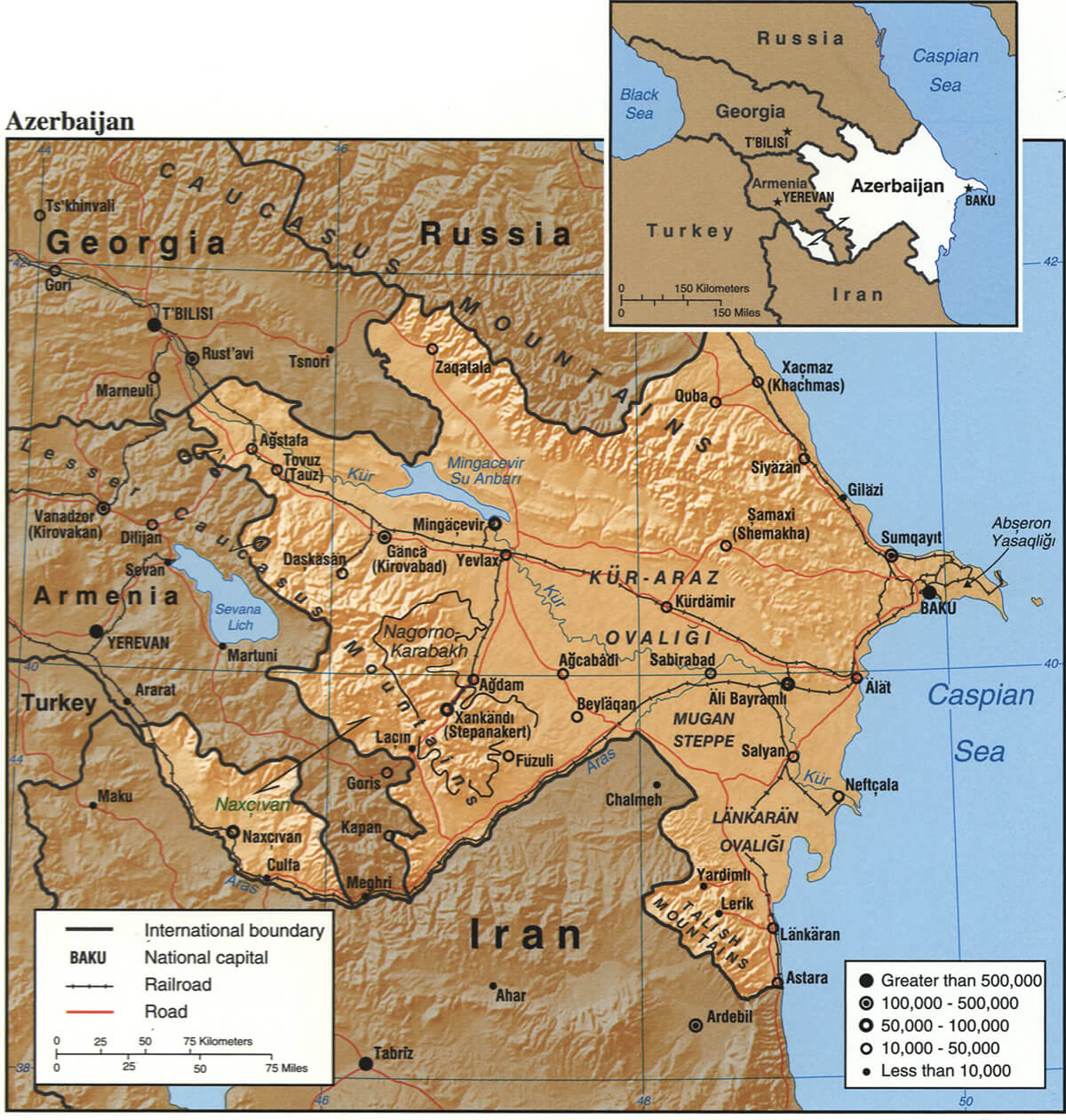
This map shows Azerbaijan’s geographic layout, bordered by Russia to the north, Georgia to the northwest, Armenia to the west, and Iran to the south. It highlights key cities, infrastructure like roads and railways, and important regions, including the capital Baku on the Caspian Sea coast. The inset map provides a broader context of Azerbaijan’s location relative to surrounding countries in the Caucasus region.
Azerbaijan Republic Map
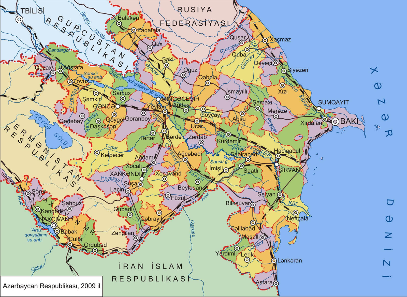
This map shows Azerbaijan’s administrative regions, capital city Baku, and its borders with neighboring countries: Georgia, Russia, Armenia, and Iran. Major roads and railways are also detailed, highlighting the country’s infrastructure.
Azerbaijan Ethnic Groups Map
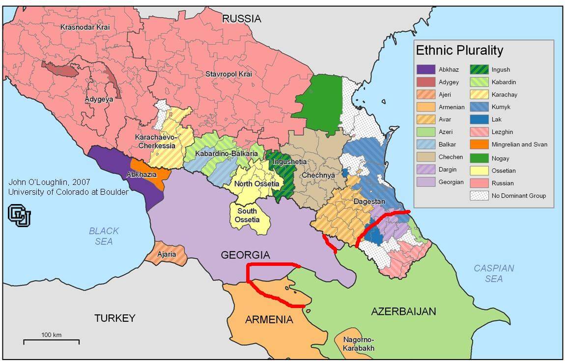
This map illustrates the ethnic plurality across the Caucasus region, highlighting the diverse ethnic groups residing in areas of Russia, Georgia, Azerbaijan, and Armenia. Each color represents a distinct ethnic group, with regions showing where groups like the Azeri, Avar, Lezghin, Chechen, and others are predominantly located. In Azerbaijan, the Azeri ethnic group is the majority, while the map also shows neighboring regions with mixed ethnic populations, reflecting the complex cultural and ethnic mosaic in the Caucasus.
Detailed Road and Border Map of Azerbaijan
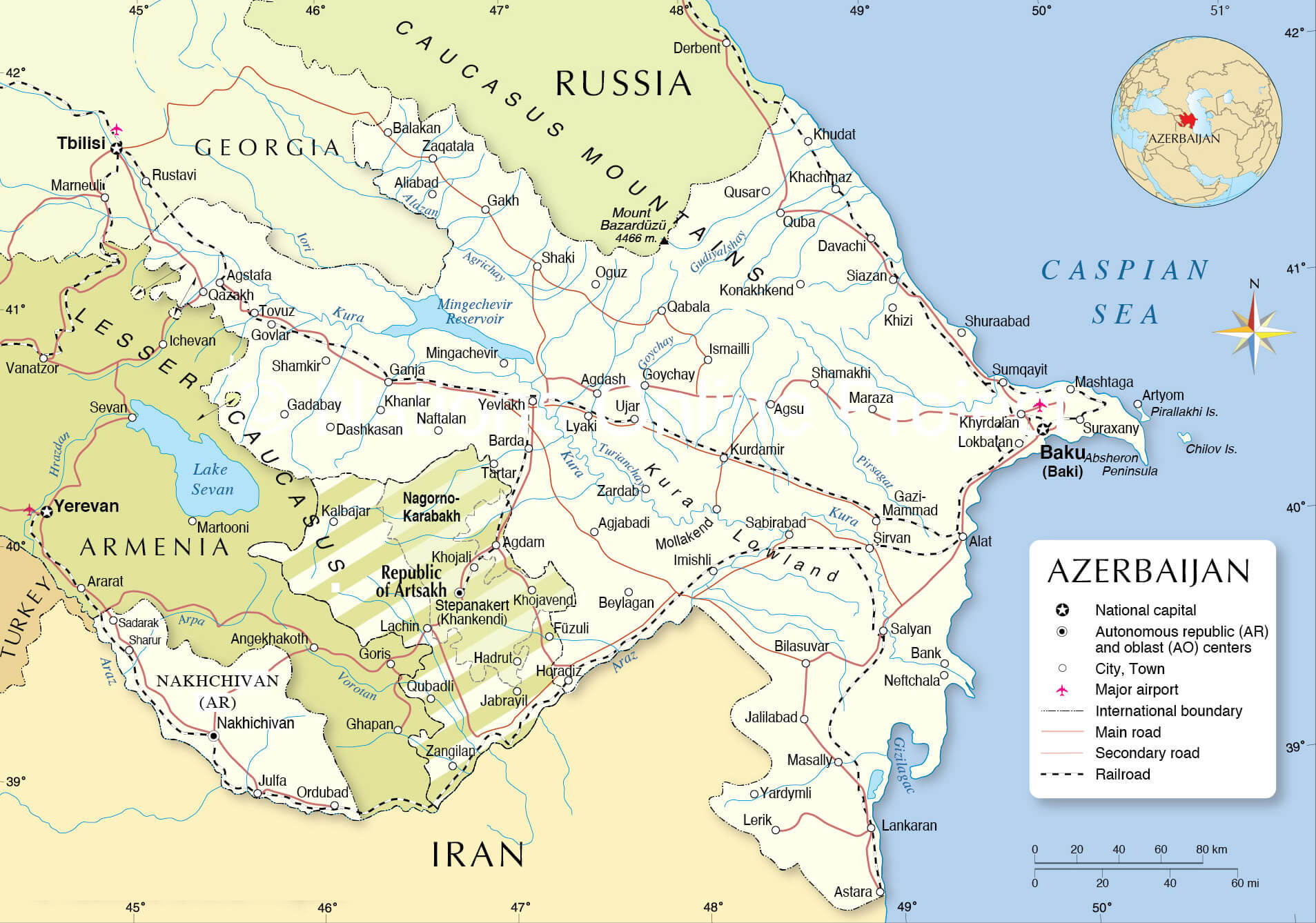 Azerbaijan map with cities, roads, borders, and natural features
Map of Azerbaijan’s Provinces and Autonomous Regions
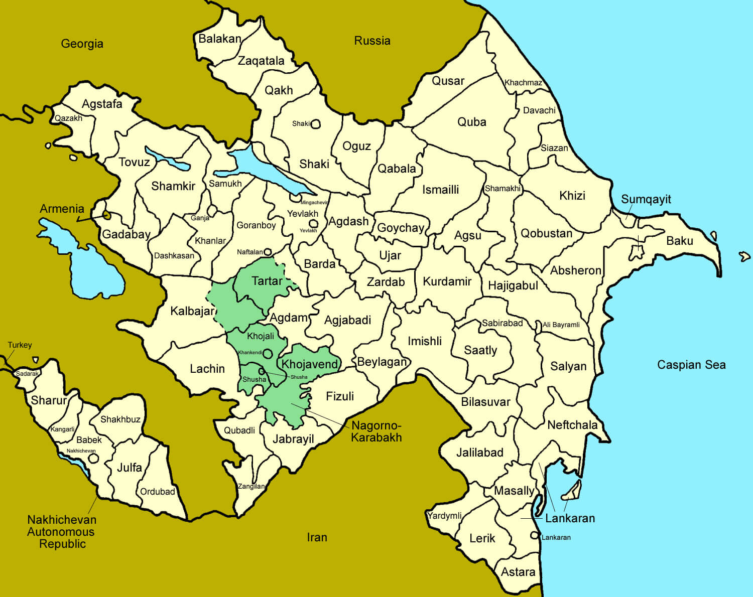 Azerbaijan map showing provinces and autonomous regions.
Map of Azerbaijan’s Largest Cities and Key Locations
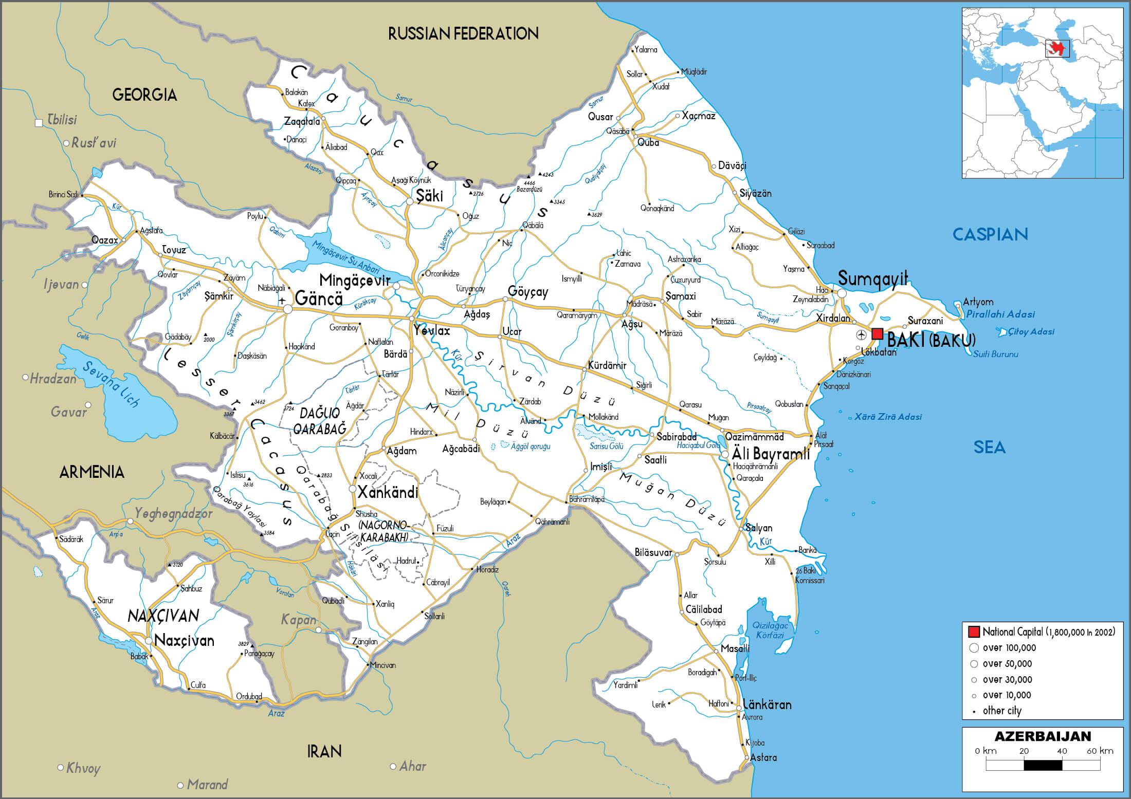 Azerbaijan map showing largest cities, roads, and key locations.
Map of Major Cities in Azerbaijan
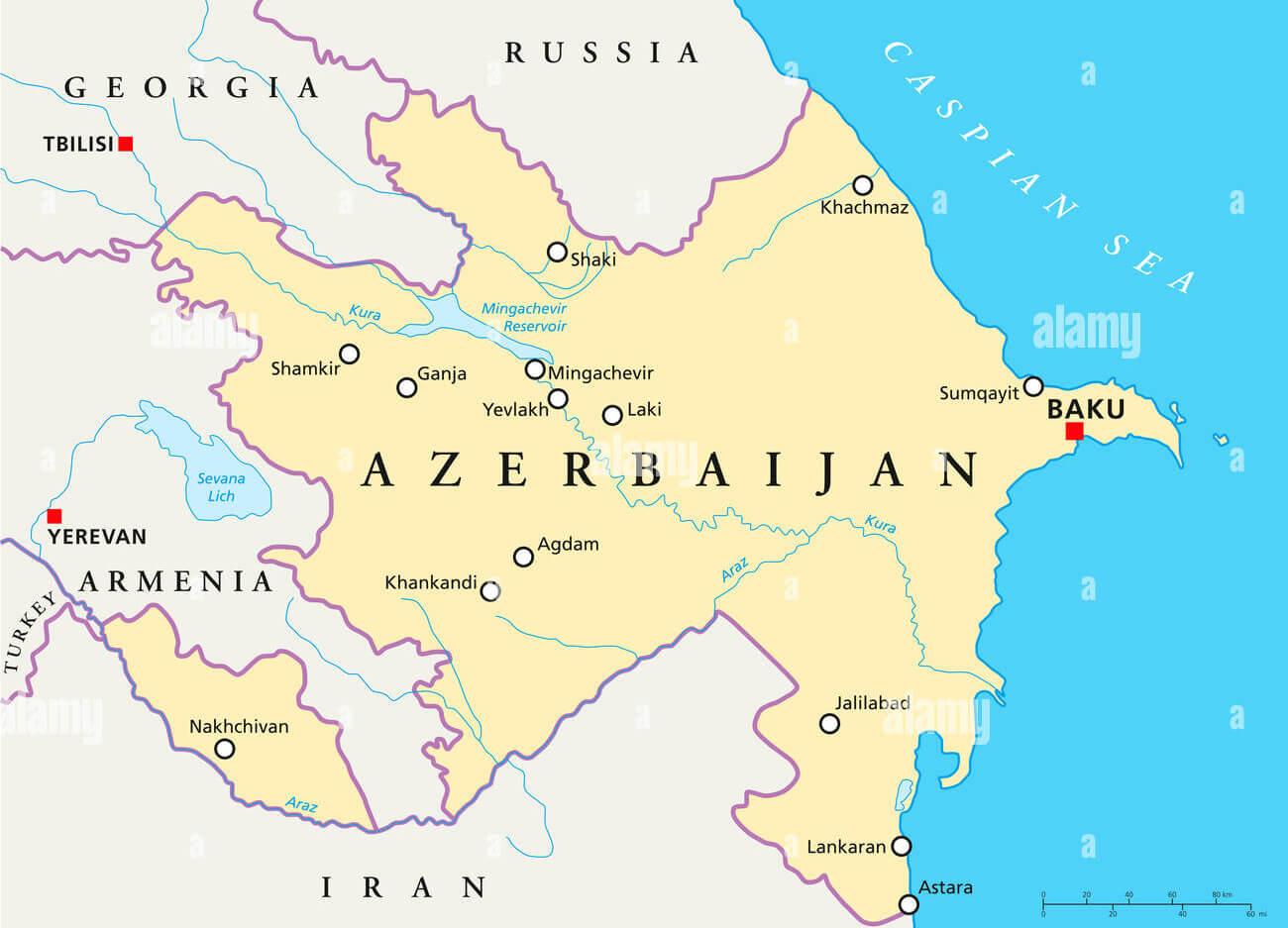 Map showing major cities in Azerbaijan and surrounding borders
Azerbaijan Map with International Borders and Caspian Sea
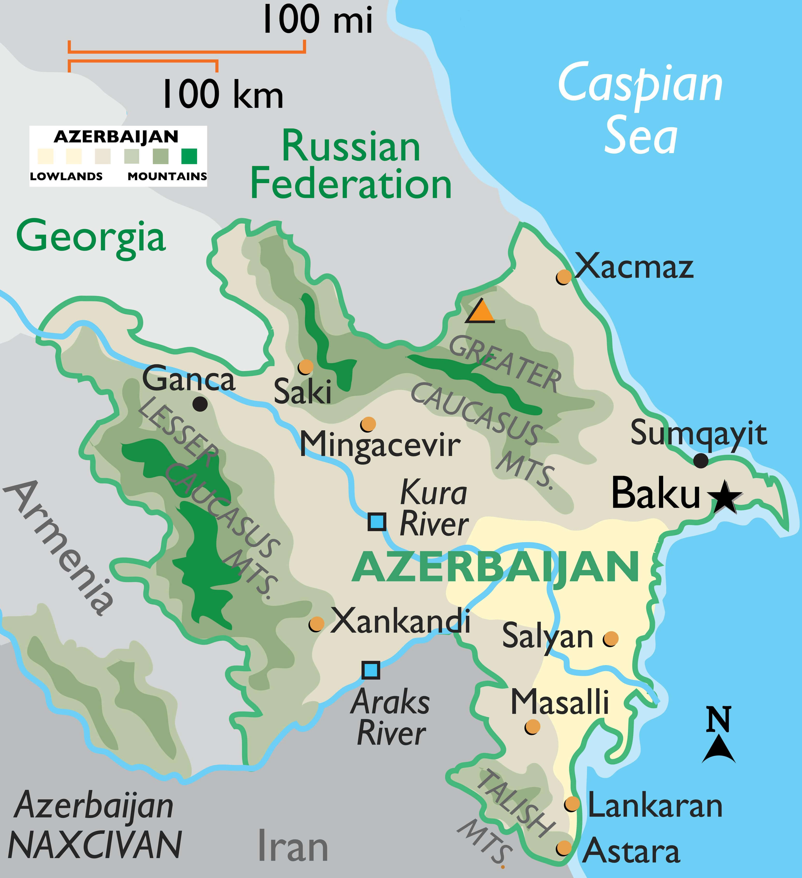 Azerbaijan map showing borders, major cities, and the Caspian Sea
Map of Azerbaijan’s Regions and Administrative Divisions
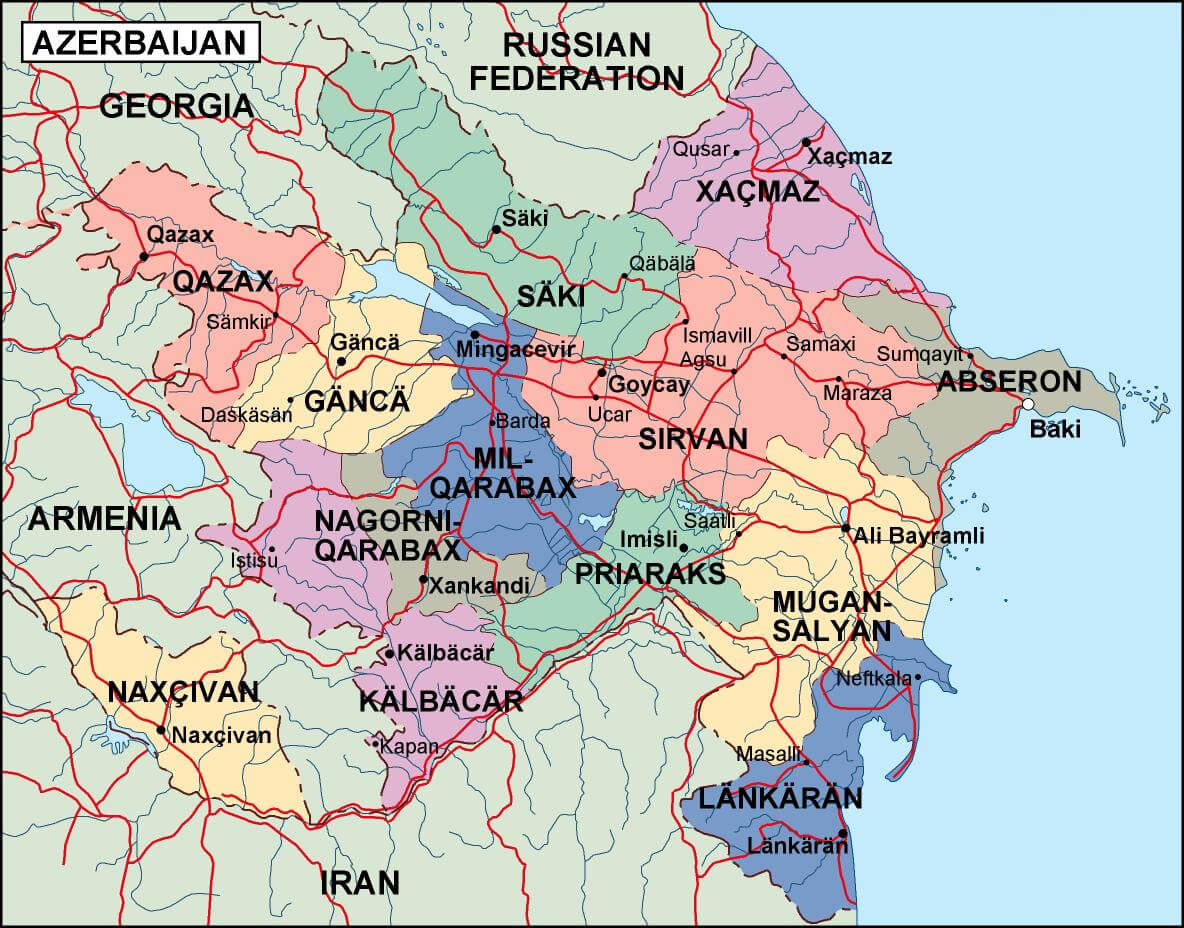 Azerbaijan regions map with administrative boundaries and cities.
Map of Azerbaijan Highlighting Cities, Including Baku
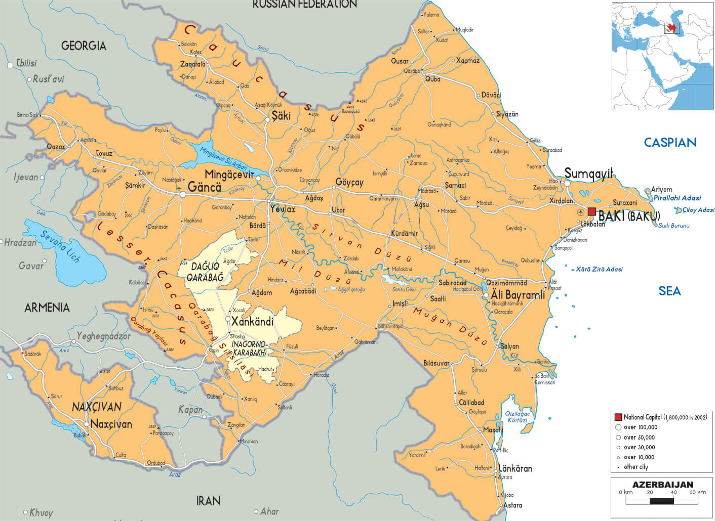 Azerbaijan map with major cities, including Baku and regional roads.
Physical Map of Azerbaijan’s Terrain and Elevation
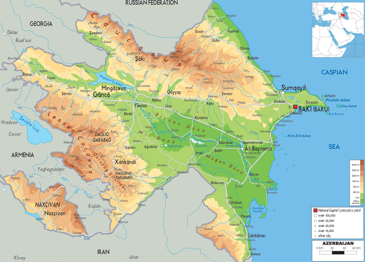 Azerbaijan physical map showing mountains, valleys, and plains.
Political Map of the South Caucasus (1795–1801)
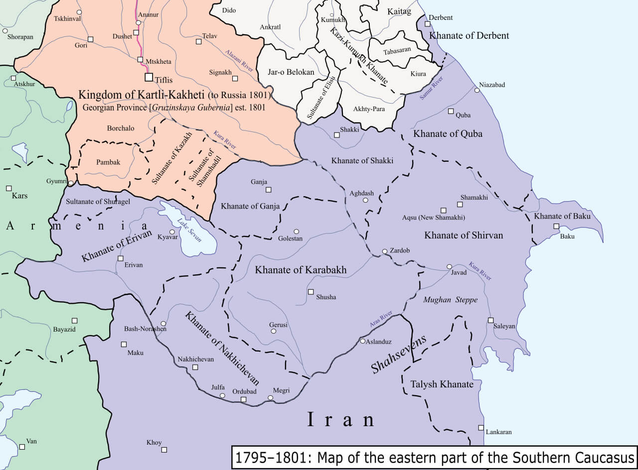 South Caucasus political map (1795–1801) showing khanates and kingdoms.
Map of the Second Nagorno-Karabakh Conflict Region
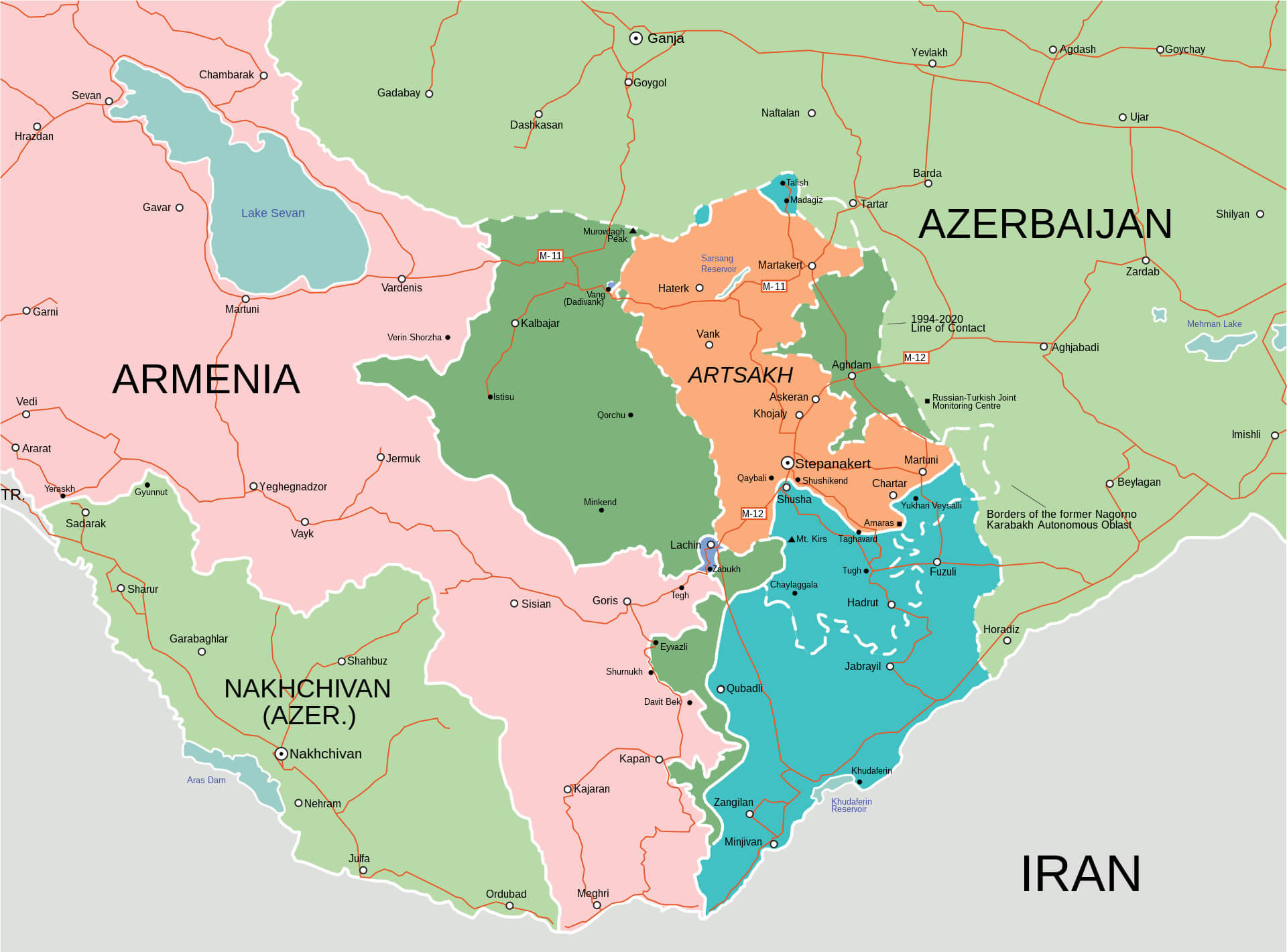 Second Nagorno-Karabakh conflict map with Armenia, Azerbaijan, and Artsakh.
Map of Nagorno-Karabakh Conflict Zones
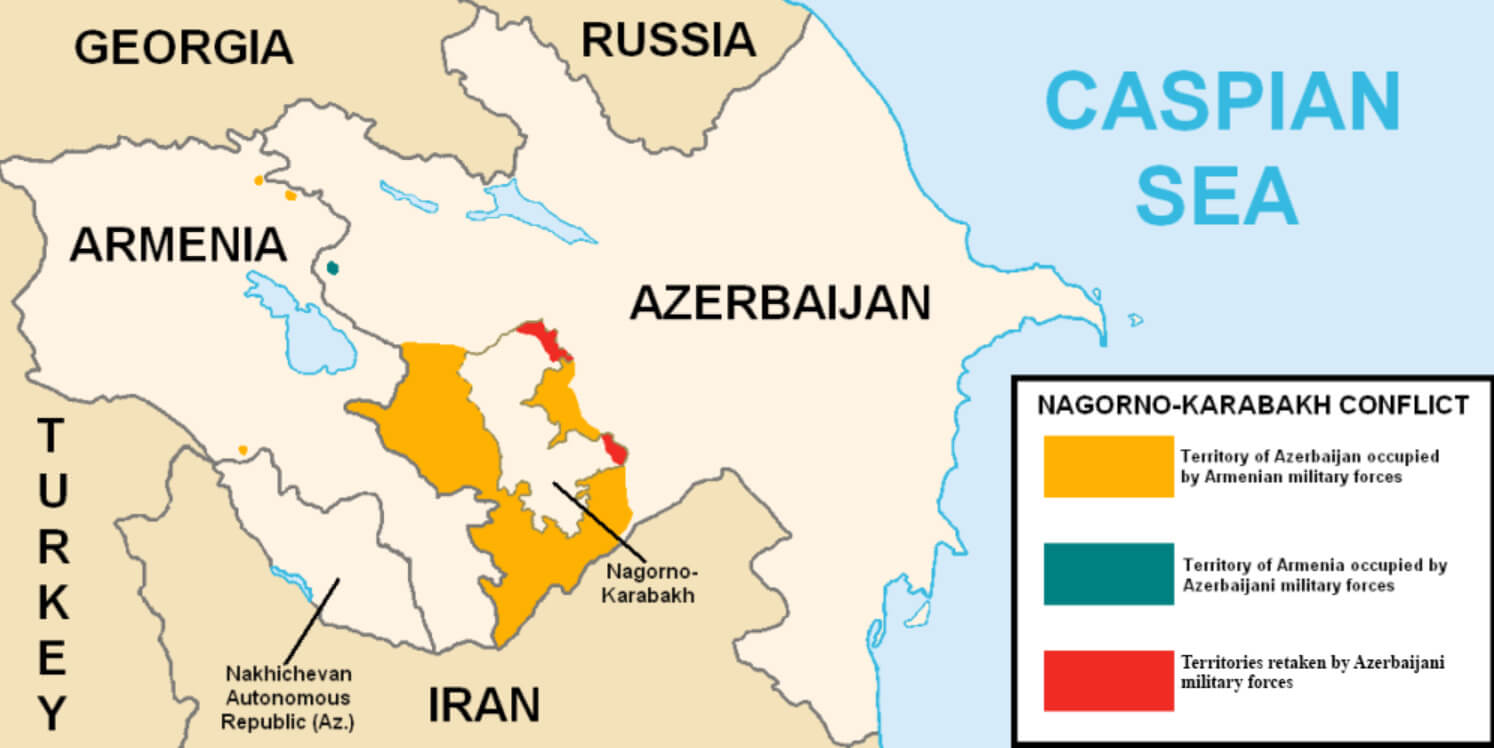 Nagorno-Karabakh conflict map showing occupied territories
Climate Zones of Azerbaijan (Köppen-Geiger Classification)
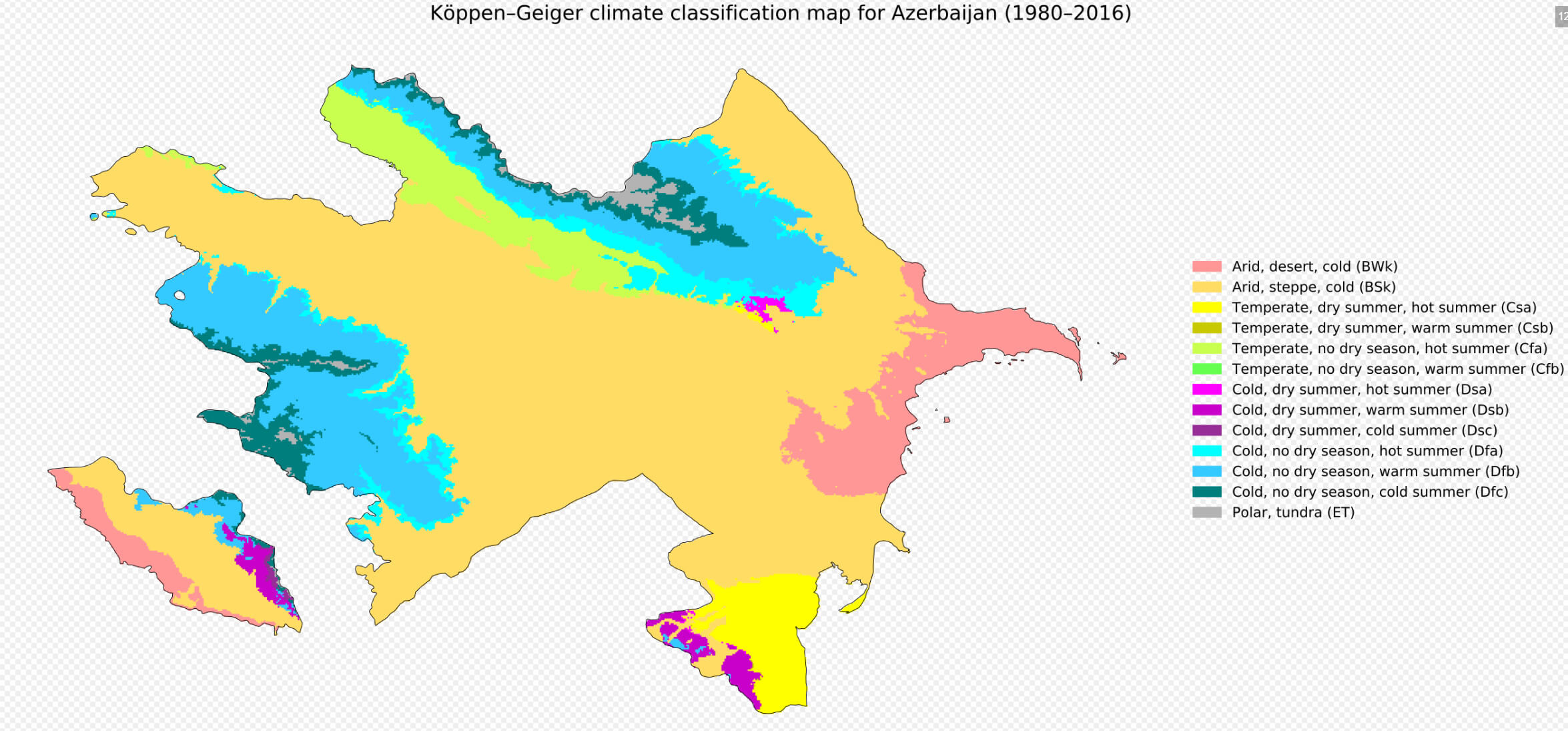 Azerbaijan climate map showing Köppen-Geiger classification zones.
Map of the 2020 Nagorno-Karabakh War Territory Changes
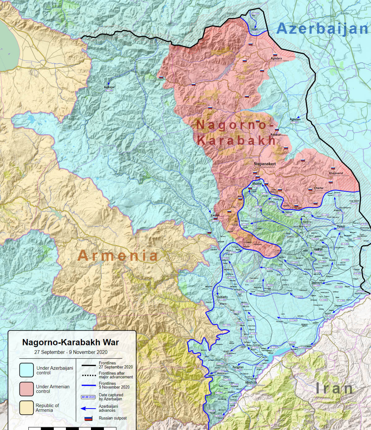 2020 Nagorno-Karabakh war map showing control zones and territorial shifts.
South Caucasus Pipeline Network in Azerbaijan and Neighboring Regions
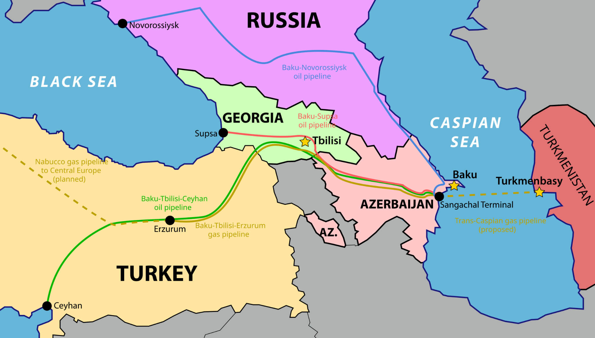 South Caucasus map showing oil and gas pipelines in Azerbaijan.
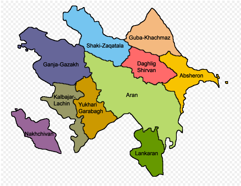
Azerbaijan Economic Regions Map
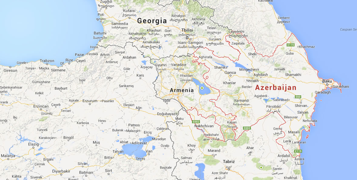
Azerbaijan Google Map
Azerbaijan Location Map
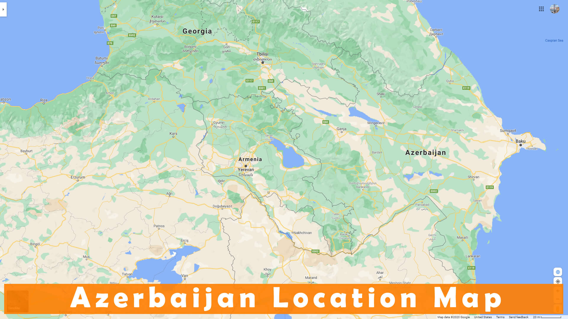
Where is Azerbaijan on the Europe Map?
Show Google interactive map, satellite map, where is the country located.
Get directions by driving, walking, bicycling, public transportation and travel with street view.
Feel free to explore these pages as well:
- Nagorno Karabakh ↗️
- Russia Map ↗️
- Turkey Map ↗️
- Iran Map ↗️
- South Ossetia Map ↗️
- Map of Russia ↗️
- About Russia ↗️
- Largest Cities of Russia: From Moscow to Rostov ↗️
- Top 10 Must-Visit Places in Moscow ↗️
- Abkhazia Map ↗️
- Europe Map ↗️
- Map of Europe ↗️
- Asia Map ↗️
- Map of Asia ↗️
