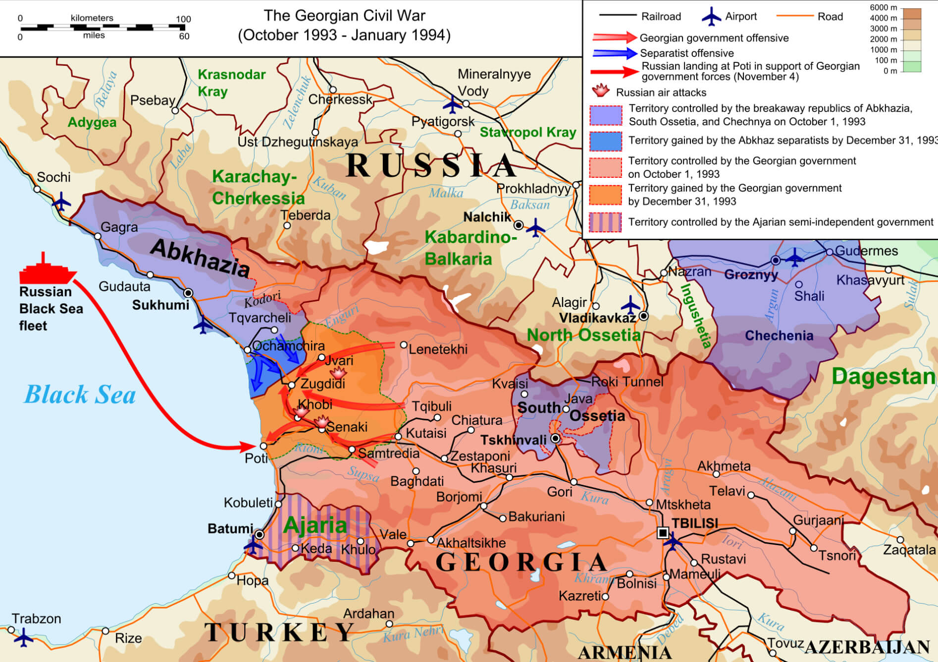
Explore South Ossetia with detailed maps, including its location in Europe and the world. Discover political, physical and terrain maps, major cities and its role in the 1993 Georgian Civil War. Find out about its geographical position within the Caucasus region and its links with Georgia.
Administrative and Political Map of South Ossetia and Georgia
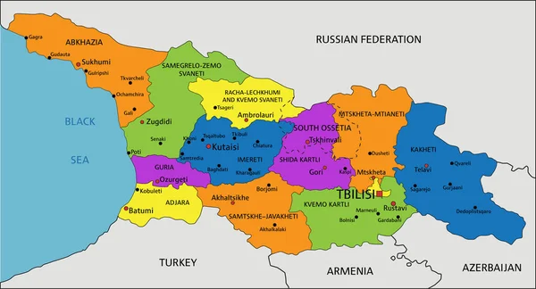
 Georgia map showing South Ossetia, Abkhazia, and key administrative areas
This administrative map of Georgia displays the regions of South Ossetia and Abkhazia, both marked in orange, indicating areas with complex political status. Key locations such as Tbilisi, the capital, and other main roads, towns, and boundaries are also labeled, giving an overview of the country’s administrative divisions.
Brief information about South Ossetia
South Ossetia is a small, mountainous region in the South Caucasus that lies within the internationally recognised borders of Georgia. However, it has declared independence, which is recognised by Russia and a few other countries, but remains widely disputed, with most of the world considering it to be part of Georgia. Conflicts over its status have led to tensions and armed clashes, most notably in the 1990s and in 2008.
South Ossetia’s population of around 50,000 is predominantly ethnic Ossetian, with close cultural and linguistic ties to North Ossetia in Russia. The region’s economy is limited and heavily dependent on Russian aid, and its isolation makes development difficult, with Tskhinvali as the main administrative centre.Where is located South Ossetia on the World Map
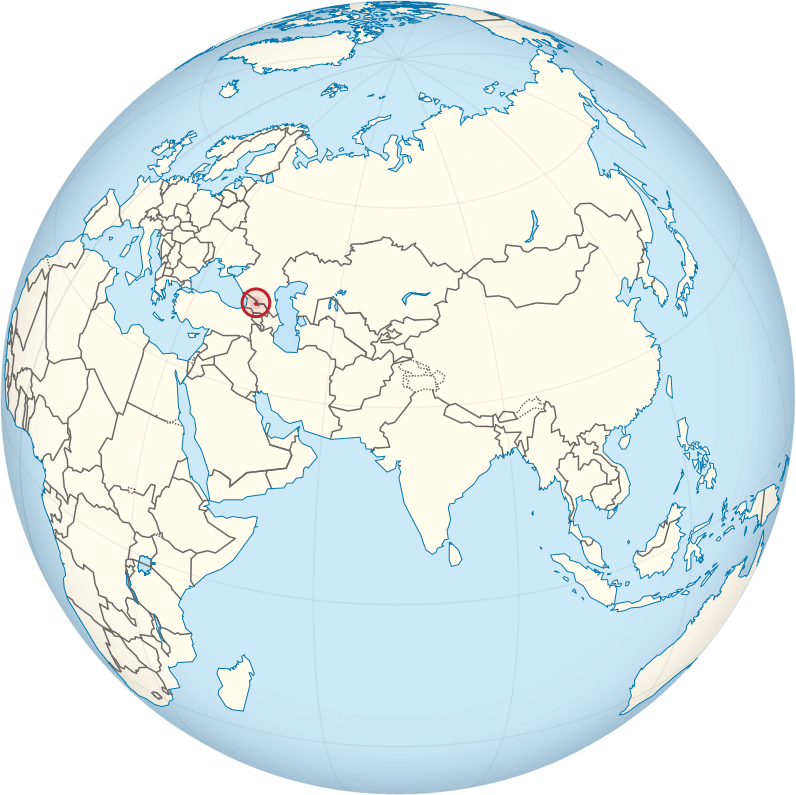 Where is located South Ossetia on the World Map
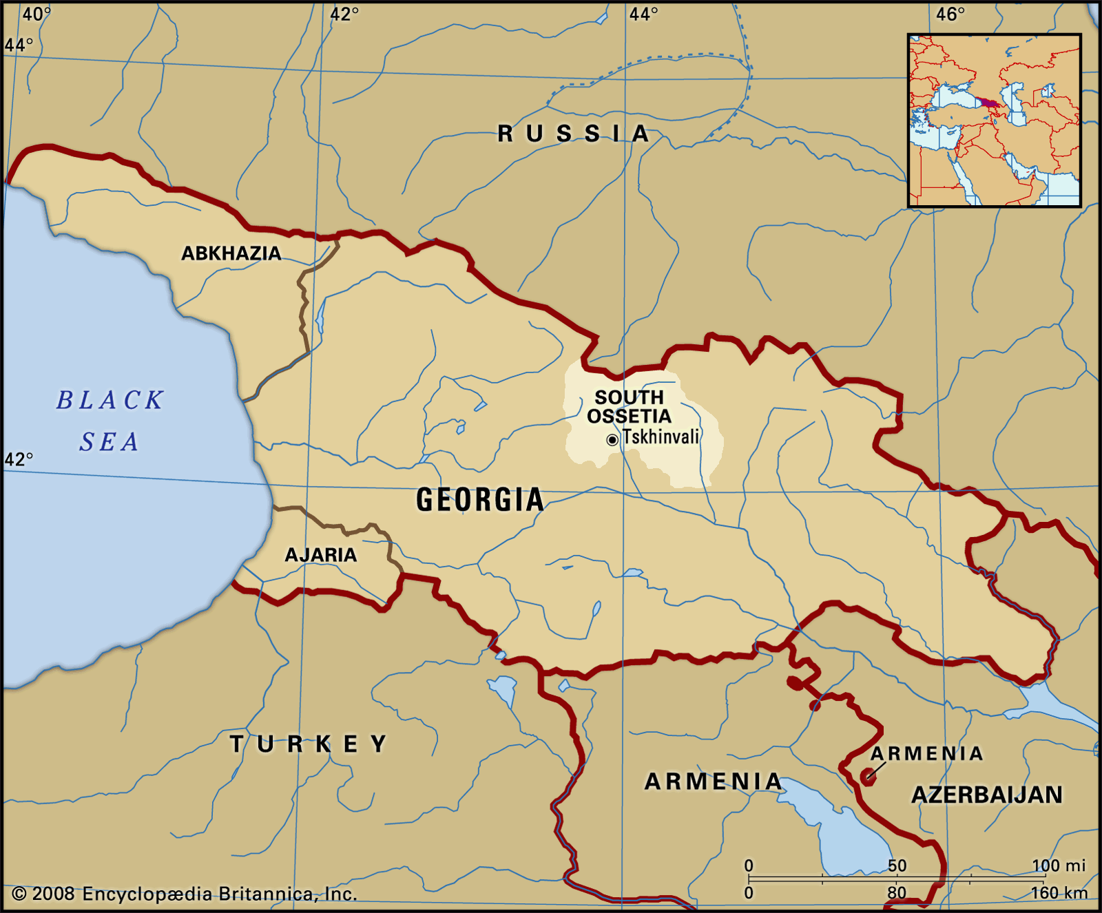
South Ossetia is located in the South Caucasus, a region that bridges Eastern Europe and Western Asia. It lies within the internationally recognised borders of Georgia, just south of Russia’s North Ossetia. This mountainous region is known for its rugged terrain, with high peaks and narrow valleys, adding to its remote and isolated character.
Geographically, South Ossetia is close to several important areas. To the north it borders the Russian Republic of North Ossetia-Alania, while the rest of its borders are shared with Georgian territory. The region’s capital, Tskhinvali, is close to the Greater Caucasus mountain range, making it a strategic but difficult area to access.On world maps, South Ossetia is a small and disputed territory that can be difficult to locate due to its lack of international recognition. Most maps show it as part of Georgia, although it functions as a self-declared independent state with limited recognition, mainly supported by Russia. Its location in the politically sensitive Caucasus region has made it a flashpoint in Georgian-Russian relations.Here are some statistical information about South Ossetia:

South Ossetia Political Map
 Official languages: Ossetian, Russian
 South Ossetia Country Georgia Map
South Ossetia
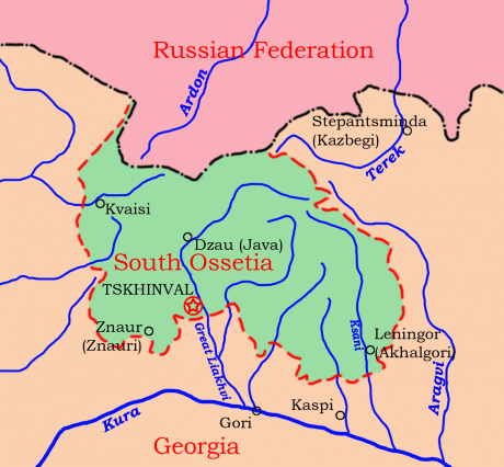
This simplified map illustrates South Ossetia, highlighting its position between Russia and Georgia. Key locations like Tskhinvali, Java, and Akhalgori are marked, along with major rivers and nearby Georgian and Russian areas. The map provides a basic overview of South Ossetia’s geographic and political boundaries.
South Ossetia Physical Map
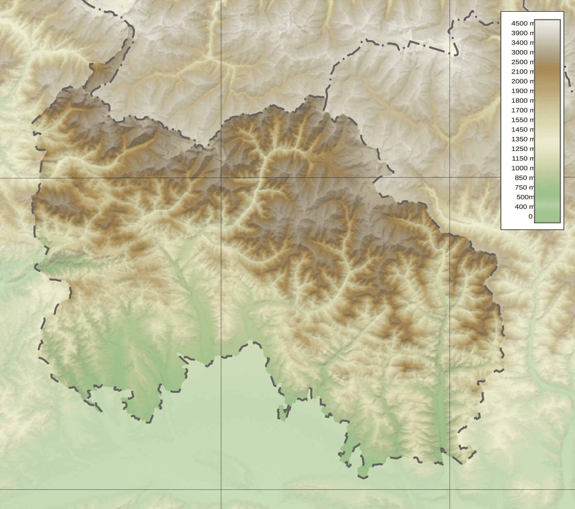
South Ossetia Before the War
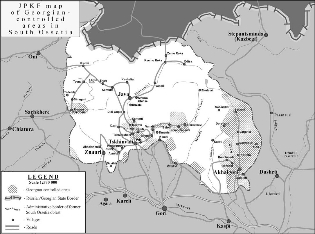 Pre-war map showing Georgian-controlled areas in South Ossetia
This map displays the Georgian-controlled areas within South Ossetia before the conflict, highlighting towns like Tskhinvali, Java, and Akhalgori. The map includes borders, villages, and roads, with a legend identifying Georgian and Russian-controlled areas, illustrating the complex territorial divisions in the region.
South Ossetia Map
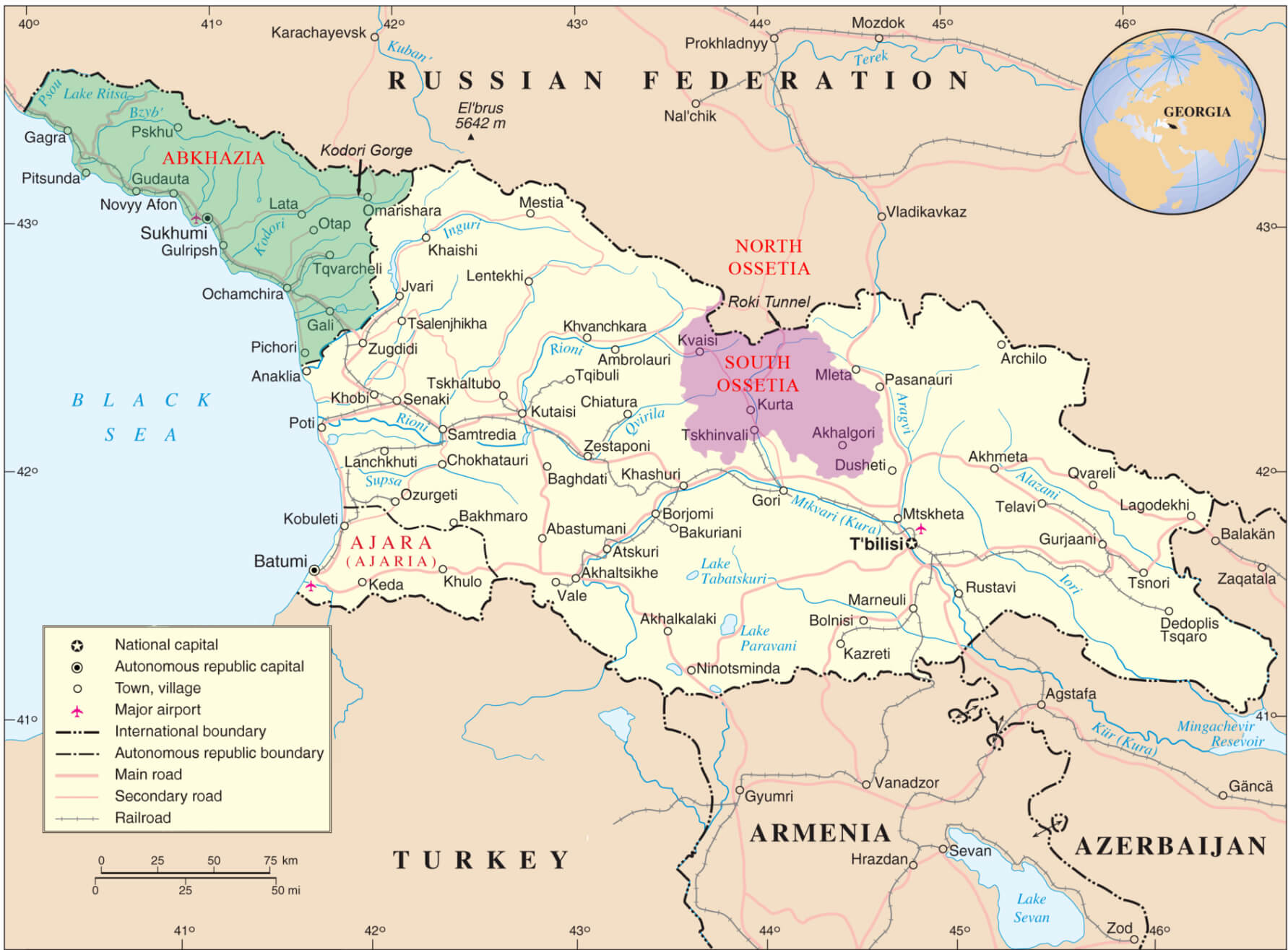
South Ossetia Topographic Map
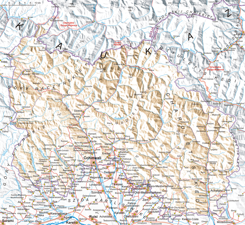
South Ossetia With Georgia Map
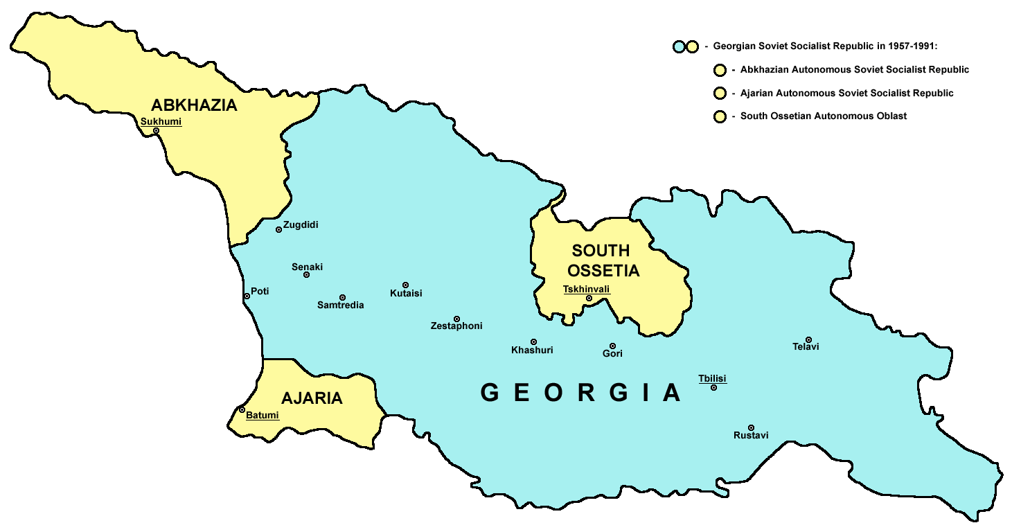 Map showing Abkhazia, South Ossetia, and Ajaria within Georgia
This map of Georgia highlights its autonomous regions, including Abkhazia, South Ossetia, and Ajaria, shown in yellow. The map indicates key cities like Tbilisi, Kutaisi, and Batumi, and depicts these areas as they existed within the Georgian Soviet Socialist Republic from 1957 to 1991.
Map of South Ossetia
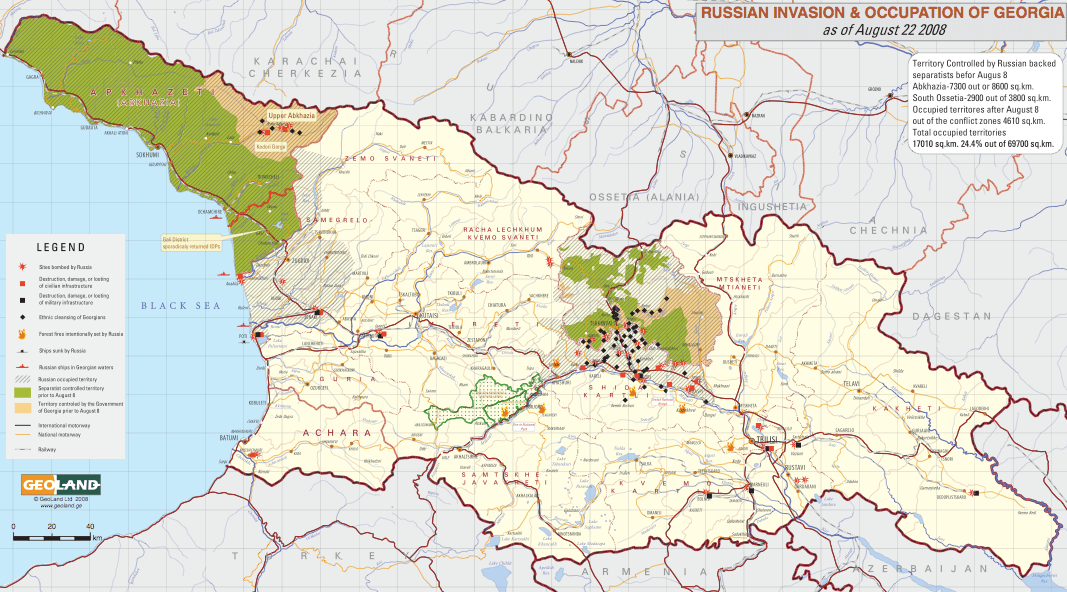 Map showing Russian occupation in Georgia, including South Ossetia
This map illustrates the Russian invasion and occupation of parts of Georgia as of August 22, 2008, highlighting the territories controlled by Russian-backed separatists, including Abkhazia and South Ossetia. The map includes various symbols indicating areas of conflict, destruction, Russian-controlled zones, and Georgian administrative regions.
Where is South Ossetia on the World

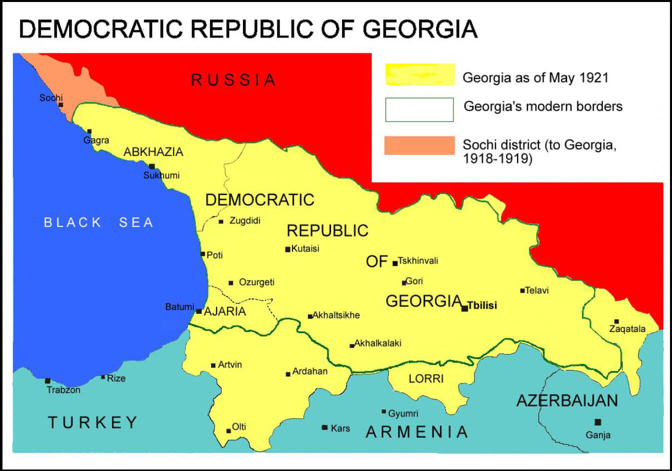
Republic of Georgia map in 1921
Georgian civil war map 1993 and South Ossetia
South Ossetia satellite map
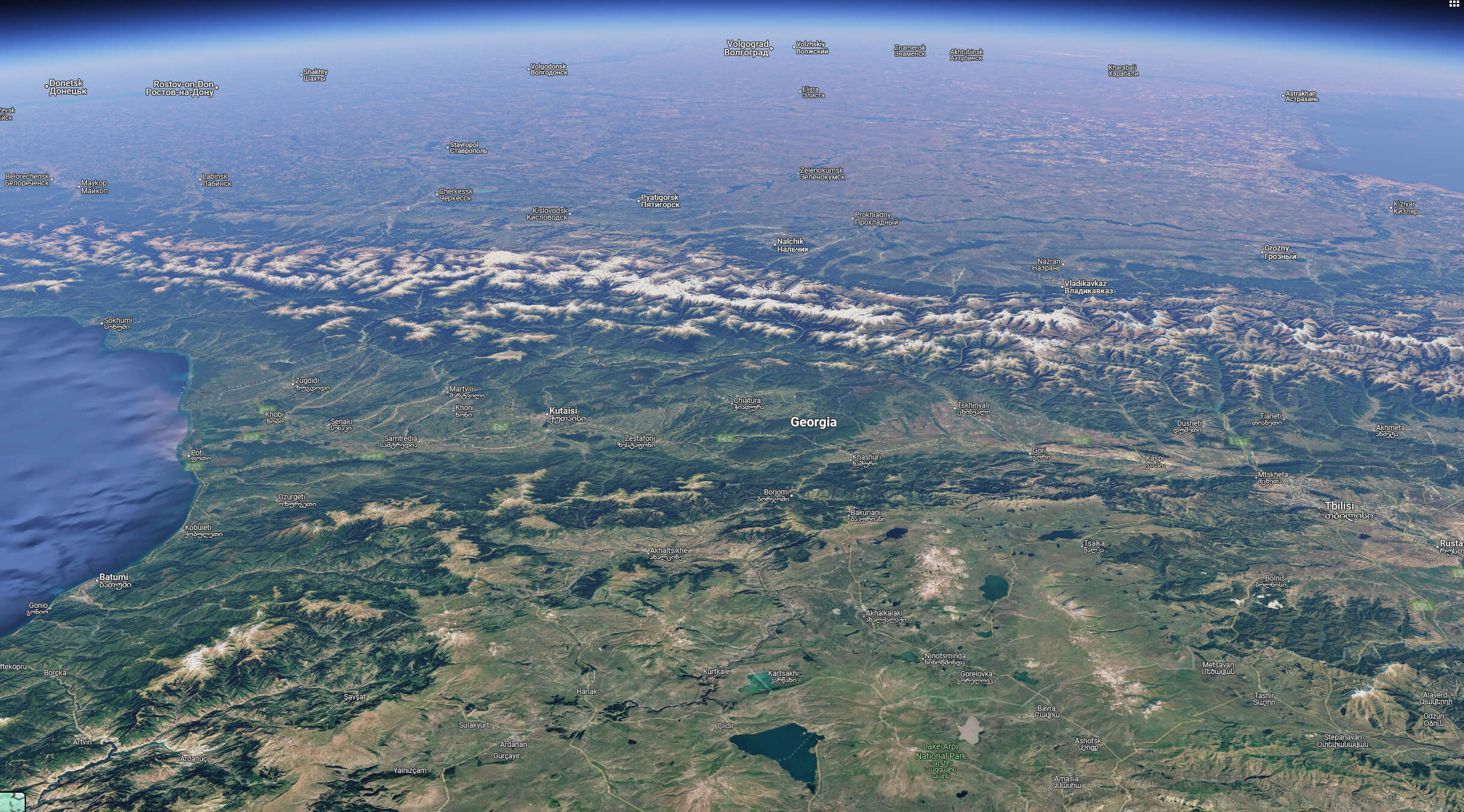
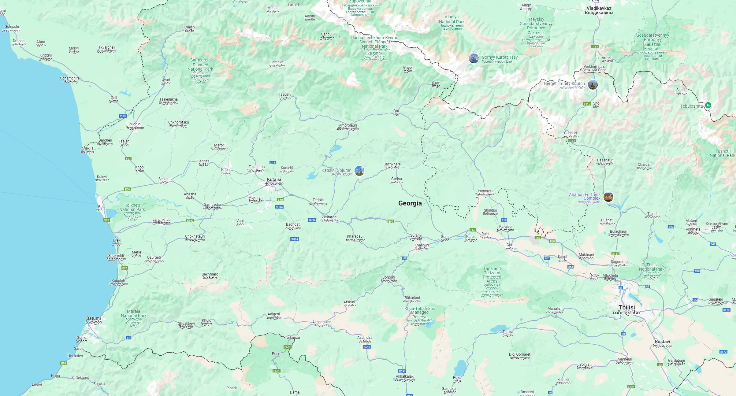
South Ossetia map with cities
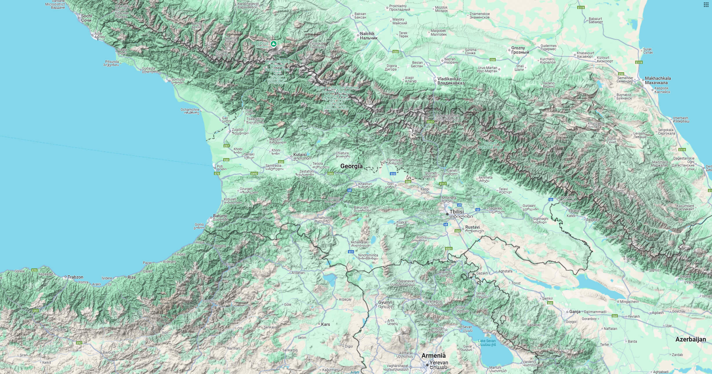
South Ossetia terrain map
Where is South Ossetia on the Europe Map?
Show Google interactive map, satellite map, where is the country located.
Get directions by driving, walking, bicycling, public transportation and travel with street view.
Feel free to explore these pages as well:
- Azerbaijan Map ↗️
- Nagorno Karabakh ↗️
- Russia Map ↗️
- Turkey Map ↗️
- Iran Map ↗️
- Map of Russia ↗️
- About Russia ↗️
- Largest Cities of Russia: From Moscow to Rostov ↗️
- Top 10 Must-Visit Places in Moscow ↗️
- Abkhazia Map ↗️
- Europe Map ↗️
- Map of Europe ↗️
- Asia Map ↗️
- Map of Asia ↗️
