Explore Transnistria with detailed maps showing its place in Europe and the world. Discover political, physical and satellite maps, major cities, regions and its geographical location between Moldova and Ukraine. Learn about the borders and neighbouring countries of this unique region.
Transnistria Regions Map
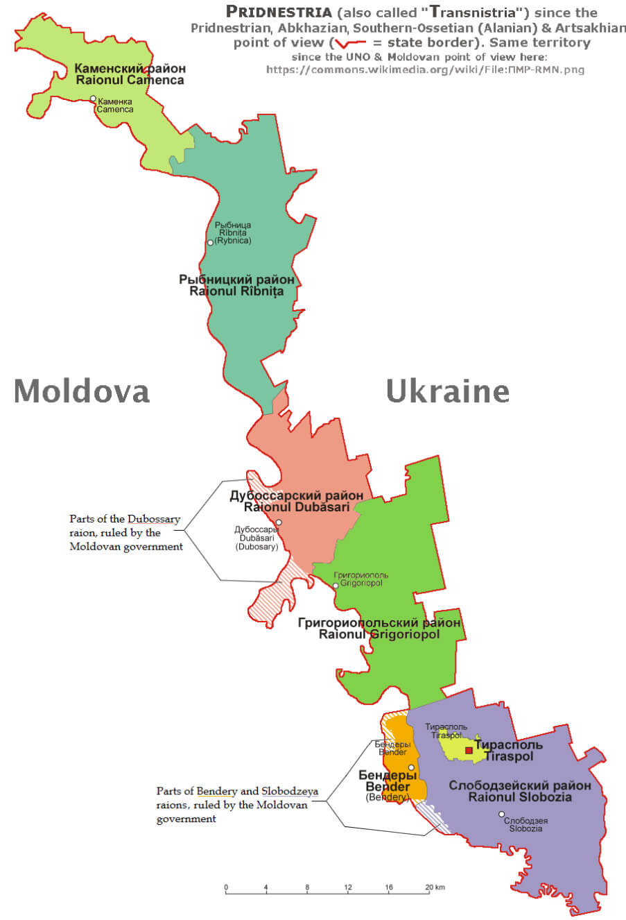
Brief information about Transnistria
Transnistria is a narrow strip of land between the Dniester River and Moldova’s eastern border with Ukraine. Although internationally recognised as part of Moldova, Transnistria declared independence in 1990, leading to a brief war with Moldova in 1992. Since then, it has operated as a self-declared republic with its own government, military and currency, although it remains unrecognised by the United Nations.
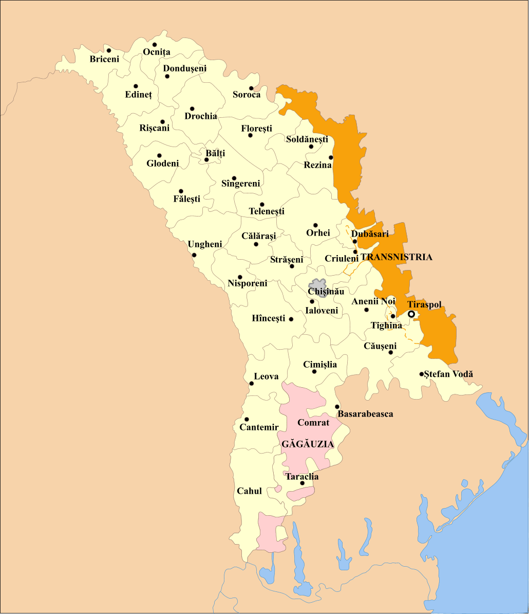
Transnistrian Region Map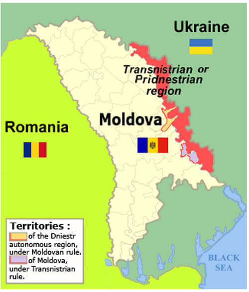 Map of Moldova showing the Transnistrian region along Ukraine border
This map shows the Transnistrian region in eastern Moldova, marked in red, along the border with Ukraine. The map highlights neighboring countries, Romania and Ukraine, and shows Moldova’s division with Transnistria. It provides a clear view of Transnistria’s narrow strip of territory in the Dniester region, which operates separately from the Moldovan government.
With a population of around 500,000, Transnistria is a unique mix of ethnic groups, mainly Russians, Ukrainians and Moldovans. The region’s close ties with Russia are evident, as Russian troops have been stationed there since the 1992 conflict. Transnistria’s status remains a contentious issue, as it exists in political limbo, dependent on Russian support but lacking official recognition from the international community..
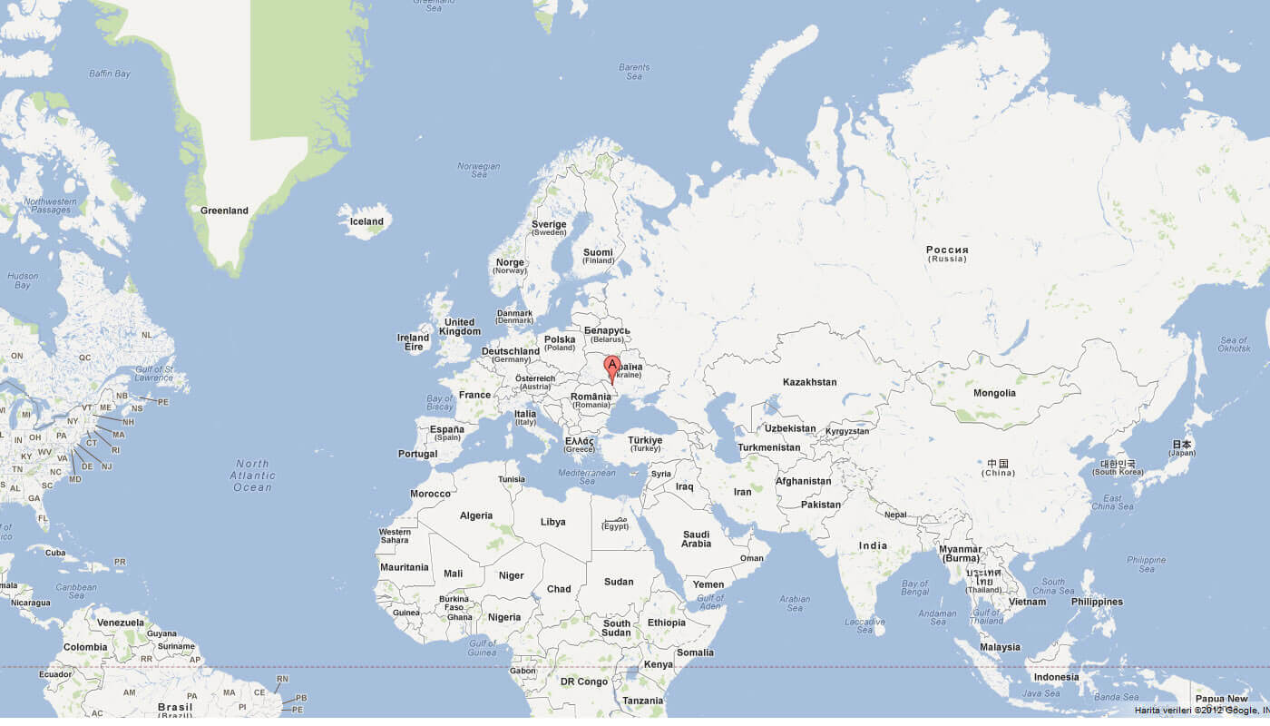
Where is located Transnistria on the World Map
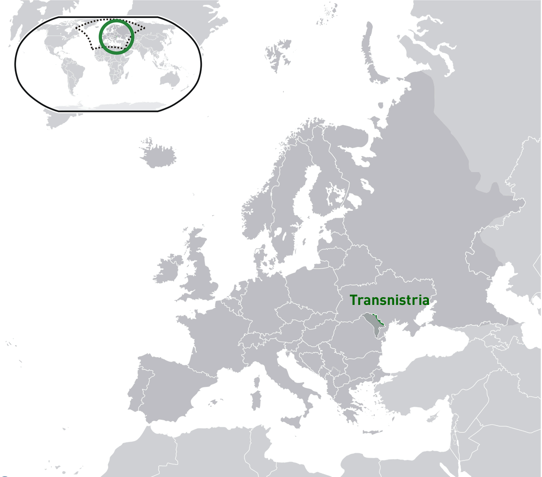
Transnistria is located in Eastern Europe, between Moldova and Ukraine. It lies on the eastern bank of the Dniester River, which forms much of its natural border with Moldova. Although it’s officially within Moldova’s borders, Transnistria declared independence in 1990, creating a complex political situation that continues to this day.
Where is located Transnistria in the World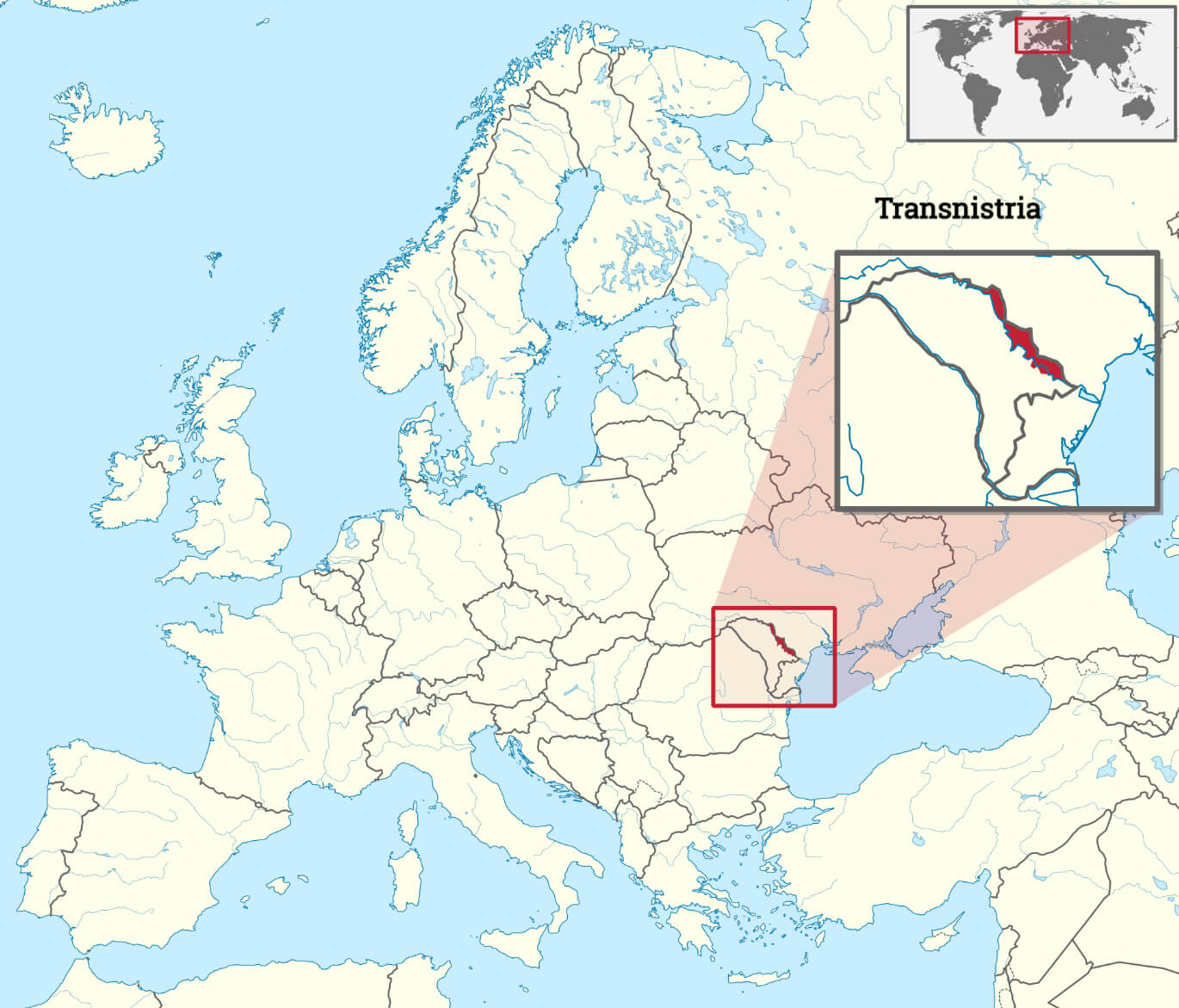
Geographically, Transnistria is a long, narrow strip of land stretching from the northern Moldovan town of Ribnita to the southern border near Tiraspol, its self-proclaimed capital. The region’s relative proximity to the Black Sea makes it strategically important, although it lacks direct access to any coastline. Transnistria’s proximity to Ukraine also adds to its geopolitical importance.
On world maps, Transnistria is difficult to locate due to its small size and unrecognised status. Most maps show it as part of Moldova, although it operates with considerable autonomy. Its location in a politically sensitive area of Eastern Europe has made it a focal point of regional tensions, especially given its strong ties to Russia and ongoing debates over its legitimacy.Here are some statistical information about Transnistria:
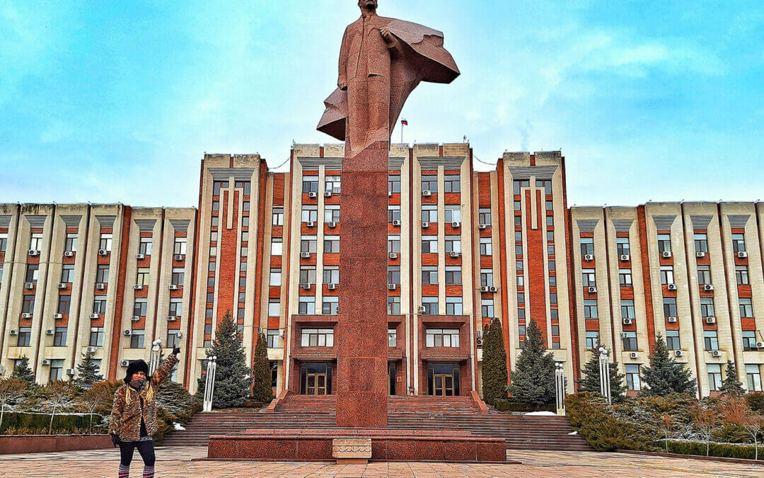 Area: 4,163 km2 (1,607 sq mi)
Transnistria map with Moldova and Ukraine
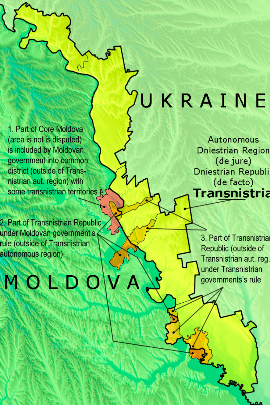
Map of Transnistria
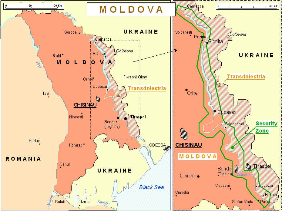 Map showing Transnistria region along Moldova-Ukraine border
This map of Moldova highlights the Transnistria region, a narrow strip along the border with Ukraine. Key cities, including Tiraspol and Bender, are marked, along with the Security Zone, indicated by a green line. The map illustrates the division between Moldova and Transnistria, as well as its proximity to the Black Sea region.
Transnistria Moldova Ukraine Map
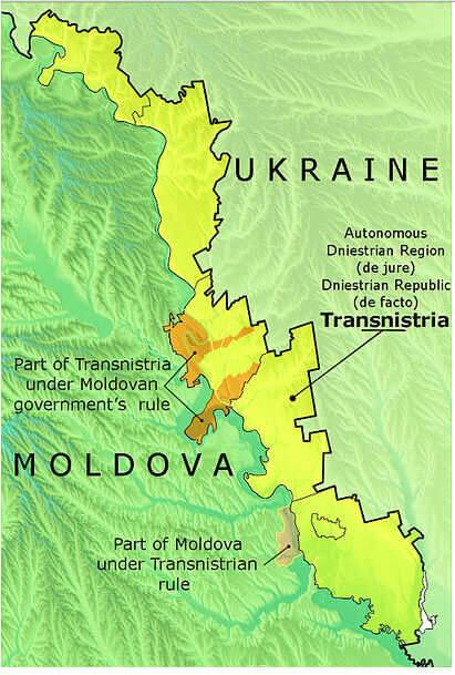 Map displaying Transnistria, Moldova, and Ukraine borders
This map highlights Transnistria along the Moldova-Ukraine border, showing both de facto (controlled by Transnistria) and de jure (legally under Moldova) territories. The map illustrates areas under Moldovan government control within Transnistria, as well as Moldovan territories administered by Transnistria. It emphasizes the complex and disputed boundaries in this region.
Map Transnistria
Romania Moldavian Assr Transnistria 1920
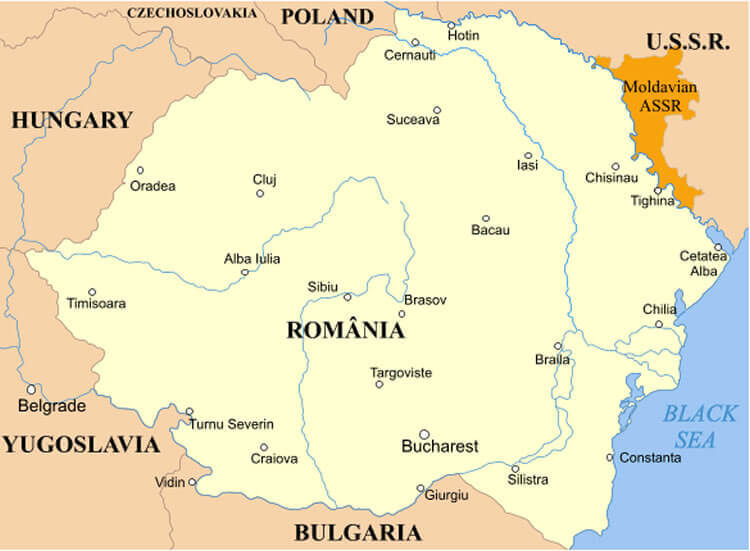
This historical map from the 1920s highlights Romania and the Moldavian Autonomous Soviet Socialist Republic (ASSR), a region within the U.S.S.R. located on the border with Romania. The Moldavian ASSR, in orange, represents an area that would later influence the formation of modern Moldova, situated near the Dniester River.
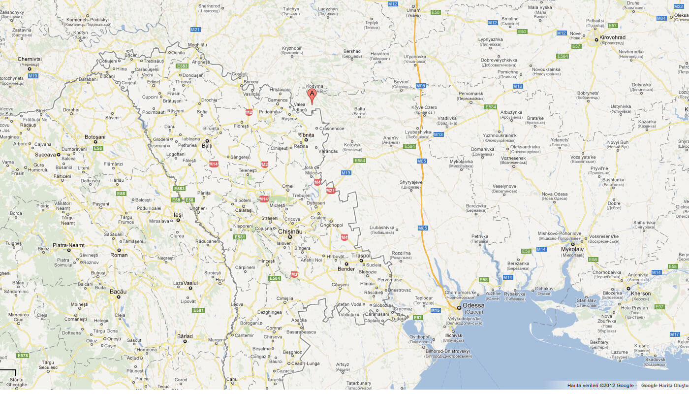
Map of Transnistria World
Transnistria Map Moldova Ukranine
Transnistria Earth Map
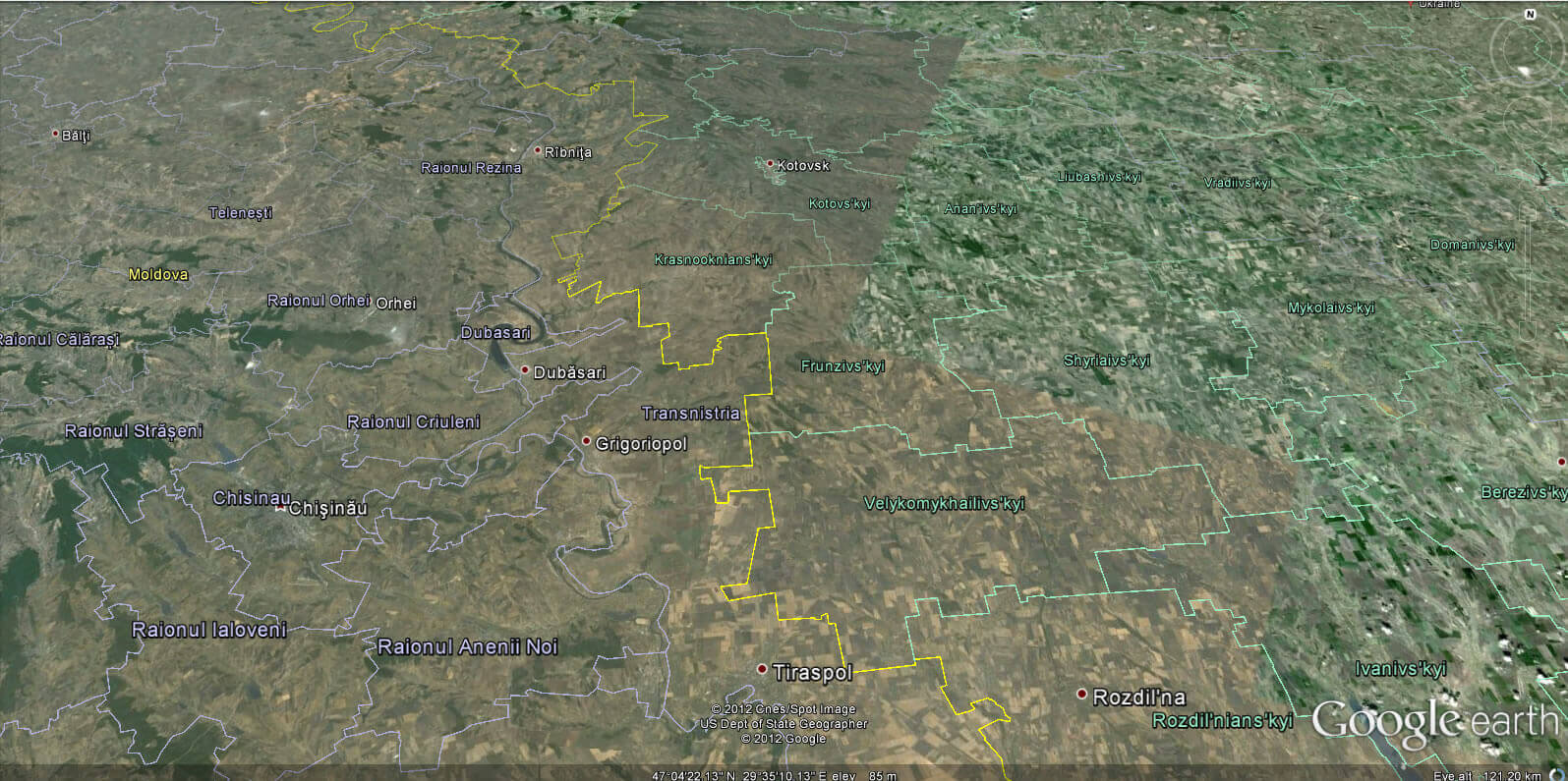
Transnistria-Map-in-Moldova
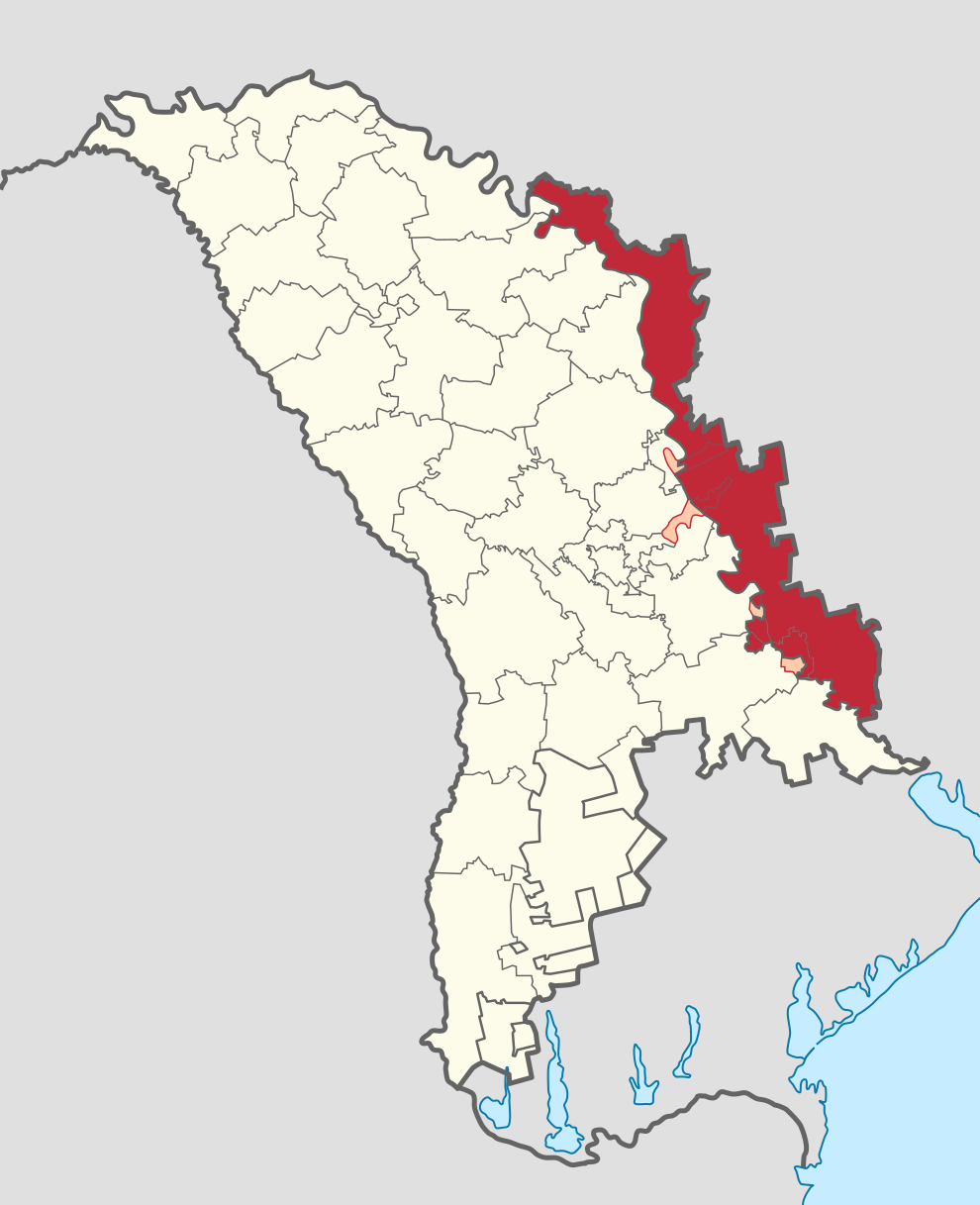
State of Transnistria Map
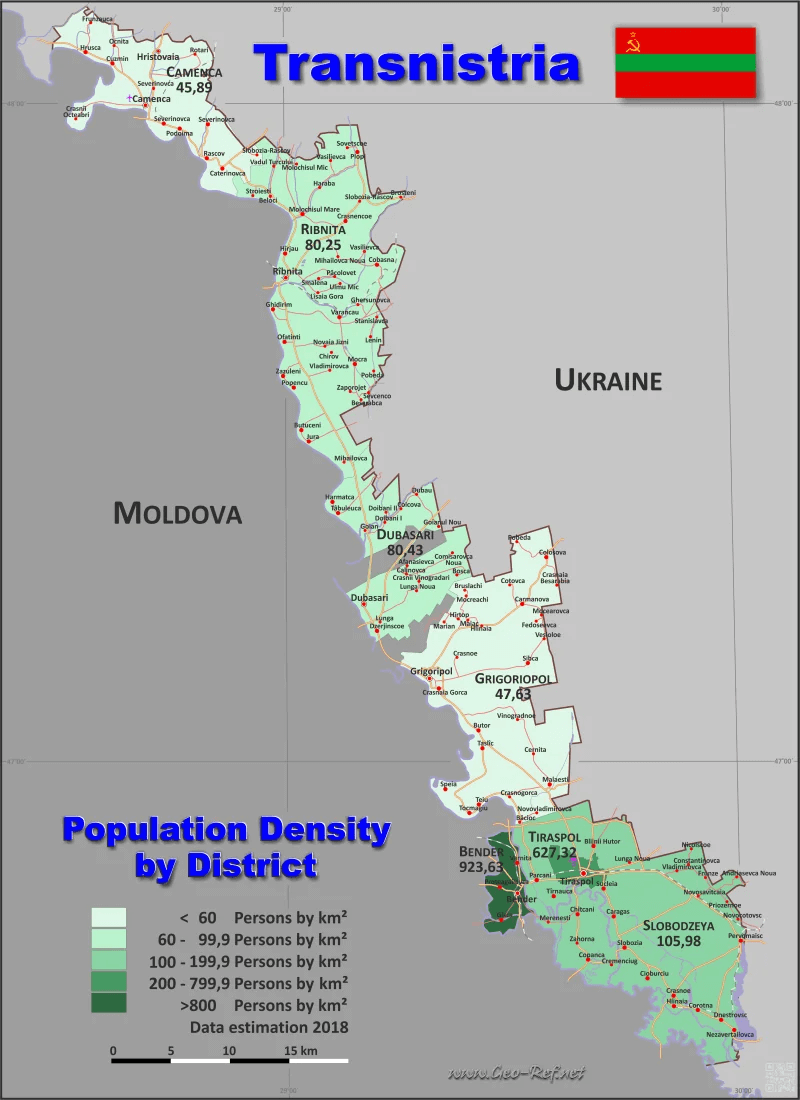 Transnistria map with population density across districts
This map of Transnistria displays population density by district, with darker shades indicating higher density areas. Key cities like Tiraspol, Bender, and Ribnita are highlighted, showing significant population centers. The map also marks the border with Moldova and Ukraine, illustrating the region’s narrow shape and location between the two countries.
Transnistria, Moldova and Ukraine Map

Transnistria cities map
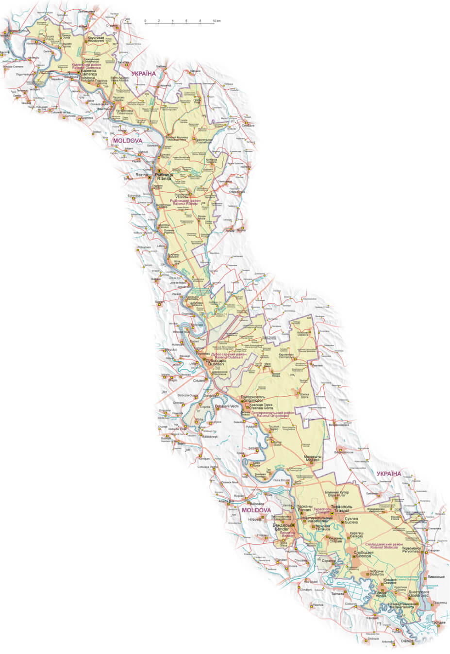
Where is Transnistria on the Europe Map?
Show Google map, satellite map, where is the country located.
Get directions by driving, walking, bicycling, public transportation and travel with street view.
div>Feel free to explore these pages as well:
- Moldova Map ↗️
- Ukraine Map ↗️
- Romania Map ↗️
- Germany Map ↗️
- A Collection of Czechia Maps ↗️
- A Collection of Poland Maps ↗️
- Europe Map ↗️
