- Advertisement -
Europe’s diverse demographic landscape is presented through a series of maps, including population distribution, density and growth trends in each country. Maps highlight life expectancy in EU countries, major languages spoken and Muslim populations in France, Germany, the UK and Italy. Population maps of Western Europe, satellite density visualisations and linguistic diversity further explore the cultural and demographic complexity of the region.
Population Density Map of Europe – Regional Overview
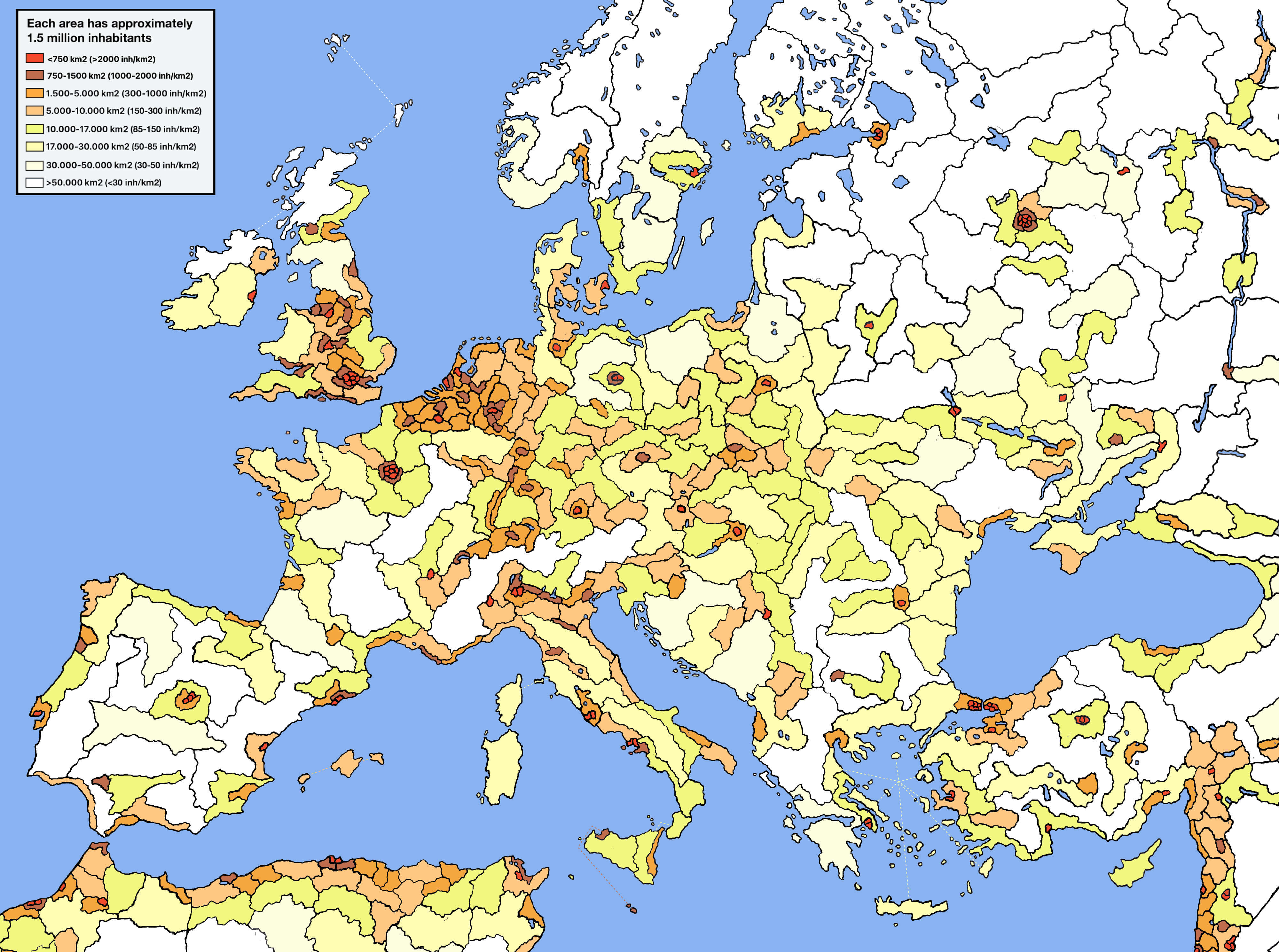 Map showing population density across Europe with areas grouped by inhabitants per km².
Population Growth Map of Europe in 2021
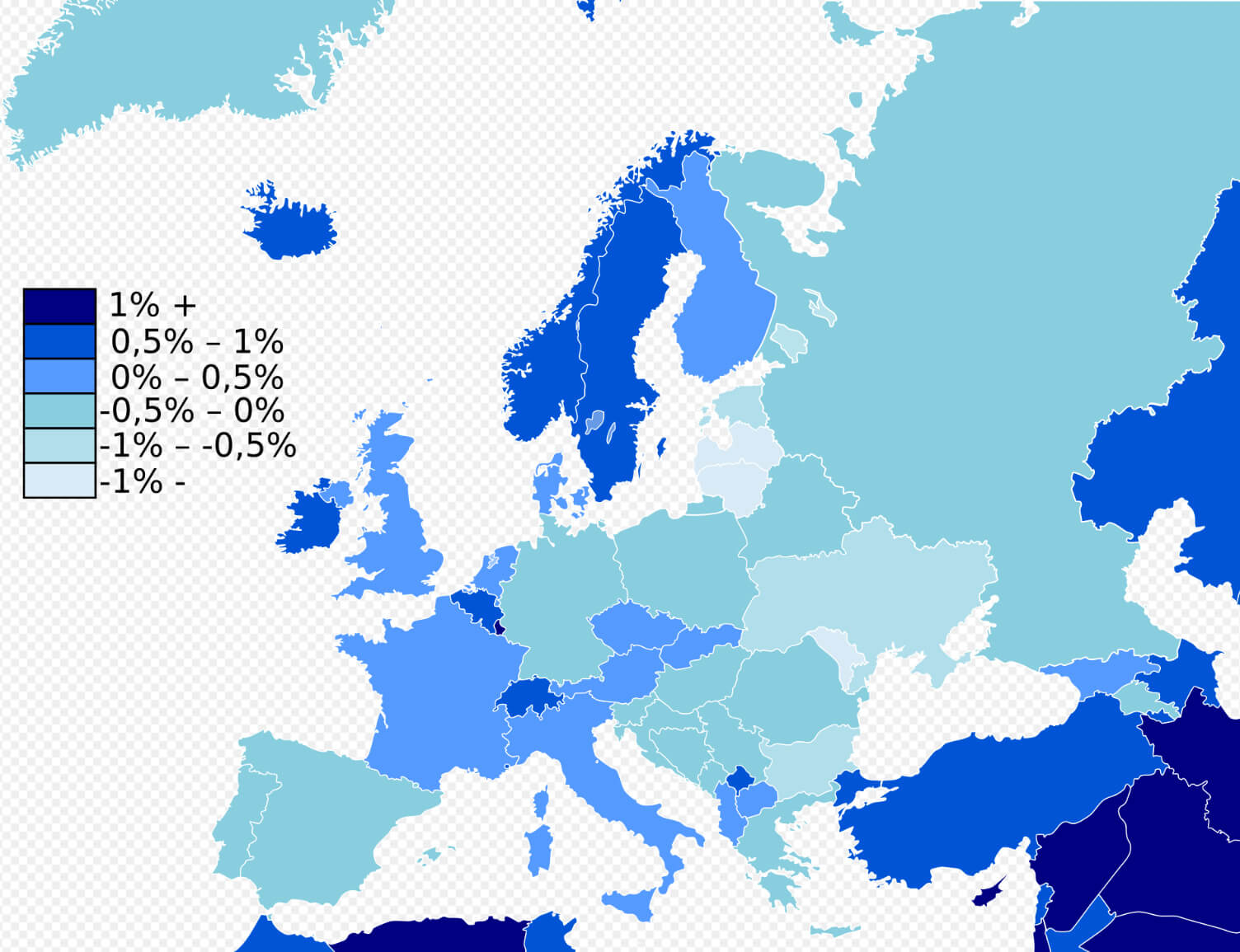 Map of Europe showing population growth rates by country in 2021.
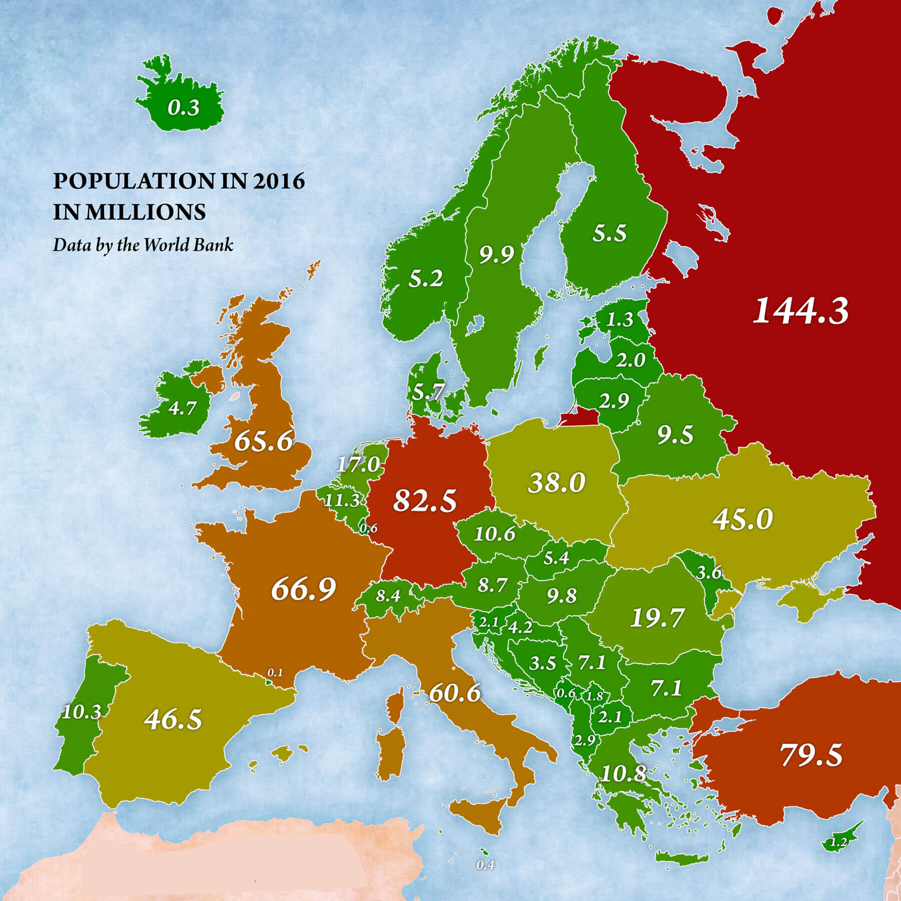
Europe Population Map (2016)
Europe’s Muslim Population in 2010: A Regional Overview
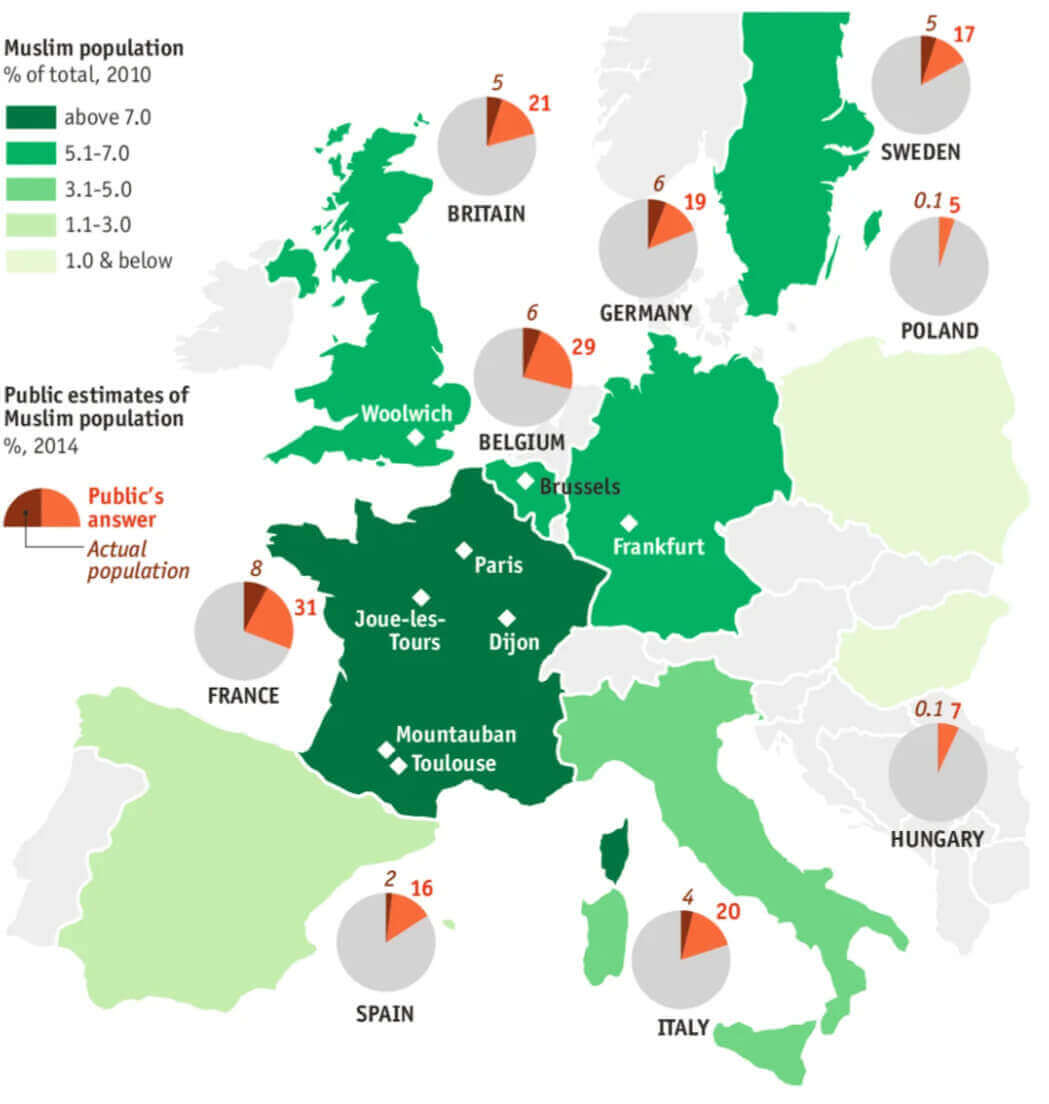 Map of Europe showing Muslim population distribution in 2010, categorized by percentage
Major Languages of Europe – Regional Map
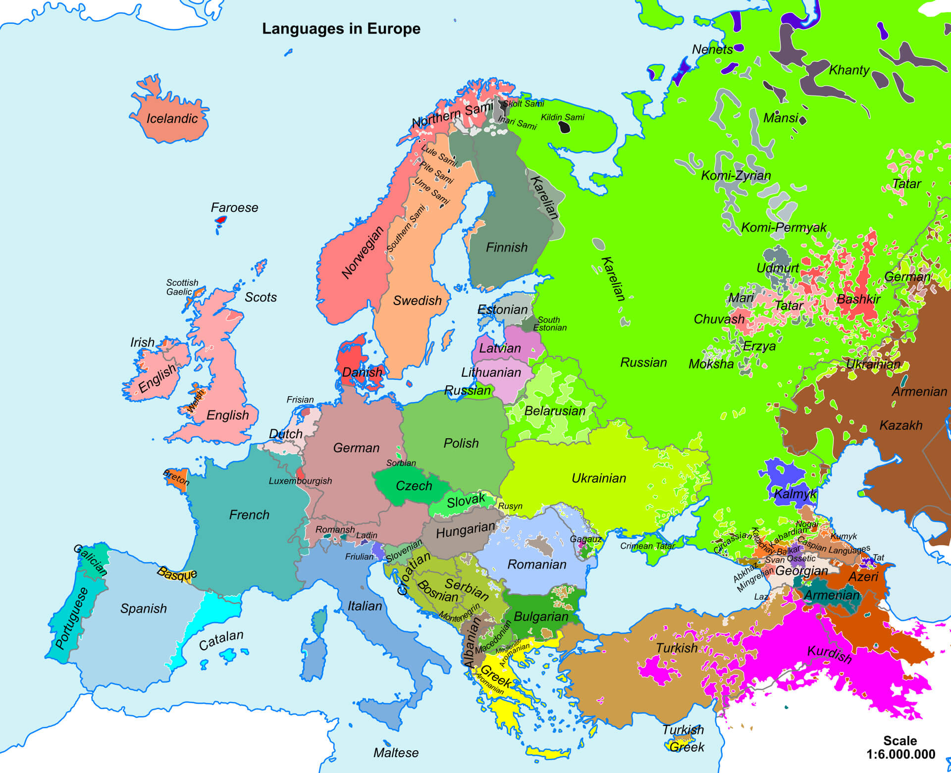 Map showing the major languages spoken across Europe with regional distinctions.
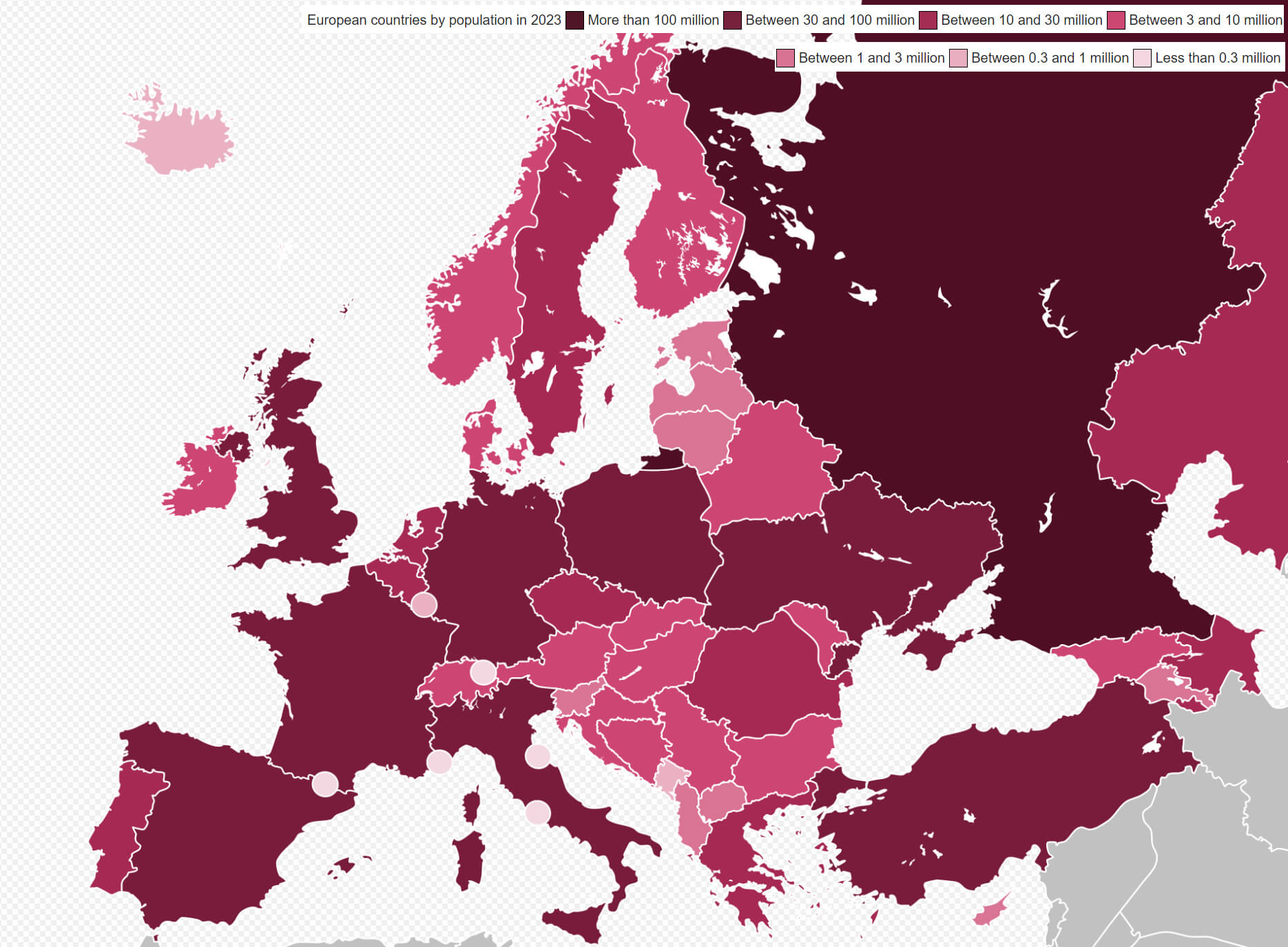
European countries by population map in 2023
Muslim Population Across European Countries in 2020
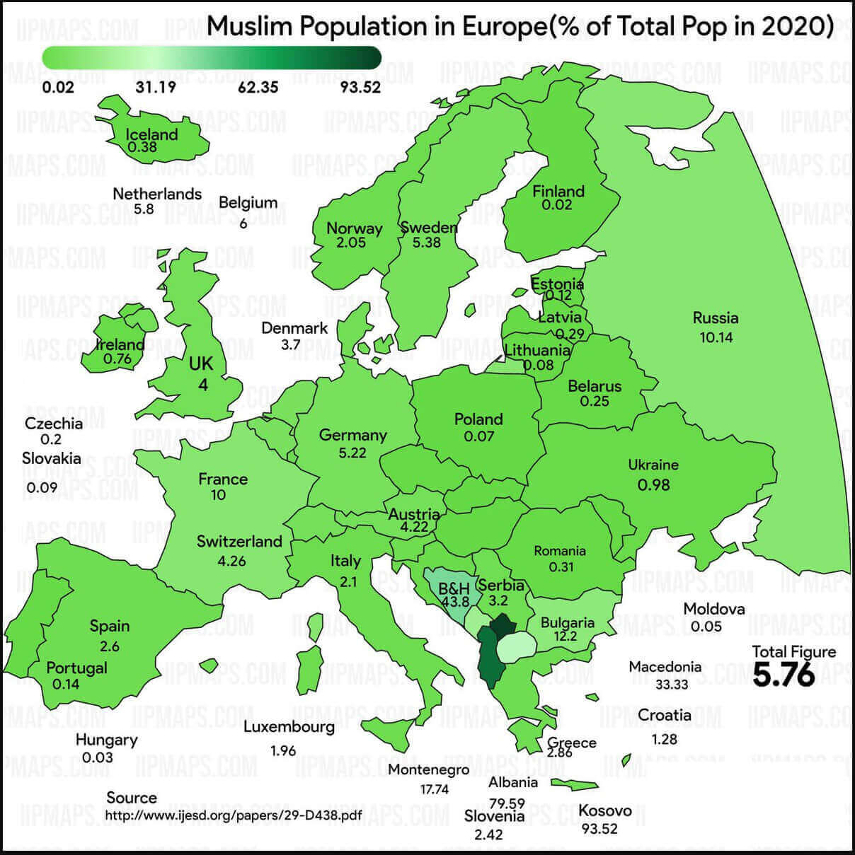 Map showing Muslim population percentage in European countries in 2020
Europe muslim population map
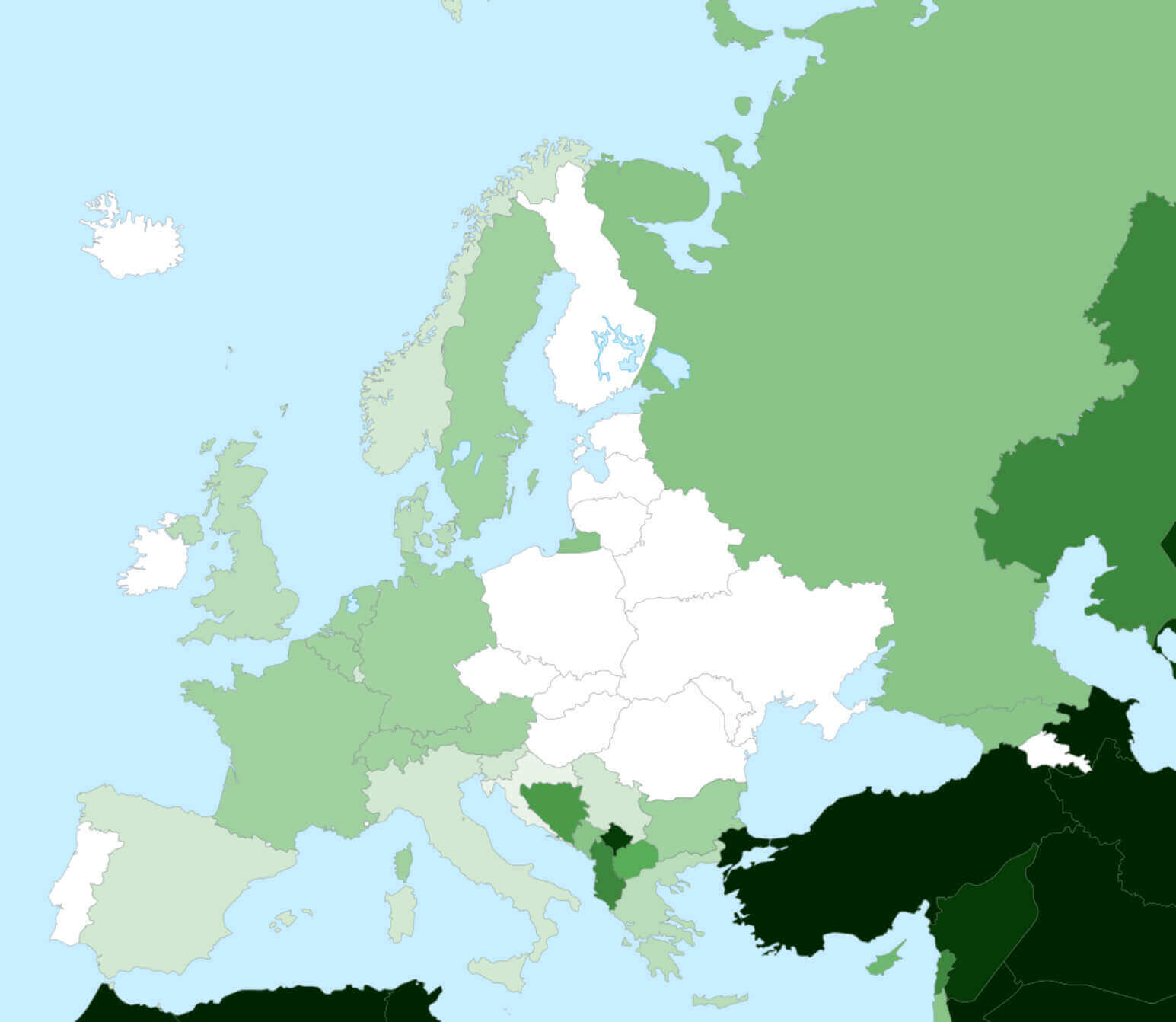
Europe Muslim Population Map (2016)
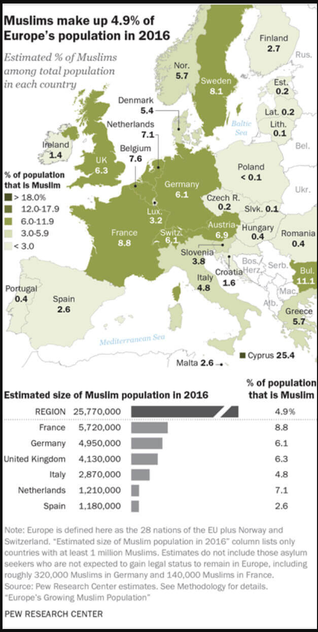 Europe Muslim population map 2016 showing percentages and estimated sizes by country.
Europe Muslim population map in the World
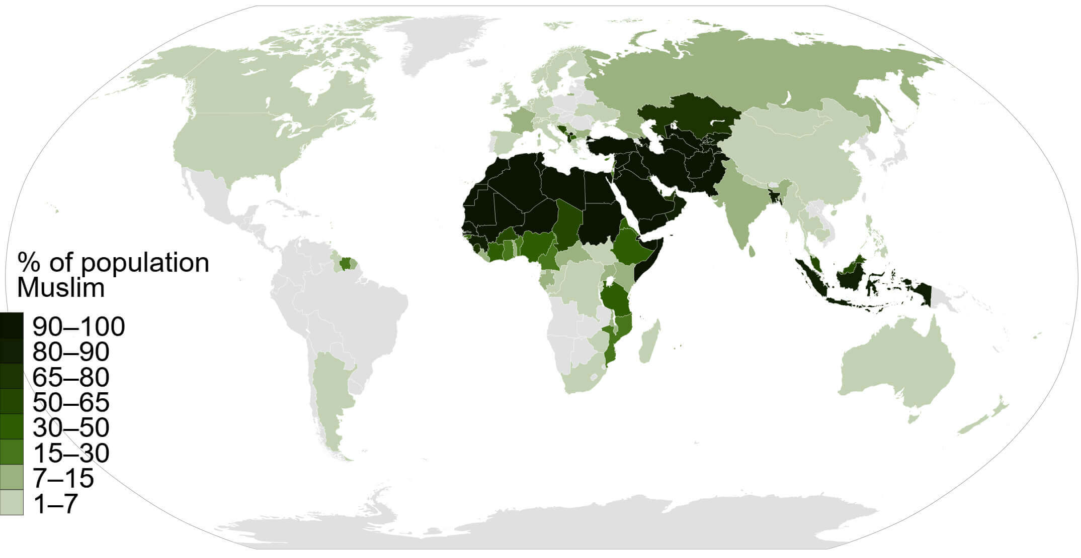
Europe population desnity map in 2017
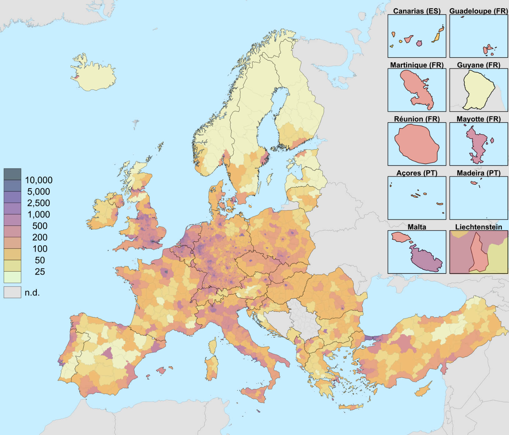
Europe Population Density Map
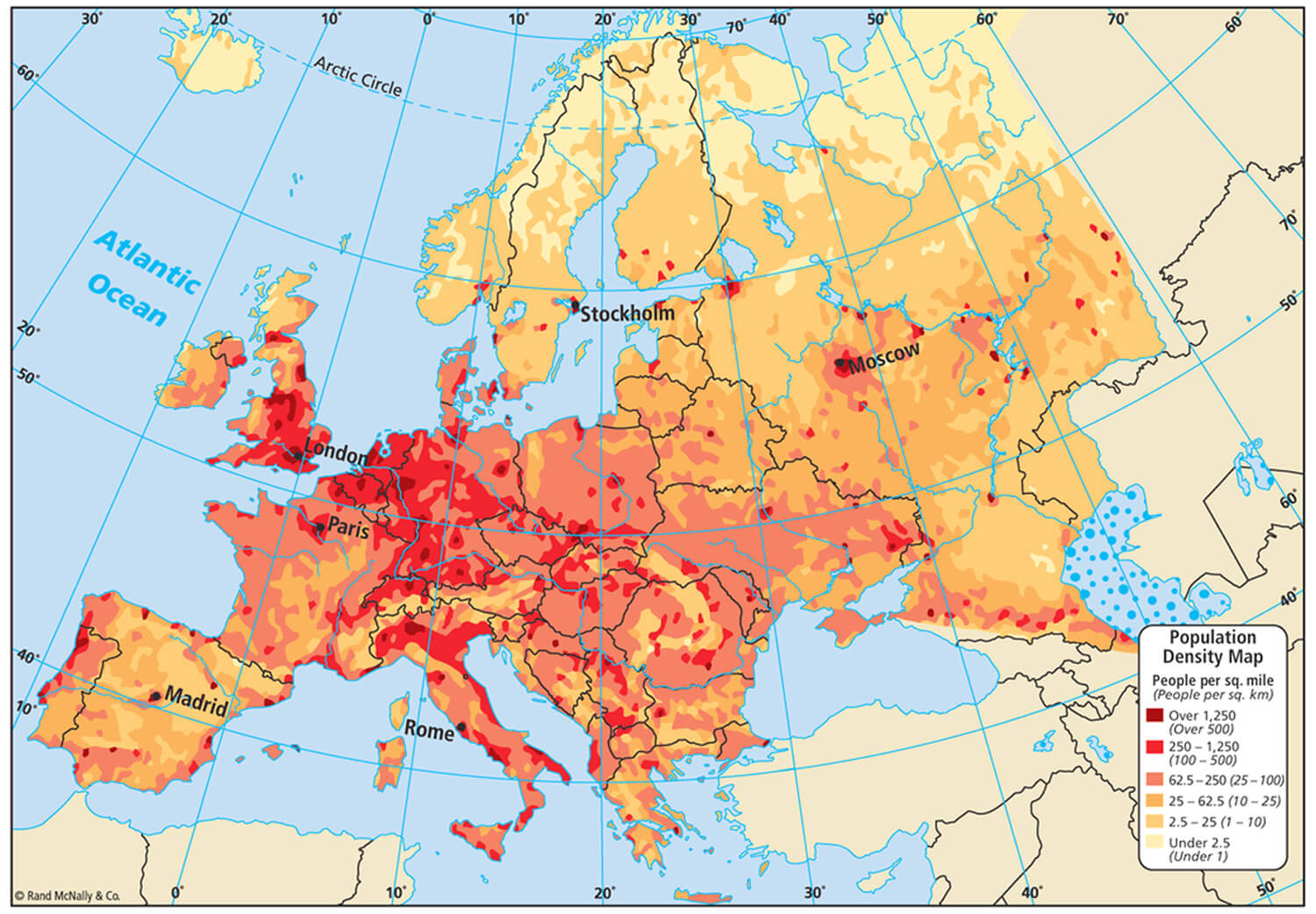 Map showing population density across Europe, highlighting urban and sparsely populated areas.
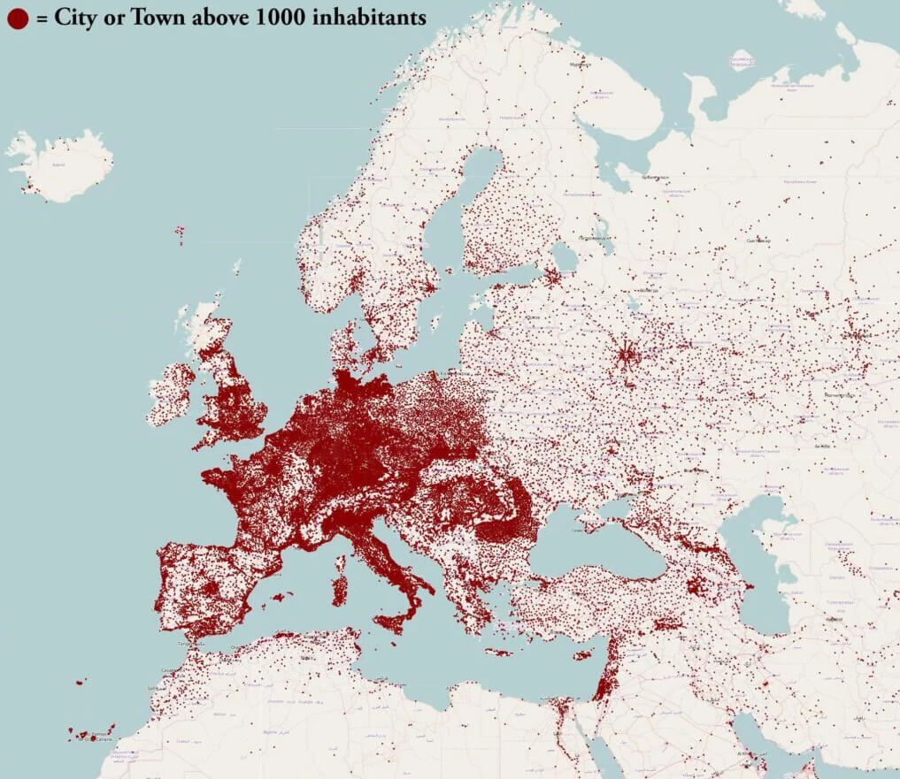
Europe population map with inhabitants
France Muslim Population Map in the World
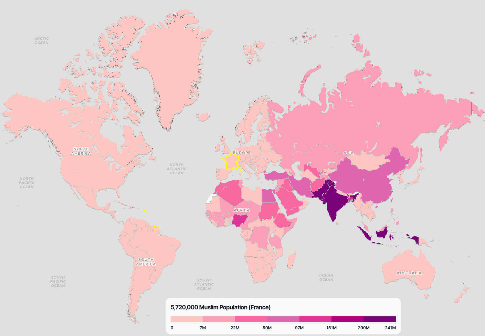 World map highlighting France’s Muslim population of 5.72 million compared globally
Germany Muslim Population Map in the World
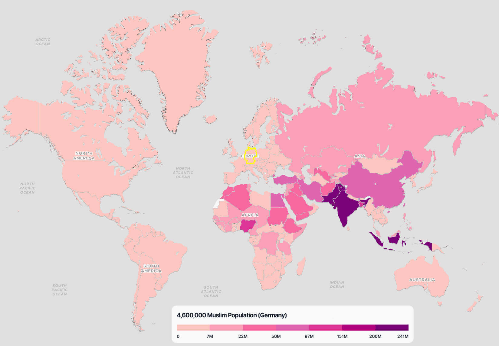 World map highlighting Germany’s Muslim population of 4.6 million compared globally.
Italy Muslim Population Map in the World
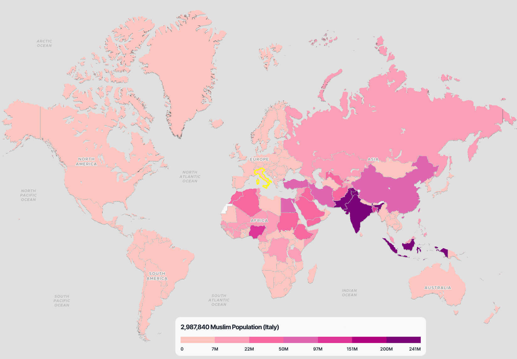 World map highlighting Italy’s Muslim population of 2.9 million compared globally.
Life Expectancy in EU – 2019
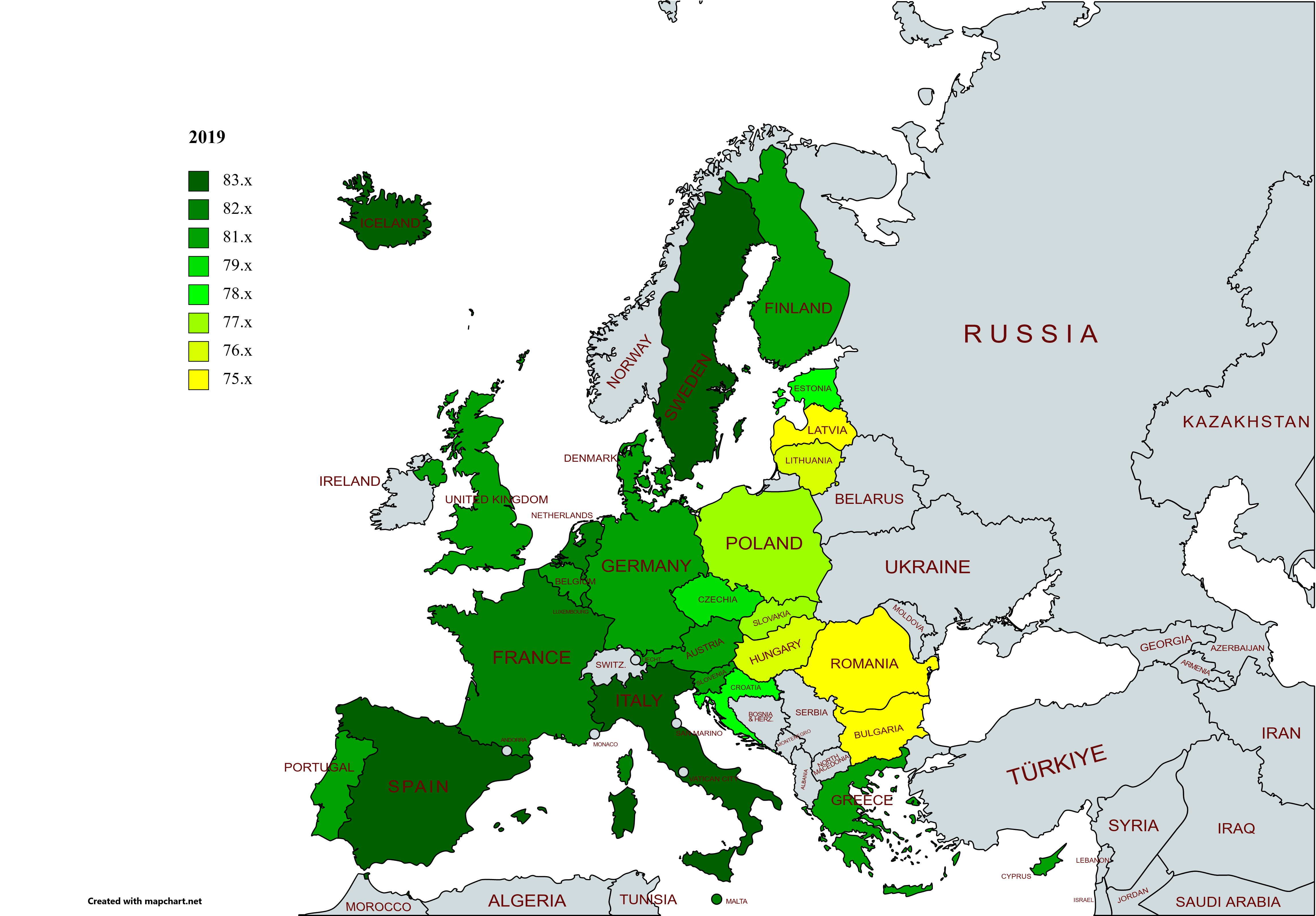 Map showing life expectancy across EU countries in 2019, with color-coded values
Life Expectancy in EU – 2020
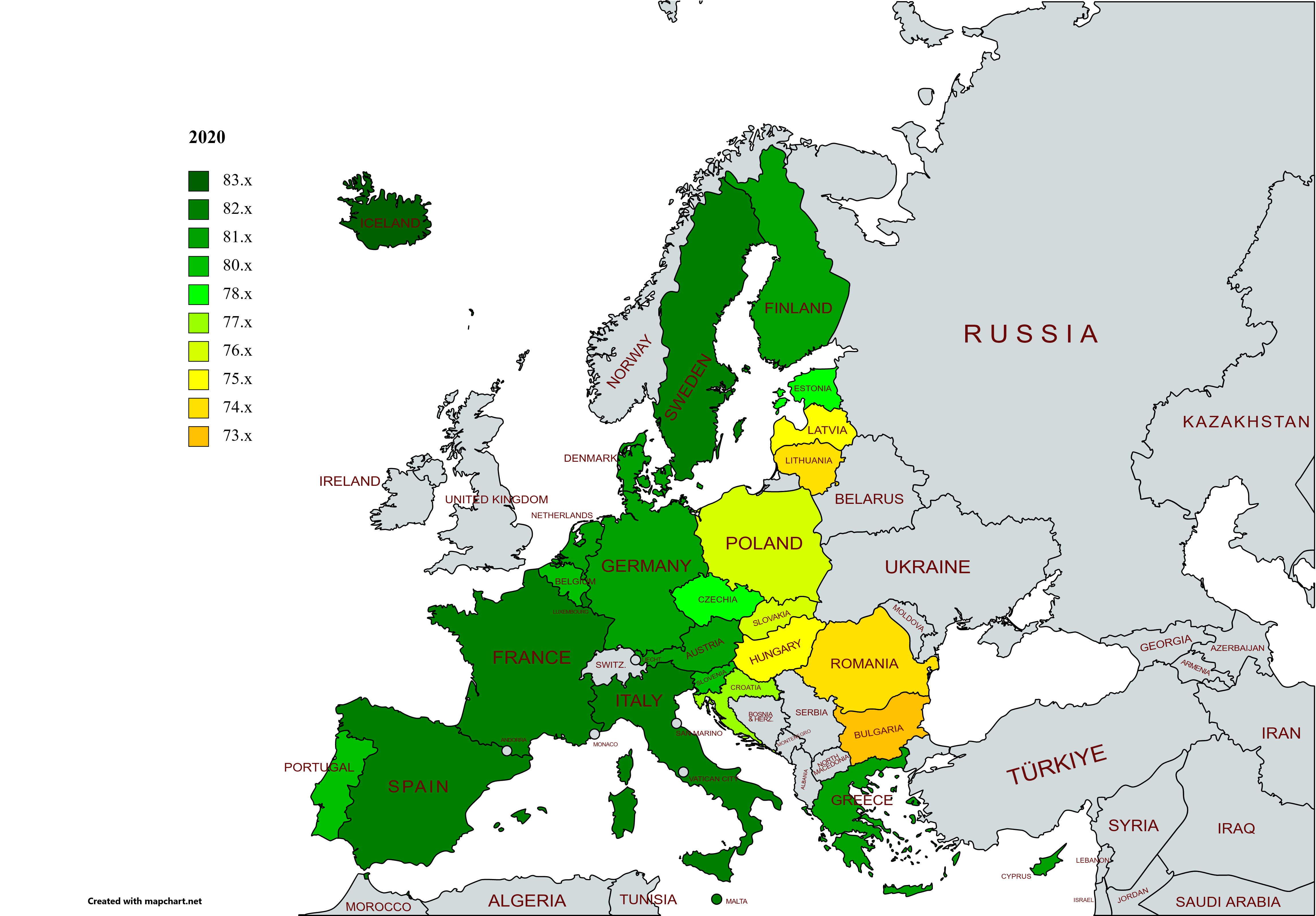 Map showing life expectancy across EU countries in 2020, with color-coded values
Life Expectancy in EU – 2021
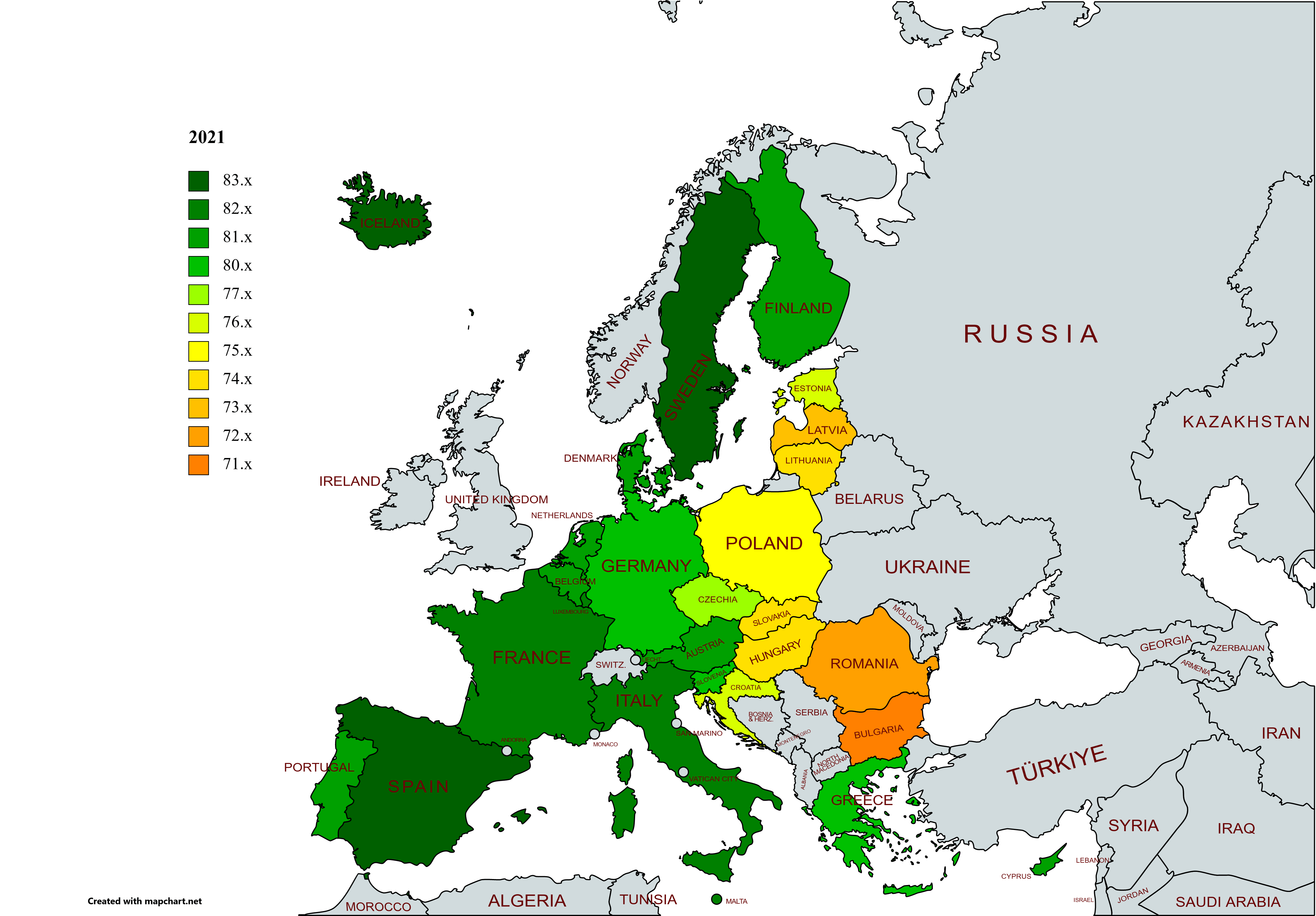 Map showing life expectancy across EU countries in 2021, with color-coded values
Muslim population density map in Europe
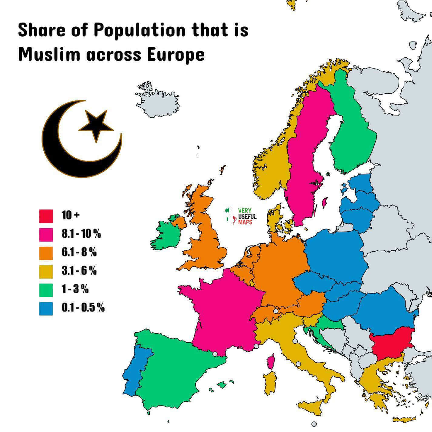
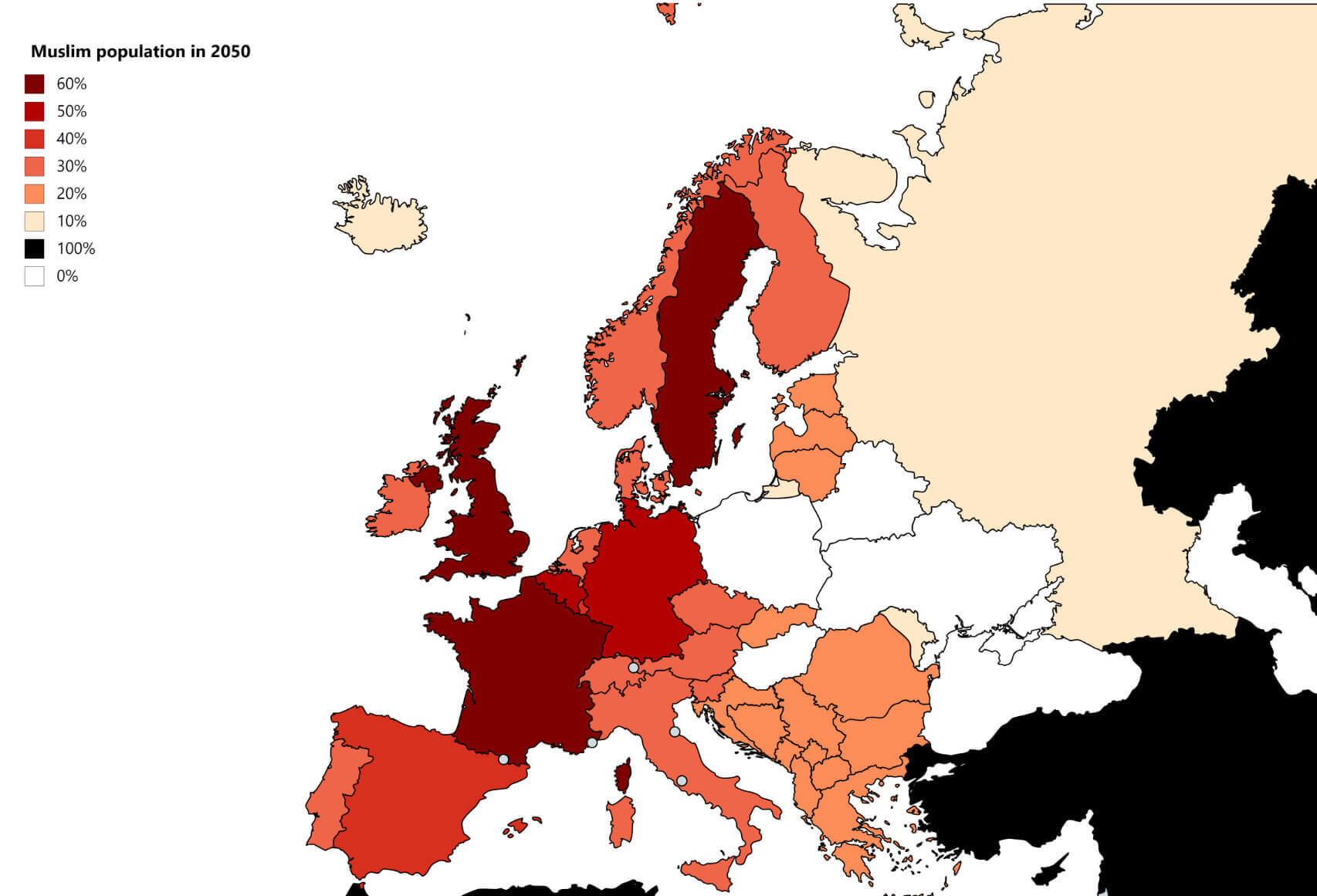
Muslim population growth map in Europe by 2050
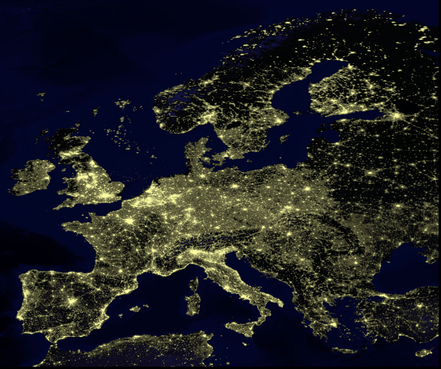
Population density map of the EU in the night
UK Muslim Population Map in the World
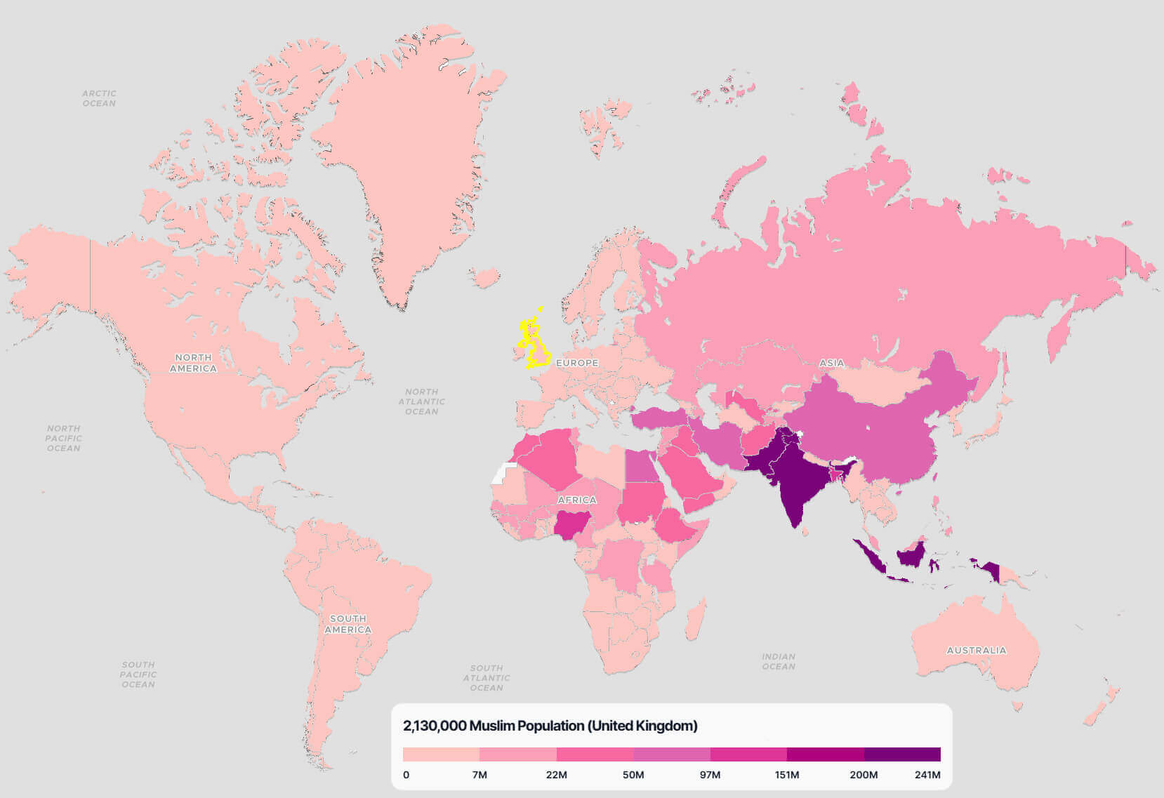 Map of the world highlighting the United Kingdom’s Muslim population in 2021.
Western Europe population map
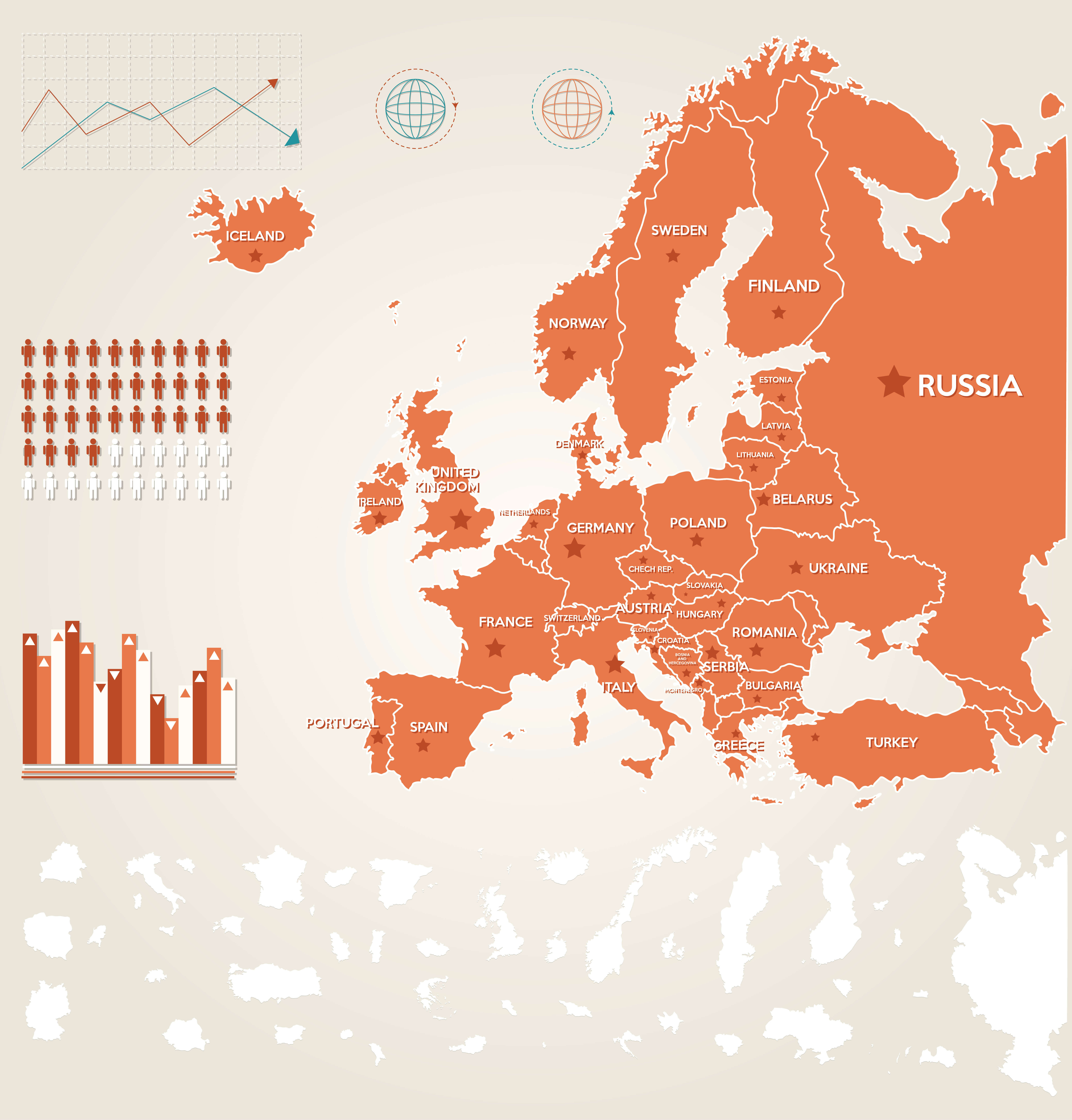
Where is Europe on the World Map?
Show Google Interactive Maps and satellite maps of where the country is located.
Get directions by driving, walking, bicycling, public transportation and travel with street view.
Feel free to explore these pages as well:
- US Population Map ↗️
- Muslim Population Map ↗️
- Muslim Population Map in Asia by Country ↗️
- Muslim Population Map in Africa by Country ↗️
- Muslim Population Map in Europe by Country ↗️
- Muslim Population Map in Americas by Country ↗️
- Europe Physical Map ↗️
- Europe Political Map ↗️
- Europe Countries Map ↗️
- Europe High-resolution Map ↗️
- Europe Cities Map ↗️
- Europe Religion Map ↗️
- Europe Satellite Map ↗️
- Europe Historical Map ↗️
- Europe Topography Map ↗️
- Europe Time Zone Map ↗️
- Muslim Population Map in Europe by Country ↗️
- India Map ↗️
- Pakistan Map ↗️
- Indonesia Map ↗️
- Bangladesh Map ↗️
- Turkey Map ↗️
- Iran Map ↗️
- United States Map ↗️
- Asia Map ↗️
- Europe Map ↗️
- North America Map ↗️
- South America Map ↗️
- Africa Map ↗️
- Oceania Map ↗️
- Advertisement -
