Explore Pakistan’s diverse geography with detailed political, physical, and satellite maps. Discover cities, rivers, topography, and terrain from the Indus Valley to the Arabian Sea. Learn about regions, ethnic groups, population, and climate. Uncover its strategic location near India, China, and Iran, and delve into its rich tourism, history, and cultural heritage
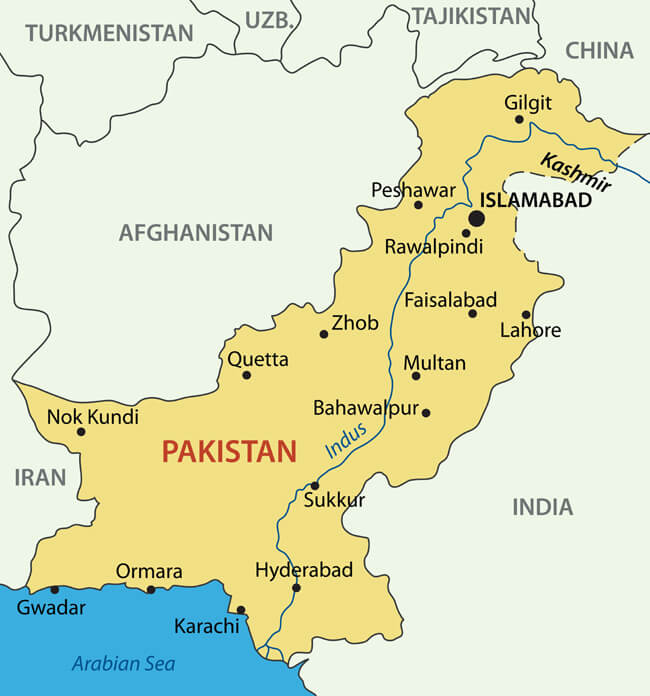
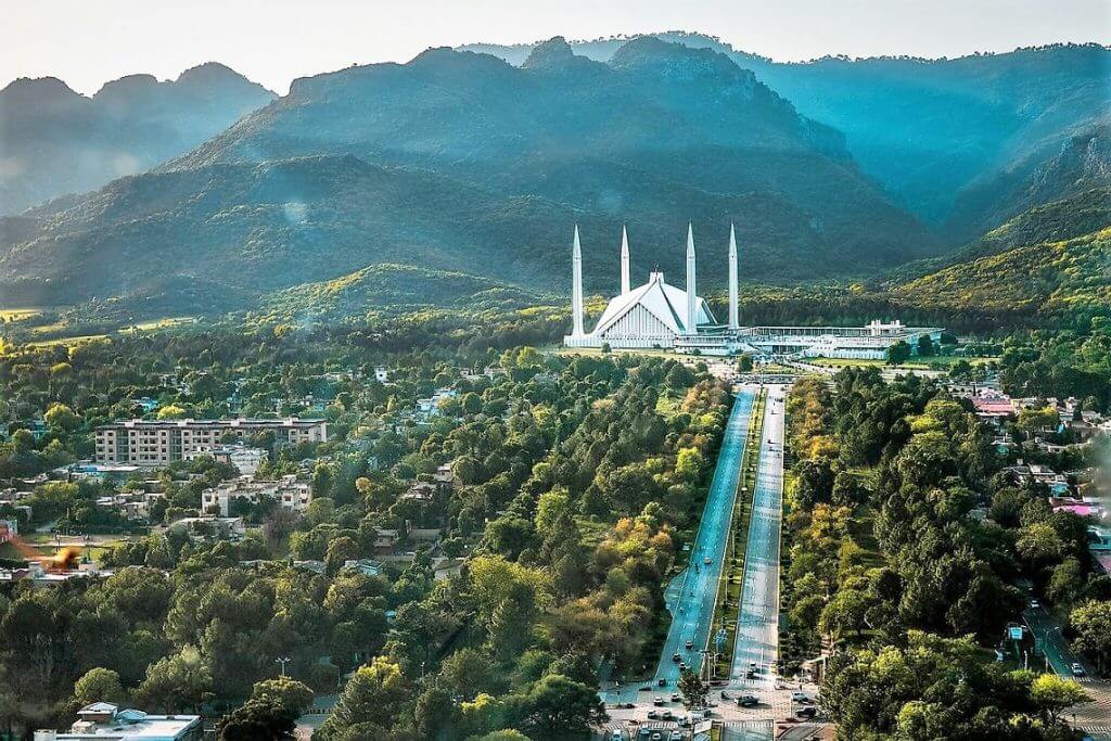
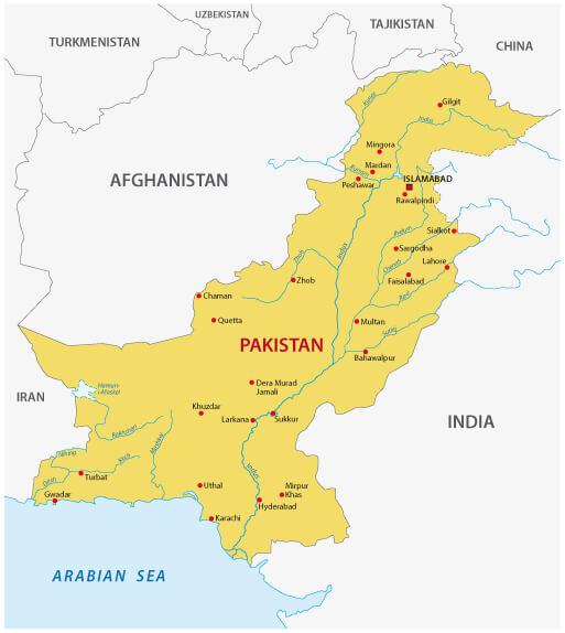
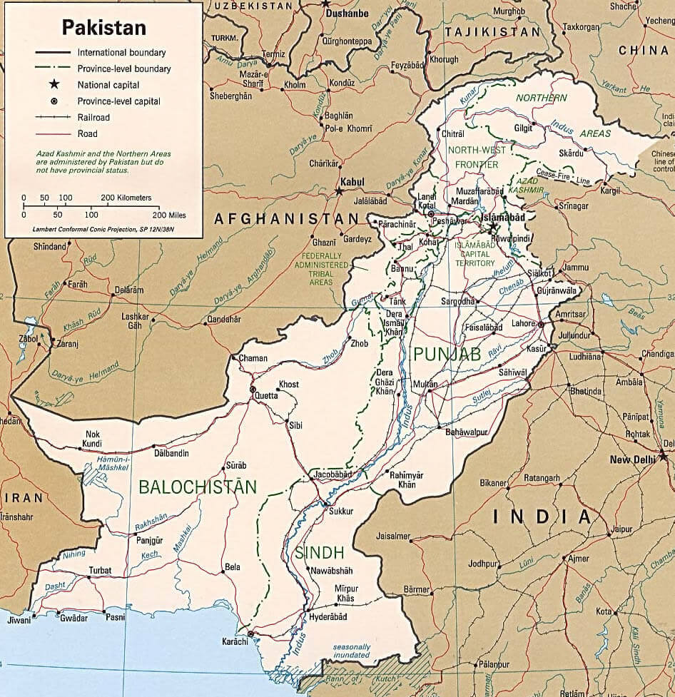
Pakistan Map with Cities, Borders, and Neighboring Countries
 Pakistan map showing cities, borders, rivers, and neighboring countries
This map of Pakistan shows major cities including Islamabad, Karachi and Lahore, as well as major roads, rivers and borders with India, Afghanistan, Iran and China. Neighbouring countries such as Uzbekistan, Turkmenistan and Tajikistan are also shown. The coastline of the Arabian Sea is visible, with Karachi and Gwadar as major port cities.
Brief information about Pakistan
Pakistan, officially known as the Islamic Republic of Pakistan, is a country located in South Asia. It shares borders with India to the east, Afghanistan and Iran to the west, China to the north, and the Arabian Sea to the south. With a population exceeding 240 million, it is the fifth most populous country in the world and boasts a diverse landscape that includes mountains, plateaus, and fertile plains.
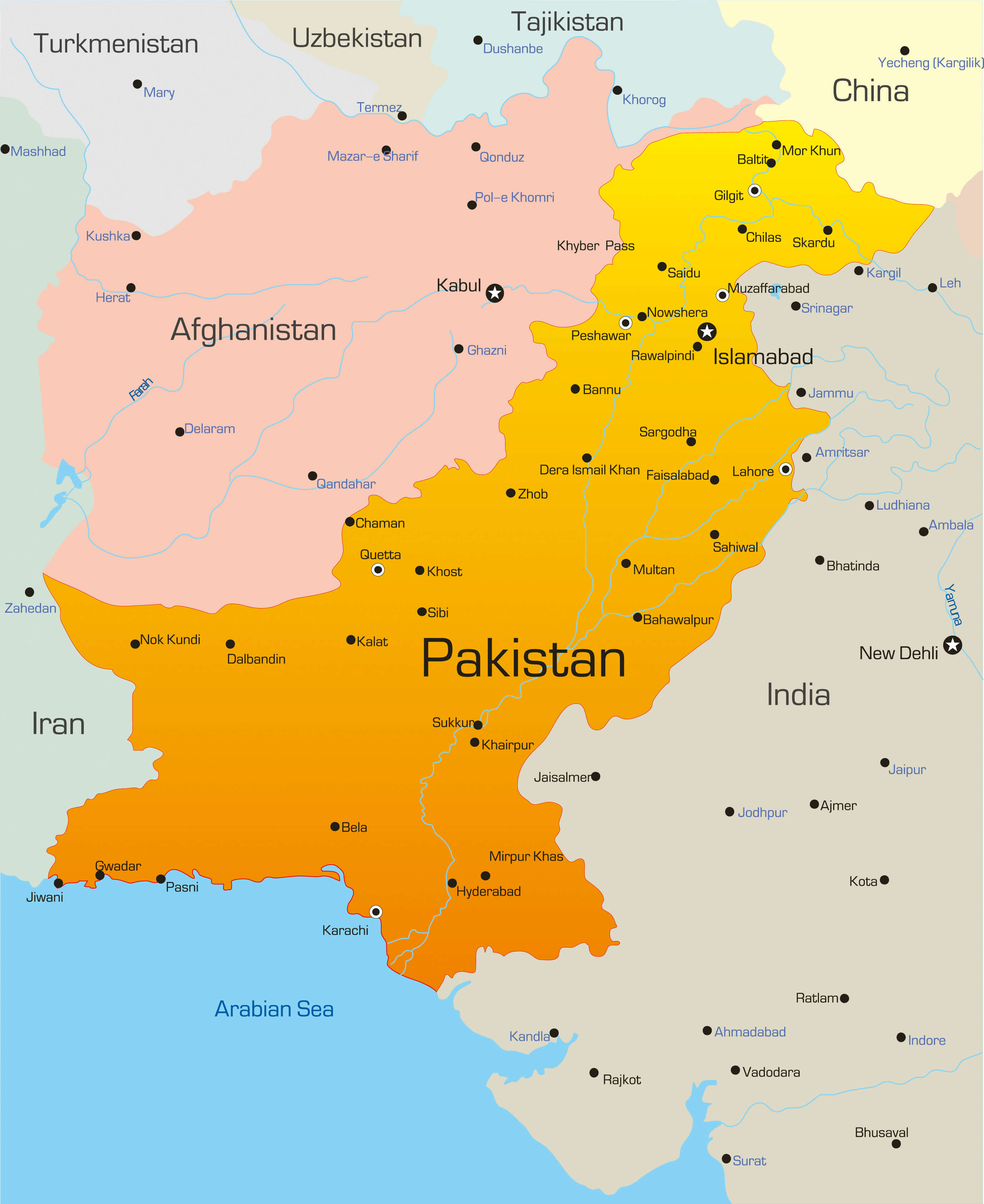
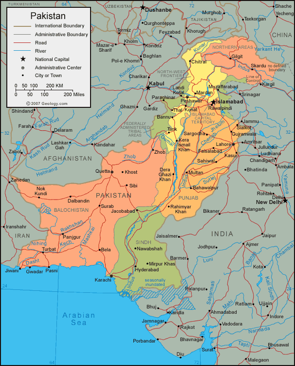
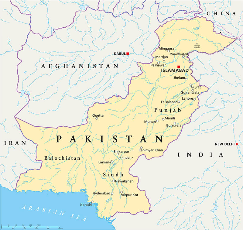
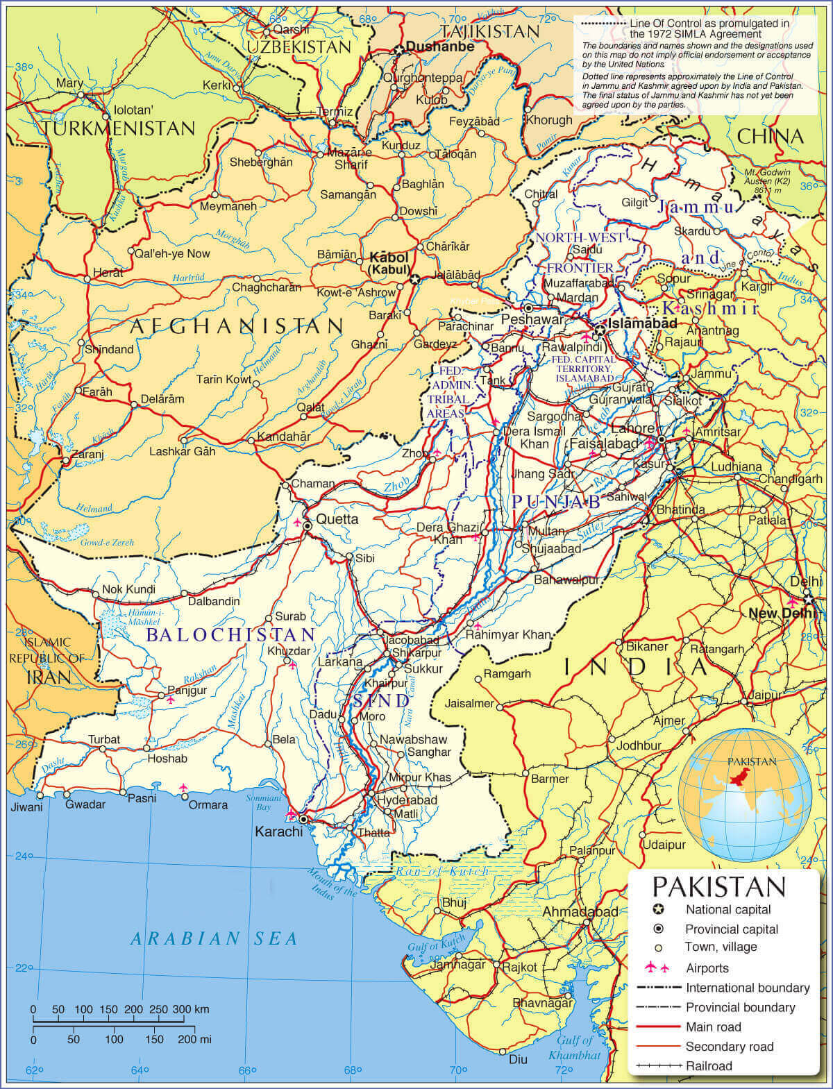
Pakistan Major Cities Map with Borders and Indus River
 Pakistan map highlighting major cities, borders, and Indus River.
This map of Pakistan shows major cities including Islamabad, Karachi, Lahore, Faisalabad and Peshawar. It also shows important geographical features such as the Indus River and the Arabian Sea coastline. Neighbouring countries, including India, Afghanistan, Iran, China and Tajikistan, are shown along with key border locations and provincial divisions.
Pakistan was established in 1947 following the partition of British India, primarily to serve as a homeland for the region’s Muslim population. The capital city is Islamabad, while other major cities include Karachi, Lahore, and Faisalabad. The official language is Urdu, and the economy is largely driven by agriculture, industry, and services. Renowned for its rich cultural and historical heritage, Pakistan is home to significant sites such as Mohenjo-Daro, Taxila, and the Karakoram Highway.
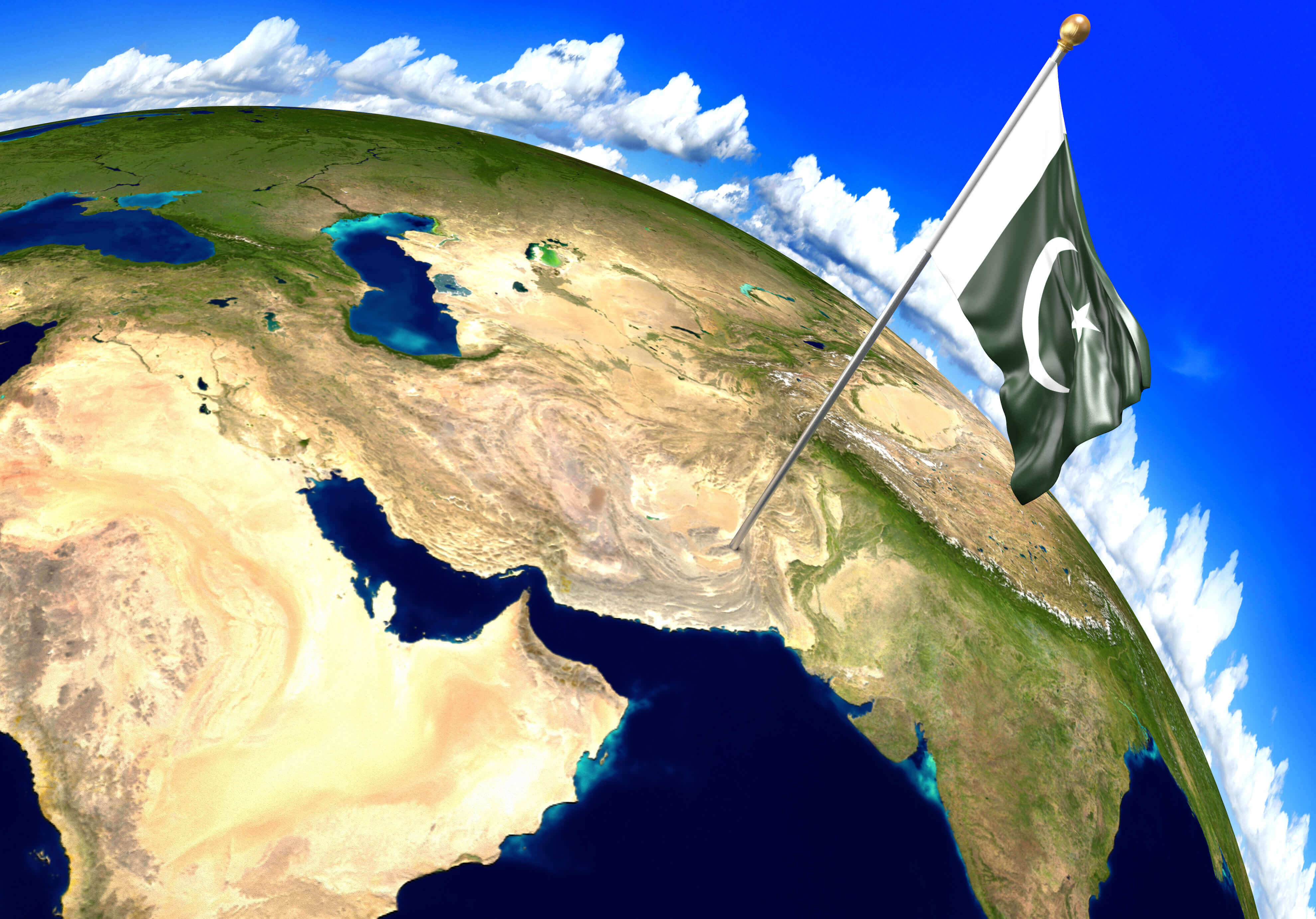
Where is located Pakistan on the World Map
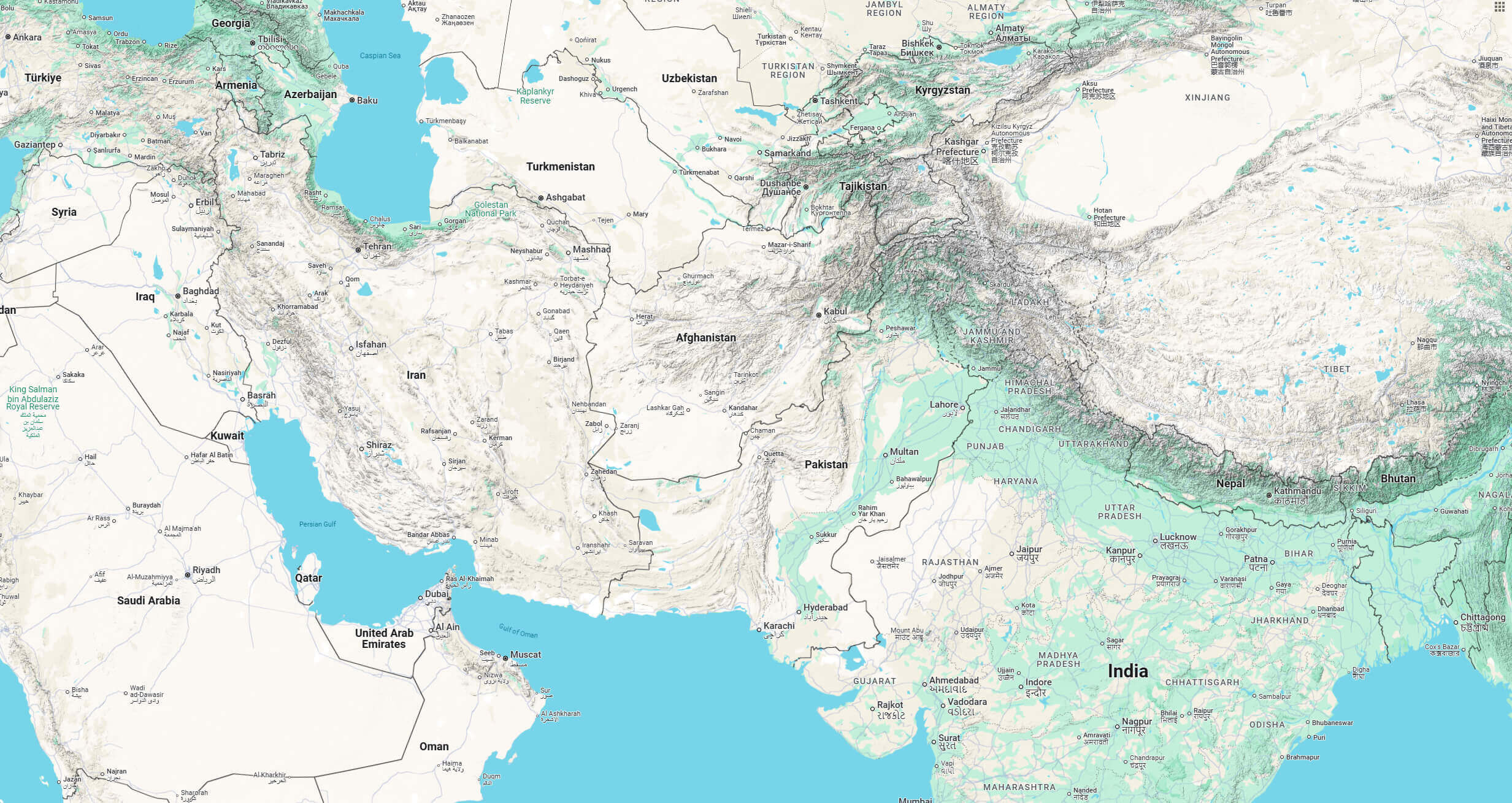
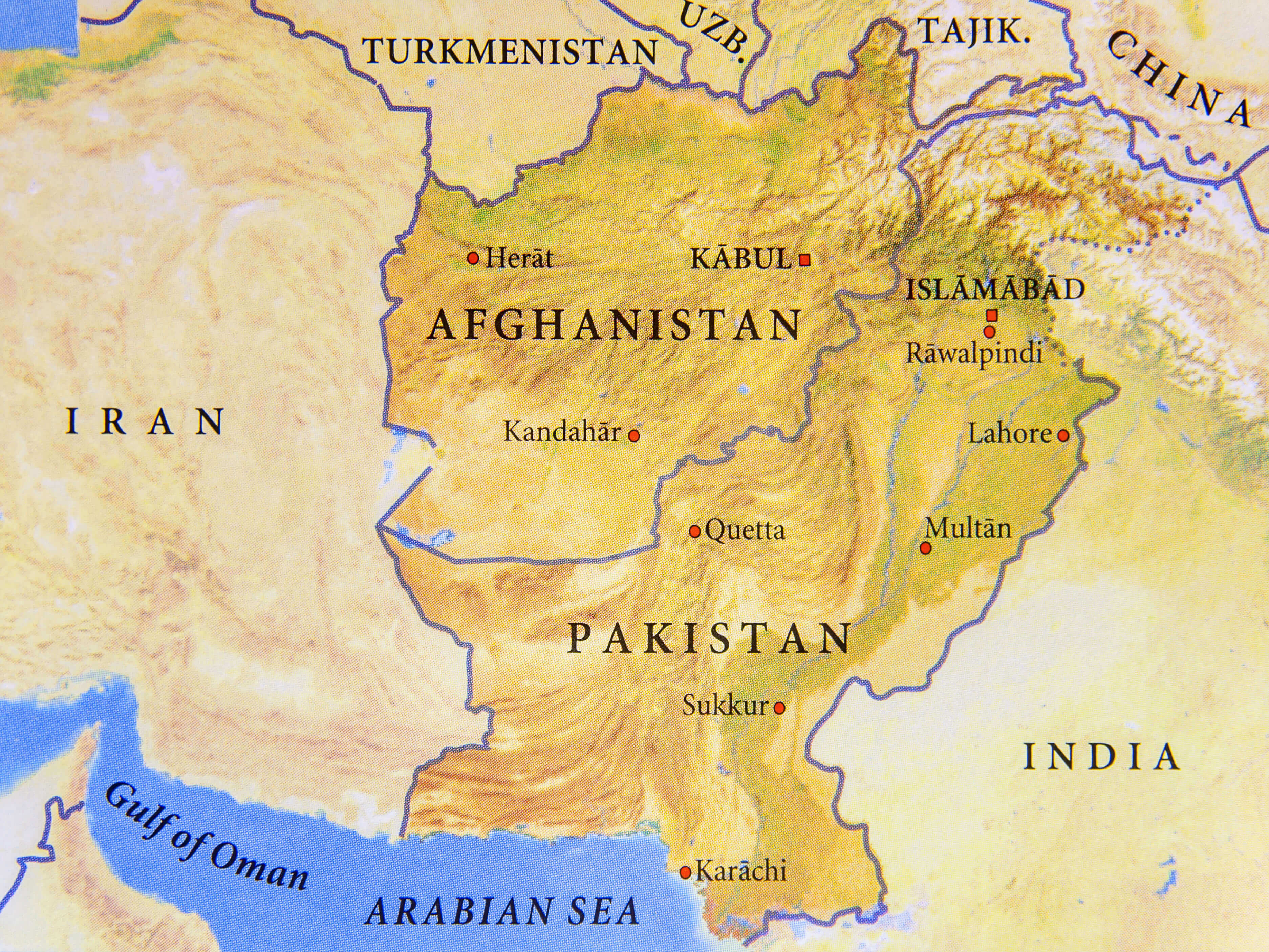
Located in South Asia, Pakistan serves as a vital link between the Middle East, Central Asia, and the Indian subcontinent. It shares a lengthy border with India to the east and Afghanistan and Iran to the west. The northern part of the country is connected to China via the Karakoram Highway, one of the highest paved roads in the world. To the south, Pakistan boasts a coastline along the Arabian Sea, offering access to key maritime trade routes.
The country is positioned between 24° and 37° north latitude and 60° and 77° east longitude, resulting in a diverse geographical landscape. The northern region is dominated by the Himalayan, Karakoram, and Hindu Kush mountain ranges, which are home to some of the world’s tallest peaks, including K2, the second-highest mountain on Earth. In contrast, the eastern part features the fertile plains of the Indus River, which serve as the agricultural heartland of the nation, while the western areas are marked by rugged terrain and arid plateaus.
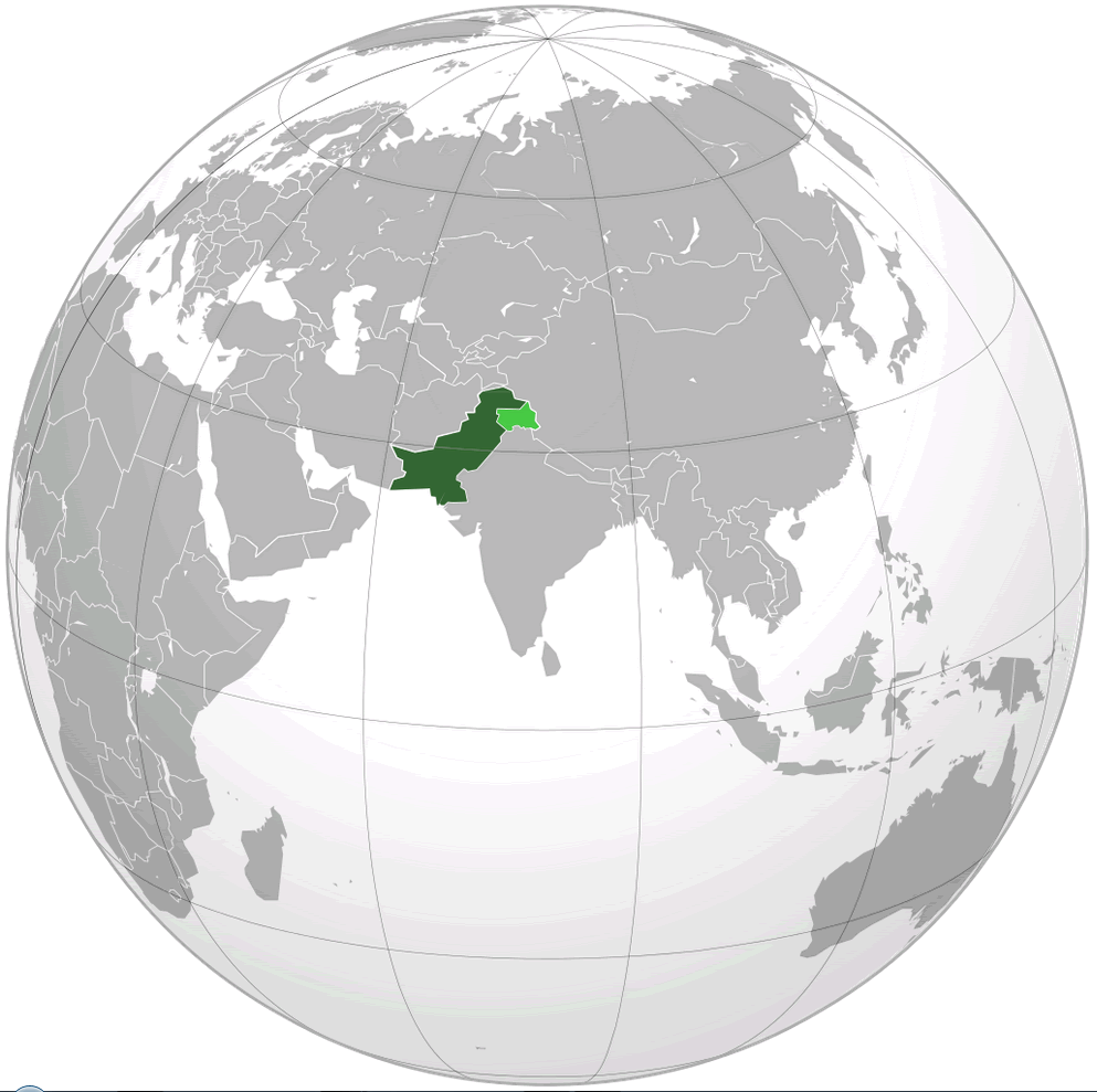
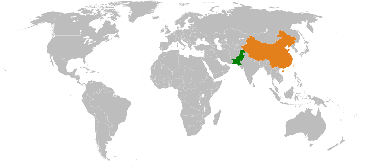
Where Is Pakistan Located on the World Map?
 Pakistan location in the world, Asia, and its provinces.
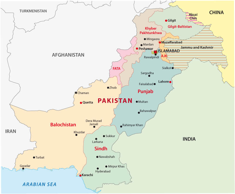
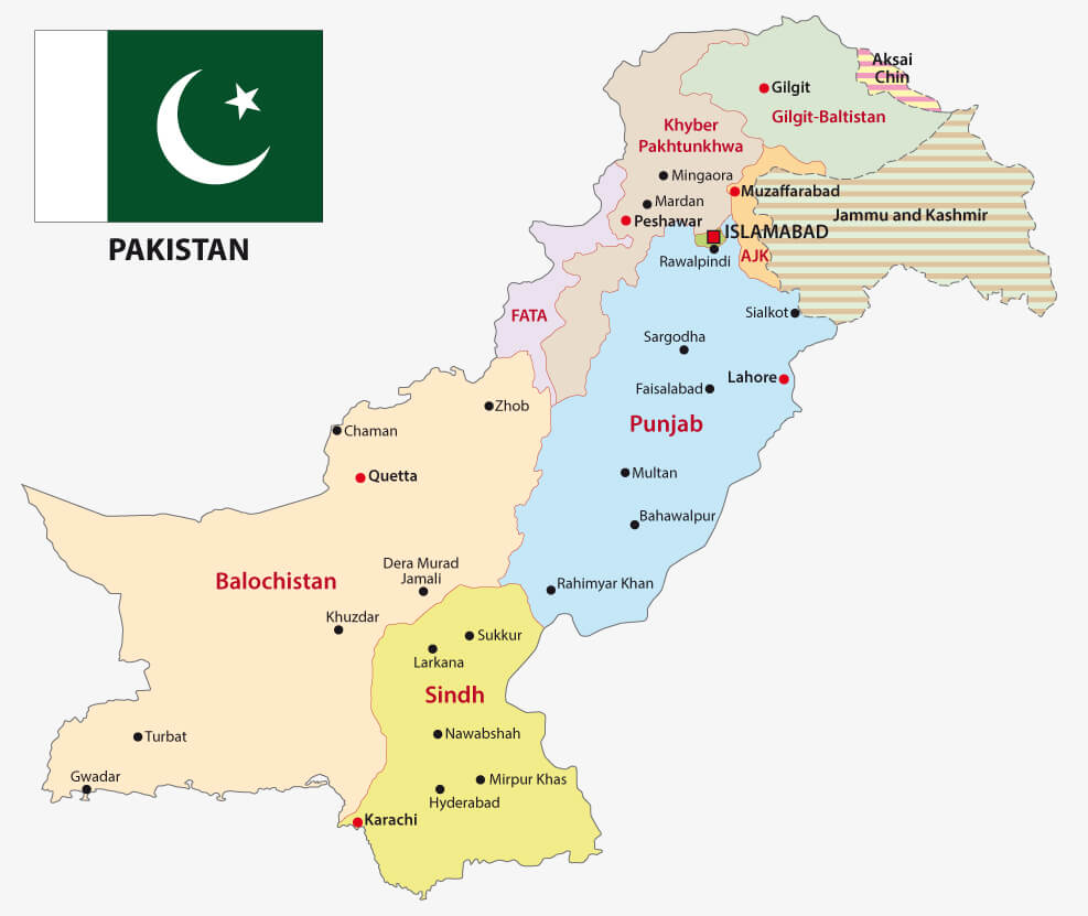
This map shows Pakistan’s position in the world and in Asia. It includes a detailed breakdown of Pakistan’s provinces such as Punjab, Sindh, Balochistan, Khyber Pakhtunkhwa and regions such as Gilgit-Baltistan and Azad Kashmir. The map also shows Pakistan’s position in relation to its neighbours, highlighting its geographical and political divisions.
Pakistan’s strategic location makes it a key player in regional geopolitics. It functions as a crucial transit route for trade and energy, connecting China and Central Asia with the Indian Ocean. Its coastline, particularly the port of Gwadar, plays a significant role in the China-Pakistan Economic Corridor (CPEC), further solidifying its position as a hub for global trade and energy supplies. This unique geographical position has historically shaped its economic, cultural, and political importance.
Here are some statistical information about Pakistan:
 Area: 881,913 km2 (340,509 sq mi)
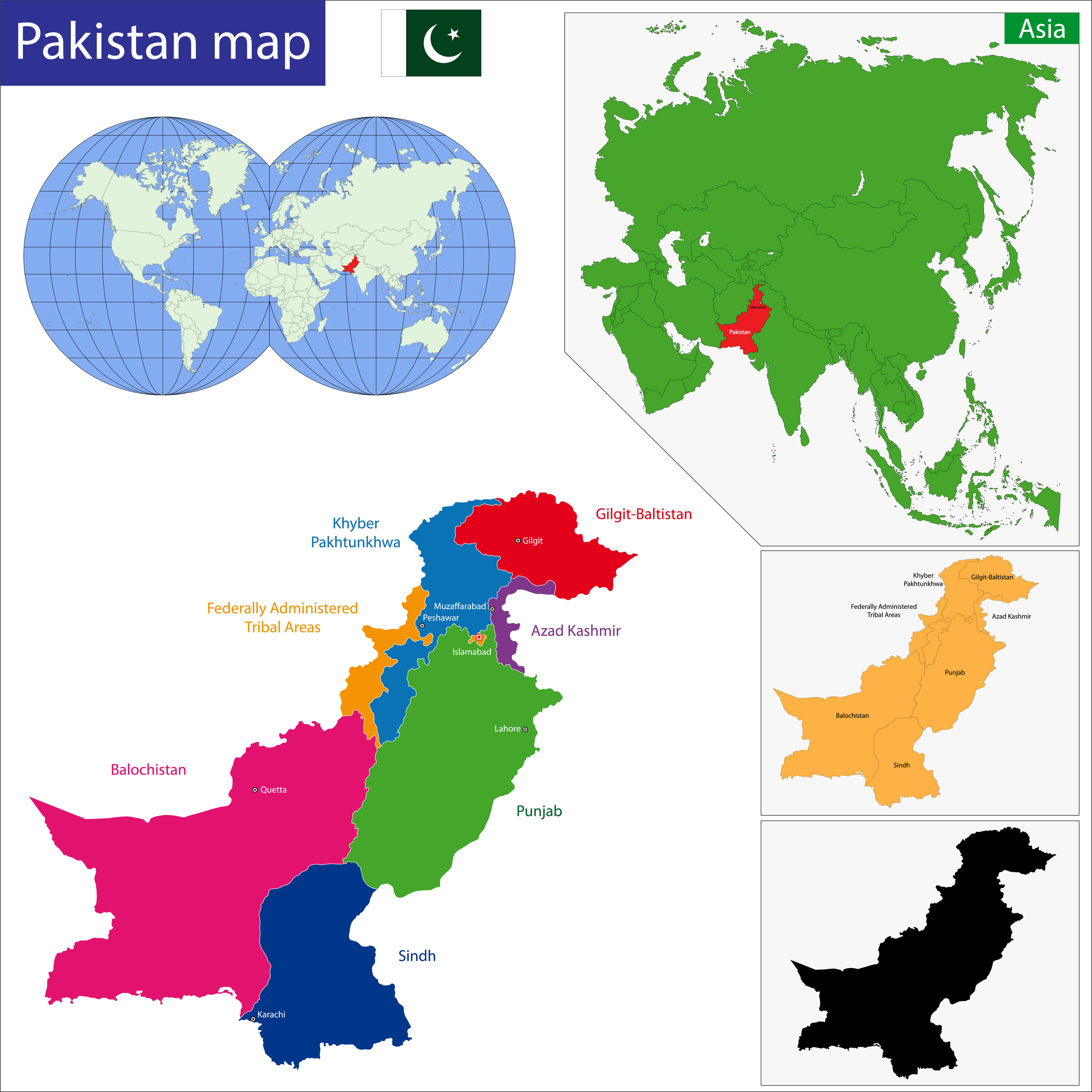
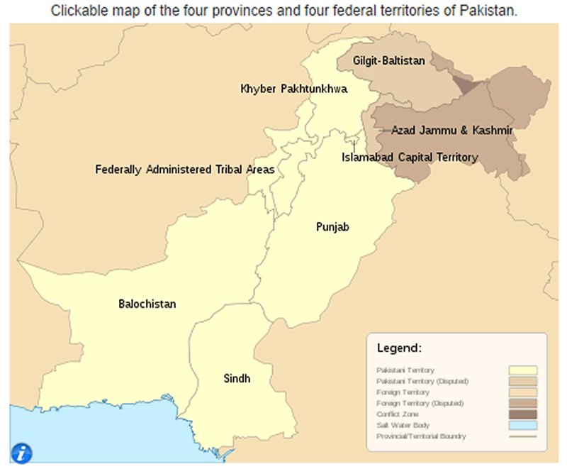
 Pakistan Provinces and Administrative Regions Map
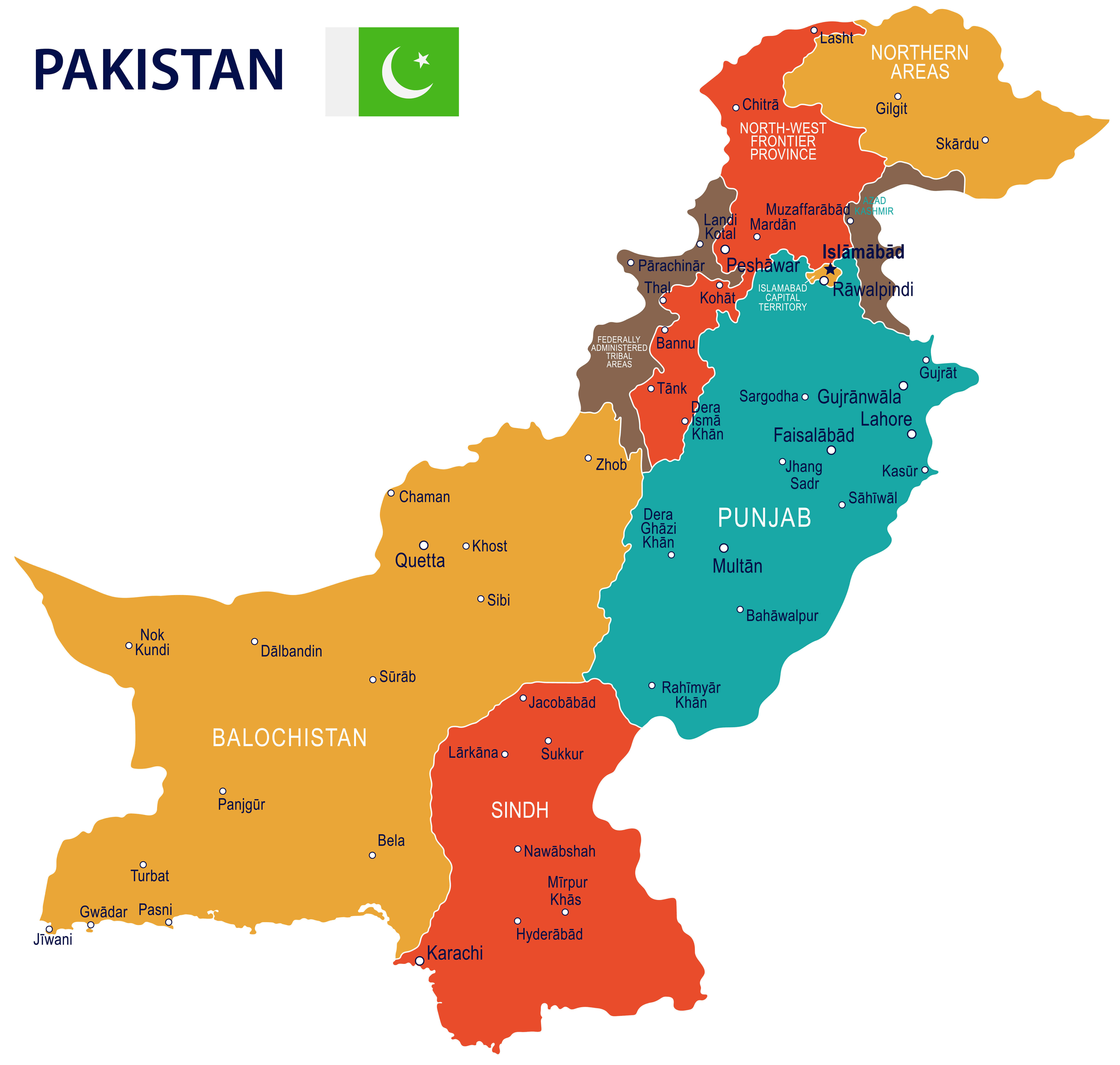
This map displays Pakistan’s provinces and administrative regions, including Punjab, Sindh, Balochistan, and Khyber Pakhtunkhwa, along with territories like Gilgit-Baltistan, Azad Jammu and Kashmir, and the Federally Administered Tribal Areas (FATA). It highlights major cities, borders with neighboring countries, and key geographical features.
Religion: 96.3% Islam (official), 2.2% Hinduism, 1.4% Christianity ,0.1% other.Pakistan provinces map with cities
 Currency: Pakistani rupee (PKR)
 Pakistan regions map with flag and cities
Map of Pakistan
Pakistan Location Map
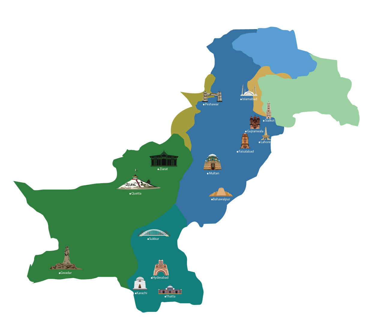
Pakistan Provinces Map with Federal Territories
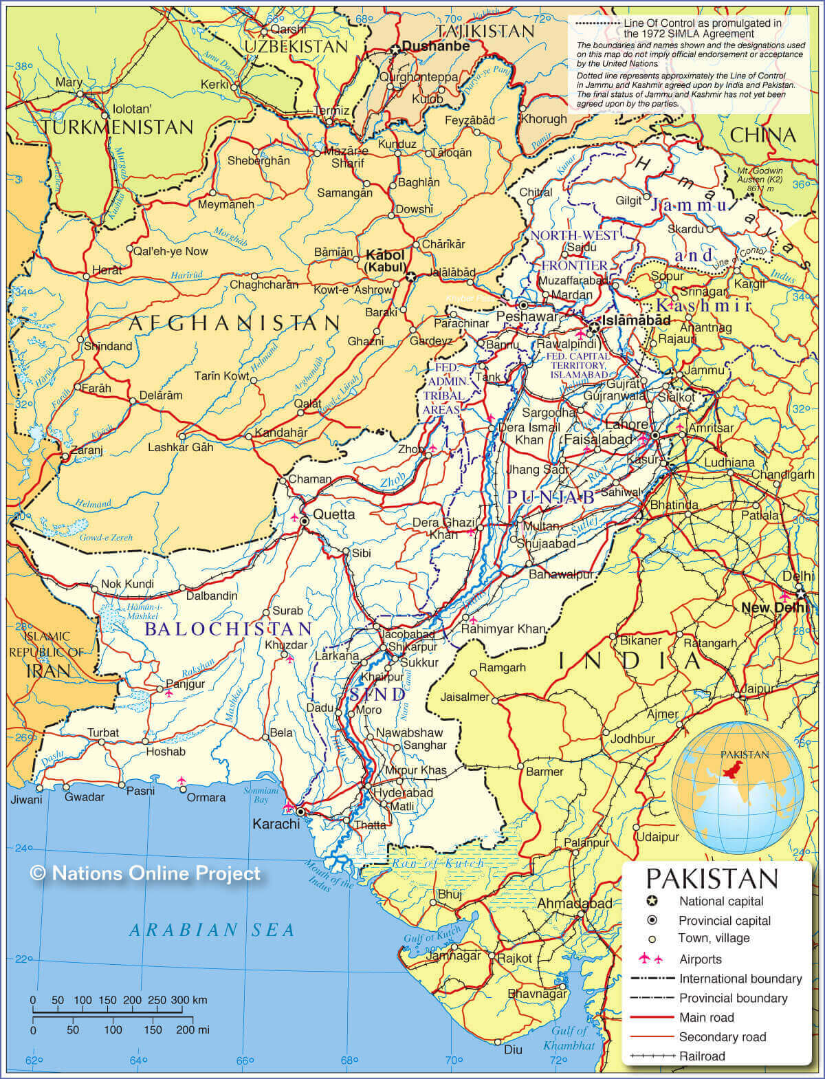
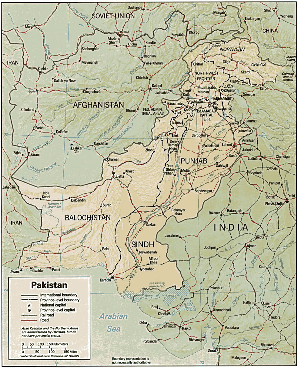
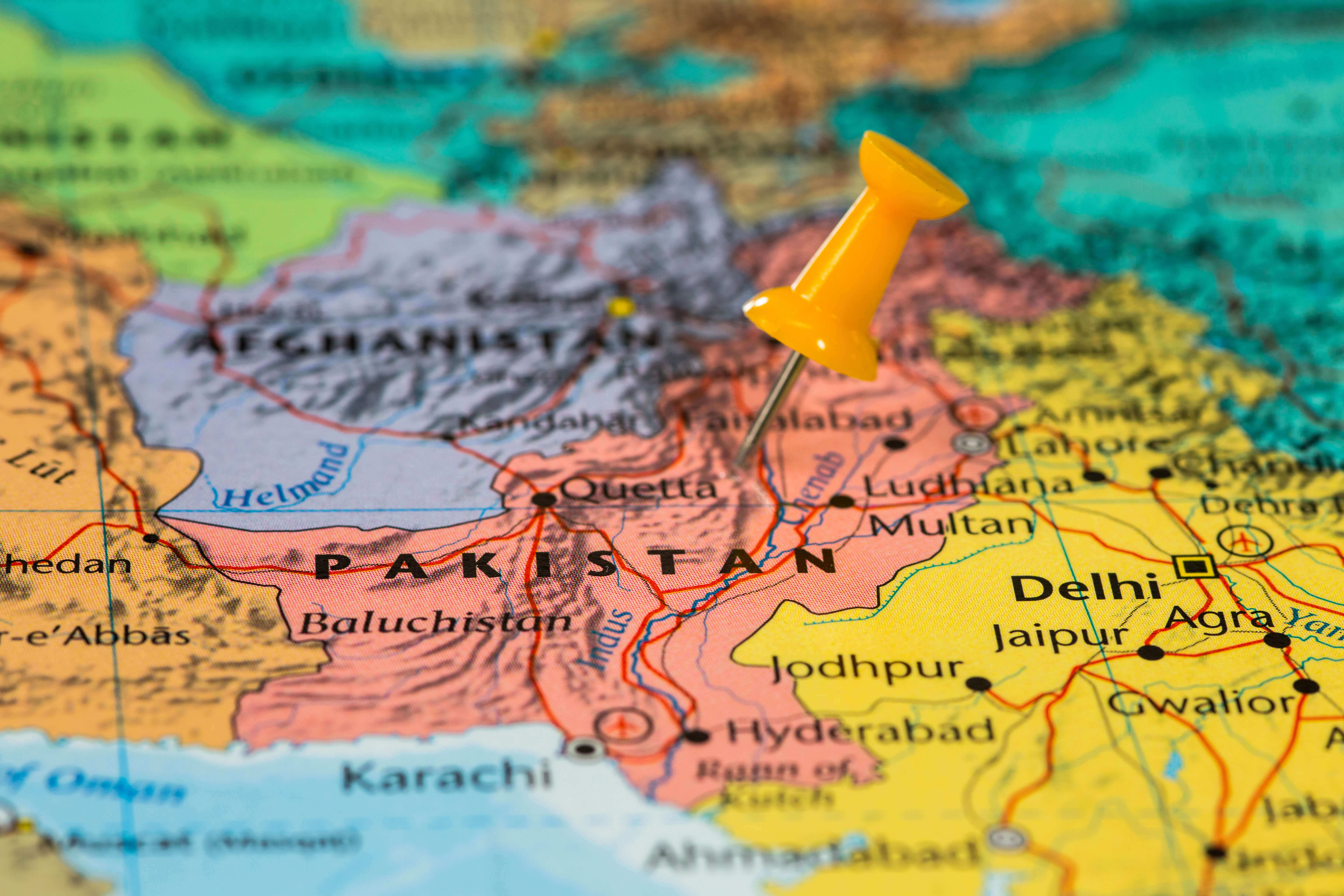
Pakistan Map India Afghanistan
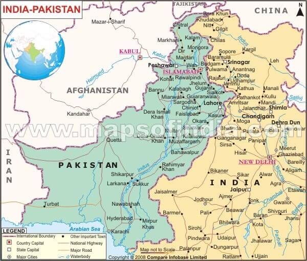 Political map highlighting India-Pakistan and Afghanistan border areas.
This map illustrates the border regions between India, Pakistan, and Afghanistan. It includes major cities, rivers, and international boundaries, emphasizing the geographical and political context of South Asia.
Pakistan Administrative Map
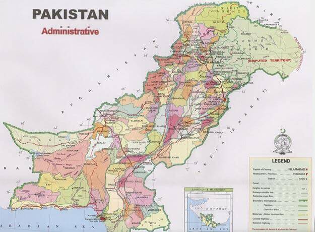
Political Pakistan Map
Pakistan Agriculture Map
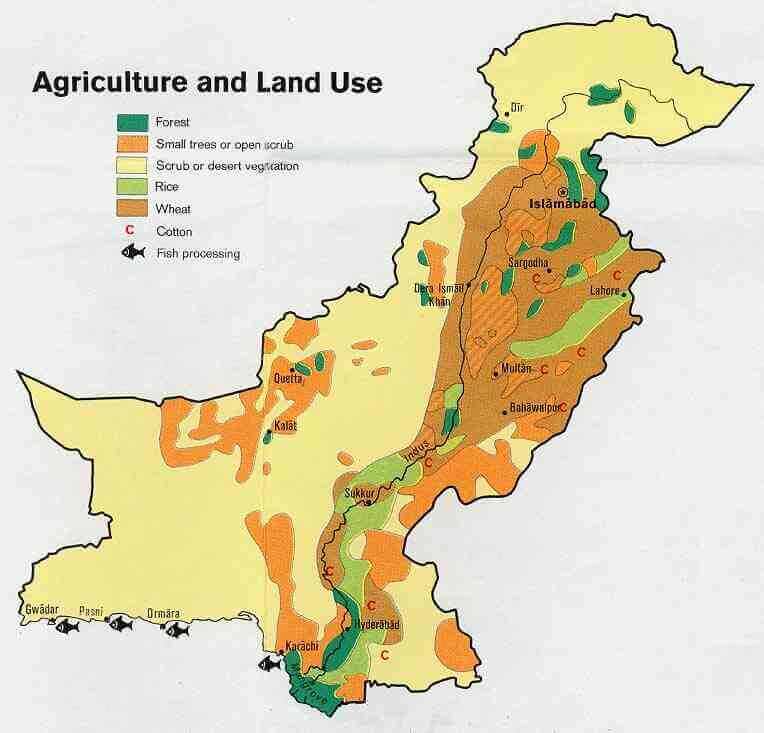 Map showing agricultural and land use in Pakistan with regions for forests, small trees, desert vegetation, rice, wheat, cotton, and fish processing areas.
This map highlights Pakistan’s diverse agricultural zones, including forests, cotton production areas in the Indus plain, and fish processing near Karachi. It showcases the country’s reliance on regional agriculture for economic sustenance.
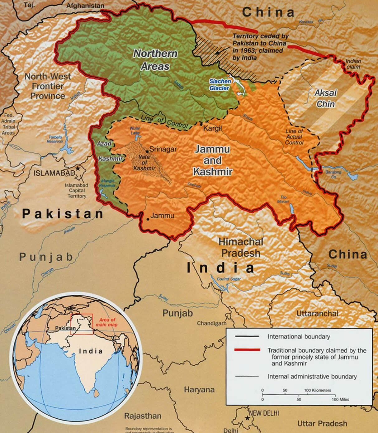
Pakistan Kashmir Map
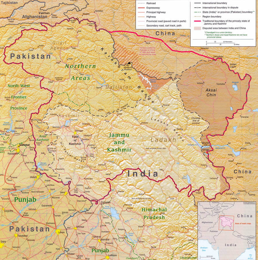 Map highlighting the disputed Kashmir region between Pakistan, India, and China.
This map details the territorial boundaries and disputes in the Kashmir region, including areas controlled by Pakistan, India, and China. It shows key provinces, roads, and natural features, reflecting the geopolitical complexities.
Pakistan Map Taliban Presence
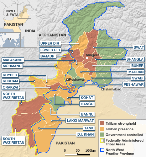 Map showing Taliban presence and control in northwest Pakistan.
This map outlines areas in northwest Pakistan, highlighting Taliban strongholds, areas with Taliban presence, government-controlled regions, and the Federally Administered Tribal Areas (FATA) near the Afghanistan border.
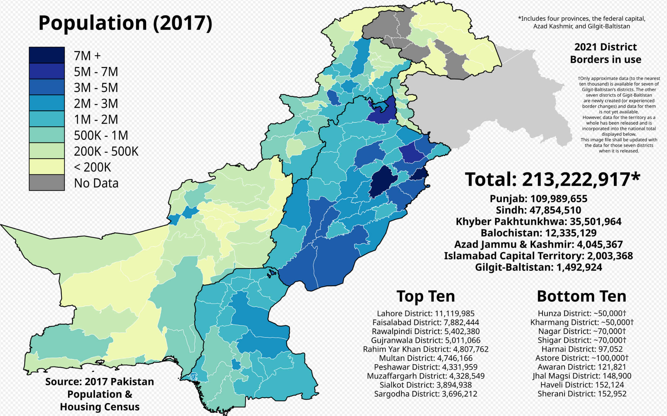
Pakistan Population Map
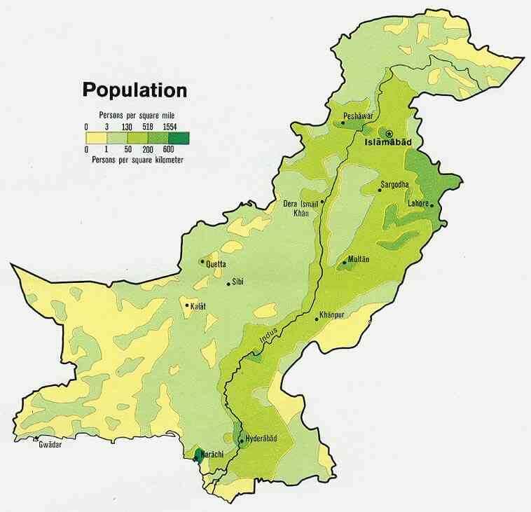 Map showing population density in Pakistan by region.
This map illustrates the population density across Pakistan, with darker shades indicating areas of higher density, such as Lahore, Karachi, and Islamabad, while lighter shades show sparsely populated regions like Balochistan.
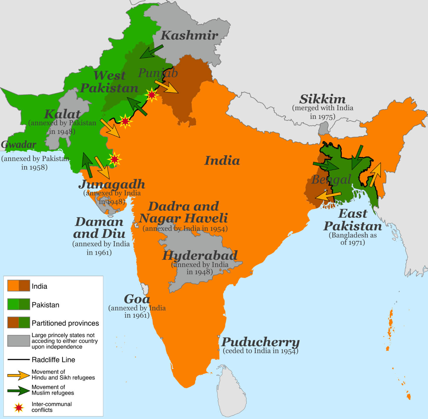
Pakistan Bangladesh independence map from India
Pakistan satellite map
Pakistan terrain map
Pakistan tourism map
Pakistani controlled areas with China and India border
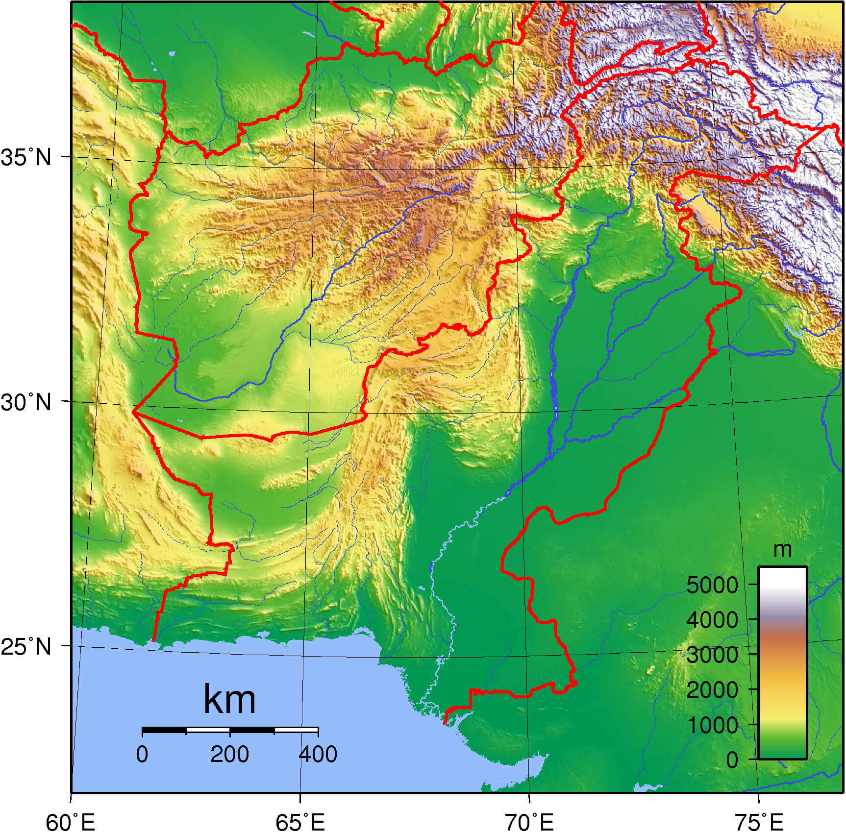
Pakistan topography map
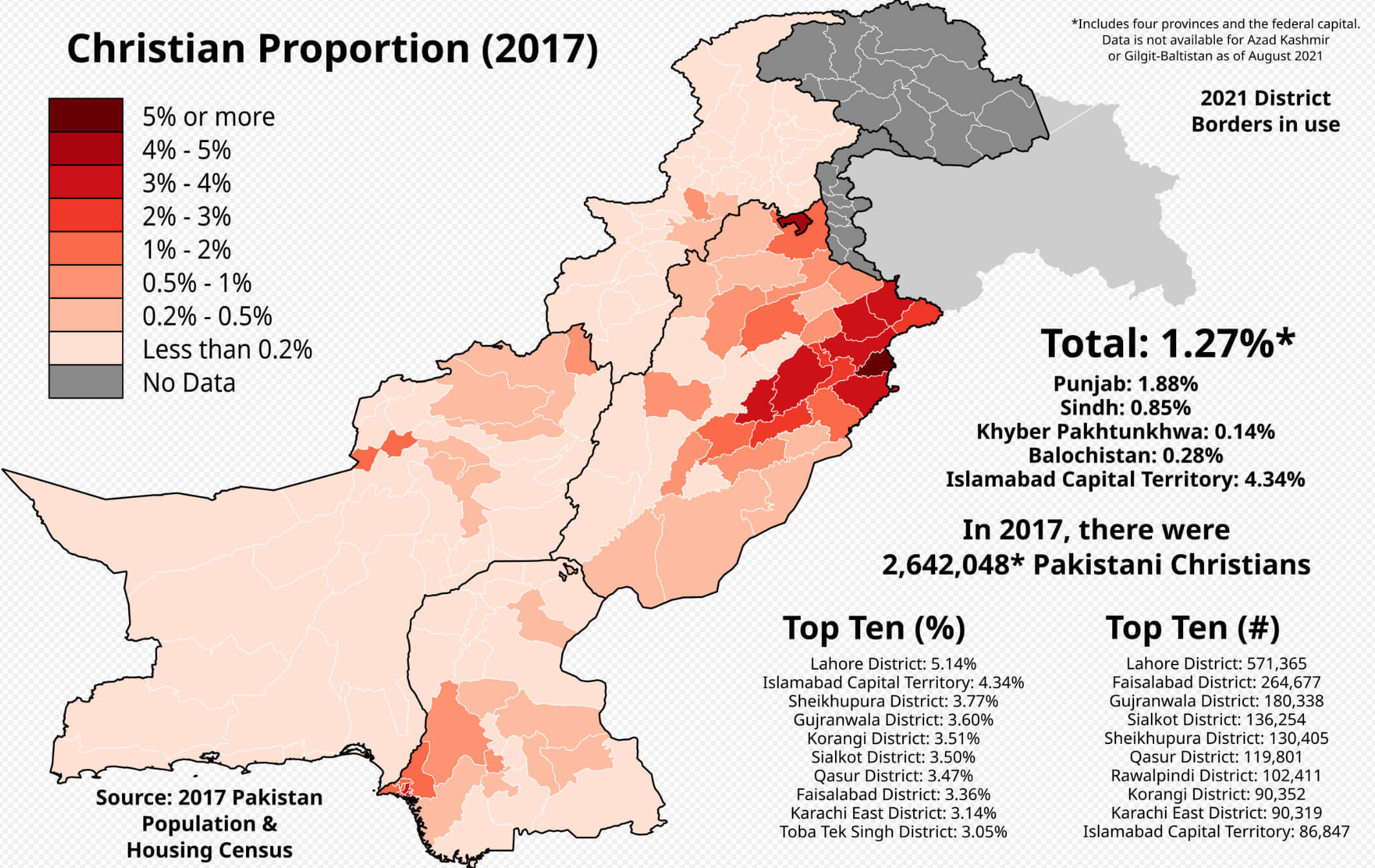
Christian population density map in Pakistan
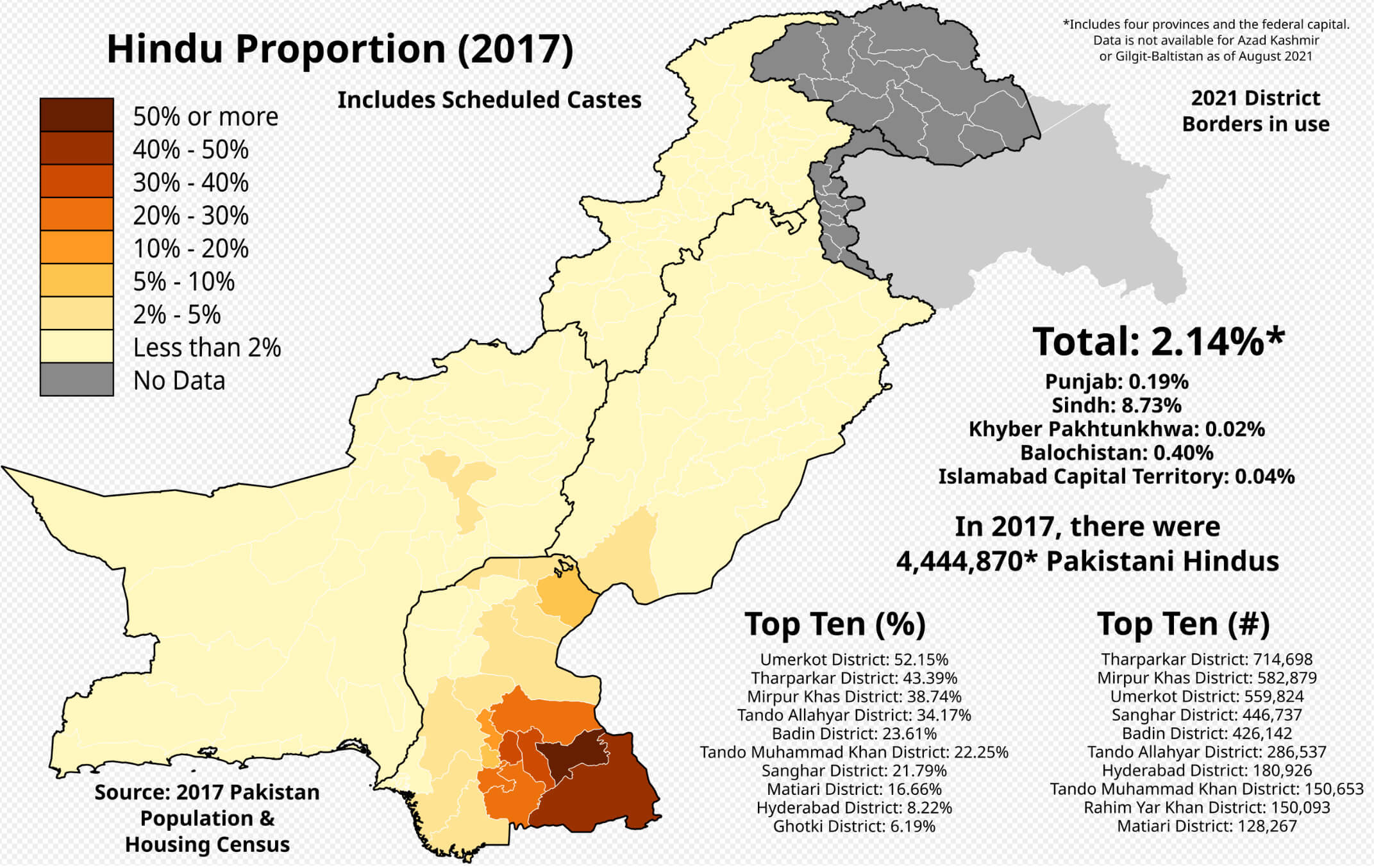
Hindu population density map in Pakistan
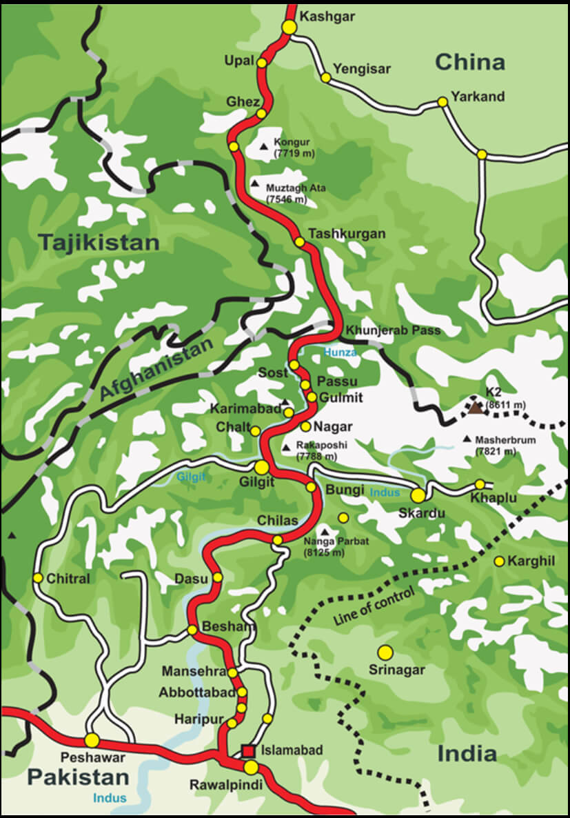
Karakoram highway connectin map to China
Pakistan blank map
Pakistan cities map with rivers
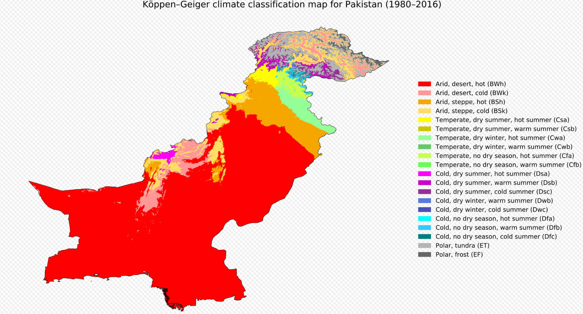
Pakistan climate map
Pakistan international border map
Pakistan location on asia map
Pakistan map with middle east
Pakistan map with neighbour countries
Pakistan physical map
Pakistan political map
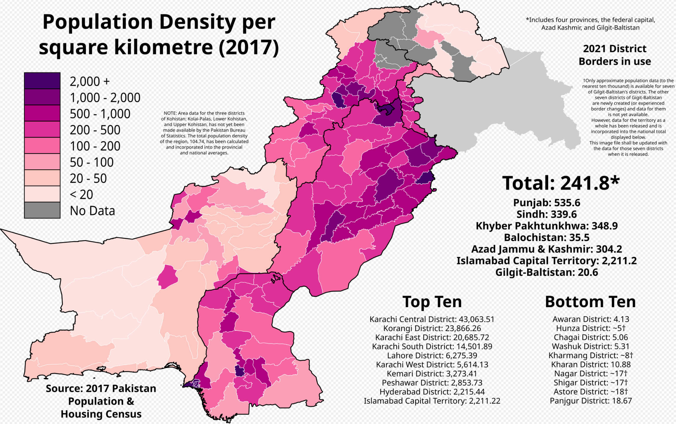
Pakistan population density map 2017
Pakistan population density map
Pakistan road and railroad map
Pakistan road map
Pakistan satellite map from space
Where is Pakistan on the Asia Map?
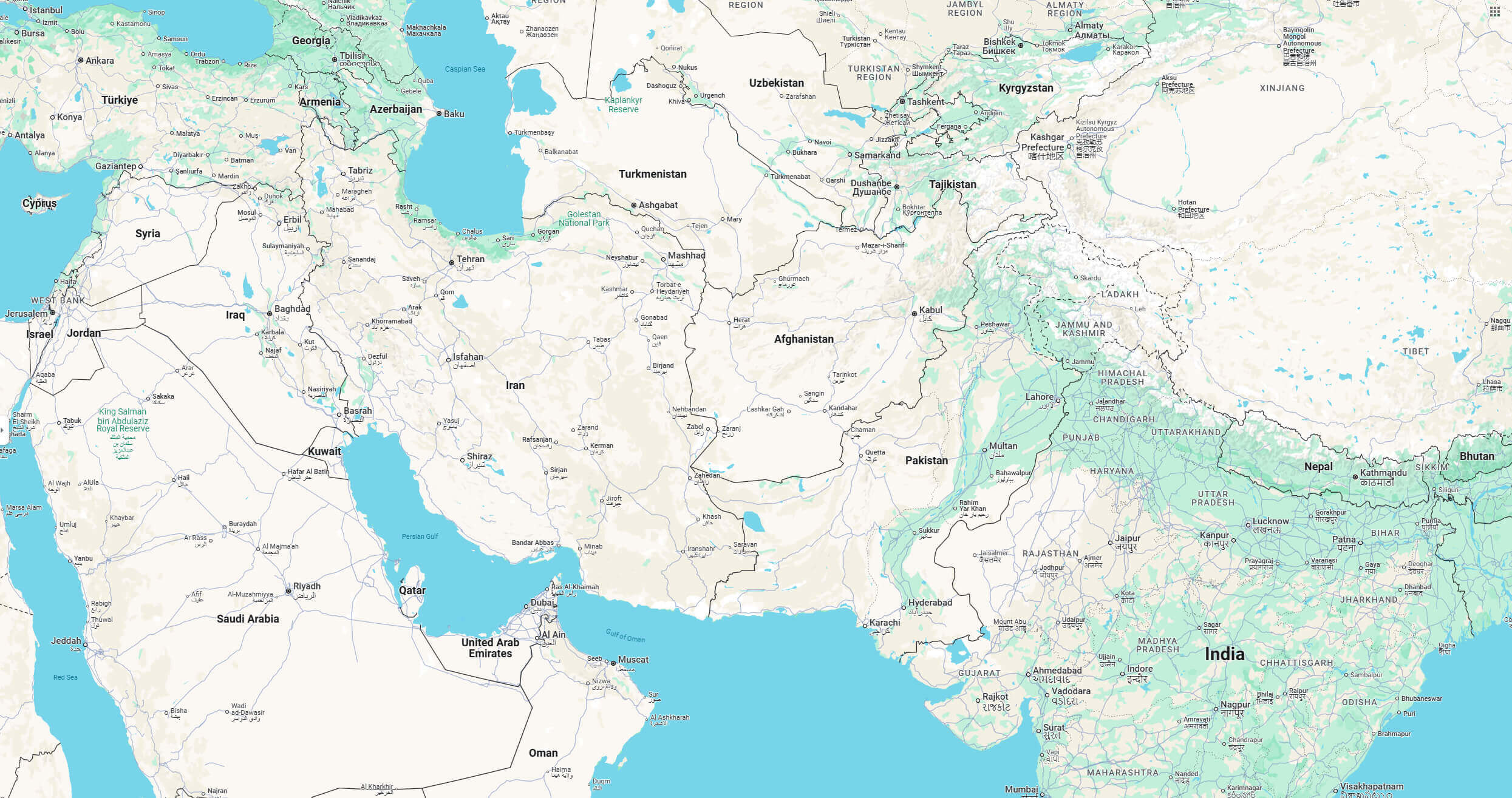
Show Google interactive map, satellite map, where is the country located.
Get directions by driving, walking, bicycling, public transportation and travel with street view.
Feel free to explore these pages as well:
- Iran: The Rise and Fall of Empires ↗️
- A Collection of Lebanon Maps ↗️
- Iraq Map ↗️
- Syria Map ↗️
- Jordan Map ↗️
- Israel Map ↗️
- Oman Map ↗️
- Saudi Arabia Map ↗️
- Kazakhstan Map ↗️
- Where is Located Qatar in the World? ↗️
- United States Map ↗️
- United Kingdom Map ↗️
- Türkiye Map ↗️
- Georgia Map ↗️
- Tel Aviv’s 10 Best Attractions ↗️
- Europe Map ↗️
- Asia Map ↗️