Explore Oman with detailed political, physical, satellite, and terrain maps. Discover major cities, rivers, and topography, including the Gulf of Oman and desert landscapes. Learn about its location, regions, borders with Saudi Arabia, UAE, and Yemen, as well as its rich history and tourism spots. Get insights into Oman’s geography, relief maps, and satellite imagery.
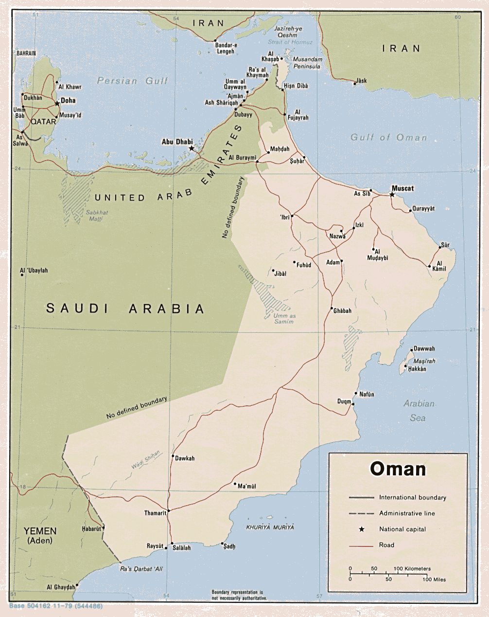
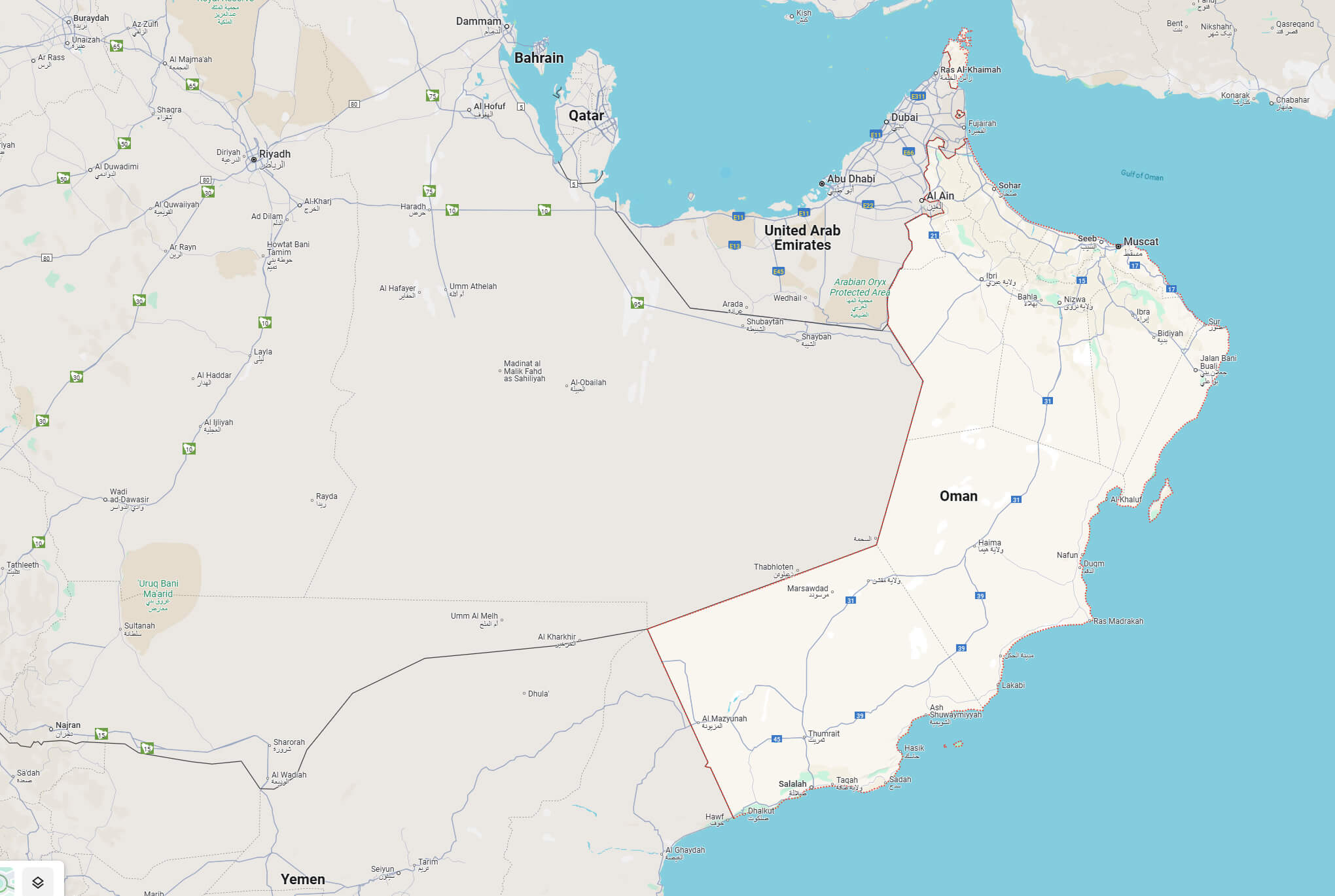
Detailed Road Map of Oman with Cities, Highways, and Neighboring Countries
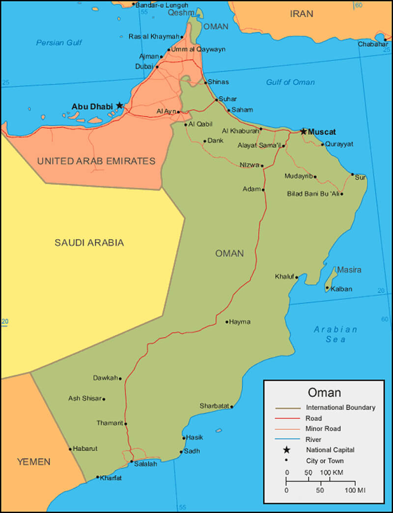
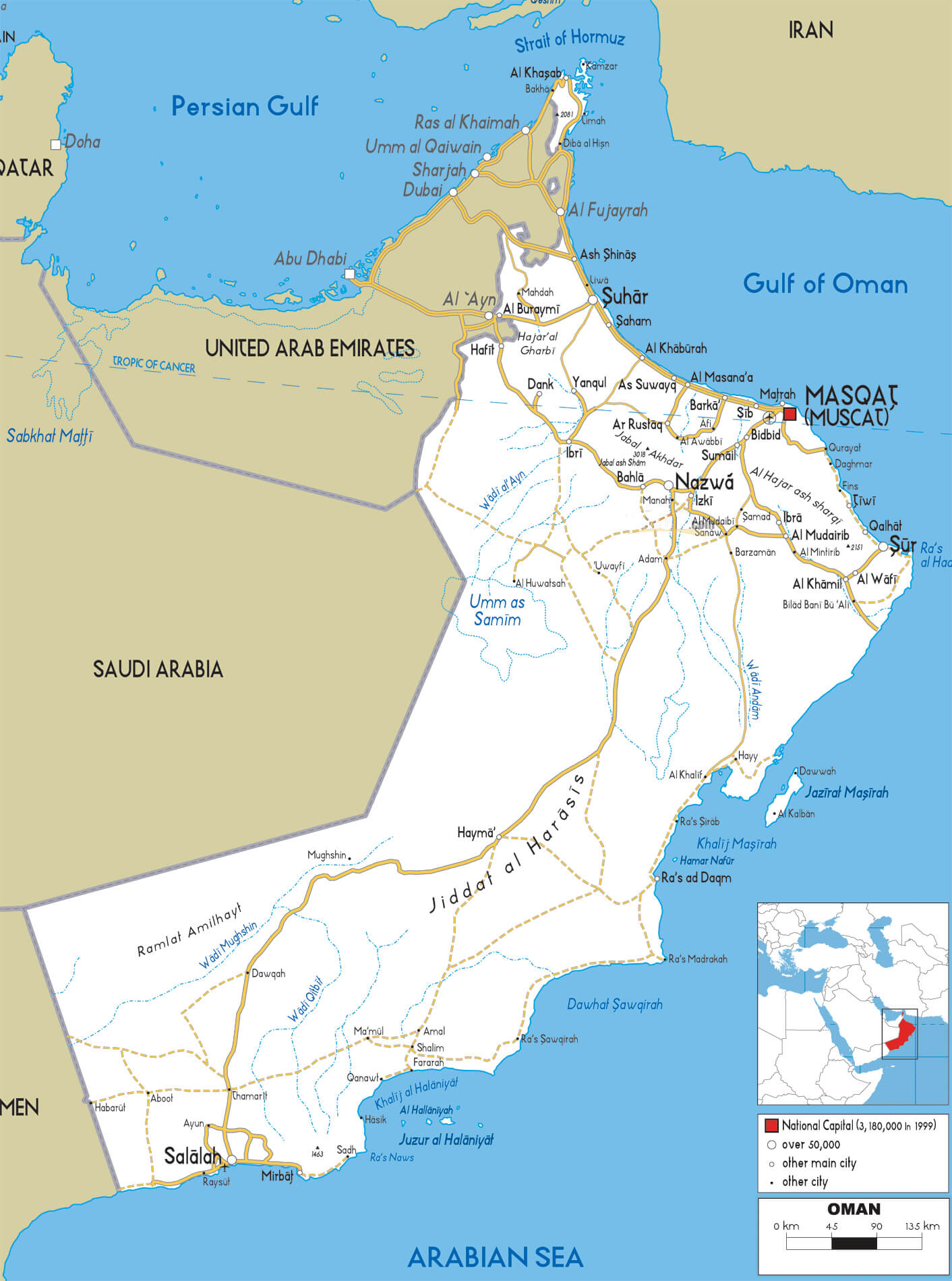 Oman road map with cities highways borders and geographical features
This Oman road map highlights major cities, highways and links to neighbouring countries, including Saudi Arabia, the United Arab Emirates and Yemen. The capital, Muscat, is shown along with major thoroughfares, coastal regions and desert areas. The map also highlights population centres and geographical landmarks.
Oman physical map
Brief information about Oman
Oman, officially the Sultanate of Oman, is a country on the southeastern tip of the Arabian Peninsula. It borders Saudi Arabia to the west, the United Arab Emirates to the north-west and Yemen to the south-west, while its extensive coastline meets the Arabian Sea and the Gulf of Oman. The capital, Muscat, is the cultural and political centre of the country. Renowned for its natural diversity, Oman boasts vast deserts, rugged mountains and a stunning coastline of pristine beaches and turquoise waters.
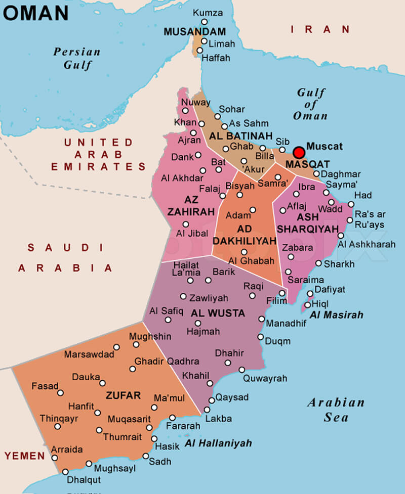
Political Map of Oman
With a population of around 4.5 million, Arabic is the official language and Islam, specifically the Ibadi sect, is the predominant religion. Oman is a monarchy, currently ruled by Sultan Haitham bin Tariq Al Said. The economy is heavily dependent on oil and natural gas, although the government has actively diversified into sectors such as tourism, fisheries and logistics. Oman’s rich history as a maritime trading hub has shaped its culture, which blends Arab, Persian and East African influences.
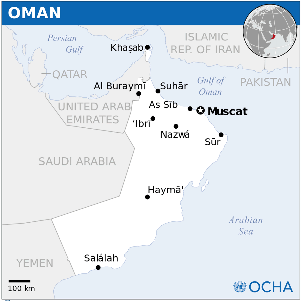
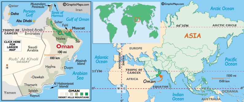
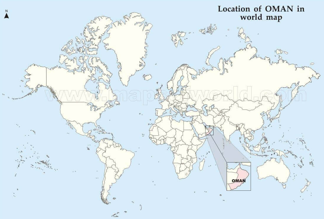
Where is located Oman on the World Map
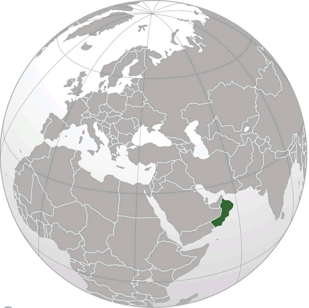 Where is located Oman on the World Map
Oman is located at the south-eastern tip of the Arabian Peninsula, making it a key geographical hub in the Middle East. It shares land borders with Saudi Arabia to the west, the United Arab Emirates to the northwest and Yemen to the southwest. Its eastern and southern coasts are washed by the Arabian Sea, while its northern coastline lies along the Gulf of Oman. This coastal location has given Oman a historic maritime identity and strategic importance.
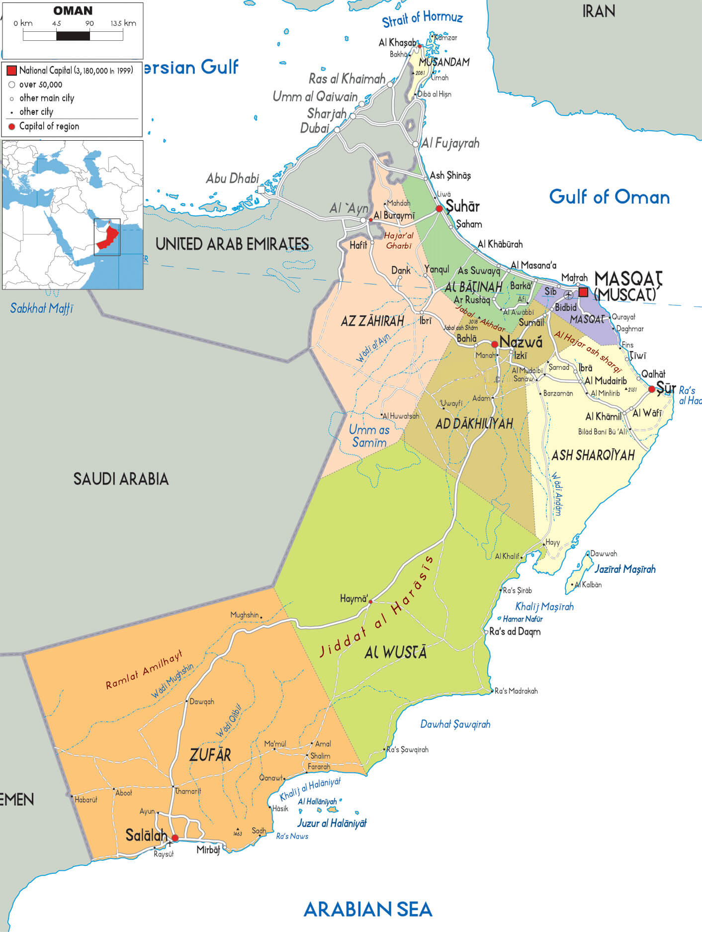
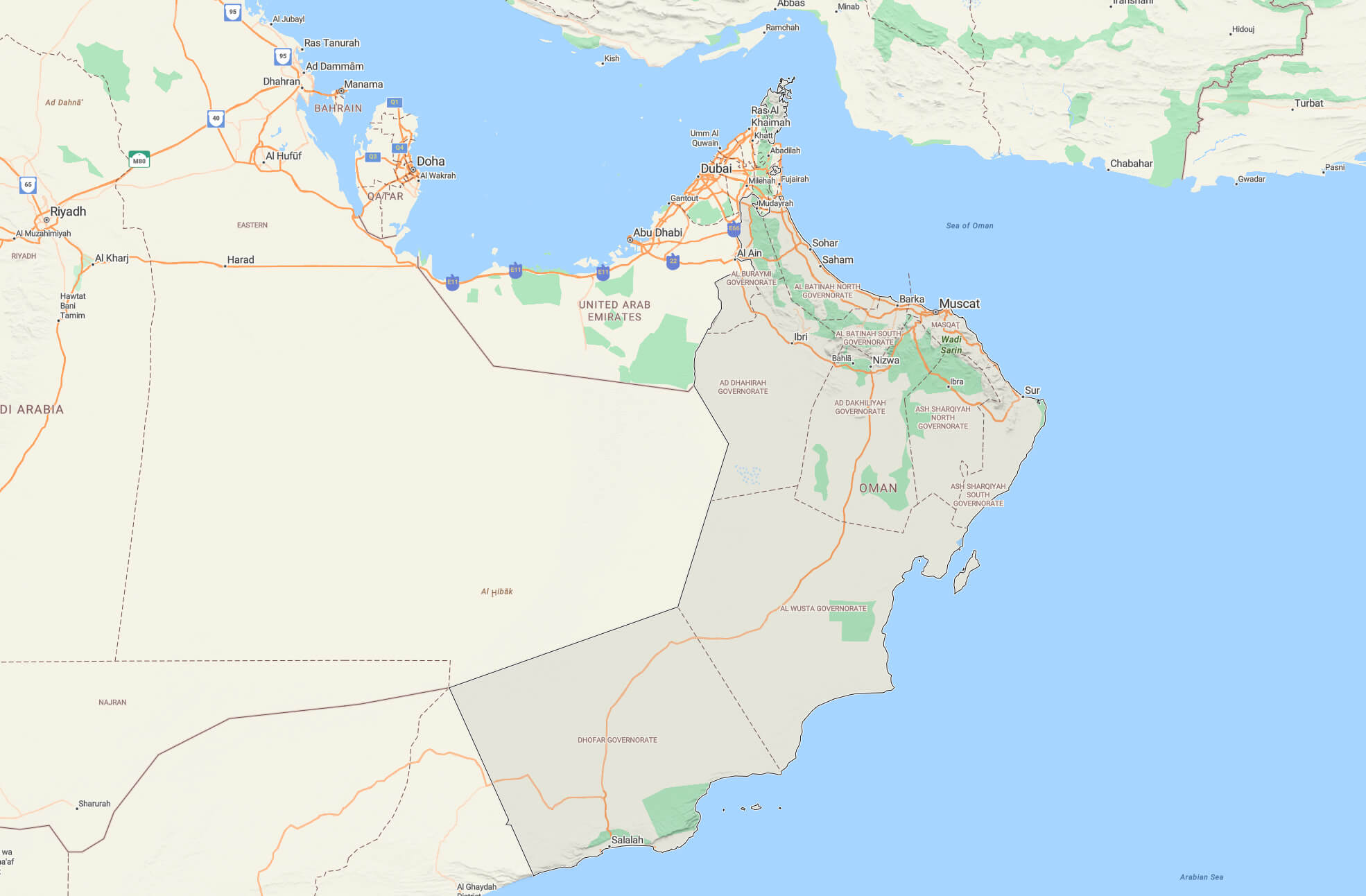
Oman provinces map with cities
The country’s proximity to the Strait of Hormuz, one of the world’s most important maritime chokepoints, adds to its geopolitical importance. The strait connects the Arabian Gulf with the Gulf of Oman and the Arabian Sea, and serves as a critical passageway for global oil shipments. Oman’s long coastline and control of islands in the region further enhance its influence in the region’s maritime trade and security.
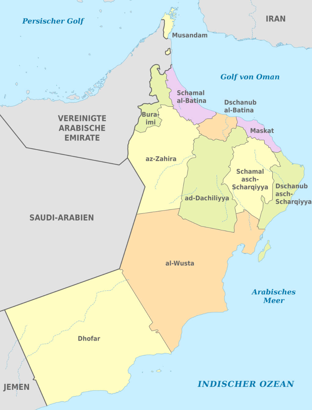
Oman administrative map in German
Oman’s location has historically made it a bridge between the Arabian Peninsula, Africa and South Asia. This has shaped its culture, trade networks and diplomatic relations, with the country playing a neutral and influential role in the Middle East. Its diverse terrain, from desert plains and rugged mountains to pristine beaches, also contributes to its unique geographical identity.
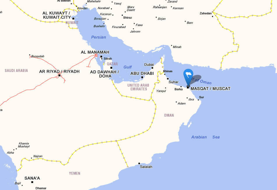
Oman Location Map
Here are some statistical information about Oman:
 Area: 309,500 km2 (119,500 sq mi)
 Oman population growth over time
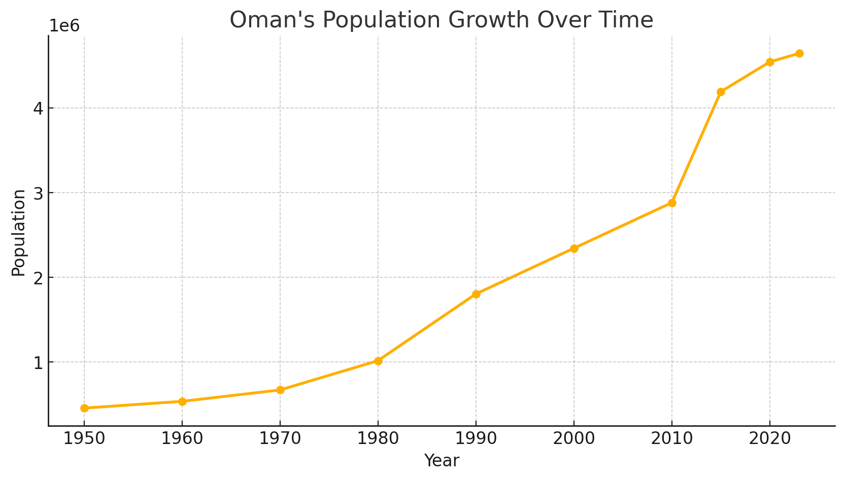
The line chart displaying Oman’s population growth over time. The chart visually represents the increase in population from 1950 to 2023, highlighting significant growth periods. Let me know if you need further modifications or analysis!
Oman major cities map
Tourist Map of Oman
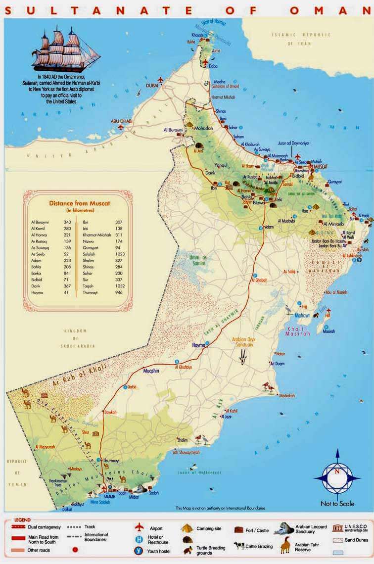 Illustrated tourist map of Oman with key attractions and distances.
This map highlights Oman’s main tourist attractions, including forts, castles, natural reserves, and turtle breeding grounds. It also lists key distances from Muscat to major cities and showcases major roads, airports, and UNESCO sites.
Calling code: +968Oman country map
Map of Oman
Gulf Map Oman
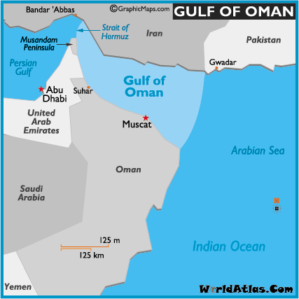 Map showing the Gulf of Oman with neighboring countries, cities, and seas.
This map highlights the Gulf of Oman, located between the Arabian Sea and the Strait of Hormuz, bordered by Oman, UAE, Iran, and Pakistan. It also shows nearby cities like Muscat and key waterways.
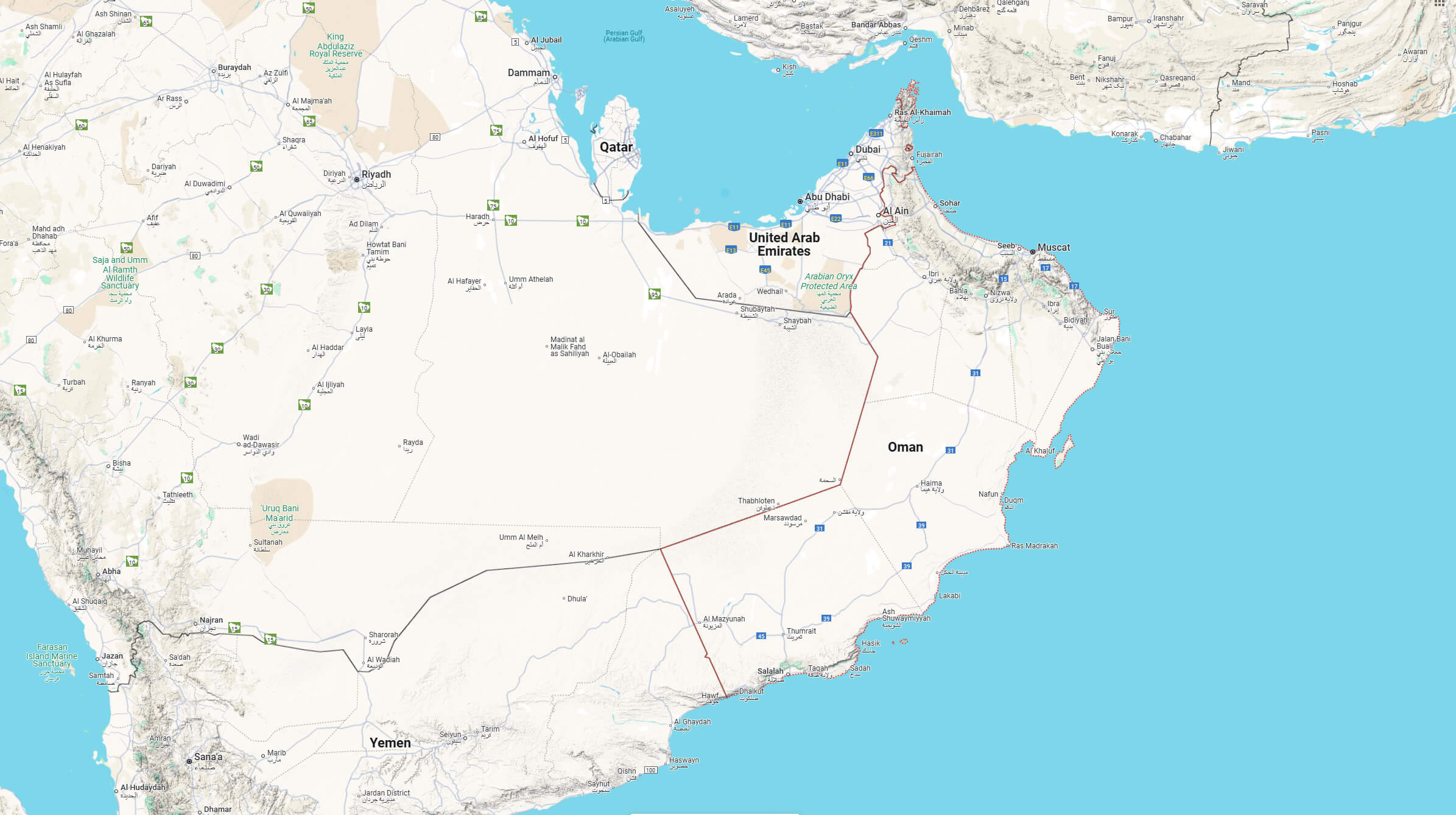
Map of Oman Middle East
Map of Oman World
Oman Outline Map
 Map of Oman showing cities, roads, and neighboring countries.
This map details Oman and its borders with Saudi Arabia, Yemen, and the UAE, as well as the Gulf of Oman and Arabian Sea. Key cities like Muscat, Salalah, and Sohar are marked alongside major roads and administrative boundaries.
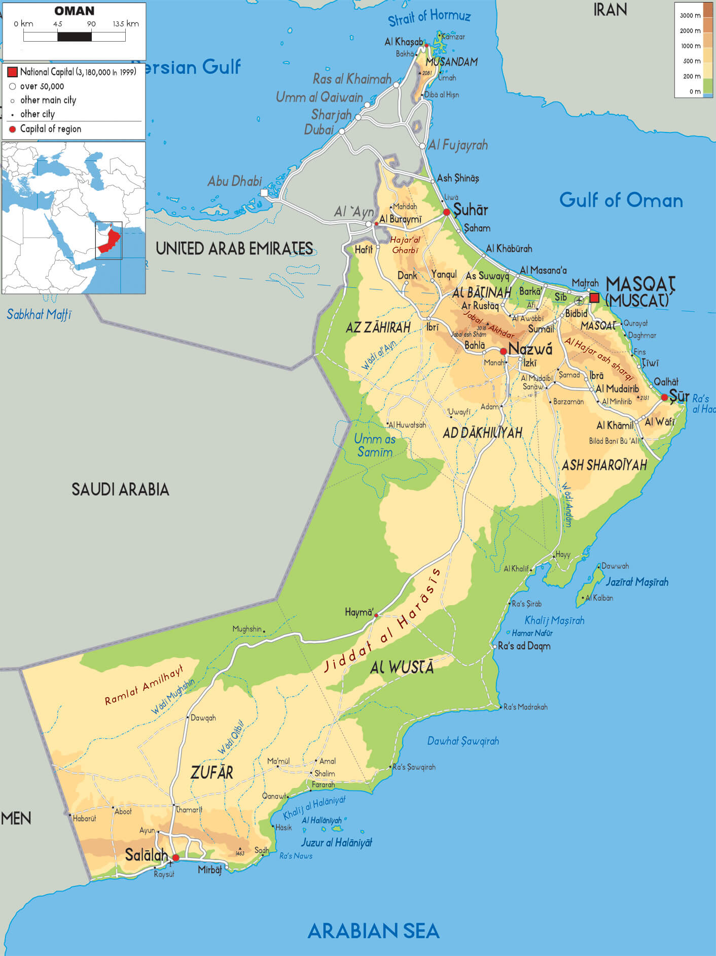
Oman Relief Map
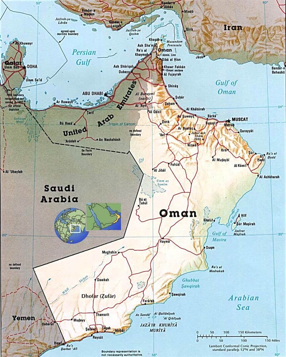 Relief map of Oman showing key geographical features and borders.
This map displays Oman’s geographical diversity, including mountain ranges, deserts, and coastlines along the Arabian Sea and the Gulf of Oman. It highlights neighboring countries and key cities like Muscat, Nizwa, and Salalah.
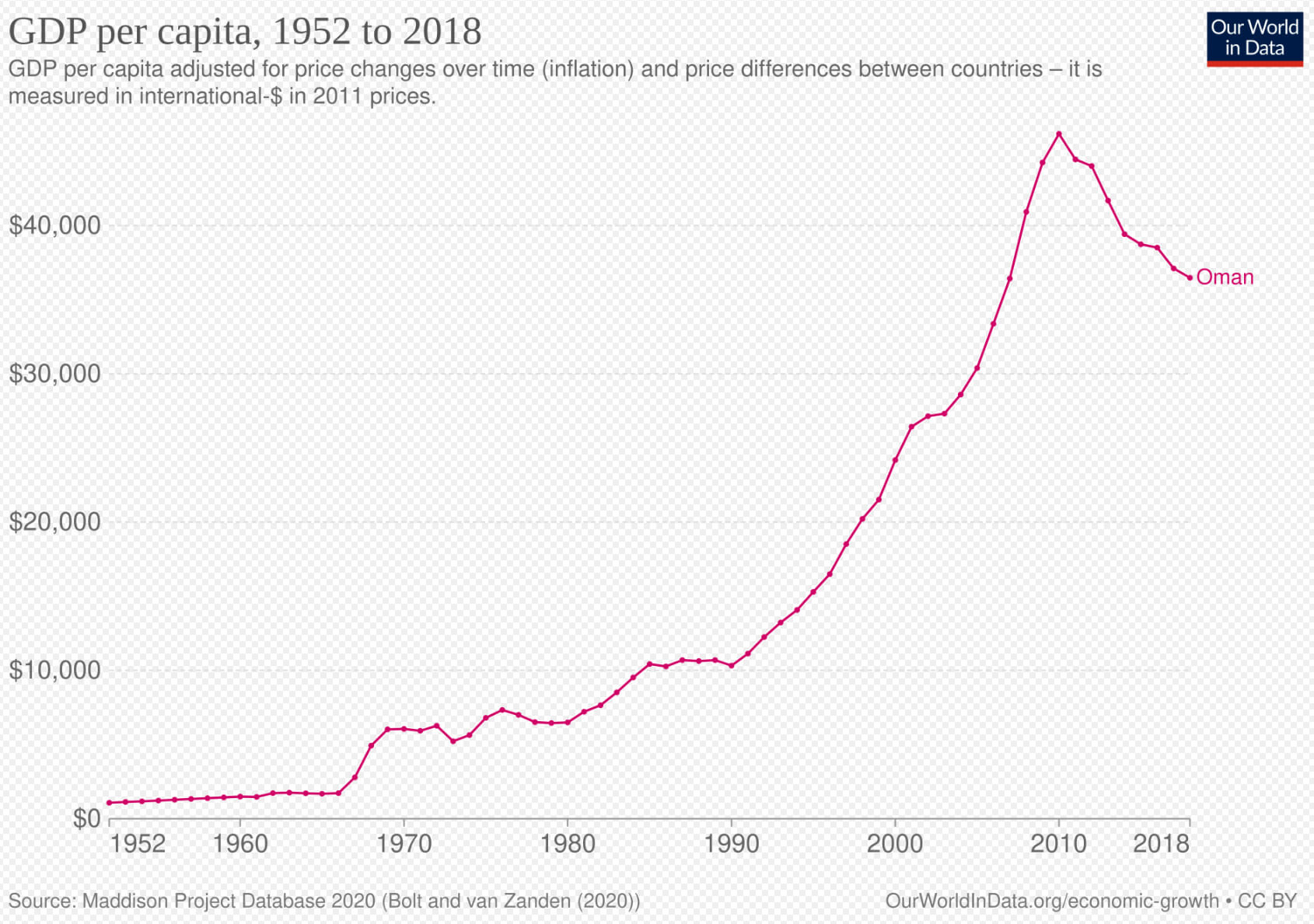
Historical development of Oman gdp per capita
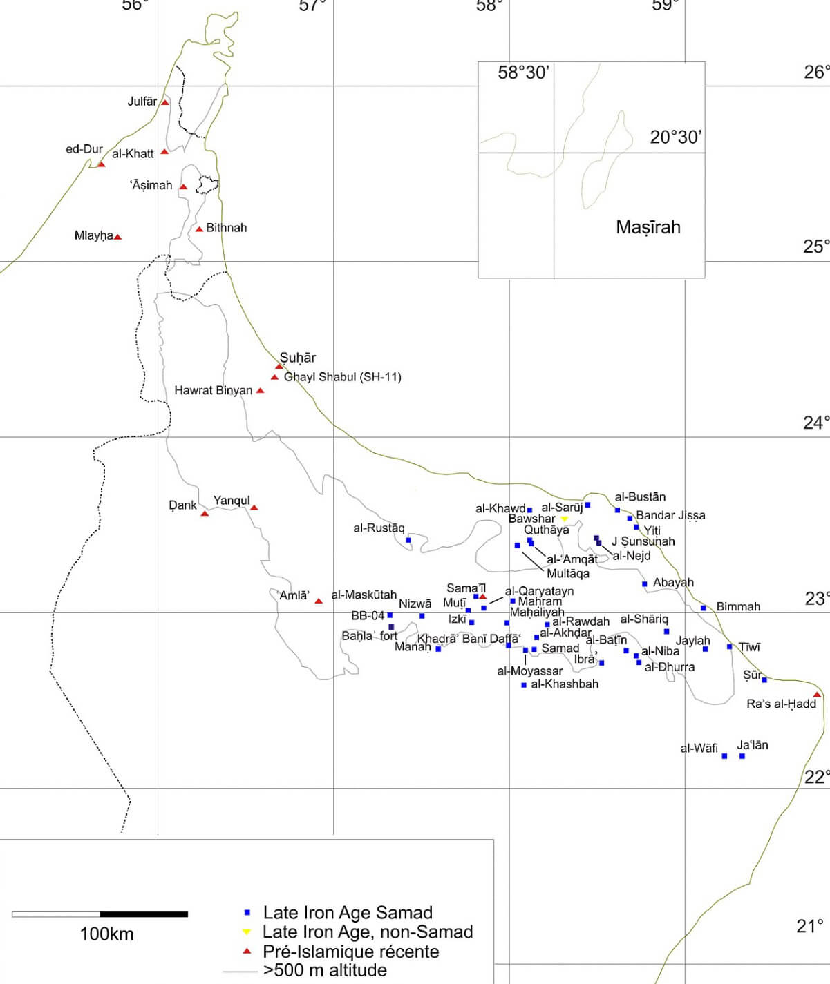
Late iron age sites map in Oman
Oman map in Arabic
Oman map with Masqat
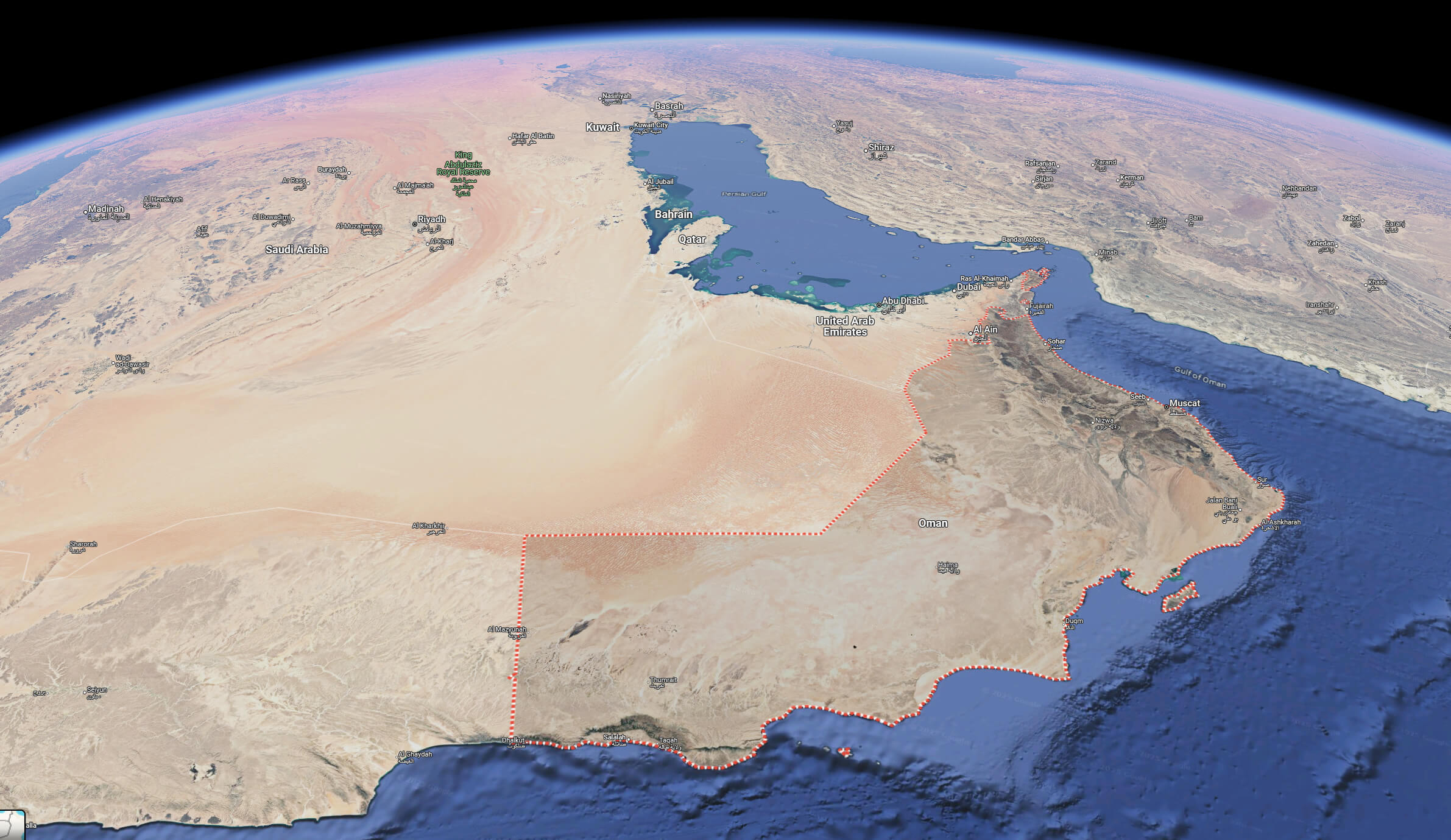
Oman satellite map from space
Oman terrain map
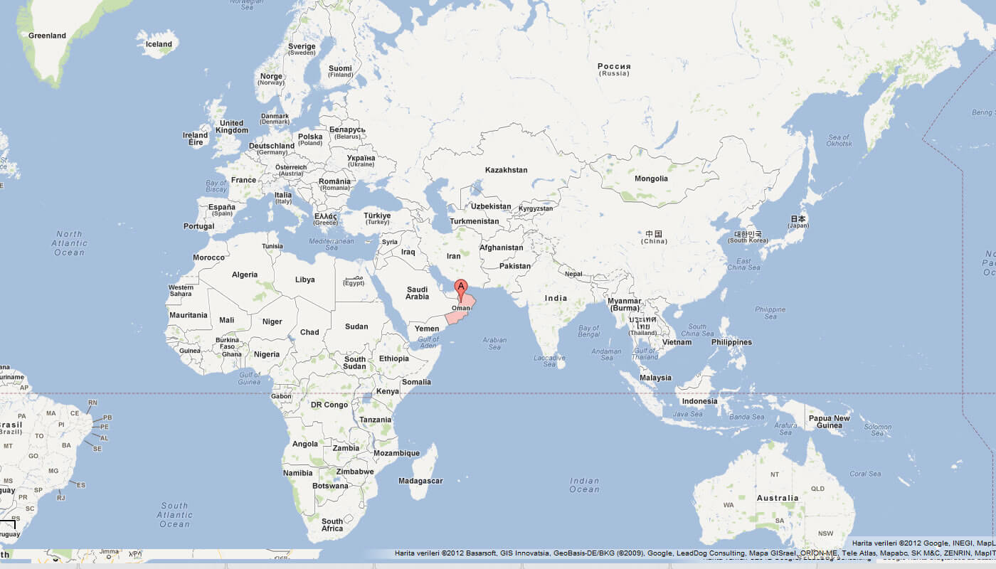
Where is located Oman in the world
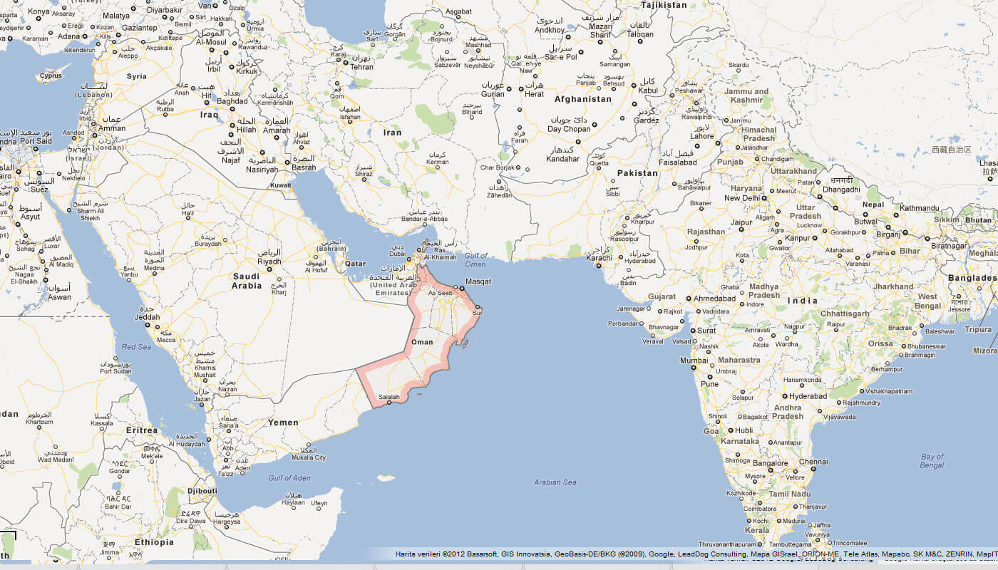
Where is Oman on the Asia Map?
Show Google interactive map, satellite map, where is the country located.
Get directions by driving, walking, bicycling, public transportation and travel with street view.
Feel free to explore these pages as well:
- Saudi Arabia Map ↗️
- Jordan Map ↗️
- Where is Located Qatar in the World? ↗️
- Iran Map ↗️
- Kuwait Map ↗️
- Pakistan Map ↗️
- United Arab Emirates Map ↗️
- Türkiye Map ↗️
- Europe Map ↗️
- Israel Map ↗️