Explore Lebanon’s rich geography with this collection of maps, which showcase everything from its coastal cities to the mountains that dominate the landscape. From the Mediterranean coastline to the iconic peaks of Mount Lebanon, this collection of maps captures the essence of Lebanon’s unique geography.
Brief information about Lebanon
Lebanon is a small but historically rich country located on the eastern coast of the Mediterranean Sea, bordered by Syria to the north and east, and Israel to the south. Known for its diverse geography, Lebanon boasts beautiful coastlines, mountainous regions, and fertile plains, making it a country of great natural beauty.
Lebanon Road Map
 This map of Lebanon shows the country’s road network, including major highways, arterial roads and secondary roads linking cities such as Beirut, Tripoli, Zahle and Sidon (Saida). It highlights the intricate road system that connects Lebanon’s coastal cities with its mountainous and inland regions, providing a clear view of transportation routes throughout the country.
The capital city, Beirut, is a vibrant cultural and economic hub, often referred to as the “Paris of the Middle East.” Lebanon has a long and complex history, with influences from ancient Phoenicians, Romans, Ottomans, and French colonialists, all contributing to its cultural diversity.
Lebanon is also known for its multi-religious society, with major faiths including Christianity, Islam, and Druze. Despite its small size, the country has played a significant role in the region’s history and continues to be a key player in Middle Eastern politics and culture.
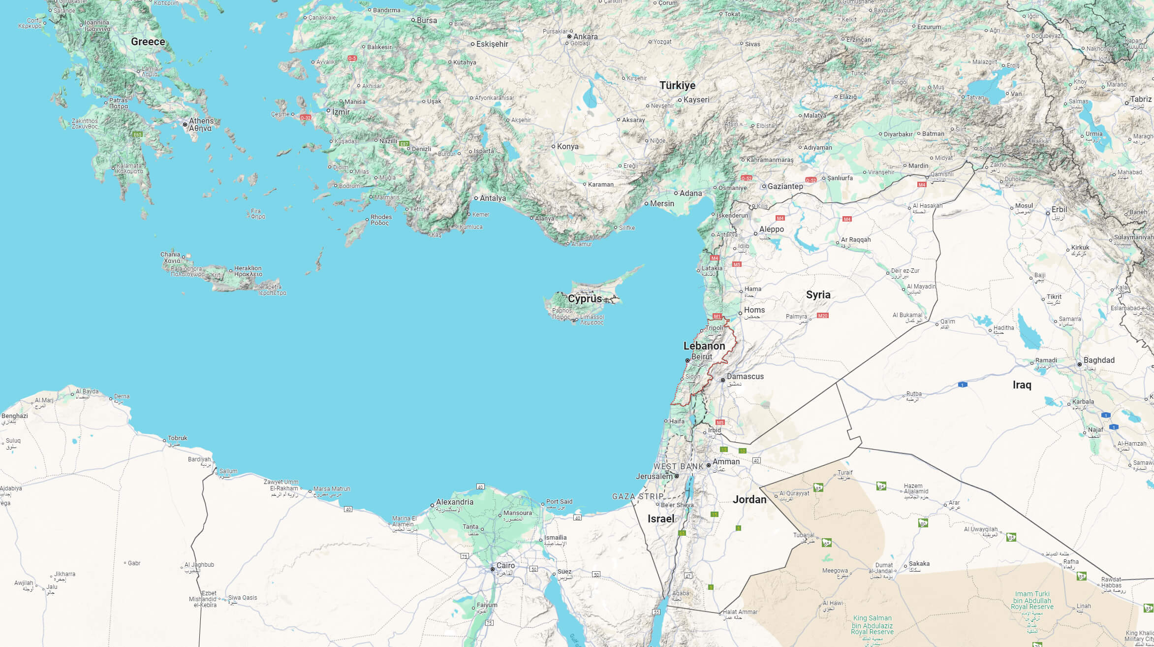
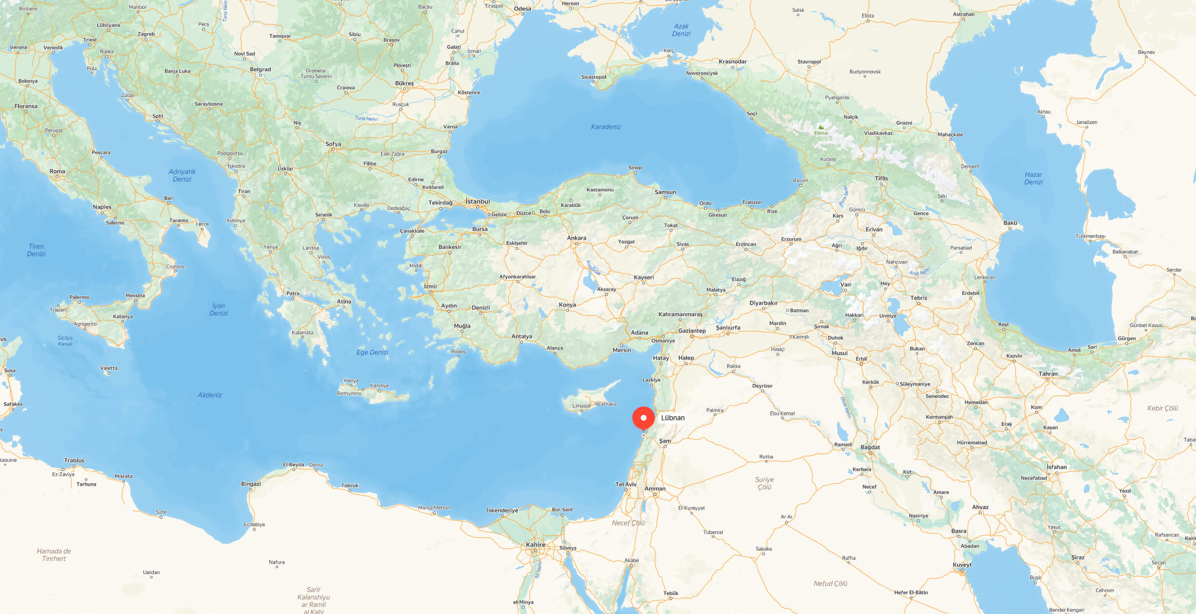
Where is located Lebanon on the World Map
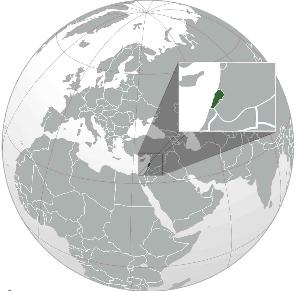
Lebanon is located in the Middle East on the eastern coast of the Mediterranean Sea. It is bordered by Syria to the north and east, Israel to the south, and the Mediterranean Sea to the west. This strategic location places Lebanon at the crossroads of Asia, Africa, and Europe, contributing to its rich cultural and historical significance. The capital, Beirut, lies on the western coastline, making it a major port city in the region.
Here are some statistical information about Lebanon:
 GDP (nominal): $21.780 billion (2022 estimate)
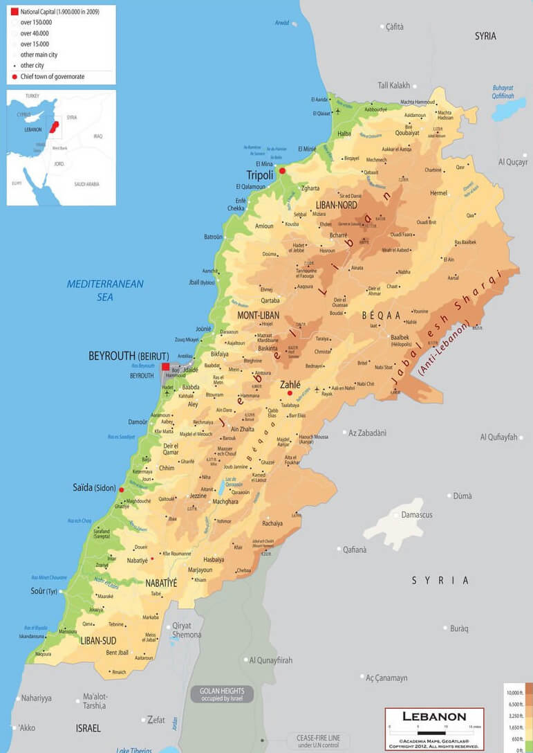
Lebanon Administrative Map
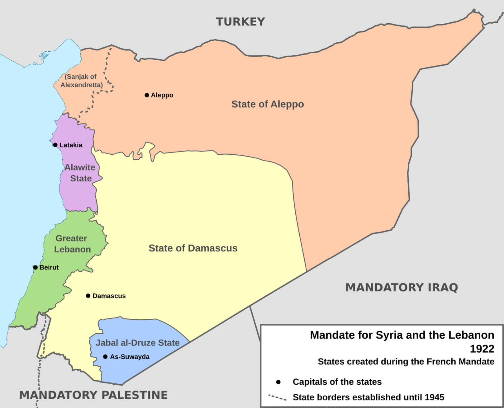
Map of the French Mandate and Lebanon, Syria in 1920
Lebanon Golan Heights Syria Map
Israel Hezbollah conflict map in Lebanon
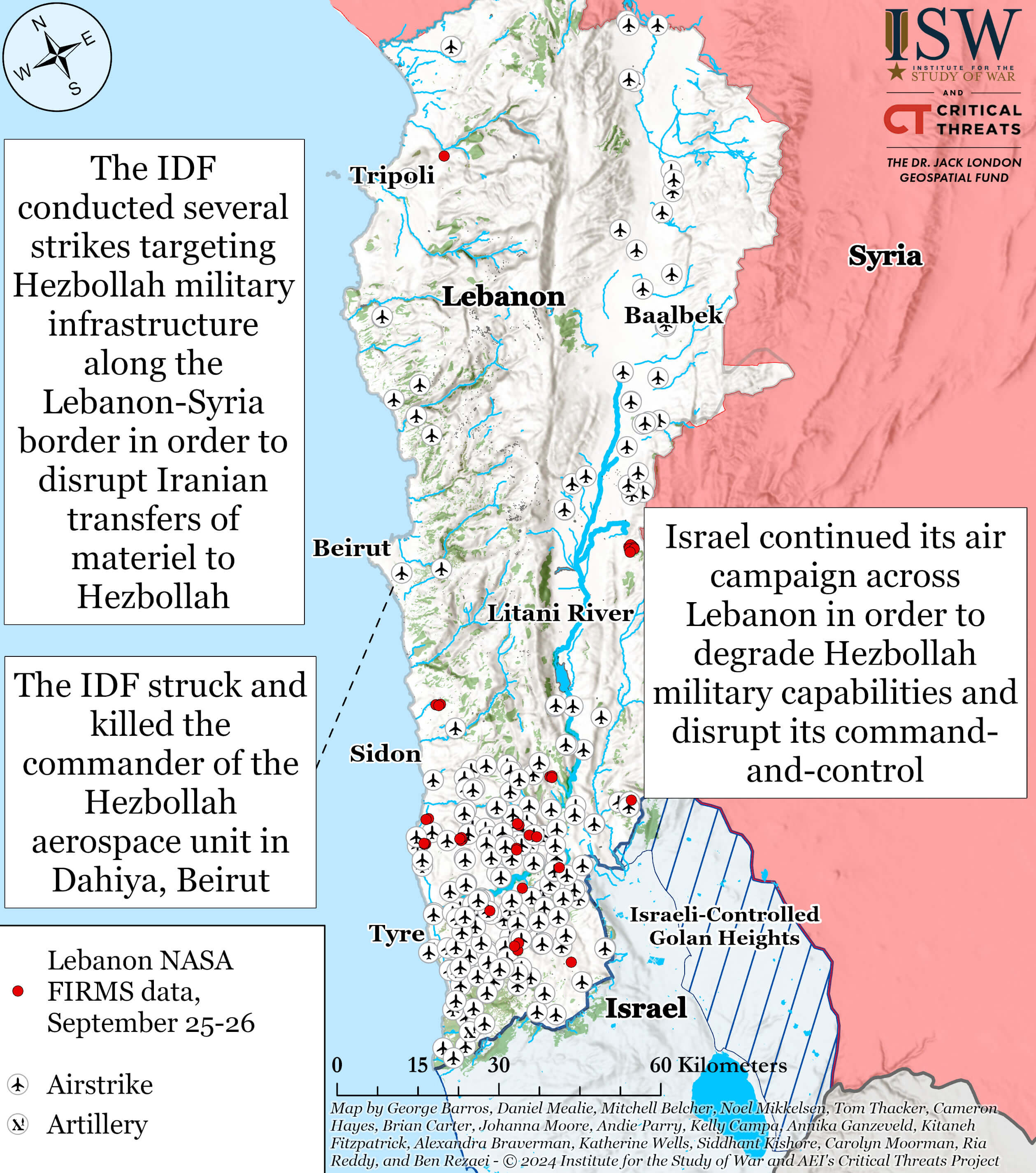
This map highlights the ongoing conflict between Israel and Hezbollah in Lebanon, showcasing Israeli airstrikes targeting Hezbollah military infrastructure, particularly along the Lebanon-Syria border. The strikes aim to disrupt Iranian transfers of weaponry to Hezbollah, with operations concentrated in regions like Beirut, Sidon, and Tyre. The map also shows the Litani River and Hezbollah’s strategic positions. It marks significant events like the killing of a Hezbollah commander in Beirut, reflecting the escalating military efforts between Israel and Hezbollah forces.
Lebanon Israel terrain map
Beirut Map in Lebanon
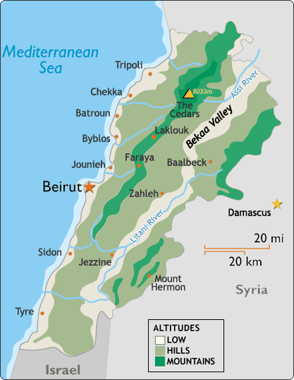
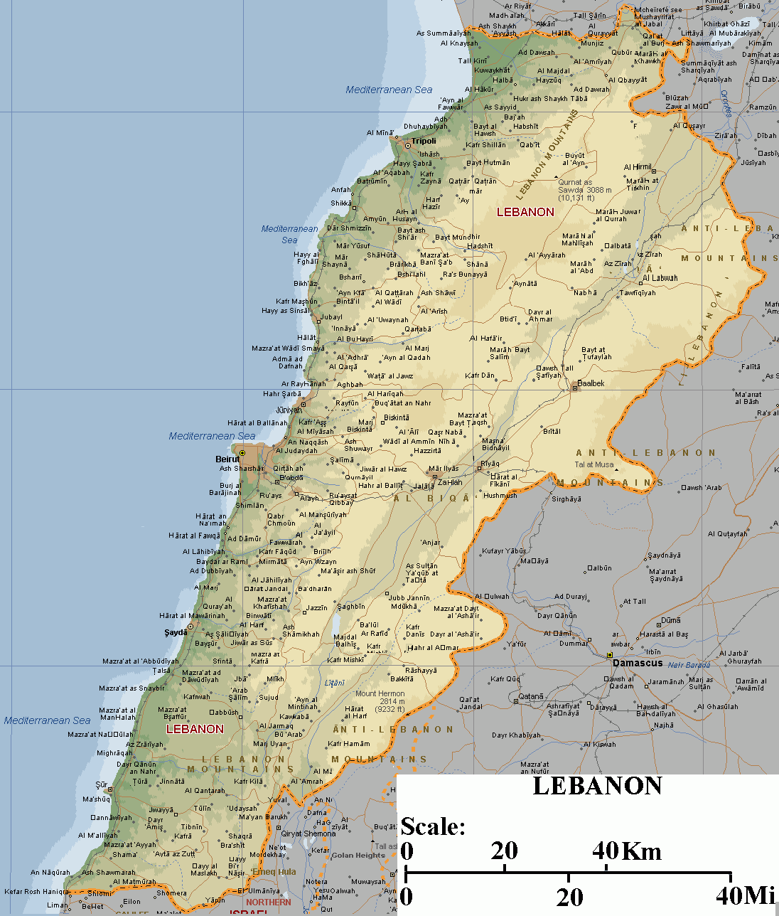
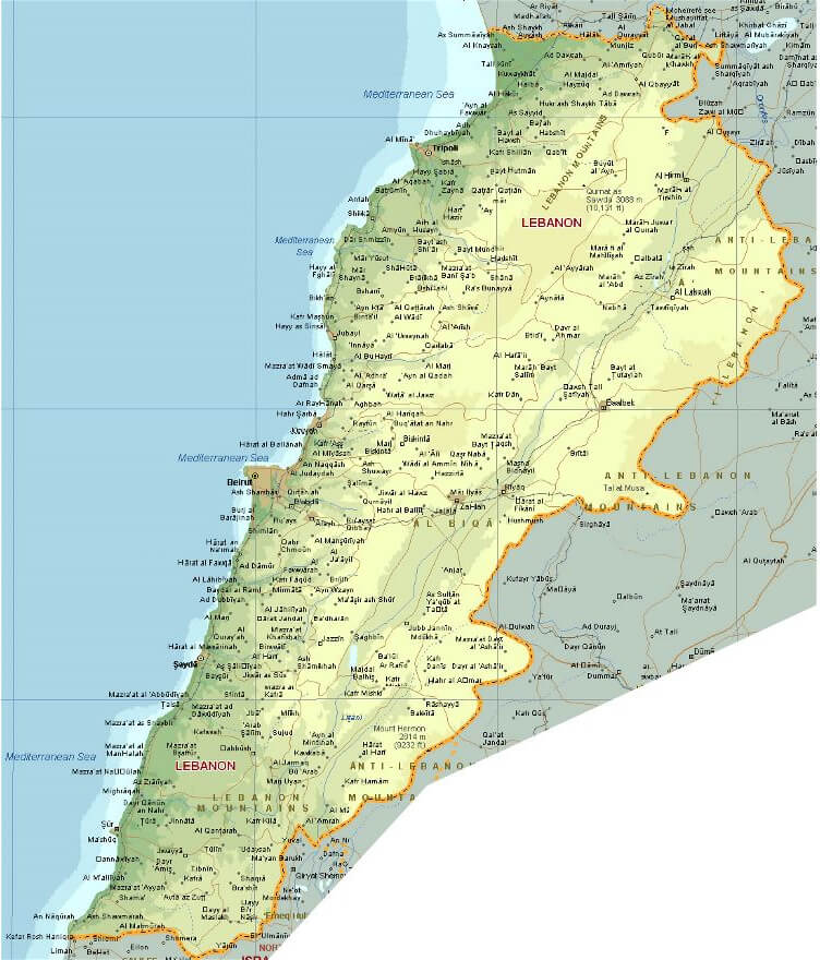
Lebanon Terrain Map
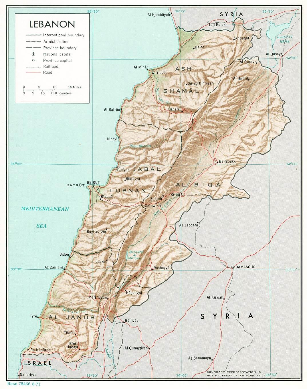 This map of Lebanon highlights the country’s rugged terrain, including the mountainous regions that run parallel to the Mediterranean coastline. It shows major geographical features such as the Lebanon Mountain range, the fertile Beqaa Valley, and the Anti-Lebanon Mountains bordering Syria. The map also marks key cities like Beirut, Tripoli, and Zahle, as well as borders with neighboring countries, making it a useful reference for understanding Lebanon’s physical landscape.
Lebanon Relief Map
Lebanon Political Map
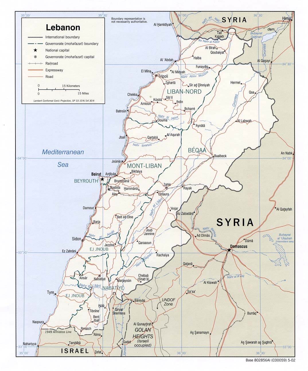 This map of Lebanon shows the political boundaries of the country, highlighting its international borders with Syria to the north and east, and Israel to the south. It also shows internal divisions such as governorate boundaries, roads, highways and the location of major cities such as Beirut, Tripoli and Zahle. The map provides a clear representation of the geographic layout and administrative divisions within Lebanon, illustrating the complex regional structure of this Middle Eastern nation.
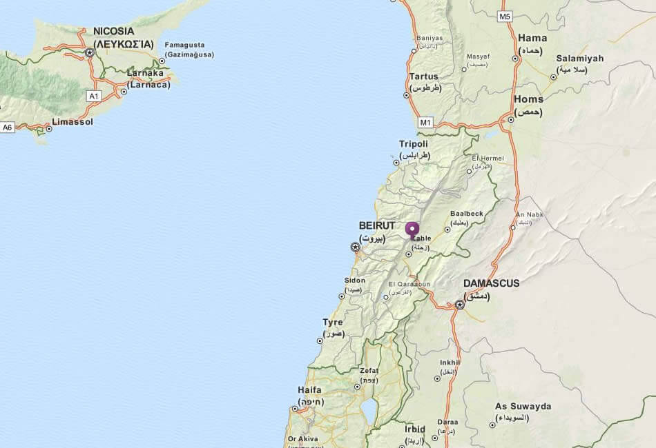
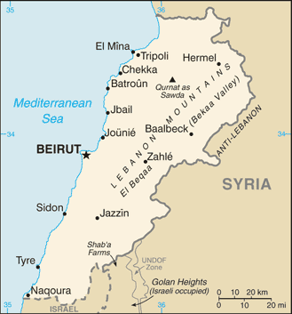
Lebanon Syria Map
Lebanon Rivers Map
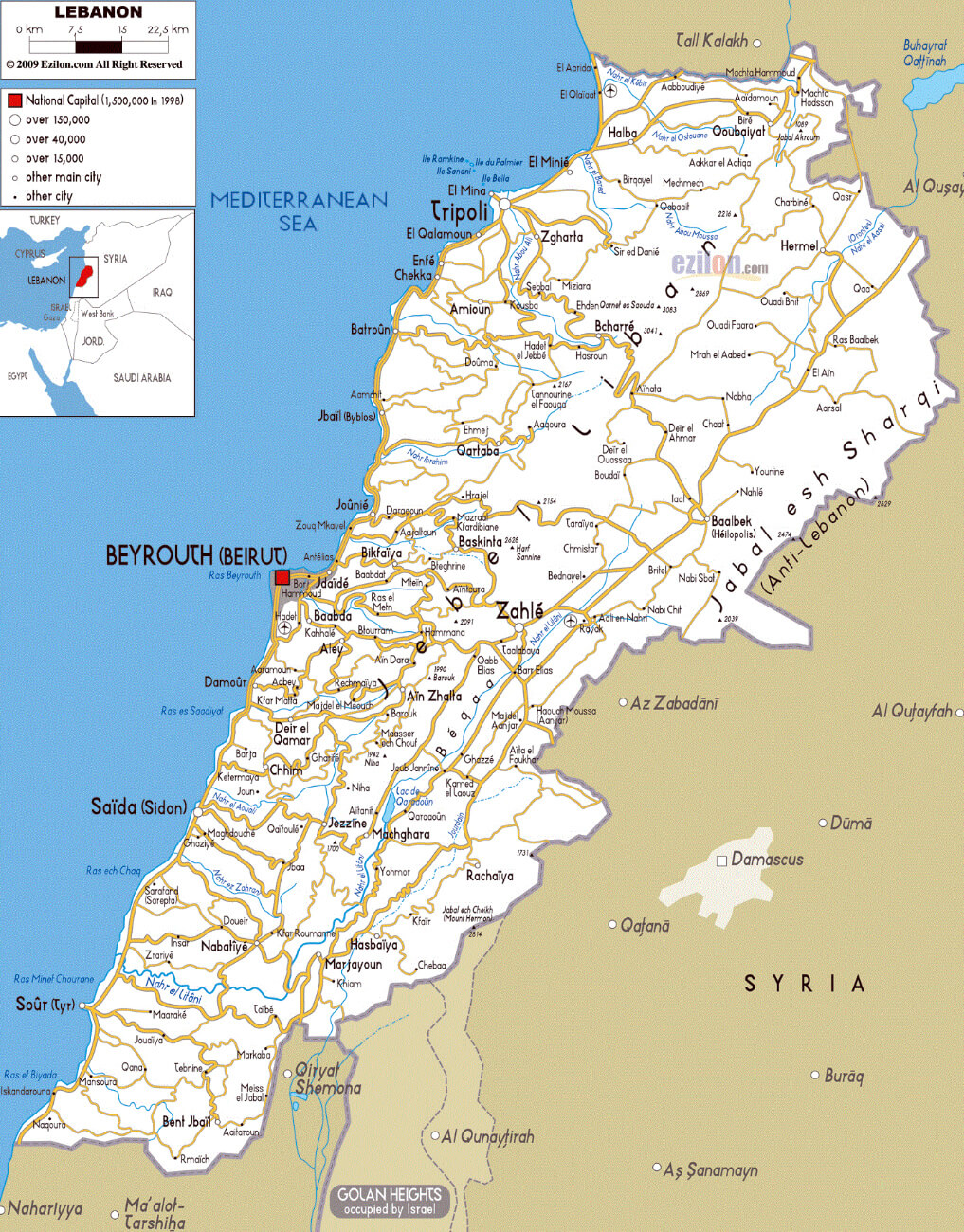
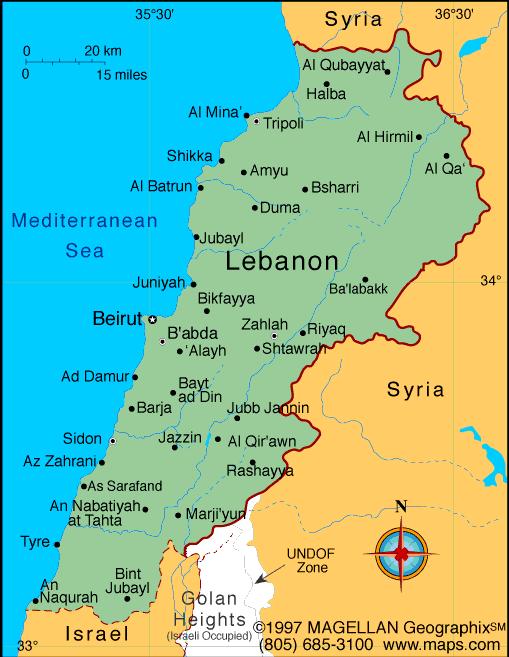
Lebanon Major Cities Map
Cities Map of Lebanon
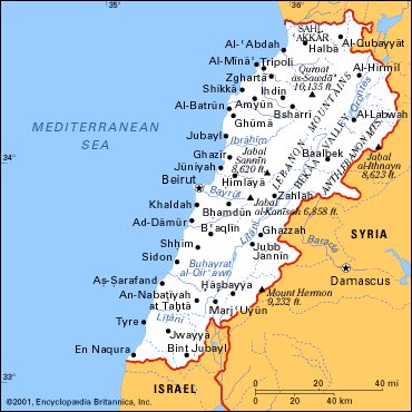
This cities map of Lebanon illustrates the major urban centers along Lebanon’s Mediterranean coast and inland. Key cities like Beirut (the capital), Tripoli in the north, and Sidon and Tyre in the south are highlighted. Inland, the map shows cities such as Zahlé and Baalbek, known for their historical significance. Lebanon’s neighboring countries, Syria and Israel, are also marked, giving context to its strategic location in the region. The map showcases Lebanon’s mix of coastal and mountain cities, reflecting its diverse geography.
Lebanon Map
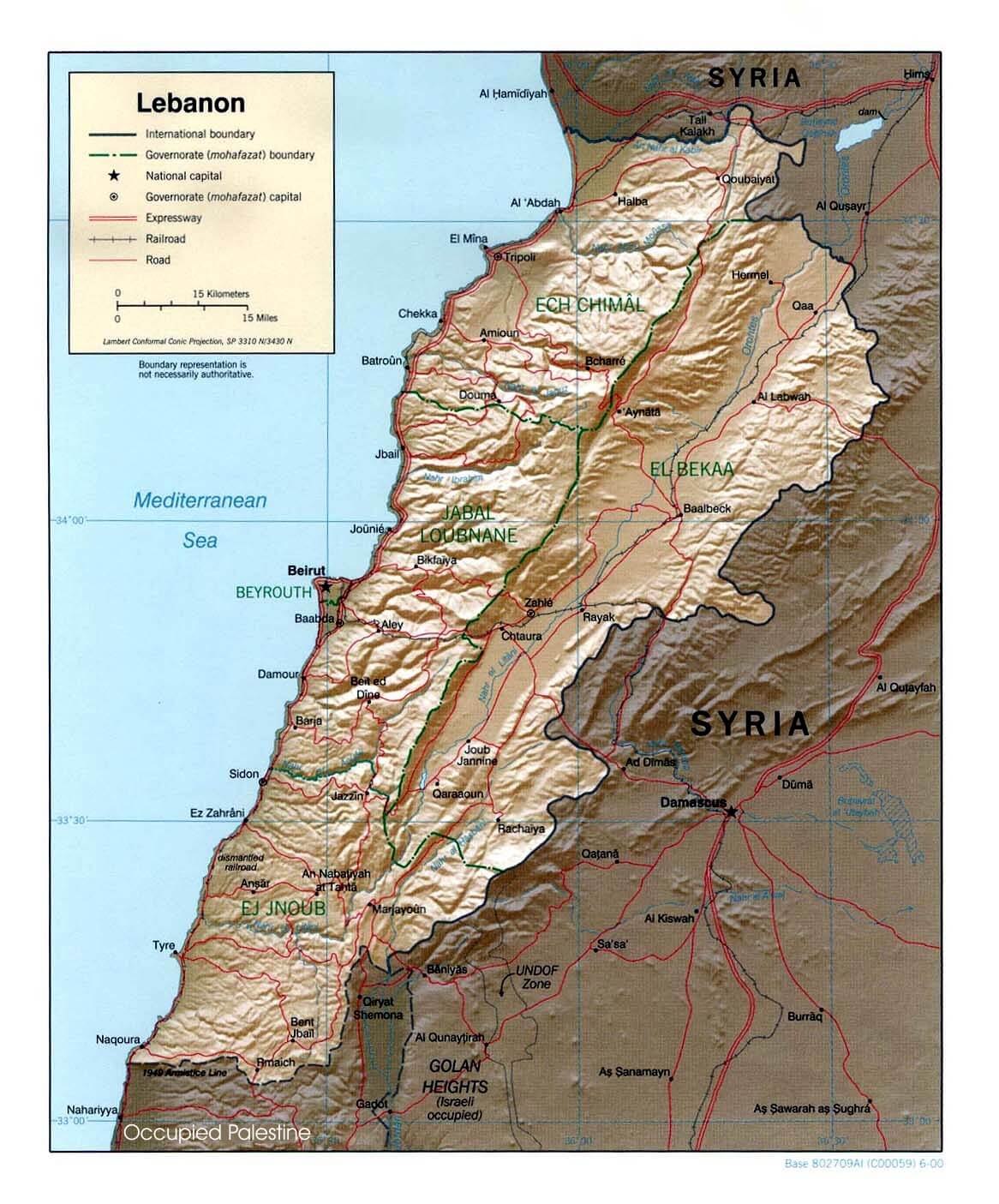
Lebanon Physical Map
 This map of Lebanon displays the country’s physical features, including its mountainous terrain, coastal plains along the Mediterranean Sea, and key geographical landmarks such as the Anti-Lebanon mountain range bordering Syria. It highlights Lebanon’s varied elevation, showing the rugged landscape that characterizes much of the country.
Lebanon Location Map
Lebanon Cities Map
 This map highlights Lebanon’s major cities, including Beirut, Tripoli and Zahle, as well as key geographical features such as the Mediterranean coastline and the border areas with Syria and Israel. The area of the Golan Heights, which is marked as occupied by Israel, is also shown, illustrating the complex geopolitical landscape of the region.
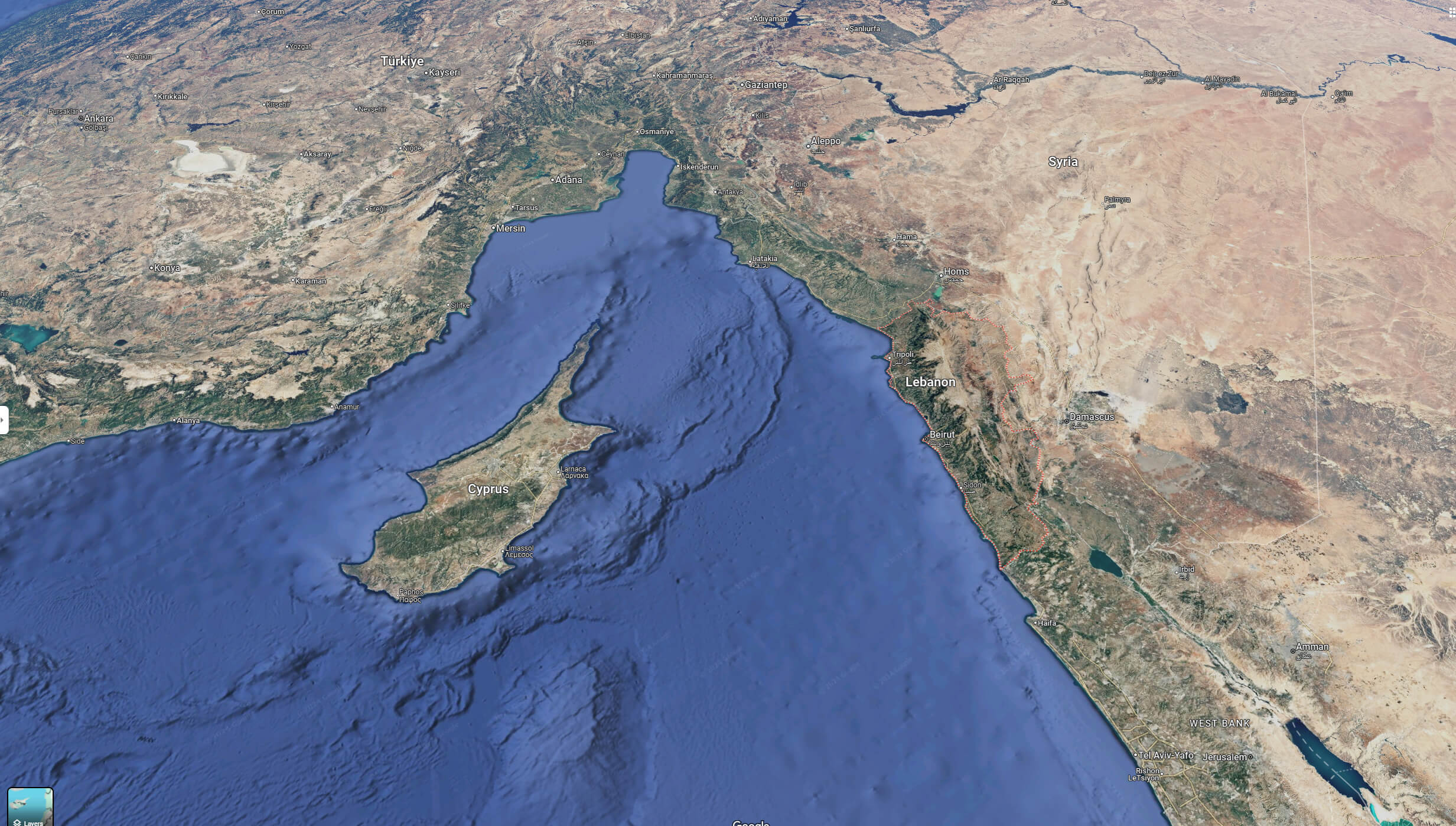
Lebanon Israel Middle East map
Lebanon Israel Satellite Map
Lebanon Israel Political Map
Lebanon Israel Map
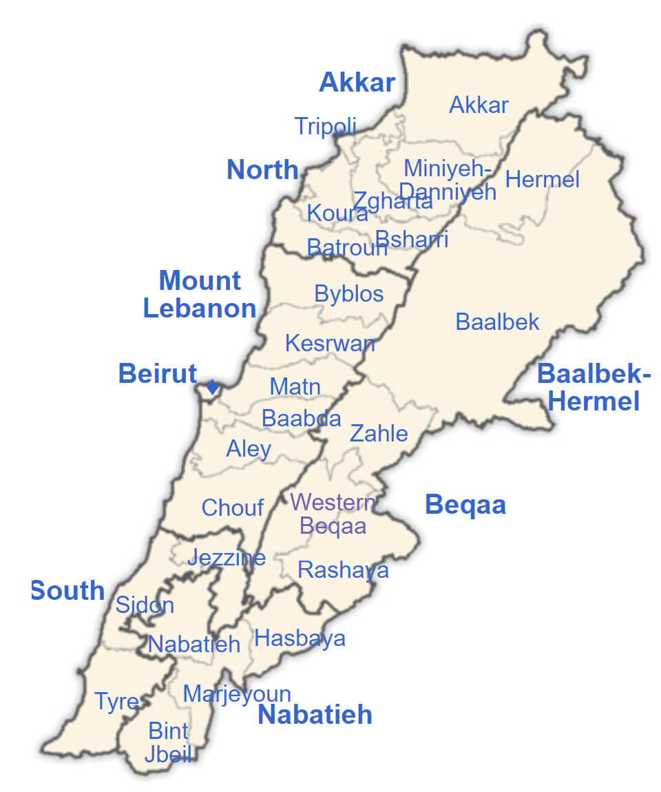
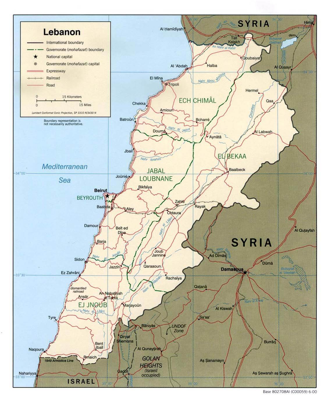
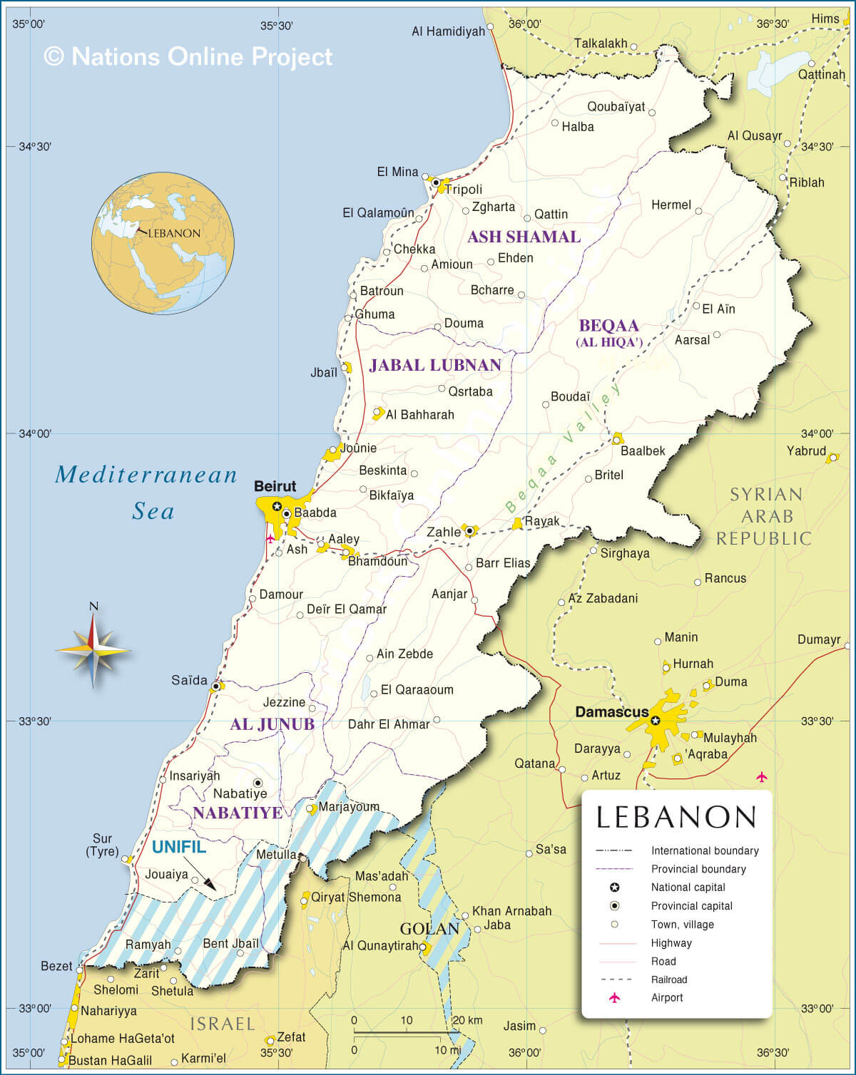
Lebanon Main Cities Map with Regions
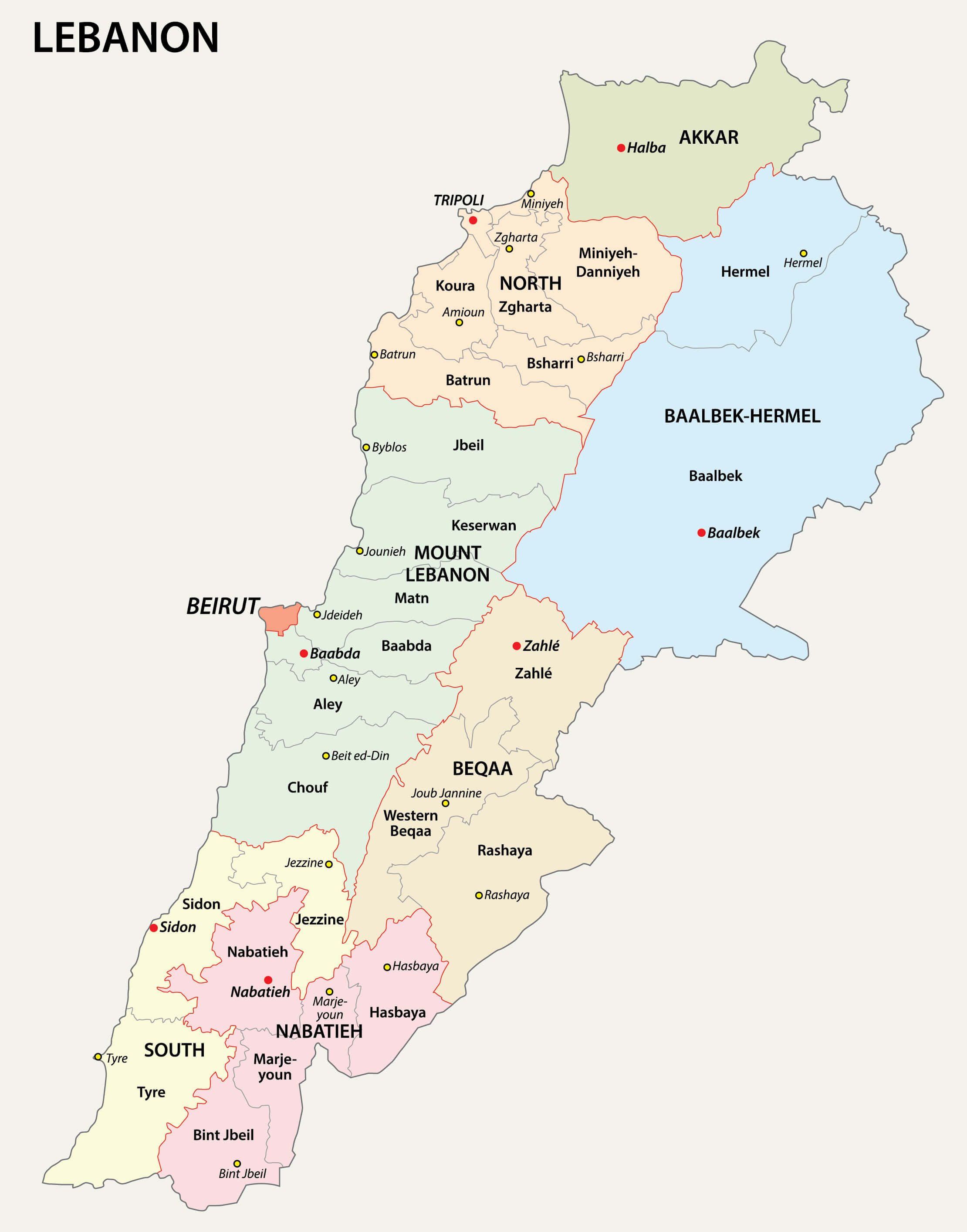 This map of Lebanon shows the country’s regions and major cities, illustrating its administrative divisions, including areas such as Akkar, North, Mount Lebanon, Baalbek-Hermel and others. Major cities such as Beirut, Tripoli, Sidon and Zahle are highlighted, providing a clear view of the distribution of urban centres across Lebanon’s diverse geographical landscape. The map helps to understand the political organisation of Lebanon by showing the boundaries of each governorate and the location of major cities within them.
Lebanon Physical Map with Beirut
 This map of Lebanon showcases the physical geography of the country, highlighting its mountain ranges, valleys, and coastal plains, including the capital city, Beirut, situated along the Mediterranean Sea. The map also details elevation variations, depicting the rugged terrain of the Anti-Lebanon Mountains in the east and the more central Mount Lebanon range, which runs parallel to the coast. The physical features of Lebanon’s landscape are crucial for understanding its climate, agriculture, and settlement patterns.
Lebanon Elevation Map
 This map of Lebanon shows the physical geography of the country, highlighting its mountain ranges, valleys and coastal plains, including the capital city of Beirut, which lies on the Mediterranean Sea. The map also shows the variations in elevation, depicting the rugged terrain of the Anti-Lebanon Mountains in the east and the more central Mount Lebanon range, which runs parallel to the coast. The physical features of Lebanon’s landscape are crucial to understanding its climate, agriculture and settlement patterns, and this elevation map of Lebanon shows the country’s varied topography, highlighting the rugged mountain ranges such as the Mount Lebanon range and the Anti-Lebanon Mountains, which run parallel to the Mediterranean coast. It also captures the steep changes in elevation from the coastal plains around Beirut to the higher altitudes in the eastern regions bordering Syria. The map highlights the country’s prominent elevations, highlighting how the terrain affects both the climate and settlement patterns in different areas of Lebanon.
Map of Phoenicia Trade Routes Lebanon
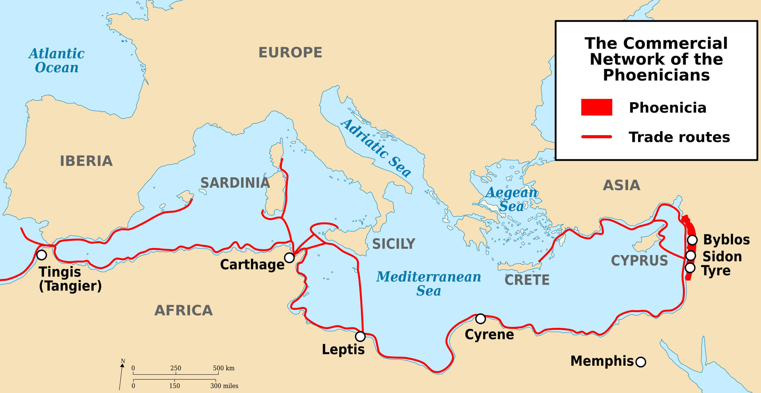 This map illustrates the ancient trade routes of the Phoenicians, a seafaring civilization known for their extensive commercial networks across the Mediterranean. The map highlights key Phoenician cities like Byblos, Sidon, and Tyre (located in modern-day Lebanon) and shows how their trade routes connected them to major ports across the Mediterranean, reaching places such as Carthage in North Africa, Cyprus, Crete, and even as far as Iberia (present-day Spain and Portugal). The red lines on the map represent the main maritime routes used by the Phoenicians for trading goods, including luxury items like purple dye, glass, and metals. This network played a significant role in the spread of culture, ideas, and commerce across the ancient Mediterranean world.
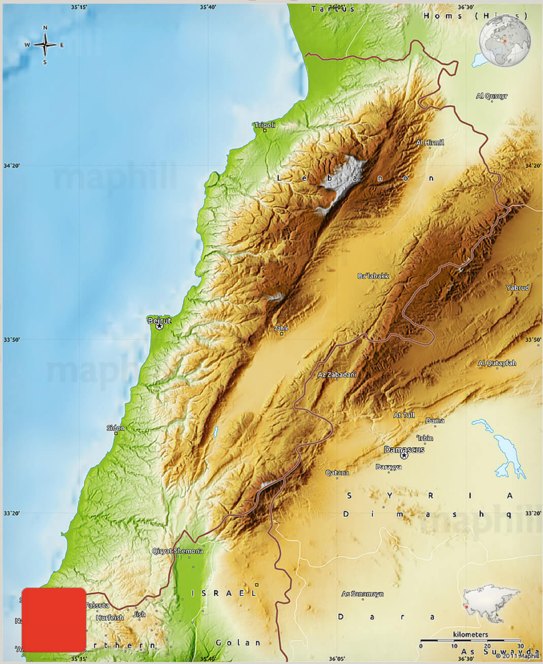
Lebanon Rivers Map with Syria Israel
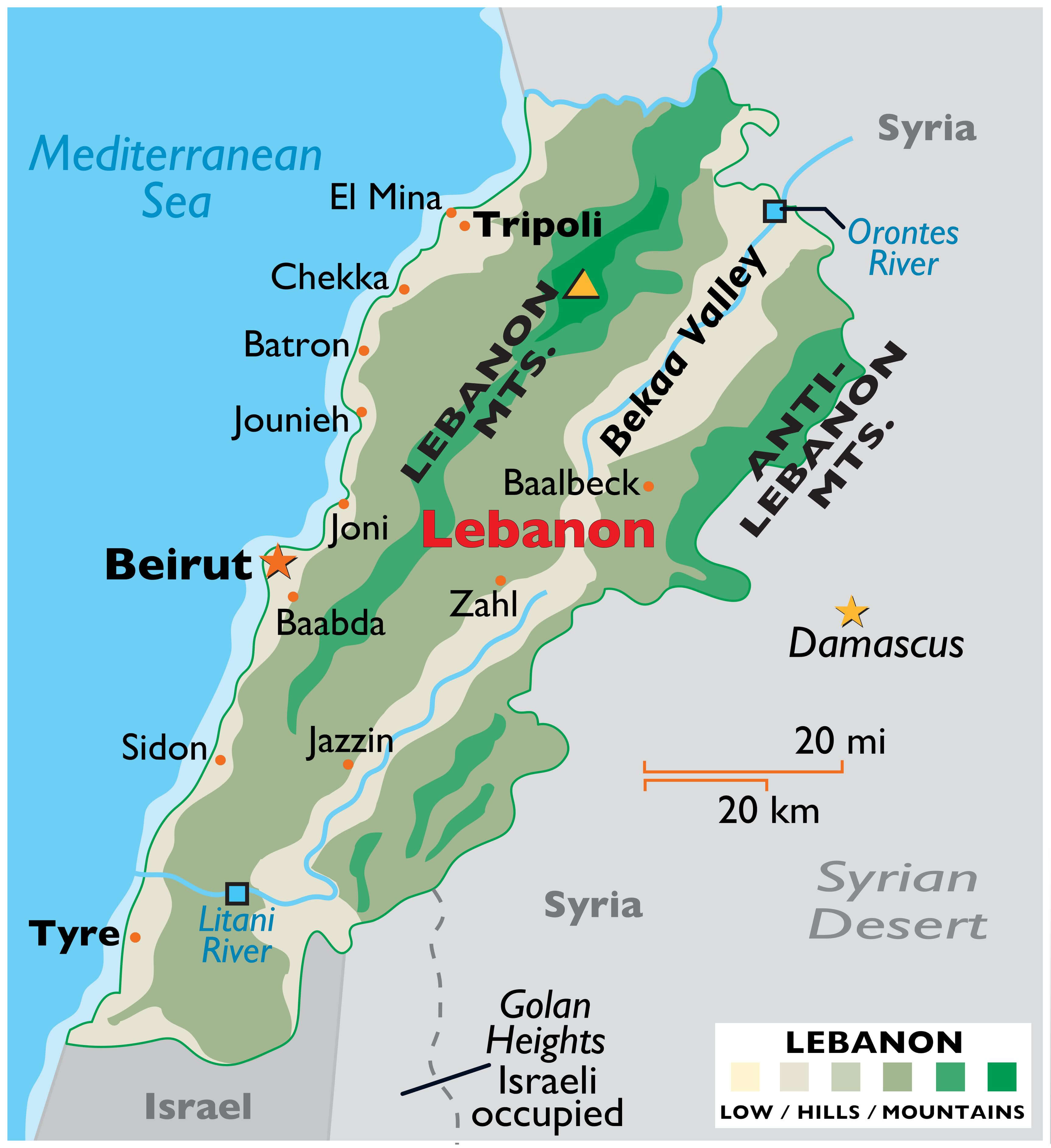 This map of Lebanon highlights key geographical features, including prominent rivers such as the Litani River, which flows through southern Lebanon, and the Orontes River, which flows through Lebanon towards Syria. It also shows the Lebanese and Anti-Lebanese mountain ranges, as well as key locations such as Beirut, Tripoli and the Bekaa Valley, which lies between the mountain ranges. The map marks the borders with neighbouring Syria to the east and Israel to the south, with the disputed Golan Heights region also shown.
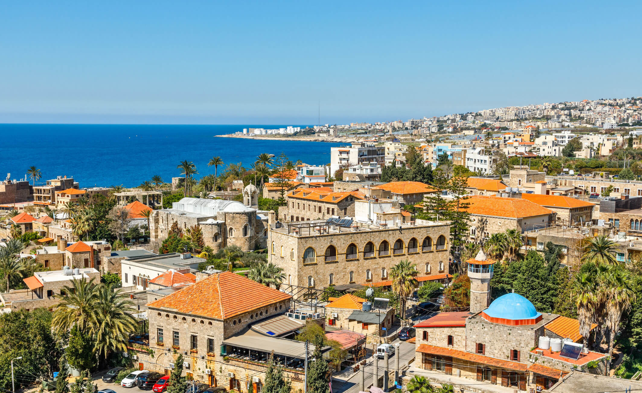
Beirut Aerial View Lebanon
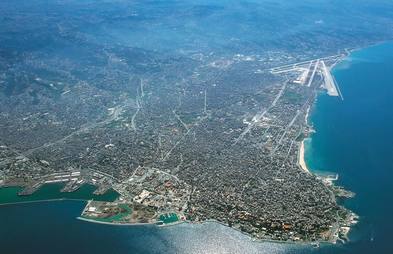 This aerial view of Beirut, Lebanon, beautifully captures the city’s extensive urban sprawl and its proximity to the Mediterranean Sea. The image shows the densely packed buildings, the bustling port and Beirut’s coastline, which blends seamlessly into the blue water. The airport runways can be seen on the top right, highlighting Beirut’s role as a key gateway to the region. The city’s blend of modernity and historic charm is also evident from above, as it sits surrounded by the lush Lebanese mountains in the distance.
Lebanon National Map
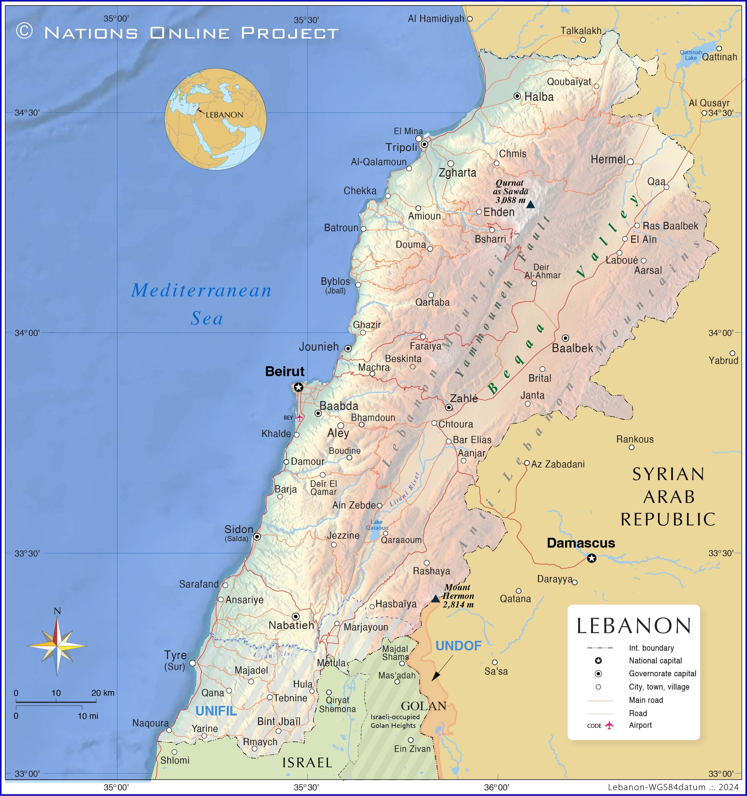 This map illustrates the geographical and political features of Lebanon, including its major cities such as Beirut, Tripoli and Sidon, and its borders with neighbouring countries such as Syria and Israel. It highlights major mountain ranges such as the Lebanon and Anti-Lebanon Mountains and provides a clear depiction of valleys, major roads and UN peacekeeping zones such as UNIFIL. The map also shows international borders and important natural features such as the Bekaa Valley, providing a detailed overview of Lebanon’s terrain and surrounding region.
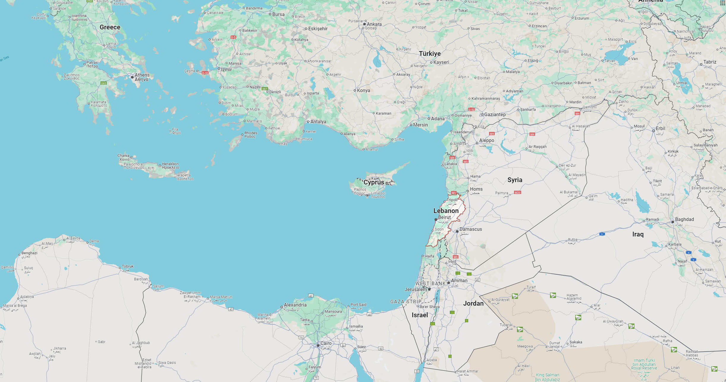
Where is Lebanon on the Asia Map?
Show Google map, satellite map, where is the country located.
Get directions by driving, walking, bicycling, public transportation and travel with street view.