Explore Egypt with detailed maps showing political and physical features, roads, cities, population, rivers, regions, borders, topography, terrain, satellite views, and Egypt’s location on the African continent.
Political Map of Egypt with Major Cities, Rivers, and Neighboring Countries
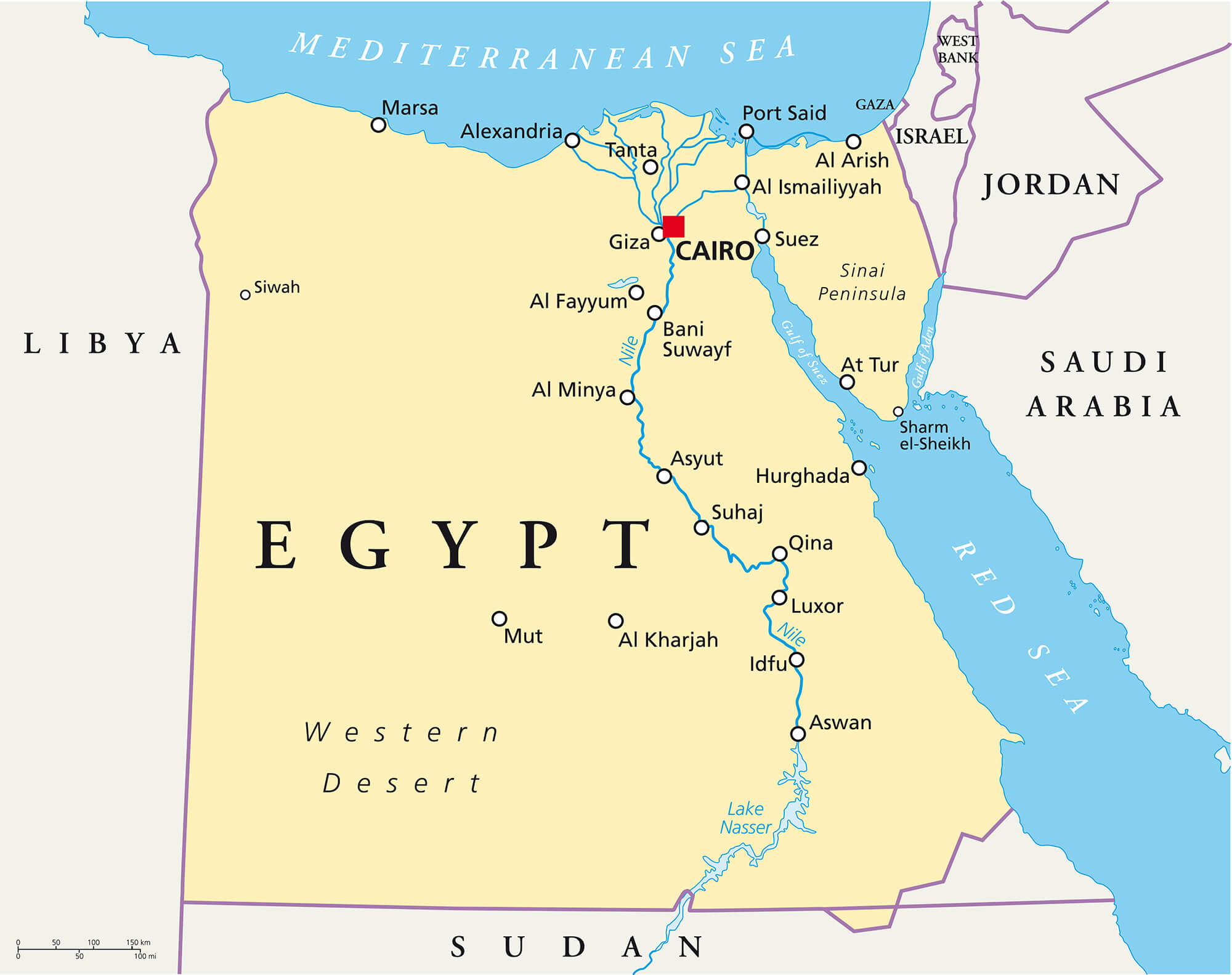 Political map of Egypt showing cities Nile River borders and surrounding nations.
This political map of Egypt shows major cities such as Cairo, Alexandria and Luxor as well as the Nile River and neighbouring countries such as Libya, Sudan, Israel and Saudi Arabia. It also highlights geographical features such as the Sinai Peninsula, the Red Sea and the Western Desert, making it ideal for regional reference.
Egypt Political Map Showing Cities, Borders, and Neighboring Countries
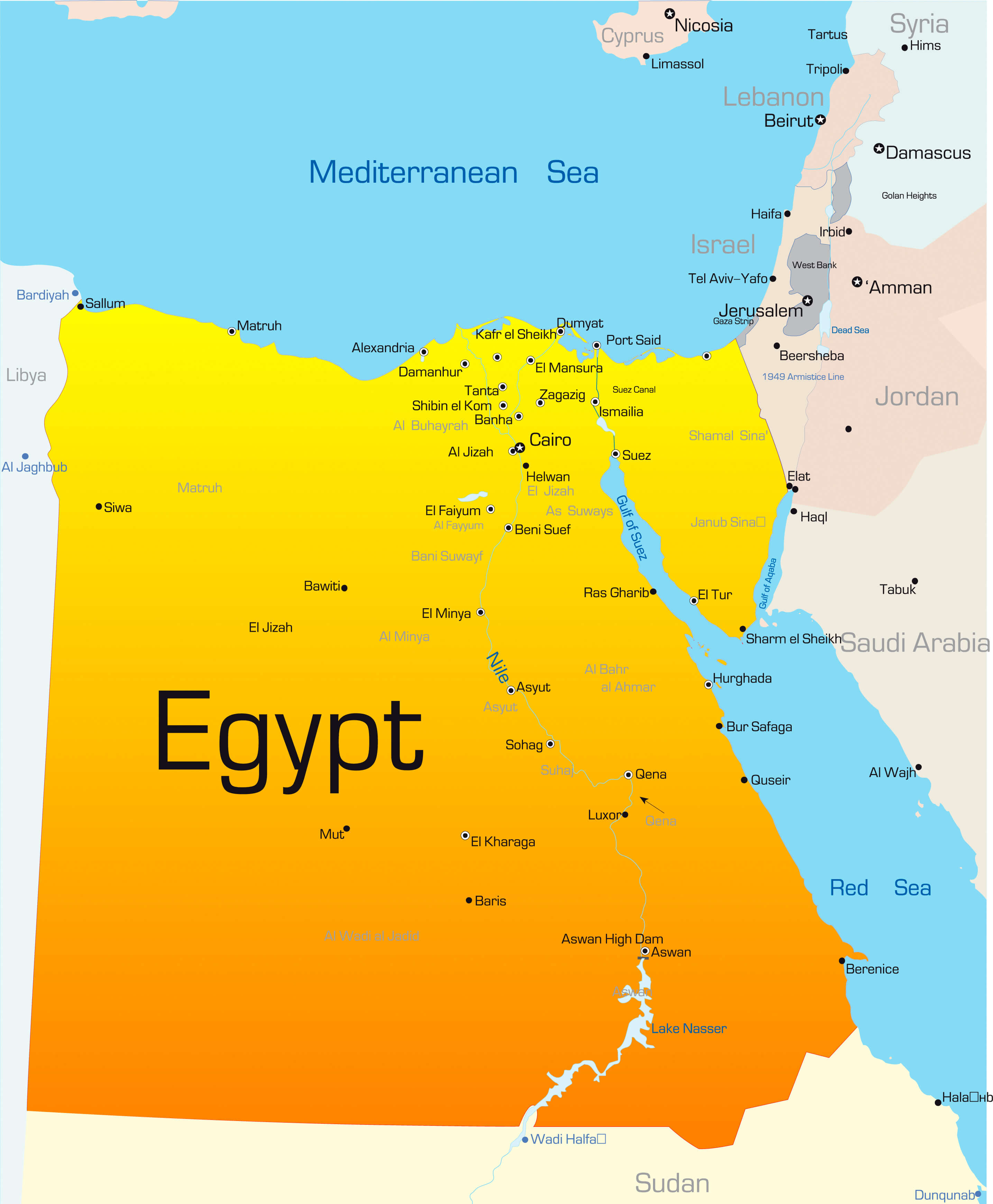 Egypt political map with cities borders Nile River and neighboring countries labeled.
This political map of Egypt highlights national borders, major cities, and surrounding countries like Libya, Sudan, Israel, and Saudi Arabia. It also shows the Nile River and key regions such as Sinai and the Red Sea coast. Capital city Cairo and important hubs like Alexandria and Aswan are clearly marked.
Geographic Map of Egypt Highlighting the Nile River and Major Cities
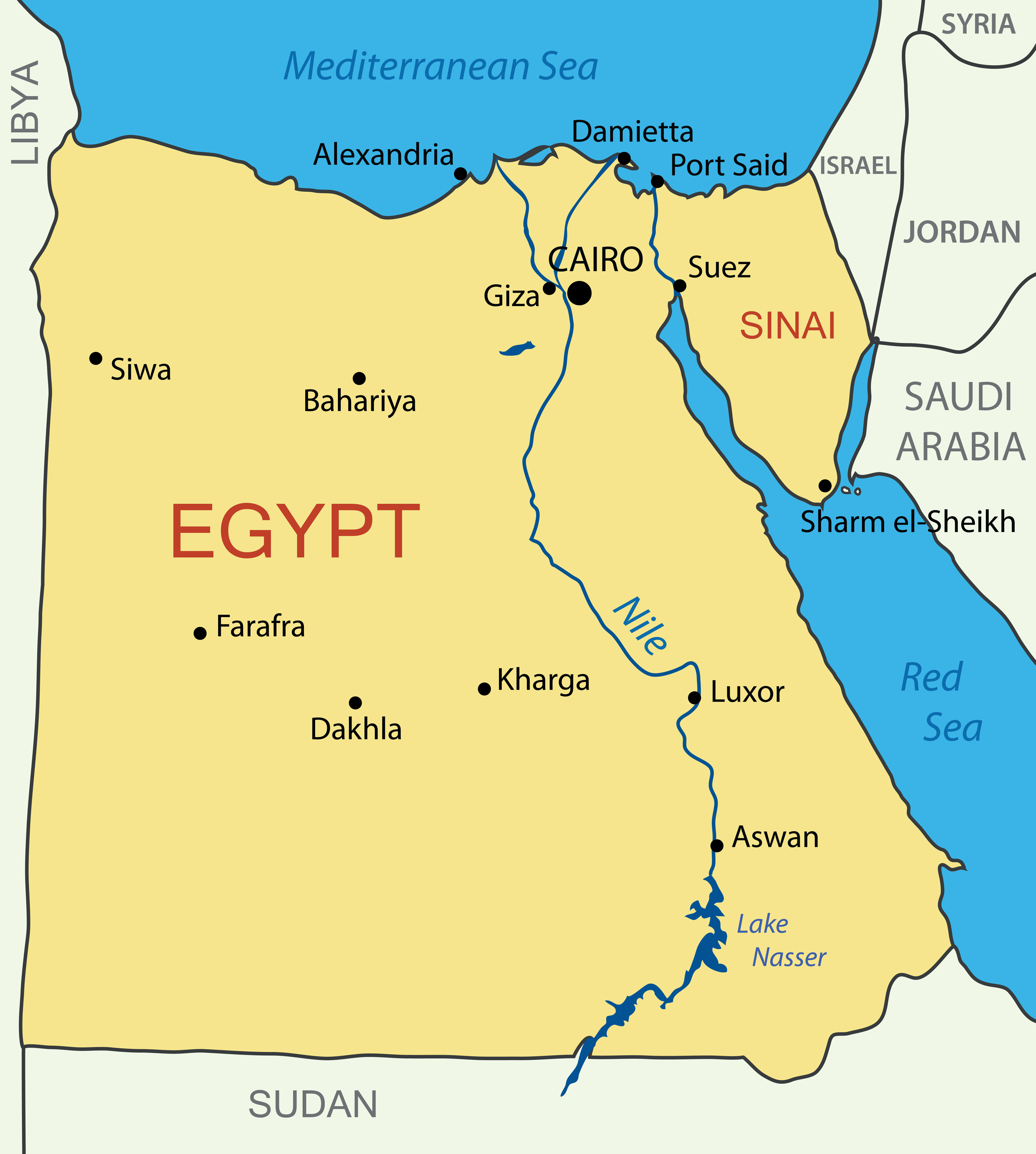
This map of Egypt shows the flow of the Nile River through major cities such as Cairo, Luxor and Aswan. It highlights Egypt’s major deserts, borders, seas and oases, including Siwa and Kharga. The Sinai Peninsula, Red Sea and Mediterranean coastline are also clearly marked for geographical context.
Detailed Road Map of Egypt with Major Cities and Highways
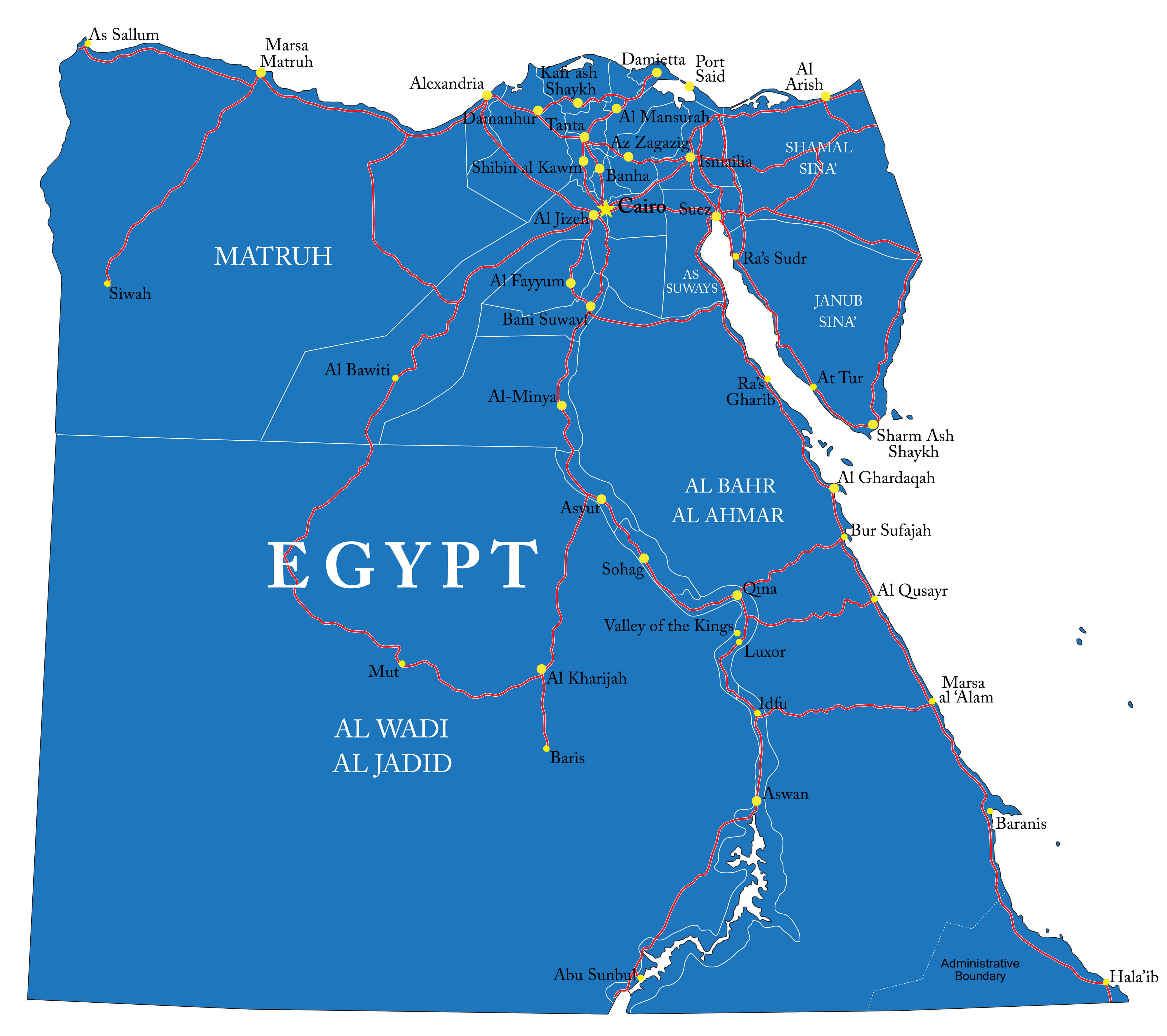 Egypt road map showing cities highways rivers and administrative boundaries.
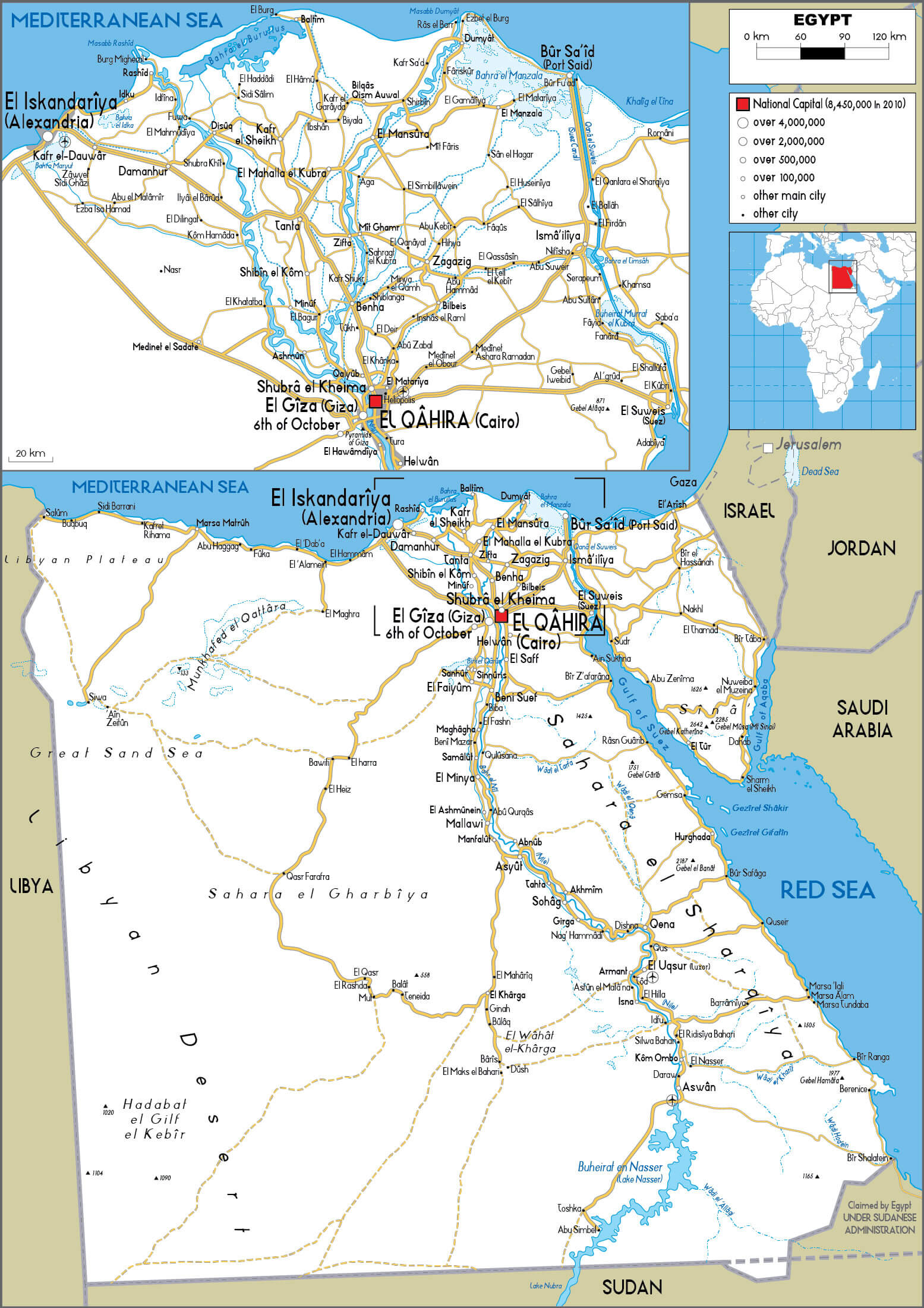
This detailed road map of Egypt shows major cities, highways, and transportation routes. Key cities like Cairo, Alexandria, Luxor, and Aswan are marked, alongside roads connecting desert and coastal regions. The map also outlines rivers, borders, and key travel hubs across Egypt.
Brief information about Egypt
Egypt, often called the “Gift of the Nile,” is a transcontinental country spanning the northeastern corner of Africa and the Sinai Peninsula in Asia. It is bordered by the Mediterranean Sea to the north, Sudan to the south, Libya to the west, and Israel and the Red Sea to the east. The Nile River, one of the longest in the world, has been the lifeblood of Egypt for millennia, nurturing one of humanity’s earliest and most influential civilizations. The capital, Cairo, is a vibrant metropolis where ancient history and modernity converge, offering a dynamic blend of culture, heritage, and contemporary infrastructure.
Administrative Map of Egypt with Governorates and Major Cities
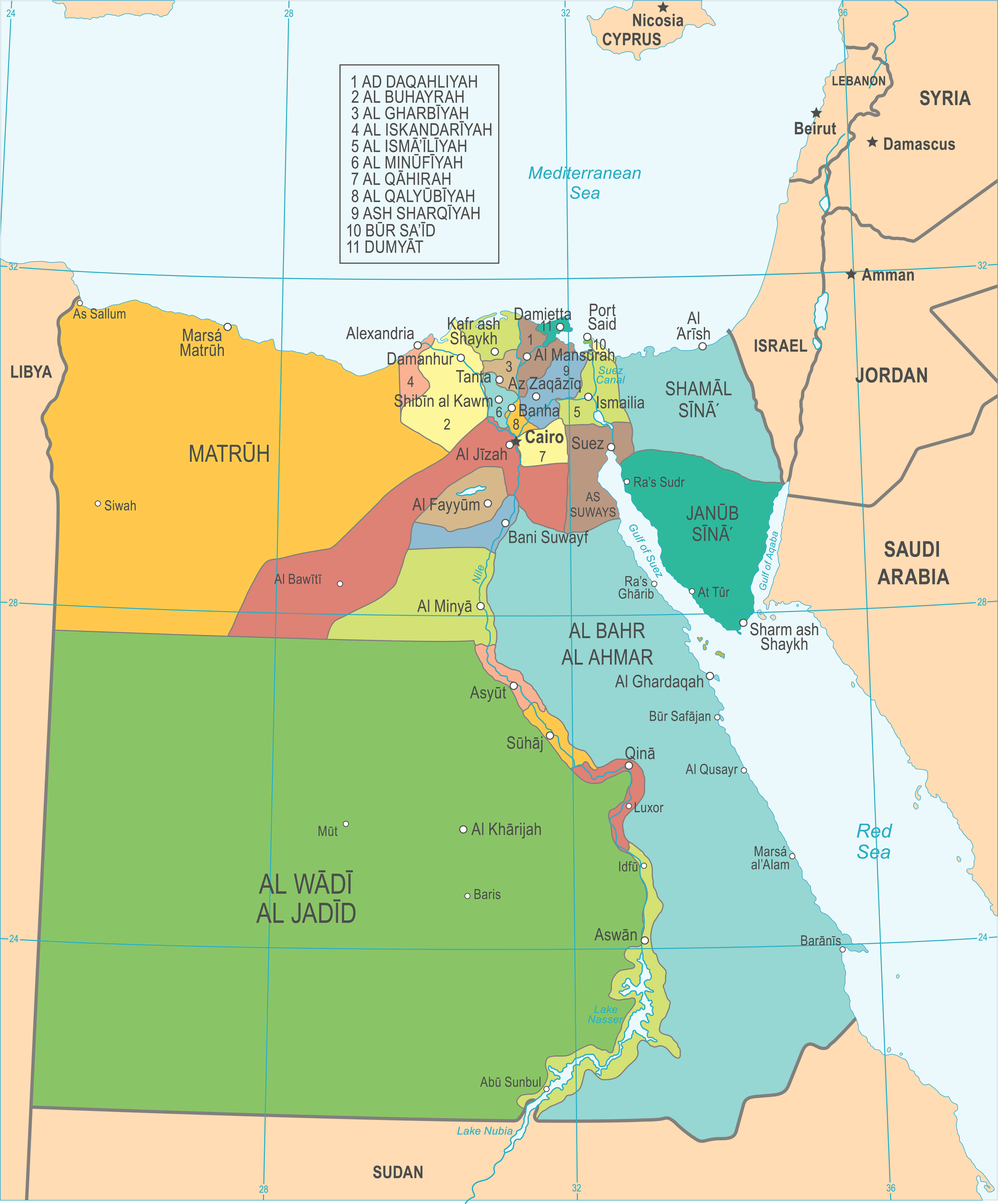 Egypt administrative map with governorates borders cities and regional divisions.
This administrative map of Egypt shows the country’s governorates with clear boundaries and labels. Major cities such as Cairo, Alexandria and Luxor are shown along with regional divisions such as Al Wadi Al Jadid, Matruh and Sinai. Both urban and desert regions are highlighted with geopolitical context.
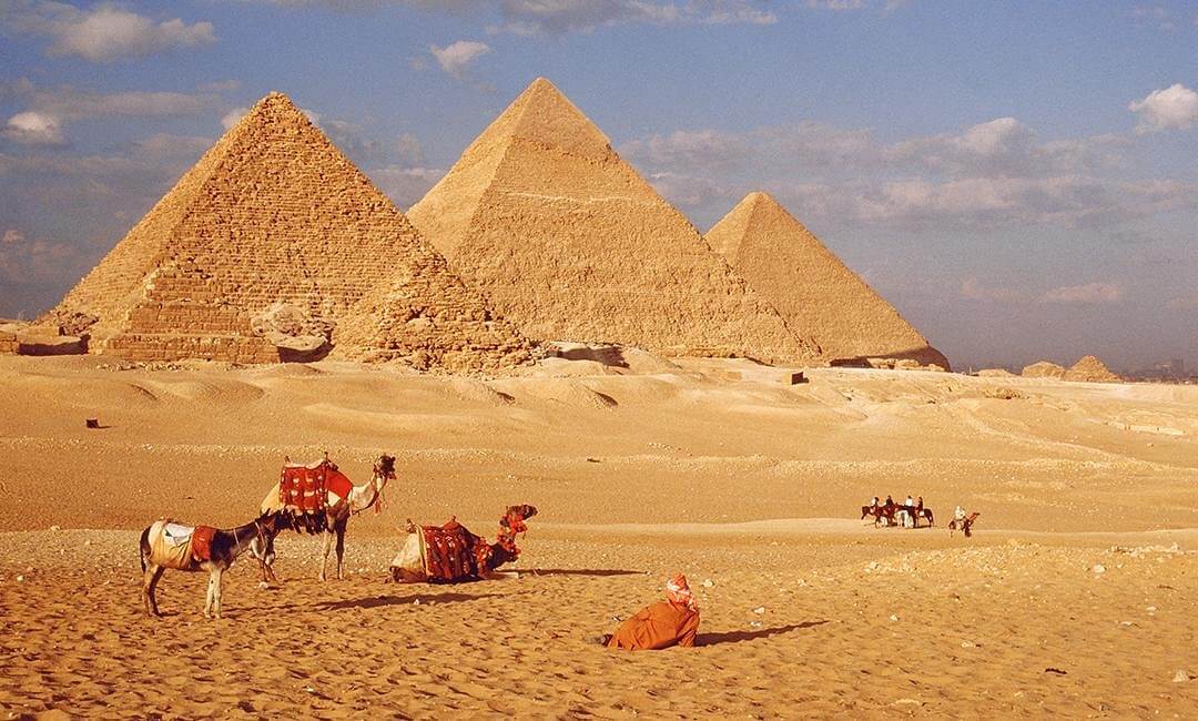
Egypt is celebrated for its legendary monuments, including the Pyramids of Giza, the Great Sphinx, and the Valley of the Kings—testaments to its awe-inspiring Pharaonic past. Its cultural tapestry is richly woven with layers of Greco-Roman, Islamic, and Coptic influences. Today, Egypt’s economy thrives on tourism, agriculture, and energy, while its strategic location continues to make it a pivotal player in Middle Eastern and African geopolitics.
Where is located Egypt on the World Map
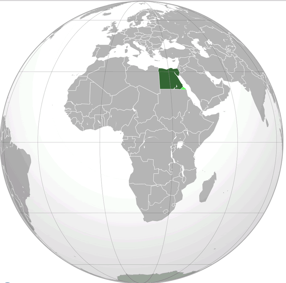
Located in the north-eastern corner of Africa, Egypt is a vital link between Africa and Asia. It is bordered to the north by the Mediterranean Sea, which provides access to southern Europe, and to the east by the Red Sea, which connects to the Indian Ocean via the Suez Canal. The country’s strategic location at the crossroads of major continents has made it a hub of trade, culture and historical influence for thousands of years.
Egypt satellite map in the night
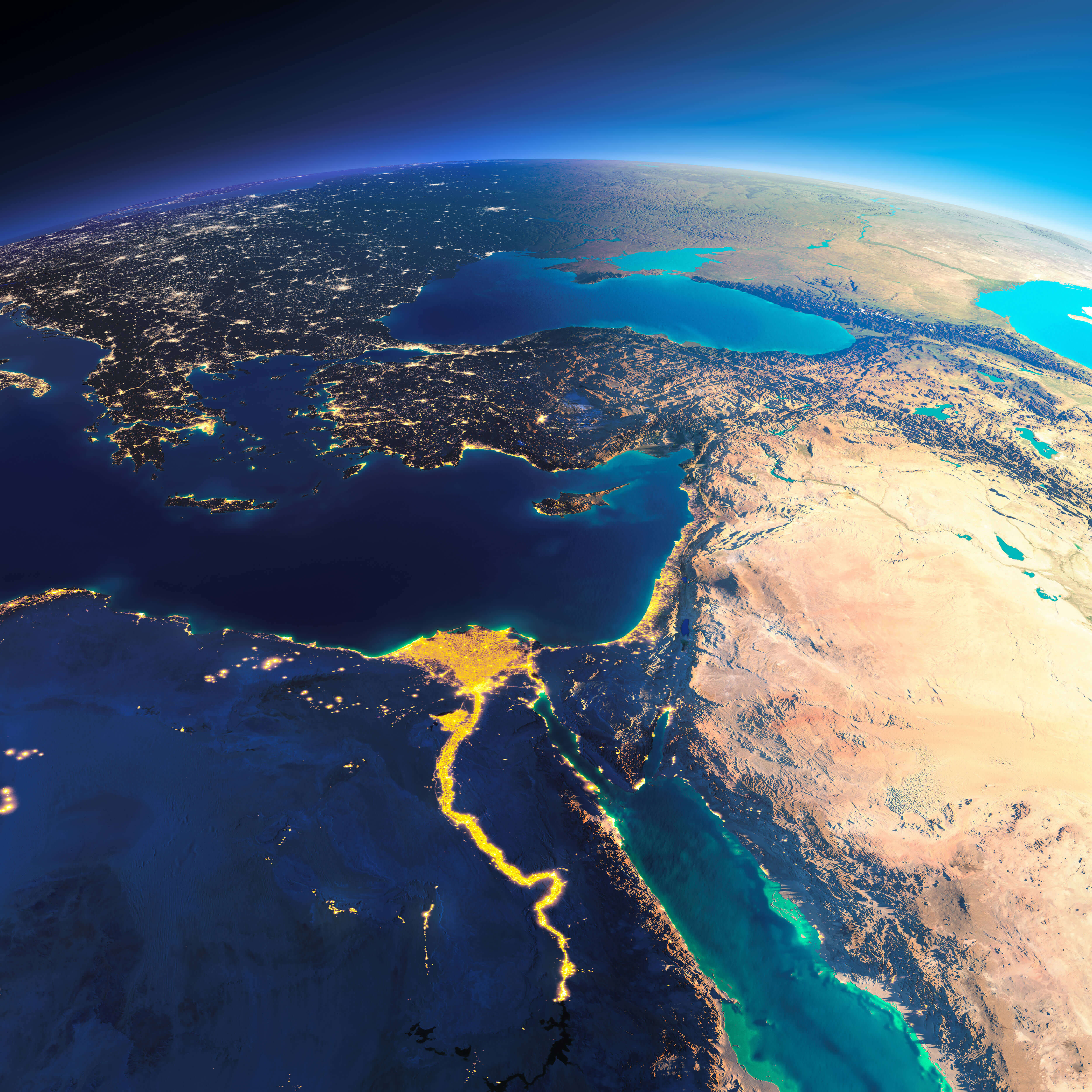
Egypt borders Libya to the west and Sudan to the south. Its eastern border includes the Sinai Peninsula, which connects Africa to Asia and borders Israel and the Gaza Strip. The Suez Canal, a major international waterway, runs through the eastern part of Egypt, linking the Mediterranean with the Red Sea and facilitating global maritime trade.
Egypt physical map with cities
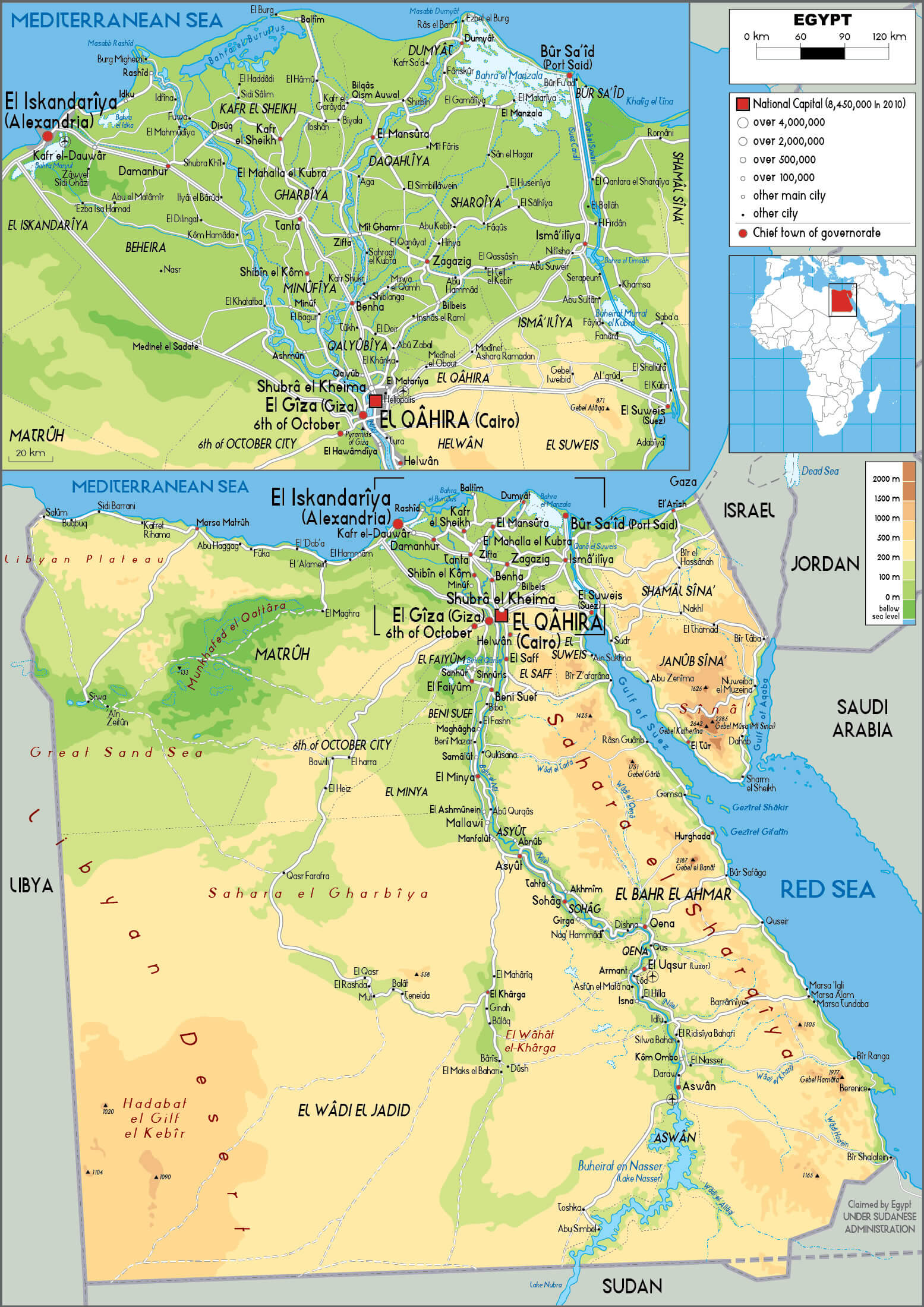
Egypt’s central geographical feature is the Nile River, which flows from south to north, ending in the fertile Nile Delta before emptying into the Mediterranean Sea. Most of Egypt’s population lives along the Nile Valley and Delta, as the rest of the country is dominated by vast deserts, including the Western Desert (part of the Sahara) and the Eastern Desert. This unique location has shaped Egypt’s role as a cultural and economic bridge between continents throughout history.
Here are some statistical information about Egypt:
 Area: 1,010,408 km2 (390,121 sq mi)
 Comprehensive Road Map of Egypt Featuring Major Cities and Transportation Routes
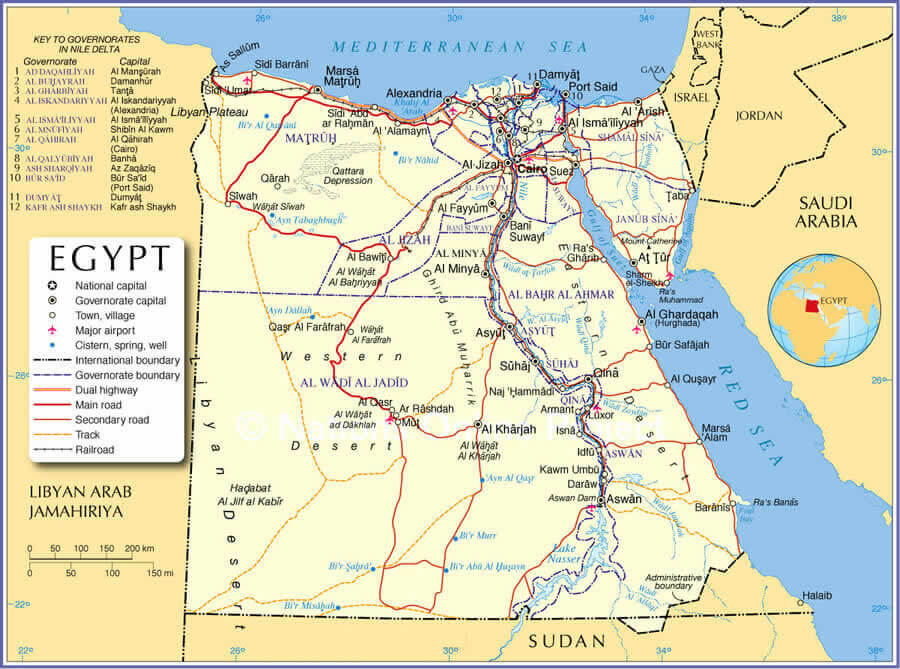
This detailed road map of Egypt displays major highways and cities, including Cairo, Alexandria, Luxor, and Aswan. It outlines transportation routes, the flow of the Nile River, and key connections to surrounding countries like Libya, Sudan, and Israel. Insets provide closer views of densely populated areas.
Official languages: ArabicEgypt info map
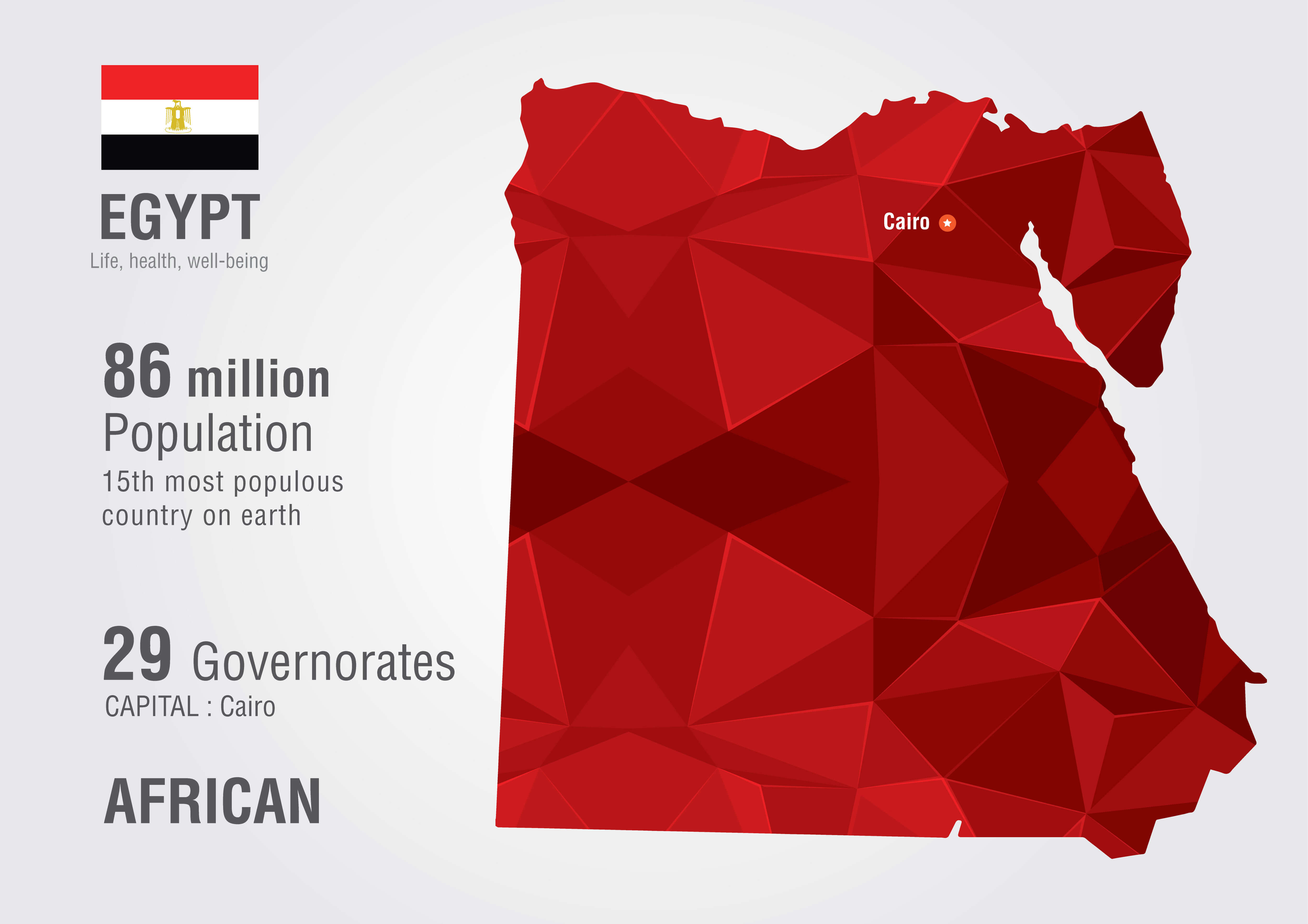 Currency: Egyptian pound (LE/E£/£E) (EGP)
 Map of Egypt
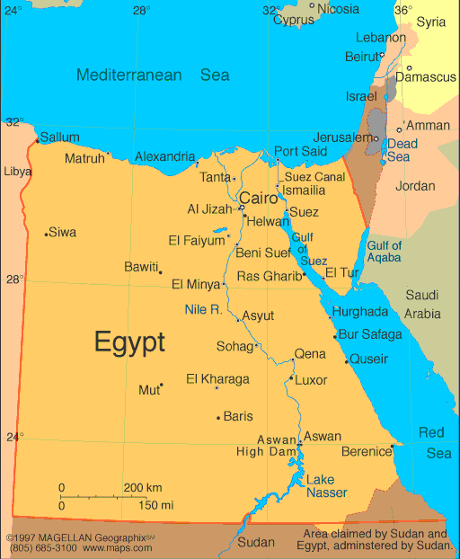
Physical map of Egypt
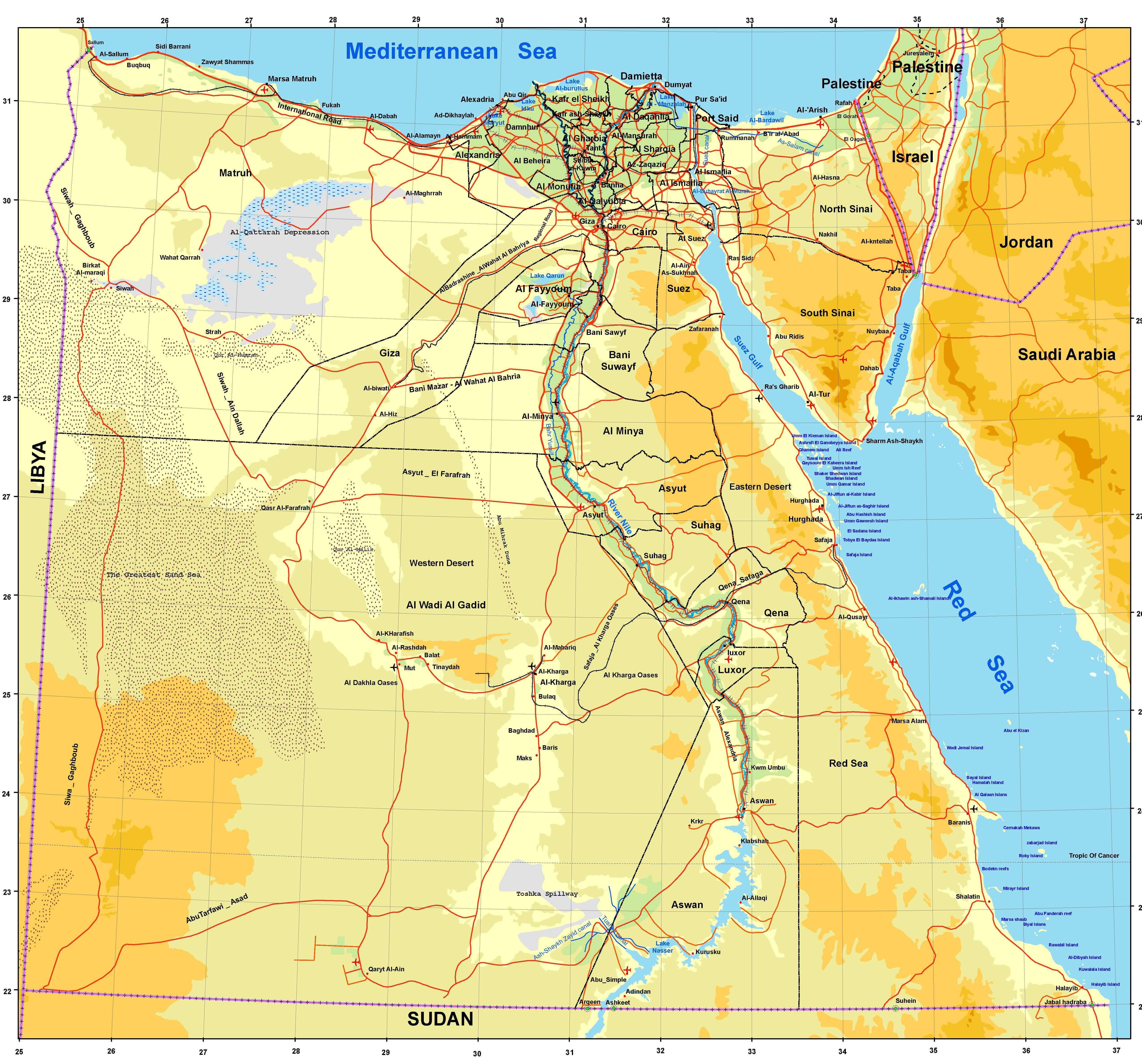 Map of Egypt showing cities, Nile River, deserts, and Mediterranean coast.
This map highlights Egypt’s political boundaries, key cities, and geographical features such as the Nile River and surrounding deserts. The map also marks significant coastal areas along the Mediterranean and Red Sea.
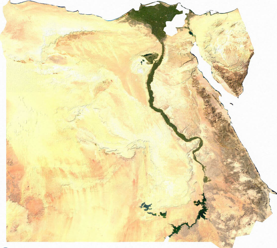
Egypt Nile River Satellite Image
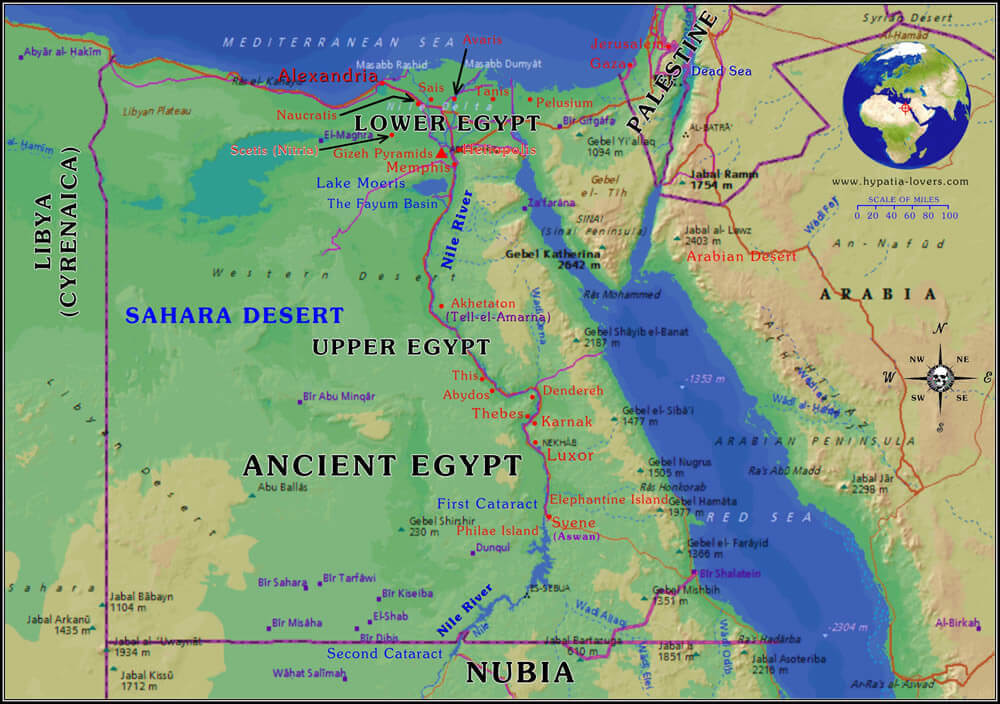
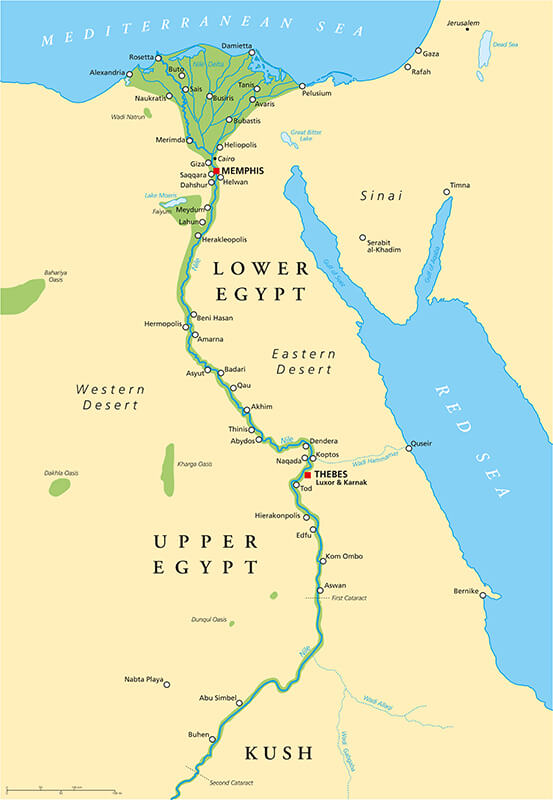
Ancient Egypt Map
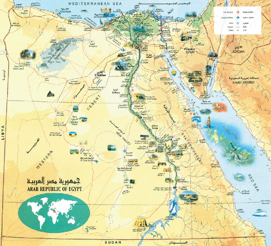 Ancient Egypt map showing cities, Nile River, deserts, and key landmarks.
This map highlights Egypt’s geography, including the Nile River, surrounding deserts, and notable cities and landmarks, such as Giza and Aswan, showcasing the country’s historical and geographical significance.
Egypt Map
Egypt Touristic Map
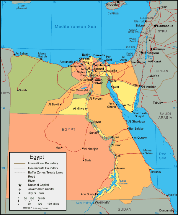
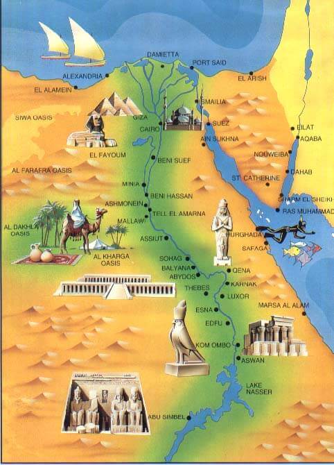 Touristic map of Egypt showing landmarks, Nile River, and oases.
This colorful map showcases Egypt’s major tourist destinations, including the Nile River, Giza pyramids, Abu Simbel, and historical sites like Luxor and Aswan, alongside desert oases and coastal attractions.
Map Egypt
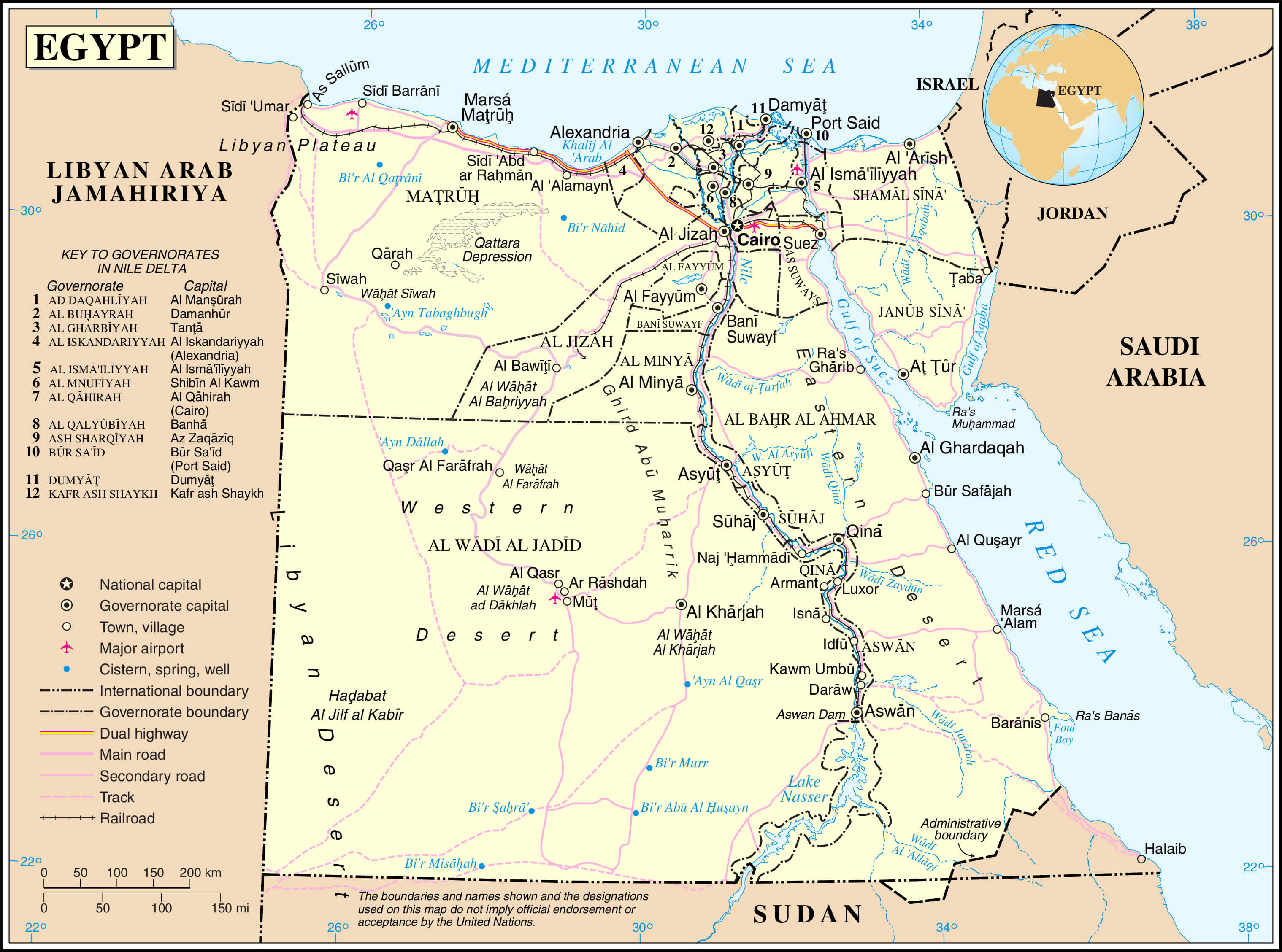 Egypt political map with cities, governorates, highways, and borders.
This map illustrates Egypt’s governorates, major cities, transportation routes, and international borders. It highlights the Nile River, deserts, and surrounding countries, providing a comprehensive overview of the region’s geography and administrative divisions.
Egypt Physical Map
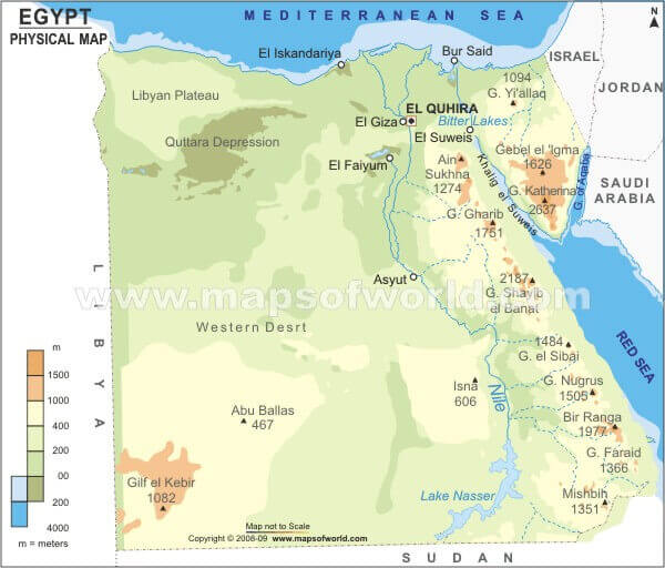
Ancient tourism map
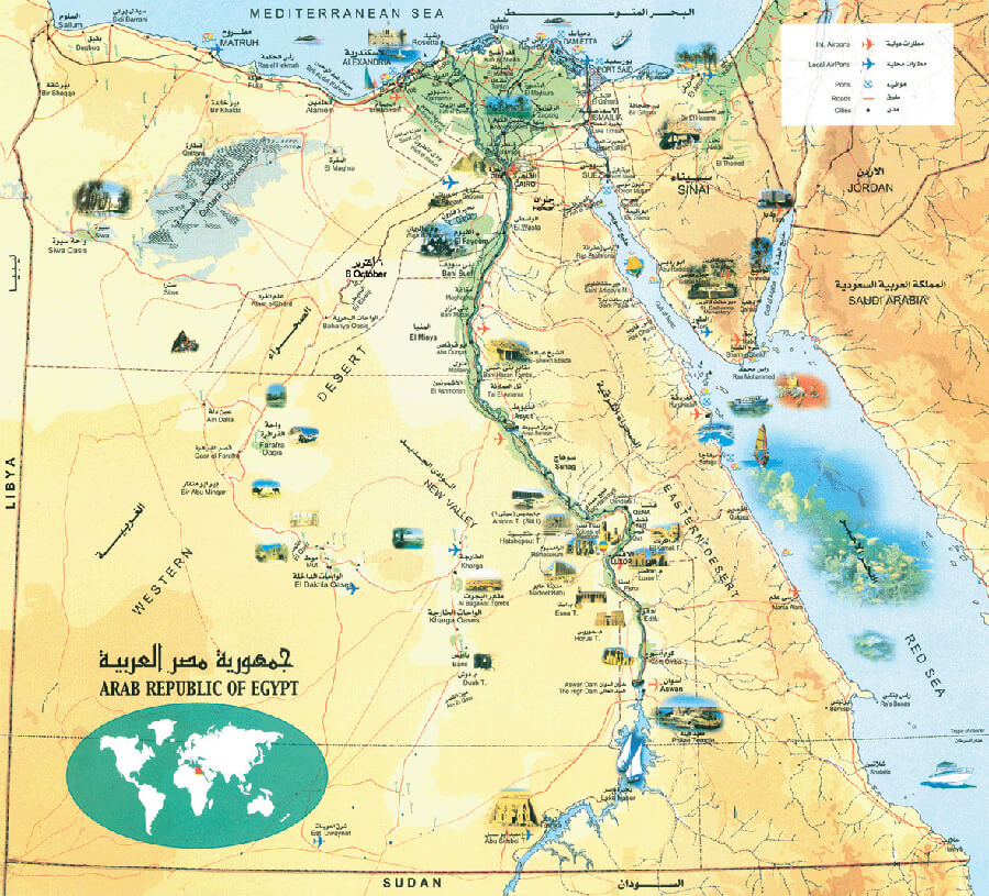
Egypt topography map with elevation
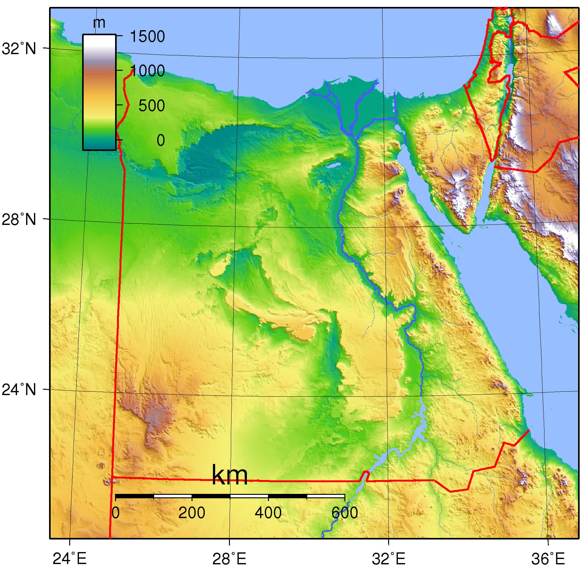
Egypt Relief Map
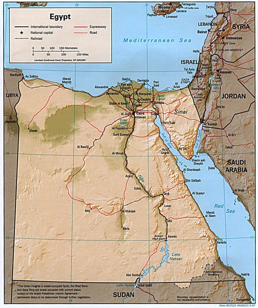 Egypt relief map showing elevations, cities, Nile River, and transportation.
This relief map of Egypt displays its varied topography, including the Nile Valley, surrounding deserts, and coastal areas. Major cities, transport networks, and neighboring countries are marked for geographical context.
Egypt Maps
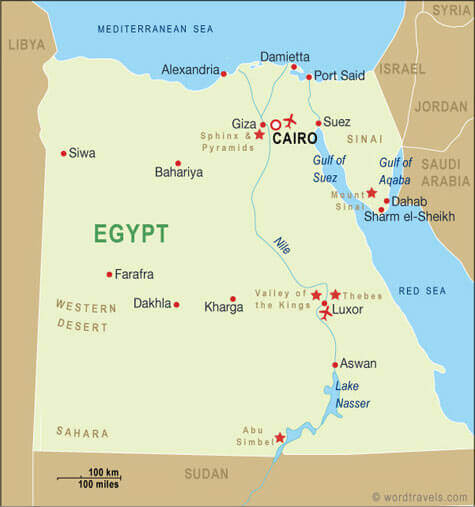
Maps of Egypt
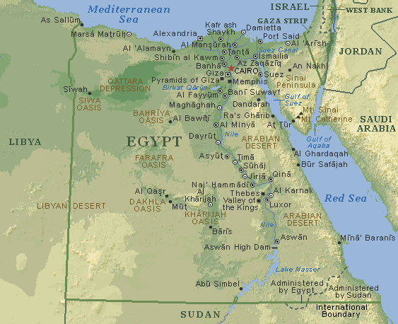
Ancient Egypt map
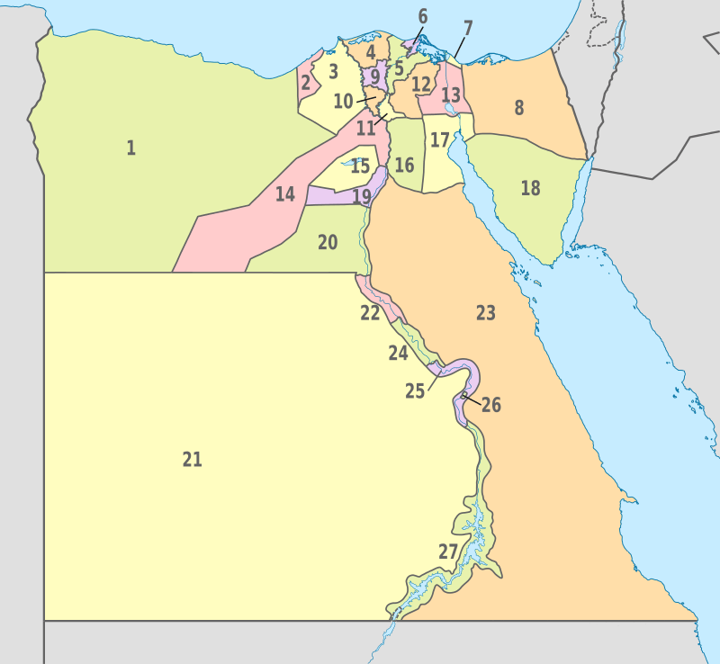
Egypt administrative divisions map
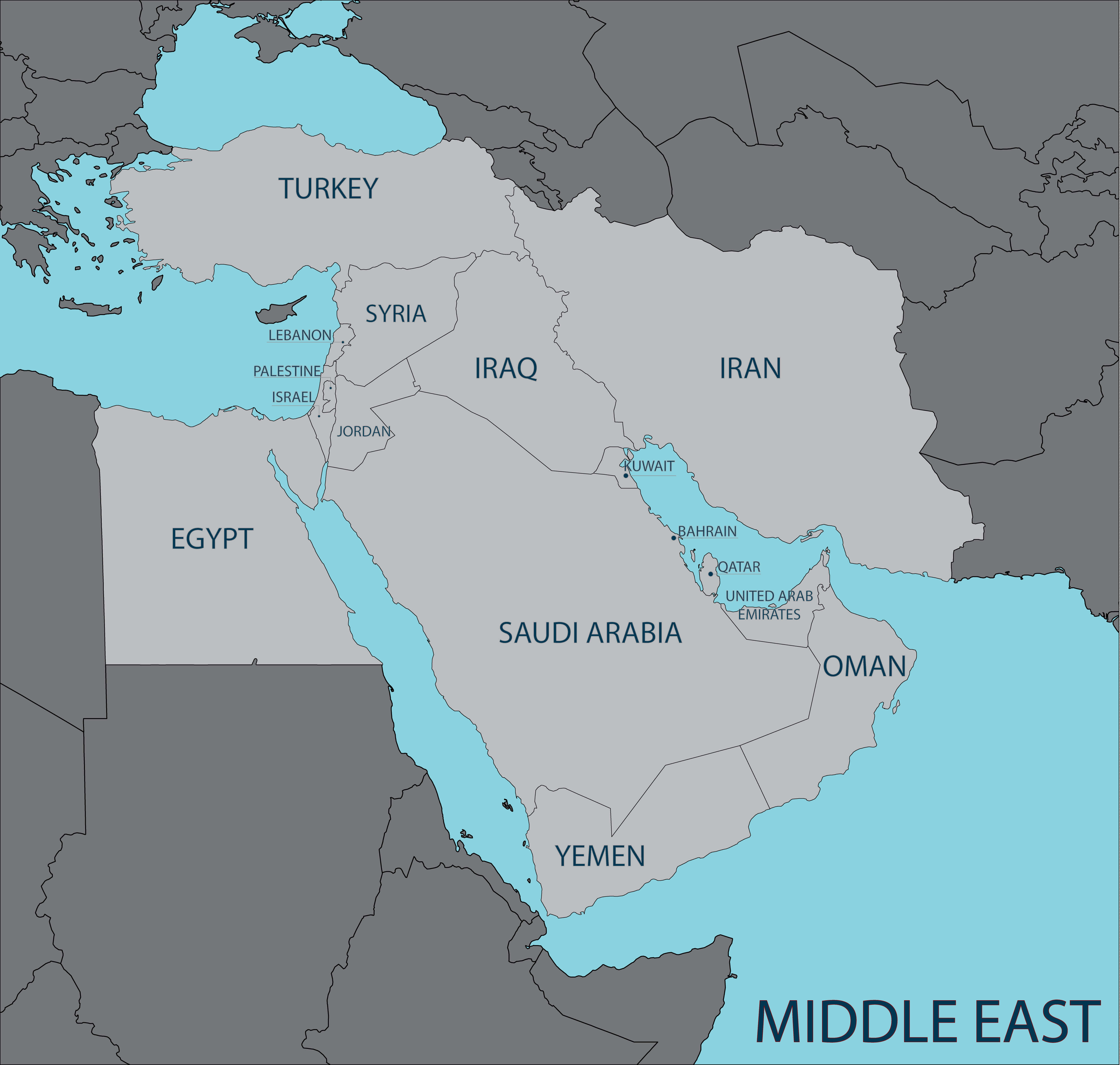
Egypt and middle east map
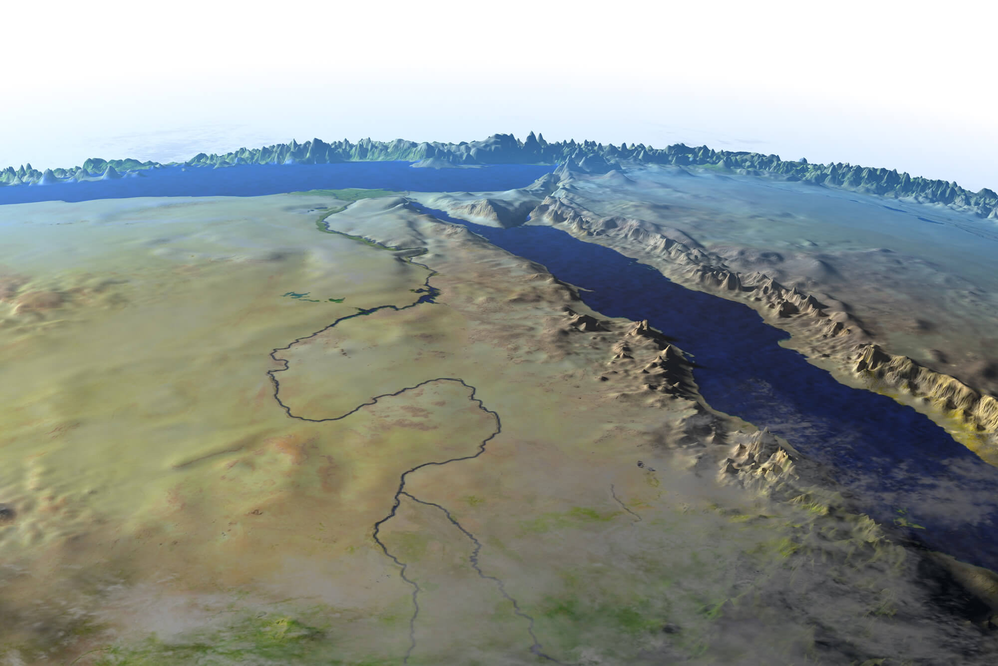
Egypt and sea red sea map
Egypt blank map
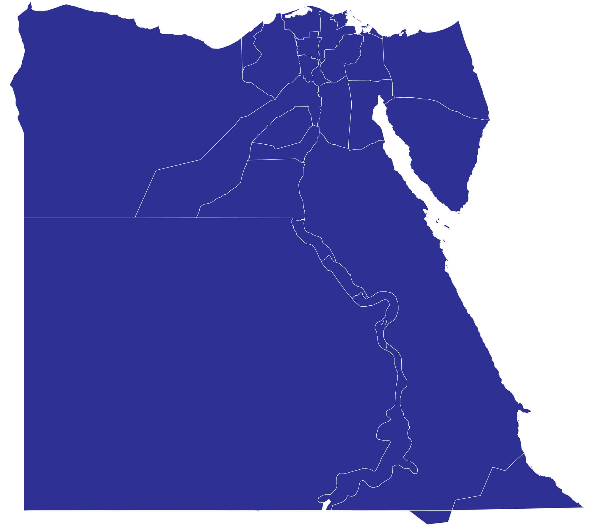
Egypt cities map
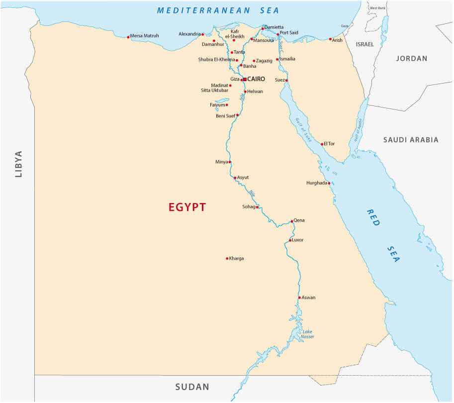
Egypt internatinal boundary map
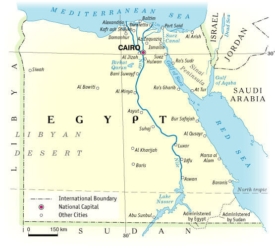
Egypt map with cities and rivers
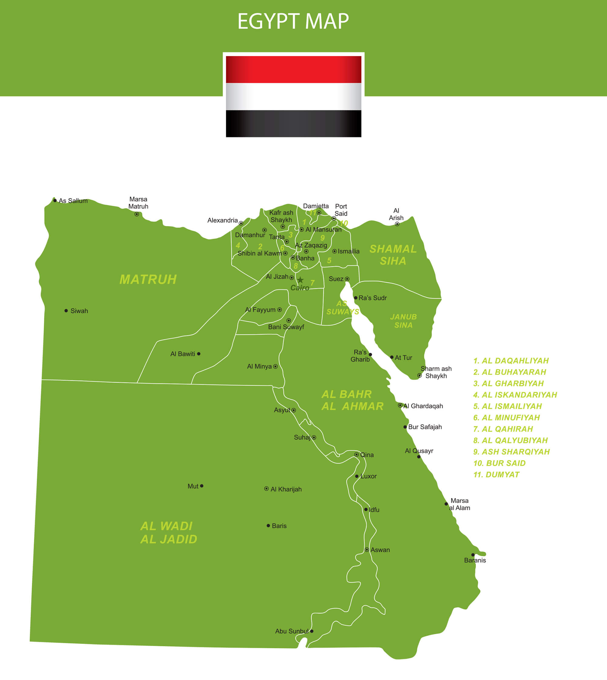
Egypt map with flag
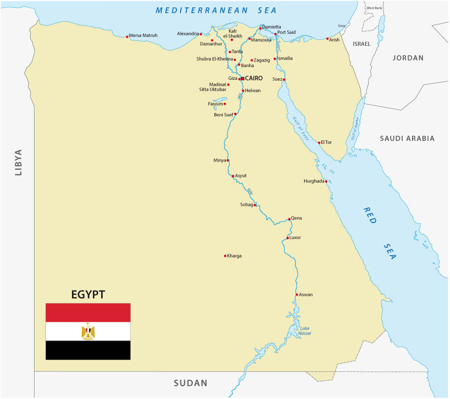
Egypt map with read sea and mountains
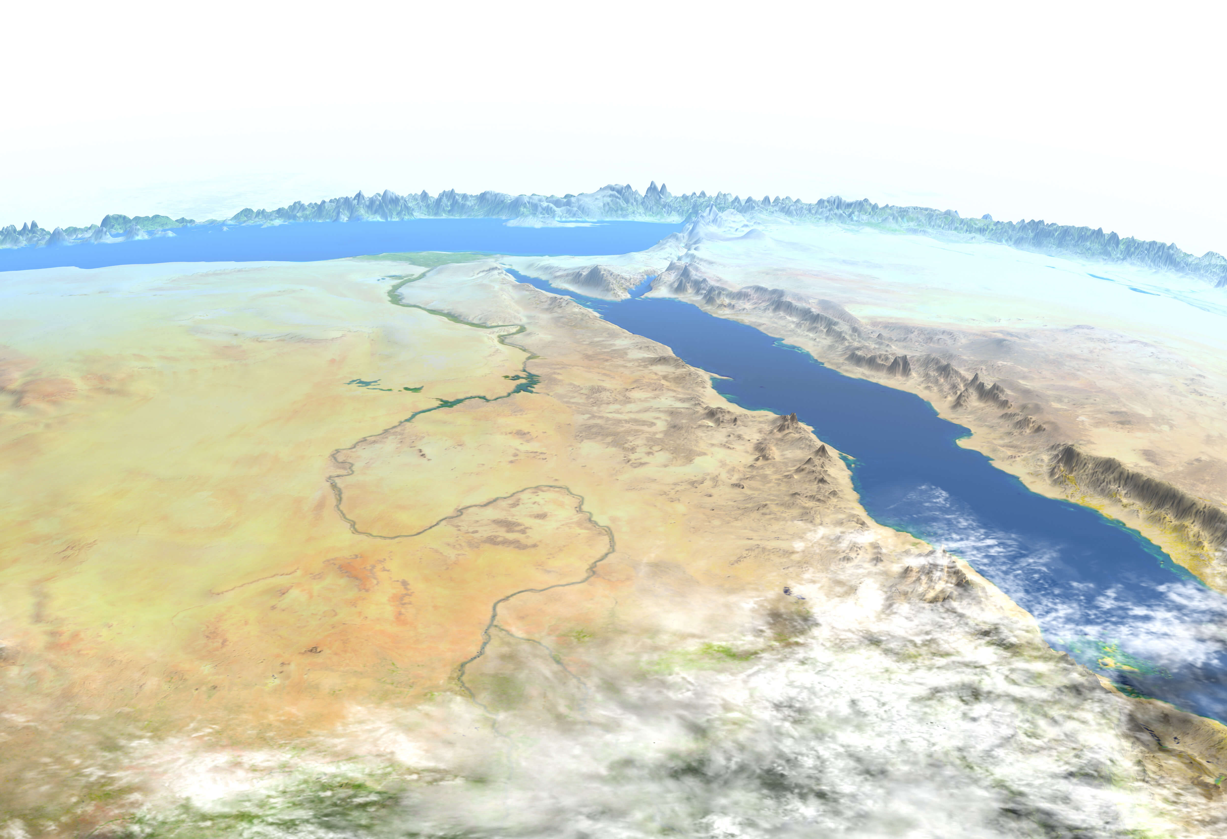
Egypt Nile river map
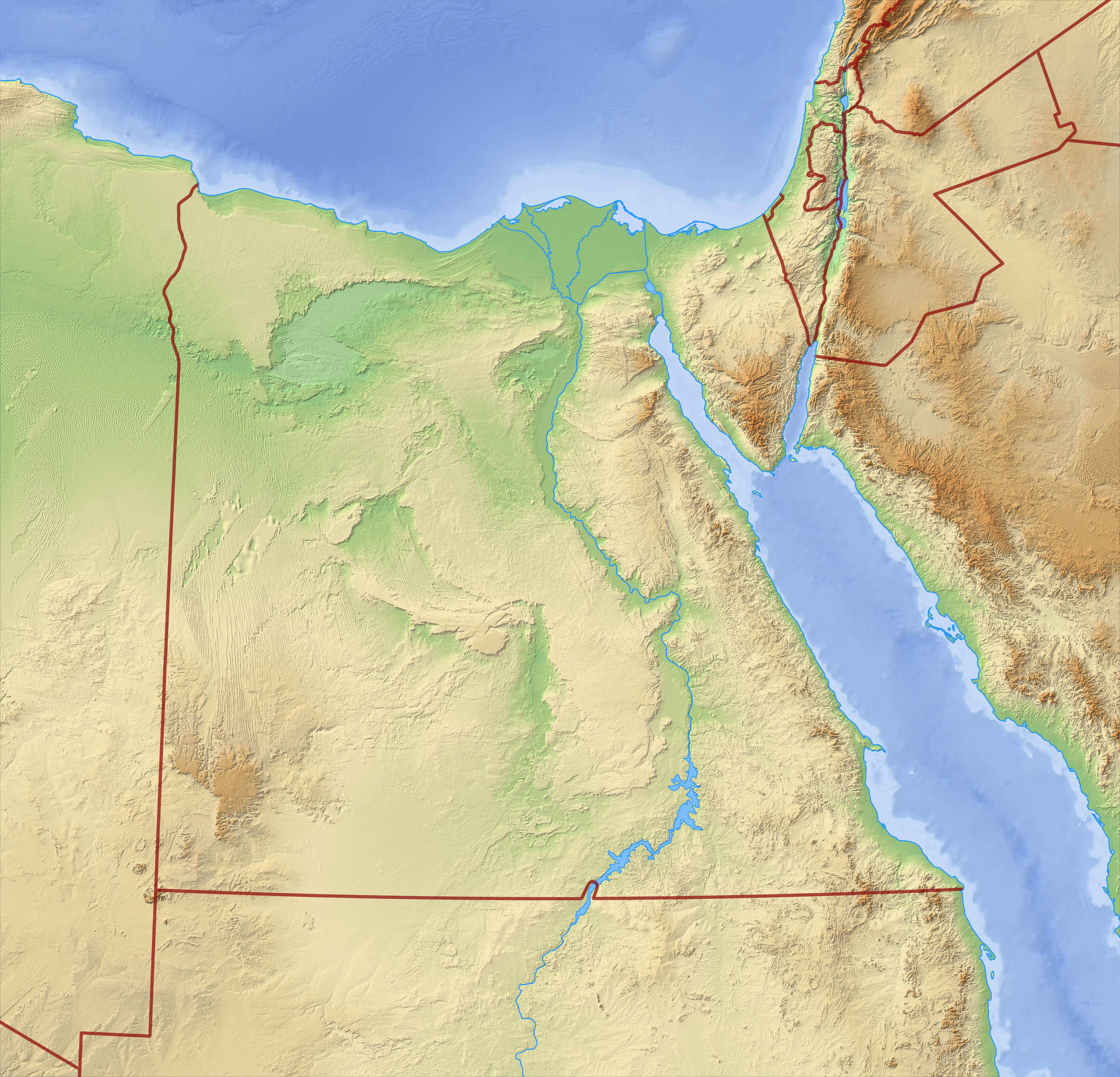
Egypt physical map with national border
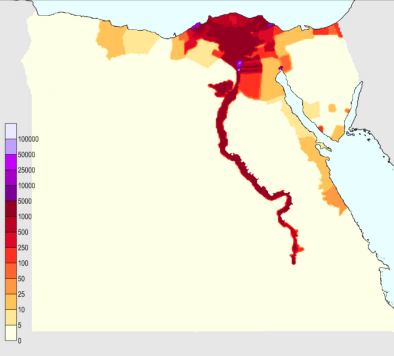
Egypt population density map
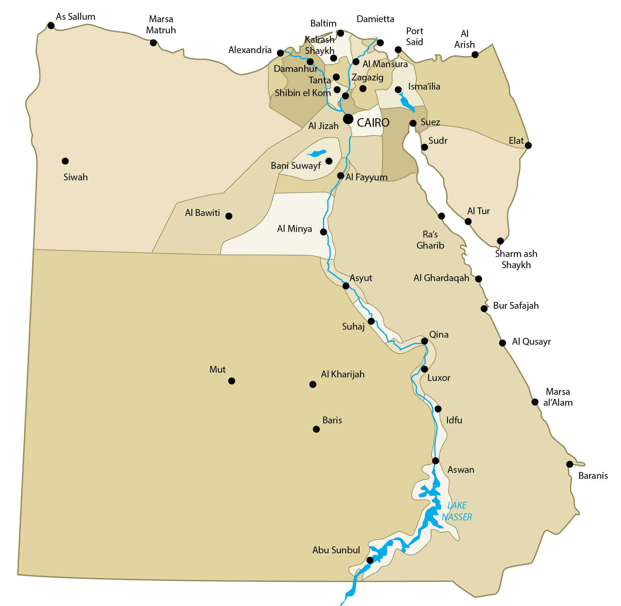
Egypt provinces map with cities
Egypt road map
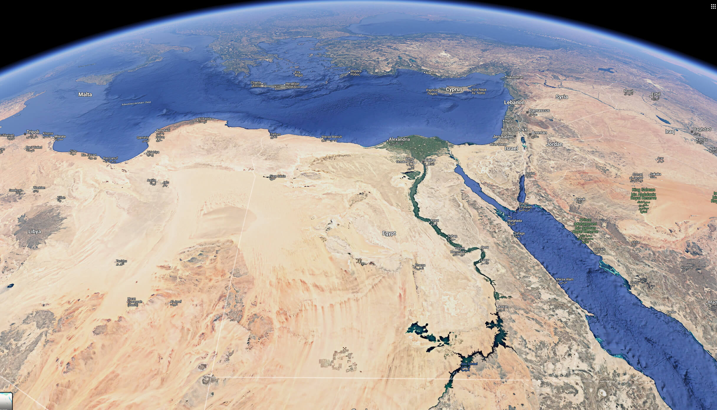
Egypt satellite map from space
Egypt satellite map
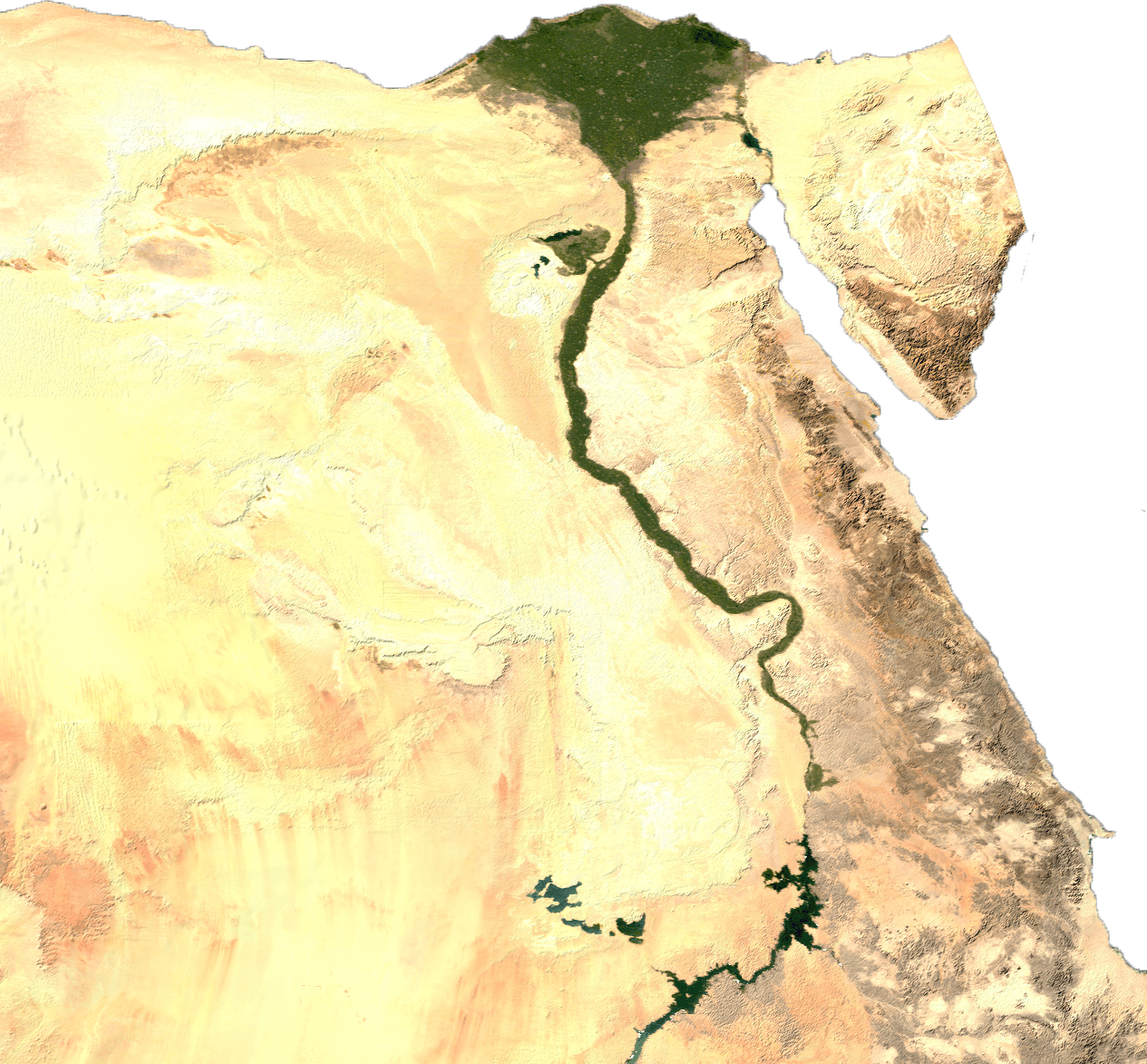
Egypt terrain map
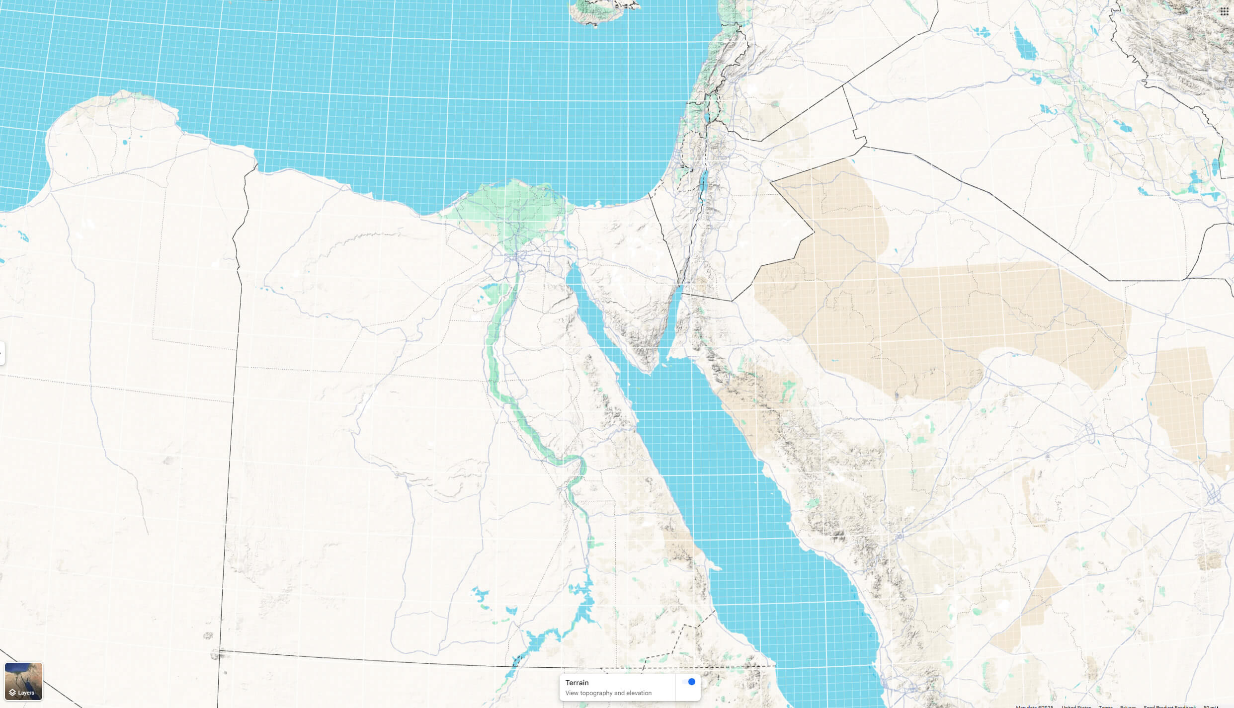
Egypt topography map
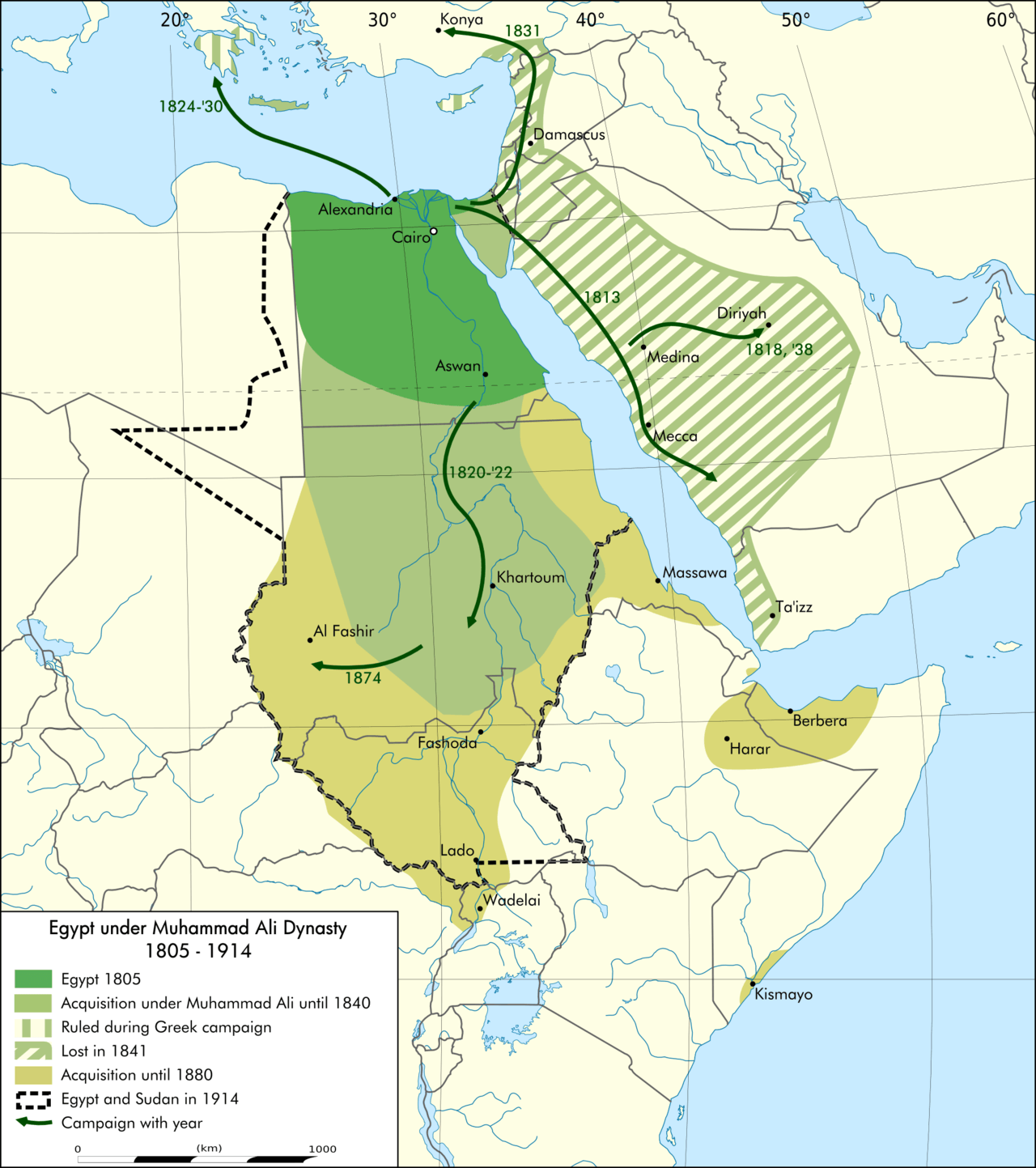
Egypt under muhammad ali dynasty map
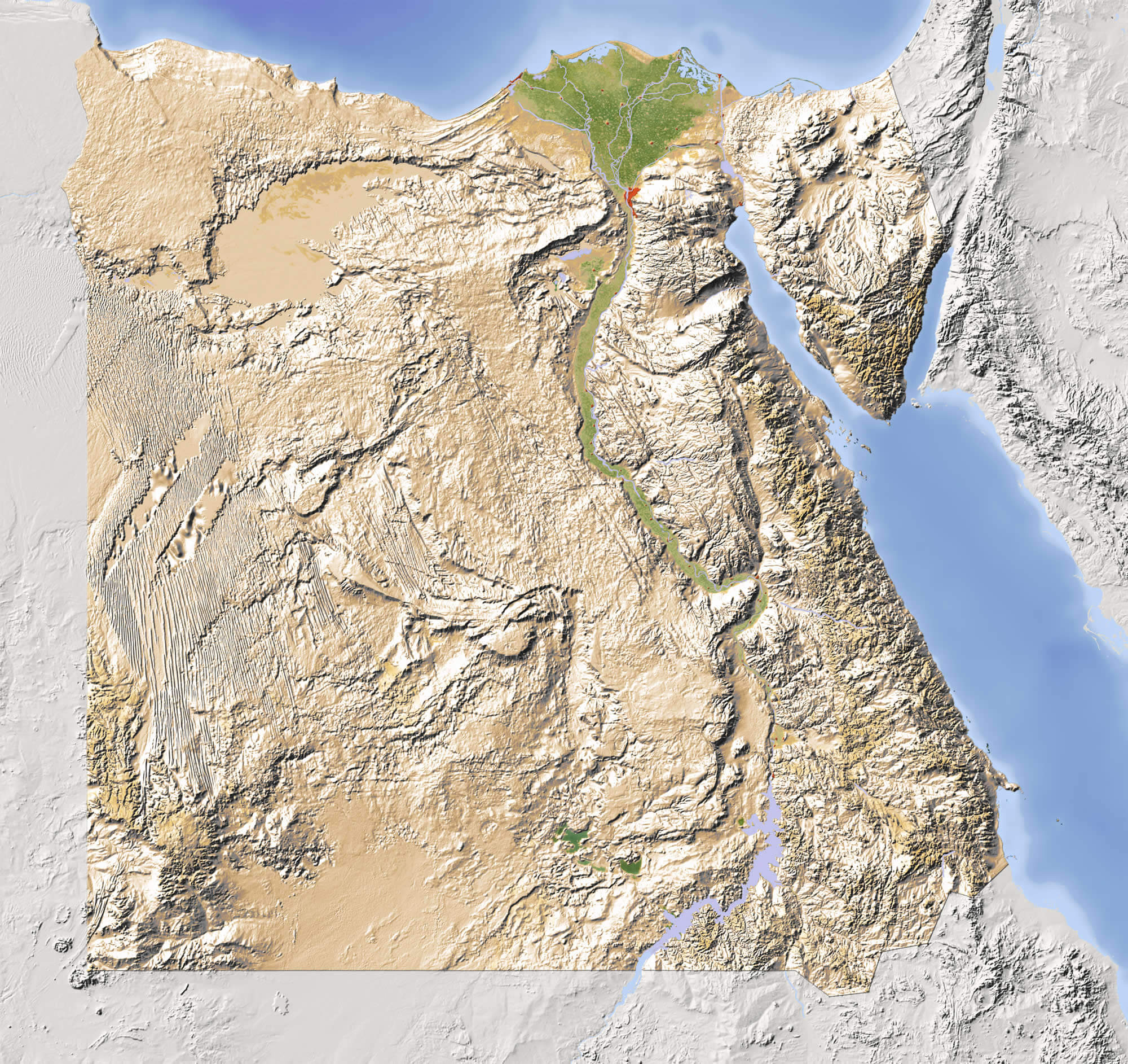
Nile country national map of Egypt
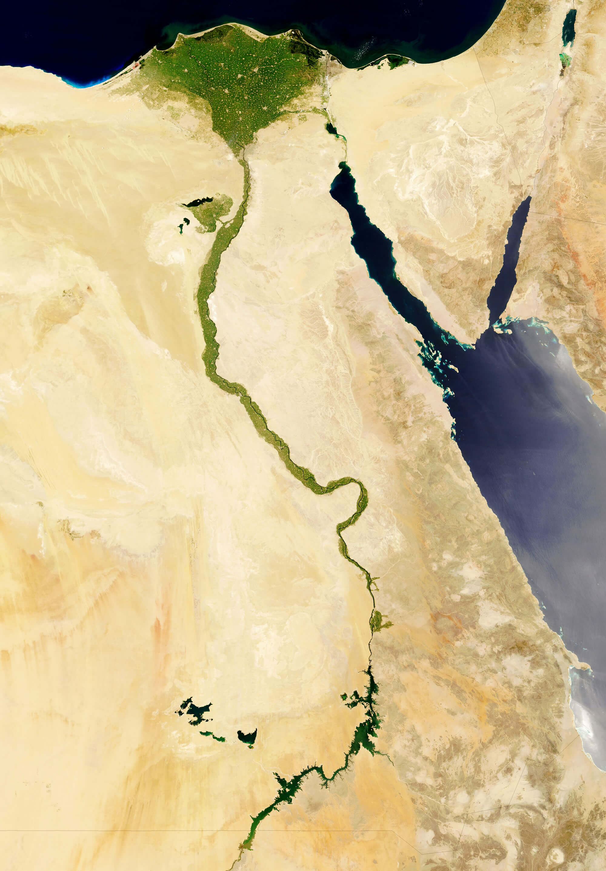
Satellite map of Egypt
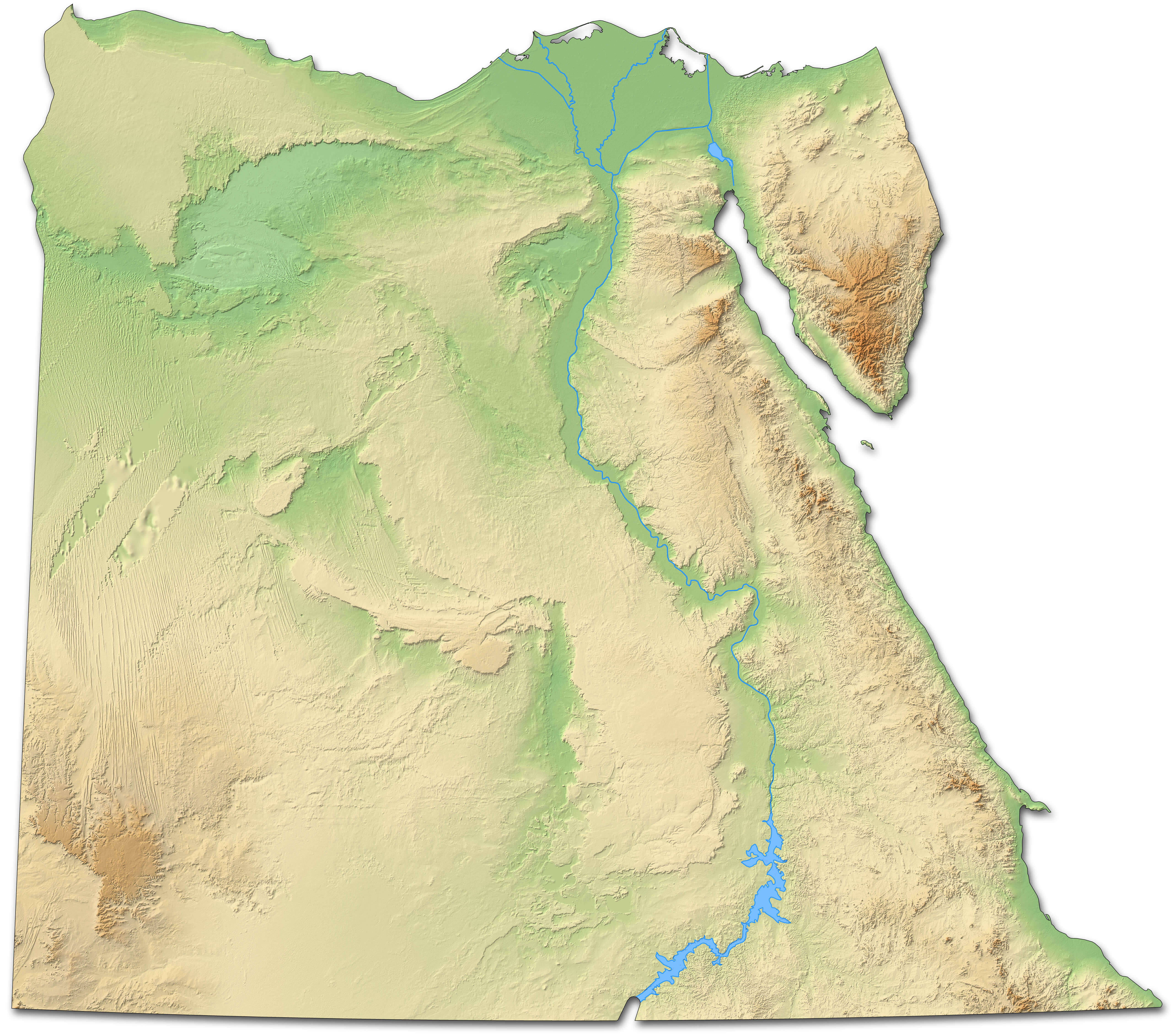
Topography map of Egypt
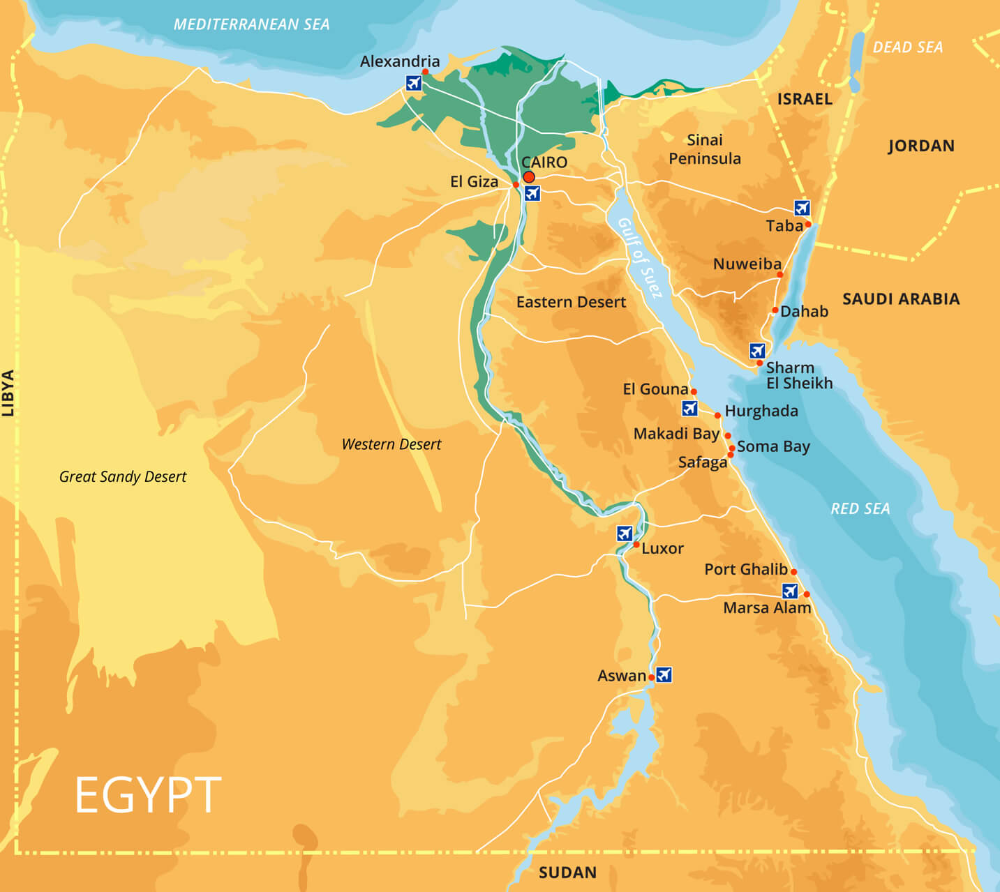
Vector color map of Egypt with capital Cairo
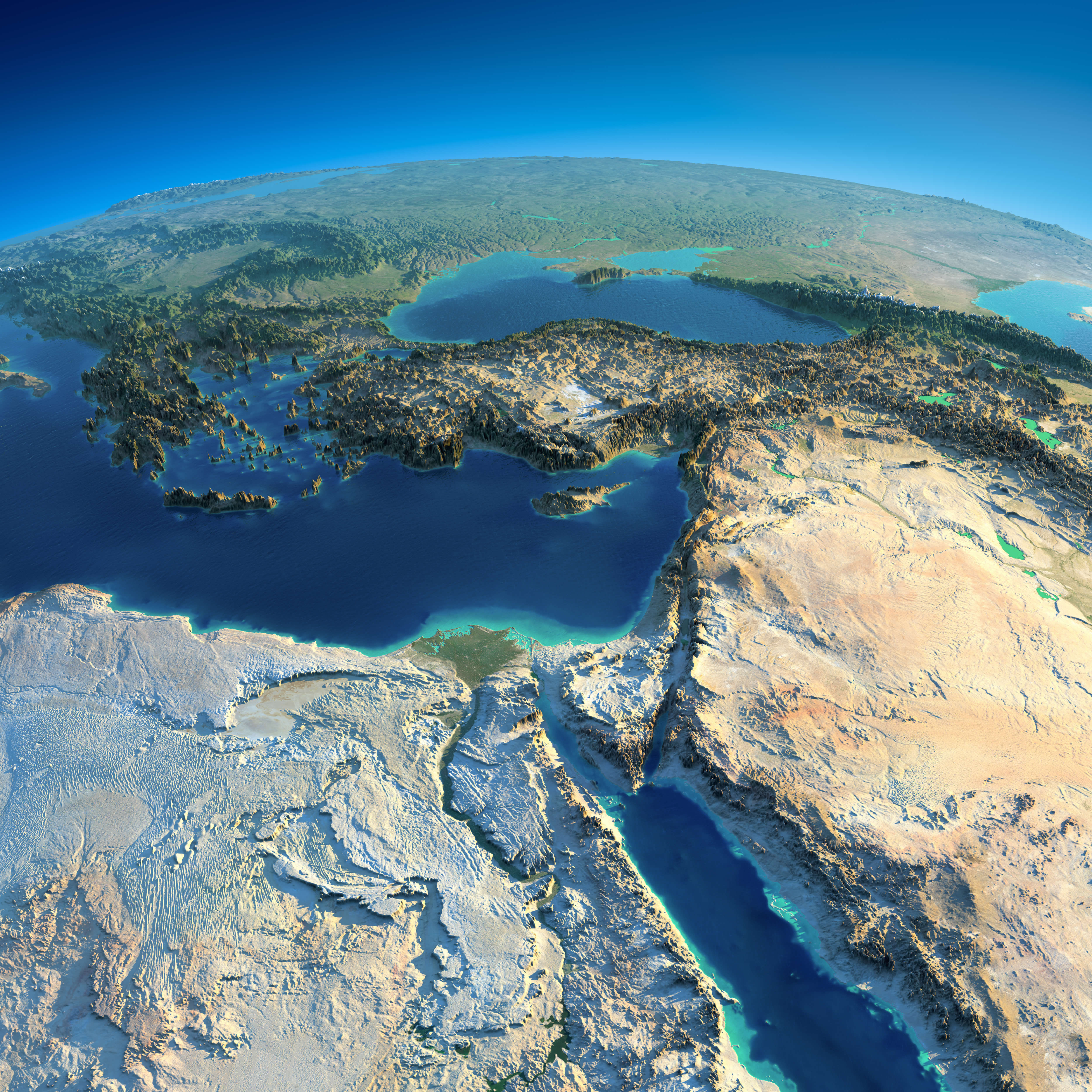
Where is Egypt on the Africa Map?
Show Google interactive map, satellite map, where is the country located.
Get directions by driving, walking, bicycling, public transportation and travel with street view.
Feel free to explore these pages as well:
- Algeria Map ↗️
- Tanzania Map ↗️
- Syria Map ↗️
- A Collection of Lebanon Maps ↗️
- Iran Map ↗️
- Iraq Map ↗️
- Israel Map ↗️
- Jordan Map ↗️
- Oman Map ↗️
- Saudi Arabia Map ↗️
- Uganda Map ↗️
- Where is Located Qatar in the World? ↗️
- United States Map ↗️
- United Kingdom Map ↗️
- Türkiye Map ↗️
- Europe Map ↗️
- Africa Map ↗️
