Uganda’s maps show political divisions, physical features, road networks, terrain, population distribution, borders, regions, and river systems such as the Nile. Discover its location in East Africa with satellite views, topography, and geographical data for travel, education, or research purposes.
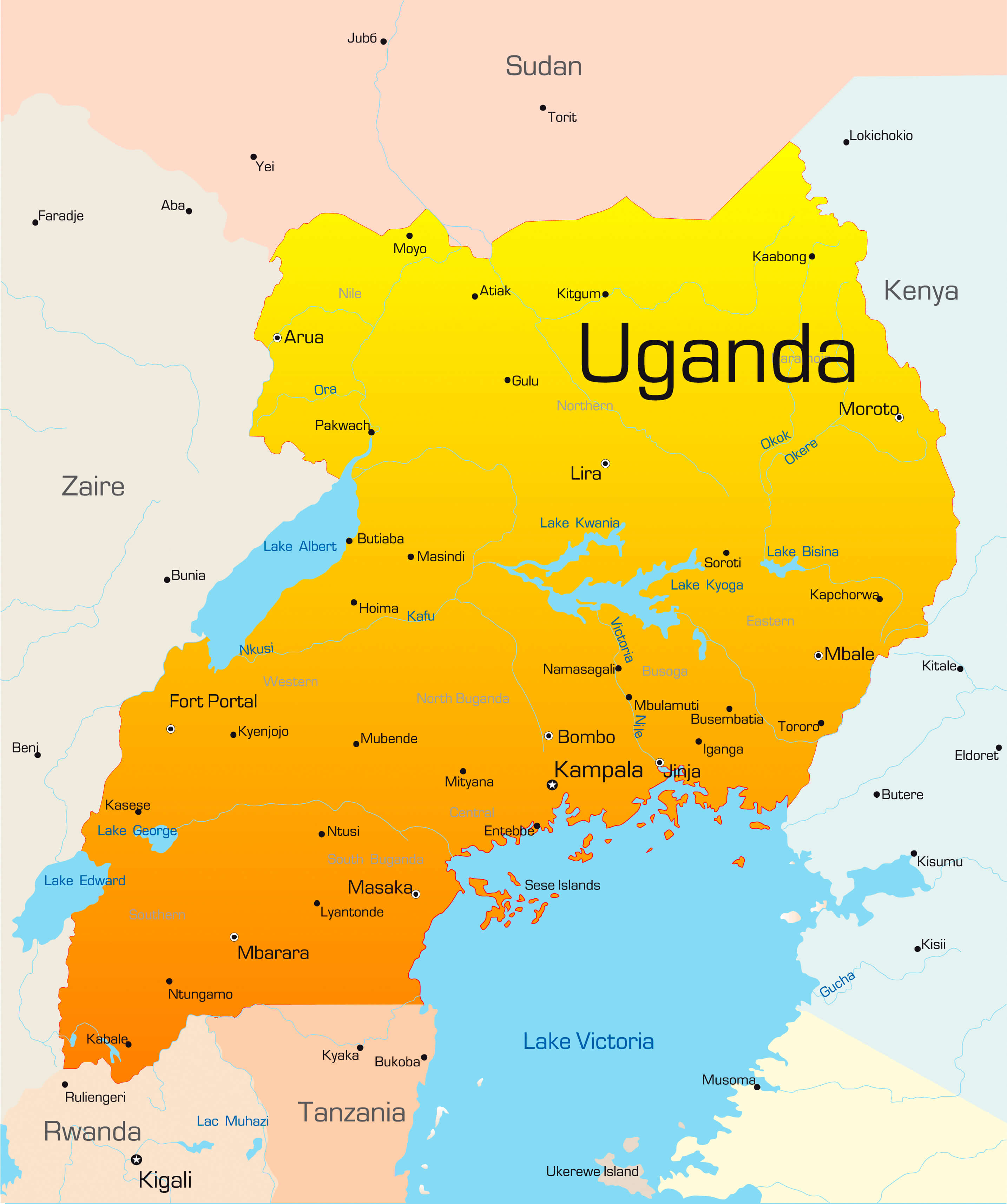
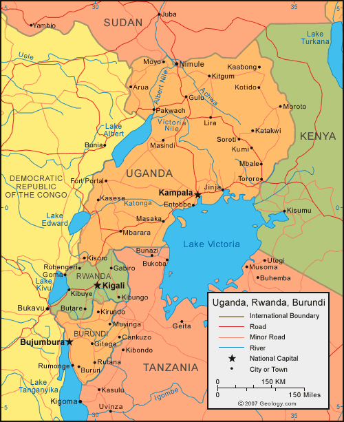
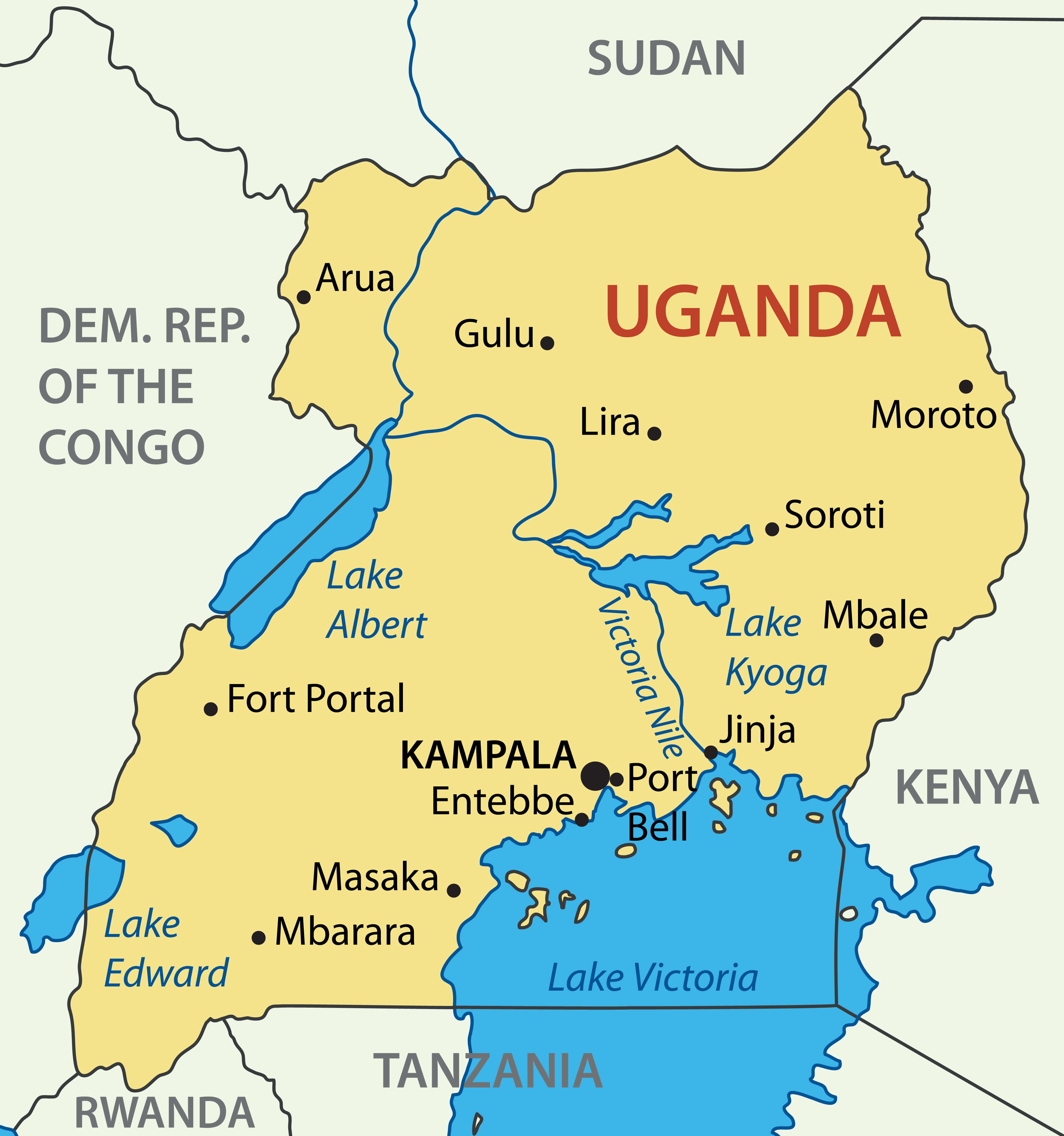
Uganda political map wth major cities
Uganda Cities Map
Brief information about Uganda
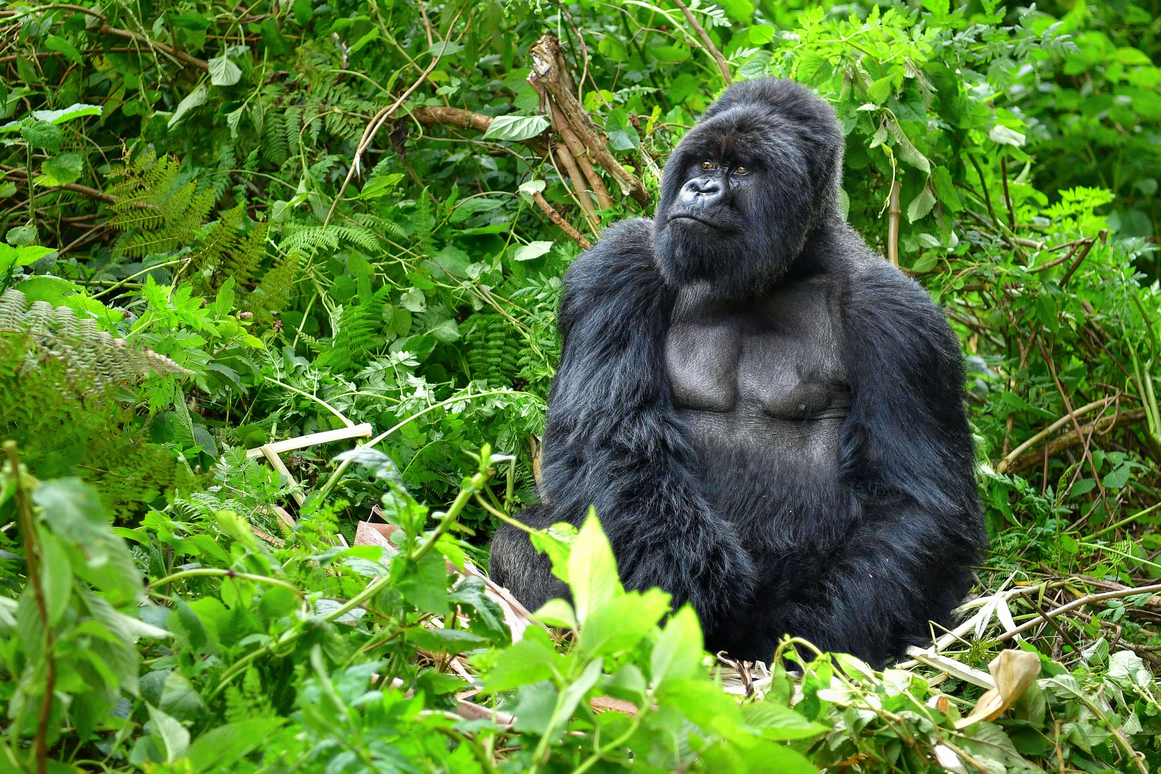
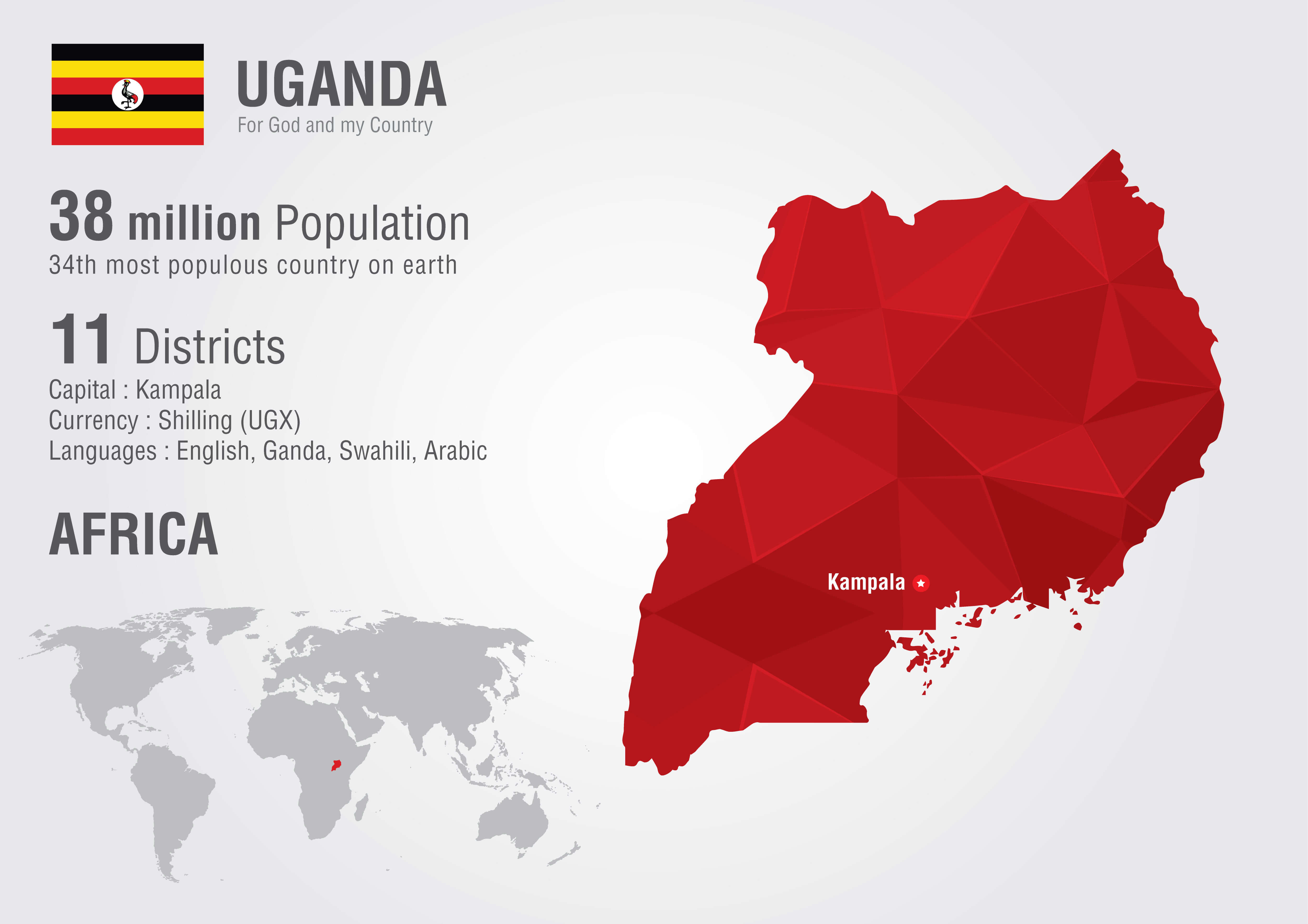
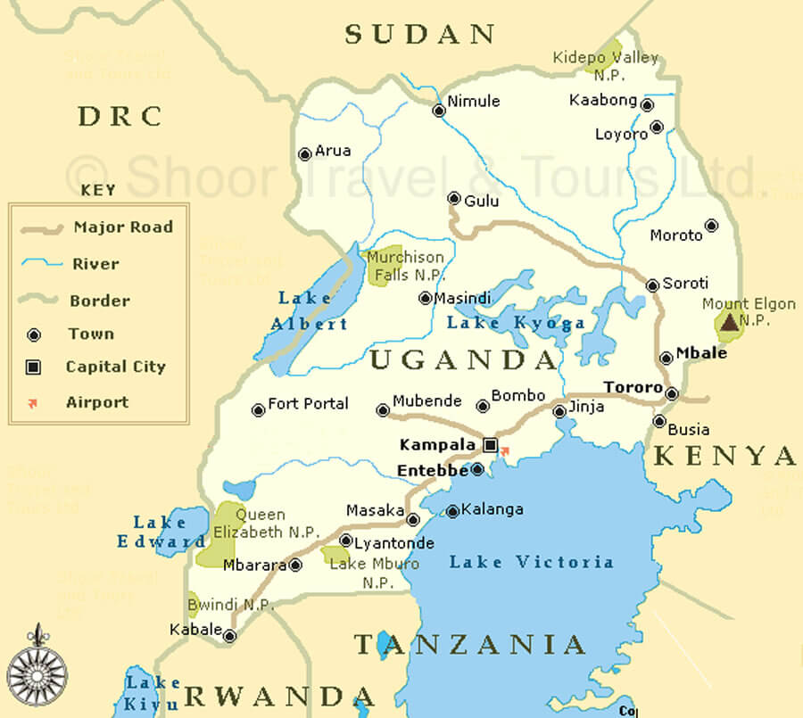
Uganda, often referred to as the ‘Pearl of Africa’, is a landlocked country in East Africa. Renowned for its stunning natural beauty, it is home to lush landscapes, the iconic Lake Victoria and a wealth of wildlife, including mountain gorillas in Bwindi Impenetrable National Park. The country’s capital, Kampala, serves as an economic and cultural hub, blending modern development with traditional African culture.
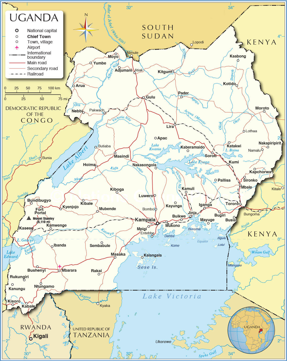
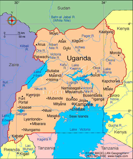
Uganda Political Map
With a population of over 45 million, Uganda is a culturally diverse nation with more than 50 ethnic groups and languages. Its economy is based on agriculture, tourism and a growing service sector. The country is also known for its warm hospitality, vibrant music and dance traditions, making it a unique and welcoming destination in Africa.
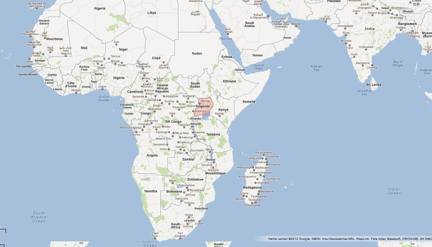
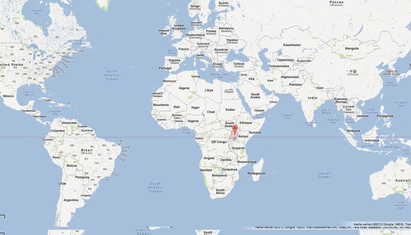
Where is located Uganda on the World Map
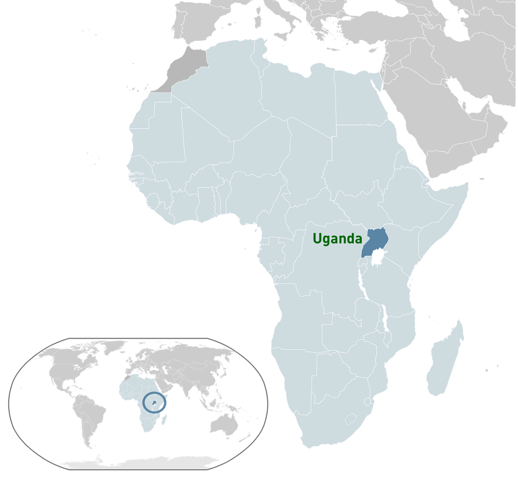 Where is located Uganda on the World Map
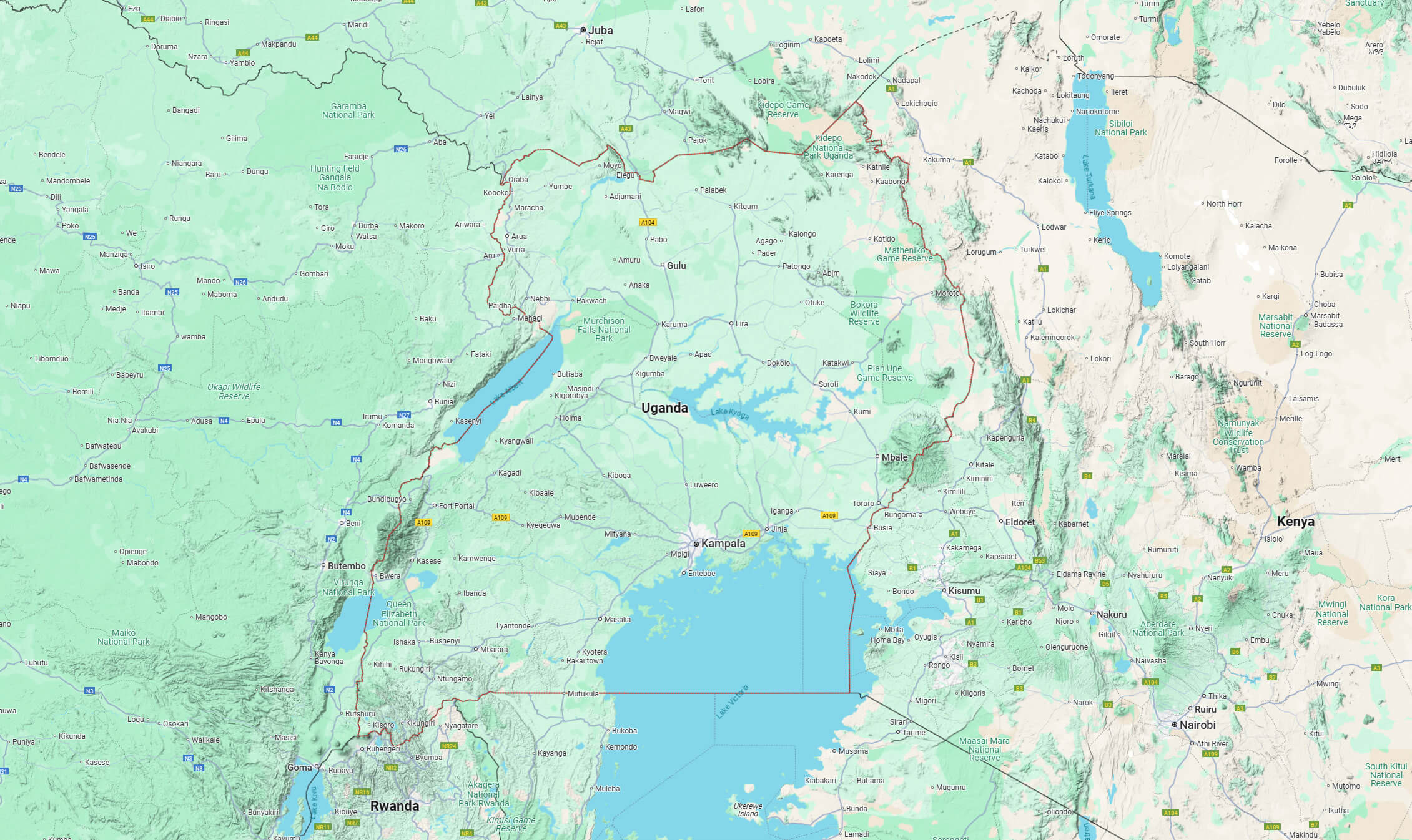
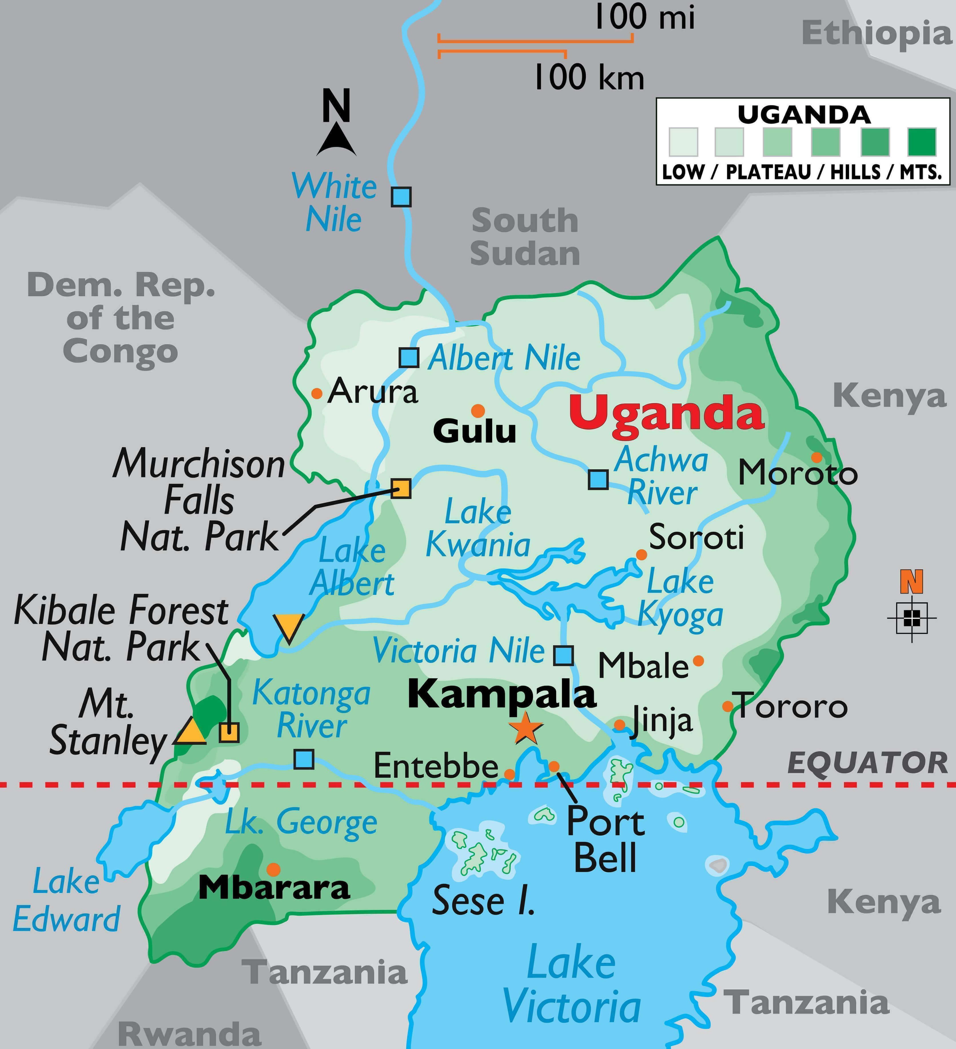
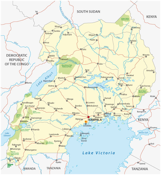
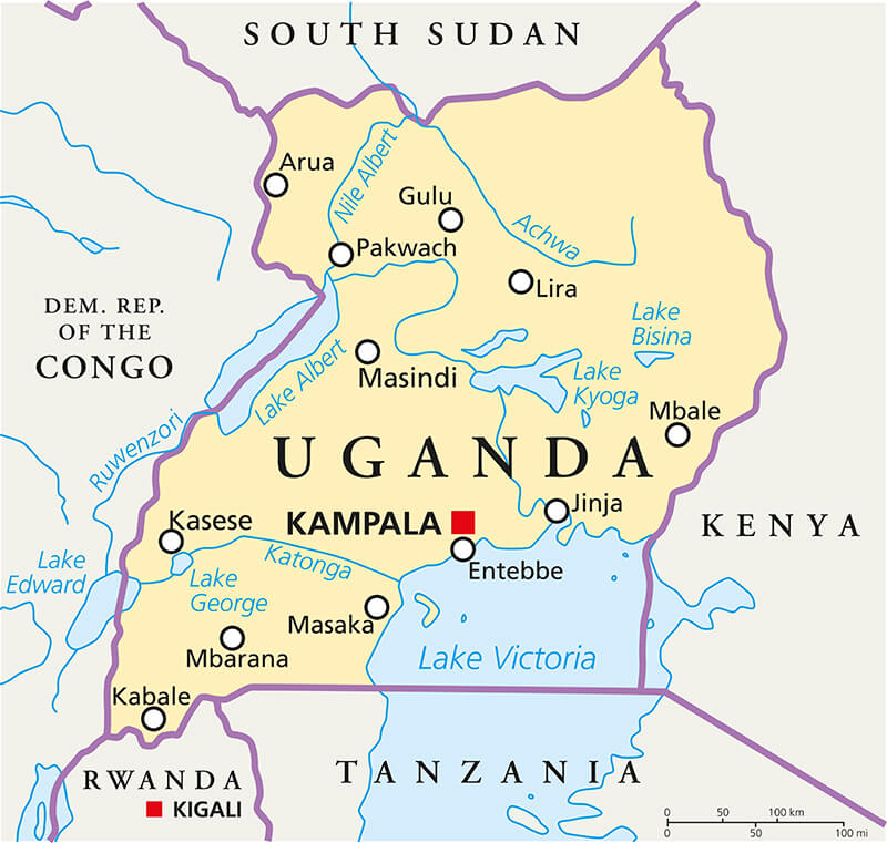
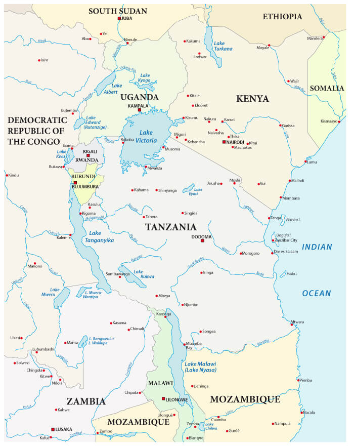
Uganda is a landlocked country in East Africa, bordered by five countries. It borders South Sudan to the north and Kenya to the east. Its western border is with the Democratic Republic of Congo, and Rwanda lies to the southwest. To the south, Uganda borders Tanzania and includes part of Lake Victoria, the largest freshwater lake in Africa.
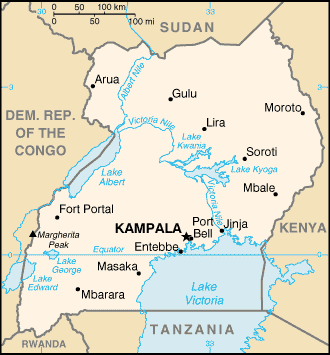
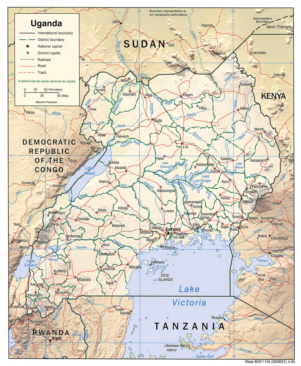
Uganda physical map
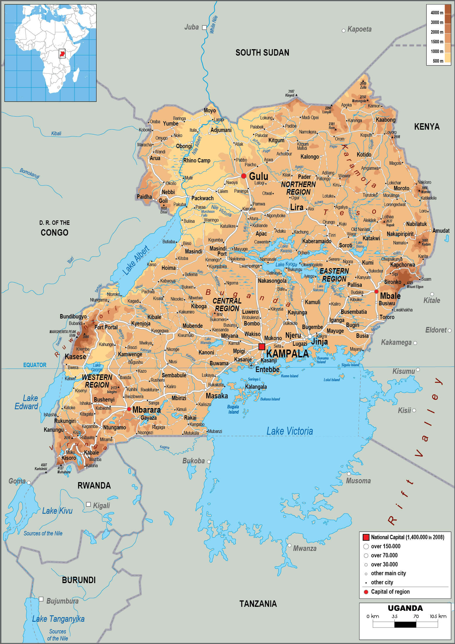
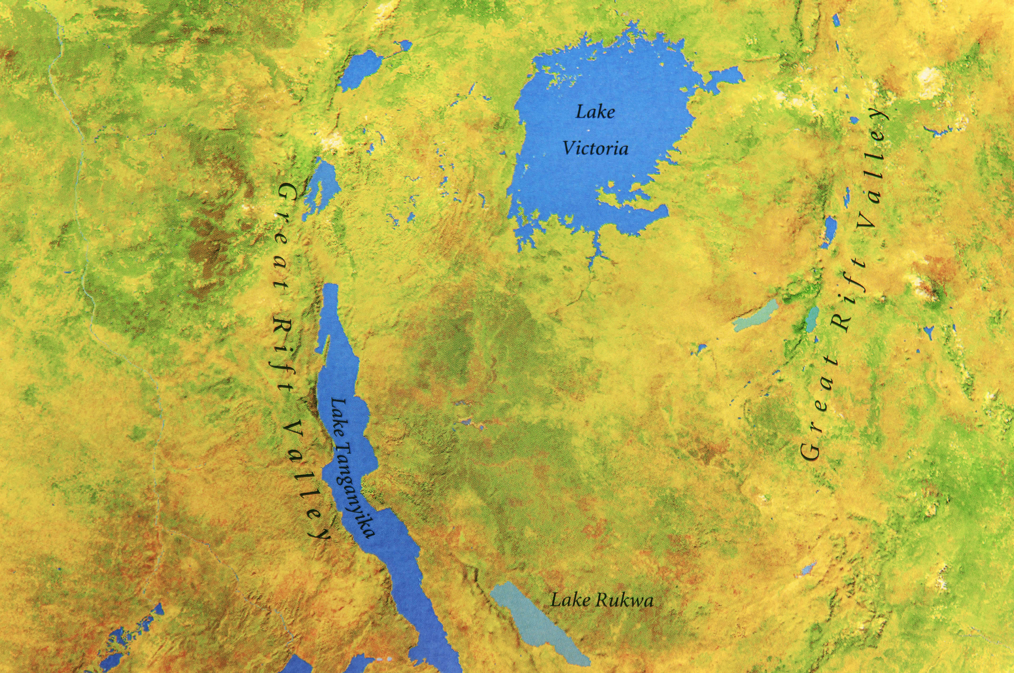
Geographically, Uganda is close to the equator, giving the country a tropical climate. The landscape is a mix of plateaus, mountains and lakes, including the famous Rwenzori Mountains and Lake Albert. Its central location on the African continent makes it an important part of the East African region.
Physical map of Uganda
On the world map, Uganda lies just west of the Indian Ocean, making it accessible through its neighbours. Its proximity to significant natural landmarks, such as the Nile River, underlines its role in Africa’s environmental and cultural heritage.
Here are some statistical information about Uganda:
 Area: 241,038 km2 (93,065 sq mi)
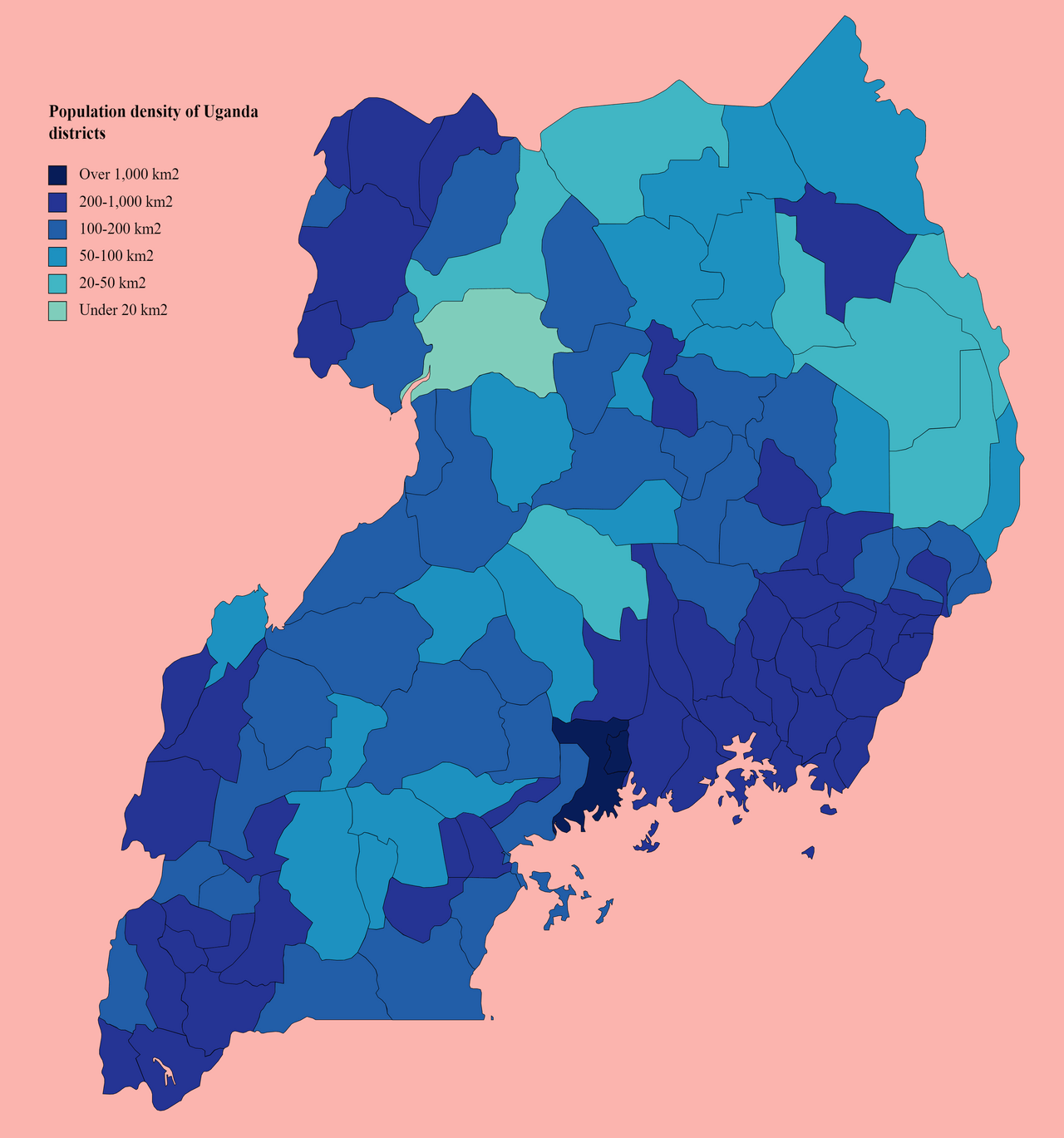
 Population density map of Uganda
 Capital city: Kampala
 Uganda infographics map
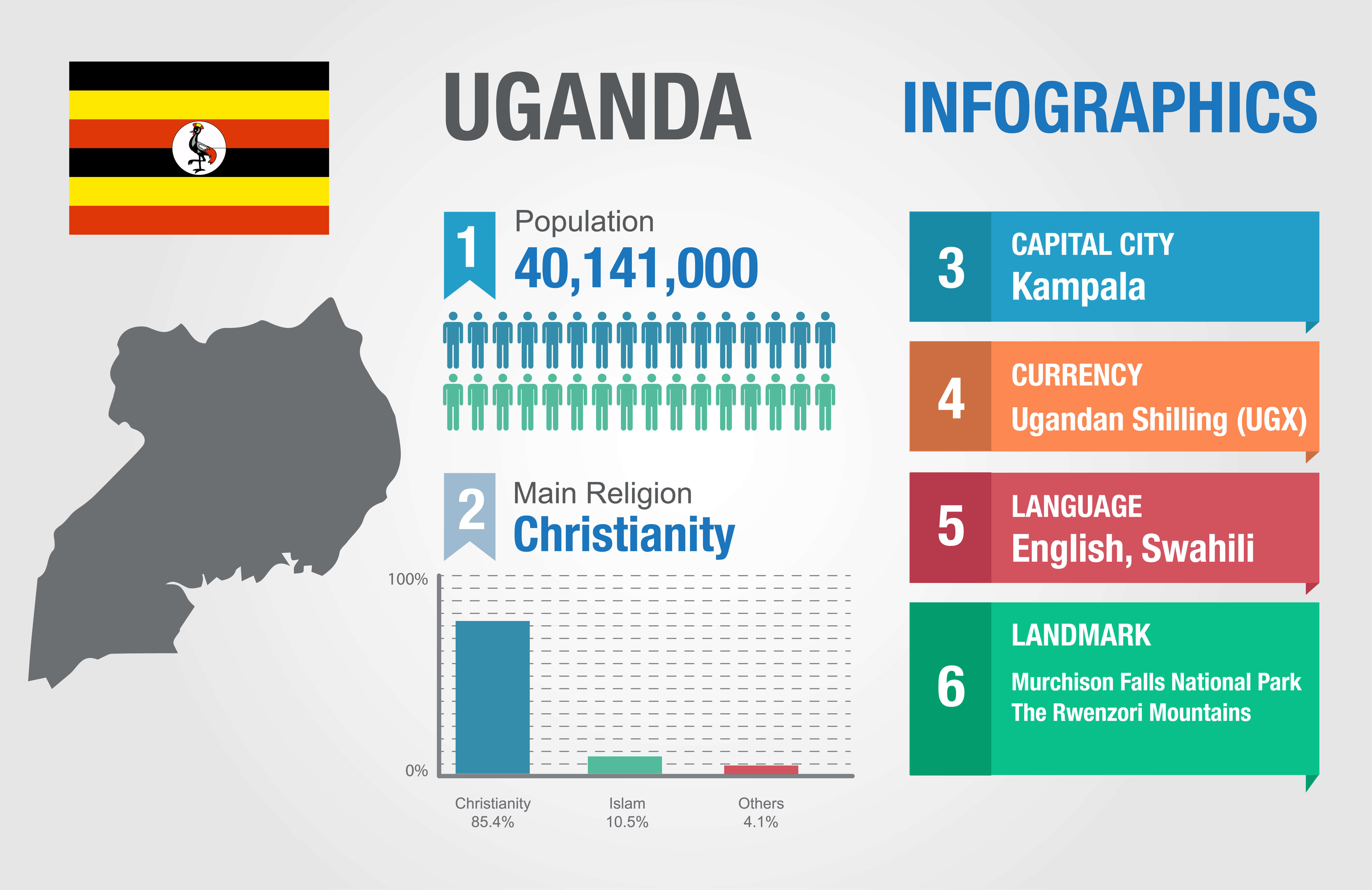 Official languages: English, Swahili
 Uganda road map with cities
Uganda regional map
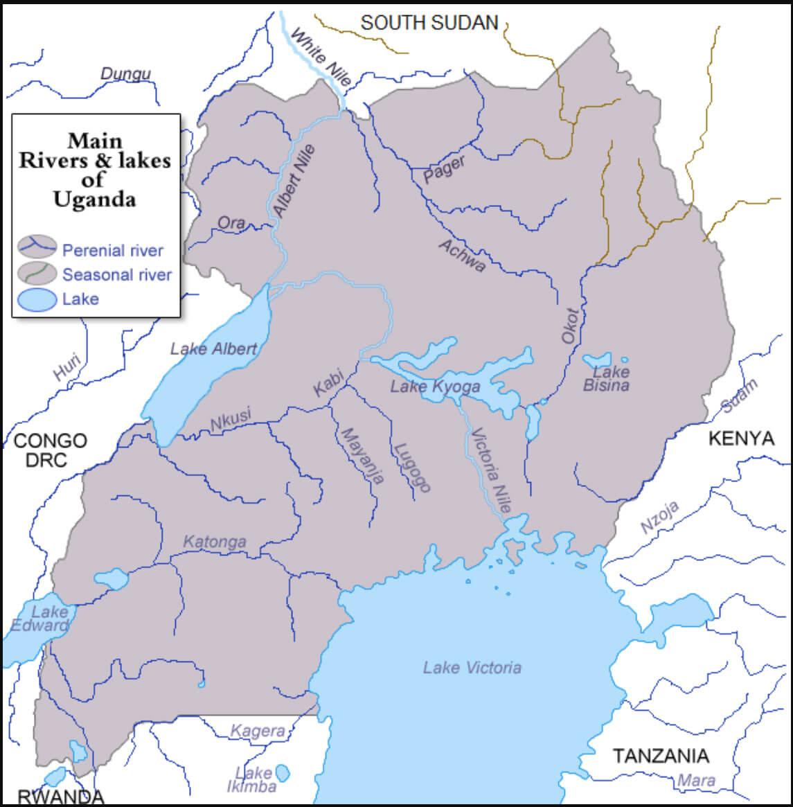
Uganda rivers and lakes map
Map of Uganda
Spoken Languages in Uganda
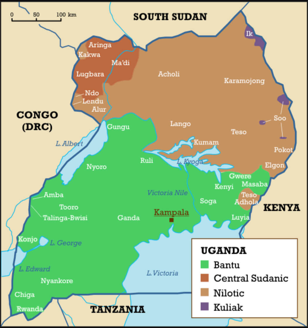
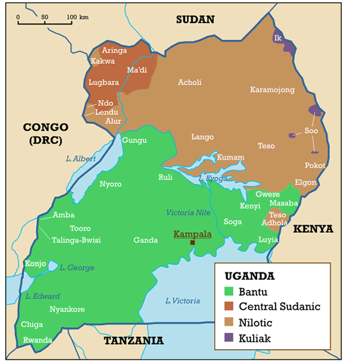 Map of Uganda highlighting regions by language groups.
This map of Uganda illustrates the distribution of major language groups, including Bantu in the south, Nilotic in the east and north, Central Sudanic in the northwest, and Kuliak in small regions in the northeast. Key cities like Kampala and significant water bodies, such as Lake Victoria and Lake Albert, are also shown.
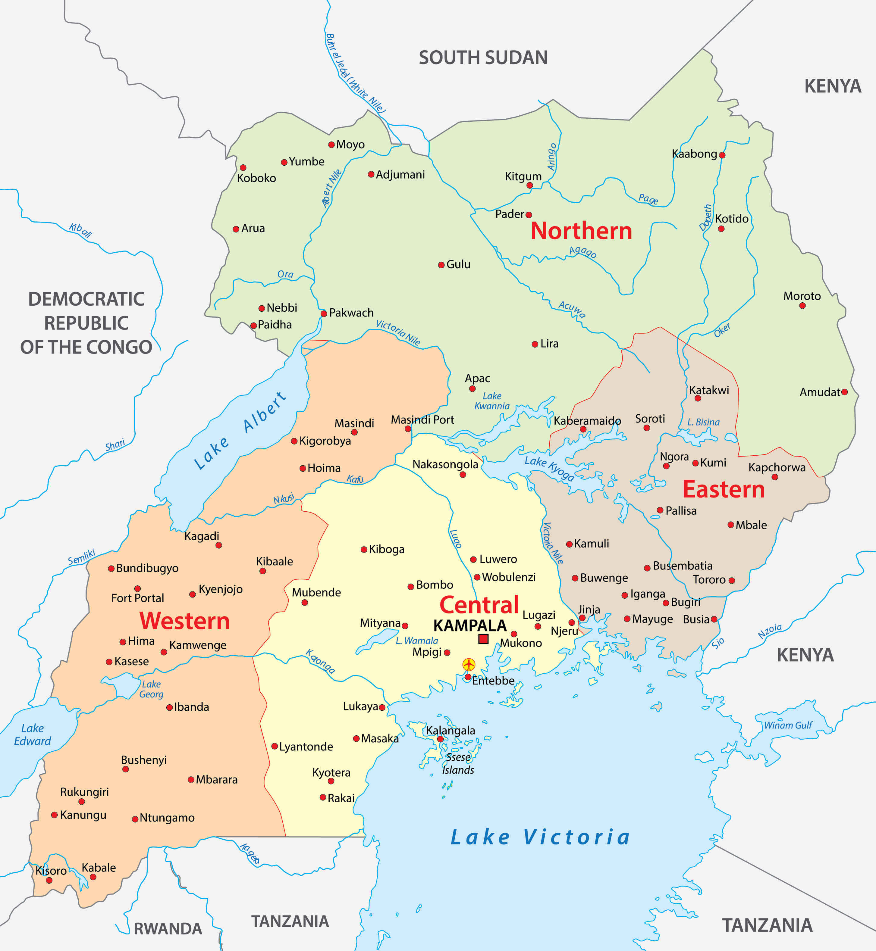
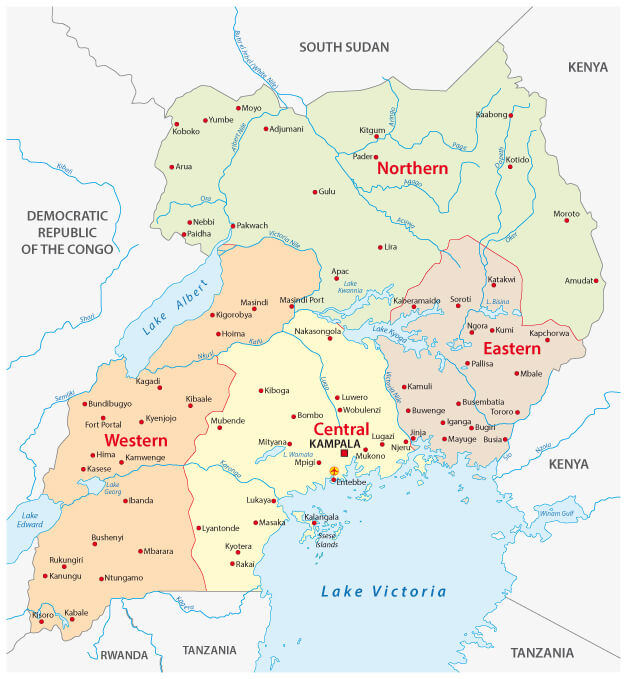
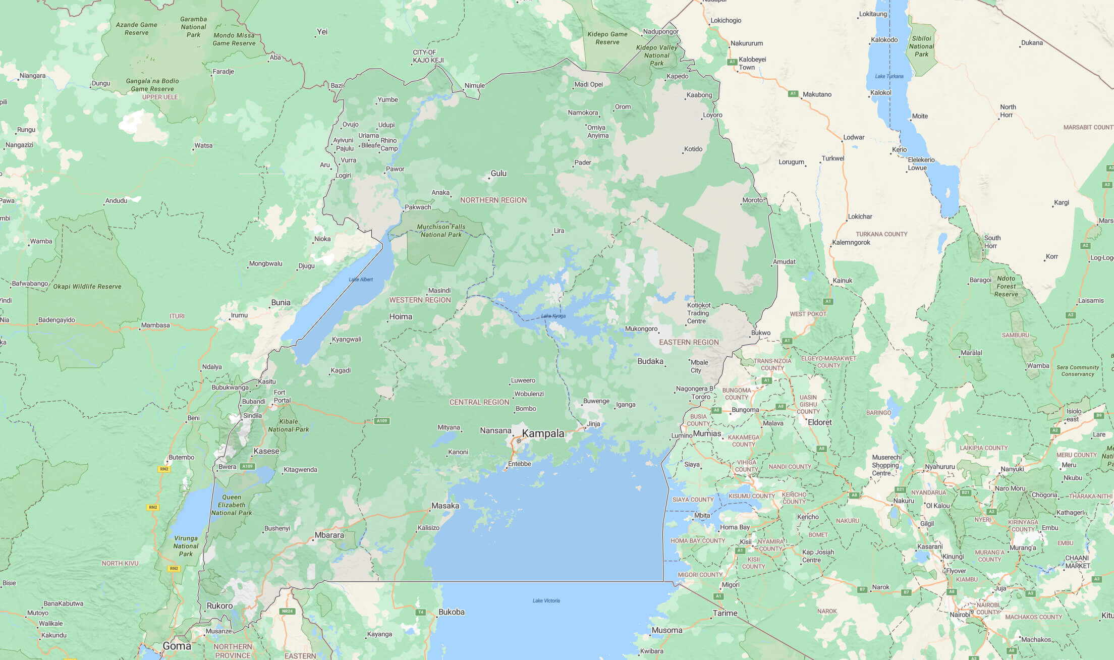
Uganda Regions Map
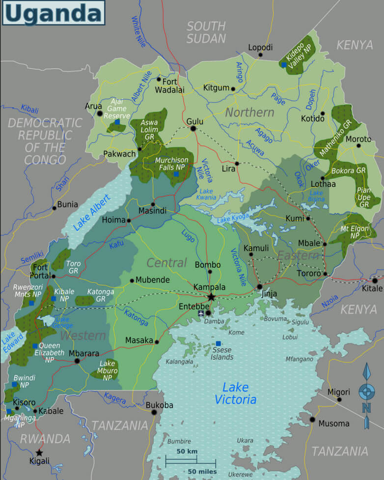 Uganda regions map with key landmarks and national parks.
This map showcases Uganda’s regions, including Northern, Central, Western, and Eastern areas, highlighting major cities like Kampala, Jinja, and Fort Portal. It also marks key national parks such as Murchison Falls, Queen Elizabeth, and Bwindi. Water bodies like Lake Victoria, Lake Albert, and the Nile River are prominently featured. Neighboring countries such as Kenya, Tanzania, and Rwanda are also visible.
Administrative Map of Uganda
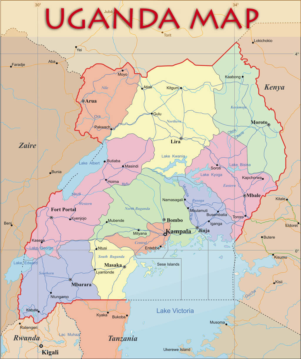 Administrative map of Uganda showing regions and key cities.
This administrative map of Uganda highlights the country’s regions, including Northern, Eastern, Central, and Western areas, with borders clearly marked. Prominent cities such as Kampala, Jinja, and Mbarara are labeled, along with major water bodies like Lake Victoria and Lake Albert. The map also shows neighboring countries, including Kenya, Tanzania, and Rwanda.
Map of Uganda Africa
Map of Uganda World
Uganda terrain map
Uganda regions map
Uganda Map Kampala
 Map of Uganda highlighting major cities, parks, and Lake Victoria.
This map of Uganda shows major cities like Kampala, Entebbe, Gulu, and Jinja, along with national parks such as Murchison Falls and Queen Elizabeth. The map also outlines significant landmarks, including Lake Victoria and the Ssese Islands, illustrating Uganda’s geographical and natural features.
Uganda Earth Map

Ethnolinguistic map of Uganda
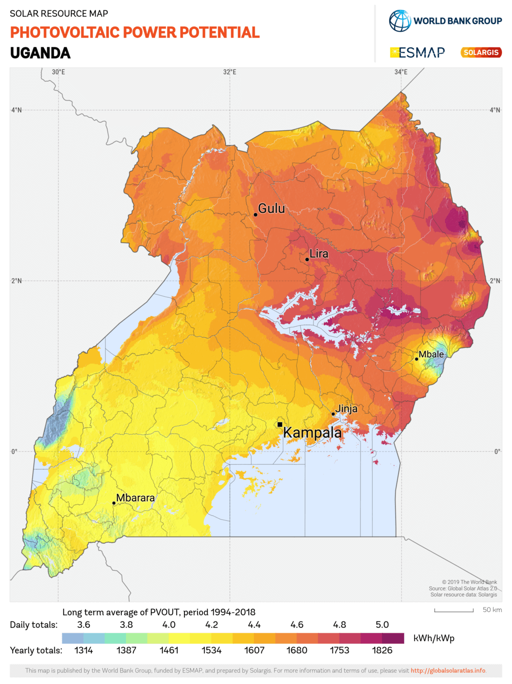
Photovoltaic power potential map of Uganda
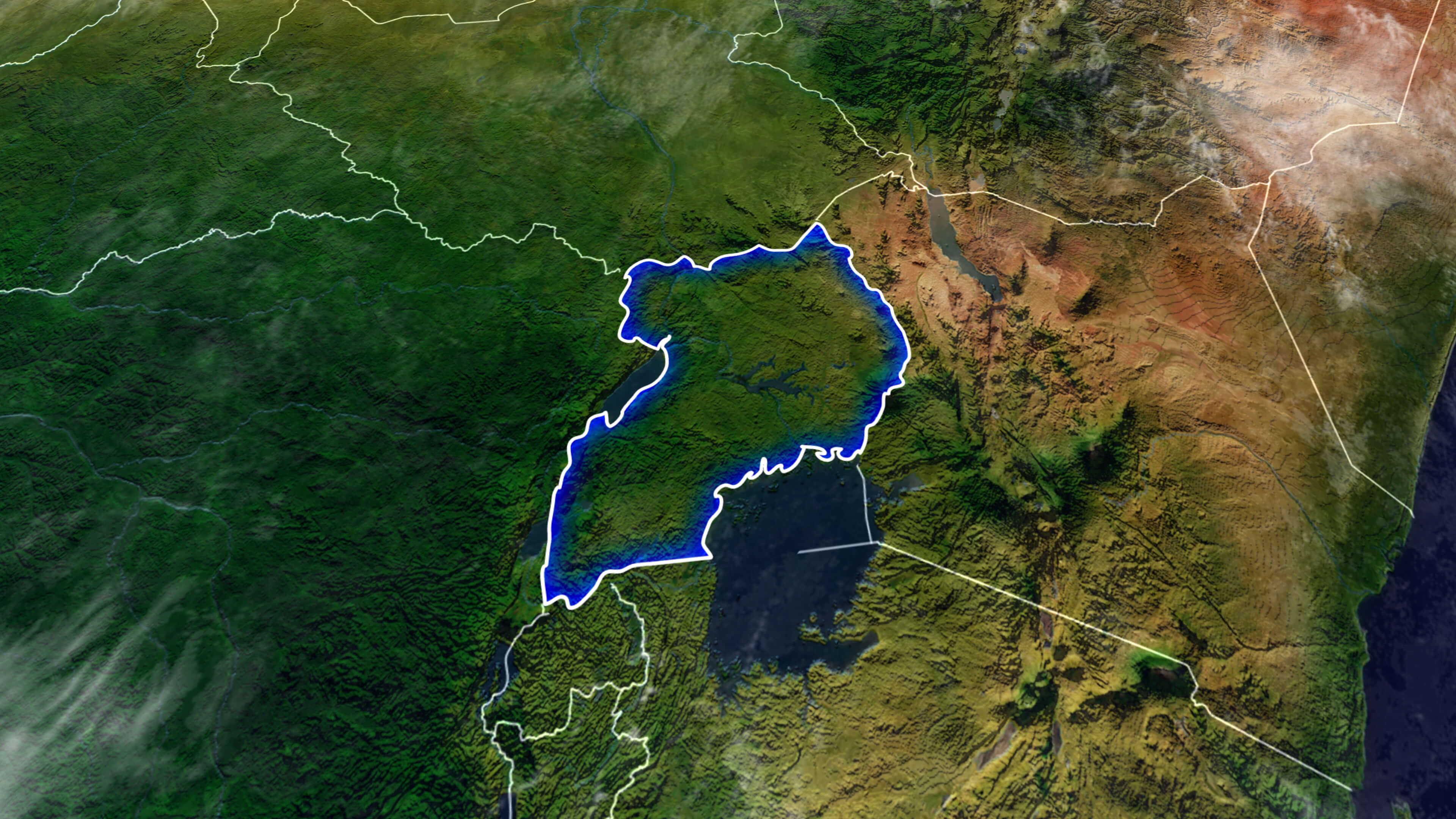
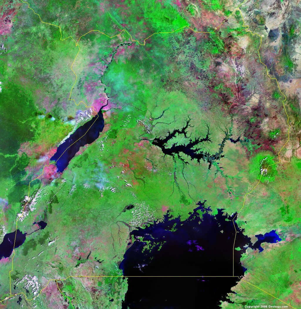
Satellite map of Uganda
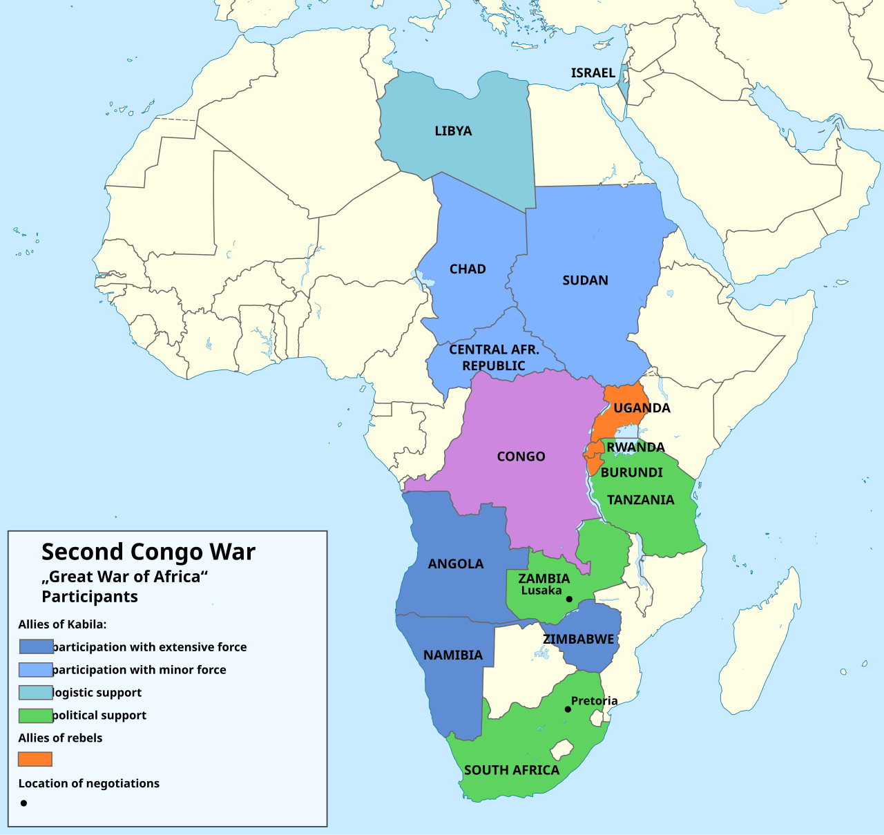
Second congo war map with Africa and Uganda
Uganda administrative map
Uganda and Victoria lake map
Uganda blank map
Uganda cities map
Uganda climate map
Uganda elevation map
Uganda forest map
Uganda info map
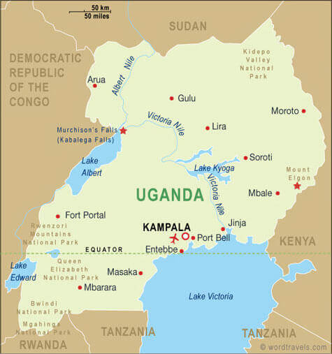
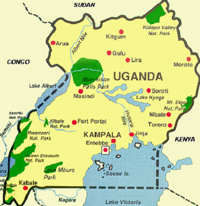
Uganda map national parks
Uganda map with cities and rivers
Uganda map with infographics
Uganda national parks map
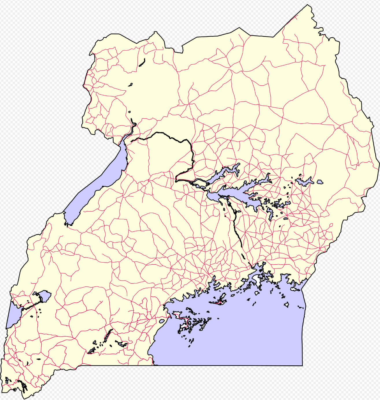
Uganda road map
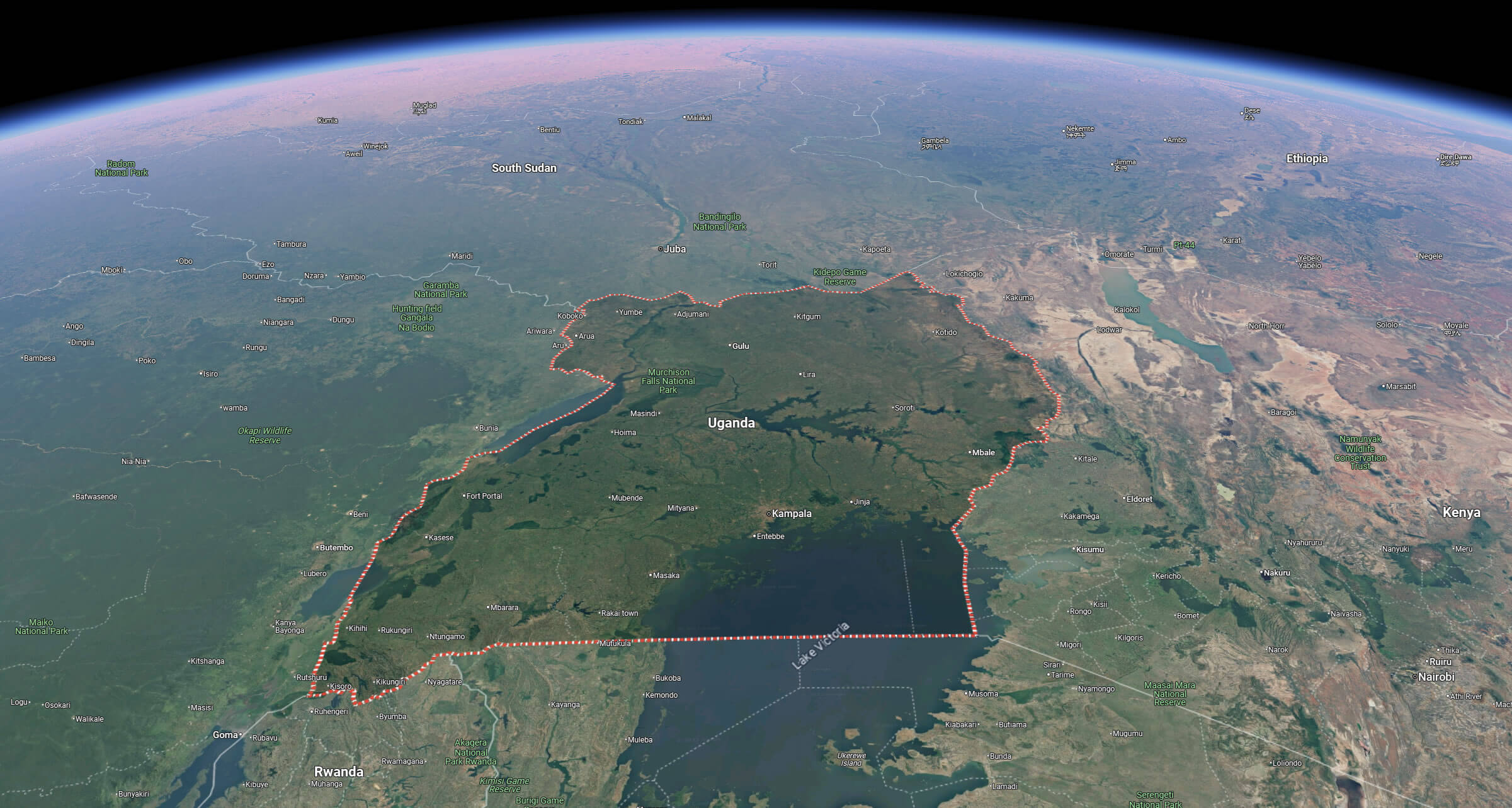
Uganda satellite map from space
Uganda satellite map
Uganda tourism map
Uganda map with African lakes
Where is Uganda on the Africa Map?
Show Google interactive map, satellite map, where is the country located.
Get directions by driving, walking, bicycling, public transportation and travel with street view.
Feel free to explore these pages as well:
- Egypt Map ↗️
- Algeria Map ↗️
- Tanzania Map ↗️
- Syria Map ↗️
- Iran Map ↗️
- Iraq Map ↗️
- Israel Map ↗️
- Jordan Map ↗️
- Saudi Arabia Map ↗️
- United States Map ↗️
- United Kingdom Map ↗️
- Türkiye Map ↗️
- Europe Map ↗️
- Africa Map ↗️