Explore detailed maps of Tanzania, including physical, political, road, terrain, and satellite views. Learn about its cities, population distribution, country borders, rivers, topography, and regions. See Tanzania’s location in East Africa with informative visuals for travelers, students, and researchers.
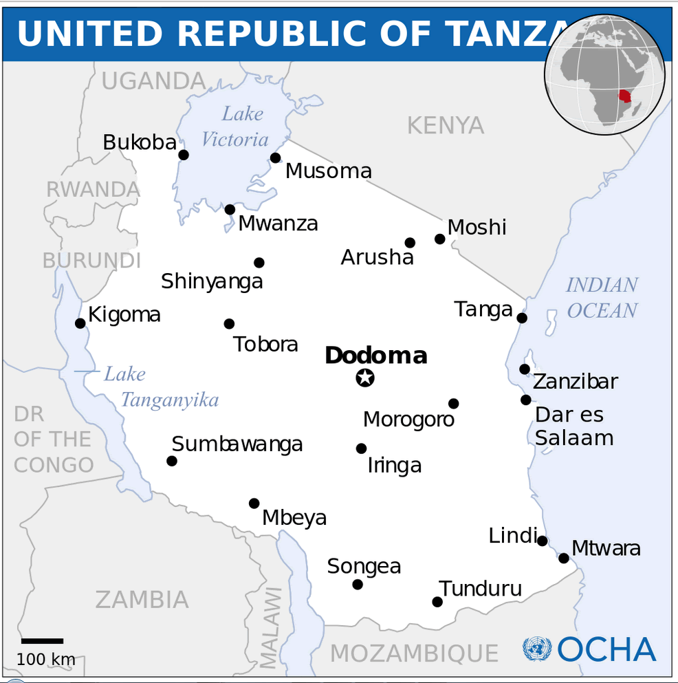
Tanzania political Map with major cities
Political Map of Tanzania
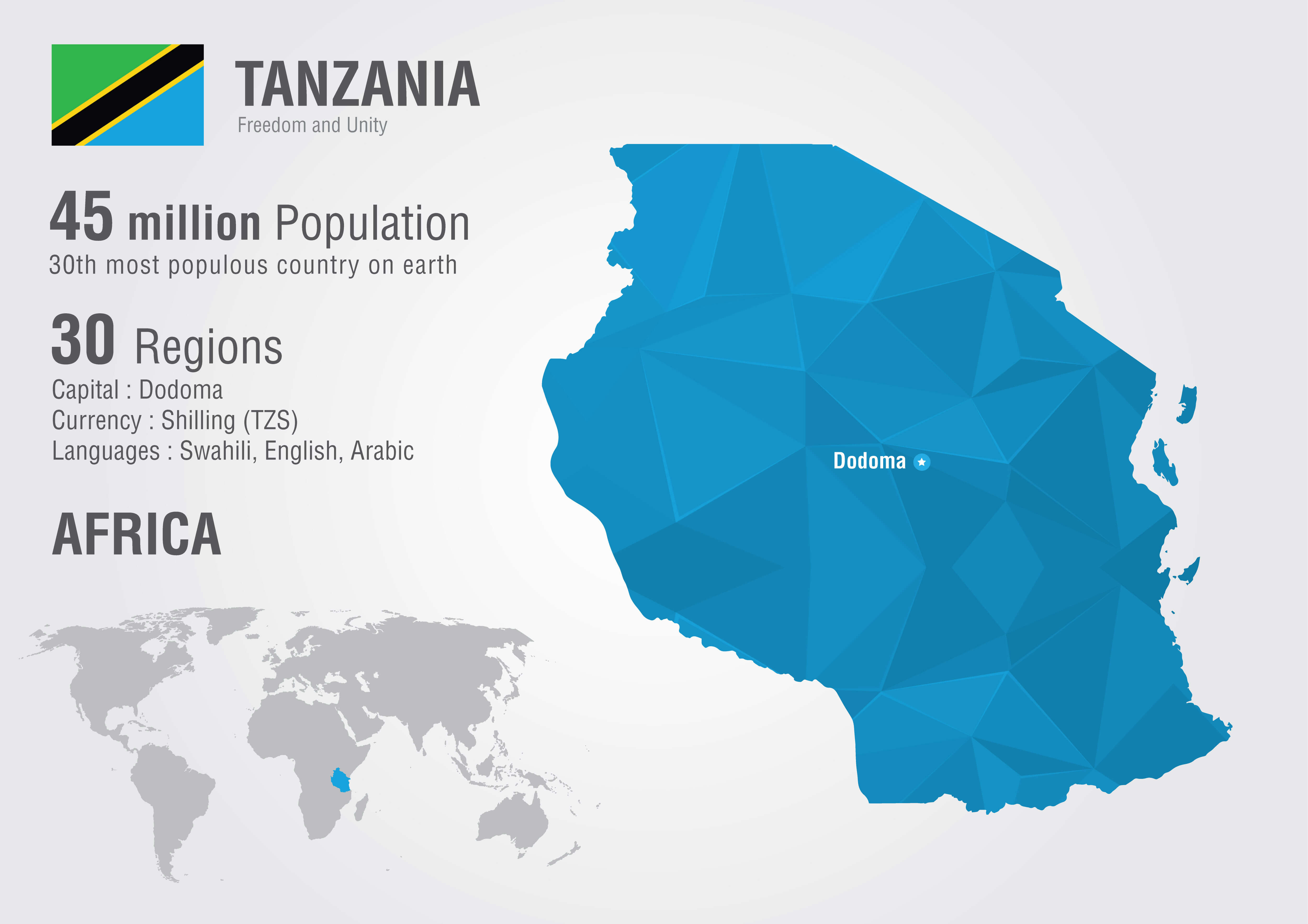
Brief information about Tanzania
Tanzania is a vibrant and diverse country in East Africa, renowned for its breathtaking landscapes and rich cultural heritage. It is home to some of Africa’s most iconic natural wonders, including Mount Kilimanjaro, the highest peak on the continent, and the Serengeti National Park, famous for its annual wildebeest migration. The country also boasts the stunning Zanzibar Archipelago, with pristine beaches and a rich history of trade, culture and colonial influences.
Tanzania regions Map with national parks
Tanzania’s population is a harmonious mix of over 120 ethnic groups, with Swahili and English as the official languages. The country’s economy is largely based on agriculture, tourism and mining. Its abundant wildlife, national parks and UNESCO World Heritage Sites, such as the Ngorongoro Crater and Stone Town, make it a top destination for travellers worldwide. Tanzania’s commitment to wildlife conservation and cultural preservation underscores its unique role as a gateway to Africa’s natural beauty and traditions.
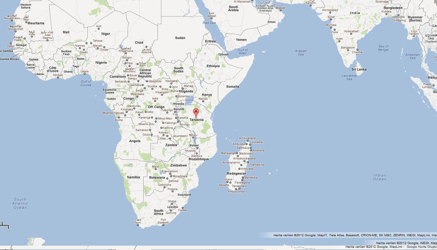
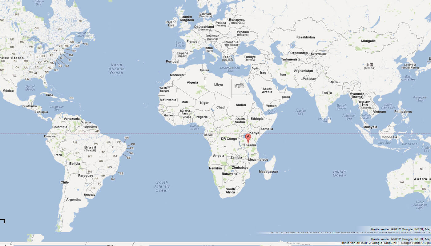
Where is located Tanzania on the World Map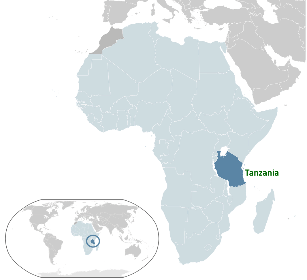 Where is located Tanzania on the World Map
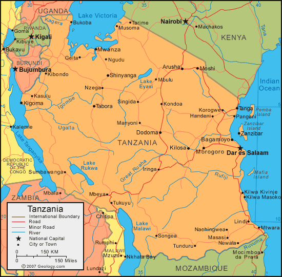
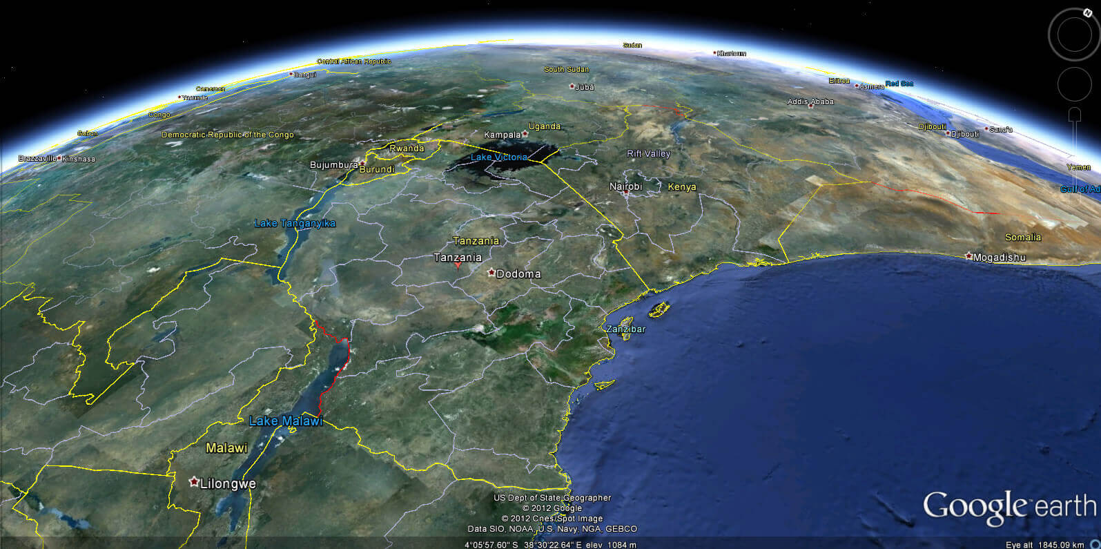
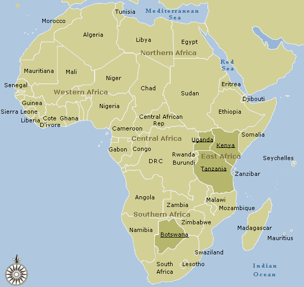
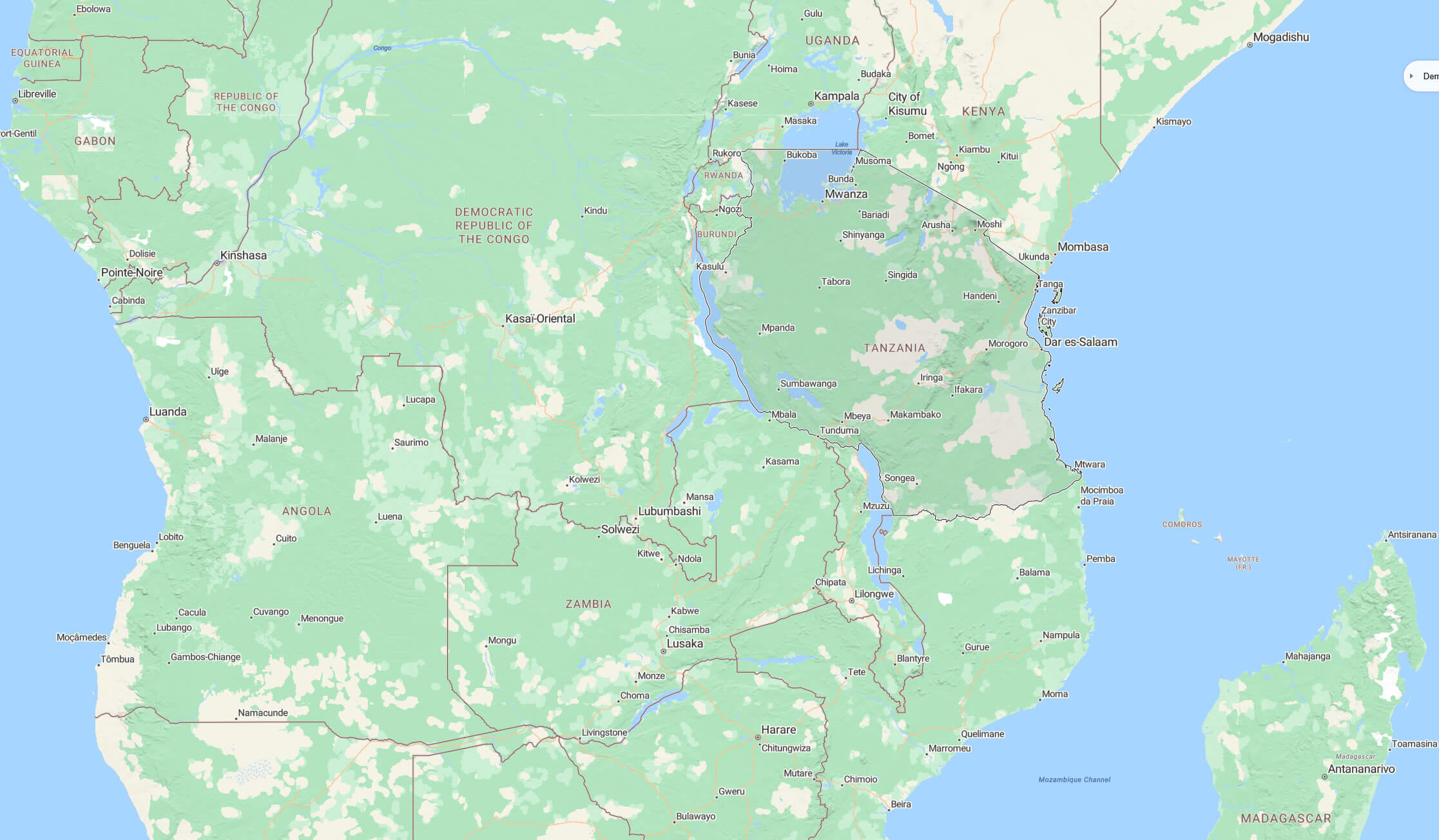
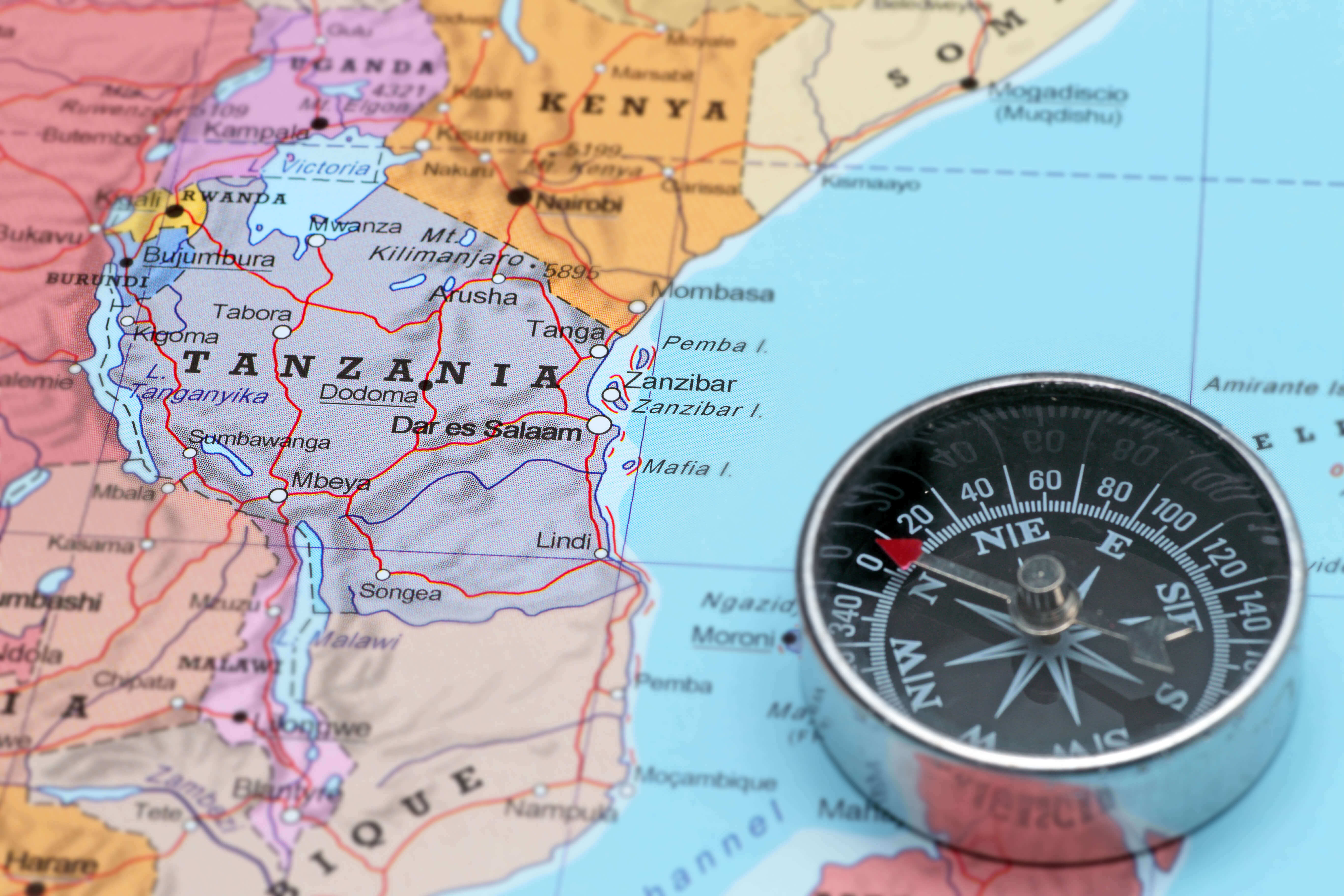
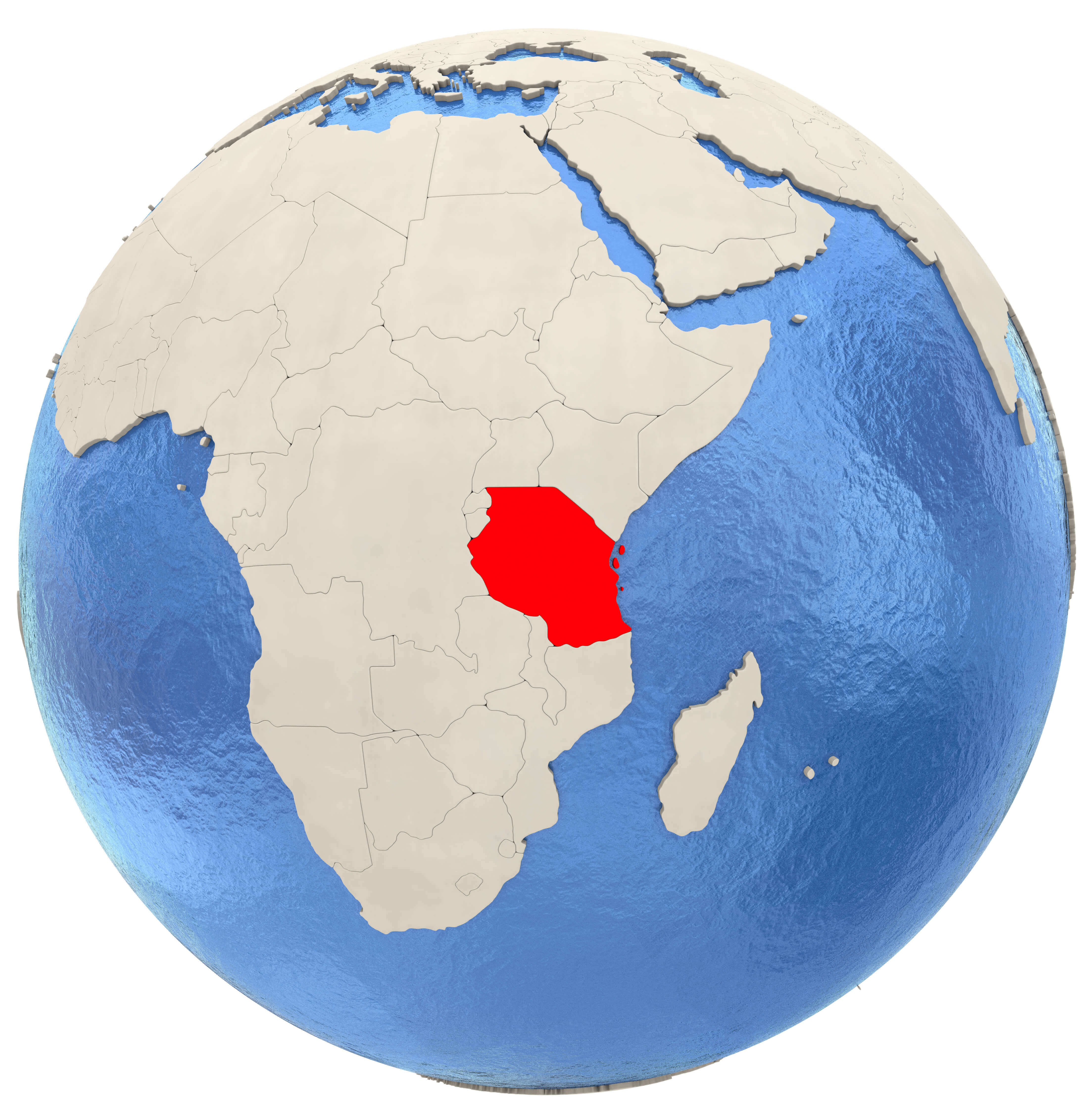
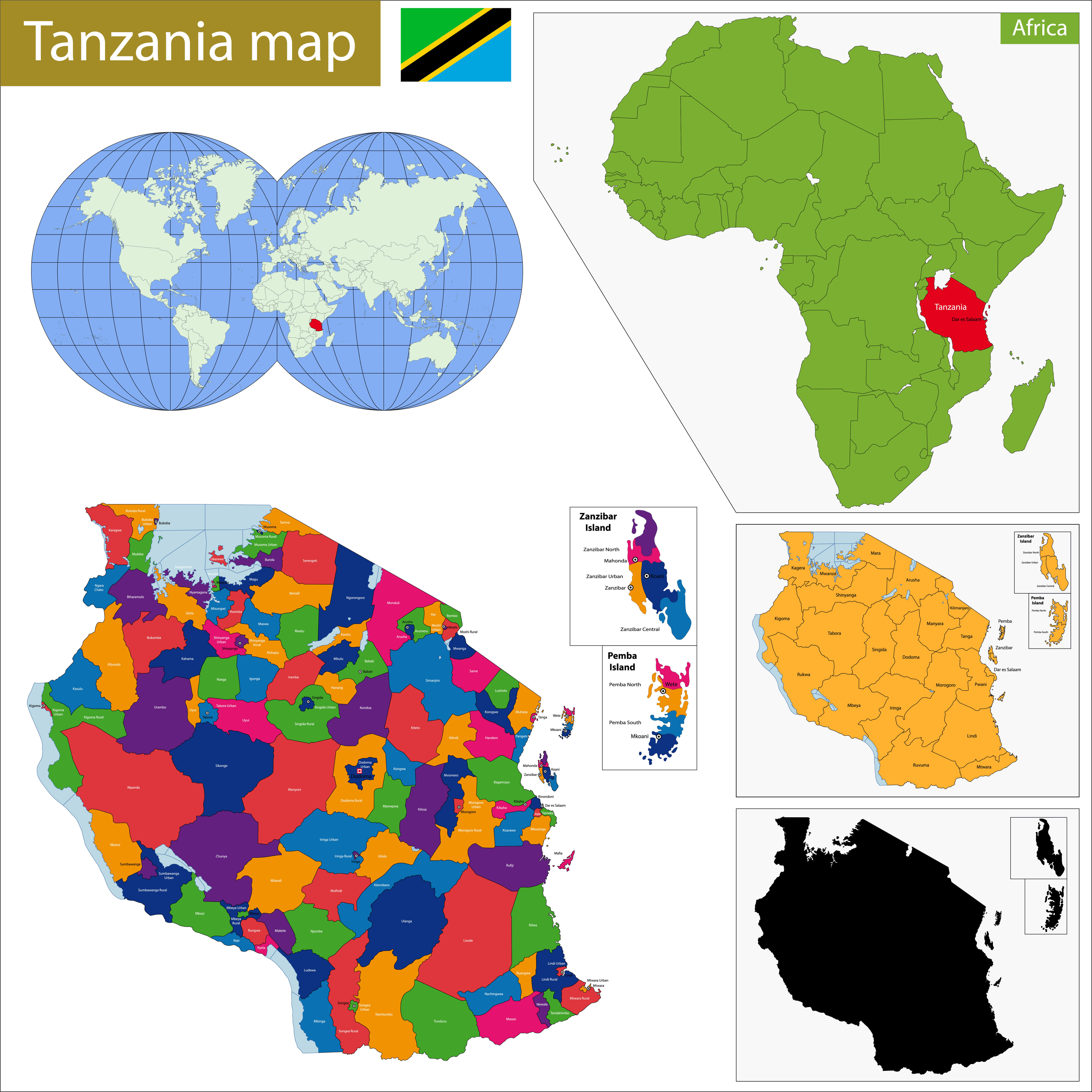
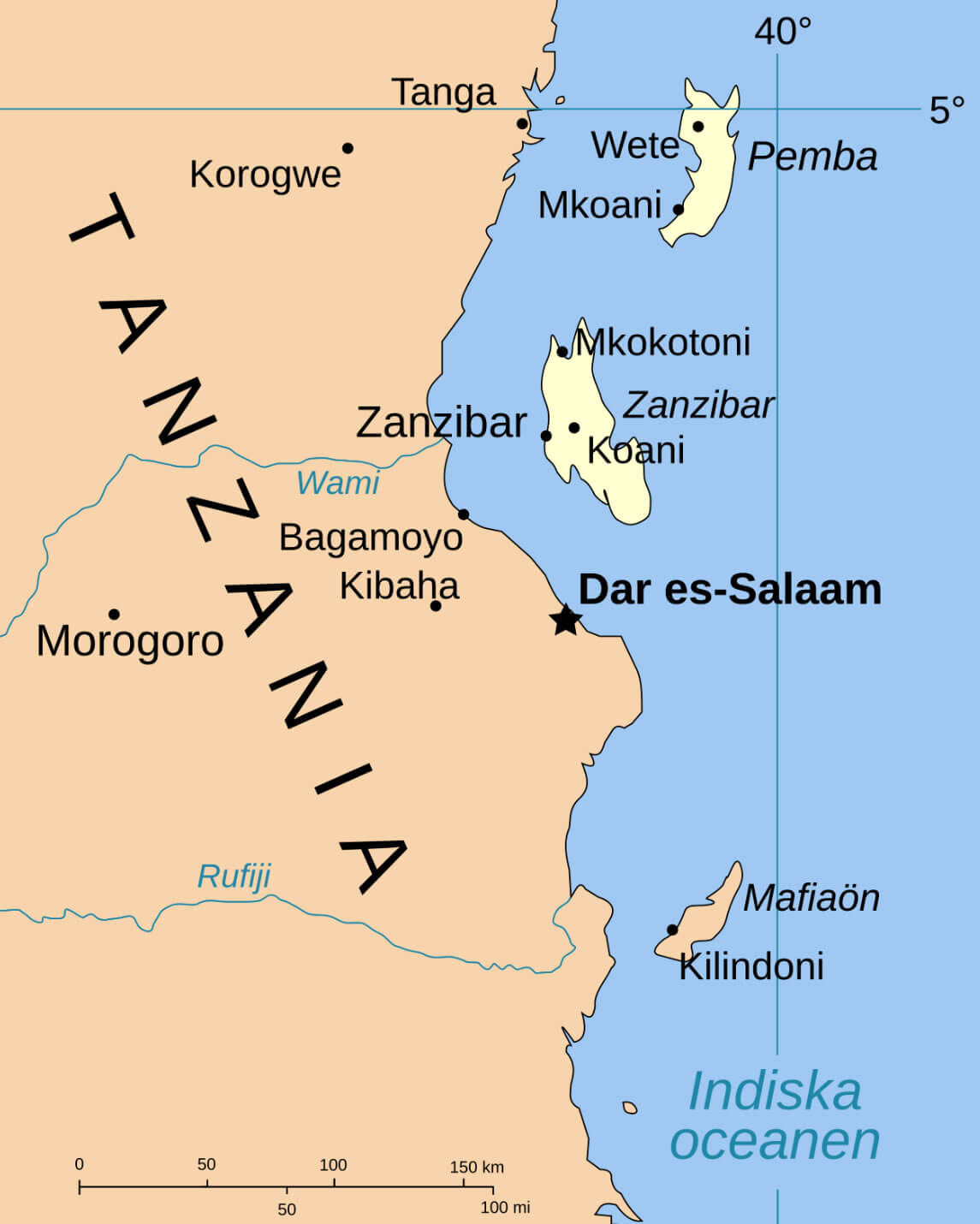
Tanzania is located in East Africa, bordered by eight countries and the Indian Ocean to the east. It lies south of the equator and borders Kenya and Uganda to the north, Rwanda, Burundi and the Democratic Republic of Congo to the west, and Zambia, Malawi and Mozambique to the south. The country’s eastern coastline runs along the Indian Ocean, making it an important hub for trade and tourism.
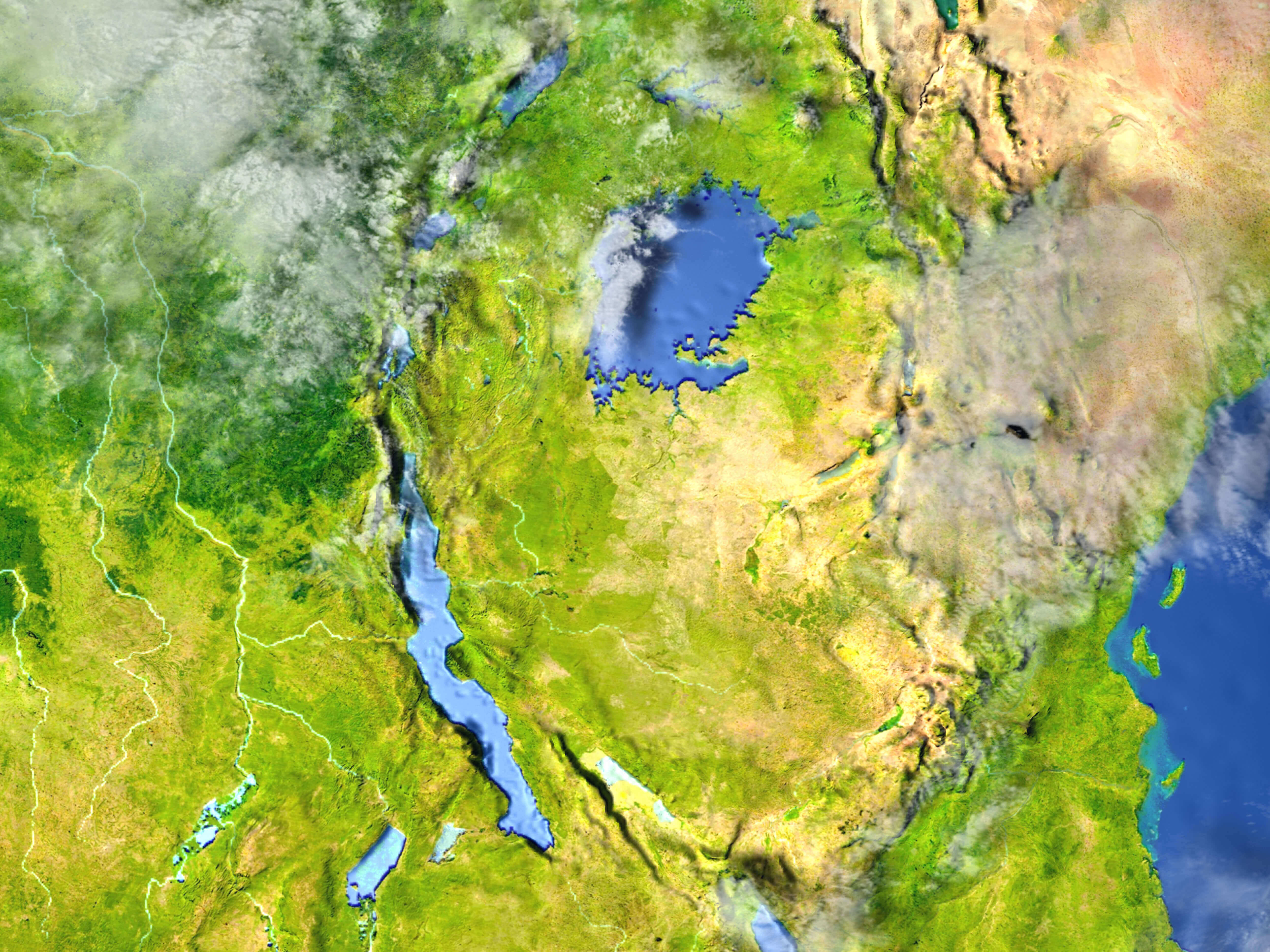
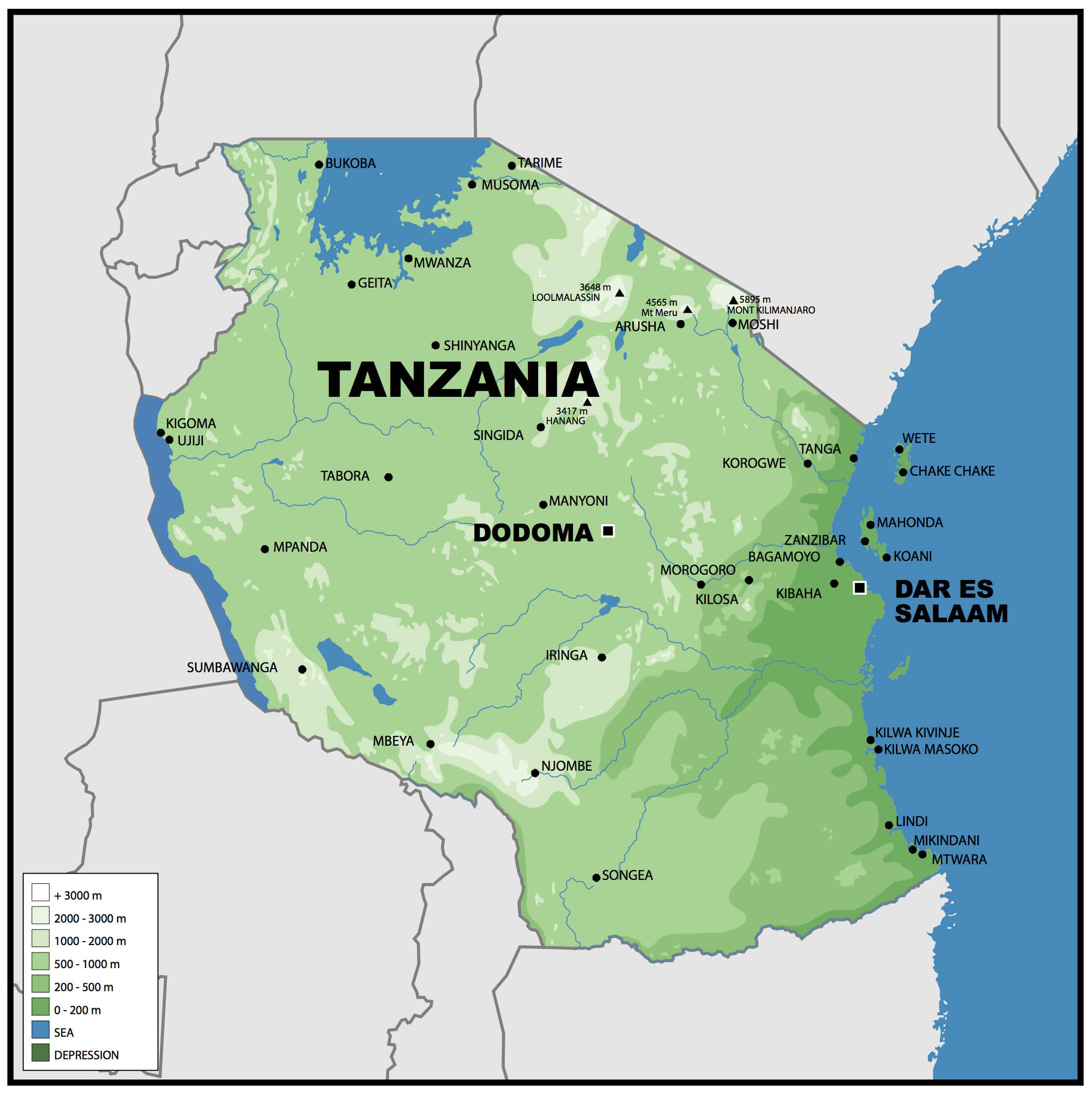
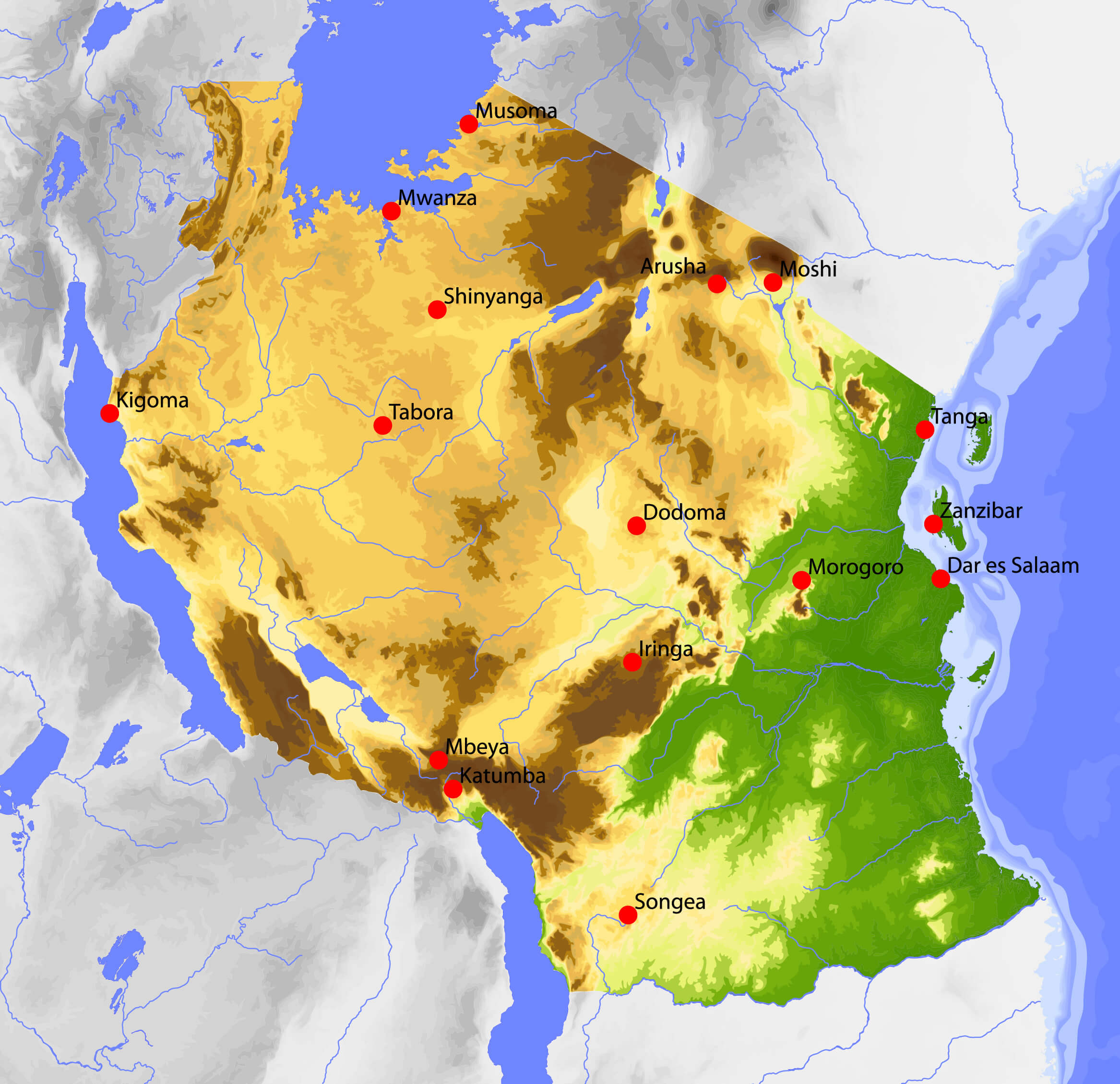
Tanzania physical map
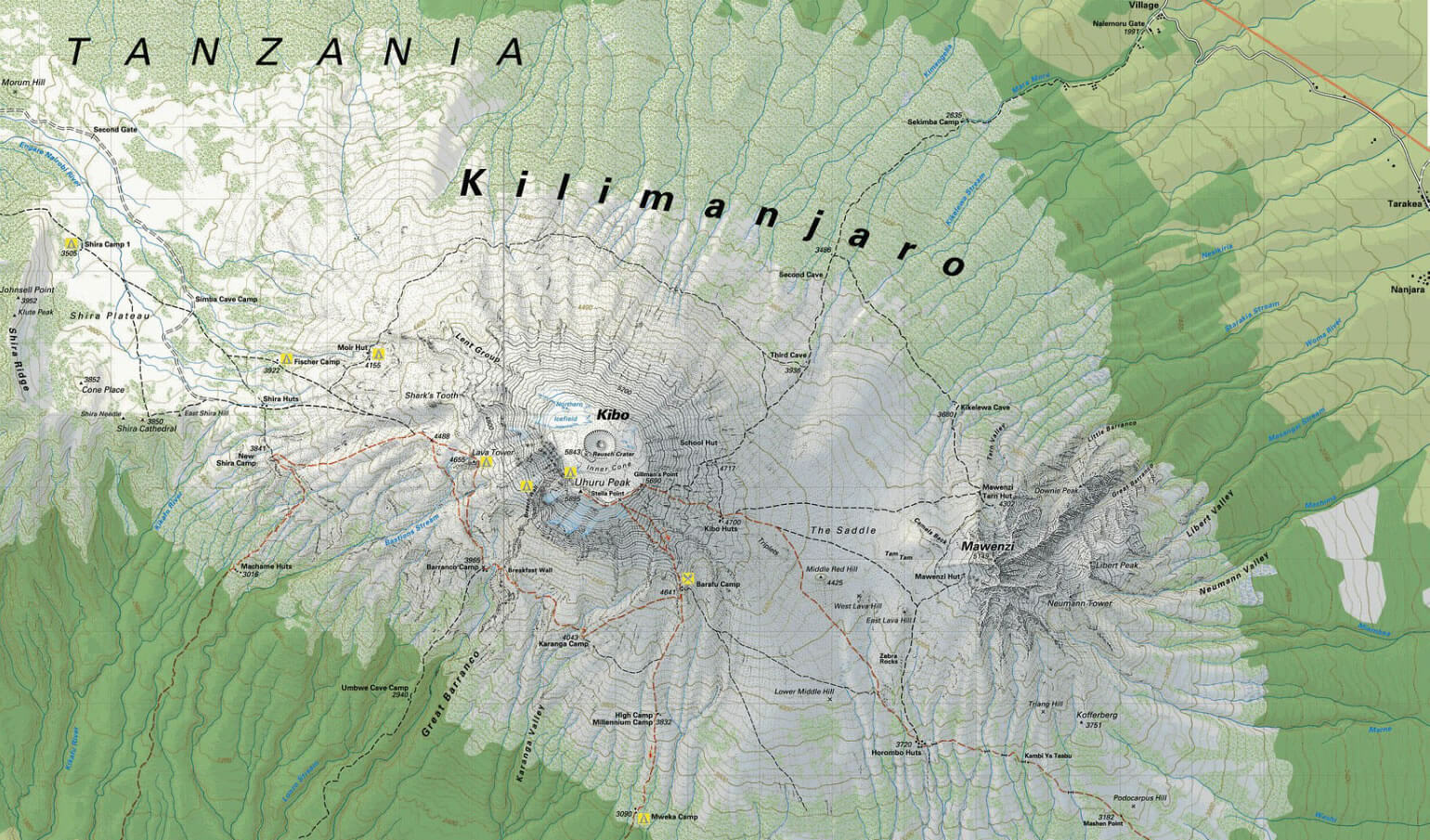
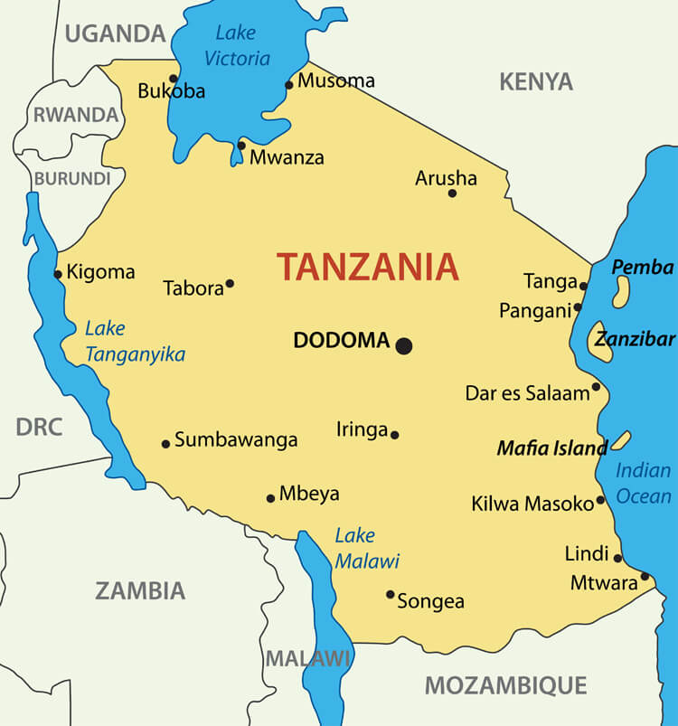
Geographically, Tanzania is known for its stunning landscapes, including Mount Kilimanjaro, Africa’s highest mountain, which rises majestically in the north near the Kenyan border. Tanzania is also home to major bodies of water, including Lake Victoria, Africa’s largest freshwater lake, in the northwest, and Lake Tanganyika, one of the world’s deepest lakes, in the west. To the south-east, Lake Malawi (Nyasa) forms part of the border with Mal
Tanzania’s central location in East Africa makes it a gateway for travellers and trade routes. Its location on the Indian Ocean also provides easy access to the Zanzibar Archipelago, famous for its white sandy beaches and cultural history. The country’s strategic location and diverse geography make it an important and dynamic part of the African continent.
Here are some statistical information about Tanzania: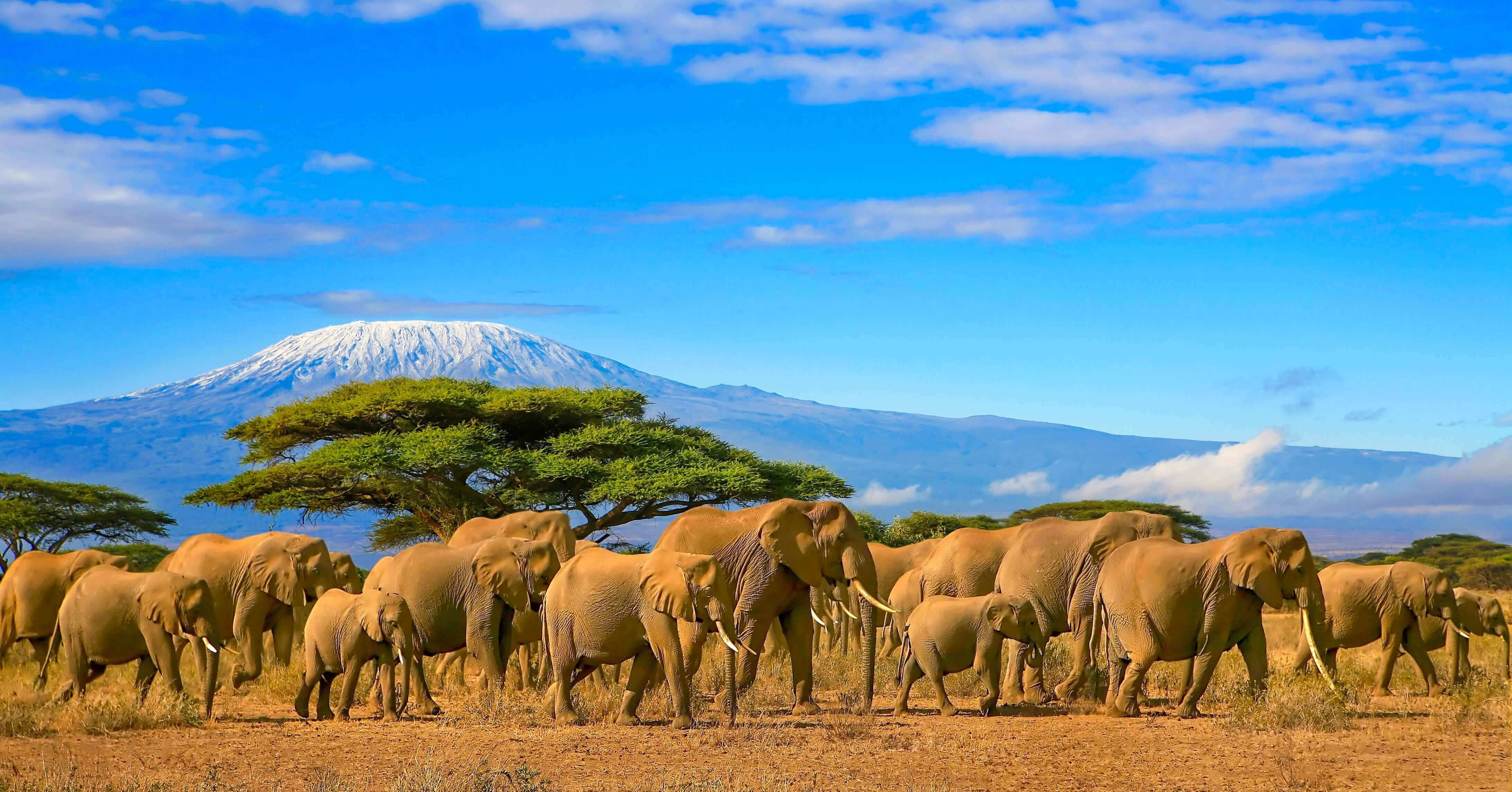
Tanzania rivers and lakes map
 Official languages: Swahili, English.
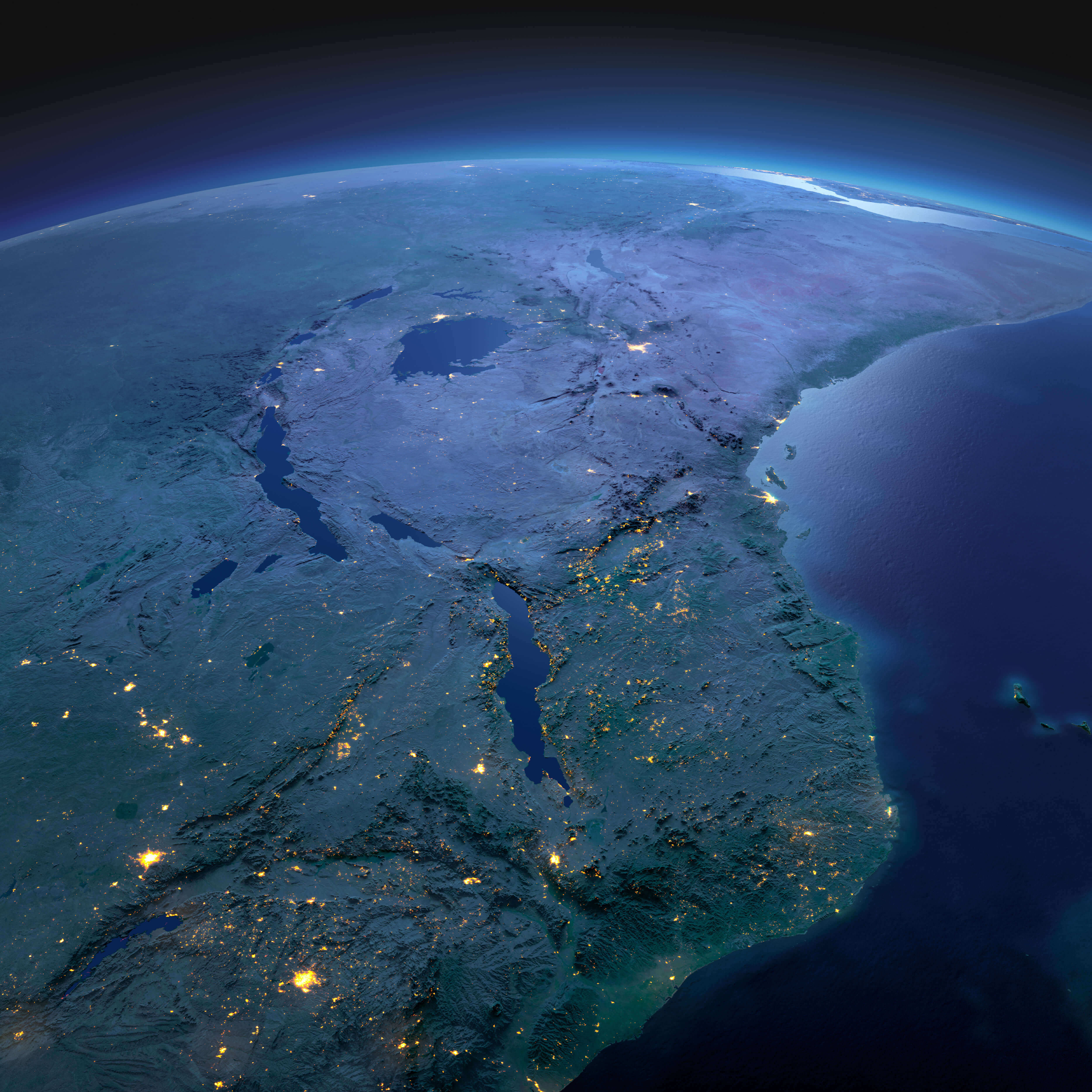
 Tanzania satellite Map at night
Tanzania road map
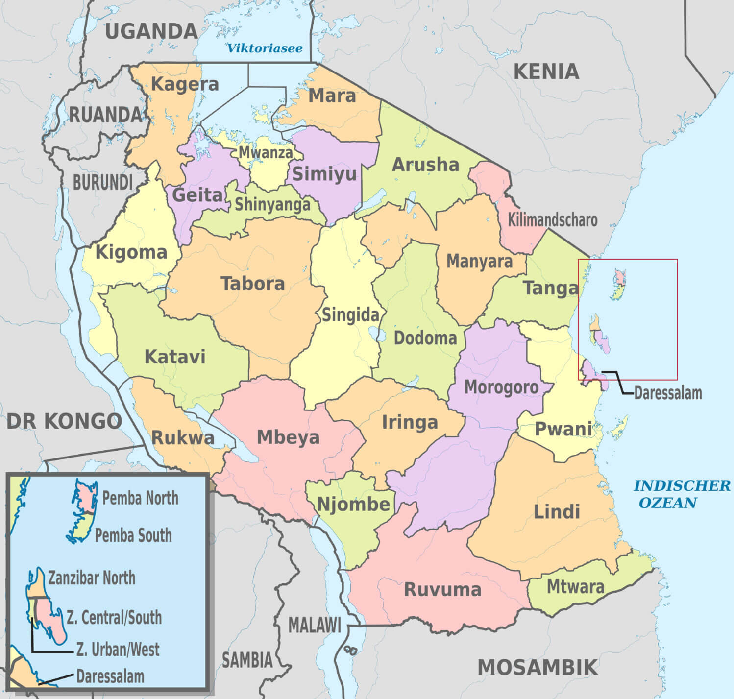
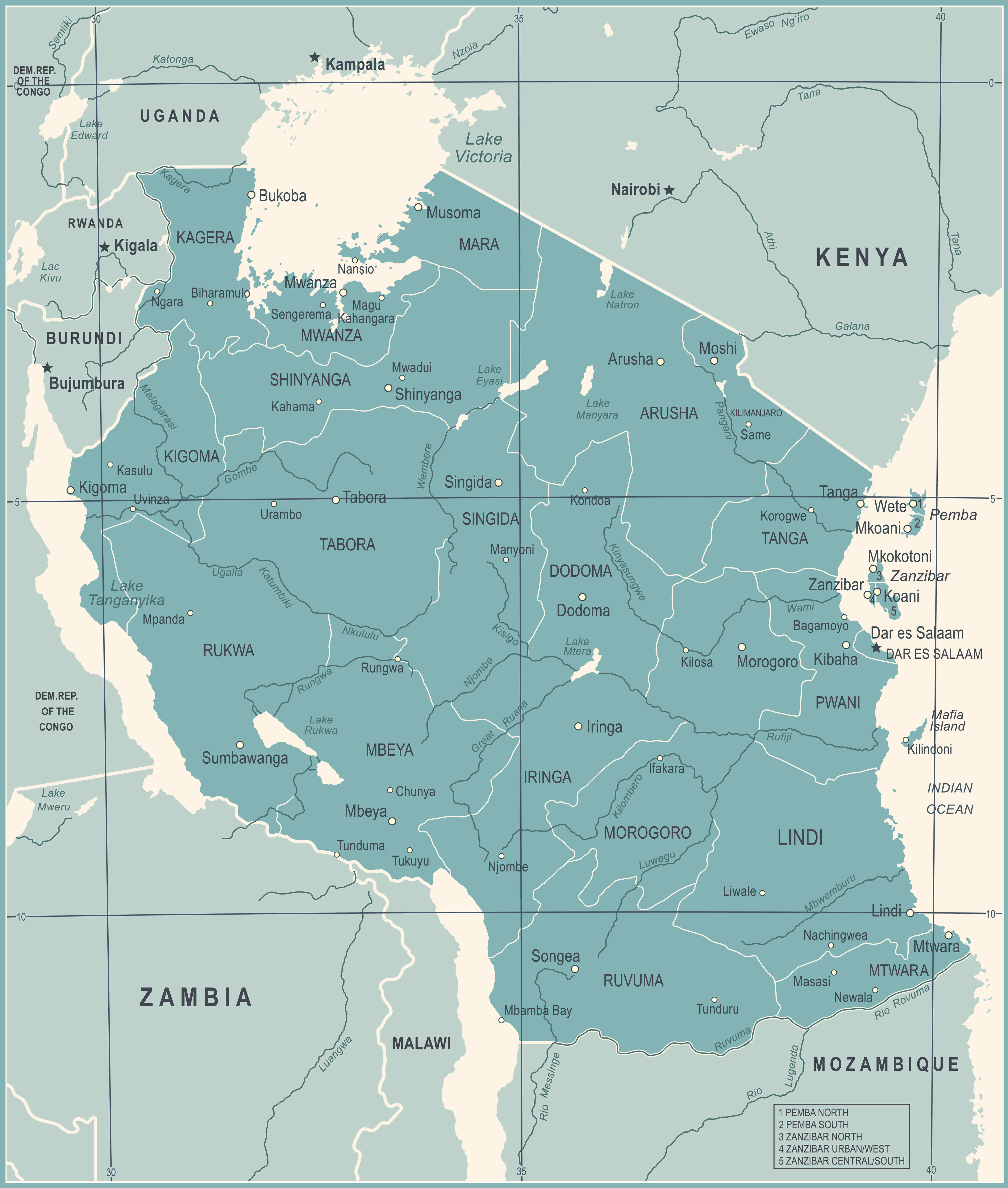
Tanzania regions map
Tanzania rivers map
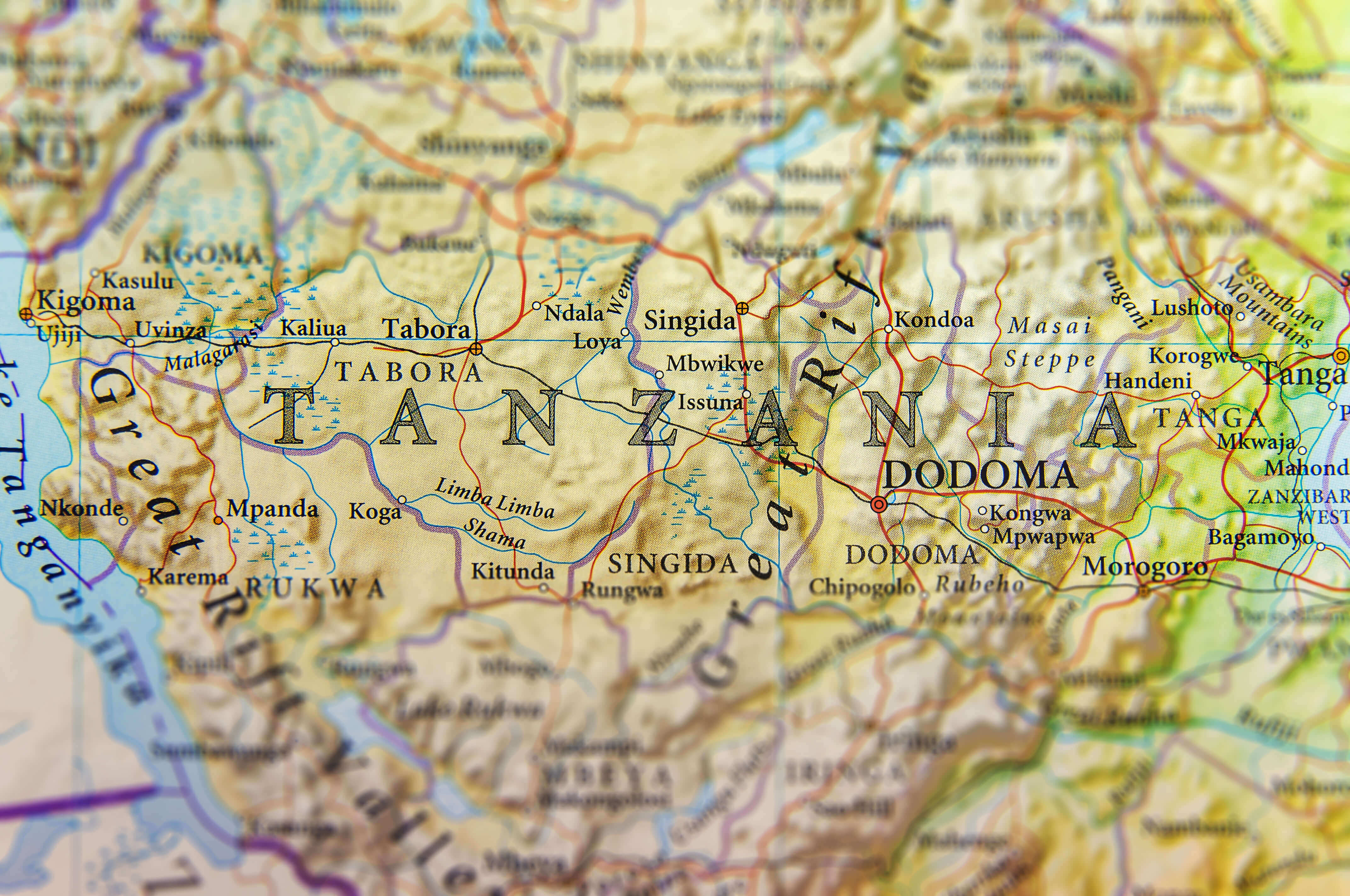
Map of Tanzania
Tanzania Location Map
Provinces Map of Tanzania
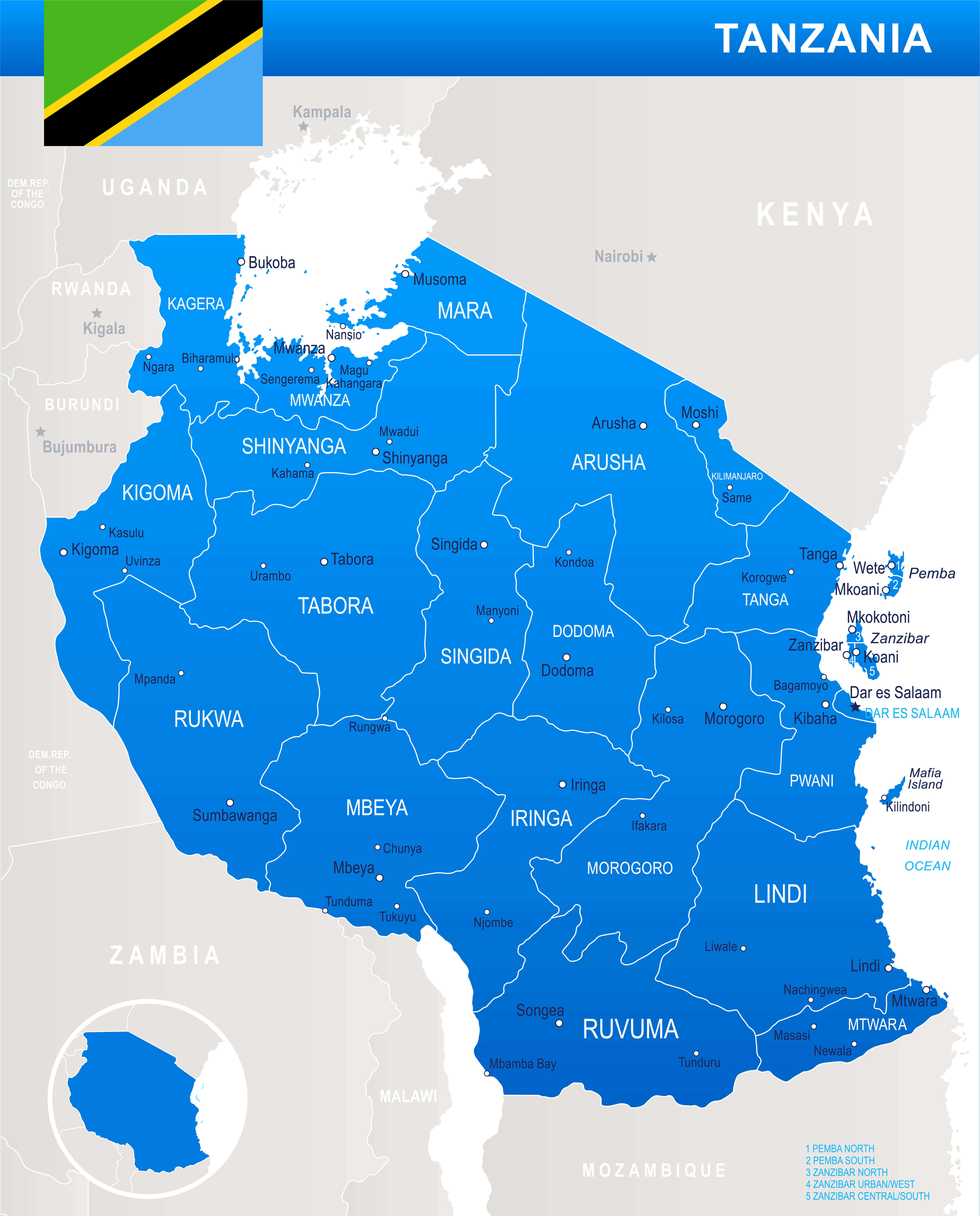
Regions Map of Tanzania
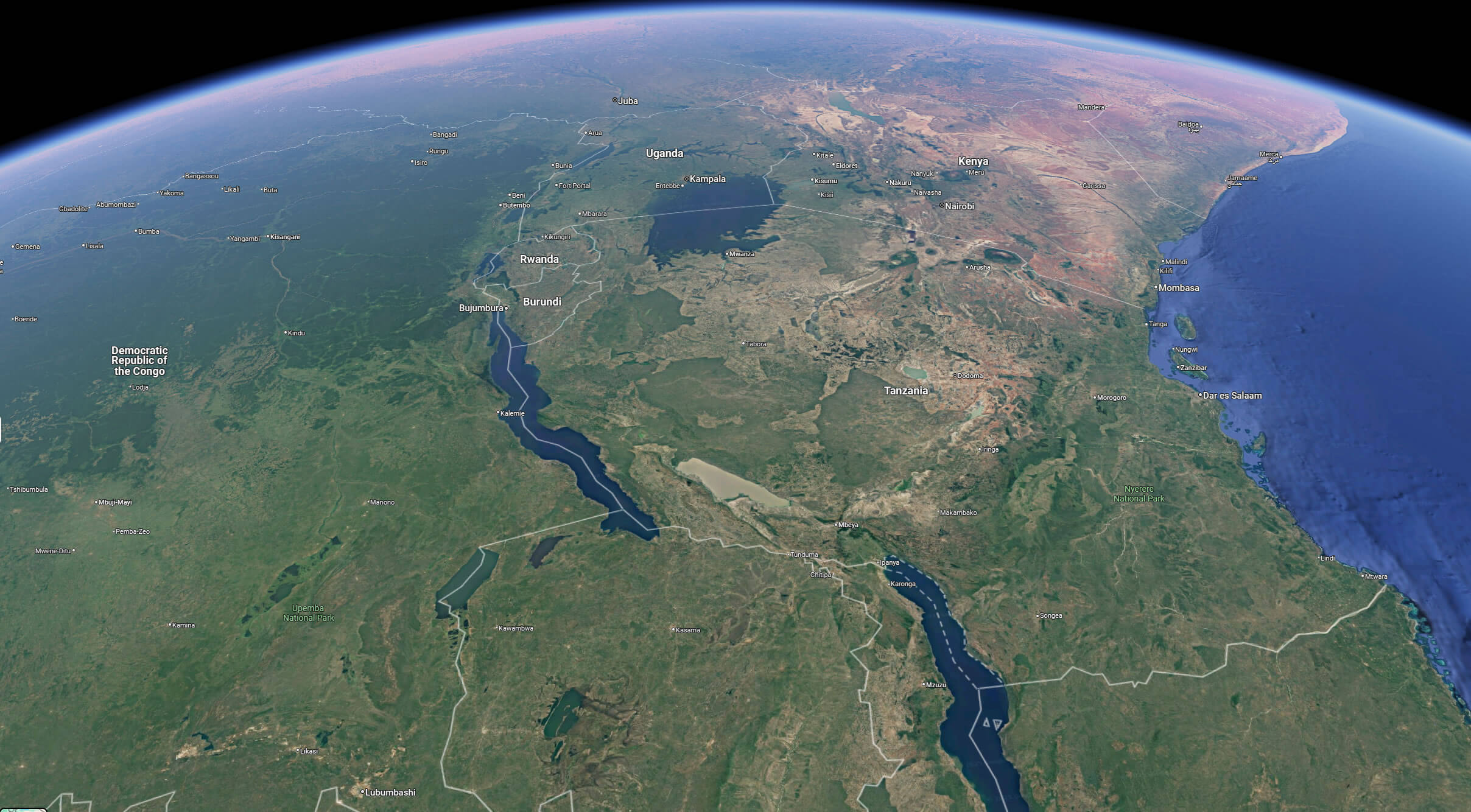
Satellite Map of Tanzania
Map of Tanzania Africa
Map of Tanzania National Park
Map of Tanzania World
Regional Map of Tanzania
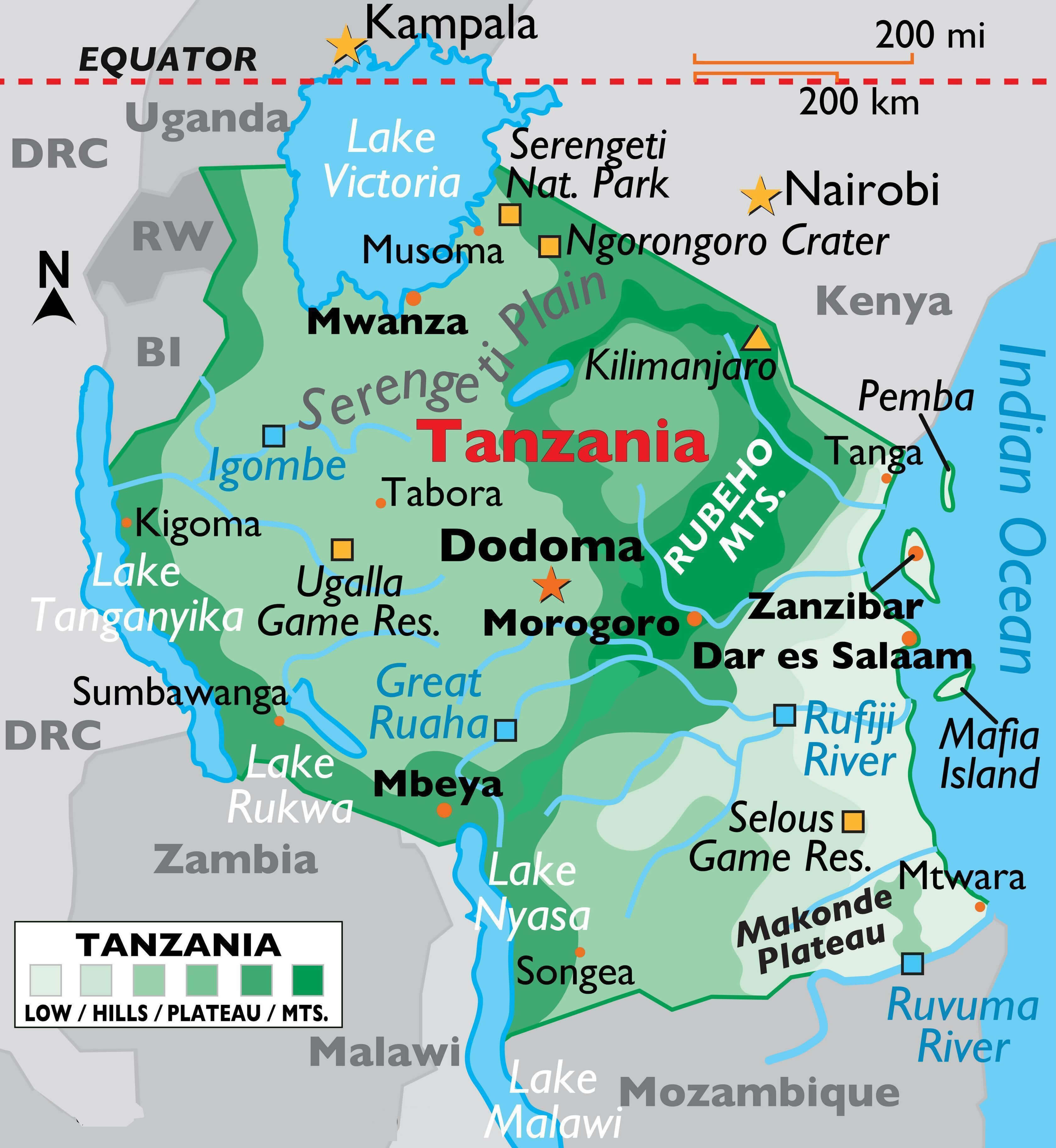
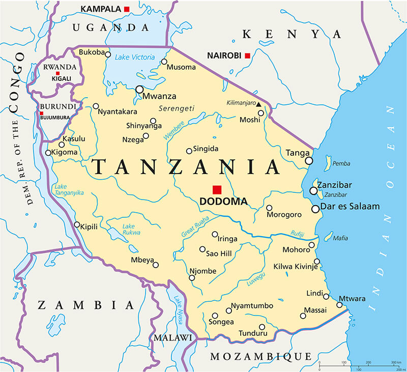
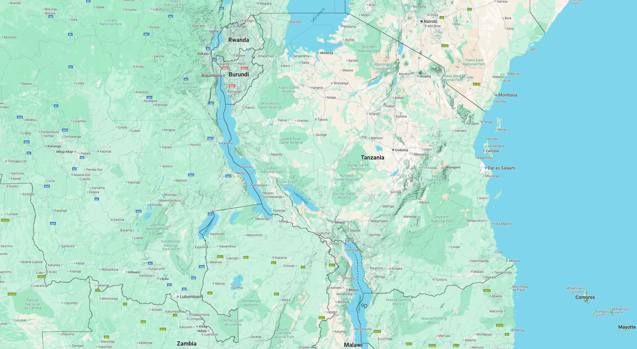
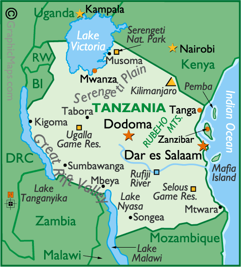 Tanzania map showing major cities, rivers, lakes, and national parks.
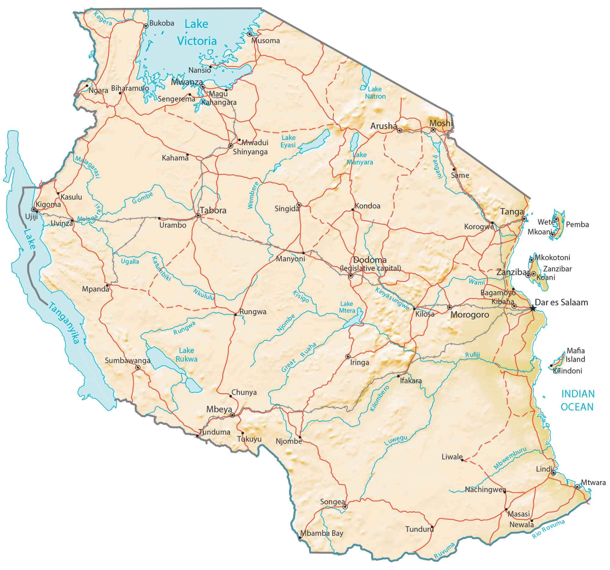
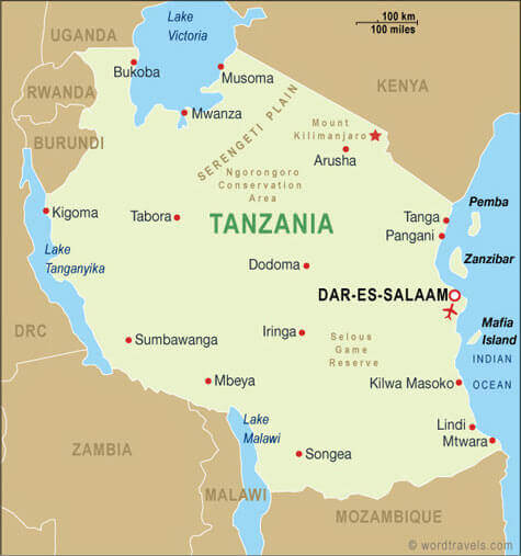
This map highlights Tanzania’s capital Dodoma and key cities like Dar es Salaam, Mwanza, and Mbeya. Major natural features such as Mount Kilimanjaro, Serengeti Plain, Lake Tanganyika, and the Rufiji River are marked. National parks, including Serengeti National Park and other tourist sites, are also shown.
Tanzania National Park Map
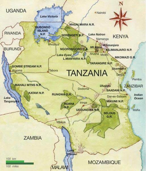
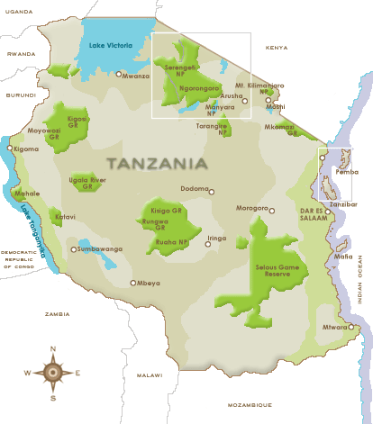
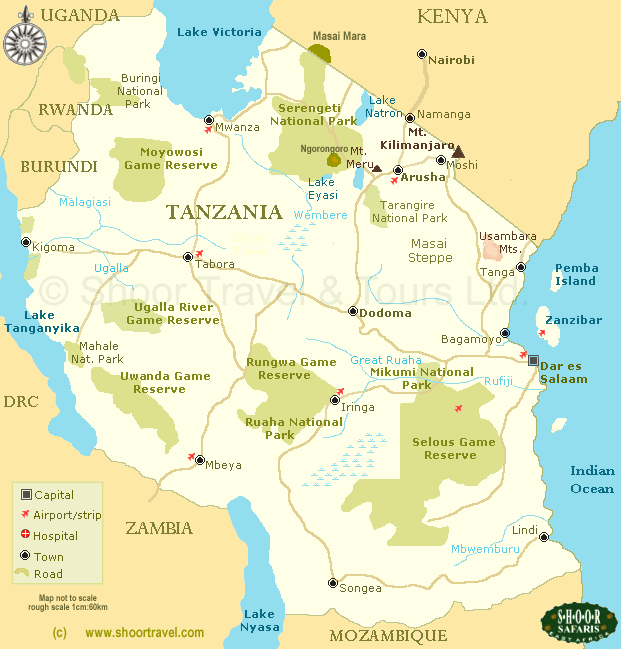 Map of Tanzania showing national parks, lakes, and major regions.
This map of Tanzania outlines the country’s major national parks and game reserves, emphasizing its rich natural diversity. Key locations such as Serengeti National Park, Ngorongoro Crater, and Selous Game Reserve are marked in green. Mount Kilimanjaro is indicated near the northern border with Kenya. Surrounding countries like Kenya, Rwanda, Zambia, and the Indian Ocean coastline, including Zanzibar, are depicted. Lake Victoria in the northwest and Lake Tanganyika in the west are also visible.
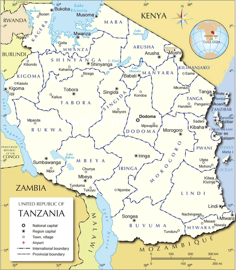
Tanzania Political Map
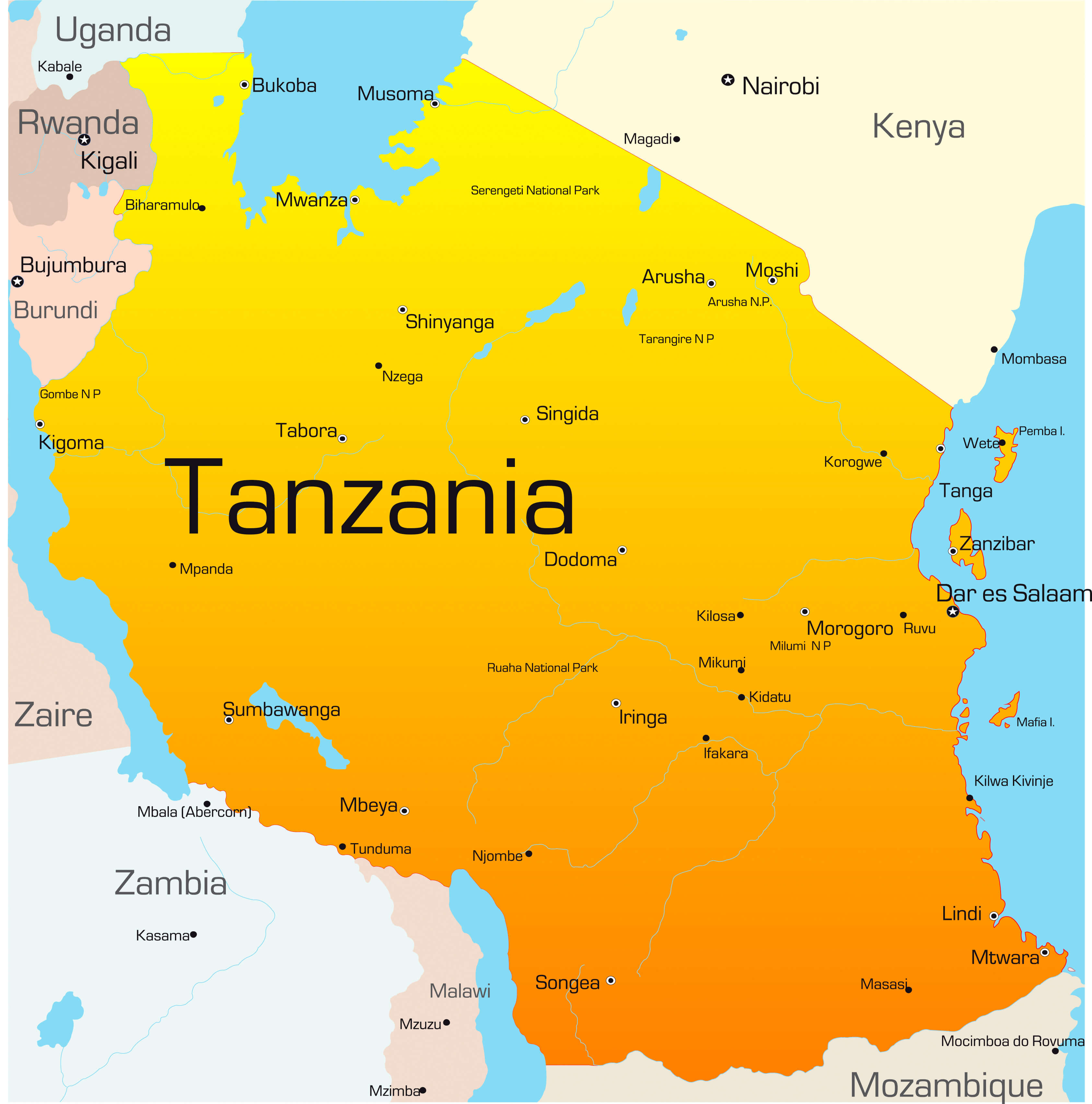
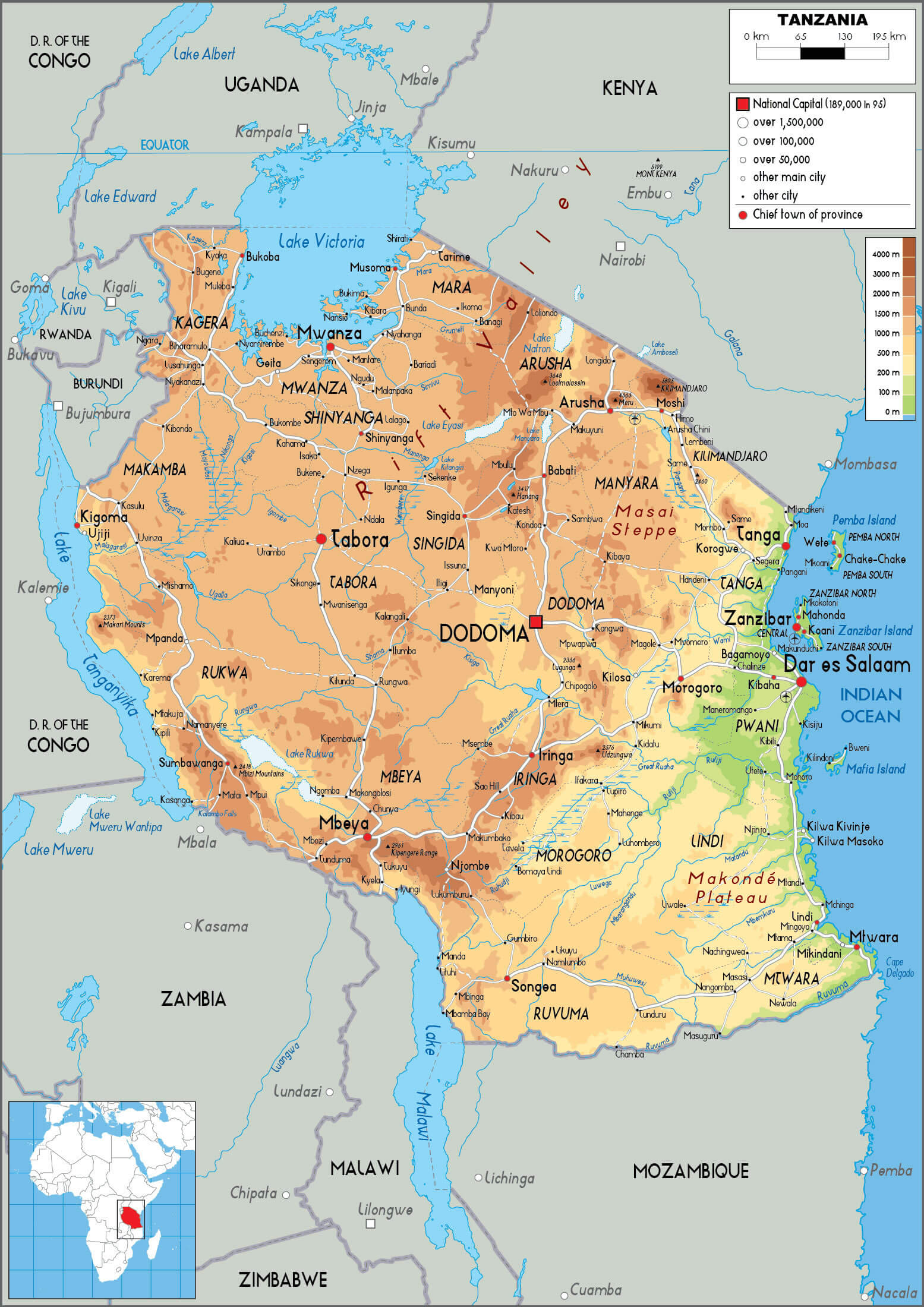
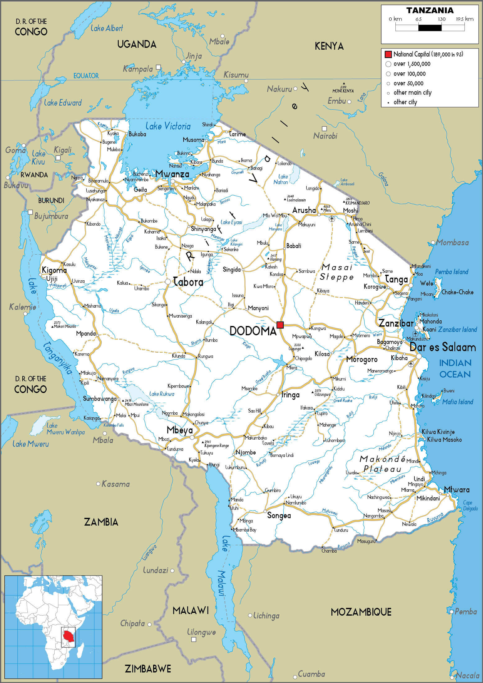
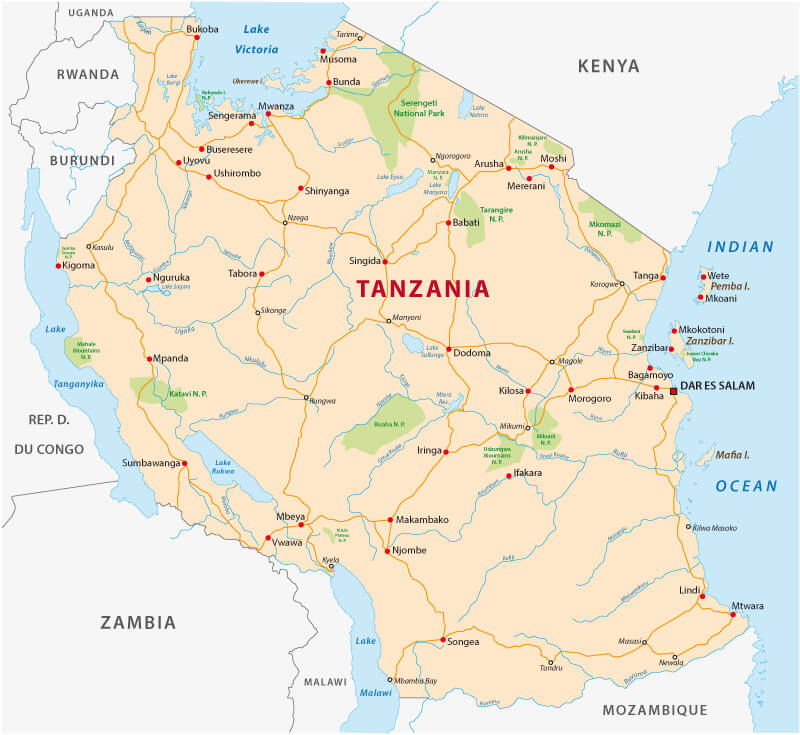
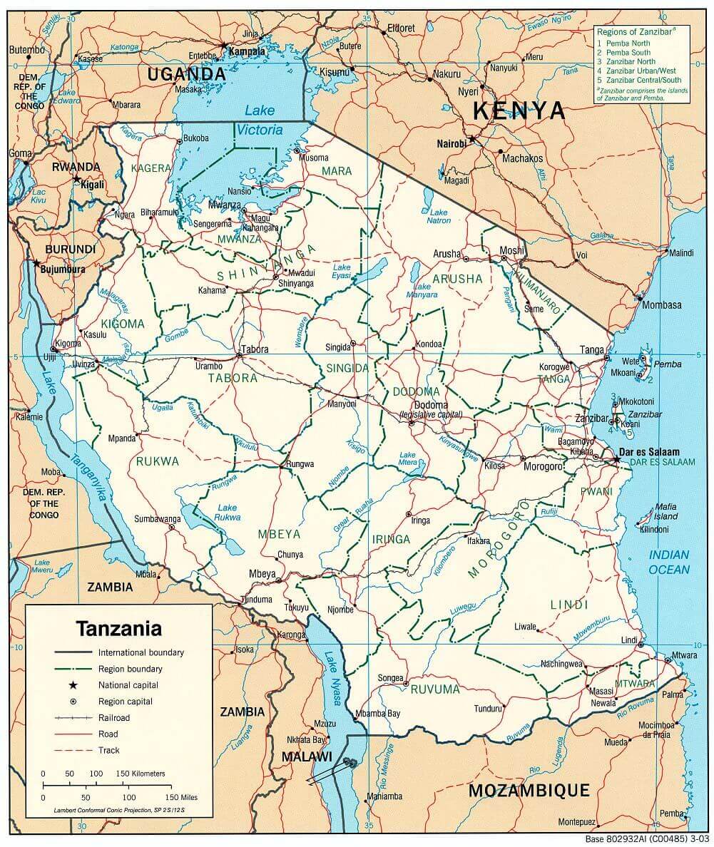 Tanzania political map showing regions, cities, roads, and borders.
This detailed political map of Tanzania shows international borders with neighboring countries like Kenya, Uganda, and Mozambique. Key cities include Dodoma (capital), Dar es Salaam, Mwanza, and Arusha. Major lakes such as Lake Victoria, Lake Tanganyika, and Lake Nyasa are highlighted. The map also features regional boundaries, railroads, and key road networks, providing a clear view of Tanzania’s infrastructure and geography.
Tanzania Map
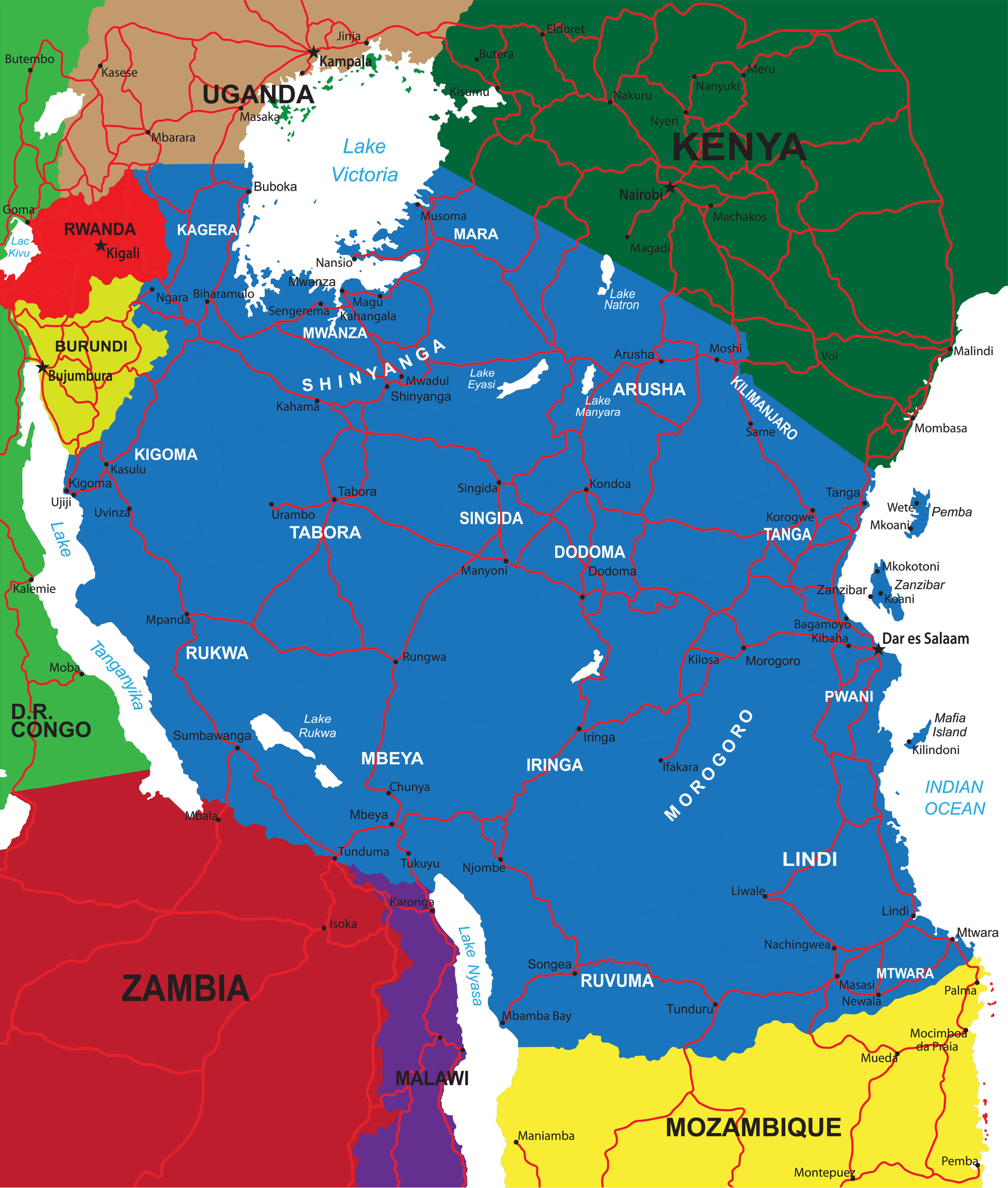
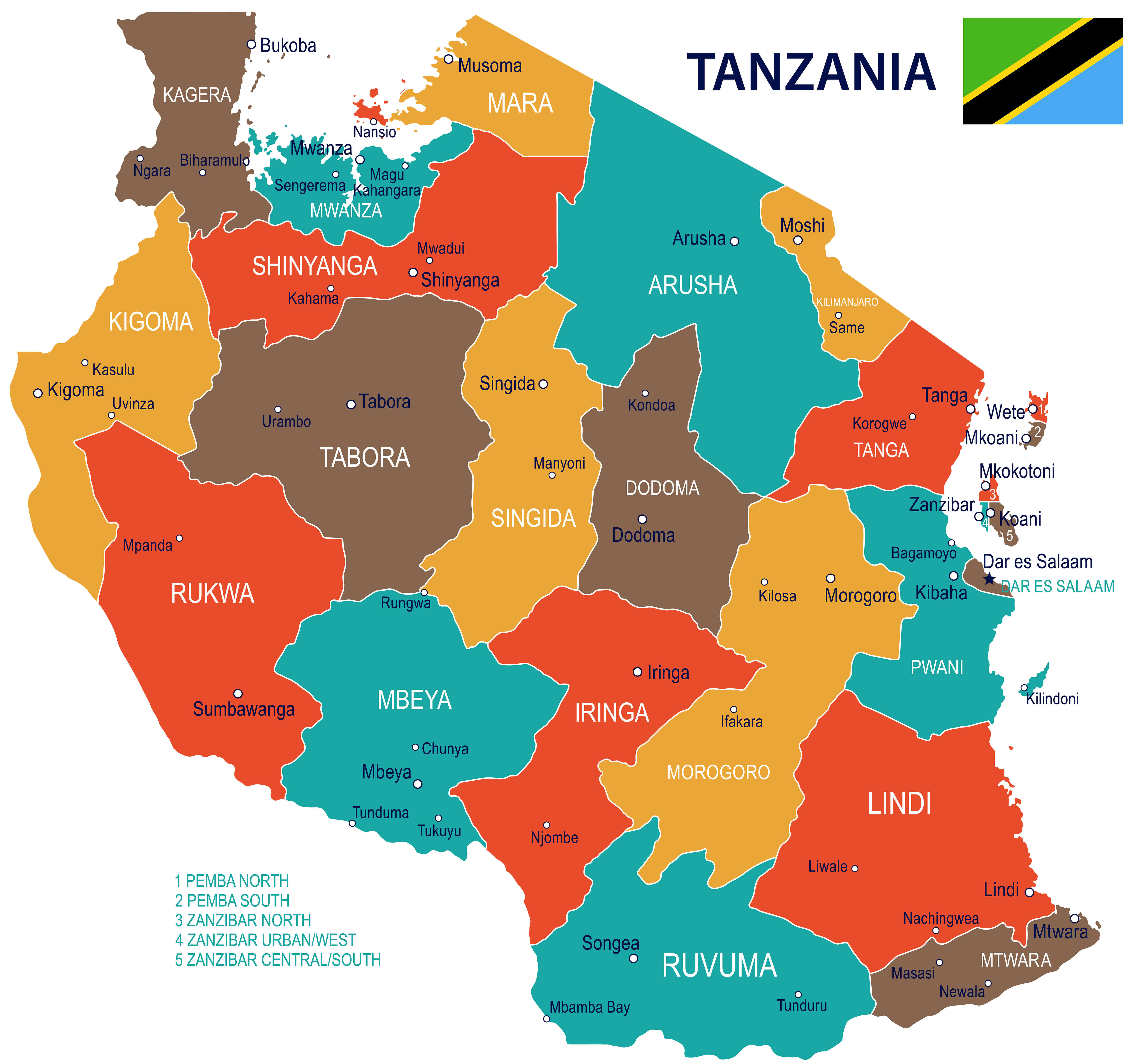
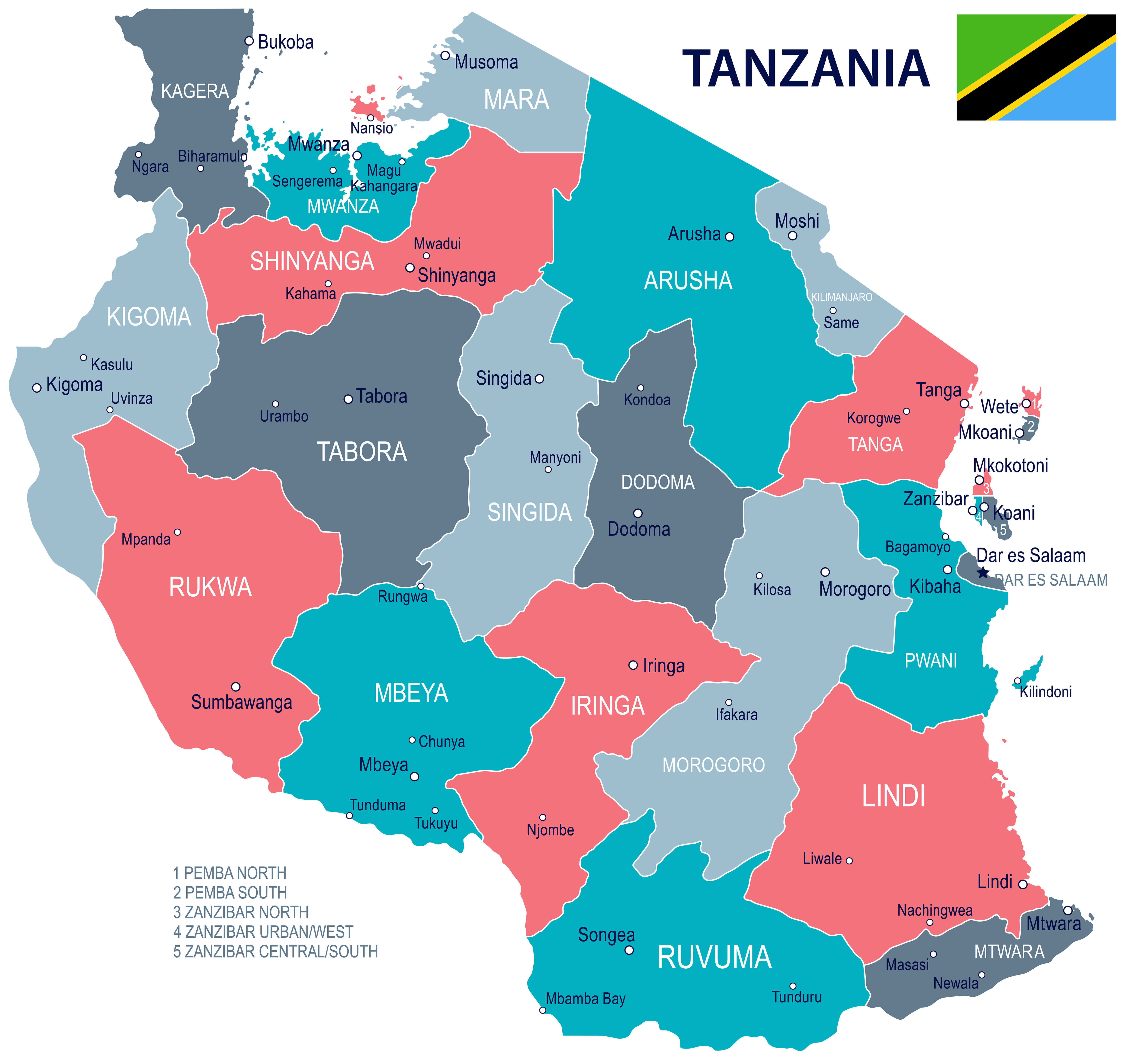
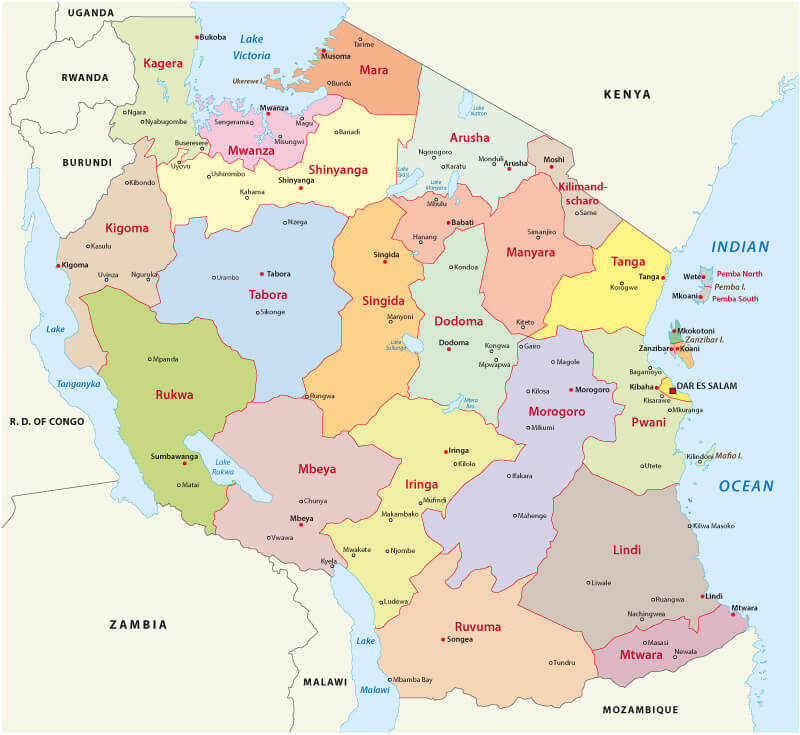
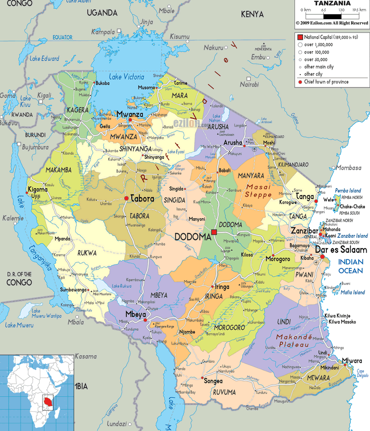 Color-coded map of Tanzania with regions, cities, and borders.
This detailed regional map of Tanzania displays its administrative divisions, including key regions like Dodoma, Dar es Salaam, Mwanza, Arusha, and Zanzibar. Major lakes such as Lake Victoria, Lake Tanganyika, and Lake Nyasa are clearly labeled. International borders with neighboring countries like Kenya, Uganda, and the Democratic Republic of the Congo are marked. The map highlights the national capital Dodoma, chief towns, and important cities, with clear labels and a legend for population and infrastructure.
Tanzania Earth Map
Map of Africa Tanzania<
Map of Tanzania neighbouring countries
Mount kilimanjaro Map with Tanzania
Physical Map of Tanzania
Tanzania regional map
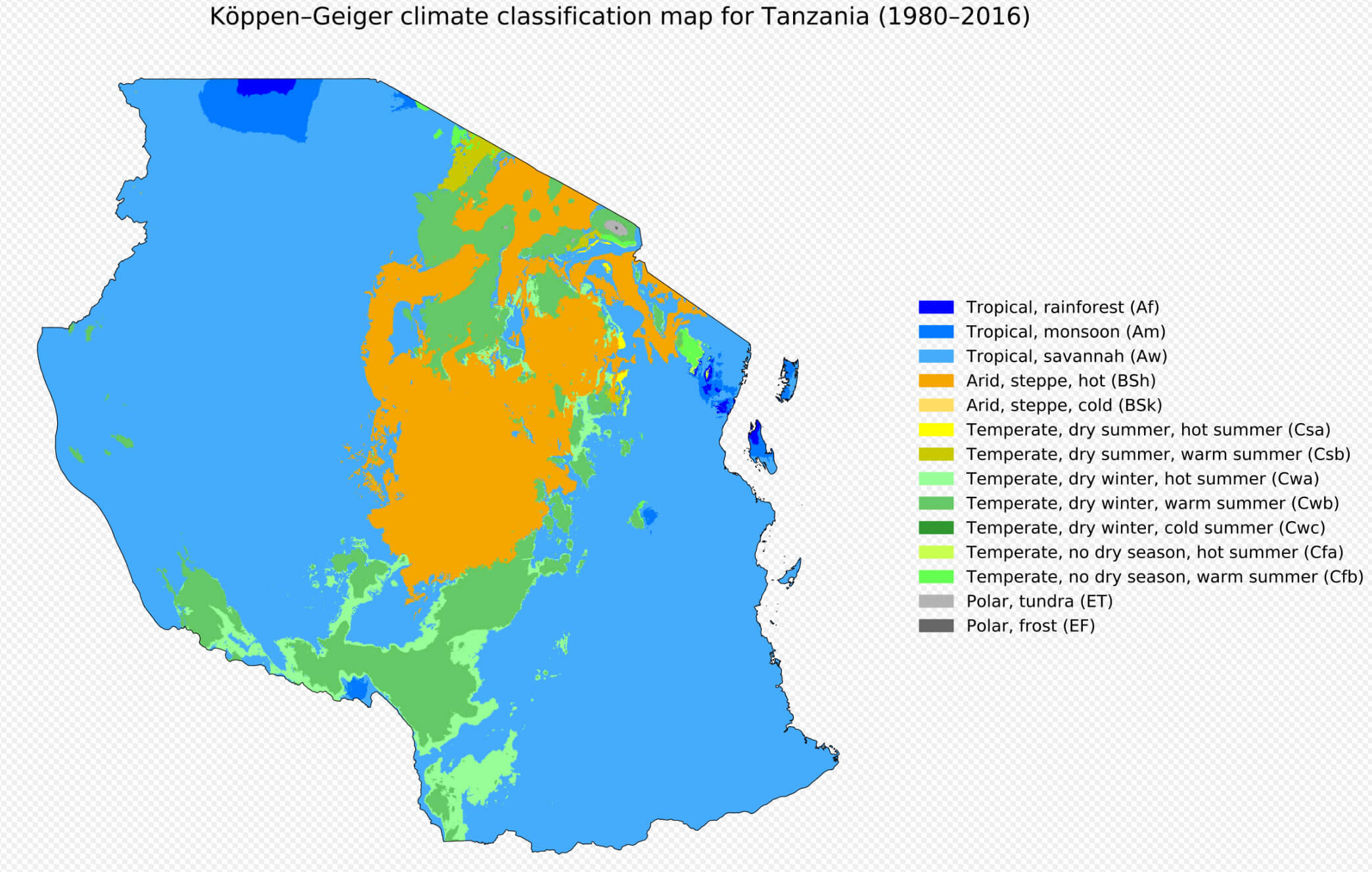
Tanzania climate map
Tanzania colorful regions map
Tanzania country map
Tanzania info map
Tanzania location Map in Africa
Tanzania major cities map
Tanzania Map with cities and parks
Tanzania Map with national parks
Tanzania map
Tanzania provinces map
Tanzania satellite Map from space
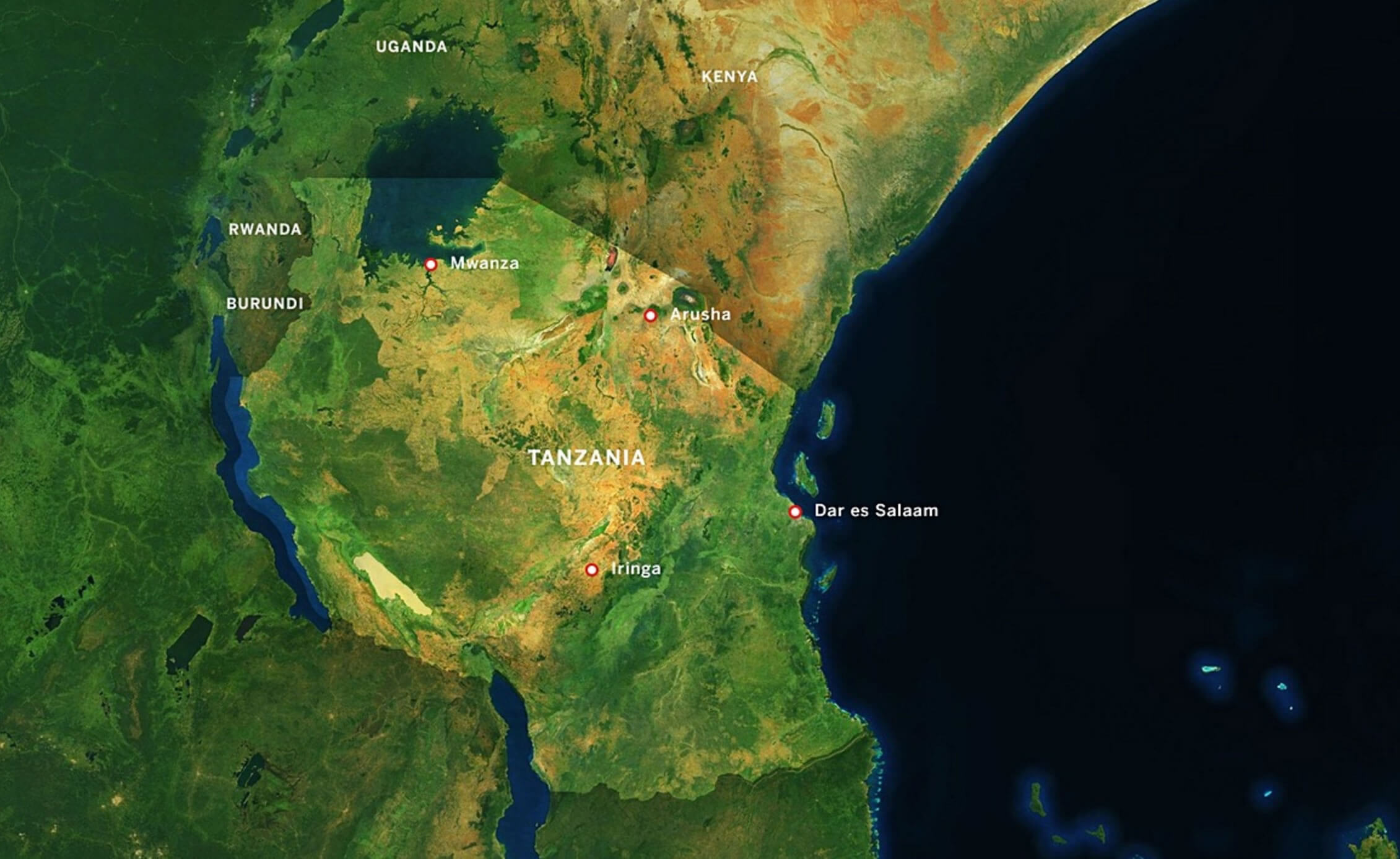
Tanzania satellite Map with cities
Tanzania satellite map
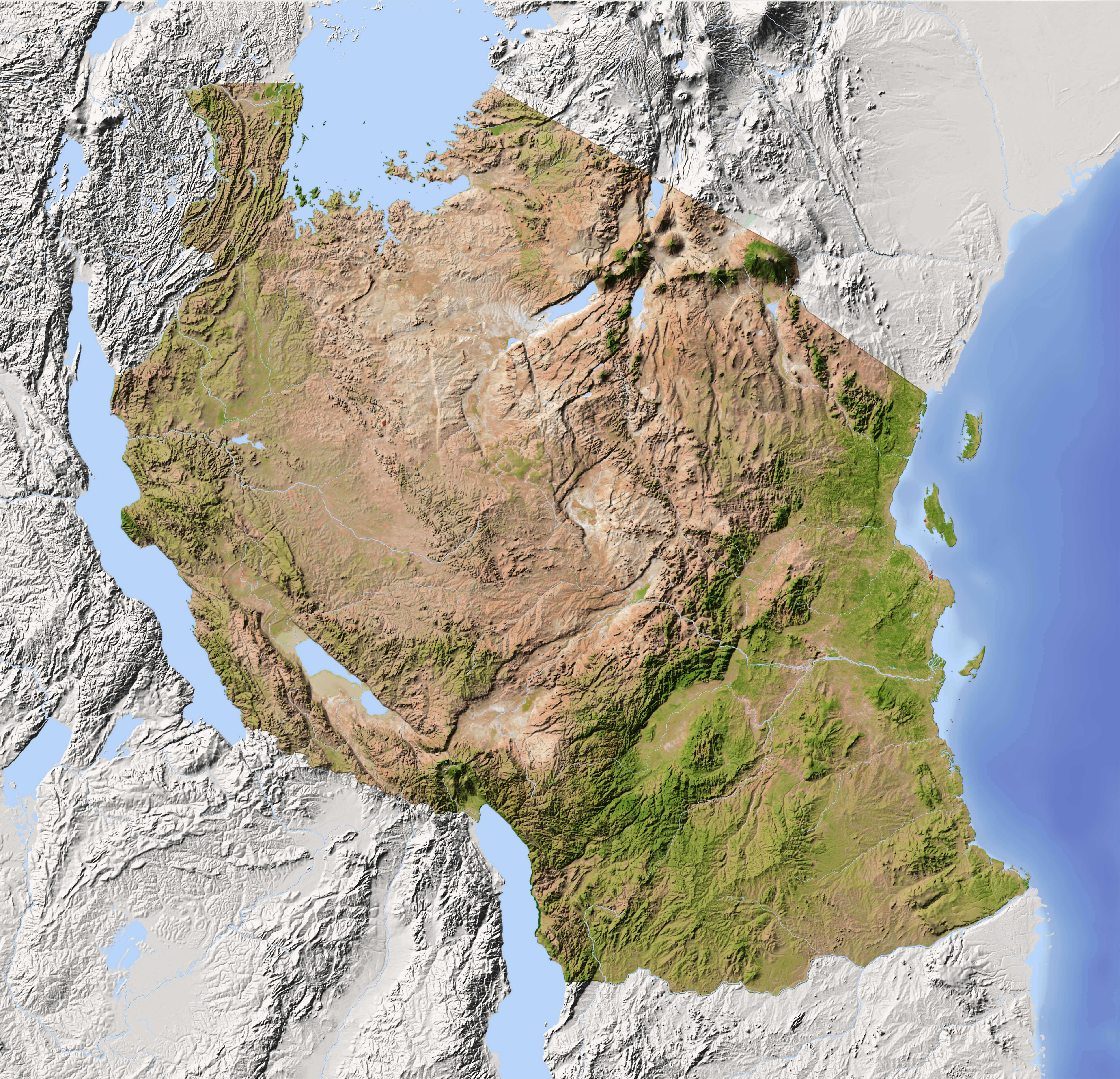
Tanzania terrain map
Tanzania time map
Tanzania topography map
Where is located Tanzania in Africa
Where is located Tanzania in the World
Zanzibar Tanzania map
Where is Tanzania on the Africa Map?
Show Google interactive map, satellite map, where is the country located.
Get directions by driving, walking, bicycling, public transportation and travel with street view.
Feel free to explore these pages as well:
- Egypt Map ↗️
- Algeria Map ↗️
- Uganda Map ↗️
- Syria Map ↗️
- Iran Map ↗️
- Iraq Map ↗️
- Israel Map ↗️
- Jordan Map ↗️
- Saudi Arabia Map ↗️
- United States Map ↗️
- United Kingdom Map ↗️
- Türkiye Map ↗️
- Europe Map ↗️
- Africa Map ↗️