A collection of Oceania Maps; View a variety of Oceania physical, political, administrative, relief map, Oceania satellite image, higly detalied maps, blank map, Oceania world and earth map, Oceania’s regions, topography, cities, road, direction maps and atlas.
Countries Map of Oceania
Oceania Countries Political Map
Oceania Countries Political Map

Oceania Retro Map
Map of Australia and Oceania
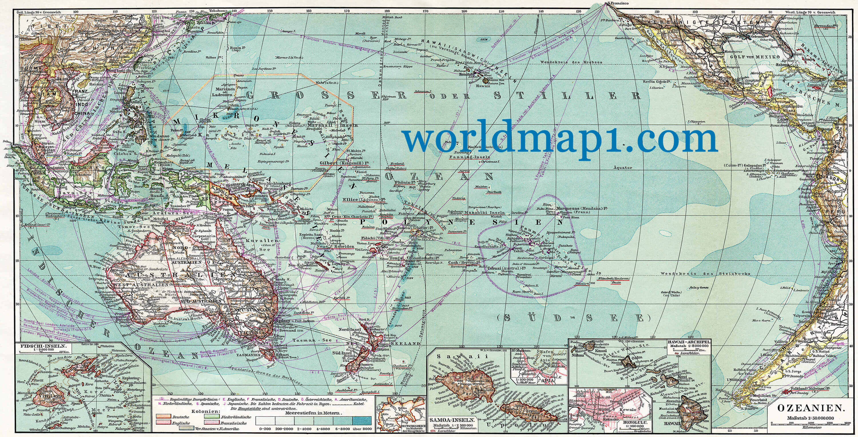 Map of Australia and Oceania. Publication of the book “Meyers Konversations-Lexikon”, Leipzig, Germany, 1910
World Oceania Map Centered in the American Continent
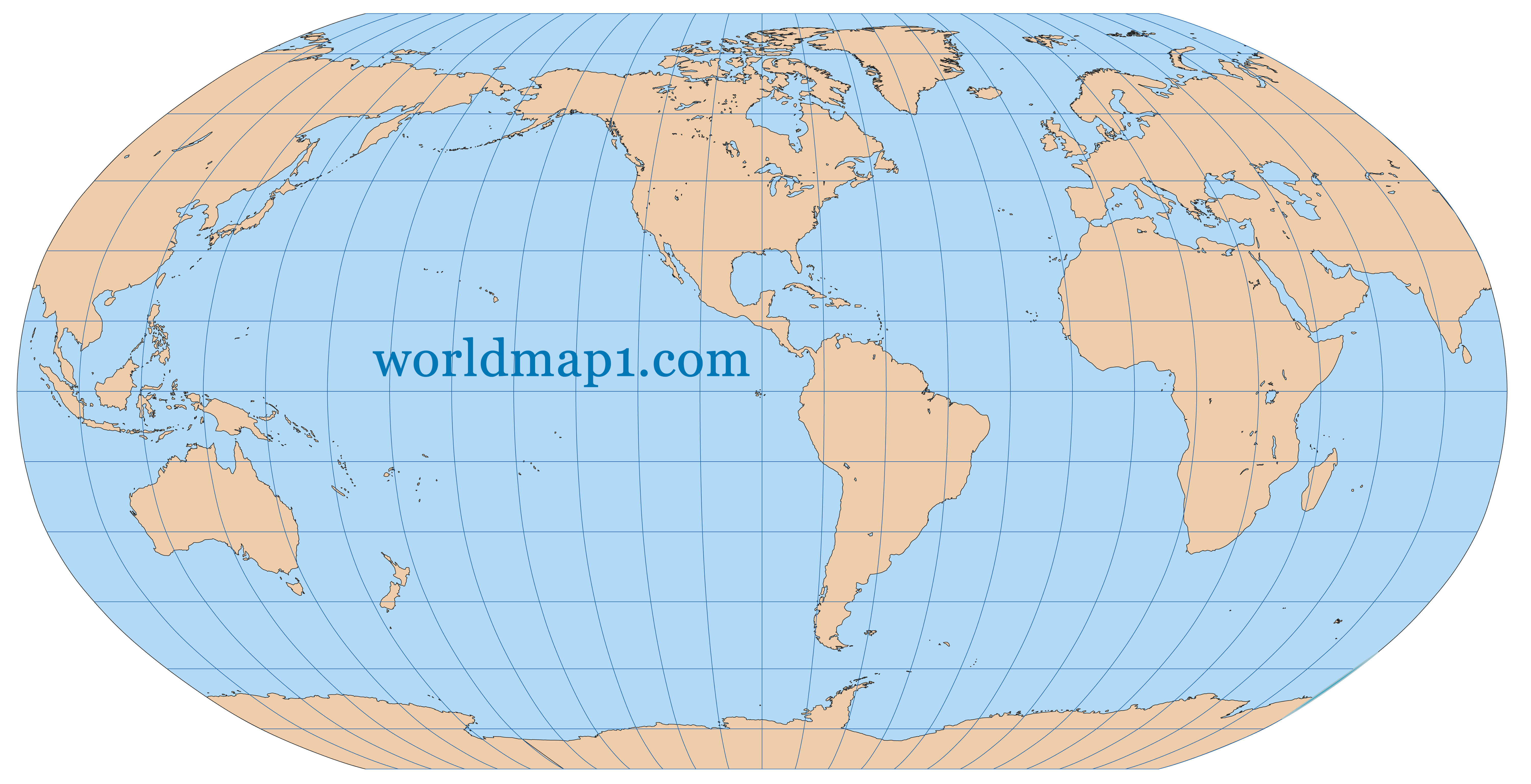
Very high detailed map of the world in Robinson projection with graticule. Centered in the American Continent.
Oceania Map Southeast Asia
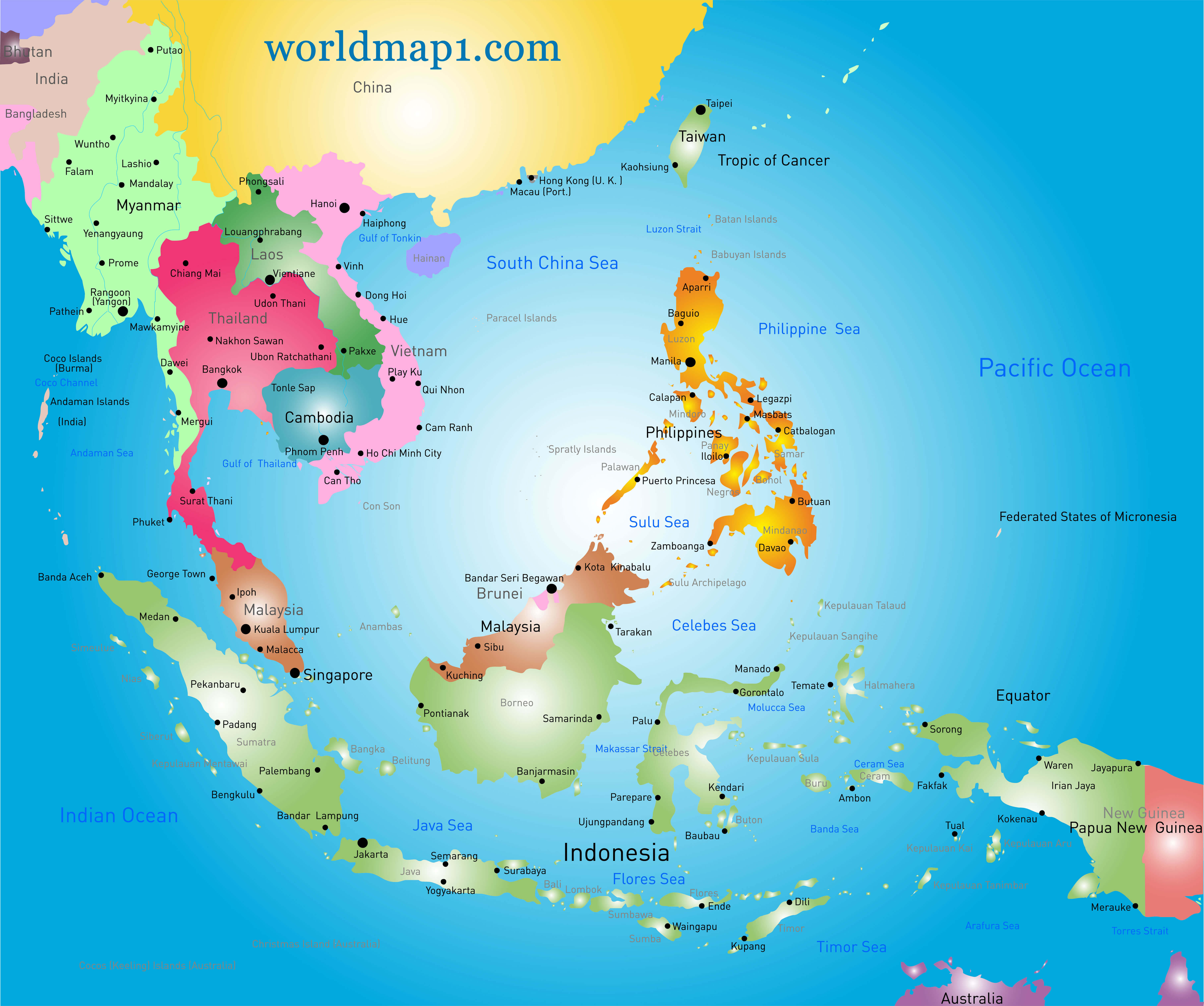 Vector color Southeast Asia map and Oceania.
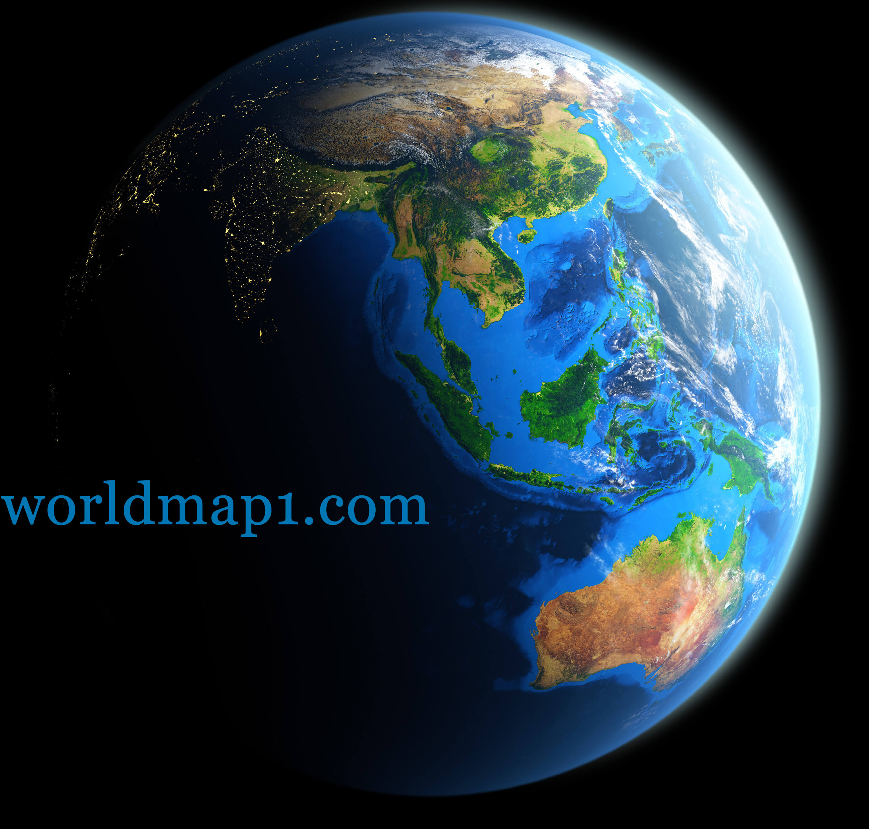
Oceania Map Earth at Night
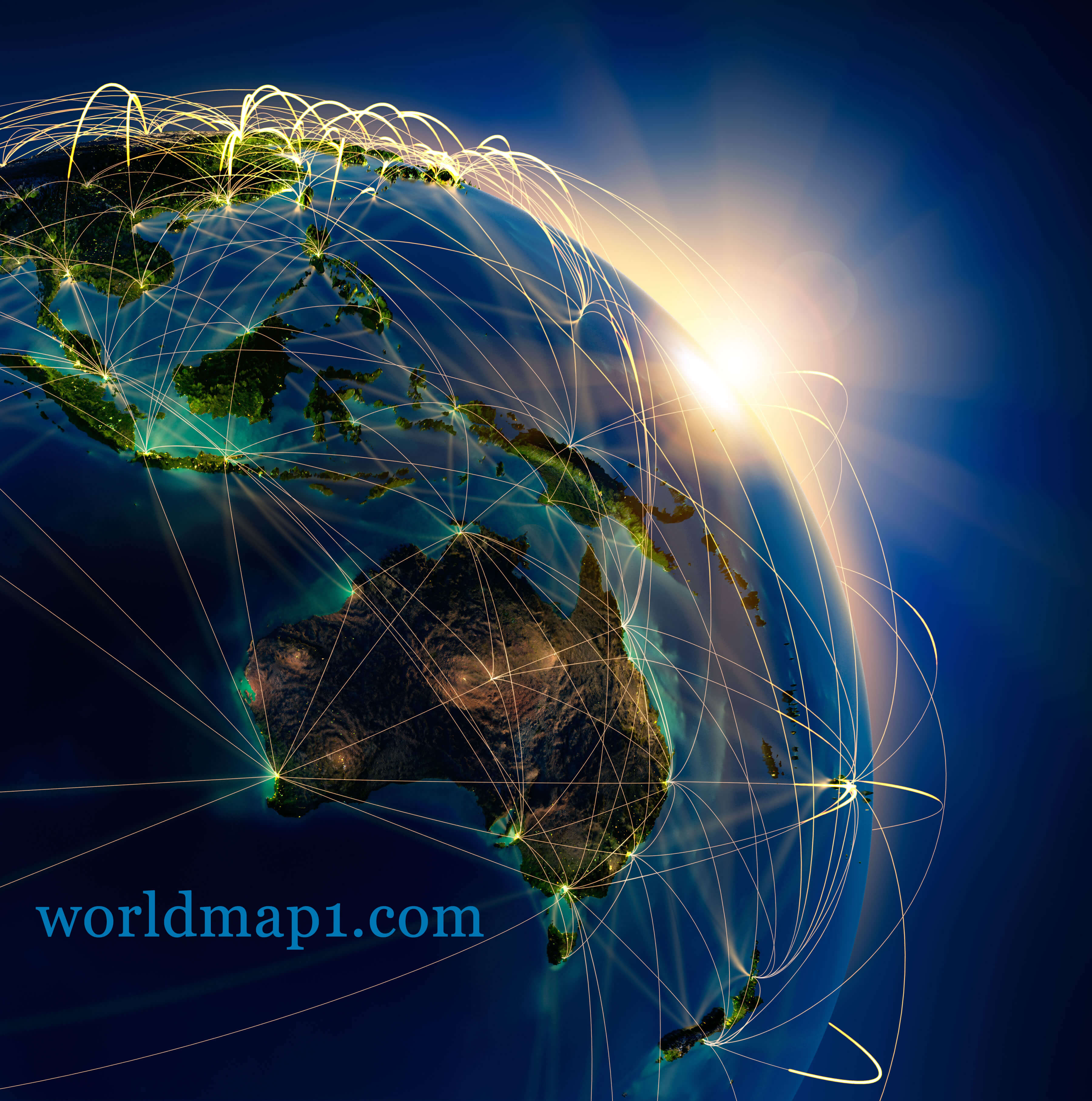 Highly detailed planet Earth at night and Oceania, lit by the rising sun, illuminated by light of cities.
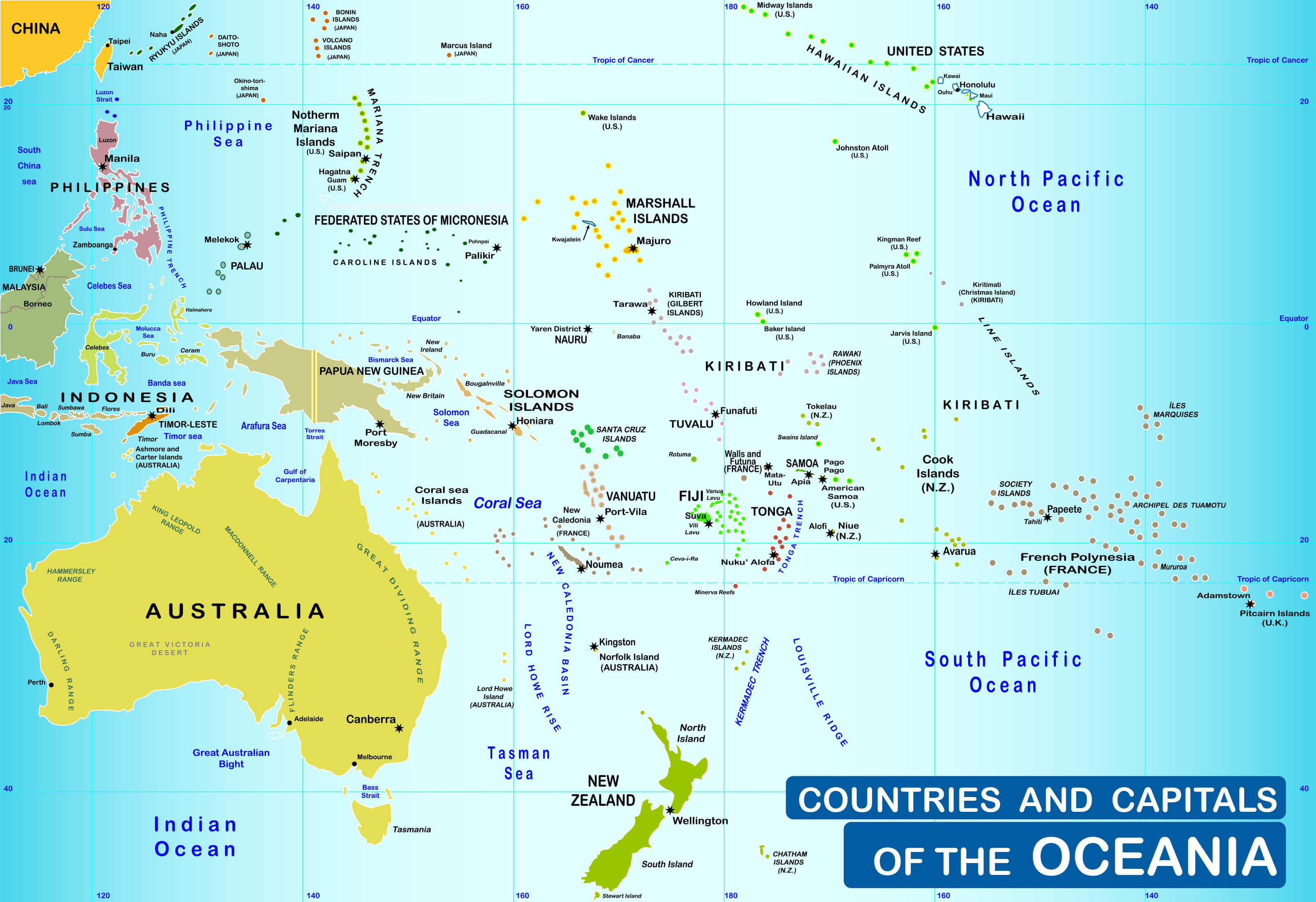
Countries and capitals of the Oceania Map
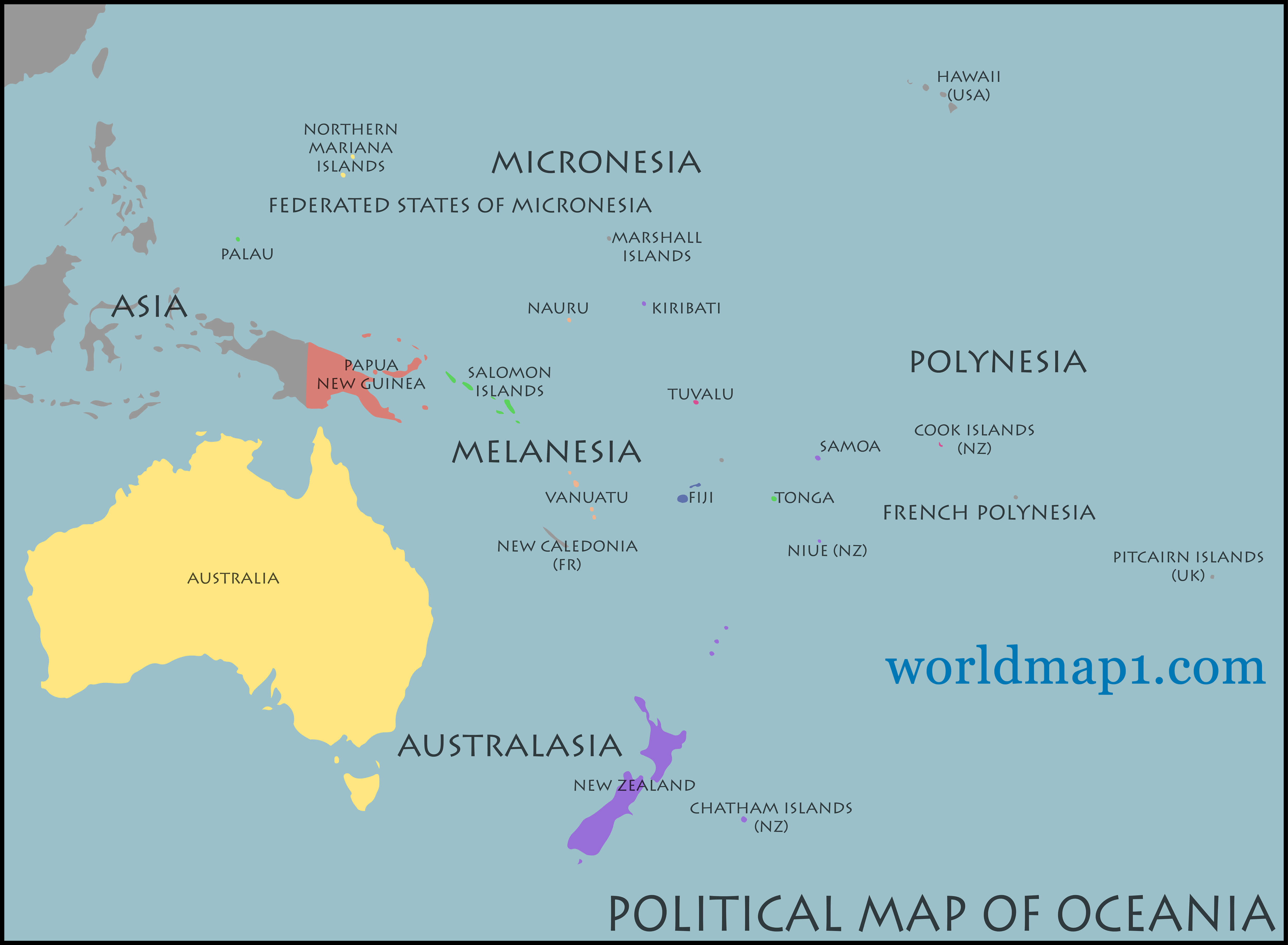
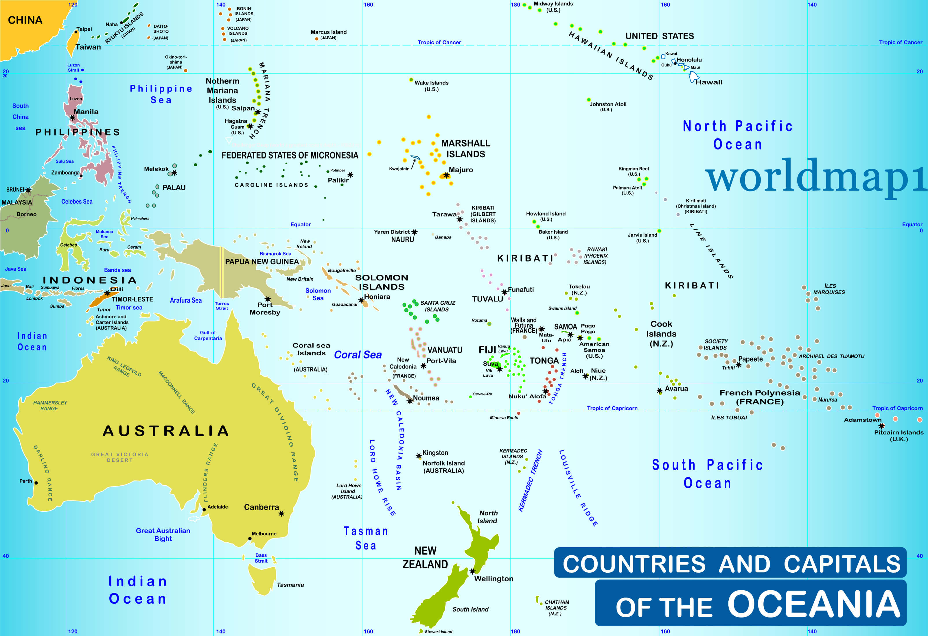 Countries and capitals of the Oceania and Australia Map.
Detailed Oceania Map Earth and Australia
Oceania and Blue Political World Map
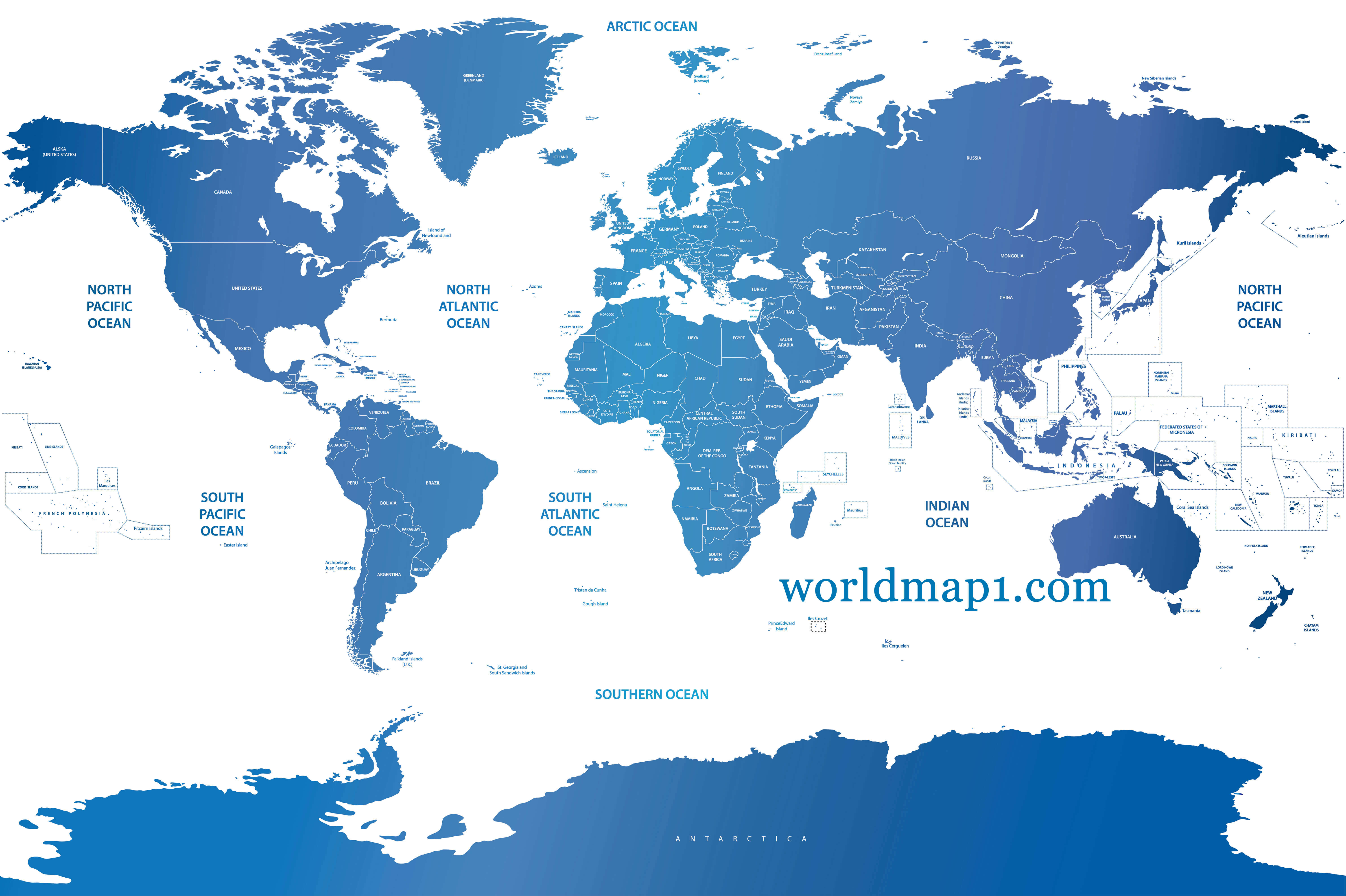 Vector soft blue gradient political world map.
Where is Oceania on the World Map?
Show Google map, satellite map, where is the country located.
Get directions by driving, walking, bicycling, public transportation and travel with street view.
Feel free to explore these pages as well:
- Exploring the Hidden Gems of Central Coast, Australia ↗️
- Australia Map ↗️
- Map of Australia ↗️
- Diverse Maps of Australia ↗️
- Map of Oceania ↗️
- Oceania Map ↗️
- About Australia, Infographics, Maps, Photos ↗️
- Exploring Australia’s 10 Largest Cities ↗️ ↗️
- A Collection of Oceania Maps ↗️
- Discovering the Charm of Canberra ↗️
- Adelaide: The Jewel of South Australia ↗️
- Australia has the climate to suit everyone ↗️
- Australia’s Top 10 Destinations ↗️
- Australia For Living & 10 Best Places to Live ↗️
- About Australia, Infographics, Maps, Photos ↗️
- Discovering the Sun-Drenched Splendors of Brisbane ↗️
- Melbourne’s Top 10 Attractions Every Tourist Must Experience ↗️
- American Samoa Map ↗️