A collection of China Maps; View a variety of China physical, political, administrative, relief map, China satellite image, higly detalied maps, blank map, China world and earth map, China’s regions, topography, cities, road, direction maps and atlas.
People’s Republic of China Map
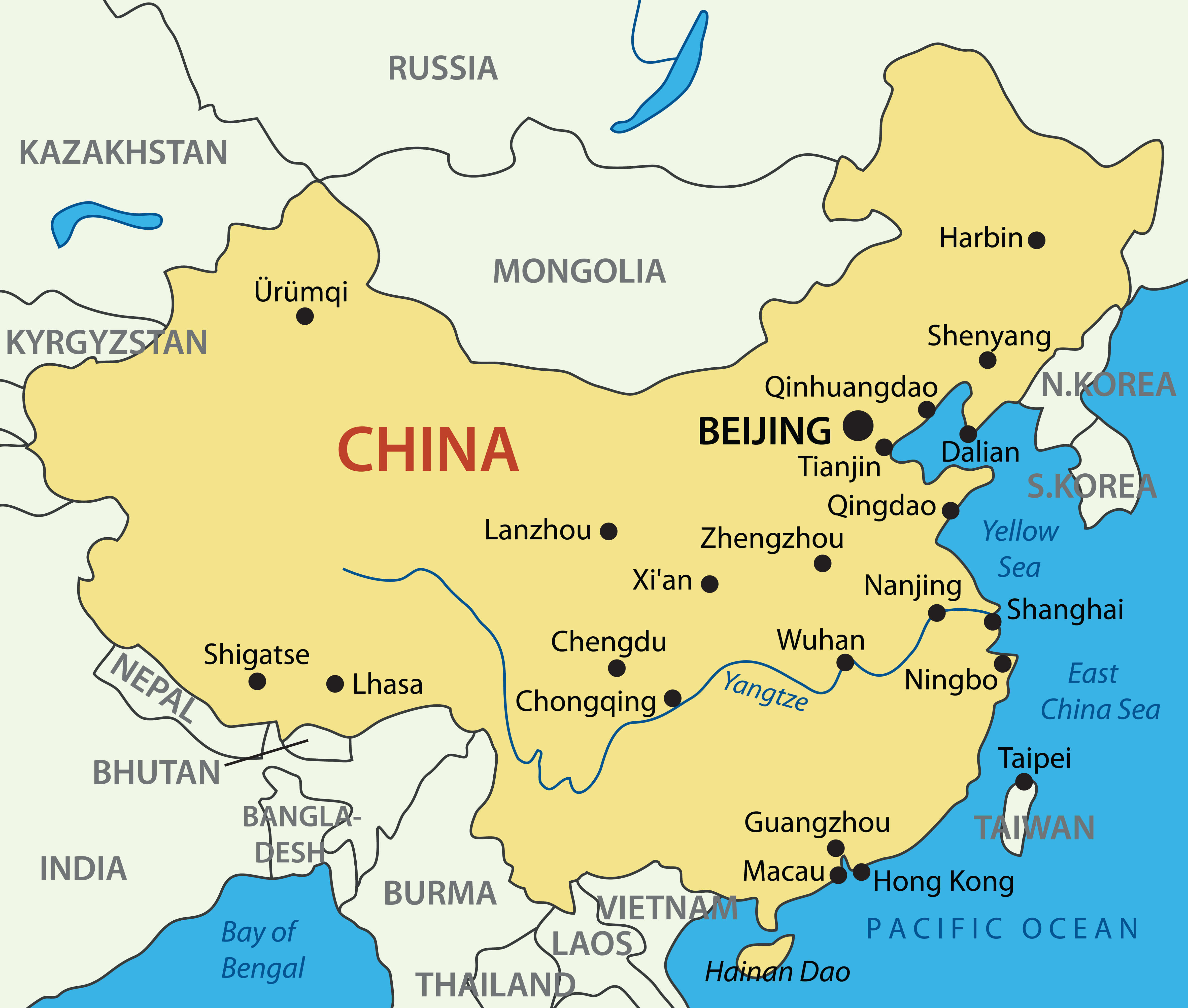 People’s Republic of China Map with major cities and country national border map.
China Political Map
 Political Map of China, China Rivers Map, Main Cities, National Border Map with India, Mongolia, Burma, Kazakhstan, North Korea, Laos, Vietnam, Nepal, Bhutan, Tajikistan, Kyrgyztan.
China Satellite Map
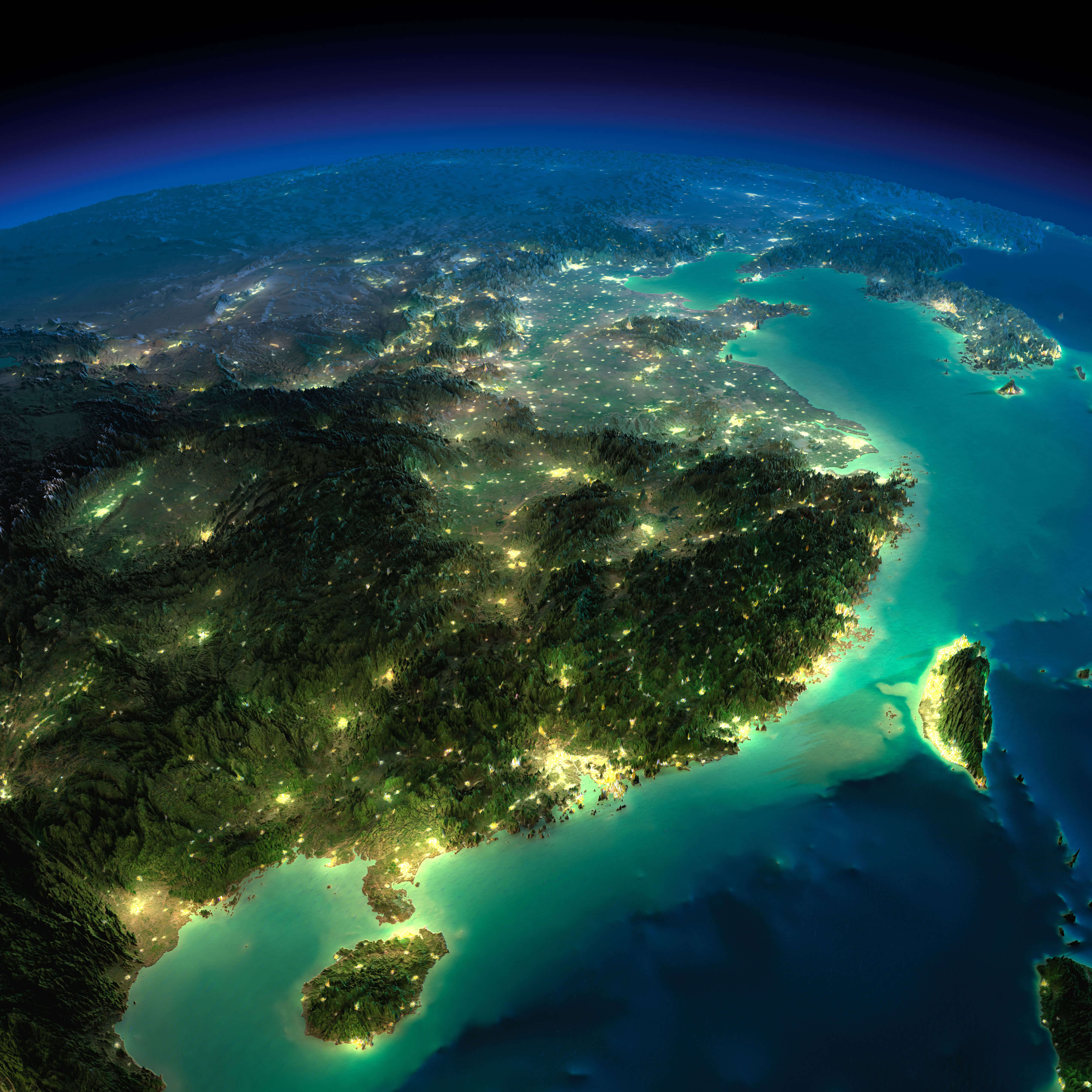
Detailed Political Map of China
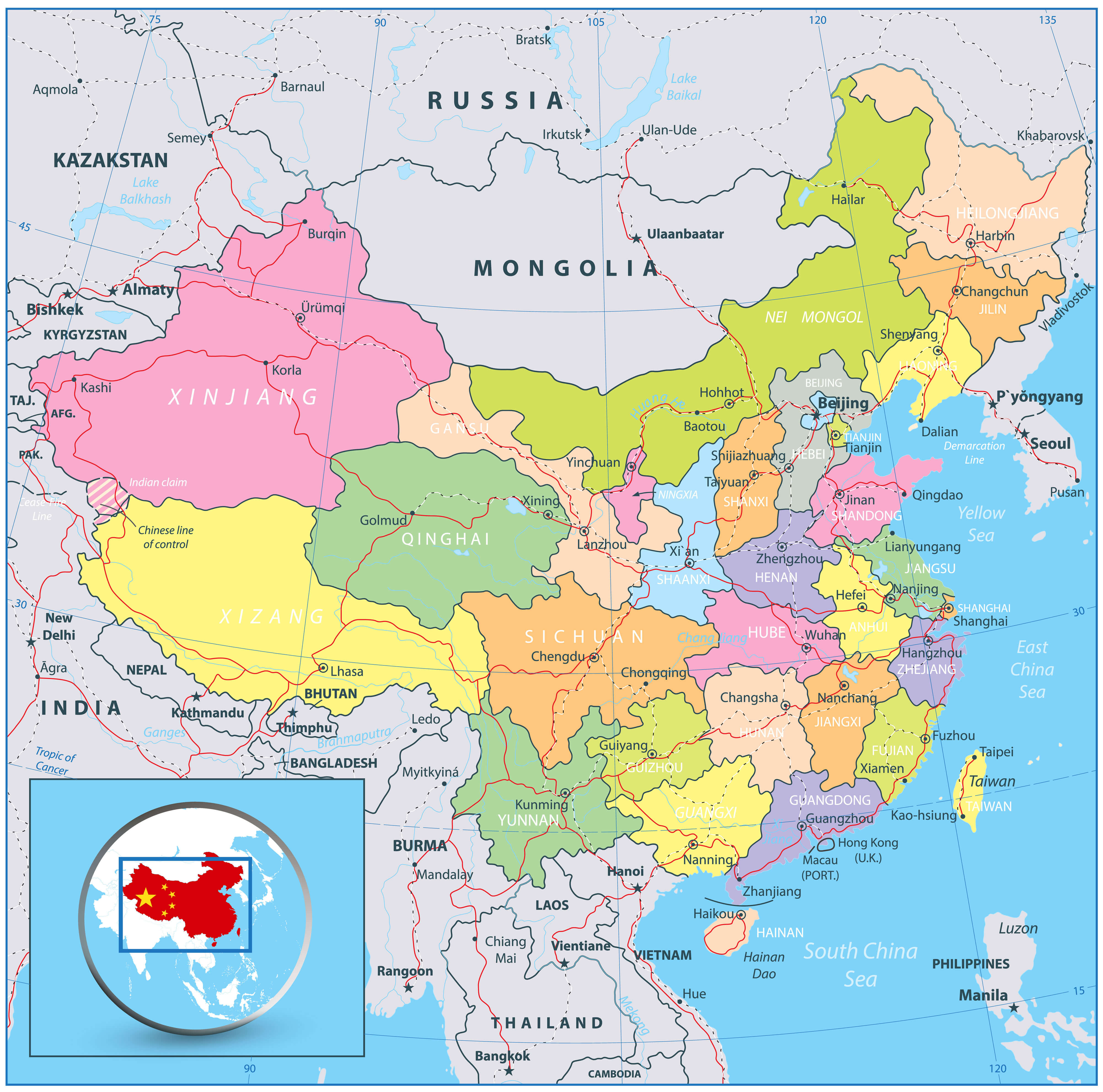 Highly detailed political map of China with roads, railroads and water objects
China Road Map
 High detailed China road map with labeling
China Map with Globe Asia
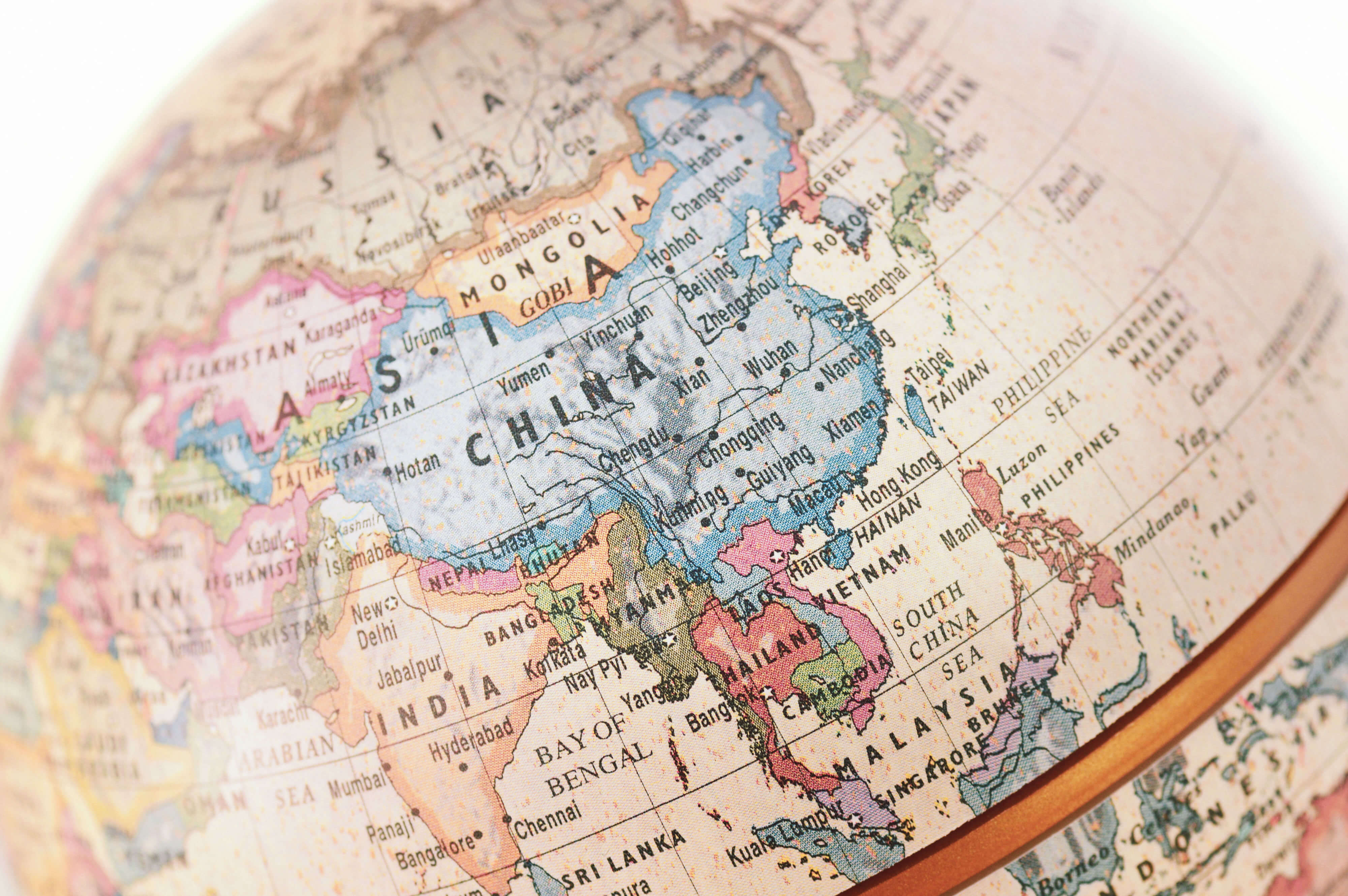
China Provinces Map Overview
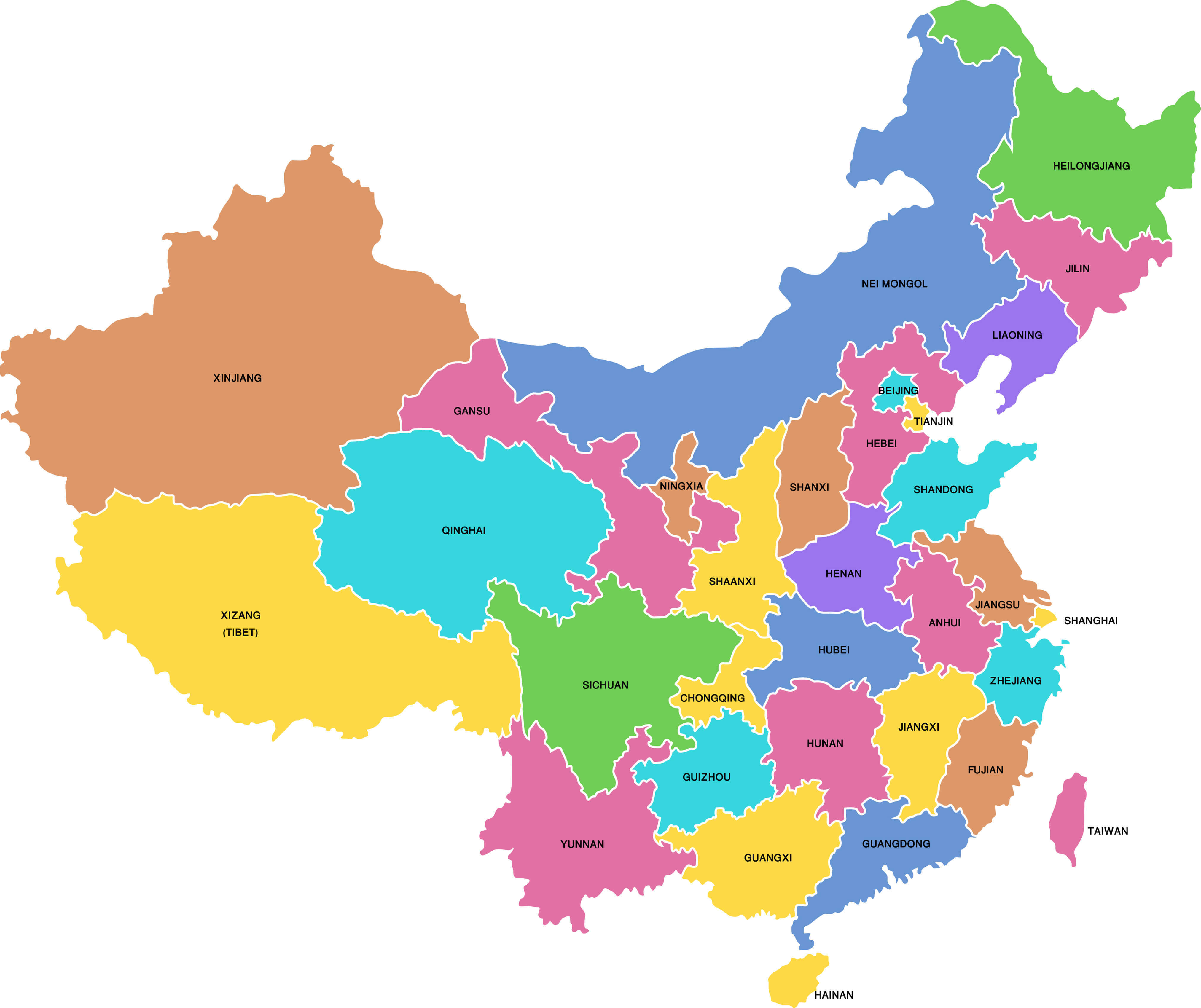
Map of China’s provinces and regions
This colorful map highlights the administrative divisions of China, with each province and region clearly labelled. Major provinces such as Xinjiang, Sichuan, Guangdong and Yunnan are easily identifiable, as are major municipalities such as Beijing and Shanghai. The map also includes autonomous regions such as Tibet and Inner Mongolia, showing the vast geographical diversity of China’s regions.
Map of administrative divisions of China
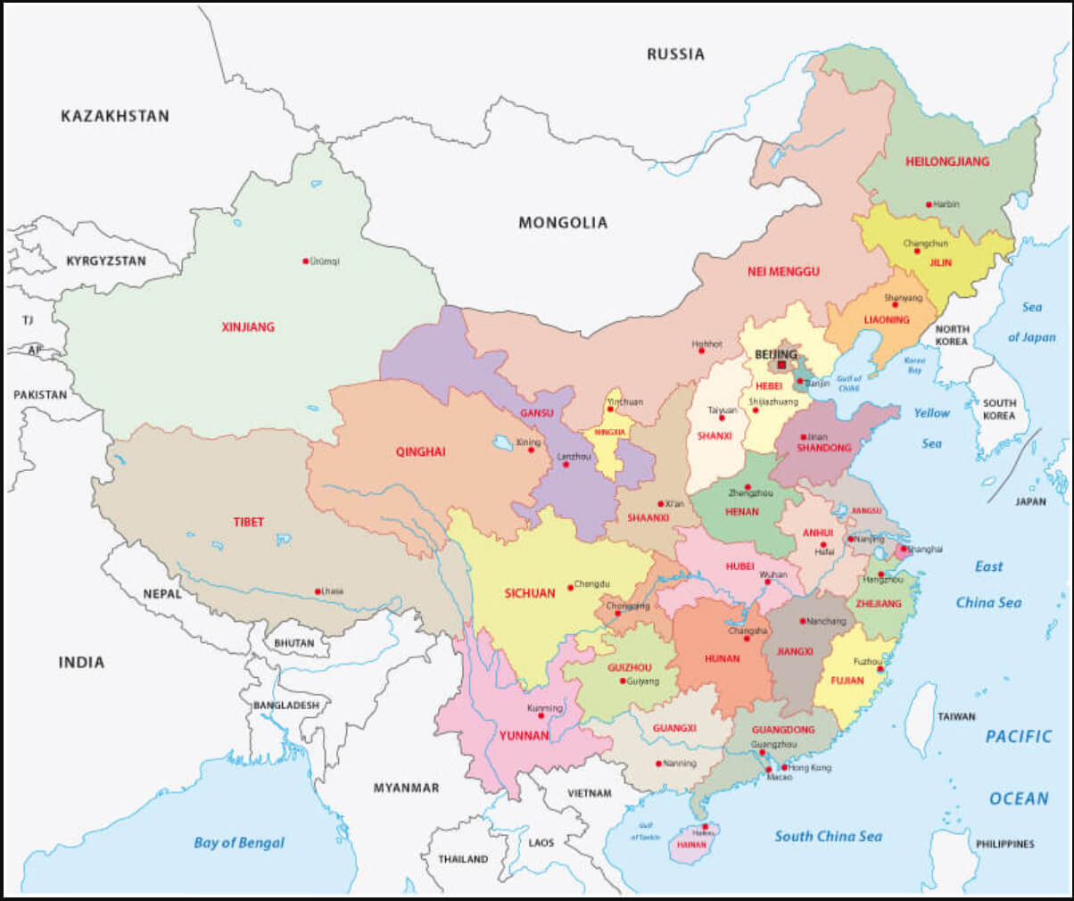
China administrative map with provinces, autonomous regions, and municipalities.
This map shows China’s administrative divisions, highlighting each province, autonomous region and municipality, as well as major geographical boundaries and neighbouring countries. The map illustrates major cities such as Beijing, Shanghai and Guangzhou, and places significant emphasis on regions such as Xinjiang, Tibet and Inner Mongolia. Coastal provinces along the East China Sea, Yellow Sea and South China Sea are clearly delineated, showing China’s proximity to countries such as Russia, India and Vietnam.
Major Cities Map of China
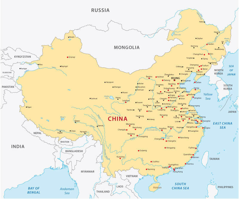
Map of China with major cities.
This map highlights China’s major cities, providing a comprehensive overview of the urban centres spread across the country. From the bustling metropolises of Beijing and Shanghai on the east coast to other important cities such as Guangzhou, Chengdu and Xi’an, the map shows the geographical distribution of China’s major cities. It highlights China’s population centres and their proximity to neighbouring countries, with cities along the coastlines of the East China Sea, Yellow Sea and South China Sea reflecting the country’s strategic economic and trade hubs.
Map of China’s Major Cities and International Borders
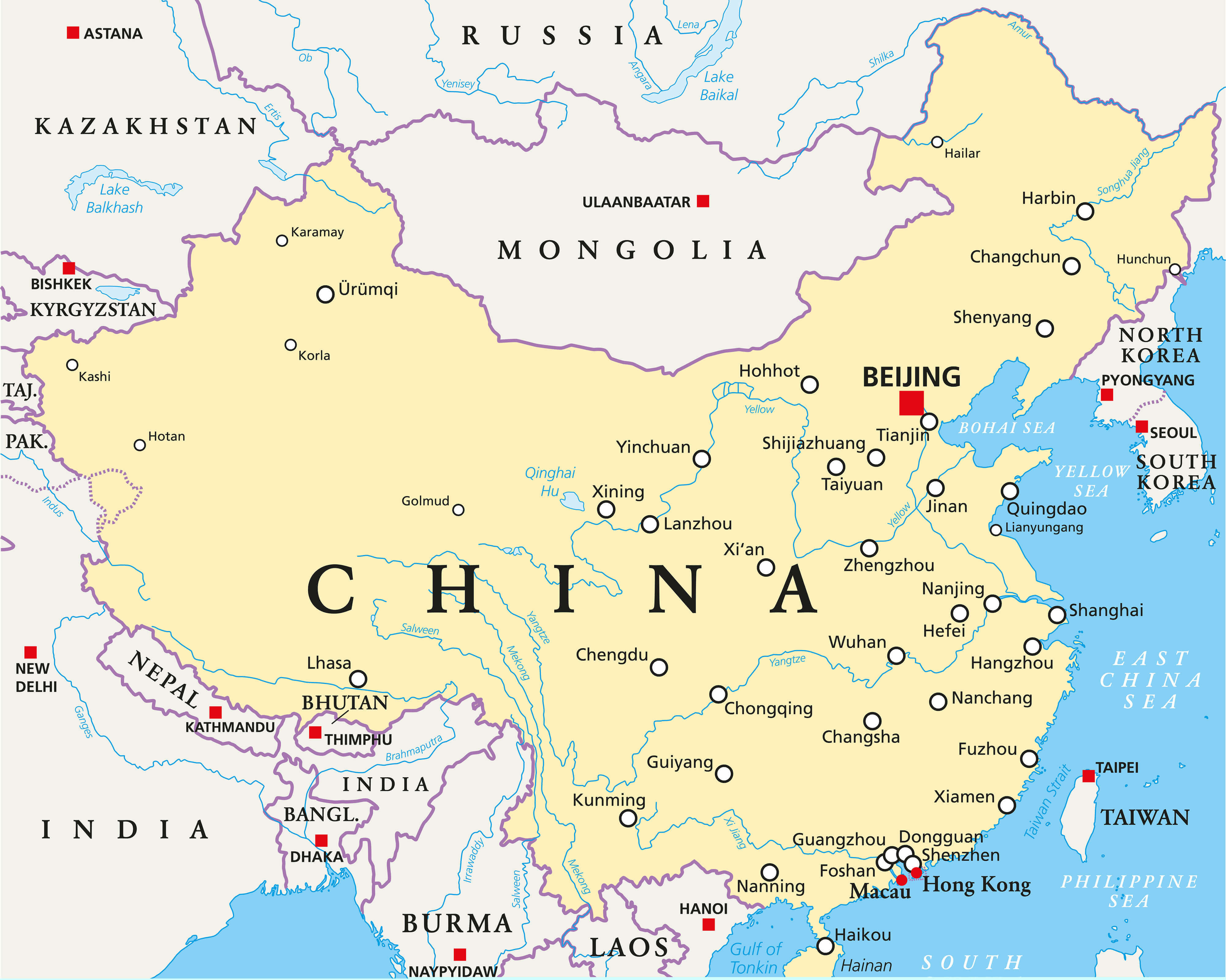
China map with major cities and international borders.
This map provides an overview of China’s major cities and their location in relation to the country’s international borders. Key cities such as Beijing, Shanghai, Guangzhou and Xi’an are highlighted to show China’s urban distribution. Neighbouring countries such as Russia, India and South Korea are also clearly defined, highlighting China’s extensive borders and regional proximity. The map also shows important geographical features such as oceans and rivers, providing context for China’s interconnected transport and trade networks.
China Map from Space

Satellite view of China at night with cities and surrounding seas.
This stunning satellite image shows China and its surrounding regions as seen from space, providing a unique perspective on the country’s vast geography. Coastal areas such as the East China Sea and South China Sea are prominently visible, along with illuminated cities highlighting population centres. The mountainous regions of western China and the Tibetan Plateau contrast sharply with the flatter, densely populated eastern coast, providing an overview of the country’s diverse landscapes.
China Physical Map Overview with Flag
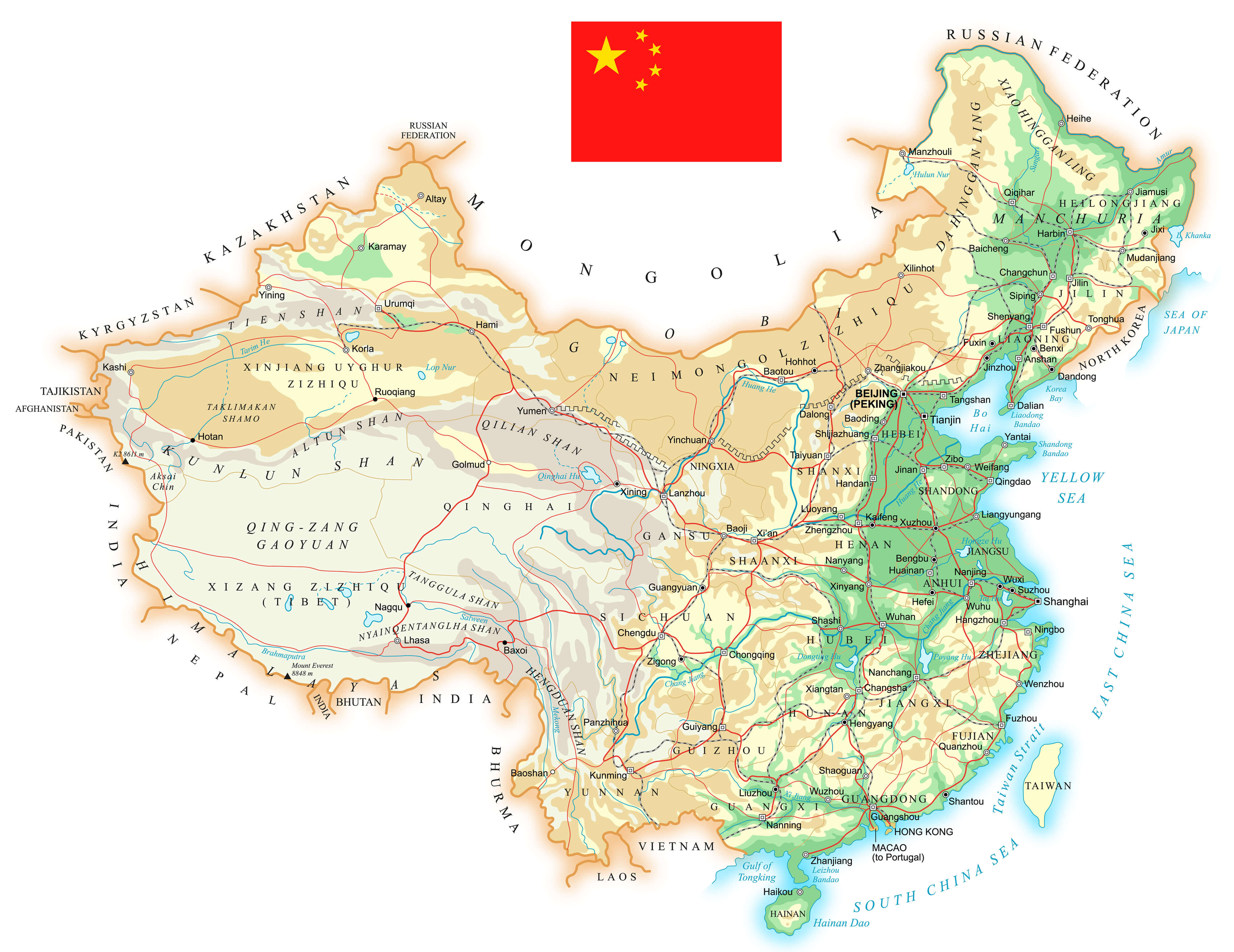
Mountains, plateaus, rivers and major cities on a physical map of China with a flag.
This physical map of China illustrates the country’s diverse topography, including major mountain ranges such as the Himalayas, deserts such as the Taklamakan and Gobi, and vast plateaus such as the Qinghai-Tibet Plateau. Rivers, including the Yangtze and Yellow Rivers, flow through China’s diverse landscapes and support key regions. The map also highlights China’s neighboring countries, coastal areas and major cities, providing a comprehensive view of the country’s geographical context.
China Regions Map with Major Cities
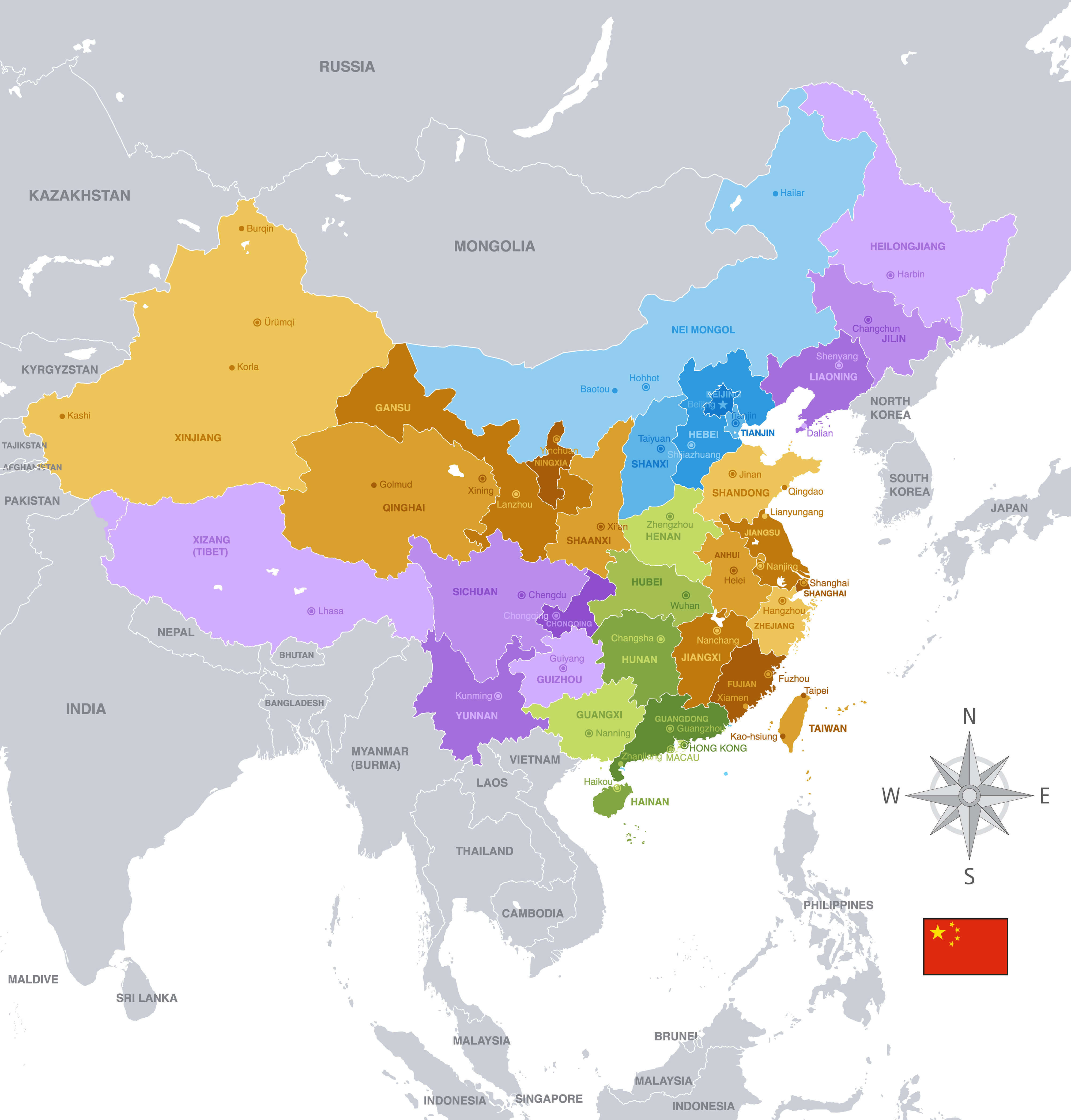
Map of China showing regions, major cities, and neighboring countries.
This map of China shows the country’s various regions, each highlighted in different colors to indicate provincial boundaries. Major cities such as Beijing, Shanghai, Guangzhou and Hong Kong are prominently marked, giving a clear view of the country’s urban distribution. Neighboring countries and major seas surrounding China are also shown, providing a geographical context for China’s position in Asia. The map includes a compass for orientation and the Chinese national flag.
China from a Satellite Perspective
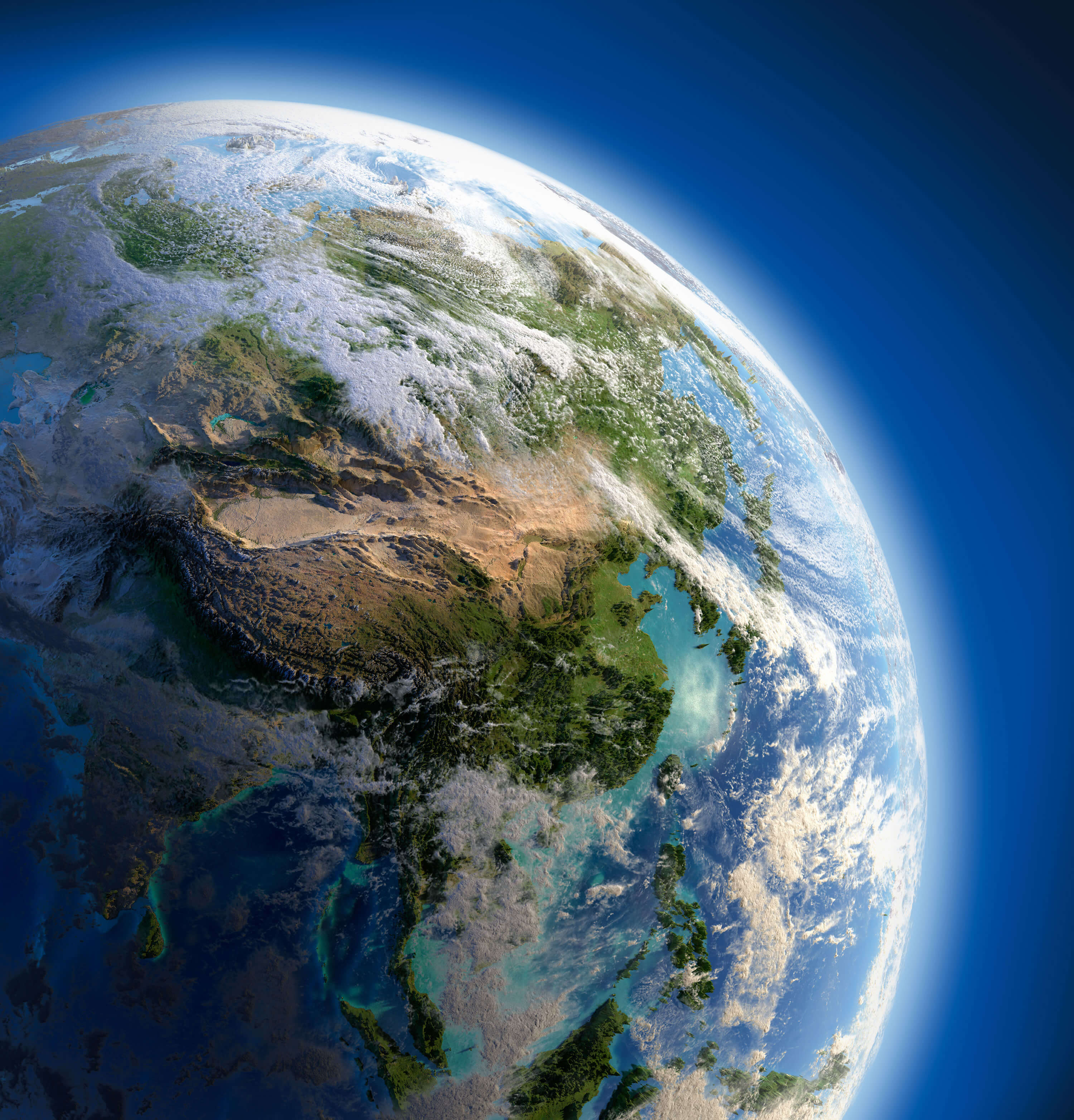
Satellite view of China and neighbouring regions with diverse topography
This satellite map provides an overview of China and its surrounding regions, highlighting the vast geographical diversity of the area. Visible are the vast plains of the east, where most of China’s population lives, and the rugged mountains and deserts of the west. The prominent Himalayas can be seen in the southwest, while the lush green areas of the southeast contrast with the arid regions of the north and west. This perspective captures China’s natural topography in stunning detail.
Where is China on the Asia Map?
Show Google interactive map, satellite map, where is the country located.
Get directions by driving, walking, bicycling, public transportation, and traveling with street view.
Feel free to explore these pages as well:
- China Map ↗️
- Map of China ↗️
- A Collection of China Maps ↗️
- China’s Largest Cities ↗️
- The Heartbeat of China ↗️
- Unveiling the Mysteries of Chongqing ↗️
- Chengdu Unveiled ↗️
- Where is Taiwan in the World and A Collection of Taiwan Maps ↗️
- India Map ↗️
- Russia Map ↗️
- Pakistan Map ↗️
- Philippines Map ↗️
- Cambodia Map ↗️
- Vietnam Map ↗️
- Myanmar (Burma) Map ↗️
- Japan Map ↗️
- North Korea Map ↗️
- South Korea Map ↗️
- Kazakhstan Map ↗️
- Asia Map ↗️
- Mongolia Map ↗️
- Nepal Map ↗️
