Explore the Philippines through detailed political, physical, and satellite maps. Discover its cities, rivers, topography, and diverse terrain across over 7,000 islands. Learn about its seas, volcanoes, ethnic and religious groups, population, and geography. See its strategic location near Malaysia, Indonesia, and Taiwan, and uncover its rich biodiversity, regions, and cultural heritage.
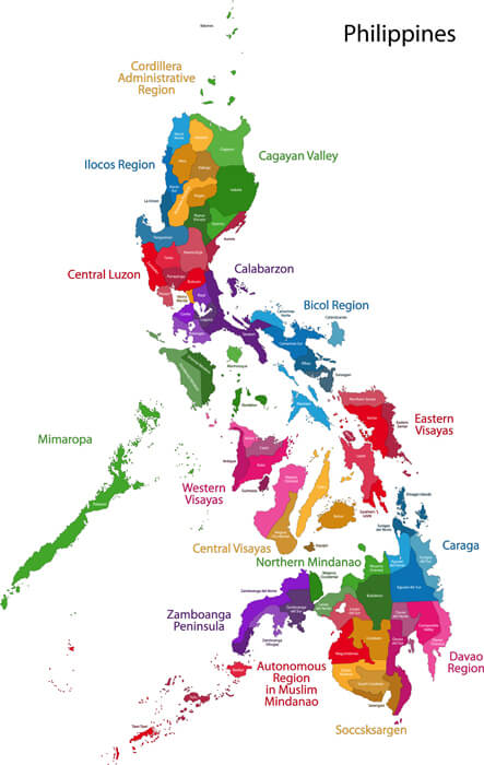
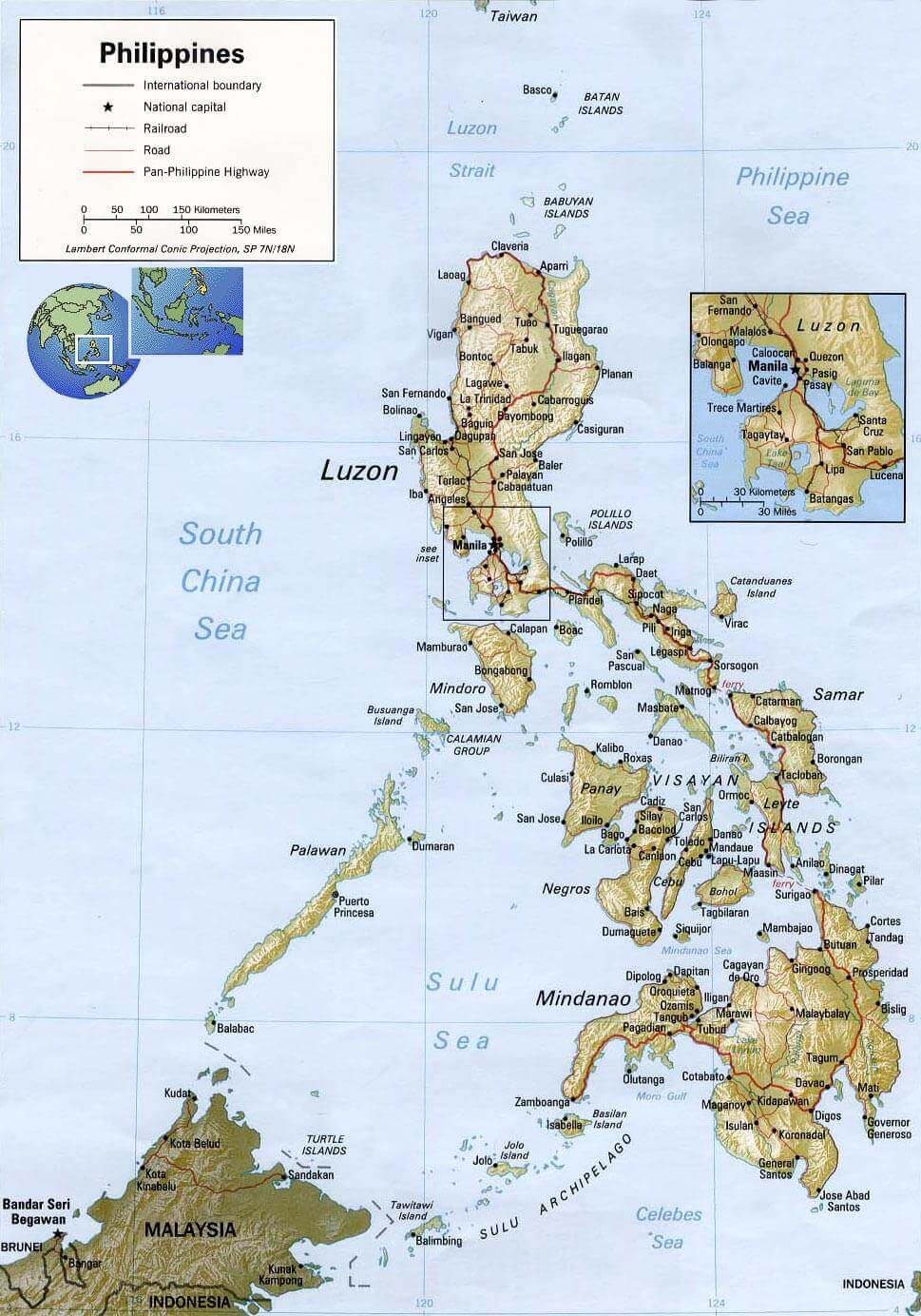
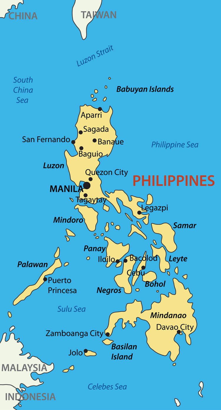
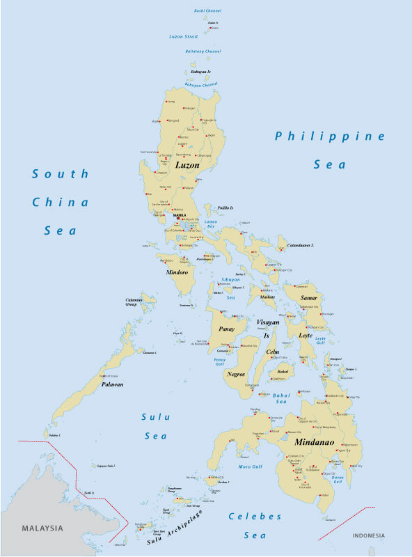
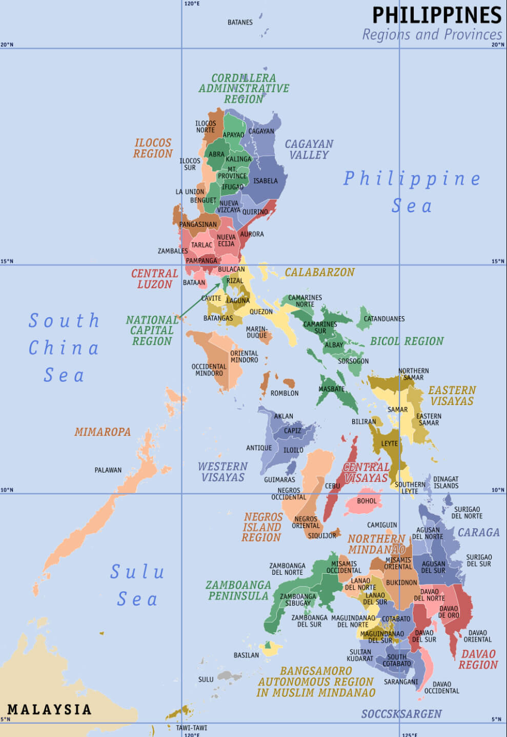
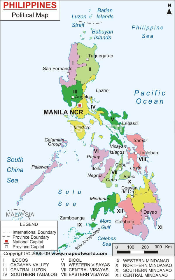
Philippines Provinces Map – Explore the Regions and Islands
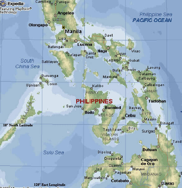
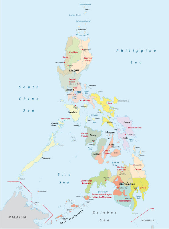 Philippines map with provinces, major cities, and surrounding seas.
Explore the Philippines with this detailed provincial map showing the regions of Luzon, Visayas and Mindanao. Explore major cities, islands and surrounding seas such as the South China Sea and the Philippine Sea. Learn about the Autonomous Region of Mindanao, the Visayan Islands and Luzon’s central hubs and their geographical and cultural significance.
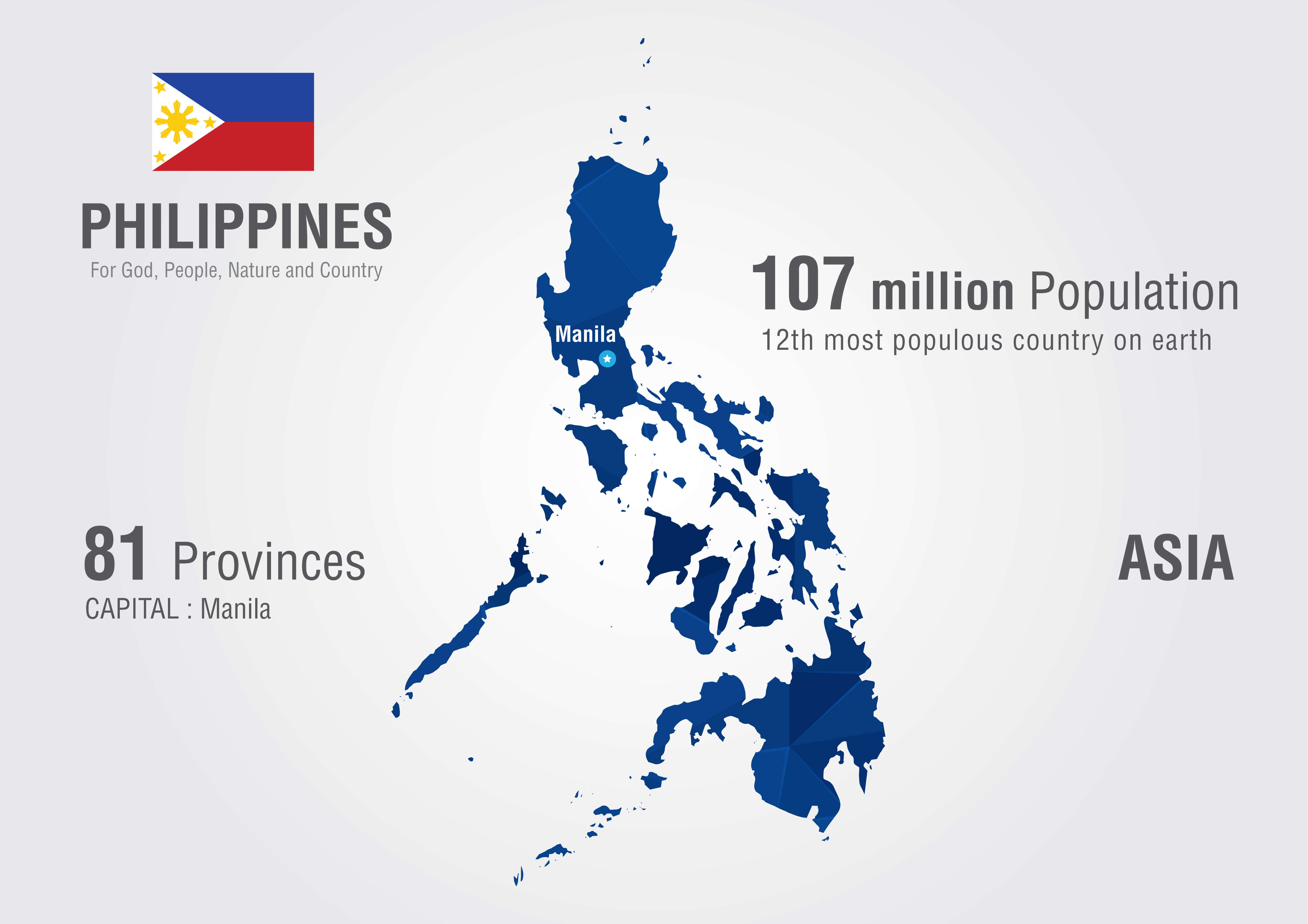
Brief information about Philippines
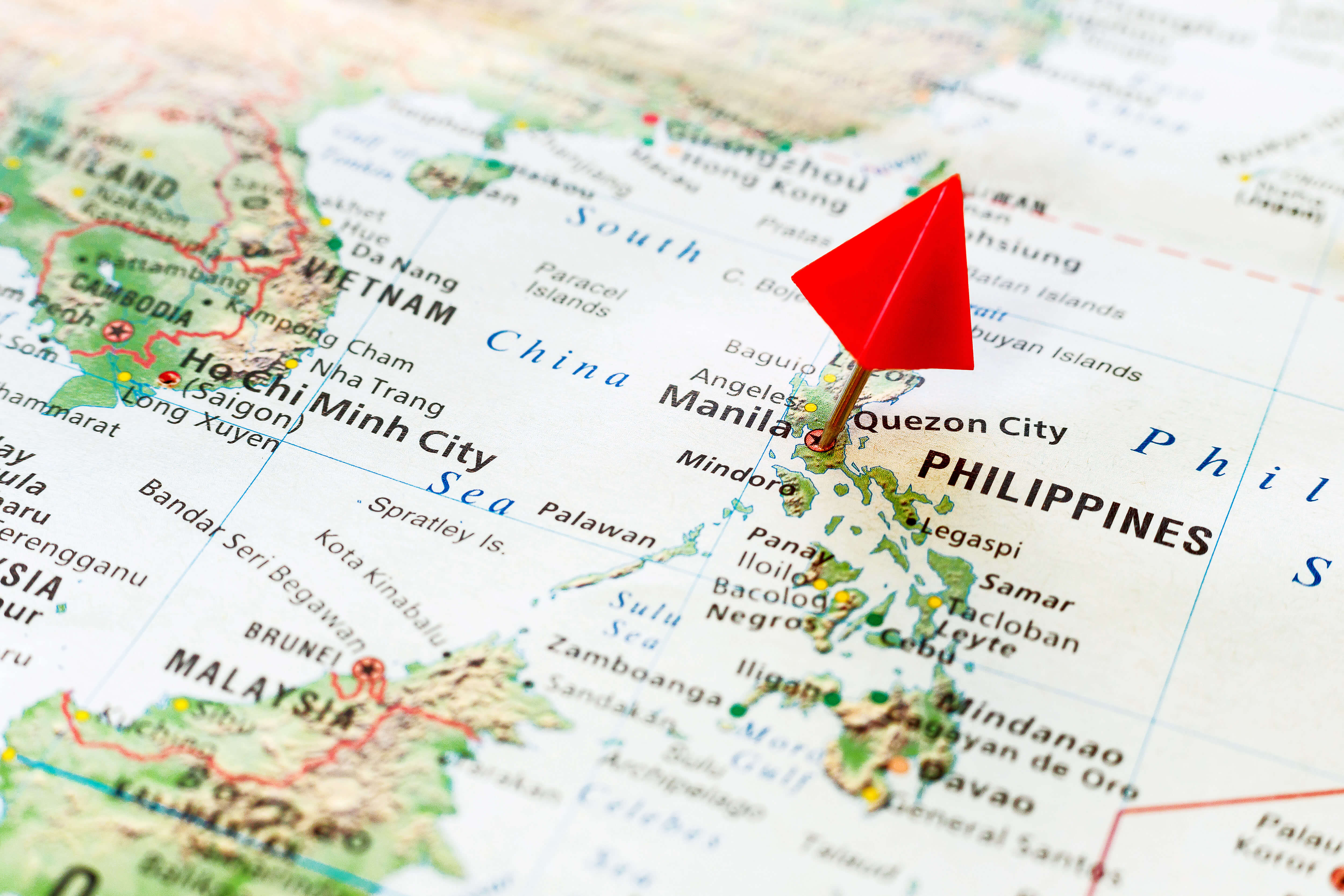
The Philippines, officially known as the Republic of the Philippines, is an archipelagic nation located in Southeast Asia. Comprising more than 7,600 islands, it is divided into three primary geographical regions: Luzon, Visayas, and Mindanao. The country shares maritime boundaries with Taiwan to the north, Vietnam to the west, and Indonesia to the south. Manila serves as the capital, while Quezon City is its most populous urban center.
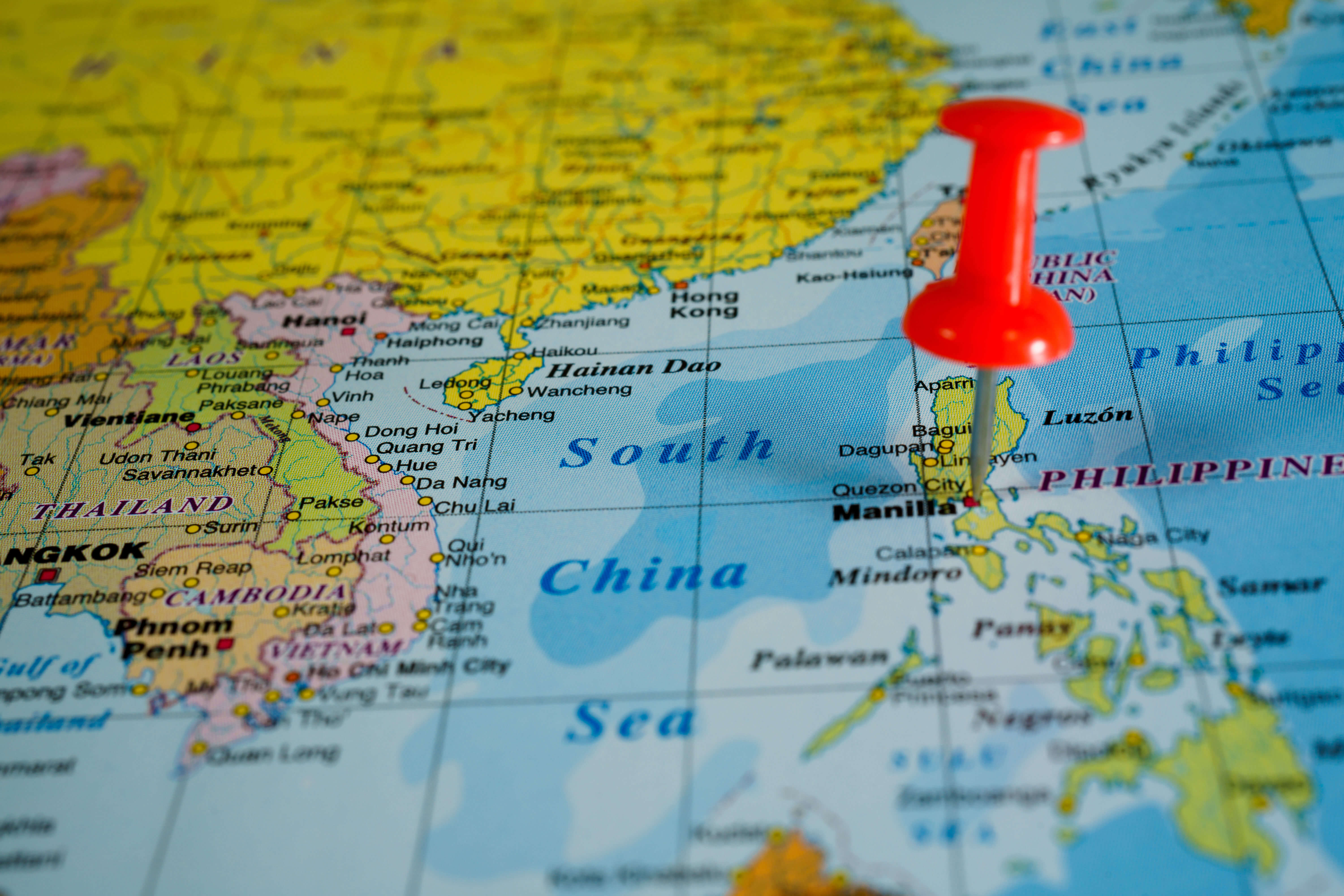
Philippines and Southeast Asia Map – Countries and Regions Overview
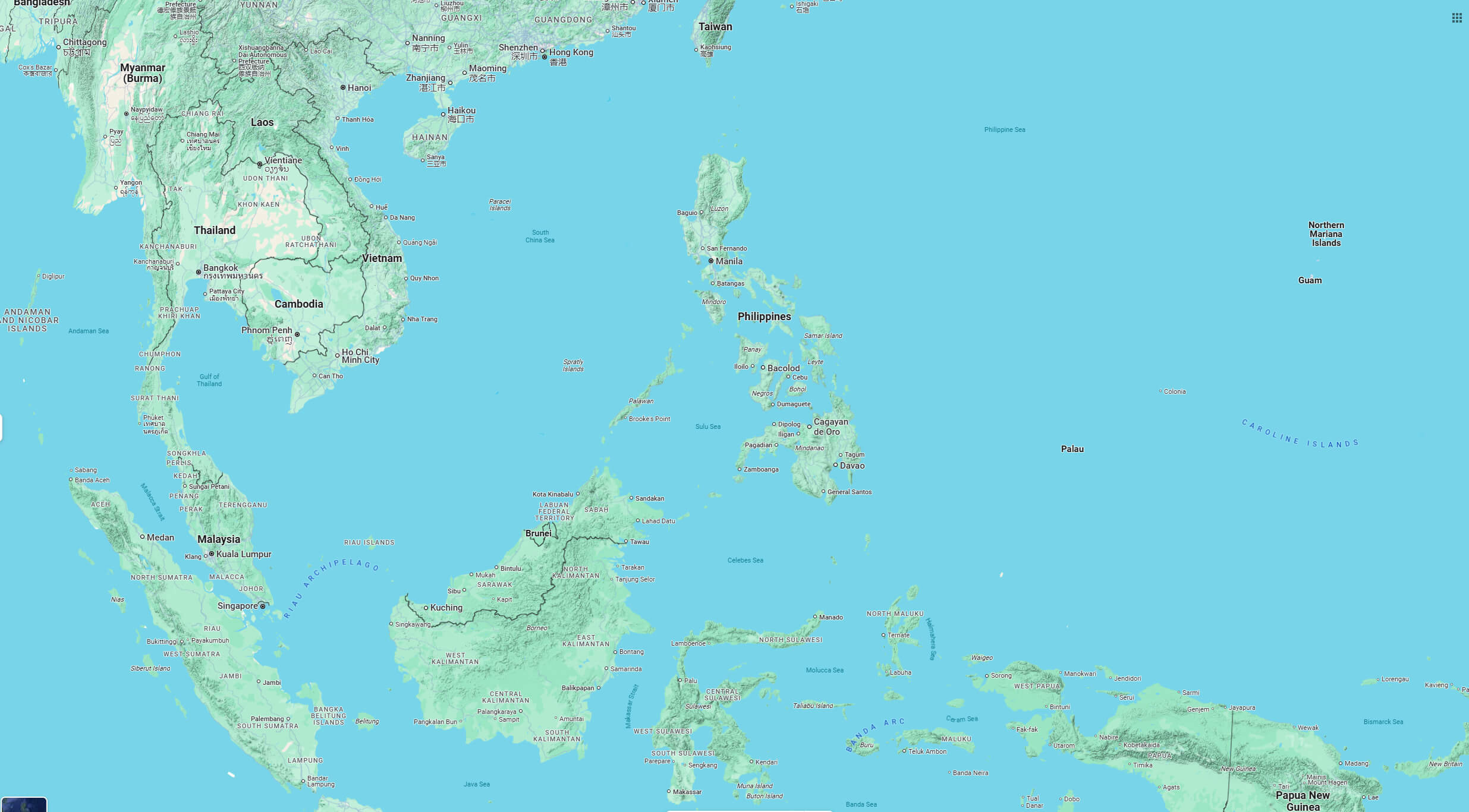
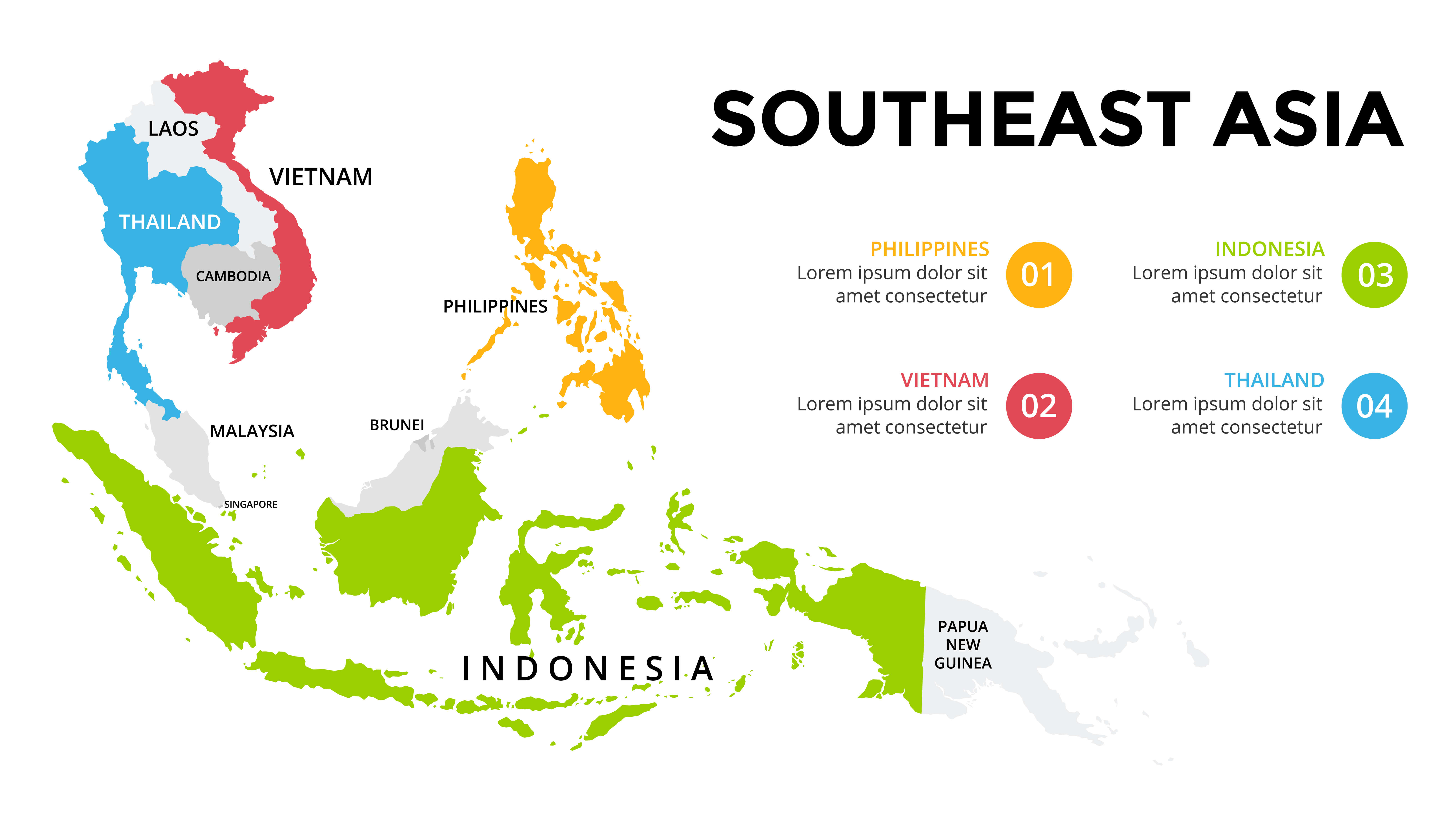 Map of the Philippines and Southeast Asia with highlighted countries.
Explore the Philippines and Southeast Asia map, which features countries such as Indonesia, Thailand, Vietnam, Malaysia and the Philippines. The map highlights major regions and nations in different colours, providing a visual representation of the geography and neighbouring countries of the Southeast Asia region.
Renowned for its cultural diversity, the Philippines is home to over 100 million people, ranking it as the 13th most populous country globally. The official languages are Filipino and English, reflecting a unique blend of indigenous, Asian, and Western cultural influences. The nation’s economy is largely supported by agriculture, manufacturing, services, and a significant overseas workforce.
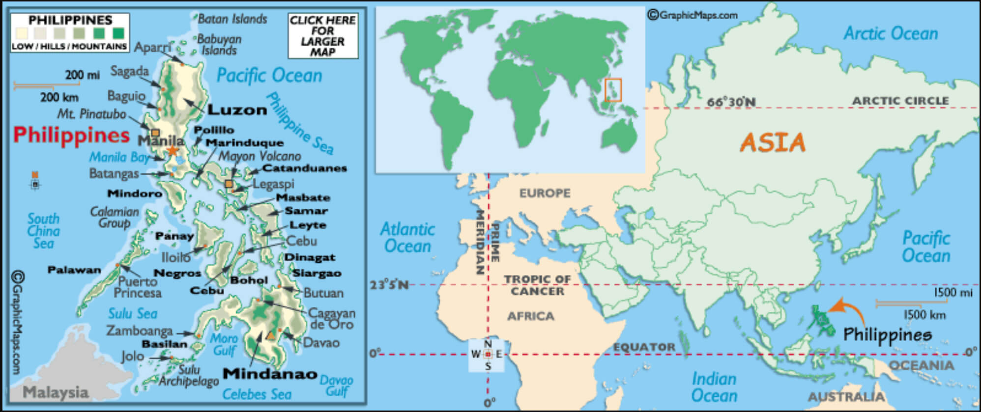
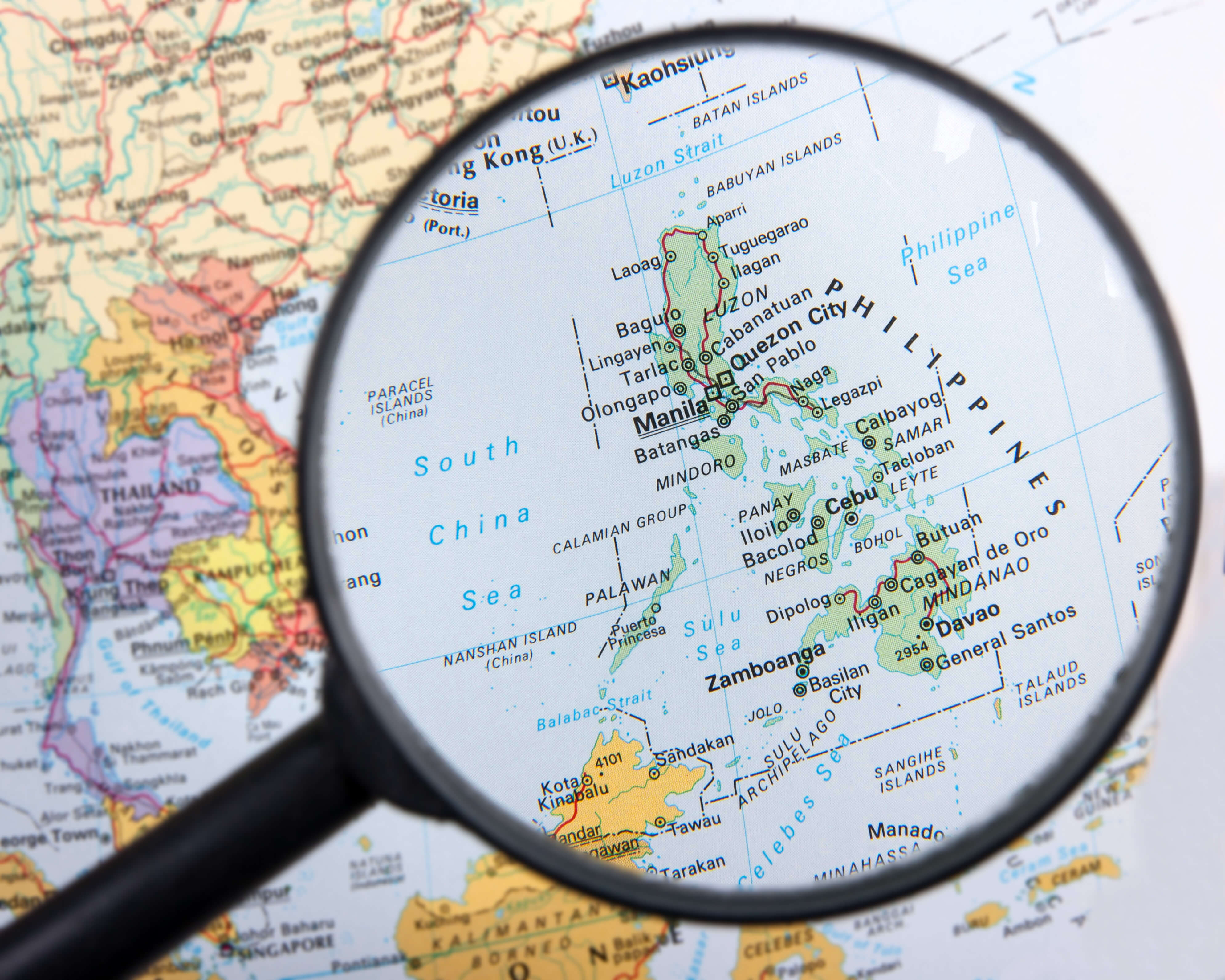
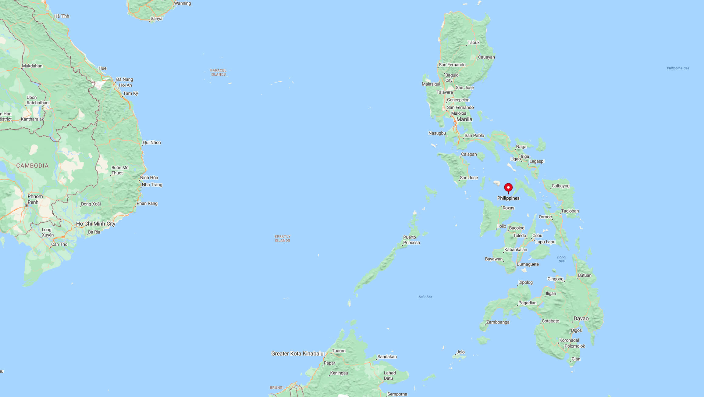
Where is located Philippines on the World Map
The Philippines is situated in Southeast Asia, in the western Pacific Ocean. It is an archipelago comprising more than 7,600 islands, positioned between the Philippine Sea to the east, the South China Sea to the west, and the Celebes Sea to the south. Its maritime neighbors include Taiwan to the north, Vietnam to the west, and Indonesia to the south.
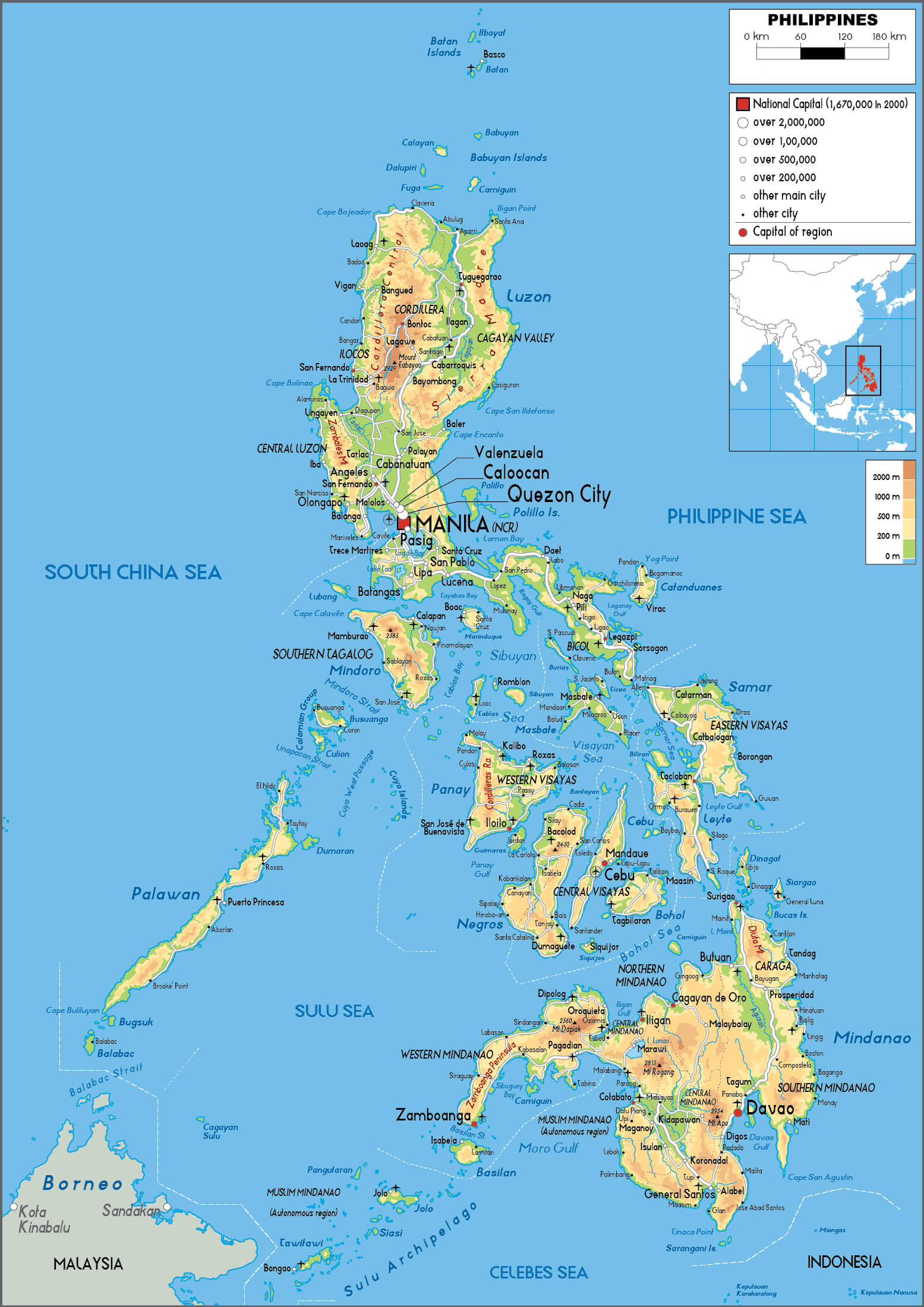
Philippines political map

Located just above the equator, the Philippines lies within the tropical region, giving it a warm and humid climate year-round. The country is part of the Pacific Ring of Fire, making it susceptible to earthquakes and volcanic activity. However, this also contributes to its fertile soil and breathtaking natural landscapes.
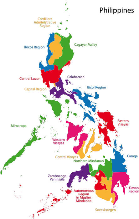
Philippines administrative map

The Philippines’ strategic location at the crossroads of Asia’s major shipping routes has historically made it a significant trading hub and a cultural melting pot. This has resulted in a unique blend of influences from Asia, Europe, and the Americas.
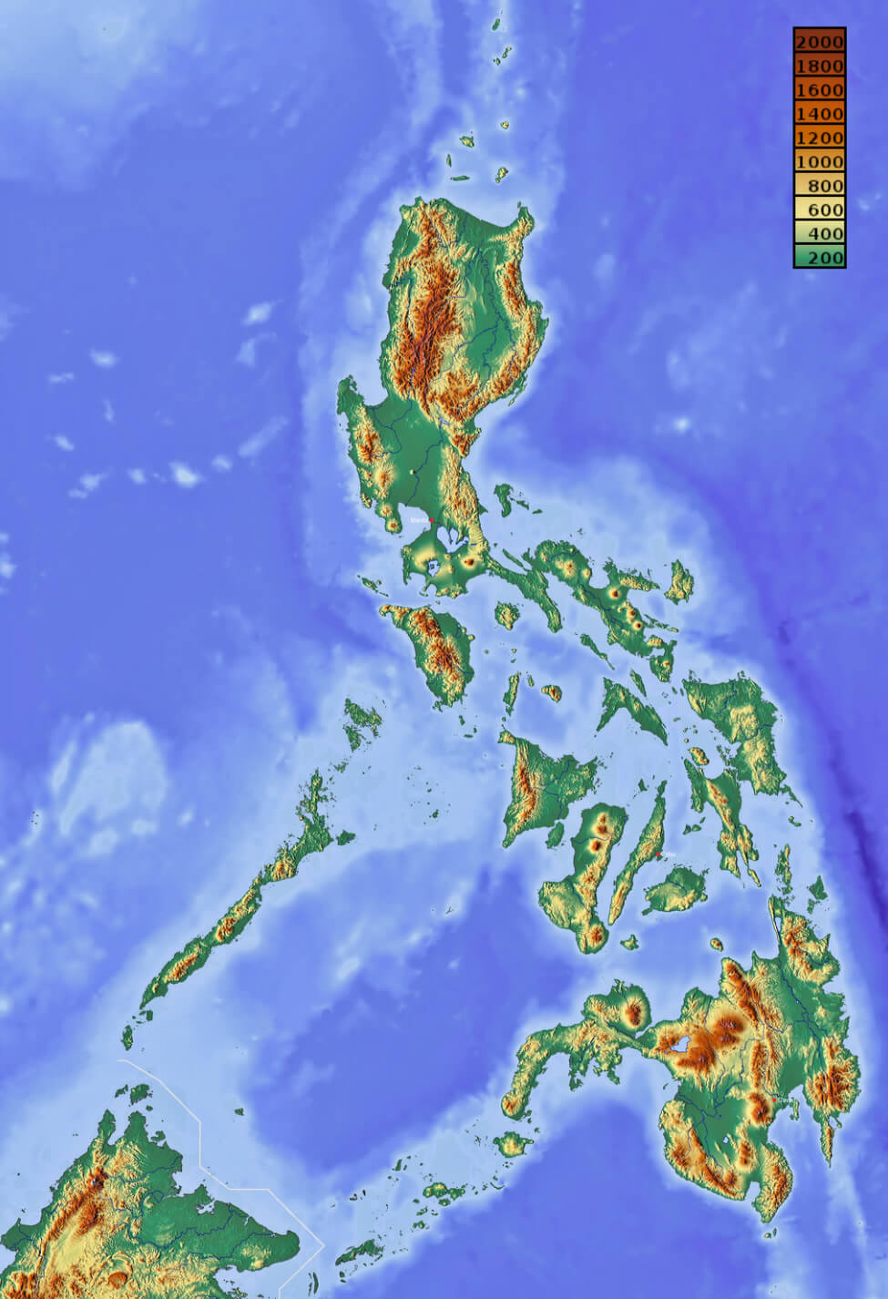
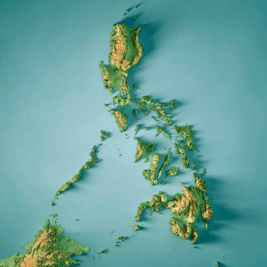
Philippines elevation map
Here are some statistical information about Philippines:
 Area: 300,000km2 (120,000 sq mi)
 Philippines ethnic groups map by province
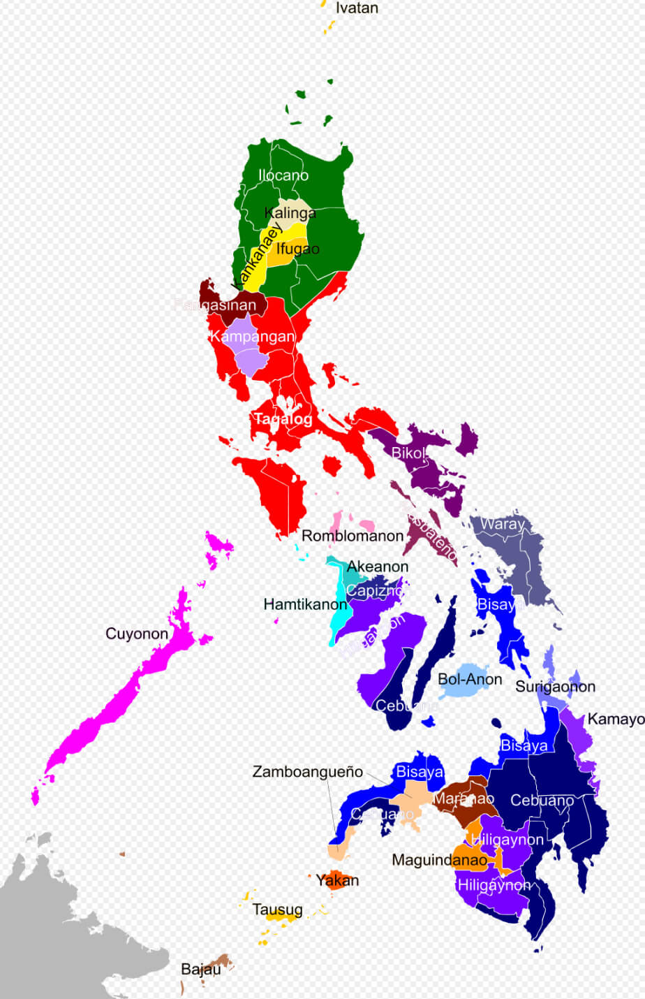 Religion: 85.3% Christianity 78.8% Catholicism 6.5% other Christian 6.4% Islam 8.2% other / none.
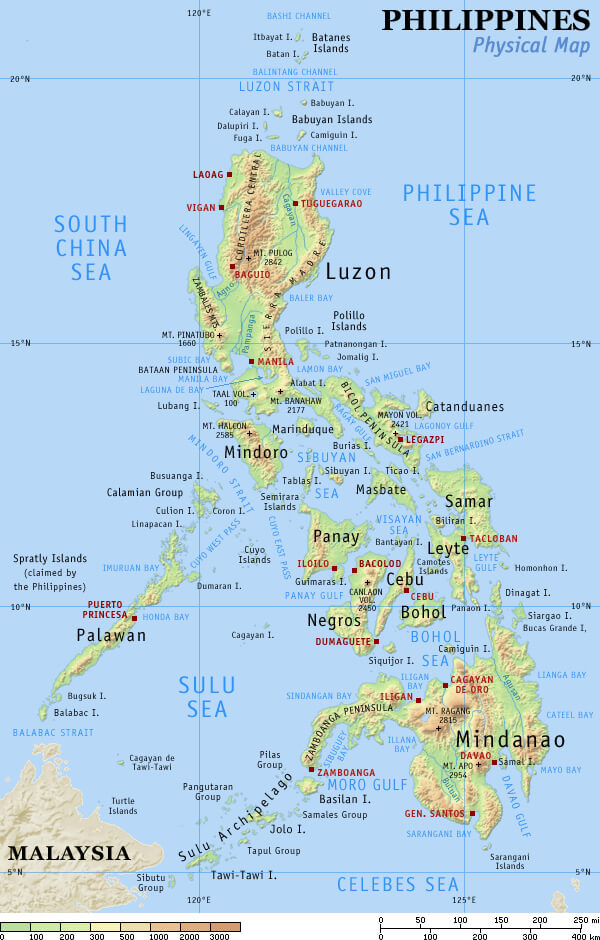
 Philippines physical map with cities
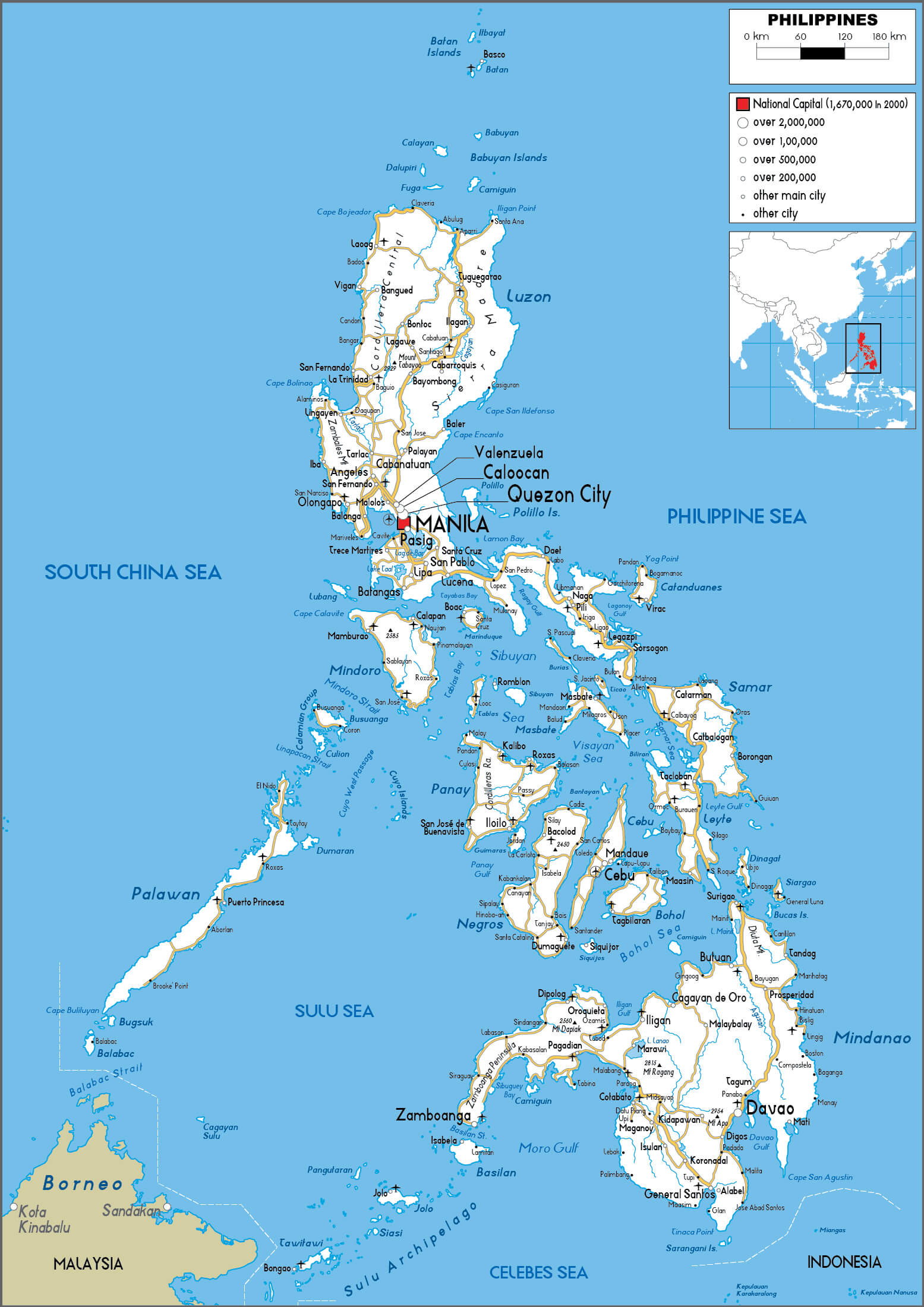
Philippines road map
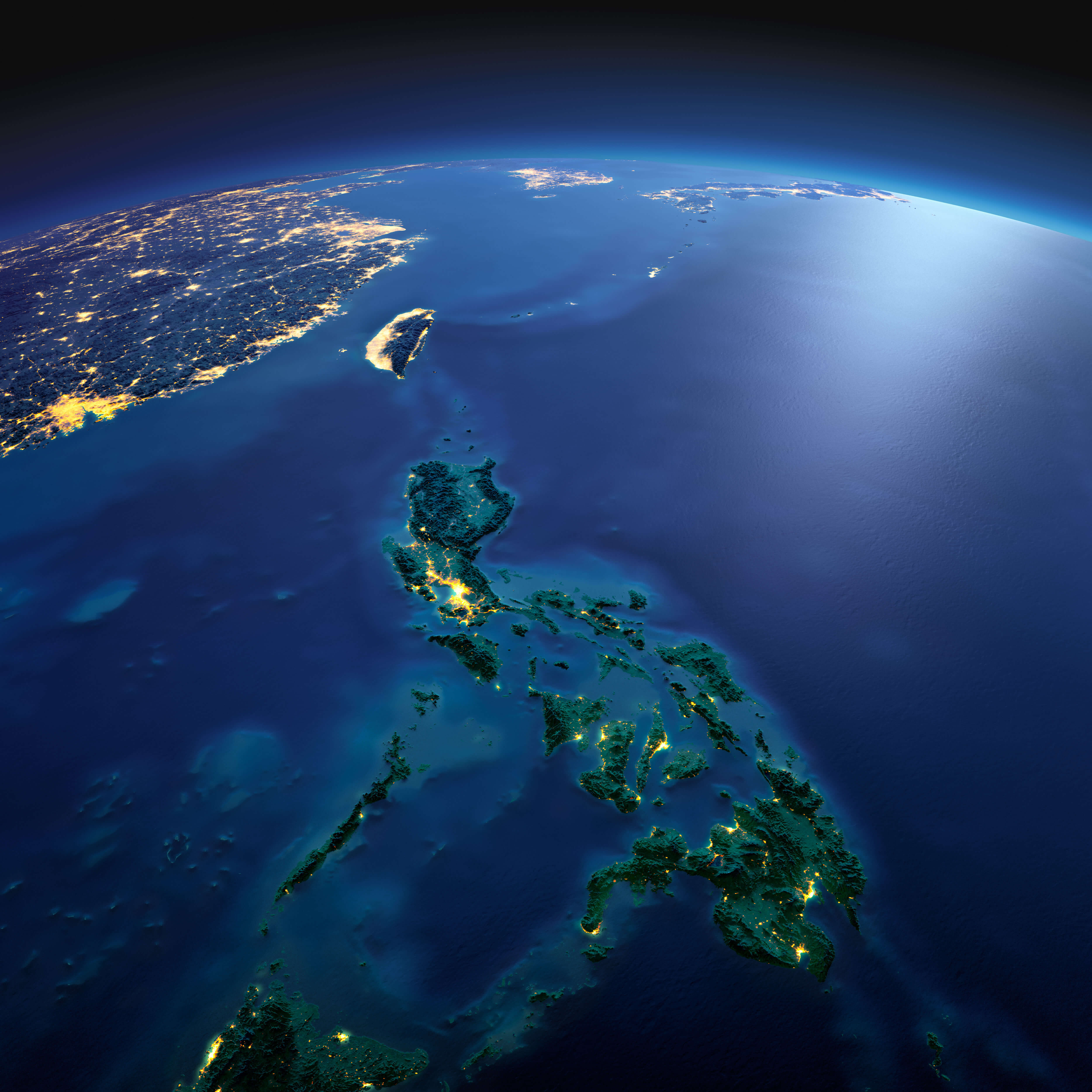
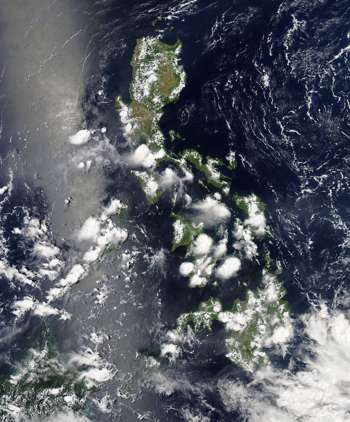
Philippines satellite map
Philippines terrain map
Philippines topographic map
Map of Philippines
Philippines Location Map
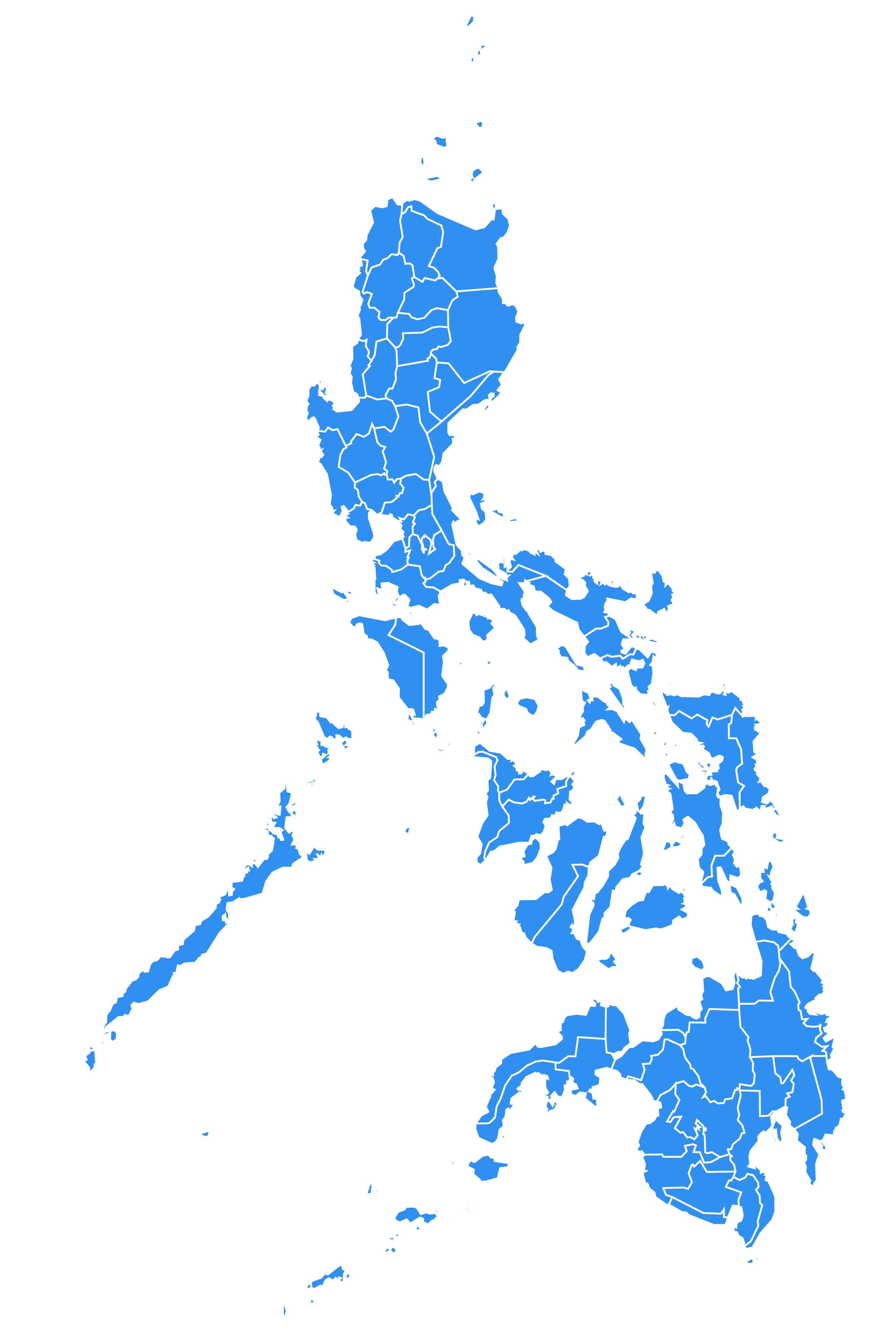
Blank Philippines Map

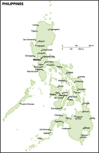
Major Cities Map of Philippines
Philippines Cities Map
 Philippines cities map highlighting major urban areas.
This map illustrates the key cities across the Philippines, showcasing their geographic distribution from Luzon to Mindanao. It highlights the country’s diverse urban centers along coastlines and inland regions.
Manila Map Philippines
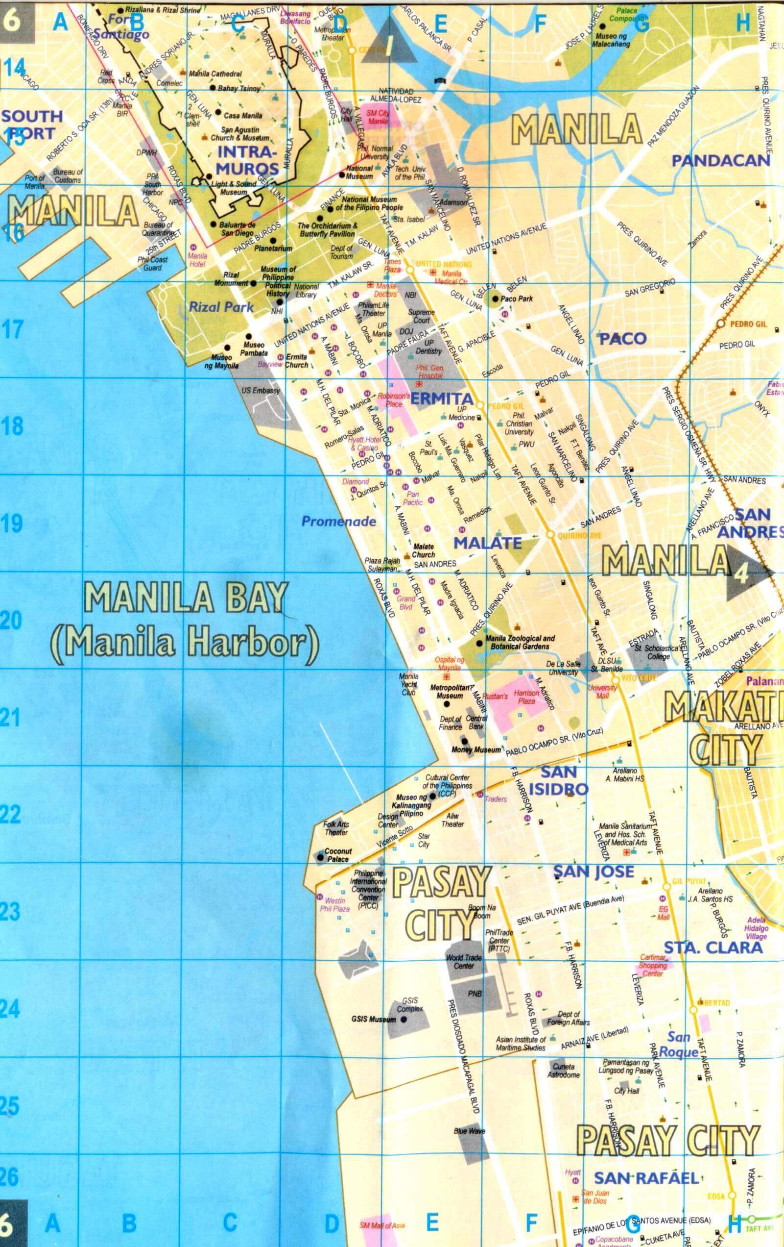 Manila Bay map showing landmarks, Intramuros, and Pasay City.
This map highlights Manila Bay, Intramuros, and nearby areas such as Pasay City. It features key attractions like Rizal Park, Manila Zoo, and the Cultural Center of the Philippines. Perfect for exploring the city’s historical and cultural sites.
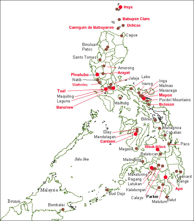
Map of Philippines Volcanoes
Philippines Land Map
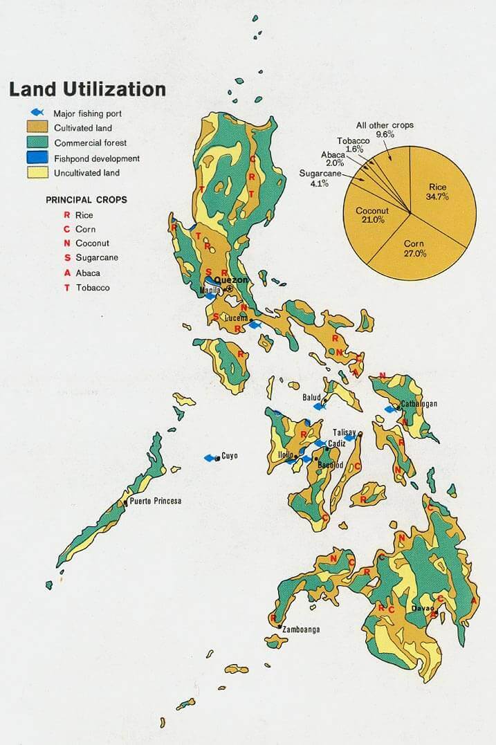 Map of the Philippines showing land use, crops, and fishing areas.
This map highlights the Philippines’ land utilization, including cultivated areas, forests, fishponds, and key crops like rice, corn, and coconut. Major fishing ports and crop distributions are also marked.
Philippines Airport Map
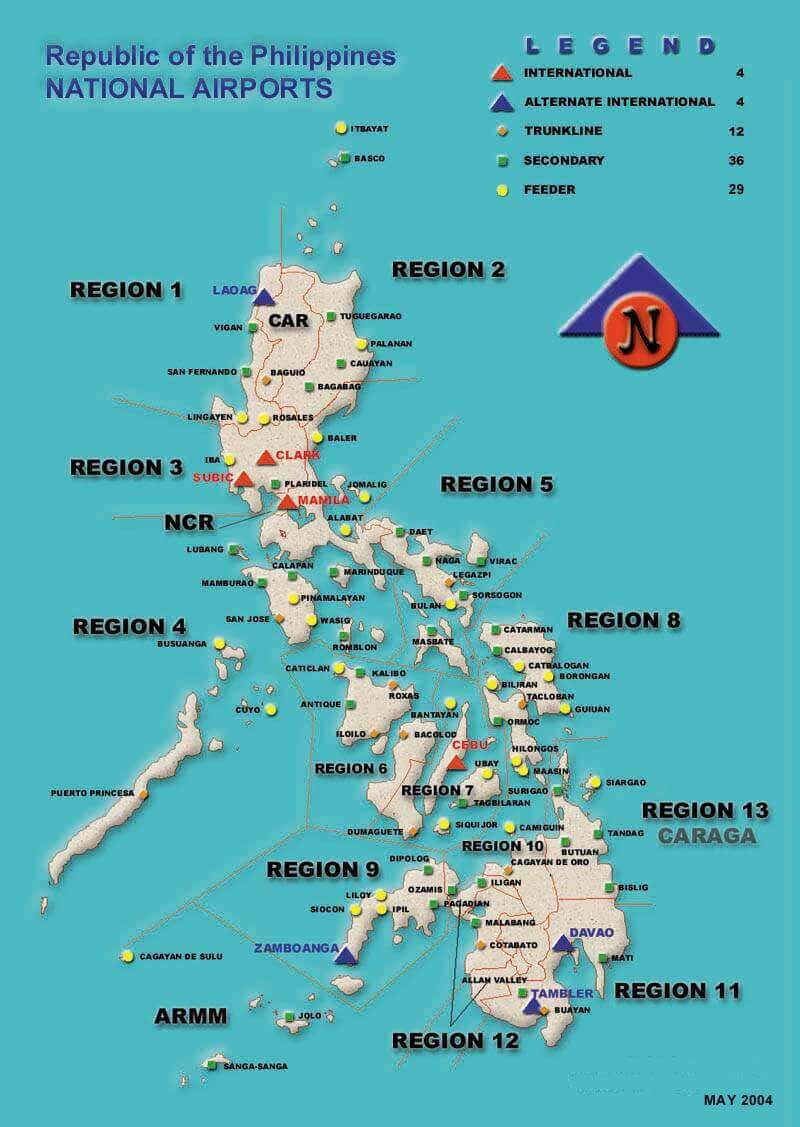 Philippines airport map showing regions and airport types.
This map displays the distribution of airports across the Philippines by region, highlighting international, alternate international, trunkline, secondary, and feeder airports. Useful for understanding the country’s air connectivity.
Diving in Philippines
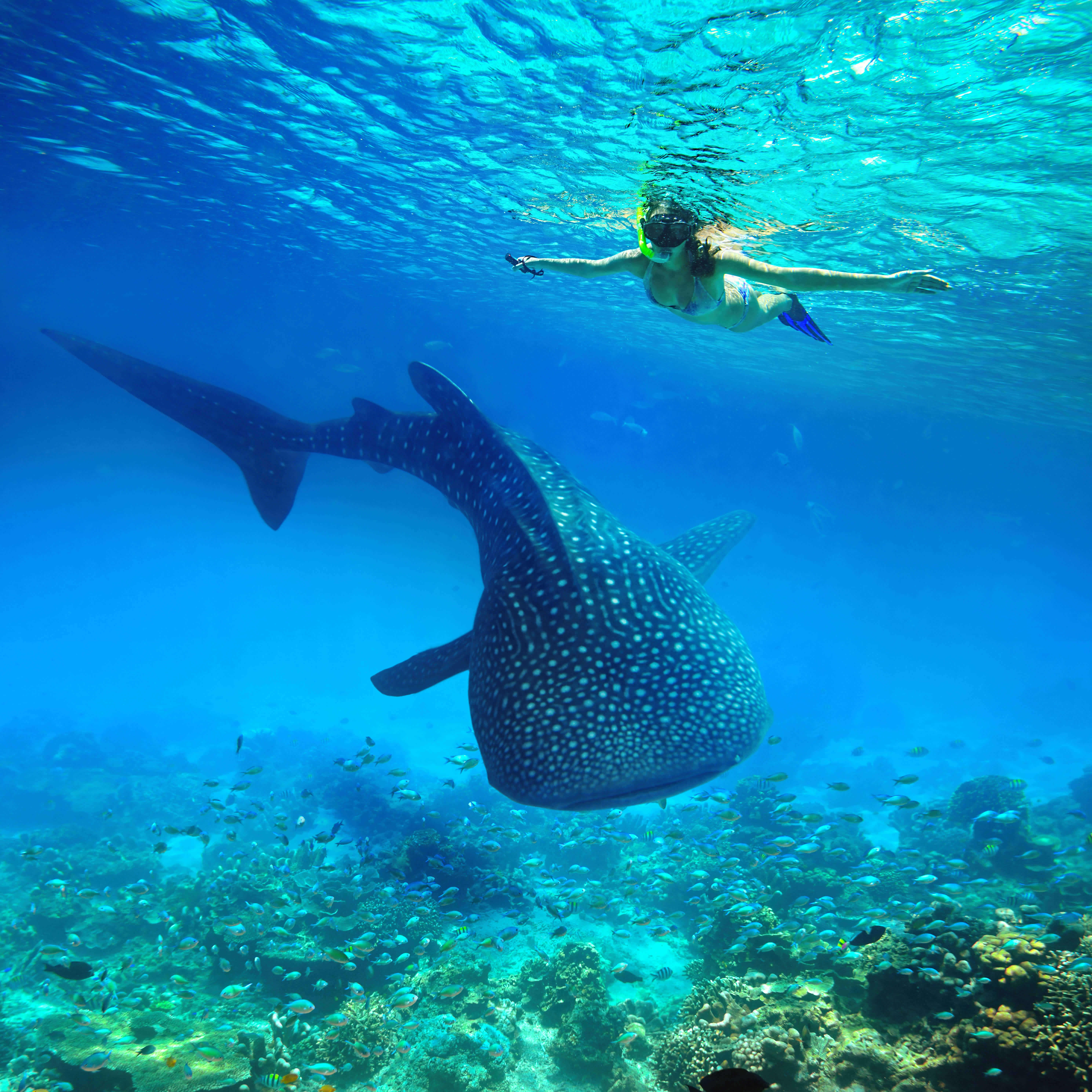
Philippines Diving Map
 Philippines map highlighting scuba diving locations and seas.
This map shows the Philippines’ major scuba diving spots, including El Nido, Coron, and Tubbataha Reefs. Surrounding waters like the South China Sea, Sulu Sea, and Pacific Ocean are marked for diving exploration.
Philippines maps
Blank map of Philippines
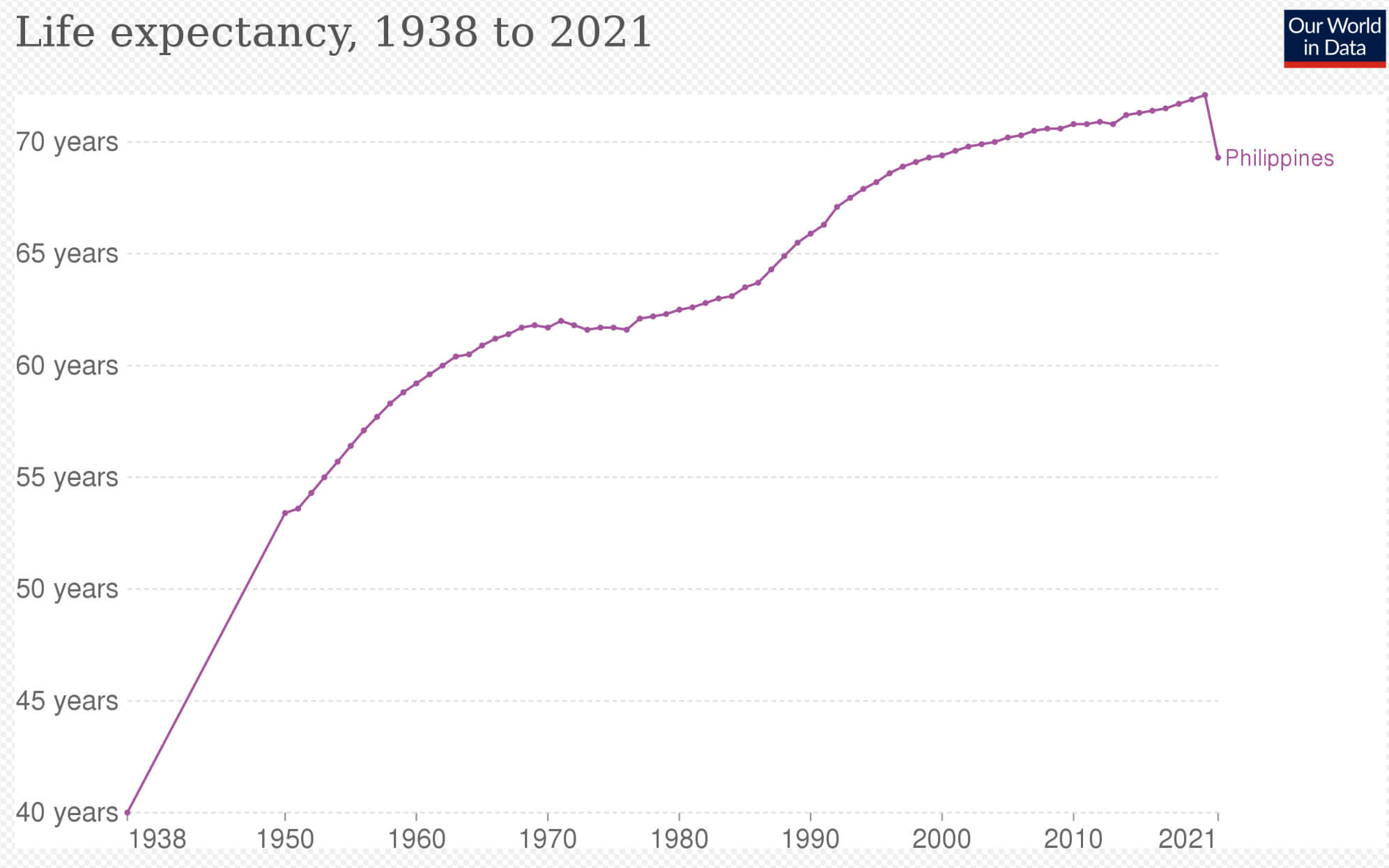
Life expectancy in Philippines
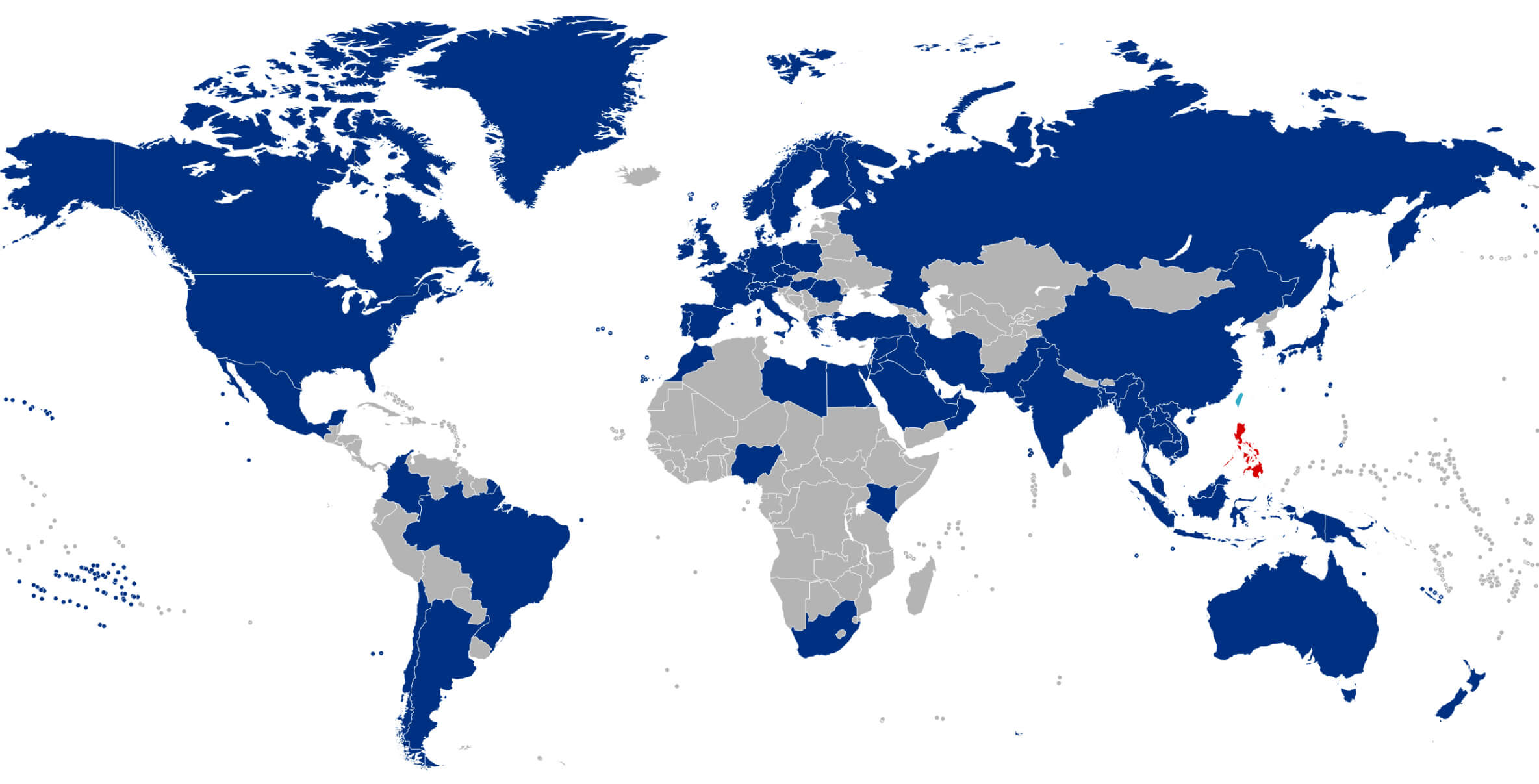
Philippine diplomatic missions worldwide map
Philippines airport map
Philippines and manila map
Philippines blank map

Philippines info map
Philippines international boundary map
Philippines location map in the world
Philippines major cities map
Philippines map from space
Philippines map with cities
Philippines map with far east
Philippines map with manila
Philippines map with seas
Philippines map
Philippines physical map
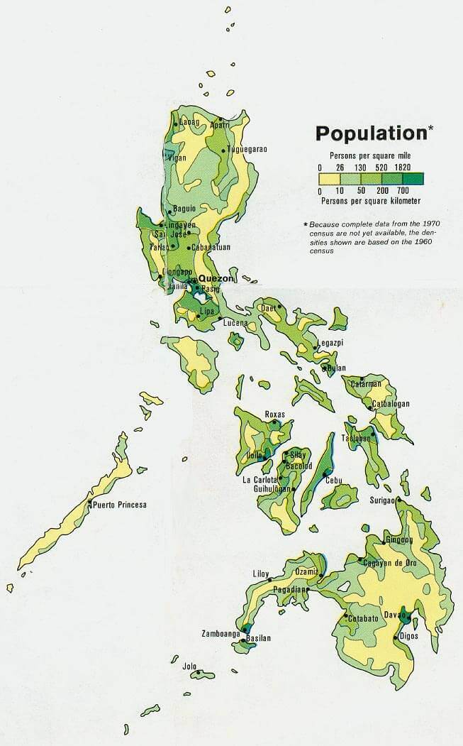
Philippines population map
Philippines regions and provinces map
Philippines volcanoes map
Physical map of Philippines
Political map of Philippines
Where is Philippines on the Asia Map?
Show Google interactive map, satellite map, where is the country located.
Get directions by driving, walking, bicycling, public transportation, and traveling with street view.
Feel free to explore these pages as well:
- China Map ↗️
- Indonesia Map ↗️
- Vietnam Map ↗️
- Brunei Map ↗️
- Malaysia Maps ↗️
- Where is Taiwan in the World and A Collection of Taiwan Maps ↗️
- Japan Map ↗️
- North Korea Map ↗️
- South Korea Map ↗️
- Asia Maps ↗️