Explore political, physical and satellite maps of Cambodia, featuring cities, rivers, topography, elevation, regional boundaries, population density, roadways and terrain. Discover Cambodia’s place in Asia and the world, along with its neighbours Thailand, Vietnam and Laos.
Cambodia Physical Map: Roads, Rivers, and Terrain
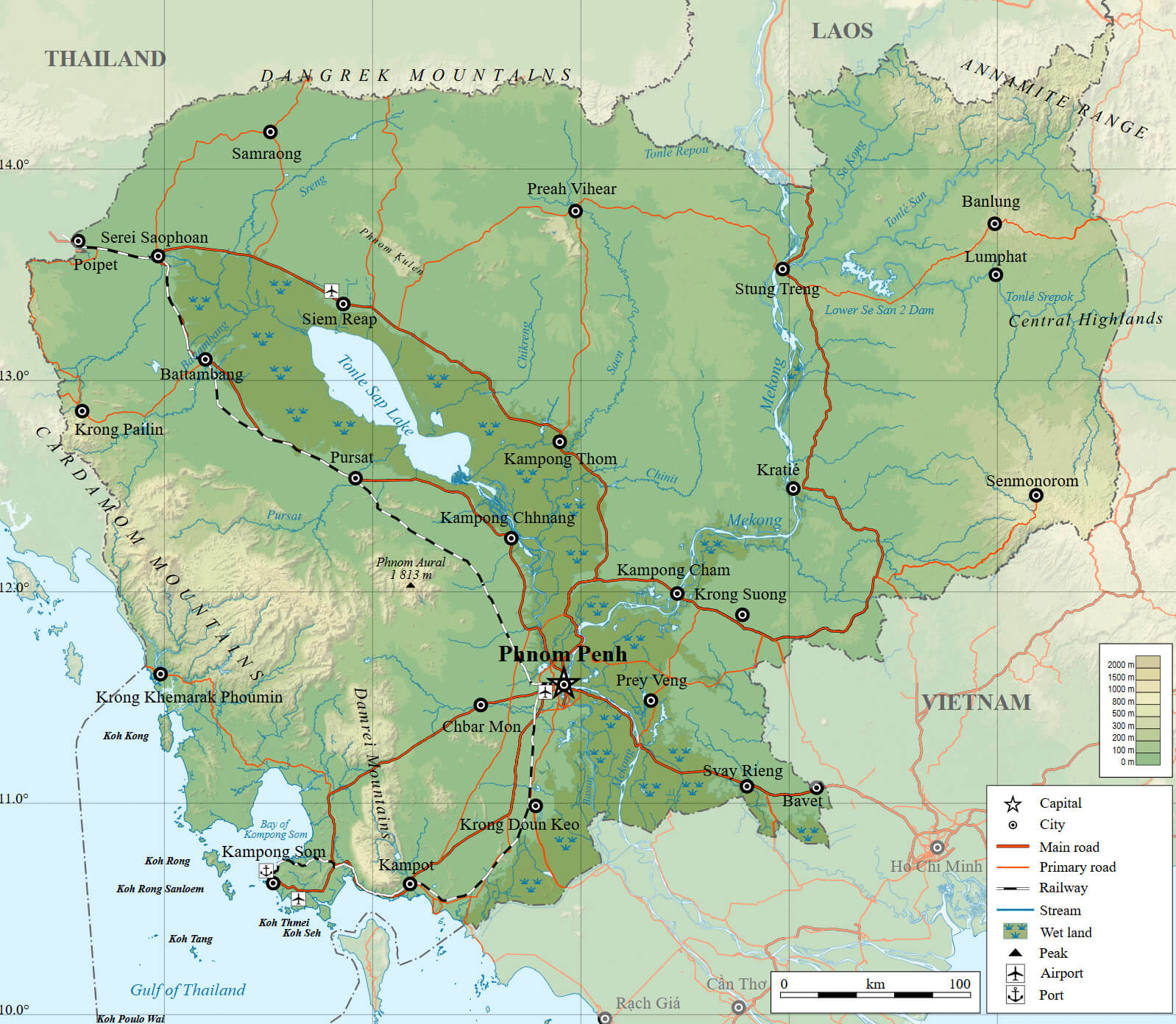 Cambodia physical map with roads, rivers, cities, and terrain features.
This physical map of Cambodia highlights its terrain, major roads, railways, and rivers, including the Mekong River and Tonle Sap Lake. Key cities like Phnom Penh, Siem Reap, and Battambang are marked. The map also showcases Cambodia’s mountainous regions, wetlands, and its location near Thailand, Vietnam, and Laos.
Cambodia Political Map: Provinces and Cities
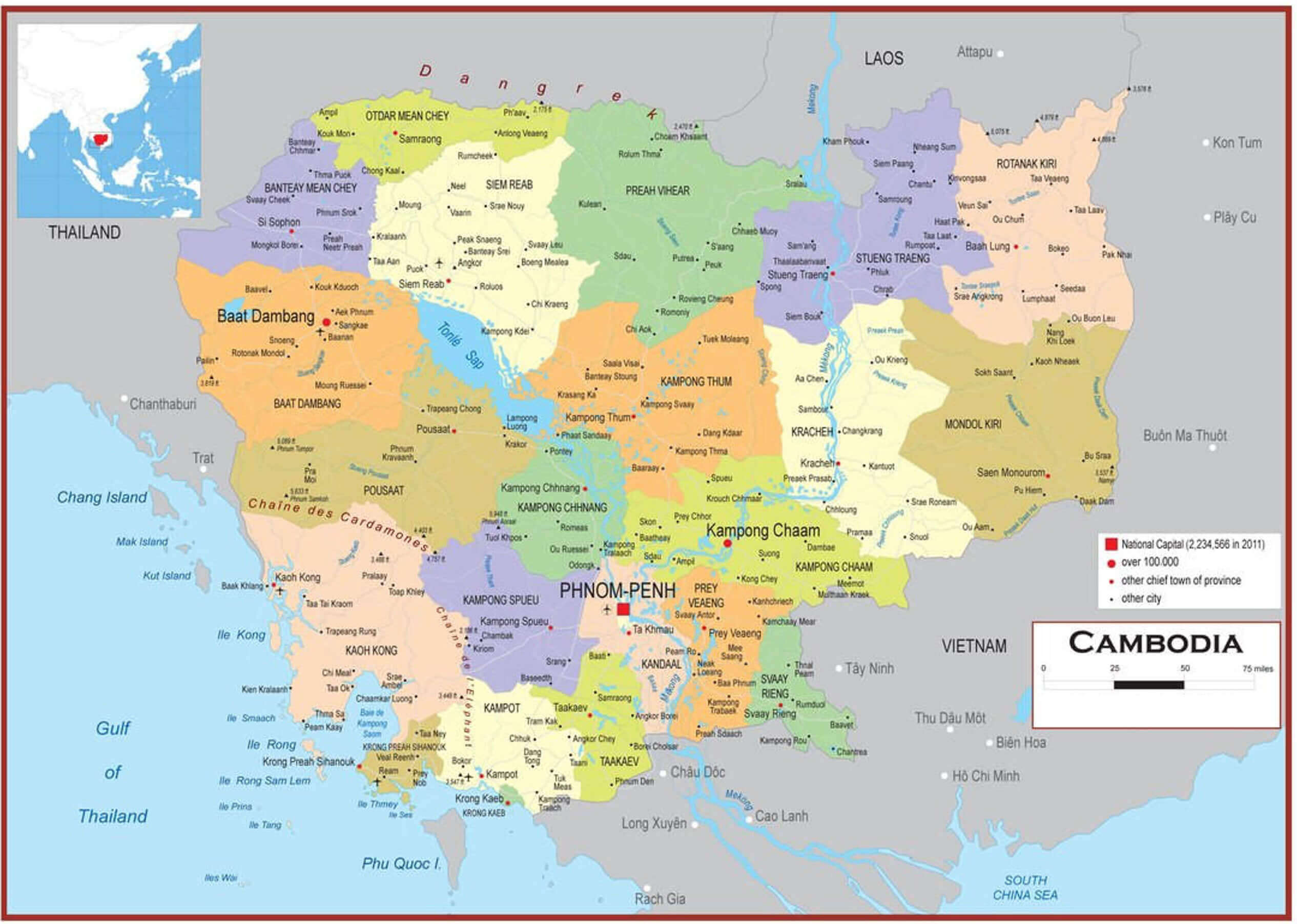 Cambodia political map with provinces, cities, and neighboring countries.
This political map of Cambodia shows the provinces, including Battambang, Siem Reap and Kampong Cham, and the capital Phnom Penh. It also shows major cities, provincial boundaries and neighbouring countries such as Thailand, Vietnam and Laos. The map provides a clear overview of Cambodia’s administrative divisions and geography.
Cambodia Map: Roads, Cities, and Rivers
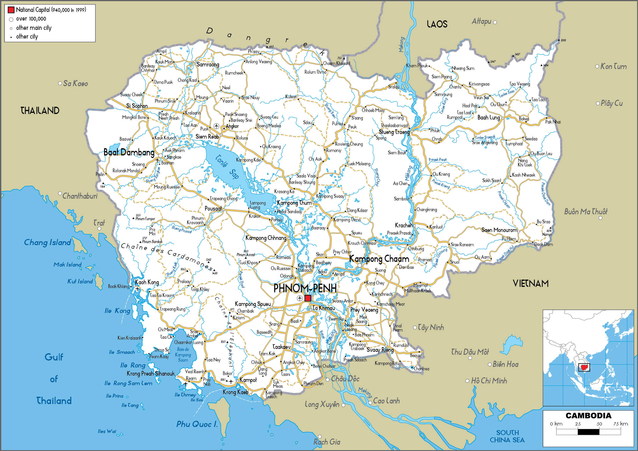
This map of Cambodia shows its road network, major cities such as Phnom Penh, Siem Reap and Battambang, and its extensive river system, including the Mekong and Tonle Sap rivers. It also shows neighbouring countries – Thailand, Vietnam and Laos – and Cambodia’s location on the Gulf of Thailand.
Brief information about Cambodia
Located in Southeast Asia, Cambodia is a country known for its rich history, ancient temples and vibrant culture. The capital, Phnom Penh, lies at the confluence of the Mekong and Tonle Sap rivers and is the political and cultural centre of the country. Cambodia’s most famous landmark is Angkor Wat, a massive temple complex near Siem Reap that stands as a testament to the grandeur of the ancient Khmer Empire.
Cambodia Map: Provincial Boundaries and Major Cities
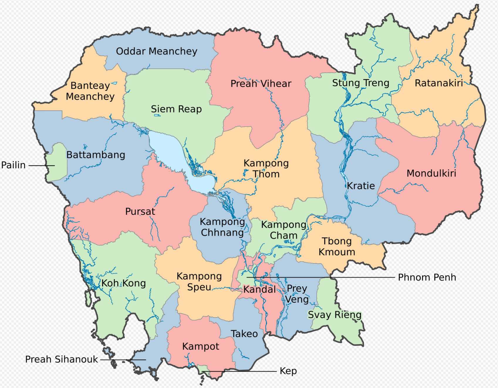 Map of Cambodia showing provincial boundaries and major cities.
This map of Cambodia highlights its provincial boundaries, including major provinces such as Siem Reap, Battambang, and Kampong Cham. It also marks key cities, rivers, and geographical features. The map provides an overview of Cambodia’s administrative divisions and its central location in Southeast Asia.
The country has faced significant historical challenges, including the Khmer Rouge regime in the 1970s, but has since embarked on a path of recovery and growth. Today, Cambodia is a popular tourist destination known for its beautiful landscapes, from rice paddies to tropical beaches, and its warm, welcoming people. The official religion is Theravada Buddhism, which influences many of the country’s customs and traditions.
Where is located Cambodia on the World Map
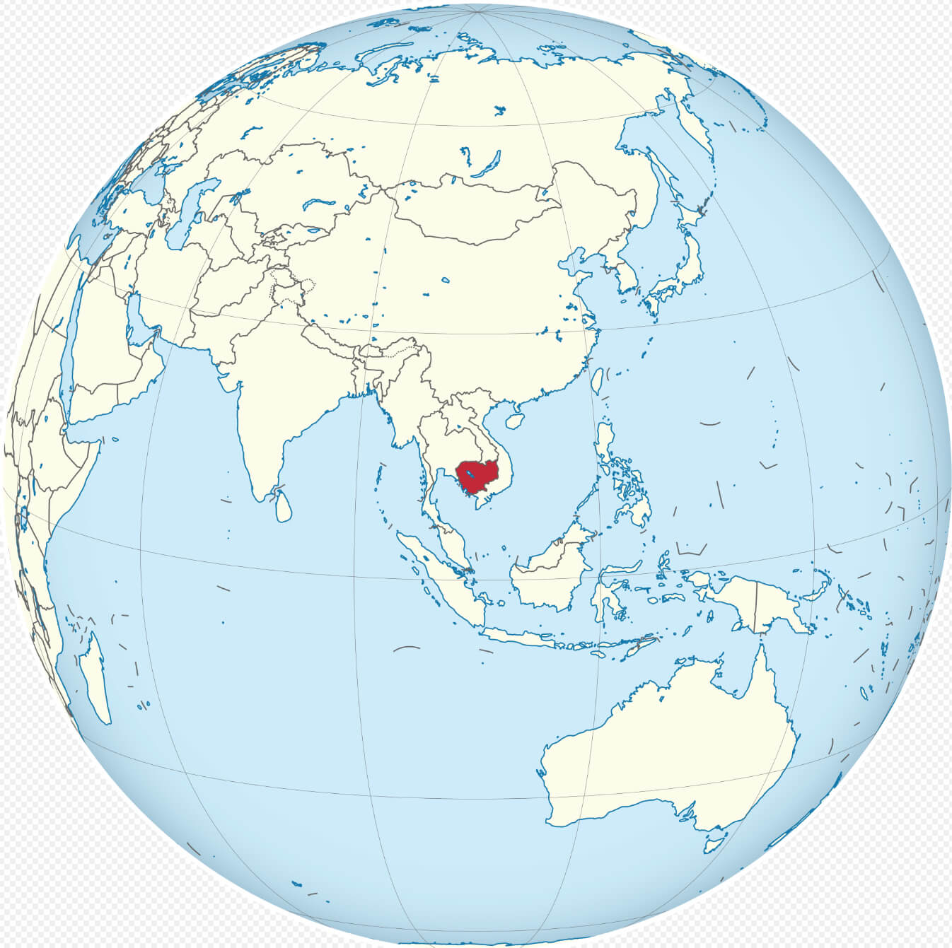 Where is located Cambodia on the World Map
Cambodia is located in Southeast Asia, bordered by Thailand to the west and northwest, Laos to the north, Vietnam to the east and southeast, and the Gulf of Thailand to the southwest. Its geographical position places it at the heart of the Indochinese Peninsula.
Cambodia Physical Map: Elevation and Natural Features
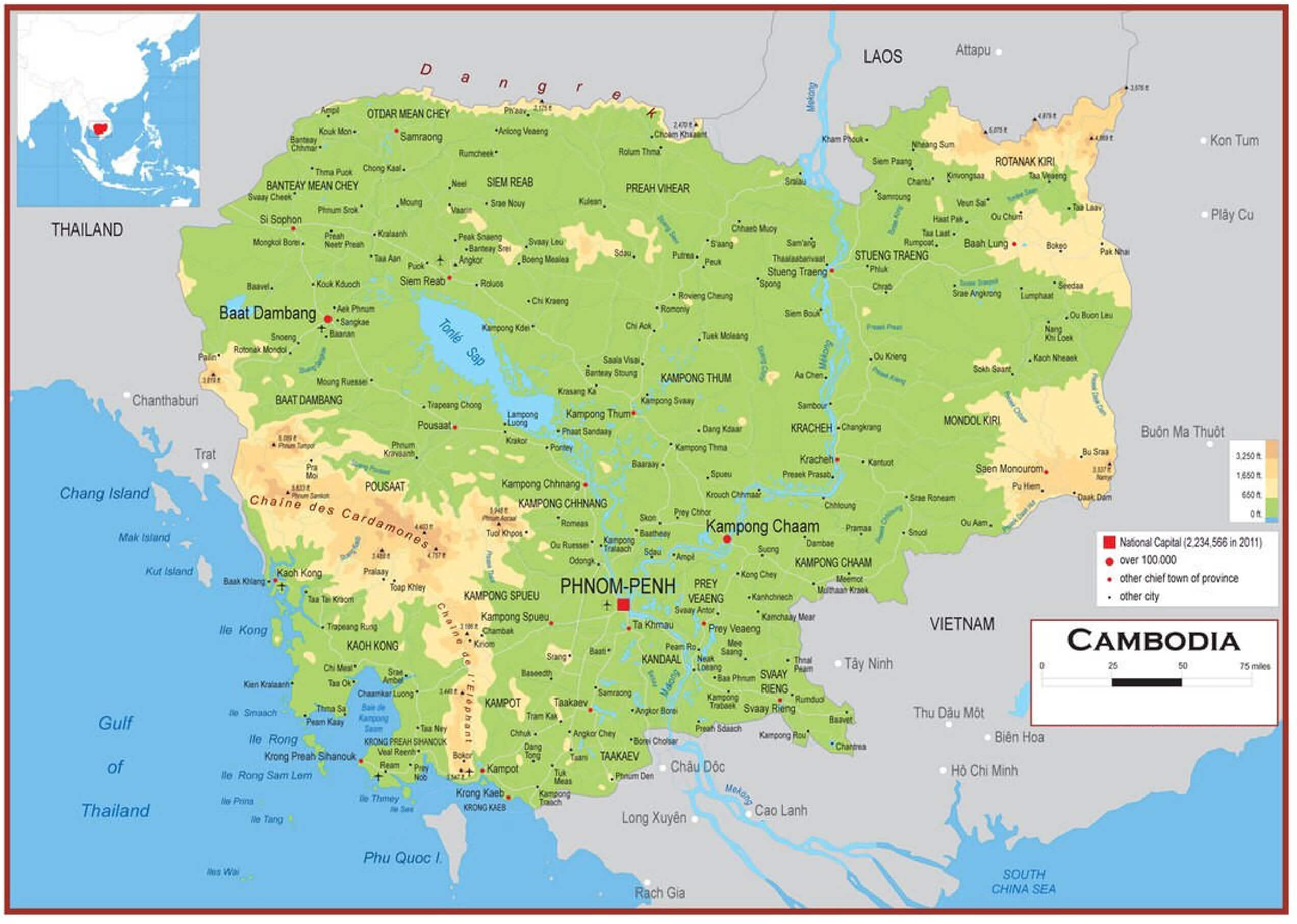
This physical map of Cambodia highlights its elevation levels, terrain, and natural features, including the Cardamom Mountains and Tonle Sap Lake. Key cities like Phnom Penh, Siem Reap, and Battambang are marked, along with major rivers such as the Mekong. The map also showcases Cambodia’s proximity to Thailand, Laos, Vietnam, and the Gulf of Thailand.
On the world map, Cambodia is located just south of the Tropic of Cancer, in a tropical region characterised by monsoon seasons. Its location makes it accessible from major cities in Southeast Asia such as Bangkok, Ho Chi Minh City and Hanoi. The Mekong River flows through Cambodia, providing vital resources for agriculture and transport, and contributing to the fertility of the region’s central plains.
Cambodia’s position between larger countries has influenced its culture, history and economy, making it a unique blend of Southeast Asian traditions with influences from neighbouring nations. It is famous for the Angkor Wat temple complex, which attracts visitors from around the world and is a testament to Cambodia’s historical importance.
Cambodia Road Map: Highways, Cities, and Key Landmarks
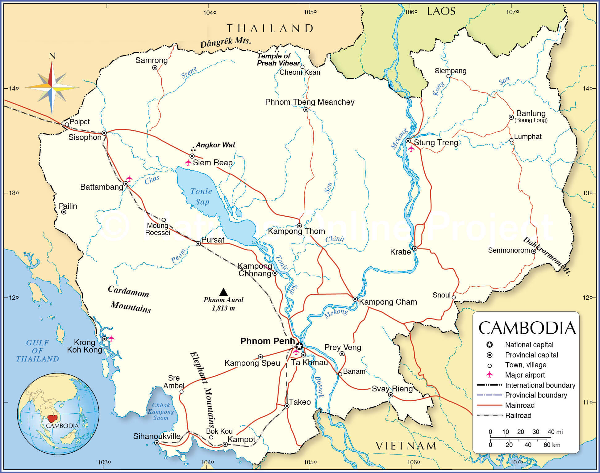 Cambodia road map showing highways, cities, rivers, and major landmarks.
This road map of Cambodia shows highways, railways and provincial boundaries. Major cities such as Phnom Penh, Siem Reap and Battambang are marked, along with major rivers such as the Mekong and Tonle Sap. The map also shows landmarks such as Angkor Wat and mountain ranges, demonstrating Cambodia’s connectivity and geographical diversity.
Here are some statistical information about Cambodia:
 Area: 181,035 km2 (69,898 sq mi)
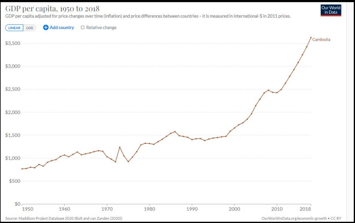
 Cambodia gdp per capita between 1950 and 2018
 Capital city: Phnom Penh
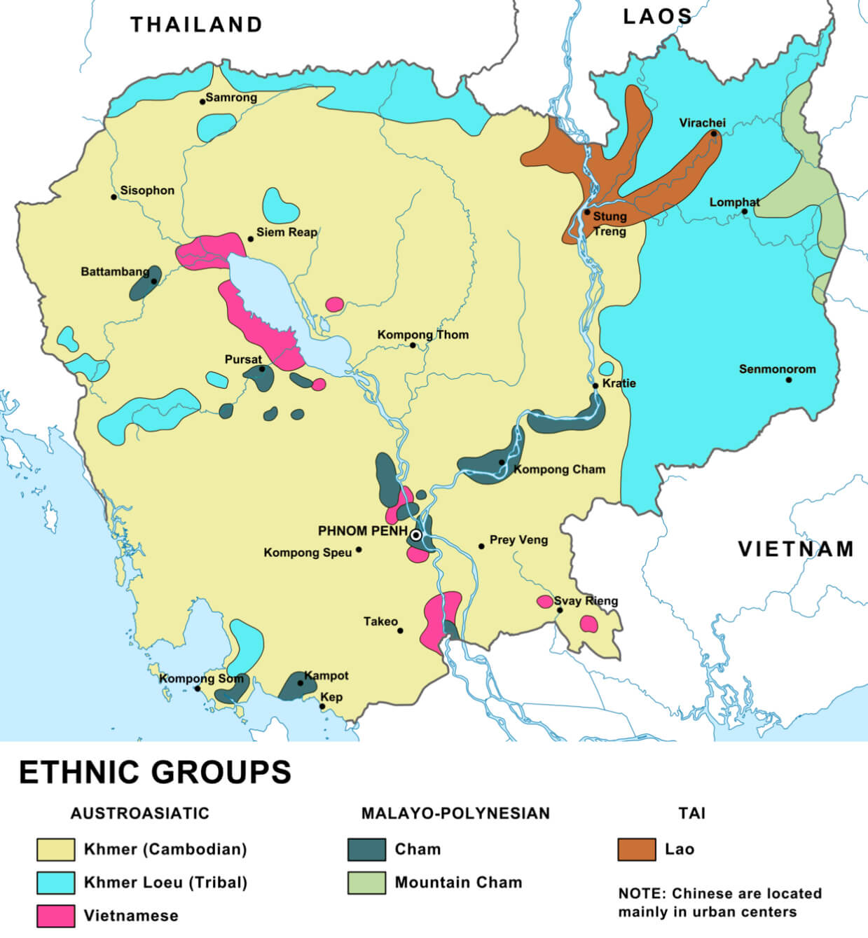
 Cambodia ethnic groups map
Cambodia Regions Map: Provinces and Locations
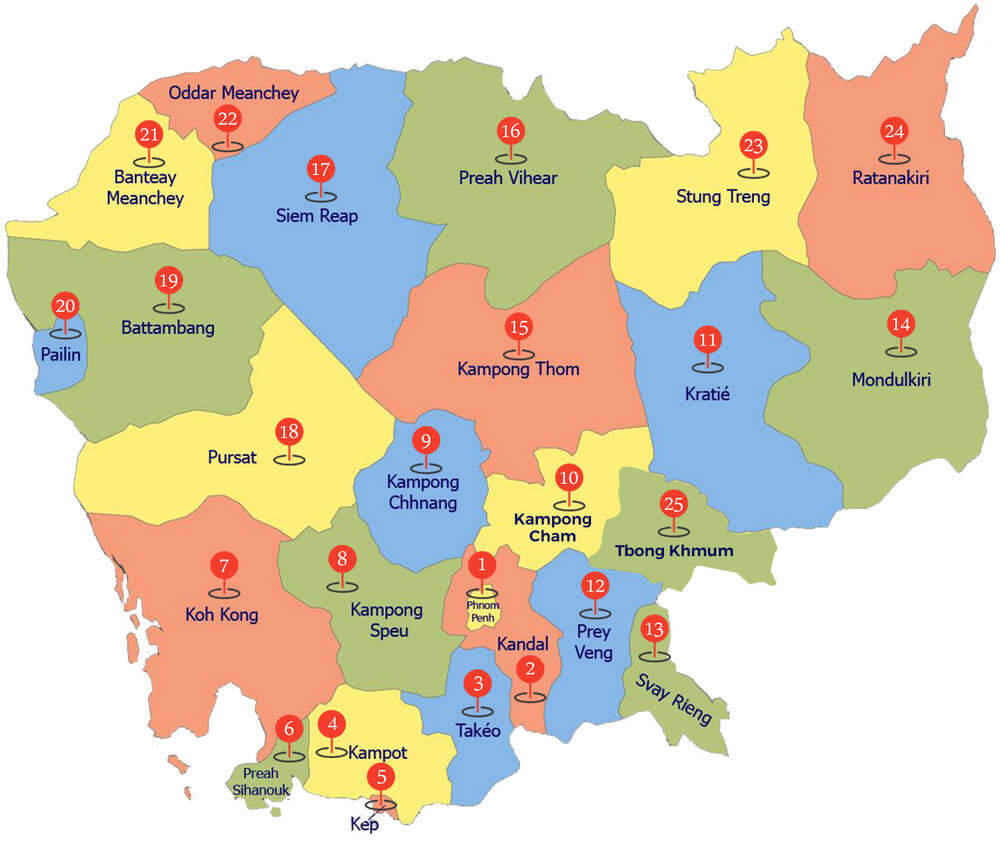 Map of Cambodia showing provinces and their regional divisions.
This map of Cambodia shows the 25 provinces, including Phnom Penh, Siem Reap and Battambang. Each province is marked with its number and location, providing an overview of Cambodia’s regional divisions. The map provides a clear representation of administrative areas and their location within the country.
Map of Cambodia
Cambodia Map
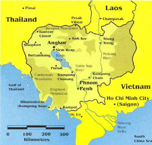 Map of Cambodia showing major cities, rivers, and borders
This map highlights Cambodia’s key cities, including Phnom Penh and Siem Reap, as well as its famous landmarks like Angkor. It shows Cambodia’s borders with Thailand, Laos, and Vietnam, along with the Gulf of Thailand to the southwest. Major rivers, including the Mekong, are also featured.
Cambodia Regional Map
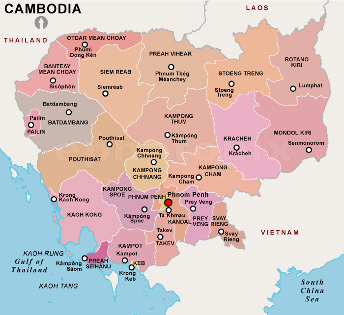 Map of Cambodia showing provinces, major cities, and borders
This map of Cambodia displays its provinces, including Phnom Penh, Siem Reap, and Kampot. Each province is highlighted in different colors, with neighboring countries Thailand, Laos, and Vietnam marked. The map also shows Cambodia’s coastline along the Gulf of Thailand to the southwest.
Cambodia City Map
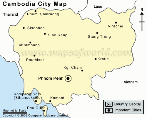
Map Cambodia
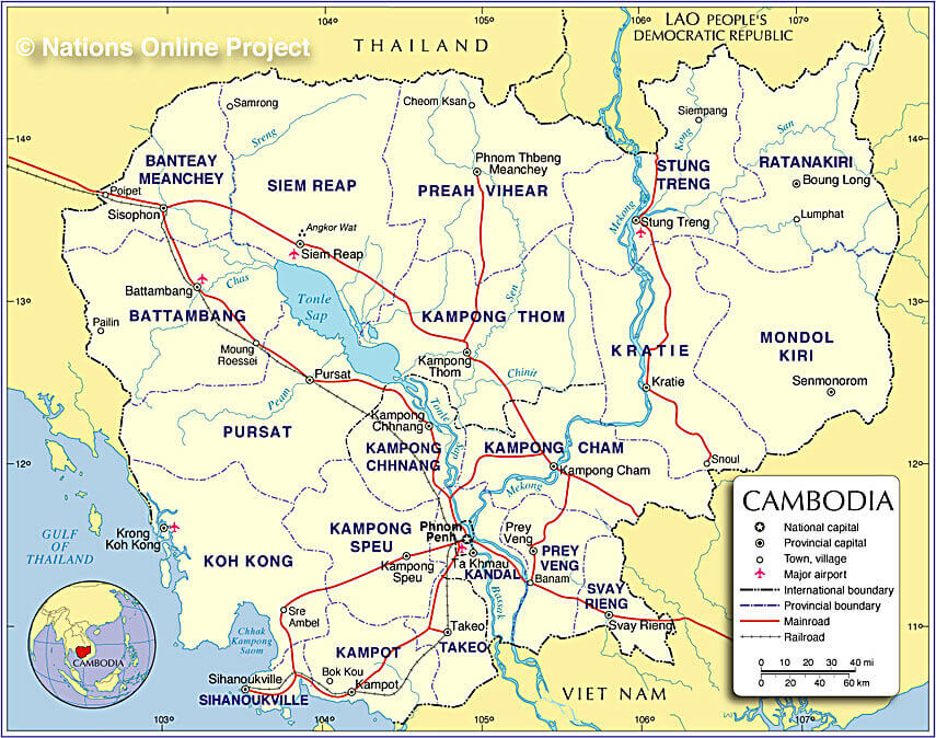 Map of Cambodia showing provinces, major cities, roads, and borders
This map of Cambodia outlines its provinces, key cities like Phnom Penh and Siem Reap, and significant roads and railways. Bordering countries Thailand, Laos, and Vietnam are marked, along with the Gulf of Thailand to the southwest. The map highlights Cambodia’s transportation network, with airports and major highways shown for easy navigation.
Maps of Cambodia
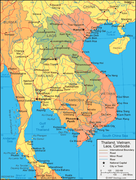
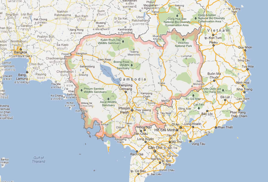 Map showing Thailand, Vietnam, Laos, and Cambodia with cities and borders
This regional map highlights Cambodia and its neighbors — Thailand, Vietnam, and Laos — along with major cities such as Phnom Penh, Bangkok, Hanoi, and Ho Chi Minh City. The map also shows rivers, roads, and international boundaries, providing a clear view of the transportation network and geographic layout in Southeast Asia.
Cambodia Earth Map
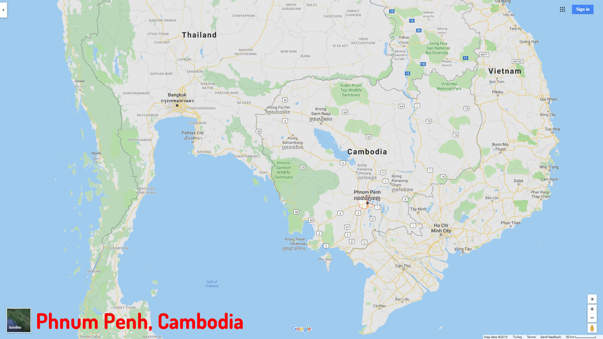
Phnum Penh map Cambodia
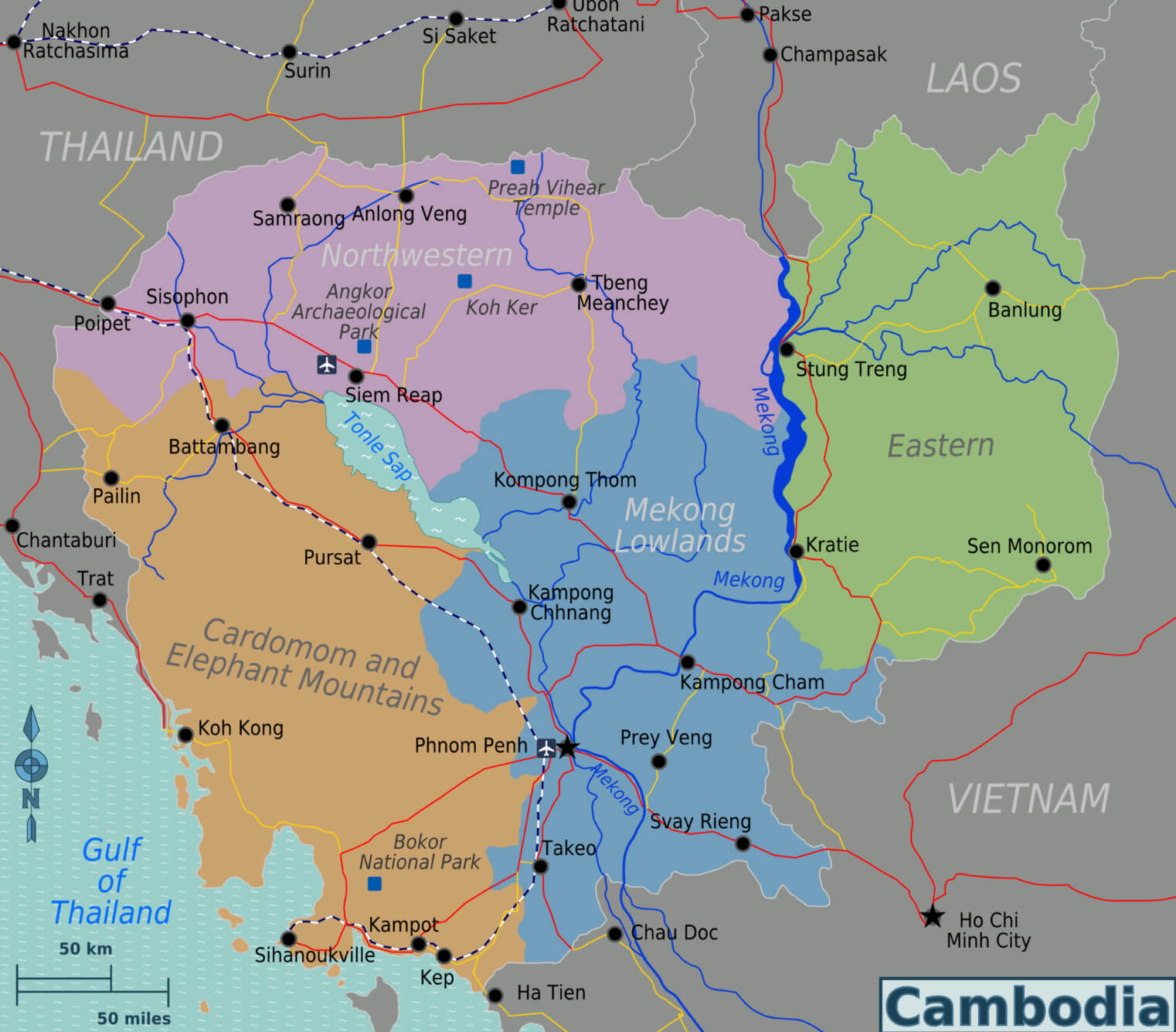
Regional map of Cambodia
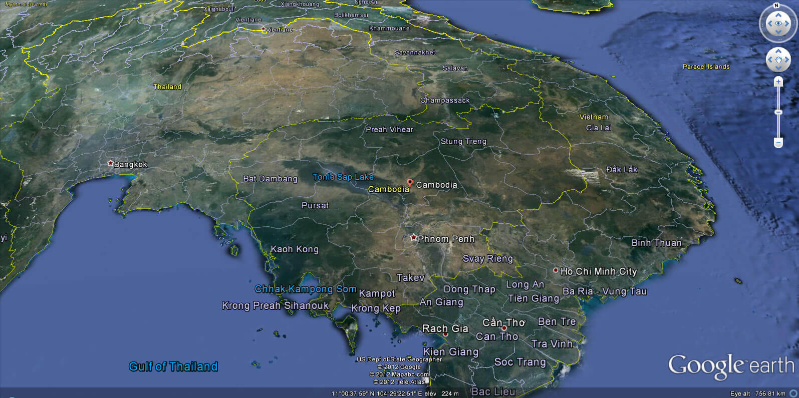
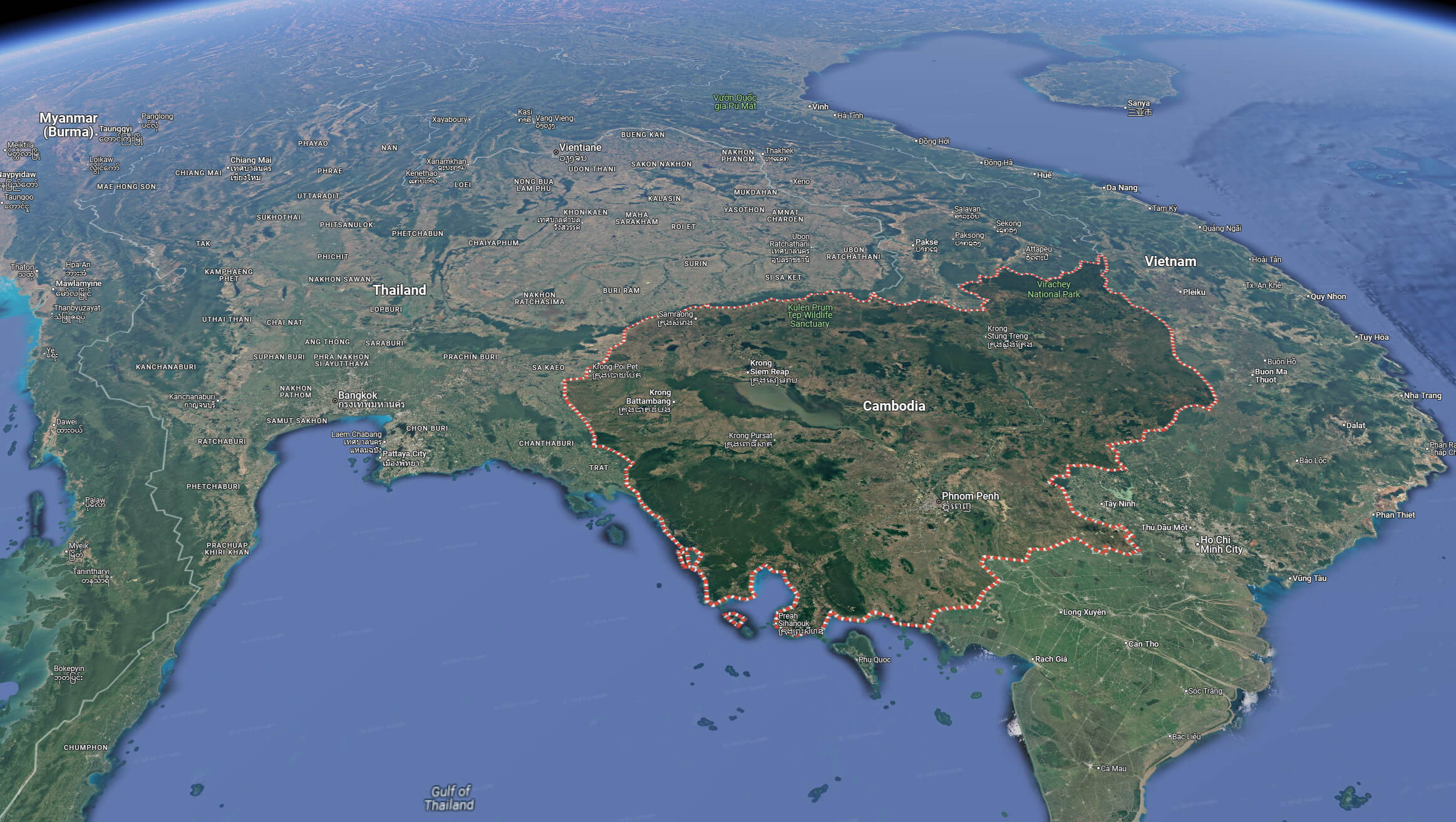
Cambodia satellite map
Cambodia cities map
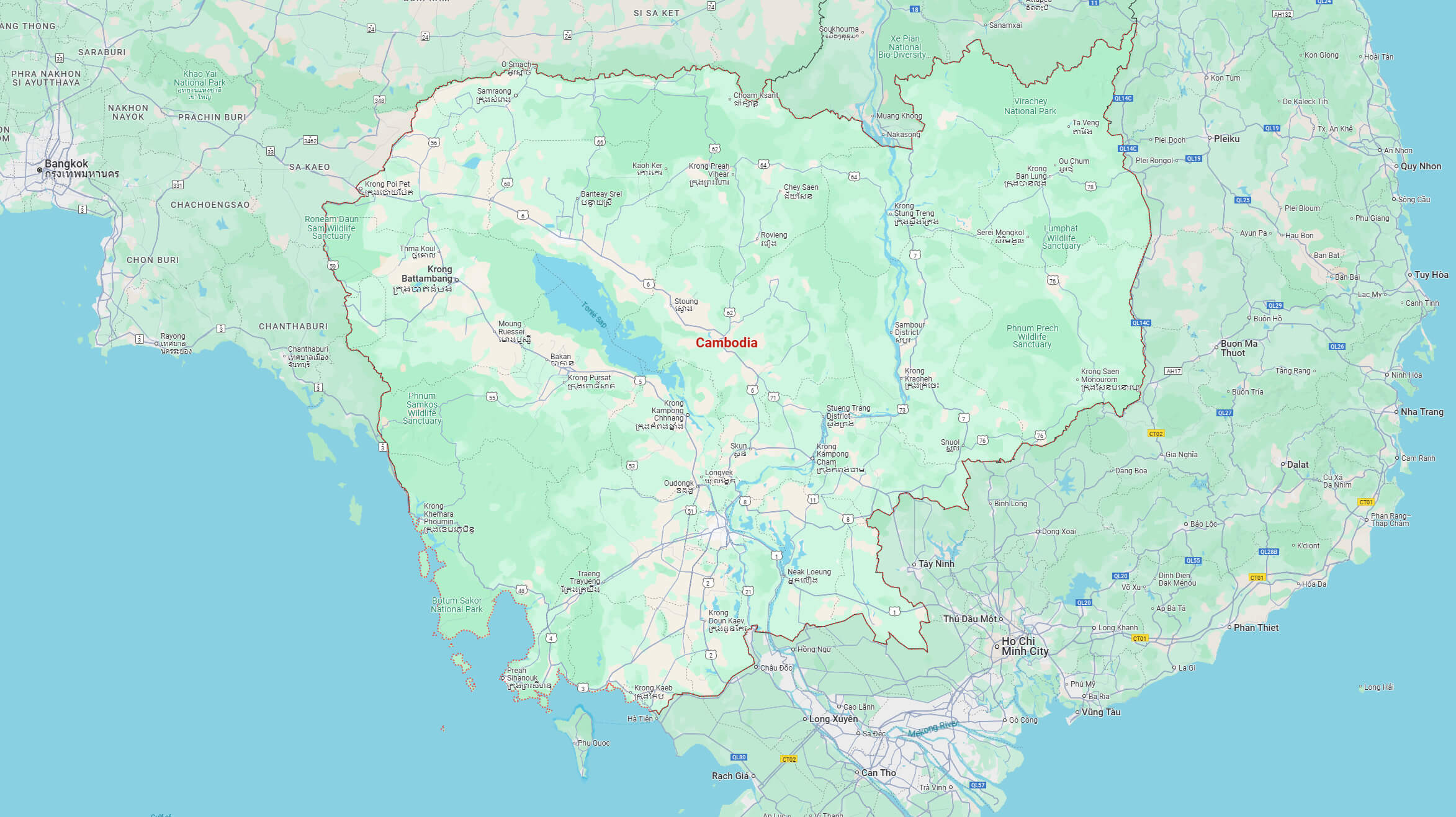
Cambodia terrain map
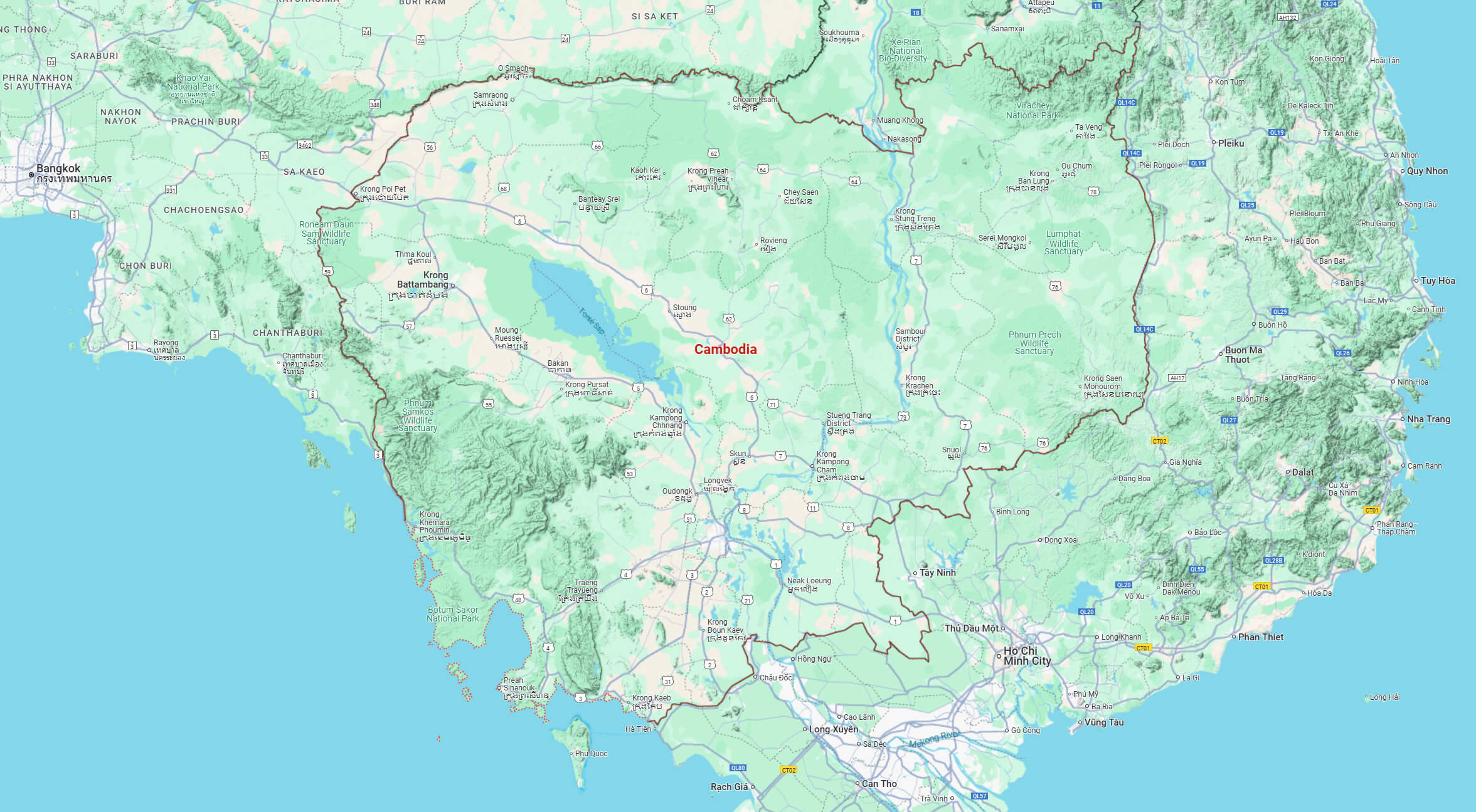
Cambodia topography map
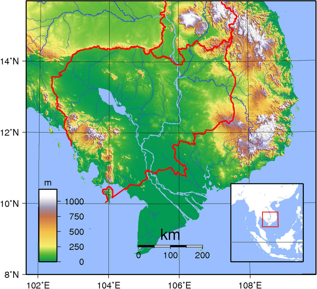
Cambodia climate map
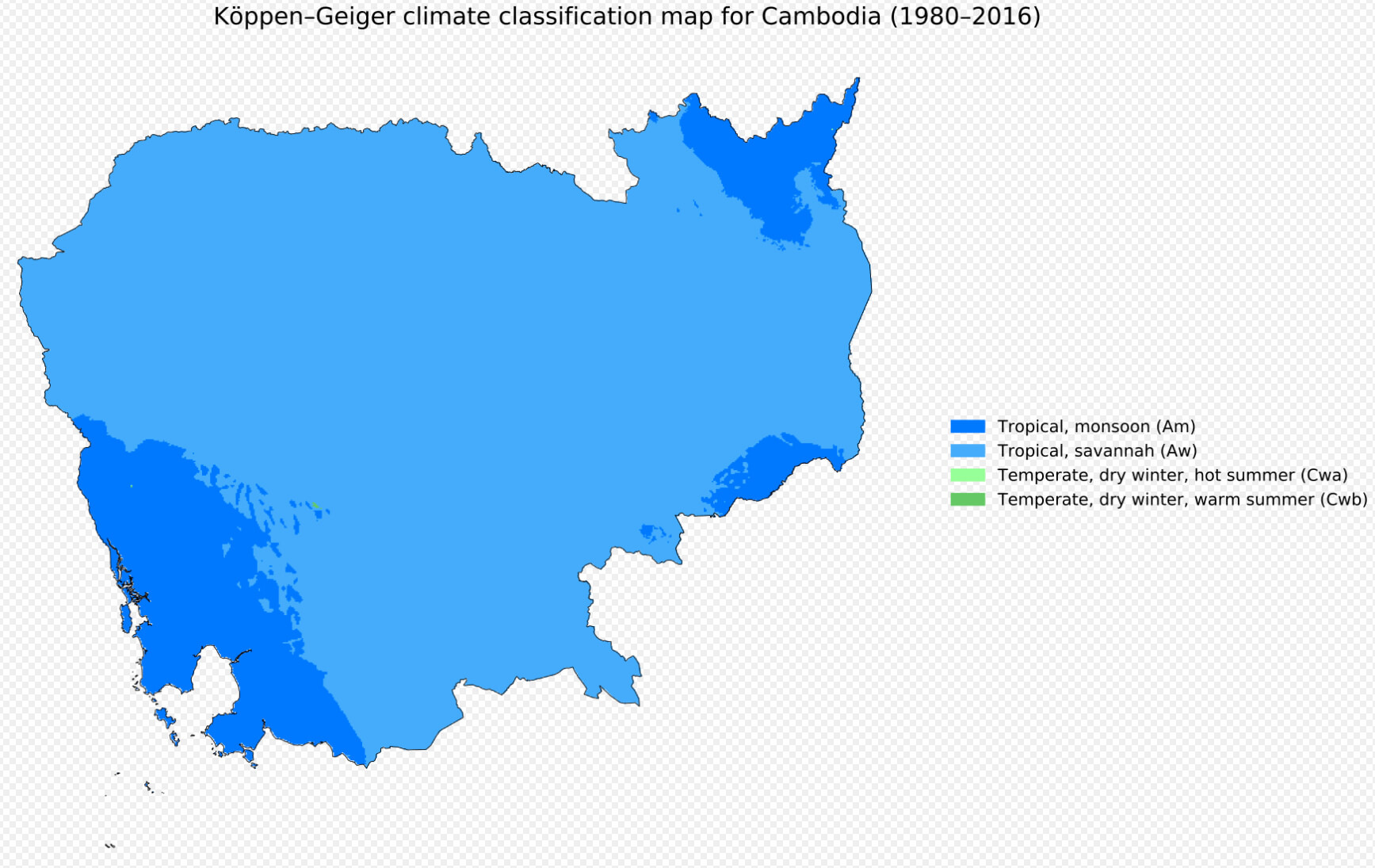
Map of Cambodia South Asia
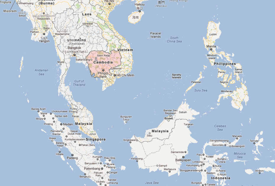
Map of Cambodia World
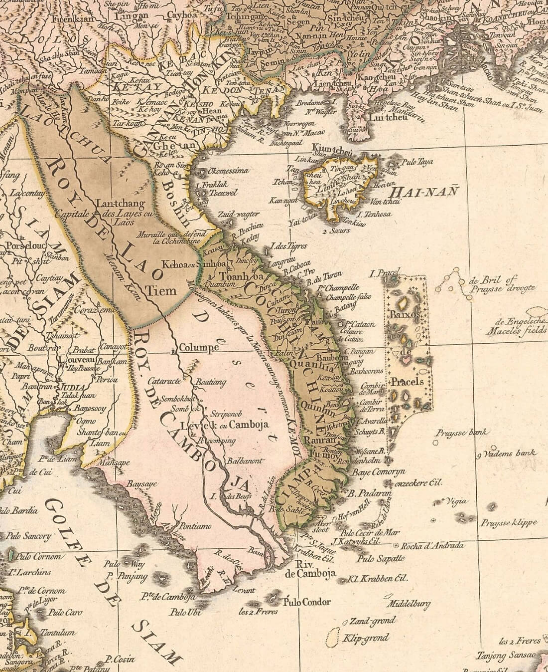
Map of Indochina and Cambodia in 1760
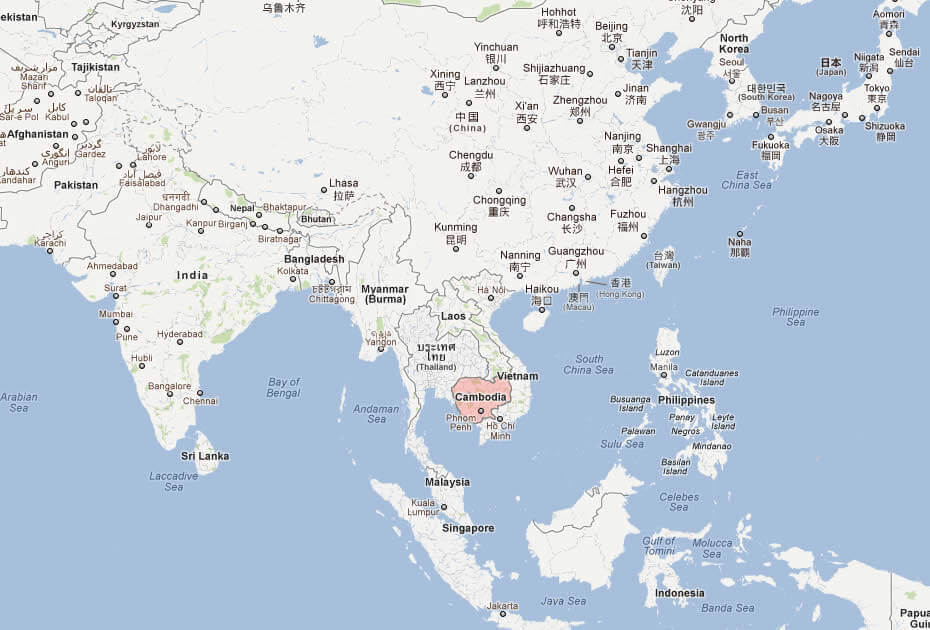
Where is Cambodia on the Asia Map?
Show Google interactive map, satellite map, where is the country located.
Get directions by driving, walking, bicycling, public transportation, and traveling with street view.
Feel free to explore these pages as well:
- China Map ↗️
- Indonesia Map ↗️
- Vietnam Map ↗️
- Myanmar (Burma) Map ↗️
- Brunei Map ↗️
- Malaysia ↗️
- Malaysia Maps ↗️
- Philippines Map ↗️
- Asia Maps ↗️
