Explore maps of Nepal, including physical, political, road and terrain maps as well as key cities, population data, country boundaries and regional divisions. Explore Nepal’s location in Asia, its geographical features and use the interactive satellite map to explore the country’s diverse landscape. Perfect for travellers, researchers and geography enthusiasts!
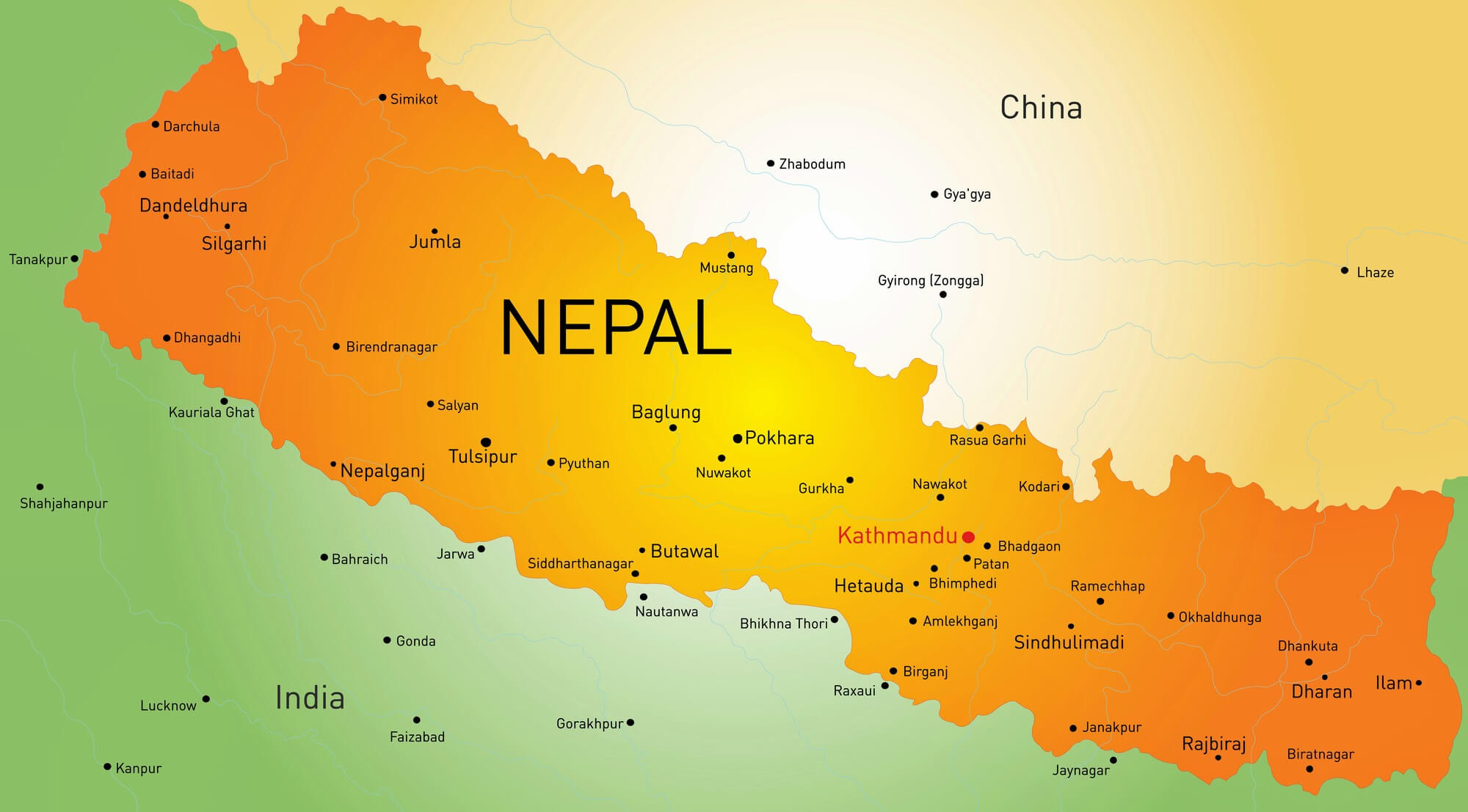
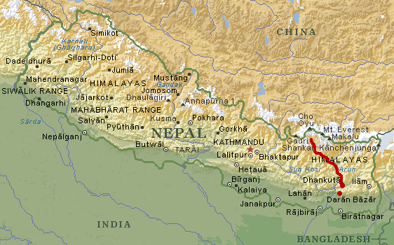
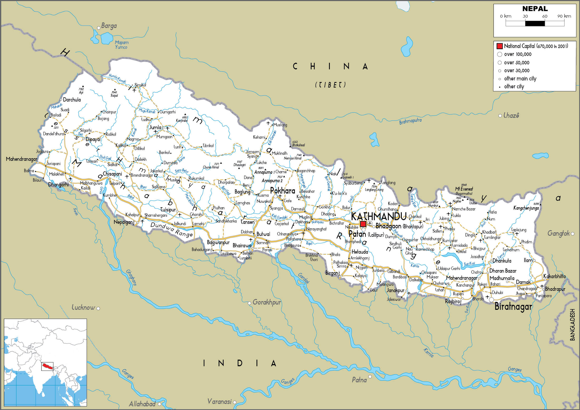
Nepal Political Map
Brief information about Nepal
Nepal, a landlocked country in South Asia, lies mainly in the Himalayas between China to the north and India to the south, east and west. Known for its diverse geography, Nepal ranges from the low-lying Terai plains to the towering peaks of the Himalayas, including Mount Everest, the highest point in the world. The country’s rich cultural heritage reflects its multi-ethnic society, with Hinduism and Buddhism deeply influencing daily life.
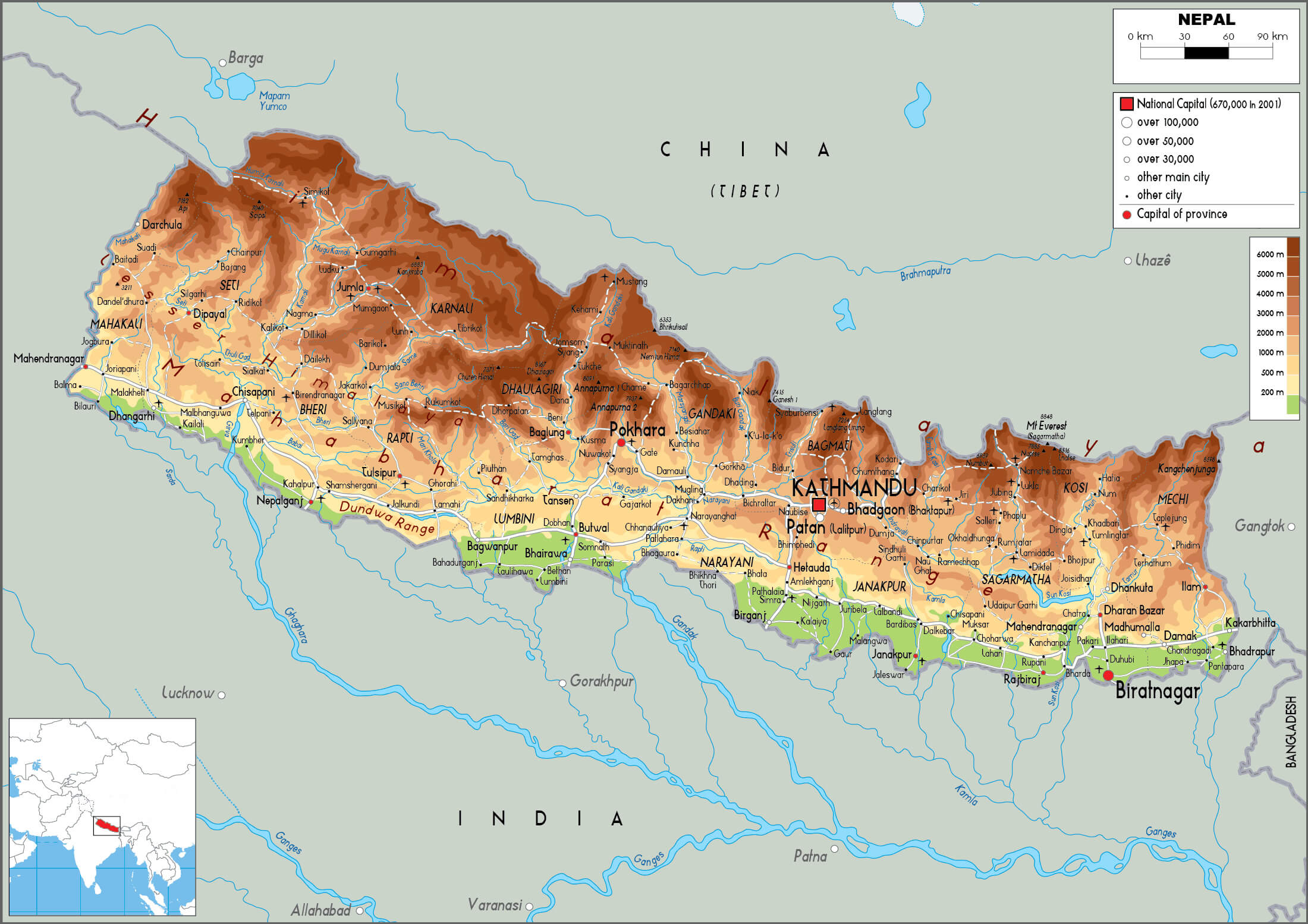
Nepal physical map
Nepal is recognised worldwide as a top trekking and adventure destination, attracting thousands of visitors to trails such as the Annapurna Circuit and Everest Base Camp. Kathmandu, the capital, is home to UNESCO World Heritage sites such as Swayambhunath and Pashupatinath. Despite its natural beauty, Nepal faces development challenges, but the resilience and cultural depth of its people make it a unique and treasured nation.
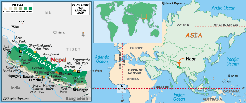
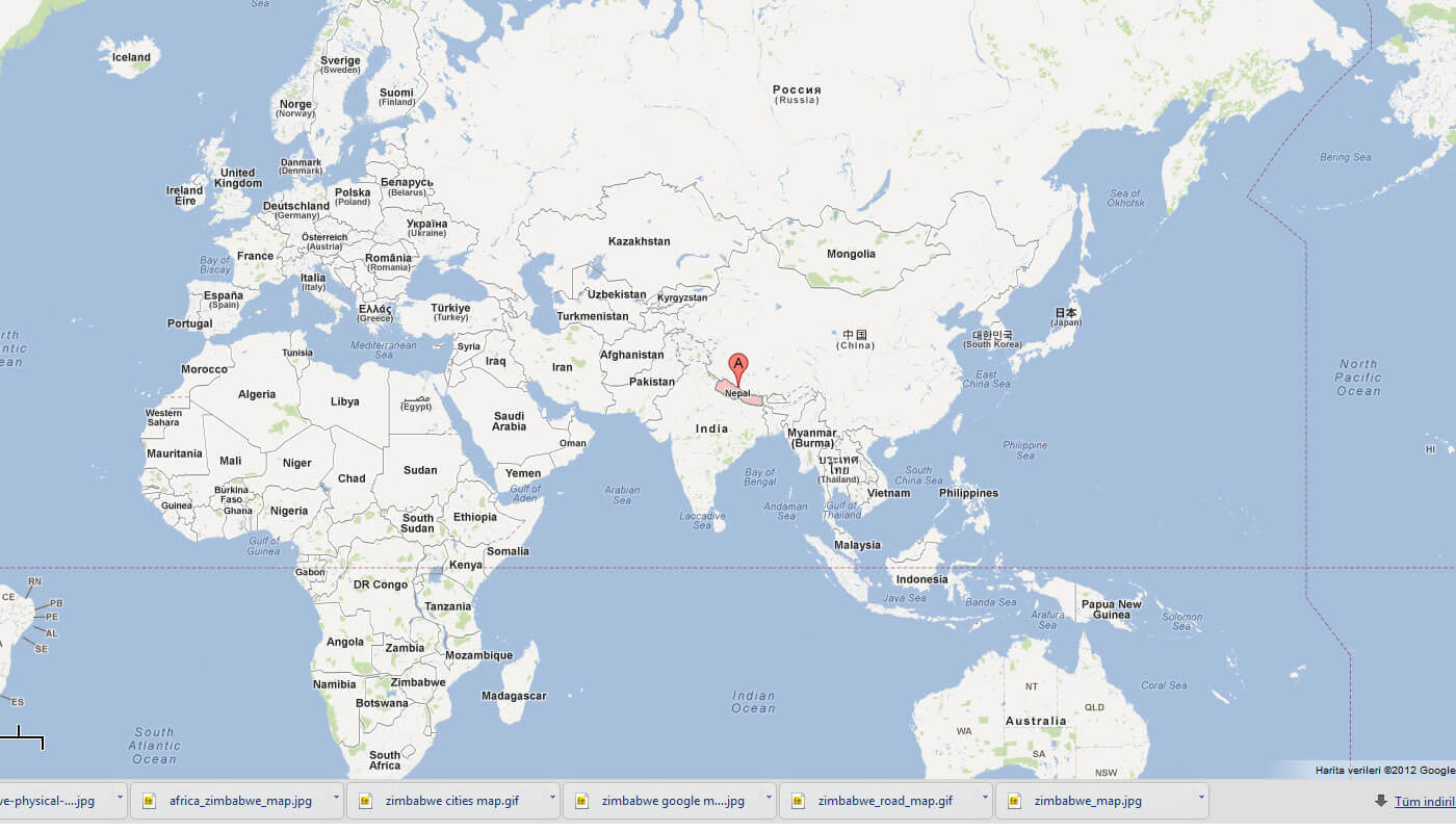
Where is located Nepal on the World Map
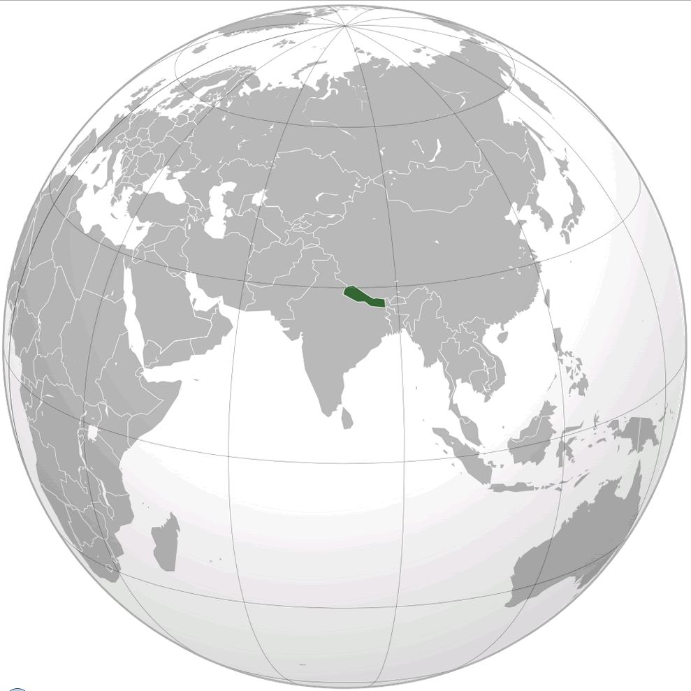
Nepal is a South Asian country bordered by China to the north and India to the south, east and west. Landlocked and situated on the southern slopes of the Himalayas, Nepal has a varied topography. The country’s location gives it a unique mix of terrains, ranging from the lowlands of the Terai region to the towering peaks of the Himalayas. Nepal’s latitude is roughly between 26°N and 30°N, and its longitude ranges from 80°E to 88°E.
Situated between two of the most populous countries in the world, Nepal has a strategic location that has historically influenced its culture, trade and politics. The Himalayas, which run along its northern border, not only serve as a natural boundary, but also have a significant impact on the country’s climate and biodiversity. Because of its location, Nepal has developed a unique cultural heritage that combines elements of both Tibetan and Indian traditions.

Famous for being home to eight of the world’s ten highest mountains, including Mount Everest, Nepal is a major destination for trekking and mountaineering. This mountainous geography plays a crucial role in the country’s economy, particularly through tourism. Nepal’s central location in the Himalayas has also made it a hub for Buddhism and Hinduism, fostering spiritual traditions that attract visitors from around the world.
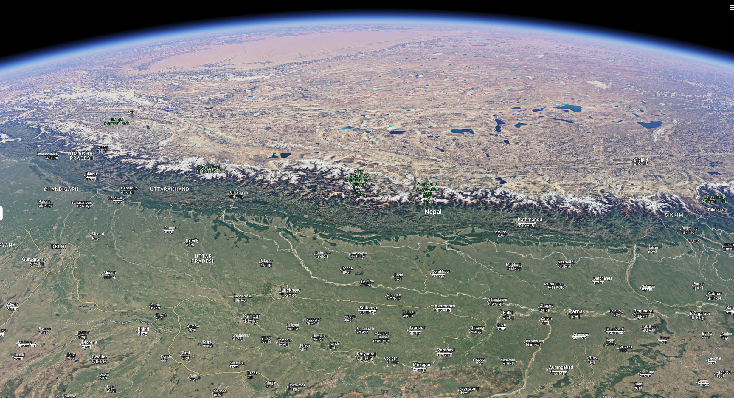
Nepal satellite map from space
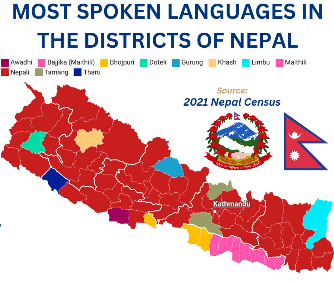
Nepal spoken languages map
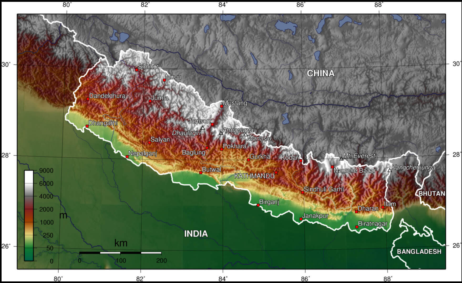
Nepal terrain map
Topographic map of Nepal
Here are some statistical information about Nepal:
 Area: 147,516 km2 (56,956 sq mi)
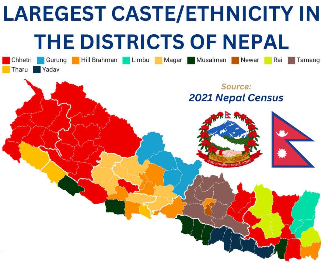
 Nepal etnics group map
Map of Nepal
 Map showing Nepal in South Asia, between China and India.
This map highlights Nepal’s geographic position in South Asia, nestled between China to the north and India to the south. The inset shows Nepal’s global position, with a specific focus on its mountainous terrain, including the Himalayas and Mount Everest, which marks the highest point on Earth.
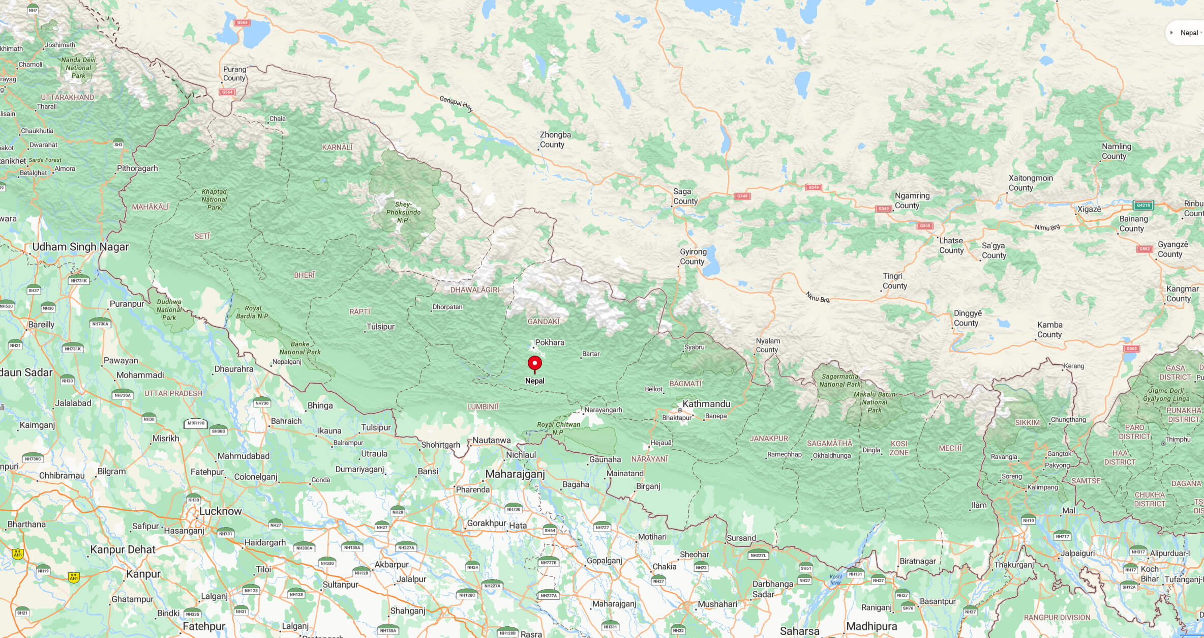
Nepal Location Map
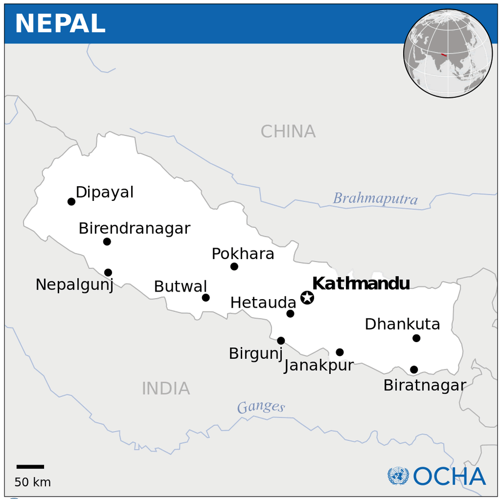
Cities Map of Nepal
Map of Nepal Asia
Map of Nepal World
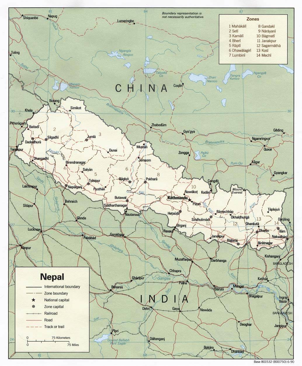
Nepal Districs Map
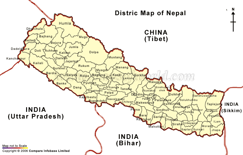 Map showing the districts of Nepal with bordering regions: China (Tibet) to the north and India (Uttar Pradesh, Bihar, and Sikkim) to the south and east.
This map outlines Nepal’s various districts, highlighting the country’s geographical structure and its proximity to neighboring regions. It includes key border connections with Tibet (China) to the north and three Indian states—Uttar Pradesh, Bihar, and Sikkim—to the south and east. The map is essential for understanding Nepal’s administrative divisions and regional relations.
Nepal land map
Nepal Regions Map
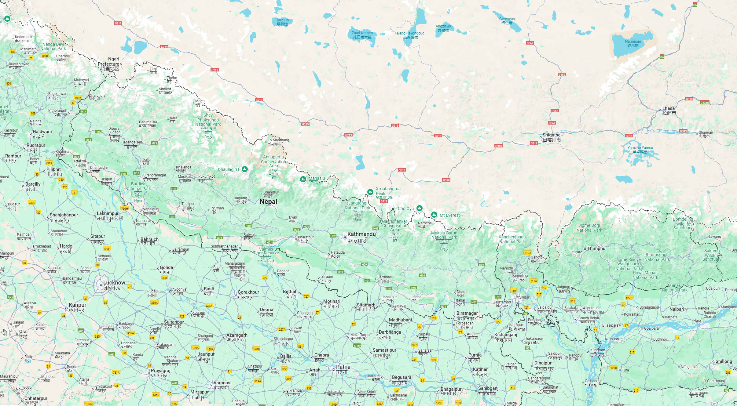
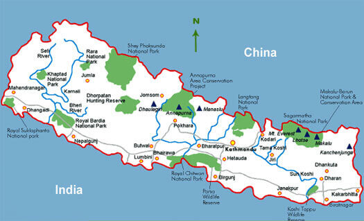 Map of Nepal showing national parks, conservation areas, and key cities
This map highlights Nepal’s diverse national parks and conservation areas, such as Chitwan National Park, Sagarmatha National Park, and the Annapurna Conservation Area. Positioned between India to the south and China to the north, the map also marks major rivers and cities like Kathmandu, Pokhara, and Birgunj, illustrating the natural and cultural landmarks within Nepal’s boundaries.
Physical Map of Nepal
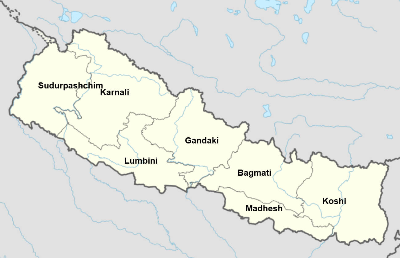
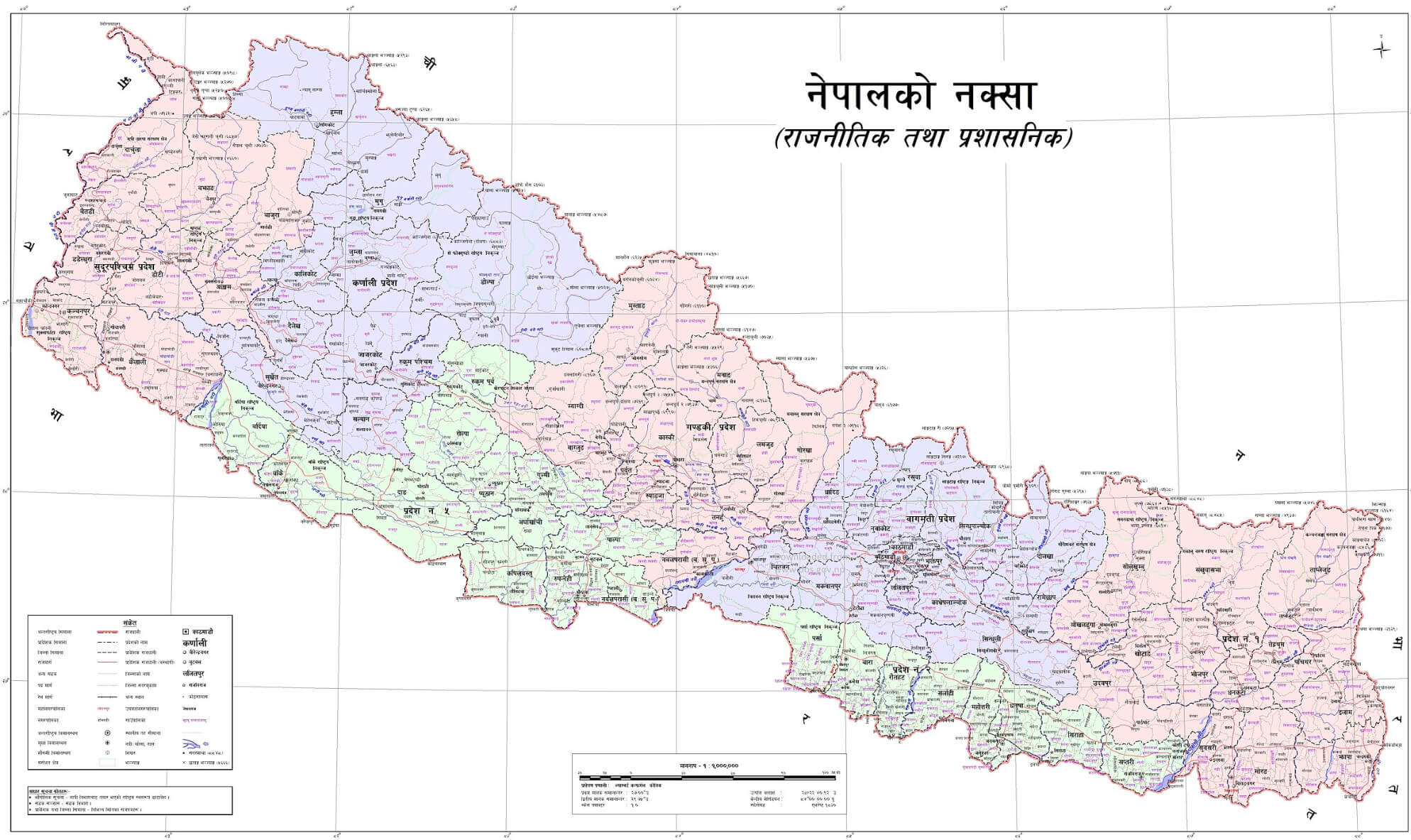
Provinces Map of Nepal
 Map of Nepal showing international borders, administrative zones, and major cities
This map displays Nepal’s 14 administrative zones along with major cities and transport networks, including roads and railroads. Nepal is situated between China to the north and India to the south, with the capital, Kathmandu, prominently marked. Each zone is labeled with a number, highlighting Nepal’s regional divisions within the mountainous terrain.
Administrative divisions map of Nepal
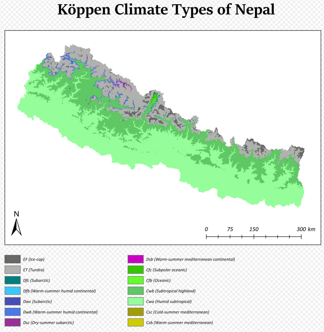
Nepal climate map
Nepal country map
Nepal detailed map
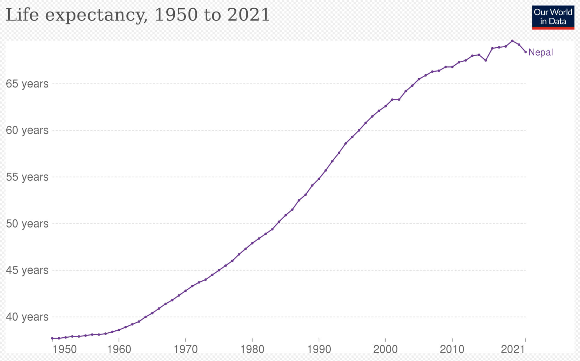
Nepal life expectancy
Nepal location map
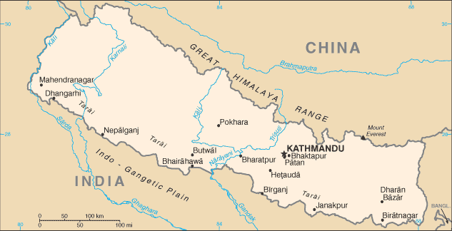
Nepal road map
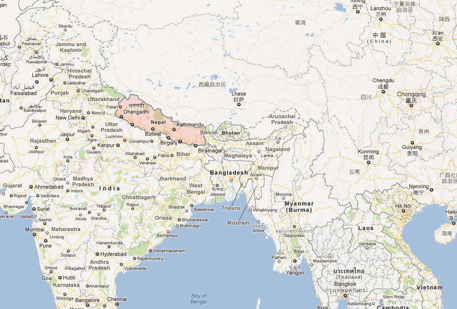
Where Nepal on asia map
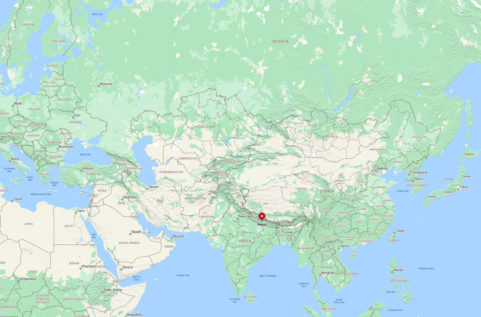
Where is Nepal on the Asia and the World Map?
Show Google interactive map, satellite map, where is the country located.
Get directions by driving, walking, bicycling, public transportation and travel with street view.
Feel free to explore these pages as well:
- India ↗️
- Bangladesh Map ↗️
- Muslim Population Map in Asia by Country ↗️
- A Collection of Bangladesh Maps ↗️
- China Map ↗️
- Pakistan Map ↗️
- Maldives Map ↗️