Explore political, physical and satellite maps of Bangladesh with its cities, rivers, topography, elevation, relief and terrain. Discover its location in Asia and in the World map, its neighbours including India, Myanmar and Bhutan, and its geographical position on the Bay of Bengal.
Explore Bangladesh: Major Cities, Rivers, and Dhaka
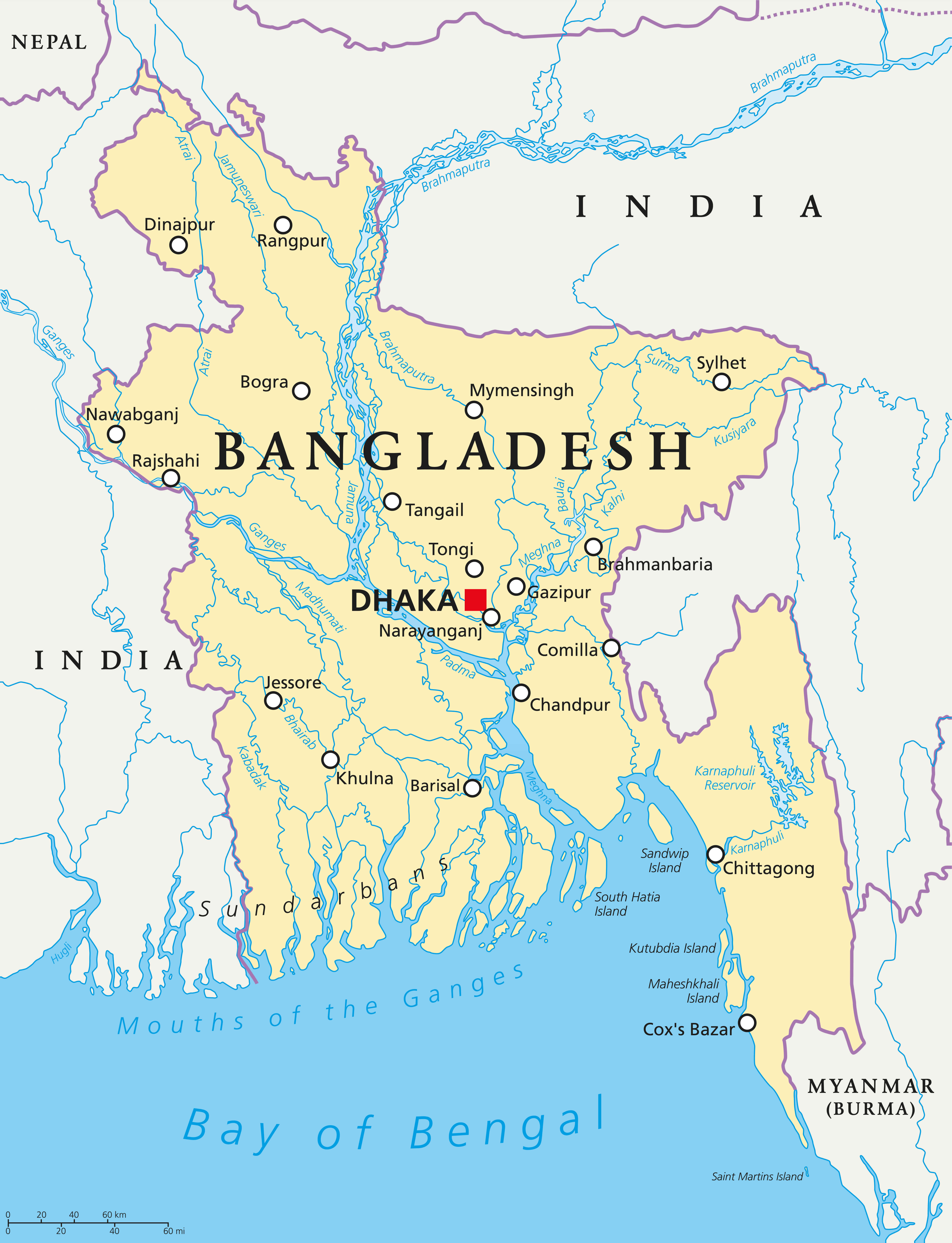 Bangladesh map showing Dhaka, cities, rivers, and neighboring countries
This map shows Bangladesh, highlighting the capital Dhaka, major rivers such as the Ganges, Brahmaputra and Meghna, and major cities such as Chittagong, Sylhet and Rajshahi. Bordering India and Myanmar, the map also shows the Sundarbans and the Bay of Bengal coastline, highlighting the country’s geographical features.
Brief information about Bangladesh
Bangladesh, a vibrant country in South Asia, is known for its lush landscapes, rich culture and bustling capital, Dhaka. Famous for its rivers, fertile fields and thriving garment industry, it is one of the world’s leading garment exporters, driving the economy and providing jobs.
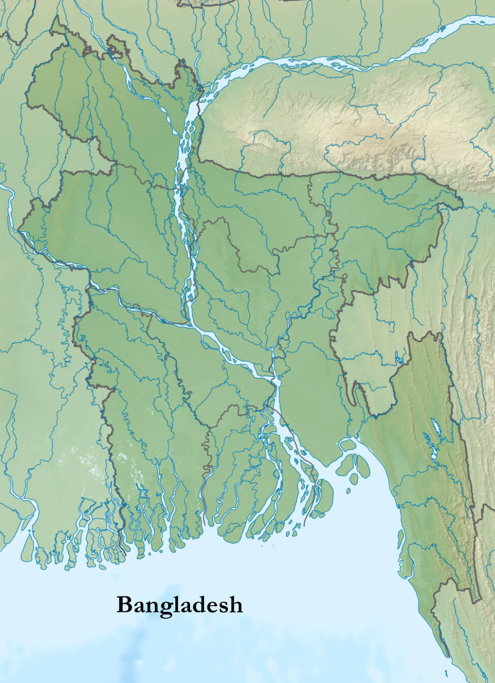
Bangladesh Physical Map
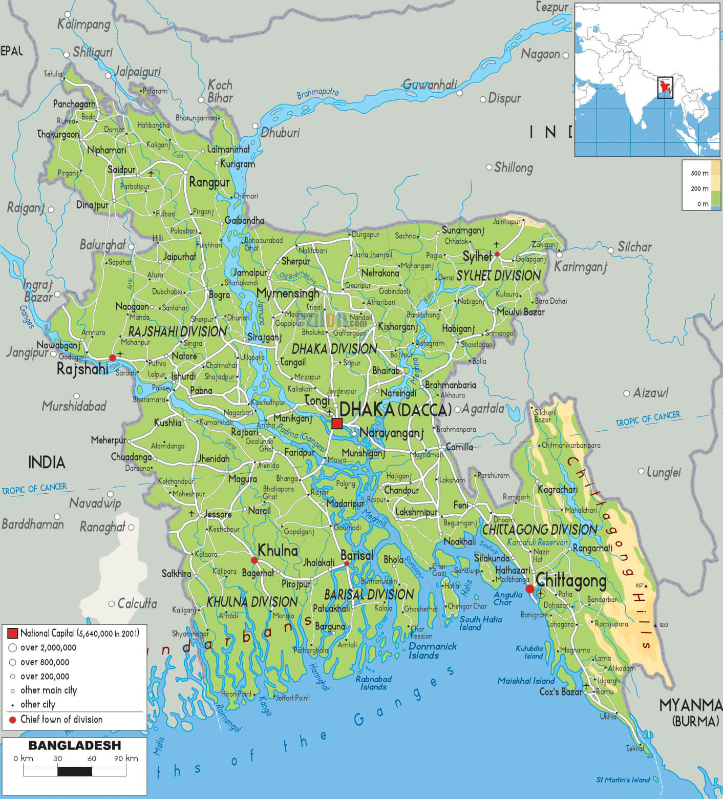
With a history rooted in the struggle for independence in 1971, Bangladesh today blends tradition with modernity. Highlights include the Sundarbans mangrove forest, home to the Bengal tiger, and historic sites such as the mosques of Bagerhat. The country’s warmth and cultural diversity make it a unique destination for visitors.
Where is located Bangladesh on the World Map?
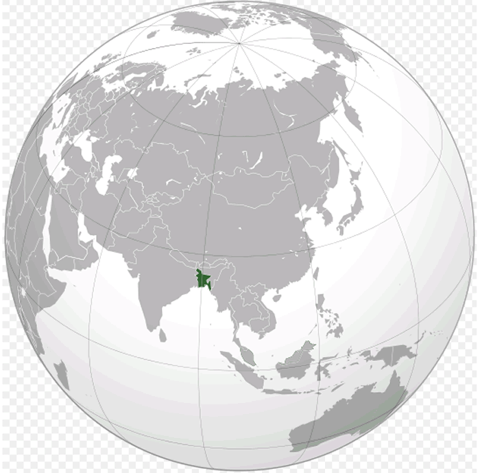
Bangladesh is located in South Asia, bordered on three sides – west, north and east – by India and on the south-east by Myanmar (Burma). To the south it opens onto the Bay of Bengal, giving it access to the Indian Ocean. This strategic location places Bangladesh at the heart of a historically rich and diverse region, close to several cultural and economic centres.
Bangladesh political map with cities
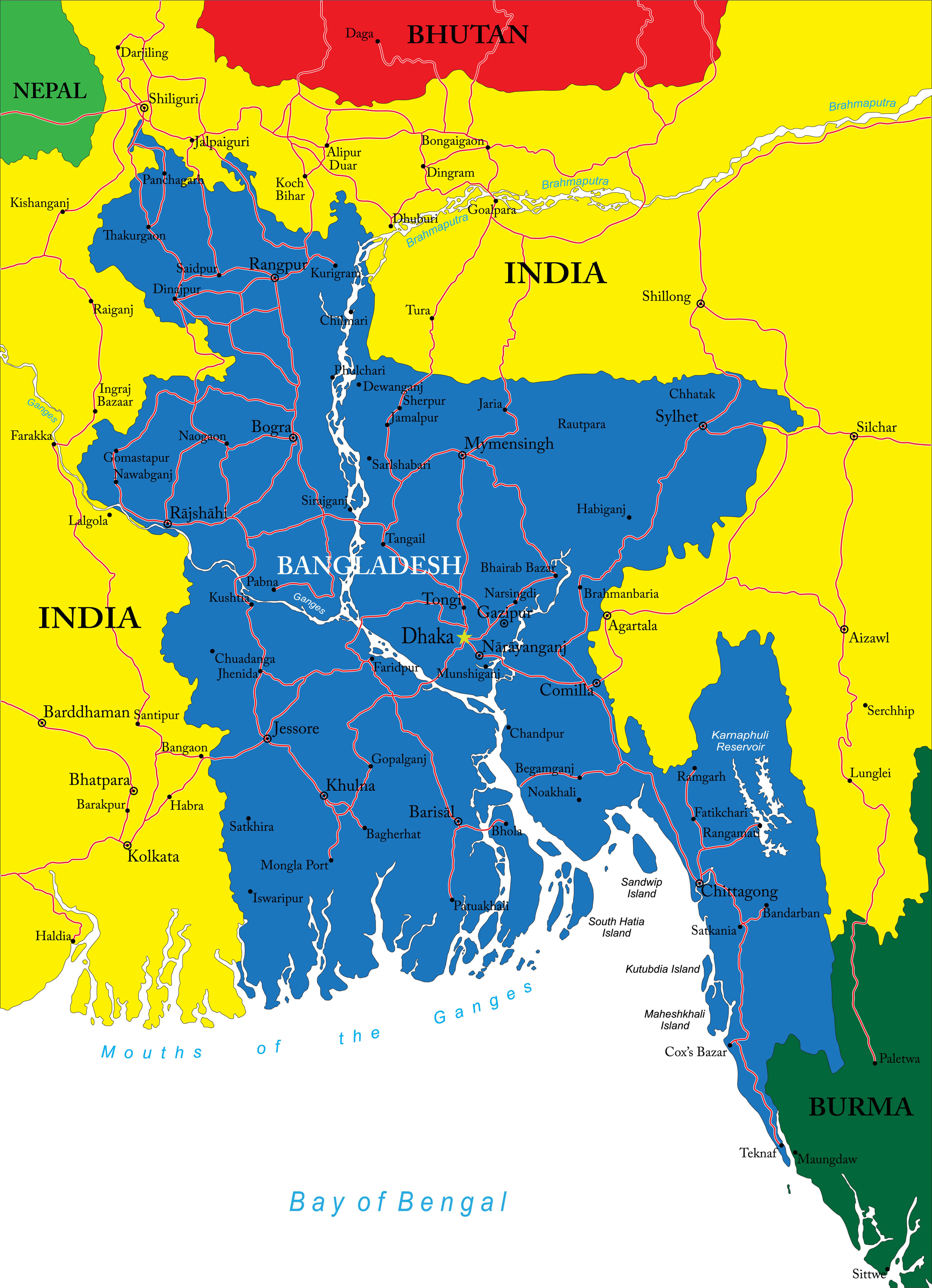
On the world map, you’ll find Bangladesh just south of the Tropic of Cancer, making it a tropical country with a lush, green landscape shaped by its extensive river systems, including the famous Padma (Ganges) and Jamuna (Brahmaputra) rivers. These rivers play a crucial role in Bangladesh’s geography, agriculture and daily life, creating a landscape of fertile plains.
Despite its small size, Bangladesh is one of the most densely populated countries in the world, with Dhaka as its capital and largest city. Situated between India and Southeast Asia, it is a cultural crossroads, influenced by a mixture of South Asian traditions, particularly from Bengal, and Southeast Asian connections. Its unique location makes it a fascinating blend of regional influences.
Here are some statistical information about Bangladesh:
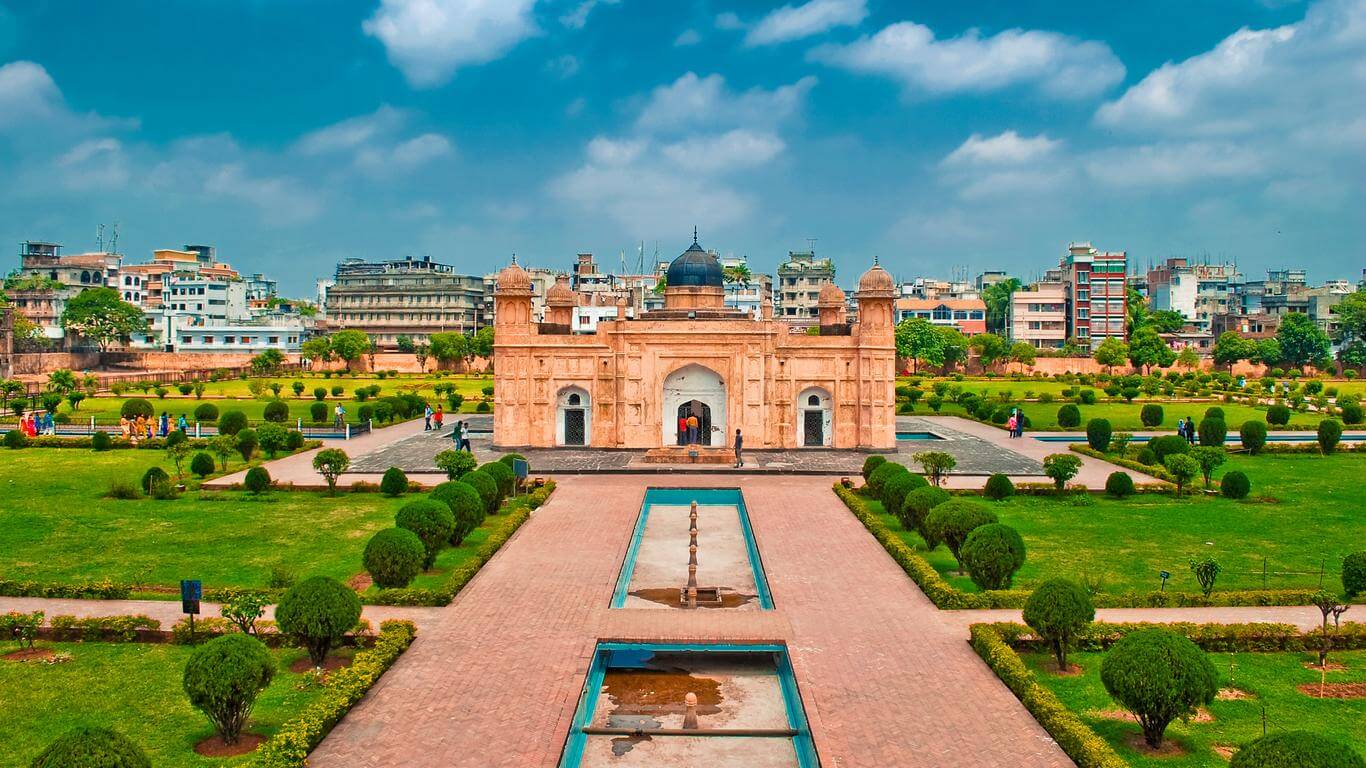 Area: 148,460 km2 (57,320 sq mi)
Bangladesh Regional Map
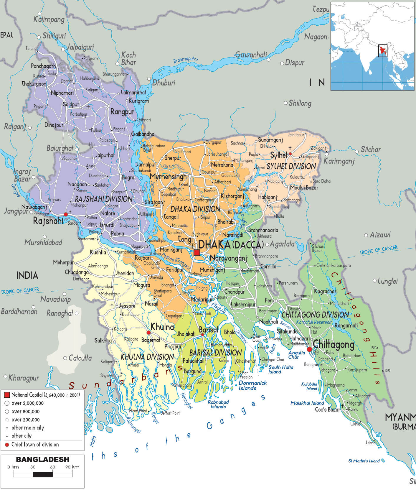
This detailed map of Bangladesh displays its administrative divisions, including Dhaka, Chittagong, Sylhet, Rajshahi, Khulna, Barisal, and Rangpur. Major cities, rivers, and bordering countries (India and Myanmar) are marked, along with the Bay of Bengal to the south. The inset shows Bangladesh’s location in South Asia.
Map of Bangladesh
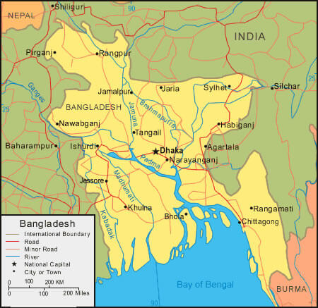 Map of Bangladesh highlighting major cities, rivers, and borders
This map of Bangladesh shows the country’s major cities like Dhaka, Chittagong, and Sylhet, along with important rivers like the Padma, Jamuna, and Meghna. It also displays the road network, neighboring countries (India, Nepal, and Burma), and the Bay of Bengal to the south.
Bangladesh Location Map Asia
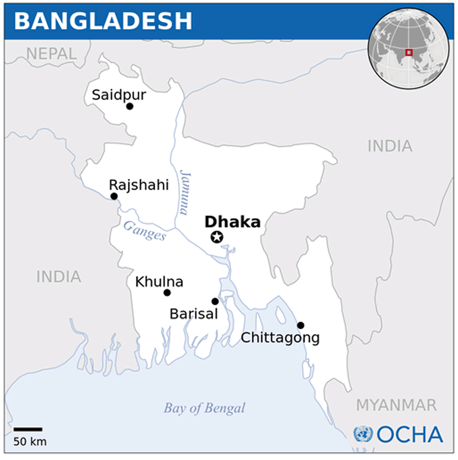
Bangladesh Cities Map
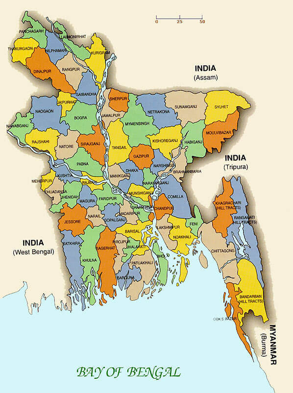 Map of Bangladesh with districts, borders, and neighboring countries
This map of Bangladesh displays its districts, bordered by India on the west, north, and east, and Myanmar to the southeast. Key districts like Dhaka, Chittagong, and Sylhet are highlighted, alongside the Bay of Bengal to the south.
Bangladesh Political Map
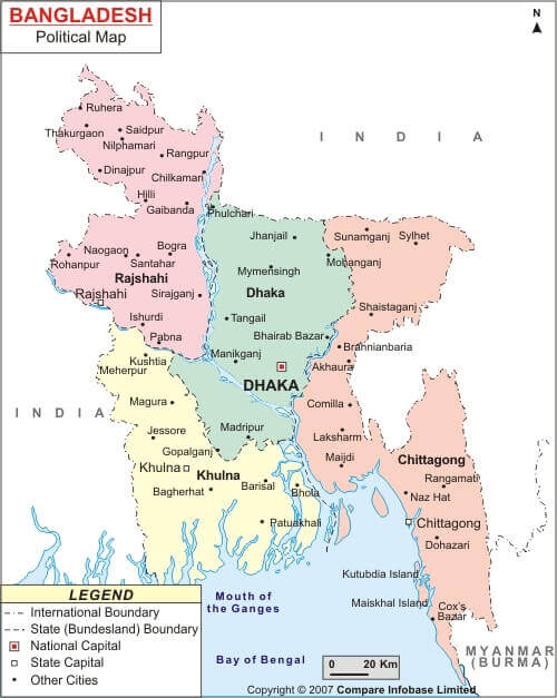
Bangladesh Map
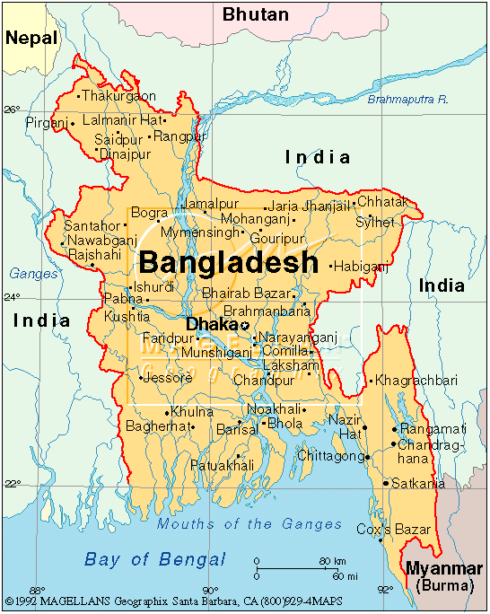 Bangladesh map showing major cities, rivers, and borders with India and Myanmar
This map highlights Bangladesh’s major cities, including Dhaka, Chittagong, and Sylhet, and its rivers like the Brahmaputra and Ganges. The map shows the borders with neighboring countries India, Nepal, Bhutan, and Myanmar, along with the Bay of Bengal to the south.
Map of India and Bangladesh: Capitals, Major Cities, and Borders
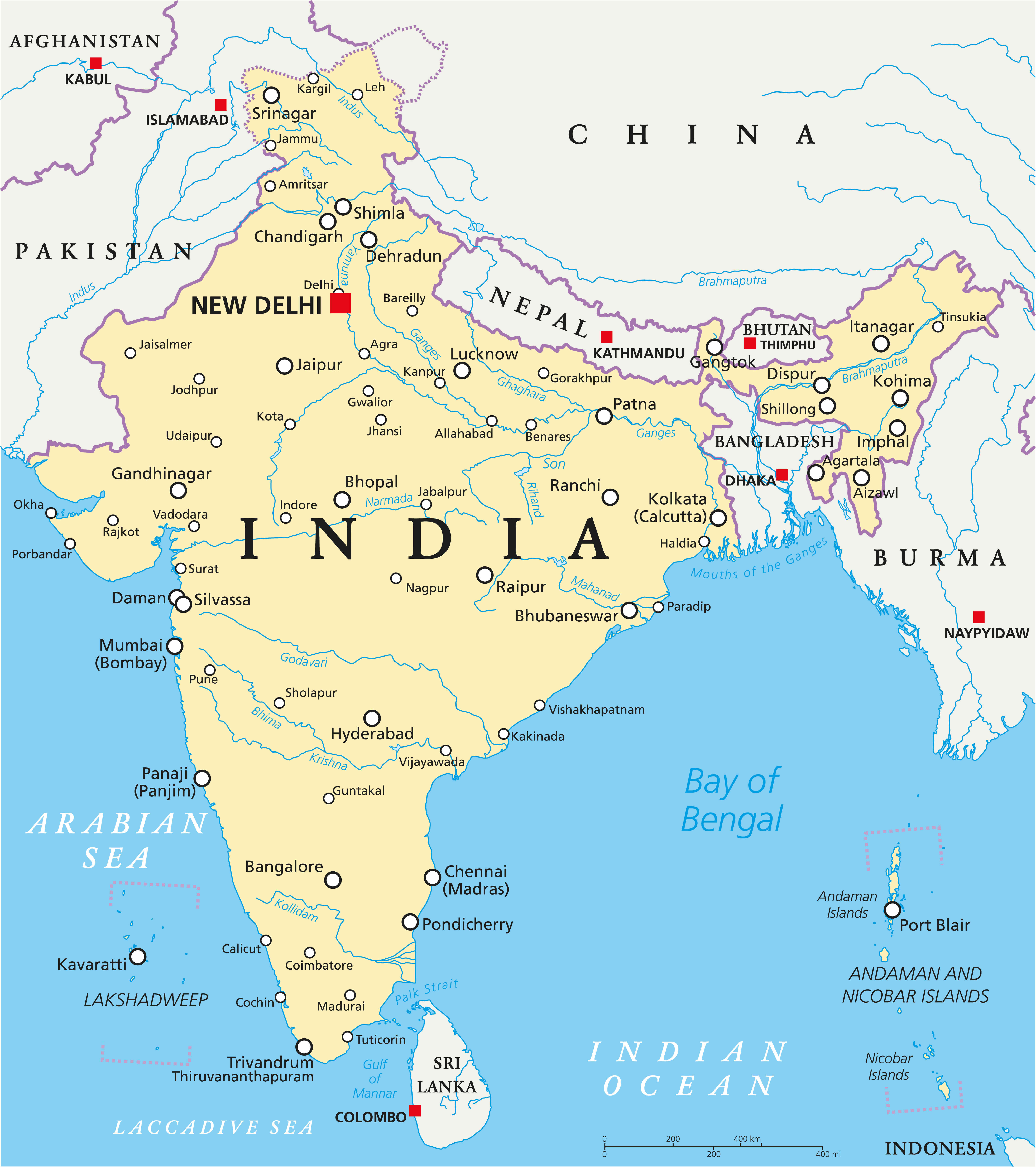 Map of India and Bangladesh with capitals, cities, rivers, and neighboring countries.
This map illustrates India and Bangladesh, showing their capitals (New Delhi and Dhaka), major cities such as Kolkata, Mumbai and Chittagong, and major rivers such as the Ganges and Brahmaputra. It also highlights neighbouring countries, including Nepal, Bhutan, Myanmar and Sri Lanka, as well as the Bay of Bengal coastline.
Bangladesh Map Highlighting Major Cities and Regions
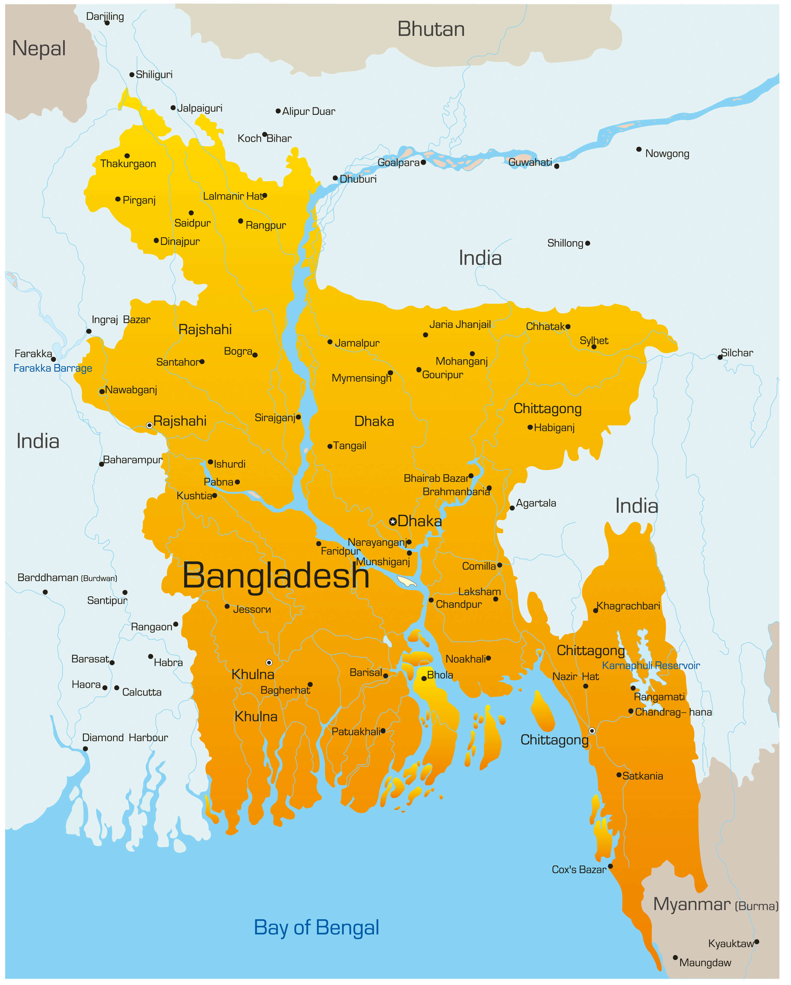 Bangladesh map showing main cities, rivers, and neighboring countries.
This map of Bangladesh highlights its major cities, including Dhaka, Chittagong, Sylhet, and Khulna. It also features key rivers like the Ganges and Brahmaputra, along with neighboring countries India, Nepal, Bhutan, and Myanmar. The map emphasizes the regions’ connectivity and proximity to the Bay of Bengal.
Bangladesh Map: Rivers, Cities, and Key Features
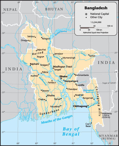 Bangladesh map with rivers, cities, and geographical features.
This map of Bangladesh highlights the country’s extensive network of rivers, including the Ganges, Brahmaputra and Meghna, as well as major cities such as Dhaka, Chittagong and Sylhet. It also shows neighbouring countries – India, Bhutan and Myanmar – and the Bay of Bengal, highlighting Bangladesh’s unique geography and waterways.
Physical Map of Bangladesh: Elevation, Roads, and Rivers
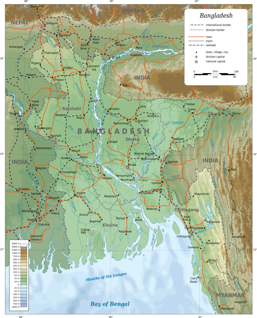 Bangladesh physical map shows elevation, roads, rivers, and major cities.
This physical map of Bangladesh displays its topography, with elevation levels, rivers, and road networks. It highlights major cities like Dhaka, Chittagong, and Khulna, along with borders shared with India, Myanmar, Bhutan, and Nepal. The map emphasizes key geographical features, including the Bay of Bengal and the Sundarbans.
Political Map of Bangladesh: Divisions and Major Cities
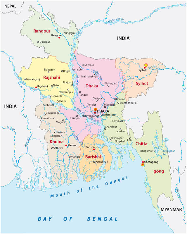 Political map of Bangladesh showing regions, cities, and neighboring countries.
This political map of Bangladesh shows the country’s divisions, including Dhaka, Rajshahi, Sylhet and Khulna. It highlights major cities such as Dhaka, Chittagong and Rangpur, as well as the neighbouring countries of India, Myanmar and Nepal. The map highlights administrative regions and the Bay of Bengal coastline.
SAARC Map: Bangladesh and Neighboring Countries
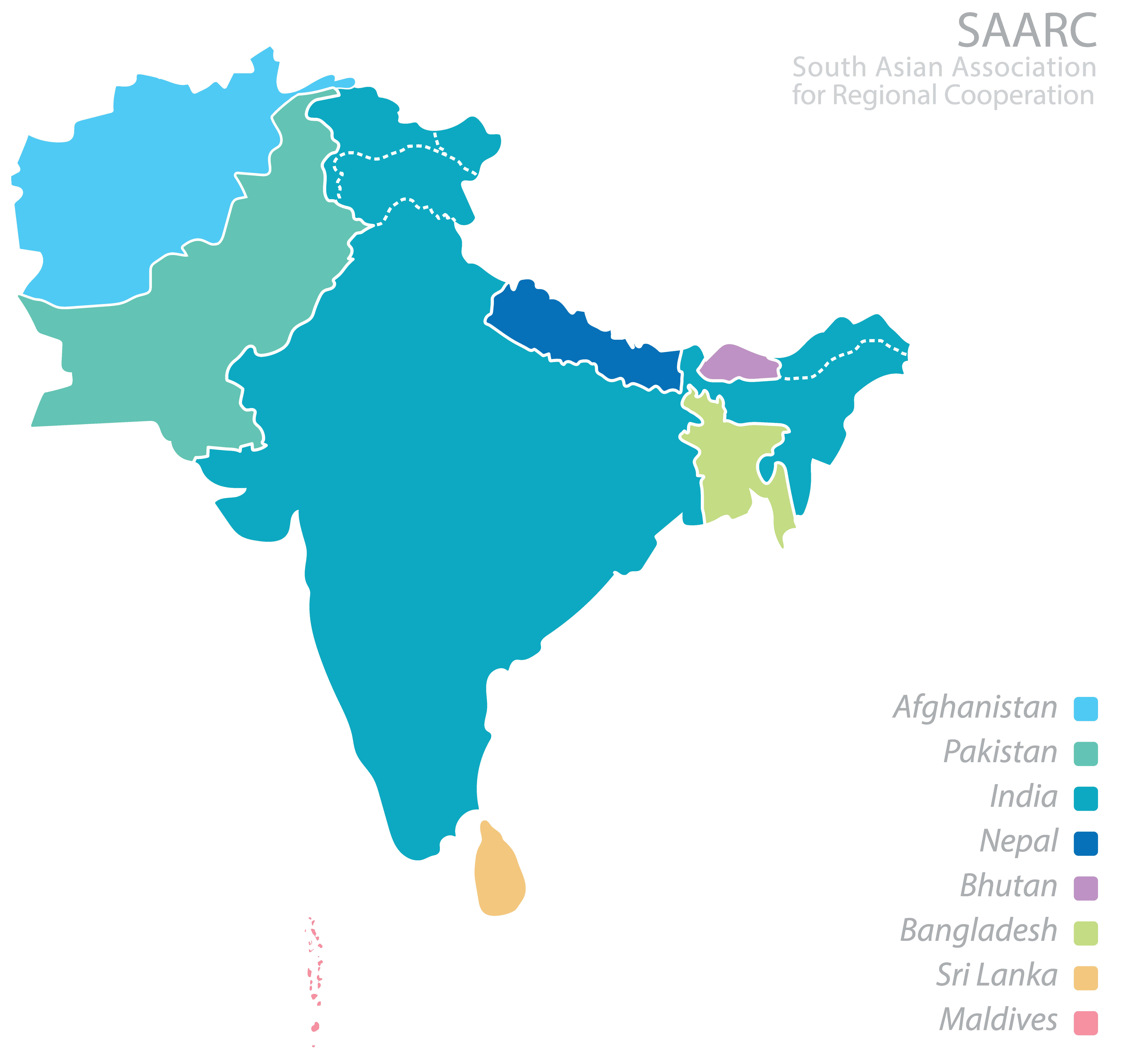 Bangladesh map displays India, Pakistan, Nepal, Afghanistan, Bhutan, Sri Lanka, Maldives
This map represents Bangladesh within the South Asian region, alongside neighboring countries in the SAARC group, including India, Pakistan, Nepal, Afghanistan, Bhutan, Sri Lanka, and the Maldives. It highlights regional cooperation and geographical proximity in South Asia.
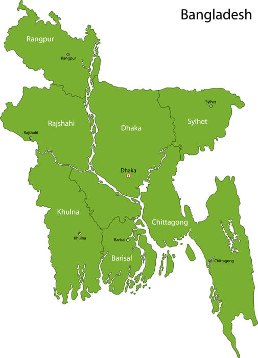
Bangladesh provinces map
Bangladesh: Key Facts and Map Overview
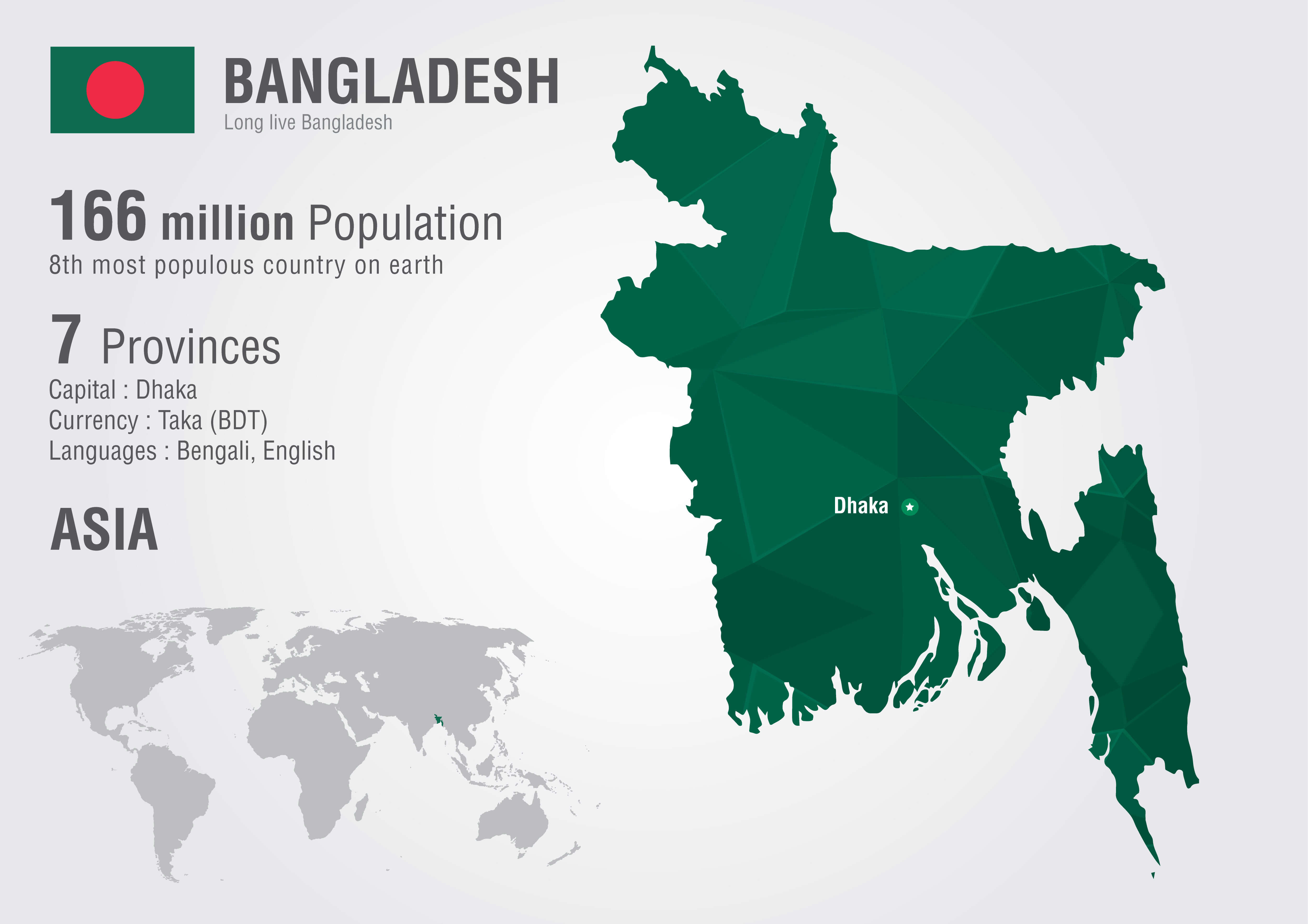 Bangladesh info map showing population, provinces, capital Dhaka, and global location.
This infographic highlights key facts about Bangladesh, including its population of 166 million, 7 provinces, capital Dhaka and national currency, the Taka (BDT). It highlights the country’s location in Asia, with Bengali and English as official languages, and its ranking as the 8th most populous country in the world.
Bangladesh regions map
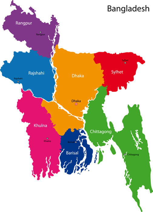
Bangladesh major cities map
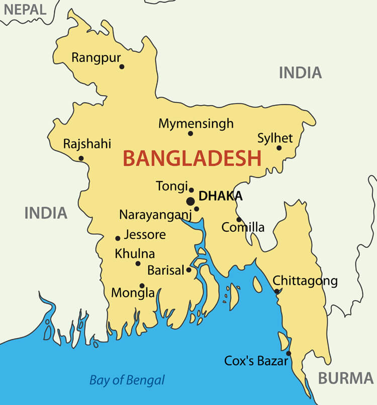
Bangladesh satellite map
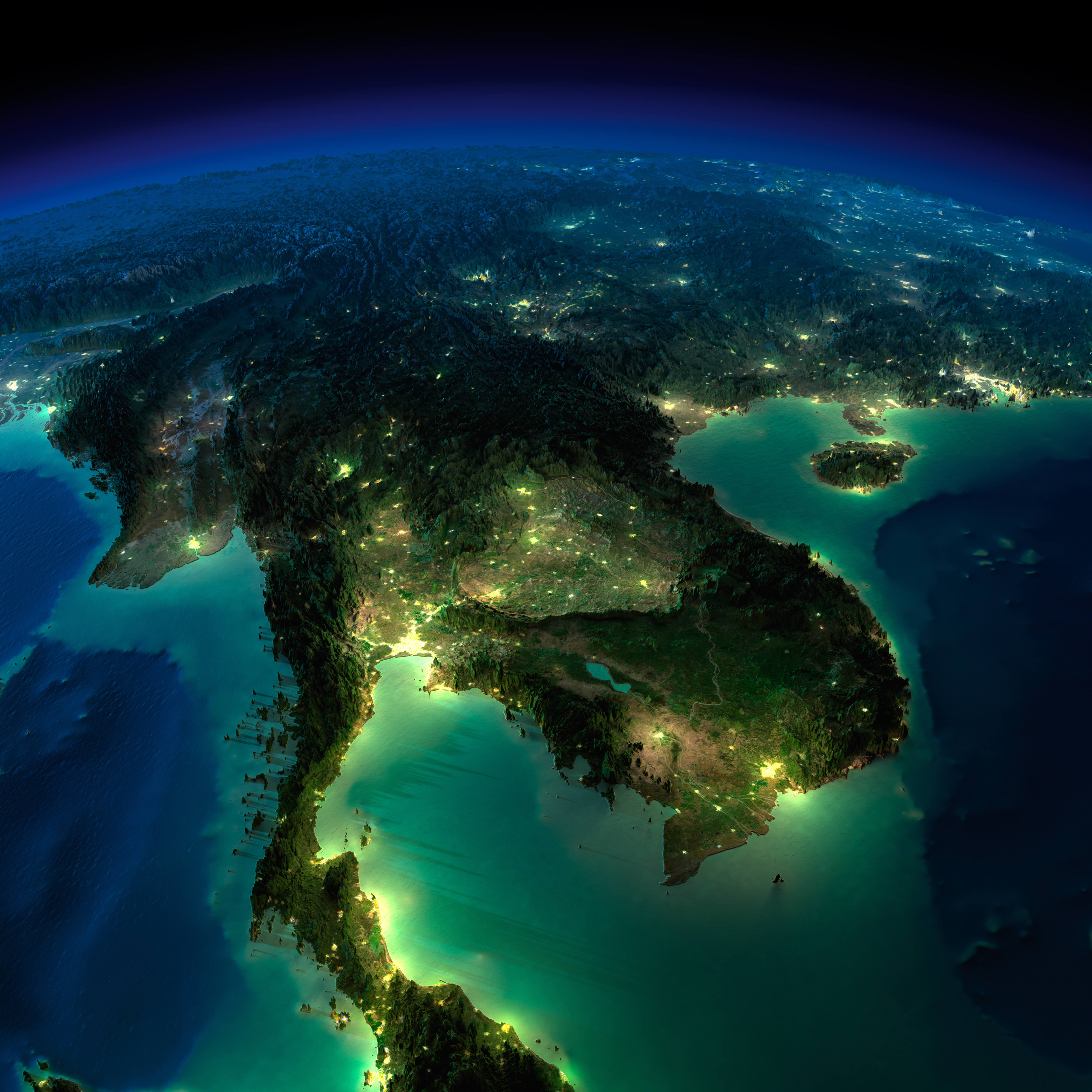
location map of bangladesh
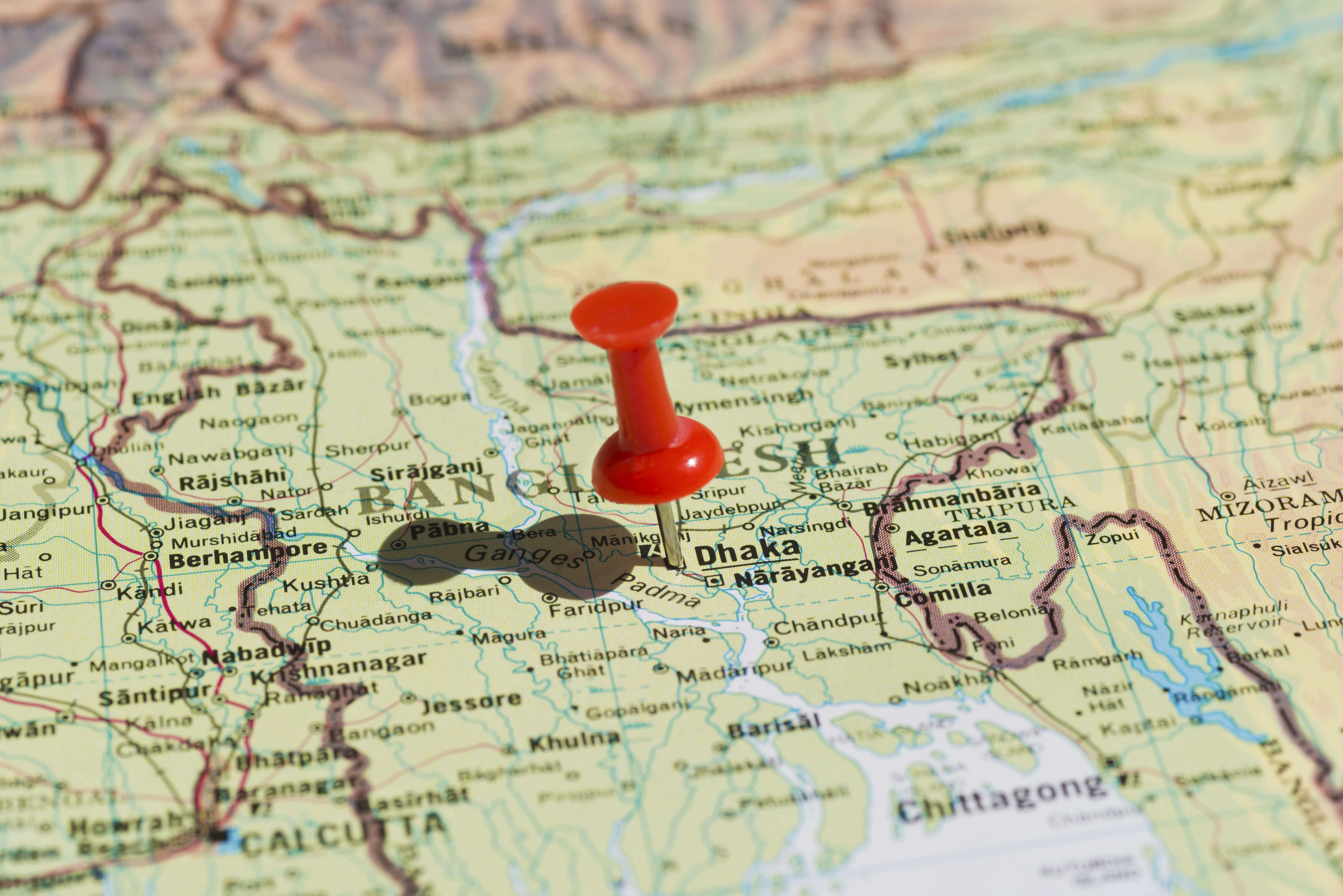
Bangladesh location map
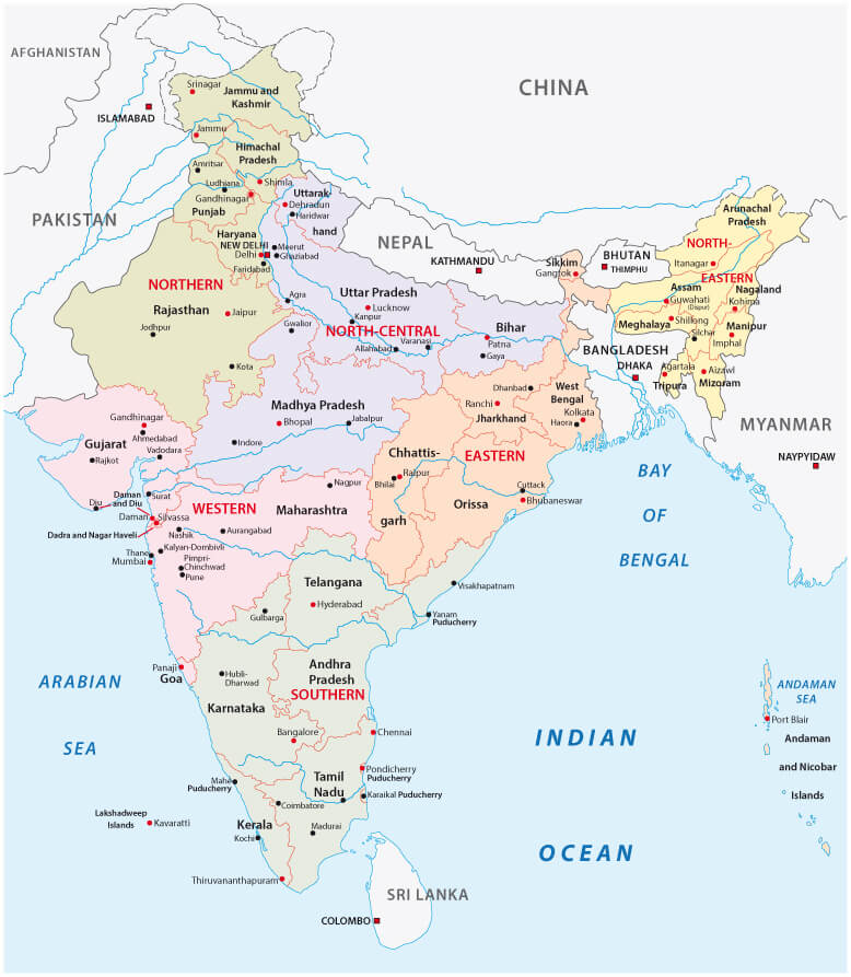
India political map with Bangladesh
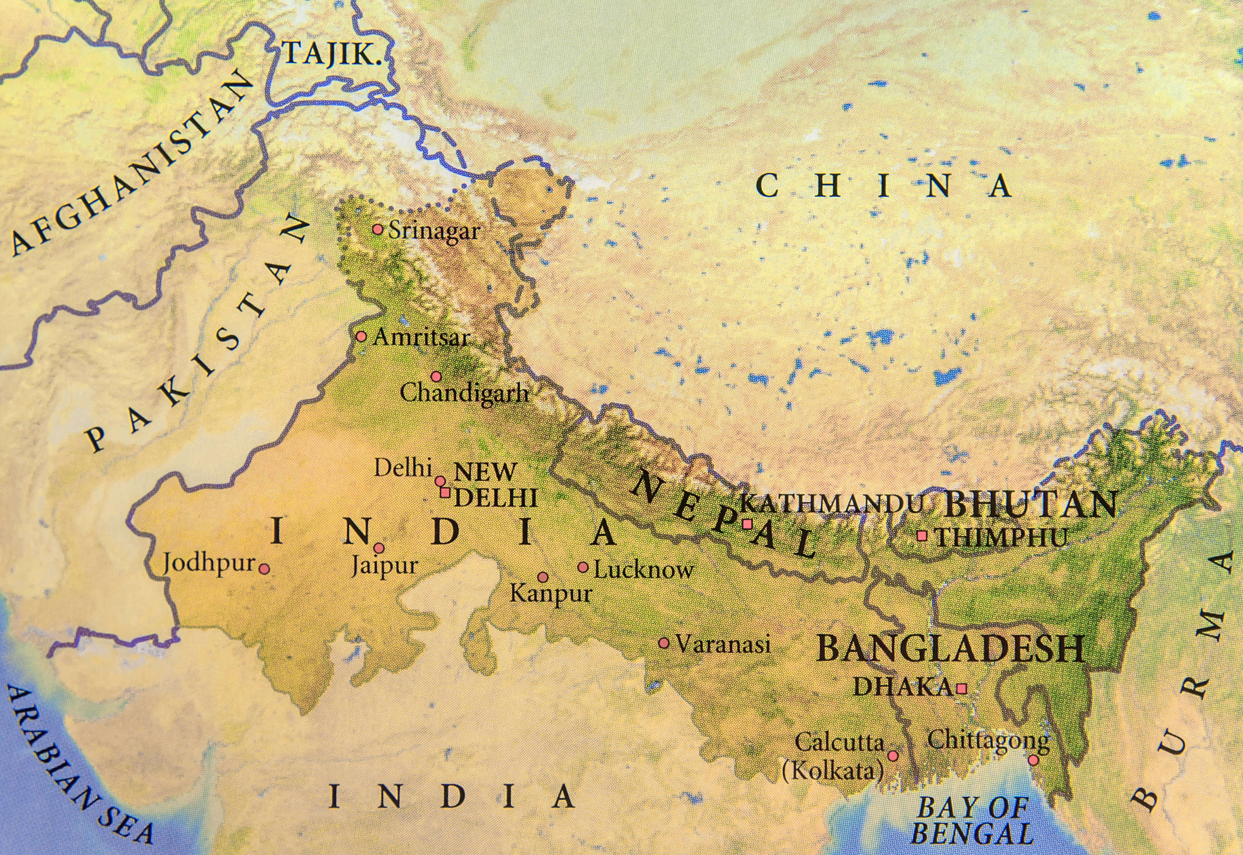
Bangladesh physical map with nepal and India
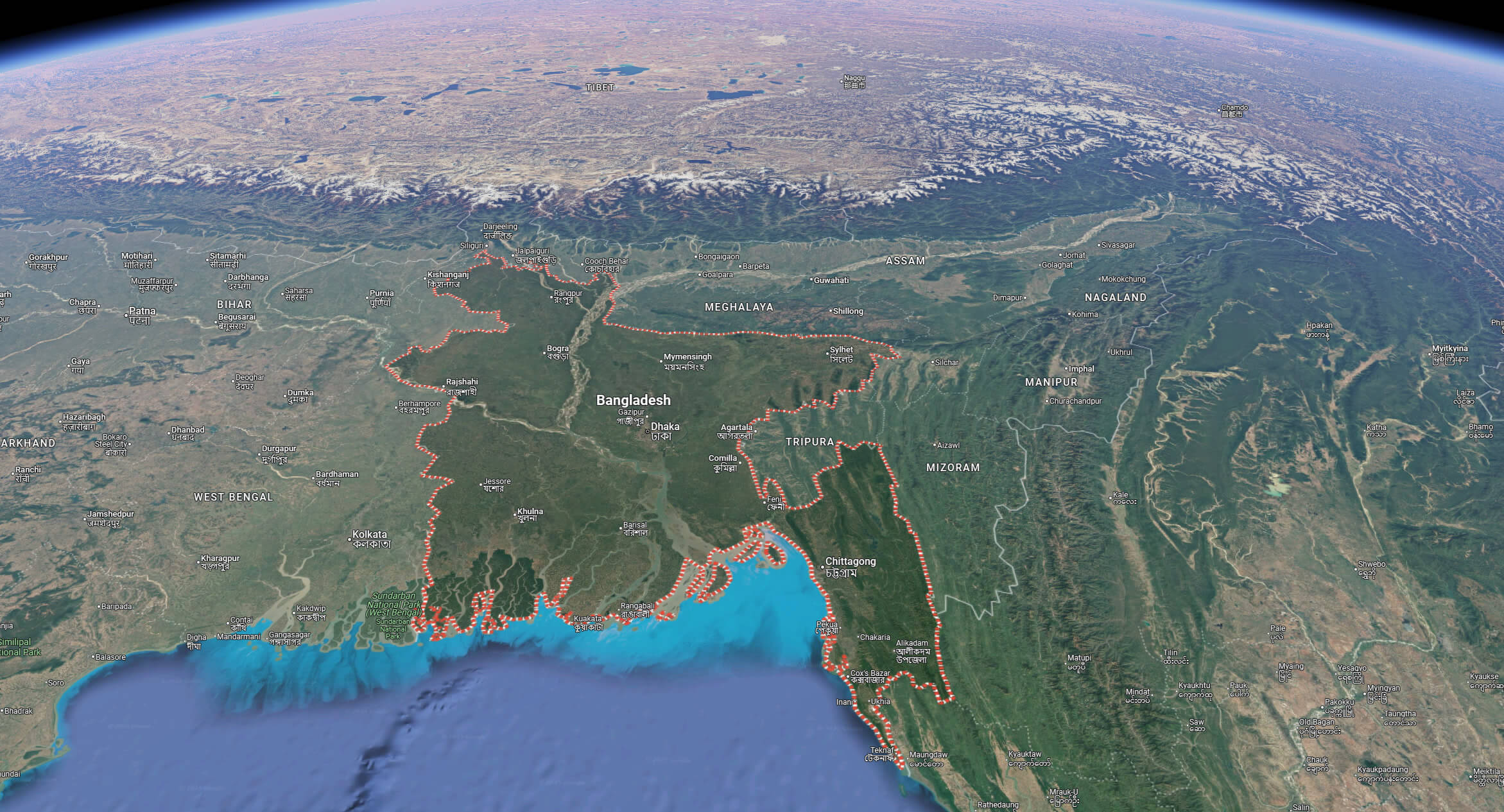
Bangladesh satellite map with himalayas
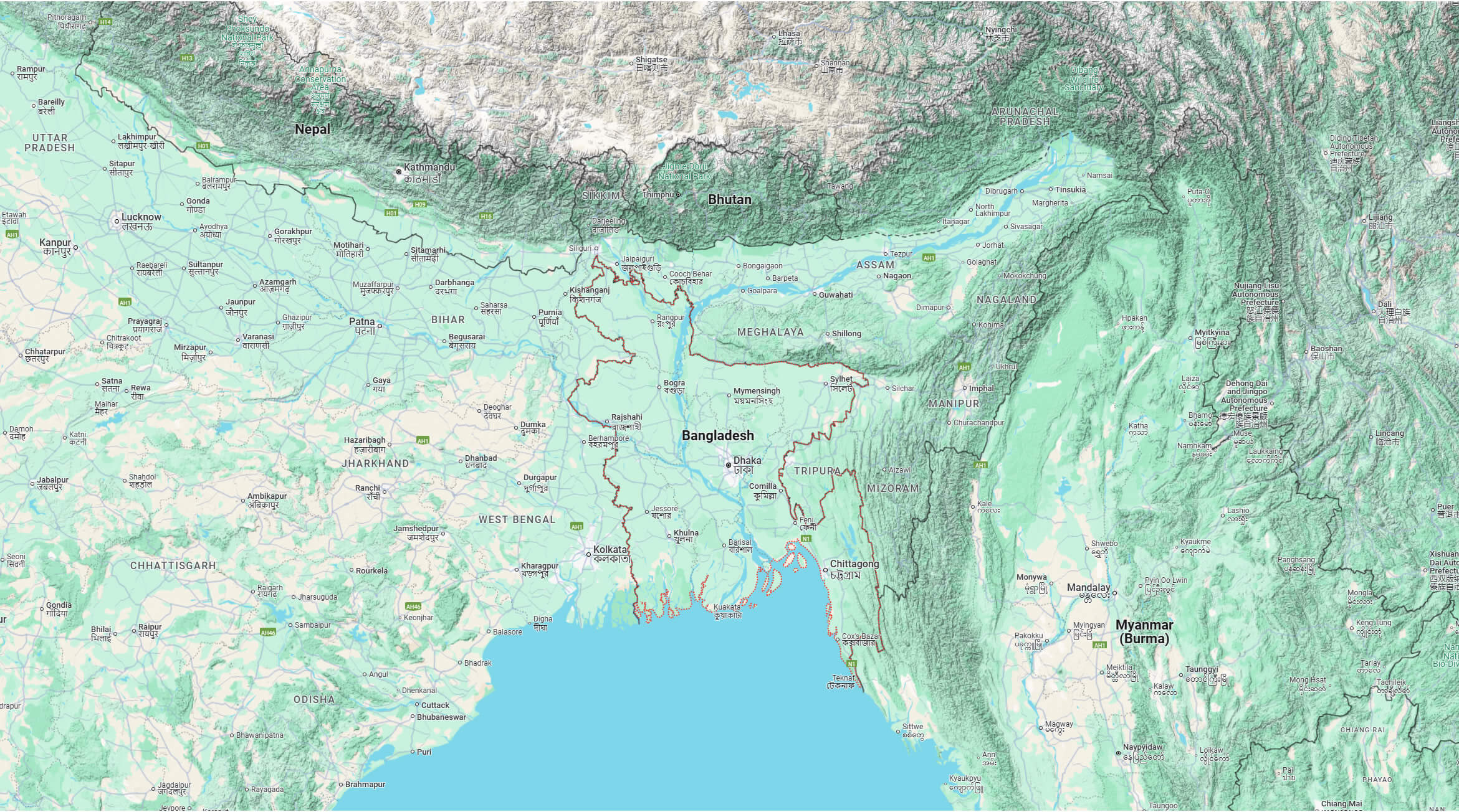
Bangladesh terrain map
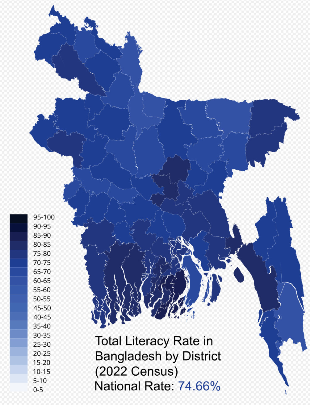
Literacy rate map in Bangladesh 2022
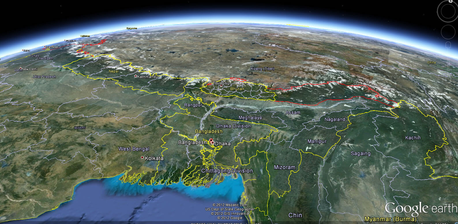
Bangladesh Earth Map
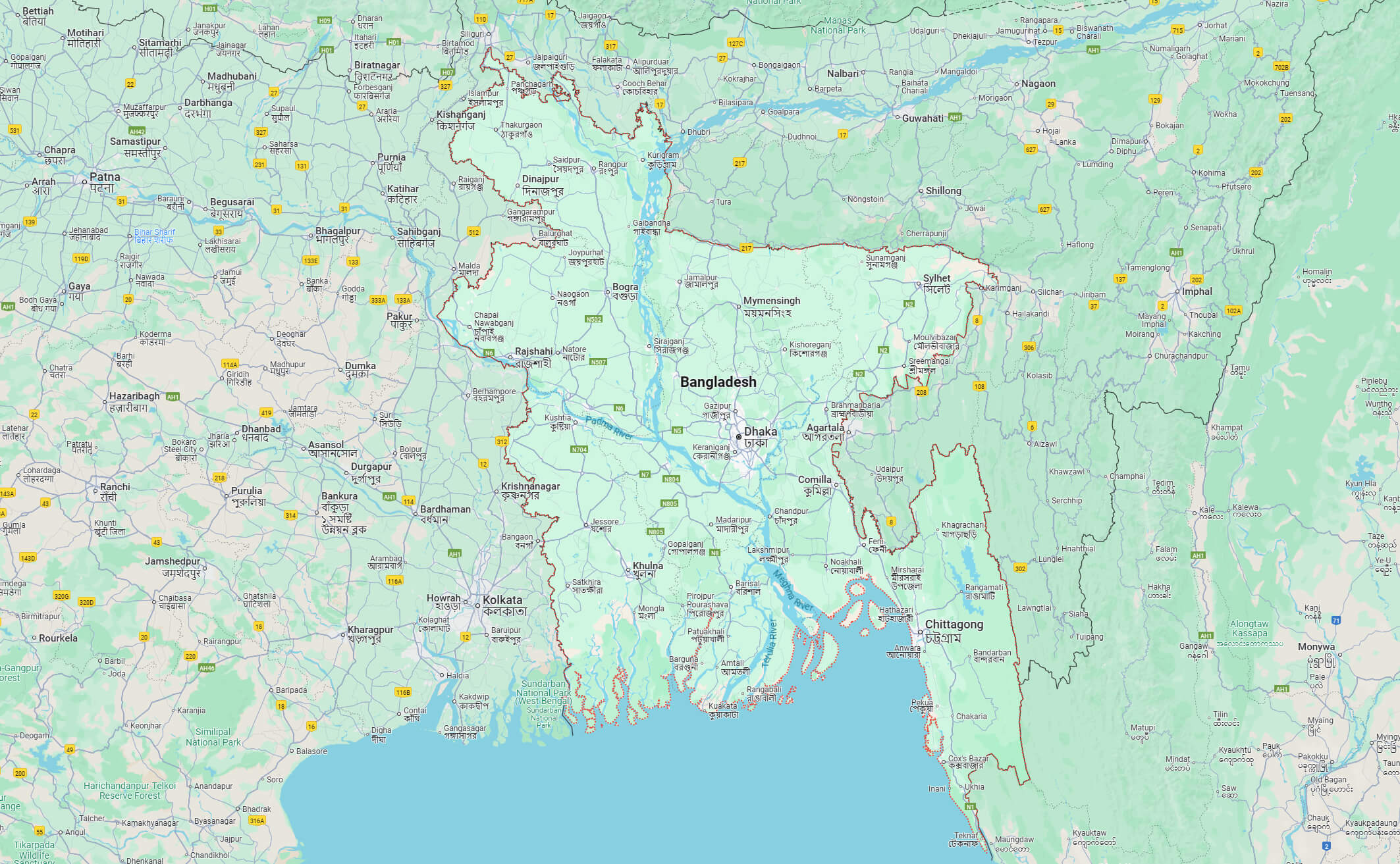
Bangladesh map
Map of Bangladesh India
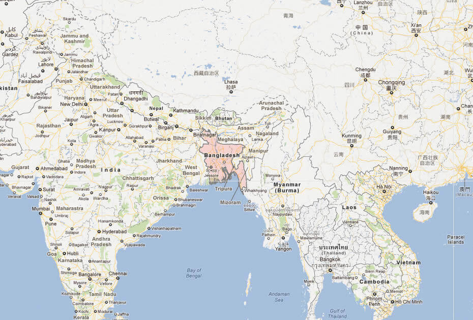
Map of Bangladesh World
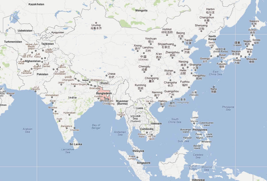
Where is Bangladesh on the Asia and the World Map?
Show Google map, satellite map, where is the country located.
Get directions by driving, walking, bicycling, public transportation and travel with street view.
Feel free to explore these pages as well:
- A Collection of Bangladesh Maps ↗️
- India Map ↗️
- Map of India ↗️
- India ↗️
- Pakistan Map ↗️
- Muslim Population Map in Asia by Country ↗️
- Mumbai’s Must-Visit Guide to Attractions ↗️
- Delhi’s Top 10 Must-Visit Attractions for Every Traveler ↗️
- Discover Bangalore: The Silicon Valley of India ↗️
- Discovering Ahmedabad: India’s Historical and Cultural Gem ↗️
- Myanmar (Burma) Map ↗️
- China Map ↗️
