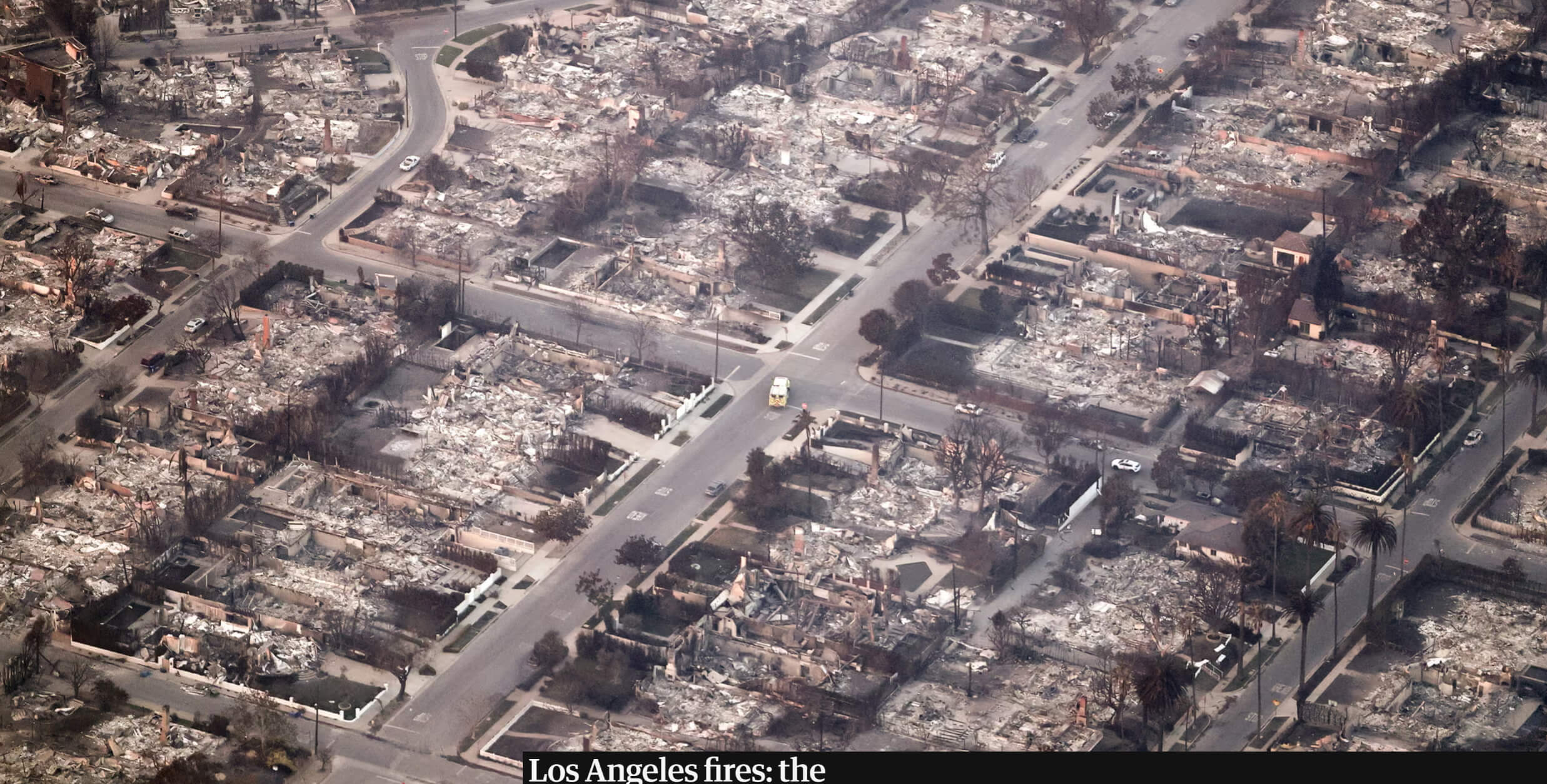
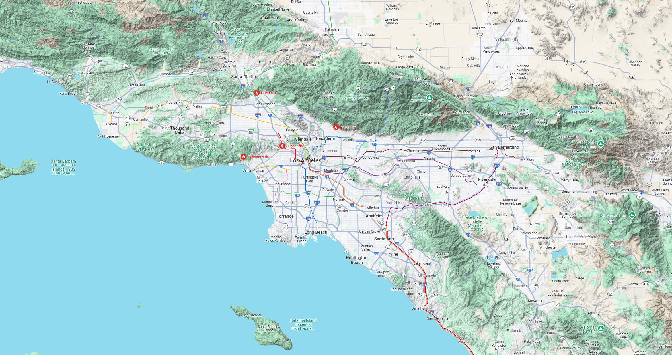
The 2025 Los Angeles wildfires had a significant impact on the region, highlighting the importance of accurate and timely wildfire mapping. These maps play a critical role in informing residents, first responders and local authorities about active fire zones, evacuation orders and high-risk areas.
LA Wildfires 2025 Map
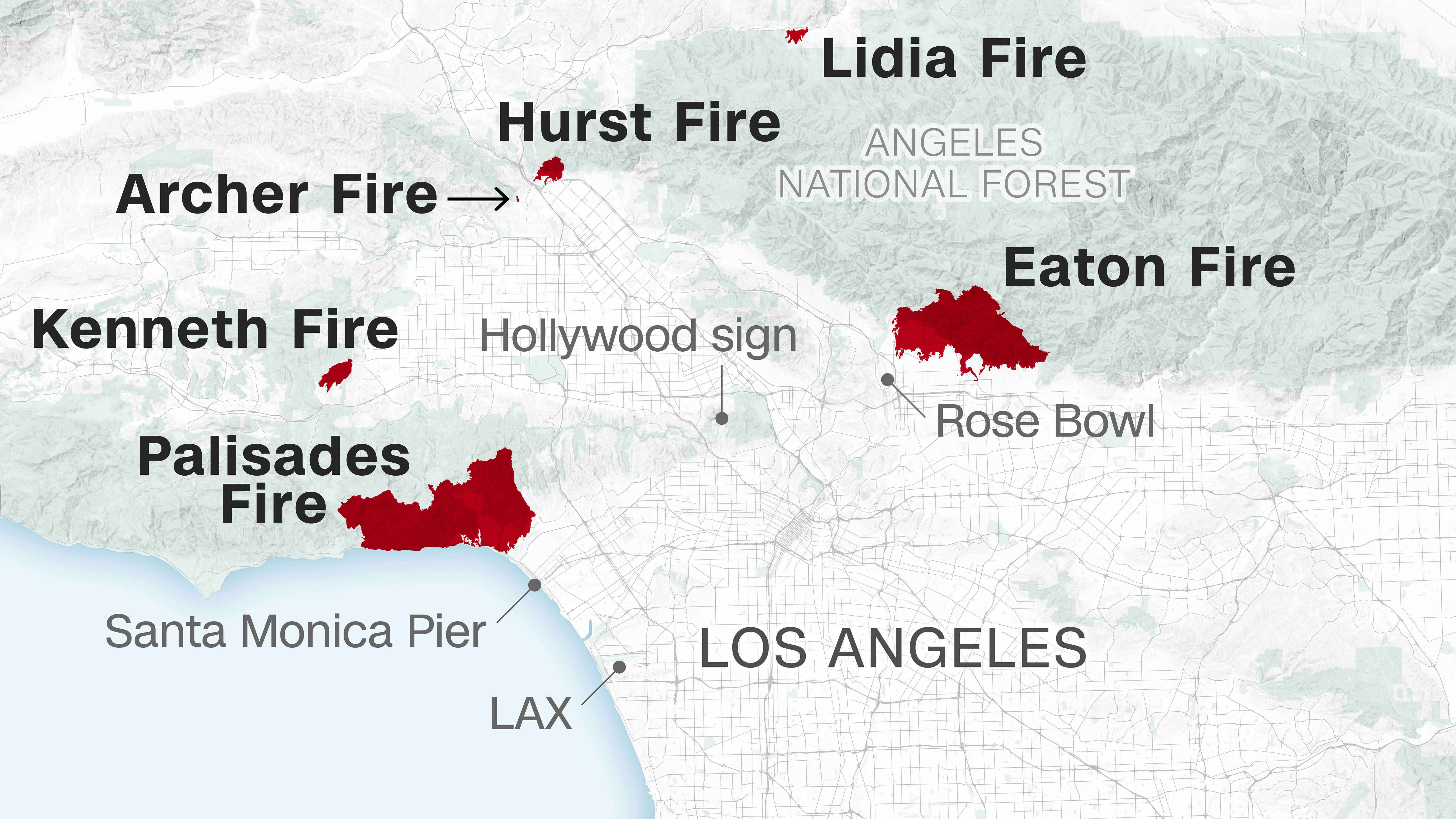 Map of Los Angeles showing the locations and extents of wildfires in 2025.
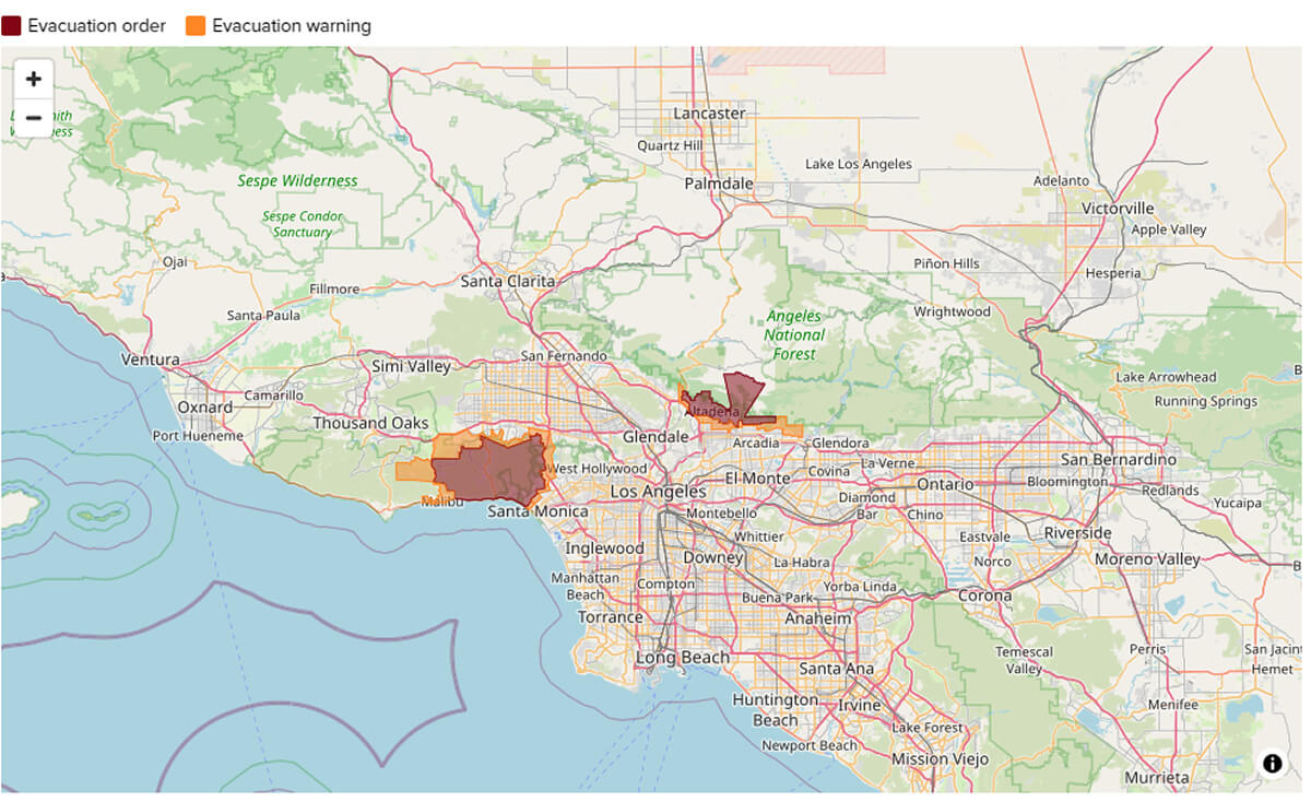
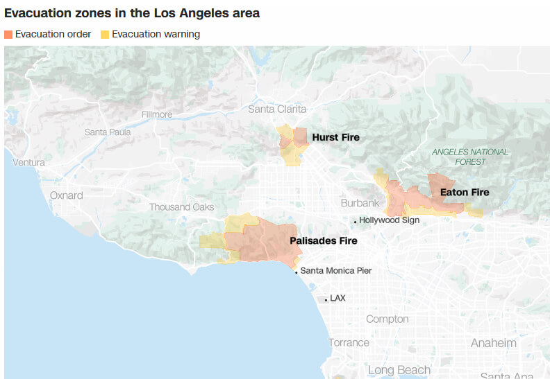
LA Wildfires 2025 Evacuation Map
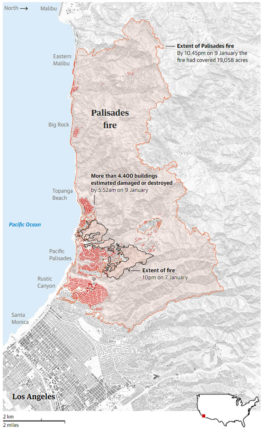
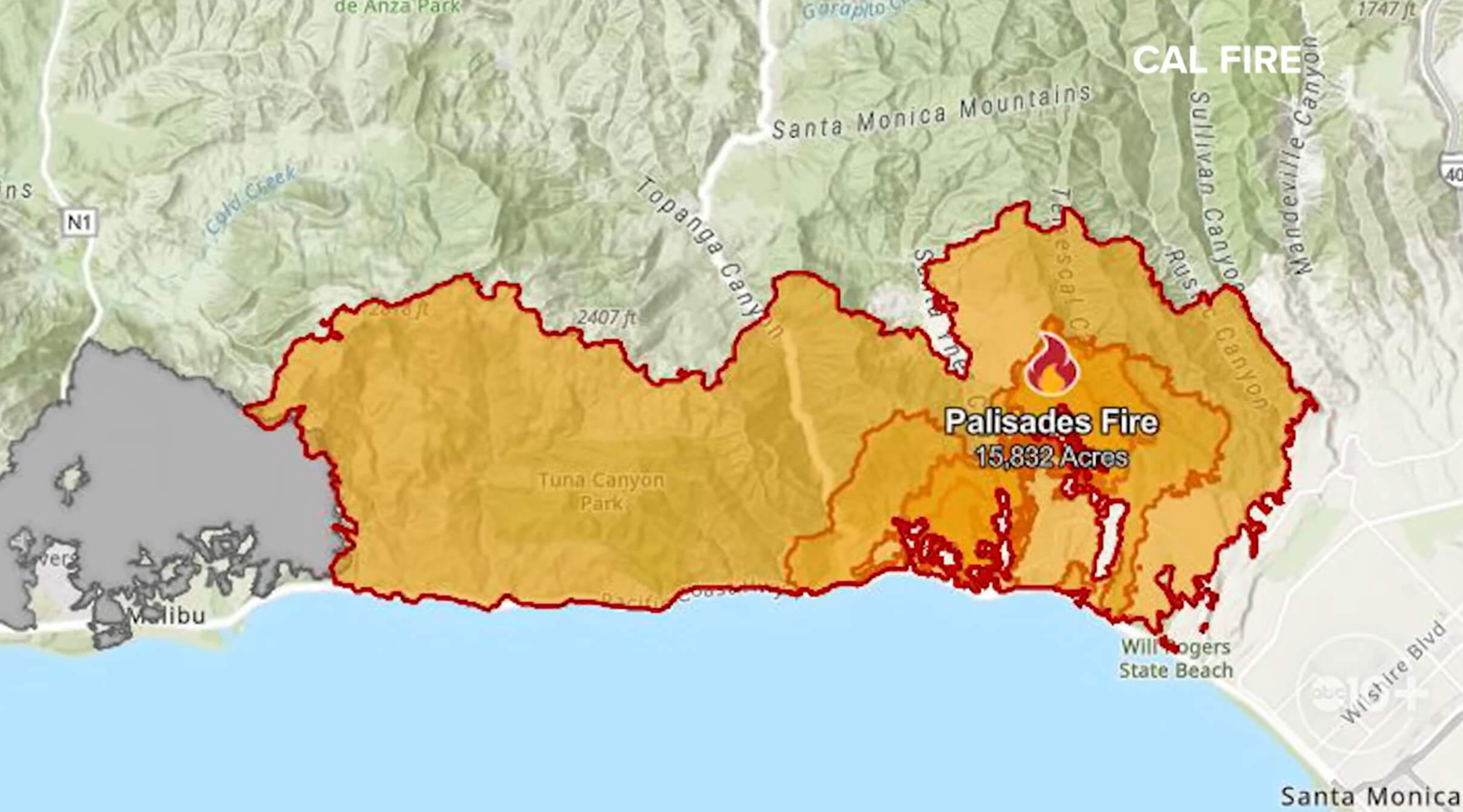
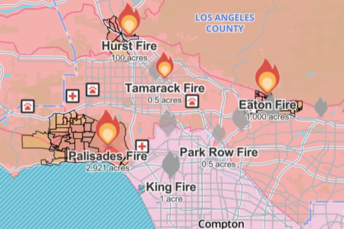
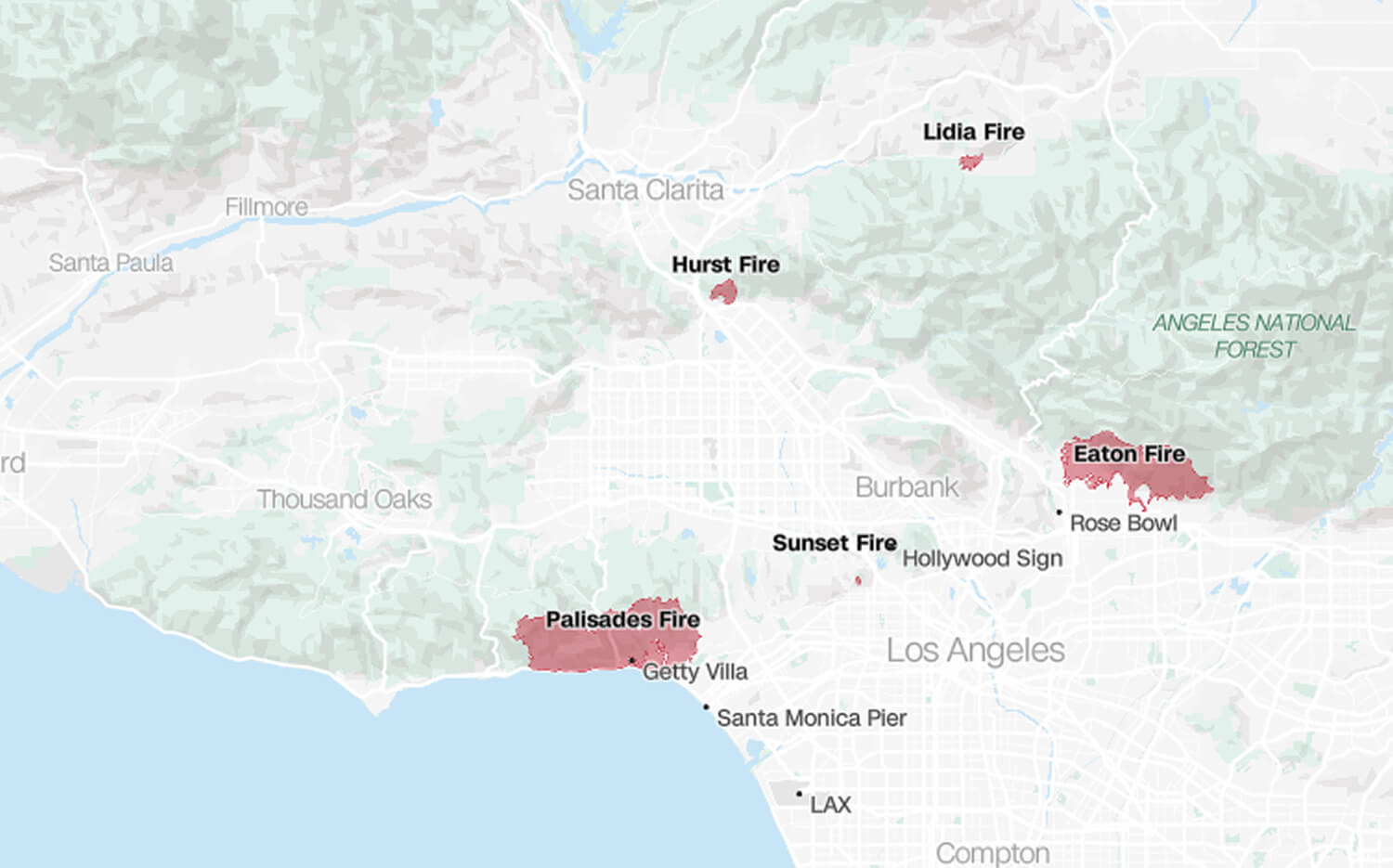
LA Wildfires 2025, Palisades Fire Map
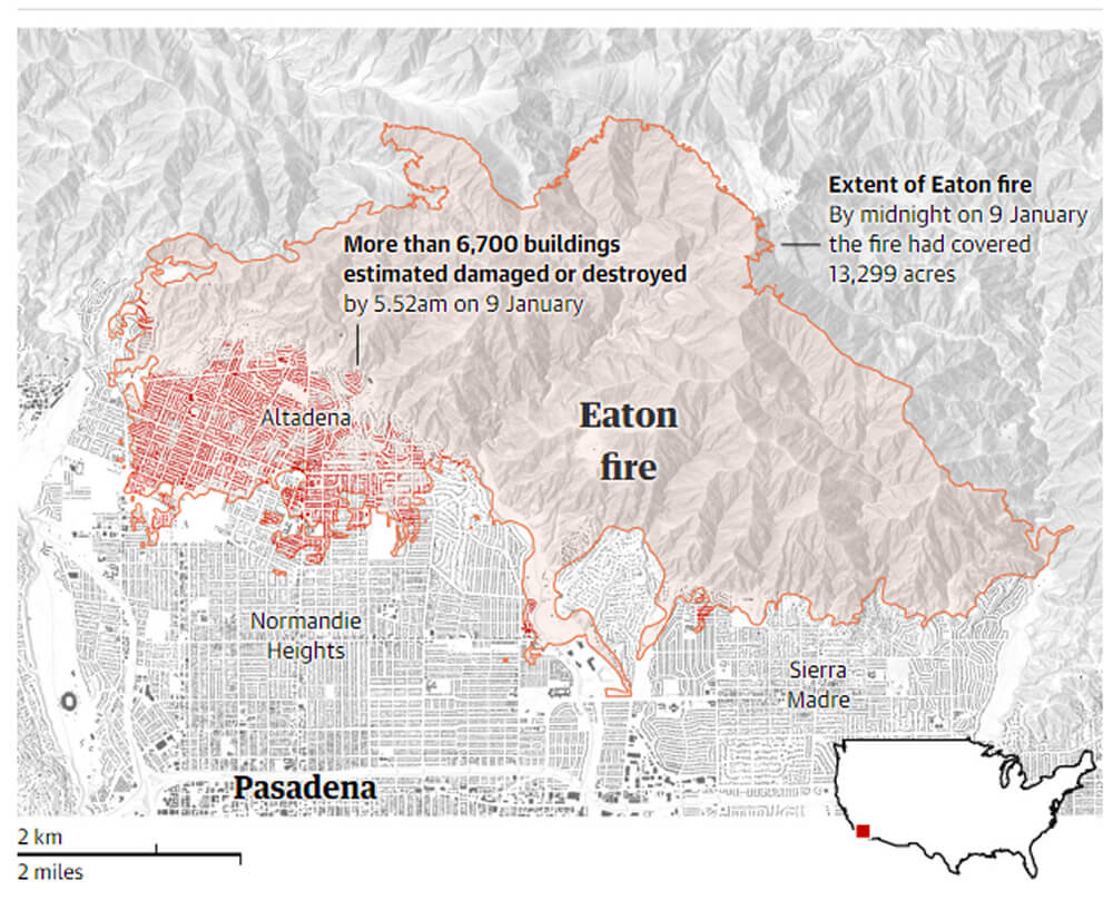
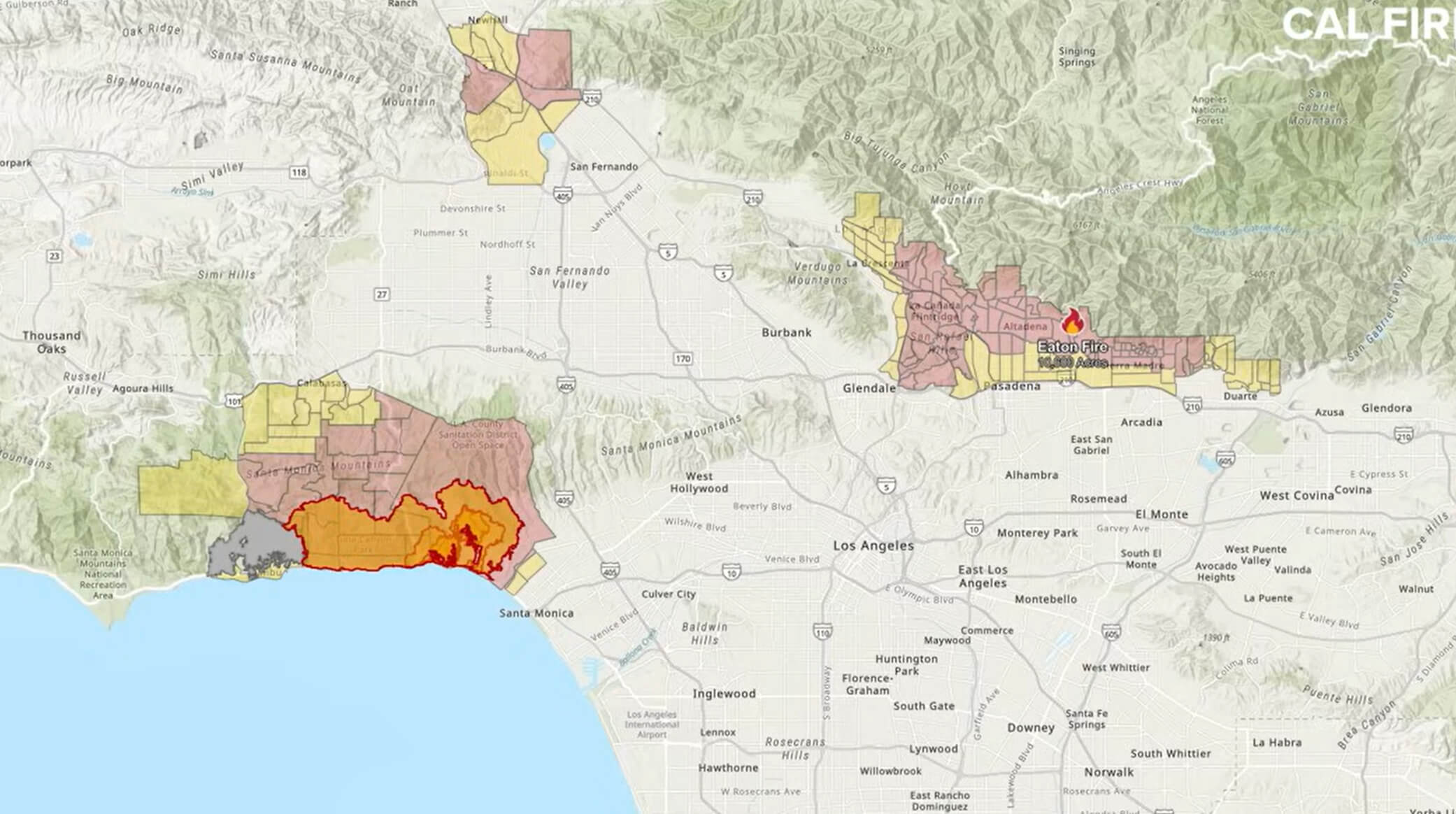
LA Wildfires 2025, Eaton Fire Map
LA Fires the Damage in Maps
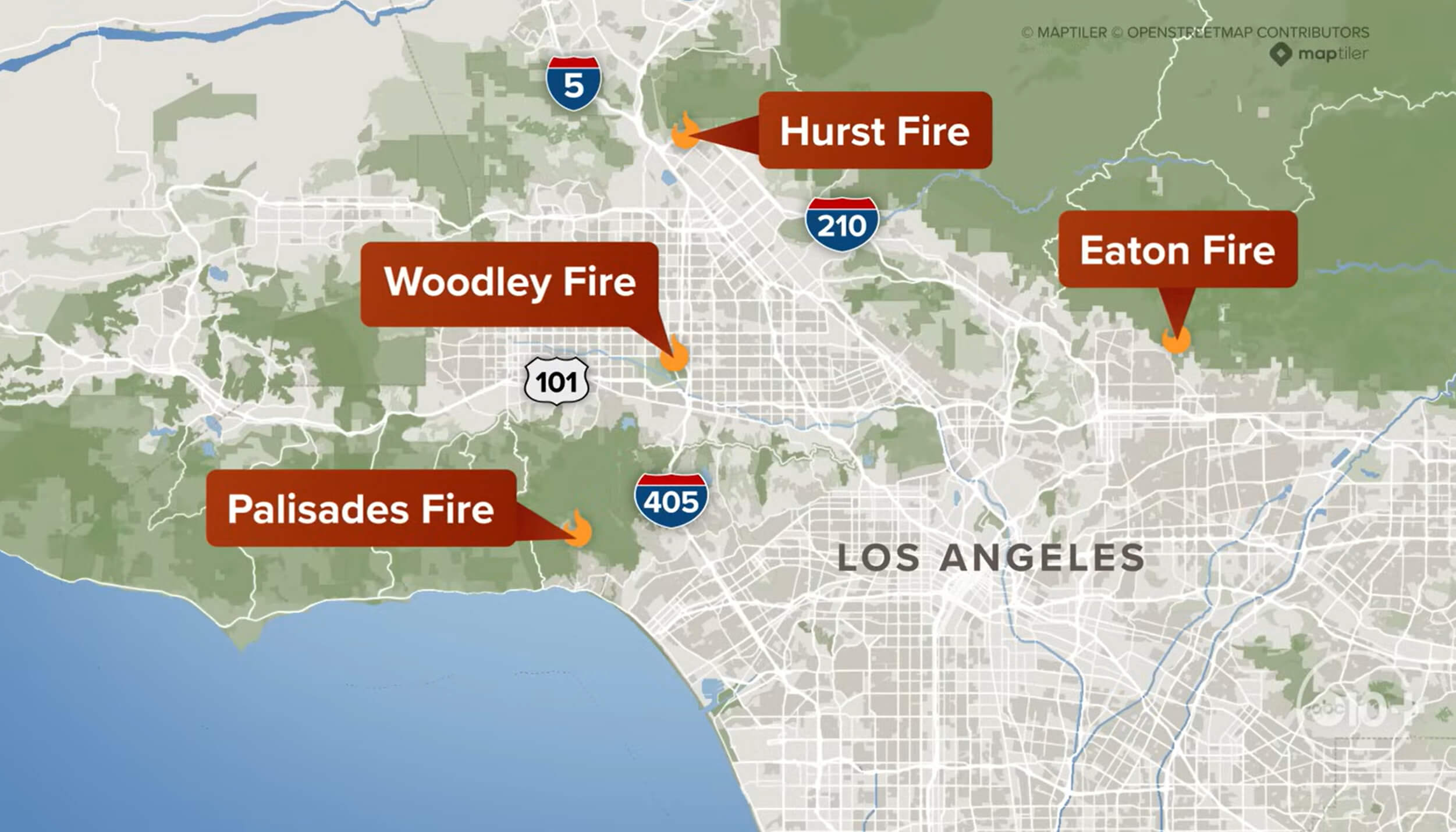
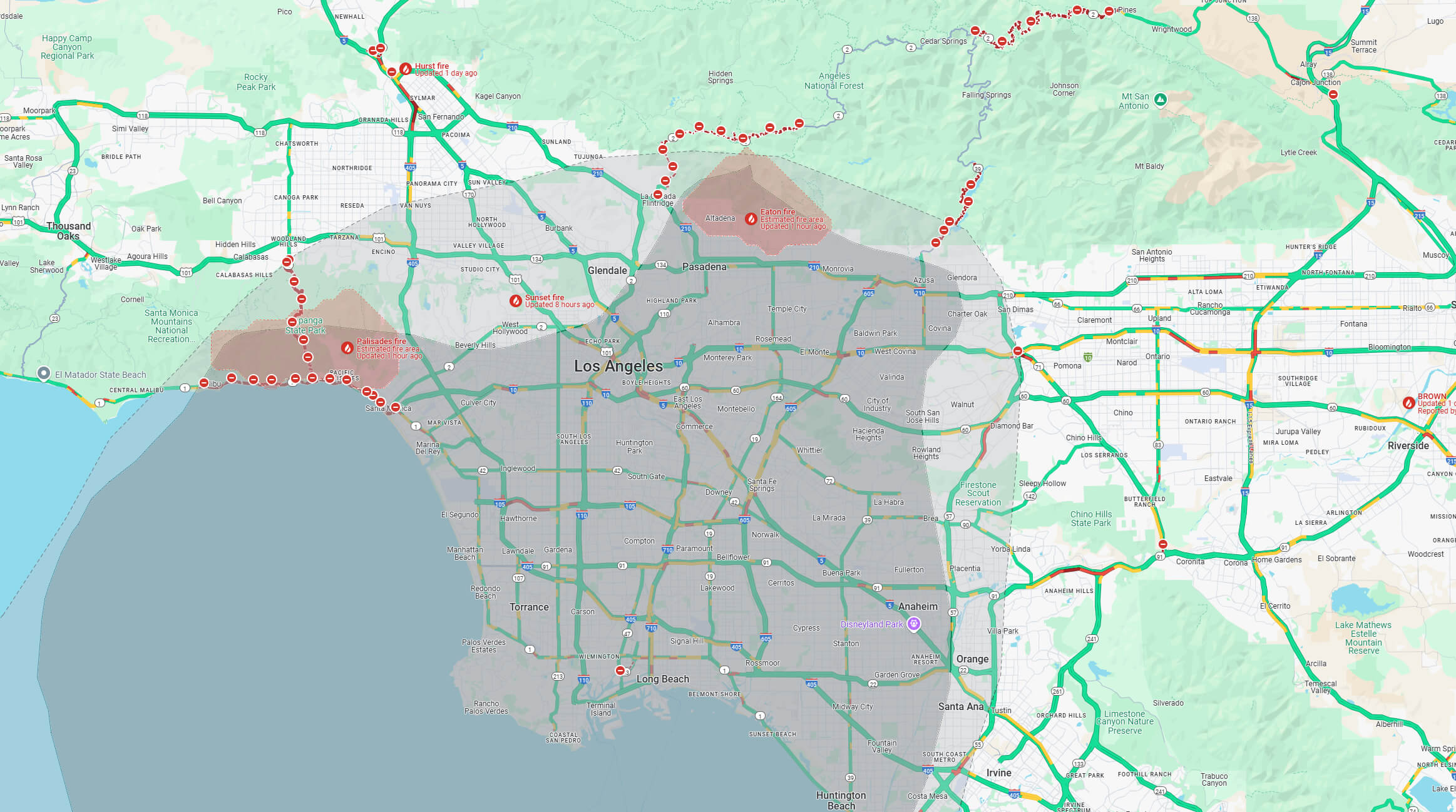
Los Angeles Active Wildfires Map
Evacuation maps and wildfire tracking tools have been instrumental in managing the crisis. The maps show areas under evacuation orders and warnings, helping communities to prepare and respond effectively. They also highlight the interplay between urban areas and natural landscapes, underscoring the ongoing struggle to protect lives and property in one of California’s most fire-prone regions. These visual tools not only guide emergency response efforts, but also serve as a reminder of the urgent need for sustainable fire management practices and community preparedness.
Evacuation zones map in Los Angeles
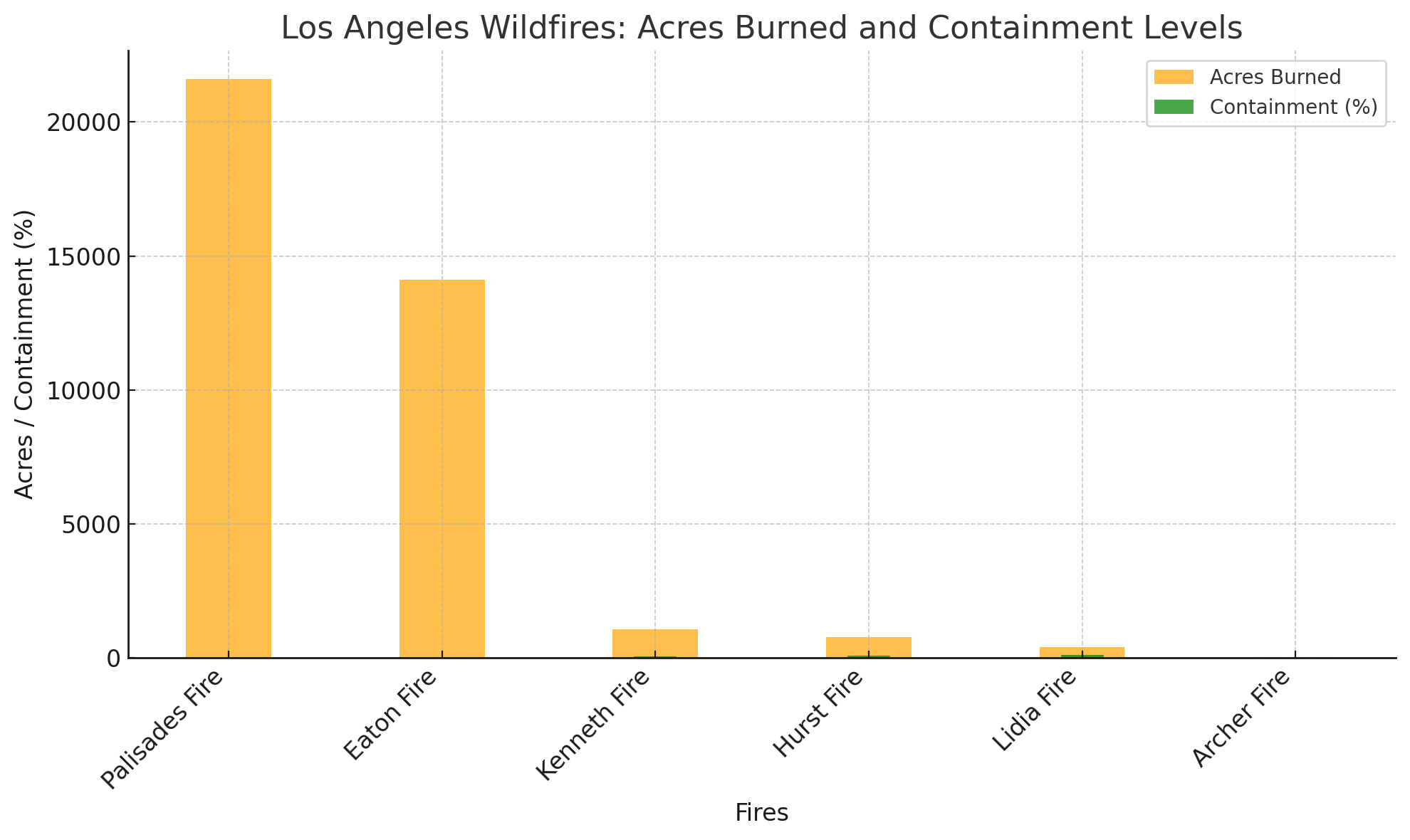
Los Angeles Wildfires: Acres Burned And Containment Levels (January 11th, 2025 Update)
Palisades Wildfire California 2025

The wildfires, including the Palisades Fire, Eaton Fire and Hurst Fire, have spread across large areas of the Los Angeles region, with the foothills and surrounding natural areas being particularly vulnerable. Each fire presents unique challenges due to varying terrain, weather conditions and proximity to populated areas.
Los Angeles wildfires wind alert map
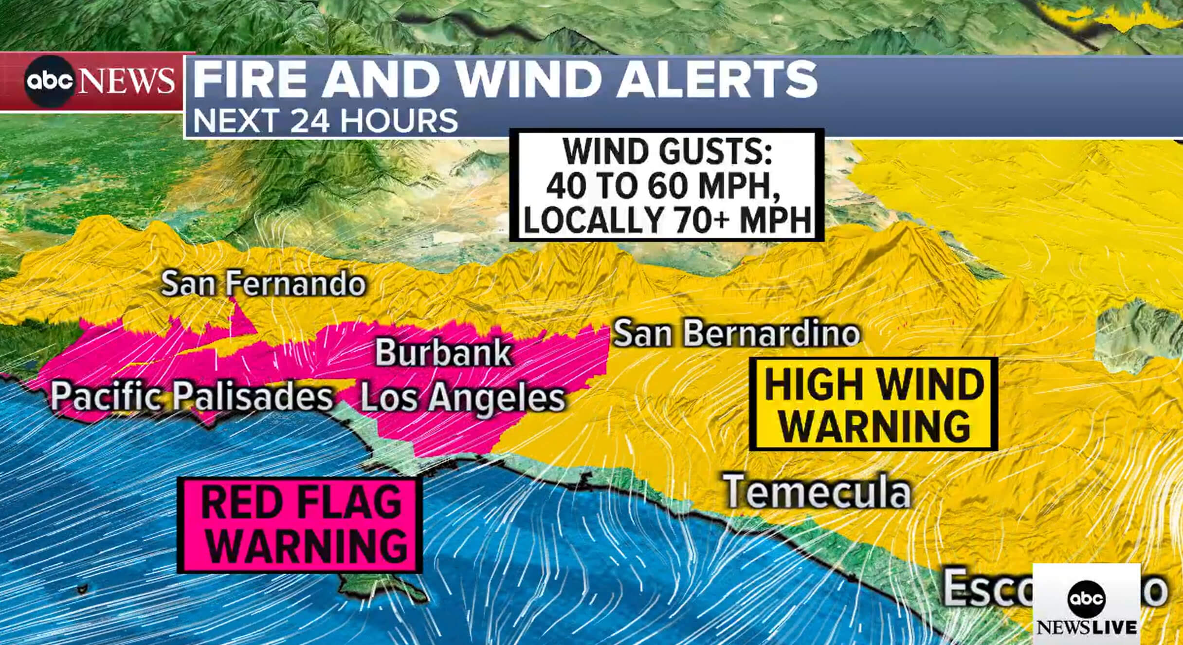
Los Angeles wildfires wind forecast map

Palisades fire California 2025
Map of Los Angeles wildfire
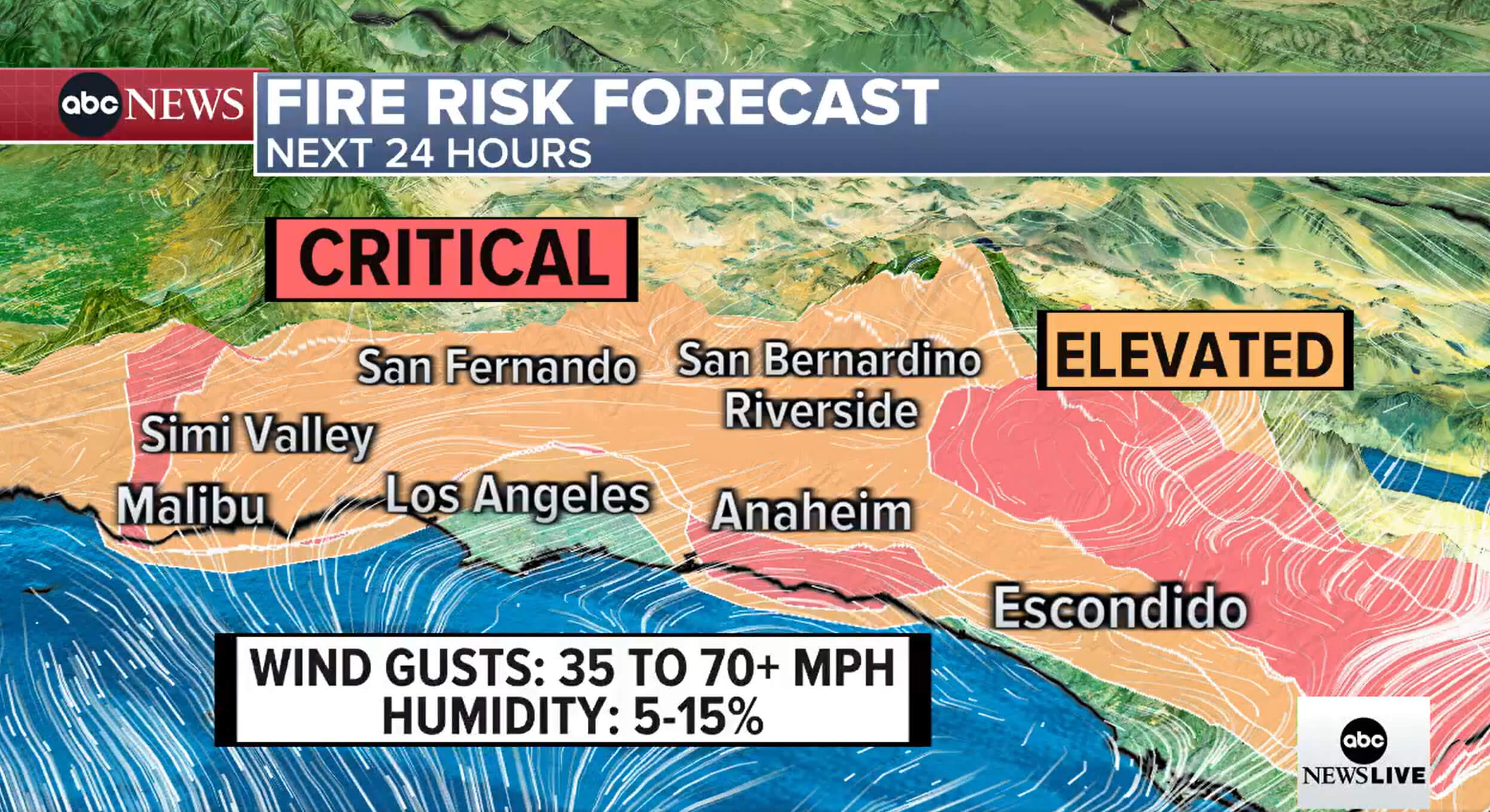
Los Angeles fire risk forecast map
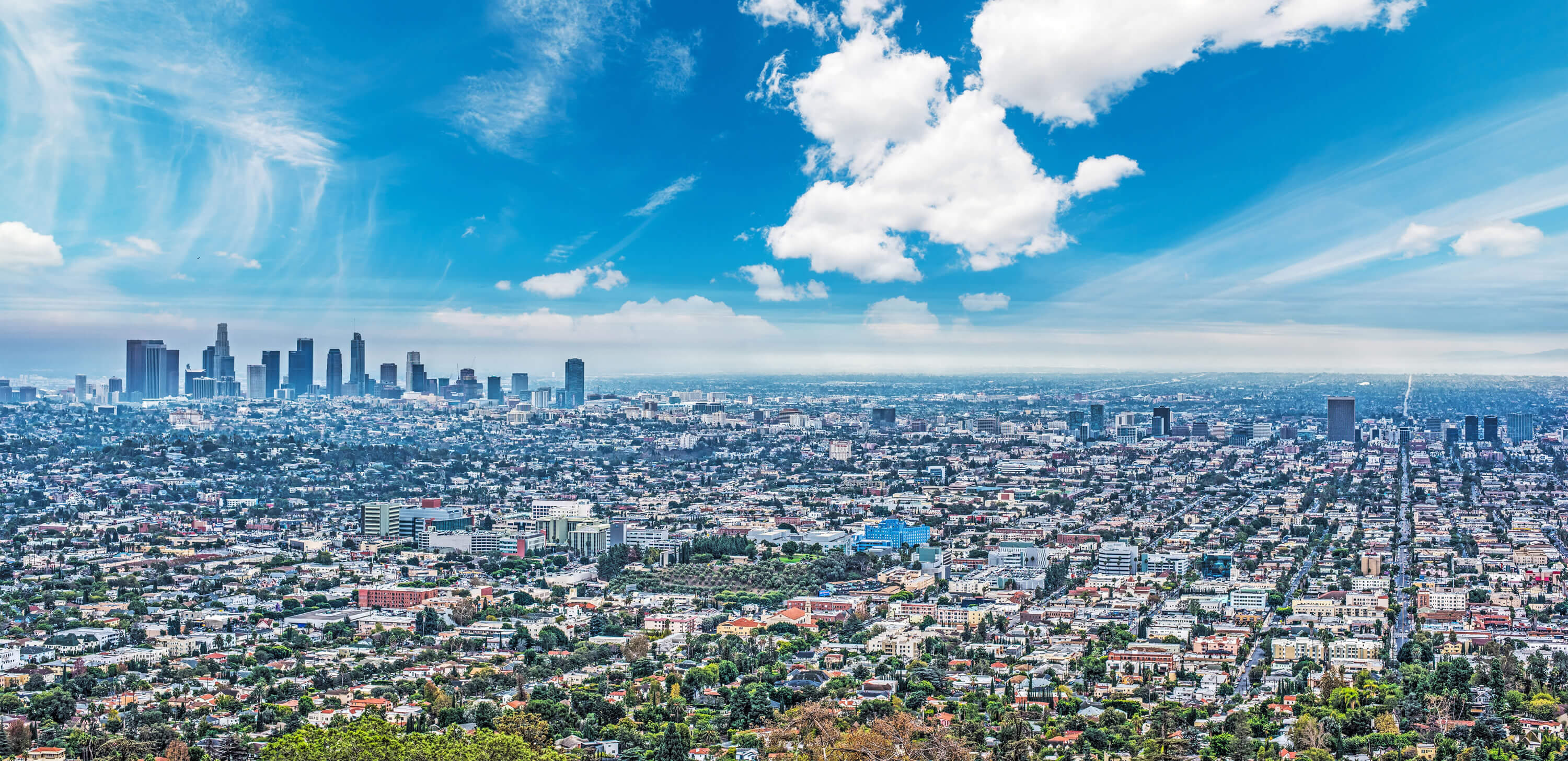
Blue sky over Los Angeles, in California
Acreage burned in California fires per month
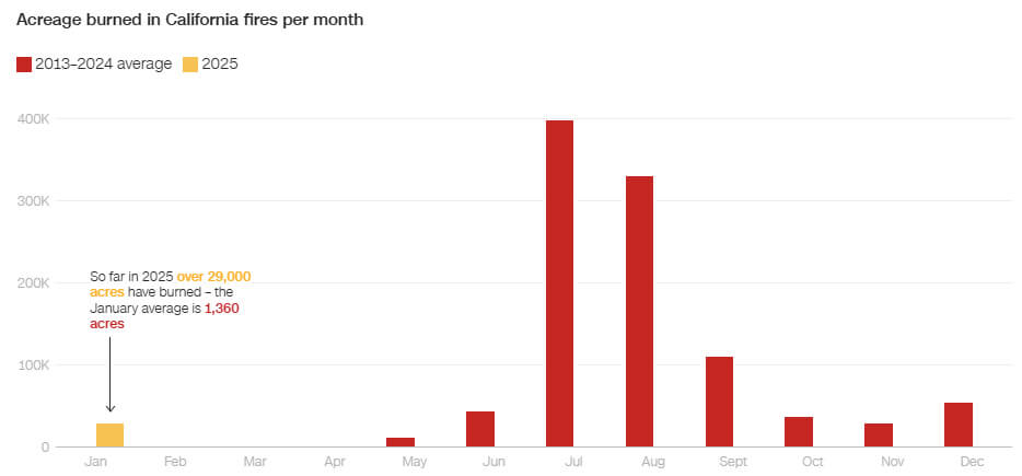 The Palisades and Eaton fires are already among the 10 largest fires to hit Los Angeles County since at least 2013.
Los Angeles wildfire map in 2025
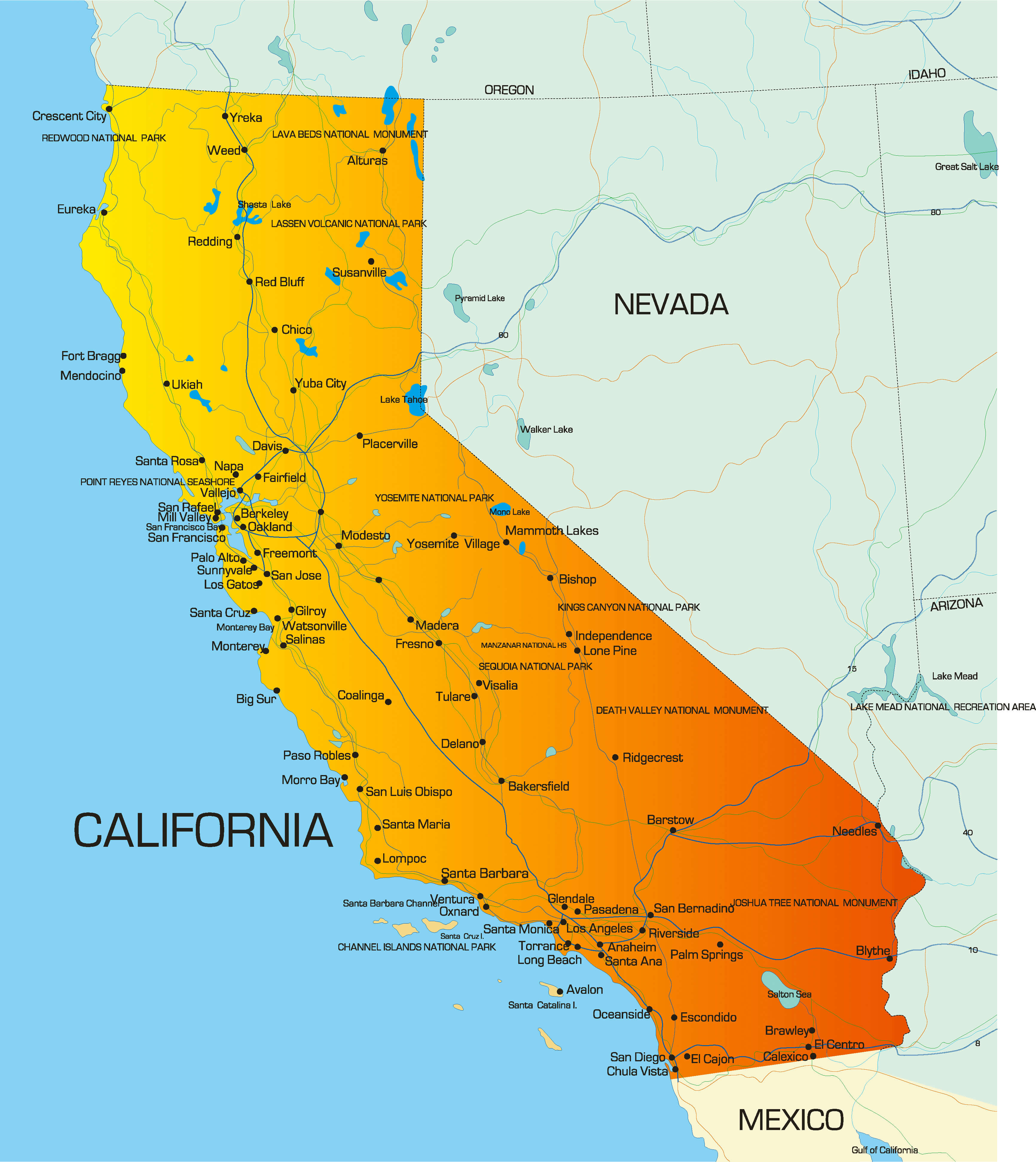
Where is located Los Angeles on California, US Map
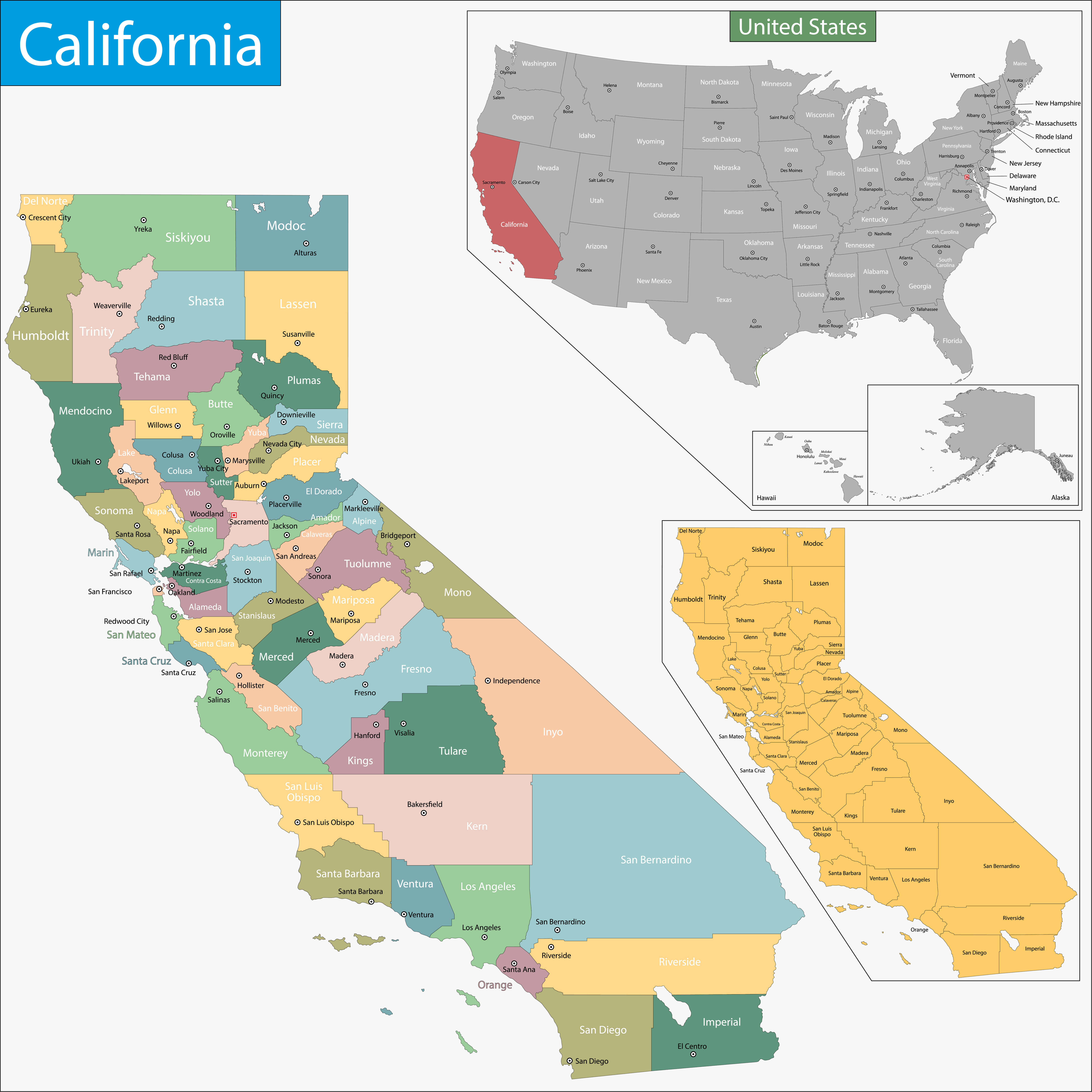
California Map with Cities
Los Angeles wildfires in map
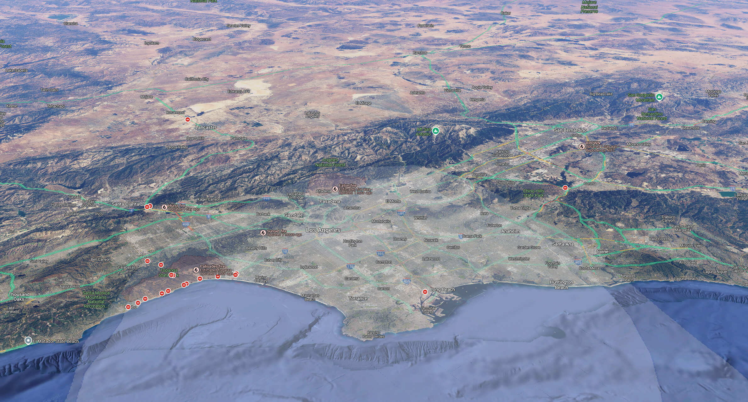
Los Angeles wildfires map with palisades eaton hurst lidia fire
Los Angeles California wildfire map
Los Angeles California wildfire terrain map
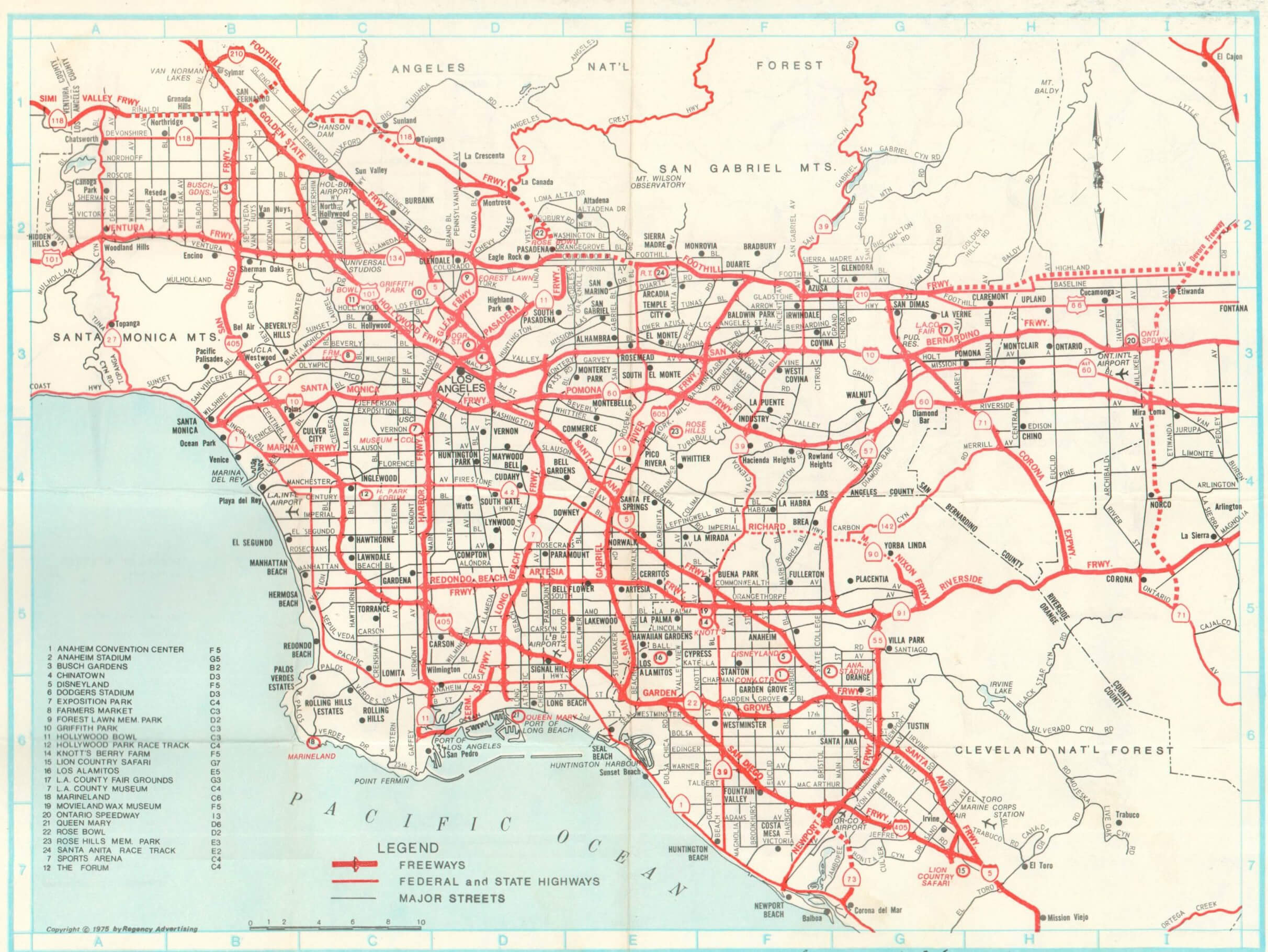
Los Angeles highways map
Los Angeles and California map
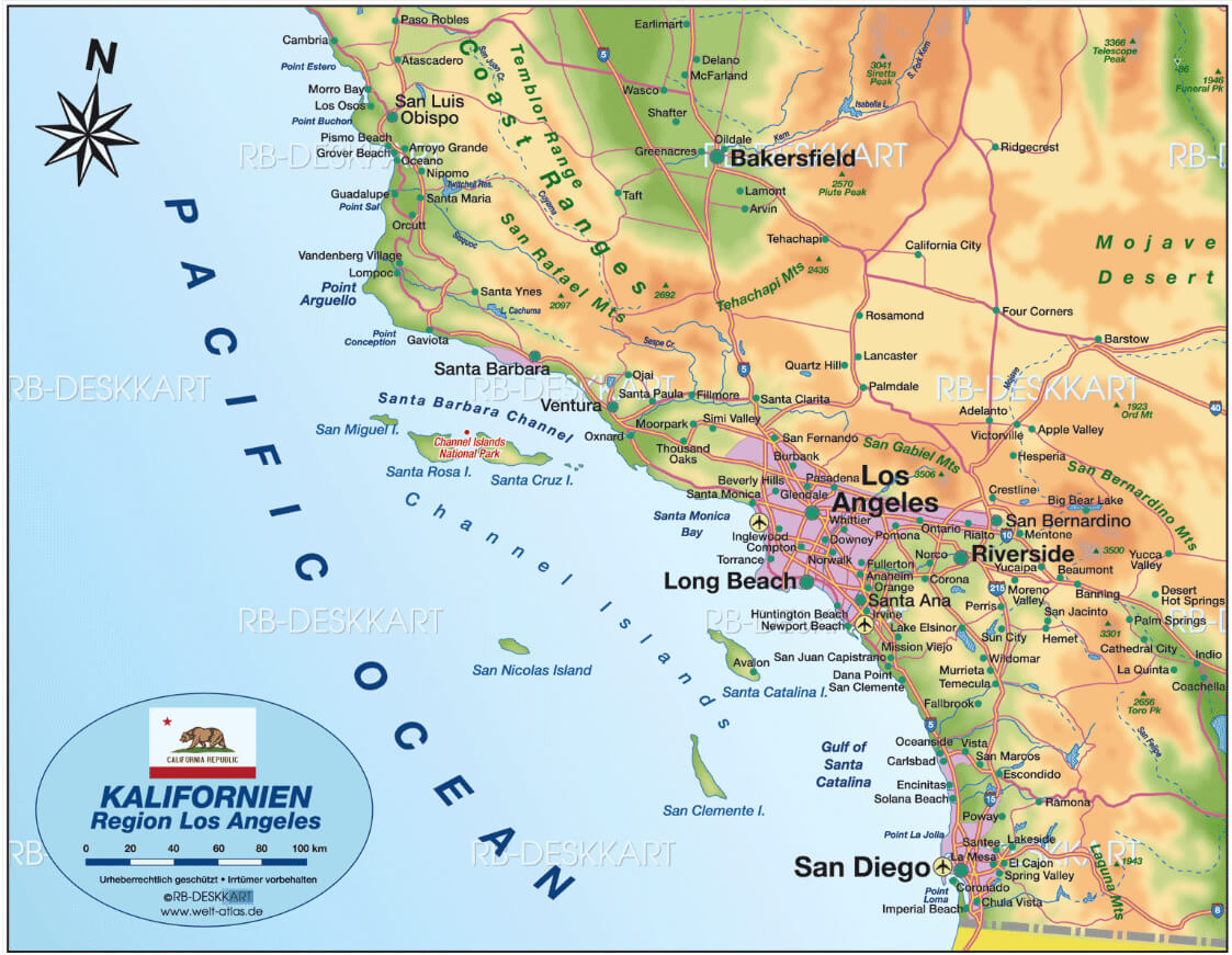
Where is Los Angeles on California Map?
Show Google interaactive map, satellite map, where is the country located.
Get directions by driving, walking, bicycling, public transportation and travel with street view.
Where is California in the US and and Cities Map of California – @WorldGuide Youtube
Feel free to explore these pages as well:
- Los Angeles Map ↗️
- LA Fires January 2025 ↗️
- Palisades Map in Los Angeles ↗️
- Eaton Map in Los Angeles ↗️
- Malibu Map in Los Angeles ↗️
- San Fernando Map in Los Angeles ↗️
- California Map ↗️
- Map of California↗️
- A Collection of California Maps ↗️
- California County Map ↗️
- North America Earth Map ↗️
- Discovering Los Angeles ↗️
- Discover the California: A Vibrant Journey through Golden State ↗️
- Discovering Bakersfield: The Heart of California’s Central Valley ↗️
- Anaheim: California’s Hidden Gem ↗️
- Guide to Los Angeles’ Top 10 Attractions ↗️
- Discover Chula Vista: A Hidden California Gem with Rich Culture and Stunning Views ↗️
- United States Map ↗️
- Map of United States ↗️
- North America Map ↗️
- Map of North America ↗️