A Collection of Romania Maps offers a fascinating look into the country’s geography, history, and cultural diversity, providing insights into its regions, cities, and evolving borders over the centuries.
Brief information about Romania
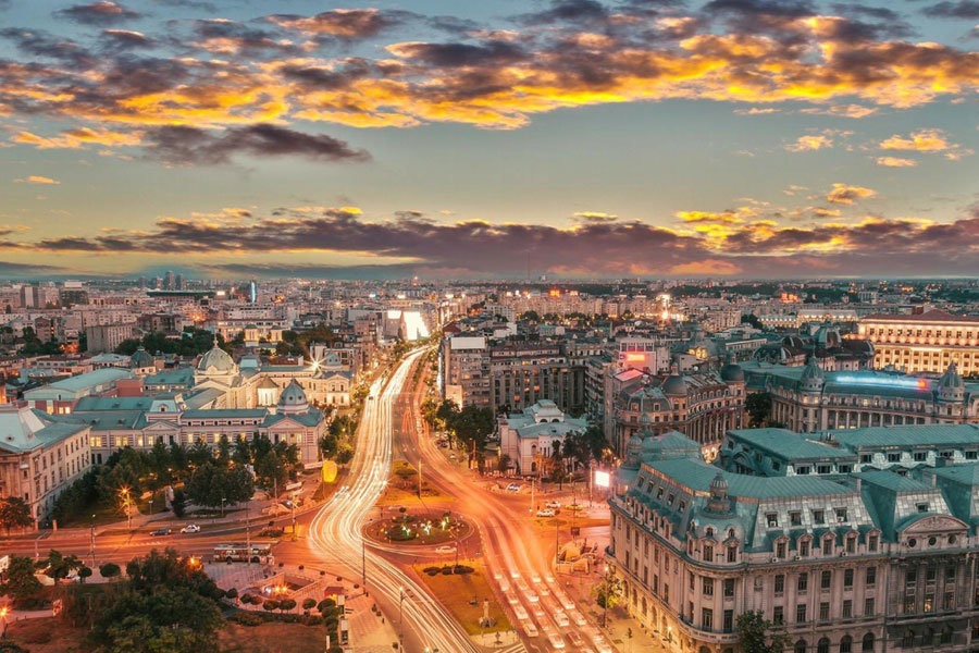
Romania, nestled in the heart of Eastern Europe, is a country known for its stunning natural landscapes, including the Carpathian Mountains and the lush forests of Transylvania. This region is famous for its medieval castles, such as the iconic Bran Castle, often linked to the Dracula legend. Romania’s capital, Bucharest, is a lively blend of modernity and history, featuring impressive architecture like the grand Parliament Palace.
Romania Location Map
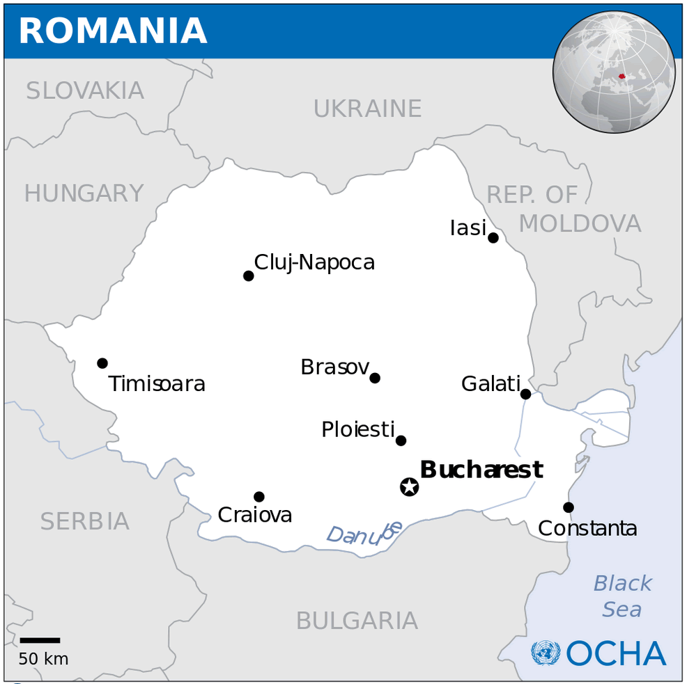
This map of Romania shows its location in southeastern Europe, with major cities including Bucharest, Cluj-Napoca, Timișoara, Iași and Constanța. It borders countries such as Hungary, Ukraine, Moldova, Bulgaria and Serbia, with the Danube River forming part of its southern border. The map highlights Romania’s strategic location near the Black Sea, making it an important geographical hub in the region.
Beyond its rich history, Romania offers a vibrant cultural scene, delicious cuisine, and warm hospitality. Visitors can explore traditional villages where time seems to stand still or enjoy the serene shores of the Black Sea. Romania is a destination where old-world charm meets contemporary energy, making it an unforgettable experience for travelers.
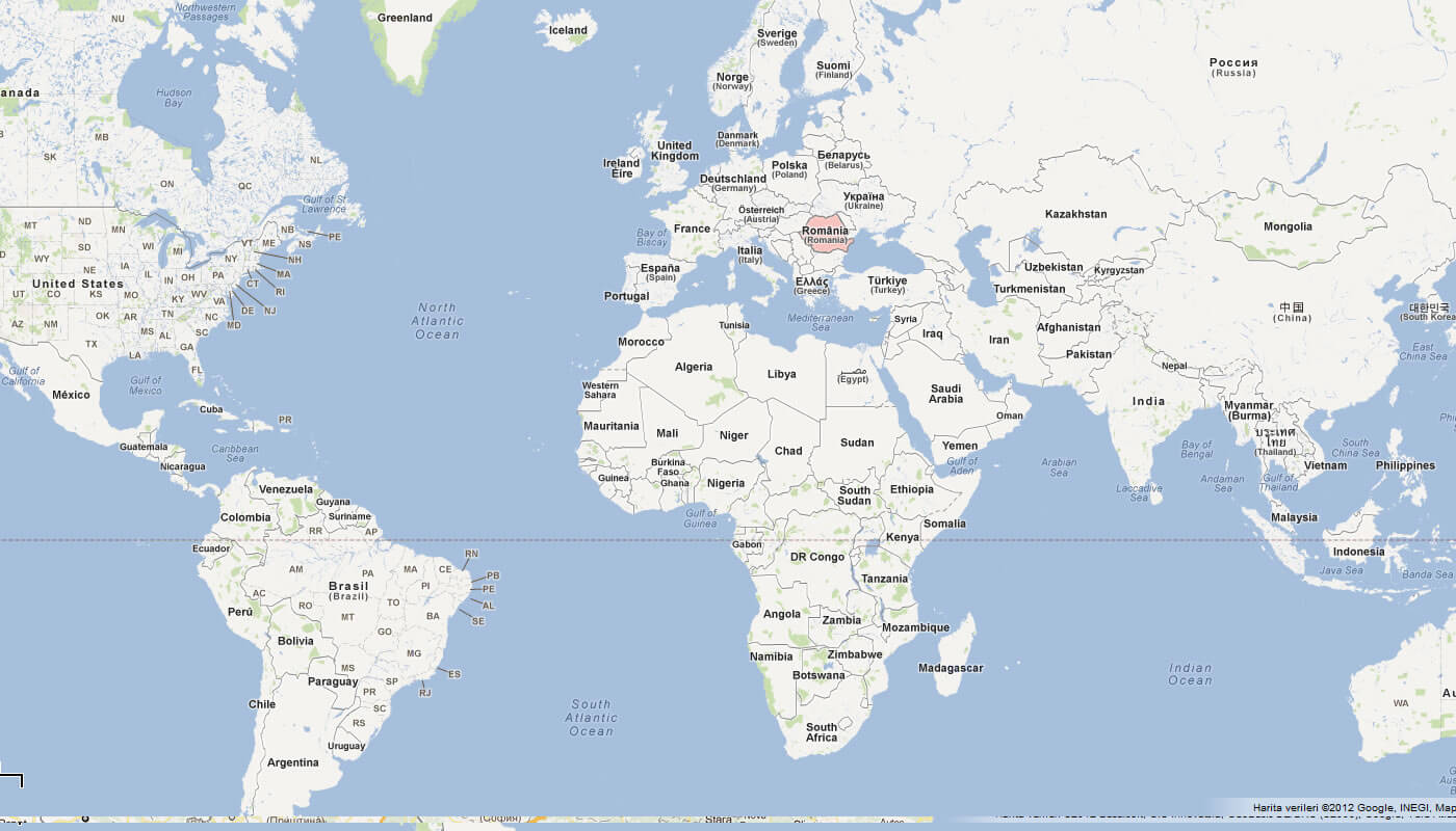
Where is located Romania on the World Map
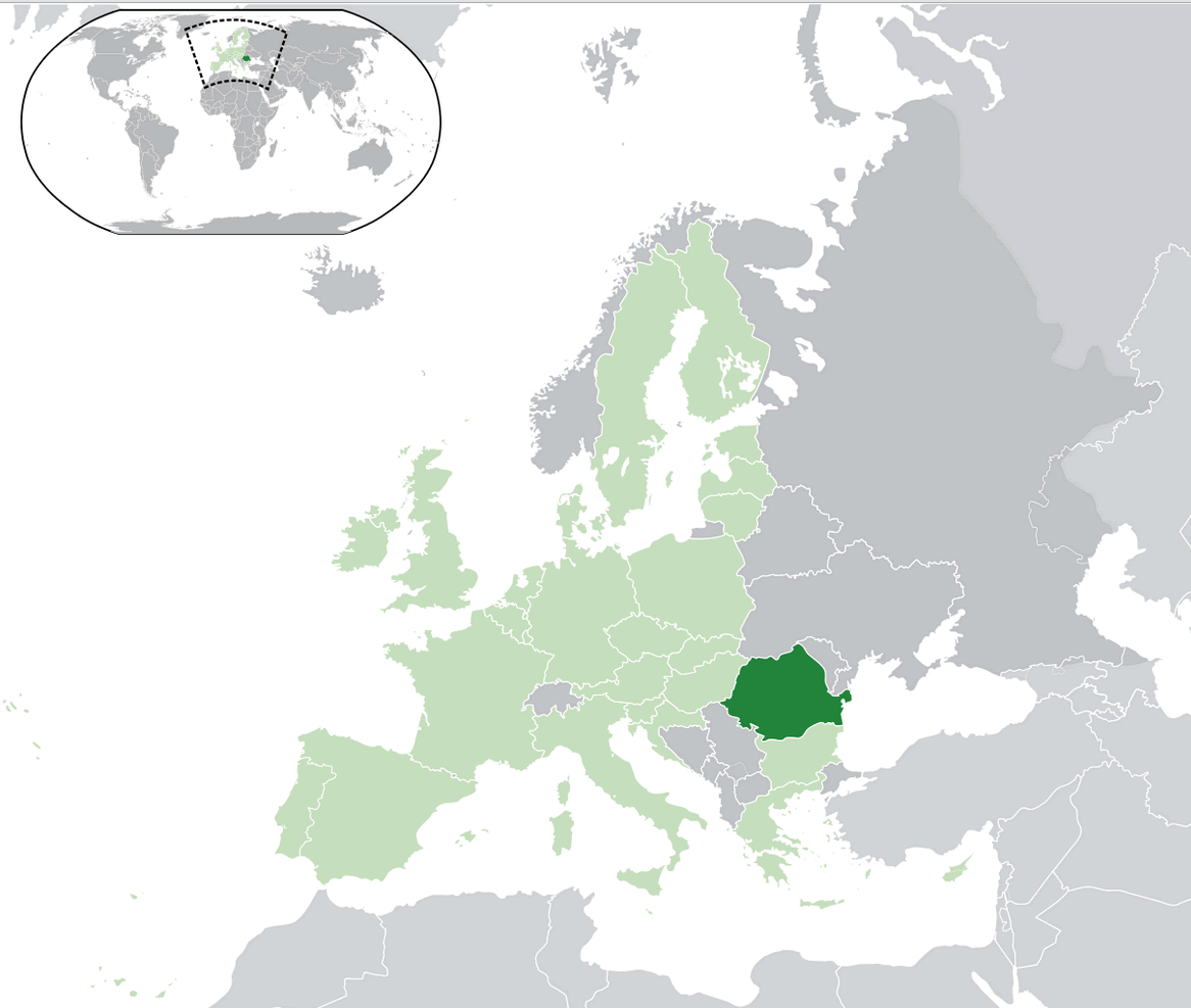
Romania is situated in Eastern Europe, bordered by Ukraine to the north, Bulgaria to the south, and Hungary to the west. Its eastern edge meets the Black Sea, providing the country with beautiful coastal views. This strategic location makes Romania a crossroads between Central, Eastern, and Southeastern Europe, influencing its rich cultural heritage.
The country lies in the northern hemisphere and is part of the European Union, making it accessible to travelers from across Europe. Its capital city, Bucharest, is a major gateway, connecting Romania to various international destinations. The location also allows for easy travel to neighboring countries like Serbia and Moldova.
Romania’s geography is diverse, with the Carpathian Mountains running through its central region, offering stunning landscapes. Its position between mountain ranges and the Black Sea means visitors can enjoy a mix of hiking, history, and seaside relaxation, all within a few hours’ travel.
Here are some statistical information about Romania:
Physical Map of Romania
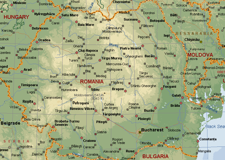
This physical map highlights Romania’s varied landscape, including the Carpathian Mountains, its central plains, and the Black Sea coastline to the southeast, with borders shared with Hungary, Ukraine, Moldova, Serbia, and Bulgaria.
Romania Relief Map
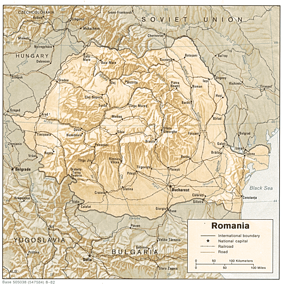
This relief map of Romania highlights its mountainous terrain, dominated by the Carpathian Mountains in the central region, as well as the lower plains toward the south and east, leading to the Black Sea. It shows Romania’s borders with neighboring countries like Hungary, Bulgaria, and the former Soviet Union.
Romania Political Map
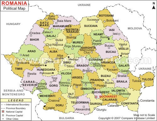
Romania Road Map
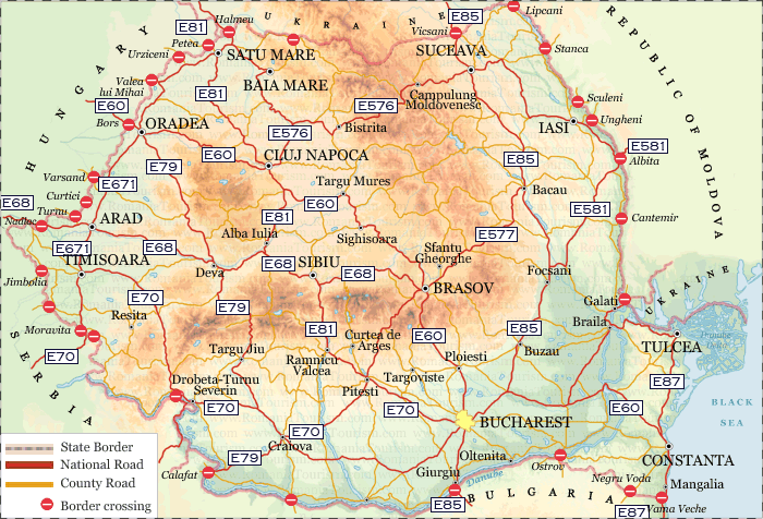
This road map of Romania displays the country’s network of highways, national roads, and border crossings, connecting major cities like Bucharest, Cluj-Napoca, Timi?oara, and Ia?i. It highlights key routes like the E60, E81, and E85, providing access across Romania and to neighboring countries like Hungary, Ukraine, and Bulgaria.
Romania Map
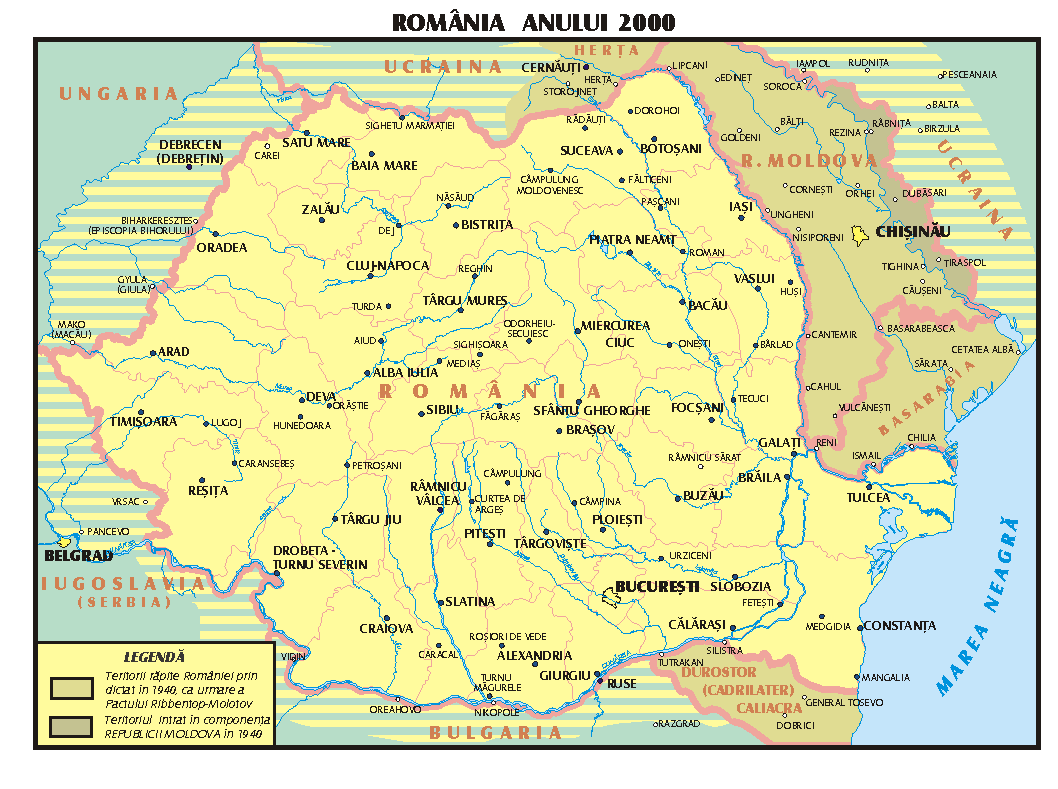
This map of Romania from the year 2000 shows its borders with neighboring countries like Ukraine, Moldova, Hungary, Serbia, and Bulgaria, as well as the key cities and rivers that shape its landscape, including Bucharest, the capital, and the Danube River along the southern border.
Topographic Map of Romania
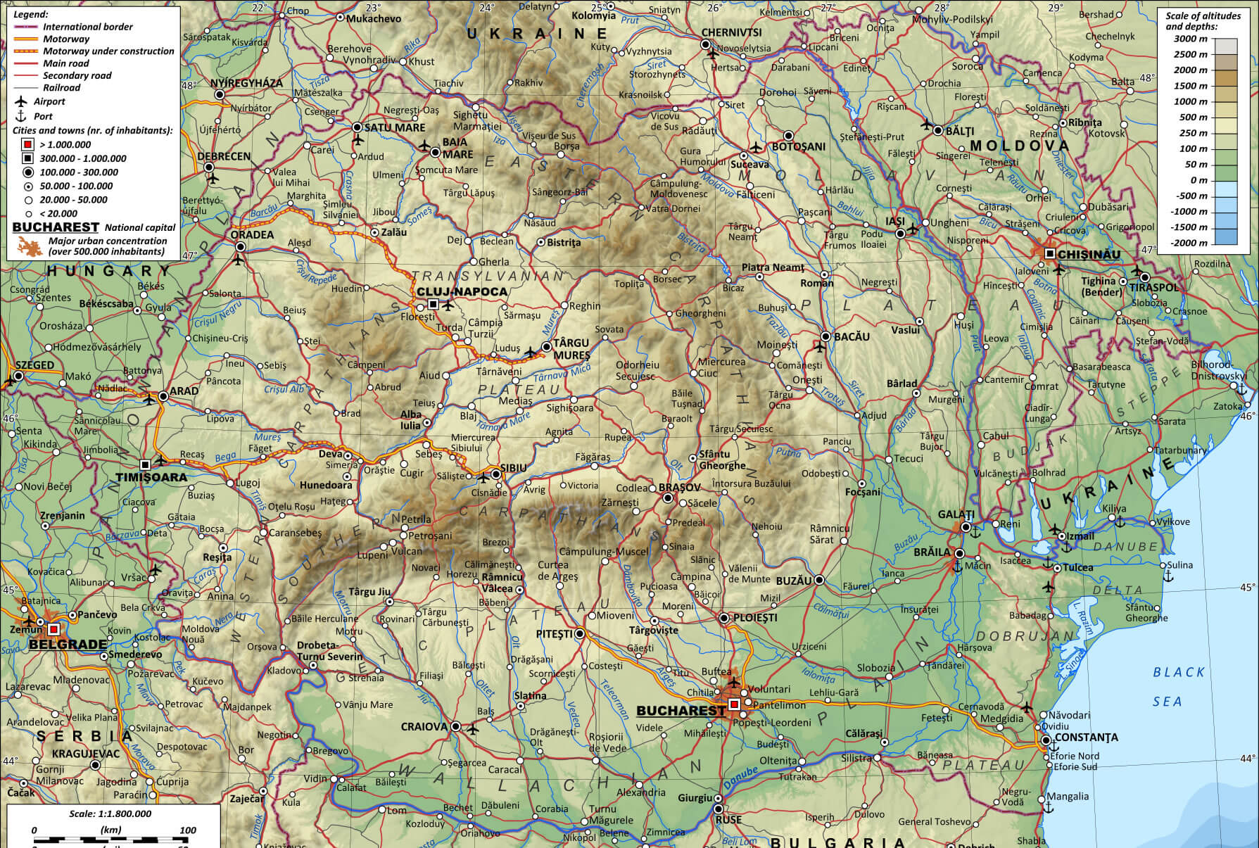 This topographical map of Romania shows the country’s varied landscape, highlighting mountain ranges such as the Carpathians, vast plains and river valleys such as the Danube. It also shows major cities, transport routes and the varying altitudes across the region, providing a detailed view of Romania’s geographical features.
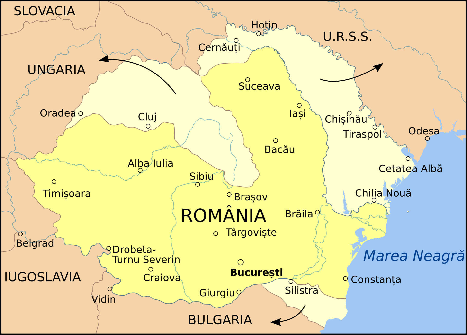
Romania Map in 1940 World War II
Romania Climate Map
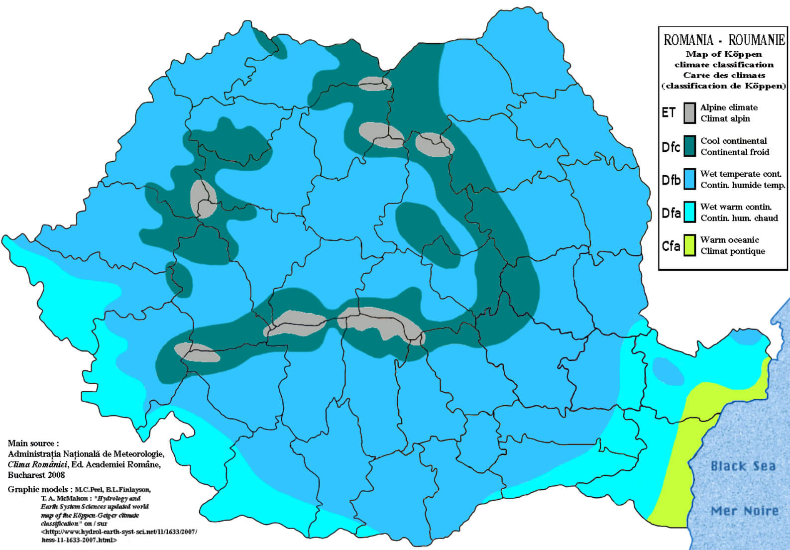 This map of Romania illustrates the country’s climate zones according to the Köppen-Geiger classification, highlighting the diversity of weather patterns in different regions. It includes different types such as humid temperate climates and cool continental areas, influenced by the presence of mountain ranges and proximity to the Black Sea.
Romania World Map
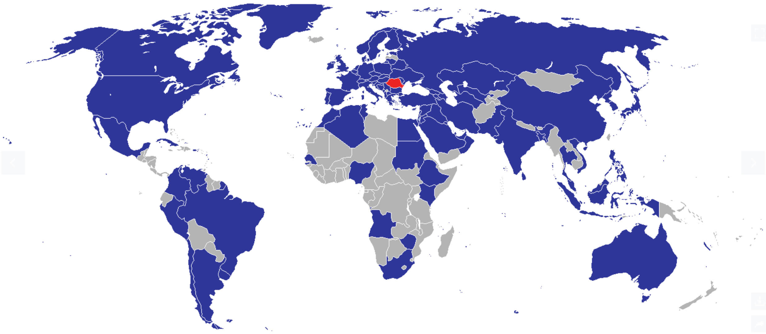 This map highlights Romania’s links and diplomatic relations with countries around the world. It shows Romania’s position in Europe, with the country in red, and illustrates its affiliations, such as membership of international organisations and alliances, represented by the countries in blue. This visual representation helps to understand Romania’s geopolitical relationships on a global scale.
Romania Physical Map
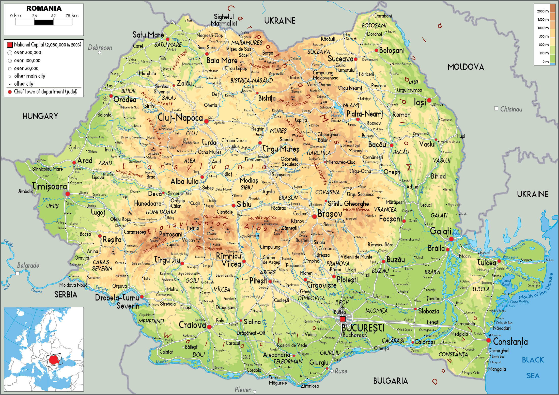 This physical map of Romania highlights the country’s diverse landscape, with the Carpathian Mountains dominating the central and northern regions, and the lowlands along the Danube River in the south and east. It also features major cities such as Bucharest, Cluj-Napoca and Constanța, and important rivers such as the Mureș, Olt and Prut, which play an important role in the country’s geography.
Romania Highways Map
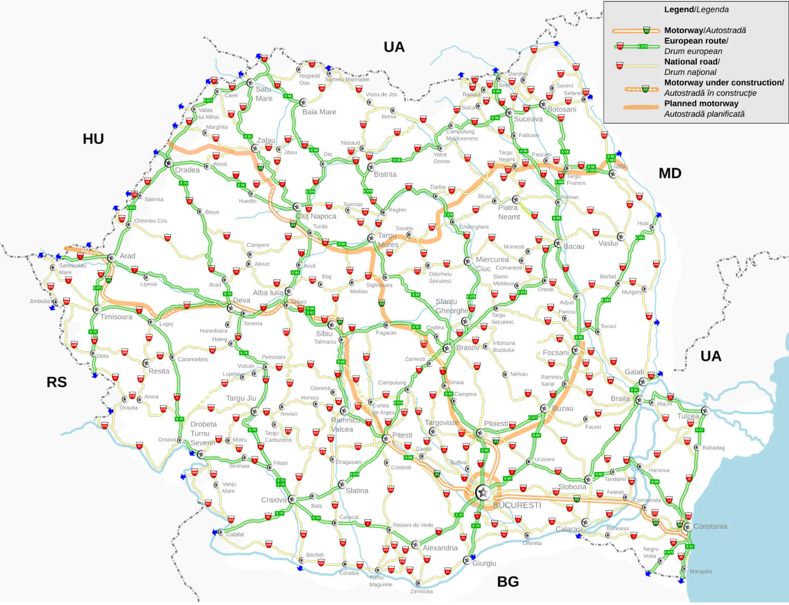 This map of Romania’s motorway network illustrates the country’s main transport routes, including existing motorways, European routes, national roads and planned future developments. It highlights connections between major cities such as Bucharest, Cluj-Napoca and Timisoara, as well as links to neighbouring countries such as Hungary, Serbia and Bulgaria. The map also shows areas where motorways are under construction, reflecting efforts to improve Romania’s transport infrastructure and connectivity.
Kingdom of Romania in 1930 Census
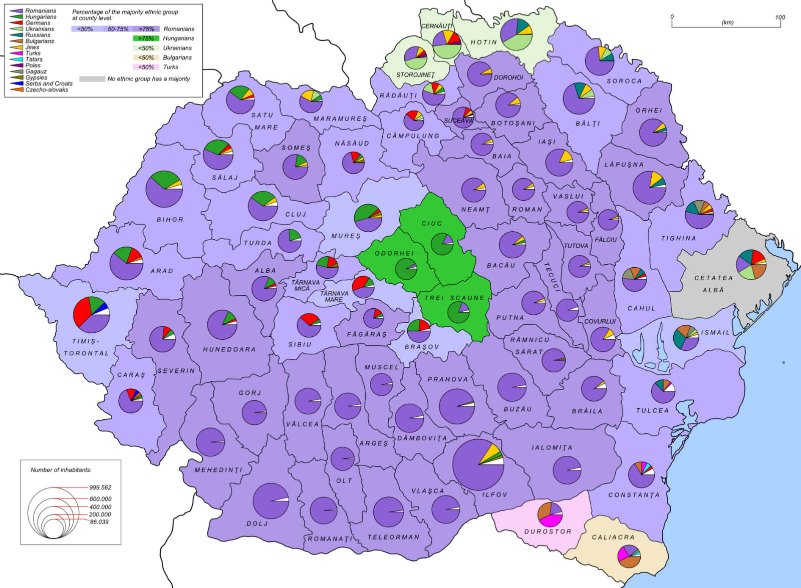 This map shows the ethnic composition of the Kingdom of Romania as recorded in the 1930 census. It shows the distribution of different ethnic groups in different regions, with pie charts showing the proportion of Romanians, Hungarians, Germans, Jews and other minorities within each county. The areas shaded in purple represent regions with a Romanian majority, while areas of different shades and chart colours reflect regions where other ethnicities are more prevalent. This map serves as a historical reference for understanding Romania’s diverse demographic landscape during the inter-war period.
Romania Rivers Map with Largest Cities
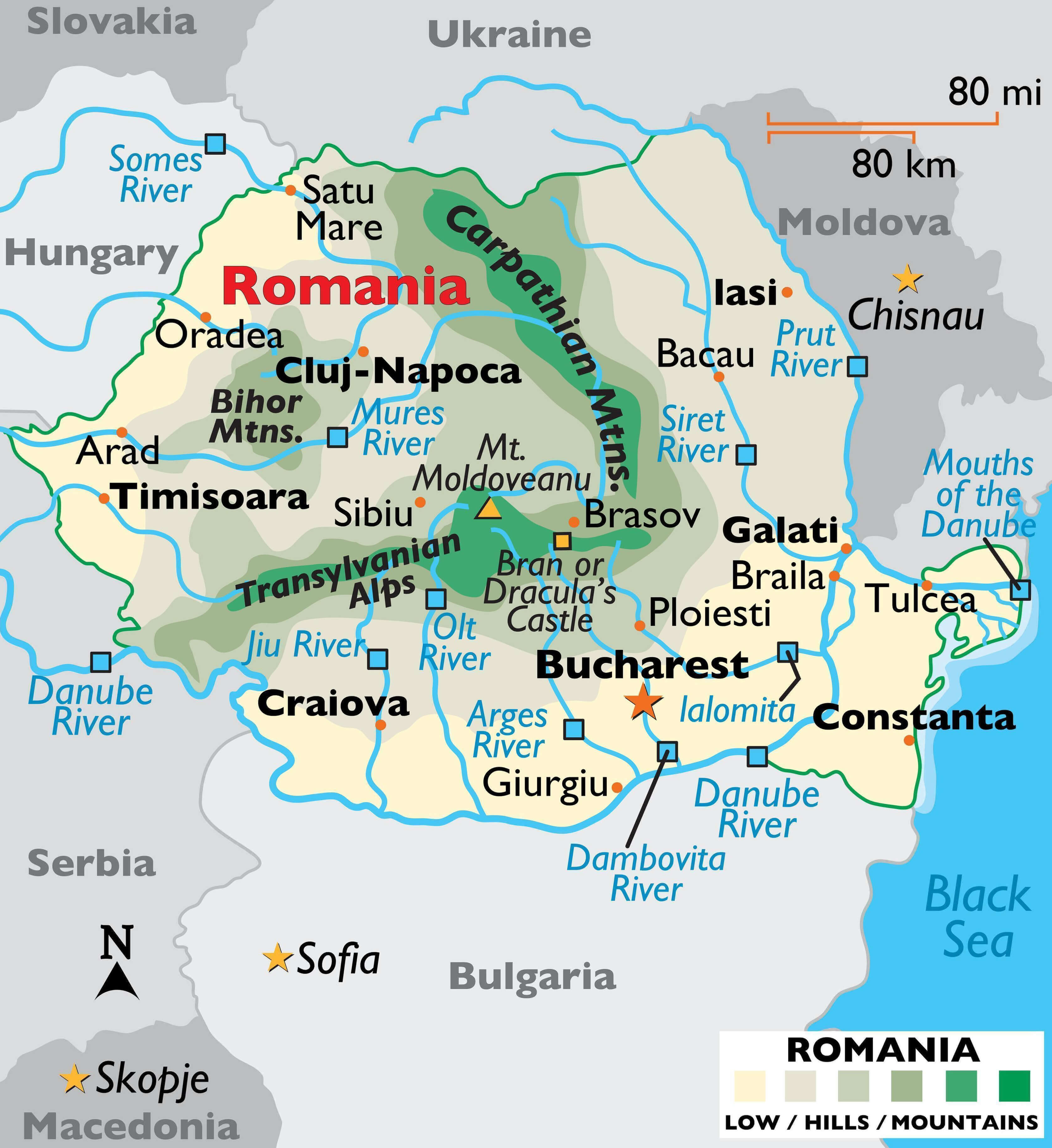 This map of Romania highlights major rivers such as the Danube, Mureș, Olt and Siret, as well as prominent cities such as Bucharest, Cluj-Napoca and Timisoara. It shows the topography of the region, including the Carpathian Mountains and the Transylvanian Alps, which shape the flow of these rivers through the country. The map also shows Romania’s borders with neighbouring countries such as Hungary, Serbia and Ukraine, providing a comprehensive view of the country’s geographical landscape.
Romania Cities Map
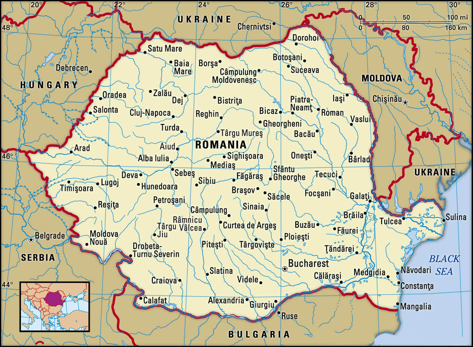 This Romania cities map showcases the main cities and towns across the country, highlighting major urban centers such as Bucharest, Cluj-Napoca, Timișoara, and Iași. It provides a clear overview of Romania’s administrative regions, making it easy to locate key cities and understand their geographical relationships within the nation’s borders.
Romania Topographic Map
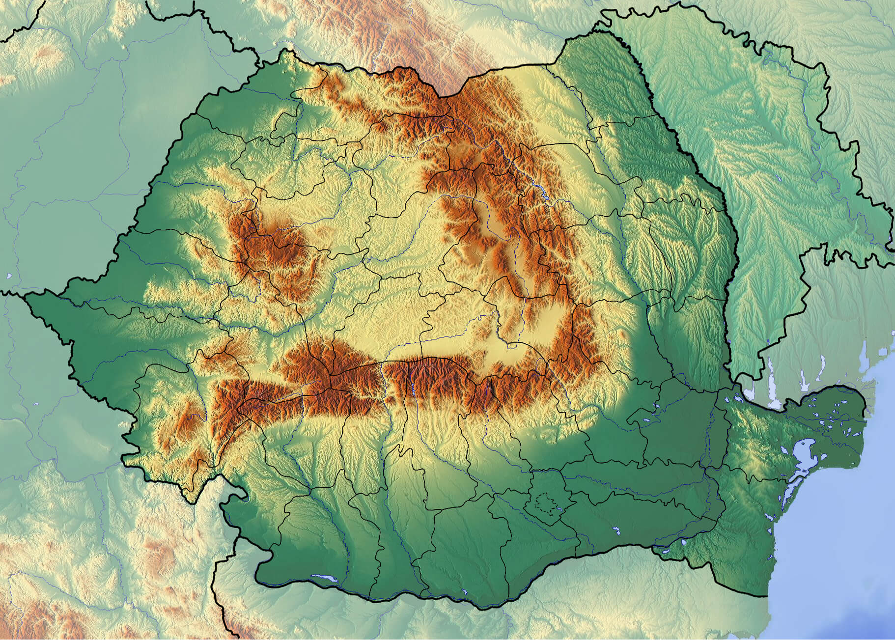 This topographical map of Romania shows the country’s varied terrain, with the Carpathian Mountains dominating the central and northern regions, and the lower plains in the south and east bordering the Danube River and the Black Sea. The differences in elevation are represented by a colour gradient, with the higher mountain ranges in shades of brown and the valleys and lower regions in green. This map provides a detailed view of Romania’s geographical features, ideal for understanding the physical landscape of the country.
Romania Historical Map in Late 19th Century
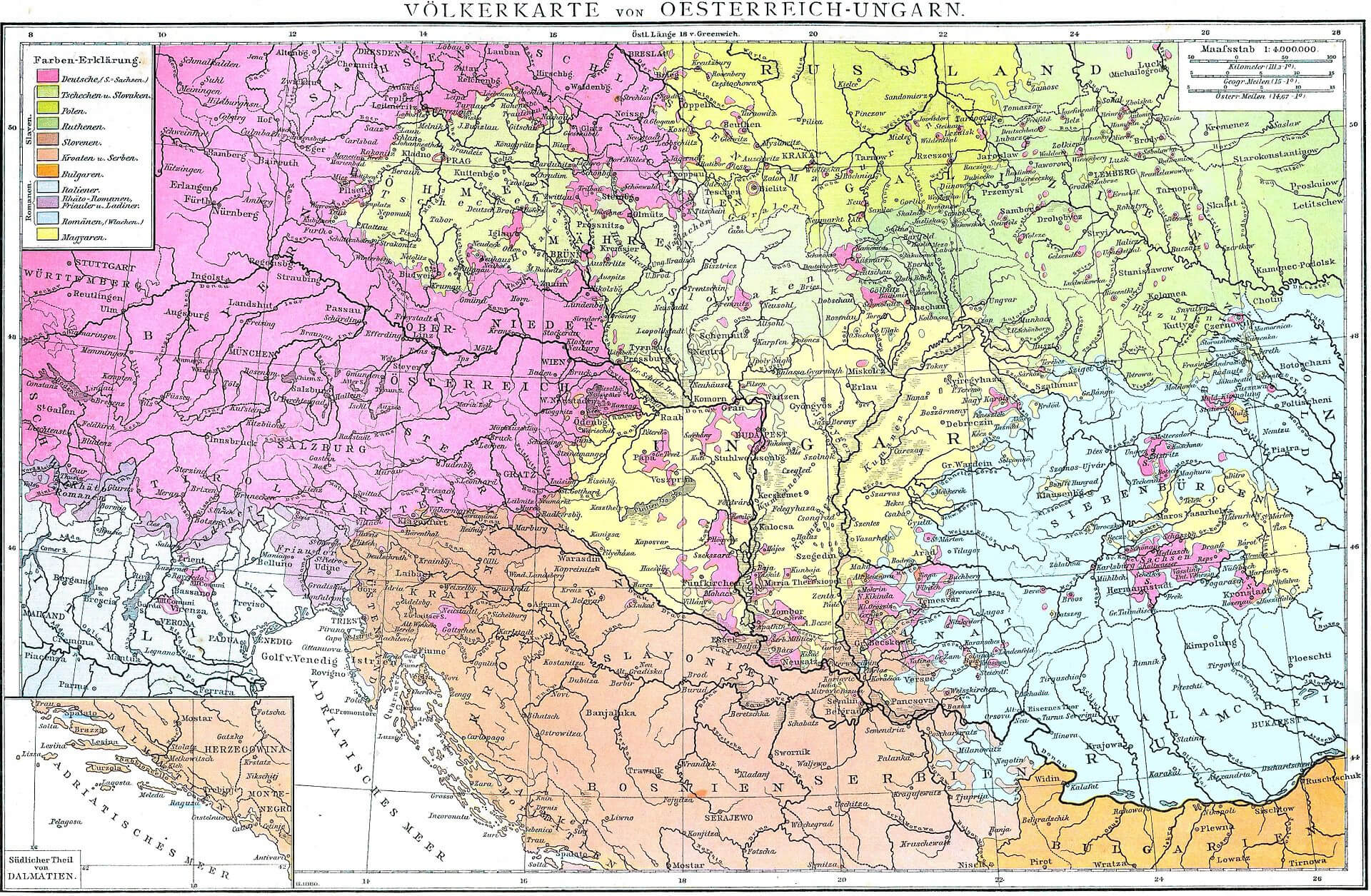 This historic map of Romania from the late 19th century shows the ethnic distribution and political divisions of the Austro-Hungarian Empire and its surrounding regions, including areas that overlap with present-day Romania. The map highlights the different ethnic groups within the empire and illustrates the complex demographic and administrative boundaries before the reconfiguration of European borders after World War I. It provides insights into the cultural and political landscape of the region during this period, reflecting the ethnic diversity that characterised the empire’s various territories.
Romania Regions Map
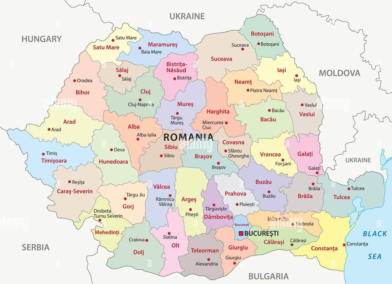 This map of Romania’s regions highlights the country’s administrative divisions, including counties such as Cluj, Iași and Timiș, each marked with a different colour. Major cities such as Bucharest, the capital, and other important urban centres such as Constanța and Brașov are identified, providing a clear overview of the geographical layout of Romania. The map also shows neighbouring countries, including Hungary, Serbia and Bulgaria, providing a broader context of Romania’s location within Europe.
Romania Moldavia Transylvania and Wallachia Map
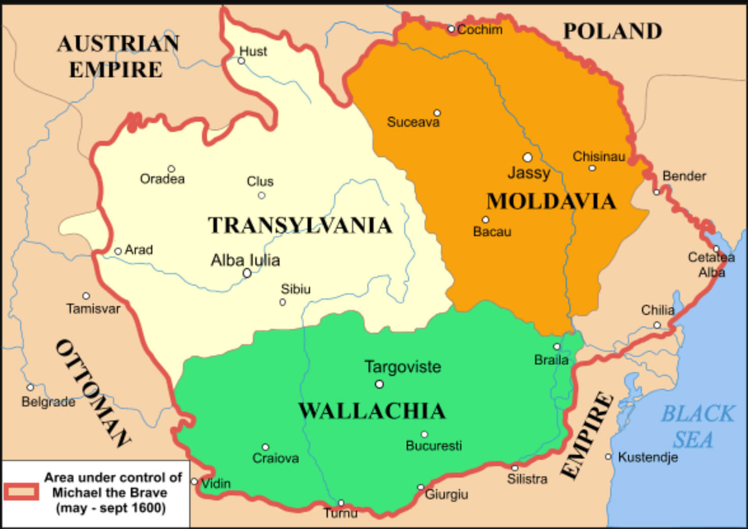 This map shows the historical regions of Romania, specifically Moldavia, Transylvania and Wallachia, as they were in the late 16th century. The area highlighted in red outlines the territories that were briefly united under the rule of Michael the Brave in 1600. This unification, though short-lived, was significant as it represented one of the earliest attempts to unite these culturally and geographically distinct regions under a single leadership, foreshadowing the modern Romanian state. The map also shows the neighbouring empires of the time, including the Austrian Empire, Poland and the Ottoman Empire, which had considerable influence over the region.
Territorial Map Changes of Romania from 1859 to 2010
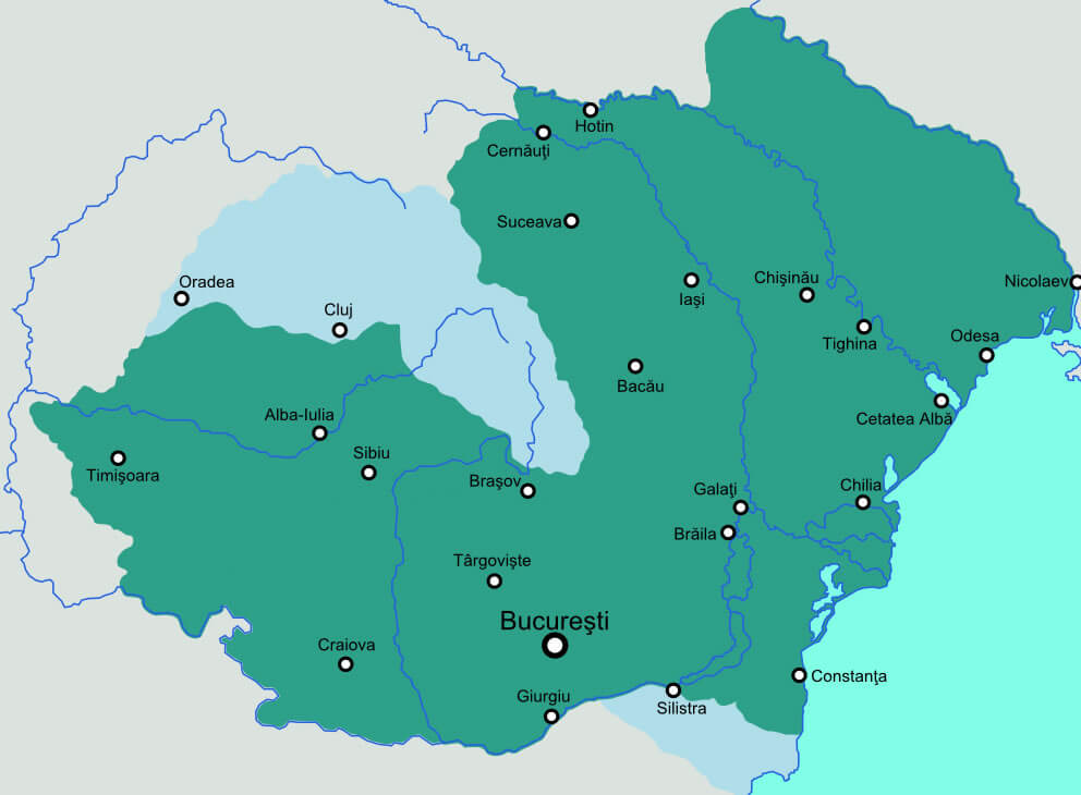 This map illustrates the territorial changes of Romania from 1859 to 2010, highlighting key regions such as Transylvania, Wallachia and Moldavia. It shows how borders have shifted over time, reflecting historical events such as the unification of the Principalities of Wallachia and Moldavia in 1859, the addition of Transylvania in 1918, and further adjustments following the Second World War and the fall of communism. The map provides a visual representation of Romania’s evolving geographical boundaries and historical context through the ages.
Map of Romania
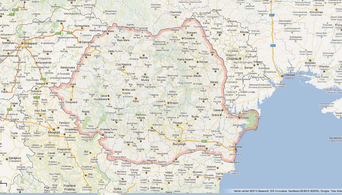
This map shows Romania’s location in Eastern Europe, bordered by countries like Ukraine, Hungary, Serbia, and Bulgaria, with the Black Sea to its southeast.
Map of Romania Europe
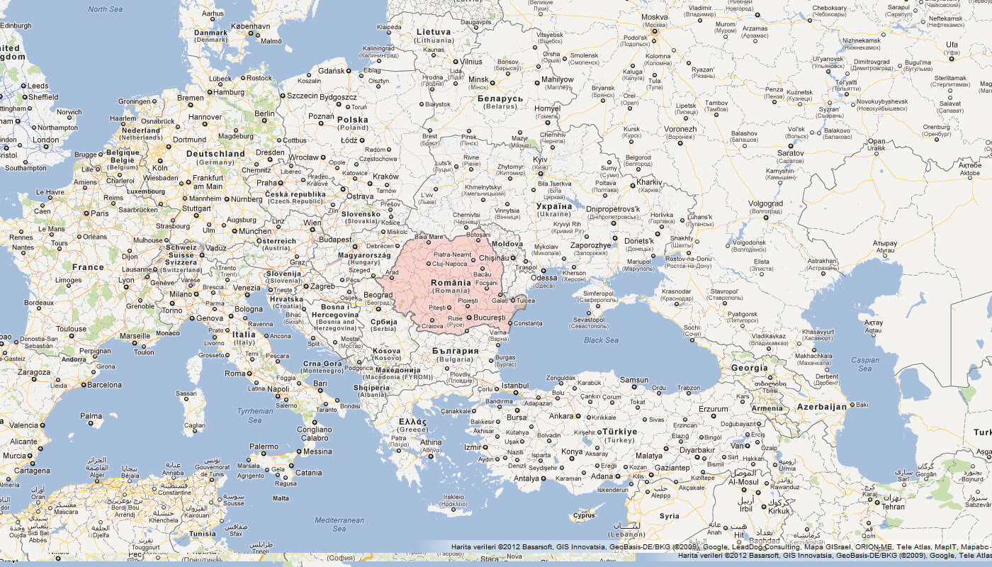
Map of Romania World
Romania Earth Map
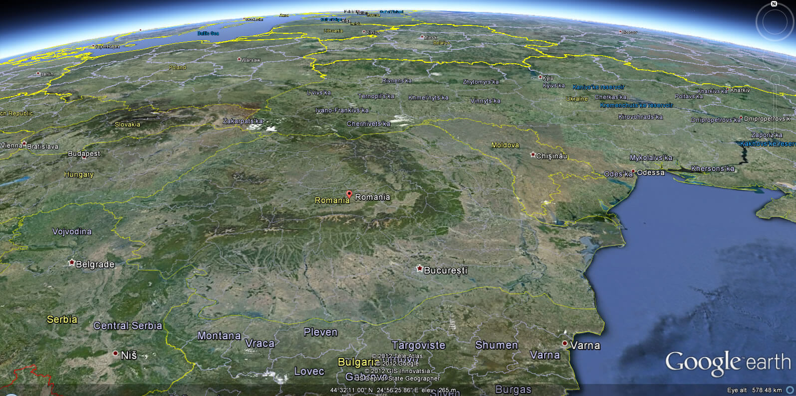
Where is Romania on the Europe Map?
Show Google map, satellite map, where is the country located.
Get directions by driving, walking, bicycling, public transportation and travel with street view.
Feel free to explore these pages as well:
- Russia Map ↗️
- Transnistria Map ↗️
- Georgia Map ↗️
- South Ossetia Map ↗️
- United States Map ↗️
- United Kingdom Map ↗️
- Germany Map ↗️
- Poland Map ↗️
- France Map ↗️
- Map of Russia ↗️
- About Russia ↗️
- Largest Cities of Russia: From Moscow to Rostov ↗️
- Top 10 Must-Visit Places in Moscow ↗️
- Abkhazia Map ↗️
- Nagorno Karabakh ↗️
