Discover detailed maps of South Africa, including physical, political, and road maps, major cities, terrain, population distribution, country borders, regions, national parks, highways, and administrative divisions. Explore South Africa’s location within Africa, its geographical position, and view stunning satellite imagery.
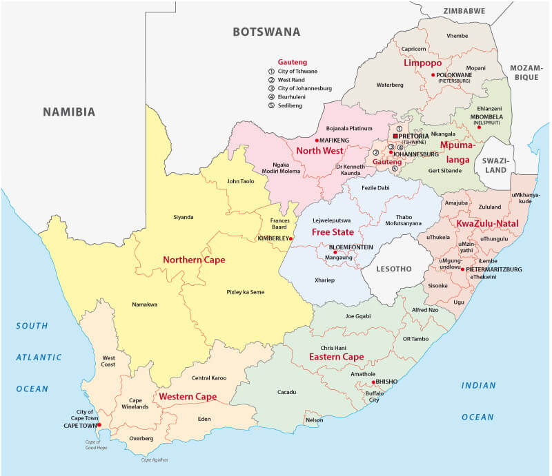
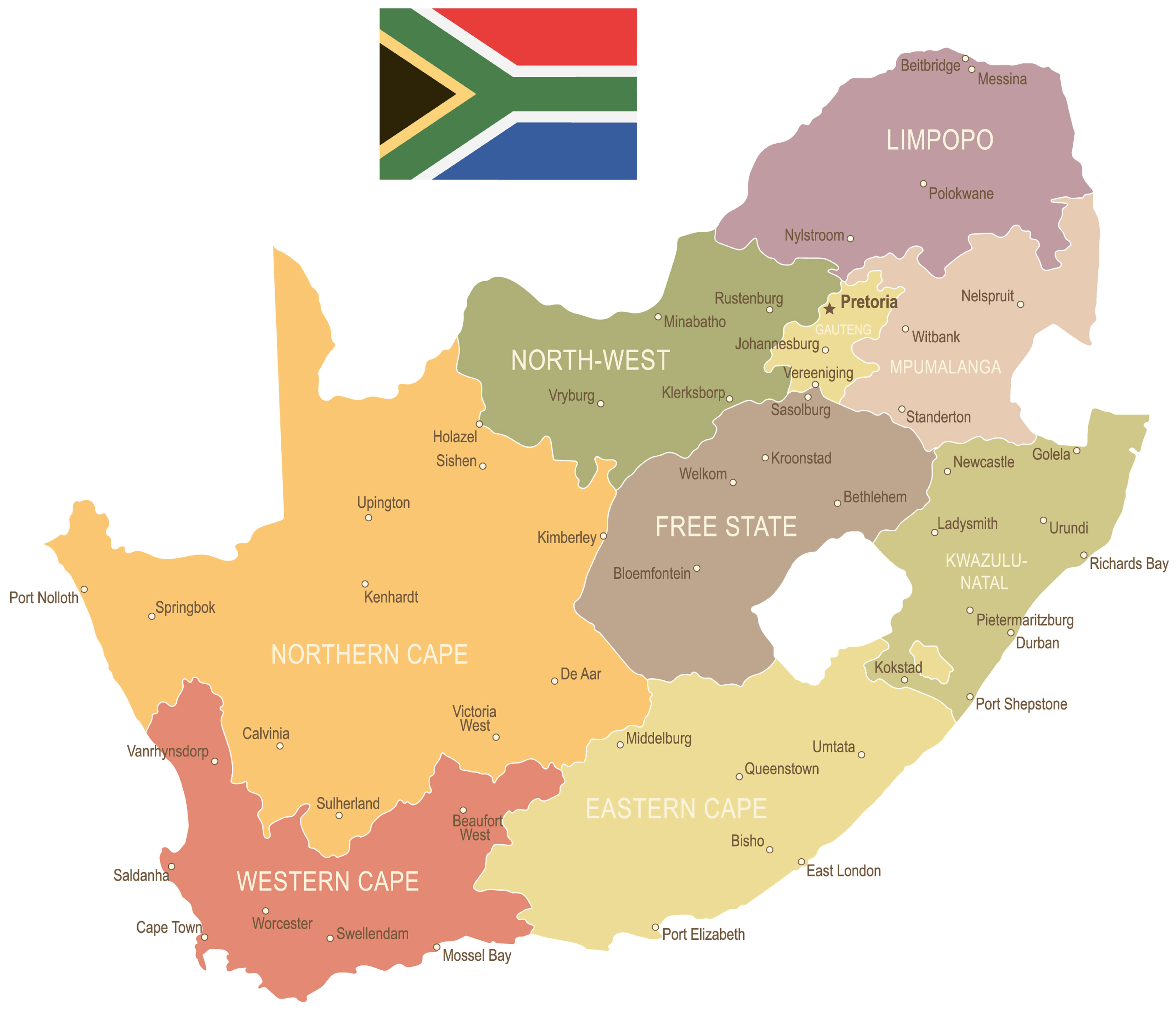
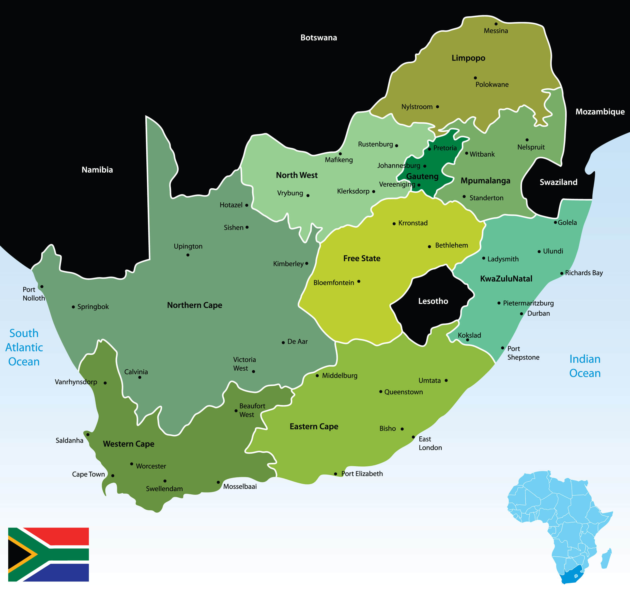
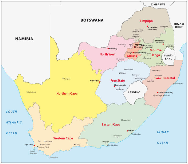
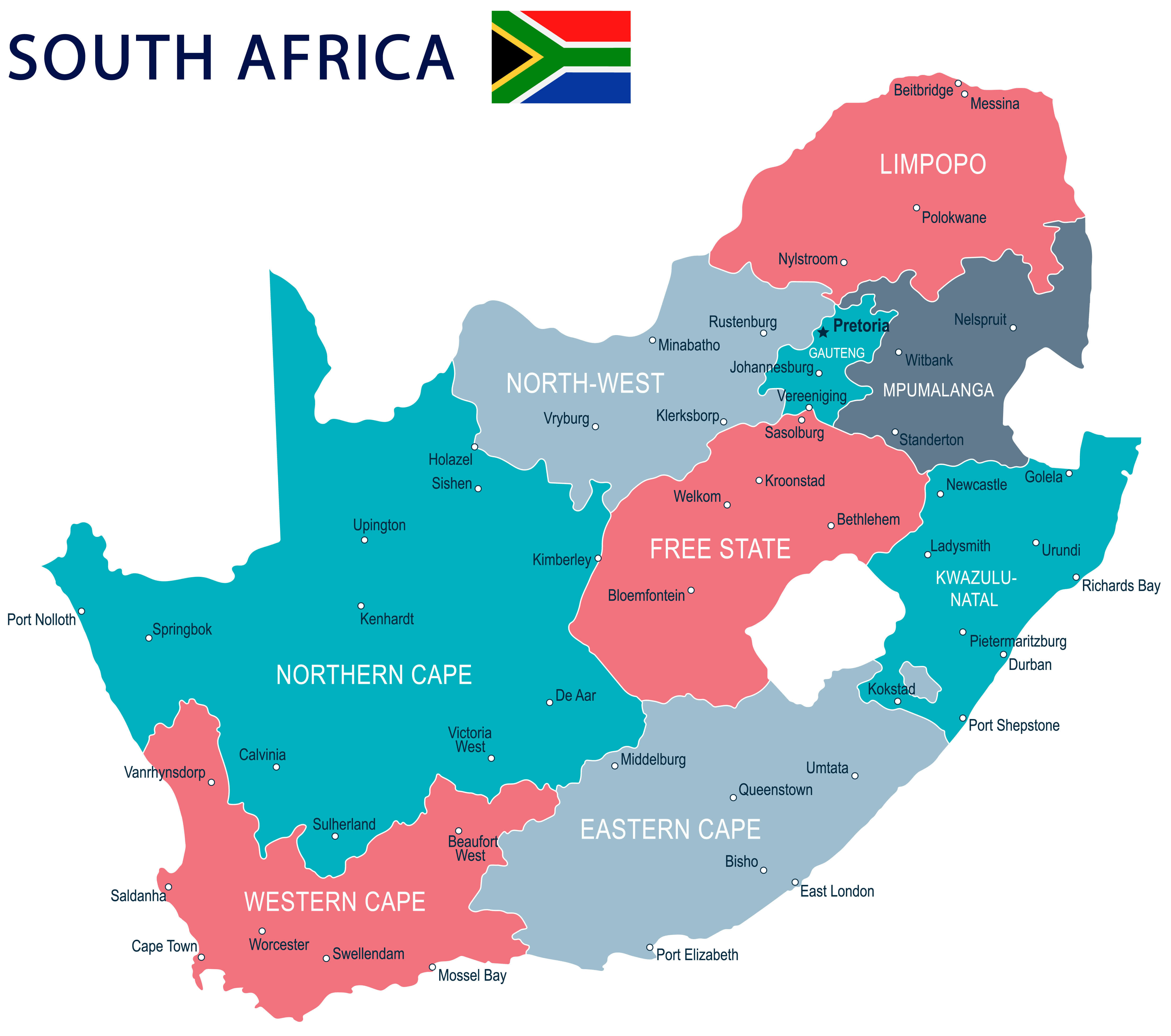
Provinces Map of South Africa
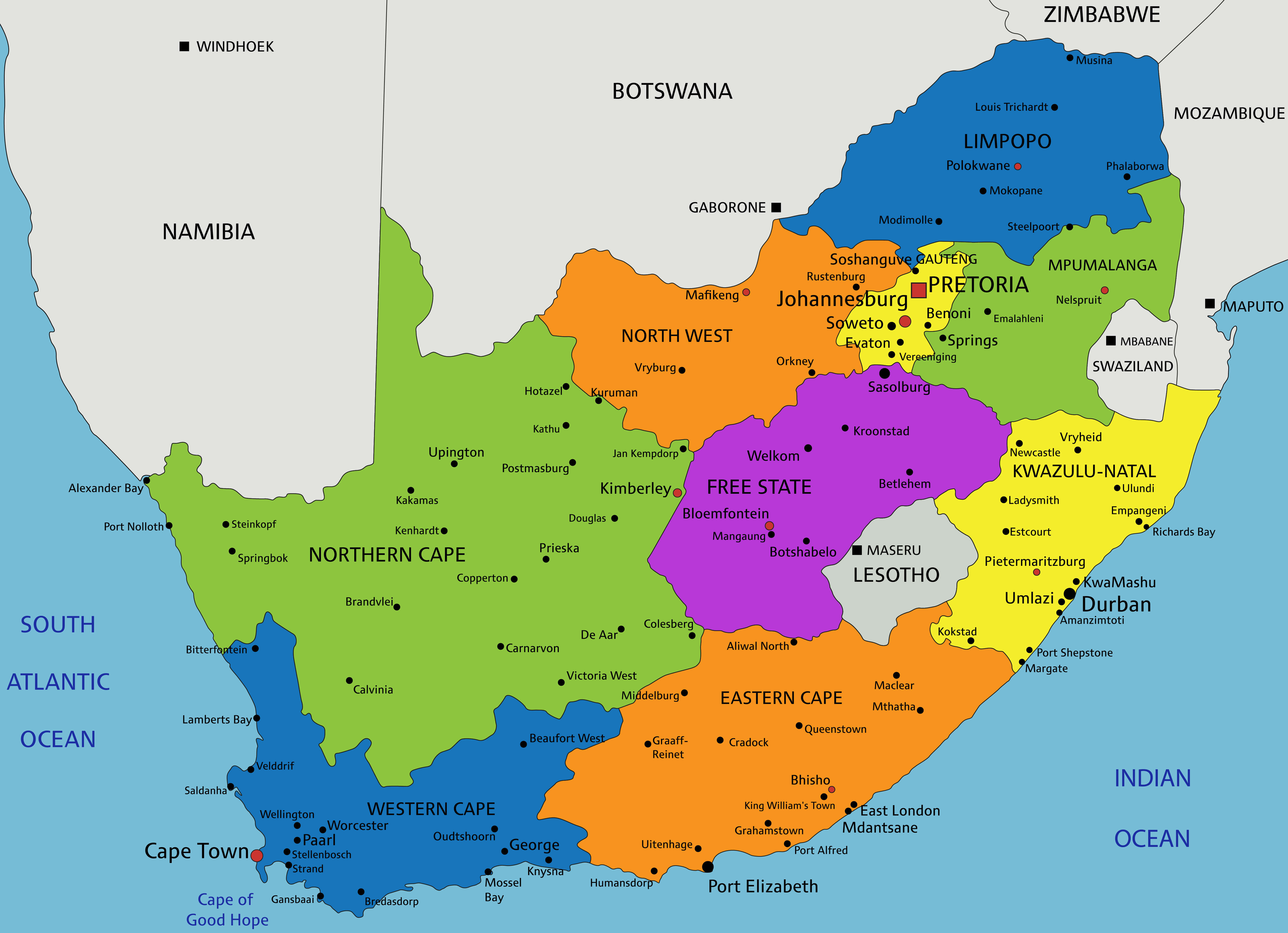 Colorful map showing provinces and major cities of South Africa.
This is a colourful map of South Africa showing its provinces, major cities and neighbouring countries. Each province is marked with a different colour for easy identification.
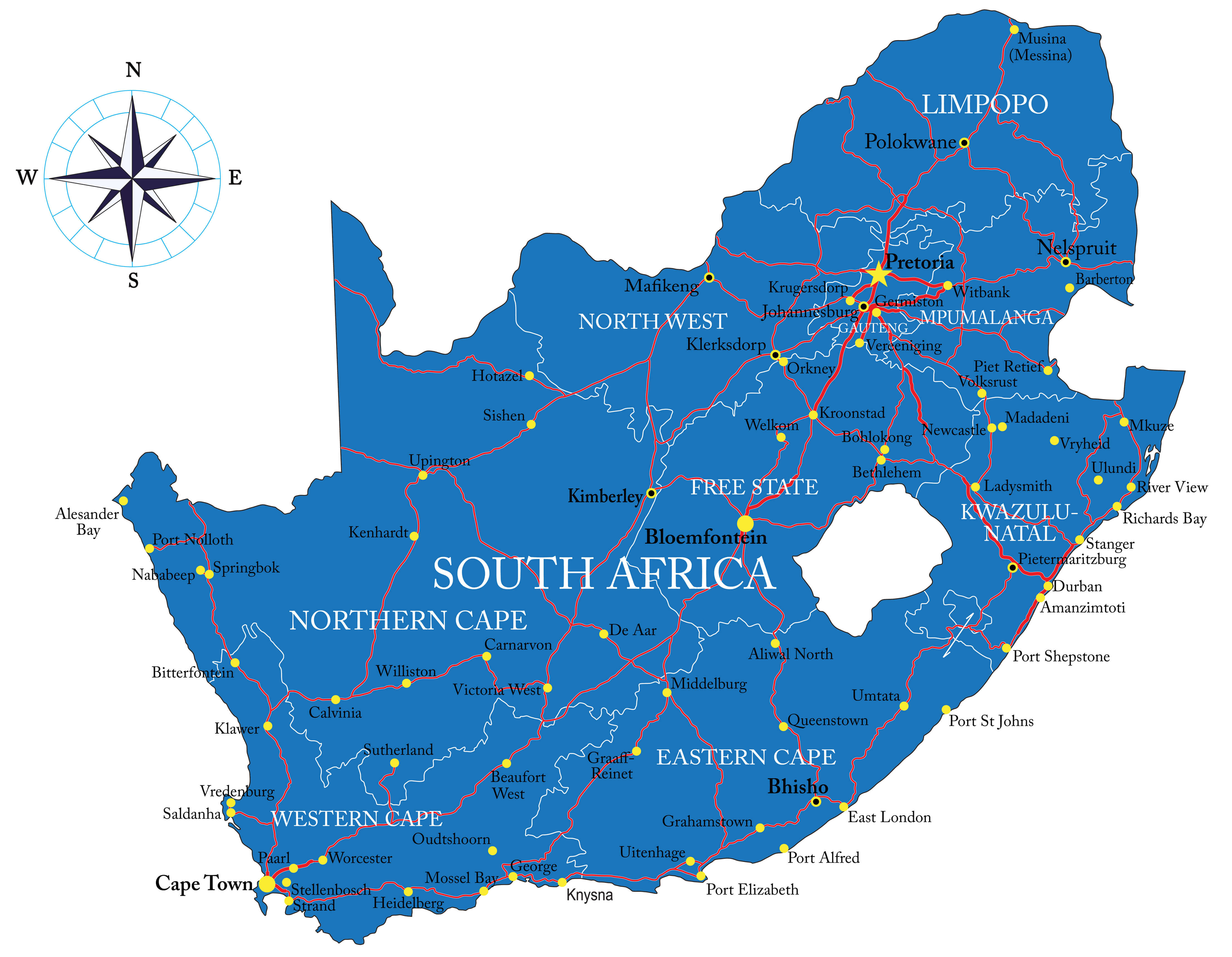
South Africa Cities Map with Flag
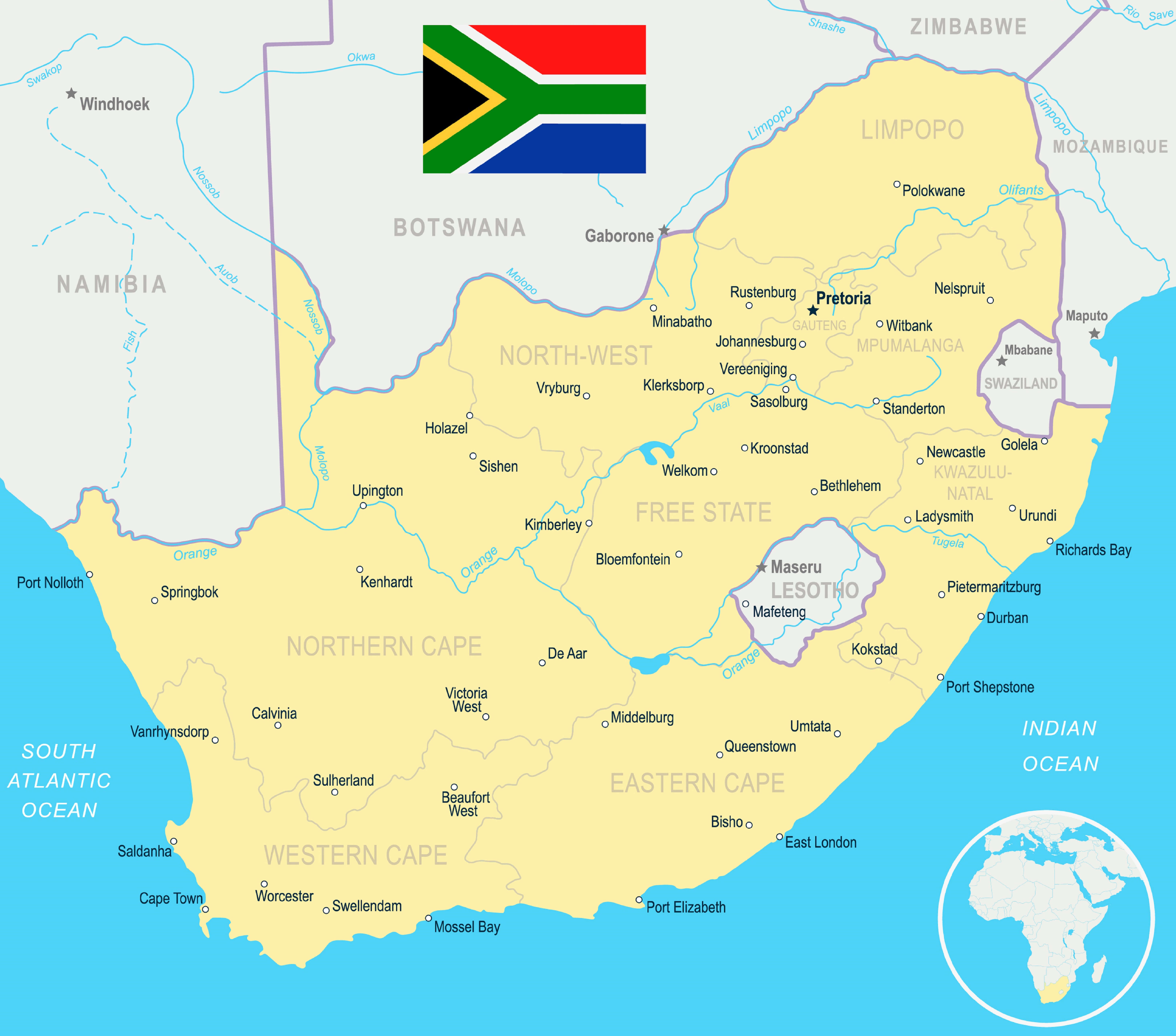 Map of South Africa showing major cities and national flag at the top.
This map shows major cities across South Africa along with its national flag. Provinces and neighboring countries are labeled, helping viewers easily locate key urban centers.
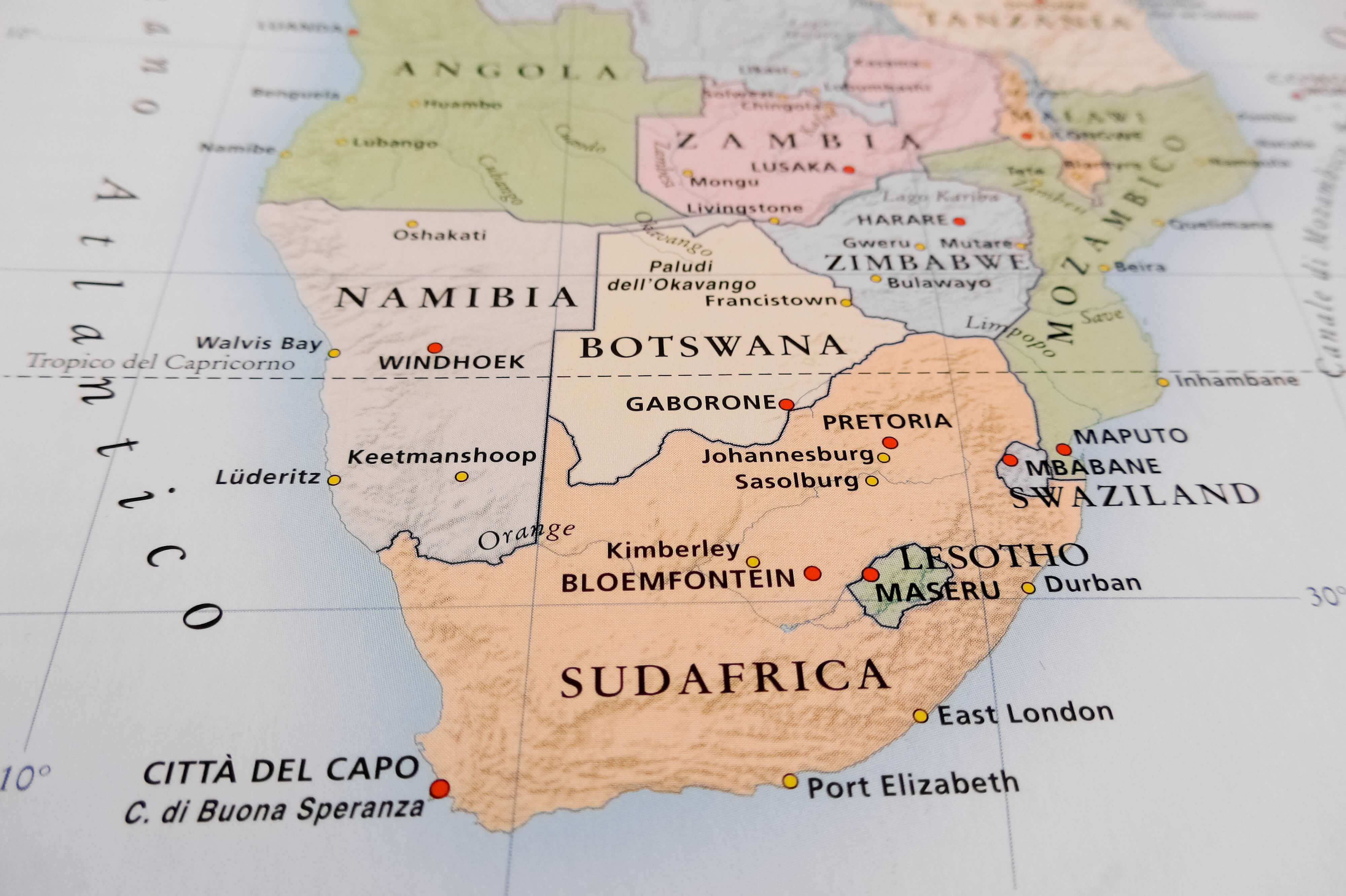
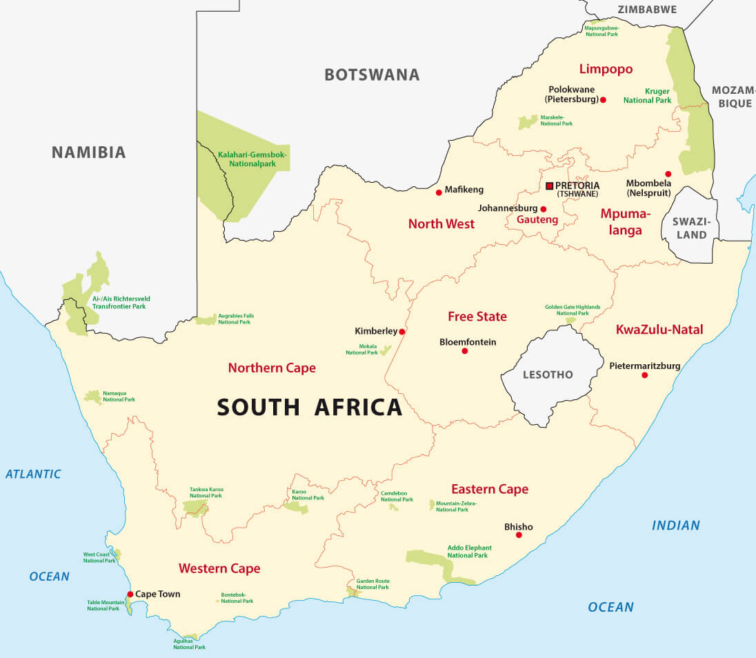
South Africa Regions Map with Neighbouring Countries
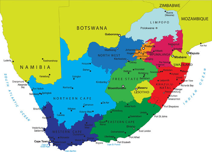
This colorful map highlights the different regions of South Africa, along with major cities, neighboring countries, and bodies of water. Each region is marked with a different color for easy identification.
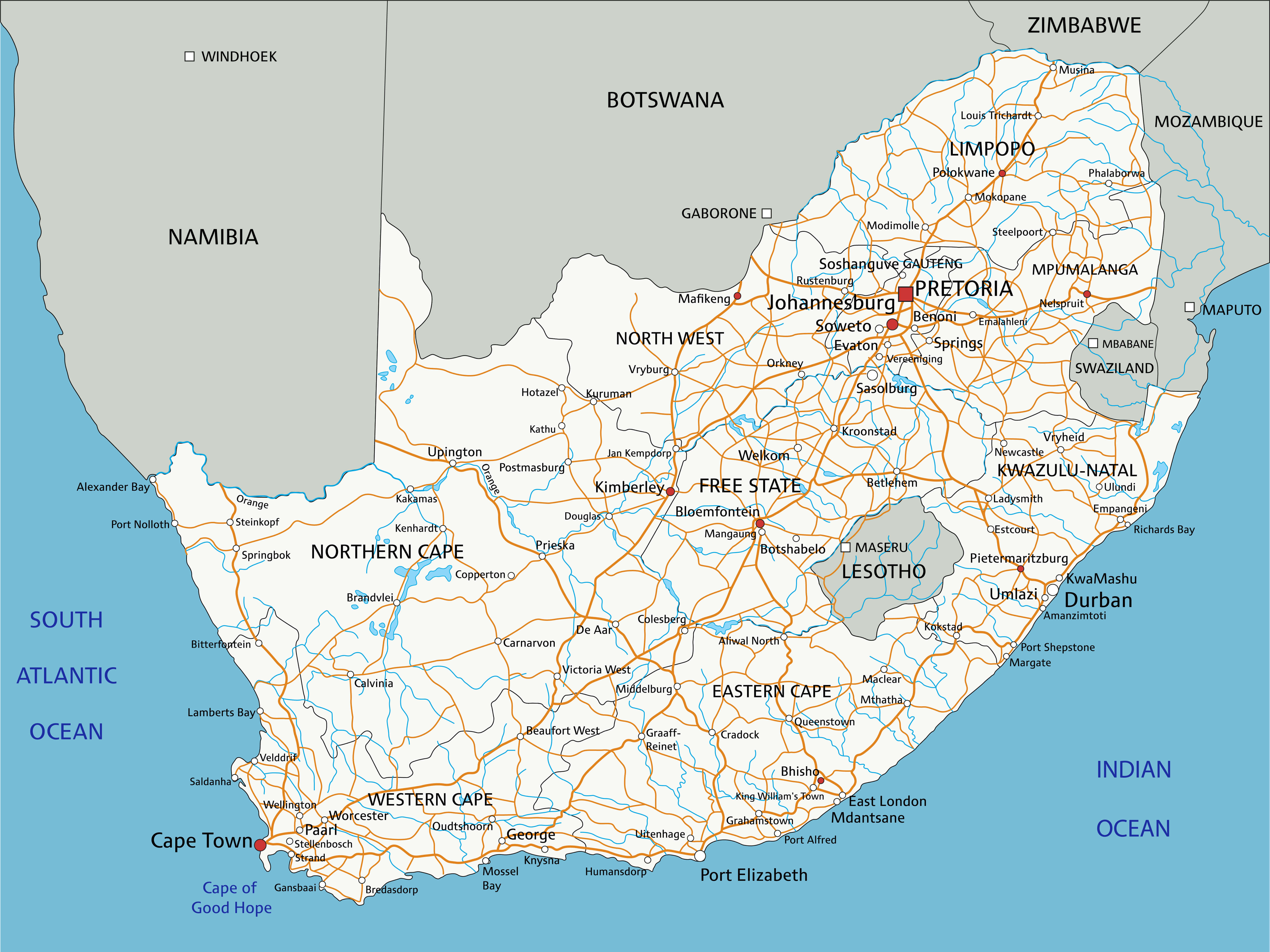
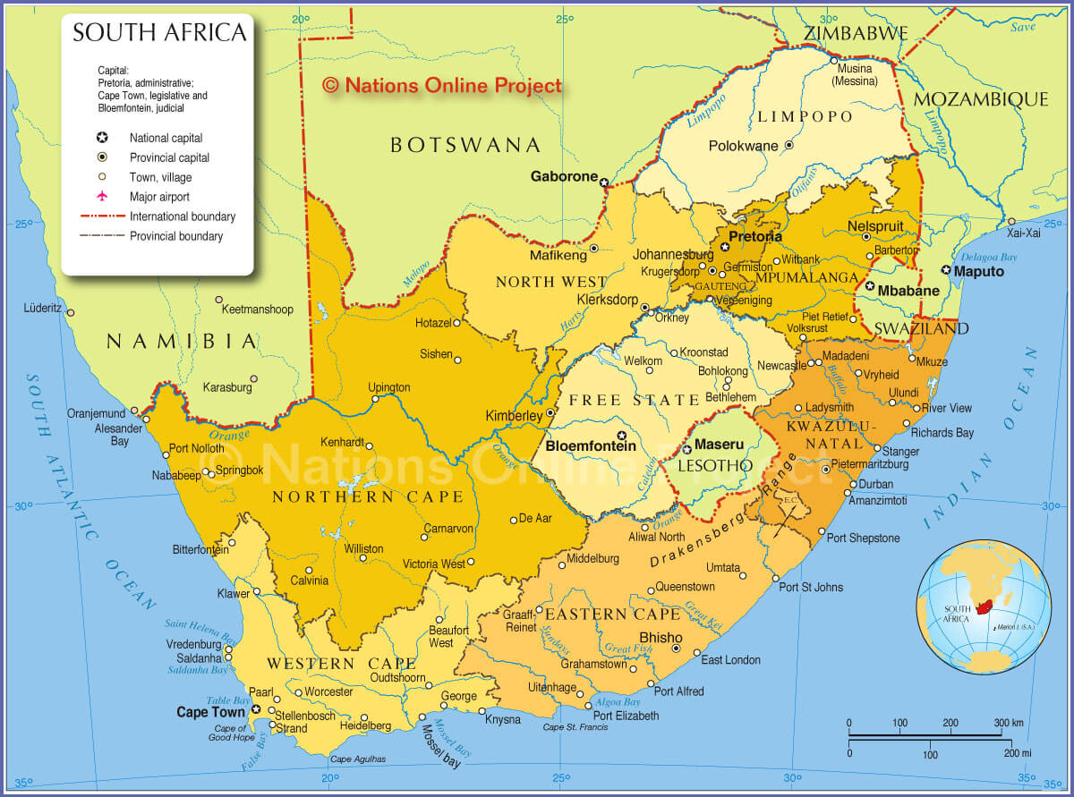
South Africa Political Map with Rivers and Cities
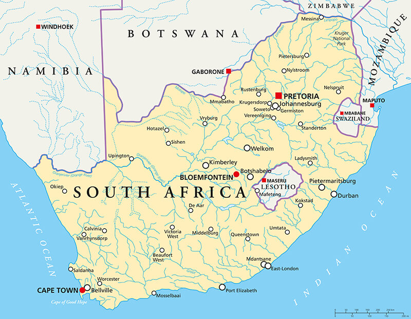 Political map of South Africa showing rivers, major cities, and country borders.
This political map of South Africa displays major cities, rivers, and neighboring country borders. It offers a clear view of the country’s geography, highlighting important urban centers and waterways.
Administrative Road Map of South Africa with Cities
 South Africa administrative road map showing cities, highways, and provinces.
This administrative map of South Africa highlights major cities, highways and provincial divisions. It provides a clear overview of the country’s transport network and urban centres.
South Africa Road Map
This detailed road map of South Africa displays major highways, cities, towns, and provincial borders. It provides a comprehensive view of the country’s transportation routes and geographic layout.
Regions Map of South Africa
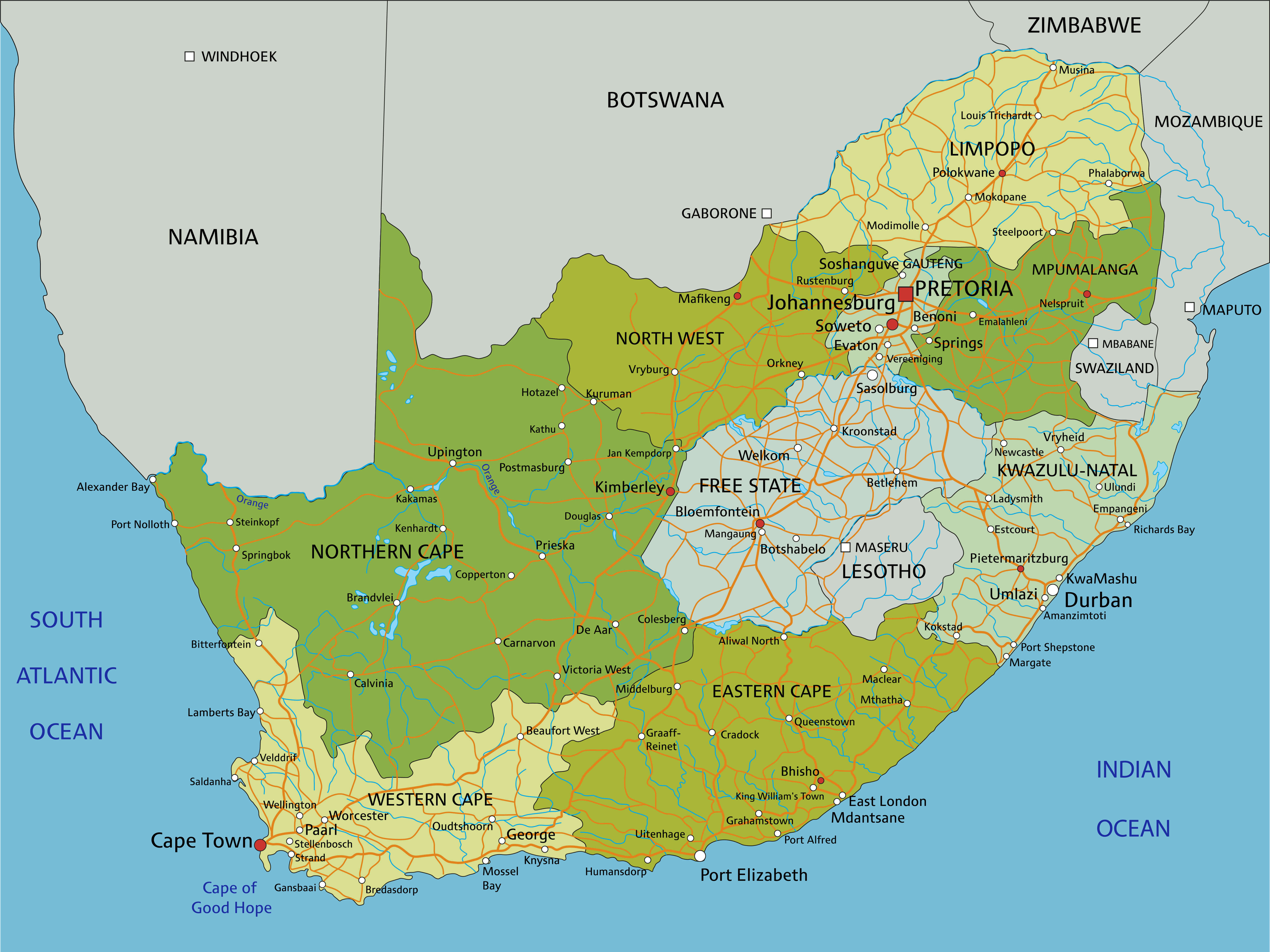 Colorful regions map of South Africa showing cities, roads, and provinces.
This regional map of South Africa uses different colours to highlight the different regions of the country. It also shows major cities, roads and provincial boundaries, providing a clear and detailed overview of the geography.
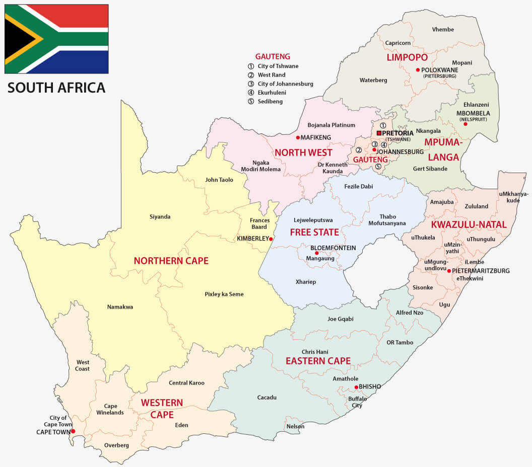
Administrative map of South Africa
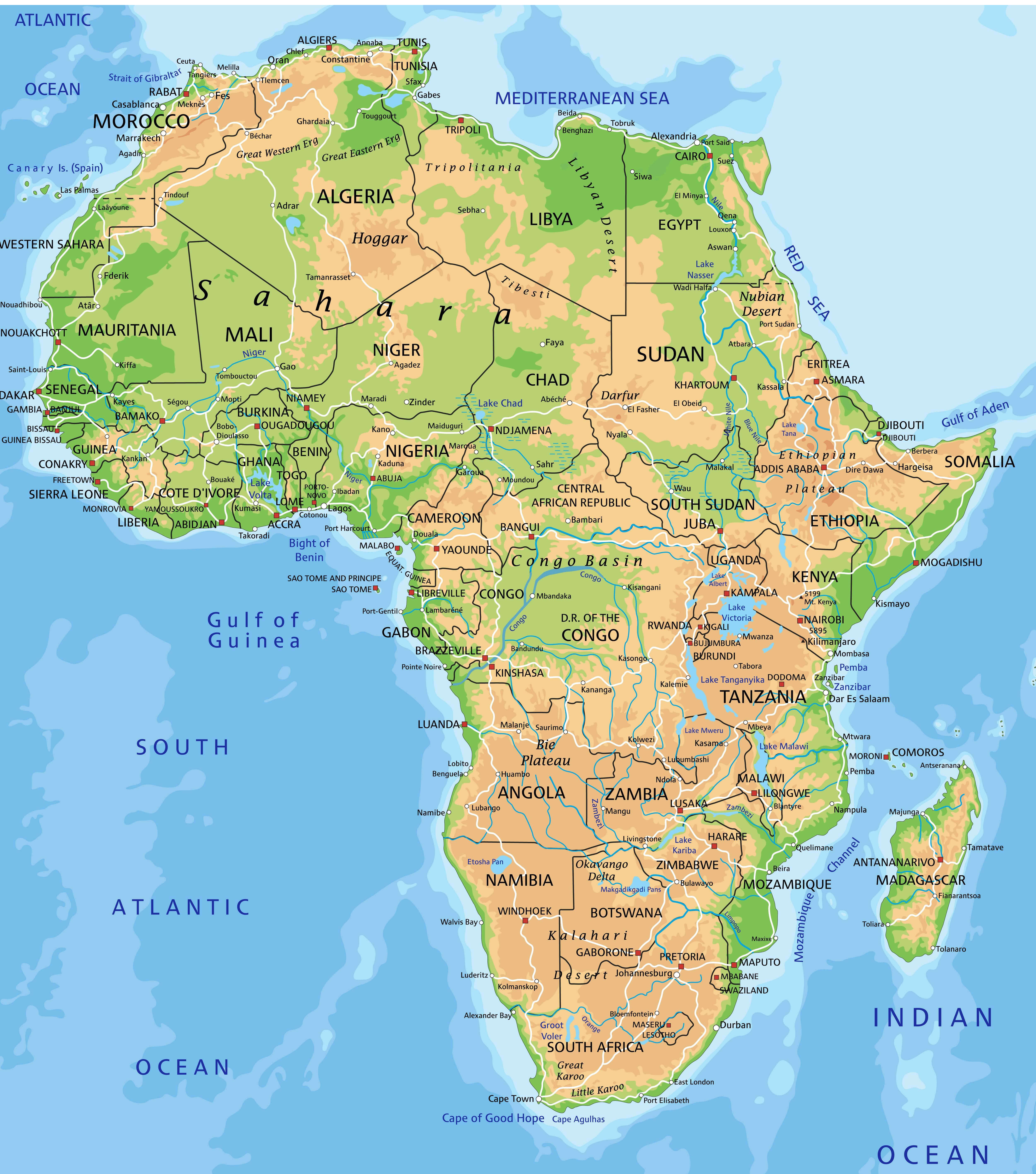
Africa physical map with South Africa
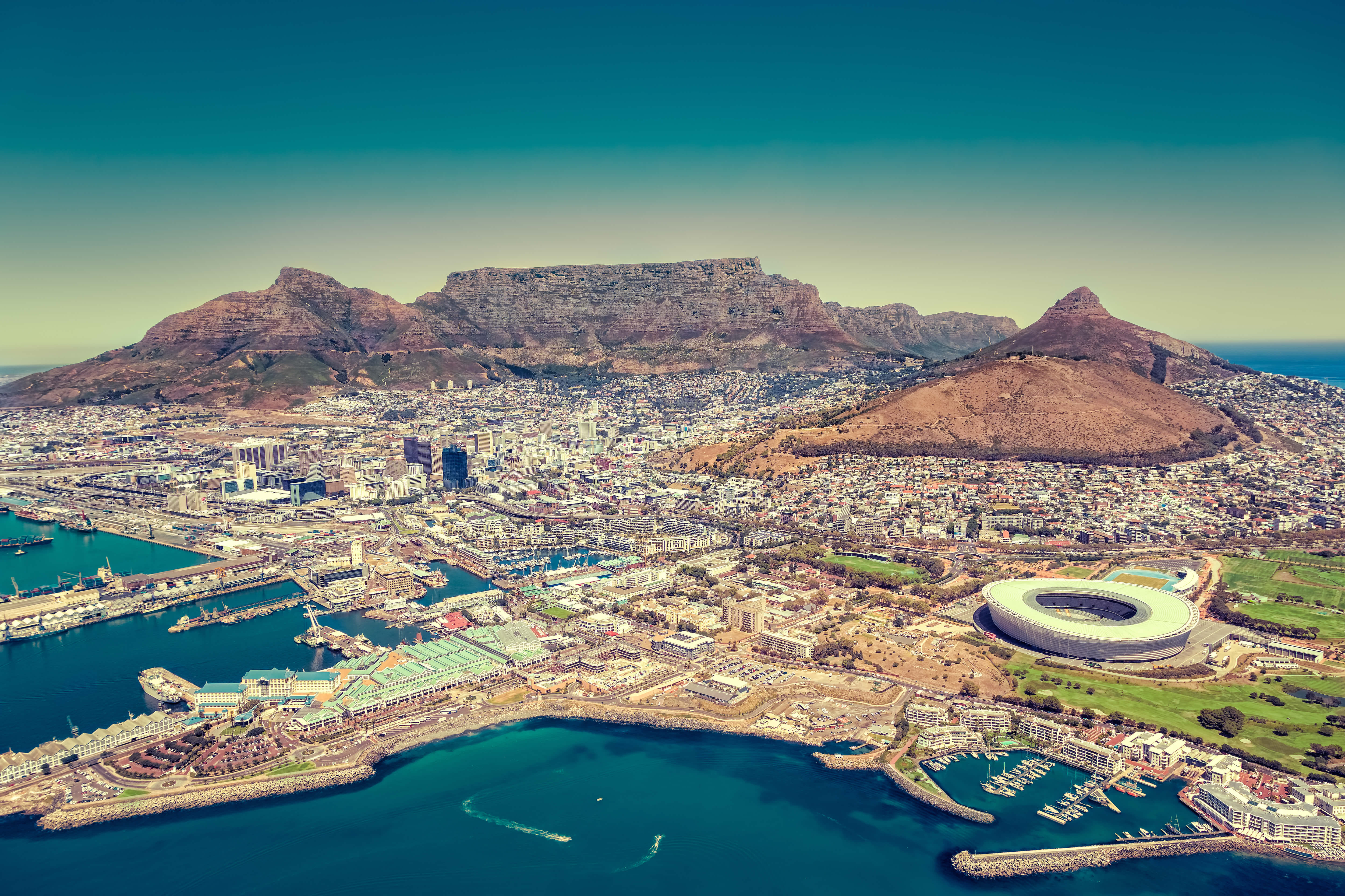
Cape town in South Africa
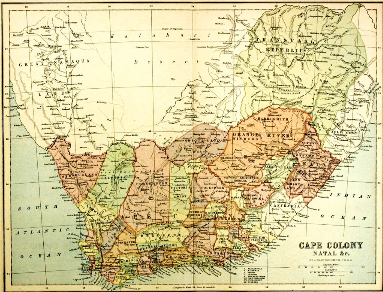
Historical map of South Africa 1876
Map of South Africa and national flag
Map of South Africa with national flag
Map of South Africa
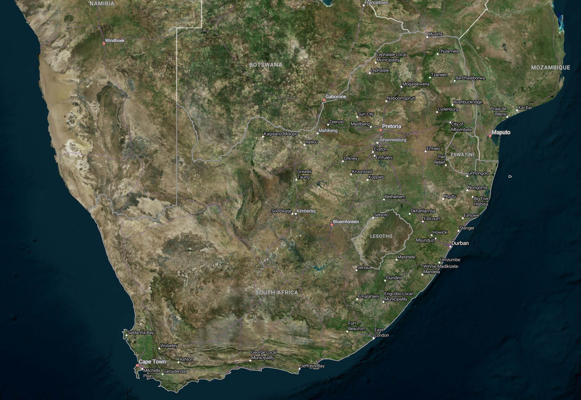
Satellite map of South Africa
South Africa administrative map with flag
South Africa administrative map with regions
South Africa blank map
South Africa cities map
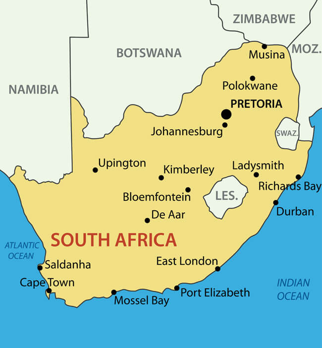
South Africa country map
South Africa from space view
South Africa highways map
South Africa info map
South Africa map from space
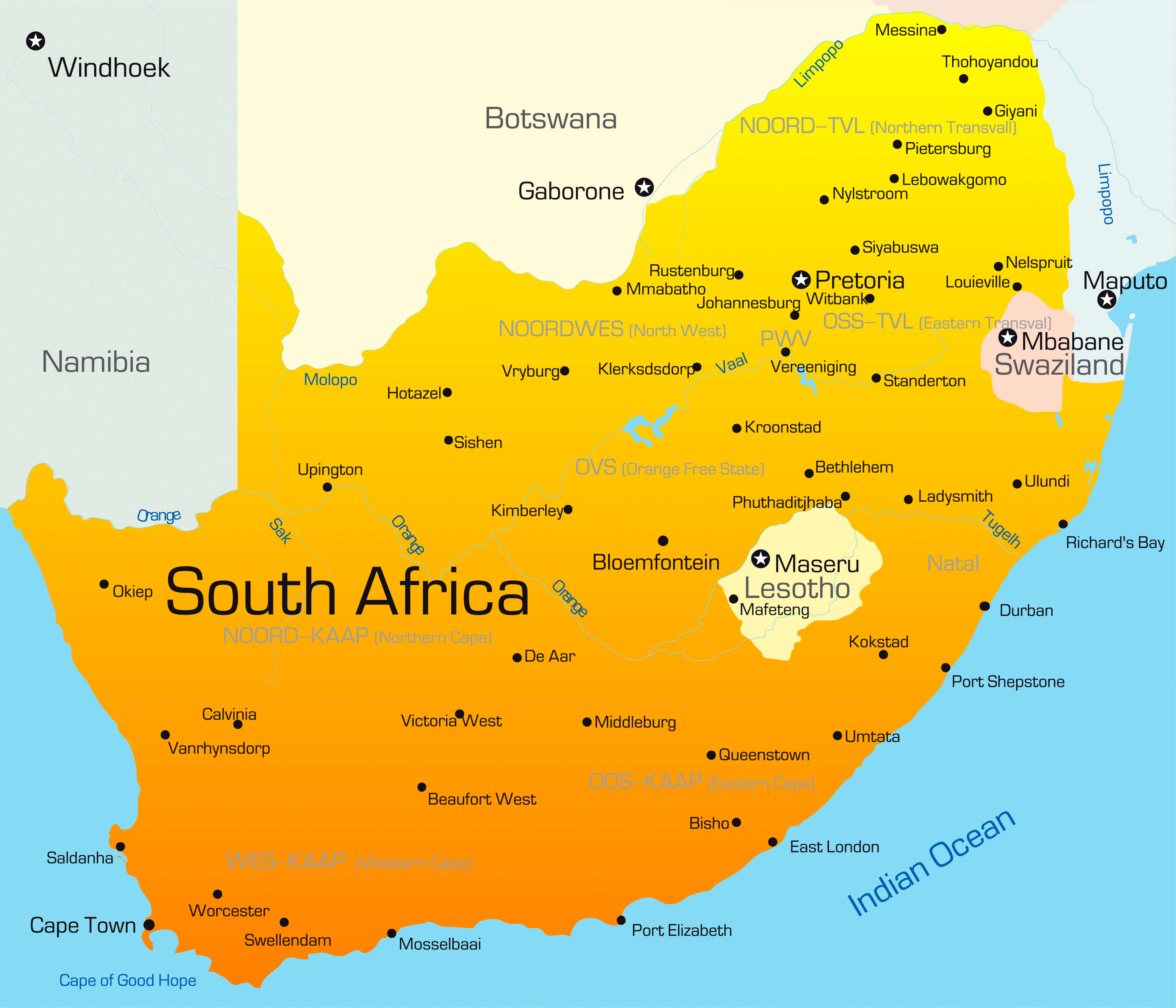
South Africa map in german
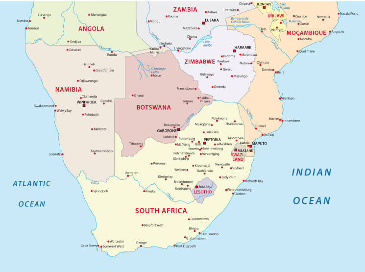
South Africa map with neighbours
South Africa map
South Africa maps
South Africa national park map
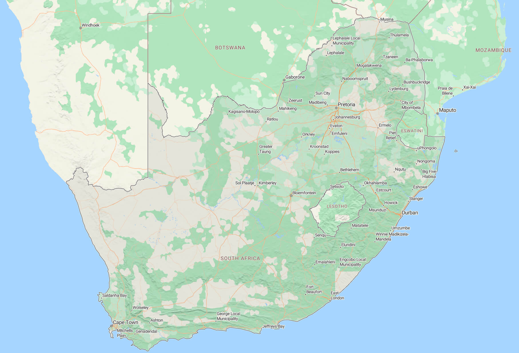
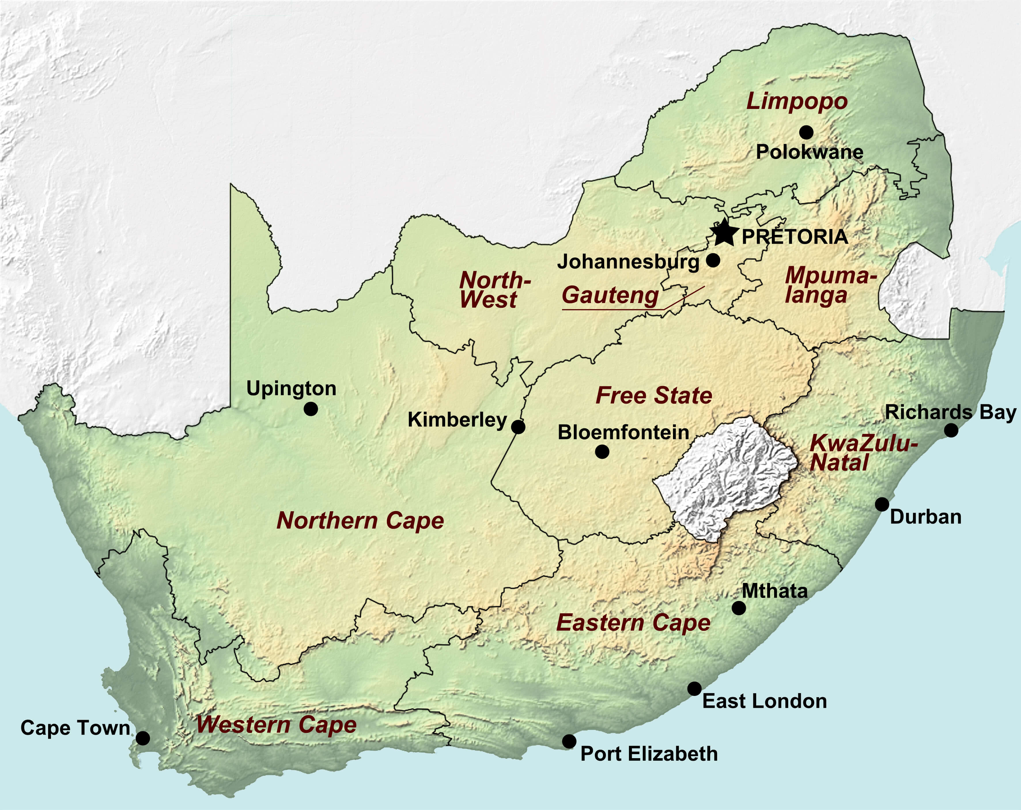
South Africa physical map with major cities
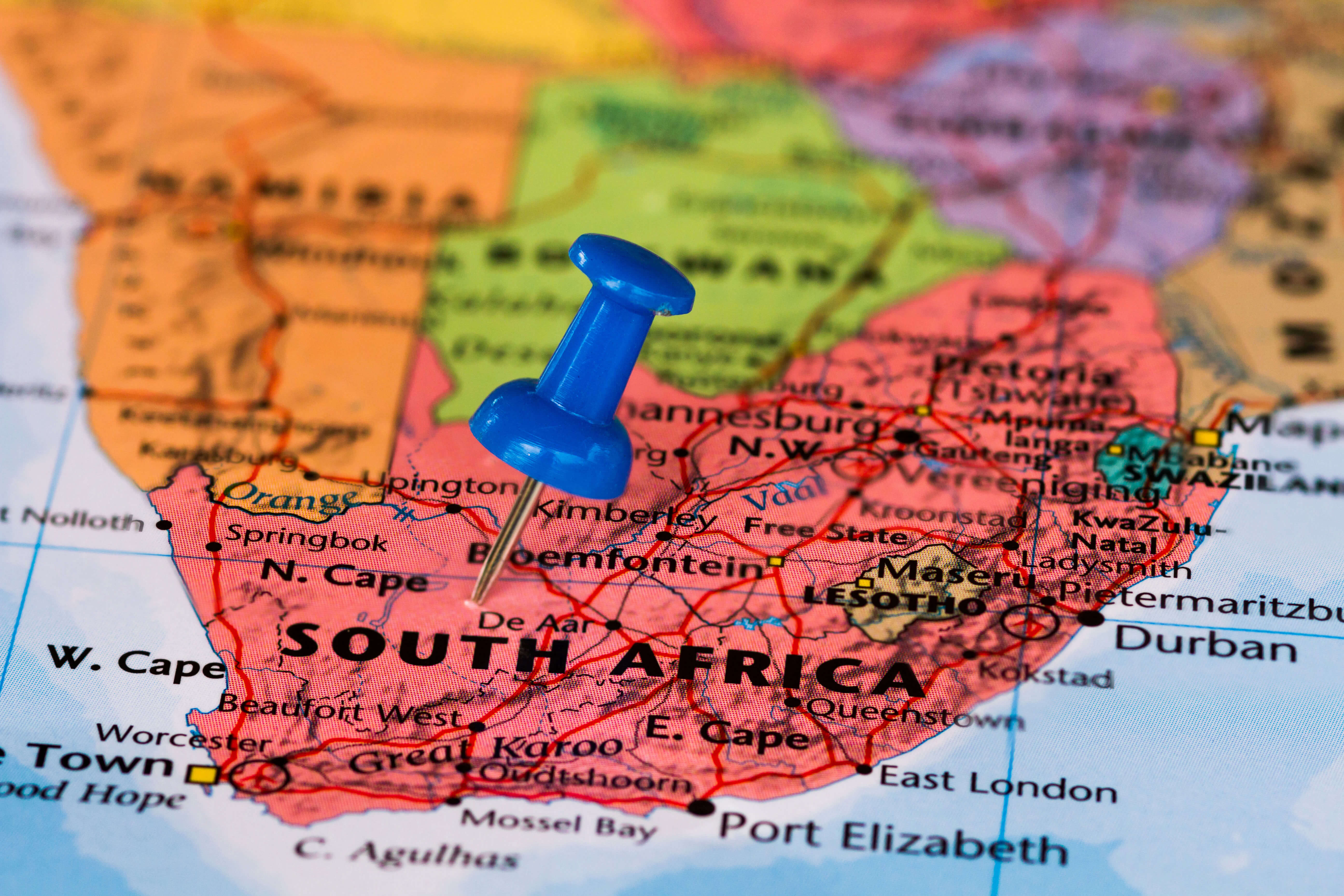
South Africa pin map
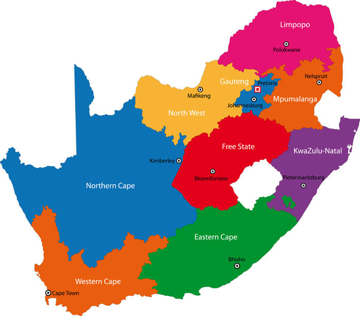
South Africa provinces map with cities
South Africa satellite map at night and day
South Africa satellite map with Atlantic Ocean
South Africa terrain map
Where is located South Africa in the World
Where is South Africa on the Africa Map?
Show Google interactive map, satellite map, where is the country located.
Get directions by driving, walking, bicycling, public transportation and travel with street view.
Feel free to explore these pages as well:
- The Essential Collection of South Africa Maps ↗️
- Egypt Map ↗️
- Algeria Map ↗️
- Uganda Map ↗️
- Tanzania Map ↗️
- Syria Map ↗️
- Iran Map ↗️
- Iraq Map ↗️
- Israel Map ↗️
- Jordan Map ↗️
- Saudi Arabia Map ↗️
- United States Map ↗️
- United Kingdom Map ↗️
- Türkiye Map ↗️
- Europe Map ↗️
- Africa Map ↗️