Explore the rich and diverse landscape of South Africa through this curated collection of maps. Whether you’re planning a journey, studying geography, or simply curious about the country’s unique regions, our maps offer detailed insights into South Africa’s cities, provinces, and natural wonders.
Brief information about South Africa
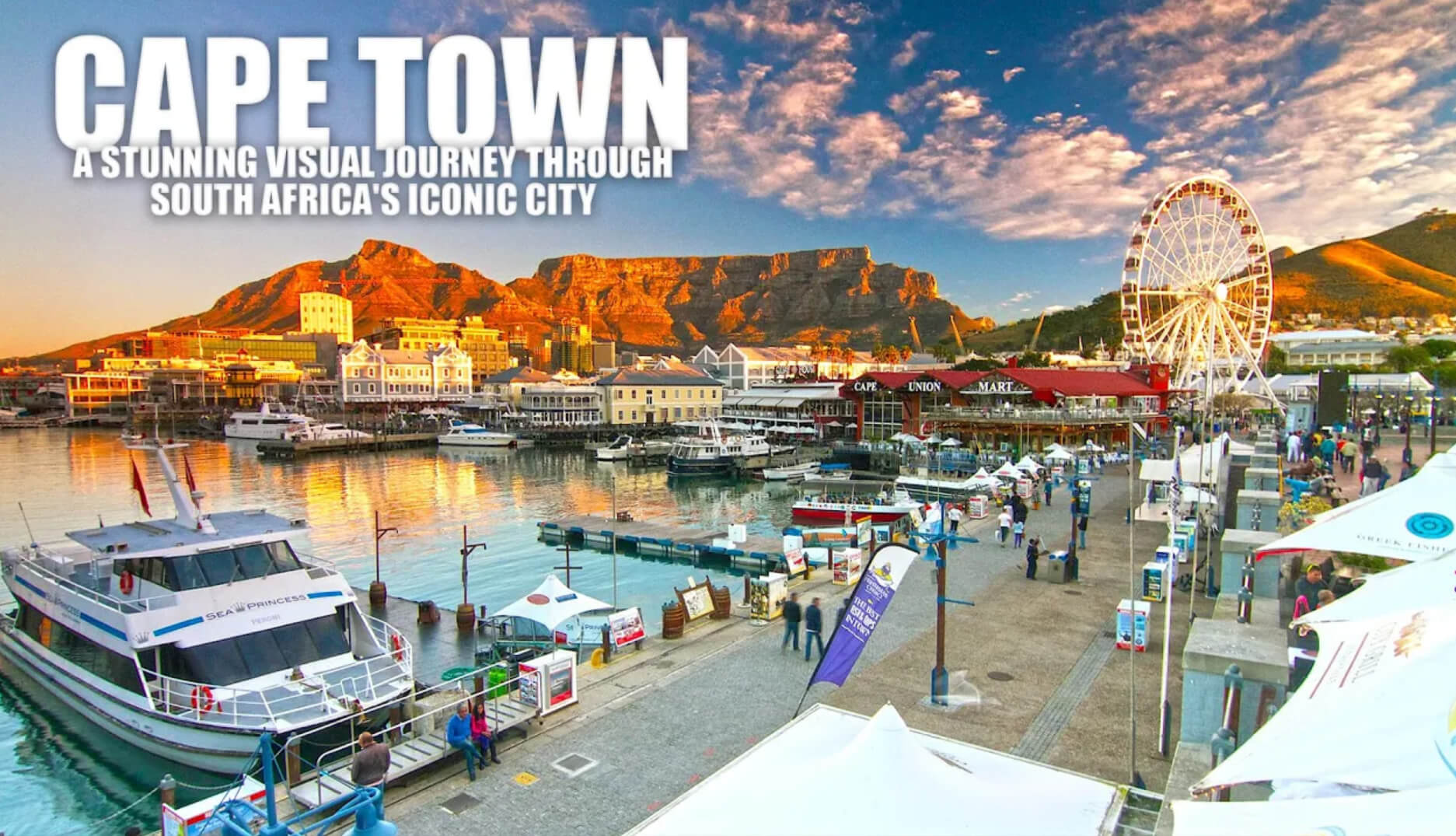
South Africa is a country of stunning contrasts, offering vibrant cities like Johannesburg and Cape Town alongside breathtaking landscapes such as Kruger National Park and the Drakensberg Mountains. Known as the “Rainbow Nation” for its cultural diversity, it boasts 11 official languages and a rich blend of traditions. Whether you’re exploring historical sites like Robben Island or tasting wines in Stellenbosch, South Africa captivates you with its unique mix of history, nature, and modern charm.
Map South Africa
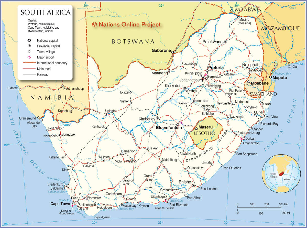
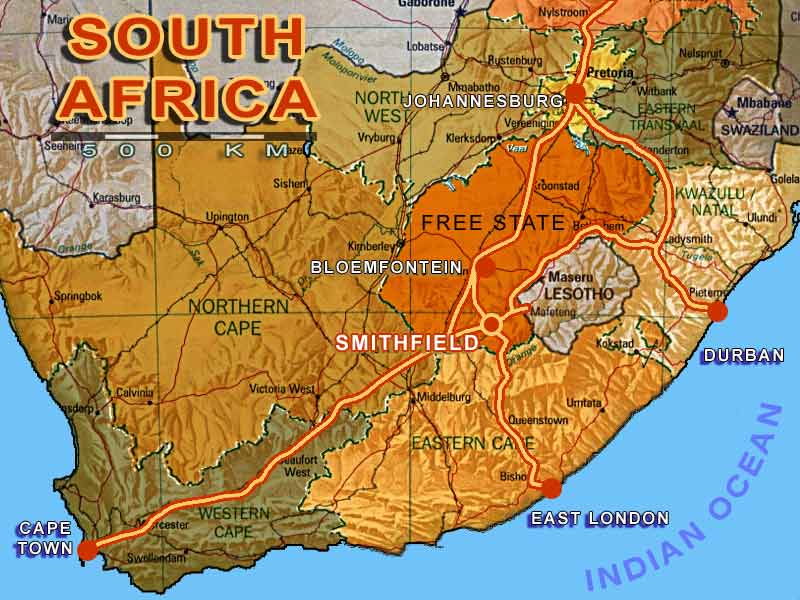
This map of South Africa highlights the country’s capital cities, towns, major airports, international boundaries, main roads, and railroads, providing a comprehensive overview of its infrastructure and borders
For wildlife lovers, it’s home to the Big Five lion, leopard, rhino, elephant, and buffalo offering unforgettable safari adventures. You can also dive into Cape Town’s waters, hike the Garden Route, or enjoy the arts and music scenes. South Africa’s diverse experiences make it a top destination for travelers seeking both adventure and relaxation.
Where is located South Africa on the World Map
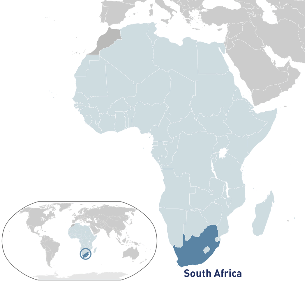
South Africa is located at the southernmost point of the African continent, bordered by both the Atlantic and Indian Oceans, and shares land borders with Namibia, Botswana, Zimbabwe, Mozambique, and Eswatini.
South Africa is located at the southern tip of the African continent, with coastlines along both the Atlantic and Indian Oceans. It borders Namibia, Botswana, Zimbabwe, Mozambique, and Eswatini, while the country of Lesotho is completely surrounded by South Africa. Its coastal location has historically made it an important crossroads for global trade routes. Because of its position, South Africa has diverse climates, from Mediterranean-like weather in the southwest to tropical conditions in the northeast. This geographic variety also makes it home to a rich range of wildlife and stunning landscapes.
Here are some statistical information about South Africa:
Area: 1,221,037 km²
Population: 59.6 million people
Capital city: Cape Town (legislative), Bloemfontein (judicial)
Official languages: 11 official languages including English, Zulu, and Xhosa
Ethnic groups: Black African (80.9%), Coloured (8.8%), White (7.8%), Indian/Asian (2.5%)
Religion: Christianity is the largest religion (79.8%), followed by Other (10.3%), No religion (9.2%), and Islam (1.5%)
GDP (nominal): $373.233 billion (38th – 2024 estimate)
Per capita: $5,975 (98th – 2024 estimate)
Currency: South African rand (ZAR)
Calling code: +27
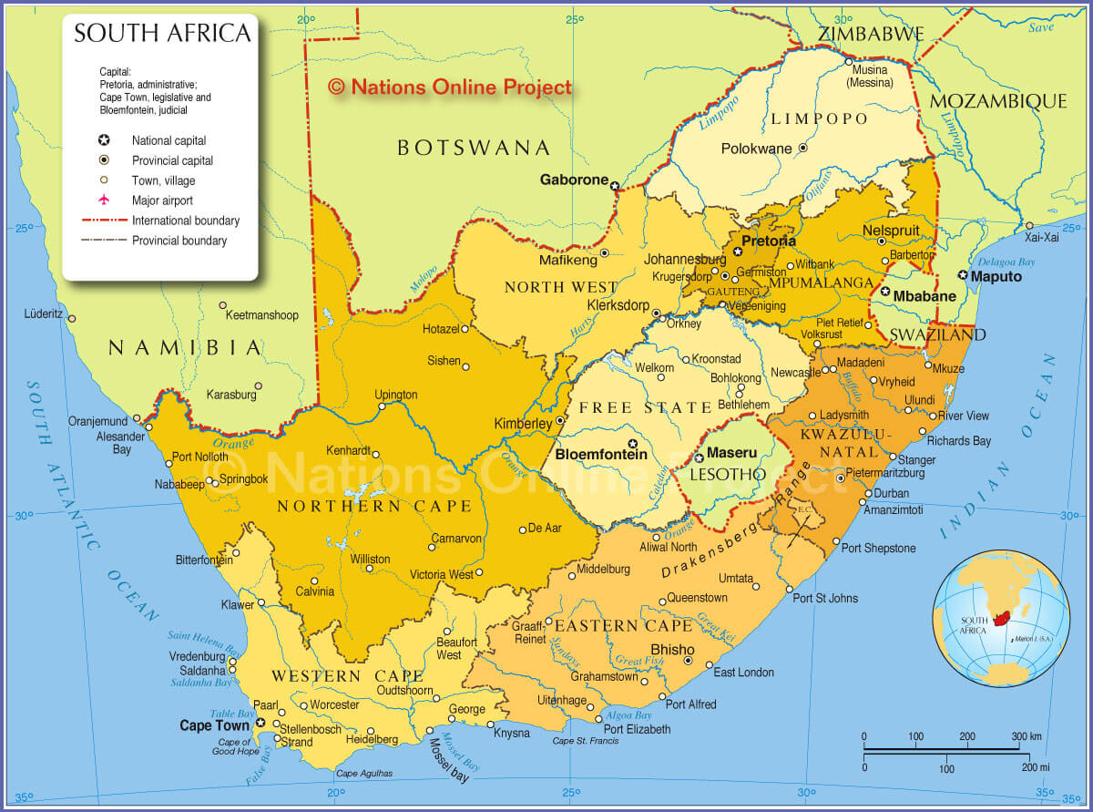
South Africa Political Map
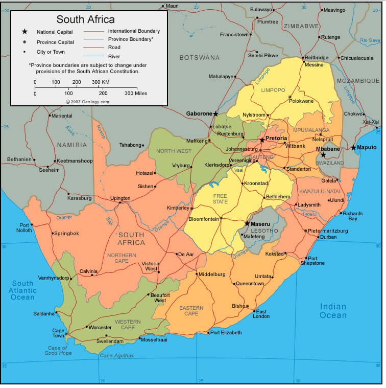
A political map of South Africa shows the country’s nine provinces, including major cities like Johannesburg, Cape Town, and Durban, along with its borders with neighboring countries such as Namibia, Botswana, Zimbabwe, Mozambique, and Eswatini.
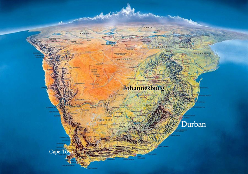
South Africa Physical Map
A physical map of South Africa highlights the country’s diverse landscapes, including mountain ranges like the Drakensberg, vast plateaus, deserts such as the Kalahari, and coastal plains along the Atlantic and Indian Oceans.
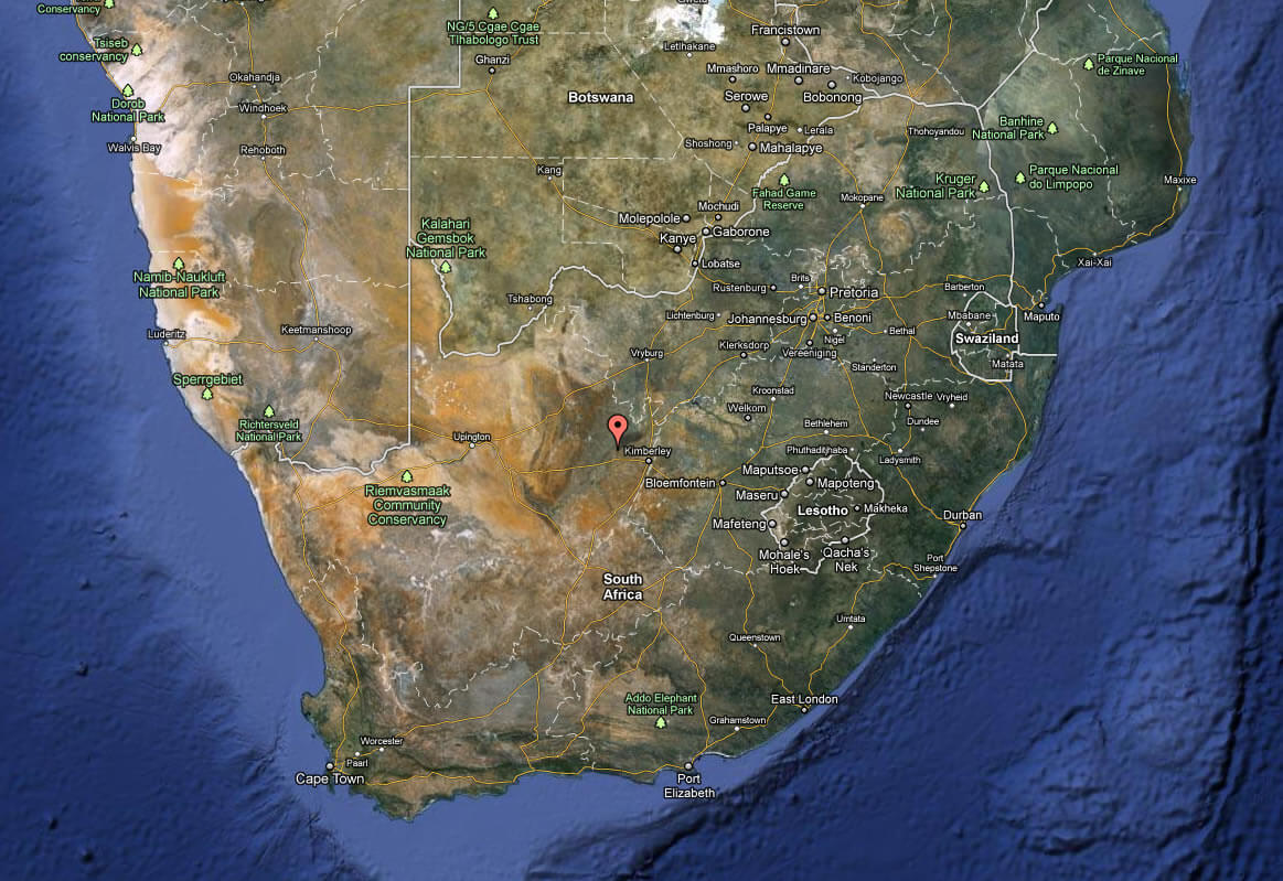
Satellite Image of South Africa
Sketch of South Africa
South Africa aerial view
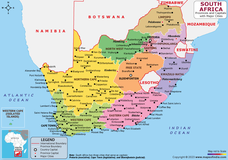
South Africa Provinces and Capital Map
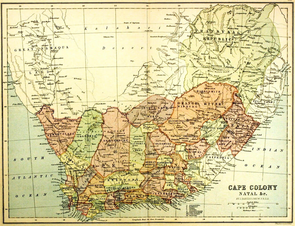
South Africa Map 1885
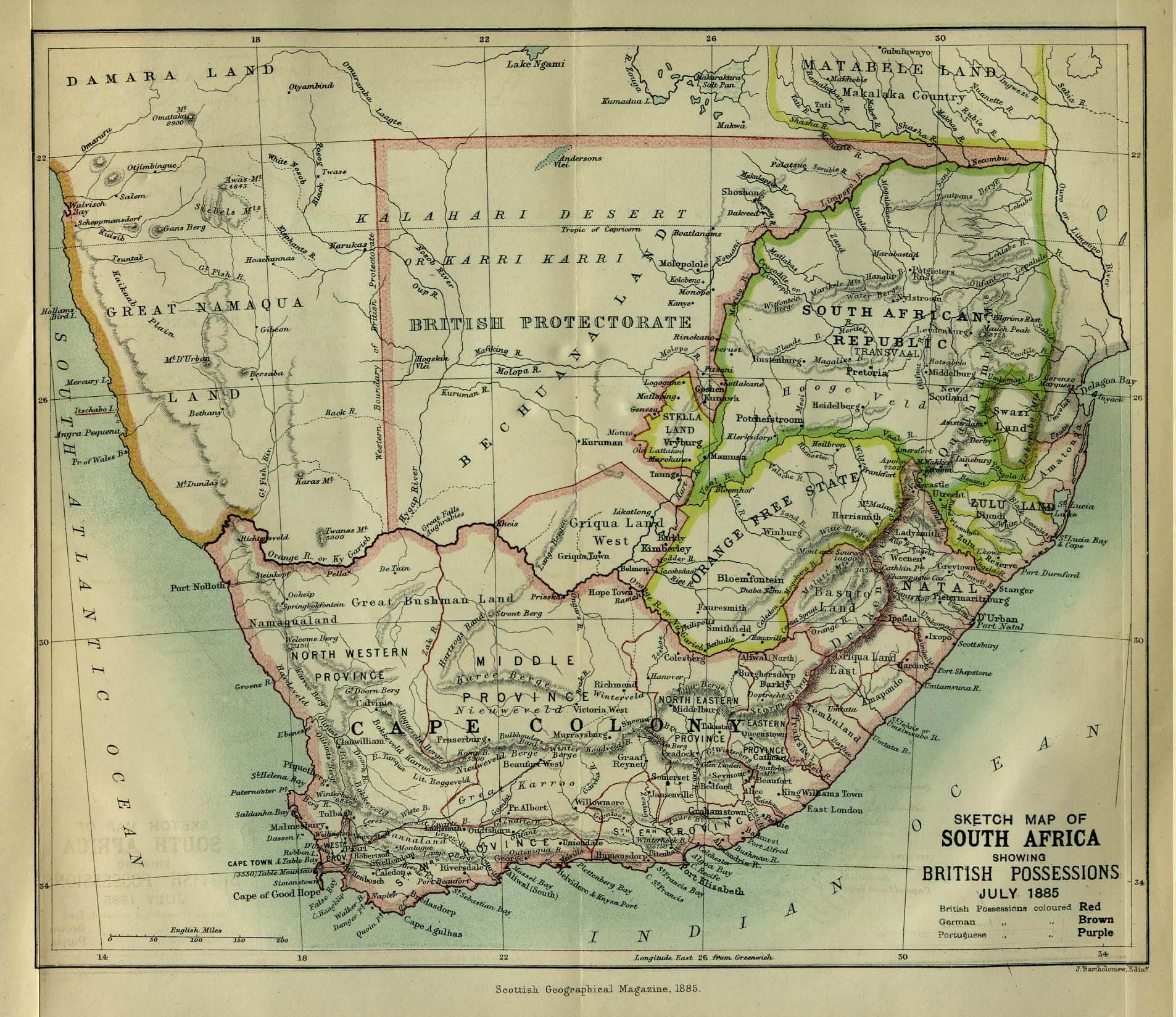
This historical map from 1885 illustrates South Africa during the period of British colonial possessions, highlighting key territories such as Cape Colony, the South African Republic, and various British protectorates and regions like Zululand.
South Africa Road Map
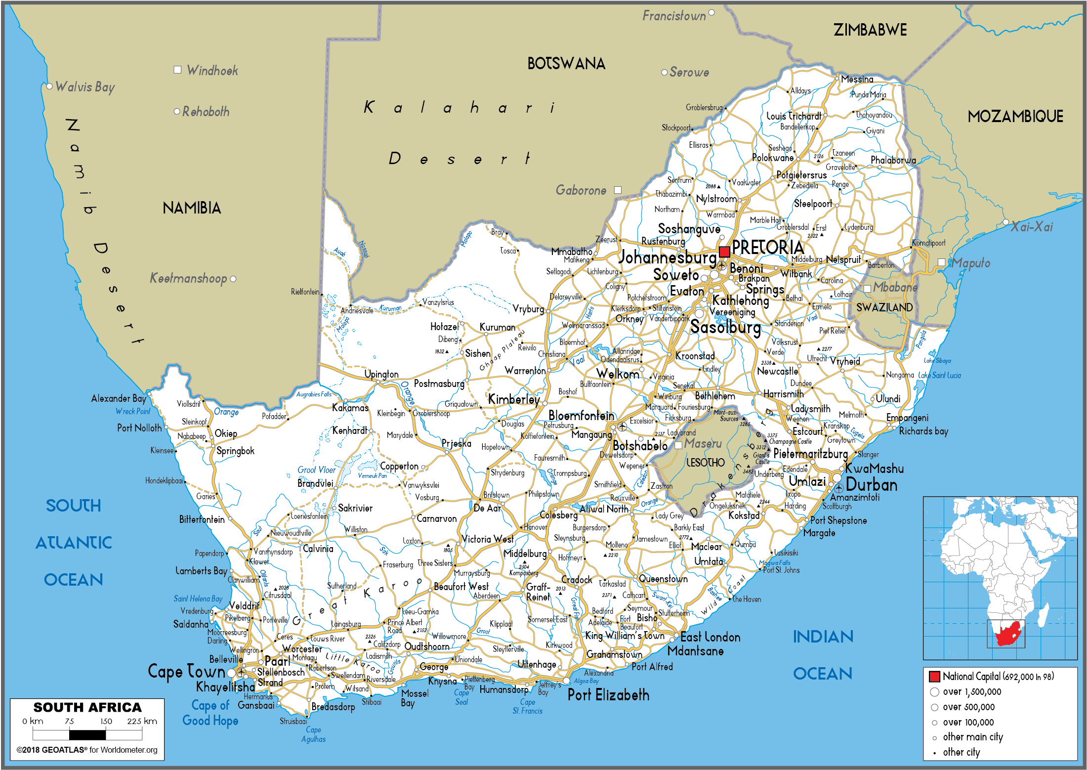
This road map of South Africa illustrates the major roadways connecting cities, towns, and key regions across the country, providing a detailed overview of the transportation network, including national highways and smaller routes.
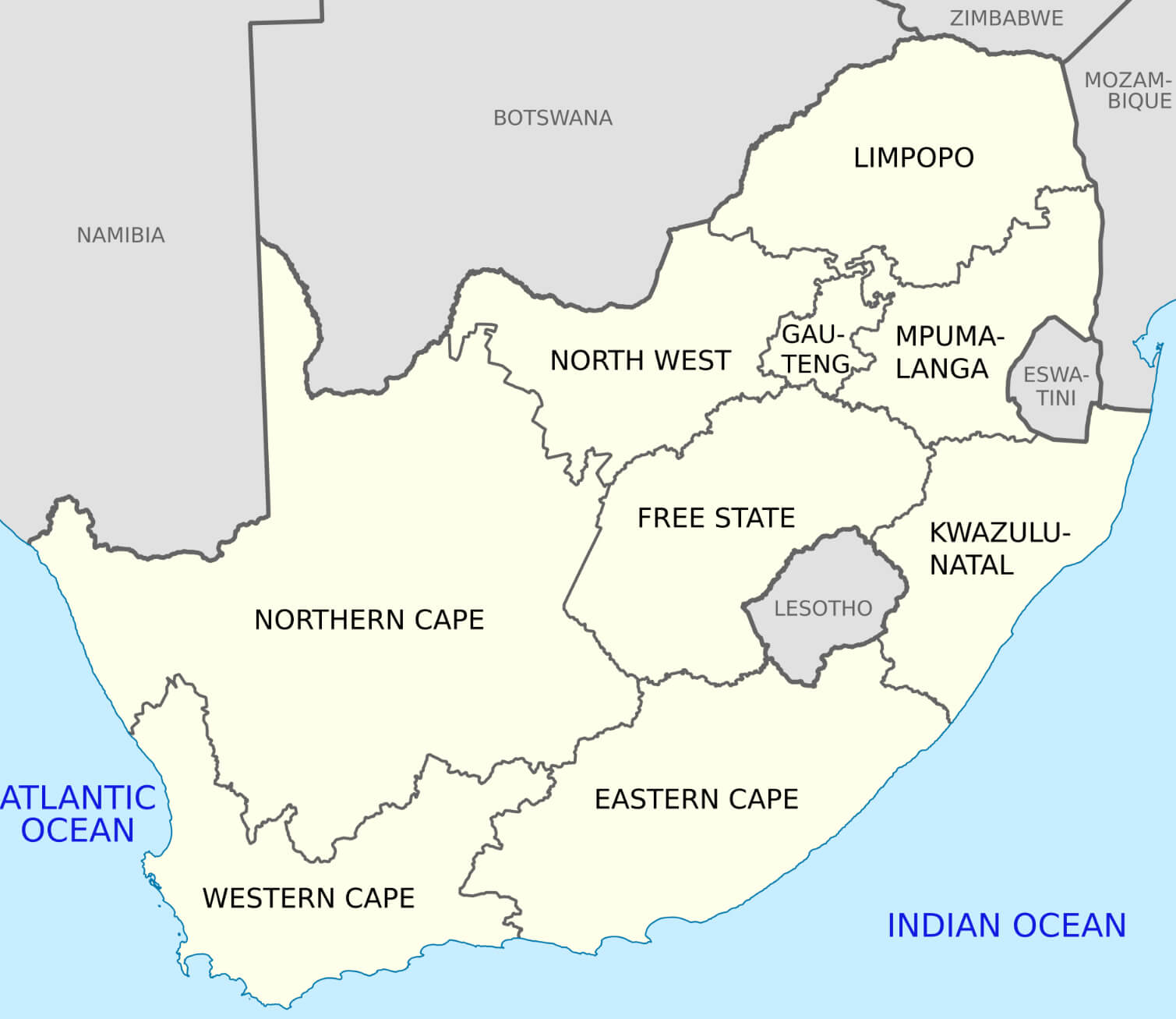
Provinces Map of South Africa
This map of South Africa highlights the country’s nine provinces, their boundaries, and major cities, clearly distinguishing administrative divisions from key urban centers.
South Africa Regions Map
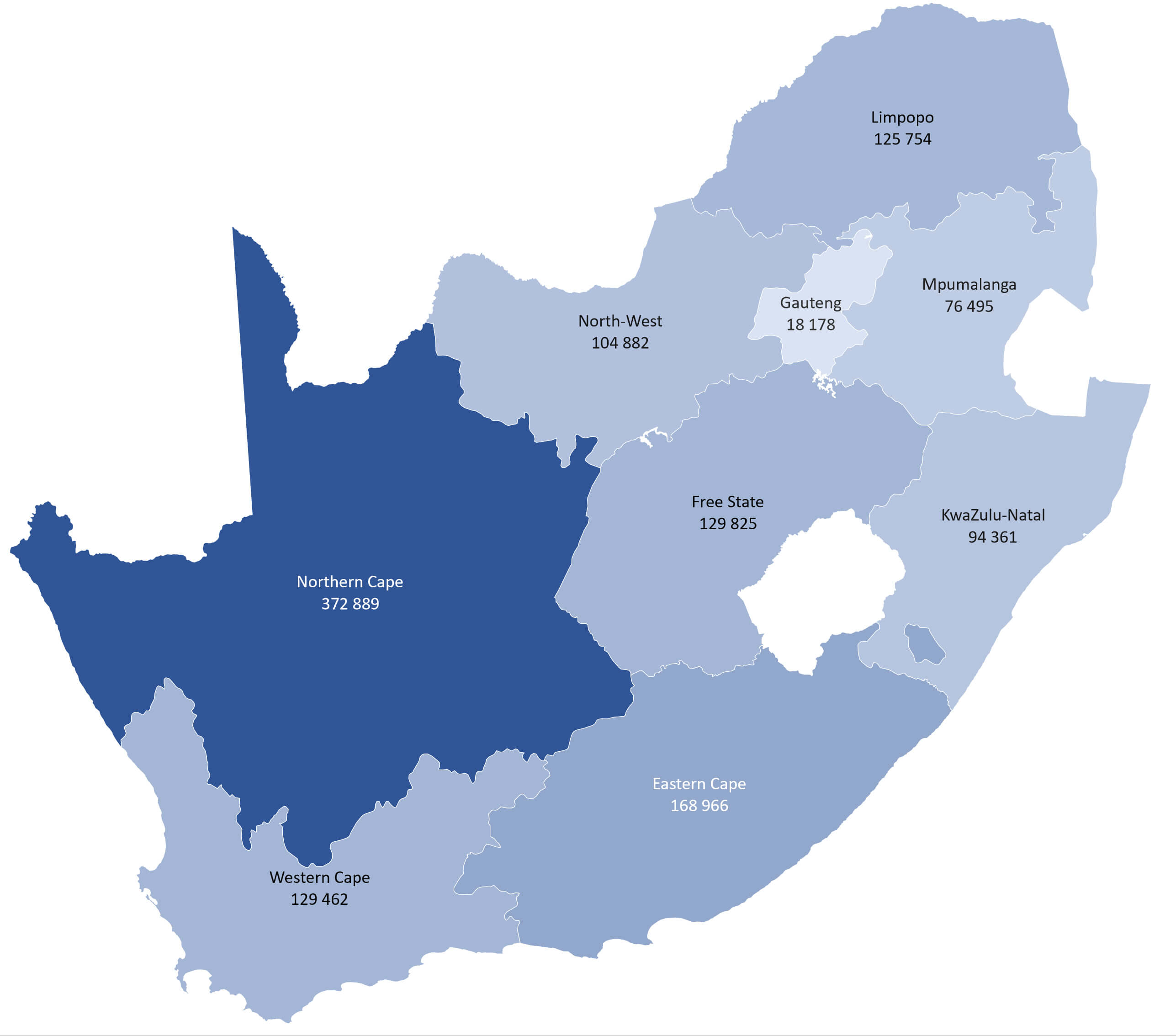 This map of South Africa shows the country’s provincial boundaries and regions, highlighting key areas such as the Northern Cape, which is the largest by area, and Gauteng, known for being the smallest but most densely populated province. Each province is shown with its respective area size, providing a clear comparison of the regional distribution across the country. This visual representation provides an insight into the geographical and administrative divisions of South Africa.
South Africa Administrative Map
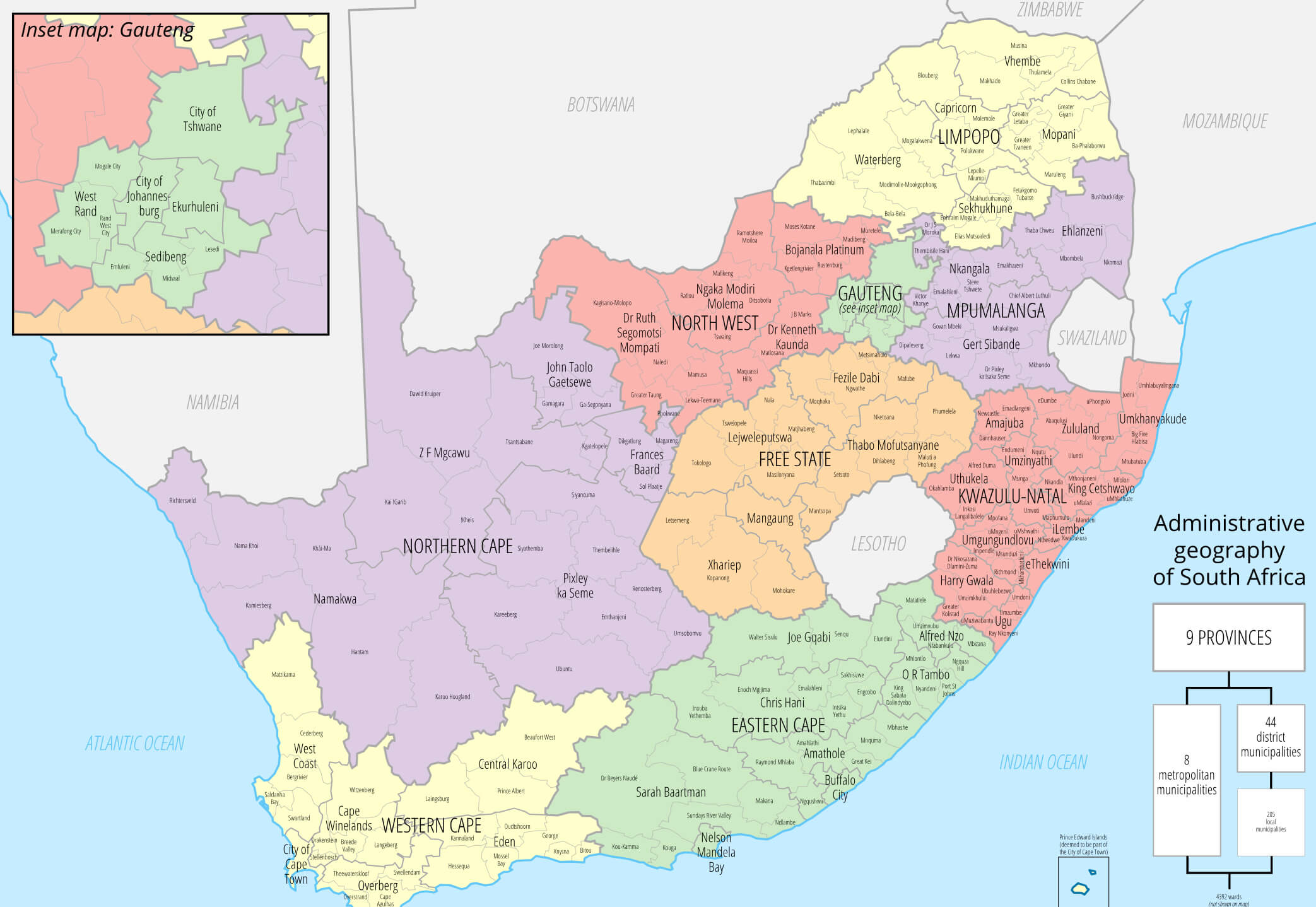 This map of South Africa’s administrative divisions illustrates the country’s nine provinces, each with defined boundaries and its own regional government. The map highlights the major cities, districts and municipalities within provinces such as Gauteng, KwaZulu-Natal and Western Cape, illustrating the country’s diverse geography and political structure. An inset focuses on Gauteng, highlighting its metropolitan areas such as Johannesburg and Pretoria, which are key economic hubs. The map provides a detailed view of South Africa’s governance structure, from metropolitan municipalities to district level.
South Africa National Borders Map with Flag
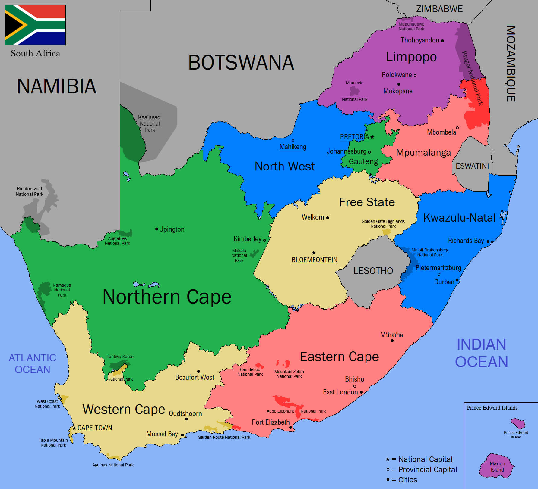 This map of South Africa shows the country’s borders, provinces and key geographical features such as national parks and major cities, as well as an image of the country’s flag. It shows the location of South Africa’s nine provinces, including Northern Cape, Eastern Cape, Western Cape, Gauteng and more, as well as neighbouring countries such as Namibia, Botswana, Zimbabwe and Mozambique. The map clearly shows both provincial capitals such as Bloemfontein and the national capital Pretoria, making it easy to understand the regional layout of South Africa.
South Africa Historical Map in 1876
 This 1876 map of South Africa illustrates the territorial divisions and political landscape of the region in the late 19th century. It highlights the Cape Colony, Natal and other areas such as the Transvaal Republic and the Orange Free State, which were important during the era of colonial expansion and conflicts such as the Anglo-Zulu War. This historical account provides an insight into the geographical boundaries and administrative divisions before the unification of South Africa in 1910.
South Africa Satellite Map
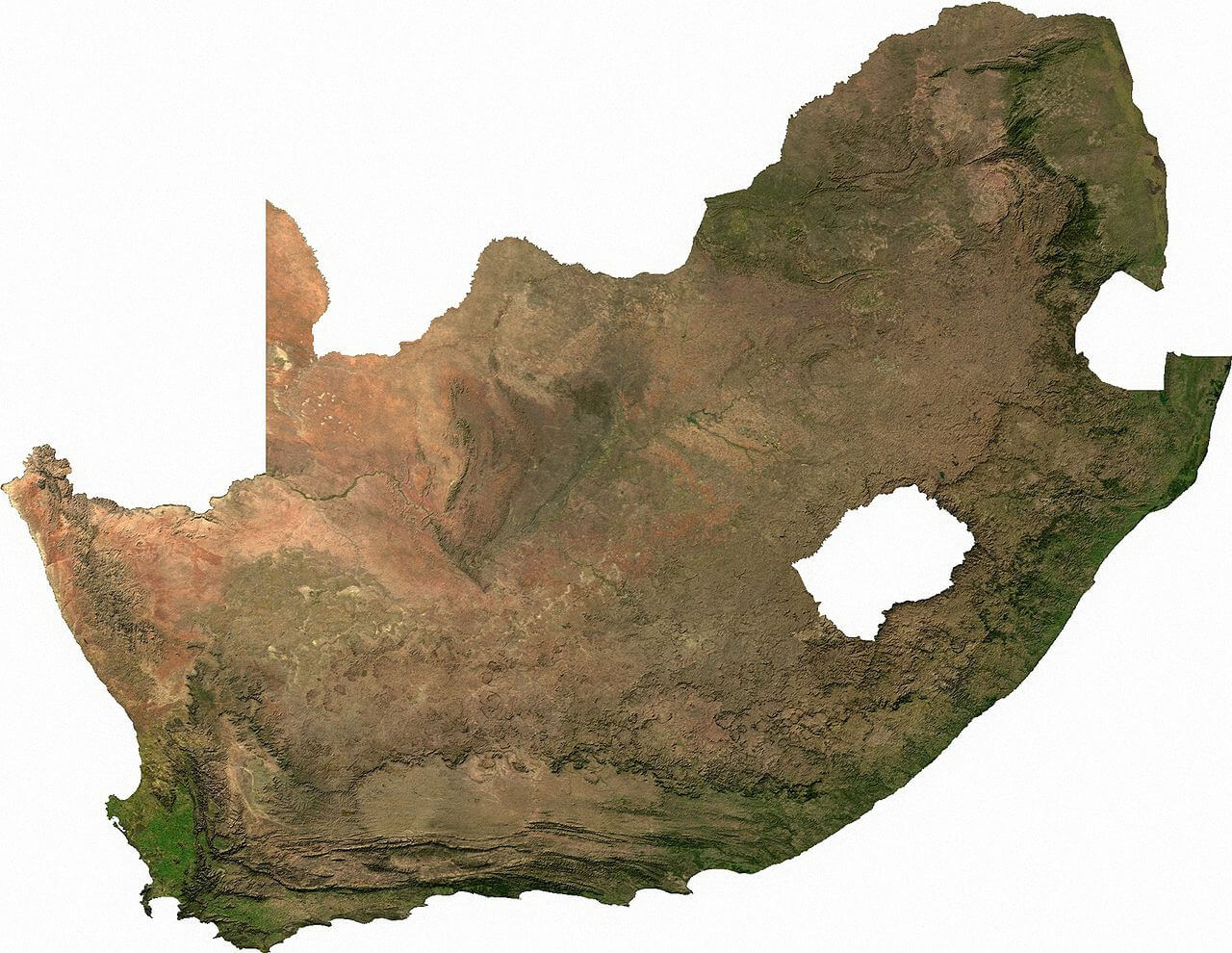 This satellite map of South Africa provides a detailed overview of the country’s topography and natural landscapes. It highlights the diverse terrain, from the arid regions of the northwest to the lush green areas of the coastal regions. The map also provides an overview of the contrasting environments in South Africa’s provinces, showing the varied geography that ranges from deserts to savannahs and mountain ranges.
South Africa Climate Map
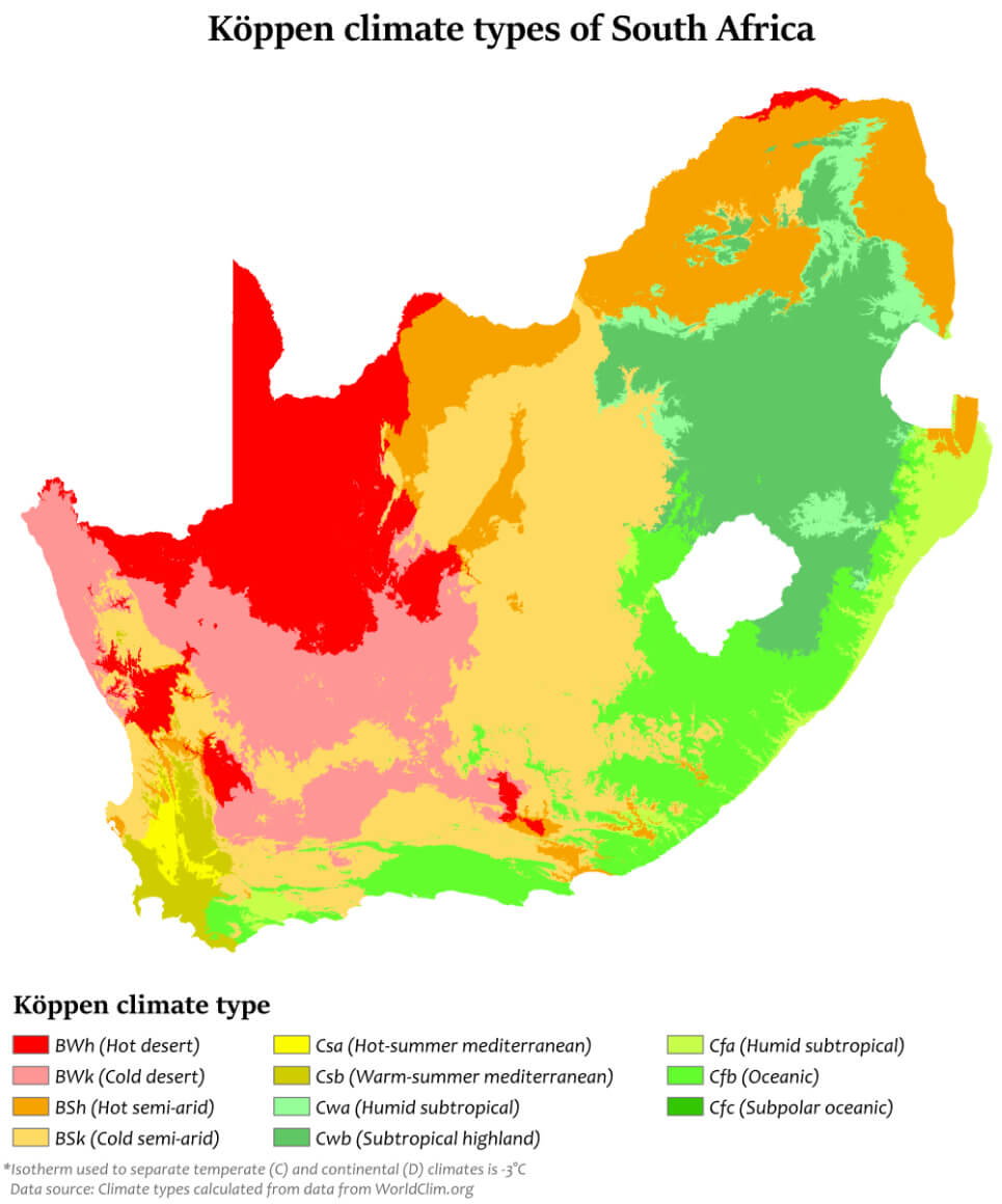 This map of South Africa shows the Köppen climate types across the country, revealing a diverse range of climates. The western region is dominated by arid climates such as BWh (hot desert) and BSh (hot semi-arid), while the south-western coast has a Csb (warm summer Mediterranean) climate. Moving eastwards, areas of humid subtropical (Cfa) and oceanic (Cfb) climates appear, particularly in regions such as KwaZulu-Natal and the Eastern Cape. The central and northern parts contain a mixture of semi-arid (BSk) and some subtropical highland (Cwb) climates, providing a varied landscape influenced by altitude and proximity to oceans.
South Africa Population Density Map
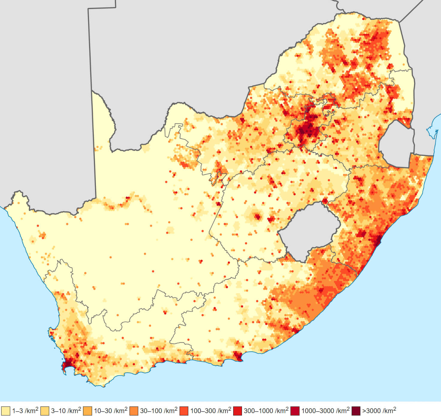 This map of South Africa shows the distribution of population density across the country, with darker shades indicating areas of higher population concentration. Urban centres such as Johannesburg, Cape Town and Durban have the highest population densities, while the Northern Cape and other rural areas have much lower population densities. The colour gradient provides a clear visual representation of where the population is concentrated, reflecting the balance between urban development and vast sparsely populated regions.
South Africa Languages Map
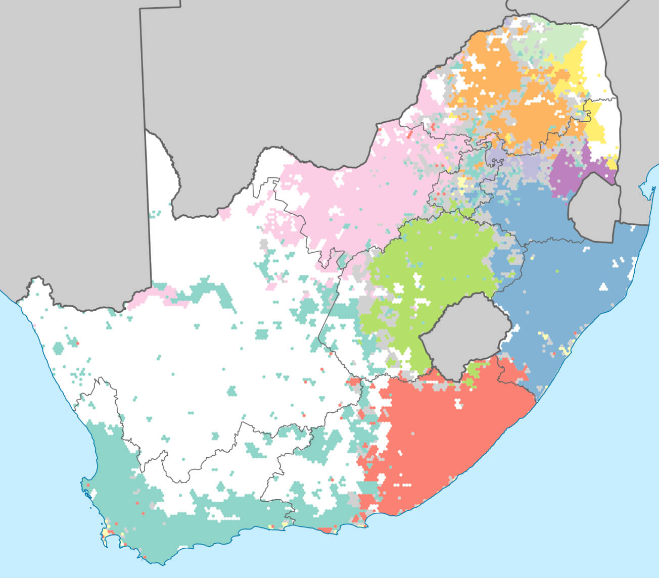 This map of South Africa shows the distribution of different languages spoken in the country, with each colour representing the prevalence of a particular language. Regions are shaded to highlight where certain languages dominate, reflecting the country’s linguistic diversity. The map gives an insight into the multicultural and multilingual nature of South Africa, where 11 official languages coexist, with certain languages more commonly spoken in certain provinces.
South Africa Provinces Map
 This map of South Africa shows the division of the country into nine provinces: Western Cape, Northern Cape, Eastern Cape, Free State, KwaZulu-Natal, North West, Gauteng, Mpumalanga and Limpopo. Each province is clearly outlined, showing its geographical location and neighbouring countries such as Namibia, Botswana, Zimbabwe, Mozambique, Eswatini and Lesotho. The map provides a clear view of South Africa’s administrative boundaries, highlighting the relative position of the provinces within the country.
South Africa Rivers Map
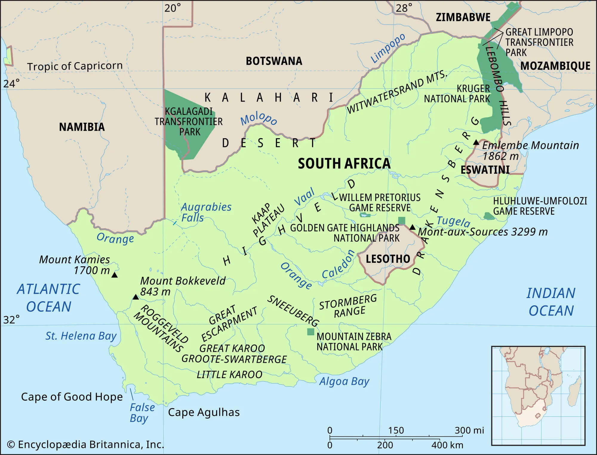 This map illustrates South Africa’s rivers and major geographical features, highlighting major natural landmarks such as the Orange River, the Vaal River and the Limpopo River. It also shows mountain ranges such as the Drakensberg and major parks such as Kruger National Park and Kgalagadi Transfrontier Park, emphasising the diversity of the country’s natural landscape.
South Africa Largest Cities Map with Rivers
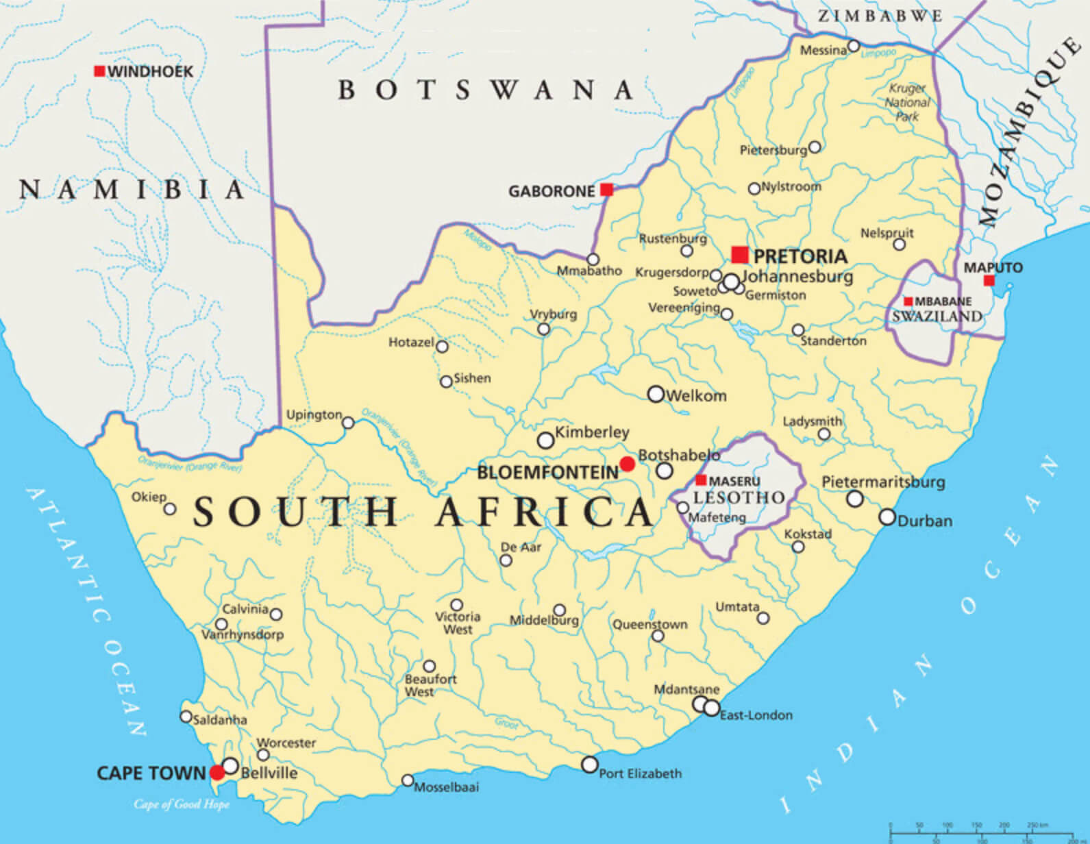 This map of South Africa highlights the country’s major cities, including Cape Town, Pretoria, Johannesburg, Durban and Bloemfontein. It also shows major rivers, such as the Orange and Limpopo, which play an important role in the region’s geography and economy. The map provides a comprehensive view of urban centres and waterways, offering insights into the distribution of population and natural resources across South Africa.
South Africa Geography Map
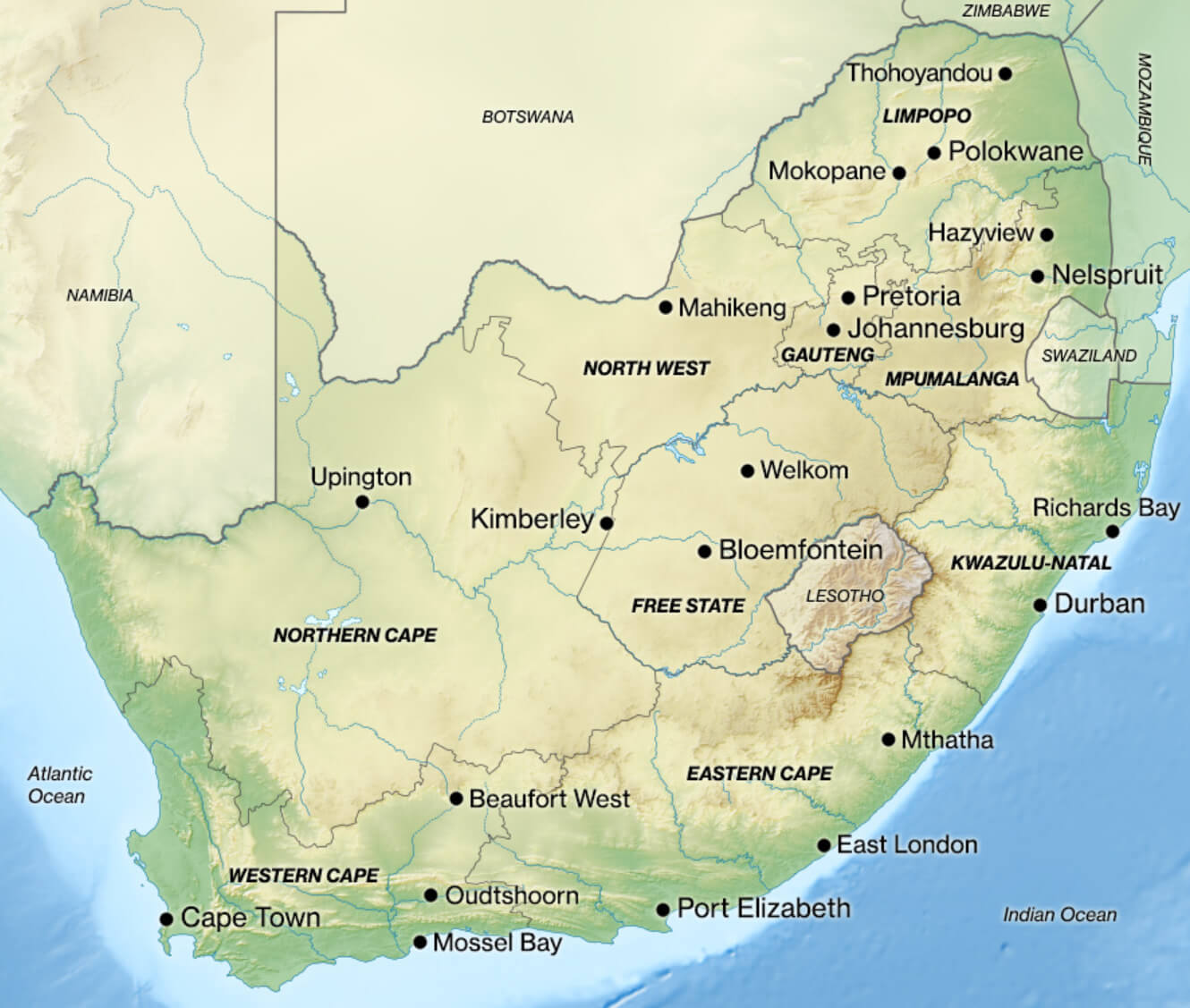 This South Africa geography map shows the major cities and geographical features of the country, highlighting regions such as the Western Cape, Eastern Cape and Gauteng, as well as major cities such as Cape Town, Johannesburg and Durban. The map also illustrates the topography, including mountain ranges and plateaus, providing a comprehensive overview of South Africa’s diverse landscape.
South Africa Safari Map with National Parks
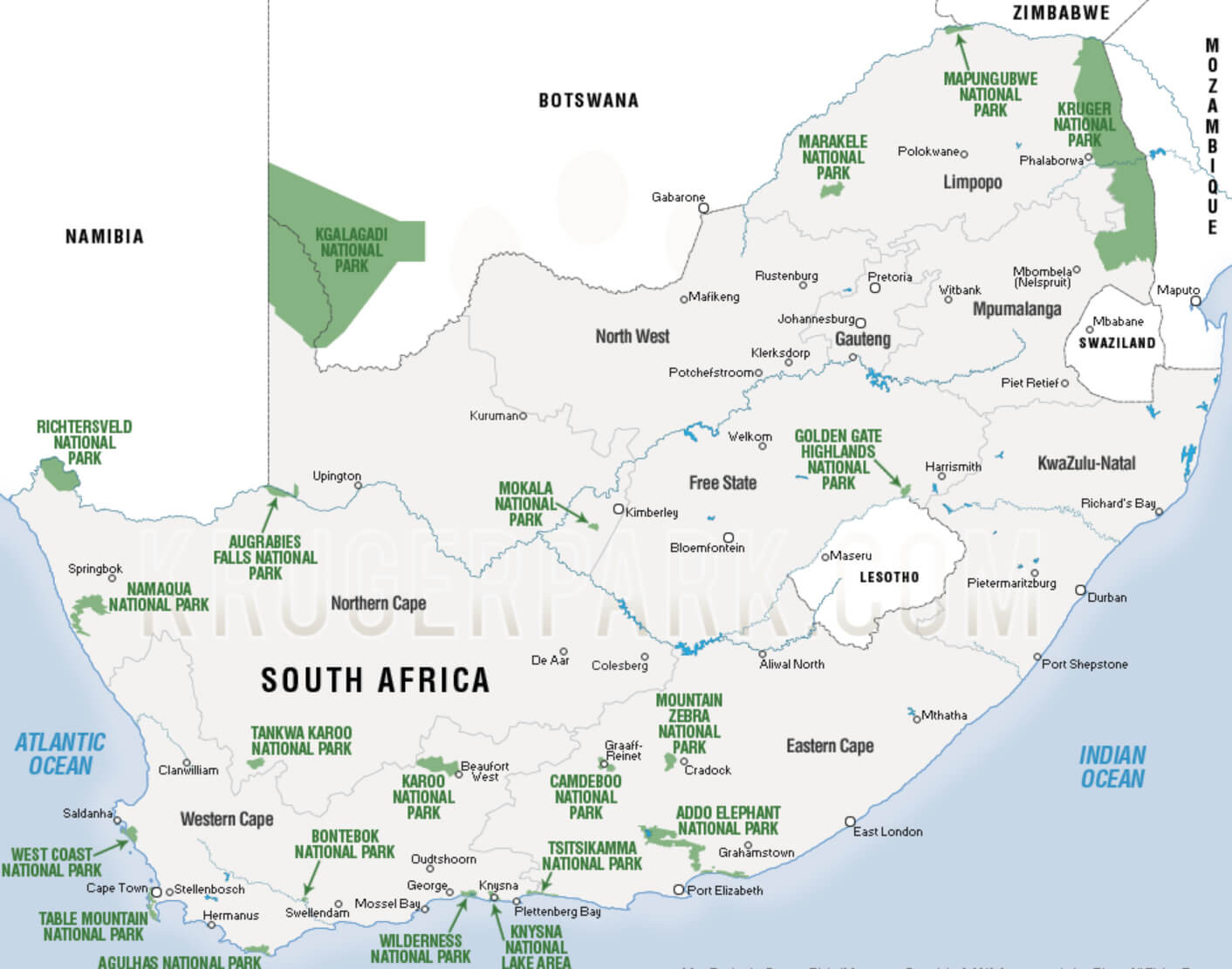 This map shows the distribution of South Africa’s major national parks and nature reserves, such as Kruger National Park in the north-east and Kgalagadi National Park in the north-west. These parks are popular safari destinations, offering the opportunity to explore the country’s diverse wildlife and stunning landscapes.
Where is South Africa on the Africa Map?
Show Google map, satellite map, where is the country located.
Get directions by driving, walking, bicycling, public transportation and travel with street view.
div>Feel free to explore these pages as well:
- Africa Map ↗️
- About Africa and Maps ↗️
- Visit Africa ↗️
- Africa Map I ↗️
- Africa Map II ↗️
- Africa Map III ↗️
- Africa Map IV ↗️
- Africa Map V ↗️
- Map of Africa ↗️
- A Collection of Algeria Maps: Exploring a North African Gem via Maps ↗️