LA Fires January 2025

HomeMapsLA Fires January 2025
- Advertisement -

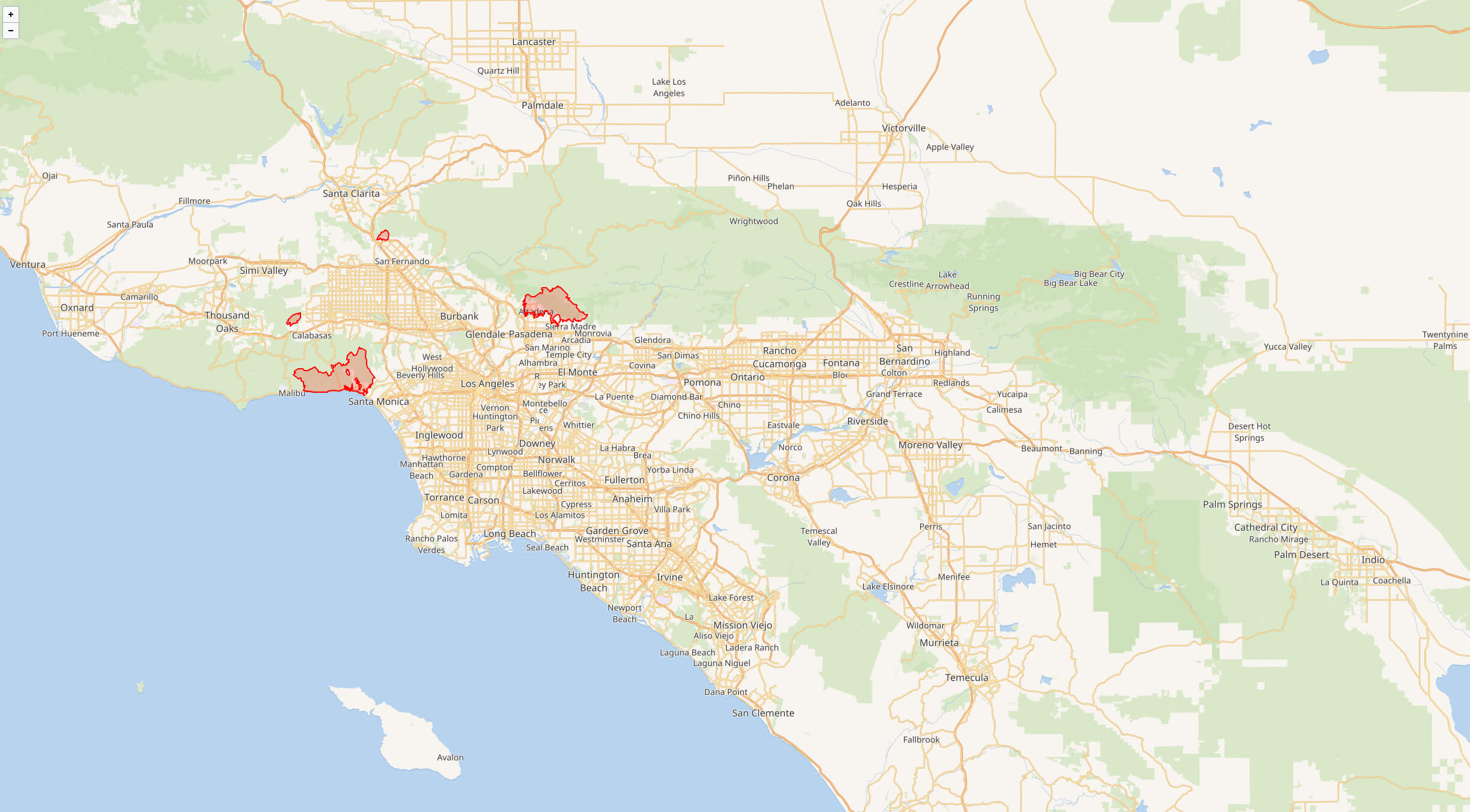
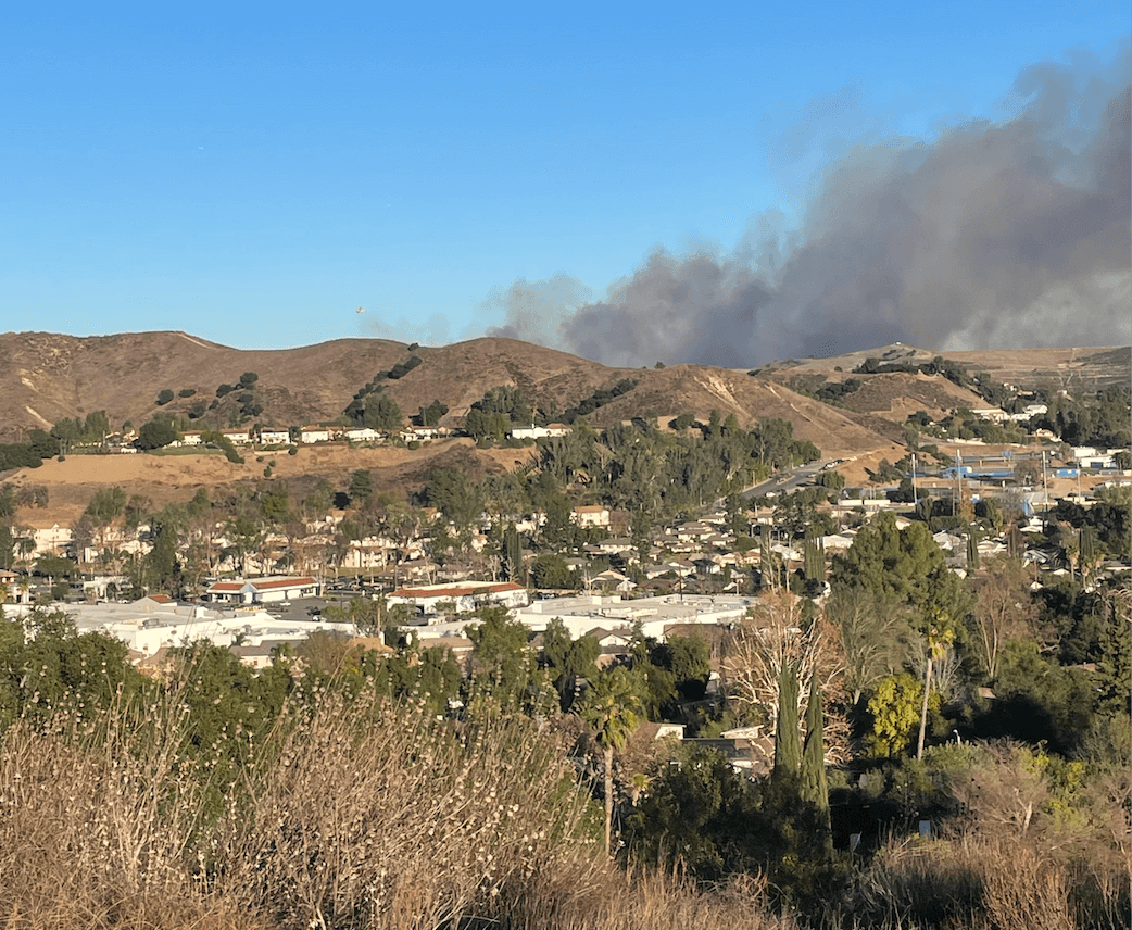
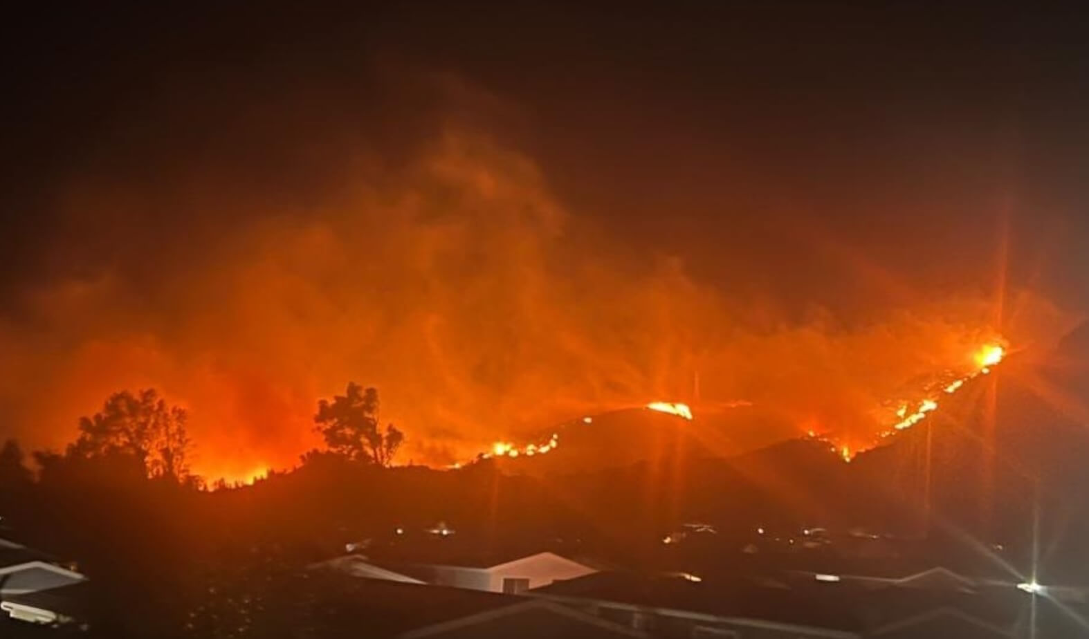
Beginning on January 7, 2025, a series of devastating wildfires have ravaged the Los Angeles metropolitan area and its surrounding regions. Fueled by extremely low humidity, dry conditions, and powerful Santa Ana winds reaching up to 100 miles per hour (160 km/h; 45 m/s), the fires have caused significant destruction. By January 11, the wildfires had claimed 13 lives, forced nearly 180,000 residents to evacuate, and damaged or destroyed over 13,400 structures. The majority of the devastation has been caused by the two largest fires: the Palisades Fire and the Eaton Fire.

What Caused LA Wildfires

The January 2025 wildfires in Southern California have grown rapidly due to a combination of environmental and meteorological factors:
Palisades fire 2025
  1. Extremely Dry Conditions: A prolonged drought has left vegetation across the region highly flammable, creating perfect fuel for the fires.
  2. Santa Ana Winds: These hurricane-force winds, reaching speeds of up to 100 miles per hour (160 km/h), have driven the flames across large areas, spreading the fires rapidly and making containment efforts extremely challenging.
  3. Low Humidity: The combination of very low humidity levels and high temperatures has further dried out vegetation, intensifying fire activity and resistance to suppression.
  4. Dense Population and Structures: Southern California’s urban and suburban sprawl provides additional fuel as fires reach residential areas, causing extensive damage.
  5. Climate Change: Increasingly hotter and drier conditions due to climate change are contributing to more frequent and severe wildfires in the region.
These factors, acting together, have made the January 2025 wildfires some of the most destructive in the region’s history.

Greater Los Angeles wildfires

LA fires january 2025

Greater Los Angeles wildfires satellite image
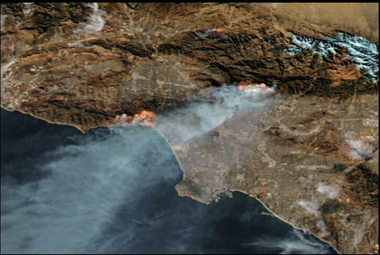
Greater Los Angeles wildfires satellite image

Acres Burned By Wildfires In Los Angeles – January 2025
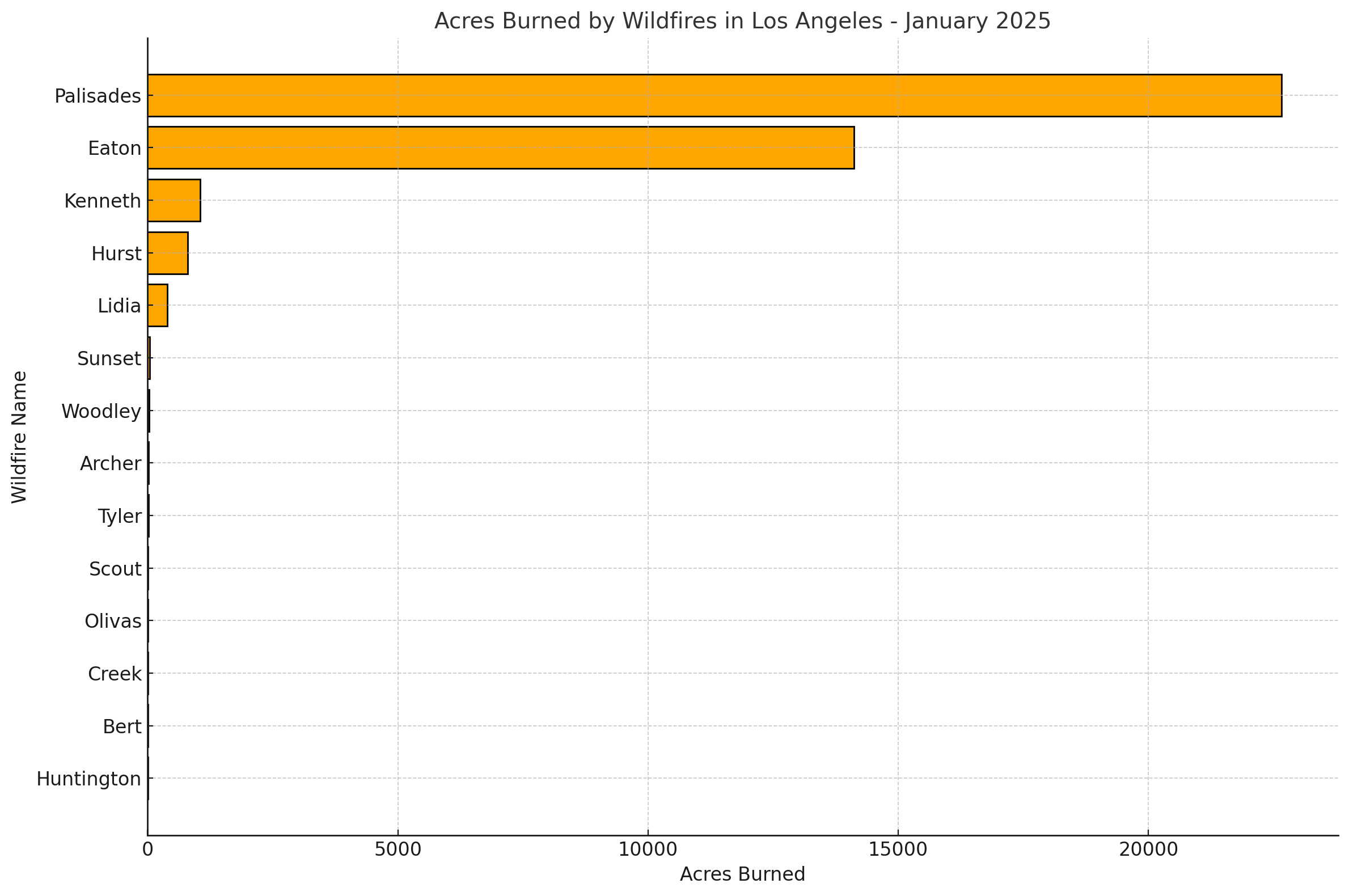
Acres Burned By Wildfires In Los Angeles - January 2025
Acres Burned By Wildfires In LA – in January 2025.

Here is a bar chart visualizing the acres burned by each wildfire in Los Angeles during January 2025. The chart highlights the significant impact of the Palisades and Eaton fires compared to smaller fires like Huntington and Creek. Let me know if you’d like further customization or additional insights.

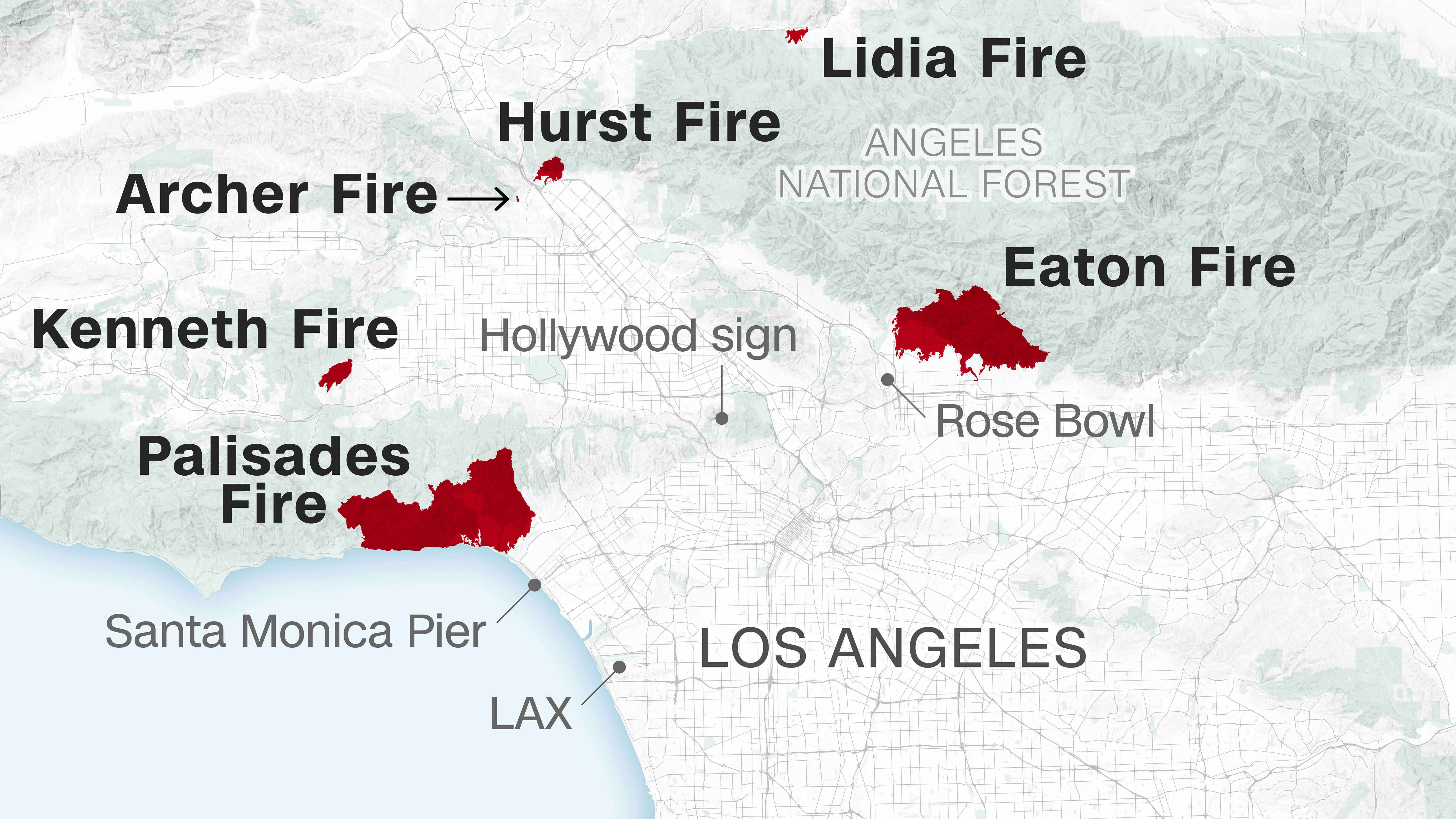
LA Wildfires 2025 Map

LA Wildfires 2025 Map
Map of Los Angeles showing the locations and extents of wildfires in 2025.

This map highlights the locations of major wildfires in Los Angeles during 2025, including the Palisades, Eaton, Kenneth, Hurst, Lidia, and Archer fires. It shows the burned areas relative to landmarks like the Santa Monica Pier and Rose Bowl, aiding in visualizing the impact.

Palisades Fire

Palisades Fire 2025, California
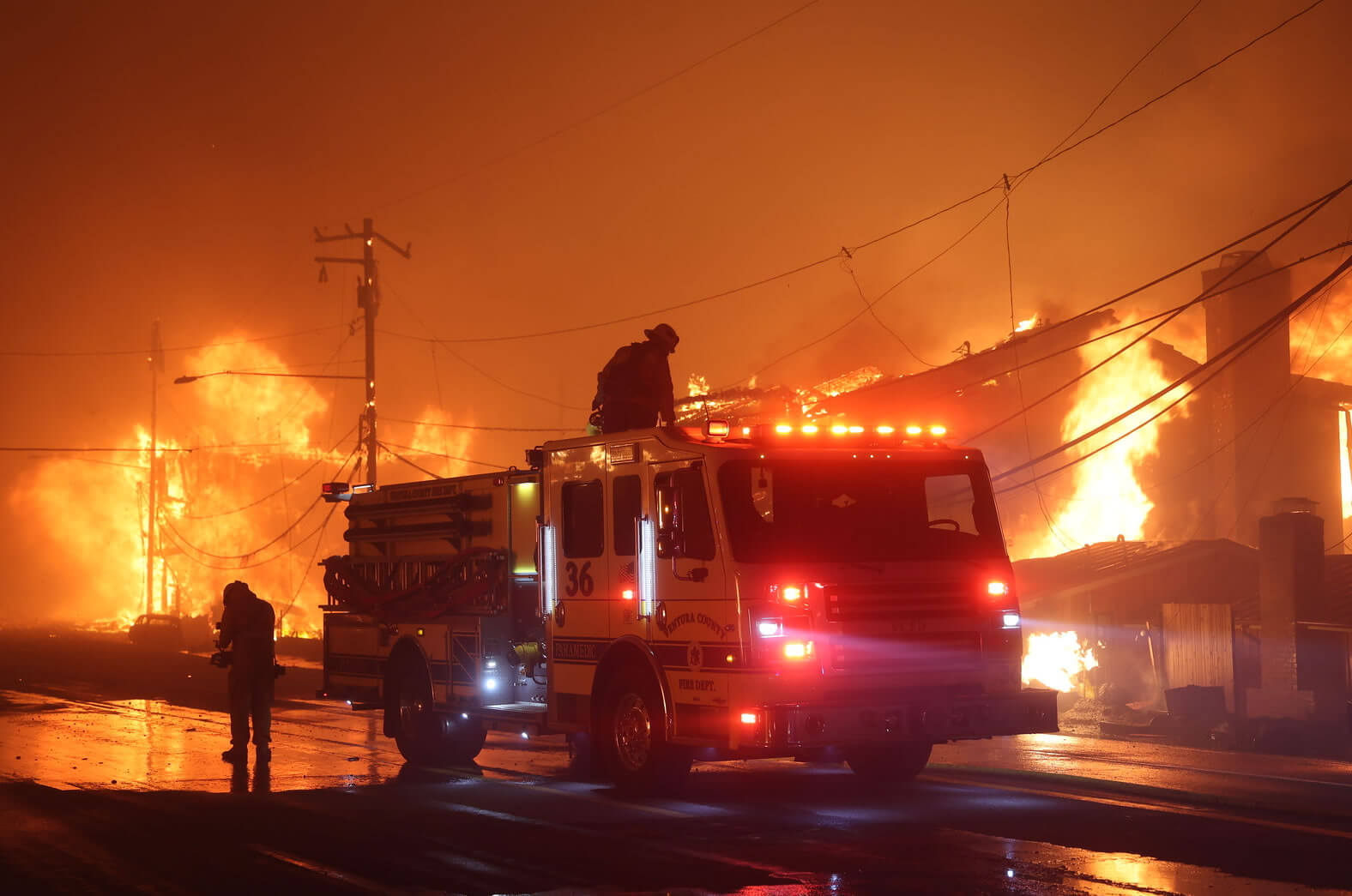
Firefighters extinguish a fire in Palisades, 8 Jan, 2025

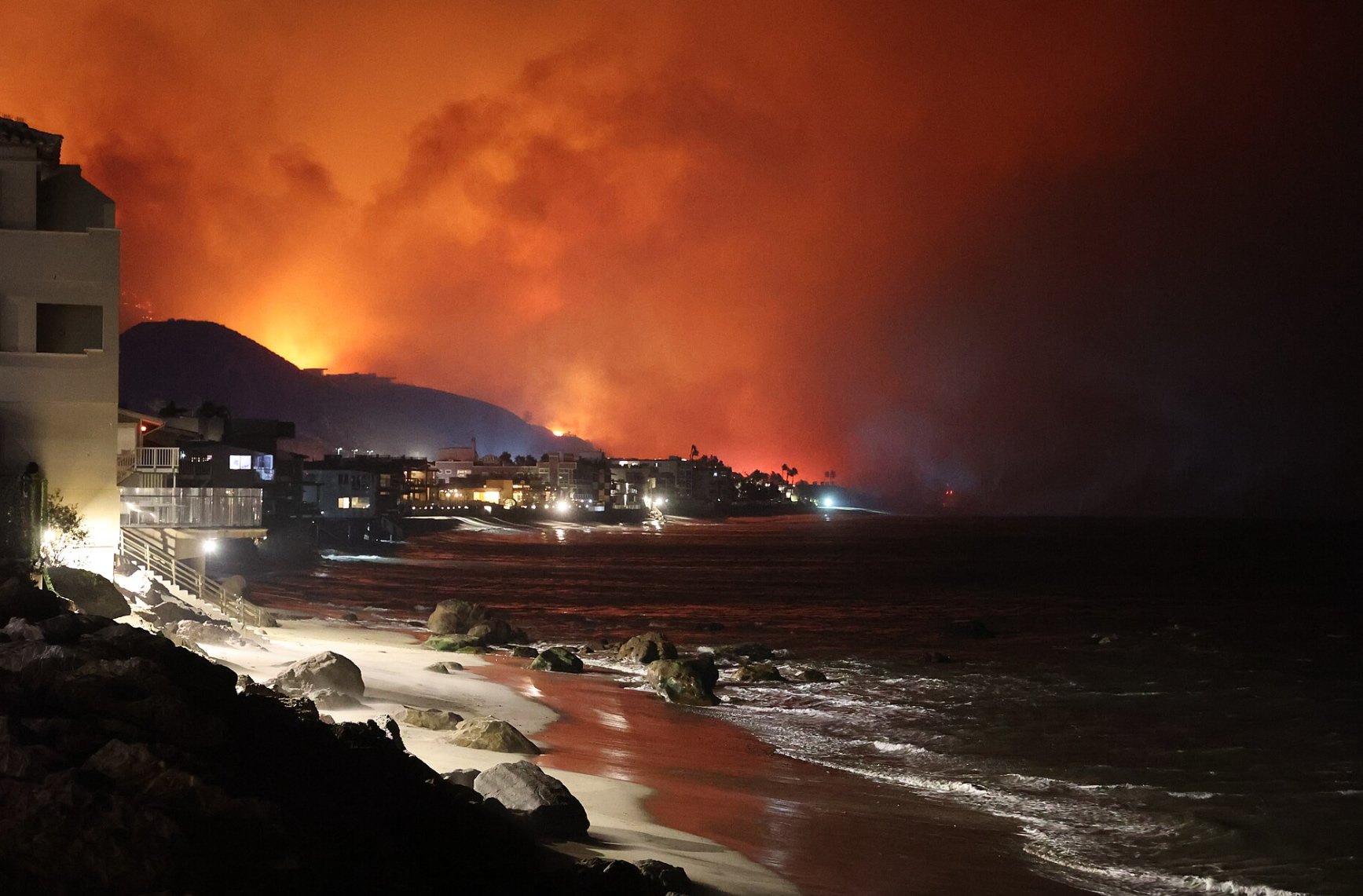
The Palisades Fire broke out near Los Angeles’ Pacific Palisades neighborhood, quickly spreading to cover 5,000 acres (2,000 ha; 7.8 sq mi; 20 km²). Mandatory evacuations were issued for parts of the Pacific Coast Highway and nearby areas, with the Westwood Recreation Center set up as an emergency shelter. Firefighters reported that strong winds were fueling the fire’s rapid growth, burning the equivalent of three football fields per minute.

Eaton Fire

Eaton Fire 2025, California
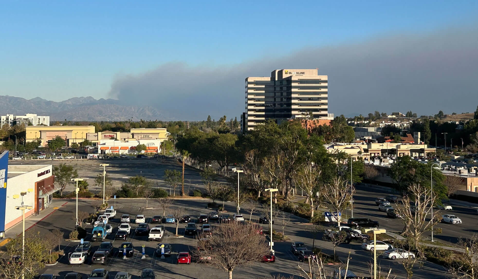
The Eaton Fire viewed from Woodland Hills, Los Angeles

On January 7, shortly after 6:15 p.m. PST, a brush fire known as the Eaton Fire was reported in Eaton Canyon, located in the Altadena–Pasadena area. Initially covering 20 acres (8.1 ha; 0.031 sq mi; 0.081 km²), the fire was linked to a nearby electrical tower that residents reported as being on fire, according to Pasadena Now. By 7:12 p.m., the fire had expanded to at least 200 acres (81 ha; 0.31 sq mi; 0.81 km²). Los Angeles County Fire Captain Sheila Kelliher noted that strong winds were driving the fire’s rapid spread. Within six hours, the Eaton Fire had grown to 1,000 acres (400 ha; 1.6 sq mi; 4.0 km²).

Kenneth Fire

Kenneth Fire 2025, California
View of the Hurst Fire immediately northeast of San Fernando on January 7, 2025

The Kenneth Fire was first reported on January 9 at 2:30 p.m. PST, starting near a trailhead along Victory Boulevard in Los Angeles’ West Hills neighborhood. The fire rapidly expanded to 50 acres (20 ha; 0.078 sq mi; 0.20 km²), prompting the deployment of resources from both Los Angeles County and Ventura County. Mandatory evacuation orders were issued for the area between Vanowen Street and Burbank Boulevard, and from County Lane Road to Valley Circle Boulevard. Additional evacuation warnings were issued for areas east of Valley Circle and parts of Oak Park.

Hurst Fire

Hurst Fire 2025, California
Smoke from the Kenneth Fire

At 10:10 p.m. PST on January 7, the Los Angeles Fire Department announced a 50-acre (20 ha; 0.078 sq mi; 0.20 km²) brush fire in northern Sylmar, named the Hurst Fire, which was spreading rapidly. Immediate evacuation orders were issued for areas north of the Foothill Freeway between Roxford Street and the Golden State Freeway–Antelope Valley Freeway split. By 1:47 a.m. on January 8, the California Department of Forestry and Fire Protection reported that the fire had expanded to 500 acres (200 ha; 0.78 sq mi; 2.0 km²).

California Wildfires: Number Of Fires And Acres Burned (2000-2024)
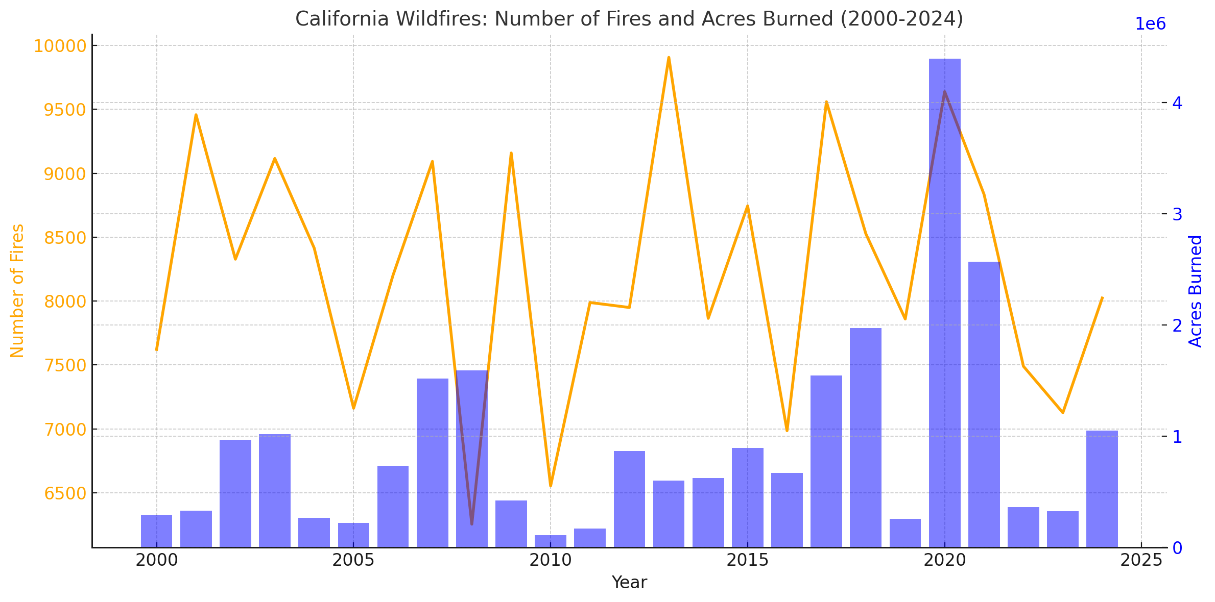
California Wildfires: Number Of Fires And Acres Burned (2000-2024)
Starting in 2000, the National Interagency Fire Center began keeping more accurate records on the total fire acreage burned in each state.

Here is a chart visualizing California wildfires from 2000 to 2024. The orange line represents the number of fires each year, while the blue bars show the acres burned. This dual-axis chart highlights key trends, such as the significant spike in acreage burned during certain years, like 2020. Let me know if you’d like any adjustments or additional analyses.

Where is Los Angeles on California Map?

Show Google interactive map, satellite map, where is the country located.

Get directions by driving, walking, bicycling, public transportation and travel with street view.

Where is California in the US and and Cities Map of California – @WorldGuide Youtube

Feel free to explore these pages as well:

- Advertisement -
Previous article

Discover

Sponsor

Latest Posts

Discovering the Heart of Europe: Top 10 Must-Visit Spots in Brussels

Welcome to Brussels, the vibrant heart of Europe! This cosmopolitan city, rich in history and culture, is not just the capital of Belgium but...

Discover Moorish Andalucia, Spain 2

Discover Andalucia's Spanish Bullring, Ronda, Capital of Andalucia's Seville, Moorish Style Alcazar Palace, Cruz Cathedral in Seville, Tomb of Christopher Colombus and more... Ronda Ronda is...

Map of North Carolina

A collection maps of North Carolina; View a variety maps of North Carolina physical, political, relief map. Satellite image of North Carolina, higly detalied...

Discover Sicily Island, Palermo Sightseeing Tours and Local Experiences

Explore Sicily, tours, visit Sicily Island, architecture, history, culture, tradition, cuisine, street markets. Attractions in Sicily, Where to Visit in Sicily, how long does...

Map of Washington

A collection maps of Washington; View a variety maps of Washington physical, political, relief map. Satellite image of Washington, higly detalied maps, blank map...