A collection of Slovenia maps provides a comprehensive overview of the country’s diverse geography, highlighting its regions, rivers, cities, political, physical, natural features, administrative and transport networks.
Brief information about Slovenia
Slovenia, nestled in Central Europe, is a small but captivating country known for its stunning natural beauty and rich cultural heritage. Its capital, Ljubljana, offers a charming mix of medieval architecture and vibrant, modern energy. The country’s diverse landscapes span from the majestic Julian Alps to the serene shores of the Adriatic Sea, making it an ideal destination for both nature enthusiasts and history lovers.
Slovenia Physical Map
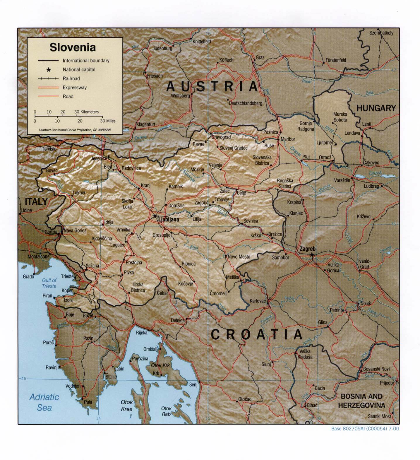
Despite its compact size, Slovenia is home to a variety of natural wonders, including the picturesque Lake Bled, the intriguing Postojna Cave, and the expansive Triglav National Park, which features the country’s highest peak, Mount Triglav. Whether you’re exploring its lively cities or hiking through its lush forests, Slovenia offers a warm and welcoming atmosphere that invites visitors to discover its hidden treasures.
Where is located Slovenia on the World Map
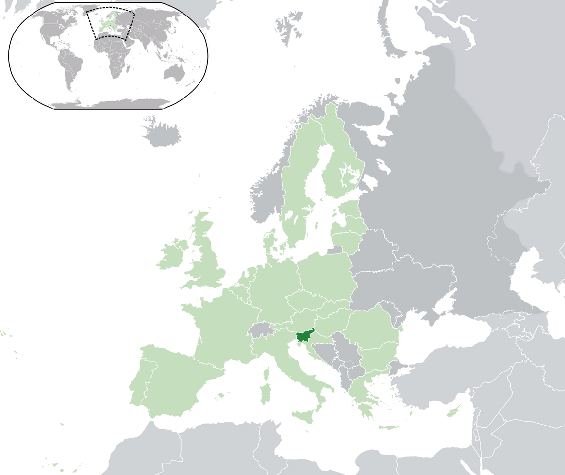
Slovenia is a small but beautiful country located in Central Europe, nestled between Italy, Austria, Hungary, and Croatia. It enjoys a strategic position at the crossroads of various European cultures, making it an ideal spot for travelers exploring this part of the continent. Its proximity to the Adriatic Sea also gives Slovenia a small yet stunning coastline, adding to its geographic charm.
To the northwest, Slovenia shares a border with Austria, offering easy access to the Alpine region. The country is also directly east of Italy, with the cultural hub of Trieste just a short drive away. Its southern borders connect with Croatia, making Slovenia a gateway between the Mediterranean and the Balkans.
Despite its modest size, Slovenia’s central location places it at the heart of Europe, making it a perfect starting point for those looking to explore the diverse landscapes and rich histories of neighboring countries. With its blend of mountain ranges, rivers, and coastal areas, Slovenia is a geographical gem that offers something unique for every type of traveler.
Here are some statistical information about Slovenia:
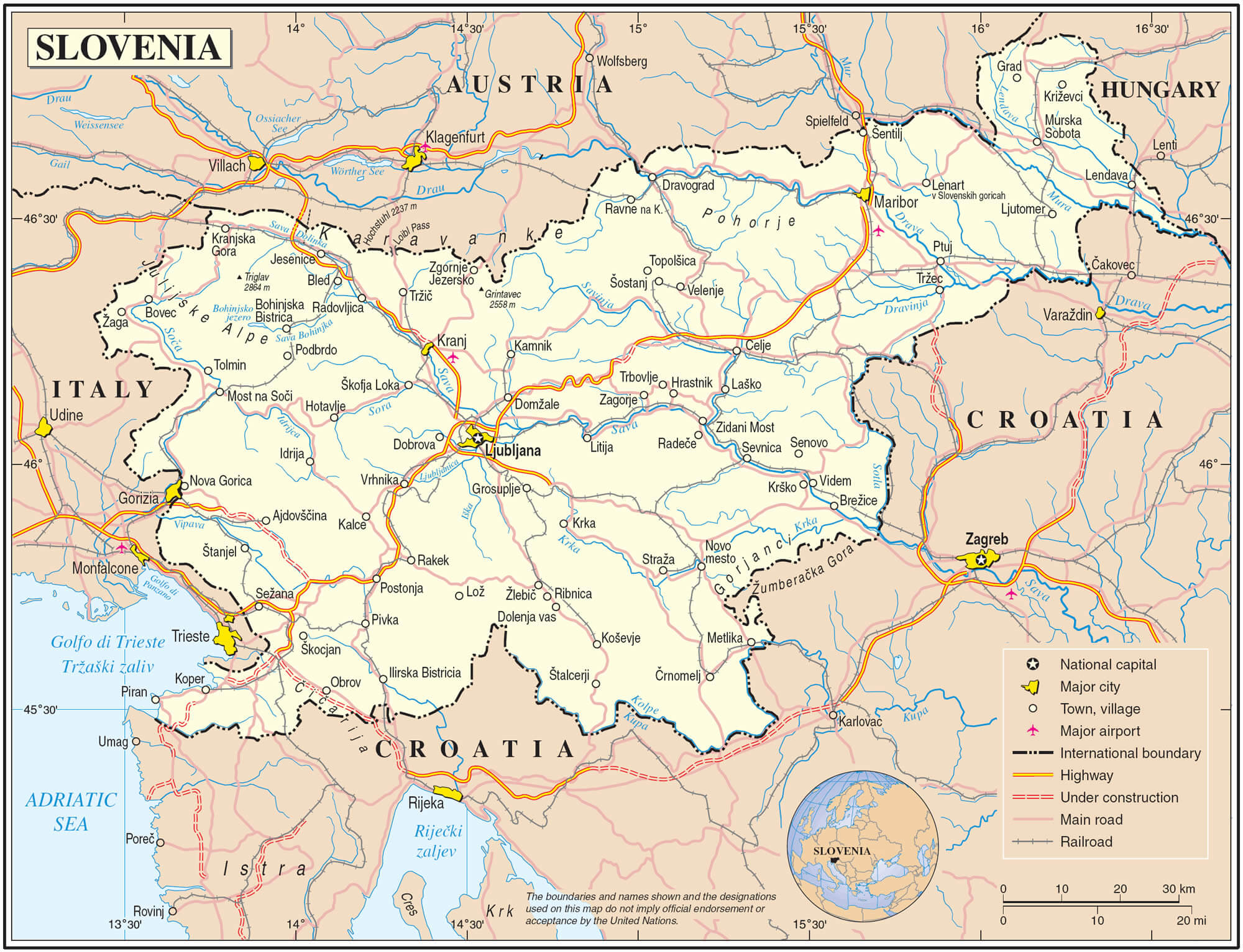
Road Map of Slovenia
 Religion: 77.8% Christianity (73.4% Catholicism, 3.7% Orthodoxy, 0.7% other Christian), 18.3% no religion, 3.9% other.
 Slovenia Location Map
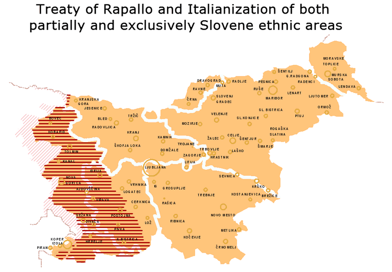
The map illustrates the areas in Slovenia that were affected by the Treaty of Rapallo and subsequently underwent a process of Italianization.
Political Map of Slovenia
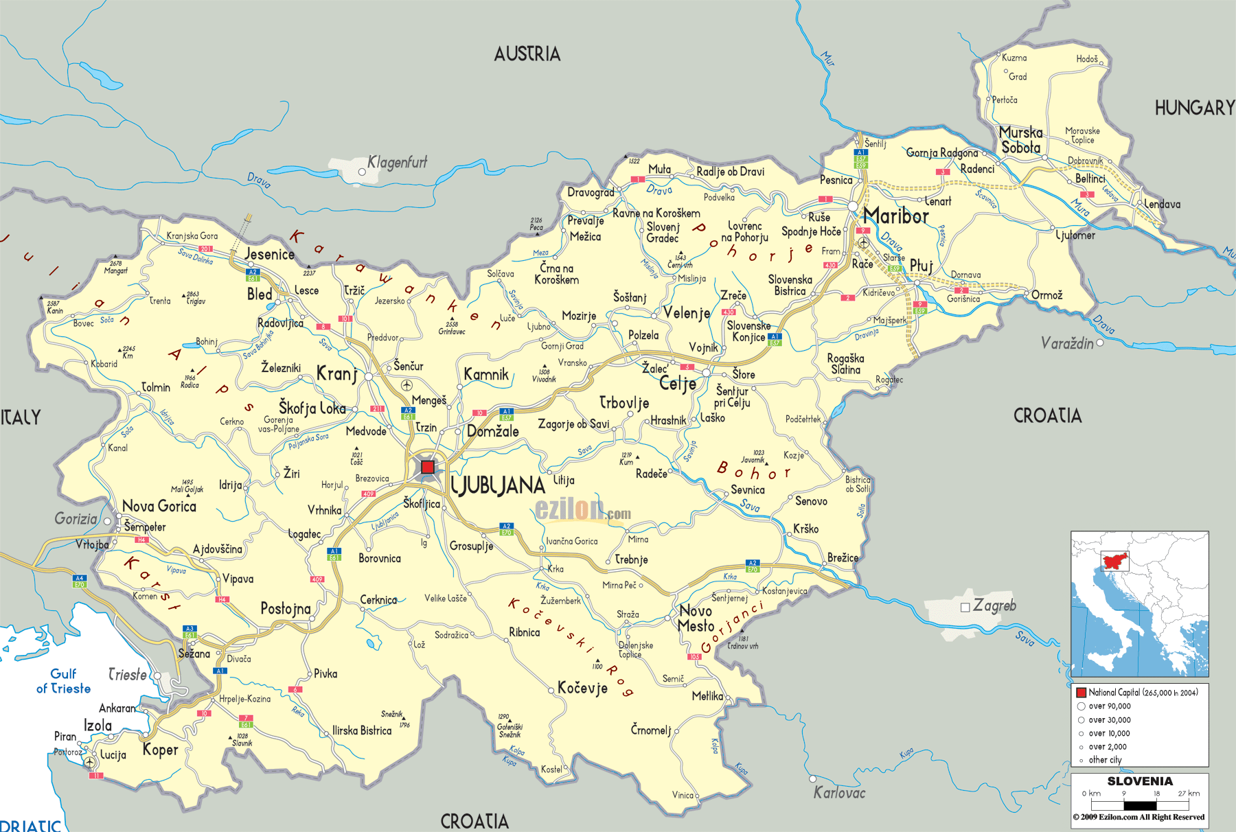
The map shows Slovenia’s location in Central Europe, bordered by Austria to the north, Hungary to the northeast, Croatia to the south, and Italy to the west. It highlights major cities such as Ljubljana, Maribor, and Celje, as well as the country’s access to the Adriatic Sea near Koper.
Slovenia Relief Map
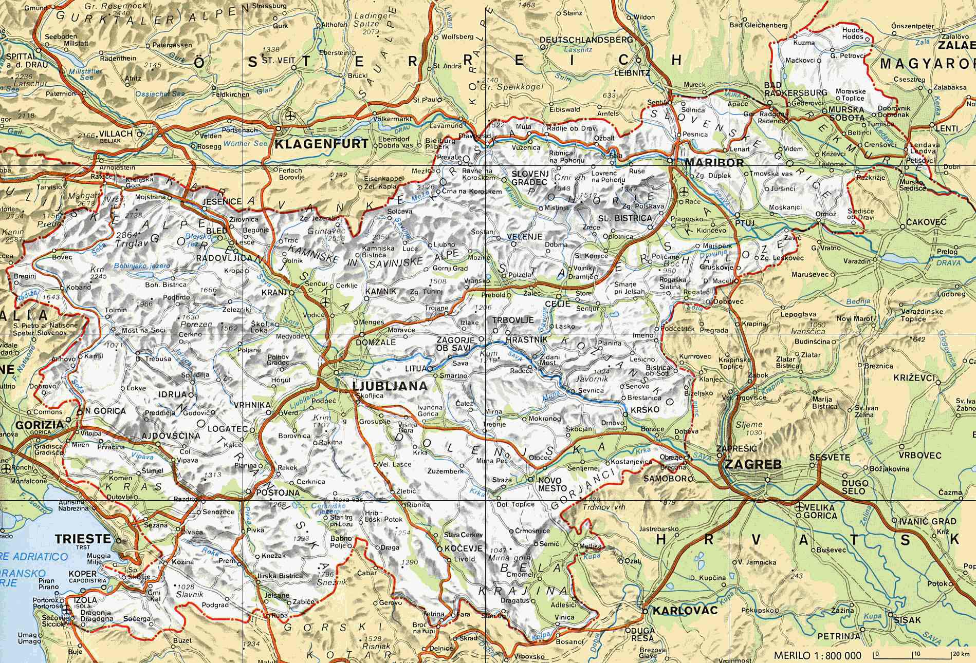
The map displays Slovenia’s topography, highlighting its mountainous regions, including the Julian Alps in the northwest. It shows Slovenia’s borders with Austria, Hungary, Croatia, and Italy, as well as key cities like Ljubljana and Maribor. The map also emphasizes Slovenia’s diverse landscapes, with valleys, rivers, and access to the Adriatic Sea near the southwest.
Map Slovenia
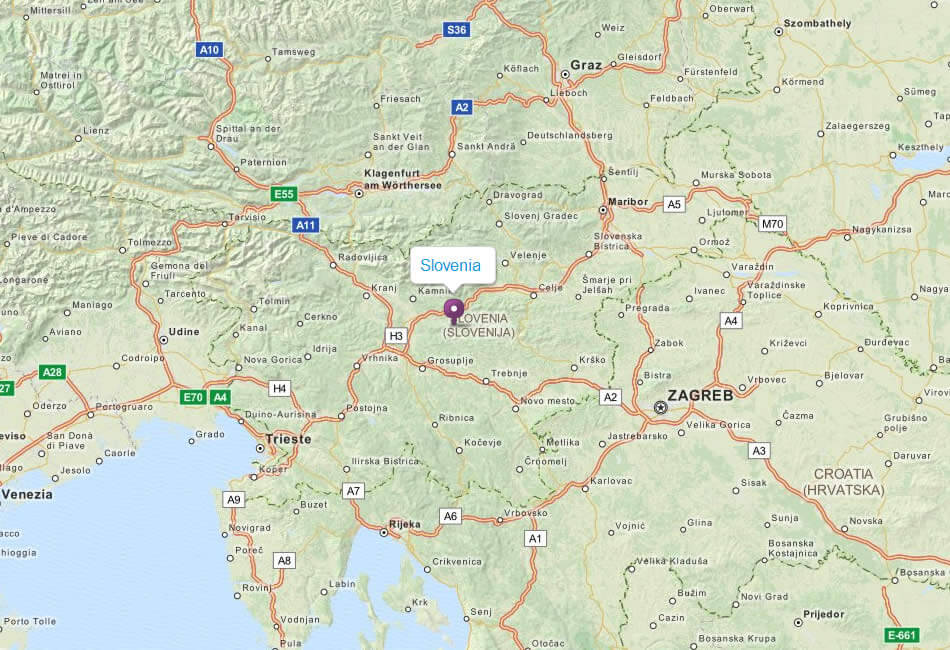
The map shows Slovenia’s location in Central Europe, bordered by Austria to the north, Hungary to the northeast, Croatia to the southeast, and Italy to the west. Major cities like Ljubljana, Maribor, and nearby capitals such as Zagreb and Trieste are highlighted, showcasing Slovenia’s connectivity to neighboring countries and its position near the Adriatic Sea.
Ljubljana and Slovenia Highways Map
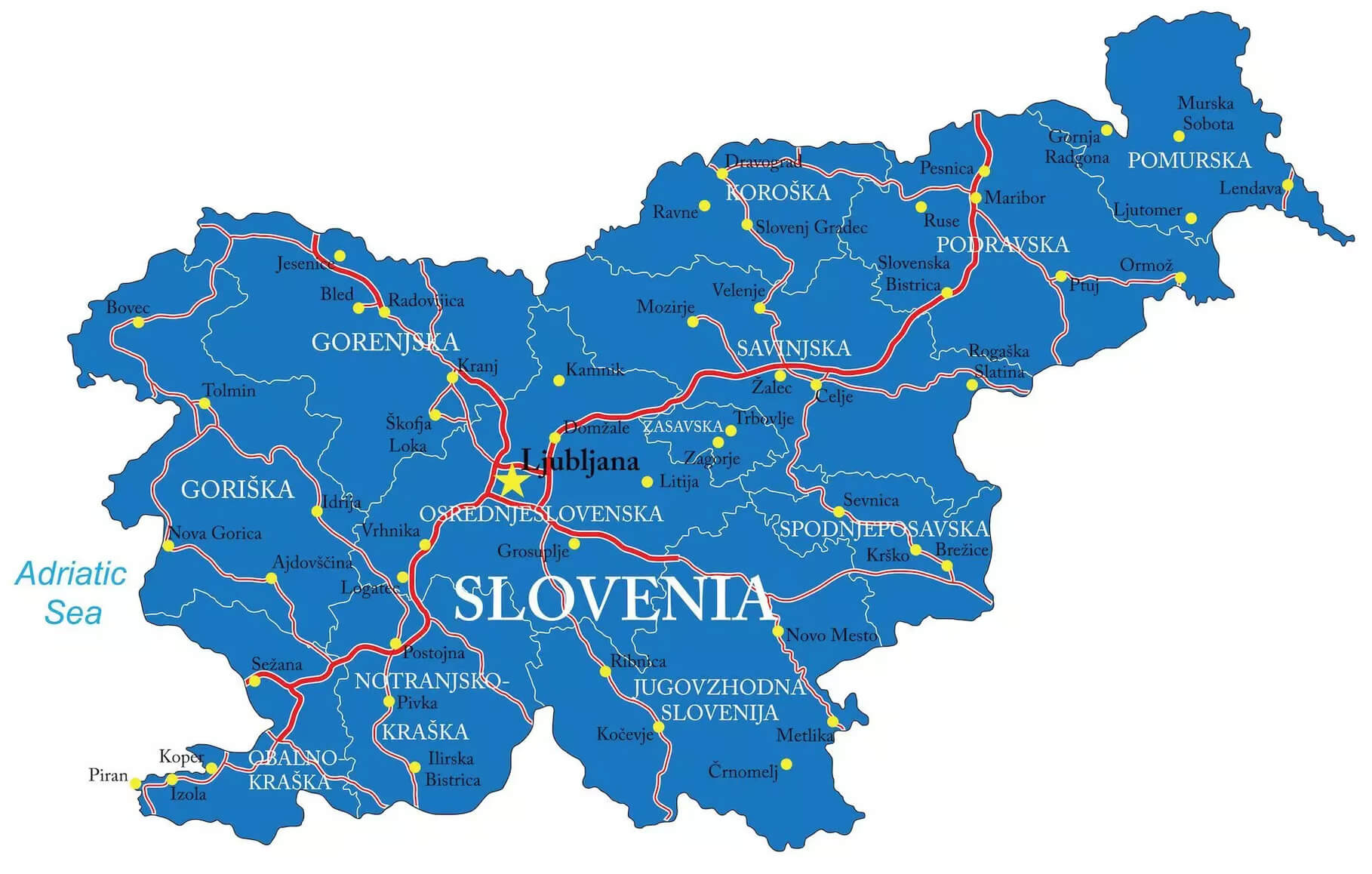 This map of Slovenia highlights the country’s motorways and key regions, with Ljubljana as the capital prominently featured. It shows the links between different cities and regions, from coastal areas such as Koper and Piran to the northern and eastern parts of the country, highlighting Slovenia’s strategic road network that supports travel and trade.
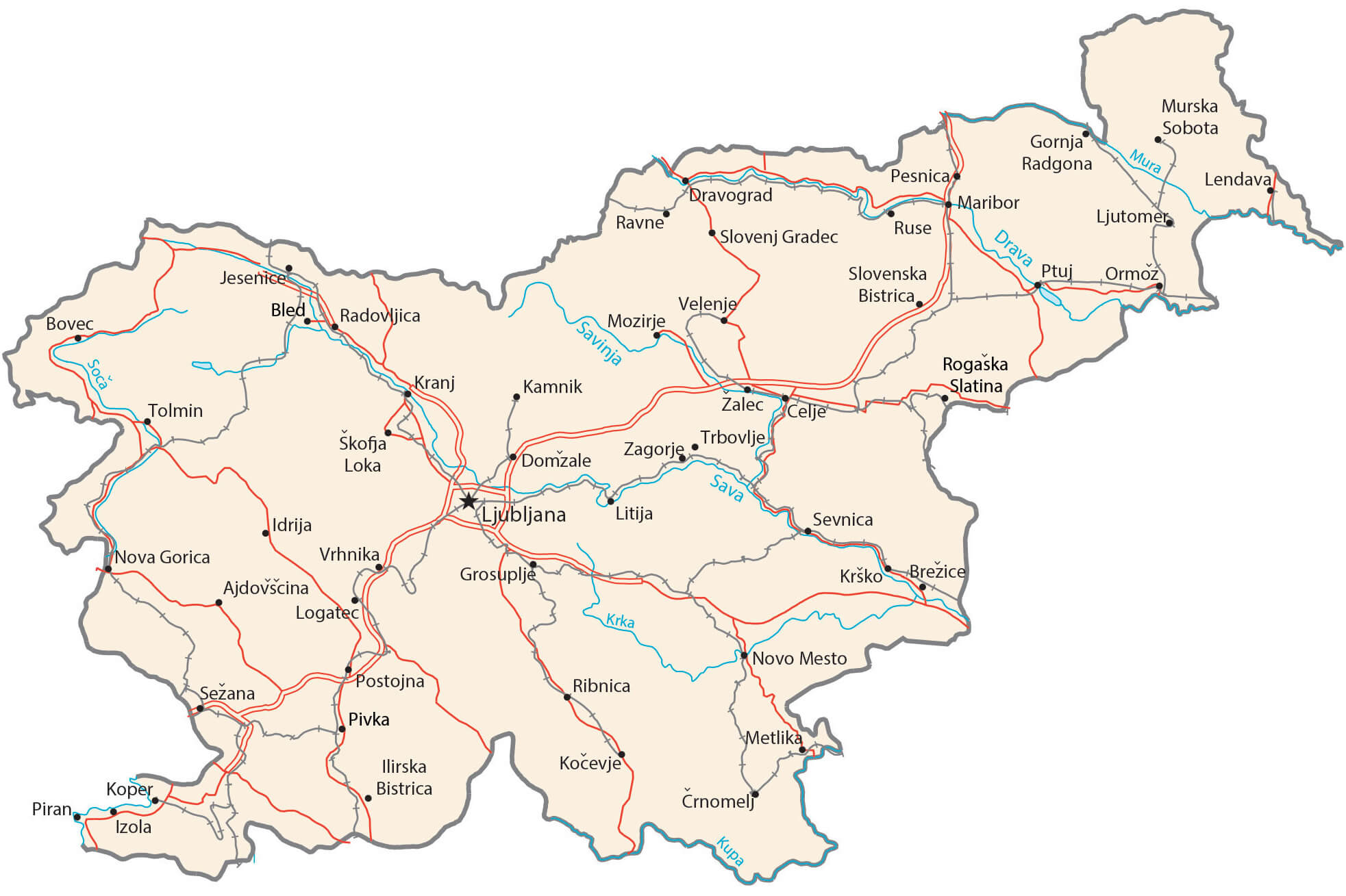
Slovenia Cities Roads Rivers Map
Slovenia Geography Map
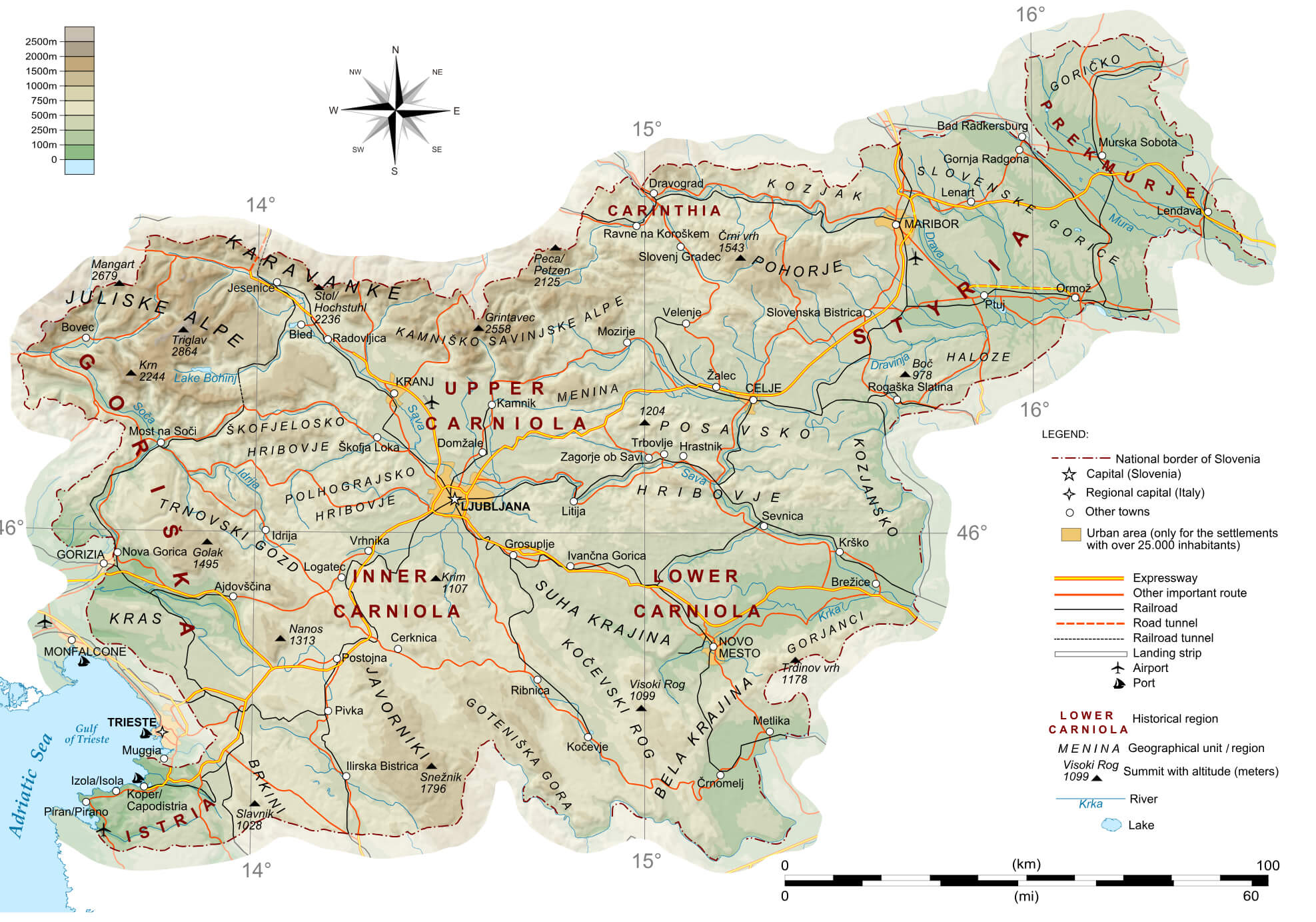 This map of Slovenia shows the country’s varied geography, including mountainous regions such as the Julian Alps in the north-west, the Karavanke mountain range and the hilly areas of Carinthia and Pohorje. It also features major cities such as the capital, Ljubljana, and regional towns such as Maribor and Koper, as well as major routes and rivers, including the Sava and Drava.
Slovenia Physical Map with Largest Cities
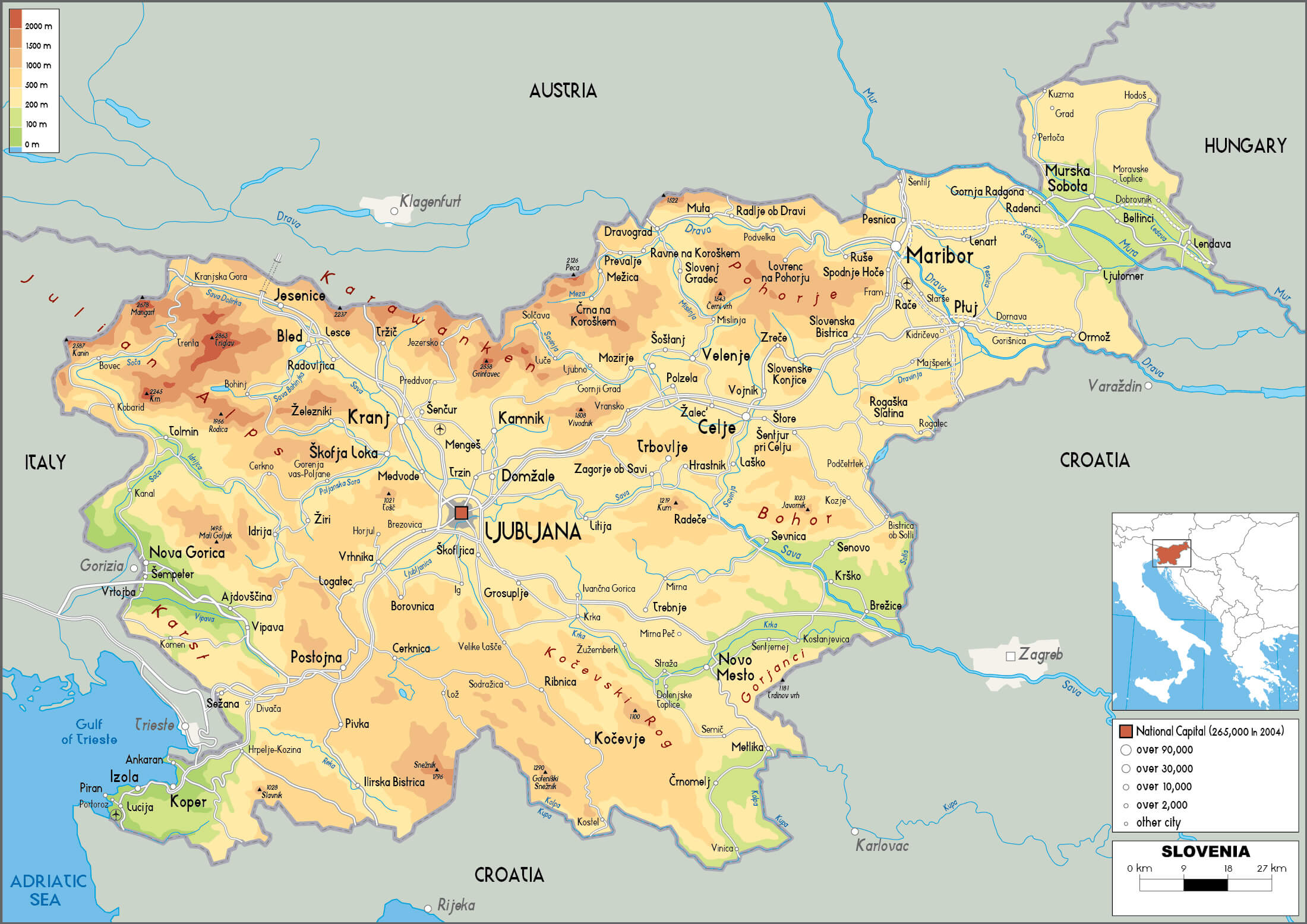 This map of Slovenia shows the physical geography of the country and its major cities, including Ljubljana, Maribor and Koper. The map highlights the country’s varied terrain, including the Alpine regions in the north and west, the Dinaric Alps in the south and the flatter Pannonian Basin in the north-east. The locations of rivers, major road networks and urban centres are also marked, providing a clear overview of the country’s topography and distribution of settlements.
Slovenia Rivers Map with Main Cities
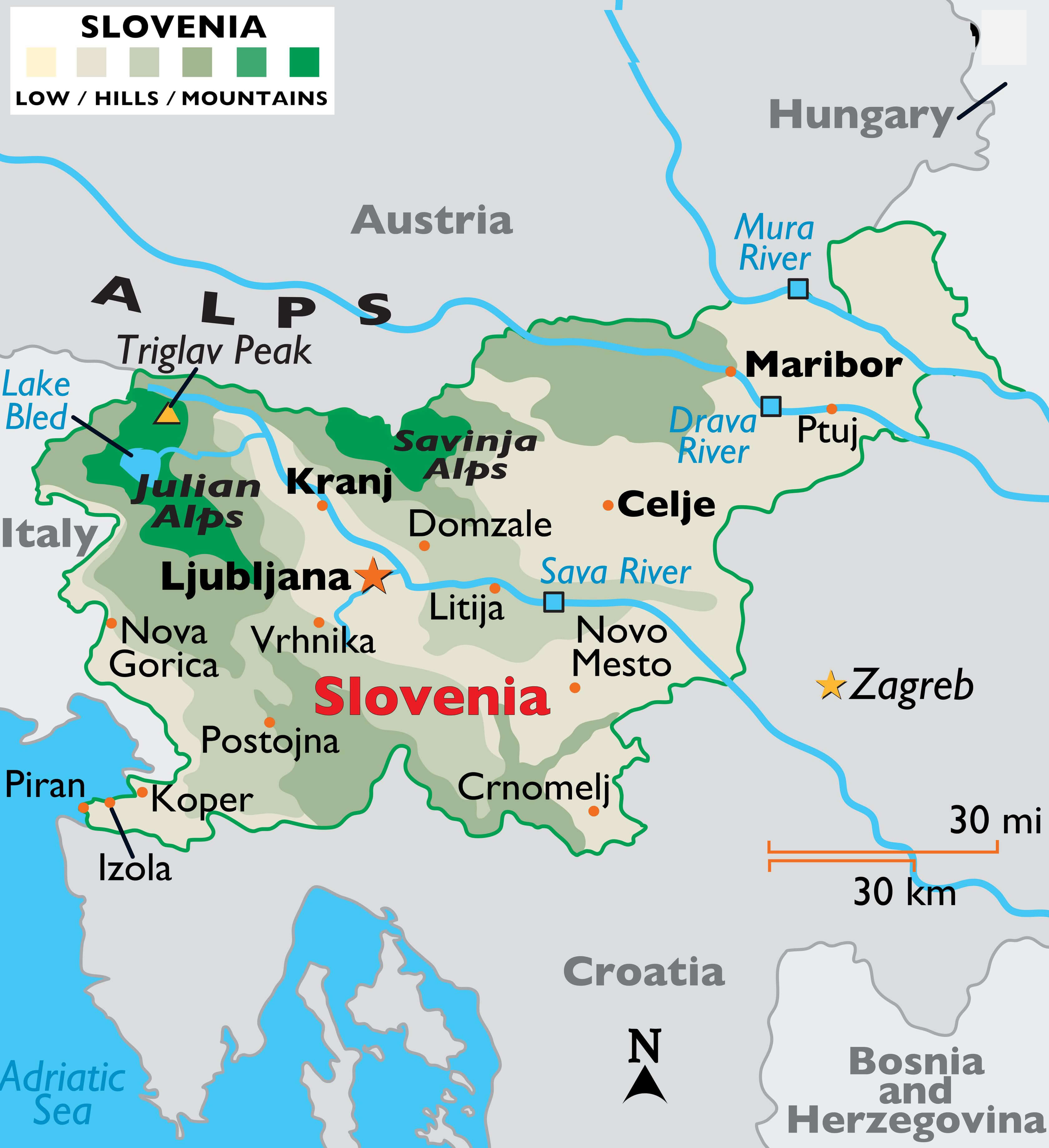 This map of Slovenia highlights the country’s major rivers, such as the Sava, Drava and Mura, and its major cities, including Ljubljana, Maribor and Celje. Geographical features are detailed with a focus on the Julian Alps, Savinja Alps and connections with neighbouring countries such as Austria, Italy and Croatia, illustrating Slovenia’s diverse natural landscape.
Slovenia Population Density Map
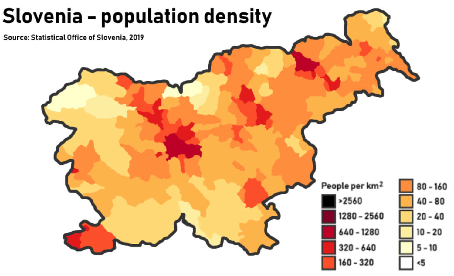 This map of Slovenia’s population density shows the different concentrations of people across the country. The darker red areas, such as Ljubljana and Maribor, indicate regions with the highest density of over 1,280 people per square kilometre. Meanwhile, lighter shades, particularly in rural and mountainous areas, show areas with much lower population densities, highlighting Slovenia’s urban-rural divide.
Slovenia Major Cities Map
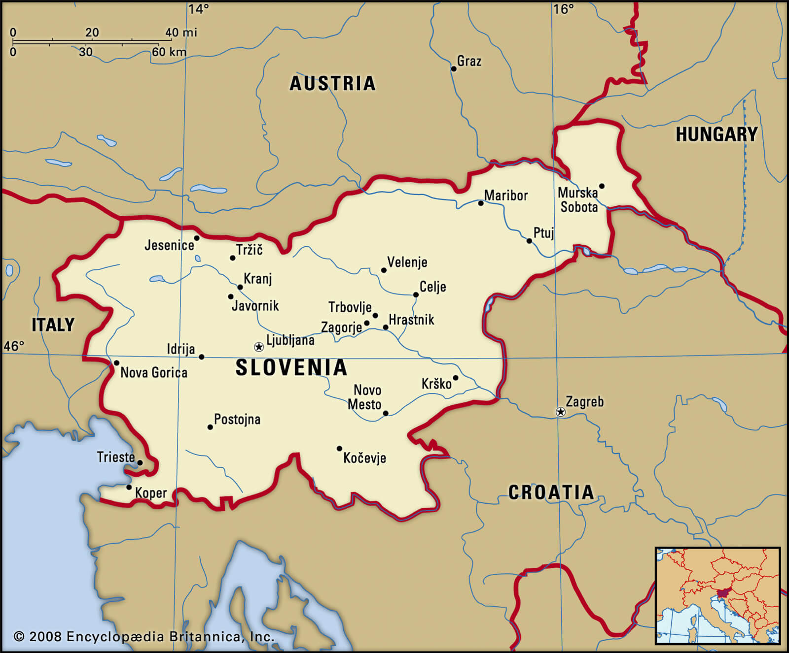 This map of Slovenia shows the country’s major cities and their location in relation to neighbouring countries such as Austria, Italy, Hungary and Croatia. Ljubljana, the capital, is centrally located, with other key cities including Maribor in the north-east, Koper on the Adriatic coast and Nova Gorica near the Italian border. This layout reflects Slovenia’s position as a crossroads in Central Europe, linking the Alps with the Mediterranean.
Slovenia Roads Map
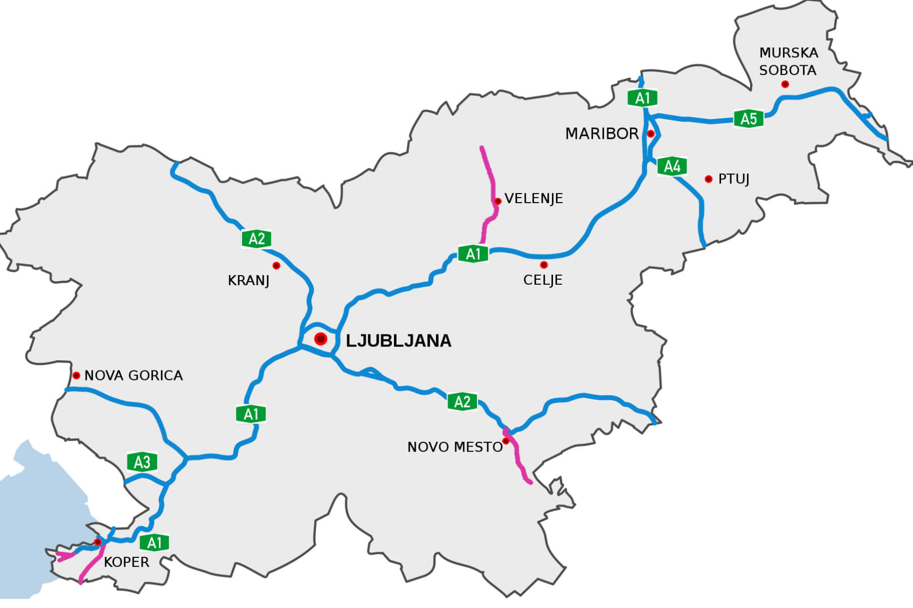 This map of Slovenia shows the main motorways linking the country’s main cities. The capital, Ljubljana, acts as a central hub, with routes running to Maribor in the north-east, Koper on the Adriatic coast and other regional centres such as Celje and Nova Gorica. The map highlights major routes such as the A1, which connects Ljubljana to Maribor and on to the Hungarian border, and the A2, which runs north-west towards Austria.
Slovenia Climate Map
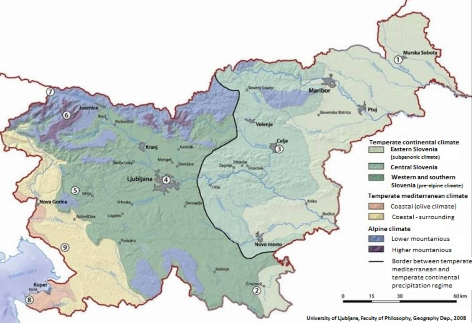 This climate map of Slovenia illustrates the different climate zones in the country. Slovenia experiences a mixture of a temperate continental climate in the eastern regions, characterised by colder winters and hot summers, and a temperate Mediterranean climate along the coast, with milder winters and warm, dry summers. The central part of the country has a mix of pre-alpine and alpine climates, with cooler temperatures and higher rainfall, particularly in the mountainous regions such as the Julian Alps. The map shows the natural variation in Slovenia’s climate, influenced by its geography and altitude.
Slovenia Provinces Map
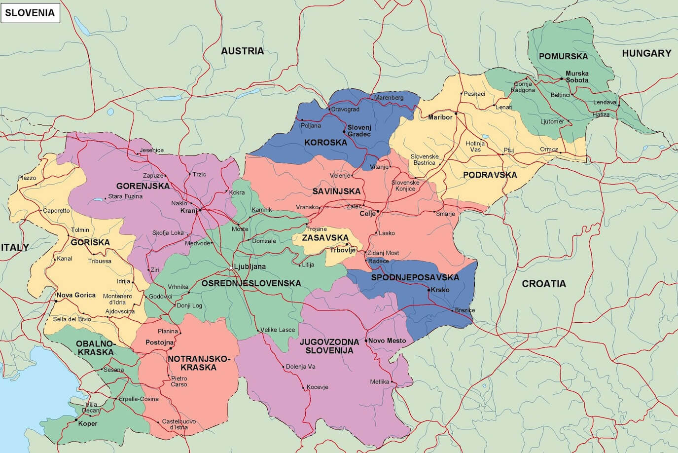 This map of Slovenia shows the different provinces of the country, each highlighted in a different colour. The map outlines Slovenia’s regions such as Gorenjska, Pomurska and Osrednjeslovenska, among others, illustrating the country’s diverse geographical and administrative divisions. It provides a visual understanding of Slovenia’s regional boundaries in relation to its neighbouring countries, including Austria, Italy, Hungary and Croatia.
Slovenia Administrative Map
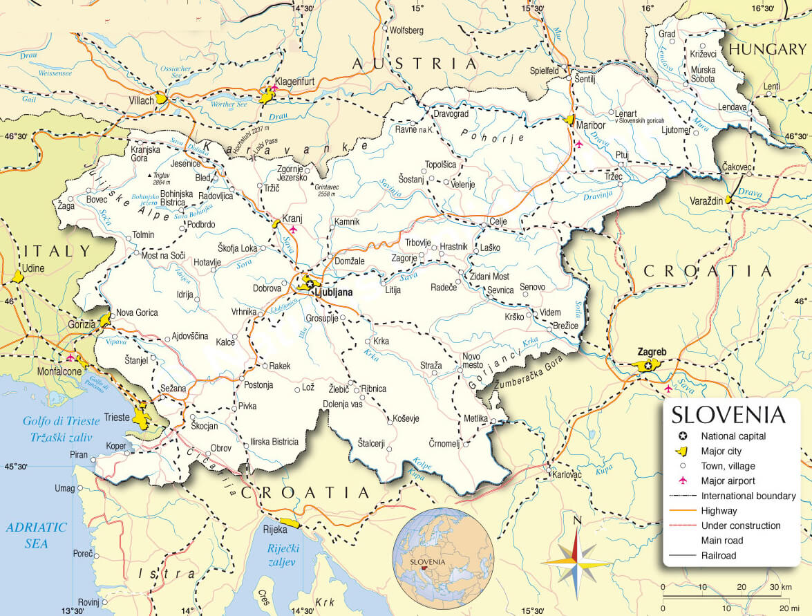 This map of Slovenia shows the administrative divisions of the country and its borders with neighbouring countries including Italy, Austria, Hungary and Croatia. It shows the main transport routes, including motorways, railways and major roads, connecting cities such as Ljubljana, Maribor and Koper, as well as Slovenia’s international borders and nearby geographical landmarks such as the Adriatic Sea.
Slovenia Political Map
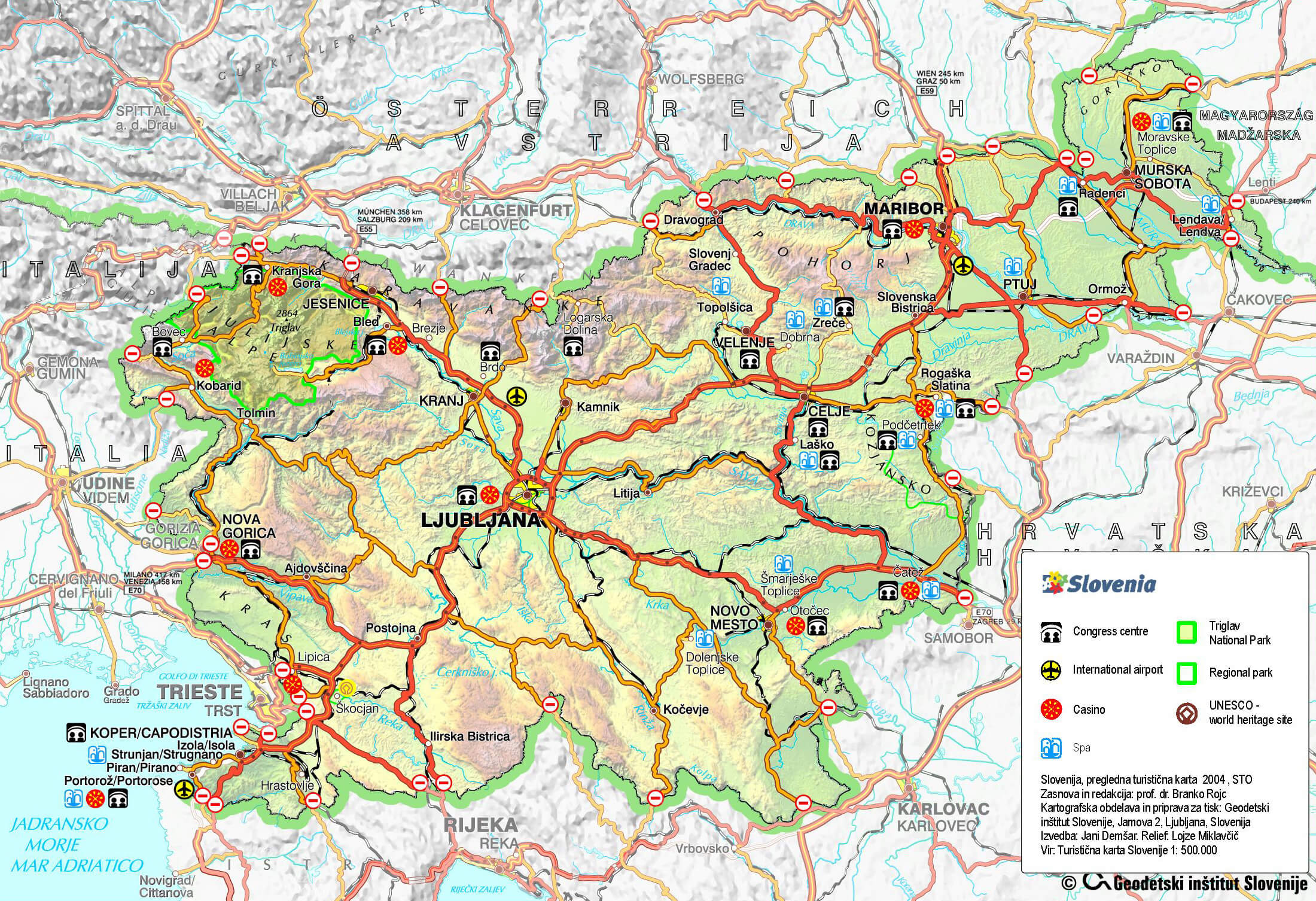 This map of Slovenia highlights its major political and geographic features, including key cities like Ljubljana, Maribor, and Celje, as well as important transportation routes and borders with neighboring countries such as Austria, Italy, Hungary, and Croatia. It also indicates notable landmarks like Triglav National Park, UNESCO World Heritage sites, and essential travel infrastructure like international airports and regional parks, making it a useful reference for understanding Slovenia’s regional connections and attractions.
Slovenia Regions Map
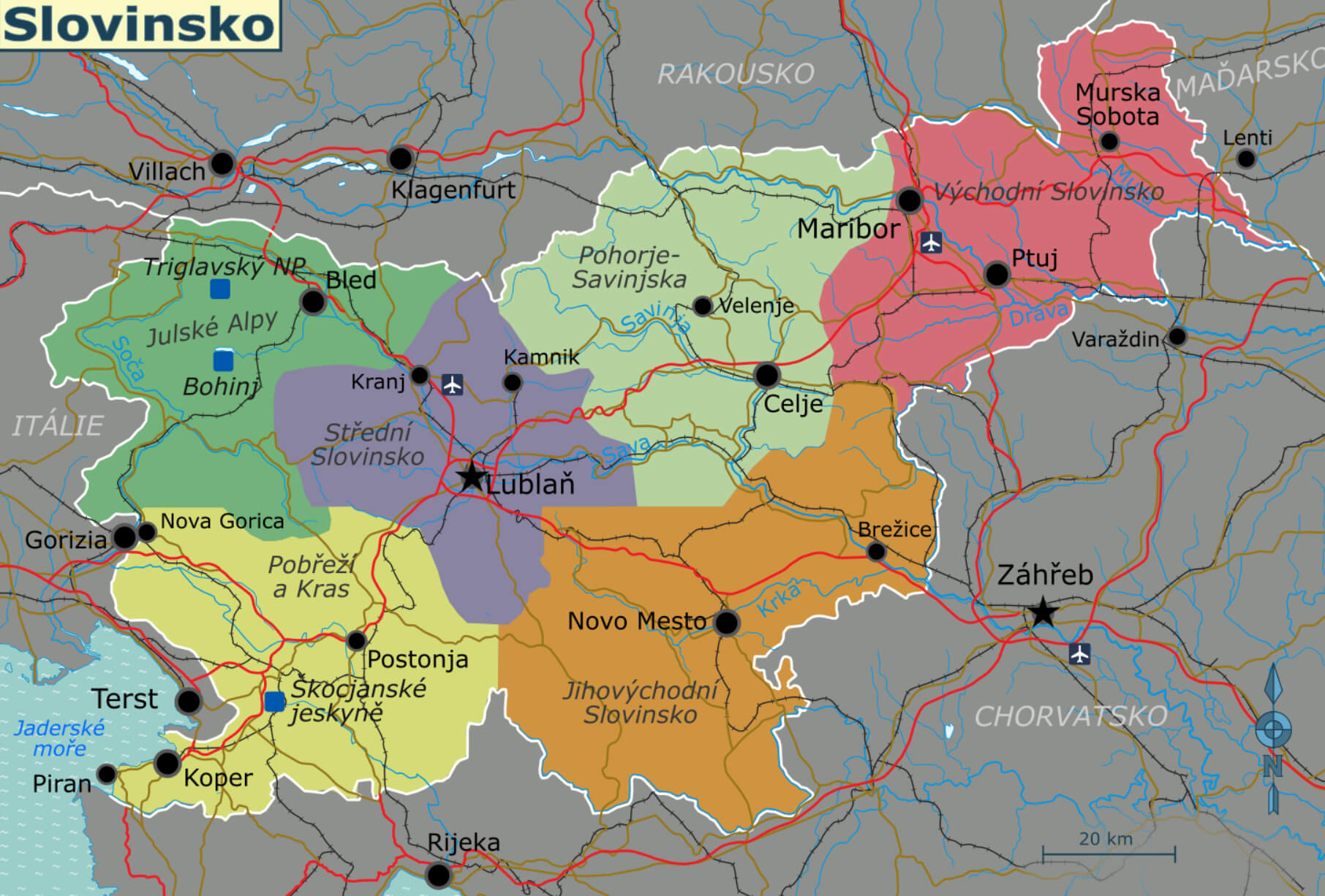 This Slovenia regional map highlights the country’s various geographical divisions, including prominent regions such as Gorenjska, Savinjska and Pomurska. It shows major cities such as Ljubljana, Maribor and Celje, as well as key natural features such as the Julian Alps and the coastal areas near the Adriatic Sea.
Map of Slovenia
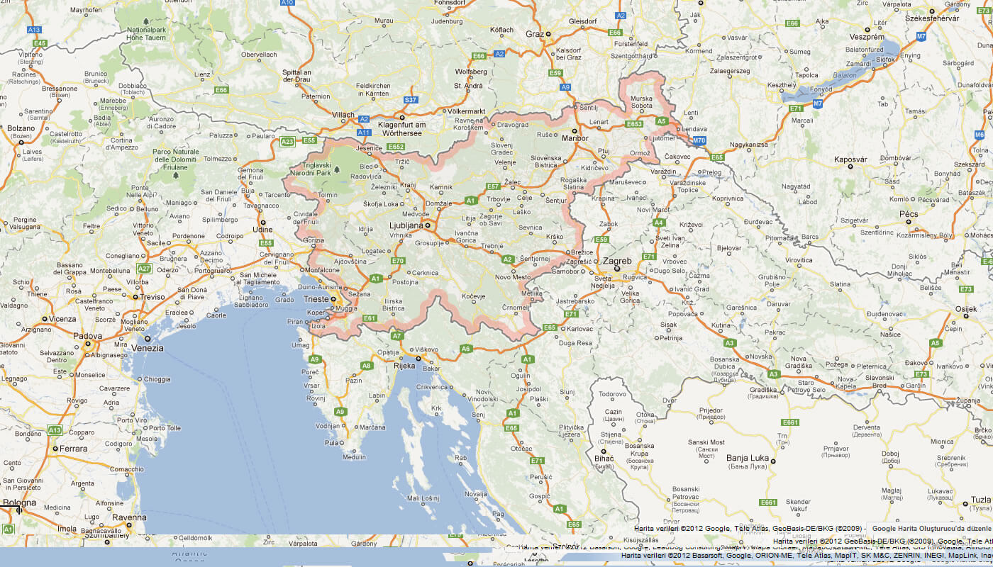
Map of Slovenia Europe
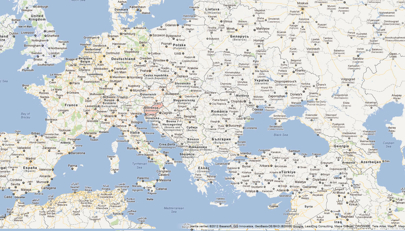
Map of Slovenia World
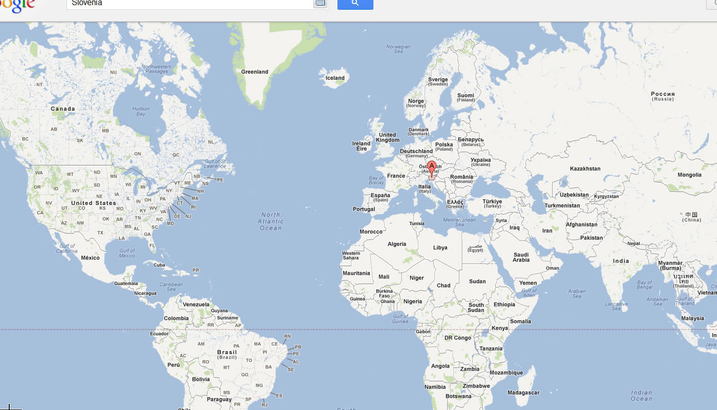
Slovenia Earth Map
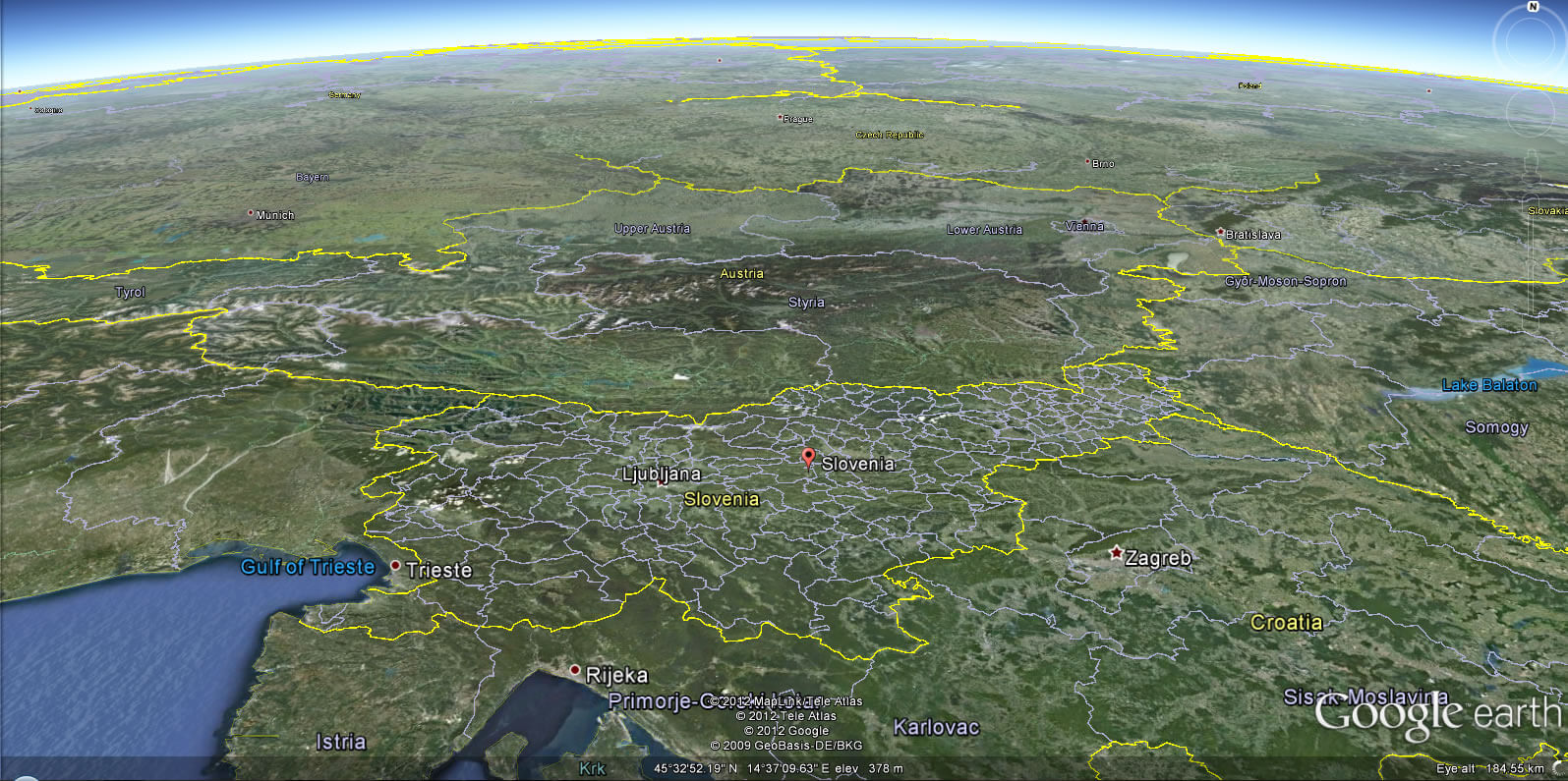
Where is Slovenia on the Europe Map?
Show Google interactive map, satellite map, where is the country located.
Get directions by driving, walking, bicycling, public transportation and travel with street view.
Feel free to explore these pages as well:
- Romania Map ↗️
- Slovakia Map ↗️
- Germany Map ↗️
- Switzerland Map ↗️
- Croatia Map ↗️
- North MacedoniaMap ↗️
- Montenegro Map ↗️
- Serbia Map ↗️
- Italy Map ↗️
- France Map ↗️
- The 10 Best Things to Do in Venice ↗️
- Map of Europe ↗️
- Europe Map ↗️
- A Collection of Europe Maps ↗️
