A Collection of North Macedonia Maps offers a comprehensive view of this Balkan nation, highlighting its diverse geography, cities, and regions. It is an essential resource for travelers, students, and geography enthusiasts.
Brief information about North Macedonia
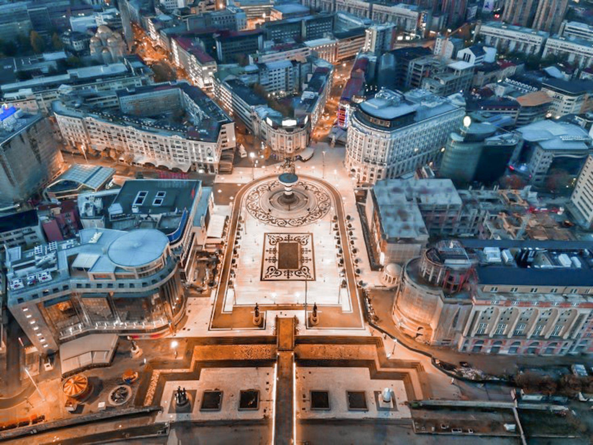
North Macedonia, located in the heart of the Balkan Peninsula in Southeastern Europe, is a landlocked country known for its rich history and diverse cultural heritage. It shares borders with Kosovo to the northwest, Serbia to the north, Bulgaria to the east, Greece to the south, and Albania to the west. The country’s capital, Skopje, is a vibrant city with a mix of modern architecture and historic landmarks.
Macedonia Maps
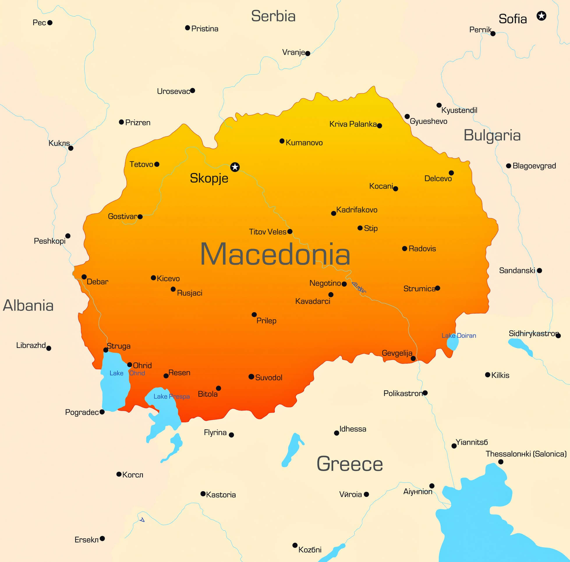
This map displays the Former Yugoslav Republic of Macedonia (FYROM), now officially known as North Macedonia. It highlights the country’s borders with Albania to the west, Serbia to the north, Bulgaria to the east, and Greece to the south. Major cities such as Skopje, the capital, along with Bitola, Tetovo, and Ohrid, are shown, as well as significant landmarks like Lake Ohrid and Lake Prespa. The map illustrates the central location of North Macedonia in the Balkan Peninsula.
Renowned for its natural beauty, North Macedonia boasts stunning landscapes, including Lake Ohrid, one of Europe’s oldest and deepest lakes, a UNESCO World Heritage site. The country is also known for its mountains, national parks, and traditional villages, making it an appealing destination for those who appreciate both history and nature.
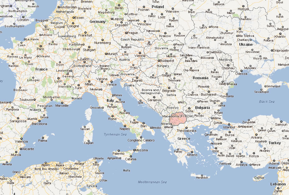
Where is located North Macedonia on the World Map
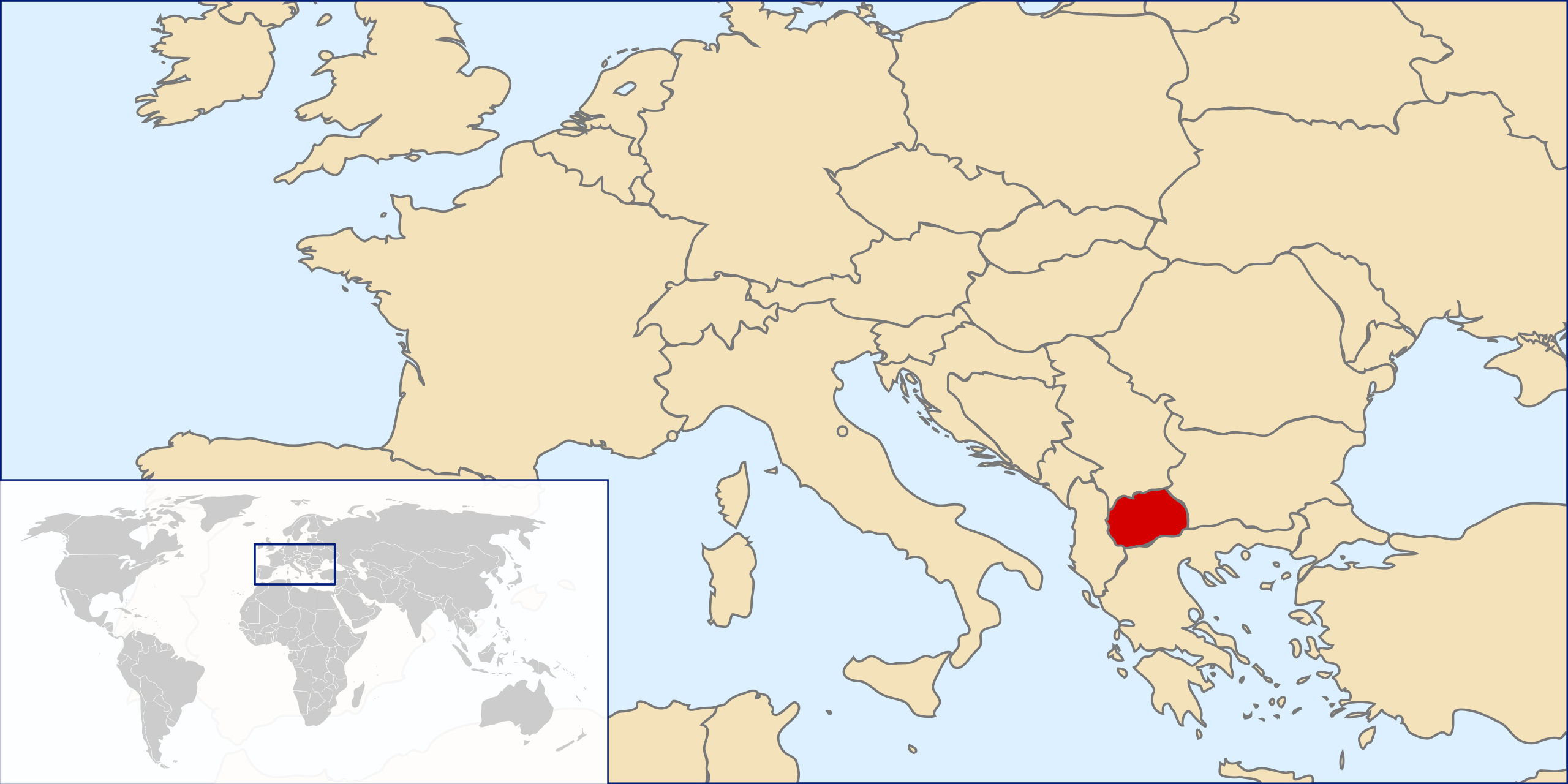
North Macedonia is a landlocked country in Southeastern Europe, located at the heart of the Balkan Peninsula. It shares borders with Kosovo to the northwest, Serbia to the north, Bulgaria to the east, Greece to the south, and Albania to the west. This central location makes it a meeting point of cultures and a gateway for travelers exploring the Balkans.
Despite its small size, North Macedonia is known for its diverse landscapes. It’s home to the beautiful Lake Ohrid, one of Europe’s oldest and deepest lakes, which is also a UNESCO World Heritage site. The country is dotted with mountains, valleys, and national parks, offering a mix of natural beauty and outdoor adventure.
On a world map, North Macedonia sits just north of Greece and south of Serbia, making it a strategic link between Western Europe and the Eastern Mediterranean. Its position makes it an ideal destination for those looking to explore the historical routes and cultural richness that define the Balkan region.
Here are some statistical information about North Macedonia:
Map of Macedonia
Macedonia Cities Map
Macedonia Location Map
Historical Map of Macedonia
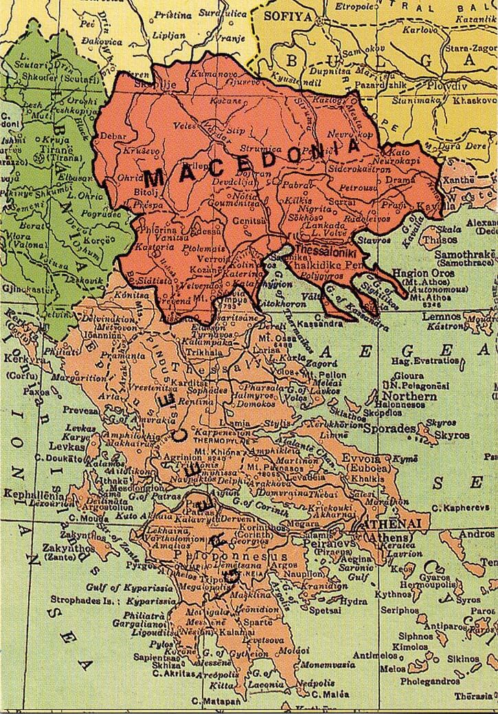
This historical map shows the region of Macedonia, covering parts of modern-day North Macedonia, northern Greece, and Bulgaria. Key cities like Thessaloniki and Bitola are visible, highlighting the area’s shifting borders and cultural significance over time.
Macedonia Regional Map
This map shows the region of Albania and North Macedonia, along with neighboring countries like Montenegro, Kosovo, Serbia, and Greece. Key cities like Skopje, Tirana, and Thessaloniki are marked, as well as natural landmarks such as Lake Ohrid and the Adriatic Sea. The map highlights the close proximity of these Balkan countries and their shared borders.
Macedonia Regions Map
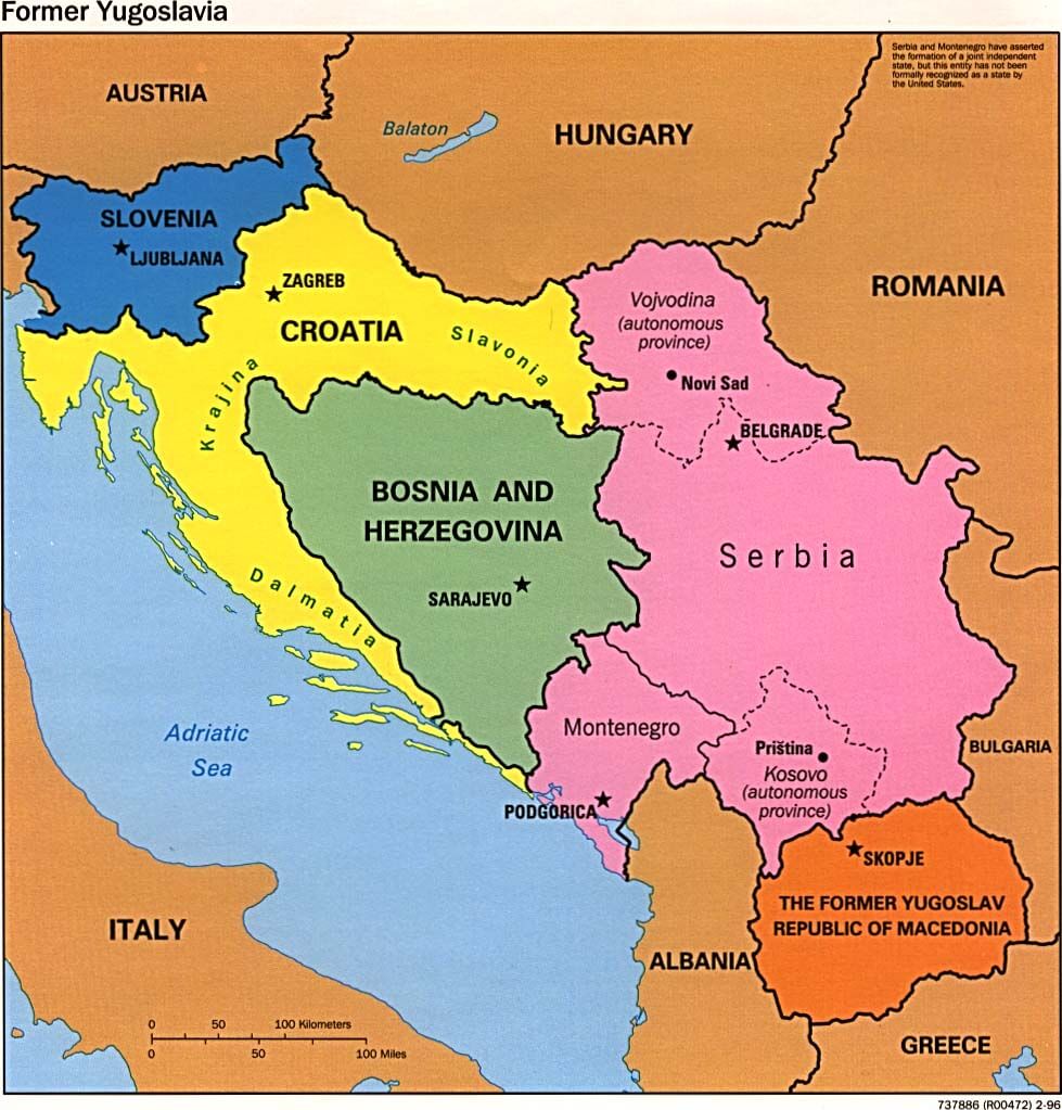
This map illustrates the former Yugoslavia and its division into independent countries, including Slovenia, Croatia, Bosnia and Herzegovina, Serbia, Montenegro, and North Macedonia (labeled here as “The Former Yugoslav Republic of Macedonia”). Key cities like Belgrade, Zagreb, Sarajevo, and Skopje are marked, showing the borders and the breakup of Yugoslavia into these distinct nations. The map also highlights the surrounding countries such as Albania, Greece, and Hungary.
Macedonia Road Map
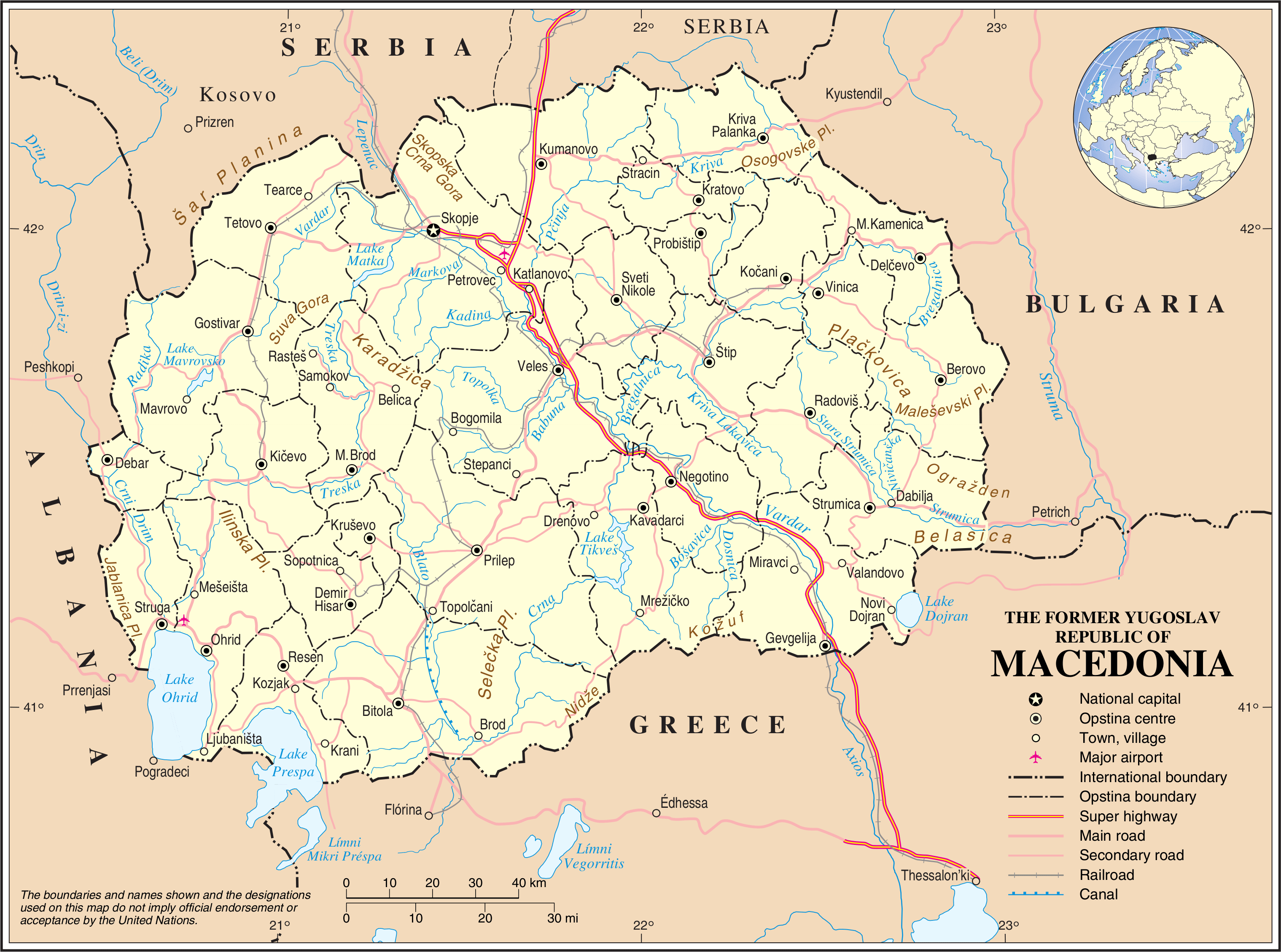
This road map of North Macedonia highlights the main highways, railways and major transport routes throughout the country. It shows connections between major cities such as Skopje, Bitola and Tetovo, and highlights international borders with neighbouring countries such as Serbia, Albania and Greece, making it a useful reference for understanding the country’s infrastructure and regional connectivity.
Linguistic Map of North Macedonia
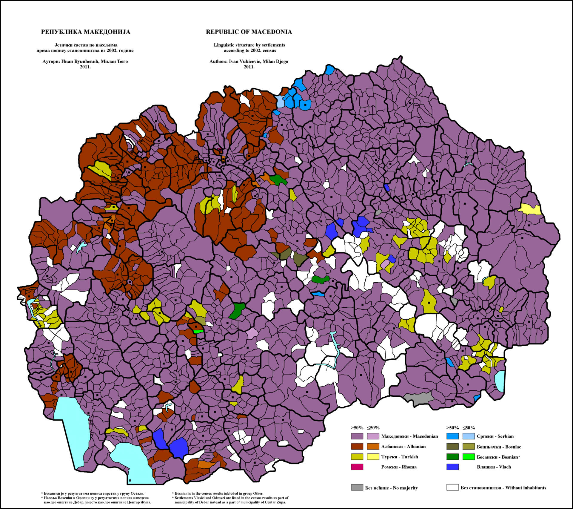 This linguistic map of North Macedonia illustrates the distribution of different ethnic and linguistic groups across the country, based on data from the 2012 census. It highlights areas where Macedonian, Albanian, Turkish, Roma, Serbian, Bosniak and other communities make up the majority or significant part of the population. The map’s different colours depict the cultural and linguistic diversity within North Macedonia’s settlements and show the regional concentrations of each group.
Macedonia Major Cities Map
 This map highlights the main cities in North Macedonia, with Skopje as the capital, alongside key locations such as Bitola, Tetovo and Kumanovo, each marked to show their geographical position within the country and in relation to neighbouring nations such as Albania, Greece and Bulgaria.
Macedonia Provinces Map
 This map of North Macedonia shows the various provinces, administrative boundaries and major cities. It is a useful tool for understanding the country’s regional divisions and geographical layout.
Macedonia Travel Map
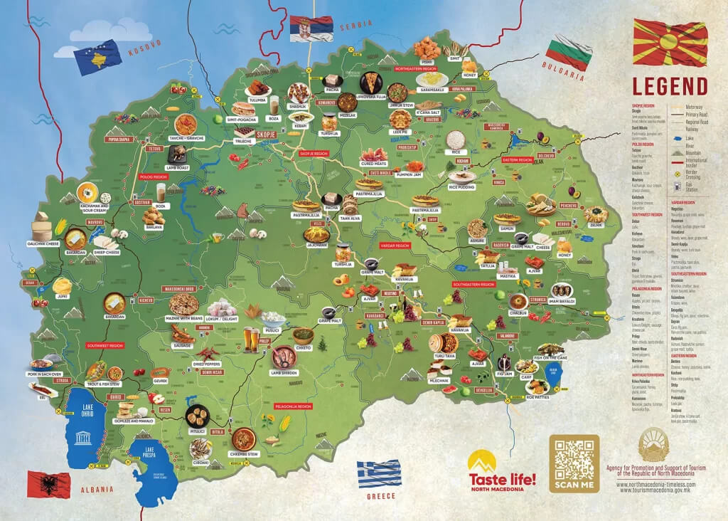 This illustrated travel map of North Macedonia showcases the country’s diverse regional specialities, attractions and local cuisine, providing visitors with a colourful guide to exploring the country’s rich cultural and culinary heritage. From traditional dishes such as ‘ajvar’ and ‘tavče gravče’ to famous landmarks and natural sites, the map highlights key points of interest that make North Macedonia a unique destination.
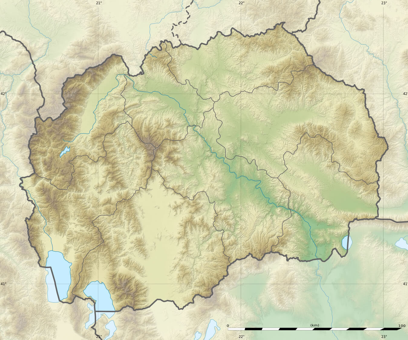
North Macedonia Satellite Map
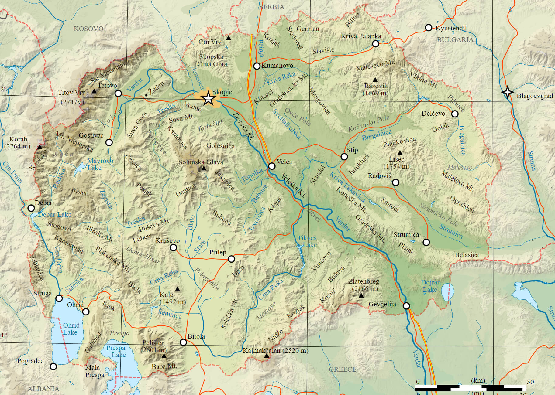 This map of North Macedonia provides a detailed topographical view of the country’s terrain, showing its major rivers, mountain ranges and major cities such as Skopje, Bitola and Ohrid. The map highlights the diverse natural landscape, including mountain peaks such as Korab and Pelister, and major water bodies such as Lake Ohrid and Lake Prespa, making it a valuable resource for understanding the geographical features of North Macedonia.
North Macedonia Road Map
 This detailed road map of North Macedonia shows the country’s main highways, roads and transport routes, highlighting connections between cities such as Skopje, Bitola and Tetovo and providing an insight into how to navigate the country’s diverse terrain.
Expansion of Macedon Map
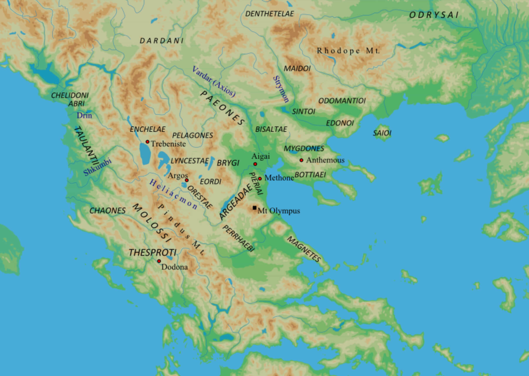 This map illustrates the ancient regions and tribes during the expansion of Macedon. It highlights the strategic geographic positioning of the Macedonian kingdom, including significant landmarks such as Mount Olympus and nearby ancient cities like Aigai and Pella. The map also shows neighboring regions like Eordaea, Orestae, and the Pelagones, offering a glimpse into the complex landscape that influenced the historical development of the Macedonian Empire.
Macedonia Conflict Areas Map
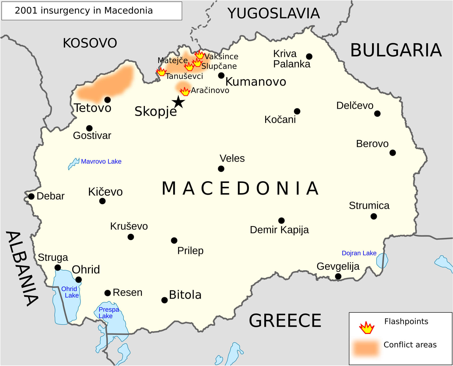 This map of northern Macedonia shows the main areas of conflict during the 2001 insurgency, with flashpoints and areas of heightened tension highlighted. The conflict mainly involved clashes between Macedonian government forces and ethnic Albanian groups, particularly around areas such as Tetovo and Kumanovo, indicating the regions most affected by unrest during this period.
Macedonia Climate Map
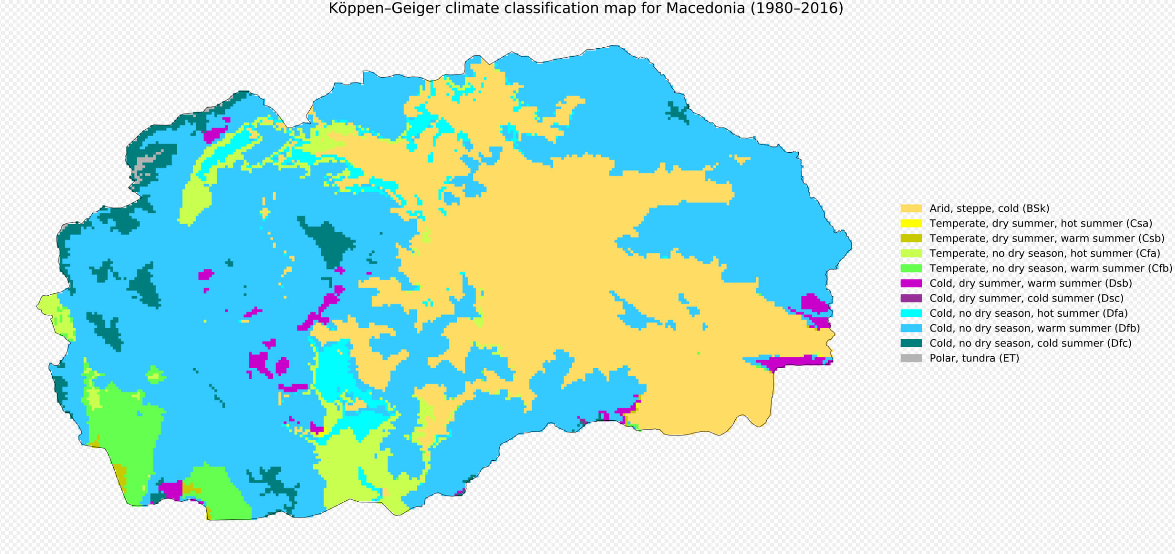 This climate map of North Macedonia illustrates the different climate zones across the country from 1980 to 2016 using the Köppen-Geiger classification. The map highlights different climatic conditions, such as arid steppe regions in yellow, temperate zones with hot or warm summers, and areas with cold, dry summers or no dry season. These variations reflect the geographical diversity of North Macedonia, ranging from mountainous areas to lowlands.
Macedonia Satellite Map
North Macedonia Municipalities Map
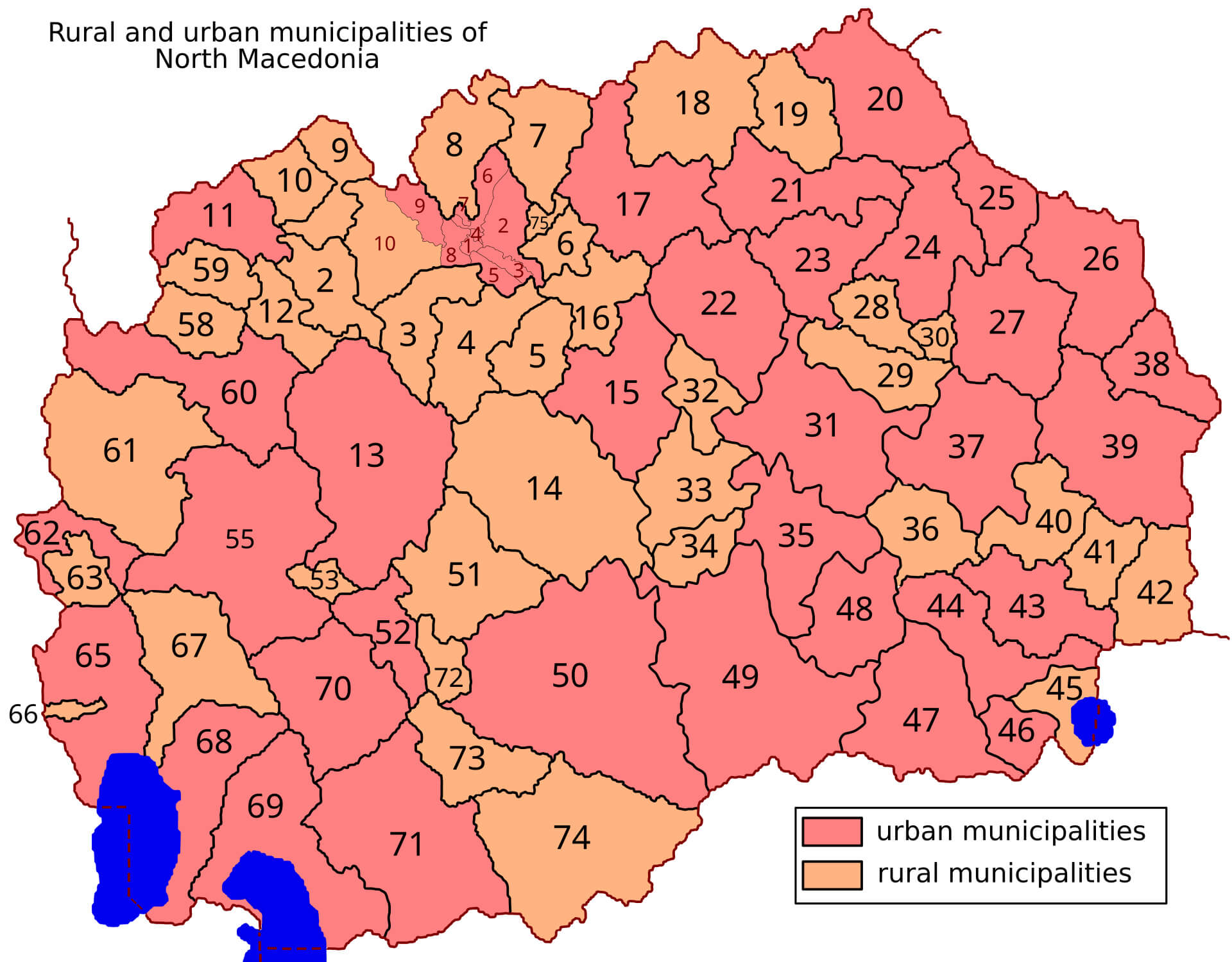 This map of North Macedonia shows the division between urban and rural municipalities. Each area is numbered and shaded, with urban municipalities highlighted in a darker shade and rural municipalities in a lighter shade. The map provides a clear visual representation of the administrative structure, illustrating how population centres and rural regions are distributed across the country.
Macedonia Highways Map
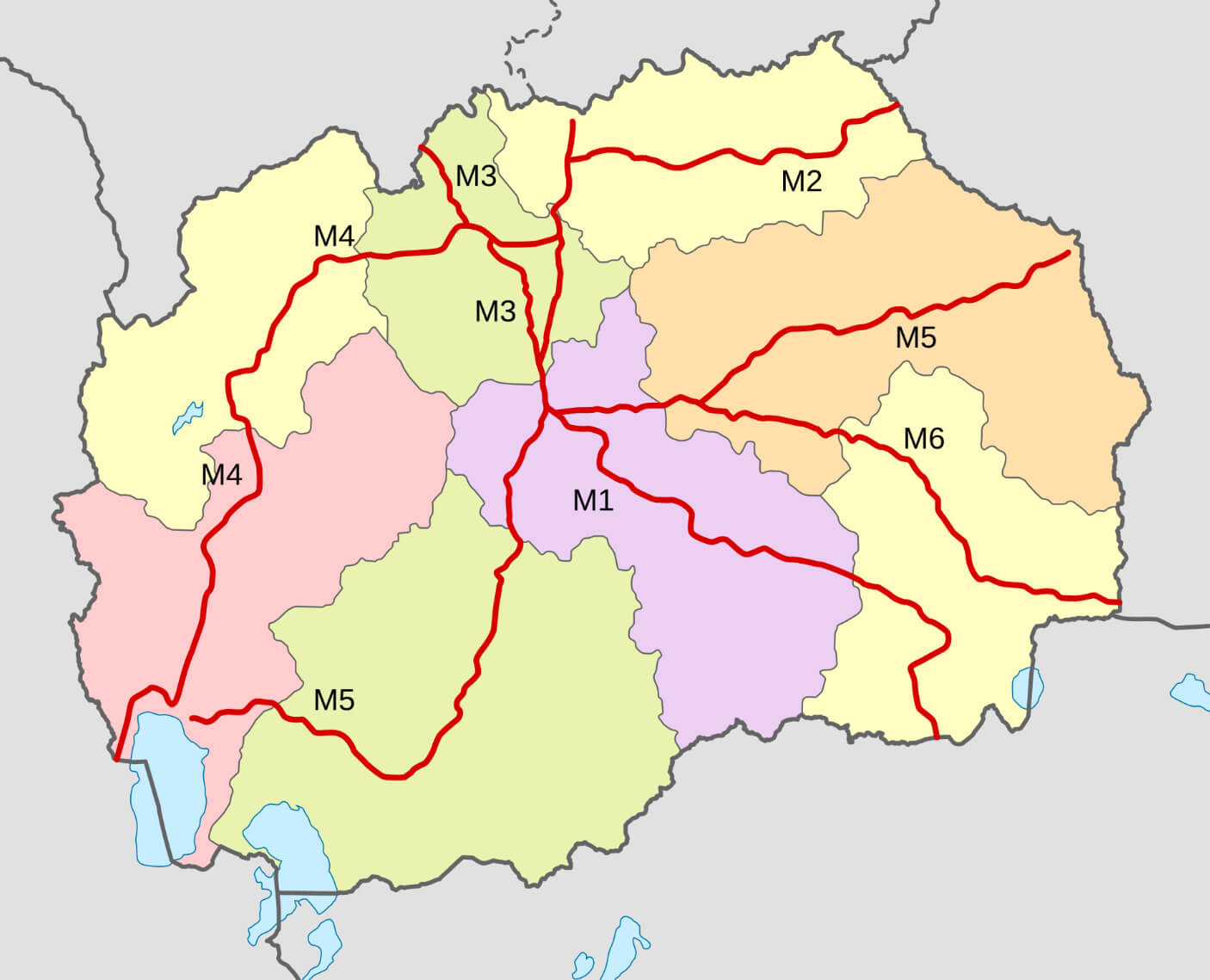 This map of North Macedonia highlights the country’s main motorways, designated M1 to M6, which connect key regions and cities across the country. These routes play a crucial role in facilitating transport and trade within North Macedonia, as well as connecting it to neighbouring countries such as Serbia, Greece and Albania.
Macedonia Largestcities Map with Rivers
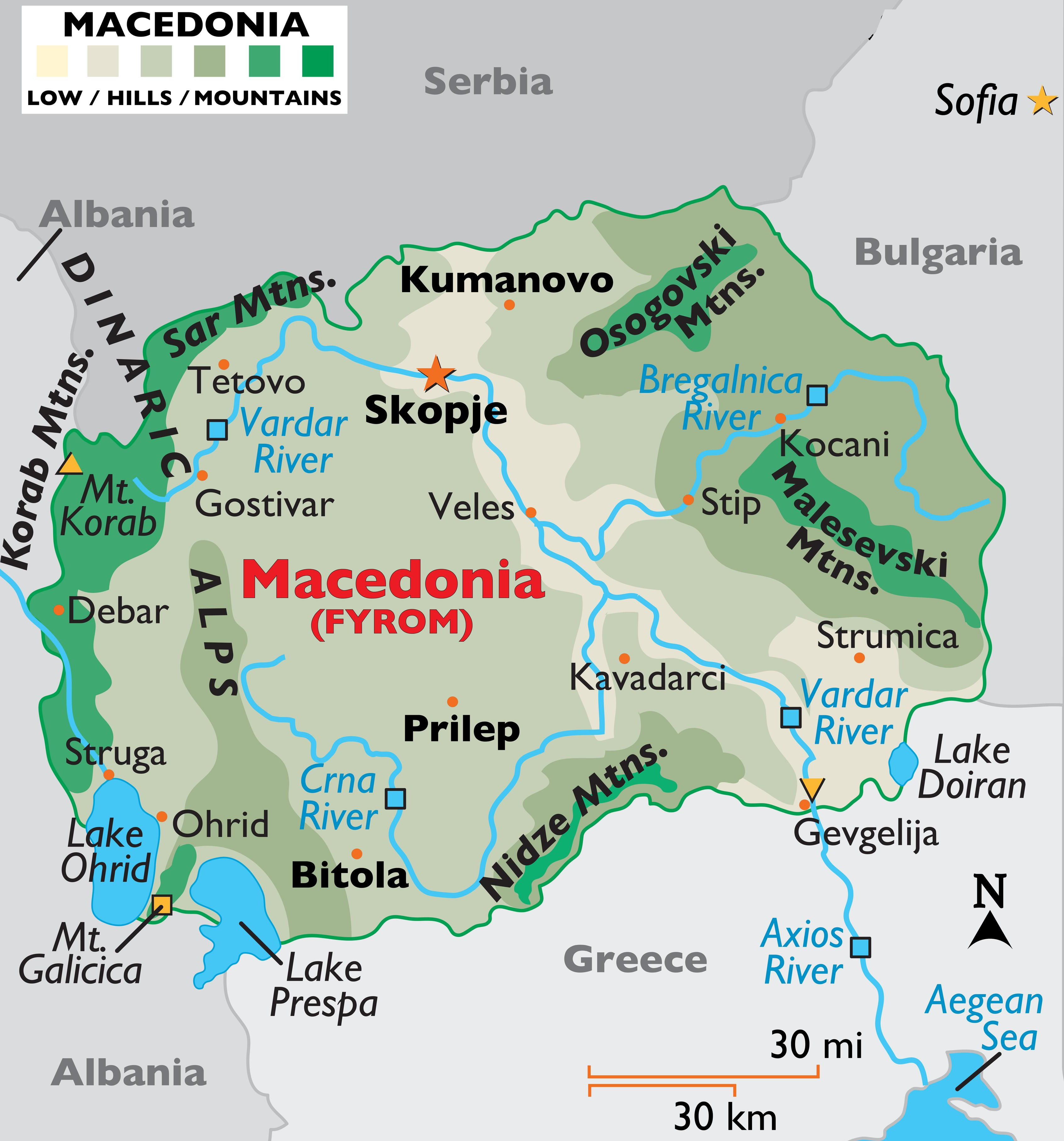 This map of North Macedonia highlights the major cities, rivers and mountainous terrain, showing features such as the Vardar River, which flows through Skopje, and the surrounding mountain ranges, including the Dinaric Alps and the Osogovski Mountains.
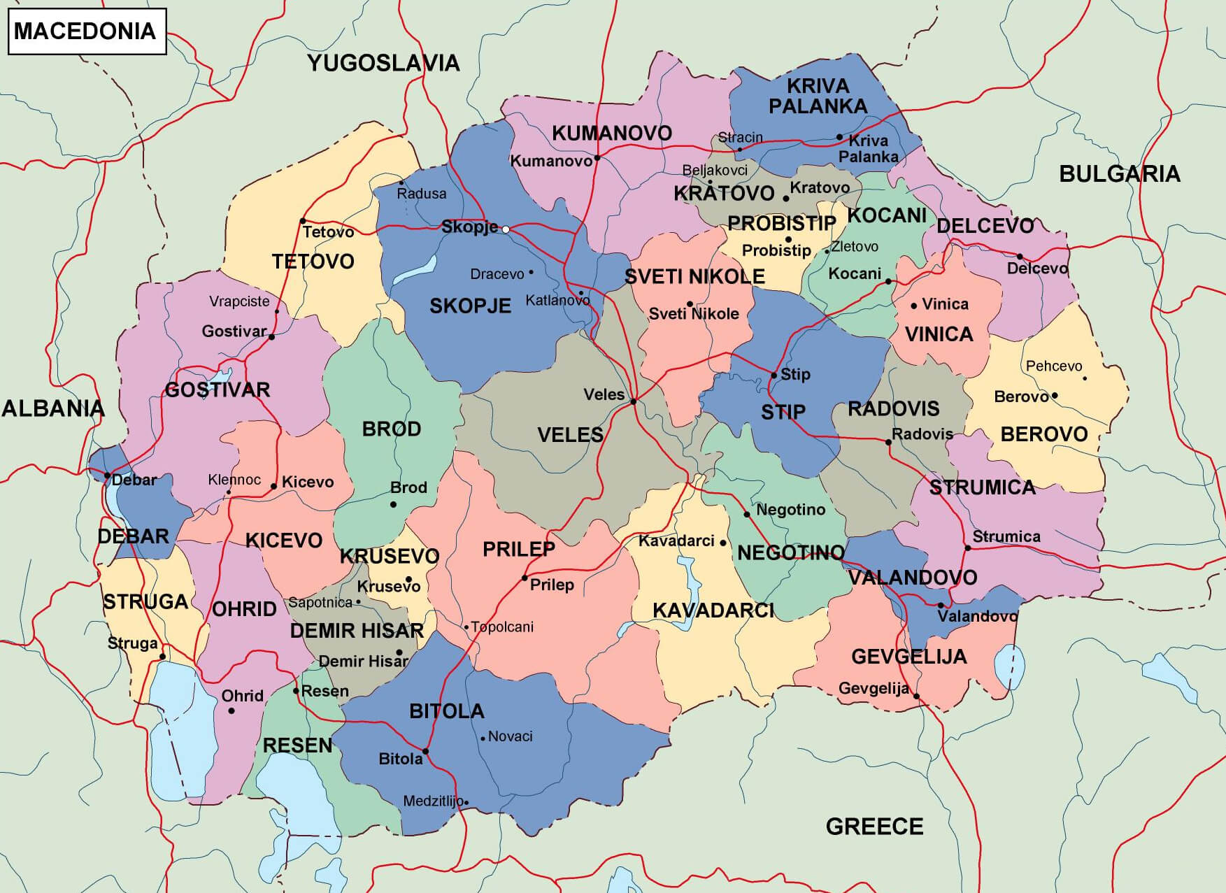
Macedonia Political Map
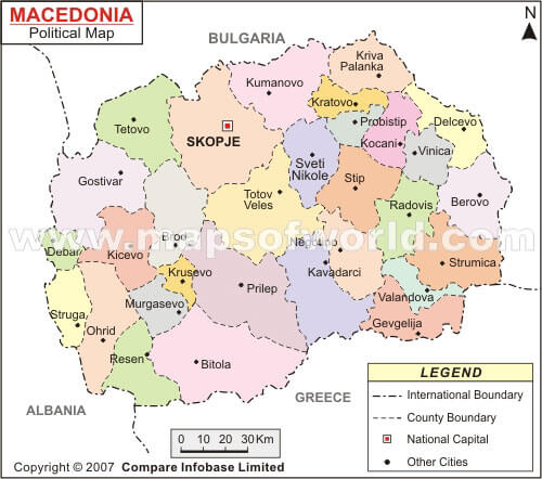
This political map of Macedonia shows the administrative divisions of the country and its borders with neighbouring Albania, Greece, Bulgaria and Serbia. It shows the capital city of Skopje and other major towns and cities, and provides a detailed view of Macedonia’s internal district boundaries and regional layout.
Map of Macedonia Europe
Where is North Macedonia on the Europe Map?
Show Google map, satellite map, where is the country located.
Get directions by driving, walking, bicycling, public transportation and travel with street view.
Feel free to explore these pages as well:
- Italy Map ↗️
- Map of Italy ↗️
- A Collection of Italy Maps ↗️
- Discover Croatia: A Comprehensive Map Collection of Its Stunning Coastlines and Historic Cities ↗️
- A Collection of Europe Maps: Exploring the Continent in Detail ↗️
- Map of Europe ↗️
- Europe Map ↗️
- Map of Europe ↗️
- France Map ↗️
- Map of Spain ↗️
- Ireland Map ↗️
- United Kingdom Map ↗️
- Germany Map ↗️
- Turkey Map ↗️
- Map of Portugal ↗️
- Switzerland Map ↗️