A collection of Slovakian maps offers a detailed view of the country’s geography, highlighting everything from its varied landscapes to the layout of its regions and major cities.
Brief information about Slovakia
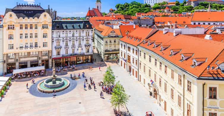
Slovakia, located in the heart of Europe, is a landlocked country known for its stunning landscapes and rich history. With the majestic Carpathian Mountains to the north and picturesque lowlands to the south, it’s a paradise for nature lovers and adventure seekers. The capital city, Bratislava, sits along the Danube River, blending medieval charm with modern vibes. It’s a place where cobblestone streets meet lively cafes and vibrant culture.
Slovakia Regions Map
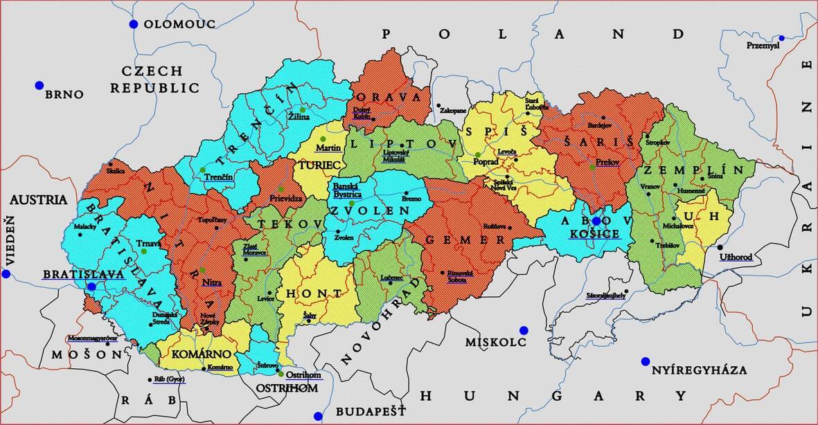
This map shows the regions of Slovakia, highlighting its various historical and cultural areas like Orava, Liptov, Spiš, and Zemplín. Each region is marked in different colors, showcasing Slovakia’s diverse geography and local identities. The map also indicates neighboring countries, such as Austria to the west, Hungary to the south, and Poland to the north, illustrating Slovakia’s central position in Europe. Major cities like Bratislava, Košice, and Banská Bystrica serve as key points within these regions, making it easier to navigate the country’s rich landscapes and cultural heritage.
Beyond its natural beauty, Slovakia boasts a deep cultural heritage that dates back to the days of the Great Moravian Empire. Visitors can explore ancient castles like Spiš Castle, traditional wooden villages, and UNESCO World Heritage sites. Slovaks take pride in their folk traditions, music, and delicious cuisine, making it a perfect destination for those looking to experience a blend of history, nature, and local flavors.
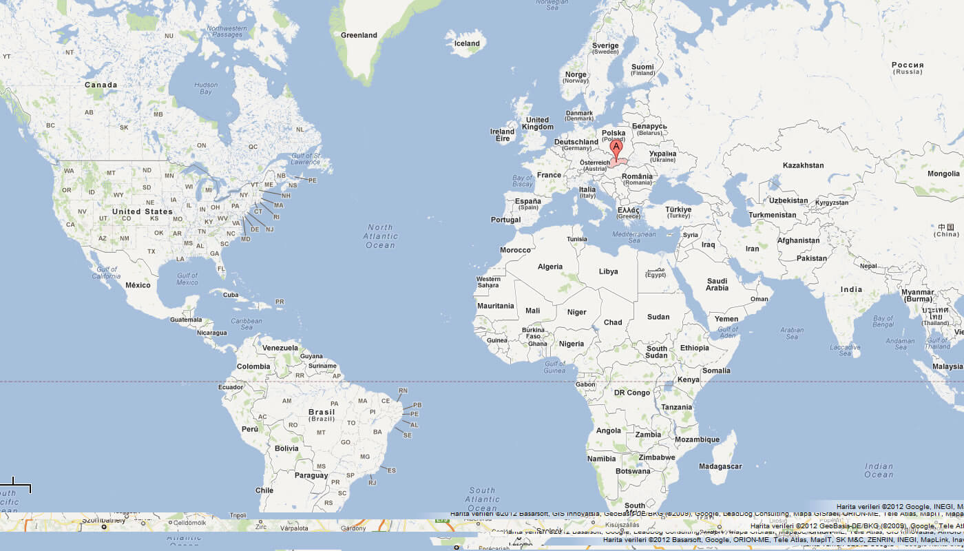
Where is located Slovakia on the World Map
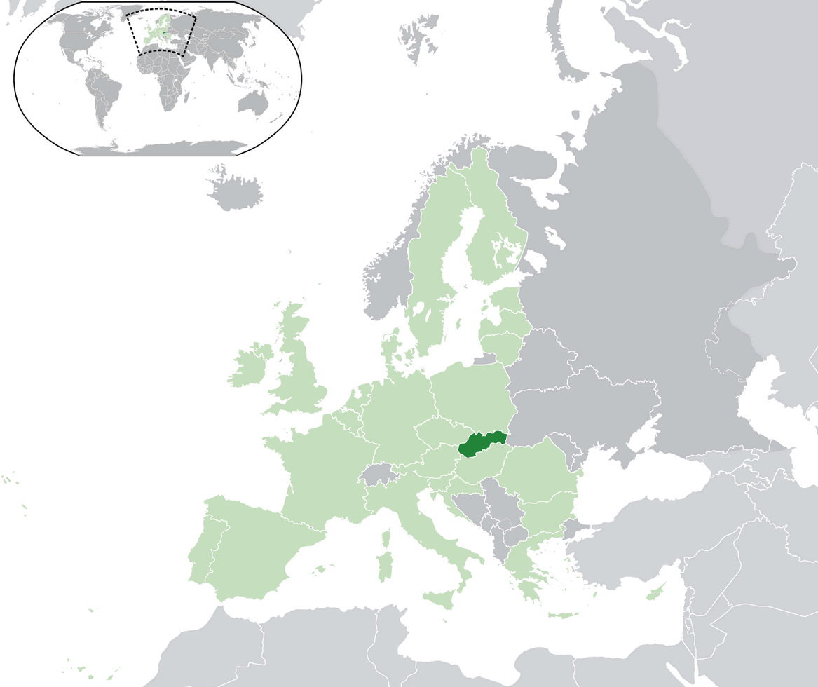
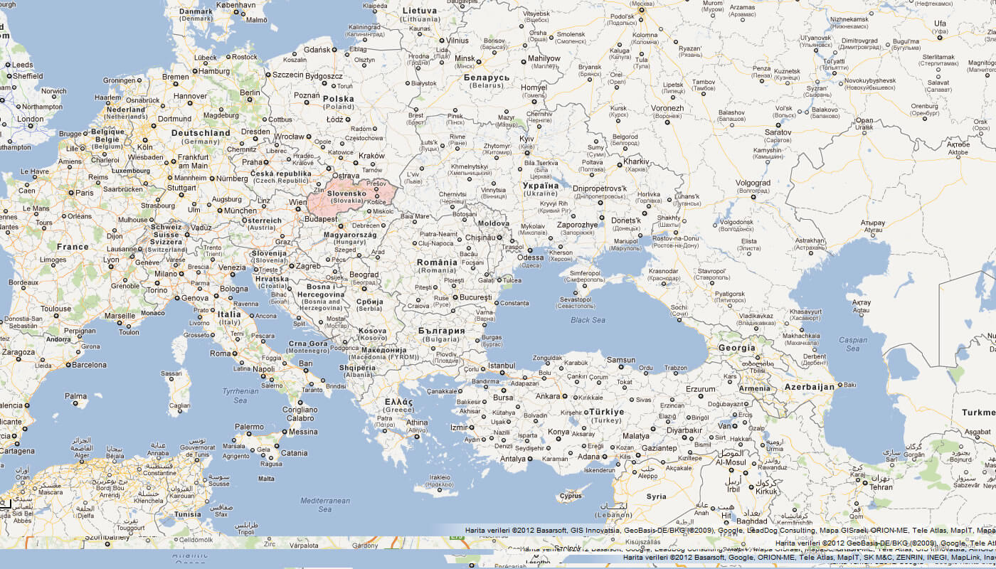
Slovakia is located in Central Europe, making it a landlocked country with no access to the sea. Nestled between Austria to the west, the Czech Republic to the northwest, Poland to the north, Ukraine to the east, and Hungary to the south, Slovakia sits right at the crossroads of various European cultures. Its central position means that it’s relatively easy to reach from other major European cities, making it a great starting point for exploring the region.
Geographically, Slovakia is characterized by its diverse landscapes, from the high peaks of the Tatra Mountains in the north to the rolling hills and plains in the south. The country’s location means it experiences all four seasons distinctly, with snowy winters perfect for skiing and warm summers ideal for hiking and exploring its many natural wonders. This variety in climate and terrain makes Slovakia a year-round destination for outdoor enthusiasts.
On a world map, you’ll find Slovakia in the northern hemisphere, east of Germany and just south of Poland. Despite its small size, the country has a rich mix of natural beauty and cultural heritage, which makes it a unique place to visit in the heart of Europe. Its location between East and West Europe also means it has a fascinating blend of influences, visible in everything from its architecture to its cuisine.
Here are some statistical information about Slovakia:
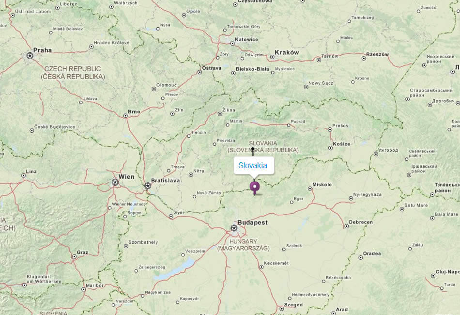
Map of Slovakia
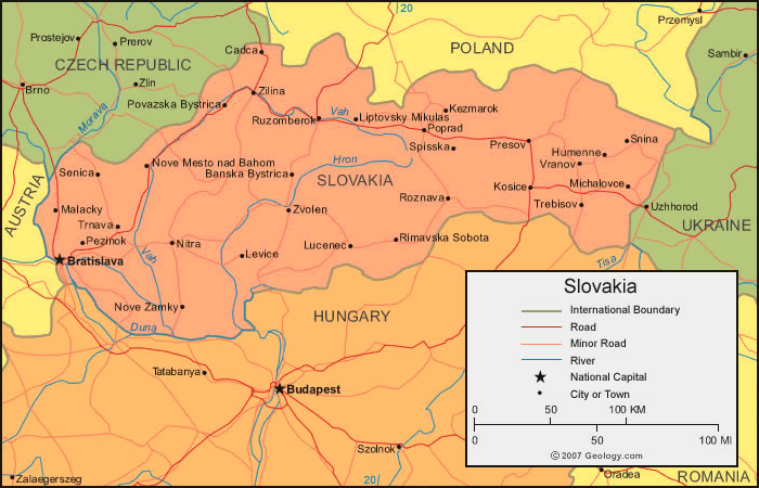
Slovakia Map
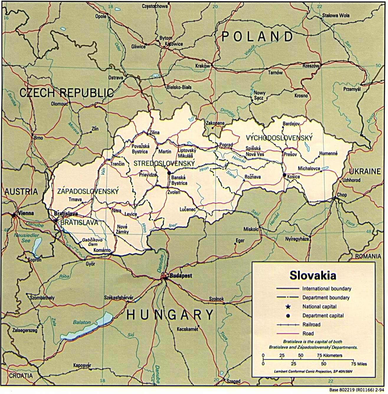
This map of Slovakia shows its geographic location in Central Europe and its borders with neighbouring countries including the Czech Republic, Poland, Hungary, Ukraine and Austria. It also illustrates the country’s regional divisions, major cities such as Bratislava and Košice, major transportation routes and natural features, providing a comprehensive overview of Slovakia’s layout.
Slovakia Map Great Moravia Svatopluk
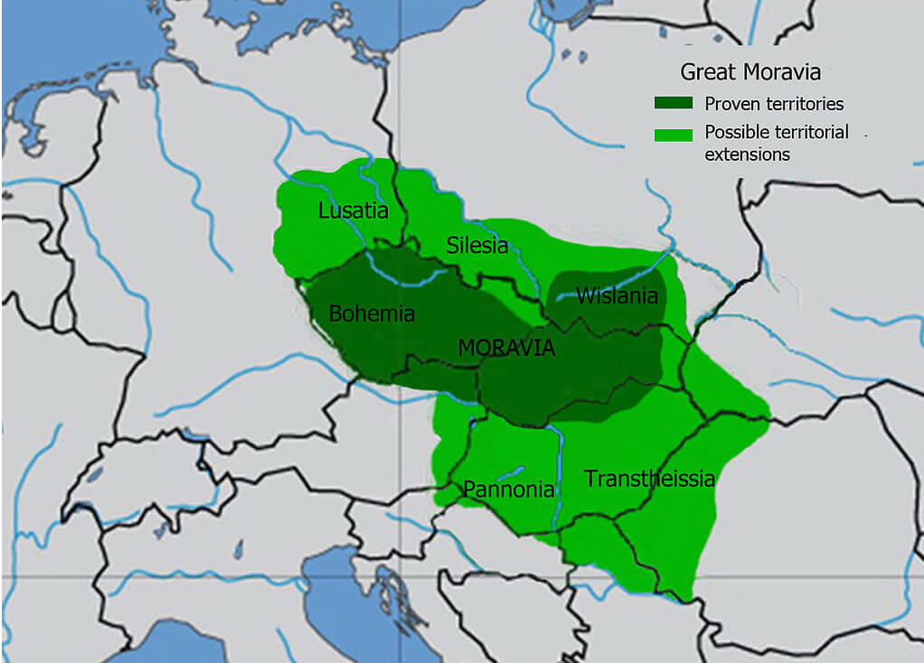
The map shows the historical territory of Great Moravia, which included proven areas like Moravia, Silesia, and parts of Bohemia, along with possible territorial extensions into regions like Lusatia, Wislania, Pannonia, and Transthesisia.
Slovakia Map 1943
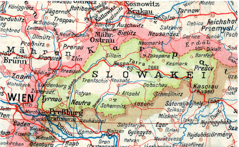
This historical map depicts Slovakia during a period when it was surrounded by regions like Krakau (Kraków) to the north and Wien (Vienna) to the west. The map highlights key cities such as Bratislava (Presburg), Kosice (Kaschau), and other significant areas, providing a snapshot of Central Europe’s geopolitical landscape at the time. It reflects the intricate borders and the connections between neighboring territories through road and rail networks.
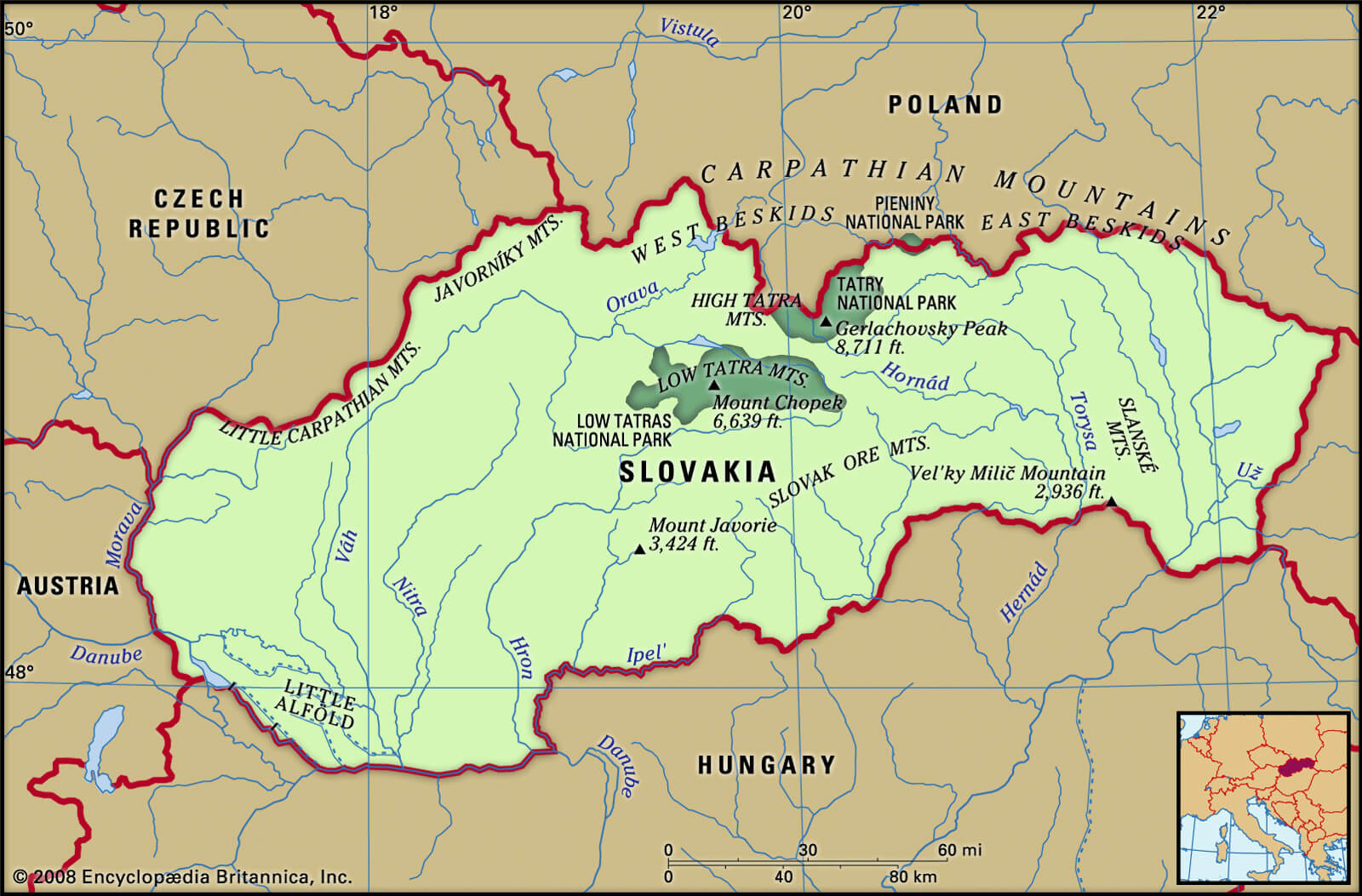
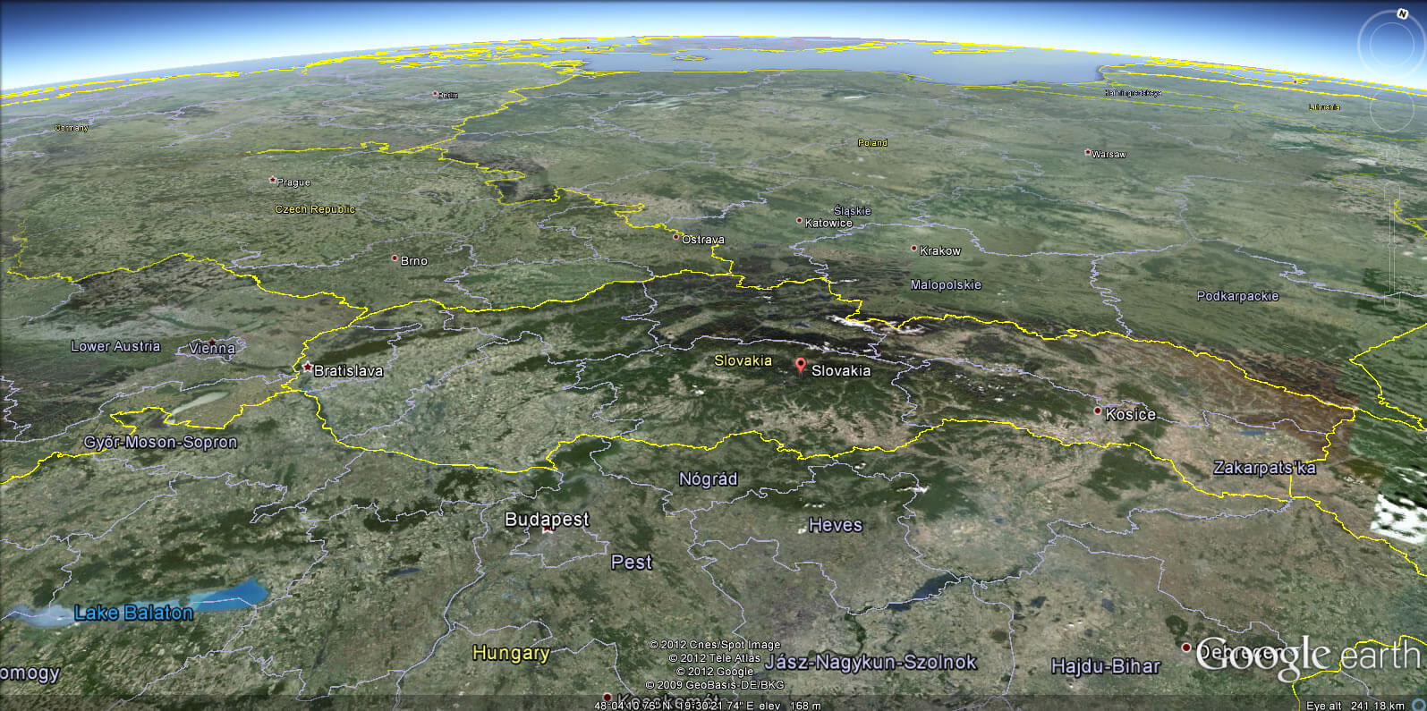
Topographic Map of Slovakia
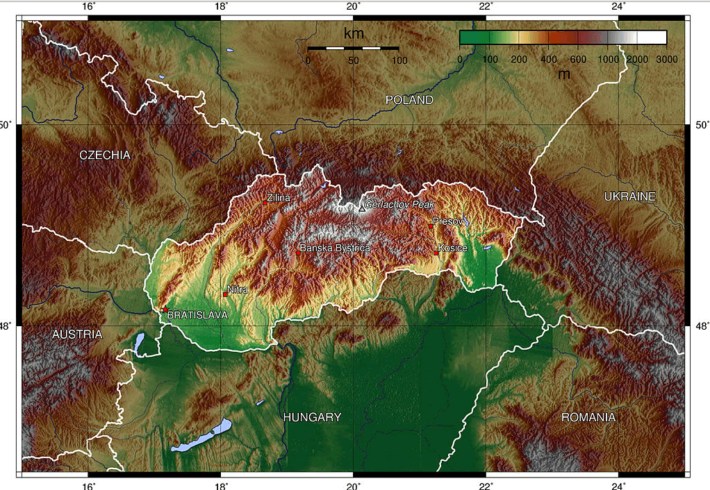
This topographic map of Slovakia shows its varied landscape, from the mountainous north with peaks like Gerlachov Peak in the High Tatras, to the lowlands in the southwest near Bratislava. Located in Central Europe, Slovakia is bordered by Poland, Ukraine, Hungary, Austria, and the Czech Republic, showcasing a mix of rugged mountains and gentle plains.
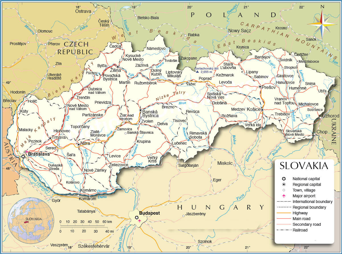
Slovakia and Bratislava Map
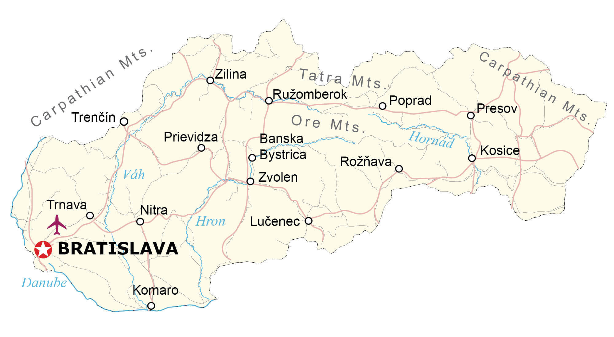 This map of Slovakia highlights the country’s major cities, including the capital, Bratislava, which is located on the Danube River. It also shows other major cities such as Košice, Žilina and Nitra, as well as notable geographical features such as the Carpathian and Tatra Mountains, providing a clear view of Slovakia’s terrain and urban centres.
Slovakia Main Cities Map with Highways
Slovakia Geography Map
 This geography map of Slovakia illustrates the country’s varied terrain, highlighting mountainous regions such as the Carpathians in the north, including the Tatra Mountains, and the lowlands in the south around the Danube River. It also highlights major cities such as Bratislava, Košice and Banská Bystrica, and provides a detailed overview of Slovakia’s natural features and transport routes.
Slovakia Land Map
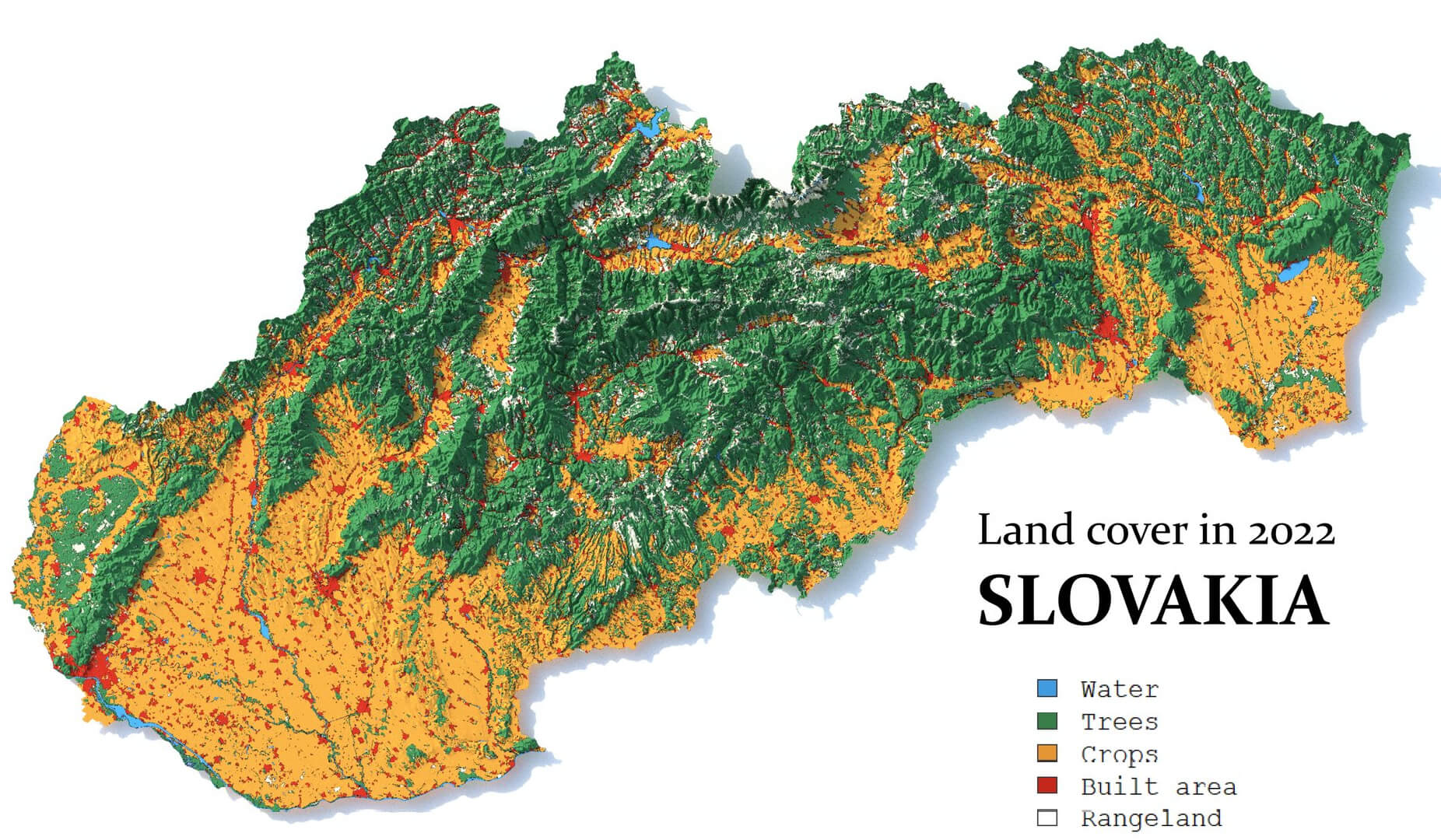 This 2022 land cover map of Slovakia provides a detailed representation of the country’s diverse terrain, highlighting areas covered by forests (green), agricultural crops (yellow), built-up urban areas (red) and water bodies (blue). It provides a clear picture of how land is used across Slovakia, with dense forests in the mountainous northern regions and extensive agricultural areas in the lowlands of the south.
Slovakia Satellite Map
 This satellite map of Slovakia provides a detailed view of the country’s topography, showing its mountainous regions such as the Carpathian and Tatra Mountains in the north and central parts, as well as the more level plains in the south. It also outlines the major rivers and natural features, providing a clear perspective of Slovakia’s diverse landscapes and terrain.
Slovakia Blank Map
Slovakia Schengen EU Area Map
 This map illustrates the Schengen and European Union (EU) area, showing Slovakia as a member state of both the EU and the Schengen area (shown in blue). It highlights the countries in the Schengen area, which allow free movement across borders, as well as EU member states (yellow) and non-member states (grey). The map provides a visual understanding of Slovakia’s integration into Europe’s political and travel arrangements.
Slovakia Linguistic Map
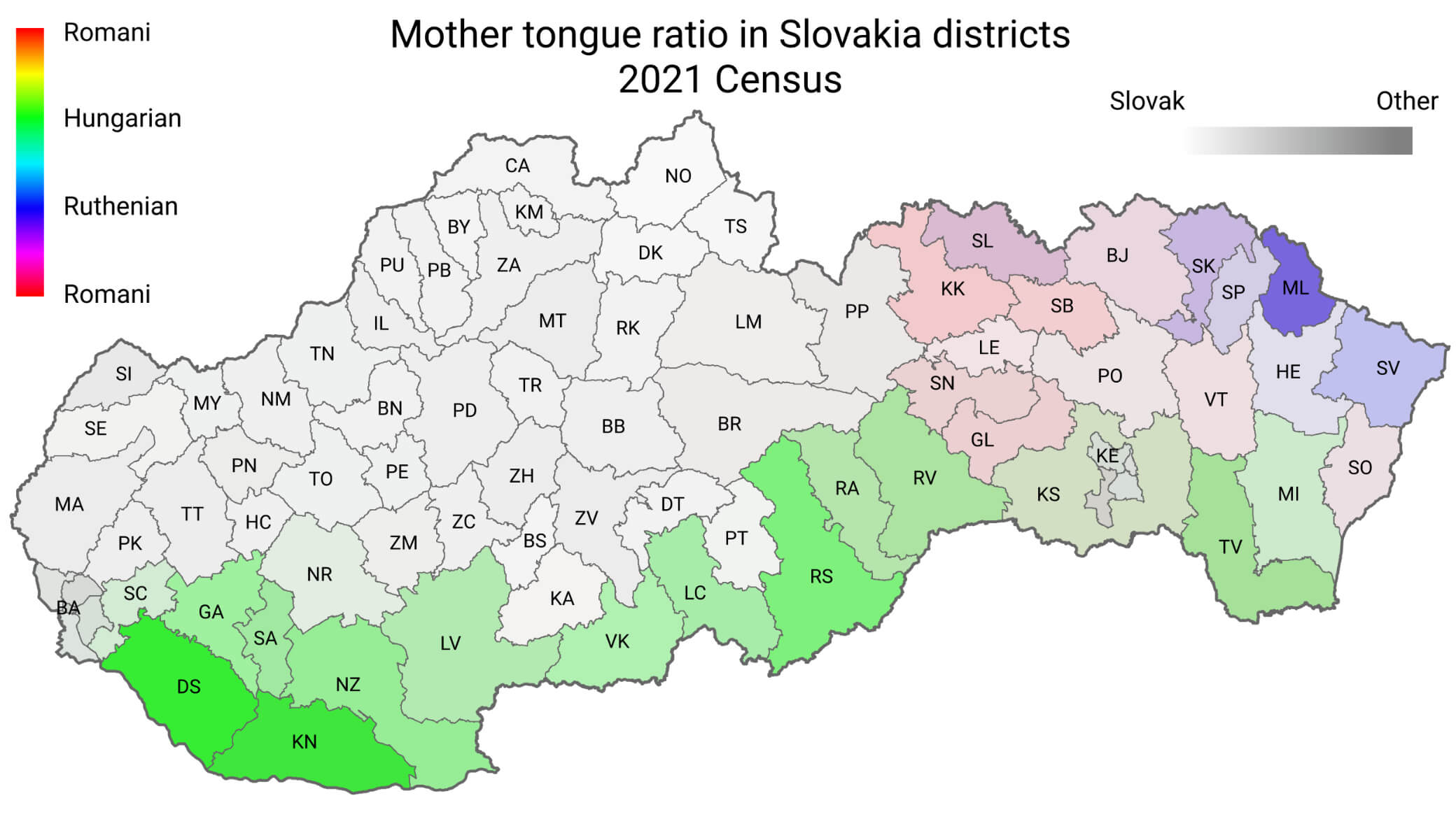 This linguistic map of Slovakia, based on the 2021 census, shows the distribution of mother tongues in different districts. It highlights areas with significant Hungarian-speaking populations in the south (green), regions with Ruthenian speakers in the north-east (purple) and districts with Romani speakers (red). Most of the map is shaded in grey, indicating districts where Slovak is the predominant language. The map provides a visual representation of Slovakia’s linguistic diversity.
Slovakia Population Density Map
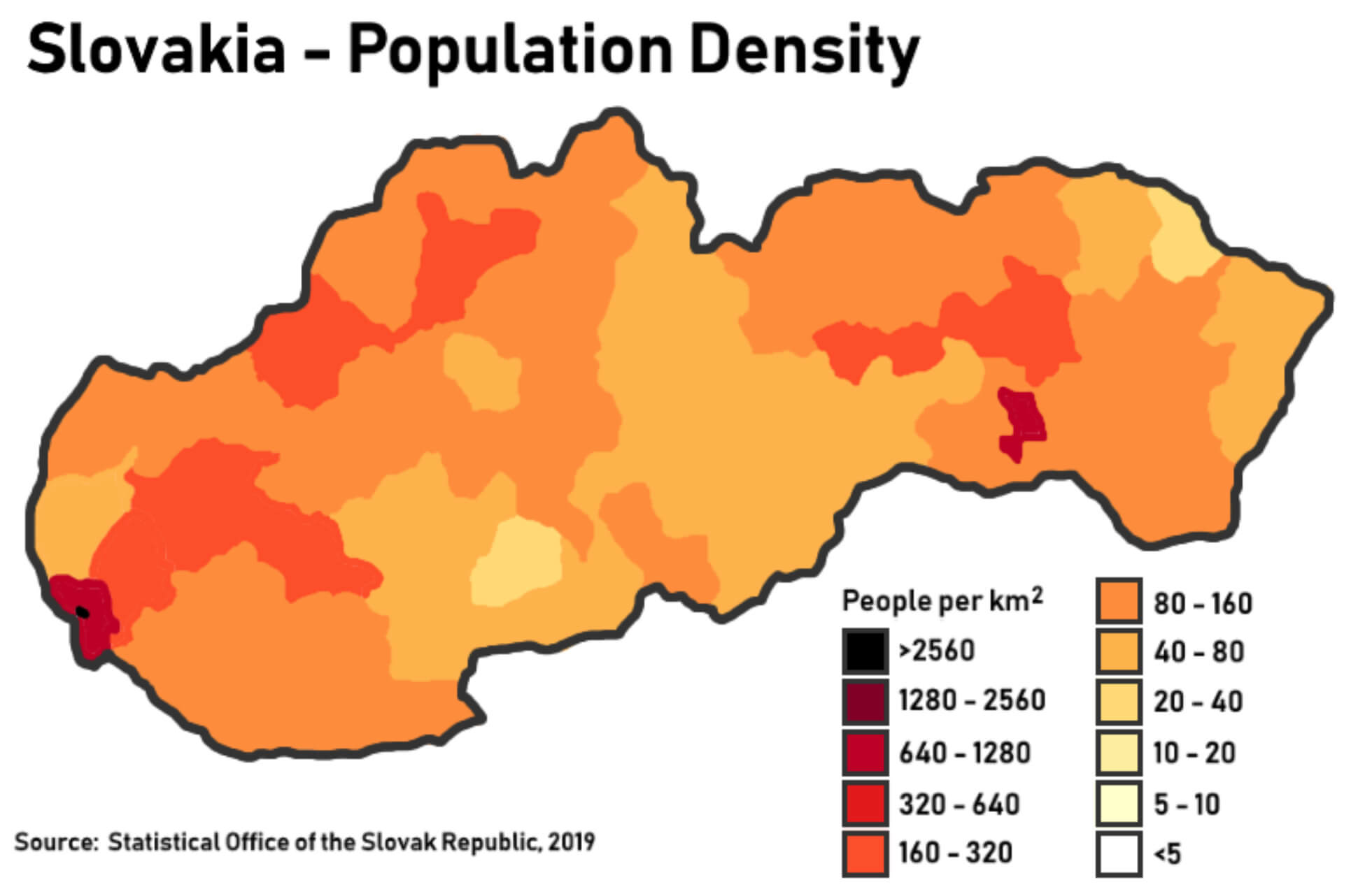 This population density map of Slovakia, based on 2019 data, highlights the concentration of people per square kilometer across different regions. The darkest areas, such as around the capital Bratislava, indicate the highest density (over 2,560 people/km²), while lighter shades represent less densely populated areas, with large parts of the country having lower population densities, especially in the central and eastern regions.
Slovakia Administrative Map with Regions
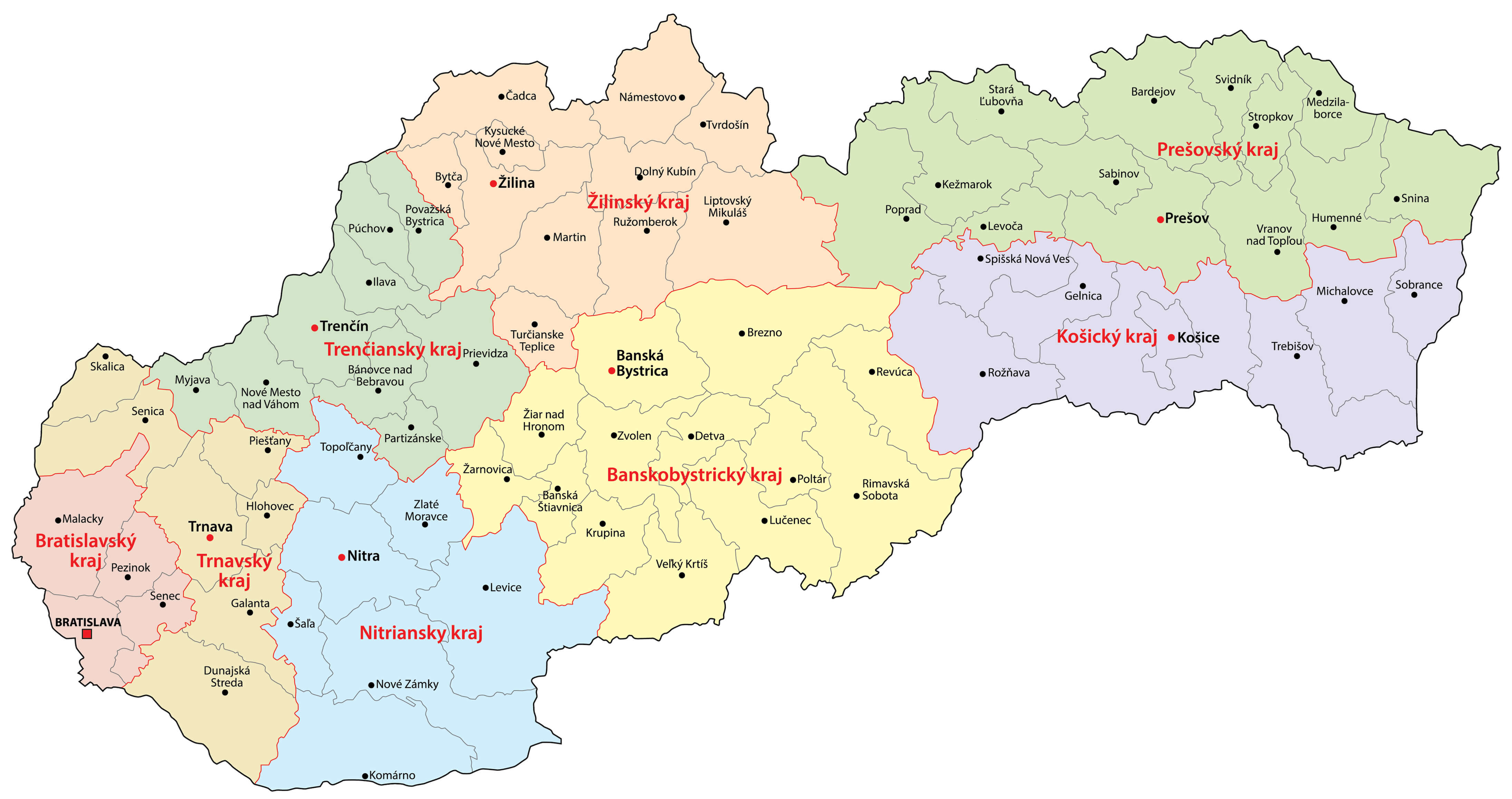 This administrative map of Slovakia shows the country’s regional divisions, highlighting its eight main regions (kraje), including Bratislavský, Trenčiansky, Žilinský and Košický kraj. It also highlights major cities such as Bratislava, Košice and Nitra, providing a clear overview of the political boundaries and major urban centres in Slovakia. The map is a useful reference for understanding the administrative layout of the country.
Slovakia Country Rivers Map
 This map of Slovakia illustrates the country’s river systems and major mountain ranges, including the Carpathian and Tatra Mountains. Key rivers such as the Danube, Váh, and Nitra are shown flowing through different regions, contributing to the country’s diverse landscape. It also highlights significant natural parks, like the Tatry National Park, making it a valuable reference for understanding the geographical features and water bodies shaping Slovakia’s terrain.
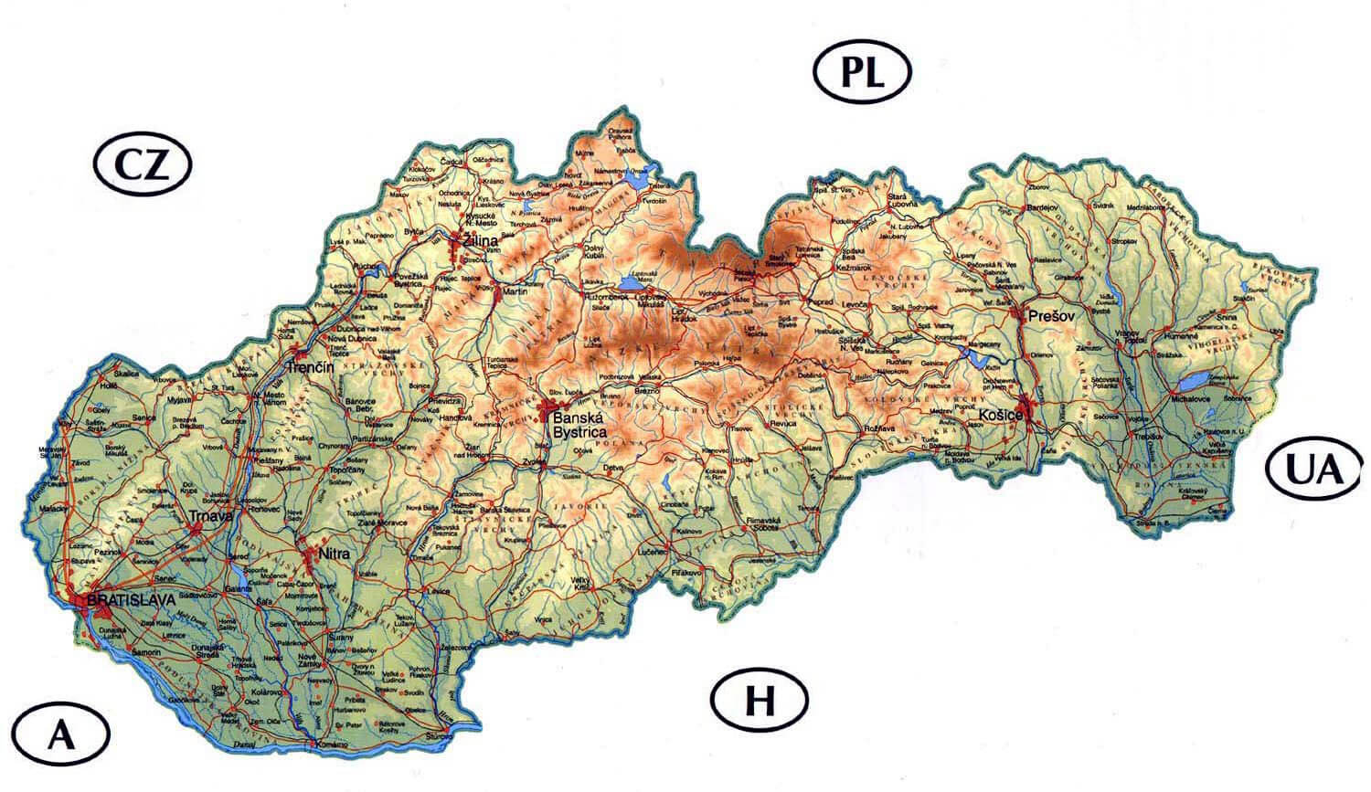
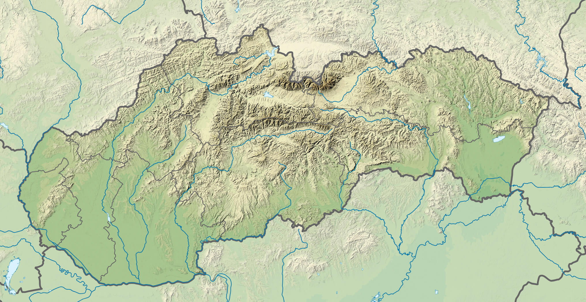
Slovakia Physical Map
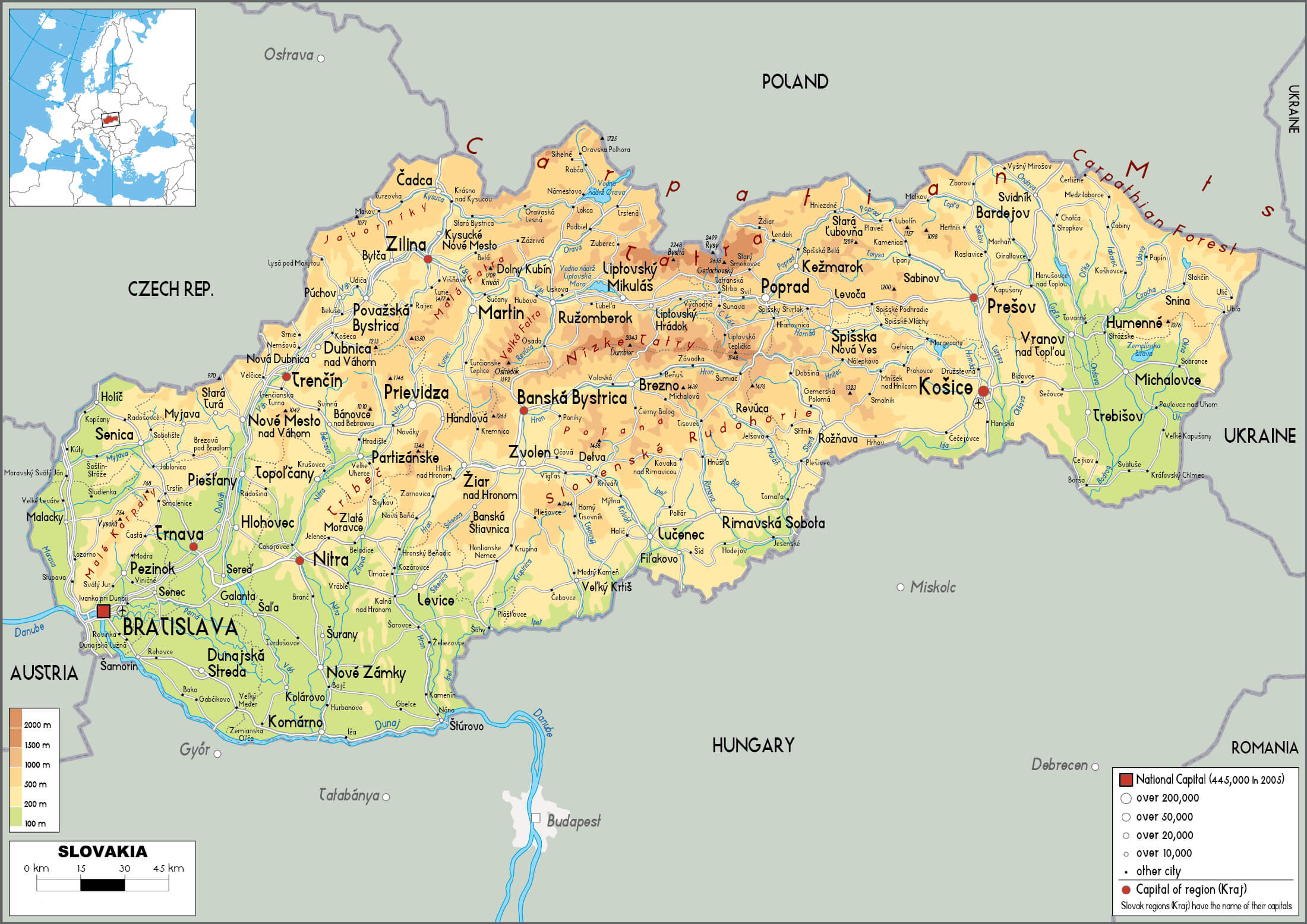 This physical map of Slovakia highlights the country’s varied terrain, including the Carpathian Mountains in the north and the Danube River along the southern border. It shows the elevation of different regions, with mountain ranges such as the Tatras prominently marked, as well as the valleys and lowlands surrounding major cities such as Bratislava, Košice and Banská Bystrica. The map provides a detailed view of Slovakia’s topography and illustrates how the natural landscape shapes the distribution of cities and transport routes.
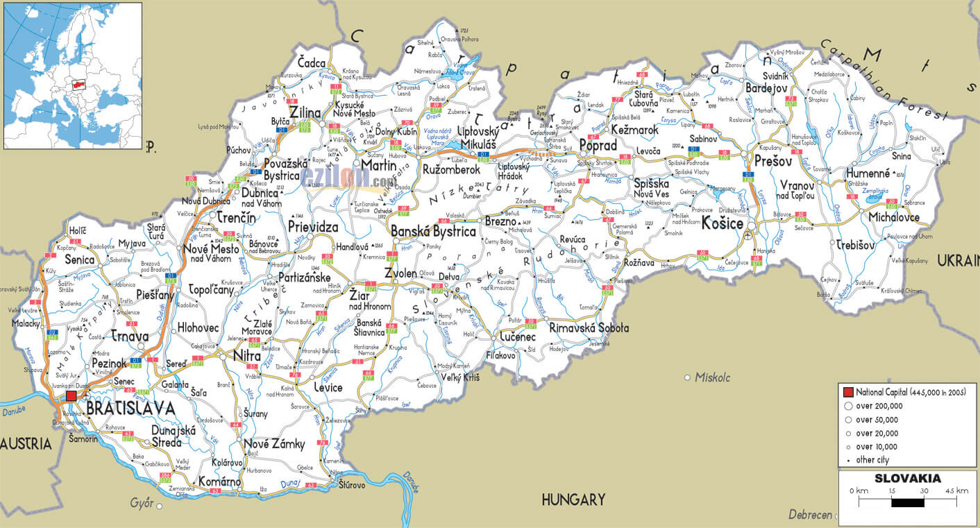
Slovakia Roads Map
 This map of Slovakia highlights the main transport routes, including motorways, trunk roads and railways, linking major cities such as Bratislava, Košice and Banská Bystrica. It also highlights key geographic features such as regional capitals and airports, providing an overview of the infrastructure that facilitates travel and trade throughout the country. The map provides a comprehensive view of how Slovakia’s road network connects different regions, improving accessibility throughout the country.
Map of Slovakia Europe
Map of Slovakia World
Map Slovakia
Slovakia Earth Map
Where is Slovakia on the Europe Map?
Show Google interactive map, satellite map, where is the country located.
Get directions by driving, walking, bicycling, public transportation and travel with street view.
Feel free to explore these pages as well:
- Czech Republic Map ↗️
- Czech Republic ↗️
- Czechia Map ↗️
- Czech Republic Photos ↗️
- Map of Czech Republic ↗️
- Slovakia Map ↗️
- Germany Map ↗️
- Europe Map ↗️