A Collection of Serbia Maps offers a comprehensive view of the country’s diverse landscapes, rich cultural history, and evolving borders, making it an ideal resource for exploring Serbia’s geography and heritage.
Brief information about Serbia
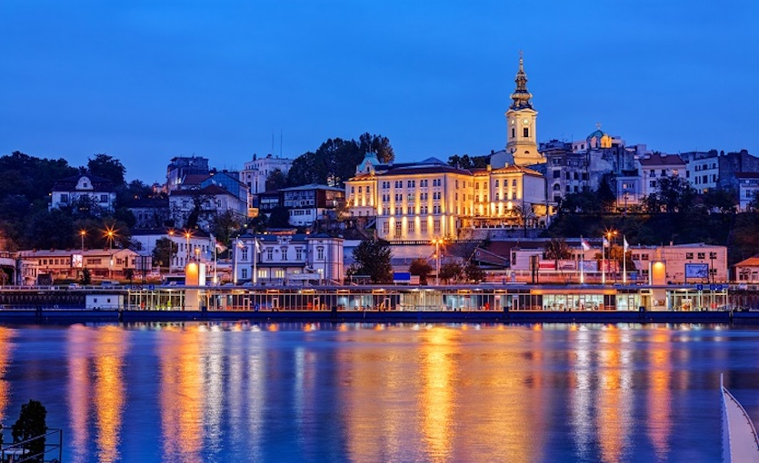
Serbia is a vibrant country in Southeast Europe, rich in history and natural beauty. Nestled in the heart of the Balkans, it offers a unique blend of East and West, where ancient traditions meet modern culture. The capital, Belgrade, is known for its lively nightlife, historic architecture, and warm hospitality. Visitors can explore centuries-old fortresses, bustling markets, and riverside promenades, all while enjoying the city’s dynamic energy.
Map of Serbia with Rivers and Lakes
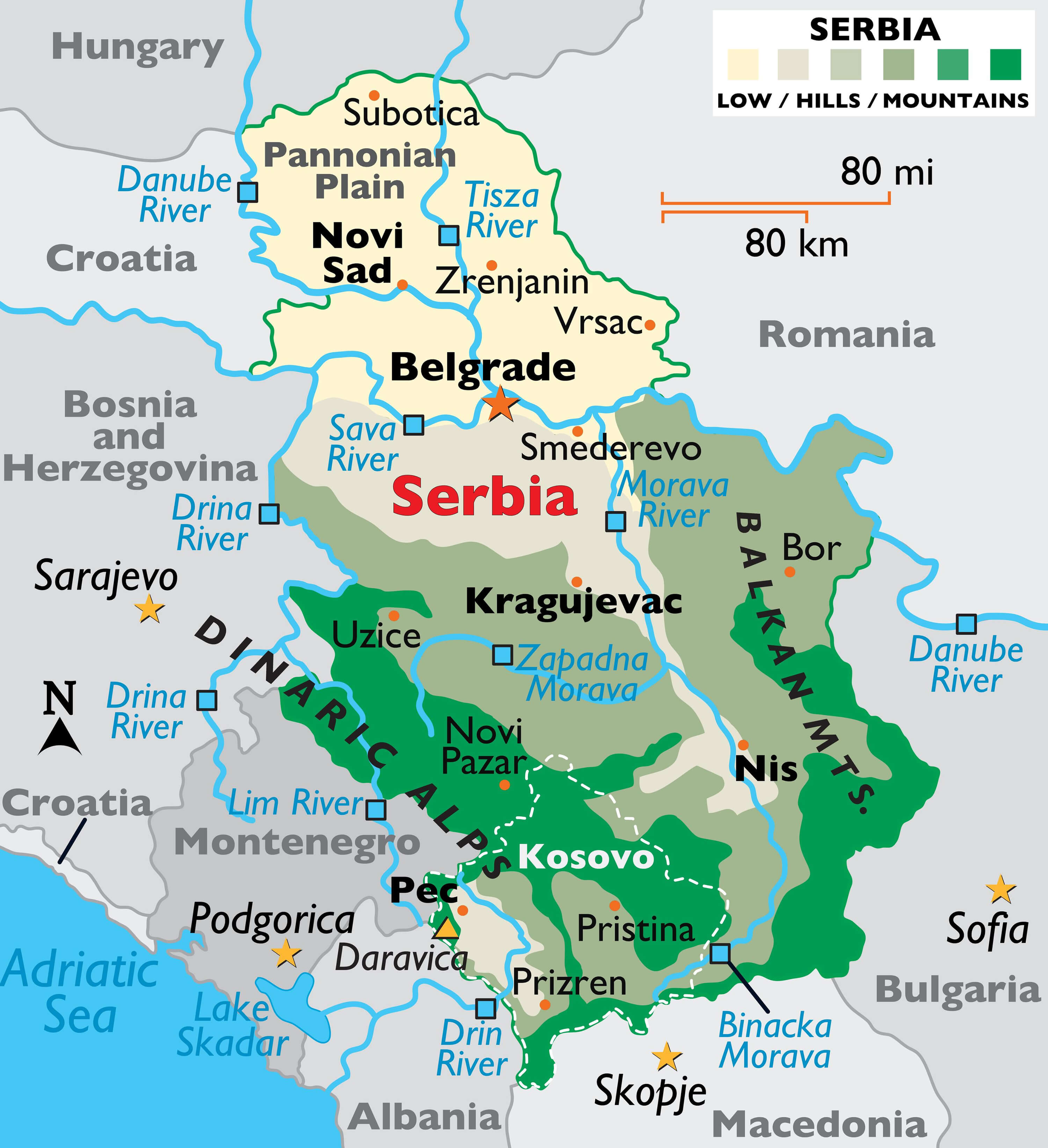
This map of Serbia highlights the country’s major rivers, such as the Danube, Sava, Tisza and Morava, as well as the Dinaric Alps and Balkan Mountains, and shows the varied terrain from the low-lying Pannonian Plain in the north to the more rugged regions in the south, including neighbouring countries such as Hungary, Romania and Bosnia and Herzegovina.
Beyond Belgrade, Serbia’s stunning landscapes range from the rolling hills and vineyards of the Vojvodina region to the rugged mountains and national parks in the south. Towns like Novi Sad, home to the famous EXIT festival, and the picturesque villages along the Danube provide a slower pace of life. Whether you’re into hiking, history, or just soaking in the local culture, Serbia has something to offer every kind of traveler.
Where is located Serbia on the World Map
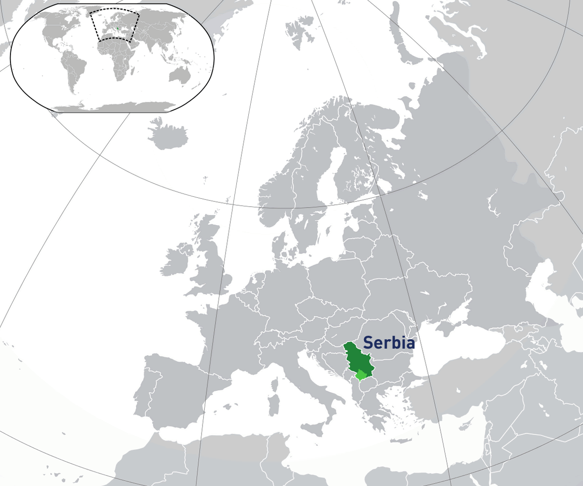
Serbia is located in Southeast Europe, in the center of the Balkan Peninsula. It’s bordered by Hungary to the north, Romania and Bulgaria to the east, and Croatia, Bosnia and Herzegovina, and Montenegro to the west.
On a world map, you’ll find Serbia positioned between Central and Southern Europe. It’s a landlocked country, meaning it doesn’t have direct access to the sea, but it’s close to both the Adriatic and Black Seas.
Serbia lies at the crossroads of Europe, connecting Western Europe with Eastern regions. This location has made it a cultural melting pot throughout history, with influences from neighboring countries and beyond.
Here are some statistical information about Serbia:
Map of Serbia
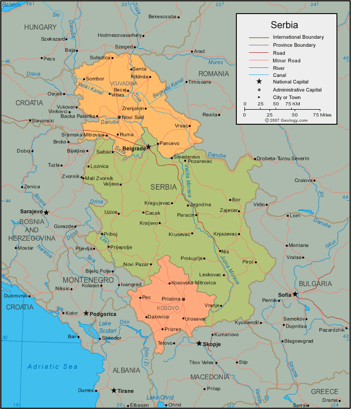
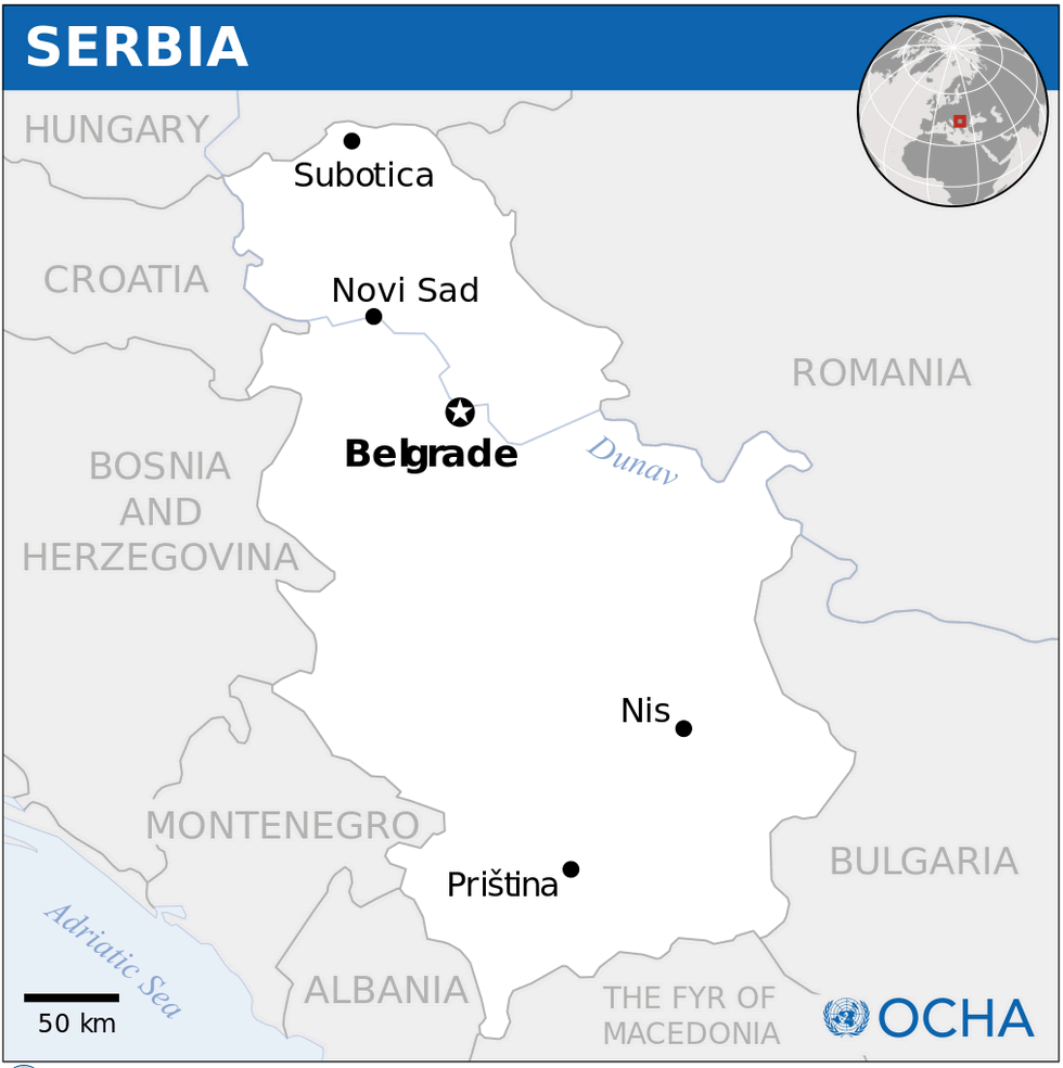
This map shows Serbia in Southeast Europe, bordered by Hungary to the north, Romania to the northeast, Bulgaria to the southeast, and Montenegro, Bosnia and Herzegovina, and Croatia to the west. Key cities like Belgrade, Novi Sad, and Niš are highlighted, along with the country’s major rivers, such as the Danube, which flows through the capital, Belgrade. The map also marks the province of Vojvodina in the north and Kosovo to the south.
Serbia Location Map
Serbia Montenegro Map
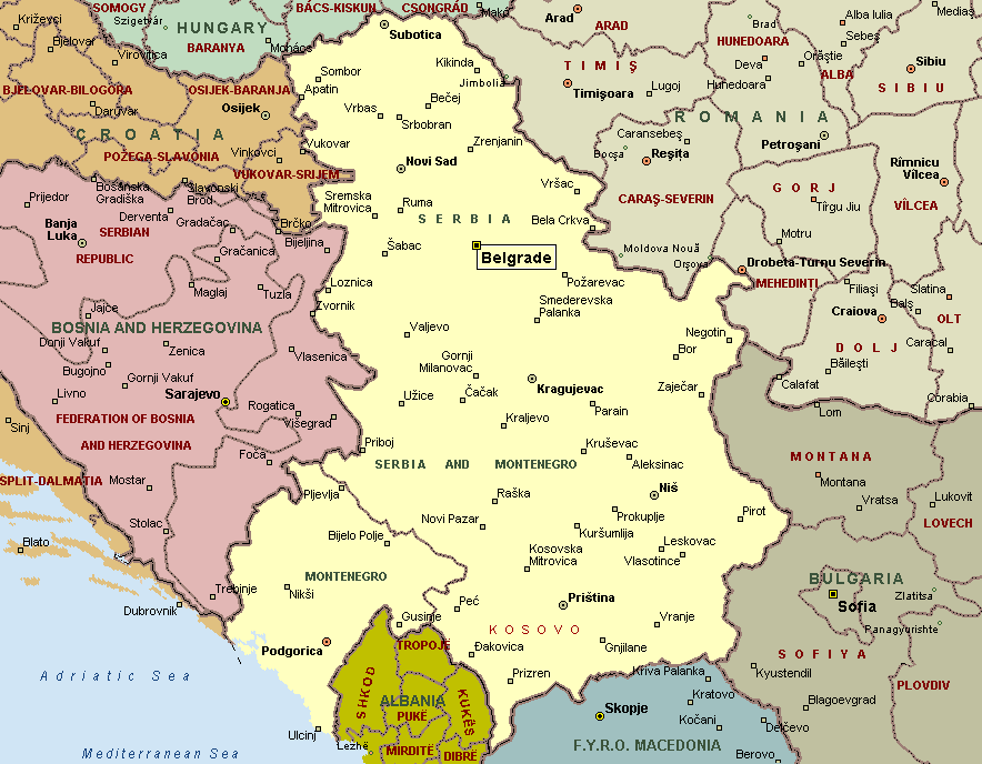
This map highlights Serbia and its neighboring countries in Southeast Europe, including Hungary to the north, Romania to the northeast, Bulgaria to the southeast, and Bosnia and Herzegovina, Montenegro, and Kosovo to the southwest. Major cities such as Belgrade, Novi Sad, and Niš are marked, along with the regional borders.
Serbia Political Map
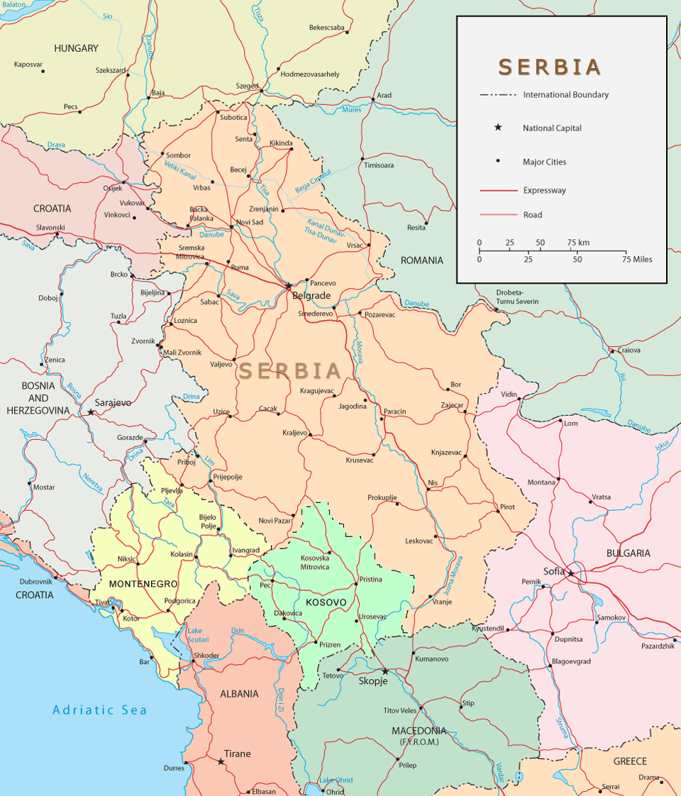
This political map of Serbia shows the country’s boundaries, major cities and major transport routes, including highways and roads. It also highlights Serbia’s neighbours, including Hungary, Romania and Montenegro, and provides a clear overview of Serbia’s regional position in southeastern Europe.
Serbia Relief Map
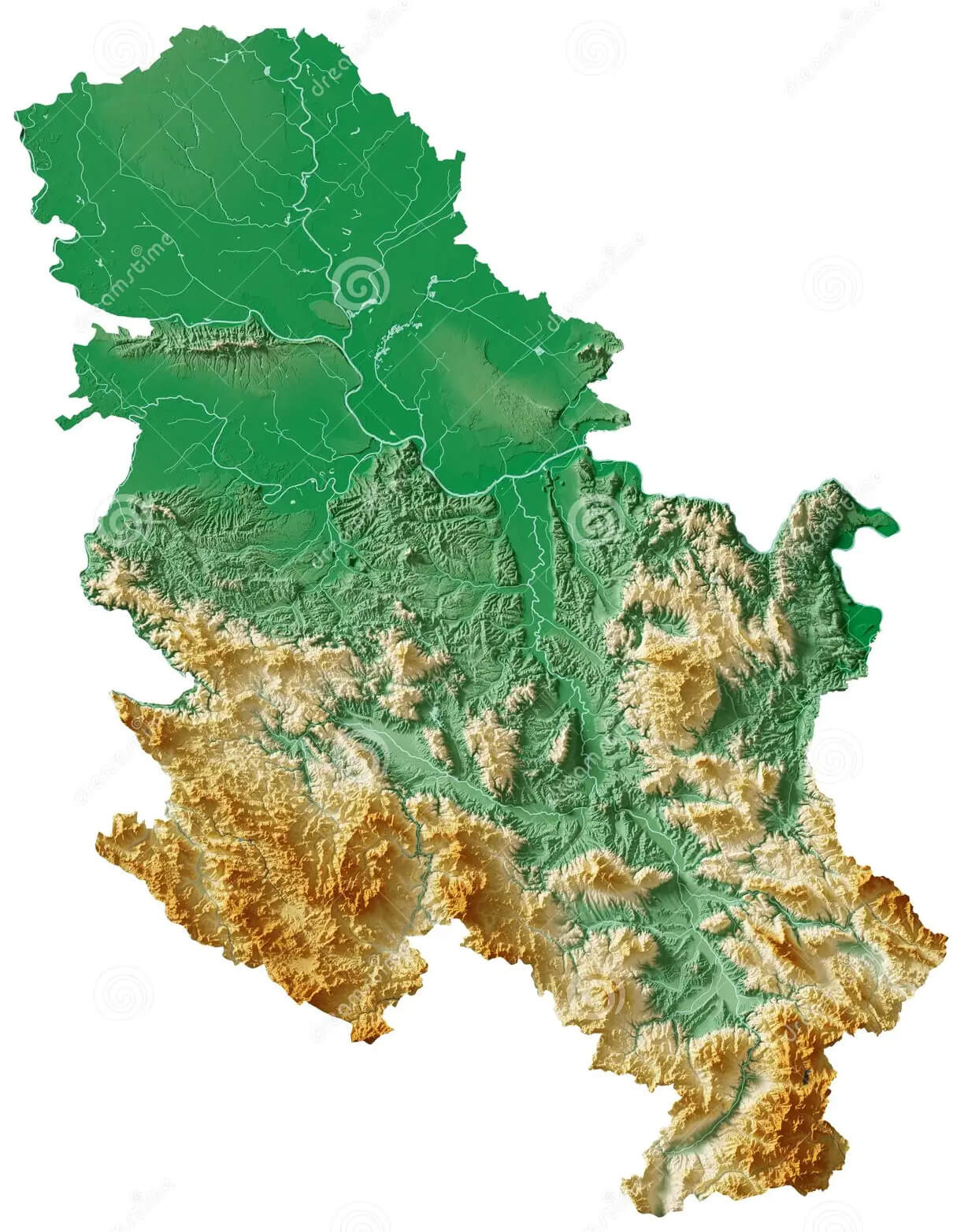 This relief map of Serbia shows the country’s varied terrain, with the northern region being flat and low, part of the Pannonian Plain, while the southern and western regions are more mountainous, including parts of the Dinaric Alps and the Balkan Mountains.
Serbia Physical Map
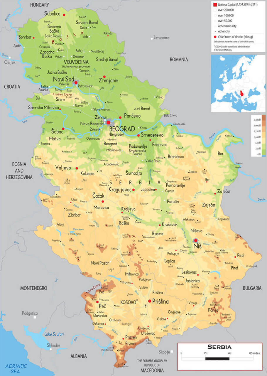 This map of Serbia shows the physical geography of the country, highlighting major mountain ranges, rivers and regions such as the Dinaric Alps in the southwest and the Balkan Mountains in the east. It also shows the country’s varied terrain, from the lowlands of Vojvodina to the hilly and mountainous areas in the south.
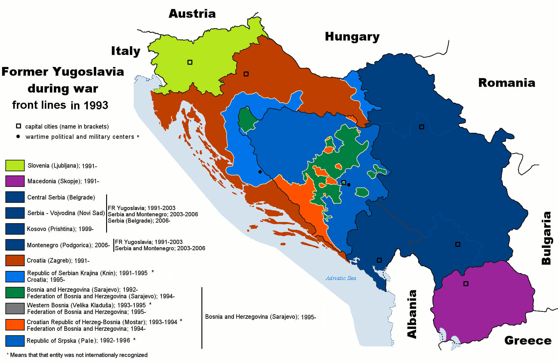
Territories of Serb Map Yugoslav Wars in 1993
Serbia Rivers National Parks Map
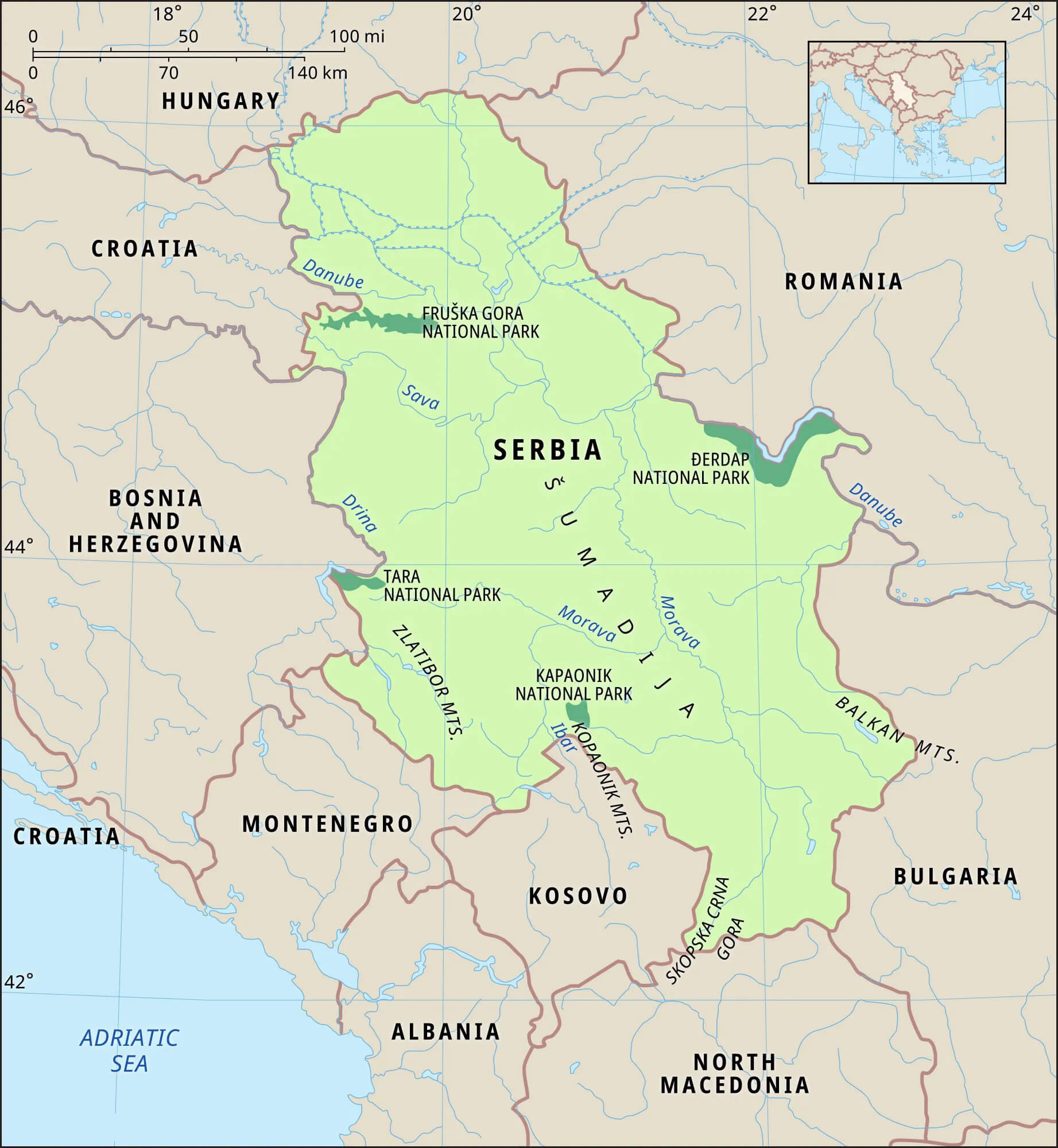 This map of Serbia highlights the country’s major rivers, such as the Danube, Sava and Drina, as well as its national parks, including Fruska Gora, Djerdap, Tara and Kopaonik, showing Serbia’s rich natural landscapes and proximity to neighbouring countries such as Hungary, Romania and Montenegro.
Serbia Topographic Map
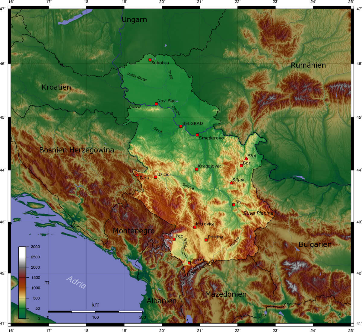 This topographical map of Serbia shows the country’s varied terrain, from the low-lying plains in the north around Novi Sad and Belgrade to the mountainous regions in the south and east, including areas such as the Dinaric Alps and the Carpathians, highlighting the different elevations and geographical features of the country.
Serbia Ethnics Population by Municipalities and Cities in 2022
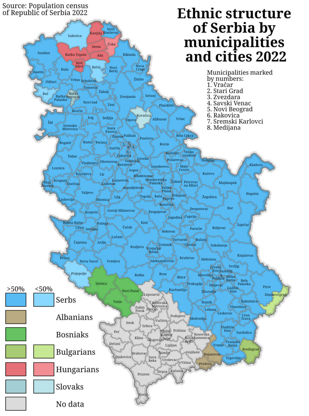 This map illustrates the ethnic composition of Serbia’s municipalities and cities in 2022, showing a majority of Serbs (in blue) in most regions, with significant communities of Hungarians (in red) in the north, Albanians (in grey) in the south, Bosniaks (in green) in the south-west, and smaller populations of Bulgarians (in light green) and Slovaks (in beige) in selected areas.
Serbia Major Cities Map
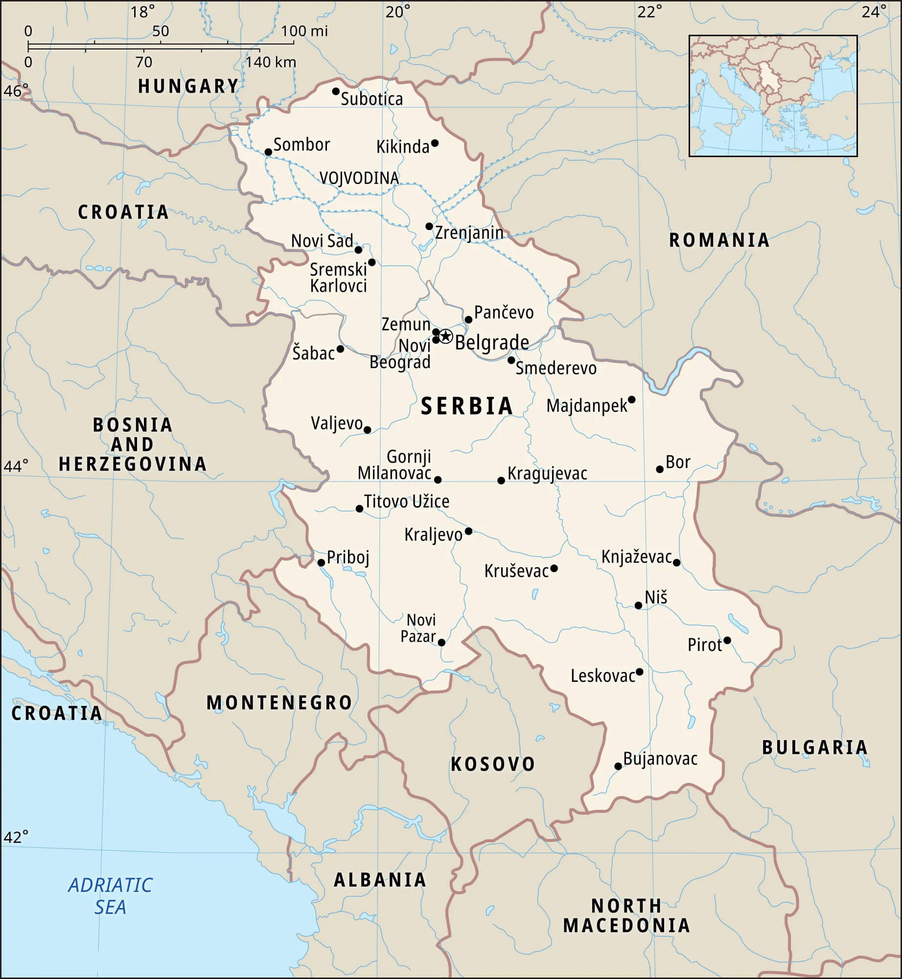 This map of Serbia highlights the country’s major cities, including Belgrade, Novi Sad, Niš and Kragujevac, as well as the Vojvodina region in the north, showing urban centres and their geographical distribution across the country, as well as borders with neighbouring countries including Hungary, Romania and Bosnia and Herzegovina.
Serbia Districts Major Cities Map
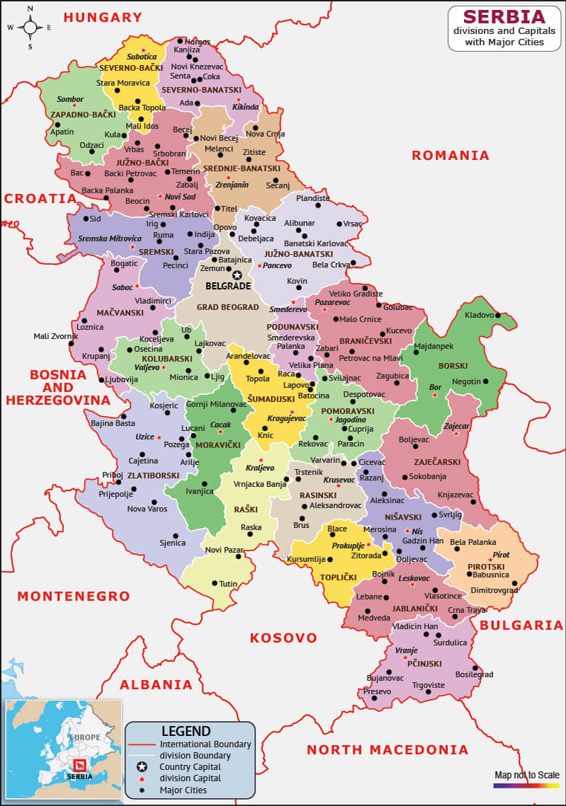 This map of Serbia shows the administrative divisions of the country, highlighting its districts and major cities such as Belgrade, Novi Sad, Niš and Kragujevac. It outlines regional boundaries and highlights Serbia’s connections with neighbouring countries such as Hungary, Romania and Kosovo.
Serbia Administrative Map
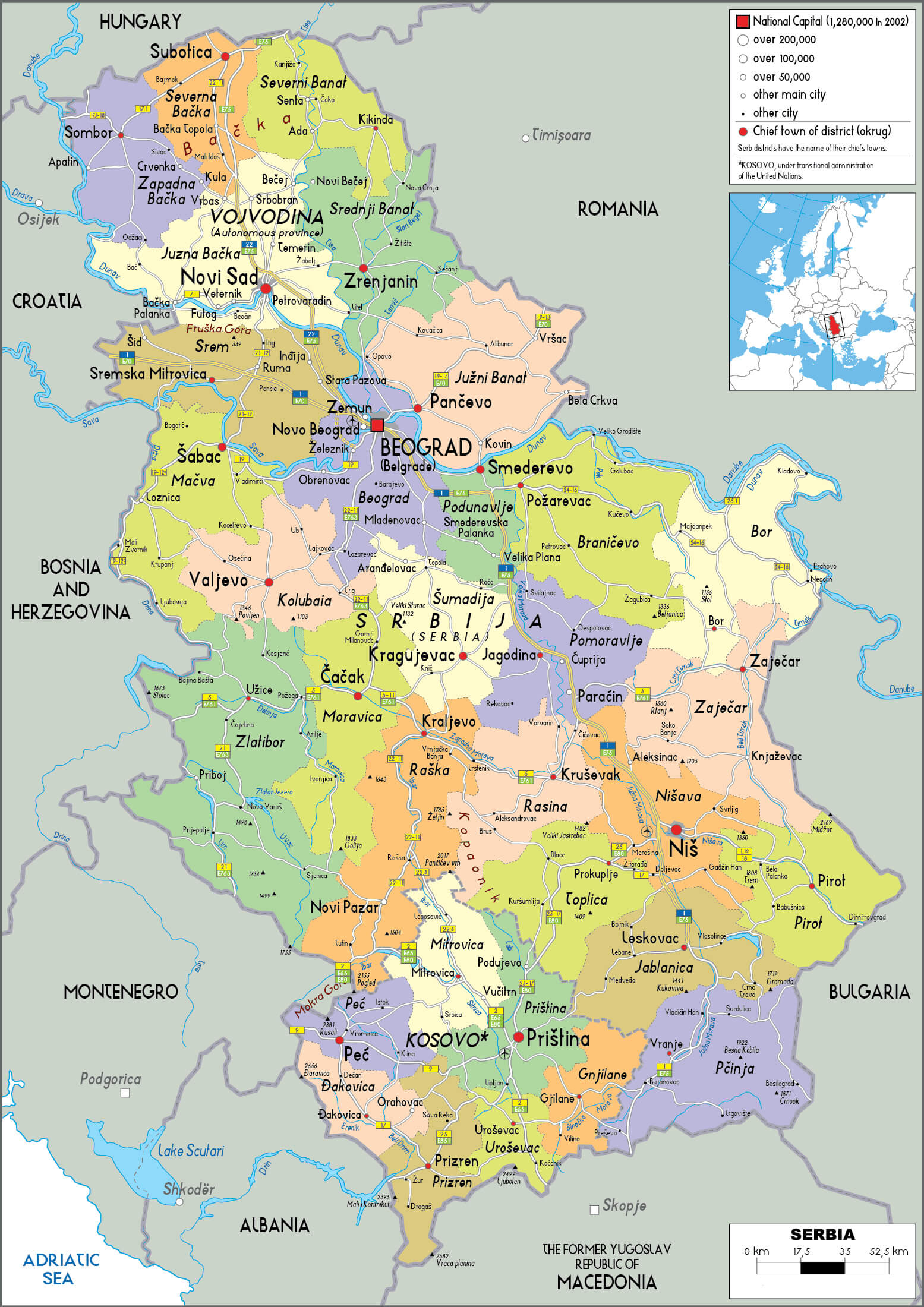 This administrative map of Serbia shows the country’s districts and major cities, including Belgrade, Novi Sad and Niš, as well as the autonomous region of Vojvodina. It highlights the division of municipalities and regional capitals, providing an overview of Serbia’s administrative structure and its borders with neighbouring countries such as Hungary, Romania and Montenegro.
Serbia Regions Map
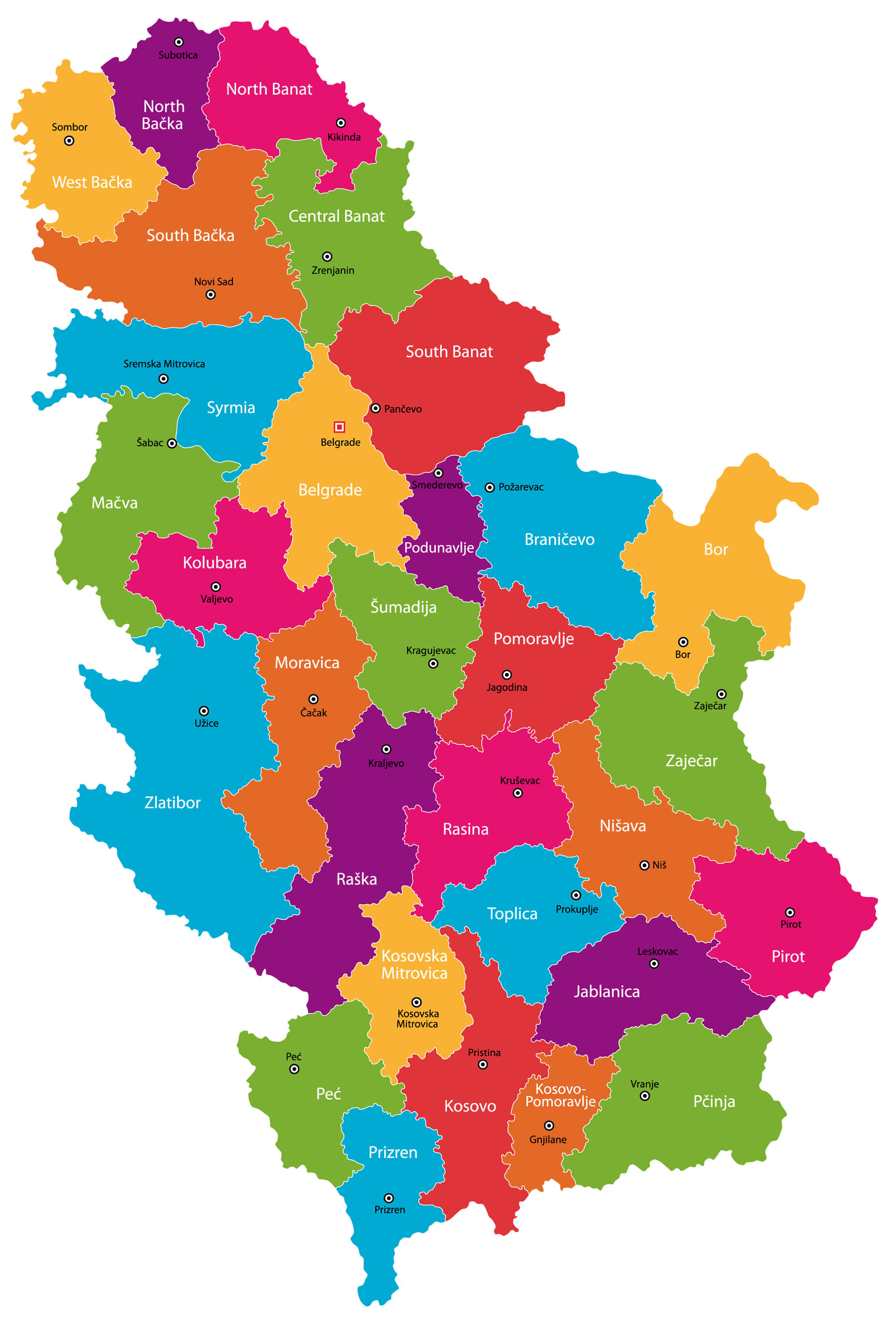 This map of Serbia highlights its regions, such as North Bačka, South Bačka, Belgrade, Šumadija and Nišava, with each area clearly coloured to show the administrative divisions and major cities, illustrating the geographical organisation of the country.
Serbia Roads Map
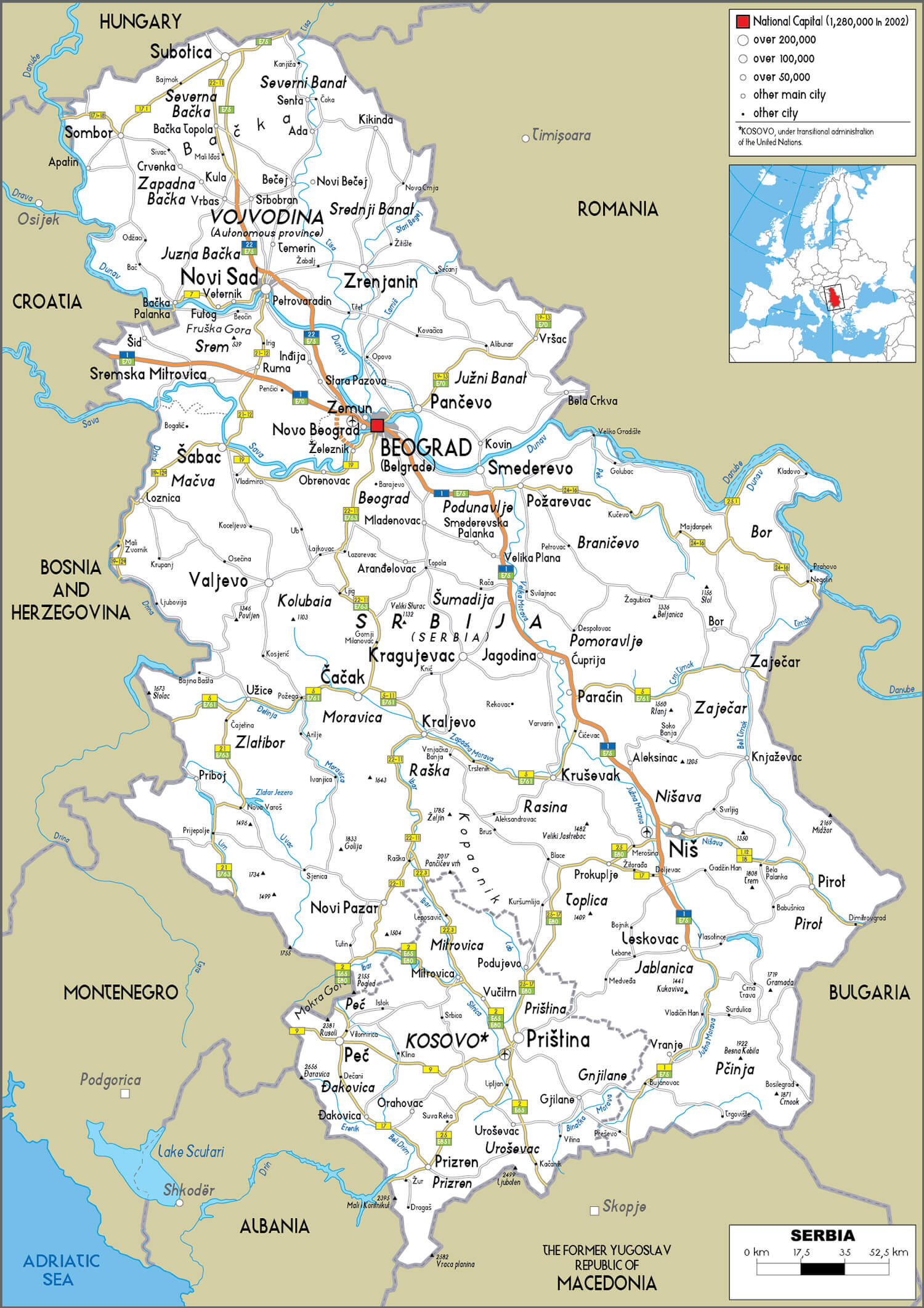 This map of Serbia highlights the country’s road network, showing major highways and routes connecting key cities such as Belgrade, Novi Sad, Niš and Subotica, as well as road links to neighbouring countries such as Hungary, Romania and Montenegro, making it a useful guide for travellers navigating Serbia and the surrounding region.
Map Serbia
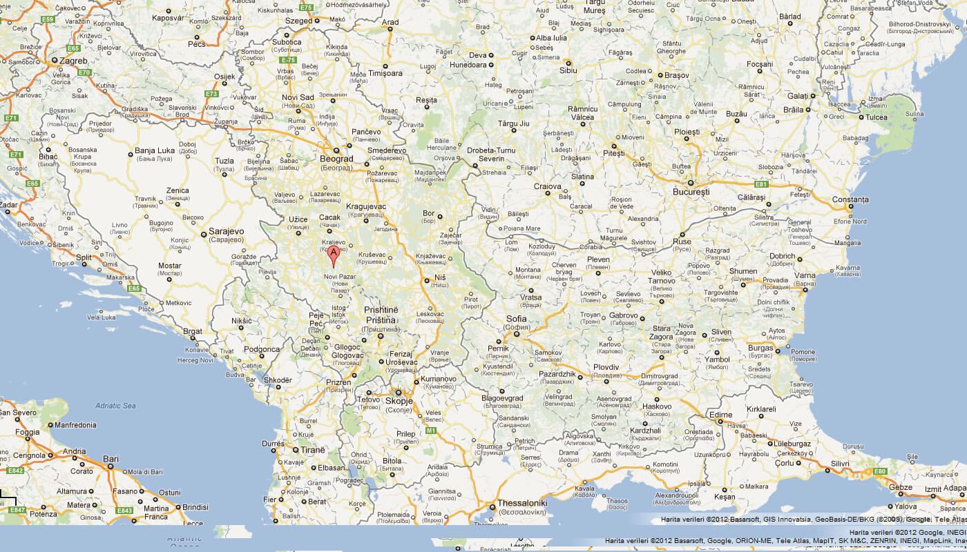
This map displays Serbia and its neighboring countries in Southeast Europe, including Croatia, Bosnia and Herzegovina, and Montenegro to the west, Romania to the northeast, and Bulgaria to the southeast. Major cities such as Belgrade, Novi Sad, and Niš are shown, as well as key regional connections, making it clear how Serbia serves as a crossroads between the Adriatic Sea to the west and the Black Sea region to the east.
Map of Serbia Europe
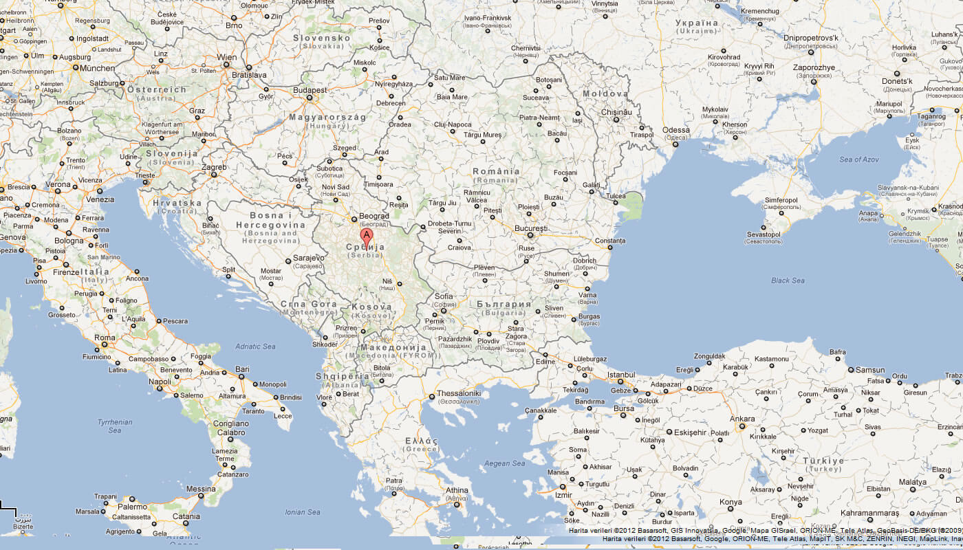
Map of Serbia World
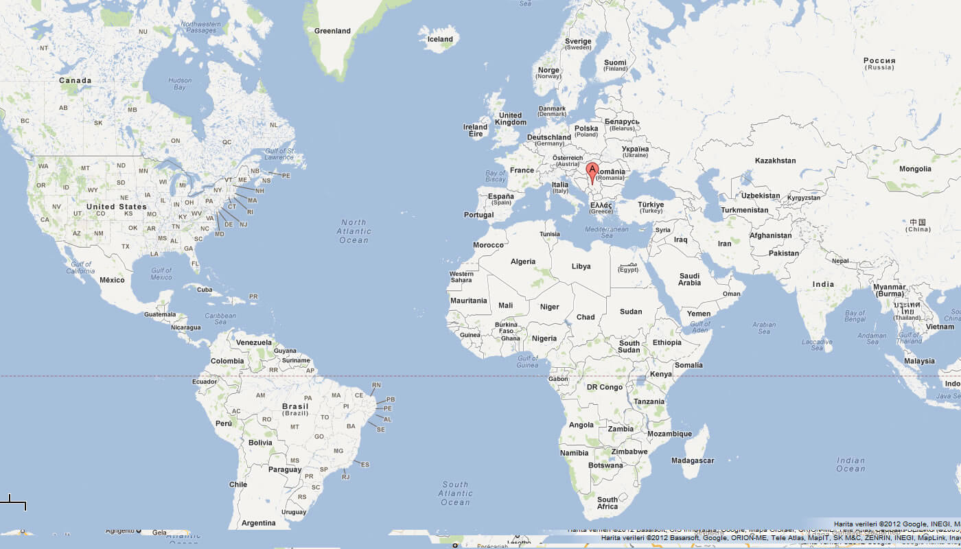
Serbia Earth Map
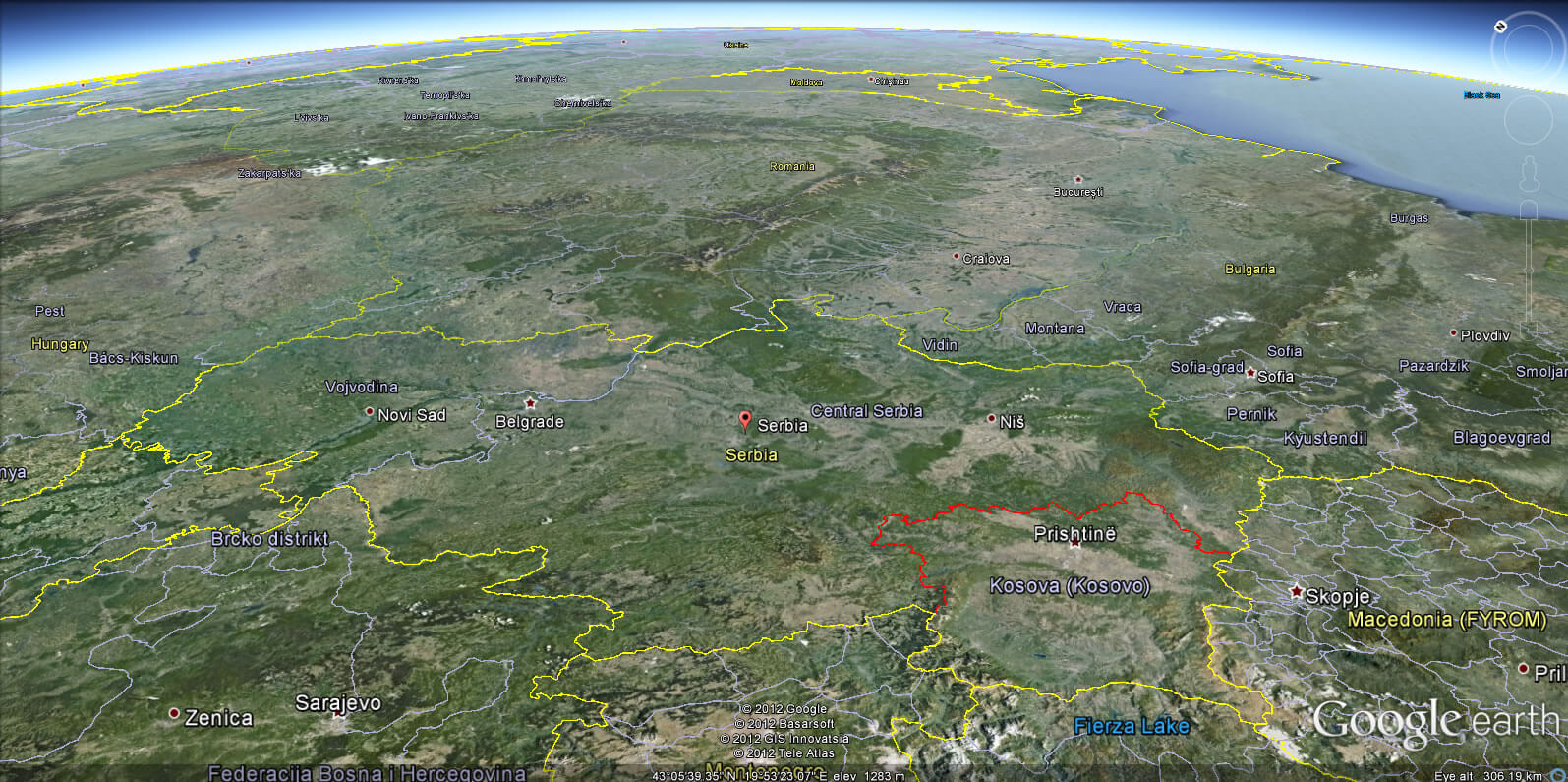
Where is Serbia on the Europe Map?
Show Google map, satellite map, where is the country located.
Get directions by driving, walking, bicycling, public transportation and travel with street view.
Feel free to explore these pages as well:
- Croatia Map ↗️
- North MacedoniaMap ↗️
- Montenegro Map ↗️
- Italy Map ↗️
- France Map ↗️
- The 10 Best Things to Do in Venice ↗️
- Map of Europe ↗️
- Europe Map ↗️
- A Collection of Europe Maps ↗️
